
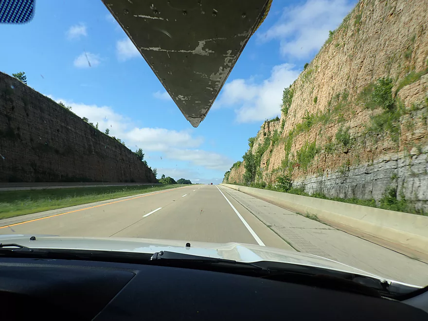
Traveling to the Mississippi along scenic Hwy 151
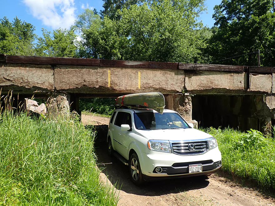
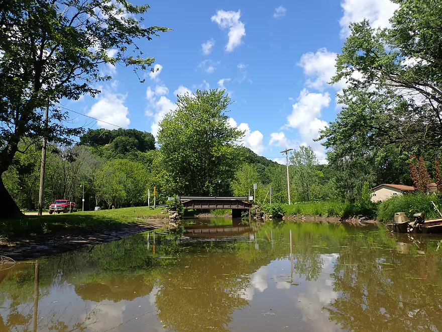
A very low bridge before the Lynn Hollow boat ramp
The reason for the bridge
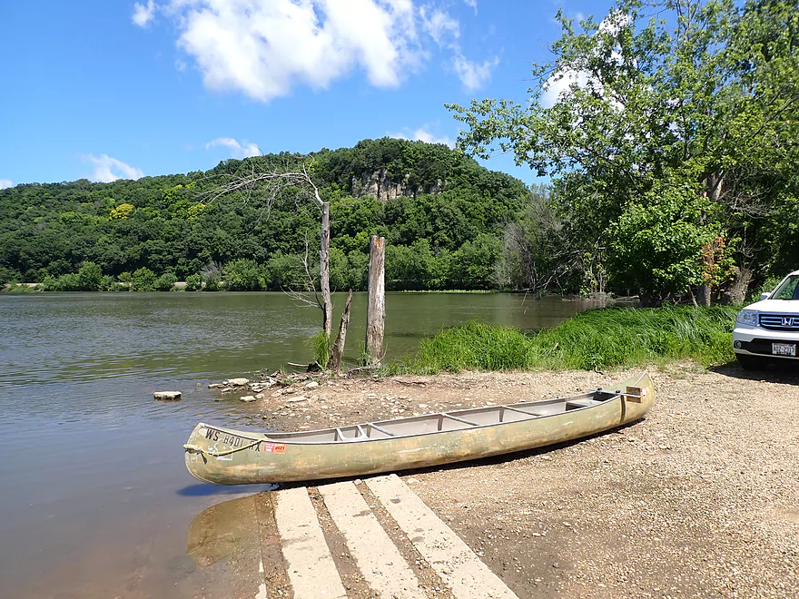
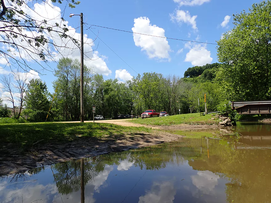
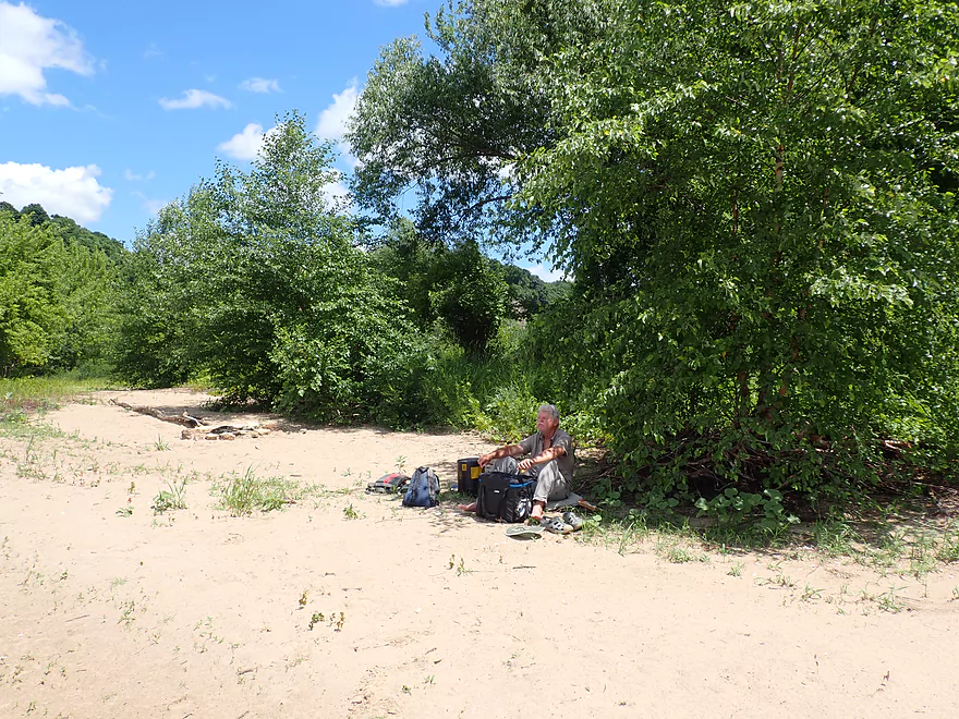
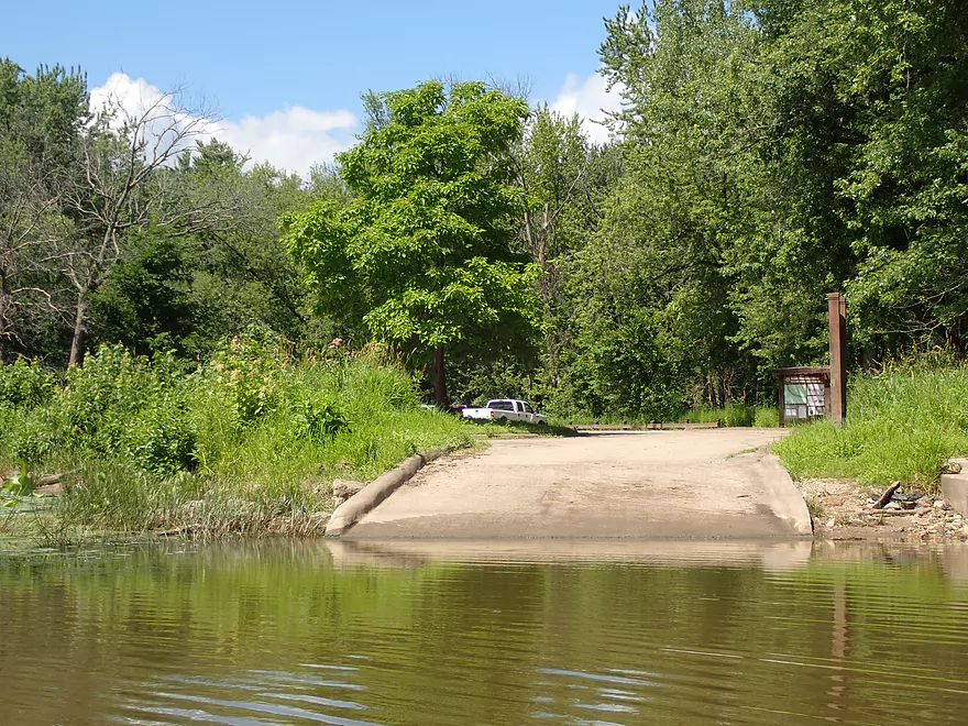
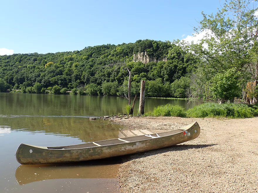
Nice launch area at the end of Lynn Hollow Lane
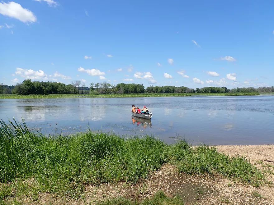
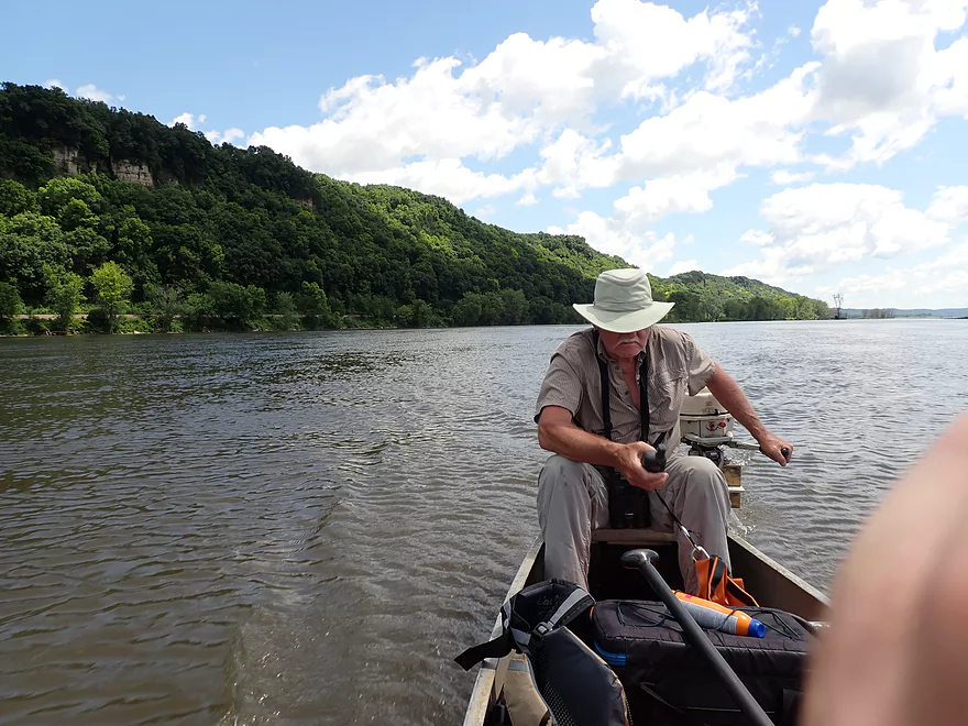
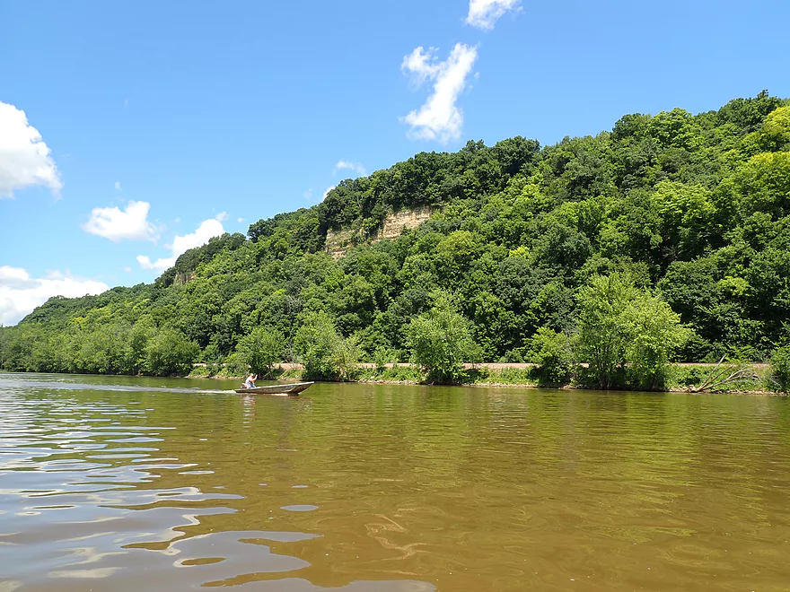
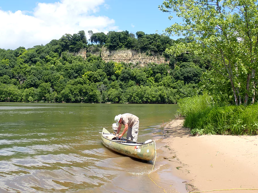
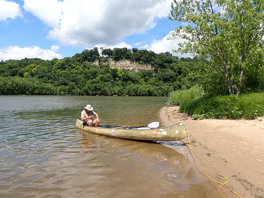
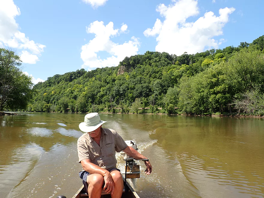
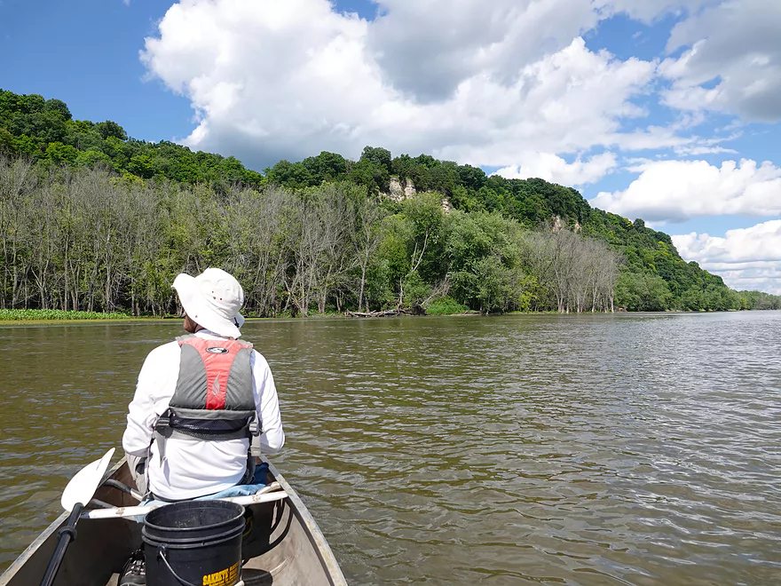
A canoer heading out ahead of us
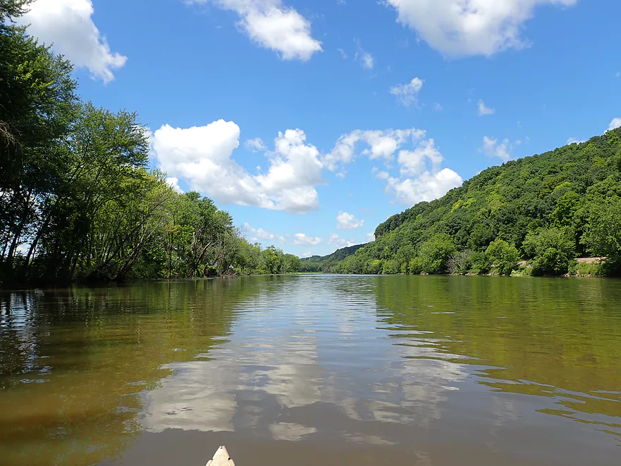
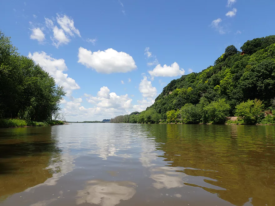
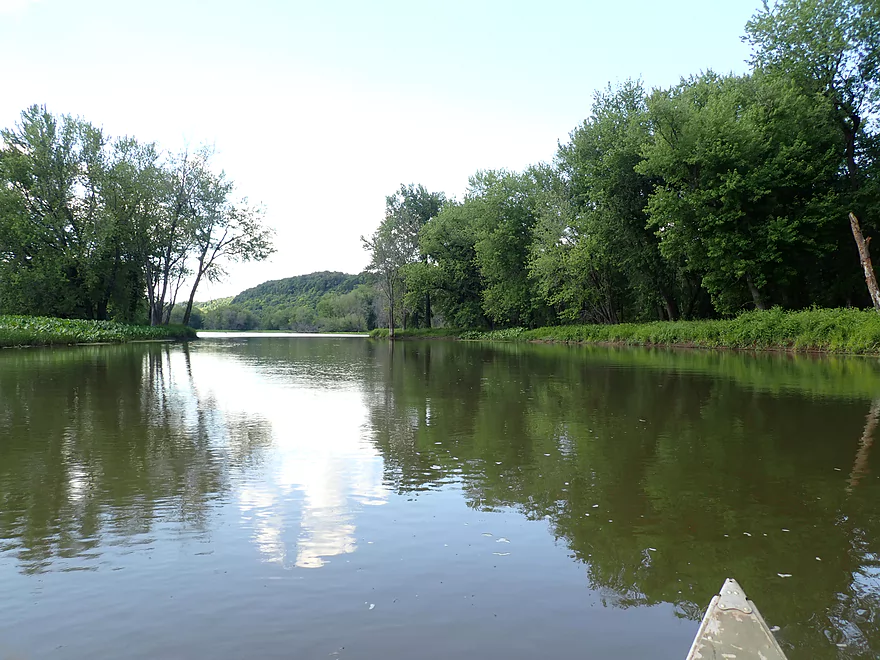
View downstream toward the Grant River
We decide to explore a bit downstream before doing our main upstream trip
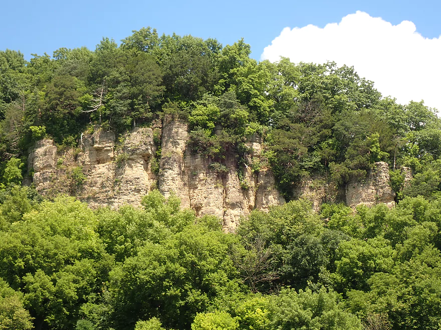
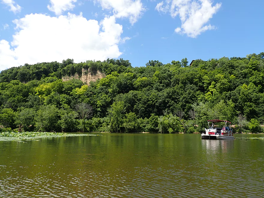
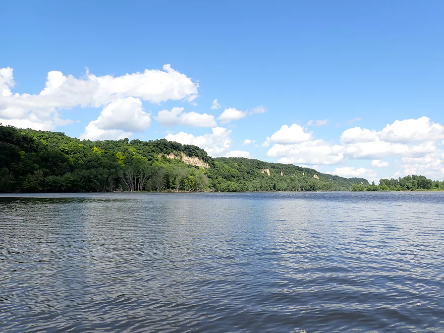
One of many nice bluffs
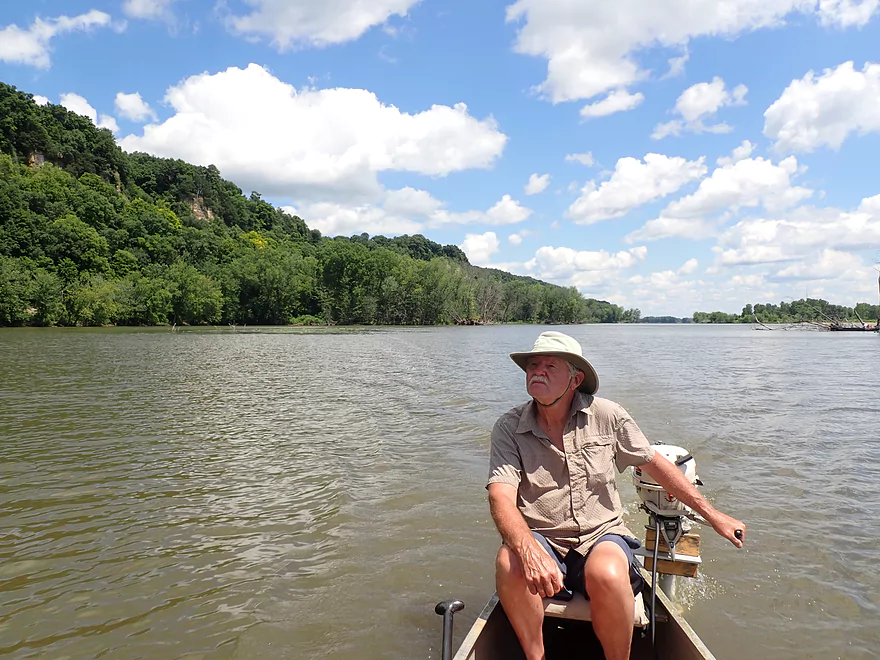
Heading back upstream
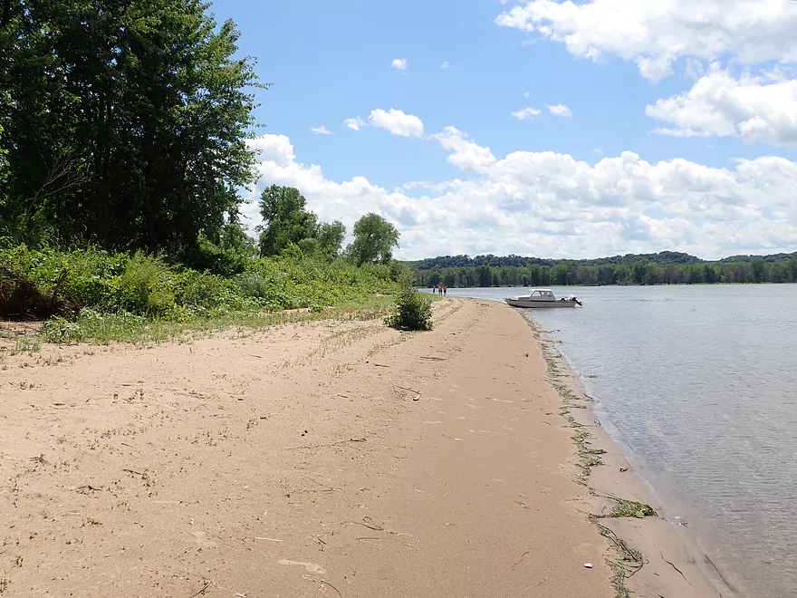
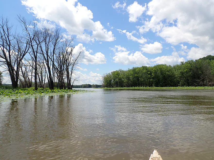
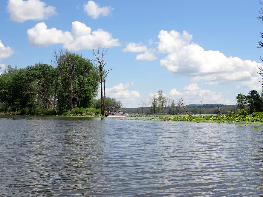
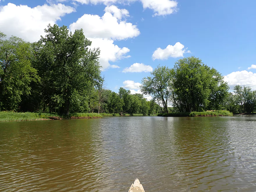
The river is very open downstream of Lynn Hollow Lane
Another dolomite outcrop
Exiting Spring Lake…
…and entering Snyder Slough
We saw a handful of fishermen on this trip
McCartney Branch Creek
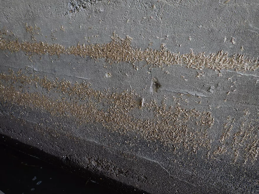
Countless caddisfly exuviae
McCartney Branch Creek is kind of nice
There is a major boat landing here
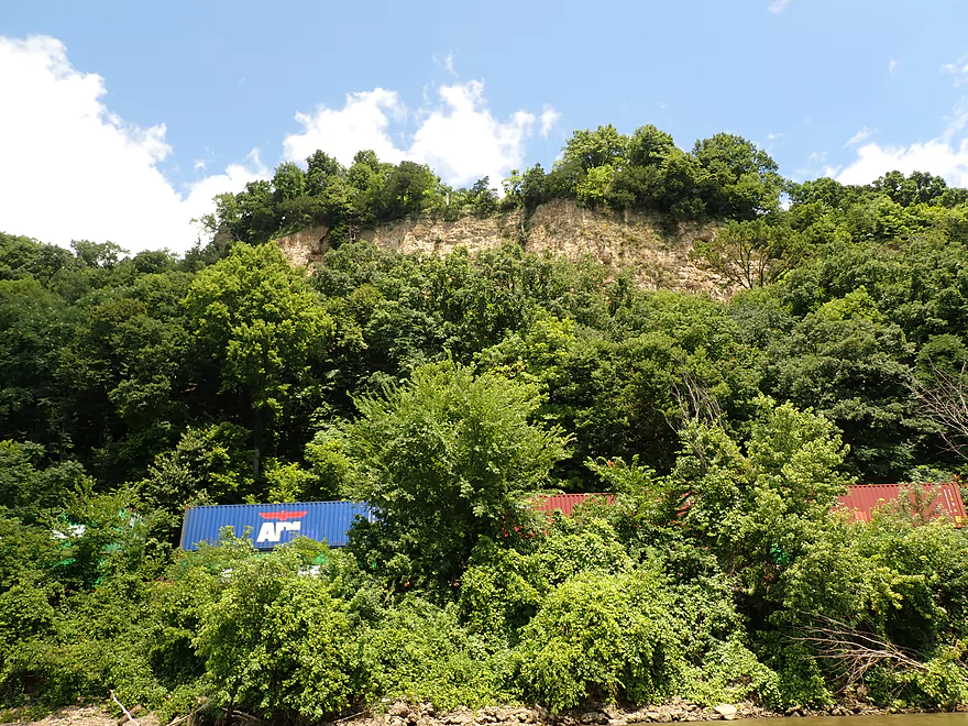
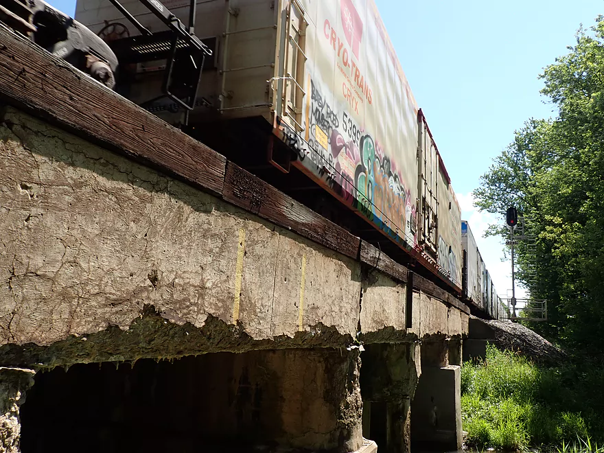
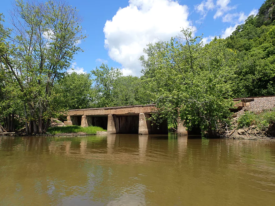
A train hiding under the bluff

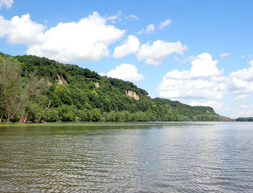
One of the nicest stretches of bluffs on the trip
Getting out on Bertom Island…
…for a quick lunch break
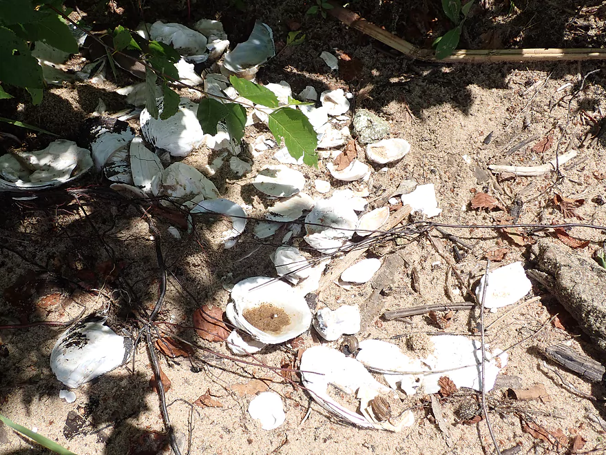
Something the racoons like to also do on this island
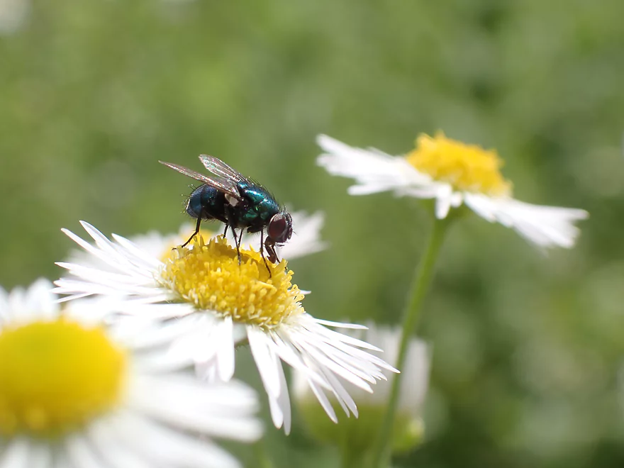
A blue bottle fly
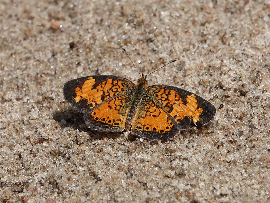
A checkerspot butterfly
There aren’t too many sandbars in the area…we had neighbors
Heading back out
We’re now officially in McCartney Lake
A rare shallow spot
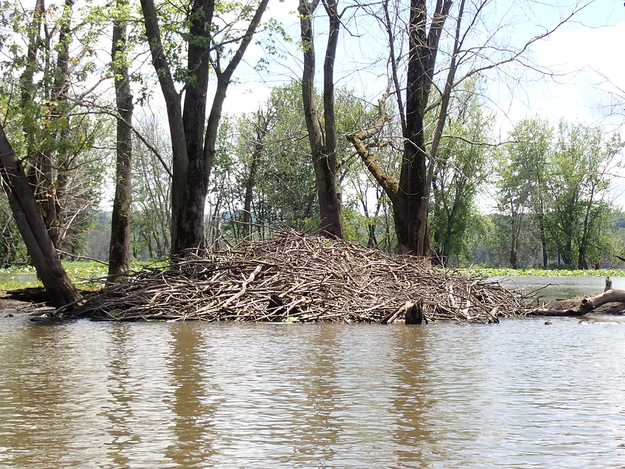
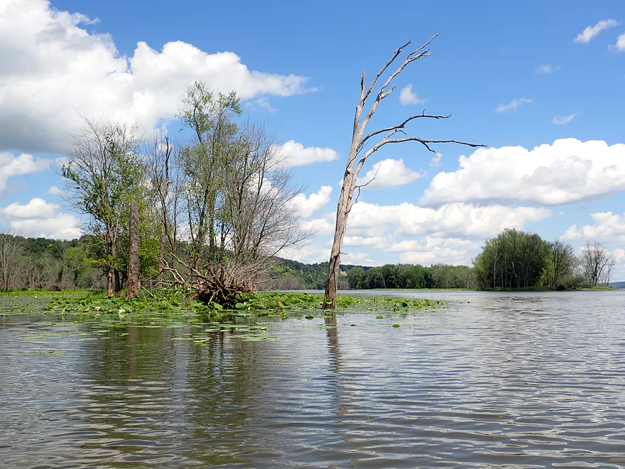
One huge beaver den
Entering Coalpit Slough
Somebody is nervous that I’m standing up in the canoe…
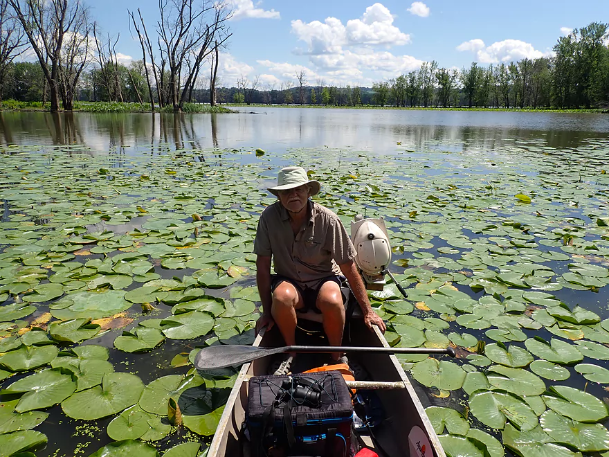
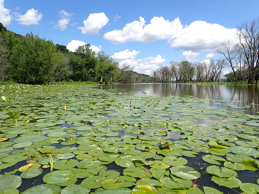
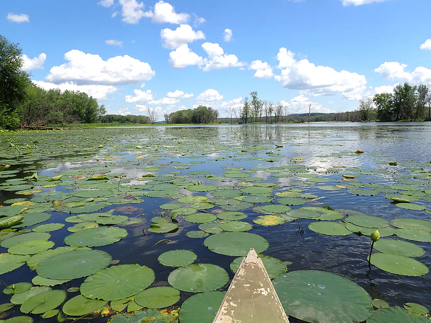
A terrific bed of American Lotus
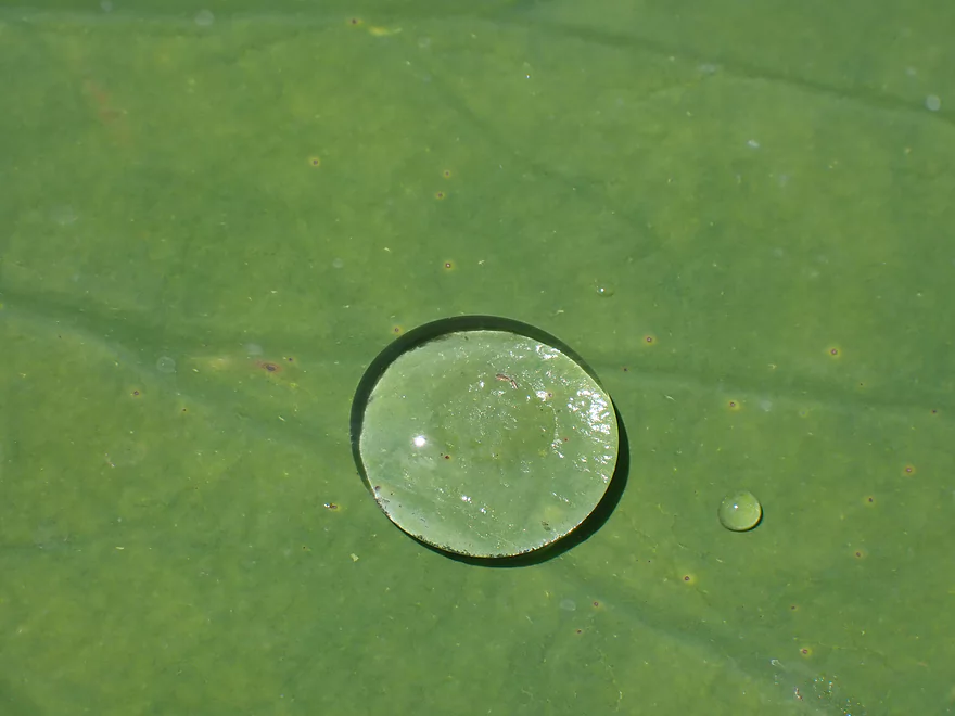
Water droplet acting like a magnifying glass
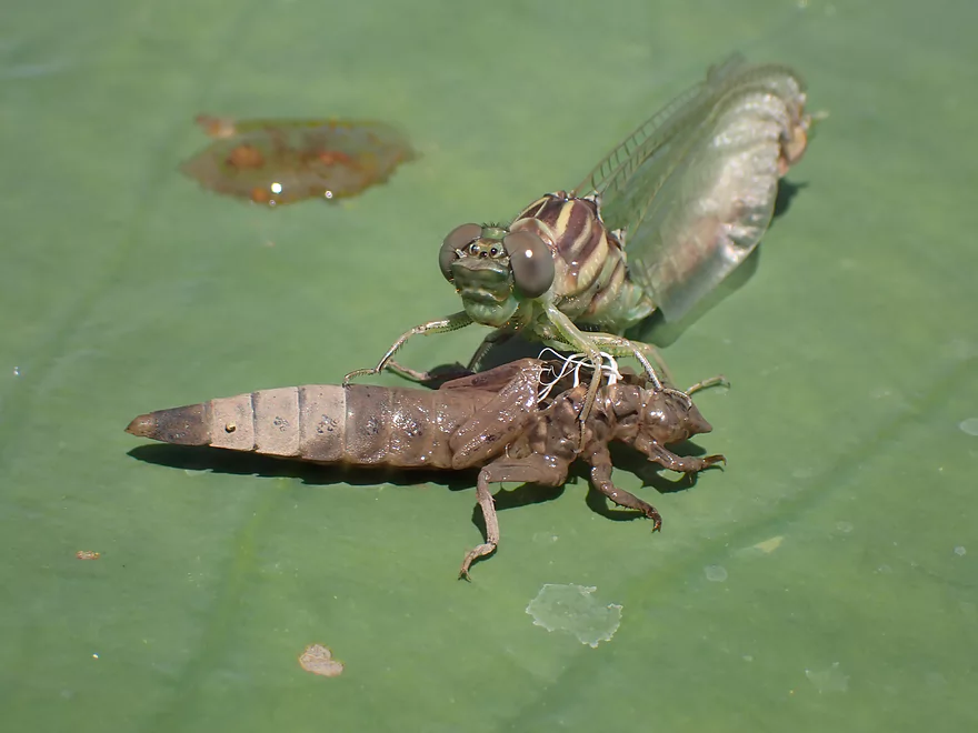
A dragonfly just emerging from its exuvia
Scenic area
Continuing to head upstream
We thought this slough went through but it was a dead-end
Still scenic though
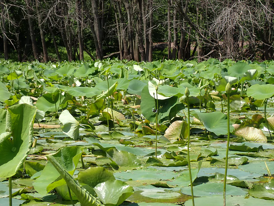
More American Lotus
An island of lotuses
Heading toward Bertom Lake
The Far Nuff Road Landing (aka Bertom Lake Landing)
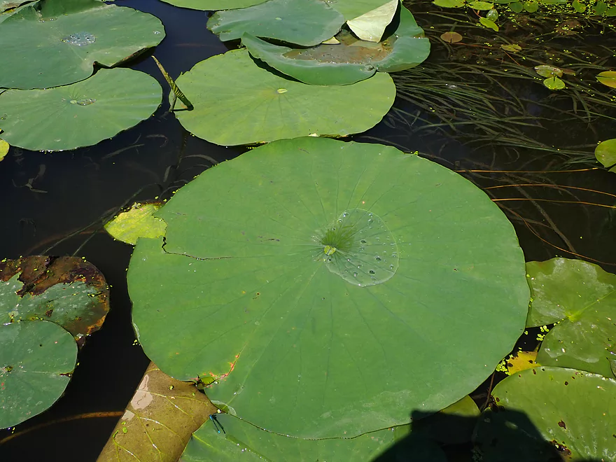
American Lotus are huge
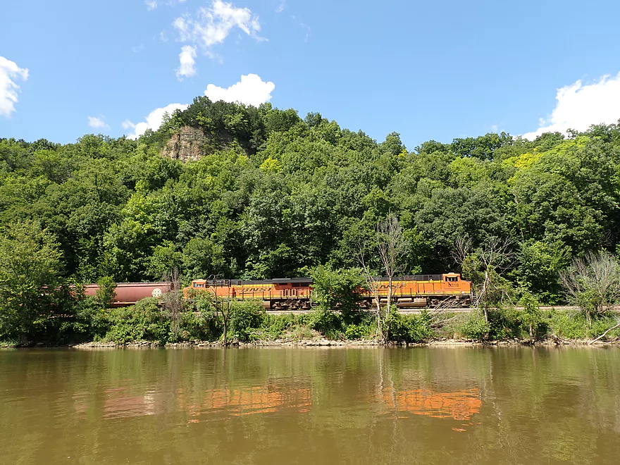
One of many trains we saw and heard
We decide not to head up to Cassville and choose to return back
Exiting Bertom Lake
The fantastic bluffs of McCartney Lake again
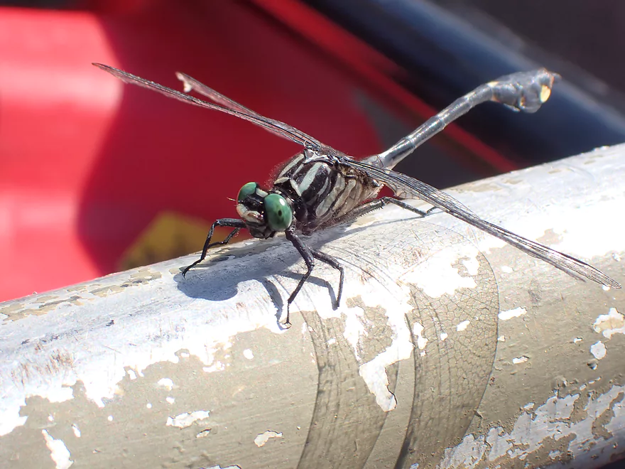
This dragonfly didn’t seem to mind riding in the canoe
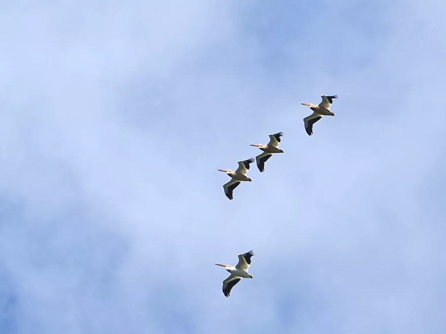
Part of a larger flock of pelicans
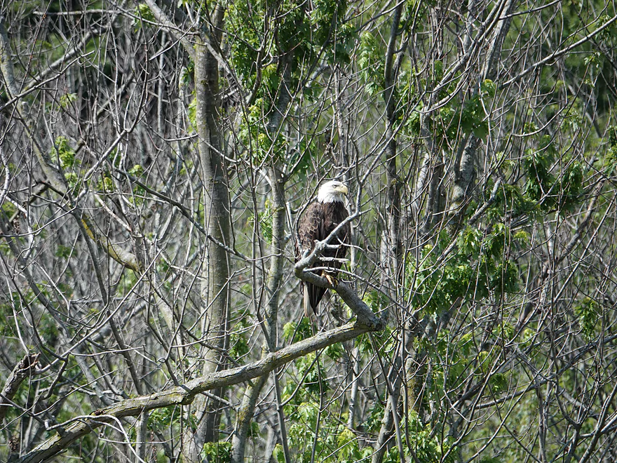
One of several eagles we saw
The home stretch
Back on Lynn Hollow Landing
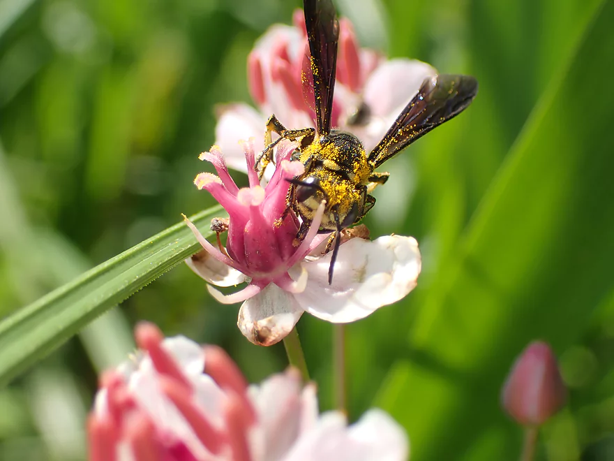
This bee is covered with pollen
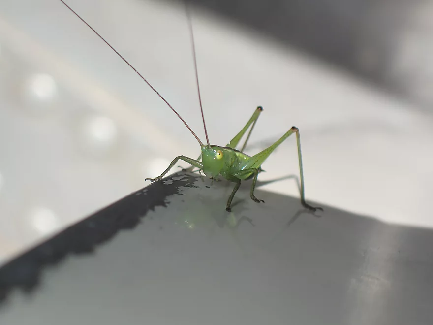
An alert katydid
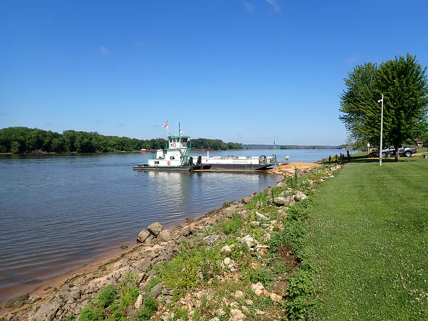
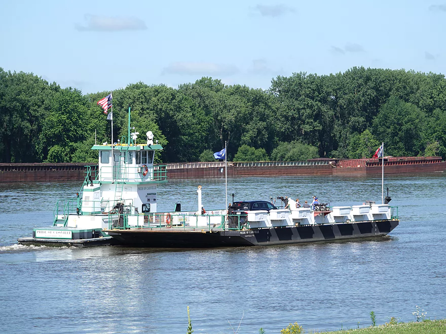
Checking out the Cassville Ferry
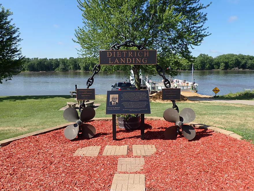
Part of a larger public park
Heading upstream to Iowa
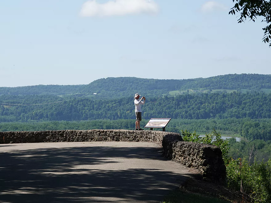
Checking out Nelson Dewey State Park
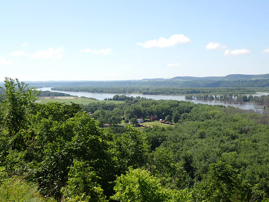
View downstream from the overlook
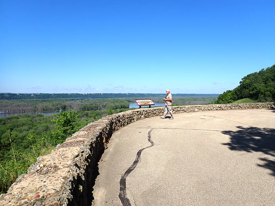
Nice view upstream
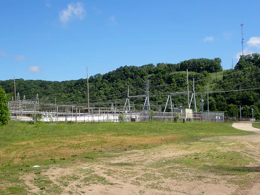
What remains of Cassville’s “iconic” coal plant that was razed in 2017
Mississippi River – McCartney Lake


One of the more obscure and overlooked paddling sections on the Mississippi is from Cassville to the mouth of the Grant River. The river here can be divided in two. The south half by Iowa is the main channel. This is fairly open and features most of the heavy boat traffic. The north side by Wisconsin is in contrast sheltered and contains a series of islands, lakes, sloughs, bluffs, and outcrops…which makes it the more scenic option for paddlers.
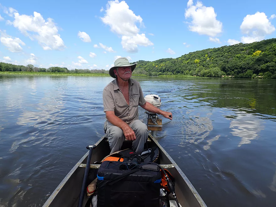
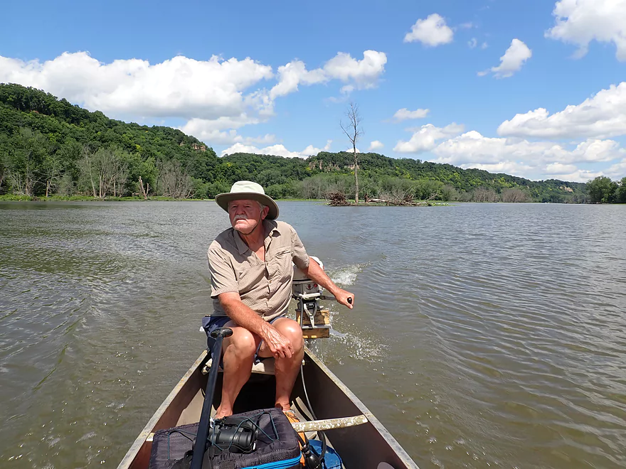
Paddling this entire stretch could be a bit overwhelming as it is over 18 miles long, but it can easily be subdivided by numerous intermediate landings. We considered multiple options…such as paddling Far Nuff Landing to Lynn Hollow Landing…but ultimately decided to do a round trip with a small motor on the canoe. Typically I prefer not to do trips with motors as they make noise, you’re constantly being buffeted with wind, and by going fast you miss a lot of subtle details in the river (changes in current, wildlife, plant life, etc…). But in this case it was practical as we wanted to explore a lot of the river, we wanted to do a round trip, and we weren’t super interested in paddling the few open water sections of this trip.
We started the trip at Lynn Hollow Landing which is technically on of Spring Lake. This is a nice access backdropped by a scenic cliff, American Lotus fields, and a large archipelago of islands. While we didn’t explore these particular islands in depth, we were told by a canoer who launched ahead of us that there were good sandbars for camping hiding on some of them. The few that we went past however were mostly muddy and full of poison ivy.
The first thing we did was to head downstream from Lynn Hollow to check out the “last” of the Cassville Cliffs. After about the second outcrop the river opens up significantly into a vast lake and most of the cliffs go away (although there are additional ones way down by the Platte and Grant Rivers). So we didn’t see the point of going all the way to Potosi and turned around to start our main trip upstream of Lynn Hollow where the best scenery was.
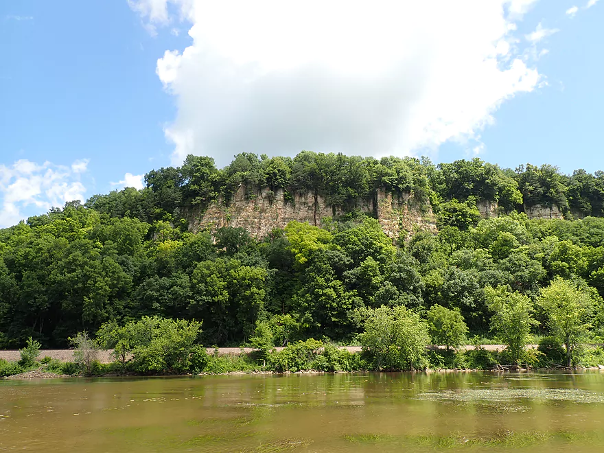
We soon exited Spring Lake via “Snyder Slough”. While this trip mostly lacked current, the exception was at the entrance to Snyder Slough where the current was noticeable. After that we mostly hugged the shoreline which was where the most scenic bluffs were. Here the cliffs appeared often…perhaps once every 2000 feet. Growing atop several of these were scenic red cedars. This area is actually even more striking in the spring/fall when trees are bare and the cliffs are much more visible and dramatic.
At the base of the bluffs was a busy two-way railway with trains passing us maybe once every 45 minutes. This is one trip where you are guaranteed to see a train! Note these Mississippi trains are fast and you don’t want to mess with them. When crossing the tracks make sure to look both ways after a train passes as another train may be coming from the opposite direction in a hurry and you won’t hear it.
We then came to McCartney Landing which is a good access option. This landing is actually not on the Mississippi, but rather on McCartney Creek which itself is an attractive paddle and can be explored upstream for some ways.
After that we headed out on the river and took a lunch break on Bertom Island. This is a very unique island created from dredge spoil taken from the main channel. Inside of the island is a self-contained lake which is a nice habitat for wildlife. Along the western side of the island was a thin sandbar which made for a nice picnic area. The island is backdropped by one of the larger cliffs along the north shore which made it very scenic.
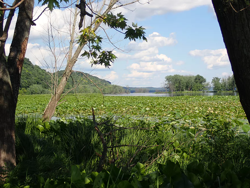
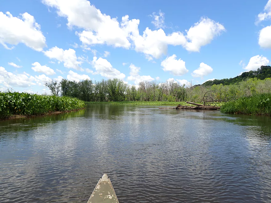
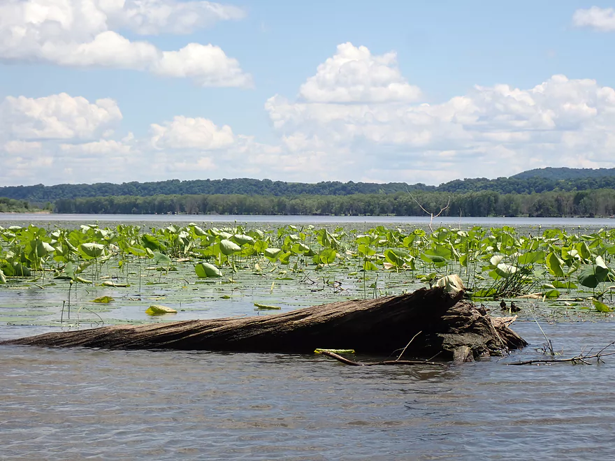
Upstream of Bertom Island we explored additional back channels and sloughs…some of which dead-ended. One of the trip highlights were the huge patches of American Lotus. These are quite different from the regular lilies you see on typical Wisconsin creeks. American Lotus are much larger and have waxy surfaces which cause water on them to pool in unique concentric puddles.
We then took “Coalpit Slough” upstream to Far Nuff Landing, which is another nice access. Far Nuff roughly marks the start of Bertom Lake, which contains a huge labyrinth of sloughs and islands. We decided not to continue to Cassville which would have entailed a time-consuming route through this maze. Instead we took in the last of the major cliffs (there aren’t many more closer to Cassville) and turned around. In years past, we would have seen the Nelson Dewey coal plant by now. This was an “iconic” part of Cassville and its smoke stack could be seen for miles. Thankfully this plant was recently decommissioned and imploded.
In summary this was a neat trip with some of the larger cliffs you’ll see in Wisconsin. Other highlights included the driftless bluffs, large patches of American lotus, and abundant wildlife. These islands and sloughs downstream of Cassville harken back to yesteryear when more of the Mississippi was like this…a braided series of islands and channels. But unfortunately much of the river is now dammed and channelized which has severely mutilated the river. This trip won’t be for everyone, as there is a decent amount of open water paddling which some might find boring.
For paddlers that like to camp, this trip could be a unique experience. You could launch at Cassville, camp on one of the islands (the best are near Lynn Hollow Landing), and then take out near the Grant River. Most islands were a bit mucky and overgrown, and would likely require hammocks instead of tents. But some islands do have nice sandbars when the river is low which I confirmed with Google Earth’s historical images.
Side note…if you find some of these lake and slough names confusing you might want to check out this Army Corp of Engineers map.
Lynn Hollow Public Access: This is a nice public access with free parking, outhouses, and isn’t too busy. The only downside is the access road goes under a very low railroad bridge (7′ 3″) which might be an issue for some vehicles with boats on top.
Alternate Access Options: There are a number of options on the Iowa side (the main channel) and the Wisconsin side (where the sloughs and cliffs are). Generally speaking the most scenic bluffs will be between Far Nuff Road Landing and Lynn Hollow Landing along the Wisconsin side. For more information and options see my McCartney Lake Overview map.
Round Trips: We attached a motor to our canoe which made a round-trip viable. For paddlers, round trips are also viable but should be planned carefully. The current isn’t too strong for the most part, but it does pick up steam when funneled between islands. For round-trippers, it’s suggested you go upstream first and you plan a trip when water levels are on the lower side (the current slows significantly when water levels are down).
Bike Shuttle: This is a difficult river to bike shuttle because the roads are hilly and not very direct. Lynn Hollow Road to Far Nuff Road would be 10.8 miles and 433′ of climbing. Something like Lynn Hollow Road to McCartney Landing would be a more manageable 4.7 miles with 299′ of ascent…but that would be a short paddle.
Wind: This is a very exposed section of the river. Check the forecast before committing to this trip.
Open Water Paddling: Some parts of McCartney Lake are quite wide so beginners should stick close to shore in case something goes wrong. Life jackets are also recommended.
Wake: McCartney Lake and the adjacent sloughs are actually quite insulated from the main channel. You won’t see barges, but will see a few fishing boats…most won’t create that much wake and this is actually a relatively calm part of the Mississippi. But if things get windy this can change and large waves can develop.
Getting Lost: Some of the islands and sloughs are not logically arranged…nor do they perfectly correspond to online maps. Some sloughs also close up in low water, while new ones are created in high water. It’s recommended you bring a GPS and have access to the latest satellite maps.
Nearest Gauge: Mississippi River @ Clayton, IA (Trip done at 13.18′)
- 0-12.5′: These are low levels. The current should be slow then which would be good for round-trippers, but not those who do one-way trips. Some parts will be too shallow for motors, but paddlers should be fine. This is also a good depth for campers.
- 12.6′-13′: An average depth and good target range.
- 13.1′-14′: An above average depth.
- 14.1′-16′: A high depth with decent current. This might be bad for round-trippers but good for one-way paddlers.
- 16.1’+: A very high depth with fast current. I suspect this area of the Mississippi can be paddled in high water as it’s sheltered from the main channel but caution should be exercised.
Hwy VV/Old Power Plant to the Cassville Public Docks: 1.2 miles. This is an open water paddle on the Mississippi by the community of Cassville. Highlights are seeing the ferry do its one mile shuttle or seeing barges (which aren’t visible from the downstream sloughs).
Cassville Public Docks to Far Nuff Road Landing: 5.4 miles. After Cassville, take the north channel when the river forks. Then look for a small channel on your left which will lead to the Wisconsin side of the river. This is the Bertom Lake area which has many small islands and sloughs that are protected from the main channel. The “Bertom Lake West Access” may be impassible in low water…if that happens you’ll have to continue a few extra miles downstream and use the “Bertom Lake South Access” instead.
Far Nuff Road Landing to McCartney Landing: 3.0 miles. A more open stretch but with some of the most scenic bluffs in the area. Bertom Island is located on this route and has a nice sandbar on the west shore.
McCartney Landing to Lynn Hollow Landing: 2.1 miles. A good leg with scenic bluffs and many side sloughs and islands to explore. While most islands are a bit mucky, there are occasional sandbars that appear in low levels that would be great for camping.
Lynn Hollow Landing to Potosi Point: 4.4 miles. The river really opens up downstream of Lynn Hollow. There are some rock outcrops but not as many. This is a less interesting section…highlights include paddling past the mouth of the Grant River and Potosi Point which is a scenic area.
Potosi Point to Grant River Recreation Area: 1.7 miles. More open water paddling that isn’t as interesting…but there are scenic bluffs near the mouth of the Platte River.
Detailed Overview
The Mississippi is both a blessing and a curse for paddlers. While rich in beauty and majesty, it can be problematic to paddle due to high wind, current, wakes, powerboats, and barges. The Upper Mississippi is frequently dammed and subdivided into “pools”, of which there are roughly 11 in Wisconsin. Generally speaking, just upstream of a dam the river is the least interesting (few islands, deep, monotonous, few sloughs, and a wide channel). But on the downstream side of pools there are often many sheltered islands and sloughs that offer unique paddling experiences.
For a list of Mississippi water trails see my overview map or use the bullet list below. Thanks to the US Fish and Wildlife Service for many of these suggestions. Check out their website for more details. Water trails are listed in order from north to south.
—
Chippewa River Trail: 6.8 miles. Chippewa River Landing to Tim’s Slough Landing. Basically the last part of the Chippewa River that connects with a slough on the Mississippi. Avoid in high water.
Nelson-Trevino Trail: 4.5 miles. South of the Chippewa River, Hwy 25 cuts across the river through a slough and over a grade. Many landings to pick from. Most paddlers venture south and then back north to one of the landings. The main water trail is roughly the biggest loop you can take south of Hwy 25 while remaining in the slough. Avoid in high water and high wind.
Finger Lakes Trail: 6.1 miles. North of the Zumbro River mouth, there is a sheltered collection of sloughs and lakes you can paddle. The main water trail skirts the south edge. In low water, some portages may be required. For a launch/take-out, use Pioneer Landing in Minnesota.
Halfmoon Trail: 5.1 miles. A scenic mix of sloughs, the main channel, and open marshlands, with a chance to explore two massive dredge piles. Note that timing is tricky: low water can dry out the interior channels, while high water makes completing the loop against the current difficult.
Verchota Trail: 11.3 miles. A long upstream paddle up the main slough then you double back mostly on the same trail. Use Verchota Landing for an access. Difficult because of its long length and upstream paddling.
Aghaming Trail: 6.7 miles. Start at the park in the main channel and float downstream until you find a gap in the slough which you can paddle upstream to explore. Turn back when done. Access at Latsch Island Park and Landing. Some upstream paddling in the main channel. Not usable in high water.
Voyageurs Canoe Trail/Perrot State Park: 6.5 miles. Your best bet is to do a one-way trip from Hwy 35 to S. Park Road. Very scenic. Completely sheltered from the main channel and is technically the Trempealeau River.
Long Lake Trail: 5 miles. A counter-clockwise circle through mostly backwater sloughs. Long Lake is mediocre and French Lake is boring and weedy. But the main channel is nice with good sandbars and bluff vistas. When in season, Big Marsh can contain scenic wild rice corridors.
Brown’s Marsh Canoe Area: More of a lake paddle and a way to experience Brown’s Marsh. Access at Lytle's Road.
Lake Onalaska Trail: Technically the last few miles on the Black River. Been on my to-do list for a while… Lytle's Road to Fred Funk Landing is 4 miles, while Lytle's to Mosey Landing is 8 miles.
Root River to Crater Island: This is mostly attractive slough paddling inside the vast Goose Island archipelago. It does include a bonus stretch on the fast Root River and some main channel paddling by Brownsville. The highlight is "Crater Island," a large man-made sand island.
Goose Island Trail: 8 miles. A nice paddle around Goose Island. Mostly simple sloughs but there are nice bluff views .
Reno Bottoms Trail: 3-14 miles. Put in on the Minnesota side and float down a long slough. Many intermediate take-out options. Access at Reno/Hwy 26 and New Albin. Some of the launches can be under water during high depths.
Blue Heron Trail: 9 miles. Located south of the Minnesota/Iowa border, this water trail features a fantastic labyrinth of islands and side sloughs. A trip highlight is being able to paddle up to the historic Black Hawk Bridge.
Ambro Slough: 8 miles. Very similar configuration to Wyalusing. You can paddle up the slough then downstream on the main channel if you wish. The upstream slough by Harper’s Ferry also looks interesting. Access is at North Ambro Road. 8.2 miles if you do a full loop on the main channel.
Yellow River to McGregor: ~4 miles. A scenic stretch featuring impressive river bluffs and a large arched bridge.
Wyalusing: 5 miles. A marked trail starts at the lower Wyalusing State Park landing, then weaves through bottomland before heading back to the landing. One of the neater areas on the Mississippi and it’s always fun to visit the park.
Johnson Slough: 6.2 miles. Just downstream of Wyalusing on the Iowa side is another nice slough to explore. Most launch at the landing, cut north through the slough, and then float back on the main channel. Some current to paddle against.
Jay's Landing to West Haven: 4.6 miles. This is a nice leg with many islands that protect paddlers from the main channel. Highlights include scenic bluffs.
Cassville Bluffs/McCartney Lake: 4.17 miles. There is a protected series of sloughs and islands on the Wisconsin side that features many scenic bluffs and outcrops.
Dubuque Water Trail: 9 miles. Start south of the dam by A.Y. McDonald Park. Float down the western shore by urban Dubuque, past the Mines of Spain to Massey Station Road. Easy to subdivide or to do round trip loops. For further information see the official webpage for the trail.
Trip Map
Overview Map
Video
Photos Size: