
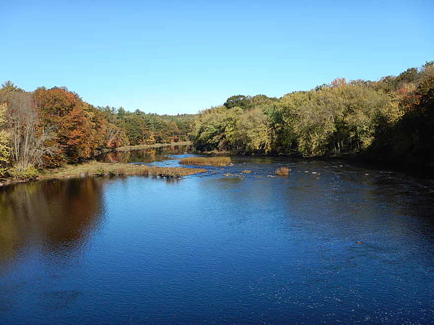
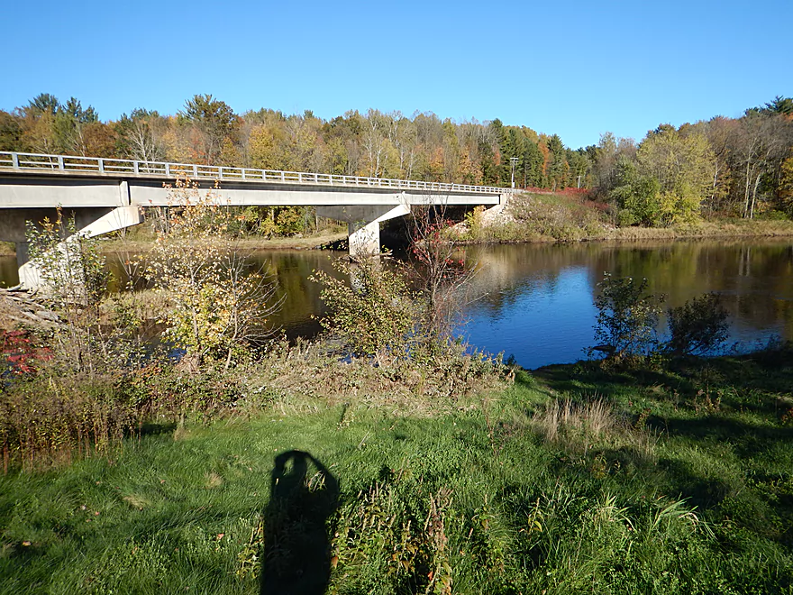
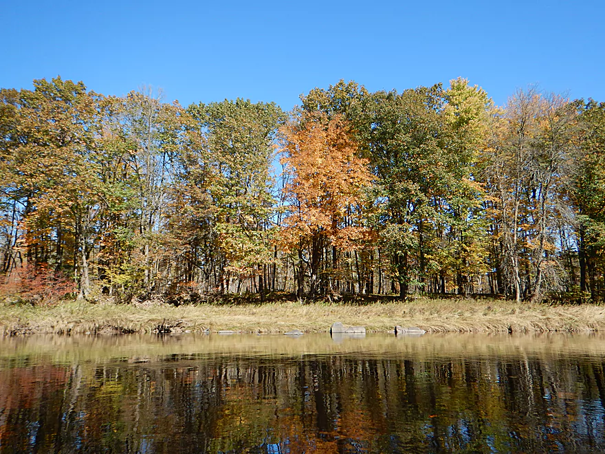
Scenic view from Hwy H
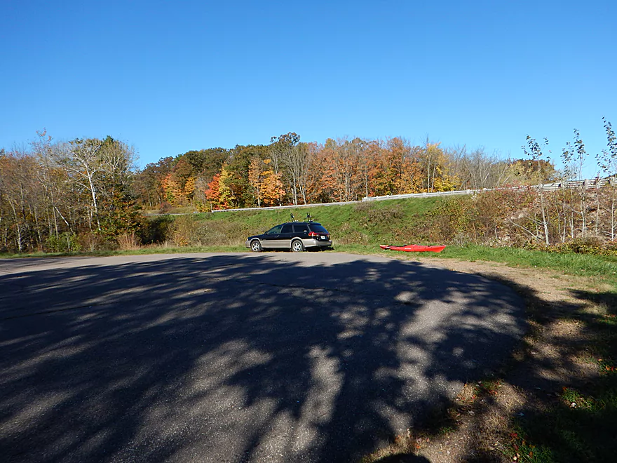
Nice pull-off for paddlers
Grassy area for launching
The Upper Black does flood with a fury
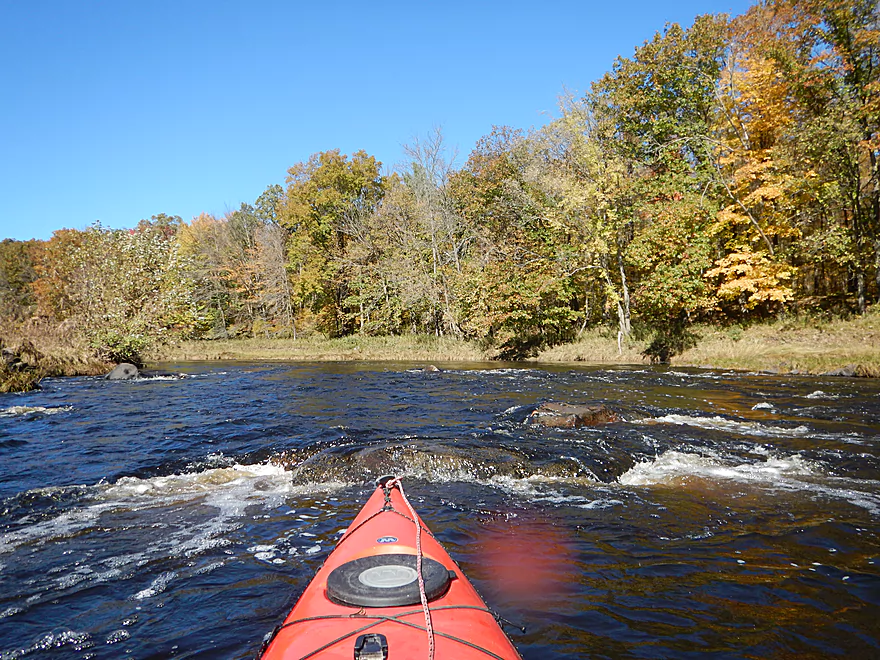
First of many…
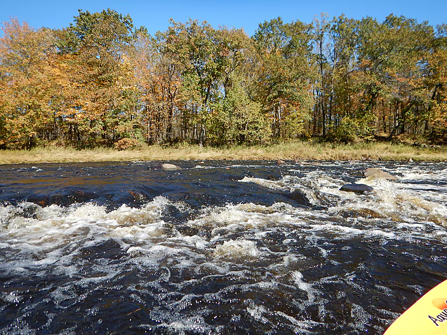
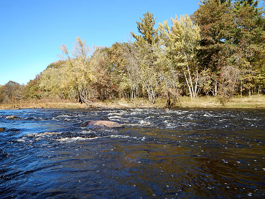
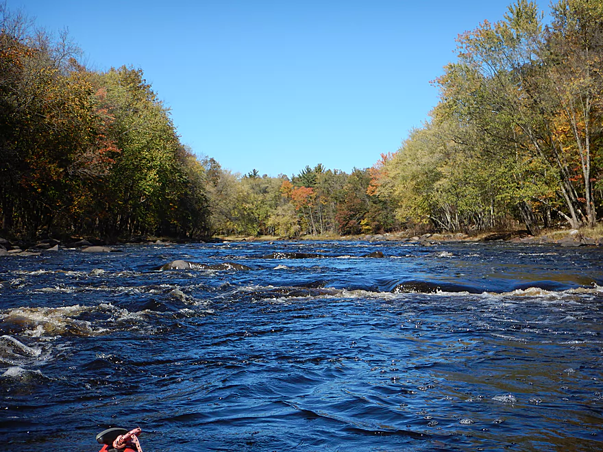
First mile is almost continuous rapids
Rocky Rapids is a Class 2
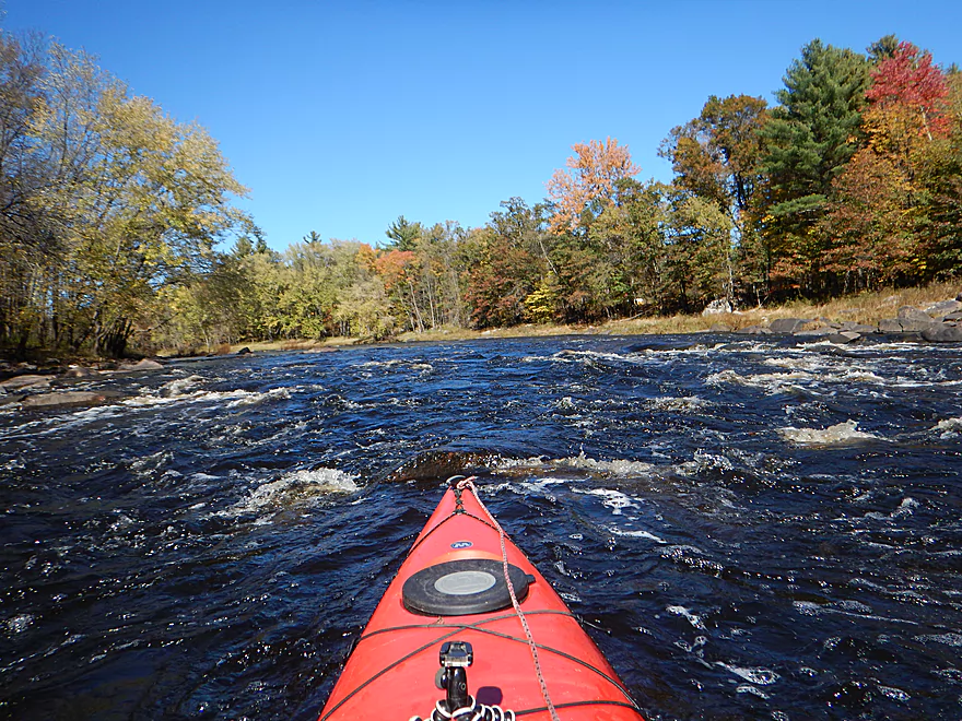
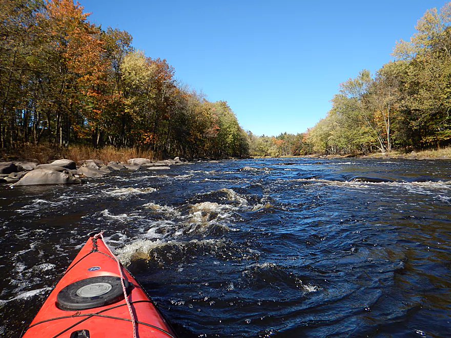
I got wet here…
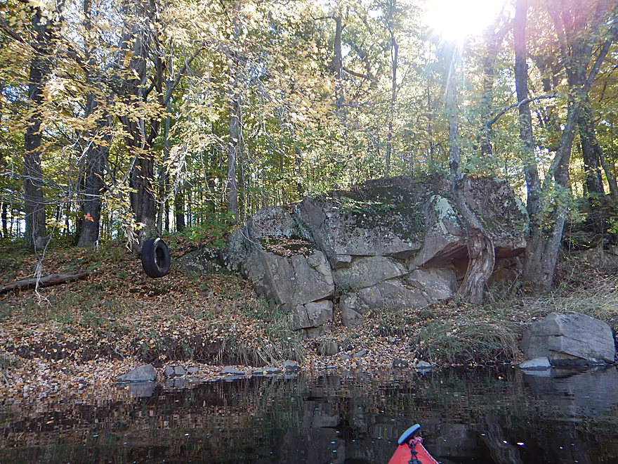
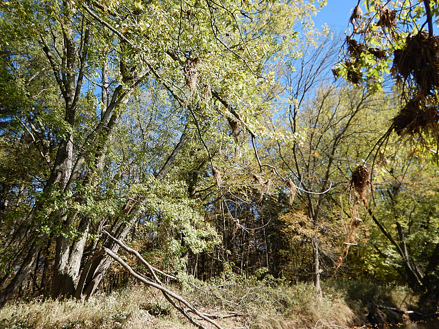
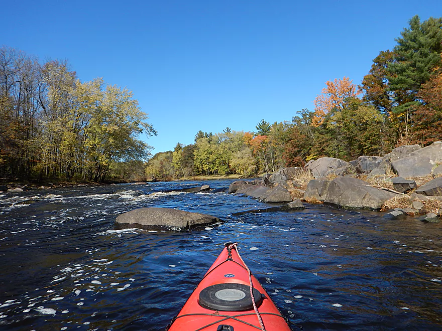
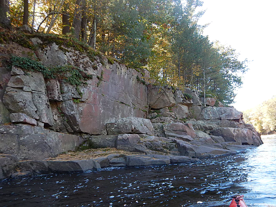
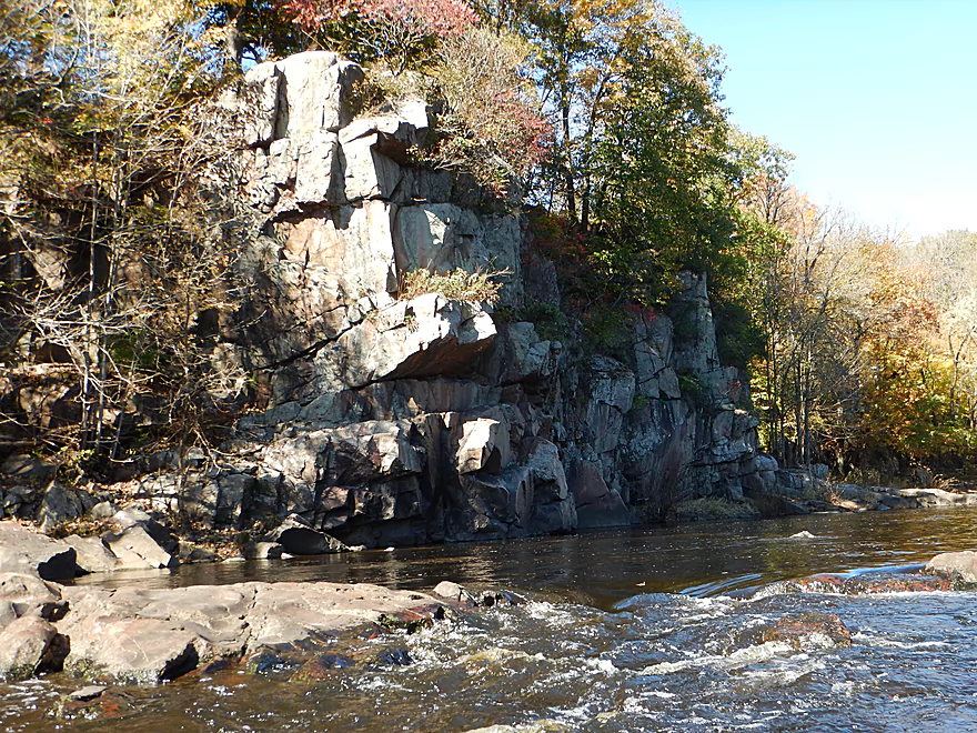
Best rock outcrop in the first half of the trip
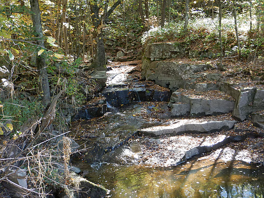
Falling down stairsteps
Almost looks man-made
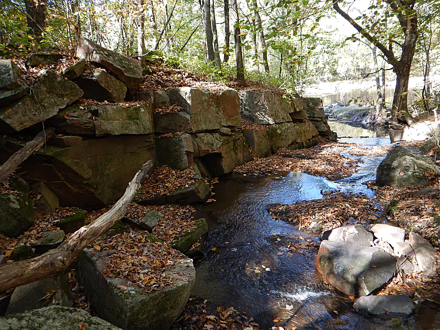
A rare sign of civilization
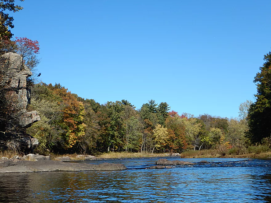
A wonderfully scenic river
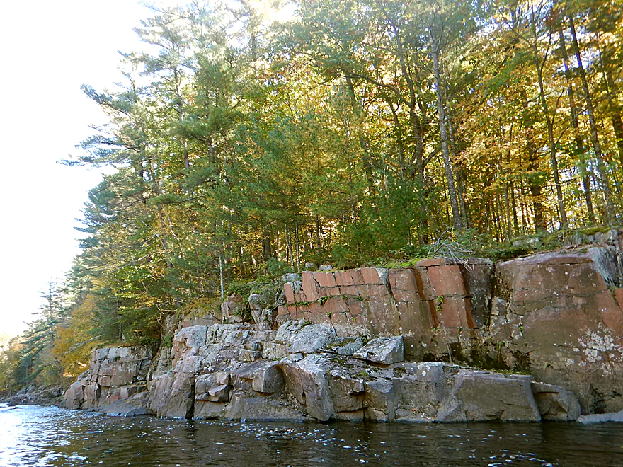
Interesting geology
One of many Class 1 rapids
Very good water clarity
Upright layers indicate major geological upheaval
Upper Mound Rips
A strong Class 1
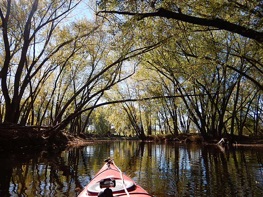
One of many long, slow sections
Getting some early fall color
Lower Mound Rips
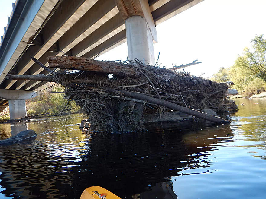
Debris height shows how high the water gets
Cawley Creek seems navigable
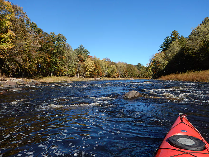
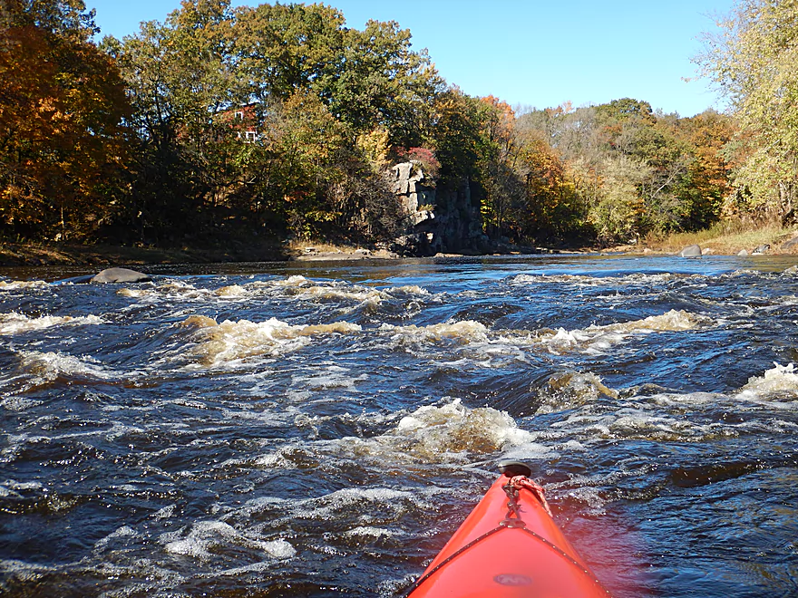
Start of a two-mile stretch of rapids
One of my favorite photos
The rapids just keep going and going…
Very tough to photo
Rocky Gorge Rapids (Class 2)
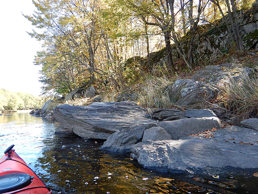
The first of four cool granite outcrops
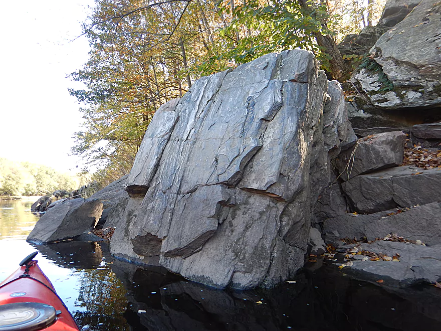
Second larger outcrop
Reverse view
The river bends are always the most scenic
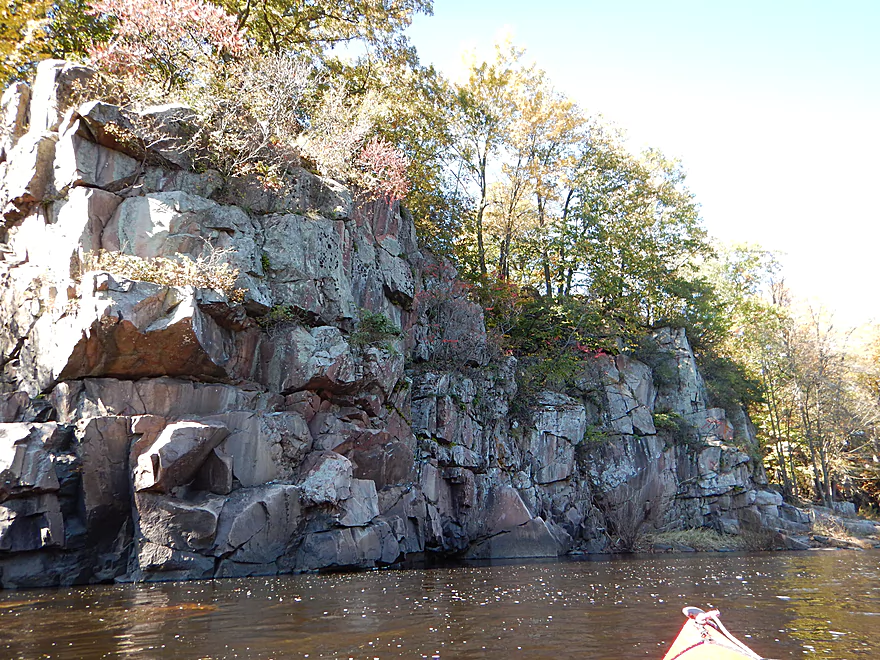
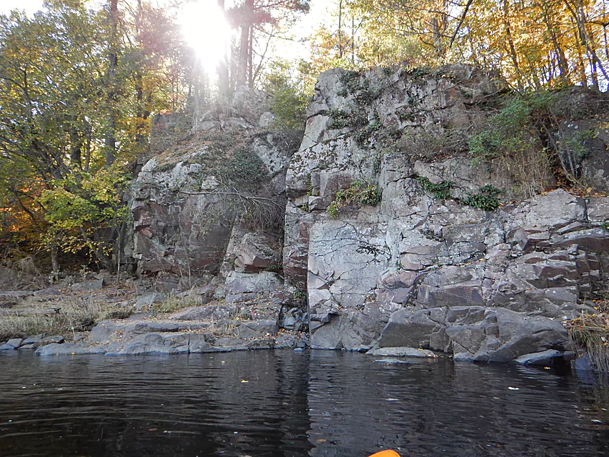
The third and best granite outcrop in the gorge
Still good current
Some natural framing
Some more Class 2 rapids (and more getting wet)
The fourth granite outcrop
A granite island with unique texture
Last rapids of the trip
Grand Ave in Neillsville
A subtle take-out
Which I missed and ended up taking out further downstream
Ok shoulder parking on Hill Road
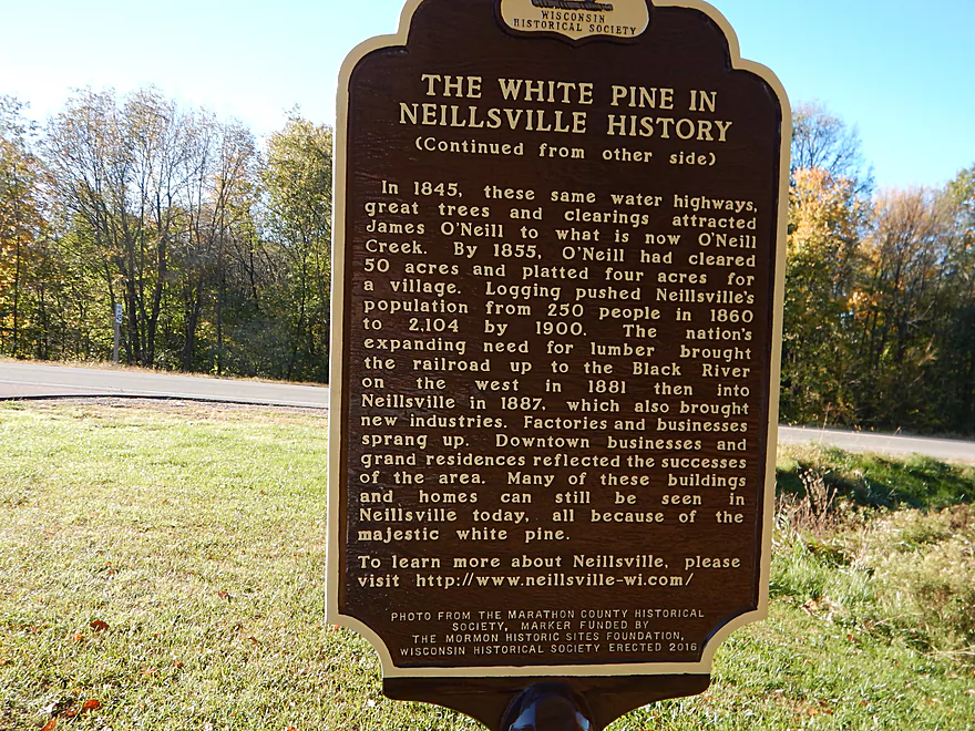
Some Neillsville history at the local Arboretum
Black River – Christie

The Black River is of course very popular with paddlers. But really, only a portion below Black River Falls gets most of the paddling traffic (with an exception below Hatfield, which whitewater paddlers love). For a river of this size and length, that is actually quite surprising. It’s been my goal for a while to explore the far Upper Black and this report is hopefully the first of many to come.
The trip starts on a great note at Hwy H. Here the bridge spans a scenic valley with a wonderful view of the river upstream. There is a dedicated pull-off for paddlers with a view of a massive log pile under the bridge. The upper portion (and, well, the lower portion, too) can and does flood with a fury, and you’ll see evidence of this throughout the trip–from matted grass to flood debris high in branches.
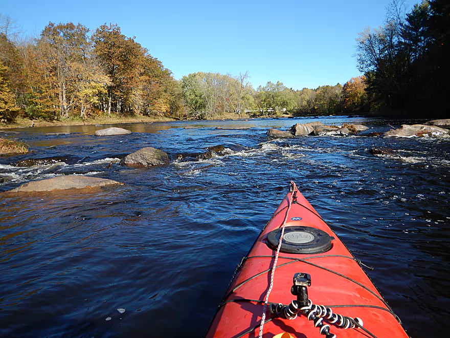
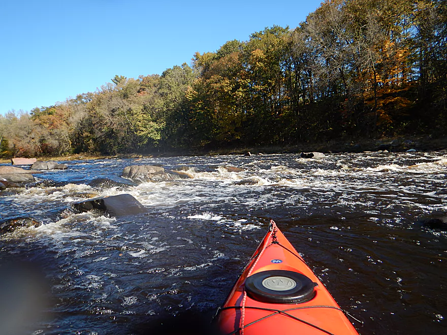
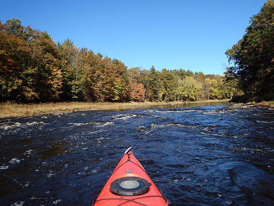
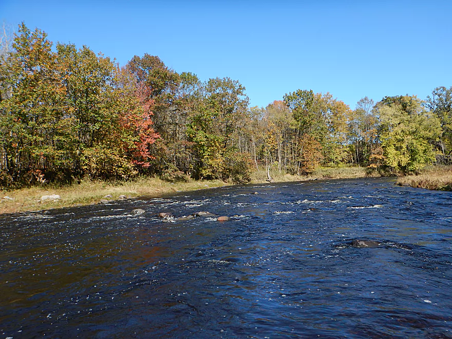
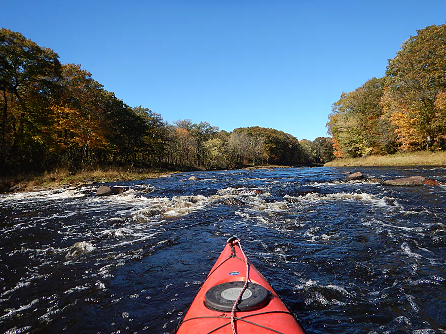
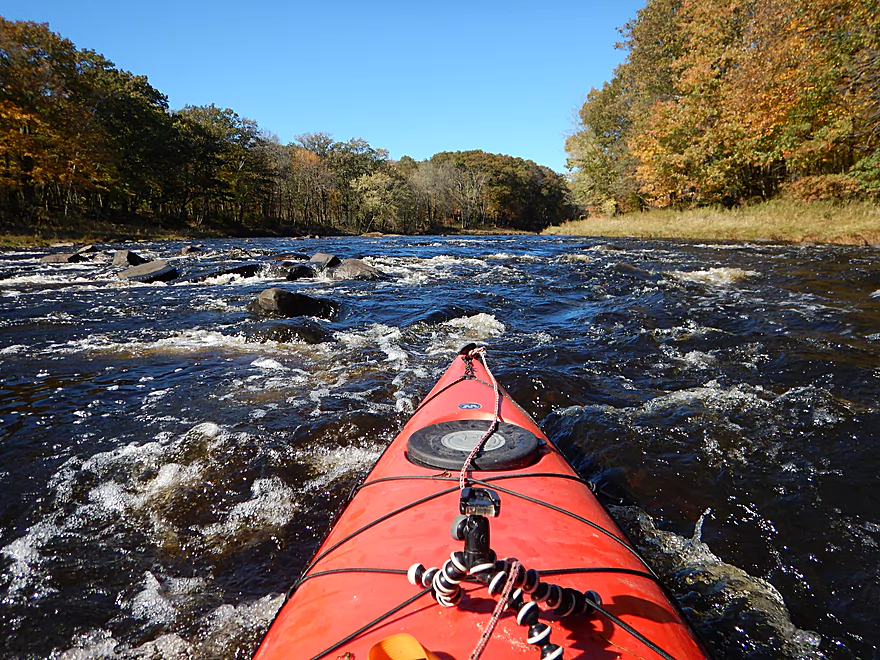
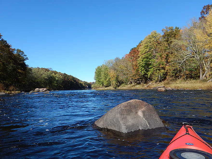
The first mile is almost nonstop rapids up to Panther Creek Road and is one of the most scenic parts of the trip. The dark blue sky and water contrasted nicely with the white whitecaps, the gray boulders, and the brown/green/orange trees along the banks. It very much reminded me of an up-north river. The rapids in this first mile start as Class 1, but get progressively faster and culminate with a Class 2 (“Rocky Rapids”). Even though this is just Class 2, take it seriously, as the current is pushy and it is easy to get turned sideways by rocks. The standing waves did pass over my half-skirt and I did get a little wet here.
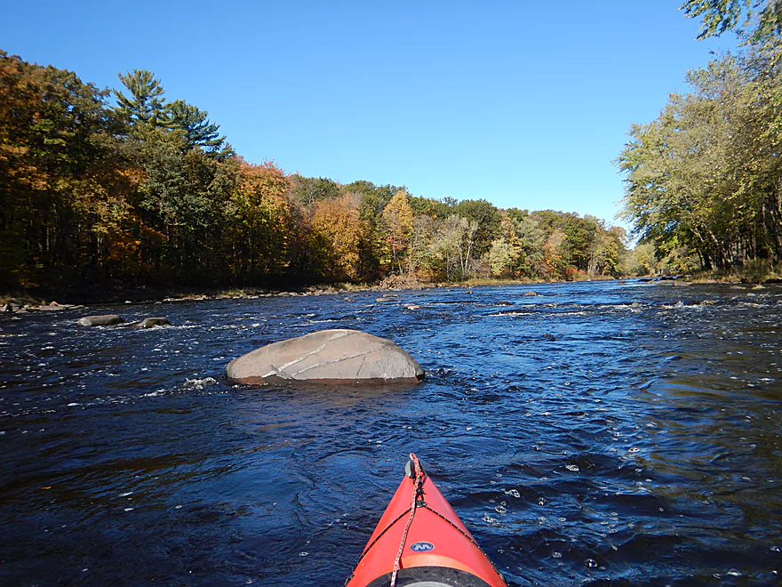
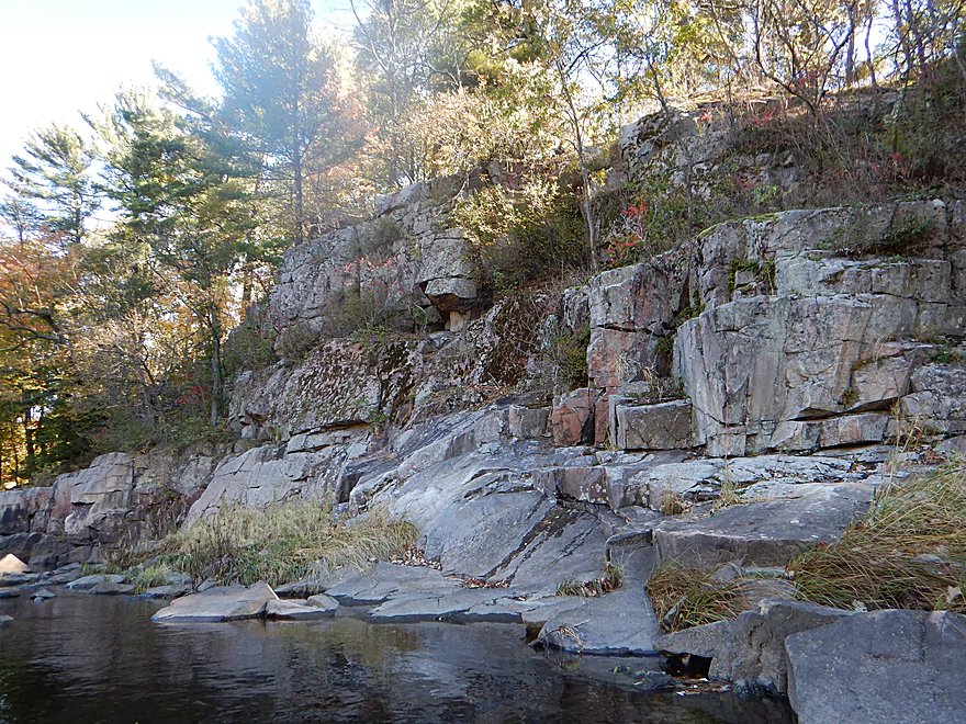
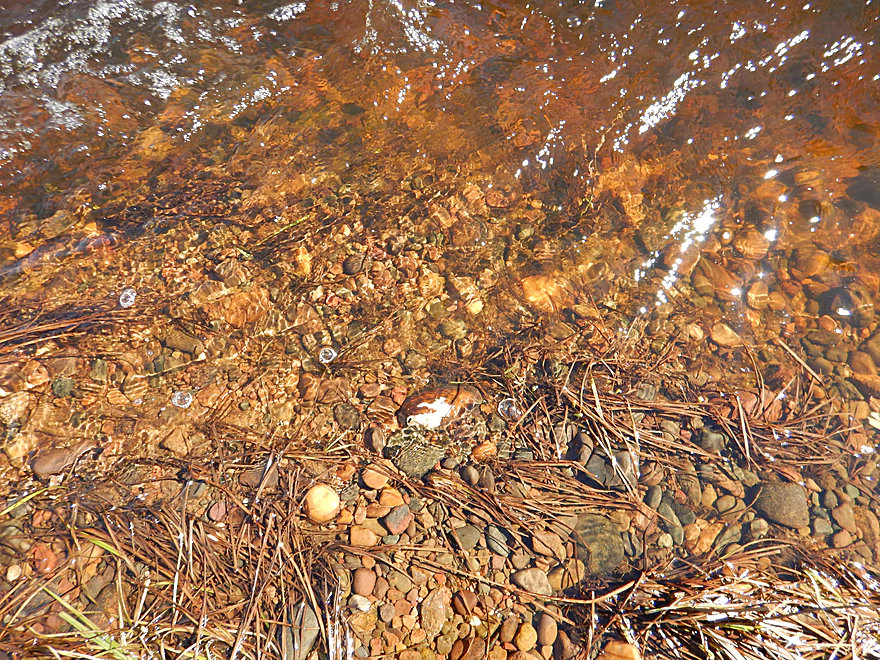
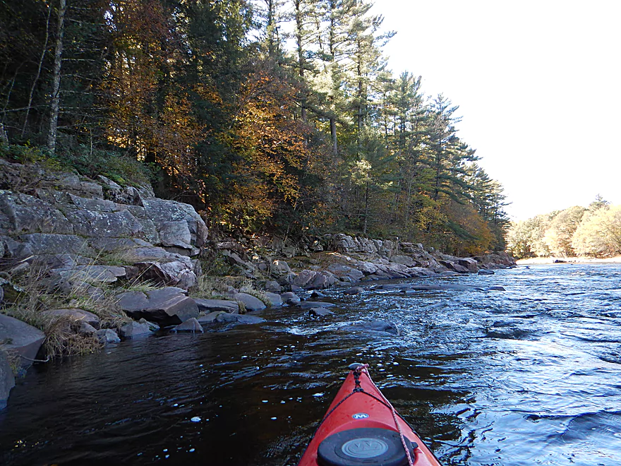
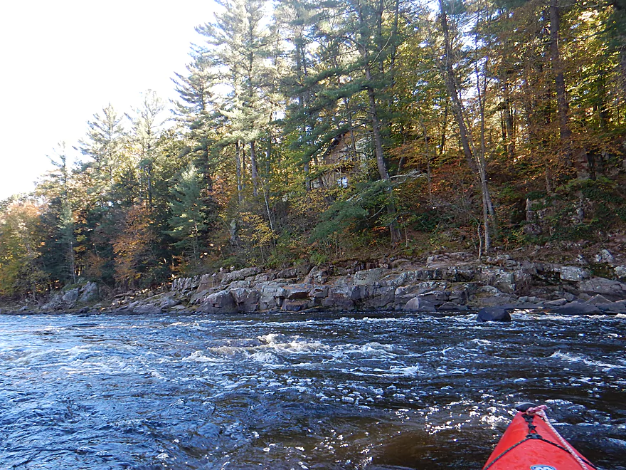
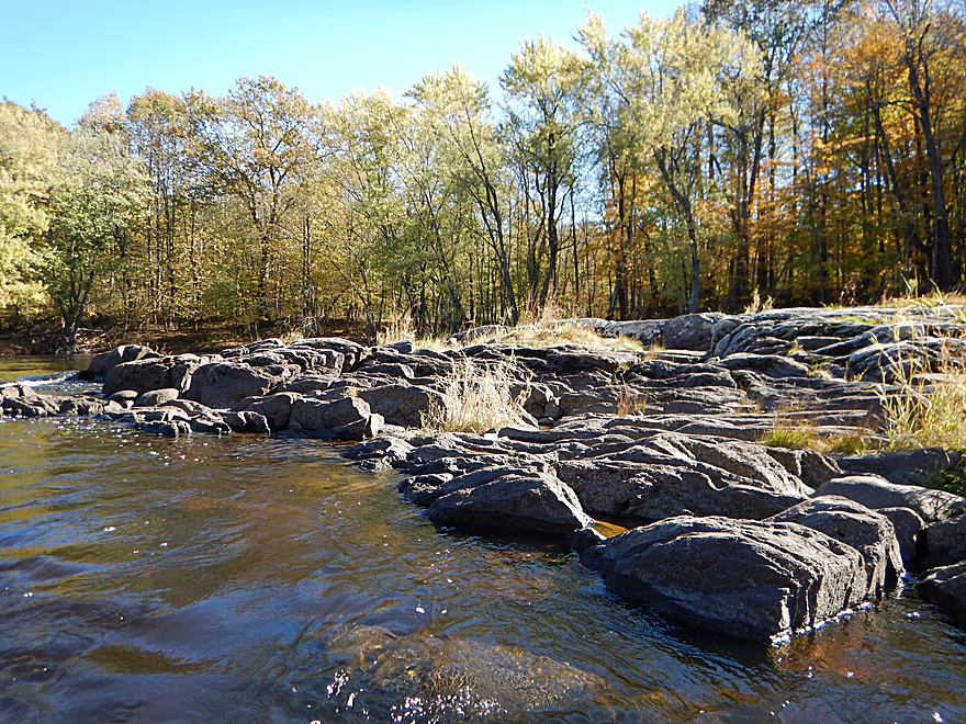
Your reward for surviving “Rocky Rapids” will be a scenic granite outcrop on the east bank immediately followed by a small creek steeply cascading over granite bedrock stairsteps. IMO it is worth it to get out and explore this creek, where you can follow the small waterfalls up to where the headwaters emerge from a huge pile of boulders. Perhaps the most unique feature of this creek is the complete lack of mud and sediment. But really, the main river channel is remarkably mud-free as well, but harder to appreciate given its much greater depth, which obscures transparency. Following the scenic micro-creek and rock outcrop, there are a few more light rapids up to Panther Creek Road, but all are pretty easy. If you paddle this on a sunny day, periodically turn around, as the most photogenic sections will almost always be directly behind you.
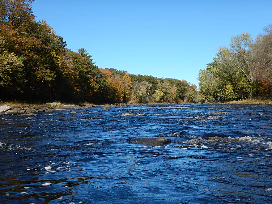
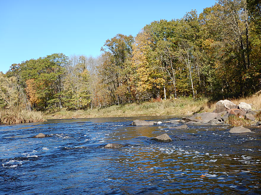
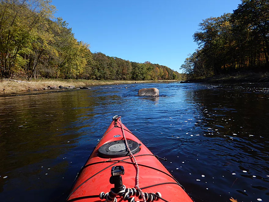
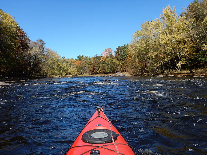
The river then slows down a bit, but there are still some striking sections with Class 1 rapids. Following “Rocky Rips,” the river REALLY puts the brakes on and to an extent morphs into a large, long lake. Still pleasant though, with attractively wooded banks and random granite sprinkled along the shoreline. But really, it wasn’t as interesting as upstream and the trip lost a star at this point. This is “pool and riffle” on steroids, as the “pools” can last for a mile, then you’ll get an amazing section of Class 1 rapids…then another long pool (most of the rapids appear by the islands if you are looking for them on a map).
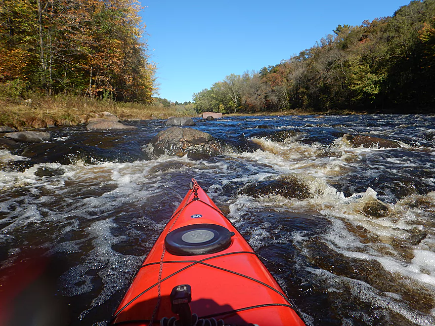
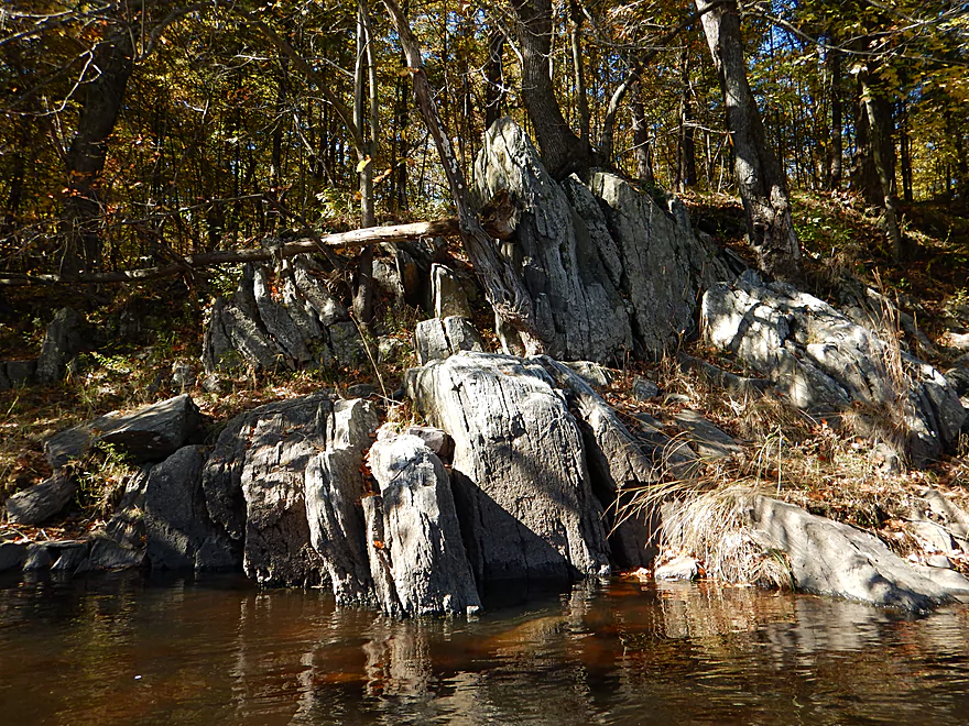
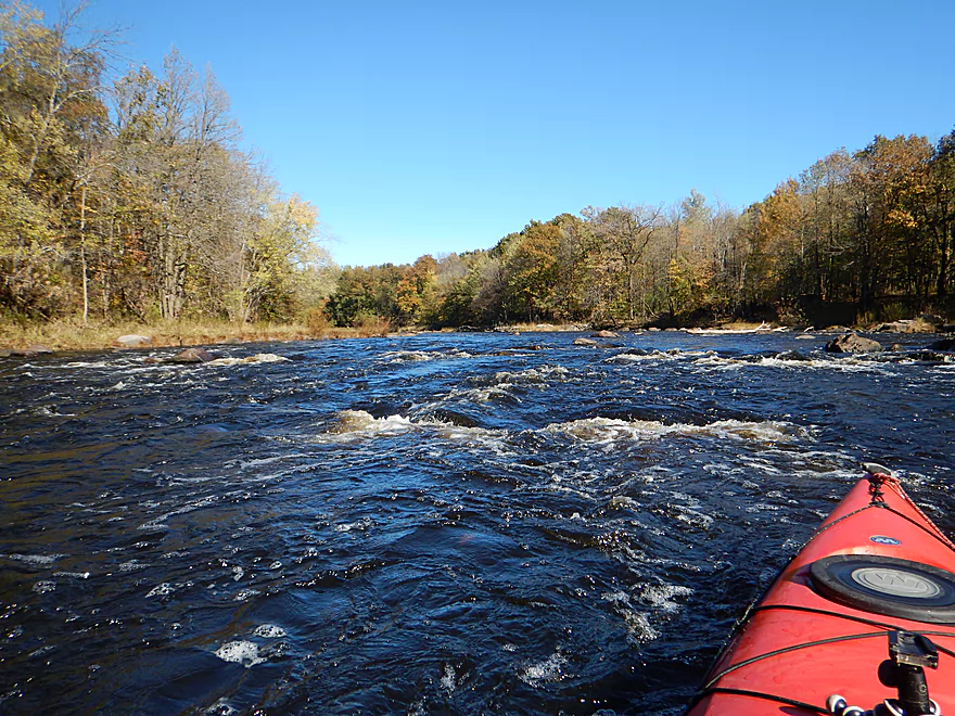
Following Cawley Creek (an interesting prospect in its own right), the river ramps up speed as it approaches Neillsville. This two-mile stretch is almost nonstop rapids, including two Class 2’s, and runs by several impressive rock outcrops. Easily the best part of the trip (and where we redeemed our lost star).
My hope had been to take out at 5th Street, but access options here did not look appealing (even for me) and I had to choose an earlier take-out at Hill Road. A shame as there are several nice Class 2 rapids between these two bridges. More adventurous paddlers could take out northeast of Hwy 10 (the third Neillsville bridge). Here there is a parking lot for the Listeman Arboretum, but you would have to drag your boat 600′ uphill over the arboretum trail to reach the parking lot from the water.
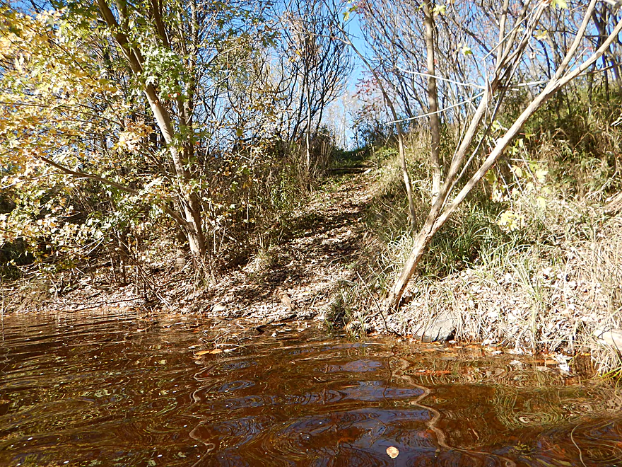
There is a good public pull-off for paddlers southwest of Hwy H. Plenty of free parking, but no outhouse. You’ll drag your boat down a grass incline to the water below. There is no ramp per say or nearby shallow area, so entry isn’t ideal, but plenty doable.
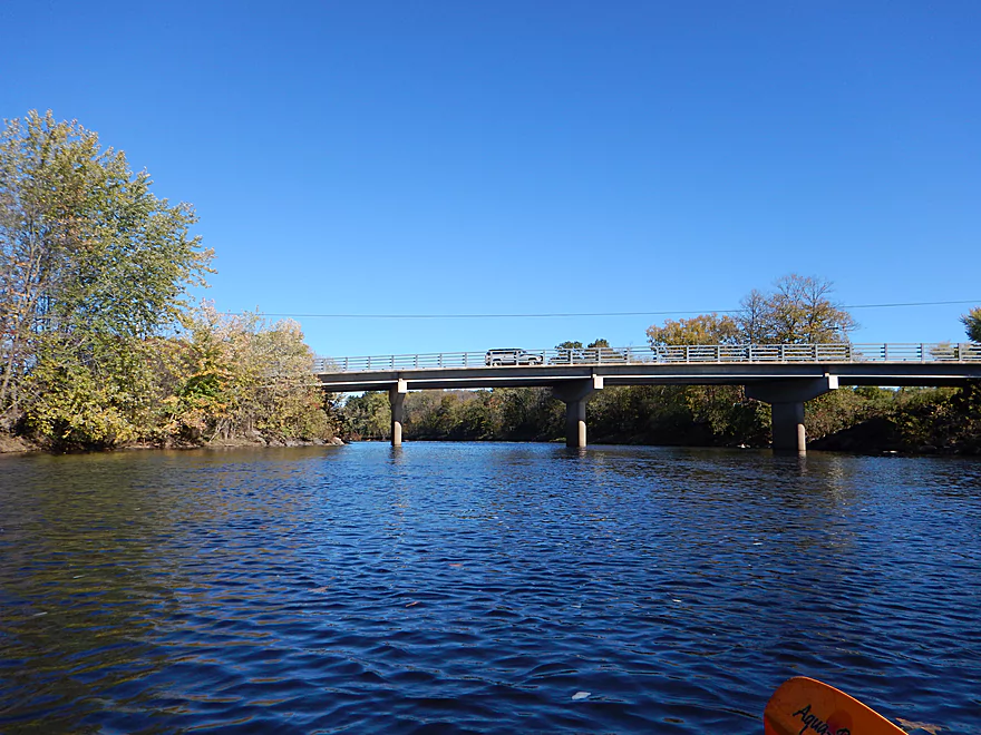
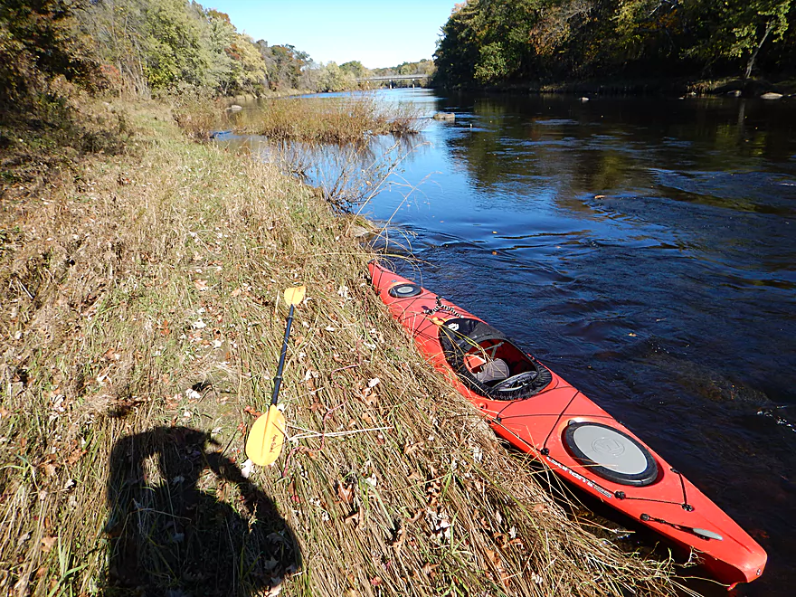
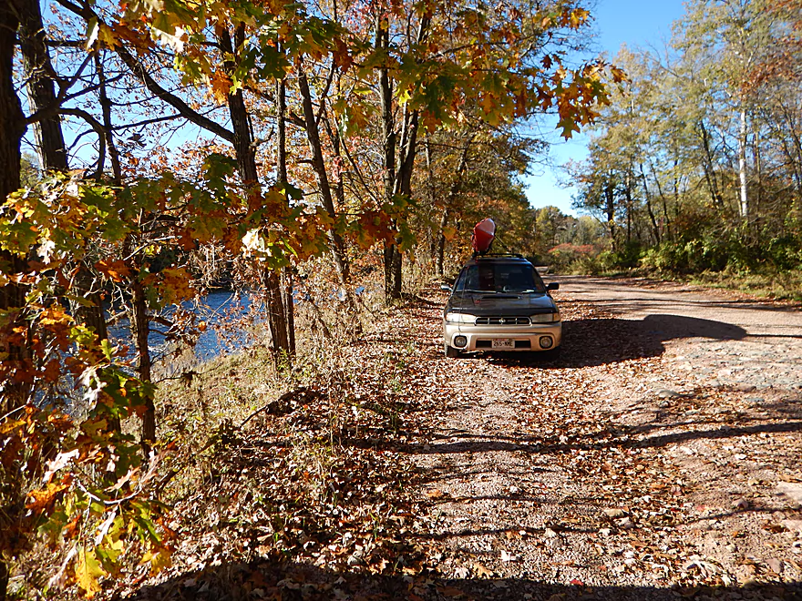
Just northwest of the Grand Ave bridge on Hill Road, there is a subtle path leading to the water. So subtle, I missed it the first time and ended up taking out a quarter mile downstream off the Hill Road shoulder (not a big deal). You should be ok to park on the shoulder (Hill Road doesn’t get a lot of traffic).
Note: Neillsville has three bridges, with Grand Ave being the first. I scouted W. 5th Street (bridge #2) as a take-out option, but it looked too steep (a shame as there are several Class 2 rapids in this short mile stretch).
Hwy 10 is the third bridge, and in theory you could take out northeast of the bridge and walk 600′ up the Listeman Arboretum trail to a public parking lot, but it would be a hilly climb.
Award for most grueling bike shuttle of 2016. 8.8 miles (long for a bike shuttle), 238′ of climbing and 246′ of descent, and one hour total of biking time. Translation…this is a very hilly bike shuttle…but on the plus side it is all paved (not something that can be said for all bike routes along the Black River).
There is a kayak livery and rental in Hatfield, but the owner prefers to start his paddlers below Neillsville. You might be able to secure a shuttle if you arrange an appointment in advance. He can be reached at: (715) 333-5009.
No logjams to worry about.
There are many rapids on this trip, including several Class 2’s, which I’ve marked on the map. These shouldn’t be taken lightly and this section should only be run by paddlers with experience. I say this as in many cases the water depth by the rapids was deep, which gave the drops more muscle to pin you sideways against the many protruding rocks if you missed your chute.
The following depth guide is only a rough guestimate based on the nearby gauge at Neillsville.
- 80-150 CFS: This would be a typical fall paddle depth. Most of the river would be plenty navigable but you would have to walk most of the rapids.
- 151 – 250 CFS: A doable depth, but you’ll probably get hung up on a number of rapids.
- 251-350 CFS: Bumpy, but I suspect a decent depth.
- 351 to 550 CFS: My suggested target range. I went at 490 CFS, which was a great depth. I rarely hit bottom and, if anything, several rapids were on the verge of being too pushy.
- 551-700 CFS: Most likely ok, but the current probably starts to get obnoxiously pushy in spots.
- 701+ CFS: Probably only suitable for hardcore whitewater paddlers.
Not much. A great blue heron, two eagles and some clams.
Quick Overview
Black River:
- Upstream of Hwy 73: Obscure sections of the Black with little known about them. Some legs will have logjam issues.
- Hwy 73 to Lake Arbutus: 48 miles. Good legs with a mix of rapids, boulder gardens and undeveloped banks. Only reason these legs don't receive more paddling traffic is because they're located away from population centers.
- Lake Arbutus: 3 miles. A scenic but challenging lake because of the waves.
- Hatfield Dam to Halls Creek Landing: 7 miles. Some of the best and most fun whitewater on the Black River.
- Halls Creek Landing to Black River Falls Dam: 6 miles. An impounded part of the river, but nice with cool cliffs.
- Black River Falls Dam to North Bend: 37 miles. This is the heart of the Lower Black and sees the most paddling traffic. No major rapids, but there are many scenic cliffs and creek inlets.
- North Bend to Mouth: 30 miles. This is the second half of the Lower Black. While not as scenic, there are still cool sandbars and sandbanks. Few paddle these stretches.
Noteworthy Tributaries:
- Robinson Creek: One of the best paddles in all of Wisconsin.
- Halls Creek: Also one of the best and with amazing sandstone walls.
- Morrison Creek: Very scenic creek with some fun whitewater.
- Wedges Creek: Great paddle with amazing boulder gardens.
- East Fork of the Black River: Some fun riffles and unique granite geology.
- Perry Creek: Shallow but a super scenic creek.
- Dickey Creek: A wonderfully scenic creek with fantastic sandstone…but too many logjams.
- Beaver Creek: Some fun rapids and amazing sandstone in Galesville, but logjams on the downstream portions.
- Popple River: A shallow whitewater river that is very nice.
- Arnold Creek: A pleasant tributary to Lake Arbutus with really nice reflections.
- Rock Creek: Many scenic boulder gardens, but usually this creek is too shallow to run.
- Roaring Creek: Very scenic creek with a great waterfall at the mouth, but might be a challenge to paddle.
- Vismal Creek: Super scenic but has a lot of logjams and is shallow. Requires very high water conditions.
- Plus countless small creeks that are too small to paddle but quite fun to explore by foot. If you know of viable paddling options, let me know! Am very curious to know more about Douglas Creek, Levis Creek, O’Neal Creek, and Crawley Creek.
Detailed Overview
Headwaters to Neillsville:
- Upstream of Division Drive: Likely too many logjams to be navigable.
- Division Drive to Sawyer Ave: (6.5 miles) Rocky and a few light rapids. Maybe 4 logjams.
- Sawyer Ave to Hwy 64: (2.5 miles) Rocky and a few light rapids.
- Hwy 64 to Bridge Road: (14.4 miles) Solid prospect reviewed by Mike Svob. Some Class 1 rapids and nice gravel bars. Intermediate access points at Bahnkes Ave and Hwy AT.
- Bridge Road to Hwy X: (6.0 miles) Little is known of this section…likely pretty simple.
- Hwy X to Colby Factory Road: (6.0 miles) Little is known about this section…likely some rapids and outcrops. Intermediate alt access points at Hwy 29 and Hwy N.
- Colby Factory Road to Popple River Mouth: (7.9 miles) This stretch has far fewer rapids than downstream legs with only a few minor rapids. It should still be pleasant though.
- Popple River Mouth to Reese Ave: (5.3 miles)
- Popple River Mouth to Warner Drive: (1.0 miles) This is a slower and less interesting stretch, but does include 4 Class 1's and scenic Hemlock Rapids which are Class 3.
- Warner Drive to Greenwood Park: (3.4 miles) A good leg with many rapids (3 Class 2's and 17 Class 1's).
- Greenwood Park to Reese Ave: (0.9 miles) A slower stretch with just 2 Class 1's. Part of this passes through the community of Greenwood.
- Reese Ave to Twenty Six Rd: (5.1 miles)
- Reese Ave to Sladich Rd: (0.7 miles) A mostly nondescript wooded stretch. The exception is Greenwood Rapids where an island splits the river. The right side is scenic, but the left side has fun Class 3 rapids.
- Sladich Rd to Willard Rd: (1.6 miles) A somewhat slow and relatively uninteresting leg. Highlights include one nice outcrop, a few gravel bars and a 400' stretch of Class 1 rapids.
- Willard Rd to Twenty Six Rd: (2.8 miles) A great leg with 10 Class 1's and 2 Class 2's. Highlights also include scenic boulder gardens and a few outcrops.
- Twenty Six Road to Hwy H: (5.0 miles) Multiple Class 1 & 2 rapids.
- Hwy H to Grand Ave/Hill Road: (8.0 miles) A great trip with several Class 2 rapids and scenic granite outcrops.
Note, for more details on the Upper Black, I highly recommend “Indian Head Rivers” by Michael Duncanson.
Alternate Black River Trips – Neillsville to Black River Falls:
- Grand Ave/Hill Road to Opelt Road Landing: (6.7 miles)
- Grand Ave/Hill Road to Hwy 10: (2.2 miles) Nice section with a handful of rapids. These are mostly Class 1 at lower depths, but strengthen to Class 2 during high flow rates.
- Hwy 10 to River Road Landing: (4.3 miles) Fantastic whitewater section. Maybe six Class 2’s and two class 3’s. Scenic boulder gardens and a few outcrops.
- Opelt Road Landing to Bryan Ave Bridge: (1.1 miles) Not sure there is anything special about this stretch.
- Opelt Ave Bridge to Hwy 95: (4.4 miles) Ok…nothing special.
- Hwy 95 to West Arbutus County Ramp/Hatfield Dam: (4.8 miles)
- Hwy 95 to North Arbutus Boat Landing: (2.4 miles) Includes a scenic gorge, boulder gardens and rapids including the Class 3 Red Granite Rapids. River slows after rapids.
- North Arbutus Boat Ramp to West Arbutus County Ramp: (2.4 miles) A large open water paddle on Lake Arbutus that can feature challenging waves on summer afternoons.
- Hatfield Dam to West/East Channel Confluence: 0.2 or 0.3 miles.
- West Dam to West/East Channel Confluence: 0.3 miles. There is a large boulder field and Class 2 rapids below the west dam. At the outlet of the west channel is a Class 4 drop. This is easy to scout and portage.
- East Dam to West/East Channel Confluence: 0.2 miles. Perhaps the most extraordinary rapids in the state with Class 4/5+ rapids. The action starts below the dam where steep granite banks narrow the river significantly and force it down deep chutes. The gorge starts with Class 2-3 rapids but ends with two significant drops. American Whitewater warns “between the dam and this point lie some serious drops which contain near inescapable boiling cauldrons at moderate to high flows”.
- Hatfield Dam Confluence/West Clay School Road to Powerhouse Road Landing: (3.1 miles)
- Hatfield Dam Confluence to Hwy K: (0.3 miles) One of the most scenic paddling areas in the state with massive granite outcrops. There is one set of Class 2 rapids.
- Hwy K to Powerhouse Road Landing: (2.8 miles) The first half mile by Hwy K is very scenic and contains one Class 3. The second mile is mostly flatwater. The third mile is almost continuous rapids and features one Class 3.
- Powerhouse Road Landing to Halls Creek Landing: (4.0 miles) Scenic section with a few Class 2 rapids and a steep ledge.
- Halls Creek Landing to Black River Falls Dam: (6.2 miles) Wonderful sandstone cliffs.
Alternate Black River Trips – Black River Falls to Mouth:
- Black River Falls Dam to Mason’s Landing: (4.7 miles) A great little section.
- Mason’s Landing to Irving Landing: (9 miles) A good section.
- Irving Landing to Lost Falls Campground (2.3 miles) A popular stretch. Highlights include a few small outcrops, two tiny waterfalls, several impressive sandbars, and one large sandbank. A side hike to Roaring Falls can be arranged. Note Lost Falls Campground is private and you must purchase a pass from them to use their access.
- Lost Falls Campground to Grinde Landing: (6.4 miles) A popular section with some nice outcrops and a waterfall by Roaring Creek. Wolf Creek may also have a cool slot canyon. The river splinters into multiple channels, some of which may be quite shallow in later summer. As of 2023, Grinde Landing is closed because somebody stole the owner's deer stand.
- Grinde Landing to Melrose Landing: (3.9 miles) A shorter section but with a really nice rock outcrop before Melrose Landing. As of 2023, Grinde Landing is closed because somebody stole the owner's deer stand.
- Melrose to North Bend: (10.1 miles) Likely the most popular stretch with the best sandbars on the river, three sets of outcrops, and a few waterfalls.
- North Bend to Hwy 53: (13.3 miles) Likely a nice paddle with sandbars, large sandbanks and maybe a few outcrops. Unfortunately it is very long.
- Hwy 53 to Hwy 35: (8 miles) A nice section with epic sand banks.
- Hwy 35 to Lytle Road: (4.0 miles) Goes through the Van Loon Floodplain Forest. This can be a shallow trip but features many nice sandbars.
- Lytle Road to Fred Funk Boat Landing (Mississippi): (5.0 miles) Multiple options because of the river delta.
Trip Map
Overview Map
Video
Photos Size:
Love the Black River. Have been fishing it on and off over the last 16 years or so. How do you think a SOT would do on this stretch of the river? Thanks!!
It would be doable…but I wouldn’t do the river when it is high as a sit-on will lack the maneuverability to get through the bigger rapids.