
Turtle Creek – School Section Rd to Creek Rd

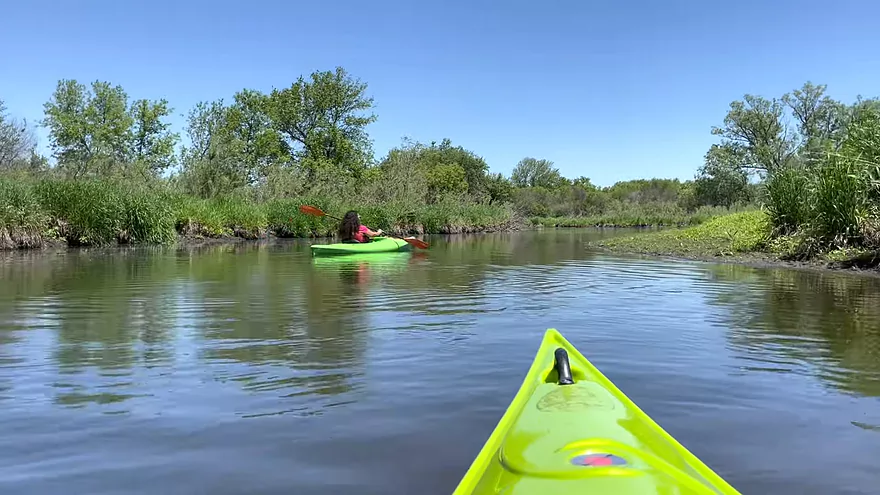
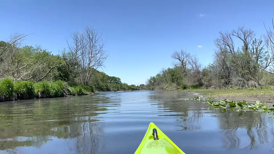
We took a leisurely paddle on Turtle Creek on 5/26/21 and were happy to have a guest paddler with us! We started at about 11:45am and paddled from the put-in at School Section Road, Darien WI and stopped at Spooner Park for a comfortably long lunch break. The sun was wonderfully warm to dry our wet feet after having to walk our boats through some shallow sections. (Check for leeches.) We then paddled to our take-out where we had the truck parked. It was difficult to see the car in the parking lot at the Creek Road DNR lot until we were nearly under the bridge. It was about 3:30pm. You have to walk your boat 250-300 feet to the parking lot.
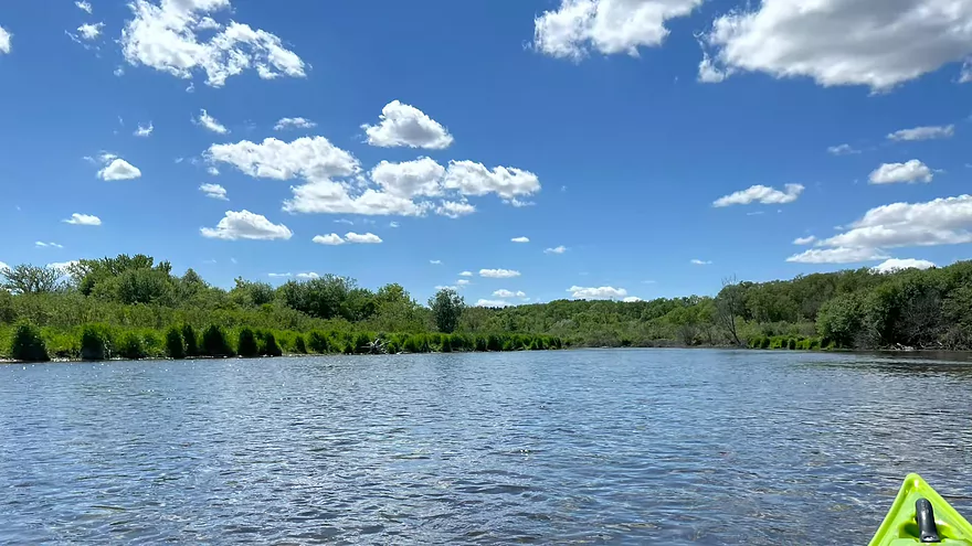
Turtle Creek is a popular paddling creek located between Janesville and Lake Geneva. The water is very clear and it’s fun to see the fish, sometimes schools of them. There are many birds to watch and listen to as well, including an immature eagle, great blue herons, sandhill cranes, geese, and songbirds. We saw one muskrat. Surprisingly, we saw no turtles! What is up with that?
This video is not intended to be a guide to the area. This idea of taking video and sharing it started with an online Nature Explorer’s Storytime, during Covid, for the public library where I worked. Then I learned that my friends who no longer can get out and enjoy nature in this way, enjoy seeing our trips. For a guide check out https://wisconsinrivers.org/, the DNR website, State Parks, and local County Parks websites.
There is a really nice 3 minute video of the river and lots of good info at: https://www.
I really appreciate the review Karen! For those that don’t know, Karen and Brad run a video blog called “Stories ~N~ Flight!“. It contains a number of water trail reviews and I do recommend subscribing to their Youtube channel.
WisconsinRiverTrips.com is always very appreciative of guest reviews, and if you the reader is ever interested in submitting one, you can use this online form.
Detailed Overview
Special thanks to Friendsofturtlecreek.com for many of these tidbits.
- Turtle Lake Boat Ramp to Turtle Lake Road: 0.8 miles. Half of this would be a lake paddle on spring-fed Turtle Lake. The other half would be over an extremely small channel that would likely require very high water to be navigable.
- Turtle Lake Road to Island Road: 3.2 miles. Artificially straightened, and perhaps requiring a few culvert portages, this marshy section would likely not be for most but could have its appeal. Google has a nice street view image of this section.
- Island Road to Dam Road: 2.5 miles. More straightened channels running through thick marshes. This could have some subtle beauty to it. An alt take-out would likely be Hwy P.
- Dam Road to North Terrace Street: 2.8 miles. For 1.5 miles the creek finally meanders naturally for the first time, but in the last mile, the creek is impounded by a dam to form Comus Lake. Take out above the dam at the public Comus Lake boat ramp.
- North Terrace Street to School Section Road: 6.3 miles. Good marsh prospect with perhaps a logjam or two. Launch below the dam but be wary of a second lowhead dam. On my to-do list.
- School Section Road to East Creek Road: 6.9 miles.
- School Section Road to Hwy 14: 2.2 miles. Great section, with terrific water clarity.
- Hwy 14 to Hwy C: 2.4 miles. A bit more weedy, but still a great section with good water clarity. Spooner Park is an alternate access.
- Hwy C to E. Creek Road: 2.2 miles. A nice section with some scenic springs.
- East Creek Road to Hwy 140: 6.8 miles.
- East Creek Road to O'Riley Landing: 1.9 miles. Good stretch with scenic wild rice.
- O'Riley Landing to S. Carvers Rock Road: 3.1 miles. Little Turtle Creek comes in and significantly increases the size of the main channel. This is still a pleasant stretch with good clarity and an attractive gravel bottom.
- S. Carvers Rock Road to Hwy 140: 1.9 miles. This stretch is more wooded and hilly. There are several hidden limestone outcrops on this leg.
- Hwy 140 to Sweet Allyn Park: 5.2 miles.
- Hwy 140 to Turtle Creek Parkway/Smith Road: 3.8 miles. A good leg with deep clear water. The latter parts are a bit weedy though.
- Turtle Creek Parkway to Sweet-Allyn Park: 1.4 miles. A more shallow, but terrifically scenic stretch with fantastic clarity. The highlight is a historic five arch stone bridge.
- Sweet-Allyn Park to S. Lathers Road: 1.5 miles. Likely a nice prospect. The take-out at S. Lathers Road is good and used by paddlers…but vague No Parking signs don’t make it clear where you can park.
- S. Lathers Road to Town of Turtle Creek Canoe Launch: 2.2 miles. Likely a nice prospect.
- Town of Turtle Creek Canoe Launch to Milwaukee Road/Turtle Creek Greenway Trail: 5.5 miles. A nice trip through the Turtle Creek floodplain and outskirts of Beloit with occasional riffles, an attractive gravel bottom, and lush jungle-like vegetation.
- Milwaukee Road to Colley Road: 0.4 miles. Good prospect.
- Colley Road to Turtle Creek Park: 1.6 miles. Good prospect. Take-out is west of Dearborn Street. Disembark north of the creek and park to the west. Bank is a bit steep here. A nicer launch is south of the creek by Turtle Tap. Turtle Tap is private, but supposedly there is a strip of public land you can use to launch from.
- Turtle Creek Park to Dickop Street: 1.0 mile. A very good prospect.
- Dickop Street to John Jose Canoe and Kayak Launch: 0.8 miles. A final short section on Turtle Creek, then a paddle upstream on the Rock River to reach a take-out.
Trip Map
Overview Map
Video
Photos Size: