
Scouting Spring Valley Road…looks a tad small
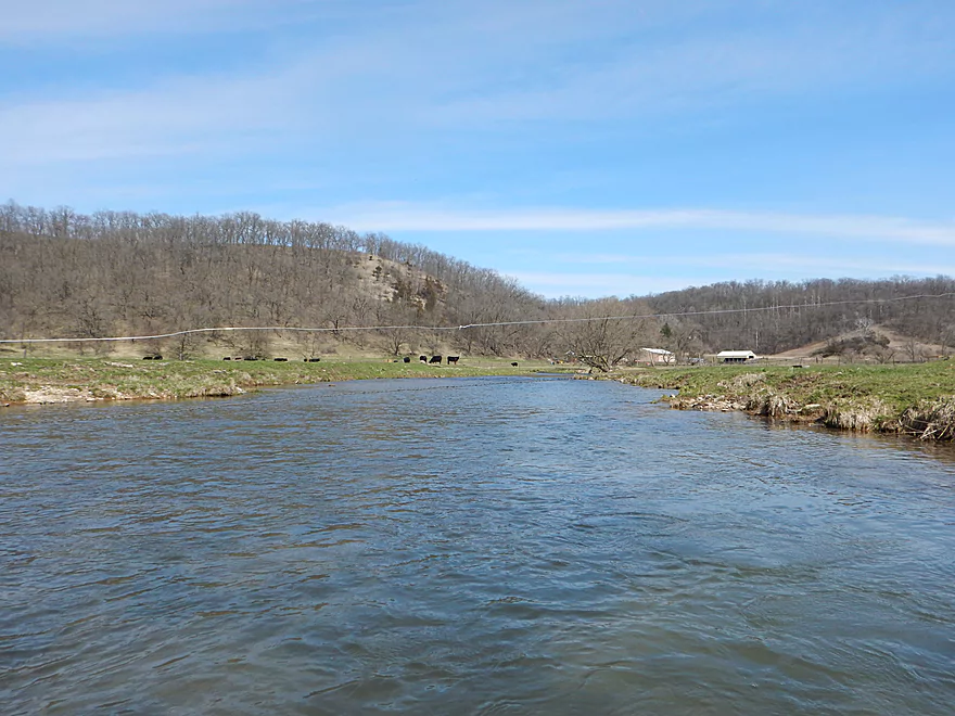
Putting in at Green River Road instead
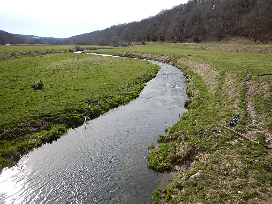
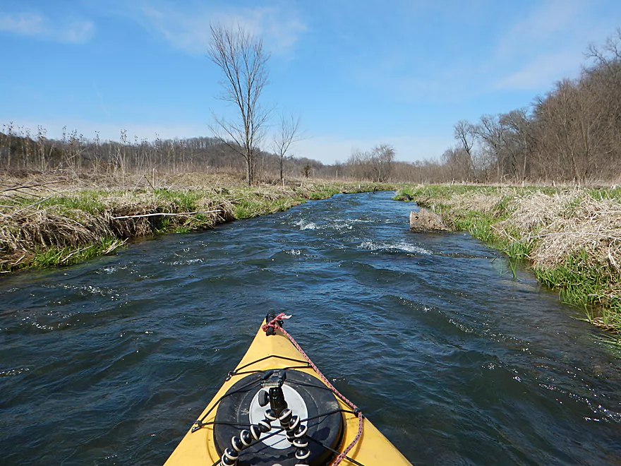
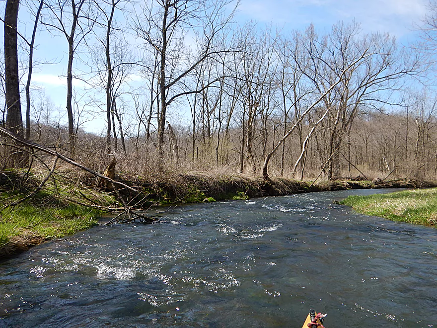
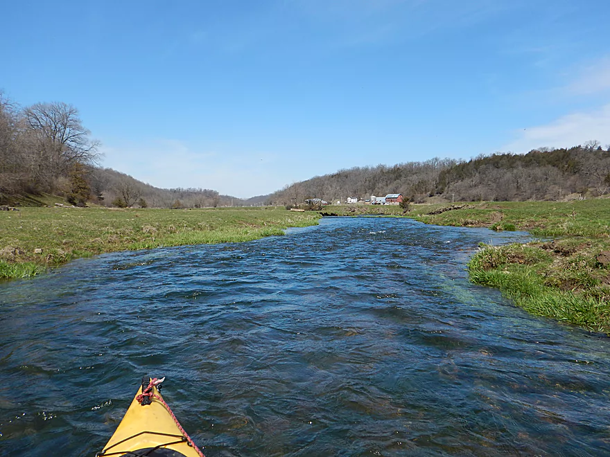
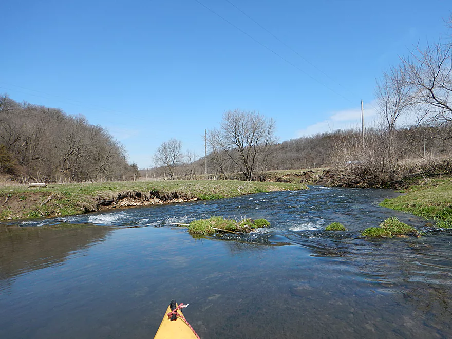
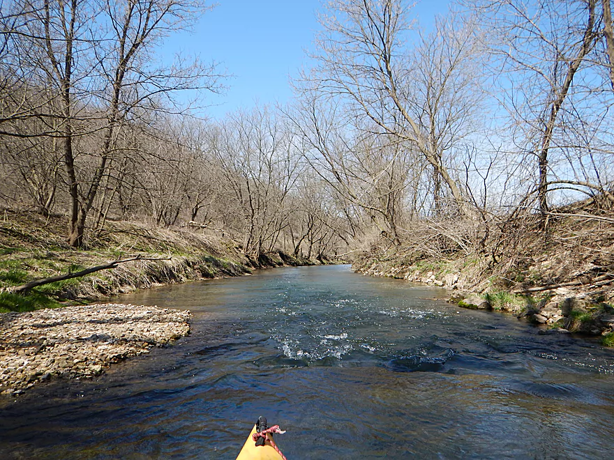
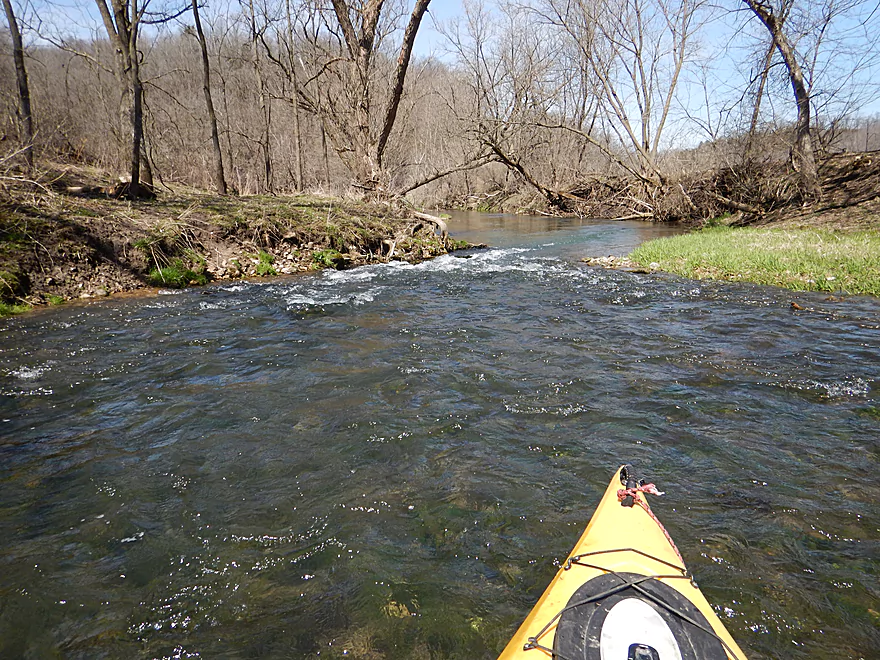
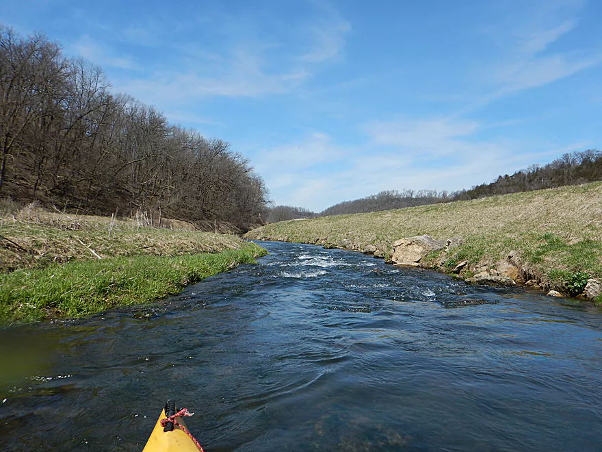
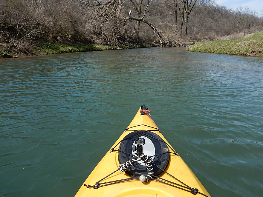
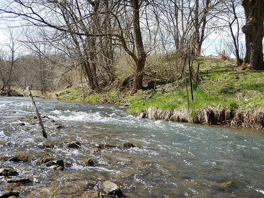
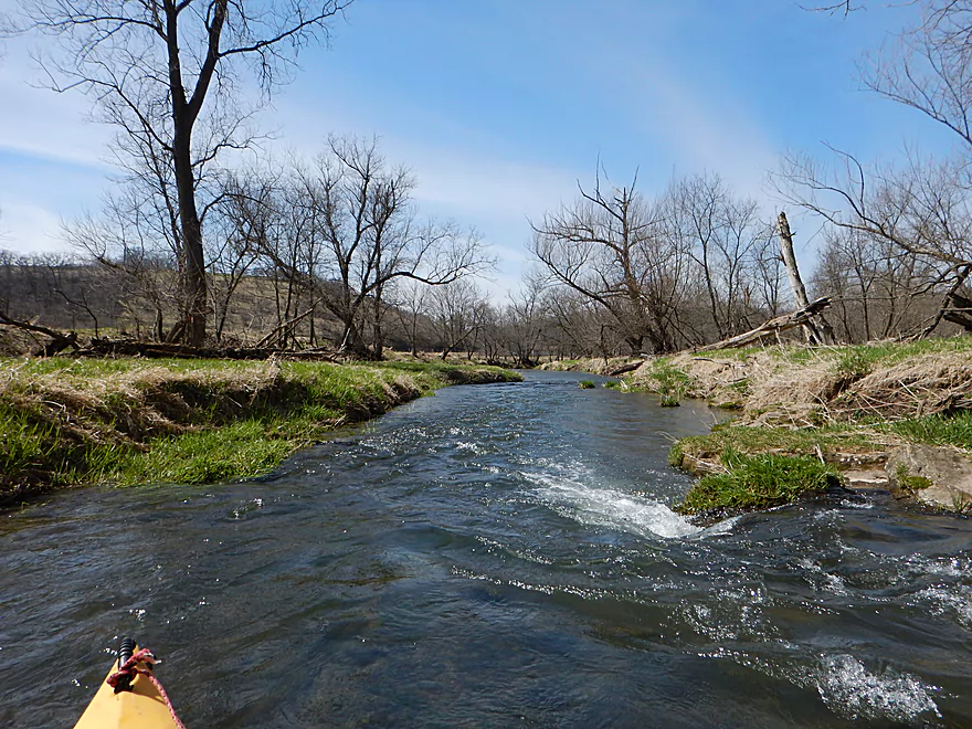
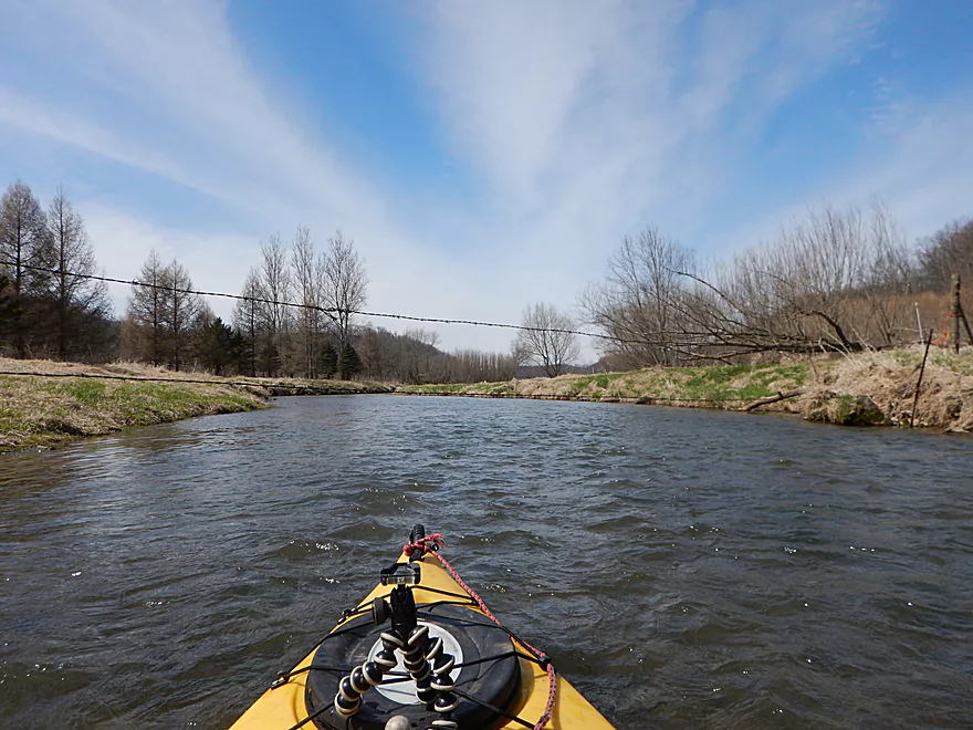
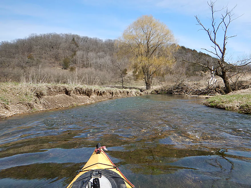
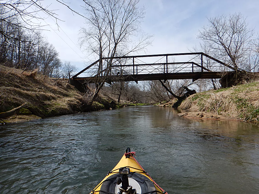
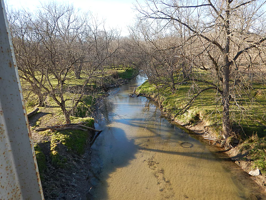
Trip starts fast
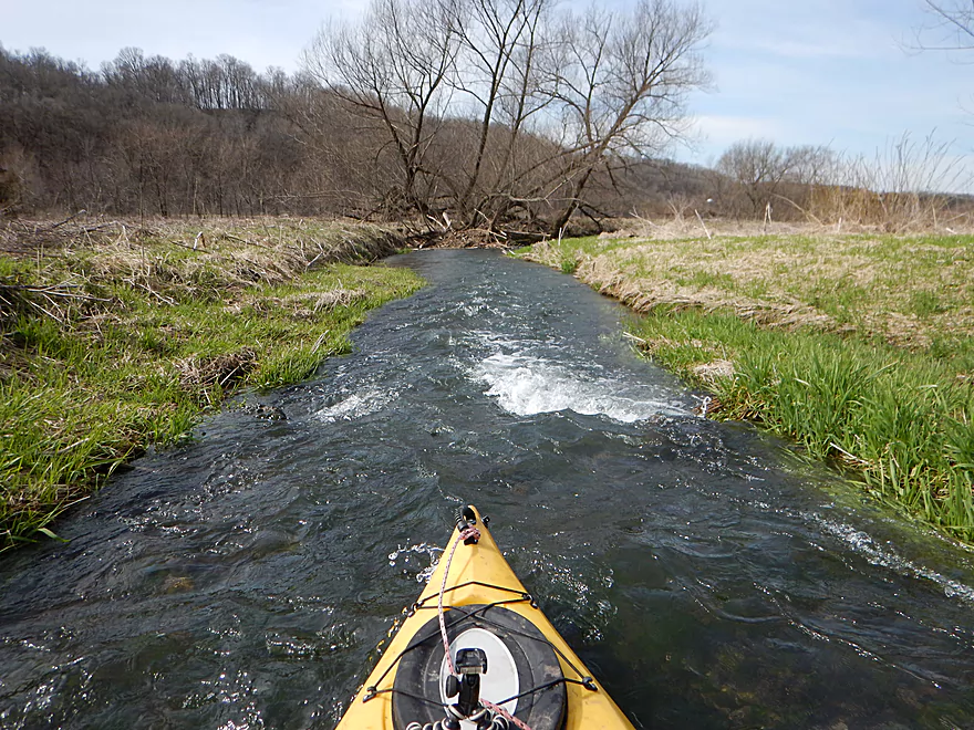
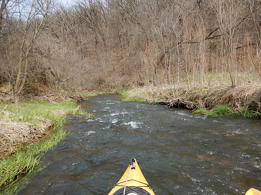
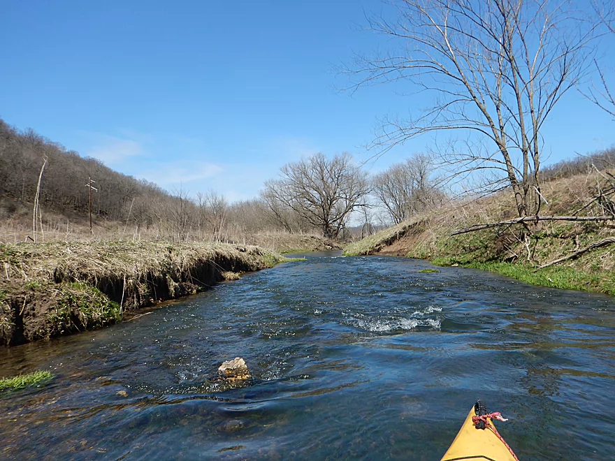
The narrow rapids are unique
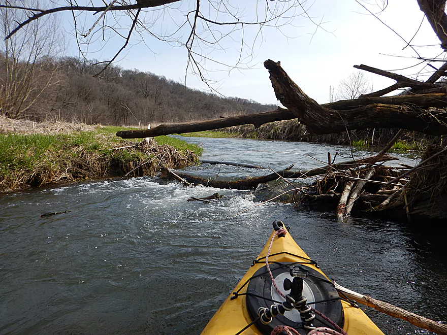
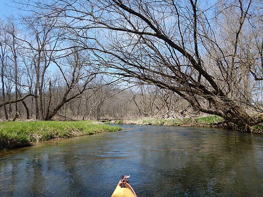
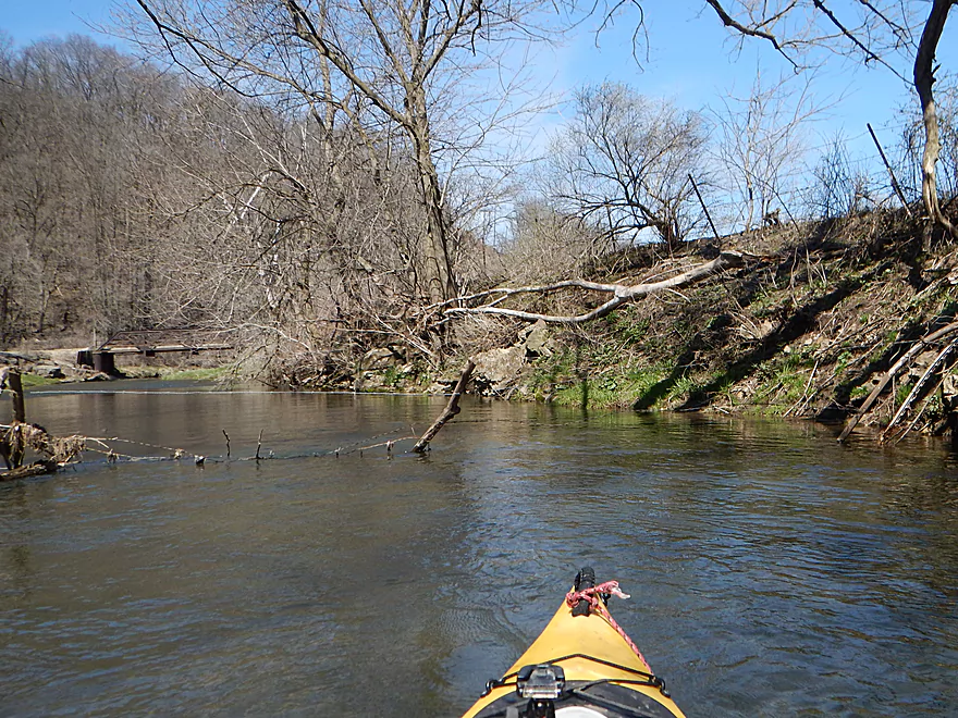
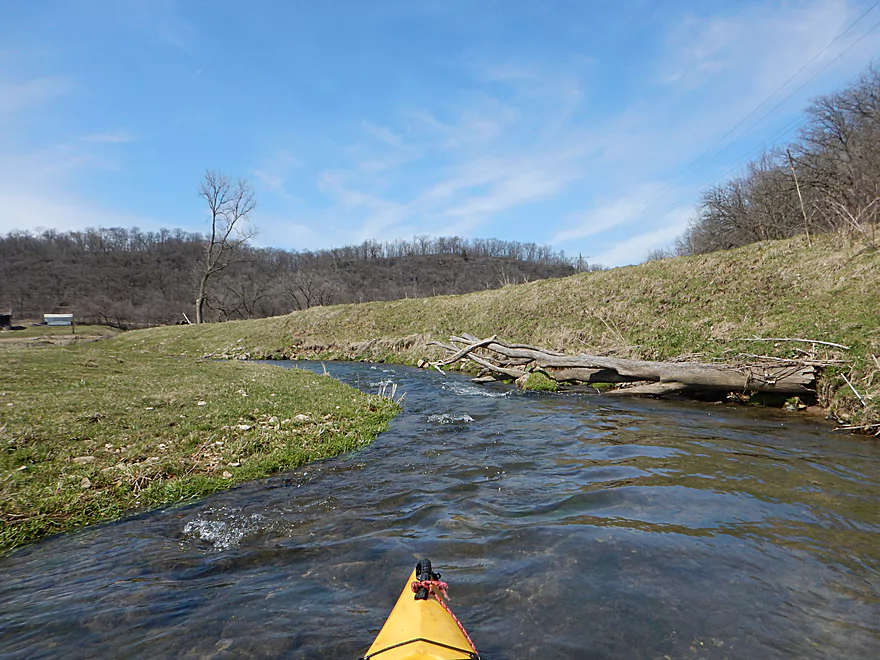
Some deadfall to hop over
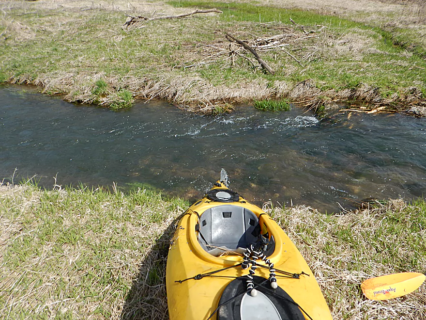
Mostly an open grassy area
Typically sections like this would be too shallow but not today
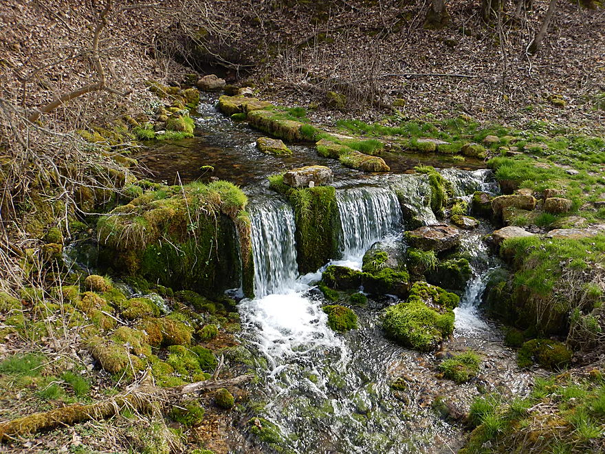
A voluminous natural spring
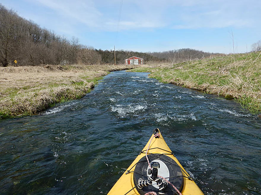
This is among the fastest creeks I’ve done
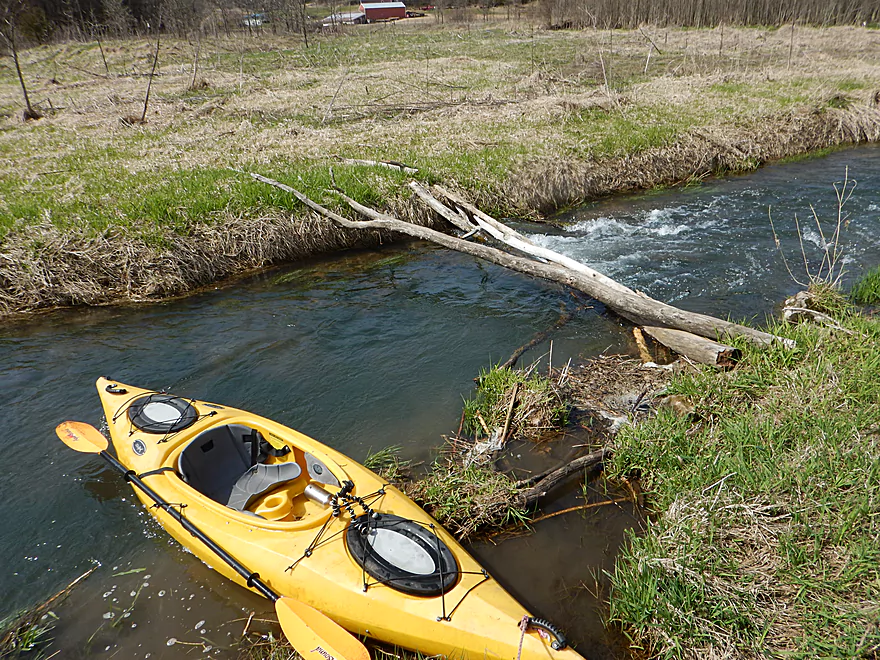
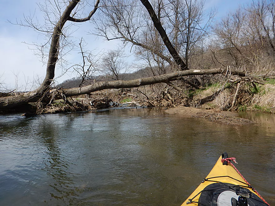
Only portage necessitating jam (which I cleared)
I actually get swamped and have to drain my boat
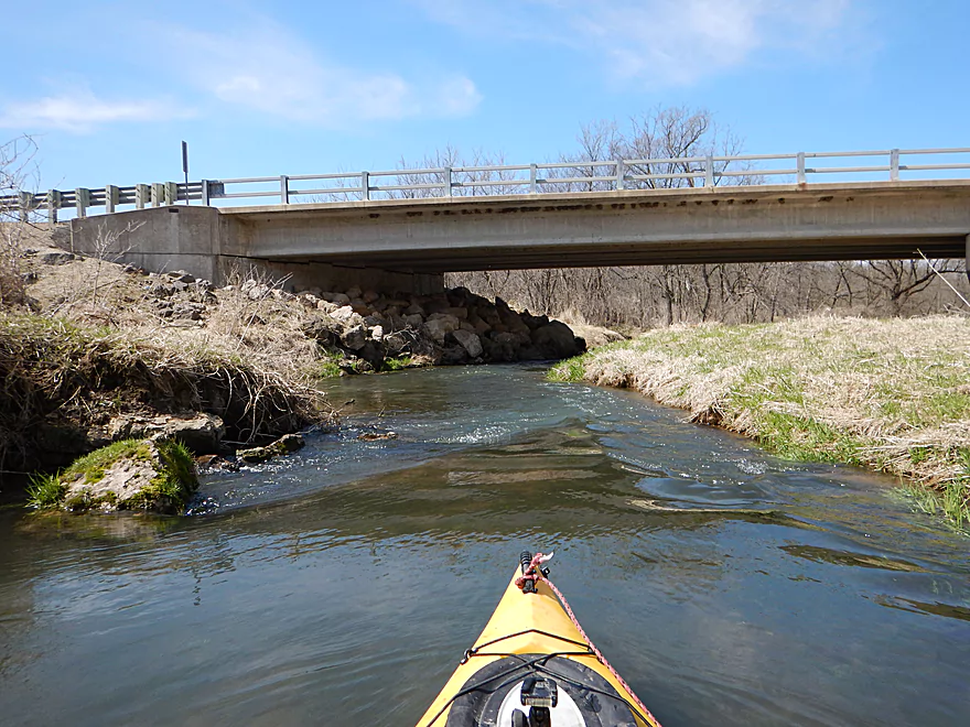
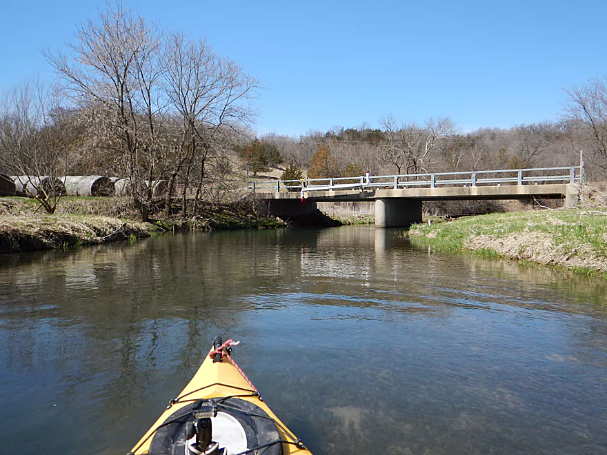
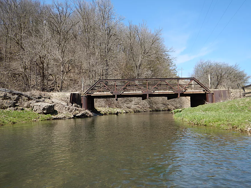
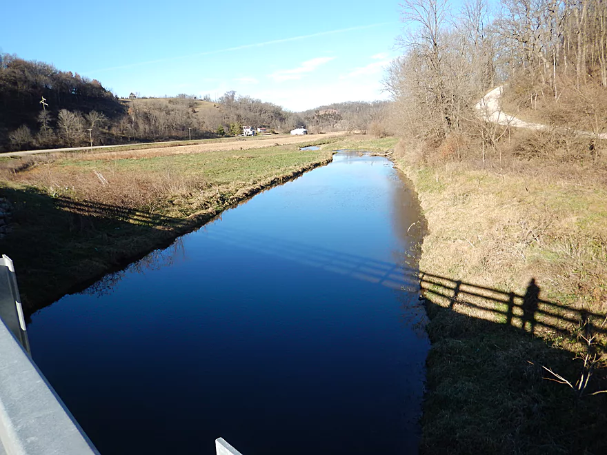
Hwy K
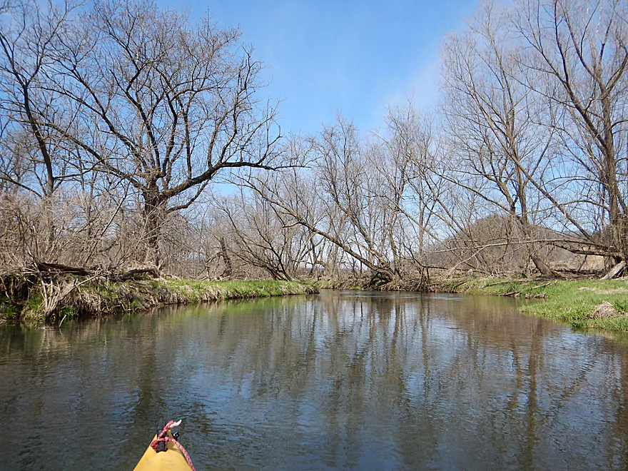
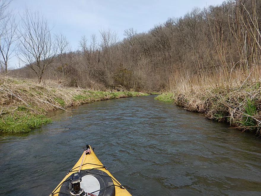
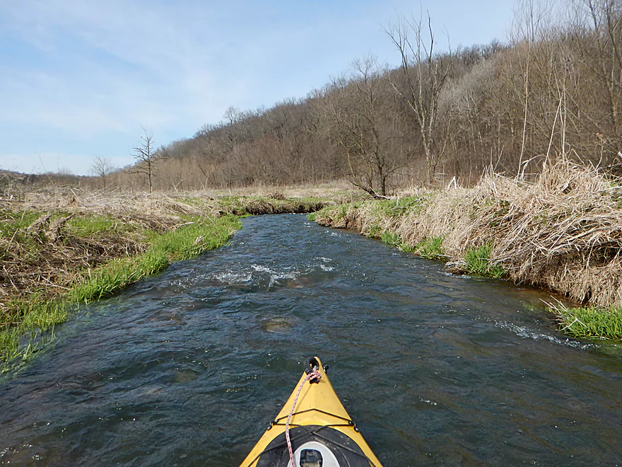
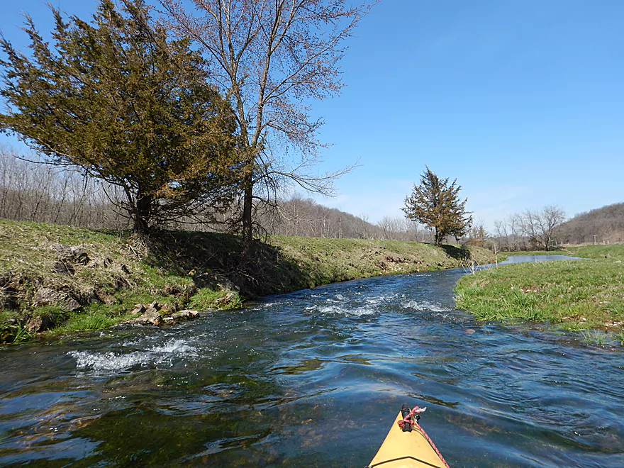
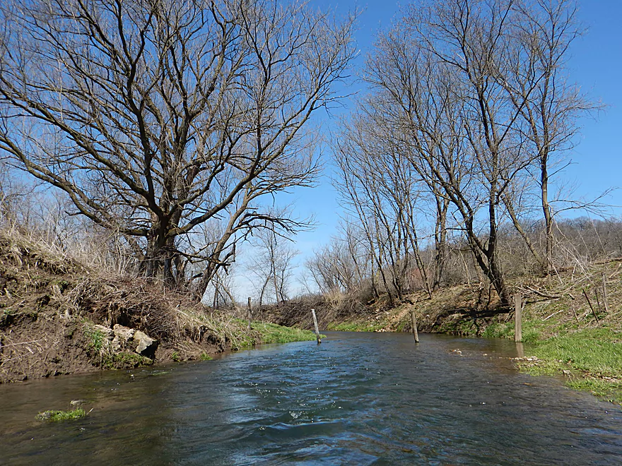
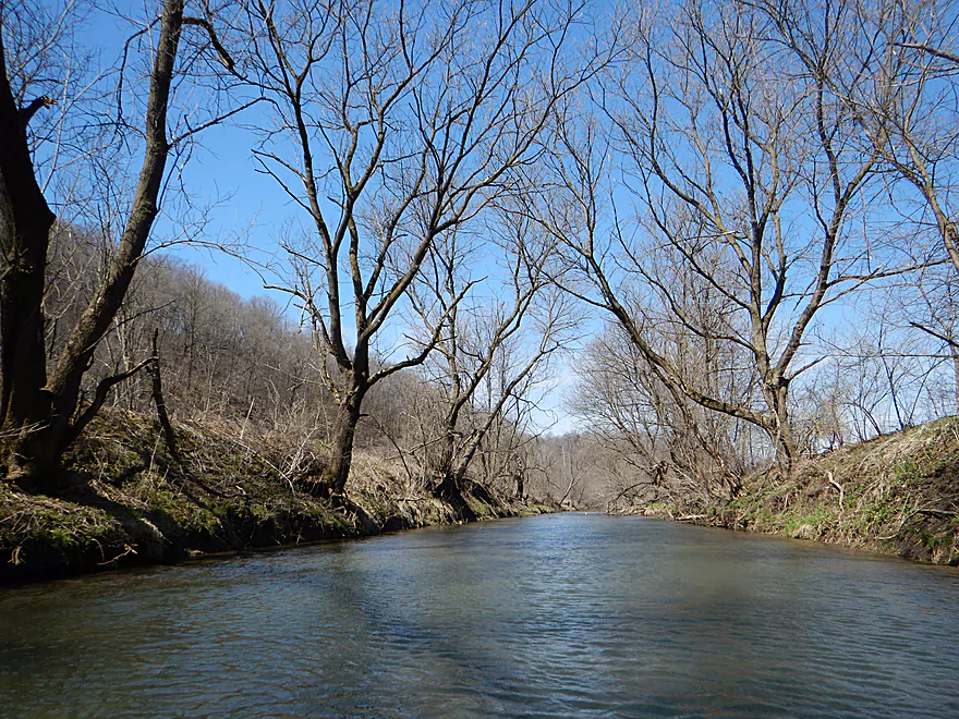
Entering a nice wooded section
Paddling over the edge
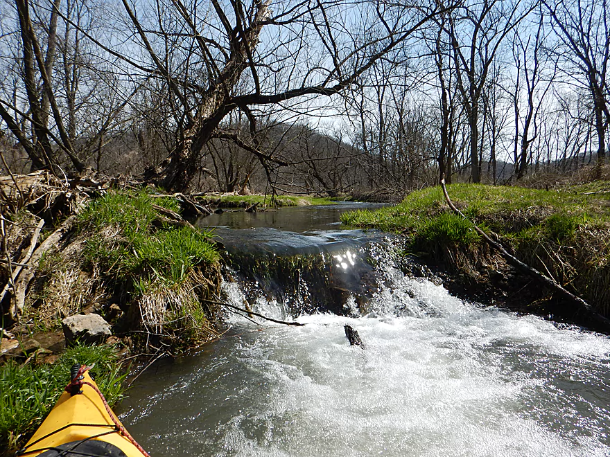
Be careful when going over this
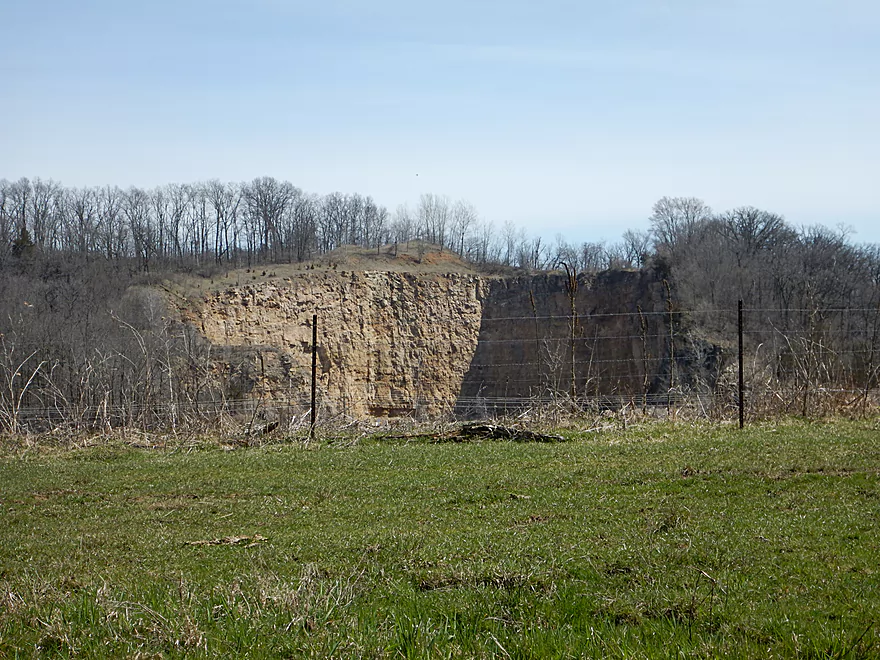
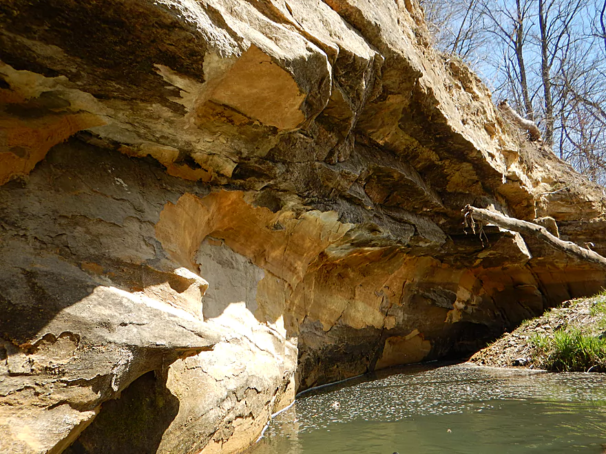
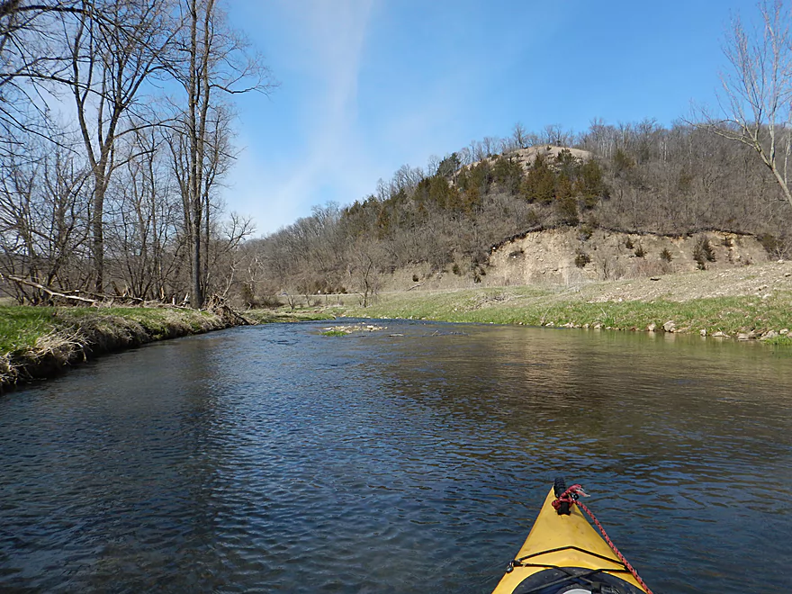
As if a giant snacked on the hillside
Out of the woods
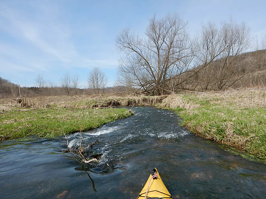
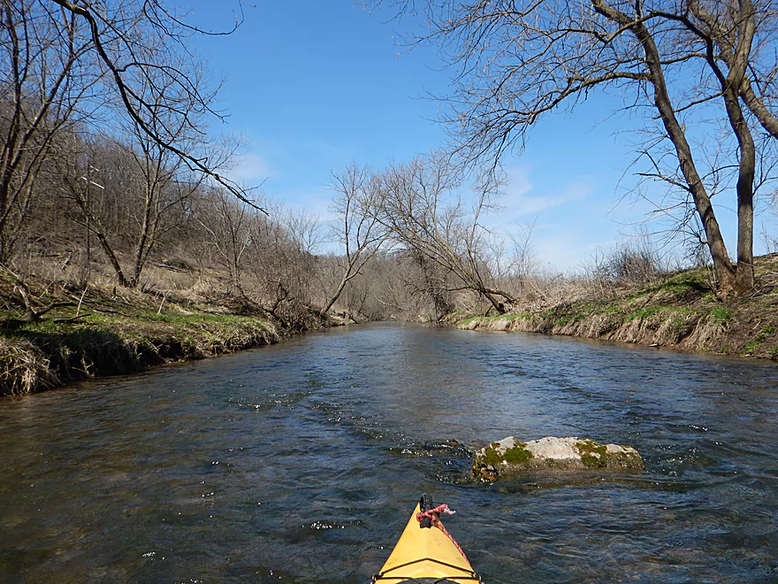
But still tons of rapids
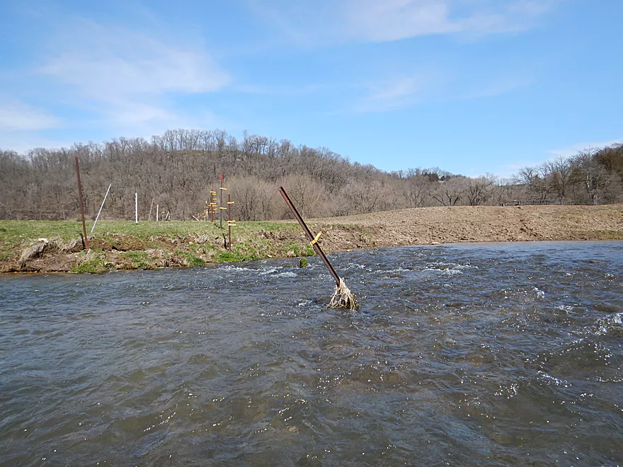
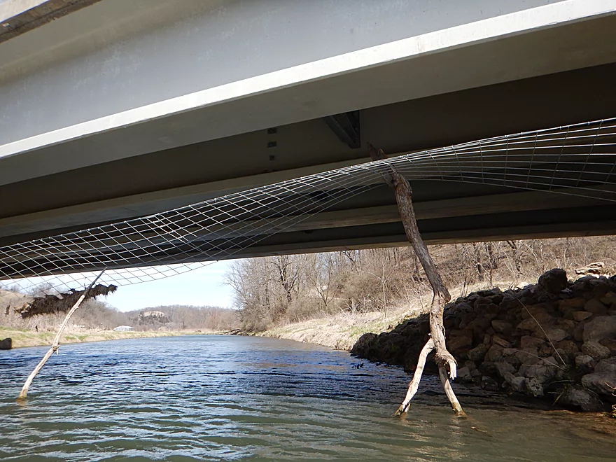
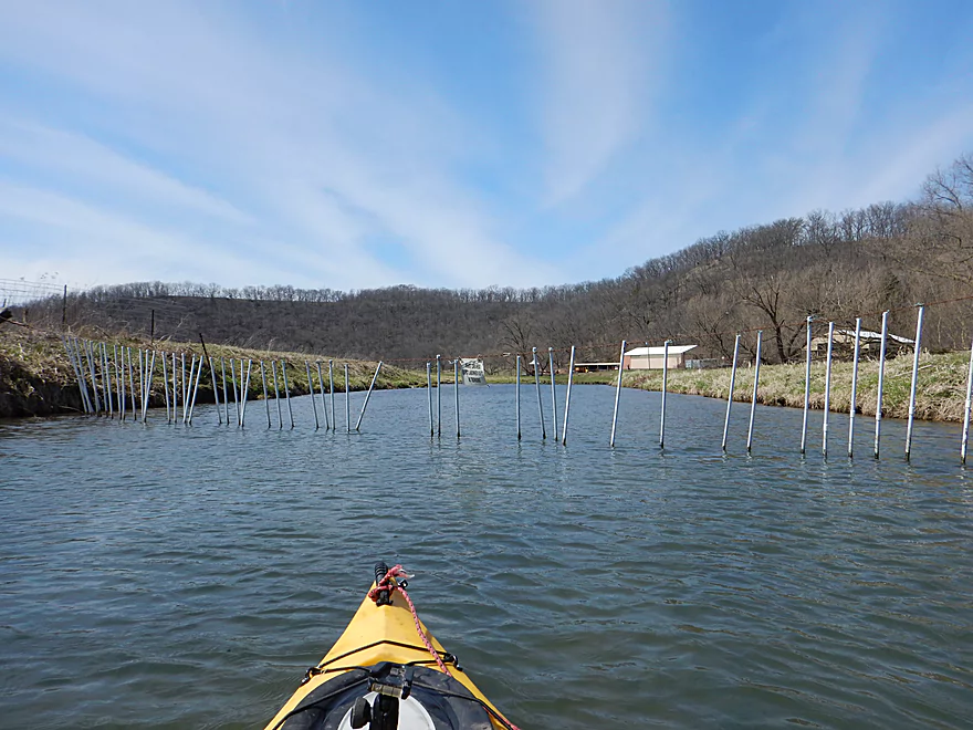
Fence #1 (see write-up for details)
Collins Road
Rapids are getting stronger
Fence #2
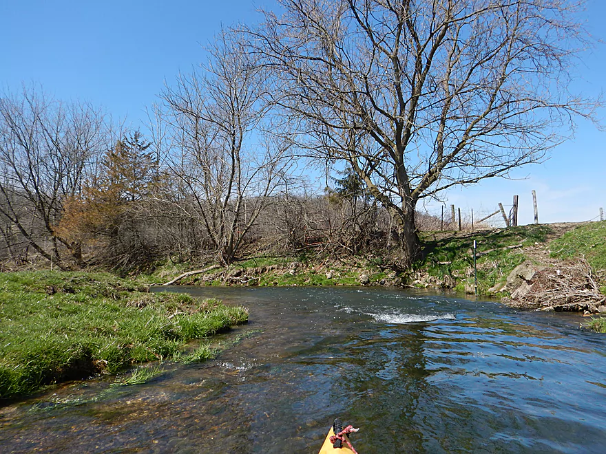
Another nice wooded section
A narrow, rocky chute that is just navigable
Fence #3
Big Green Road
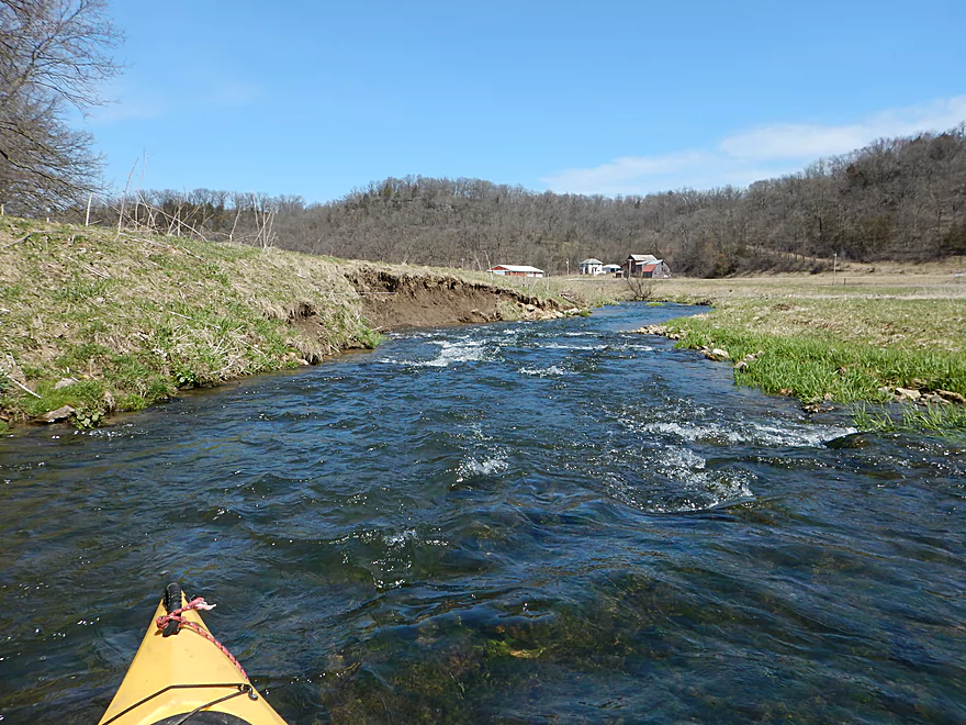
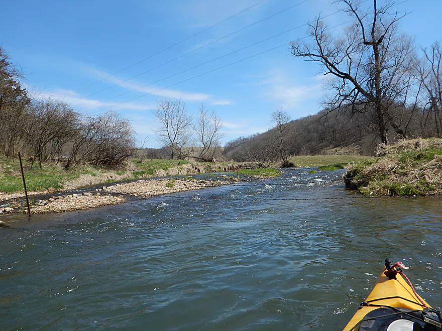
Entering the heart of farm country
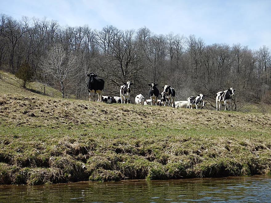
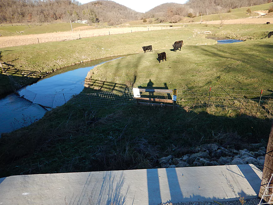
Cows running over to watch me run the rapids
Fence #4
The water actually on occasion would appear green
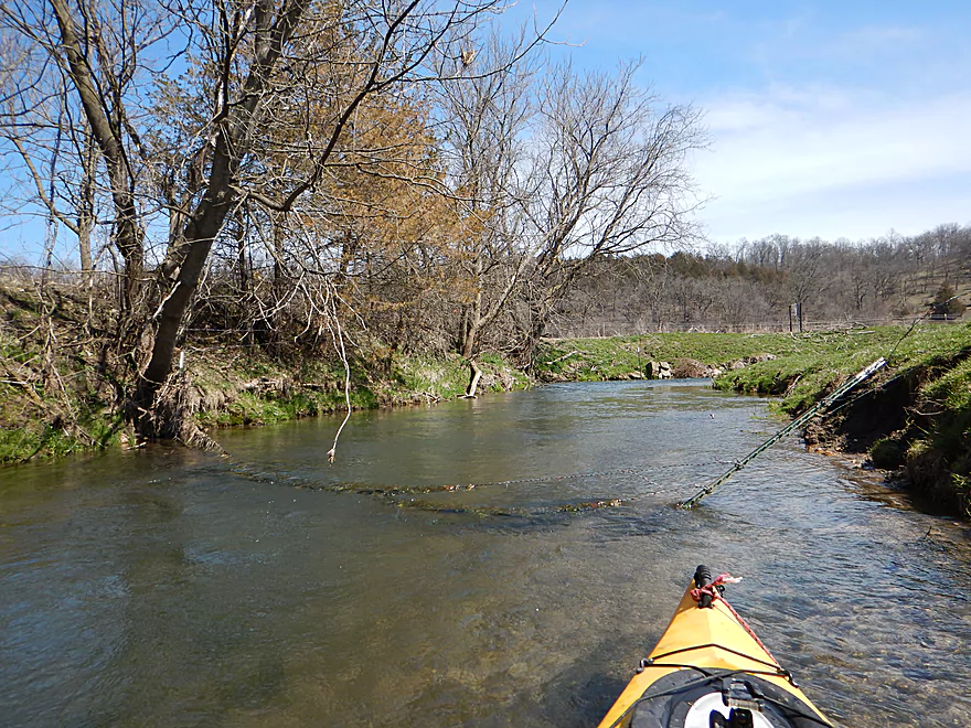
Logjam doing good instead of evil
View from Hwy K
Fence #5 (tricky)
A pleasant surprise
Future cave in the making
Having to get out for better lighting
Hillside going bald
Fence #6…make sure to catch the eddy (river left, picture right)
View from Hwy T
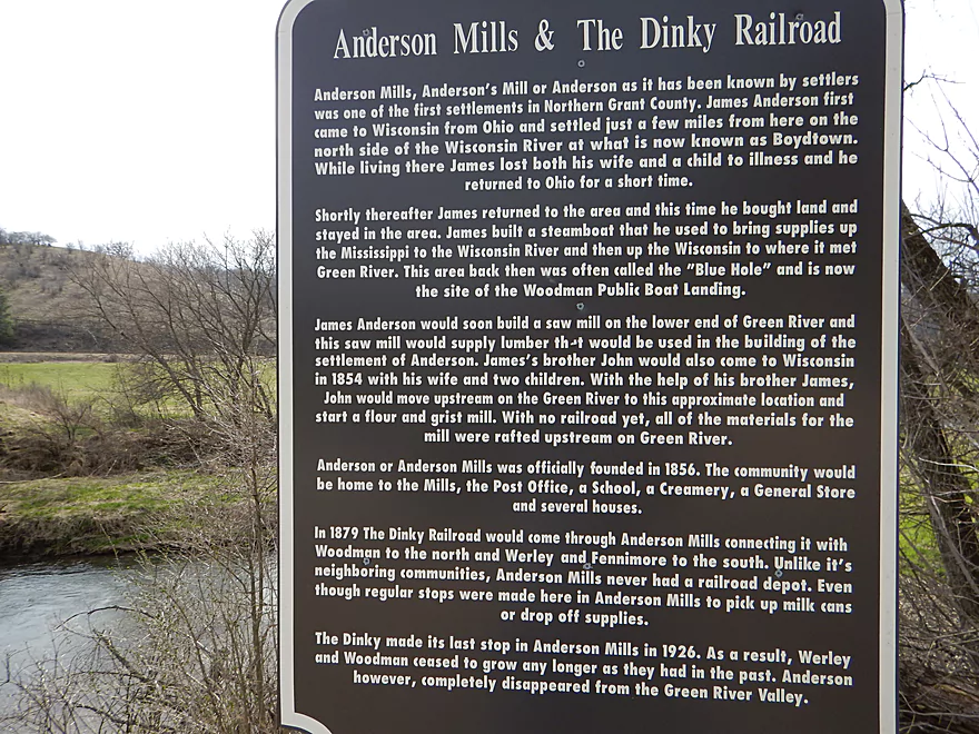
A historical marker
Fence #7 (super easy to get under the PVC pipes)
Fence #8 (tricky barbed wire/electric combo)
Lot of cattle in this section
Fence #9 (pretty easy)
More balding hillsides
Fence #10 (relatively easy)
This part of the creek is popular with fishermen
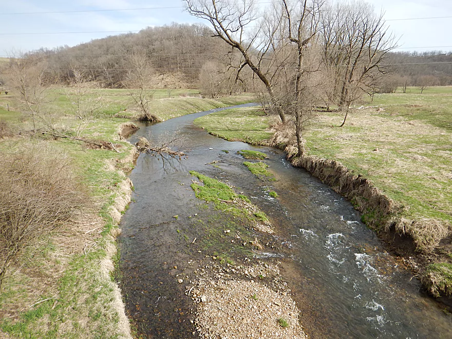
Scenic river valley
Last mile has some deadfall (doable…barely)
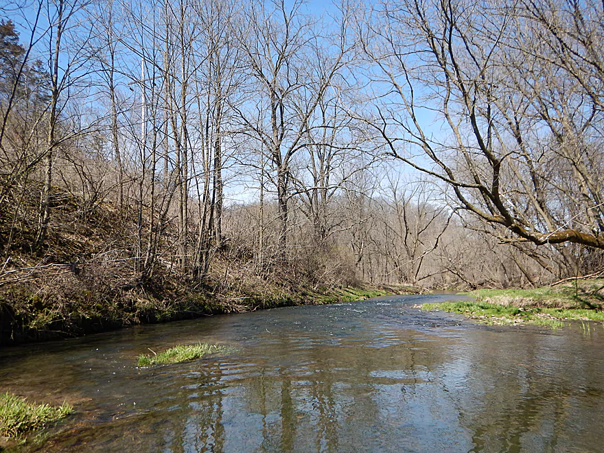
Otherwise a nice wooded section
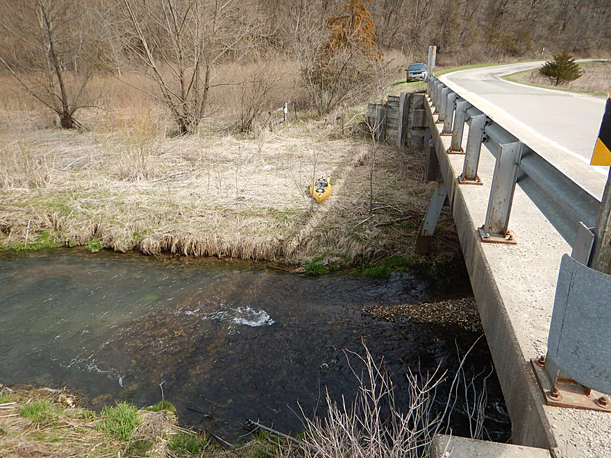
Not a road bridge, but a snowmobile bridge
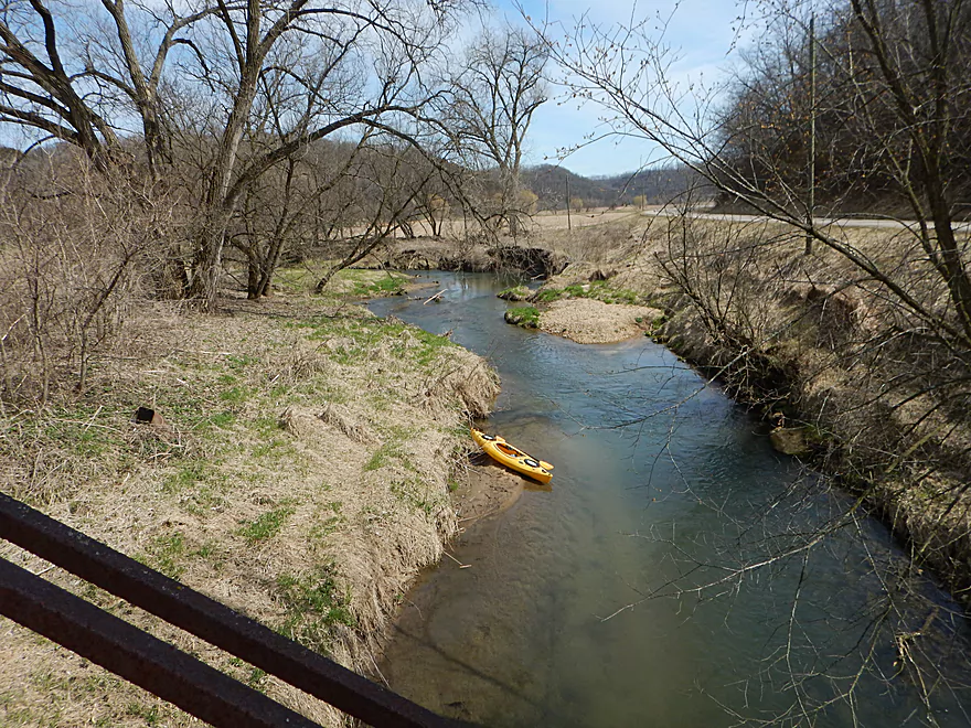
To take out here, you do have to drag your boat a bit
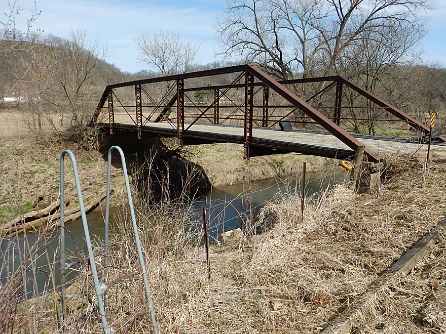
This snowmobile bridge by Hwy K is part of a public easement
You could take out a mile later at the Hwy K bridge, but the fence could be an issue
Hwy 133 would be a tricky take-out, but scenic
Big Green River

The Big Green River is a creek tributary of the Wisconsin River just south of Wauzeka. This is a very popular fishing stream, but few paddle it as typically it is too shallow. Fast, rocky, heavily influenced by agriculture, and flanked by scenic hills, this is very similar to other Grant County rivers. What makes this creek special and why I gave it five stars are the rapids which rank among the best I’ve experienced in SW Wisconsin.
There are a lot of bridges over the Big Green, so you’ll have a bevy of put-in options, but I liked my choice of Green River Road, which is a decent access and about the point where the river becomes navigable.
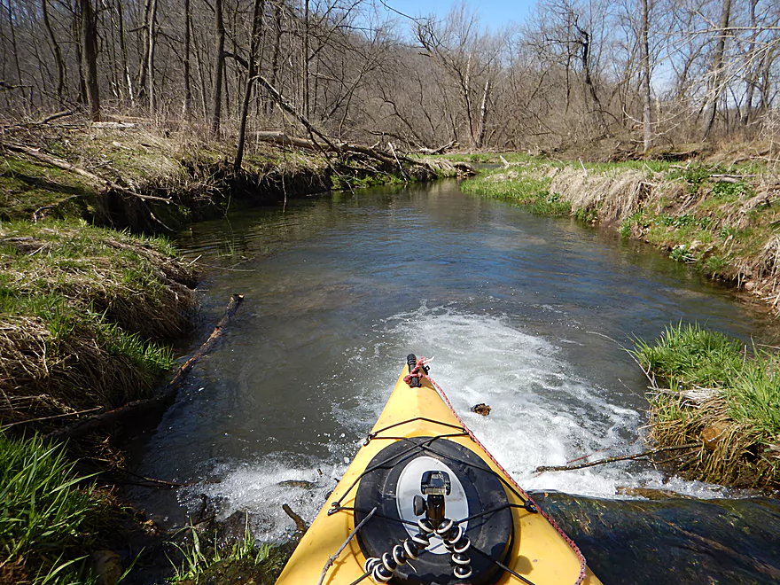
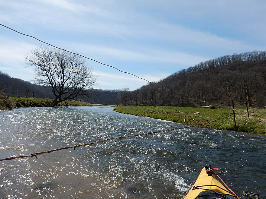
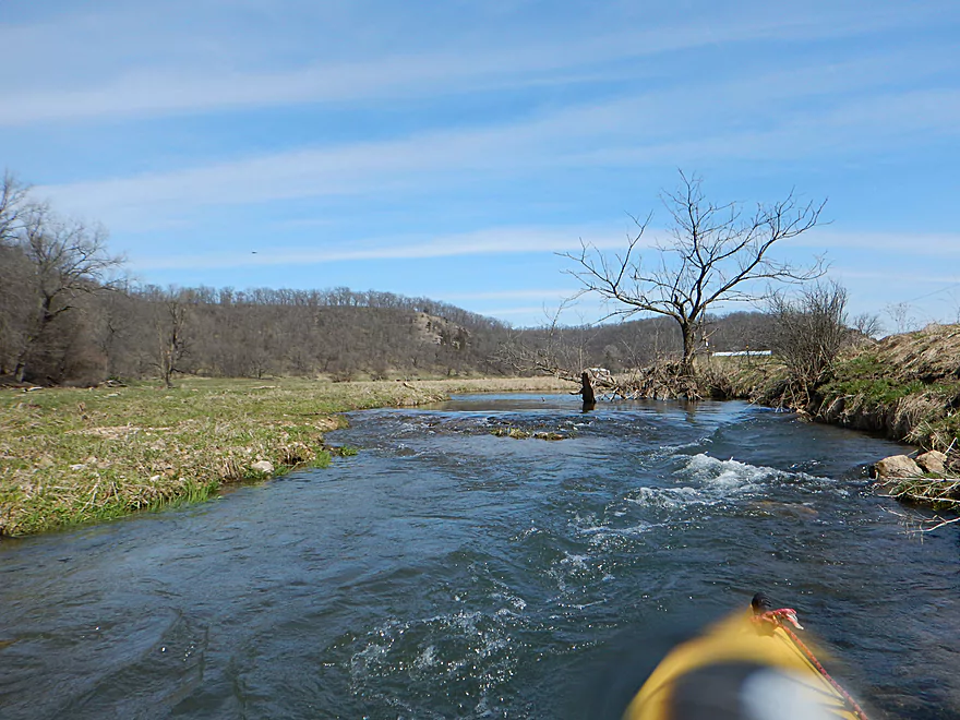
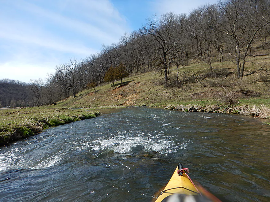
The first leg of the trip was from Green River Road to Hwy K (1.3 miles). Here the creek was at its narrowest but this might have been my favorite leg. The numerous rapids with the tight curves and narrow channel gave this a “waterpark ride” feel which was quite fun. Despite the water being on the high side, the clarity was good and exposed the rocky substrate. On several occasions deadfall constricted the channel, but I was always able to get through with some scooching. After a brief section of woods, the creek opens up into a nice grassy area. Soon on your left you’ll hear a waterfall from a natural spring that will come gushing out of culvert.
There was only one logjam that required a portage on the trip, and I did clear it out. After I did so, I re-entered backwards, blindly, and foolishly into very fast current while cleaning my camera lens. The tail of my boat hit a rock and I was pinned sideways. With the fast current it quickly “dammed” my boat, swamped it, and I had to bail ship. Thankfully it was warm out and I could drag my boat ashore to drain it. But the moral of the story is always be careful around fast current, never get pinned sideways, and always keep your valuables in a drybag (which thankfully I did).
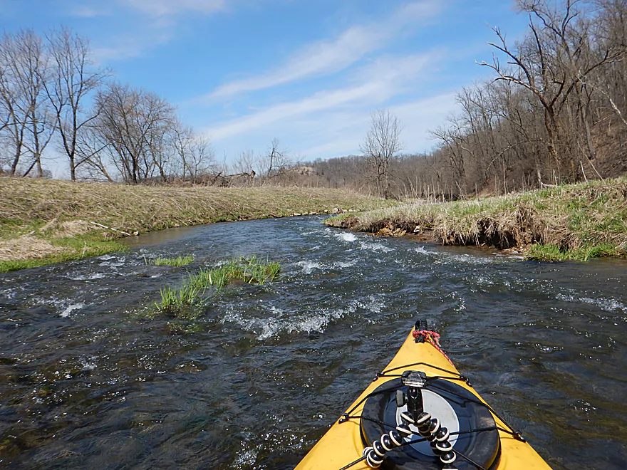
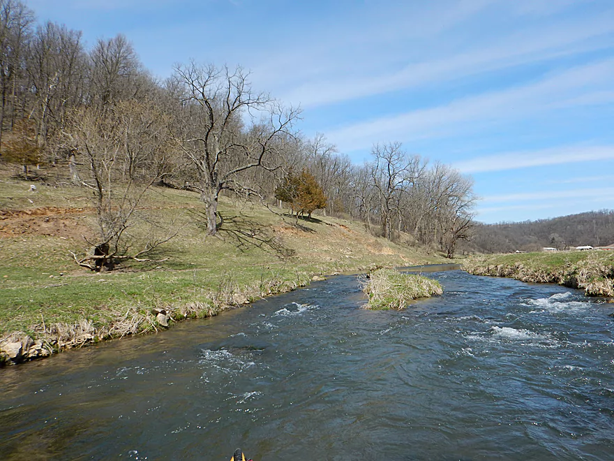
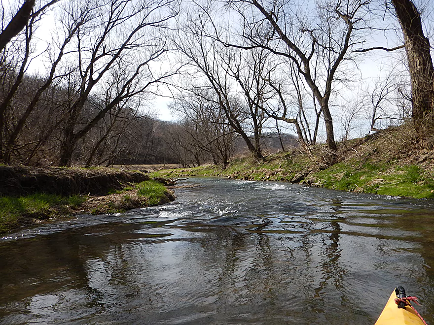
The second leg of the trip goes from Hwy K to Collins Road (0.7 miles). Here the rapids continue through a woods which was quite scenic. At one point however, the river constricts thanks to deadfall and results in an “I can’t see over the horizon line” moment. I was able to go over the 2′ ledge no problem but others may wish to portage this (or remove the log creating the ledge). After the woods, the creek swells in size as it enters open pastureland with evidence of recent bovine activity.
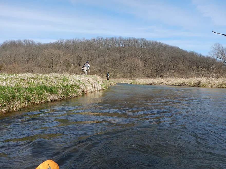
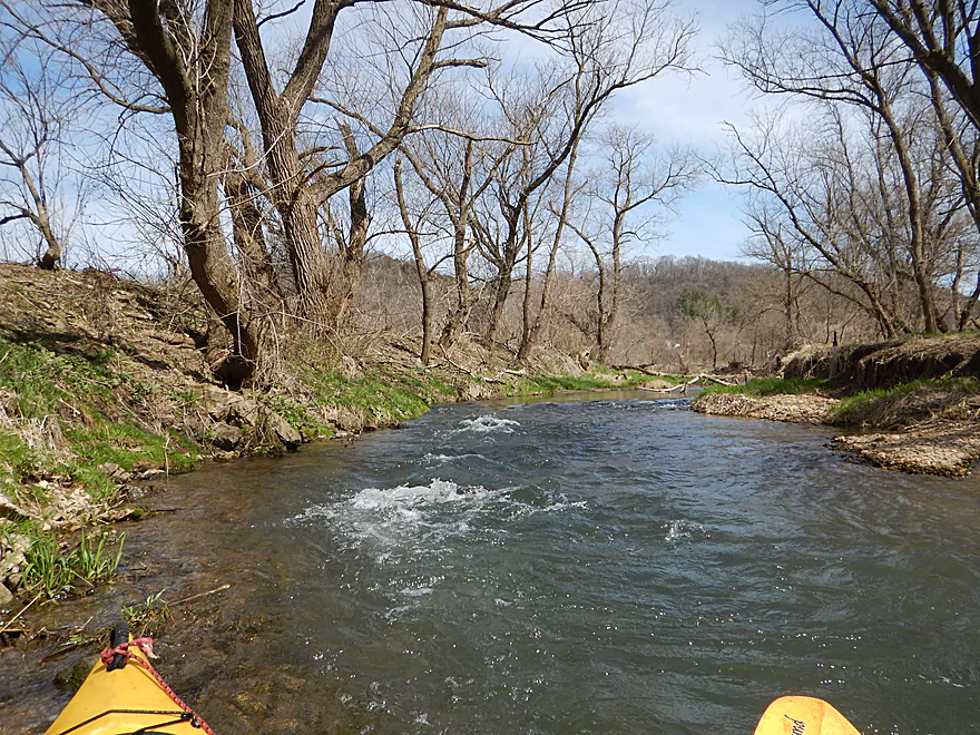
The third leg is from Collins Road to Big Green Road (0.7 miles). Lots more fun rapids, lot of fish in this section but also the start of the fences. The two here I was able to get through with little difficulty though (non-electric but are barbed). After a really nice brief wooded section, you’ll come to Big Green Road which is a popular access spot for fishermen.
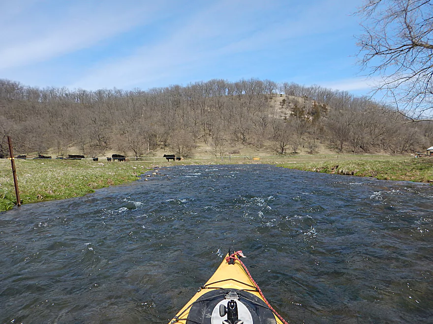
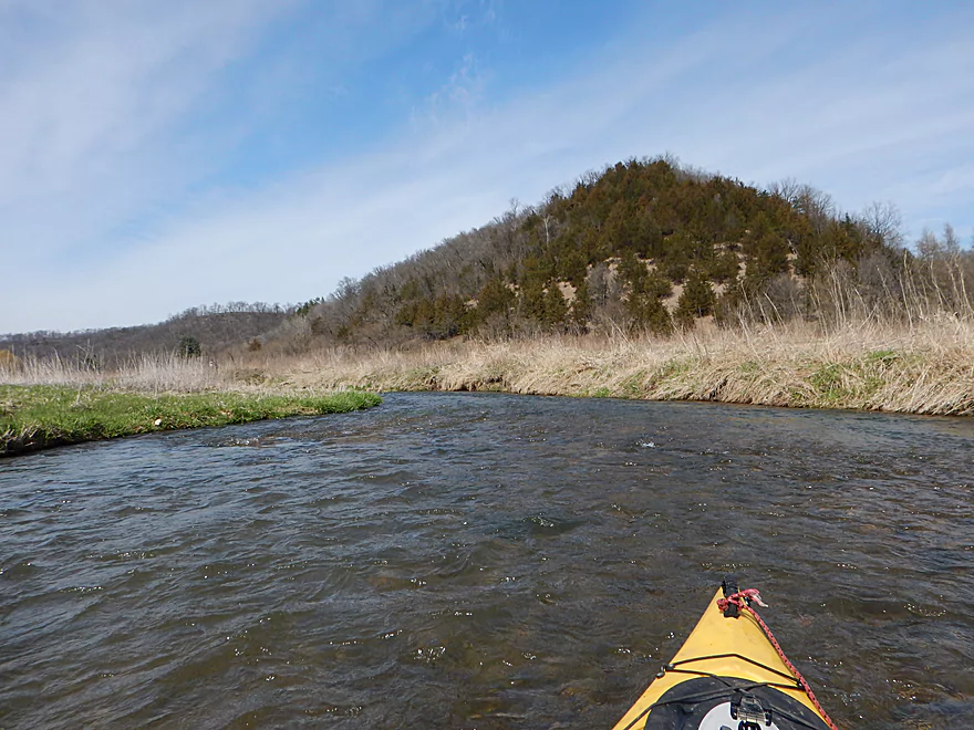
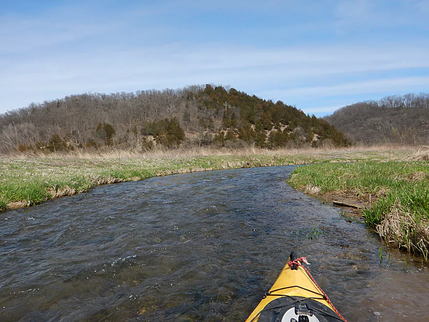
The forth leg is from Big Green Road to Hwy K (1.2 miles). Here the rapids pick up power as the river goes through very open cow country (the cows seemed to find my going over the rapids very amusing). Here the Big Green starts to live up to its namesake. The river at times takes on a “swimming pool” green which is kind of unique and probably a by-product of dissolved minerals. Only one troublesome fence that is electric and over rapids, but I thought it was easy enough to duck under. There is a fence at Hwy K, but interestingly enough a logjam had pole-vaulted it up, creating a natural arch for paddling under. Nice to see logjams doing good instead of evil work.
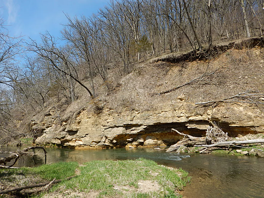
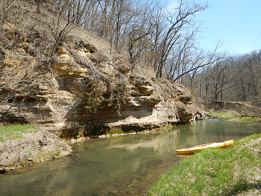
The fifth leg is from Hwy K to Hwy T (1 mile). The rapids are probably the strongest here with maybe some Class 2’s. There is a barbed (non-electric) fence that is annoying as it is right over some Class 1 rapids with some big rocks. I was able to duck under on the left, but you might prefer to beach yourself intentionally on the right so you can slowly and safely scootch under. After I got through this fence I was rewarded with a really cool sandstone outcrop that was gorgeous.
At Hwy T was one of the most annoying fences I encountered. Again over rapids, it is not too difficult to get around if you catch an eddy on the left. But I doubled back for a photo and got pushed sideways into the barbed wire fence and slightly poked. I was more worried about getting pinned sideways again than I was of drawing blood from the barbs, but thankfully this all worked out, and I wisely gave up trying to photo this section.
The sixth and last leg runs from Hwy T to the public snowmobile bridge off Hwy K (2.2 miles). This was probably the weakest of the sections (least scenic, most deadfall, fewest rapids), but was still nice with some gorgeous views of the “balding” hillsides (probably prairie management). The first mile is the most mutilated by agricultural which was sad to see. There is a “pvc pipe” fence to get through, which is pretty easy. The following barbed wire/electric fence was trickier because of the rocky rapids and the low height of the barbs. I was able to get through ok, but this was annoying (and illegal but I doubt today’s DNR cares about such things). Just one more barbed fence to duck under (and that is pretty easy) and then you’re done with fences for the trip. What was amusing was that while I was ducking under these evil fences, a farmer on a tractor was working on expanding his fence network…well before he saw me and curiously followed me a half mile along the river while on his tractor. While all segments are popular with trout fishermen, this is the most popular fishing spot and chances are you’ll see some fishermen here. After a private drive bridge, deadfall becomes an issue (I never had to portage but did have to do some hopping in fast current).
In conclusion this was a great five-star trip that I had a blast on because of the good scenery and great rapids. I actually suspect most paddlers would rank lower instead (maybe 3-4 stars) because of the fences, but they didn’t detract from my personal experience.
The bridge at Green River Road is a decent access with good shoulder parking and a nice grassy area for launching your boat. Honestly though most of the Big Green bridges are viable for launching because they connect with public easements used by trout fishermen.
The creek is small here and if you prefer, you can launch instead at a downstream bridge, but you’ll miss out on a nice segment. Alternatively you can launch a half mile upstream at Spring Valley Road, but the creek gets pretty small by this point and you’ll have to fit your boat through a wooden fence to access the water (doable, but not ideal).
The take-out is at a public snowmobile bridge off Hwy K. It’s a bit tricky to disembark here as you’ll have to drag your boat up a small hill and then over the bridge itself. In my opinion it is worth it though.
If you take out 1.2 miles later at the Hwy K bridge, you might encounter a few logjams and you will have to drag your boat through a wooden farm fence to reach your car (it is a public easement area though). If you take out 2 miles earlier at Hwy T, you will miss out on a nice 2 mile stretch of the river and Hwy T has a tricky shoulder and fence (doable though).
The bike shuttle was 5.3 miles, relatively flat, and “typically easy”. Not that day though as my front tire sprang a flat and I ended up a combination of walking and riding on the rims the entire distance. You’re not supposed to ride on the rims and sure enough, I wrecked that too and ended up having to purchase a brand new tire from the bike shop the next day. Moral of the story…always pack a spare inner tube and pump.
This river is only suitable for experienced paddlers in small boats. Yes, the rapids typically don’t exceed Class 1 (maybe a few Class 2’s), but the issue is you sometimes don’t have a lot of room to maneuver around rocks and logs which can result in your boat getting pinned sideways and you going over. For a less pushy experience, you can simply go at lower depths.
Fences are an issue. Most can be gone though with little difficulty, but there are few tricky ones. Here are my notes for each (the map and photo gallery use the same key system for cross referencing).
- Fence #1: Located just a bit upstream of Collins Road, this barbed wire fence should be pretty easy to completely go over most of the time.
- Fence #2: A low barbed wire fence downstream of Collins Road that you can get under ok by going to the far left shore and gently lifting the wire over your head.
- Fence #3: Located just upstream of Big Green Road, this is a bit trickier as you can’t get under the barbed wire. But the fence is in poor condition and you can gently lift it over your head like a swing gate.
- Fence #4: A mile downstream of Big Green Road is the first electric fence. Decent clearance but it is over rapids. If you navigate hard to the left and duck, you should be fine.
- Fence #5: Maybe a mile upstream of Hwy T. A little tricky as the barbed wire fence is over some shallow rapids. You need to hit the right hole and duck low to get under the fence. This might not be a difficult fence portage though as the shore is flat and grassy.
- Fence #6: Another barbed wire fence over rapids, just upstream of Hwy T (easy to scout). The trick is there is a nice eddy on the far left. Catch it and you should have all the time to easily lift the wire over your head. Trying to take pictures I missed the eddy and got slammed into the fence sideways and frantically had to pull the barbed wire out of my clothes and over my head before my boat tipped over from the rapids. Not fun…but would have been easier had I been paying attention.
- Fence #7: An easy hanging PCV pipe fence to get under just downstream of Hwy T. Farmers are starting to use these more often now and they are WAY better than electric and barbed wire fences (plus they don’t trap debris).
- Fence #8: Maybe a mile downstream of Hwy T, this was my least favorite. It’s a combination barbed wire and electric over shallow rapids. I grounded myself on the left bank and barely nudged under but it it was difficult because of the strong current. The far right bank would be easier in hindsight. The electric line is higher up and easier to avoid than the lower barbed wire.
- Fence #9: Just downstream from #8 is a simple barbed wire and electric fence. This is easy to get under as there is little current.
- Fence #10: Barbed wire fence by a fishing trail. Easy to duck under.
Typically the river is too shallow to run. Well you could run it during low times, but you would have to walk many of the rapids. There is no gauge on the Big Green, but the Platte River Gauge might be a good analogue. It read 179 CFS or 4.2′ for the trip. This was a good depth for getting over the rocky rapids, but the river was a tad pushy at times. Another reference is the Fever River which was at 3.16′.
Here is an overview based on my guesstimates and the Platte River levels:
- 0-140 CFS: Probably way too low. (I did scout this at 110 CFS)
- 141-160 CFS: Pretty bumpy and marginal. Water clarity should be quite nice though.
- 161-200 CFS: A good target range (my trip was done at 179 CFS).
- 201+CFS: Unless you are a serious whitewater paddler, the river might be too rough to run. Getting under the fences would be an issue.
Three muskrats, plenty of cows and many horseflies. The highlight was the many fish I saw, presumably mostly trout. They loved hanging out at the bottom of the deep pools, and were more common on the upper portions of the creek. With the trout, there were a lot of trout fishermen. Most fished below Hwy T, which is ironic as that’s where I didn’t see any fish.
- Upstream of Spring Valley Road: The creek might be too narrow to be navigable.
- Spring Valley Road to Green River Road: 0.5 miles. Creek is narrow and probably marginally navigable. Maybe one downed tree. Put-in at Spring Valley Road is doable but not ideal because of a wood fence (popular access with trout fishermen).
- Green River Road to Hwy K Snowmobile Bridge: 7.1 miles. Reviewed Apr 2017.
- Green River Road to Hwy K: 1.3 miles. Narrow, twisty and fast. This was one of my favorite sections.
- Hwy K to Collins Road: 0.7 miles. Nice wooded area.
- Collins Road to Big Green Road: 0.7 miles. Mixture of pasture and woods.
- Big Green Road to Hwy K: 1.2 miles. An open pasture paddle with some fun rapids.
- Hwy K to Hwy T: 1.0 miles. More woods, perhaps the strongest rapids, and a really neat sandstone outcrop.
- Hwy T to Hwy K – Snowmobile Bridge: 2.2 miles. Not as interesting, but popular with fishermen and has nice views of the hills.
- Hwy K – Snowmobile Bridge to Hwy K Road Bridge: 1.2 miles. Maybe 1-3 serious logjams. You can take-out at Hwy K (public easement), but you will have to drag your boat over a wood fence.
- Hwy K to Hwy 133: 0.9 miles. Maybe 1-2 logjams. Clear and sandy, this is a nice stretch. Hwy 133 is a tricky take-out though and would require a lot boat dragging.
- Hwy 133 to Mouth on Wisconsin River: 1.2 miles. You should be able to sneak by all the downed trees. Nice public launch area on the Wisconsin River.
Also of note, the Little Green River is a tributary of the Big Green and might be navigable but I don’t know much about it.
Trip Map
Video
Photos Size:
I was just on the lower Big Green River today (6/5/24). I launch at the Woodman Landing and paddle upstream since it is a fairly lazy river on that end, then float back to the car when I’m done. For the past couple of years I’ve been stuck by a log jam not too far in, but today – either due to the higher water or the jam finally breaking up – I was able to get through. There was another jam shortly afterwards, but I was able to work some logs free and make a path through. After that I kept going under the bridge on 133. Around there the river changes from a murkier, wide river to a more narrow, shallow, and clear river. I kept going until I hit a log jam that was impenetrable, a little ways short of the Highway K.
I’ll definitly have to paddle the upper part of the river as it sounds terrific!
Thanks for the updated. I do need to check out the stretch you did…great news that the floods cleared out that logjam. Be warned if you do the upper stretches, rapids, shallow water, and fences are an issue.