
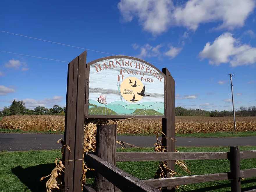
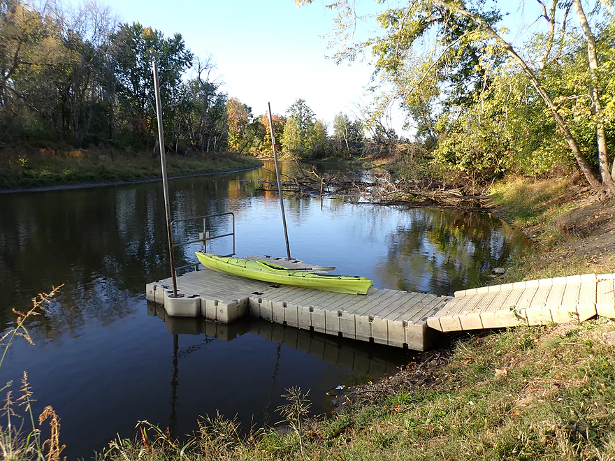
Starting the trip at Harnischfeger Park
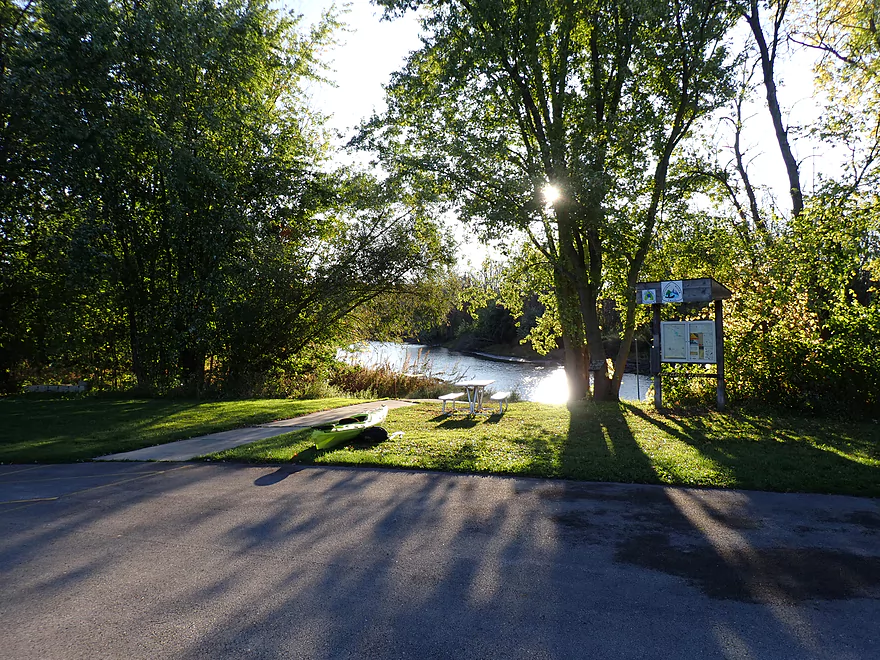
It has a nice public launch
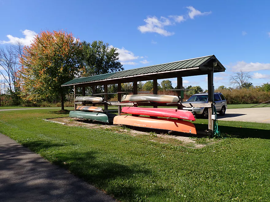
And kayak/canoe rentals
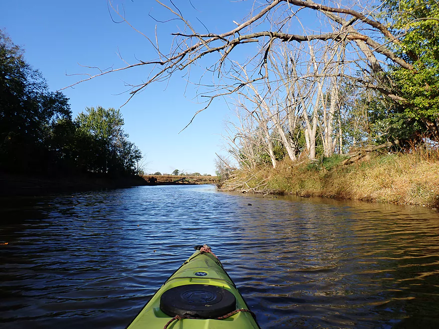
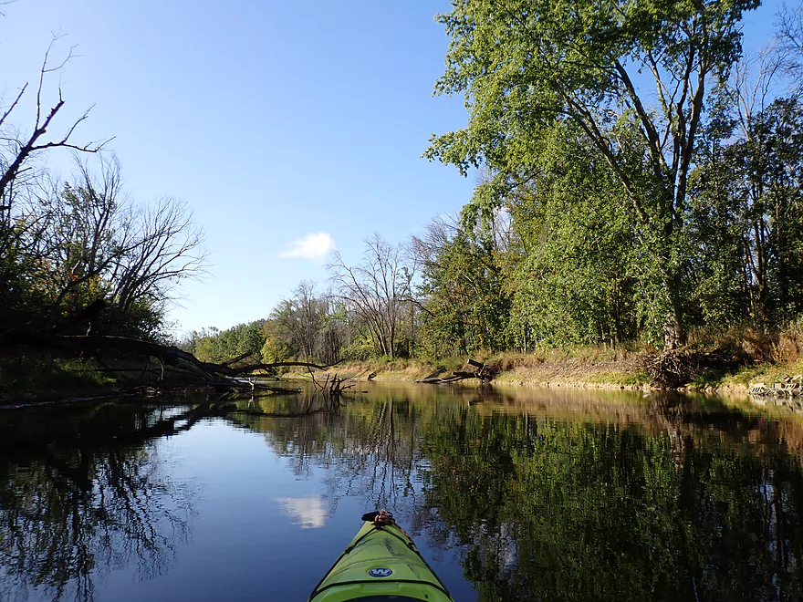
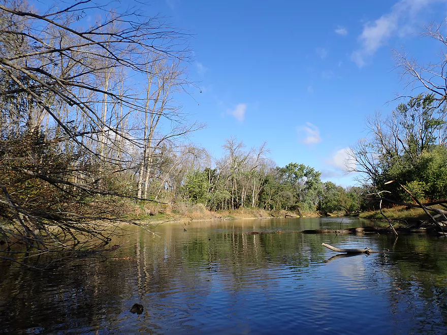
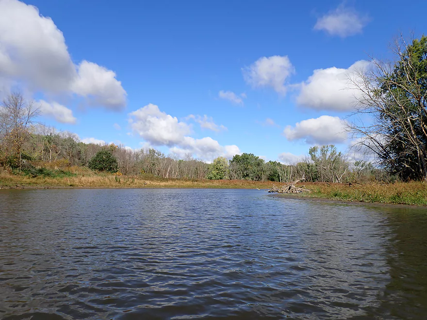
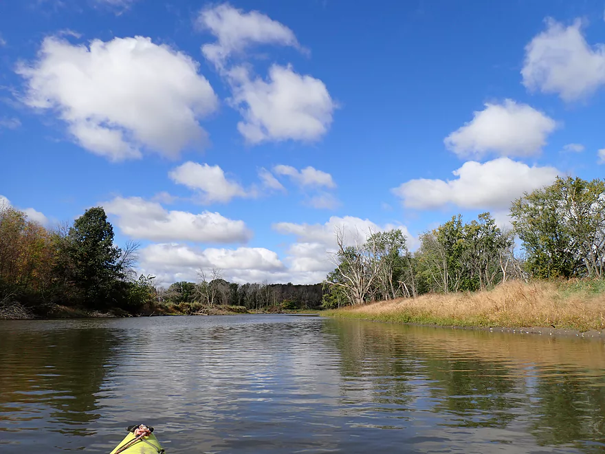
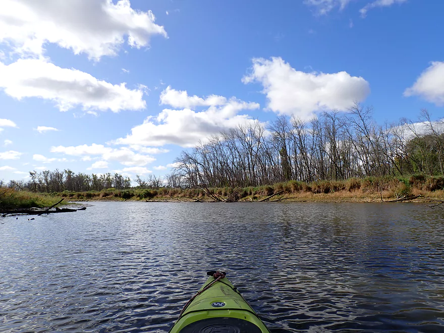
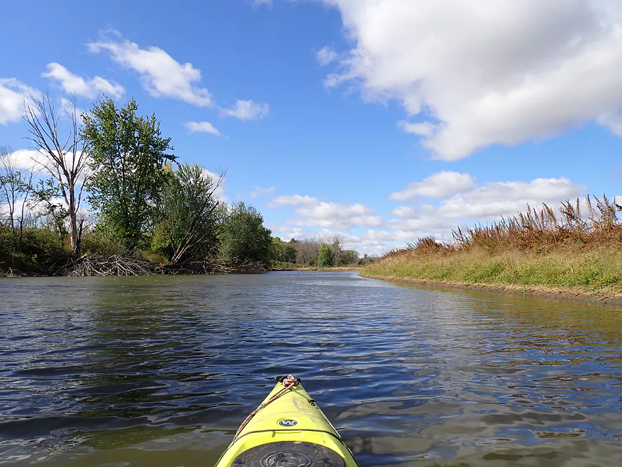
View upstream
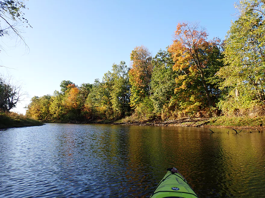
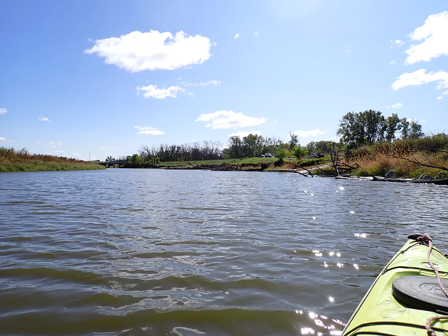
View downstream
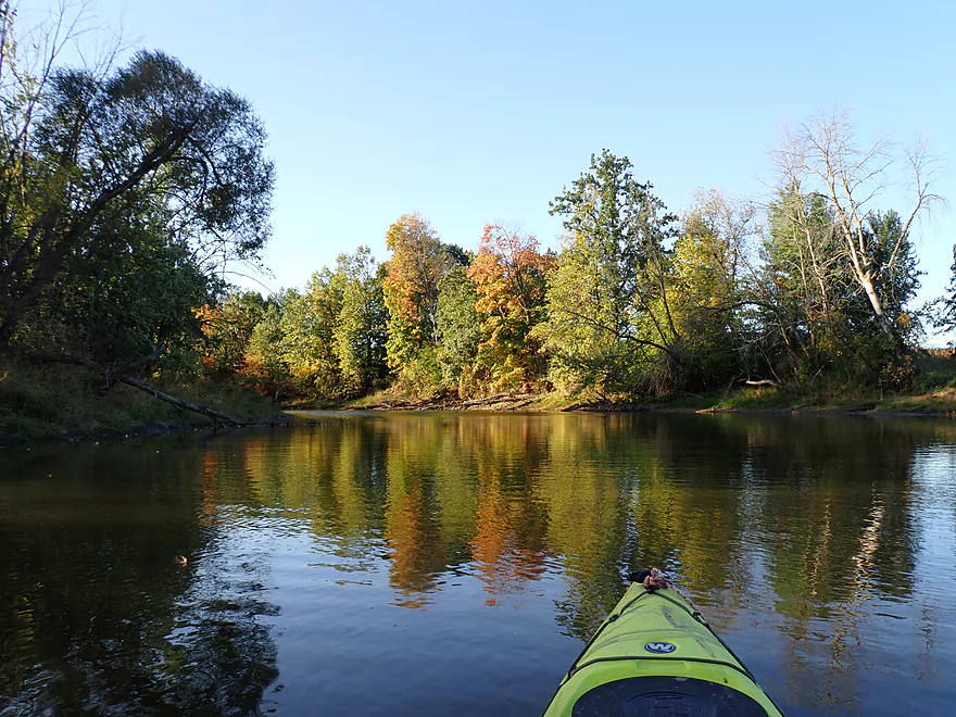
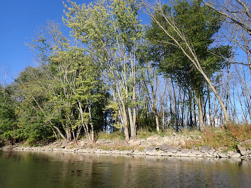
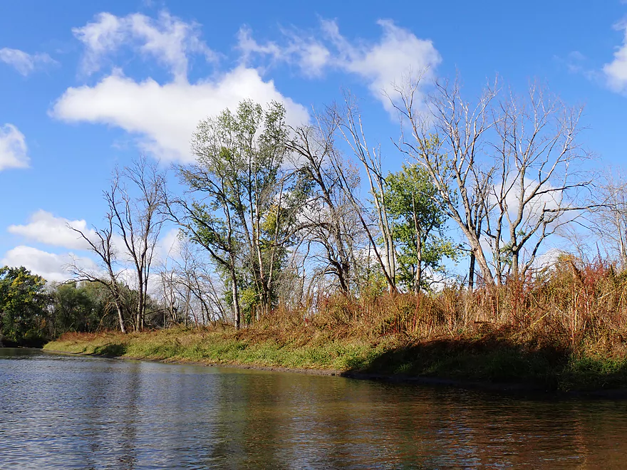
Early fall color
Not as many reflections as I hoped because of the wind, but some
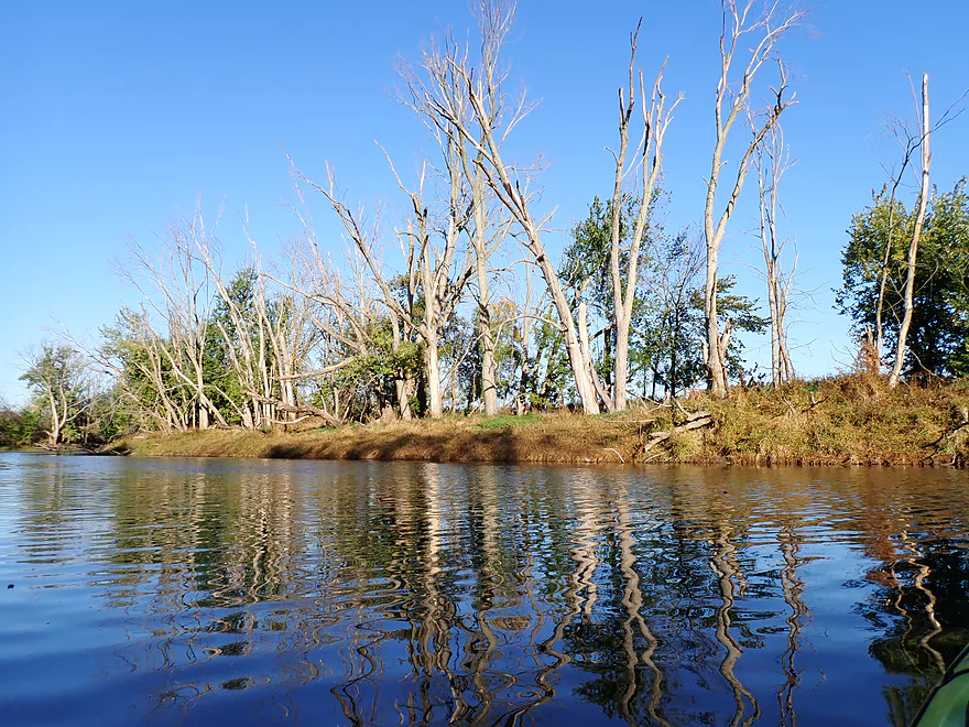
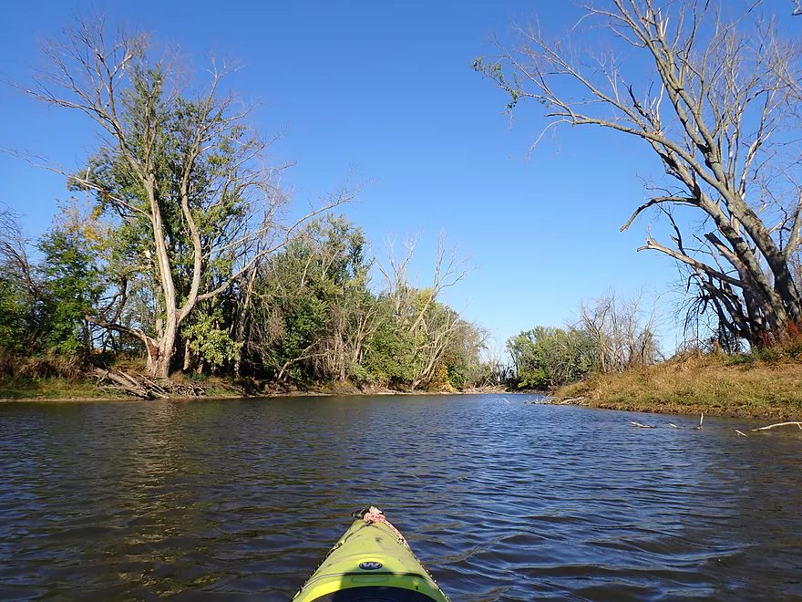
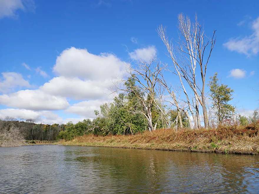
So many dead ash trees on this trip
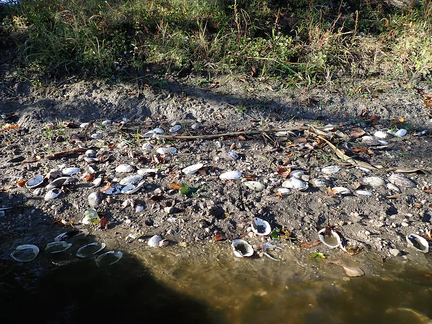
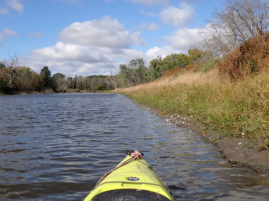
Surprising number of clamshells
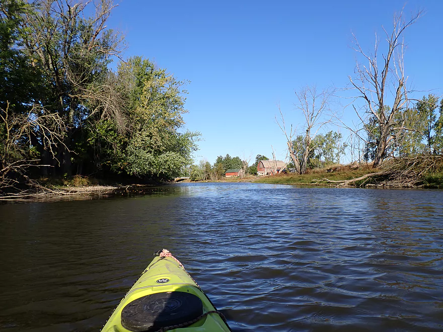
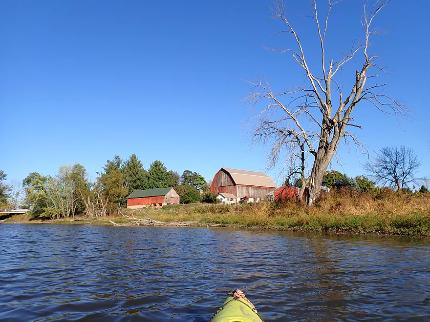
Picturesque barn
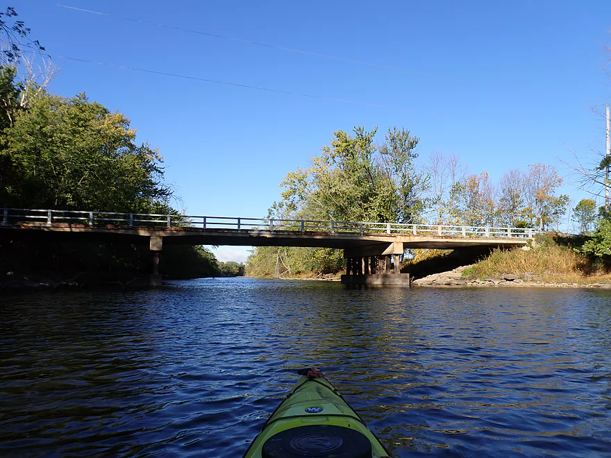
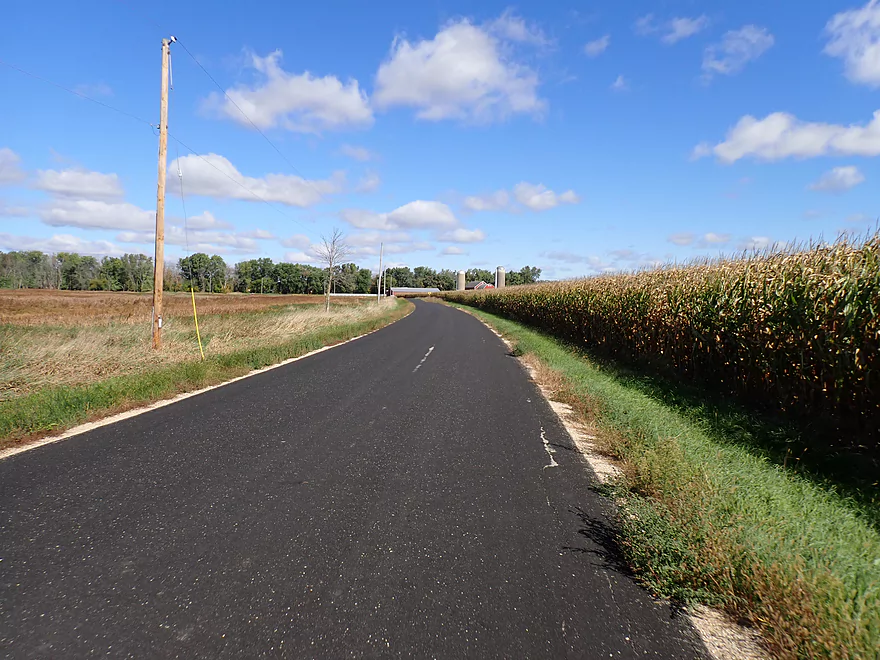
Highview Road
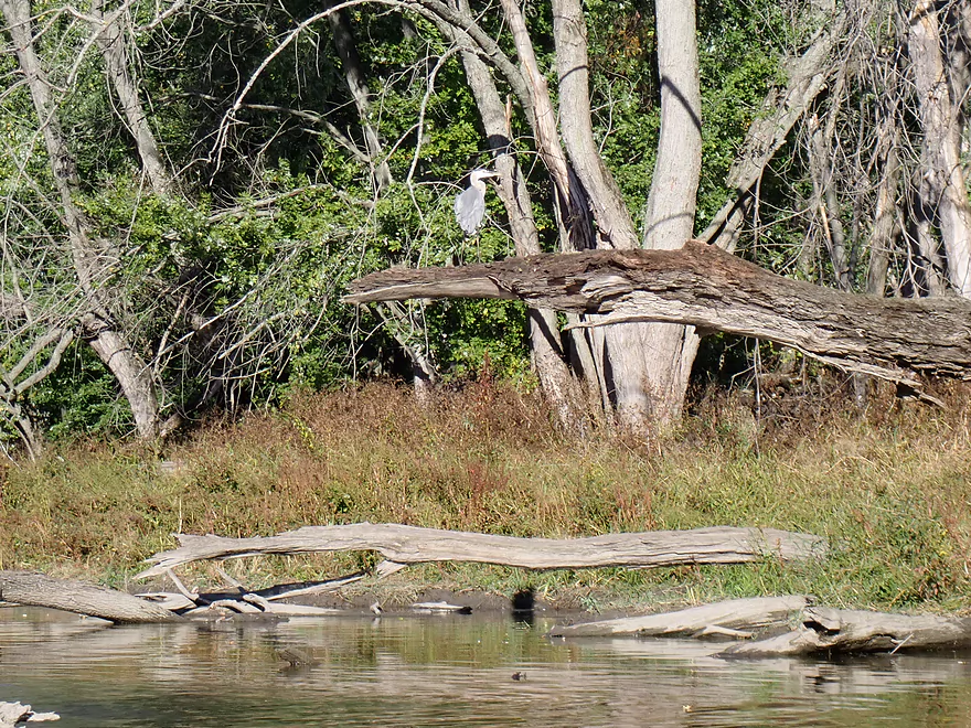
Heron, eyeing me warily
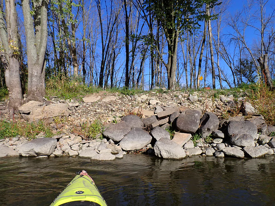
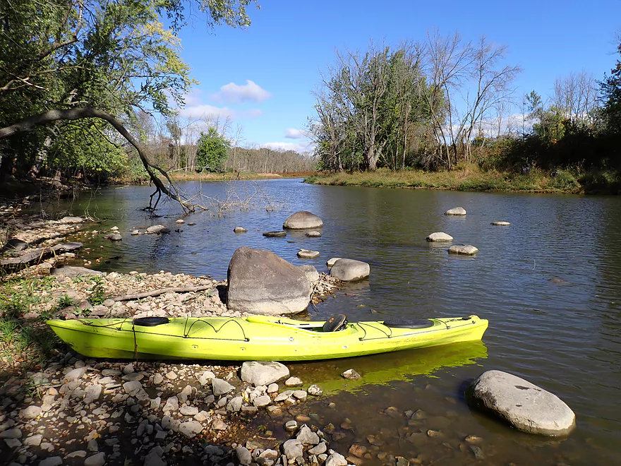
Rocks on the Rock
River living up to its namesake
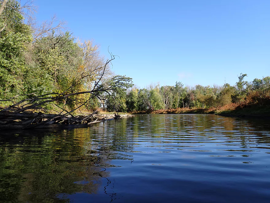
More reflections
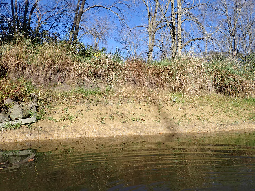
Clay banks were relatively common
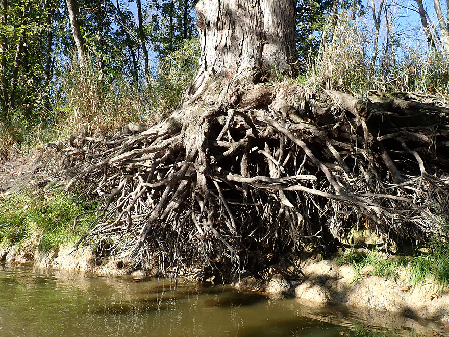
Tree root x-ray
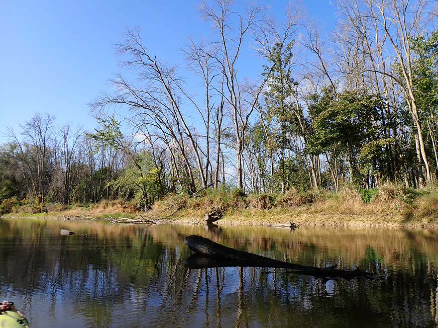
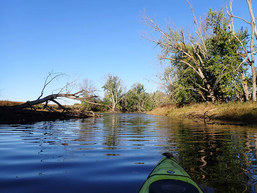
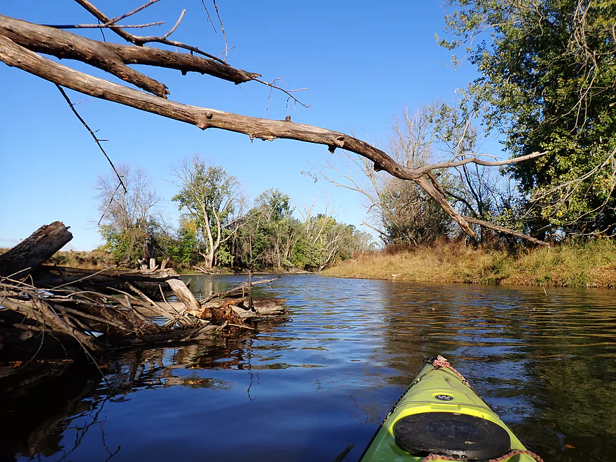
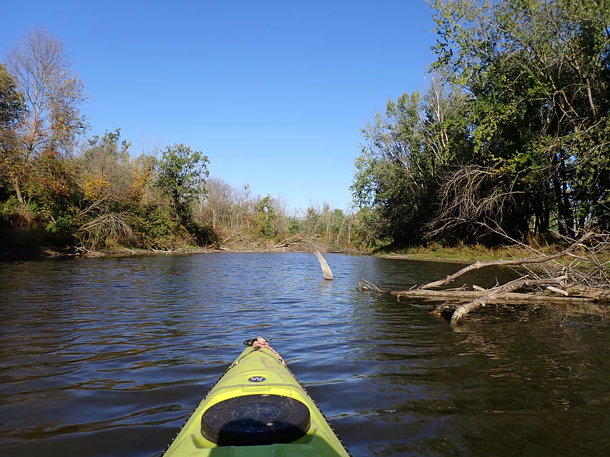
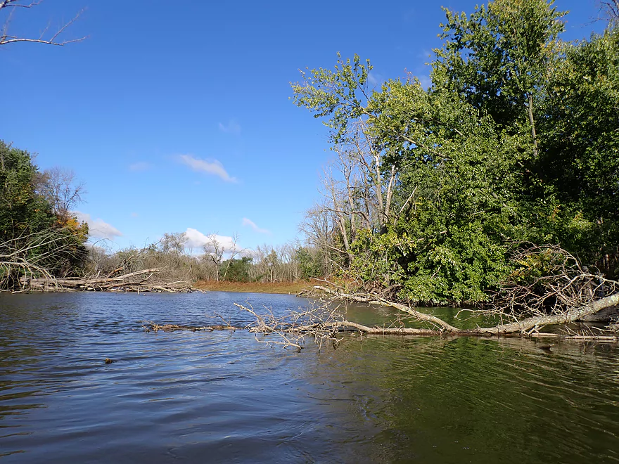
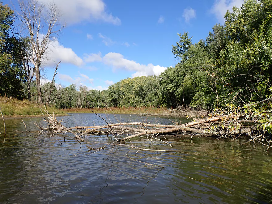
Some deadfall debris, but always super easy to get around
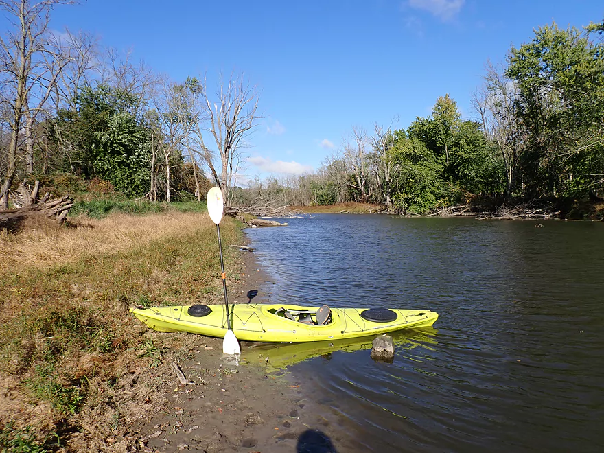
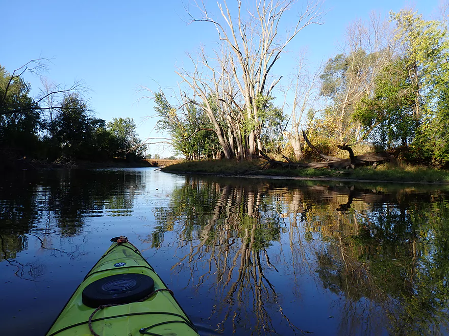
Looking upstream
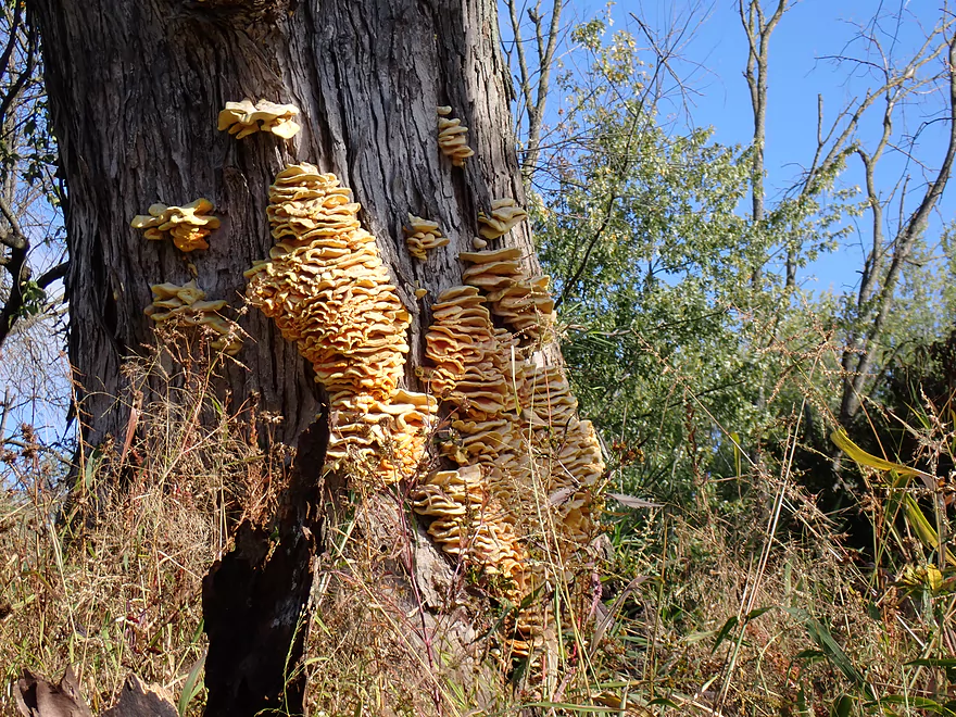
Looks like “chicken of the woods,” an edible mushroom
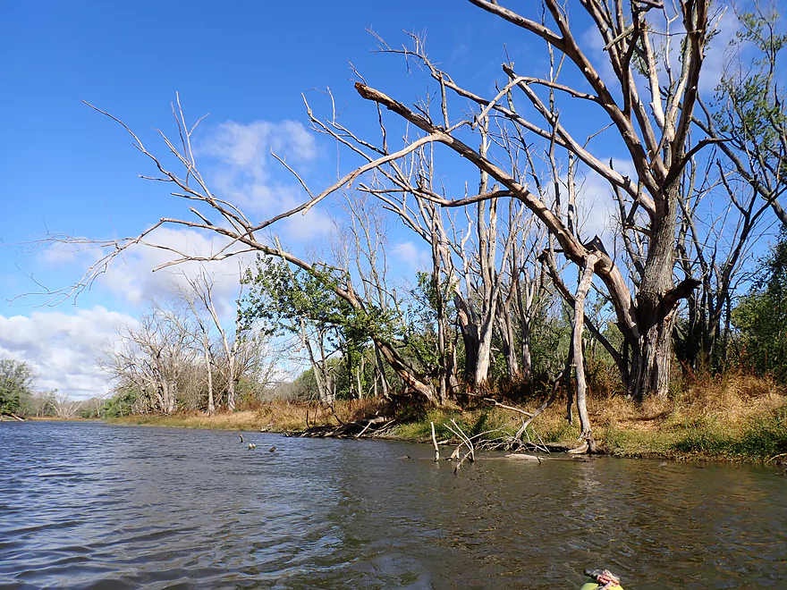
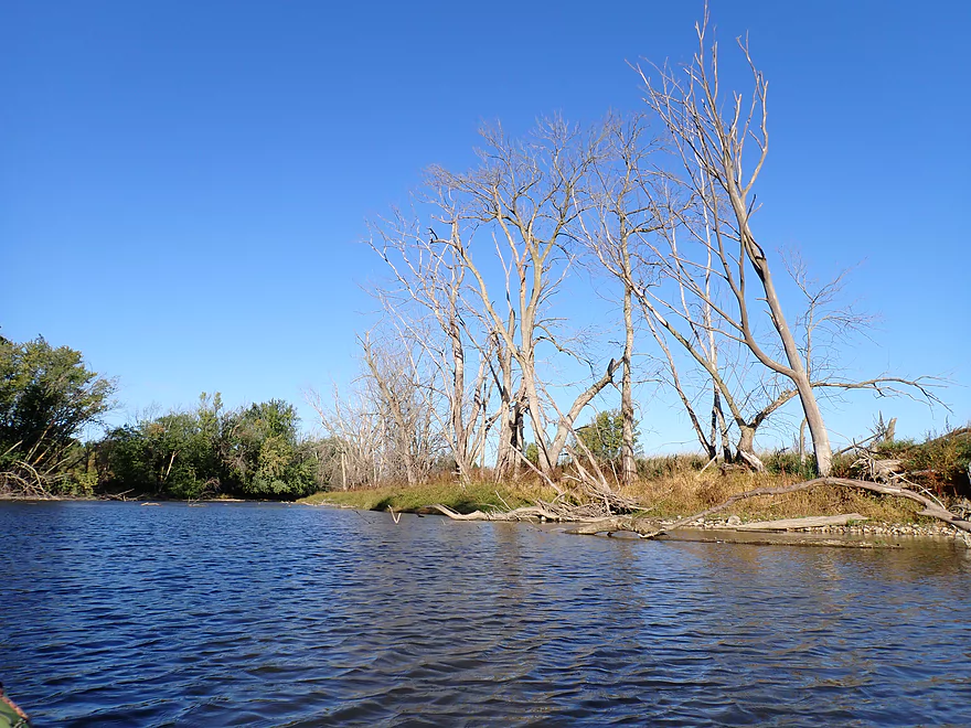
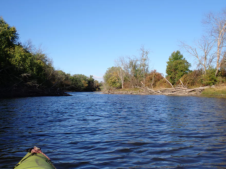
There might have been more dead trees than live trees on this trip
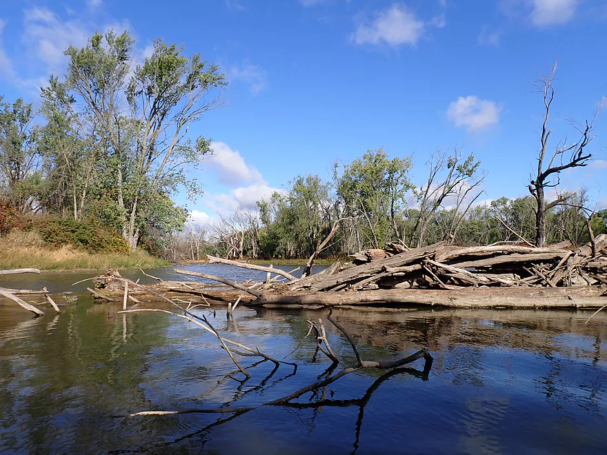
Tree graveyard
Dead trees as far as you could see
More clamshells
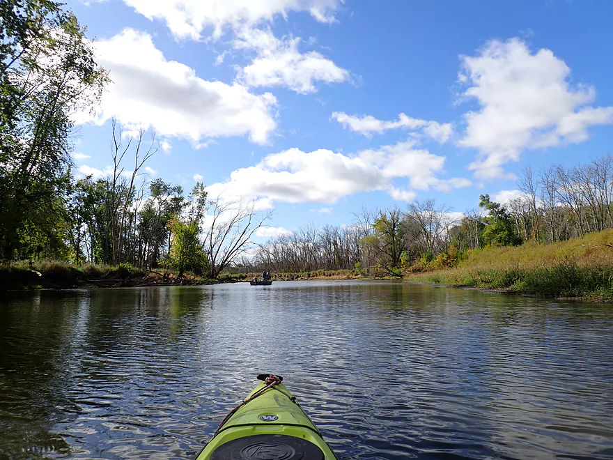
One of several boaters on the trip
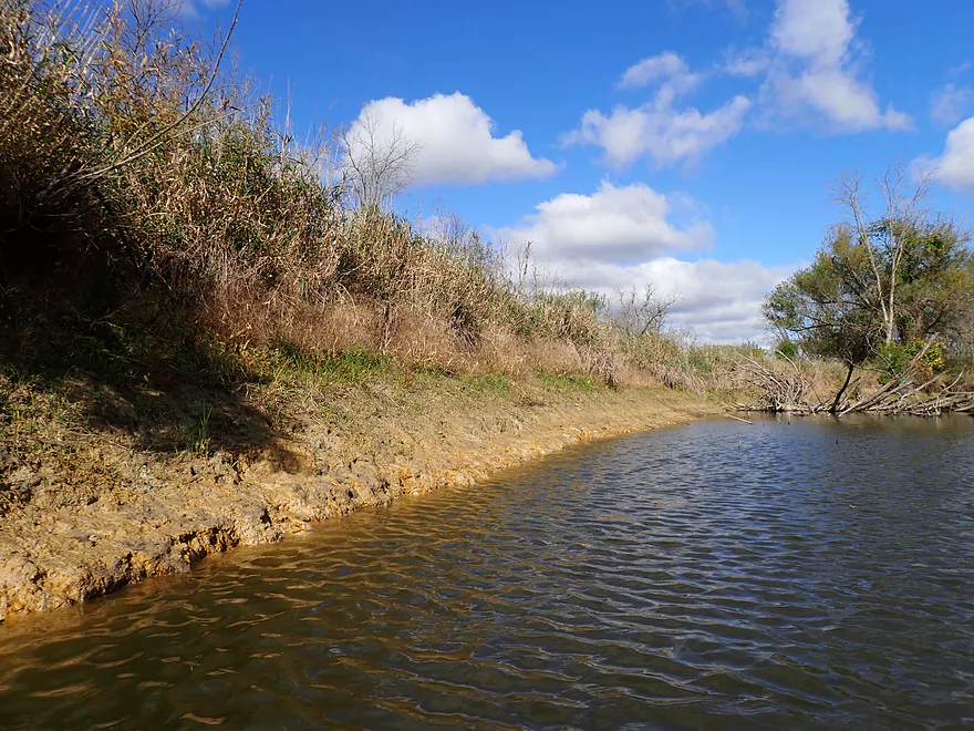
You could make pottery from these clay banks
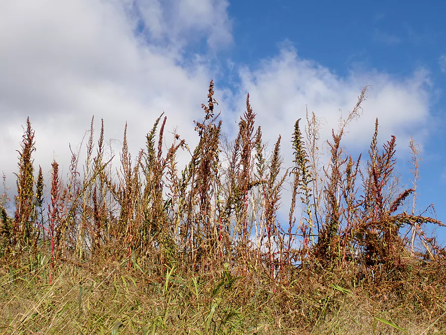
Amaranth skeletons
Favorite scene of the trip
Last leg
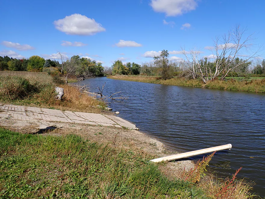
Taking out at Kaul Park…note that the fire hydrant pipe is ABOVE the water line
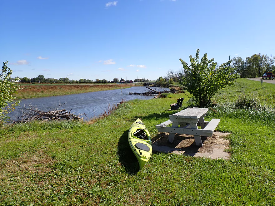
Nice park
…and scenic
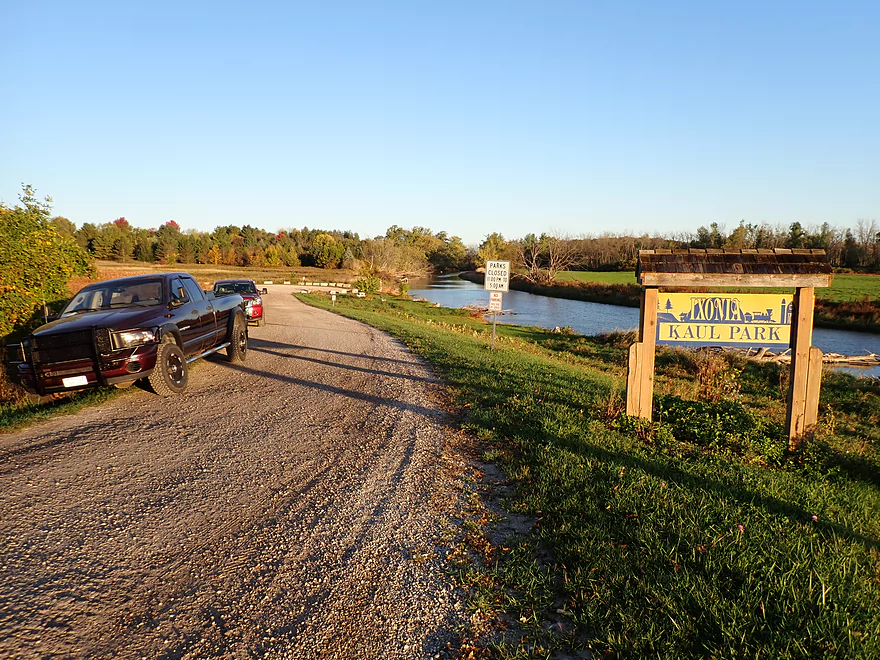
But not private…a security camera spies on the park behind the sign
Scenic bike shuttle back to the put-in
Rock River – Harnischfeger Park

The Rock is not an elite paddling river. Its channel is typically slow and wide, but there are several pleasant stretches between Horicon and Watertown worth exploring. This week I checked out the leg between Harnischfeger Park and Kaul Park.
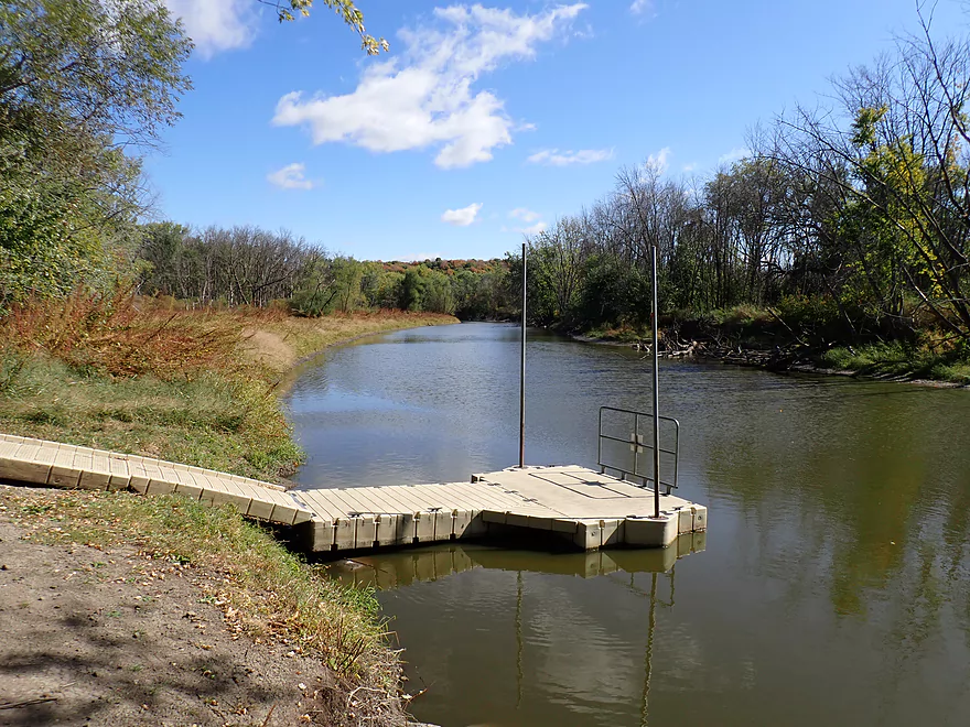
The put-in at Harnischfeger Park was pretty good. It’s basically a public RV campground, but there is an access dock and parking lot for kayakers. The dock (like most docks) is designed more for canoes and isn’t really practical for kayaks, but it was easy enough to just launch from shore.
The first mile to the Highview Road bridge was scenic and nice. There were some nice tree reflections and a smattering of fall color. There were also many dead ash (here and throughout the trip), as the Emerald Ash Borer has done a number on the Rock River. Unfortunately the current was quite lacking and the air temperature was colder than expected. Last year I did a nearby trip on the Rock which featured some great fog. I had hoped for a “fall fog” paddle again this year and woke early for pictures, but conditions didn’t materialize.
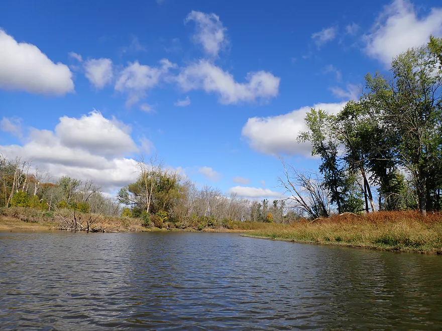
The next two miles featured wooded banks that, despite being a bit scruffy, were nice. I was pleasantly surprised to see a few rocky stretches on the river. The Rock despite its namesake isn’t really that rocky. Maybe it was a century earlier before farm erosion reshaped the river.
The second half of the trip wasn’t as interesting. There were fewer woods, more open banks, and the channel was wider. I was surprised to see several motorboats on the river (mostly duck hunters or fishermen). There are shallow stretches on the Upper Rock, but not really on this leg. Even in the drought it was plenty navigable.
One motorboater saw my camera and made a sarcastic remark about appearing in a magazine. This was frustrating on multiple levels. I take countless pictures for this kayaking blog most of which don’t make the final cut. I appreciate that people don’t like their pictures taken, but sometimes they unwittingly block key and scenic stretches of a river with good lighting. This puts me in a tough spot of being nice and not being a “paparazzi” vs capturing key video/pictures that I would have taken REGARDLESS if the person were photobombing the scene.
Just upstream from Kaul Park I encountered a fantastic little boulder garden…a gift from our recent drought. The last glacier, of course, dropped off these rocks–along with bulldozing most of the terrain along the Rock. Dodge County has the highest concentration of drumlins (linear hills) in the world
Kaul Park itself was a scenic and good public take-out. In fact it’s actually a boat ramp, and that day the shoulder was packed with boat trailers. The landing features a fire hydrant intake, but because of the drought, the pipe was sitting well above the water line and would have been worthless in a fire. At the ramp I was aggressively confronted by a duck hunter’s dog, before the owner yelled at it to return. Then the dog used the landing as an outhouse. If you bring your pet with you on a trip, remember to be considerate to other people and public spaces.
In summary this was an ok trip, but nothing special. It’s very close to Oconomowoc and the western edge of the Milwaukee burbs. When the Bark and Oconomowoc Rivers get too low to paddle, this is a good alternative.
Sights included clam piles, migrating geese, herons, and a catfish.
Harnischfeger Park Boardwalk: I didn’t check it out, but supposedly there is a nice boardwalk in the park with views of nearby wetlands and the river.
Harnischfeger Park: This is a very good public access and features a dock for launching. There is a parking lot and outhouse on site that paddlers can use.
Alt Put-ins:
- Hwy MM (6.9 miles upstream from Harnischfeger): I believe there is a rough launch west of the bridge. I don’t much about the leg below MM, but I assume it is mediocre.
Kaul Park: This is a good public boat ramp. Don’t be surprised to see a lot of boat trailers parked here on summer weekends. Google Maps mistakenly calls this “CW Canoe Landing” and not “Kaul Park”. There is no outhouse here and the entire landing is under watch by a video camera.
Alt Take-outs:
- Kanow Park (5.7 miles downstream from Kaul Park): Kaul Park is a good access, but sometimes is gated shut. I don’t know much about the Rock River above Kanow Park, but I assume it is mediocre.
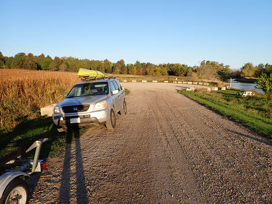
Bike Shuttle – Kaul Park to Harnischfeger Park: 2.9 miles with 14′ of ascent. This was a very easy bike shuttle (and was scenic).
Rentals – Harnischfeger Park: This park does offer kayak and canoe rentals. Shuttle service, however, is not available and rentals are only during the summer months
Logjams/Dams: None…this is a very safe/easy river.
Wind: This is a relatively open river. Be mindful of forecasted strong headwinds.
Current/Rapids: The current on this leg was extremely slow and sometimes non-existent.
Nearest Gauge – Rock River @ Watertown: Trip was done at 111 CFS or 1.07′. This gauge is downstream from several dams so may not be perfectly representative.
- < 100 CFS: This would be relatively low but still would be plenty navigable. This is one of the more drought resistant water trails in Southern Wisconsin.
- 101-200 CFS: Low depth but plenty navigable.
- 201-300 CFS: Slightly below average, but a good depth.
- 301-400 CFS: An average depth.
- 401-500 CFS: A higher depth, but still suitable for paddling.
- 501-800 CFS: This is a high depth, but the river should still be fine for kayaking.
- 801+ CFS: Maybe too high for enjoyable paddling?
Detailed Overview
East Branch:
- Upstream of Hillcrest Drive: I believe these portions are too congested to paddle.
- Hillcrest Drive to Hwy DW: 4.1 miles.
- Hillcrest Drive to Riveredge Park: 0.9 miles. Scenic stretch through the outskirts of Allenton with good clarity. However, there are two major logjams to portage and several minor logjams to squeak past.
- Riveredge Park to Hwy DW: 2.7 miles. An open stretch through wetgrass and a state natural area. One logjam needs to be portaged.
- Hwy DW to Hwy D: 5.5 miles. Outside of one nasty logjam cluster, this is a pretty open creek paddle through a protected wildlife area that might be decent.
- Hwy D Wayside to N. Pole Rd. Launch: 7.3 miles. A good wetland paddle prospect through Theresa Marsh. Maybe 1-2 downed trees on the upper part.
- Kohlsville River: Note, the Kohlsville River joins the East Branch here, but it seems too congested with downed trees to be feasible for paddling.
- N. Pole Rd to Gill Rd (East): 6.0 miles.
- N. Pole Rd Landing to River Edge Park: 1.3 miles. A slow, open, and marshy channel. Nice though.
- River Edge Park to Rock River Street/Dam: 0.5 miles. A nice town paddle through the community of Theresa. One dam to portage.
- Rock River Street/Dam to Hwy AY: 3.5 miles. One of my favorite stretches on the entire Rock River. While shallow in spots, it is scenic with nice woods, small boulder gardens and multiple light rapids.
- Hwy AY to Gill Road (East): 0.7 miles. A brief wooded stretch that is a nice paddle.
- Gill Road (East) to Hwy 67/Dam: 8.3 miles.
- Gill Road (East) to McArthur Road/Fink Creek: 4.7 miles. Starts boring, weedy, and slow, but gets nice with clear water and rocks later on. Gill Road (West) may be a viable halfway access.
- McArthur Road to Hwy 67/Dam: 3.6 miles. A less interesting paddle through a flowage and downtown Mayville with numerous alt take-outs.
- Hwy 67/Dam to Green Head Road Ramp: 6.4 miles.
- Hwy 67 to Hwy Y/Ziegler Park: 1.9 miles. One of the best paddling stretches on the entire Rock River with good current and small boulder gardens.
- Hwy Y to Hwy TW/Kekoskee Pond Ramp: 1.9 miles. A good stretch that includes a little bit of flowage paddling.
- Hwy TW to Green Head Road Ramp: 2.6 miles. An ok stretch as the river really slows and starts to turn into marsh.
- Green Head Road to N. Nebraska St. Ramp: 10.0 miles. The most popular route through Horicon Marsh. Known for its waterfowl.
South Branch:
- Upstream of E. Rock River Rd.: I suspect downed trees are too much of an issue for this to be navigable.
- E. Rock River Road to Hwy 49: 1.6 miles. Perhaps a cluster of downed trees in the middle and an electric fence upstream of Hwy 49.
- Hwy 49 to Waupun Park: 1.7 miles. Hwy 49 is not ideal for launching, but should be doable. A good prospect mostly through a golf course. Maybe 2 logjams?
- Waupun Park to E. Waupun Road: 7.2 miles. A good section.
- Waupun Park to Tanner Park: 3.1 miles. Great section though downtown Waupun. Alt access at Pine Street Park, Meadow View Park and Harris Mill Park.
- Tanner Park to Roadside Park: 3.2 miles. A pleasant paddle through a mixture of woods and open areas. A couple of logjam squeakers and one major portage.
- Roadside Park to E. Waupun Road: 0.9 miles. River widens, slows, and gets less interesting.
- E. Waupun Road to Dike Road: 10.0 miles. This is the northern unit of Horicon Marsh and is off limits to paddlers per National Wildlife Refuge rules.
- Dike Road to N. Nebraska St. Ramp: 5.6 miles. Am 80% sure you can drive on Dike Road from the east to launch in the ditch. Mostly a long, straight canal paddle through Horicon Marsh with perhaps interesting side canals to explore. You can also launch in a west canal by Burnett Ditch Road. The city of Horicon marks the confluence of the South and East Branches of the Rock River.
West Branch:
It’s a neat prospect, but I suspect the logjam situation is too much (I could be wrong).
Main Branch:
- N. Nebraska St. to Legion Park/Dam: 0.9 miles. An ok section through downtown Horicon.
- Legion Park to River Bend Park: 1.1 miles. Simple river segment…probably nothing too special.
- River Bend Park to Lions Park: 8.8 miles. A large and probably uninteresting flowage. If you get permission to take out at Ox-Bo Marine, you can avoid much of the flowage paddling.
- Lions Park to Elmwood Park: 7.2 miles. Trip starts nice with a great boulder garden, but becomes less interesting as the current dies.
- Elmwood Park to Hwy MM: 4.4 miles. An interesting prospect recommended by Frank Piraino.
- Hwy MM to Harnischfeger Park: 6.9 miles.
- Harnischfeger Park to Kaul Park/Hwy CW: 5.1 miles. Despite slow current and some motorboat traffic, this is a pleasant and relatively secluded stretch of the Upper Rock River.
- Kaul Park to Kanow Park: 5.7 miles. Despite a lack of current, dead trees, and some mud, this is a very nice leg and one of the better stretches on the Rock River.
- Kanow Park to Hwy F: 5.0 miles.
- Hwy F to Wayside Park: 0.9 miles. Short but scenic leg.
- Wayside Park to Rockvale Road: 1.9 miles. Slow, simple stretch but pleasant.
- Rockvale Road to Hwy F: 2.4 miles. Scenic leg.
- Hwy F to Hwy P: 6.0 miles. This isn't an elite trip with slow current and no exotic scenery. But it is pleasant and one of the nicer legs on the Lower Rock.
- Hwy P to Dam1st/Front St.: 5.6 miles. Probably an uninteresting flowage paddle.
- Dam(1st)/Front St. to Dam(2nd)/S. 1st Street: 2.6 miles. Possibly a unique paddle through downtown Watertown.
- Watertown Dam/1st Street to Cappie's Landing: 3.5 miles. A mediocre prospect.
- Cappie's Landing to Crossroads Landing: 9.3 miles. The put-in is SE of Hwy 26 via Jefferson Road. This segment is more undeveloped, but is still probably mediocre at best.
- Crossroad Landing to Hwy B Boat Launch: 1.6 miles. Maybe a boring mini leg...it does pass under busy I-94.
- Hwy B to Lubahn Park/N. Watertown Ave: 4.1 miles. Probably uninteresting.
- Lubahn Park to Tensfeldt Park: 2.3 miles. Paddling through downtown Jefferson might be unique, but there is a dam to portage. Many alt landings in Jefferson.
- Tensfeldt Park to Klement Park: 4.2 miles. Probably an uninteresting tweener section between Jefferson and Fort Atkinson.
- Klement Park to Lorman Bicentennial Park: 3.1 miles. A weak prospect through downtown Fort Atkinson.
- Lorman Park to Hwy 26 Ramp: 3.3 miles. A weak prospect.
- Hwy 26 to E. Knudsen Road Ramp: 11.8 miles. Mostly boring paddling on Lake Koshkonong. Many other launches on the lake.
- E. Knudsen Road Ramp to Hwy M/Dam: 3.4 miles. Boring flowage.
- Hwy M/Dam to Hwy 14: 8.2 miles. Probably uninteresting.
- Hwy 14/Rock River Park to Centerway Dam: 4.7 miles. This is a slow impounded stretch that flows through the north end of Janesville. It does include some nice parks and wooded hills, but also many piers, riverside developments, and motorboat traffic. There are many intermediate access points to choose from (see overview map for details).
- Centerway Dam to Afton Boat Launch: 2.9 miles. An interesting leg through Janesville's revitalized riverfront. Highlights include unique bridges, building art, some rapids, a cave, good waterfowl and a recently removed dam. This section can be tricky if not dangerous due to fast currents (especially when water levels are high). There are many alternative access points to choose from that aren't listed.
- Afton Boat Launch to Happy Hollow Park: 7.8 miles. A mediocre section with wooded banks, but mostly beat-up flood-bottom trees. The river here is mostly free flowing and not impounded by any dams.
- Happy Hollow Park to Preservation Park Boat launch: 3.2 miles.
- Preservation Park to Wooton Park Boat Ramp: 3.0 miles. Start of urban paddling in Beloit. Numerous other launch options in Beloit proper.
- Further Rock River Trips: From here on, you are in Illinois. For further information see “Paddling Illinois” or Rockrivertrail.com.
Trip Map
Overview Map
Video
Photos Size: