Milwaukee River
This is a classic paddling river located in Southeastern Wisconsin. The highlight is the downtown leg which goes through downtown Milwaukee.
Trip Reports
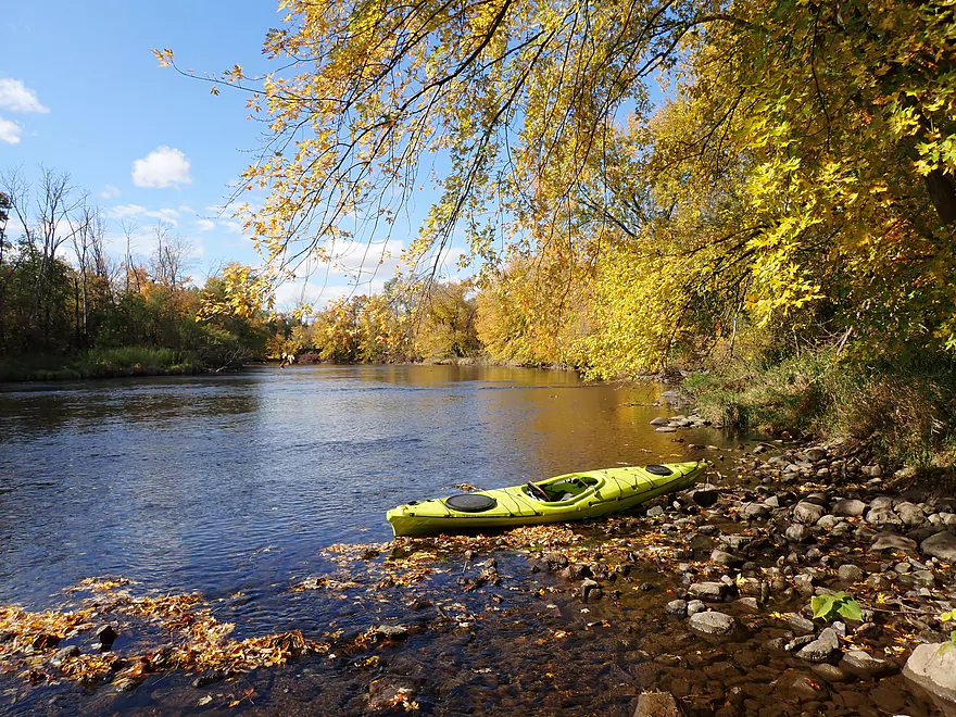
Hwy W to New Cassel Street
Date Paddled: April 12th, 2025
Distance: 4.6 miles
Time: Expect 2 hours
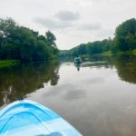
How far upstream on the Milwaukee River can you paddle? Time to find out as I explore a far, far upper portion of the river in Kettle Moraine country. This proved to be a varied but enjoyable trip.
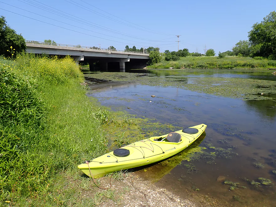
Read More...Washington Street Dam to Quaas Creek Park
Date Paddled: September 5th, 2020
Distance: 3.9 miles
Time: Expect 90 minutes
The removal of the Woolen Mills Dam has revealed one of the nicer stretches of the Milwaukee River. Highlights include great current, attractive urban riverfront and scenic prairies.
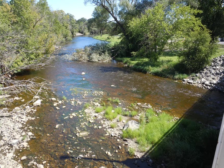
Read More...Quaas Creek Park to Goeden Park
Date Paddled: June 23rd, 2018
Distance: 6.3 miles
Time: 4 hours 6 minutes (3 hours is more typical)
A return to the Upper Milwaukee River for a pleasant and easy float. Highlights include little development, clear water, and good access options.
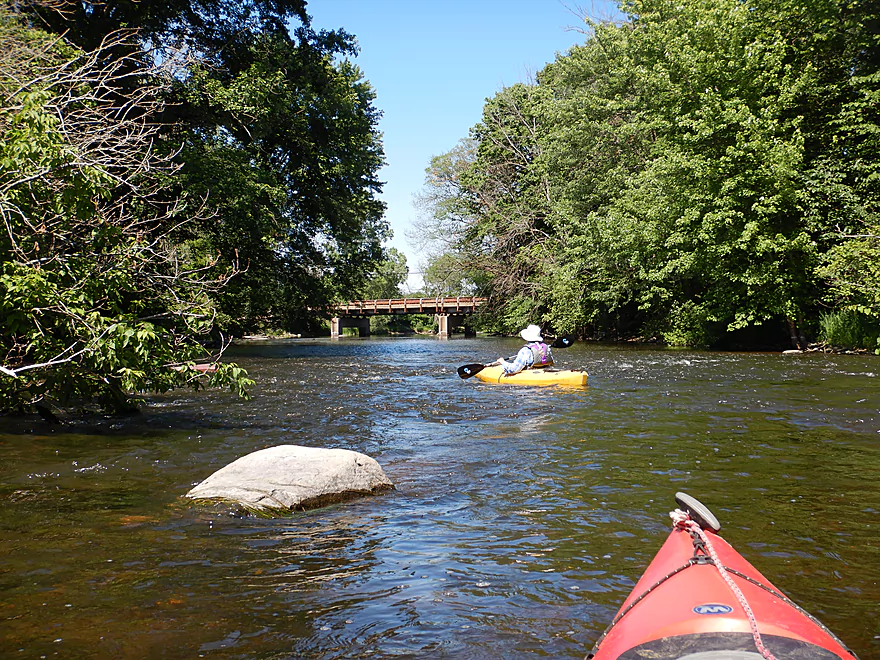
Read More...Main Street Bridge @ Newburg to Hwy A Bridge
Date Paddled: September 6th, 2014
Distance: 6.0 Miles
Time: 2 hours 54 minutes
This is probably the best section on the Milwaukee River. A fine paddle, with clear, red water; no jams/hazards; swift, fun current; good bank quality; and a surprising amount of wilderness for a river with this namesake. Put-in: Just downstream/east of the Main Street bridge in Newburg is a nice public put-in. Note: while this […]
Read More...Hwy A to Waubedonia Park
Date Paddled: October 15th, 2022
Distance: 5.4 miles
Time: Expect 2-3 hours
A decent leg with good current, some rocky stretches, and nice fall color. The North Branch joins up on this leg and significantly enlarges the river.
Read More...Waubedonia Park to Ehler's Park
Date Paddled: August 9th, 2021
Distance: 5.5 miles
Time: 2 hours
A guest review for the Milwaukee River between Fredonia and Saukville.
Read More...Thiensville Village Park Launch to Badger Meter River Park
Date Paddled: August 4th, 2023
Distance: 4.7 miles
Time: Expect 2 hours
This is a less popular stretch of the Milwaukee. While not bad, it had somewhat repetitive scenery and lack of unique features.
Read More...Riverside Park to McKinley Marina
Date Paddled: August 18th, 2018
Distance: 6.3 miles
Time: 4 hours 4 minutes (3 hours is more typical)
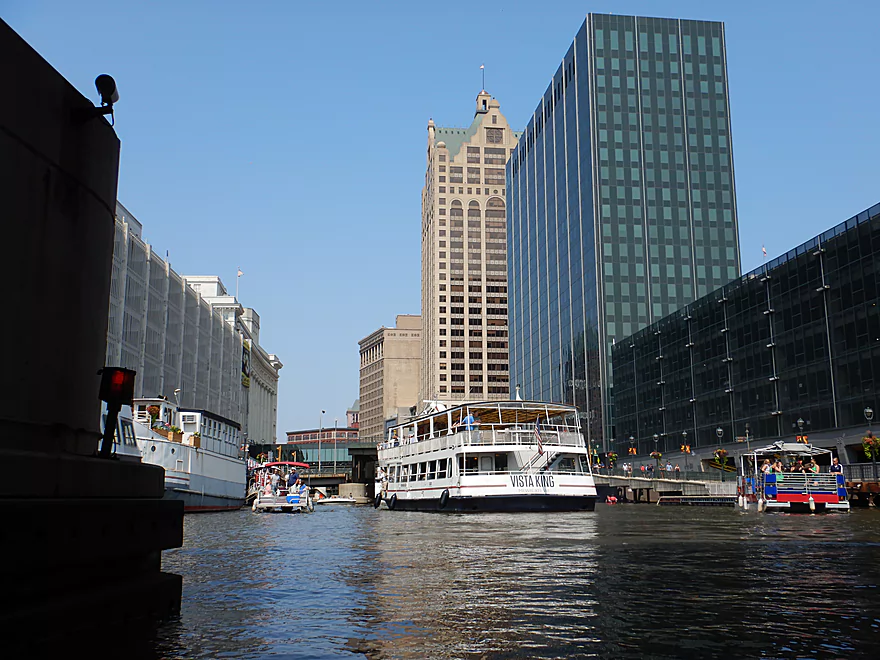
A fantastic paddle on the last segment of the Milwaukee River, which flows through the heart of downtown Milwaukee. Highlights include Wisconsin's tallest buildings, fantastic architecture, moveable bridges, large tour boats, and a great view of the Milwaukee Riverwalk.
Read More...Overview Map
Detailed Overview
Additional access options are visible on the overview map. Special thanks to Milwaukeeriverkeeper.org which has some detailed information on the river, including this great map.
- Upstream from Happy Road: Not viable for kayaking.
- Happy Road to Meadow Road: (0.7 miles) Small but mostly open stretch partly straightened by farmers. Likely ok.
- Meadow Road to Cty W: (1.5 miles) Very open stretch that flows past wetgrass marshes and farms. Likely an ok prospect with no logjams.
- CTY W to CampbellSport: (4.5 miles)
- Hwy W to Campbellsport Wayside: (4.1 miles) Starts as a narrow wet grass marsh and widens into a slower cattail marsh. Marsh recedes when sandwiched between two drumlins and becomes rockier and faster with some rapids. Overall a varied and scenic paddle. As of 2025 one logjam will have to be portaged.
- Campbellsport Wayside to Columbus PARC: (0.4 miles) A pleasant and scenic leg flowing past the outskirts of Campbellsport and a local town park.
- Campbellsport/Columbus PARC to Cty Y: (2.8 miles) Maybe 2-3 logjams. Otherwise this is a scenic stretch.
- Cty Y to Hwy 45: (1.7 miles) Maybe 3-5 logjams.
- Hwy 45 to Auburn Ashford Drive: (1.3 miles) Maybe 1-3 logjams...some riffles.
- Auburn Ashford Drive to Old Bridge Road: (0.7 miles) Maybe 1-3 logjams.
- Old Bridge Road to West/Main Branch Confluence: (2.0 miles) Maybe two logjams. For those launching above Kewaskum, I think they will start on the West Branch instead.
- Alternate - Hwy 45 to West/Main Branch Confluence: (0.7 miles) Probably one logjam...but more viable than starting from Old Bridge Road.
- West Branch/Main Branch Confluence: (2.8 miles) A mediocre prospect. Maybe one logjam..I don't know much more.
- Kewaskum Dam/Park to Cty H: (2.9 miles) Solid prospect.
- Cty H to First West Bend Dam: (6.3 miles) A solid prospect with some flowage paddling at the end. The take-out entails dragging your boat across a private parking lot.
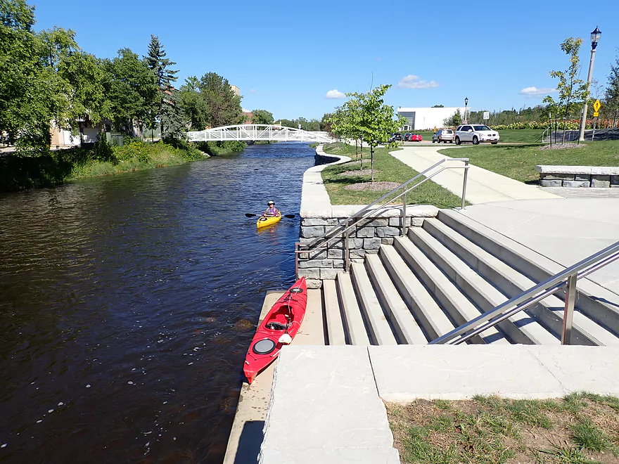
- First West Bend Dam (Barton Ave) to the Second West Bend Dam: (1.3 miles) Mostly an urban flowage paddle. The first dam is a difficult portage or put-in.
- 2nd West Bend Dam to Quaas Creek Park: (3.8 miles)
- 2nd West Bend Dam (Washington Street) to South River Road: (2.1 miles) Terrific section with a restored prairie, fast current, light rapids, and good urban scenery.
- South River Road to Quaas Creek Park: (1.7 miles) A paddle through urban woods...pleasant but not top-notch.South River Road to Cty M: (6.3 miles) A pleasant stretch with little development and clear water.
- Quaas Creek Park to Goeden County Park: (6.3 miles) A pleasant stretch with little development and clear water.
- Cty M to Main Street Bridge (Newburg): (3.4 miles) Good prospect with small boulder gardens in shallow water.
- Main Street Bridge (Newburg) to Cty A Bridge: (6.3 miles) A popular paddle with great water clarity.
- CTY A to Waubedonia Park (Waubeka): (5.7 miles) A decent leg with good current, some rocky stretches, and nice color in the fall. North Branch joins up and significantly enlarges the river.
- Waubedonia Park to Ehlers Park/Mink Ranch Road: (5.3 miles) A good stretch with a number of light rapids.
- Ehlers Park to Peninsula Park: (2.5 miles) A suburban stretch with maybe one set of rapids.
- Peninsula Park to Grafton Canoe Launch (south Saukville on Cty O): (1.9 miles) Kind of a suburban paddle.
- Grafton Canoe Launch to Veterans Memorial Park (Grafton): (4.1 miles) Some suburban and flowage paddling, although I think there are minor rapids in the upper stretch.
- Grafton Dam (SW of Bridge Street) to Lime Kiln Park: (1.3 miles) A terrific section with class 2-3 whitewater and scenic dells.
- Lime Kiln Park to Hwy T: (1.6 miles) A good section with the scenic 'Grafton Dells' and some Class 1 whitewater. I'm not sure Cty T is a good take-out.
- Cty T to Pioneer Road: (1.9 miles) A solid prospect.
- Pioneer Road to Thiensville Park: (6.9 miles) A solid d prospect but with some flowage paddling at the end.
- Thiensville Park to Badger Meter River Park: (4.8 miles) This is a less popular stretch of the Milwaukee. While not bad, it had somewhat repetitive scenery and lacked unique features.
- Badger Meter River Park to Kletzsch Park: (5.3 miles) This is a solid prospect.
- Kletzsch Park to Estabrook Park: (4.1 miles) Some flowage paddling and a nasty low-head dam to portage. A second dam has been, I believe, recently removed so this section might be very different now.
- Estabrook Park to Riverside Park: (3.1 miles) A number of decent rapids in this wooded but urban paddle.
- Riverside Park to McKinley Marina: (6.3 miles) A great trip on the last section of the Milwaukee.
- Riverside Park to Bruce Street Boat Ramp: (3.9 miles) A scenic paddle through downtown Milwaukee featuring some skyscrapers and great architecture.
- Bruce Street Boat Ramp to McKinley Marina: (2.5 miles) A bonus add-on section along Lake Michigan that features scenic vistas of the downtown.