
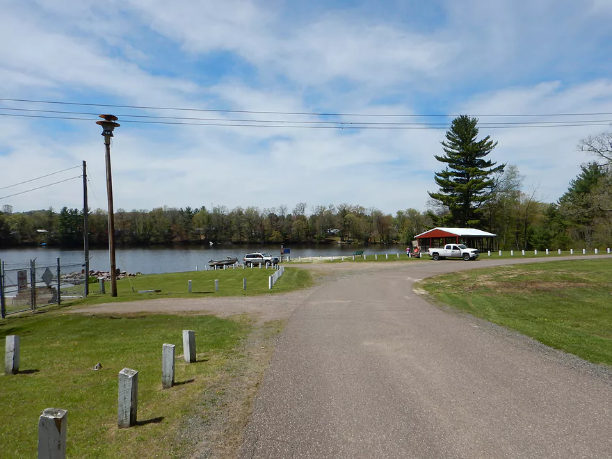
Trow Lake Public Launch
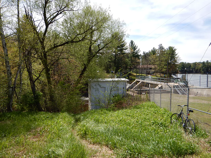
Steep trail to launch
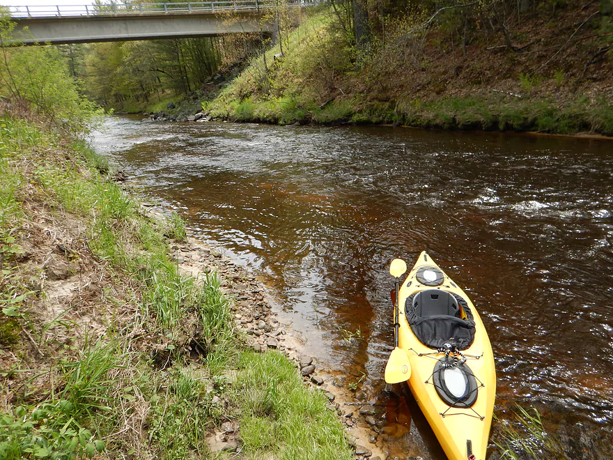
Good launch
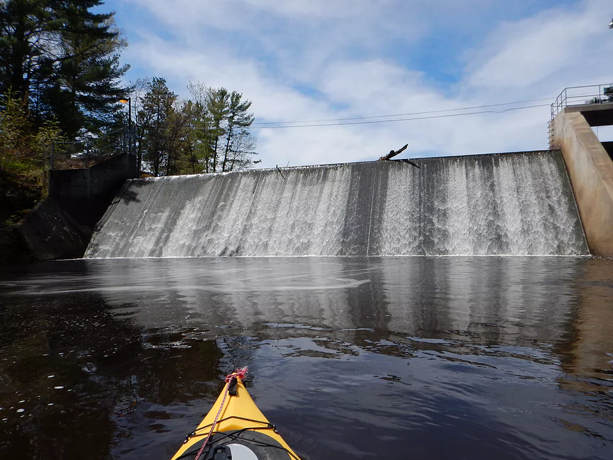
The dam (a make-shift flow rate reference)

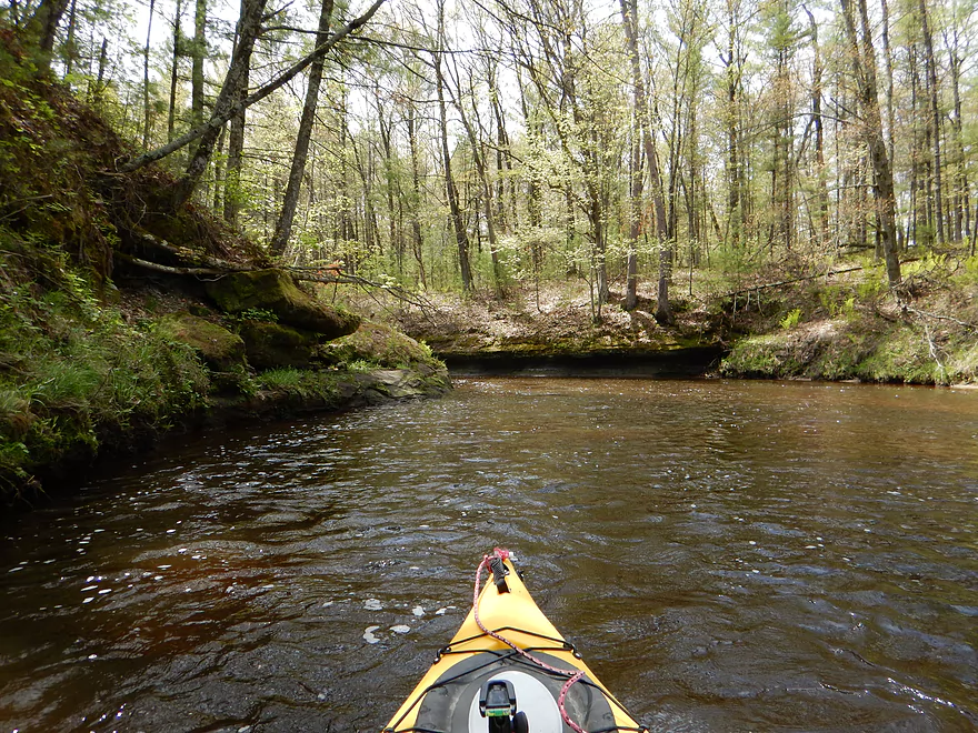
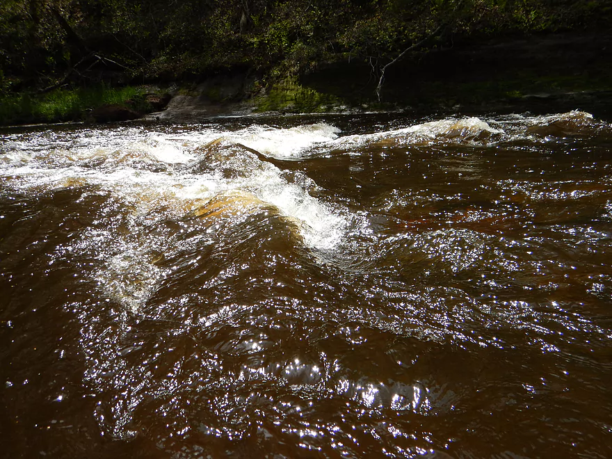
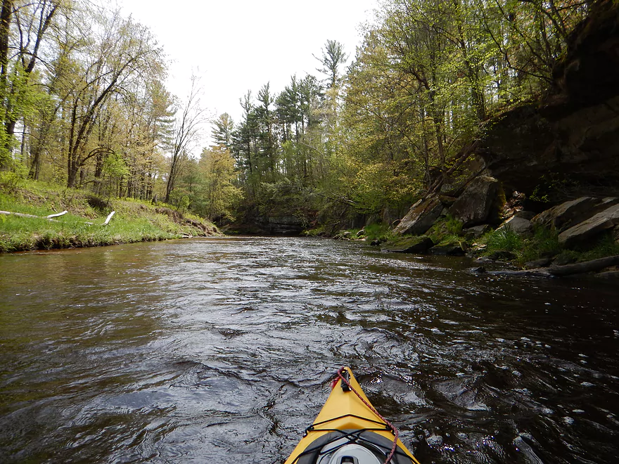
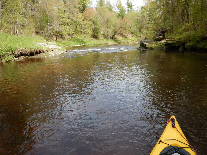
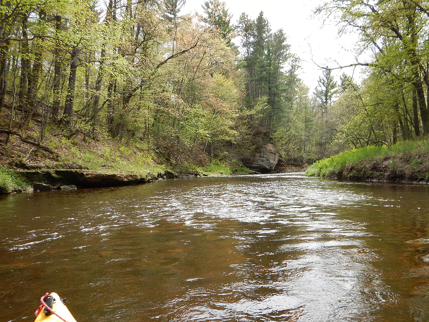
Fun riffles for much of the trip
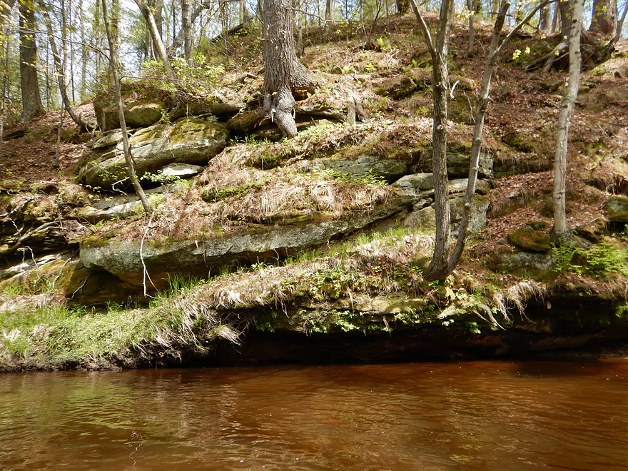
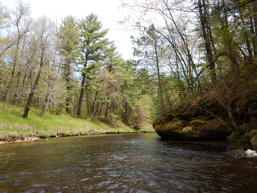
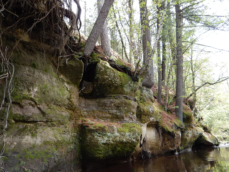
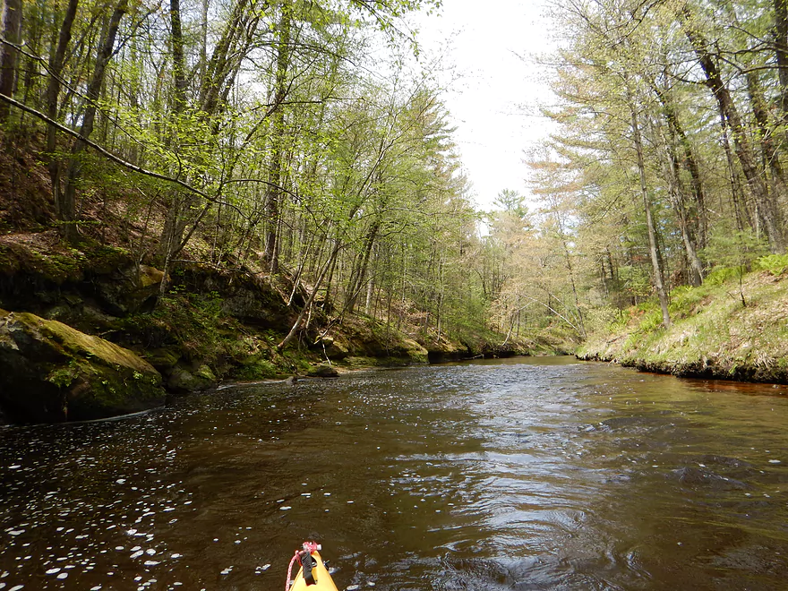
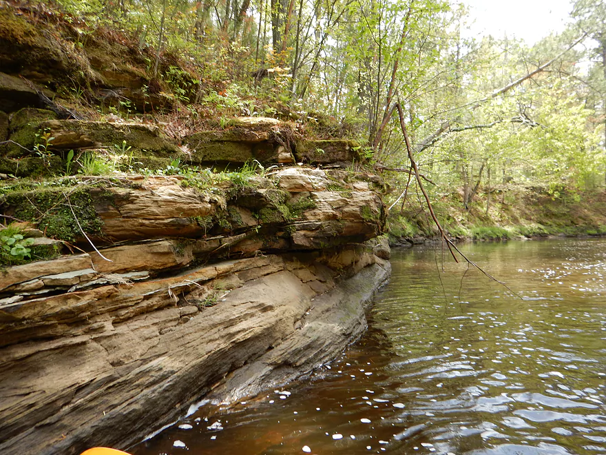
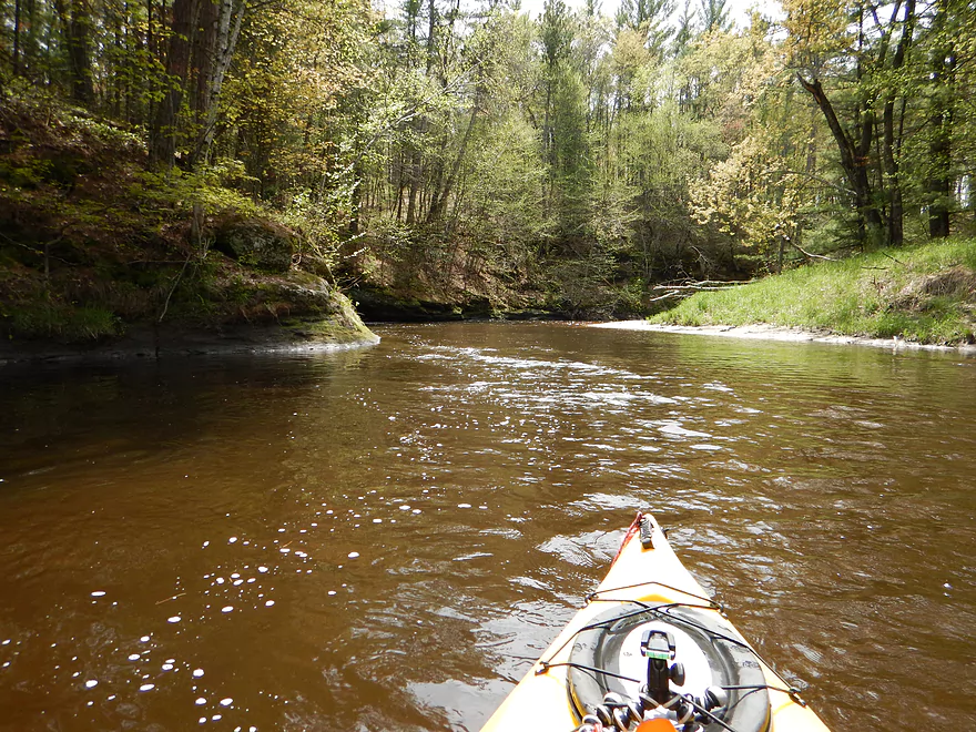
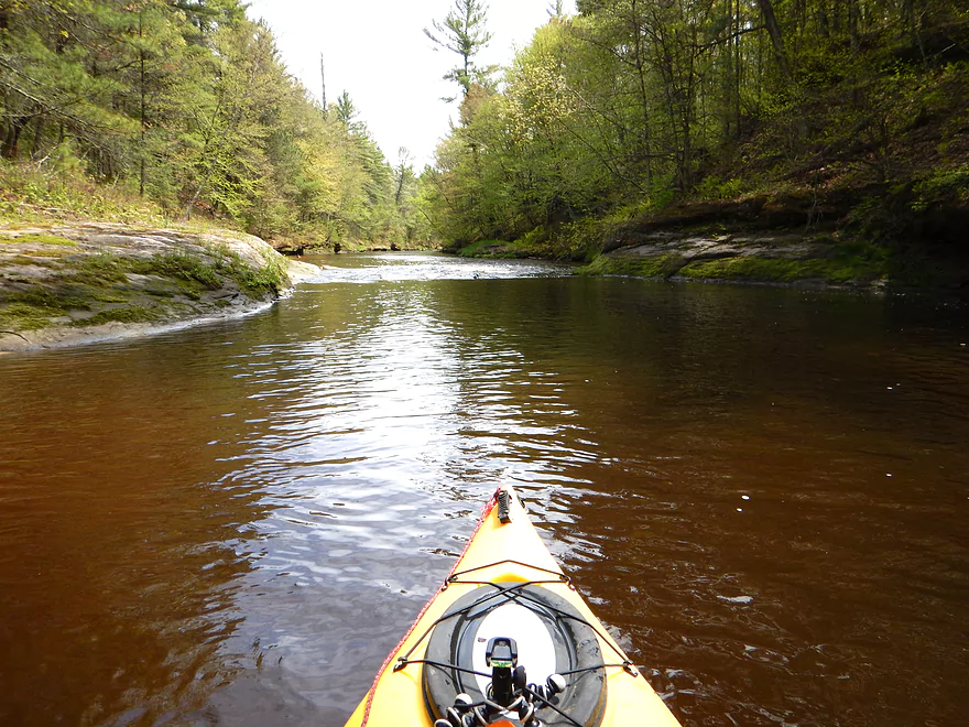
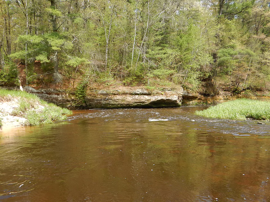
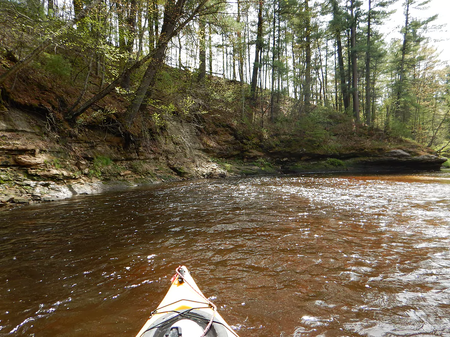
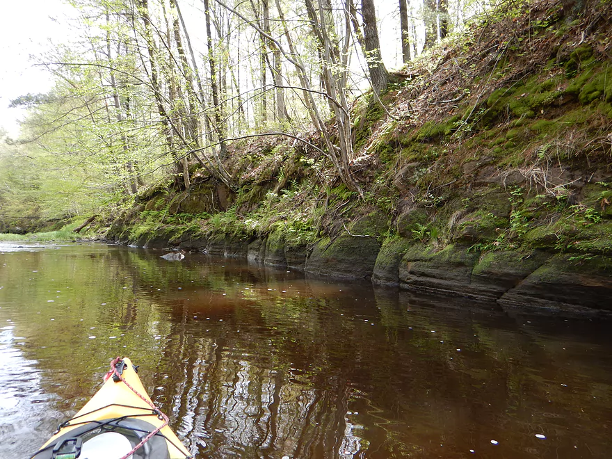
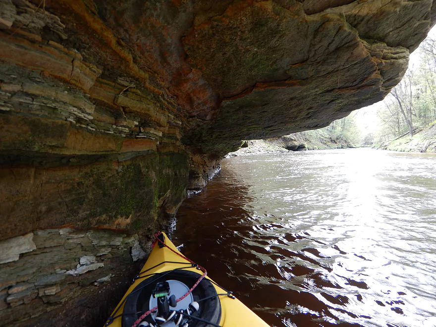
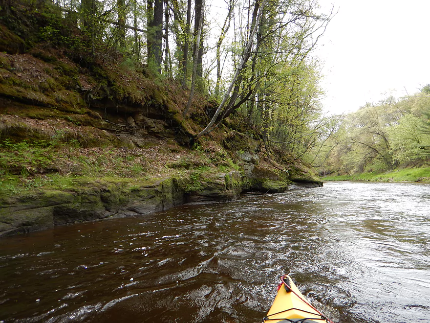
Lot of rock outcroppings
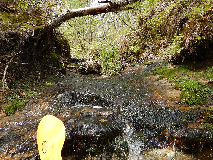
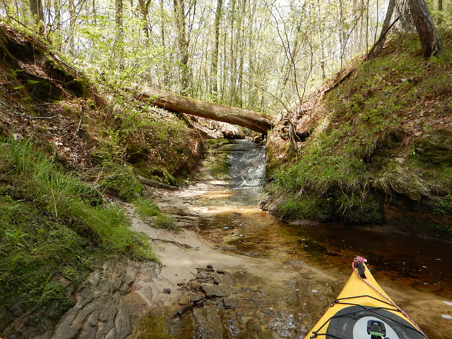
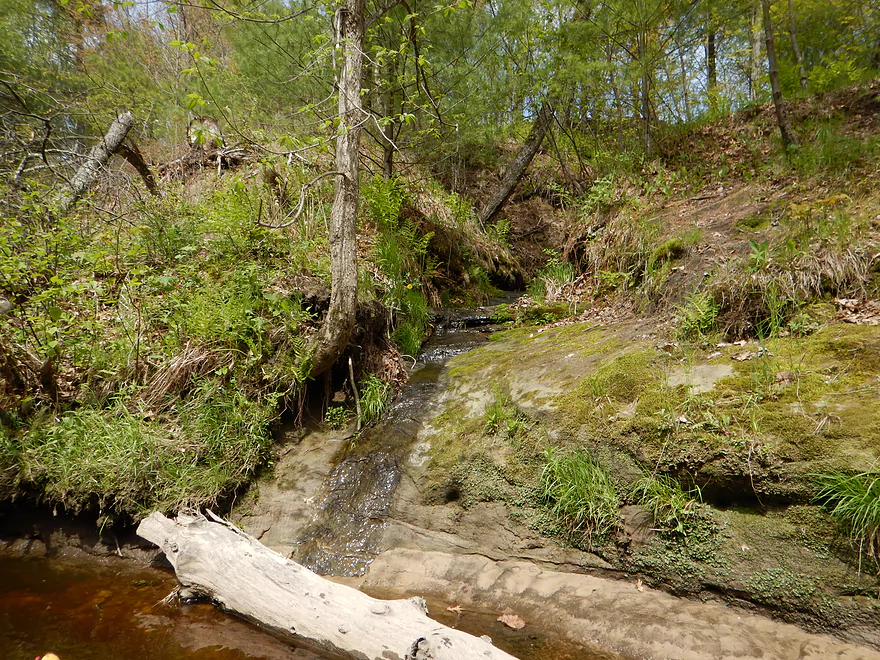
Nice micro-creek
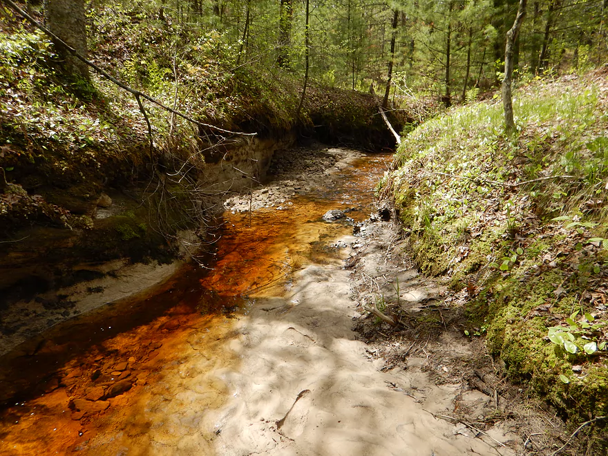
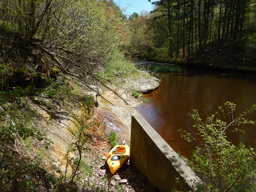
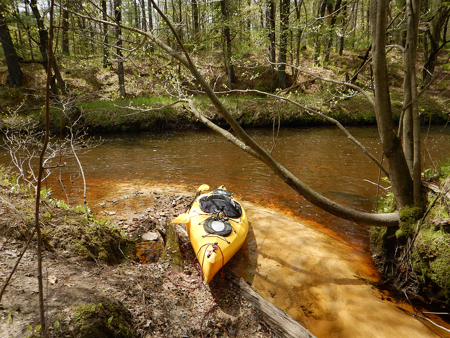
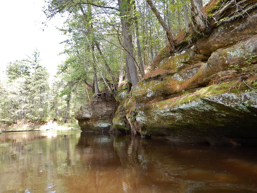
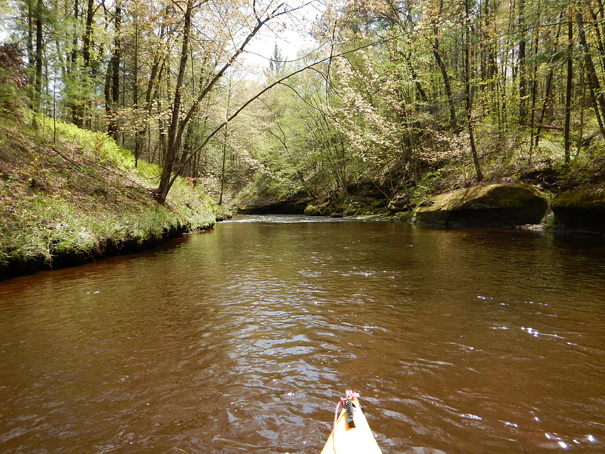
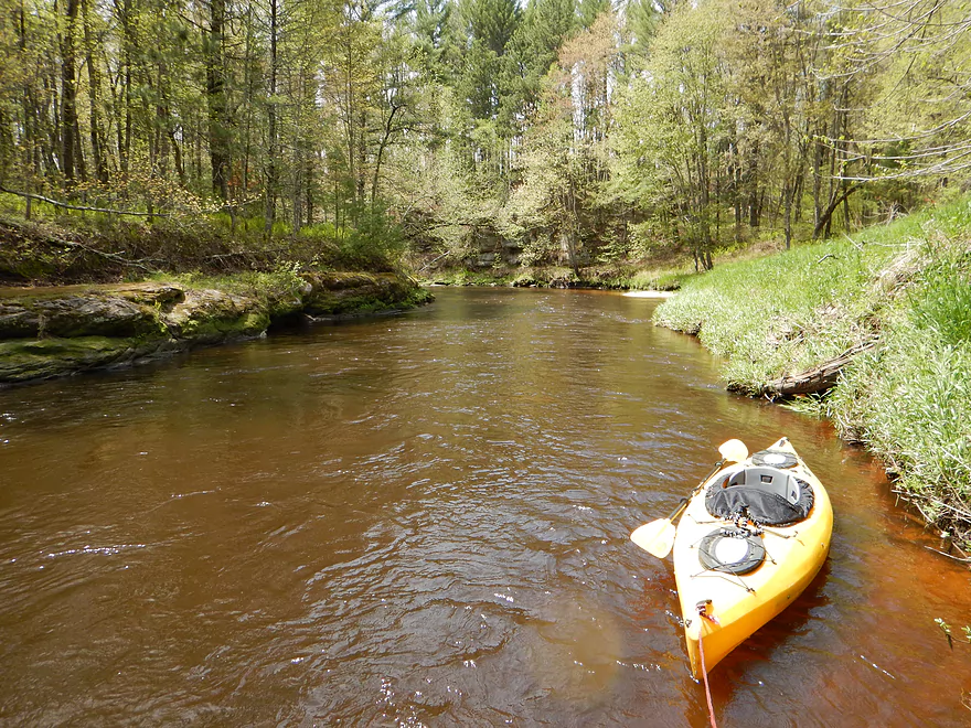
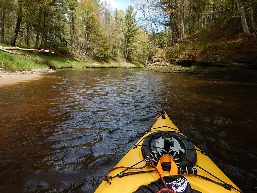
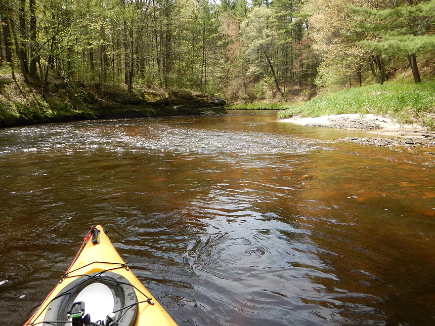
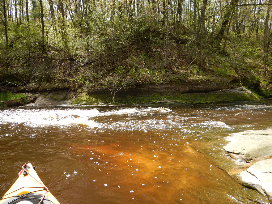
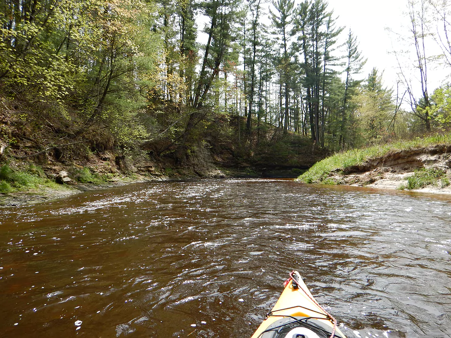
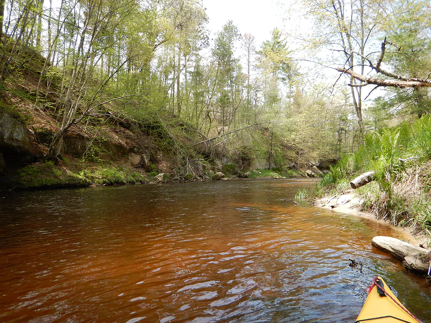
Terrific “root beer” water
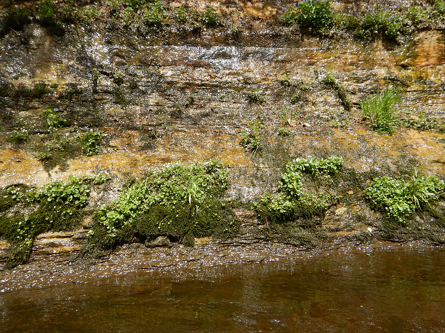
Another micro-waterfall
Number of these on the creek
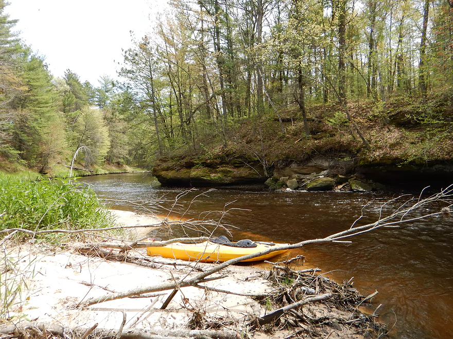
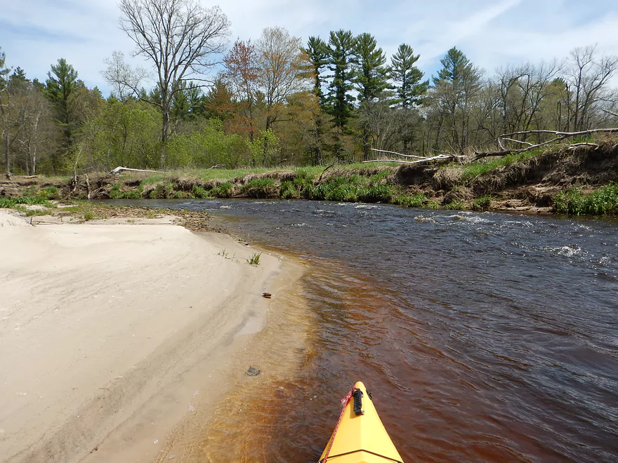
Cool micro-sandbar
Another terrific micro-waterfall
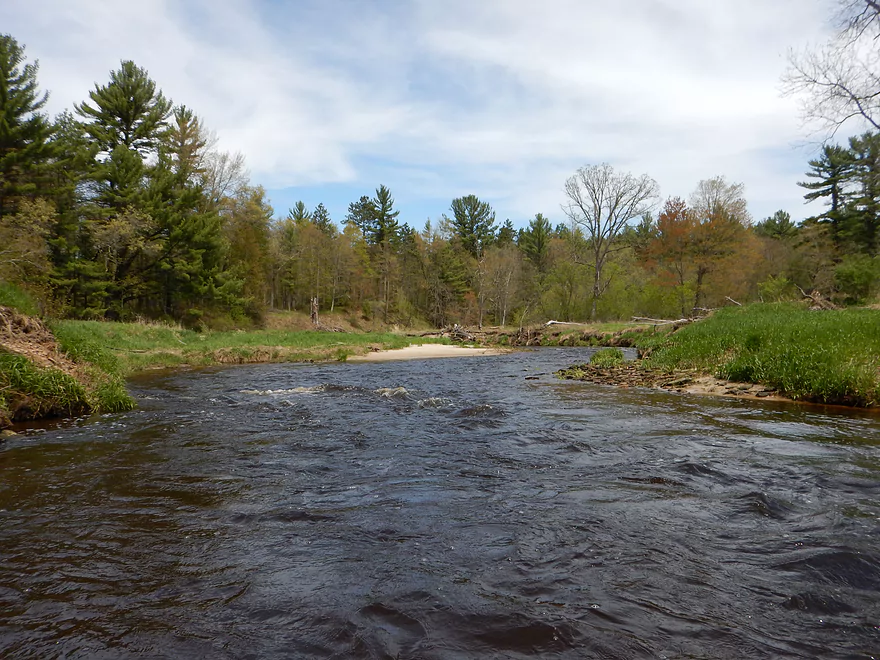
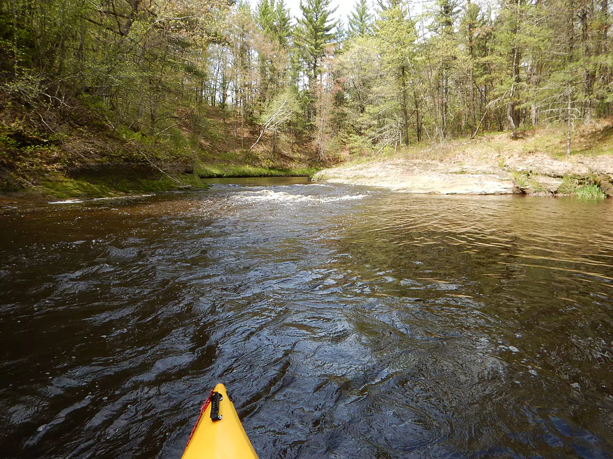
One of many class 1’s
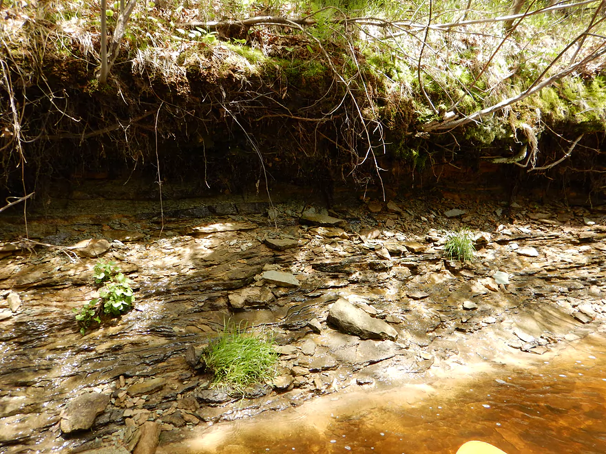
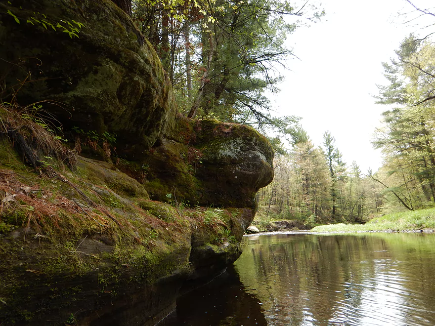
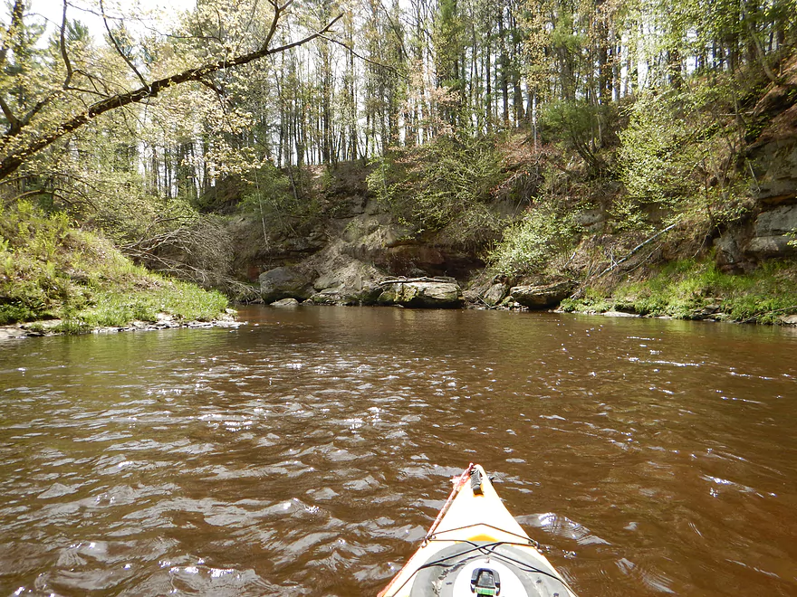
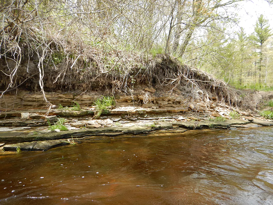
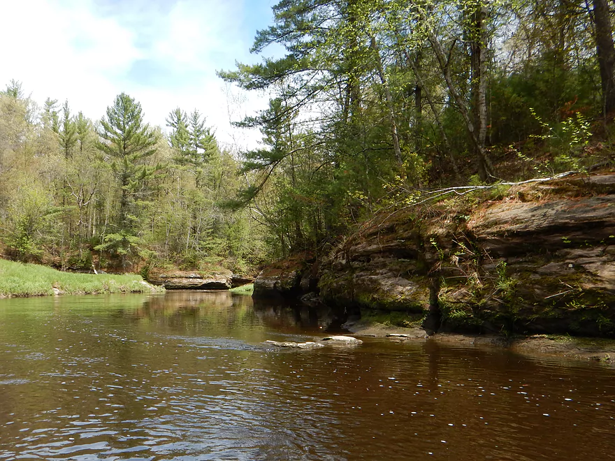
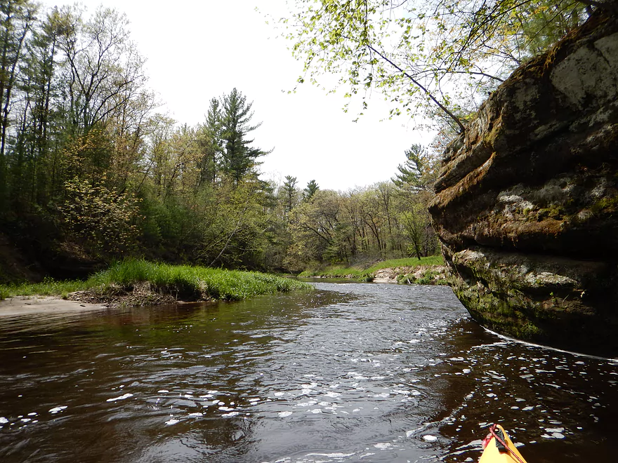
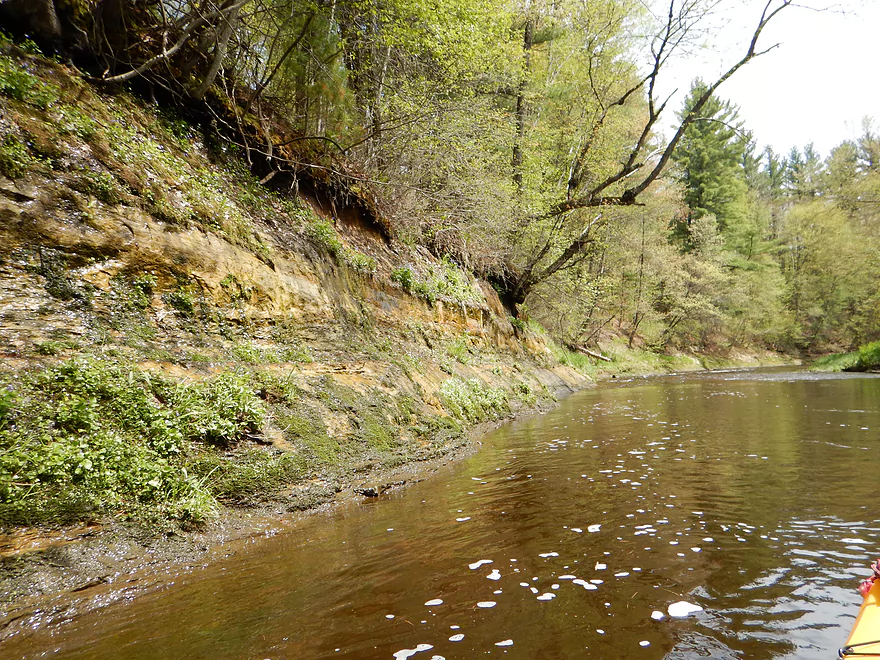
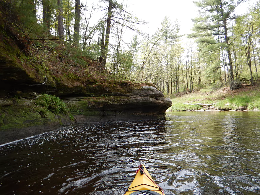
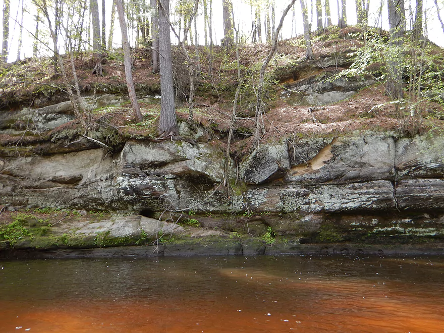
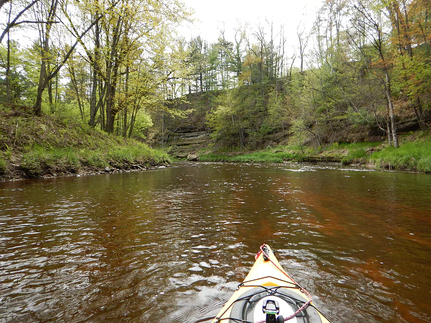
Nice rock strata
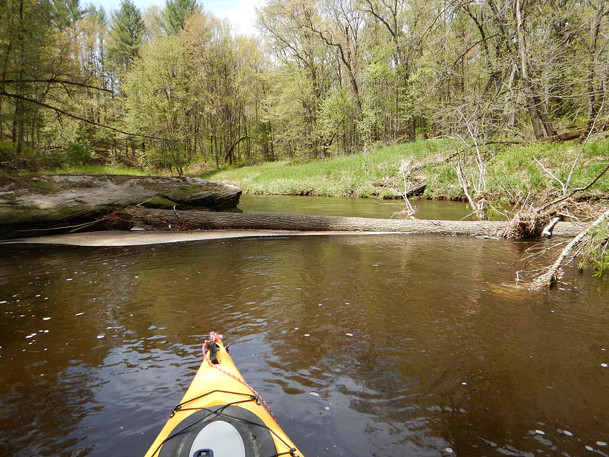
Only log jam
One of the few open/flat areas
Nice micro-sandbar
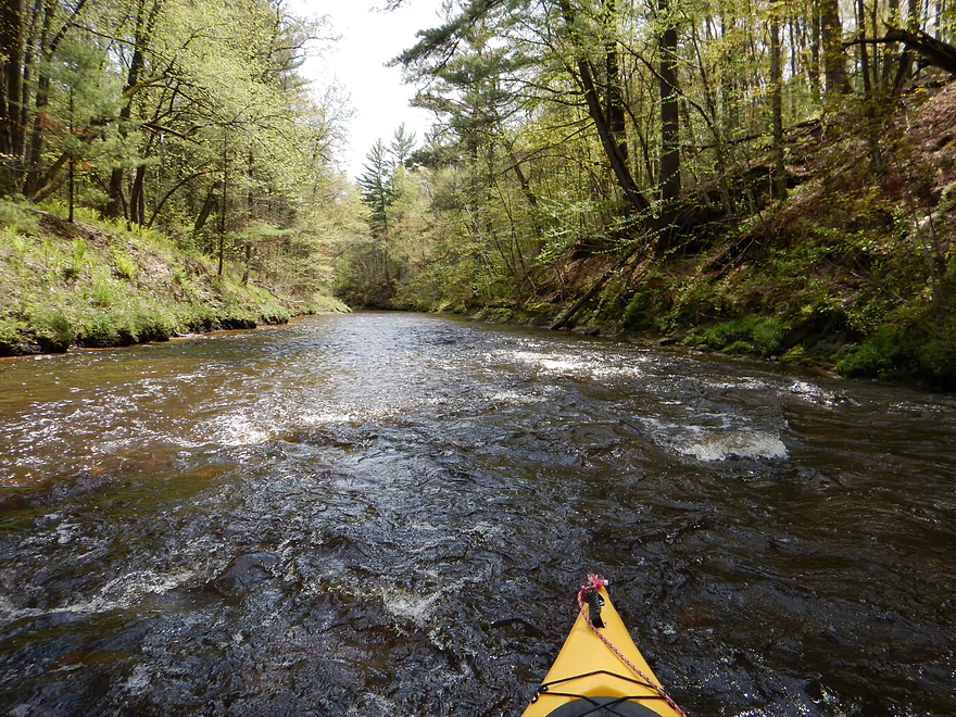
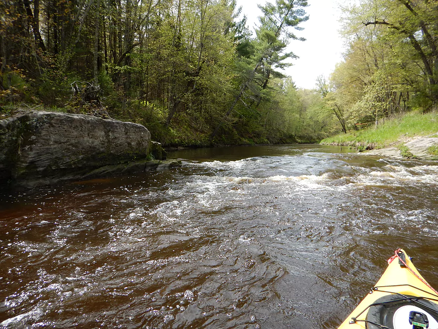
Most serious rapids on trip (maybe class 2)
Reverse view
This would be much more serious in higher water
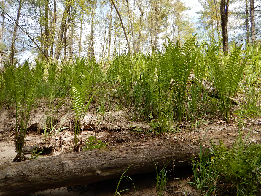
Number of fern “forests”
2nd most serious rapids
Not bad now…probably worse in high water
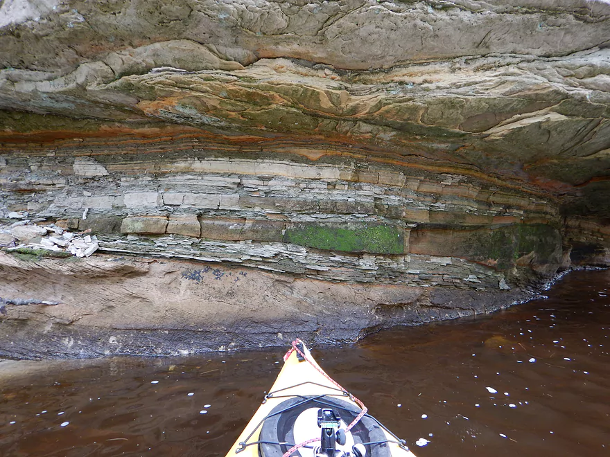
A look back into time
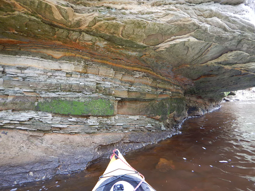
A geology professor would go nuts on this trip
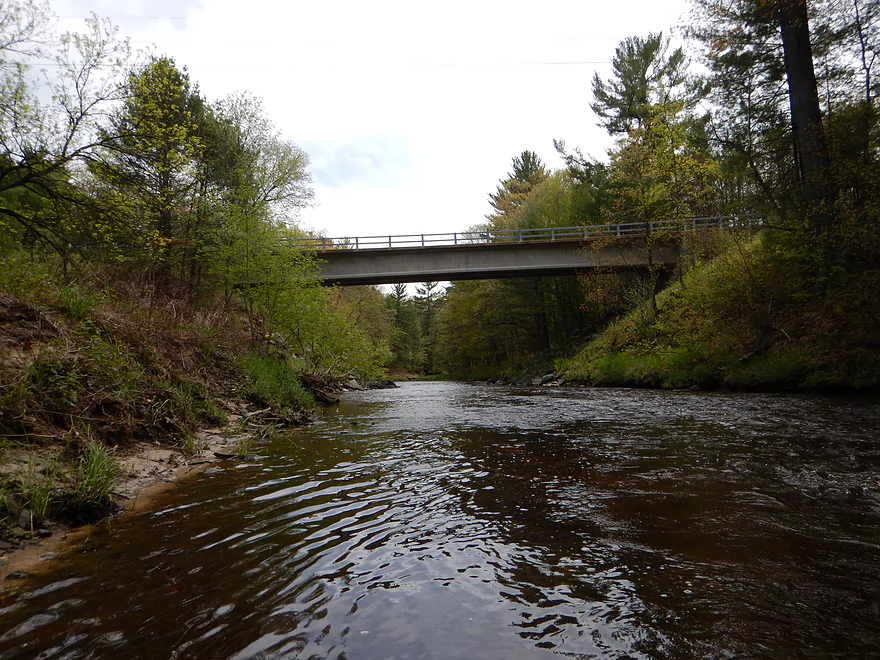
Garage Road bridge
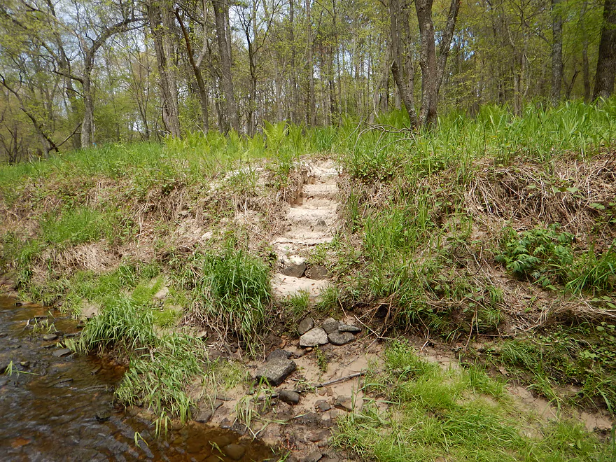
Unique sand steps for paddlers
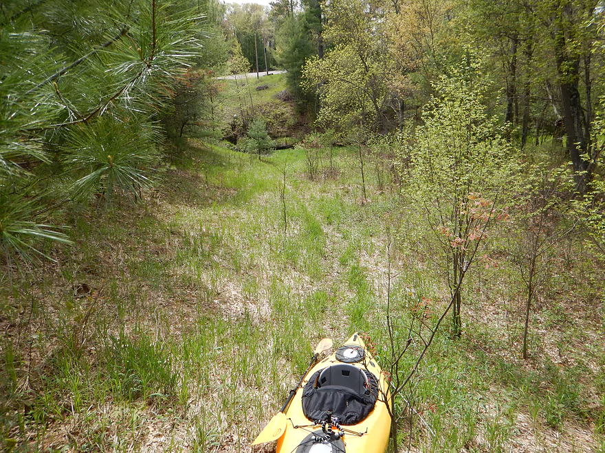
Good take-out area
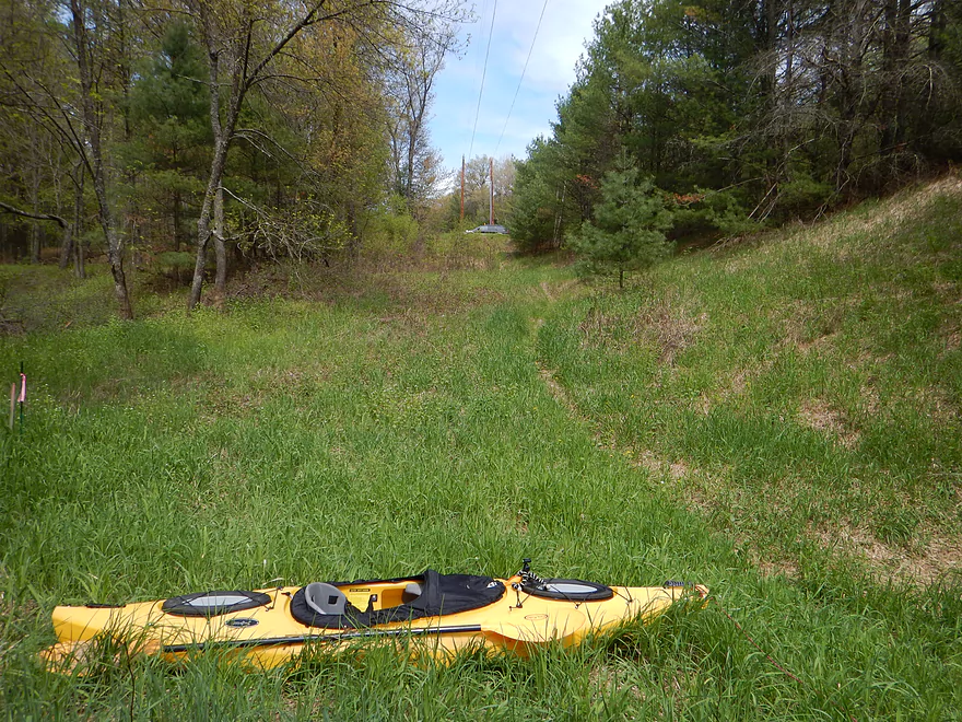
But a hike & drag to the car
Watch out for ticks!
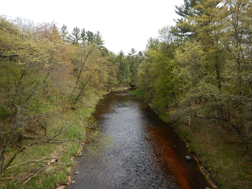
View from bridge
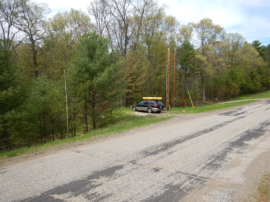
Nice parking
Halls Creek

One of Wisconsin’s crown jewel paddle trails. This is a terrific Black River tributary with frequent class 1 rapids, root beer colored water and terrific dells. So why haven’t you heard of it before? Because it is a “Goldilocks stream”–it has to have “just the right” water levels to run (which is unfortunately rare). In the spring, the creek is a raging whitewater trail that you absolutely shouldn’t do unless equipped and trained to run major whitewater rapids. Plus, it tends to be cold in the spring and ugly with no leaves on the trees. Summer on the other hand has the opposite problem…as the creek runs shallow, making it very difficult to run. So there is a sweet spot–late May to perhaps early June–when Halls Creek can be properly run by non-whitewater folks (like myself).
There is no gauge on Halls Creek, but there are five upper Black River gauges and one East Fork gauge. Halls is a tiny creek that drains quickly…so most of these gauges are not terrific representations. Even the nearby East Fork gauge has too much volume to be an accurate measure of depth. The best gauge is probably the one furthest to the north at Niellsville…but the Black River up there is still much bigger than Halls Creek. You can still use this gauge…but figure a rough correction for how recent the last rainfall was. The guys over at “American Whitewater” have a terrific report on the creek, with a depth guide based on the Niellsville gauge. They recommend 5’+ and I went at 5.3′, which was perfect IMO. However, I used a small 10.5′ kayak with a flat bottom and bumped my share of rocks, but I never had to get out because of low water. A v-bottom boat or heavier canoe may face a more difficult time. For the most part, there was easily enough water to paddle. What happens is that the creek alternates between slow, deep sections and riffles. If it is shallow, you’ll still be able to navigate the slow sections…you’ll just hit rocks on the rapids.
I do recommend reading the American Whitewater report…but with some caveats. These are whitewater boaters who have experience and special gear for whitewater kayaking. They strongly prefer high water to avoid bumping rocks and to create rapids to play in. Largely speaking, whitewater folks put an overemphasis on high water and an underemphasis on low water because they want that roller coaster effect. But, the danger of a creek/river is exponentially correlated with the water volume. This site instead caters toward recreational kayakers who might enjoy occasional riffles, but are not seeking extreme waterwater experiences that are dangerous for non-whitewater boaters. ‘American Whitewater’ recommend 5-10′, but IMO the best would be 4-6′–maybe even 3′ with a small, flat bottom boat and the willingness to wade a little. In their pictures, they show how high (and dangerous) Halls can be, although I experienced none of this, thanks to the low water (maybe just one class 2 rapids at the “worst”). The picture of the old dam they show I definitely did not see (perhaps it has since been removed). Neither did I face any of the other extreme pictures they showed. Granted, though, I only did the first half of the creek.
You won’t have too many put-in options for this trip. The upper section of Halls Creek is dammed to form Trow Lake. This is a tall dam for a creek and no doubt was placed over terrific rapids/dells and perhaps even a waterfall (a real tragedy that so many terrific waterways in this state are submerged by dams). Perhaps there are paddling options upstream of Trow Lake…I don’t know about them though. Trow Lake is a lake-front community and powerboat mecca that doesn’t seem yak friendly, but I did not explore it much. A terrific put-in is the public boat launch by the dam. Most people use the launch for their powerboats…but there is a small trail to the left that leads down a steep incline to a nice rocky ledge for launching below the dam. Again, this is a great launch–with parking, no visible fees, facilities, and a nice launch area. The only downside is the incline…maybe bring a rope.
The 3.8 mile bike shuttle for the trip (Black River liveries do not service this area) is pretty good. Not too hilly and with little traffic. The south section of old K is gravel…but is easy to avoid by biking a bit further and entering Trow Lake from the north (see map).
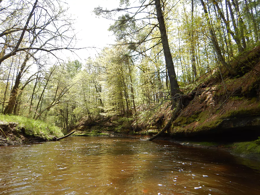
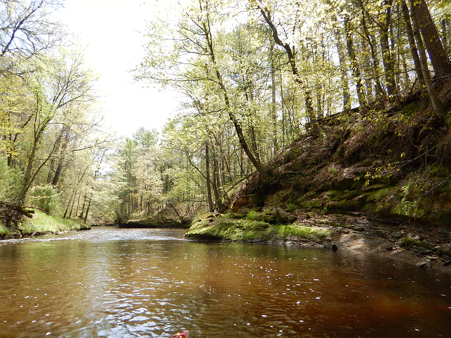
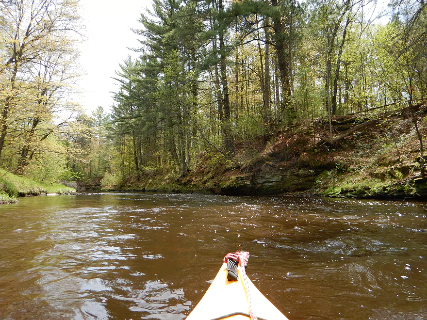
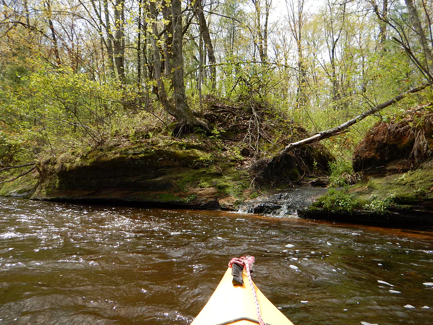
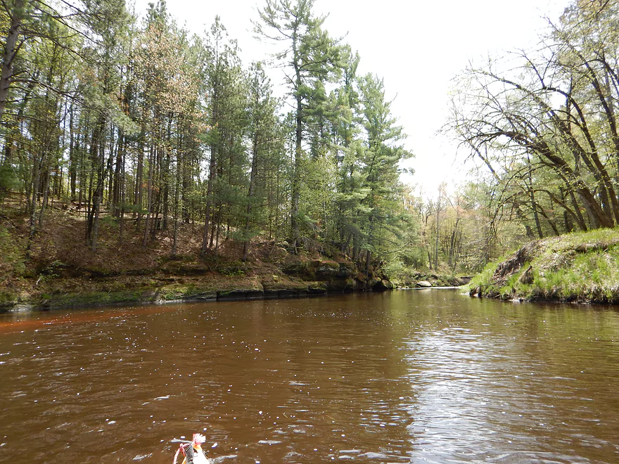
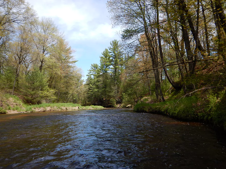
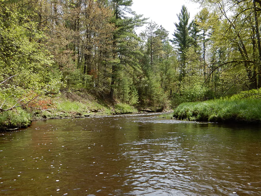
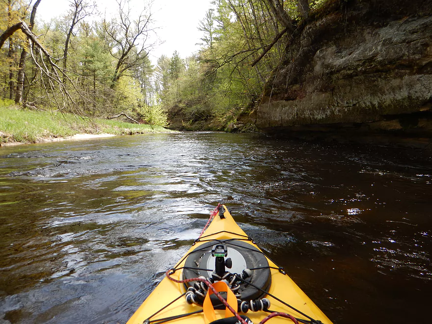
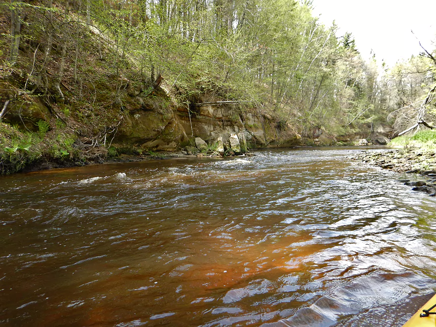
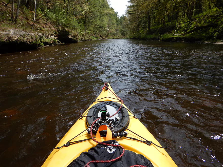
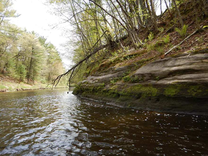
After putting in below the dam, you’ll get a taste of what is to come: beautiful root beer water, rock outcroppings, and class 1 rapids. Much of the creek is in a steep valley, which gives it a cool, sheltered feel…and a bit of a tunnel effect. The banks are clean and steep, with mossy rocks flanked by pines (some hardwoods on the creek as well). There was rock bumping (mostly at the riffles) but, again, depth was mostly not an issue. This is a fast creek with frequent class 1 rapids…but they really felt safe and not too pushy. There is one class 2 (supposedly) and that was easy to run at this water level…although, if you are not experienced running rapids, do not take these class 1’s for granted. In a longer boat, it could be tougher to maneuver around the rocks and to keep from being pushed into the rock walls by the fast current. The “rock walls” were the highlight of the trip. There weren’t just a few rock outcroppings…but a lot, and they were terrific. Most weren’t super large (although there were a few big ones), but they made for a striking ensemble with the red water, deep creek valley and cool plant life. This truly rivals the Kickapoo or Wisconsin Dells. The other superb feature of this must-paddle creek are the seeps and micro-waterfalls that come out of the banks. In a sense, the rocks “weep”…and mosses flock to these “tears” making a striking scene.
Log jams and even squeakers, for the most part, aren’t a problem on this creek. There was only one jam, and it was easy to portage over in knee high water (see pictures and map).
Wildlife wasn’t top-notch on this trip–some fish splashing around, some clams and a deer, but not much else. Other people warned about mosquitoes and ticks in the area…but I didn’t have a problem with them (don’t worry…you’ll get to hear about mosquitoes and ticks next week!).
I didn’t want to rush what I knew would be a nice trip, so took out early at the Garage Road bridge for a 4-mile trip. This is a good take-out (for a bridge). Take-out on the left bank upstream of the bridge (northeast side). The only downside to this access is that it is a bit of a hike to the car over steep grassy terrain (not bad if you have a rope and are patient). There is a nice pull-off for the car, but being a bridge access area, there are, of course, no facilities. The road is lightly trafficked, which is good if you want to hide kayaks/bikes, but I preferred locking my stuff at the Trow Lake dam.
Most individuals will prefer to not take out here but continue the remaining ~6-7 miles to the mouth of Halls Creek on the Black River. I haven’t paddled this second half, so cannot speak authoritatively on it. There may be a steep ledge pictured from the Whitewater page…I can’t say for certain. You could, I suppose, take out at the E bridge, but this looks steep with restrictive guard rails. Best would be to paddle a bit further and take out at the official Halls creek landing at the mouth–a terrific (and popular) canoe launch that has been freshly paved (good for bike shuttles). This is a great access area for both Halls Creek and the Black River (no facilities though). When I scouted this landing, the Black was high and was backfilling Halls, so it was difficult to gauge how much water the creek truly has at its end. When I scouted this same landing last year, the water (at the Halls mouth) was too shallow to run (although this may be because of the delta effect, which usually flattens waterways at their mouths).
A warning if you bike shuttle the second half: Flood Road (the most direct route) is gravel (and therefore evil for bikes). I suggest a slight detour by going west to Hwy 12 and then east on West Road (I’m 90% sure West Road is not gravel…don’t quote me on that though).
A quick word on the general Black River area itself for paddling. Below the dam at Black River Falls to the mouth of the Mississippi is very popular with paddlers–good sandbars, little in riffles, some rock outcroppings, and cool areas…but generally much tamer/simpler than the upper sections and the creeks, which can run dry in the summer. The flowage from Halls creek to the Dam is very cool and I recommend this as a trip. The section on the Black River from Halls Creek upstream to Lake Arbutus is the famous whitewater section…too serious for us rec-kayakers. The Black upstream of Arbutus is a good paddling prospect that can be rough in high water, but is tamer than the lower section. This section, however, runs “dry” in the summer and is another “goldilocks” water trail. The creek tributaries to the Black are top-notch. You just read about Halls, but Robinson (which I hope to do in the future) might be as good (less bluffs, but cleaner and better plantlife). Morrison Creek is bigger than Halls and Robinson and quite a bit rougher–not as many rock outcroppings, but a very scenic creek. The east fork of the Black River is a terrific paddling prospect (probably a bit high now for my taste), with fun rapids and clean banks in a wilderness section protected by state forest. This runs dry in the summer. All these super tributaries (except maybe Robinson) are Goldilocks water trails. I suspect there may be more gems beyond the aforementioned. Dickey Creek, Perry Creek, Roaring Creek, and Coon Fork Creek, in particular, have me intrigued (they tend to have dangerous drops to them though).
- Sand Road to Giles Memorial Park: 1.4 miles. This might be scenic, but there could be logjams.
- Giles Memorial Park to Trow Lake Dam: 1.4 miles. Launching below the first dam should be doable, but might be a bit tricky. This stretch might have a neat canyon, but is mostly flowage paddling and there is likely a logjam to deal with.
- Trow Lake Dam to Garage Road: 4 miles. Shallow but a great stretch with some nice outcrops.
- Garage Road to Mouth on Black River: 7.6 miles. Best stretch on Halls Creek, and one of the TOP water trails in the ENTIRE state of Wisconsin.
Trip Map
Overview Map
Video
Photos Size: