
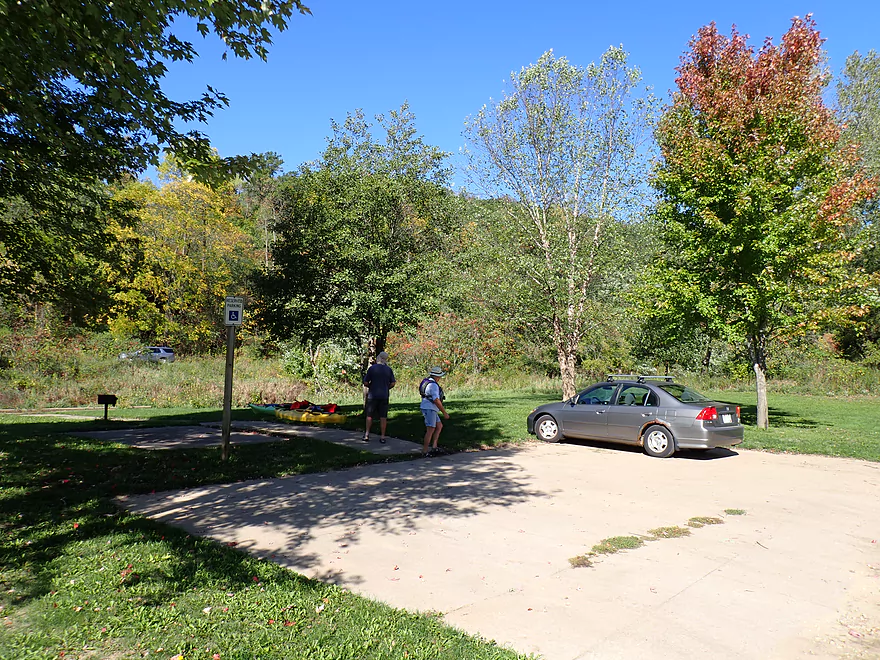
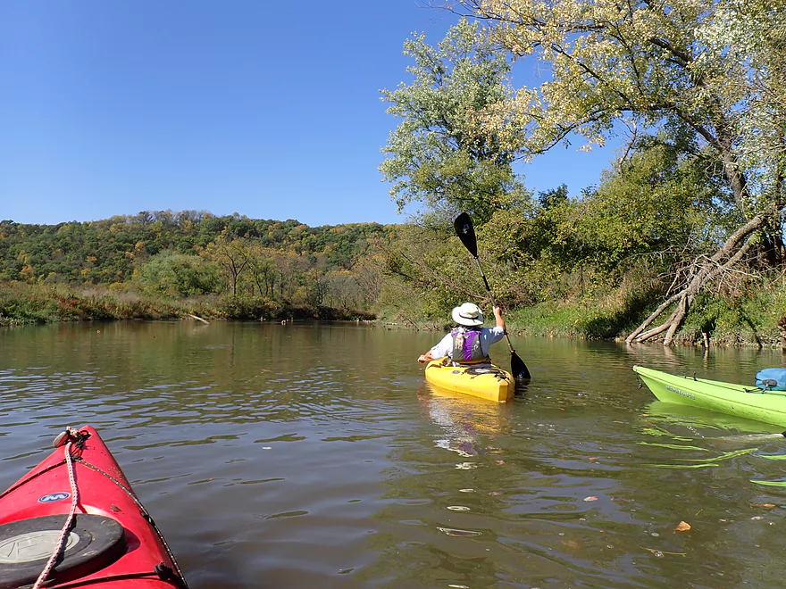
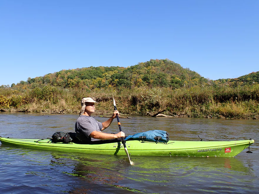
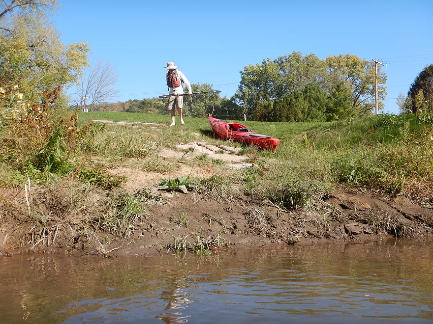
Starting the trip at Tourist Park in Readstown
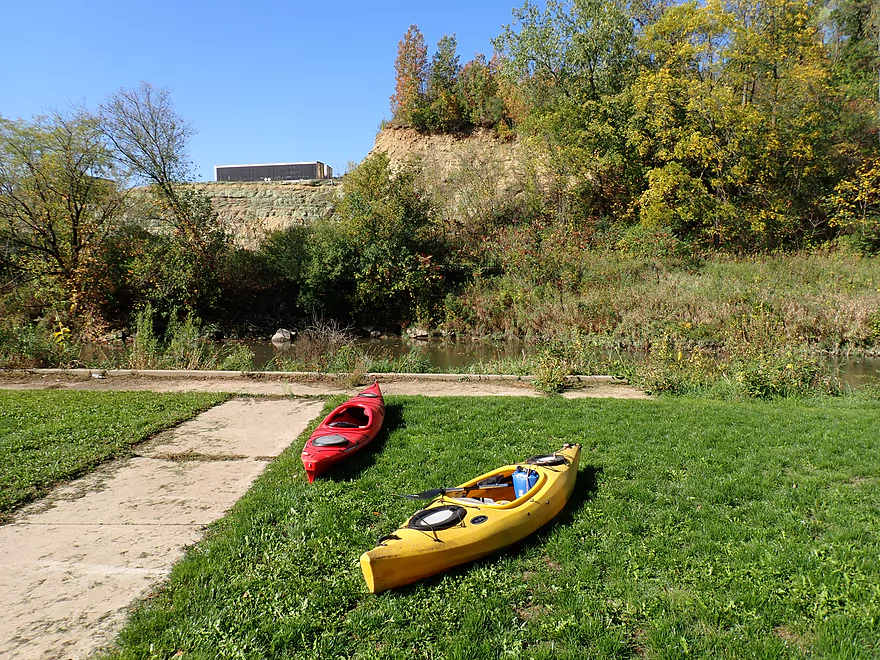
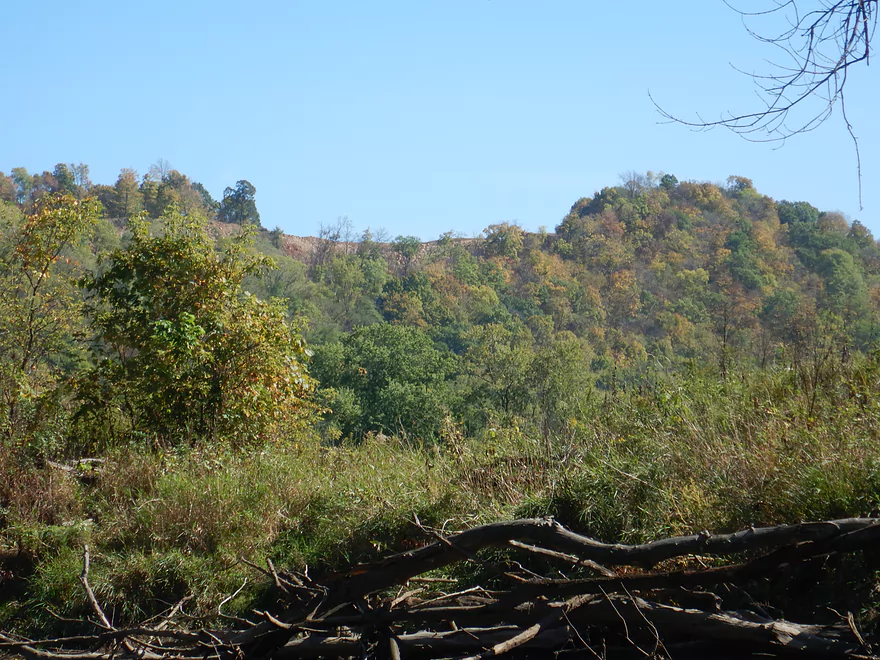
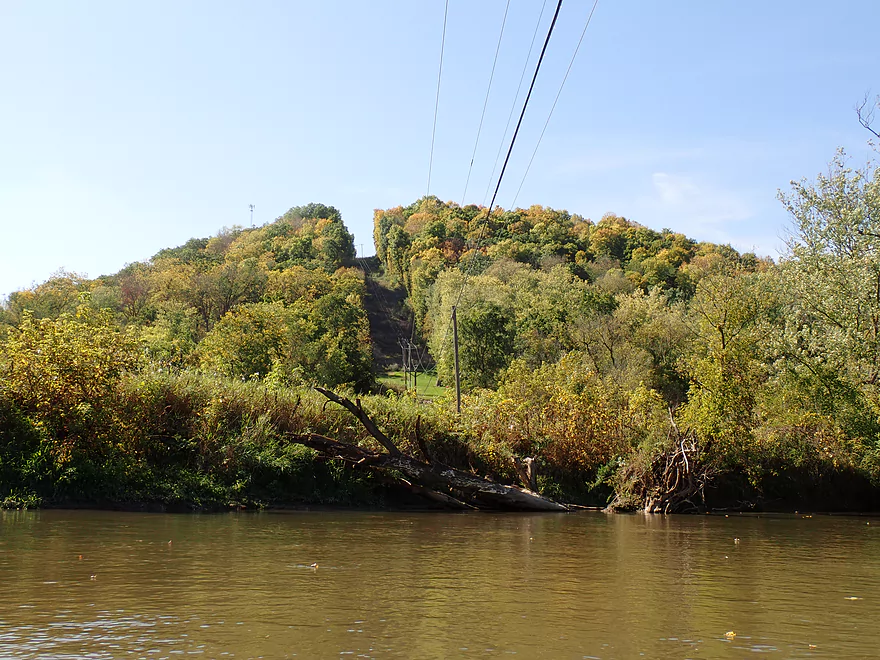
Backdropped by a large quarry
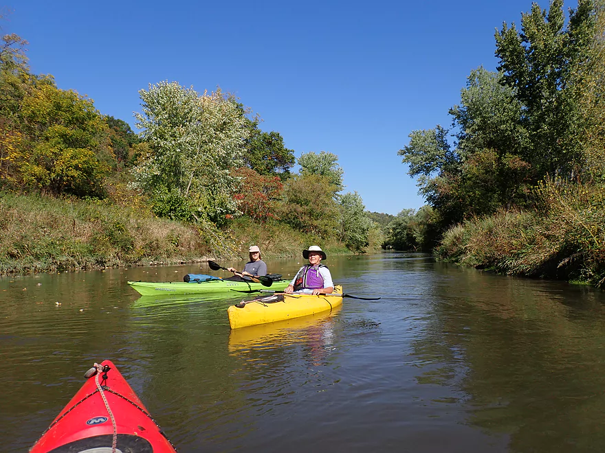
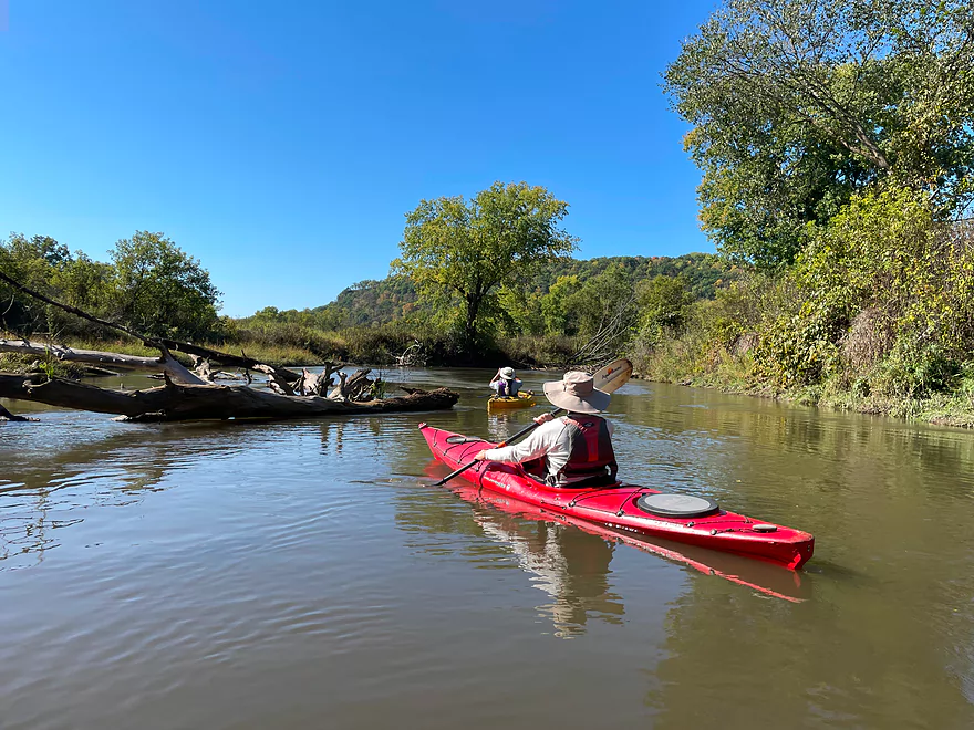
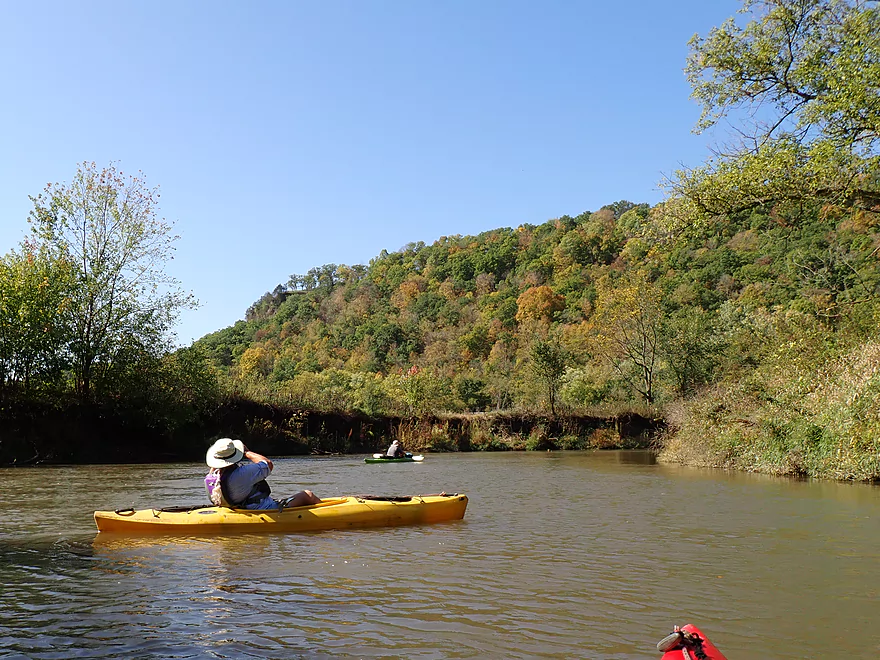
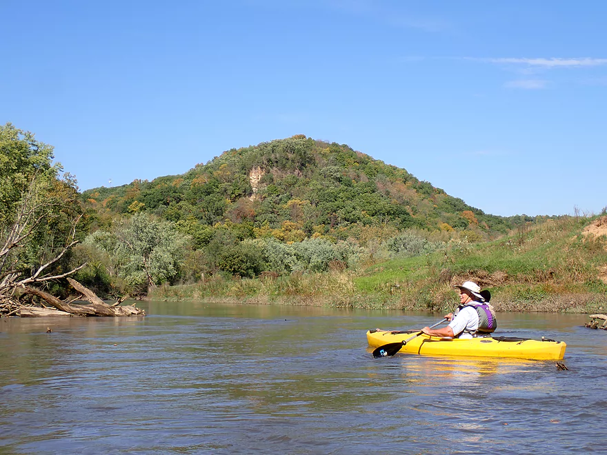
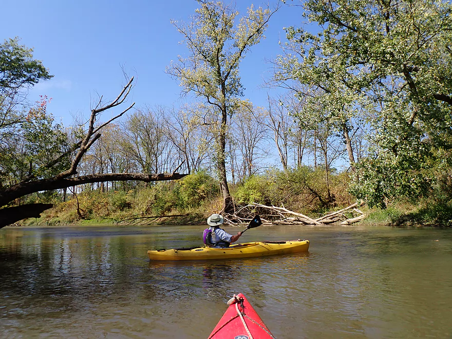
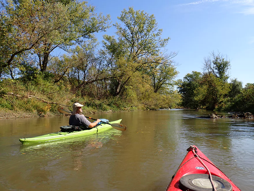
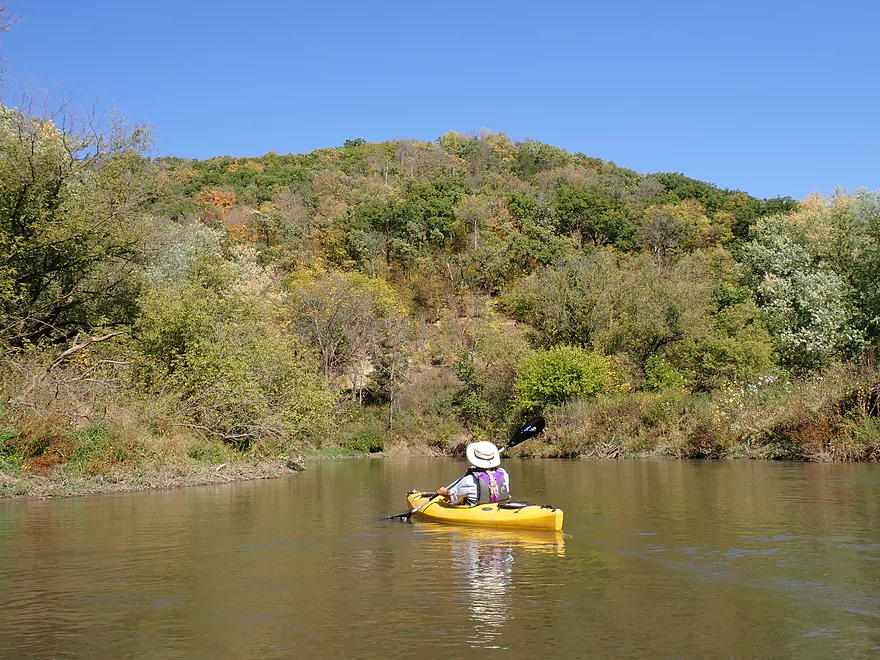
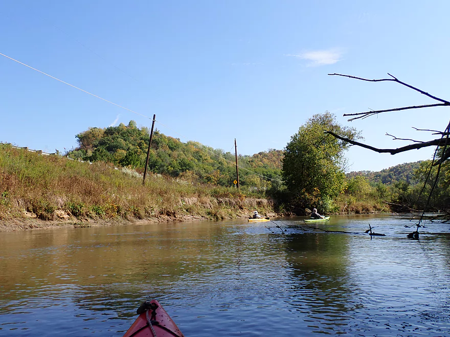
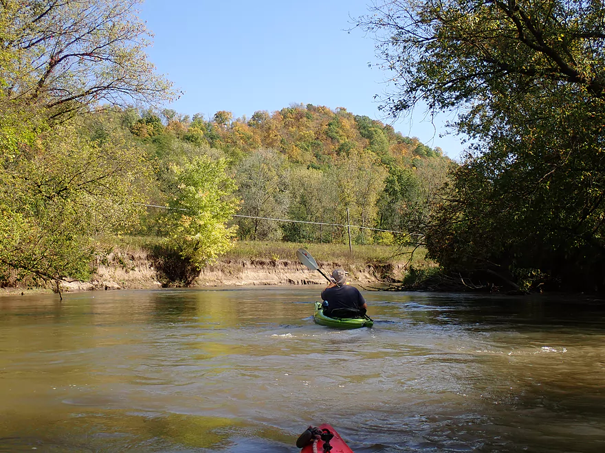
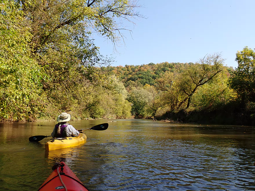
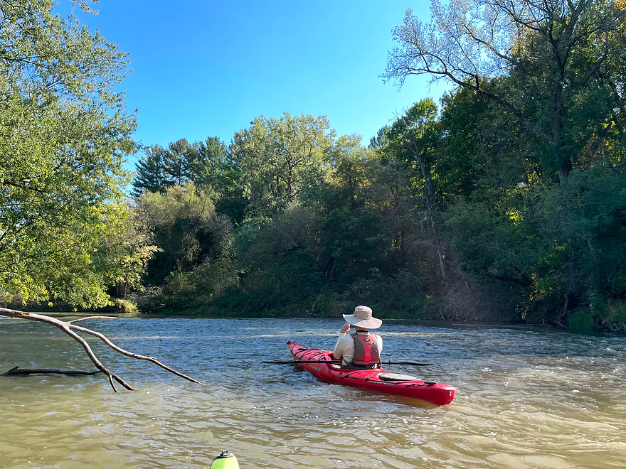
Nice stretch of the river by Readstown
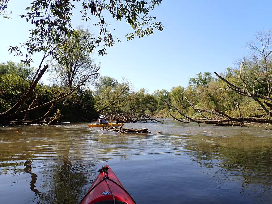
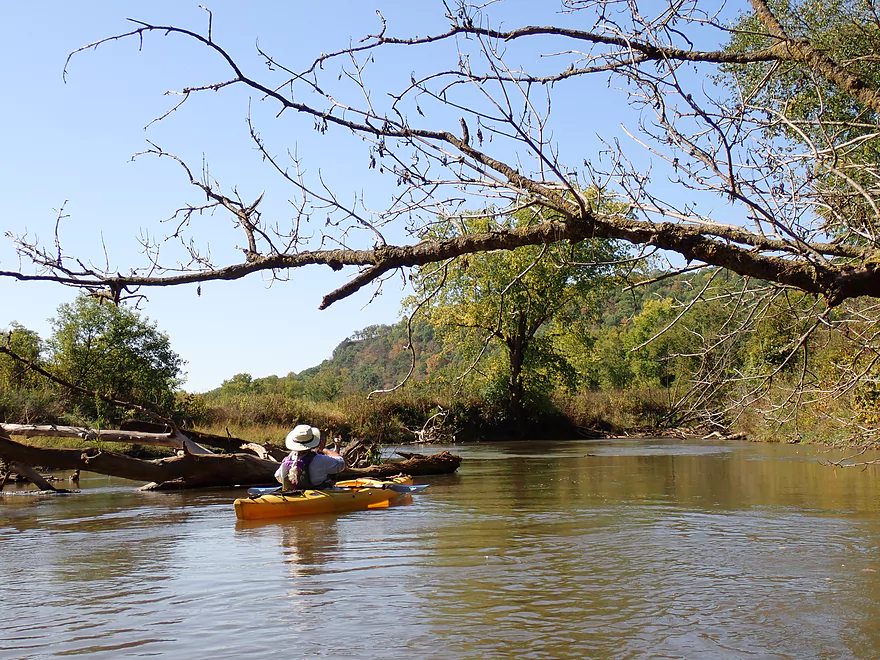
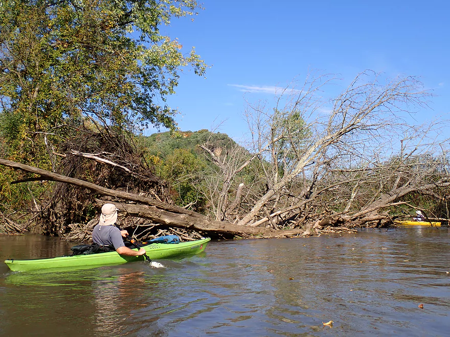
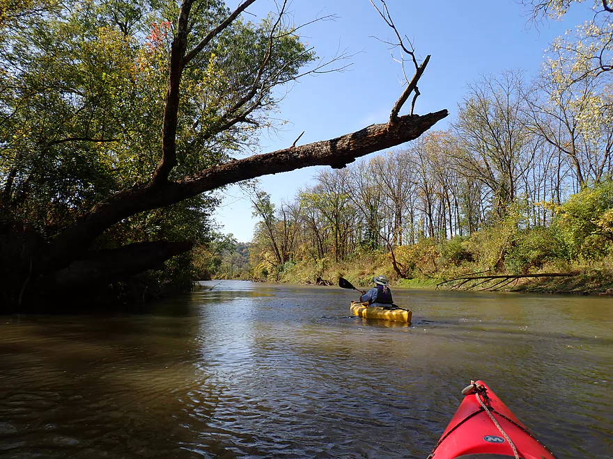
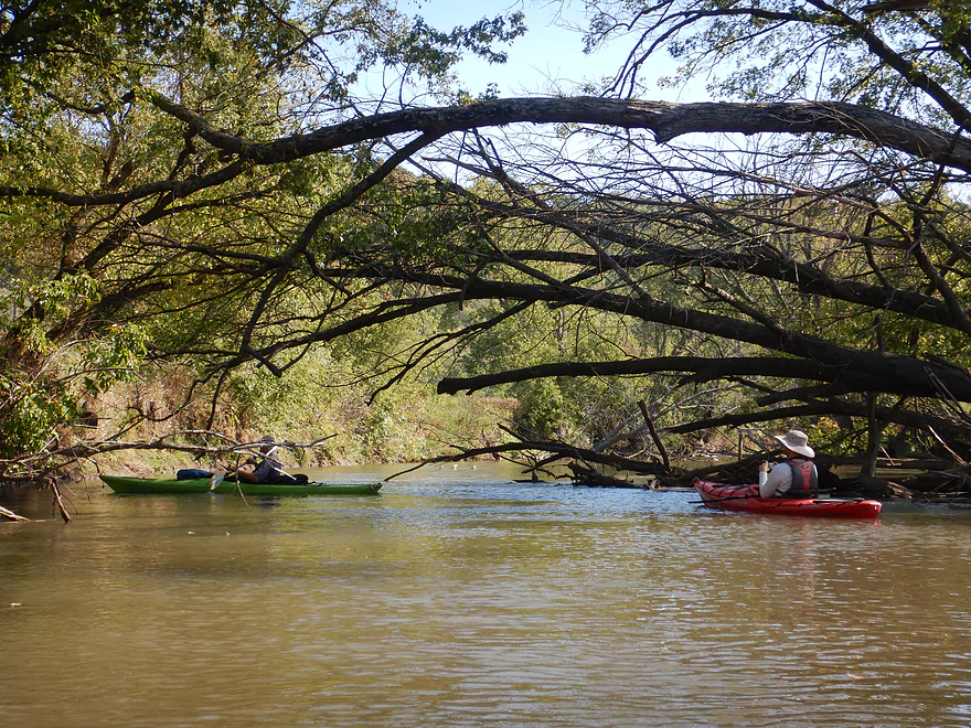
Lot of deadfall in fast current
Reads Creek (river right) is a noteworthy tributary
More deadfall…but always easy to dodge
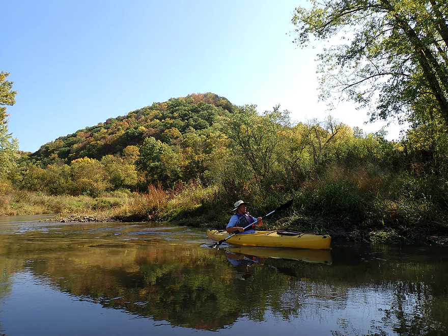
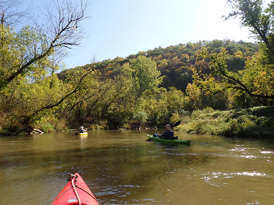
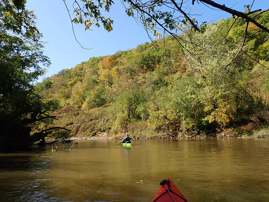
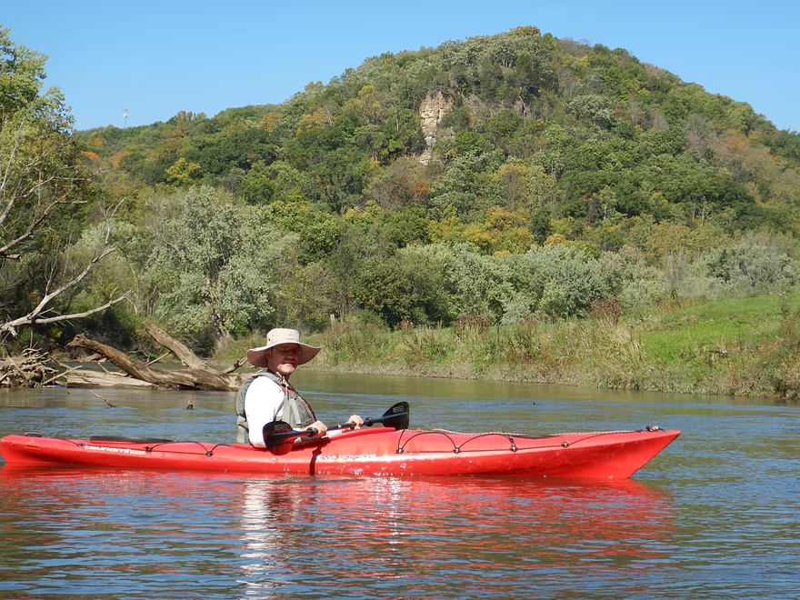
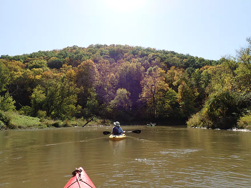
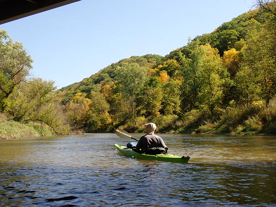
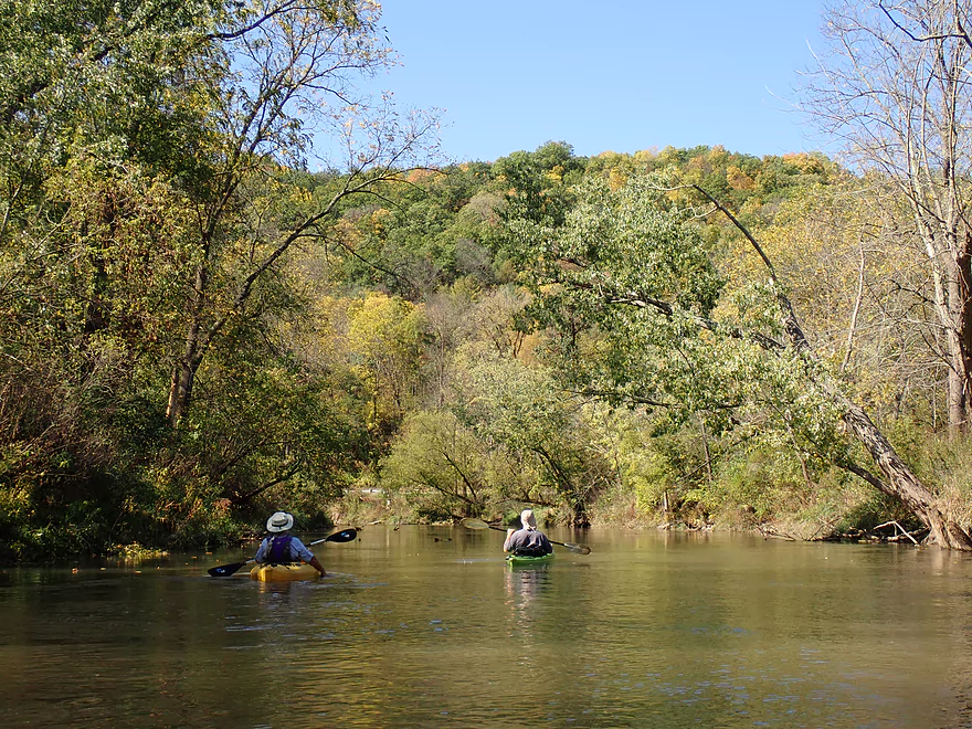
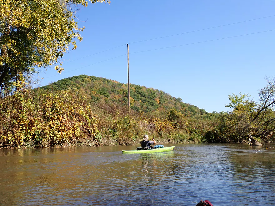
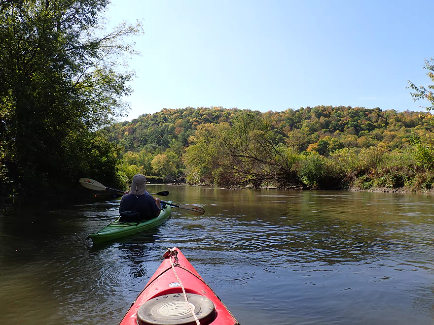
Steep bluffs
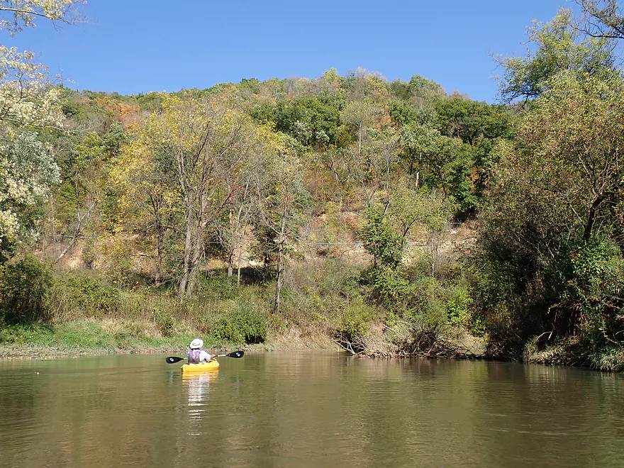
More great bluffs
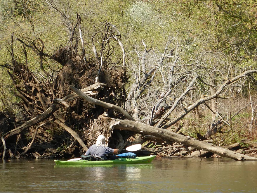
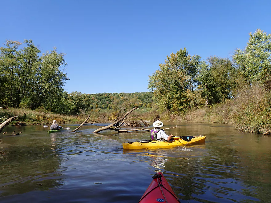
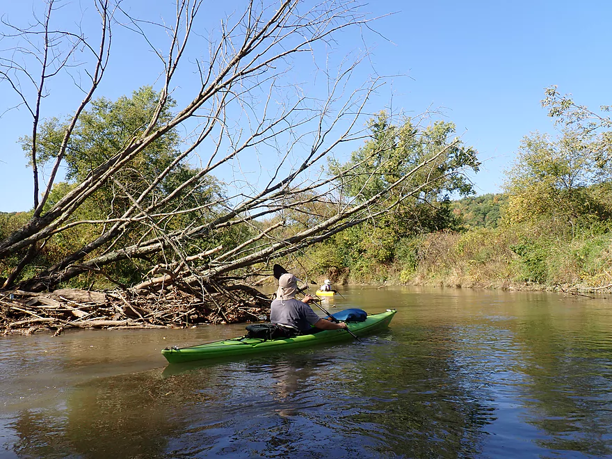
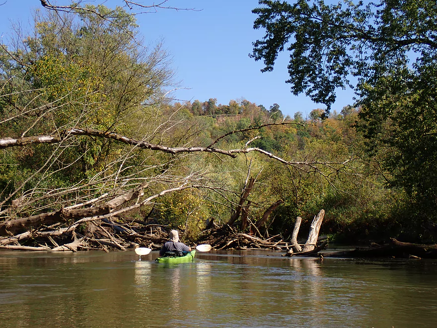
A massive pile of roots and trunks

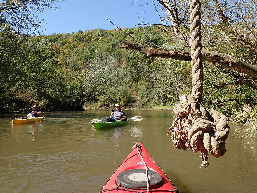
Rope in the middle of nowhere!
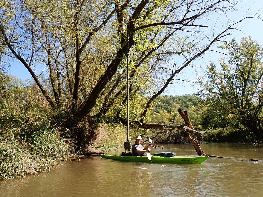
Would be a fun river swing if everything wasn’t so muddy
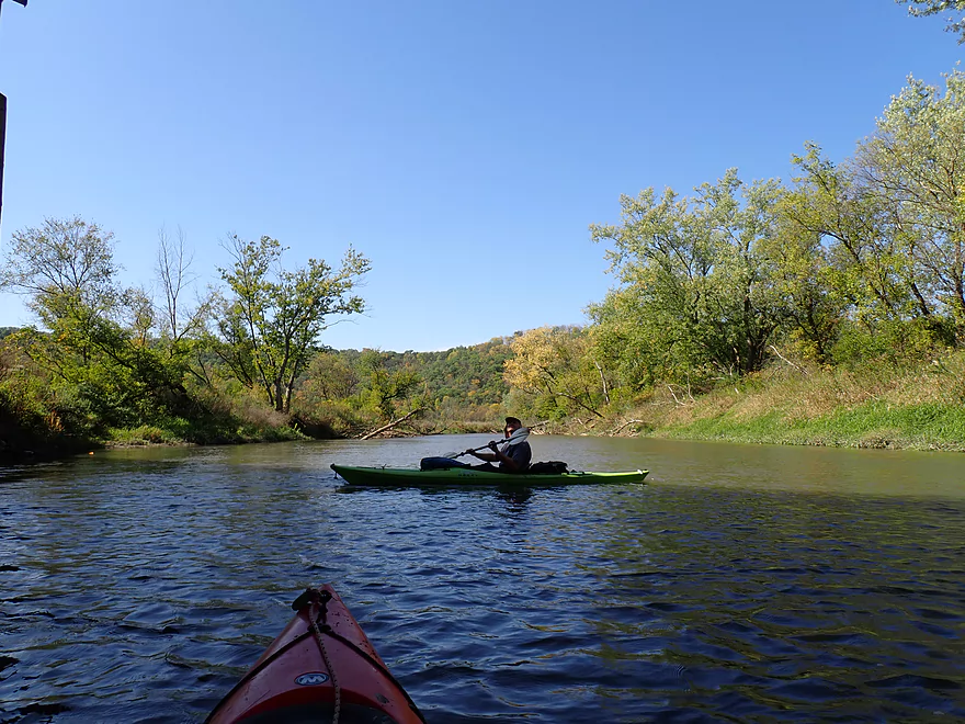
Early fall color
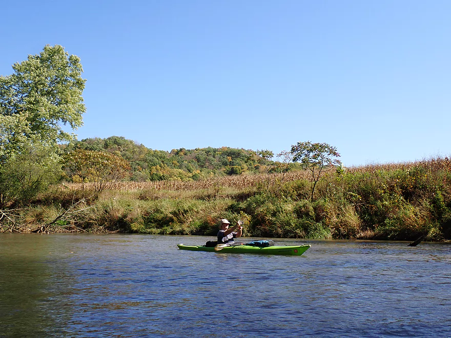
Cornfields close to the river
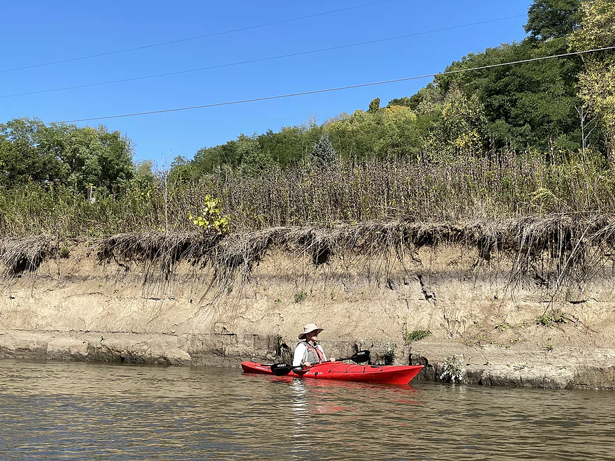
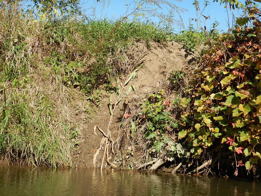
Decades of erosion have buried the river valley in mud
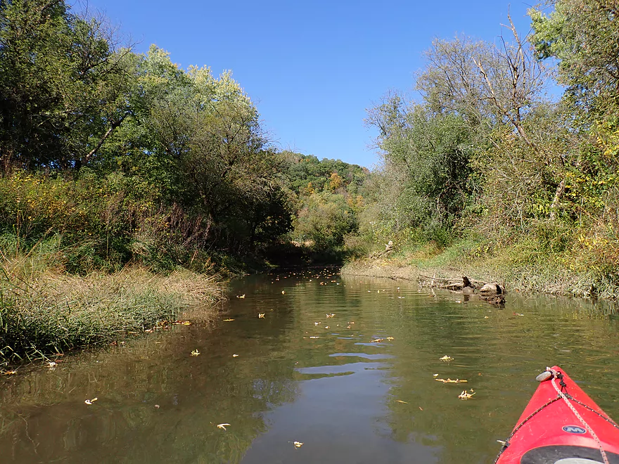
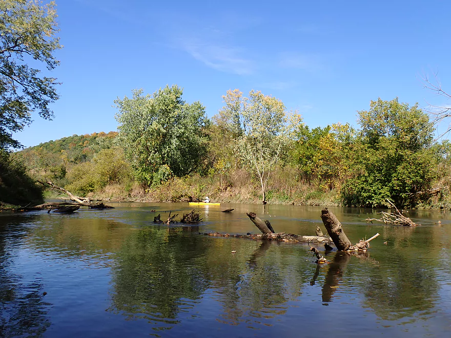
A scenic bend in the river…
With an exposed outcrop
No problem…easy passage on the right
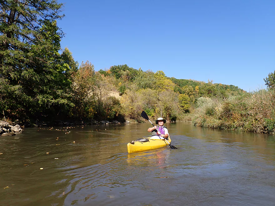
Paddling into a sunflare
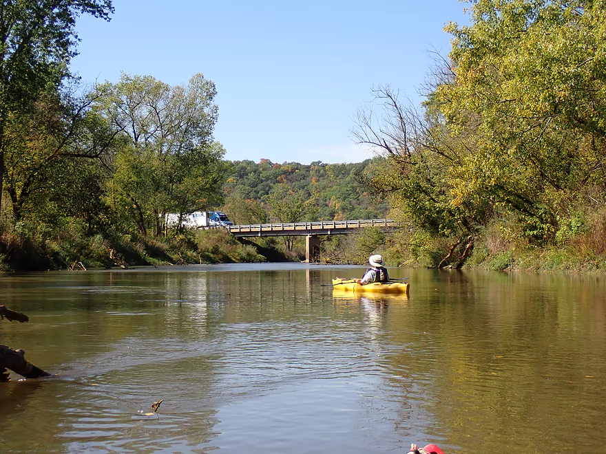
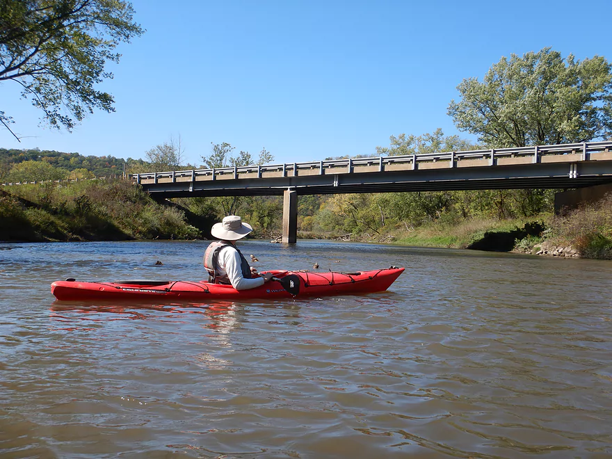
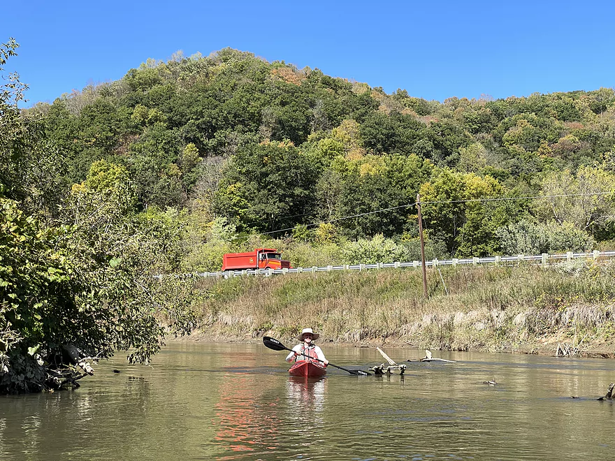
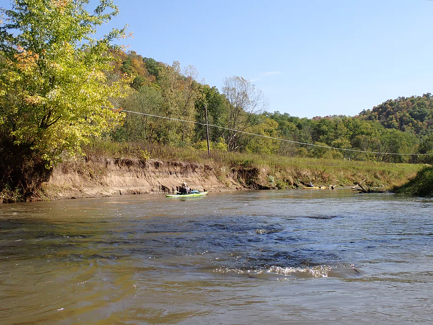
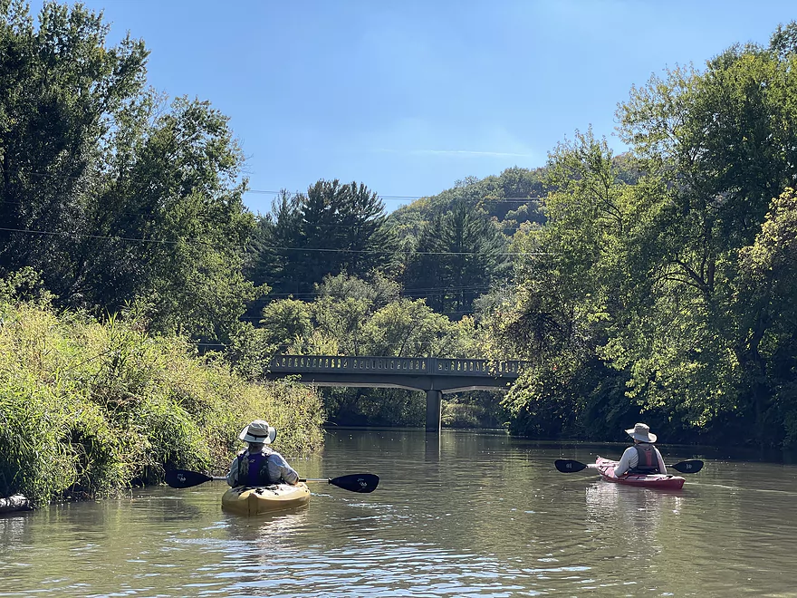
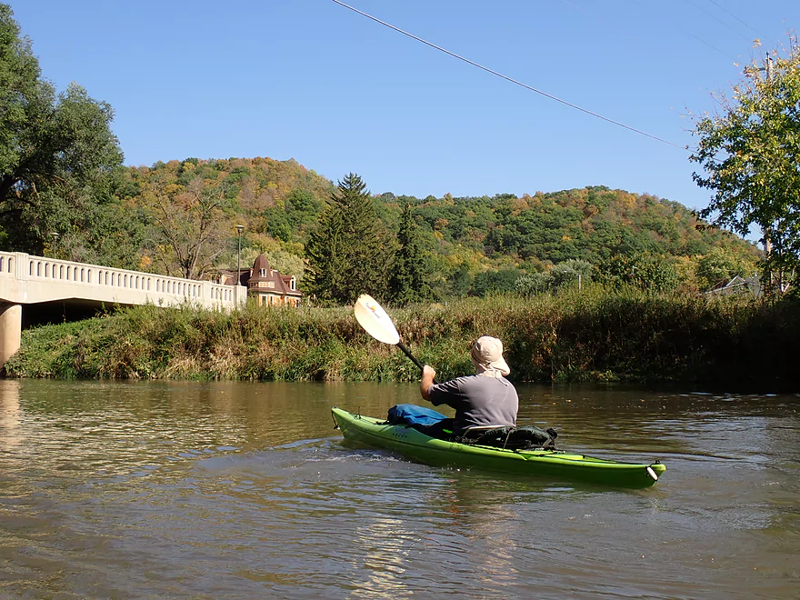
Busy Hwy 61 switches from the west to east side of the river
A possible bridge access, but not great
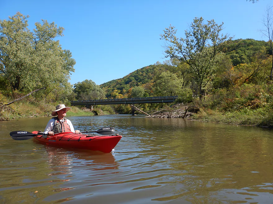
Great bluffs by the bridge
Doing a depth test–the river was frequently over the paddle
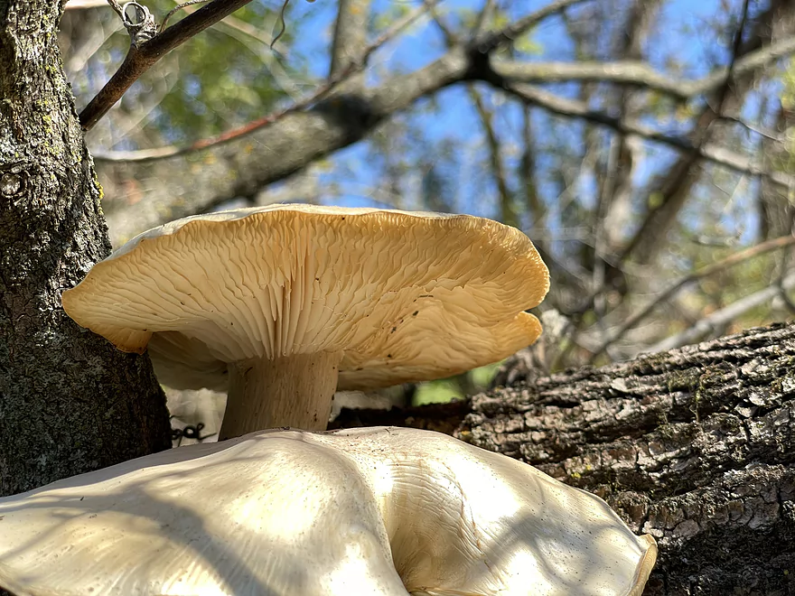
Photogenic mushrooms
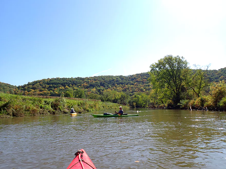
Not as many bluffs in the second half of the trip…and they were farther away
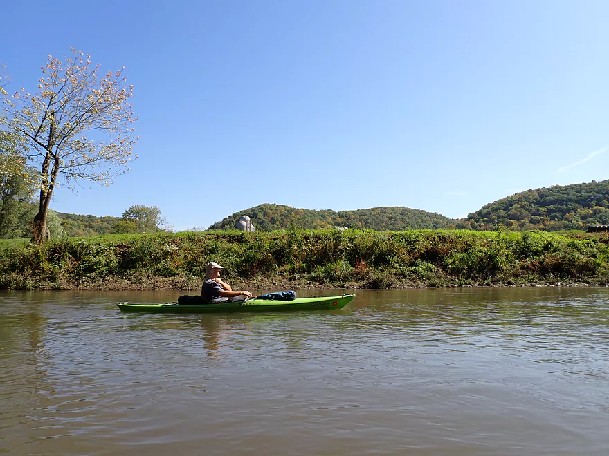
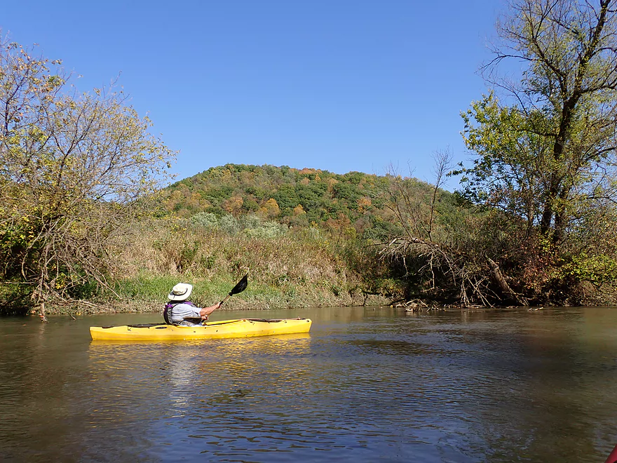
A pointy hill
This ridge is being destroyed by a quarry
Paddling up to busy Hwy 61
A very noisy road
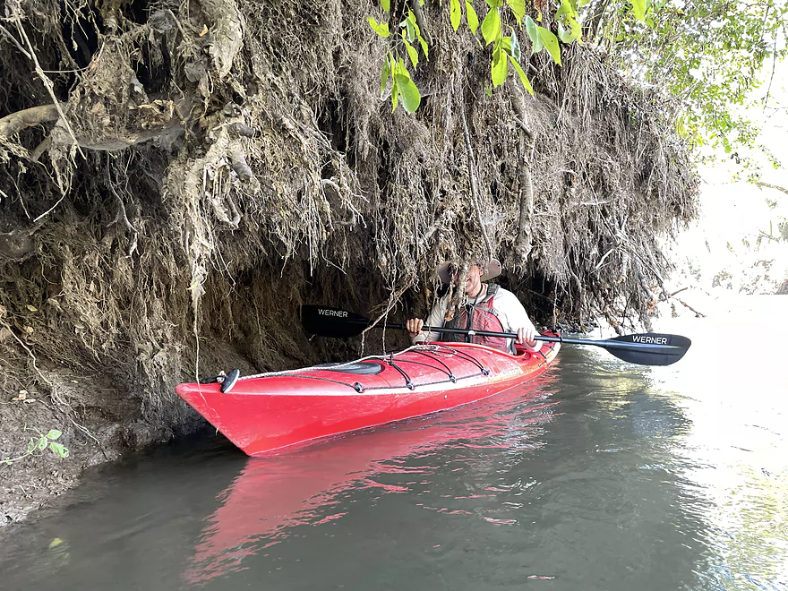
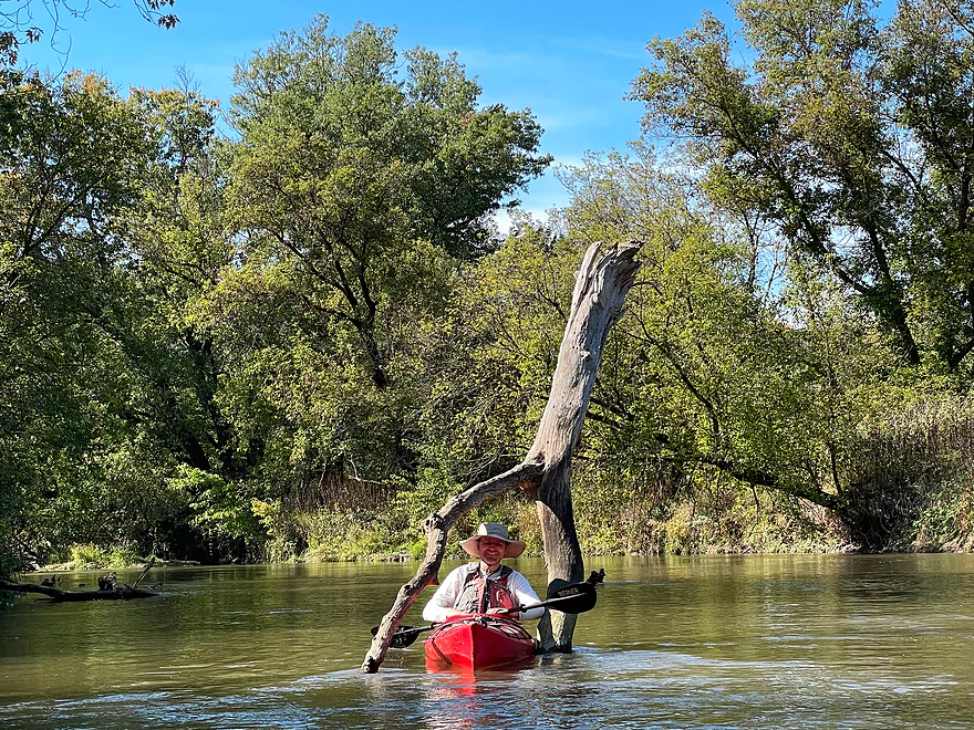
A cave made of roots
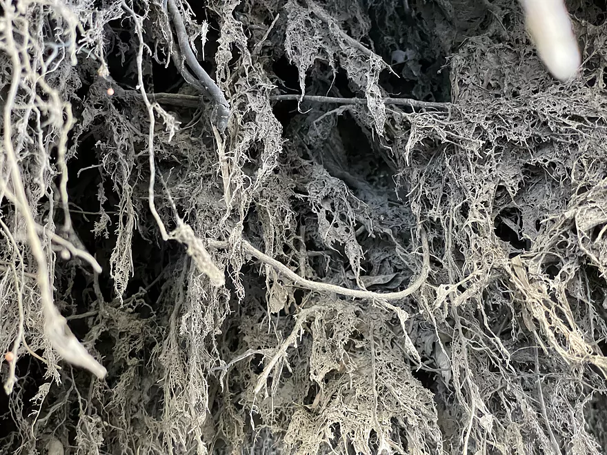
Neat character
Logjam rapids (pretty easy)
Getting forked by the Kickapoo
Exposed banks
150 years ago the river was clean and had a gravel bottom
Some great logjam cleanup work has been done
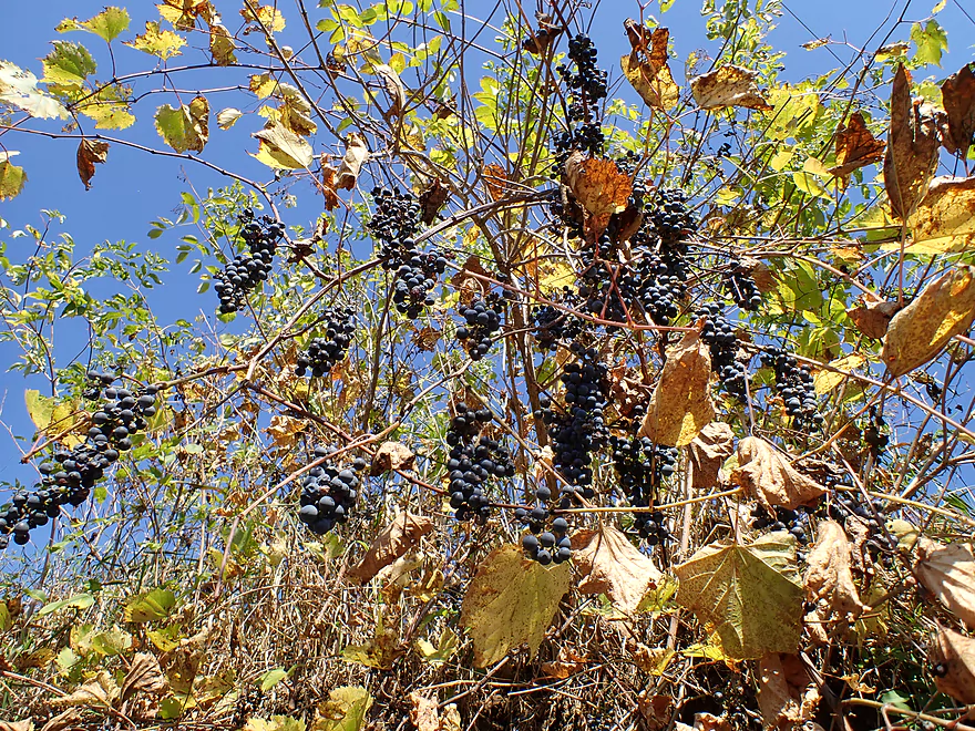
Wild grapes
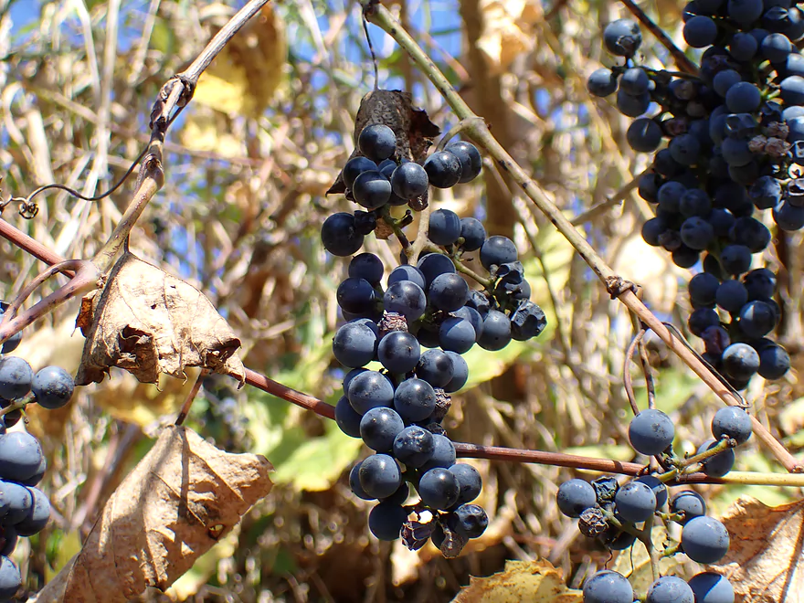
Surprisingly tasty
Massive corridor cut into the woods to let the power line through
Beaver slides
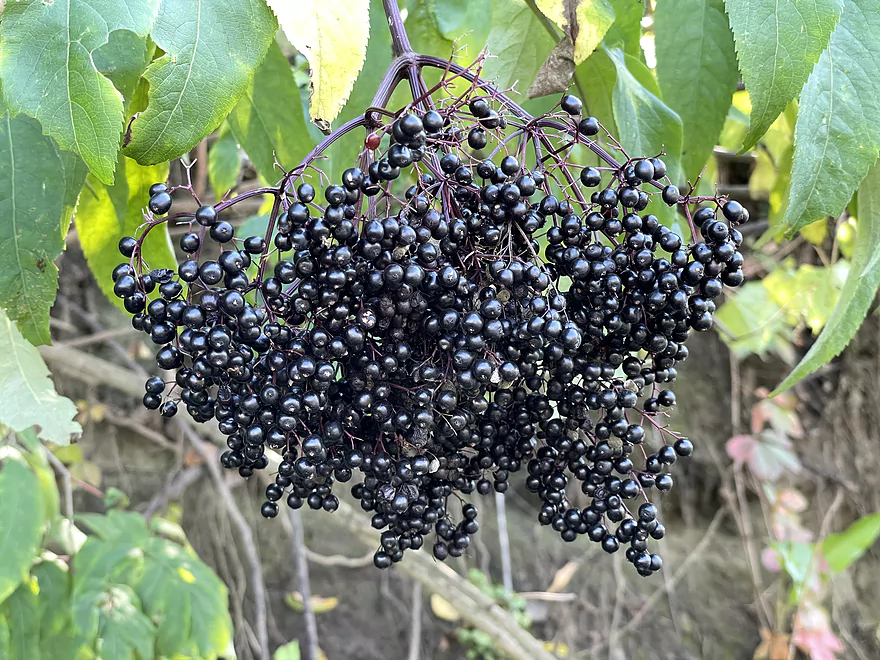
Ripe elderberries
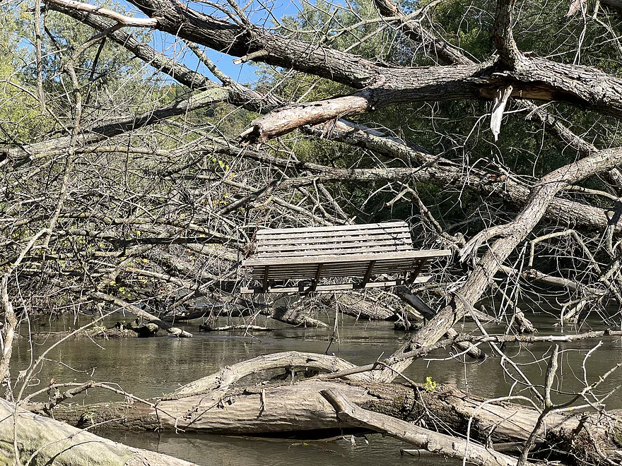
Bench on the logjam
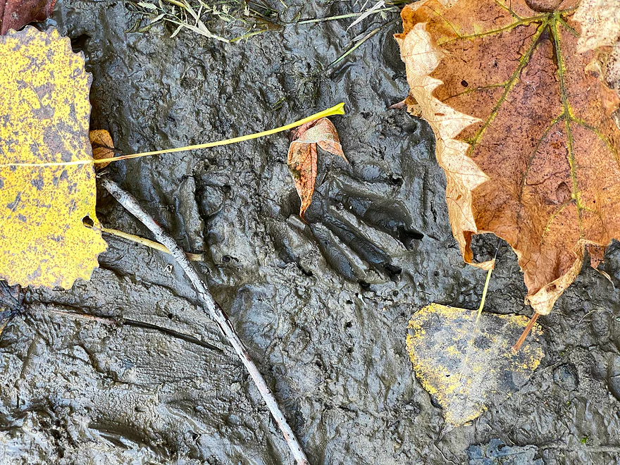
Coon tracks, mud, and fall leaves
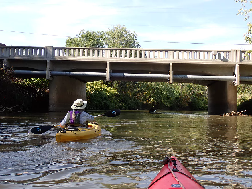
Coming up on Pine St.
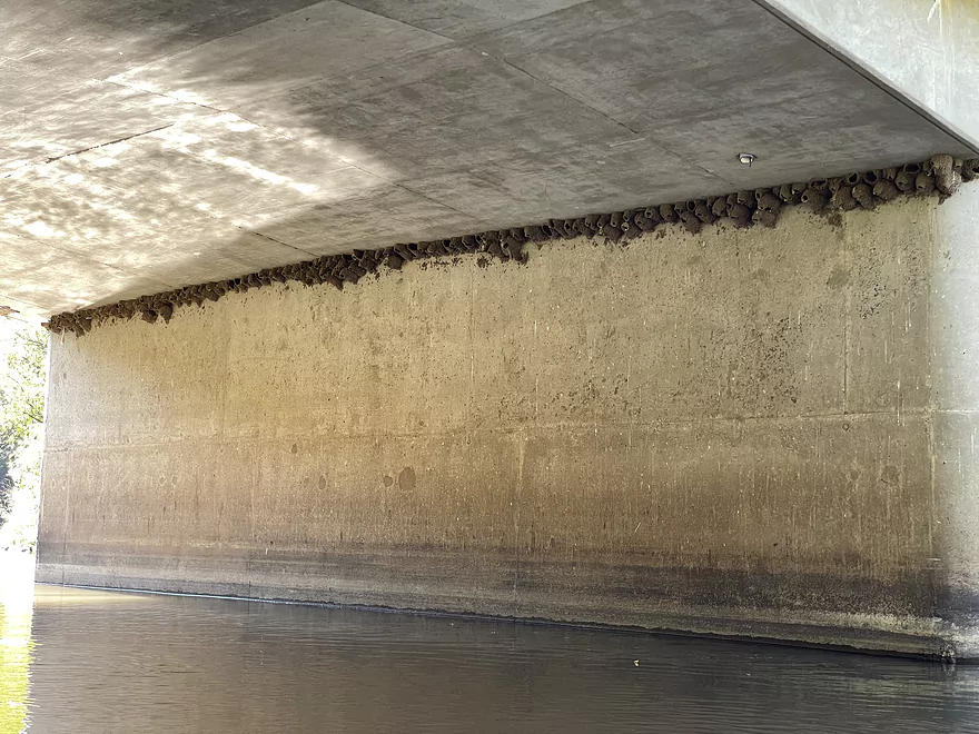
Lots of cliff swallow nests, but no swallows–they head south in August
Last great bluff of the trip
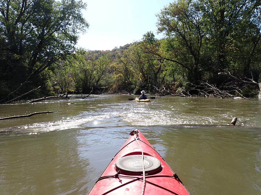
Some surprise rapids
Church Street
Taking out at the Soldiers Grove Canoe Access (just past Church St.)–pretty muddy
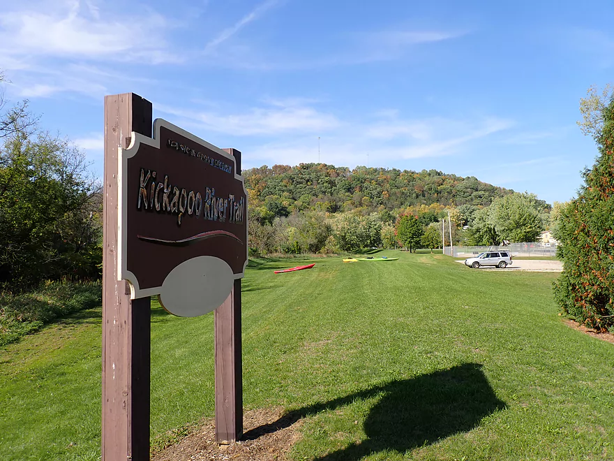
A sign, a levee, and Beauford T. Anderson Park–a huge park where the Soldiers Grove downtown used to be
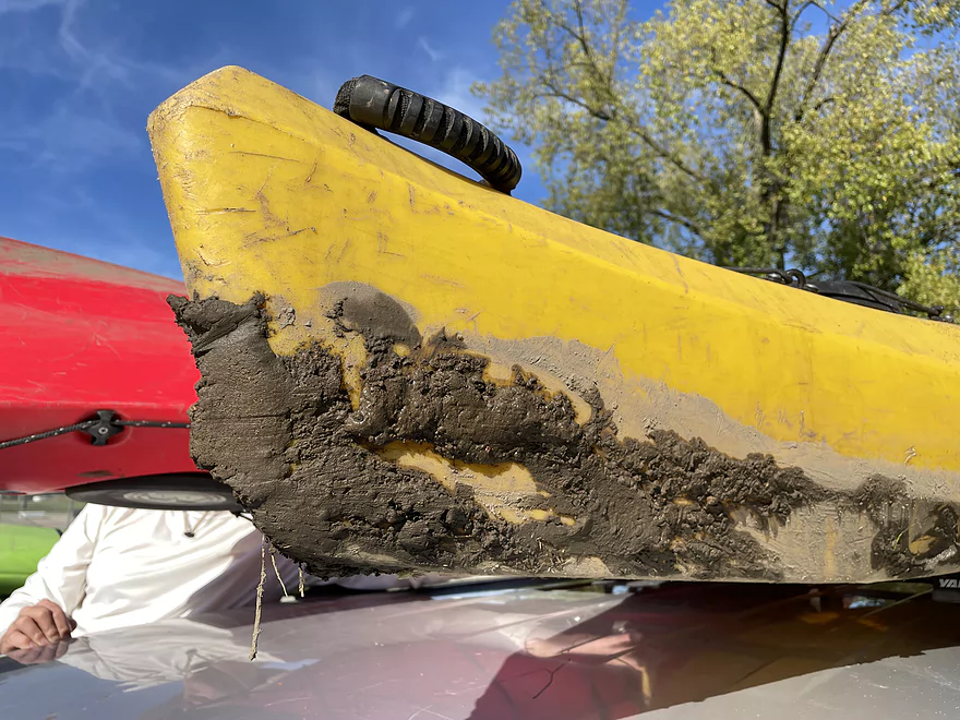
Did I mention the take-out was muddy?
Kickapoo River – Readstown

The Kickapoo River can be divided into two distinct regions. The Upper Kickapoo (upstream of Readstown and the West Fork confluence) is more popular and features many fantastic outcrops. The Lower Kickapoo lacks these sandstone cliffs and fewer people paddle it. It’s also much larger, eroded, and has been damaged by years of heavy floods. While there are no elite stretches on the Lower Kickapoo, there are decent legs. This trip explores one of those legs.
The trip started at Readstown where there is an established public access. It wasn’t ideal with some mud, but was quite doable. Opposite the landing was the partly degraded rock face from an open quarry. It wouldn’t be the last quarry we saw on this trip.
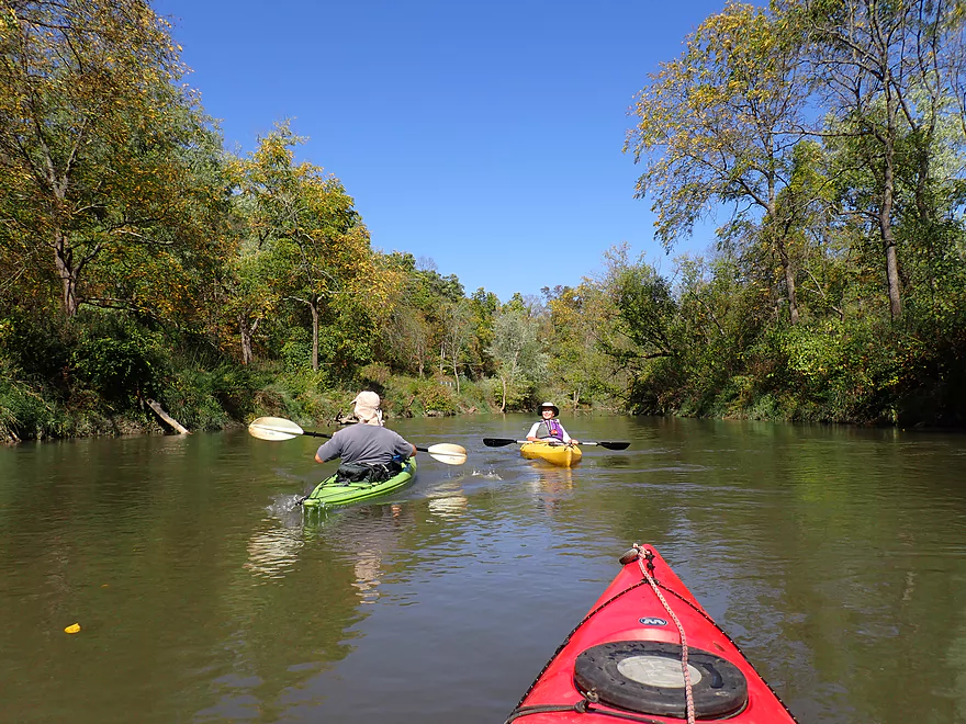
What was surprising was how fast the current was, especially in the first two miles of the trip. There was also a lot of deadfall. None of it completely blocked the river, but with the fast deep current, you need to be careful not get turned sideways and pinned against any of the logs.
The debris was a bit disappointing as was the dirty, turbid water. But what saved the trip were the fantastic and steep Driftless Area hills along the river which were incredibly scenic. A few even had exposed rock faces near their top, and most had some early fall color (but not a lot).
The Hwy 61 bridge was roughly at the 3 mile mark and was kind of the halfway point of the trip. Hwy 61 itself wouldn’t be a great bridge access, but I suppose if a paddler really wanted to they could make it work.
The second half of the trip wasn’t as interesting. There were still nice distant bluffs, but the river entered more of a lowland and a wider valley. Here the tall muddy banks and weedy boxelders growing on them blocked many of the best views. The current also seemed to slow somewhat in the second half and deadfall wasn’t as common.
Above Soldiers Grove the river flows right next to noisy Hwy 61 (an undercut bed may be in the road’s future). We also saw the top edge of an enormous quarry to the east, gnawing away at one of the area’s scenic ridges.
Near the outskirts of Soldiers Grove the banks became a bit more wooded and nicer. Here we passed under two bridges and even over some surprise rapids that were kind of fun. We took out at the Soldiers Grove Canoe Access which was doable, but again not ideal because of the mud.
In summary this was kind of a mediocre trip. The first half was a lot of fun with fast current and big steep bluffs filled with early fall color. But the second half just wasn’t as interesting and has likely been degraded by decades of heavy flooding/erosion. This isn’t a bad stretch for paddlers wanting to start exploring the Lower Kickapoo, but it certainly isn’t in the same league as any of the Upper Kickapoo legs. The other trip I did on the Lower Kickapoo two months ago (Plumb Creek to Hwy 60), was actually much nicer.
The Lower Kickapoo River has a rich history and I highly recommend this article for more background. The river valley contained many valuable oak and pine for logging, and the river was used to float the logs downstream. This may seem surprising as the Kickapoo today is much too shallow to float logs down it. But 150 years ago the river was larger, faster, and had clean shores and a gravel bottom. I suspect decades of topsoil erosion from poor land management have buried the Kickapoo Valley in mud and forced it to meander excessively. The loss of ground cover also promoted devastating floods, particularly in Soldiers Grove and downstream Gays Mills.
In 1962 Congress authorized a dam to be built upstream by La Farge. The idea was to control runoff and flooding. This project almost went forward and would have ruined the Upper Kickapoo and its cliffs, but was narrowly stopped at the last moment. One of the concerns was that a Kickapoo impoundment would silt in. It’s ironic that one of the selling points of the dam was that it would create a lake that would be popular with tourists…yet this same lake would have inundated the very cliffs and scenery that now draw thousands of padders and visitors to the river each year.
Flooding, unfortunately, has remained a major issue for the Lower Kickapoo. In 1979 Soldiers Grove, which is surrounded on three sides by the Kickapoo, finally used local and federal funds to relocate their downtown to higher ground. The move was also nationally significant because of the use of solar power in all the new buildings. Today in Soldiers Grove all that remains of the old downtown is an empty Main Street and a very large Beauford T. Anderson Park where the original stores and buildings once stood.
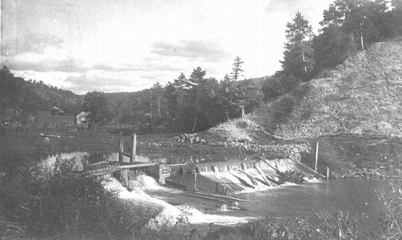
Historical Pictures of Soldiers Grove and the Kickapoo:
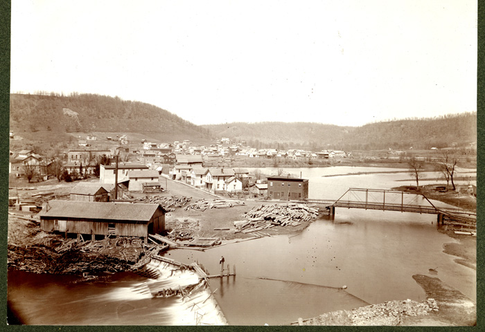
- Very early dam at Soldiers Grove. Note the pines–Soldiers Grove’s original name was Pine Grove.
- A broader view of early Soldiers Grove. The building by the dam is a sawmill. Main Street is beyond the mill. Note the bare hills in back–no wonder rain water ran off so fast.
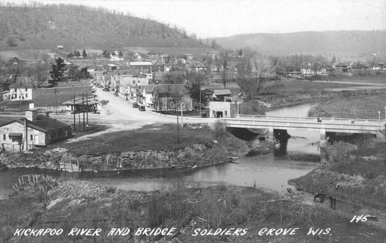
- A later view of Main Street and a new concrete bridge. The dam and sawmill are now gone. This entire area is now part of Beauford T. Anderson Park.
Sights included one green heron, one blue heron, many wood ducks, and a number of beaver slides. Two beavers actually hit the water very loudly with their tails (a warning to other beavers).
Tourist Park Readstown: This is an ok public access with bathrooms. Note the launch area itself is a bit muddy but is doable. Also in spring, the grounds (not just the landing) of Tourist Park can be extremely muddy and parts can be gated off. Really fall and summer are the best times to use this access.
Alt Put-ins:
- Hwy 131 (3.0 miles upstream from Readstown): Only the adventurous should try putting in here. I estimate there would be 3 major logjams on this bonus stretch and the Hwy 131 bridge access wouldn’t be good.
Soldiers Grove Canoe Access: This is an ok public access located just downstream from the Church Street bridge. It’s not a well marked landing and hides behind a dike, so navigating to it from car can be tricky, although from water the landing is easy to see. Prepare to get muddy getting out. A bathroom is available in the park, but it is a bit of a hike away from the ramp.
Alt Take-outs:
- Hwy 61 Bridge (3.8 miles upstream from Soldiers Grove): You could take out here if you wanted a shorter trip as the leg below Readstown is more scenic and interesting. There is no landing at the bridge though so it could be a rough access.
Bike Shuttle – Soldiers Grove to Readstown: 4.8 miles with 49′ of ascent. This would be a manageable bike shuttle.
Rentals/Shuttles: Generally speaking I don’t think the Upper Kickapoo liveries come down this far south. Per Google there is a livery “Ocooch Mountain Made” in nearby Gays Mills “Canoe & Kayak Tour Agency”. They might provide rentals/shuttles…call 608-735-4008 for more info.
Current: The current is surprisingly fast…especially in the first half of the trip closer to Readstown.
Fences: There are no fences on this stretch.
Logjams: While there are a number of trees in the water, there was always a way around them. Locals do a good job of keeping this stretch open.
Rapids: In Soldiers Grove there are two sets of Class 1 rapids. These are pretty easy.
Strainers: There are many strainers in fast deep current. Experienced paddlers should have no problems avoiding these, but regardless everybody should wear a life jacket and stay vigilant. The river may become pushier and more dangerous at high water levels.
Closest Gauge: Kickapoo River @ Steuben
Trip Depth: 421 CFS or 6.40′
Navigability Estimates: Note these are just rough estimates. Always use your own judgement.
- < 6.5′: Relatively low, but still plenty deep. I don’t think this leg ever gets too low to paddle.
- 6.6-6.7′: Average depth.
- 6.8-7.0′: Above average depth. Note because of the fast current and frequent deadfall, I’m not sure I can recommend doing the river at these higher/pushier levels.
- 7.1-7.4′: High depth. Maybe too high?
- 7.5’+: Very high depth. Likely too high for this leg.
Quick Overview
- Wilton to Ontario: 12 miles. This stretch is seldom paddled, but is cleaner and faster than downstream legs. Those willing to endure weedy bridge accesses and occasional snags will be rewarded with spectacular outcrops. A very underrated part of the river.
- Ontario to Rockton: 13.5 miles. This is the most popular section for kayaking on the river (if not the entire state). Highlights include many spectacular sandstone outcrops. This stretch can easily be subdivided. Shuttle services are plentiful, but this leg can get crowded and noisy during summer weekends.
- Rockton to La Farge: 11 miles. This is the second most popular stretch of the river. While the outcrops here aren’t as numerous as the Ontario leg, they do tend to be larger and more impressive.
- La Farge to Mouth: ~90 miles. After La Farge there are few rock outcrops and the river becomes much less interesting. The Lower Kickapoo is a generic hardwood floodplain that is at best a mediocre paddle.
- Tributaries:
- Kickapoo River – West Fork: While lacking the outcrops of the main branch and a bit shallow in spots, this is a very underrated river with many fun rapids.
- Billings Creek: I actually like this creek better than the main river itself. There are just as many outcrops, and the water and banks are much cleaner.
- Tainter Creek: While not very big and lacking in outcrops, it’s still a cool creek with very swift current.
Detailed Overview
- Upstream from Lincoln Ave: The river is likely too small and degraded by open pasture to have much appeal for kayaking. Although "Kickapoo Springs" (the primary source of the river and a public DNR area) might be interesting.
- Lincoln Ave to Keystone Road: 2.5 miles. The river is small here (likely too small for most paddlers) and more scruffy with fewer outcrops. Figure 1-2 logjams and 3 outcrops. Several of the Elroy-Sparta Trail bridges over the river are quite scenic/rustic. High water will be required to do this stretch.
- Lincoln Ave to Hwy 131 (East of Midge Road): 6.3 miles.
- Lincoln Ave to Hwy 71: 1.6 miles. Section includes five outcrops, including one really nice one. River is shallow here with many Class 1 rapids. There is one strainer that has to be portaged, but no other logjams. I encountered a bull on this stretch (here) which might be a deal breaker for most paddlers. You could possibly portage around the farm in question along the Elroy-Sparta Trail but it would be a long and difficult portage.
- Hwy 71 to Wilton Campground/Library: 0.7 miles. A nice stretch with ~3 mediocre outcrops and one really nice one. Water clarity is stunning here. There is a low tree that requires some tight ducking to get under.
- Wilton Campground/Library to Hwy 131 (by Posey Creek): 1.4 miles. Less attractive stretch but still ~4 mediocre outcrops. There is a serious logjam by Water Street that must be portaged.
- Hwy 131 (by Posey Creek) to Hwy 131 (by Mica Rd): 1.3 miles. A terrific stretch with scenic pine trees, several mediocre outcrops and one fantastic sandstone outcrop.
- Hwy 131 (by Mica Rd) to Hwy 131 (East of Midge Rd): 0.7 miles. More of a scruffy stretch, but still a few mediocre outcrops. The Black Valley hills in the distance are very scenic from this leg.
- Hwy 131 (East of Midge Road) to Hwy 131 (near Nicollet Ave): 4.1 miles.
- Hwy 131 (east of Midge) to Hwy 131 (by Michigan Ave): 0.5 miles. A good leg with one nice set of outcrops.
- Hwy 131 (by Michigan Ave) to Hwy 131: 0.6 miles. Another good leg with 3 outcrops. Some minor rapids, including a 4-6" ledge.
- Hwy 131 to Hwy 131 (by Nisswa Rd): 0.6 miles. One of the best legs on the Upper Kickapoo which features 6 noteworthy outcrops and terrific ice flows in February and early March.
- Hwy 131 (by Nisswa Rd) to Hwy 131 (by Nordale Ave): 1.1 miles. Not as scenic as other legs with messy shorelines and eroded banks. There are still a few nice outcrops.
- Hwy 131 (by Nordale Ave) to Hwy 131 (by Nicollet Ave): 1.3 miles. Another one of the Upper Kickapoo's best legs with ~6 outcrops, including a small natural bridge you can paddle through.
- Hwy 131 (near Nicollet Ave) to Ontario: 5 miles.
- Hwy 131 (by Nicollet Ave) to Hwy 131 (Oil City): 2.3 miles. Two long stretches of bluffs contain great outcrops.
- Hwy 131 (Oil City) to Hwy 131 (Kickapoo Wild Adventures): 1.4 miles. Terrific stretch with two major outcrops. One set of Class 2 rapids.
- Hwy 131 (Kickapoo Wild Adventures) to Ontario (Brey Valley Road Park): 1.5 miles. Three sets of outcrops.
- Ontario to Hwy 131/Bridge #4: 3.6 miles. A more open and flatter stretch of the Kickapoo. There are still 3-4 outcrops. This is THE most popular leg on the entire river.
- Bridge #4 to Bridge #7: 6.0 miles.
- Bridge #4 to Wildcat Landing: 3.1 miles. A super popular stretch and the most scenic on the Kickapoo. River flows past steep hillsides and many outcrops (at least 16).
- Wildcat Landing to Bridge #5: 0.9 miles. River opens up a bit, but still has three super sandstone outcrops.
- Bridge #5 to Bridge #7: 2.1 miles. A good stretch with seven major outcrops and one cave.
- Bridge #7 to Bridge #14: 7.7 miles.
- Bridge #7 to Bridge #8: 1.2 miles. From bridge #7 onward, the Kickapoo becomes much less interesting. There are still some good spots though. This stretch has maybe 3 outcrops.
- Bridge #8 to Bridge #10: 2.5 miles. A good stretch with 5-6 outcrops.
- Bridge #10 to Rockton/Landing #12: 1.4 miles. This stretch is more open, and less interesting. But there are still 3-4 mediocre outcrops.
- Rockton to P/Bridge 14 Canoe Landing: 2.4 miles. A scenic stretch with 5 noteworthy outcrops–three of which are huge.
- Bridge #14 to La Farge: 8.0 miles. A great stretch with a covered bridge and 4-5 outcrops...several of which are huge (the largest on the river).
- La Farge to Hwy 131 (by Ski Hill Road): 6.8 miles. Nice section but with a few jams.
- Hwy 131/Ski Hill Road to Viola (Banker Park): 7.0 miles. Maybe 2 bluffs, but mostly open I think. Have been told there are 26 portages between La Farge and Viola, so beware.
- Viola to Hwy 131 - Bridge 1: 5.8 miles. Maybe one outcrop and 14 major logjams.
- Hwy 131 - Bridge 1 to Hwy 131 - Bridge 2: 4.3 miles. Maybe one outcrop and 13 major logjams.
- Hwy 131 Bridge 2 to Readstown Tourist Park: 3.0 miles. Maybe one outcrop and three major logjams. The river grows significantly with the addition of the West Fork.
- Readstown Tourist Park to Soldiers Grove: 6.9 miles.
- Readstown to Hwy 61: 3.1 miles. A surprisingly nice stretch with impressive hills and good current. On the downside there is a lot of tree debris although it is always avoidable. Hwy 61 is not a good access.
- Hwy 61 to Soldiers Grove: 3.8 miles. Not as good as the previous leg with fewer hills, muddier banks, and slower current, but still not bad. The highlights include a few impressive bluffs and two minor rapids in Soldiers Grove.
- Soldiers Grove to Hwy B: 9.0 miles. I doubt there are logjams, but I think this stretch would not be very interesting. The river flows through one of the wider flood bottoms on the river.
- Hwy B to Hwy S: 8.6 miles.
- Hwy B to Gays Mills: 4 miles. Fast stretch with some strainers. Bank quality is poor, but the bluffs are attractive. A dam in Gays Mills slows the last mile of this leg.
- Gays Mills to Hwy S: 4.6 miles. A pleasant but not elite leg with some nice bluff vistas.
- Hwy S to Haney Valley Road: 5.8 miles.
- Haney Valley Road to Taylor Ridge Road: 3.6 miles. Likely an ok prospect. Note, Taylor Ridge Road is aggressively fenced by the local farmer and would be a difficult access.
- Taylor Ridge Road to Steuben Landing: 5.0 miles. A good prospect with likely some nice bluffs. Note, Taylor Ridge Road is aggressively fenced by the local farmer and would be a difficult access.
- Steuben Landing to Hwy 179: 2.9 miles. A mediocre prospect.
- Hwy 179 to Plum Creek Landing: 11.8 miles. A good prospect with nice bluffs.
- Plum Creek Landing to Hwy 60: 6.7 miles. Starts uninteresting with fast current, but features some surprisingly nice bluffs and overall was a decent trip.
- Hwy 60 to Lowell Geitz Memorial Boat Landing: 2.7 miles. This stretch mostly lacks interesting bluffs but does feature wetgrass and floodplain forests as part of the Wauzeka Bottoms State Natural Area.
- Take-out options on the Wisconsin River:
- Lowell Geitz Memorial Boat Landing to Adiantum Woods State Natural Area: 2.5 miles. This is mostly a downstream trip on the Wisconsin River.
Trip Map
Overview Map
Video
Photos Size: