
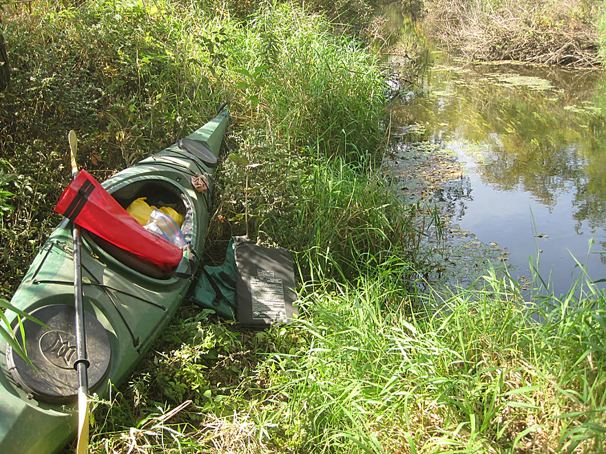
Put-in at Verona Community Gardens
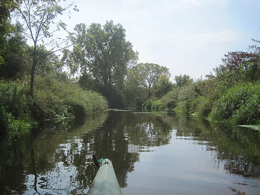
Upper part of creek runs along Military Ridge Bike Trail
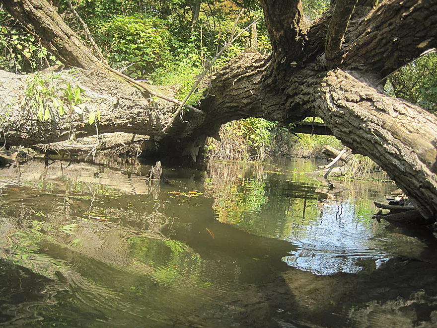
Easy duck-under
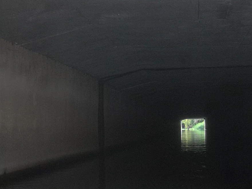
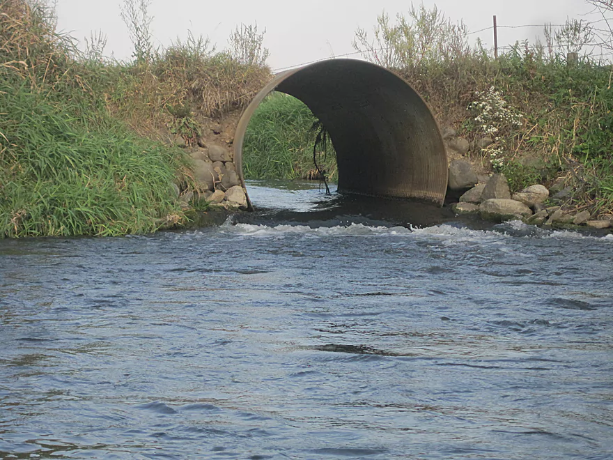
100 yd tunnel under Hwy 18/151
Riffles after bridge
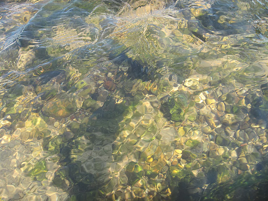
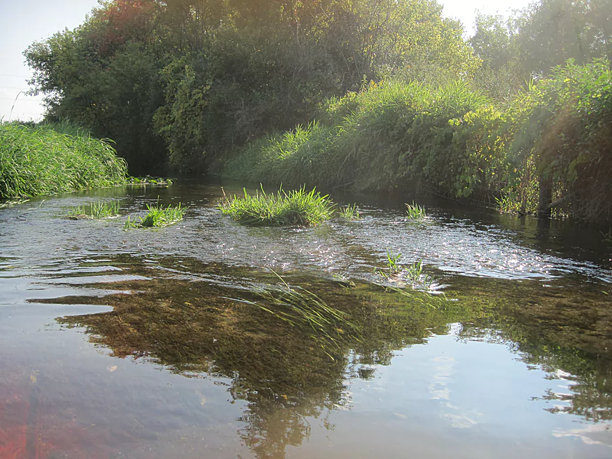
Crystal clear water and nice gravel bottom
Shallow riffles after spring
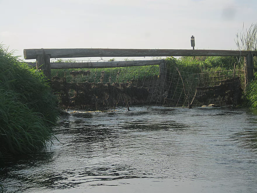
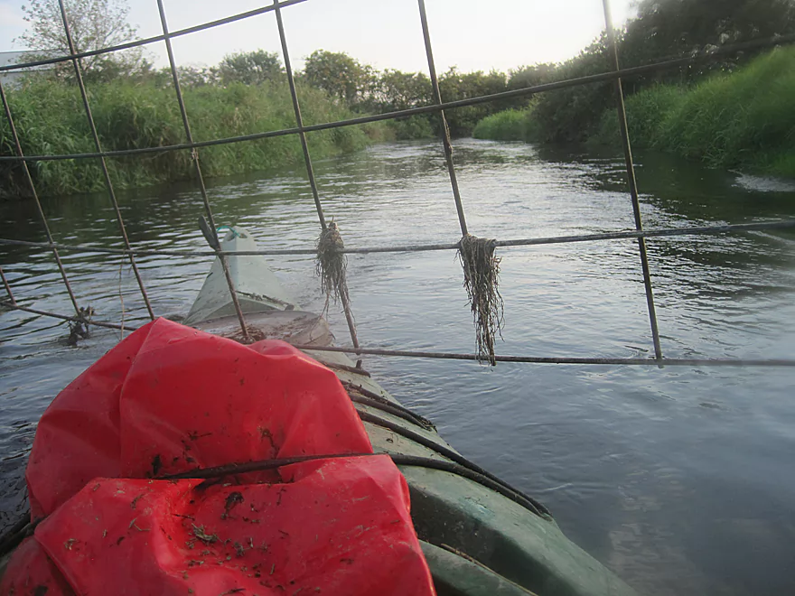
Approaching 1st set of cattle gates
Going through 1st set of cattle gates
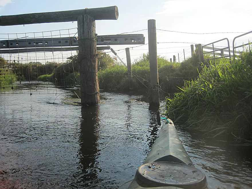
2nd set of cattle gates
Barbed wire fence
Wood turtle
3rd set of cattle gates
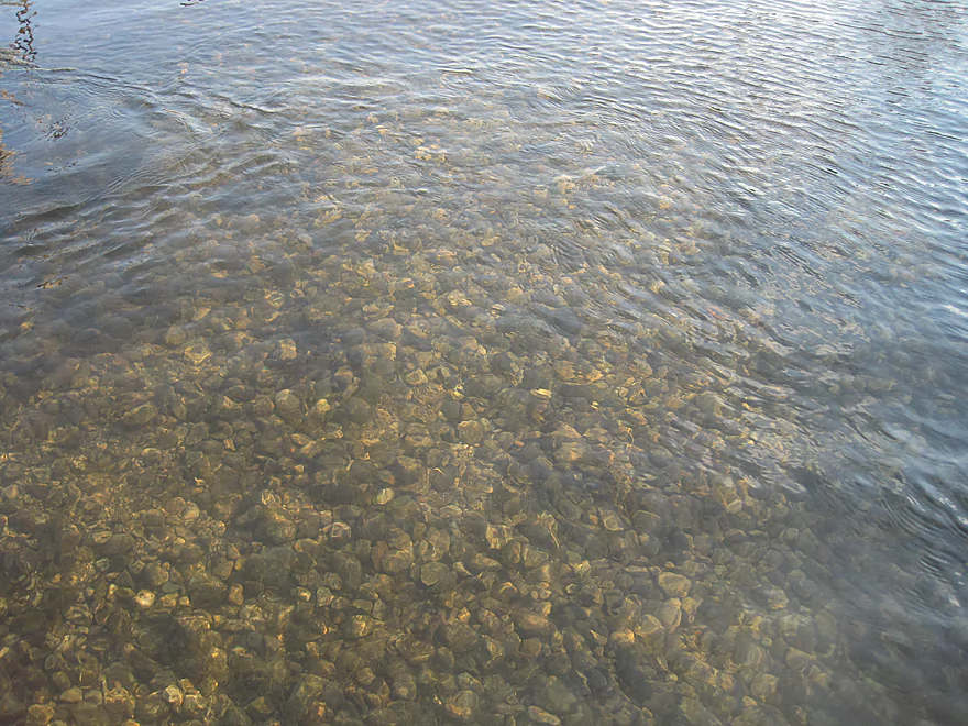
Clear shallow water and gravel bottom at 3rd gate
Looking up river at drop coming out of culvert right after 3rd gate
Approaching 4th gate
Going under 4th gate
Looking up river at 4th gate
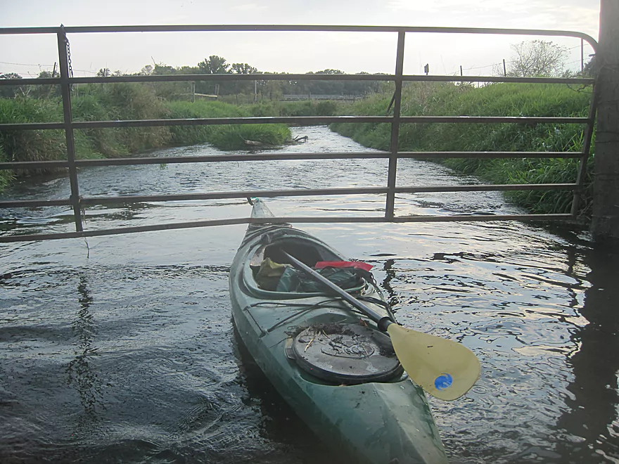
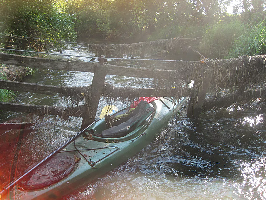
Going under 5th and last gate!
An alternate take-out at Bruce Street
Badger Mill Creek

This trip is not for everyone as it will involve several lift-overs, a couple of duck-unders, a 100 yard tunnel, dodging trees and cows, shallow spots, and requires you to get out of your boat to get under several very low cattle gates. That said, for the adventurous paddler it offers a fun challenge, clear water, varied terrain, abundant wildlife and several put-in/take-out possibilities. And with an easy bike shuttle it could be a welcome addition to your local “after work” paddling options.
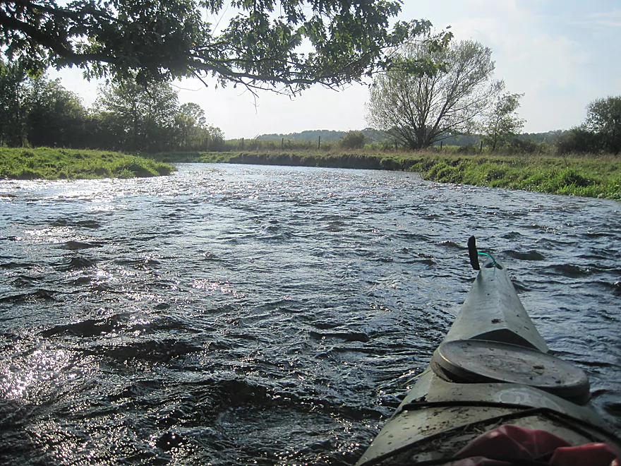
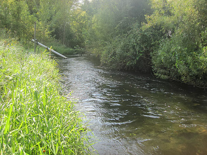
Badger Mill creek runs from its source between Madison and Verona to its confluence with the Sugar River at Riverside Road just southwest of Verona. This trip report deals with the section between the Military Ridge Park and Ride to its confluence with the Sugar River and down to the take-out at the Hwy 69 bridge. The trip is a blend of urban and rural paddling on a surprisingly clear creek with a respectable current that passes through a pleasant variety of landscapes.
Similar to Badfish Creek, Badger Mill Creek gets most of its water from the Madison Metropolitan Sewerage District, but unlike the Badfish I have never noticed the treated water smell that you sometimes get on the Badfish. Thanks to all the added water the creek is always clean, clear, and there is always sufficient water to paddle.
The upper part of the creek has been channelized so it is fairly straight, but there is not much development visible so it’s easy to forget you are in an urban environment. The creek here has a nice substrate of sand and gravel, and the channel meanders from side to side which creates numerous ledges, holes and shallow spots, which help keep this section interesting. It also seems to be excellent fish habitat for I always see numerous fish in this section. After passing under several pedestrian/bike bridges, you will reach the first obstruction, a large tree lying in and across the creek. The creek is not too deep here, and there is an easy lift over on river left. The creek then winds past the backyards of Brady Bunch looking homes before you reach a big downed tree that requires the second lift over shortly before passing under the Main Street bridge. Debris tends to accumulate at this bridge, but the left most passage is usually open and has the most water.
The river now flows through Fireman’s Park where, at one point, there is a massive tree lying across the river from bank to bank. While I think it would be a simple portage around the tree, I ducked under the first trunk, and then climbed over the second trunk and climbed back into my boat. The creek now gets narrow, windy and the current picks up a bit as it comes to the Bruce Street bridge.
There is an easy alternative put-in/take-out just past the bridge on river left, where there is also a small set of rapids and a USGS river gauge. There is a parking lot for easy loading, but I believe it is city/county property, so it is probably best to park on the street.
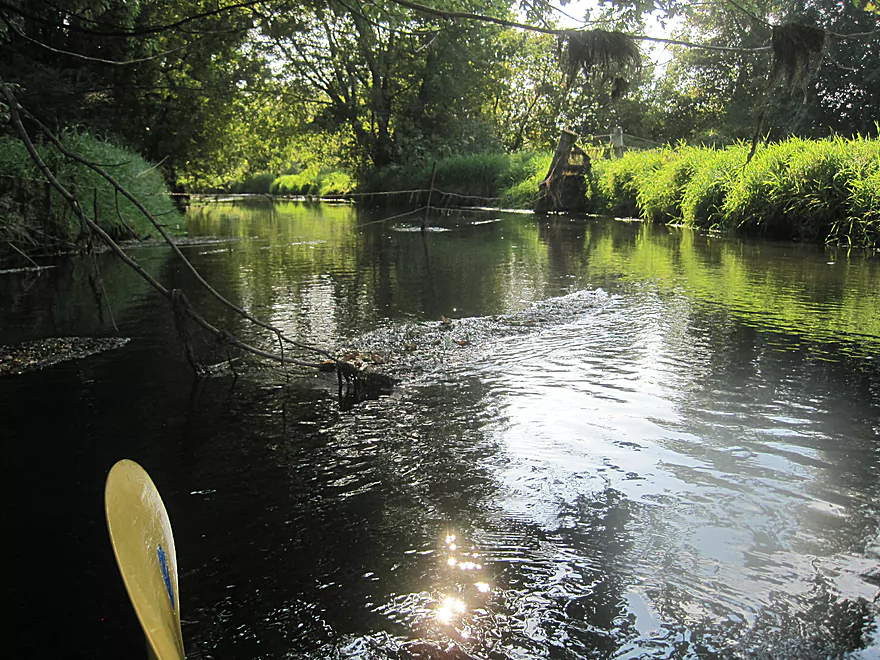
As the creek winds south out of Verona there are a couple of places with branches and trees hanging across the creek, but there is always a way through. You will now start to hear road noise from Hwy 18/151 and after a sharp bend you will see a 100+ yard tunnel under the highway. The tunnel has three passages, avoid the middle one as it gets very shallow on the other side.
After a few sharp turns you will come to a small farm bridge. There is plenty of room to go under the bridge but there is tree hanging over the left bank and some debris on the right side of the bridge to maneuver around so you have do a bit of a zig and a zag to around the tree and under the bridge.
The river now passes through an active pasture so be prepared for cattle on the banks and in the river. After a couple of turns you will pass a large spring on the left and then the creek widens and there is a short stretch of very shallow water. I have always been able to scoot through using my paddle/hands, but if you don’t want to scrape up your boat, I suspect an empty boat would float through with no problems.
You will shortly encounter a single strand of wire about three feet above the creek. It is an easy duck under, but use caution as it appears to be electric fence. That being said, I do not believe it has ever been “hot” when I have encountered it.
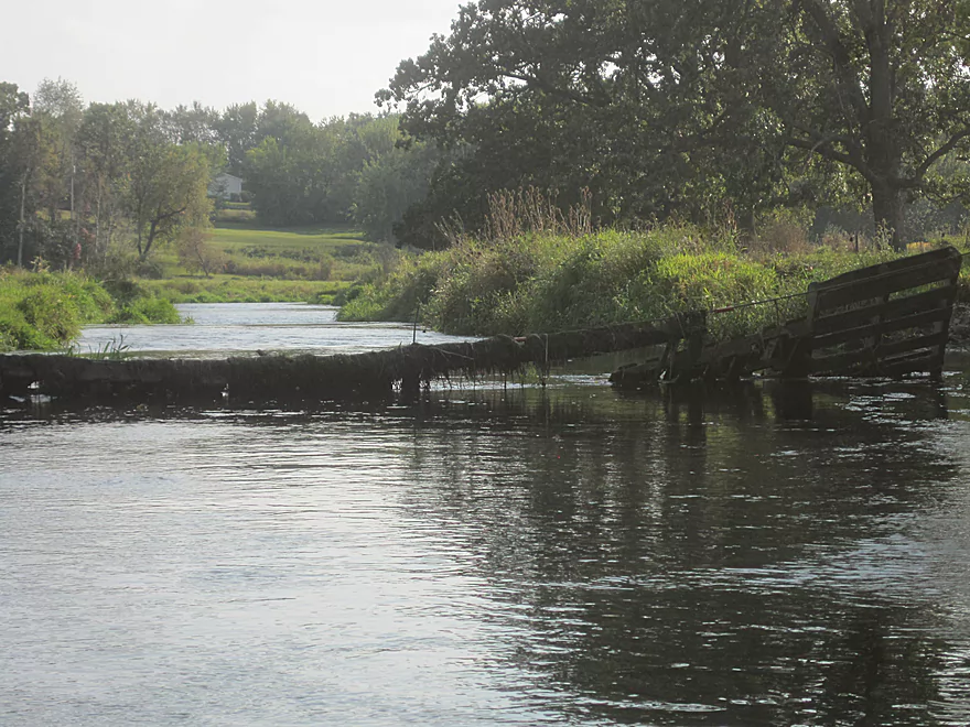
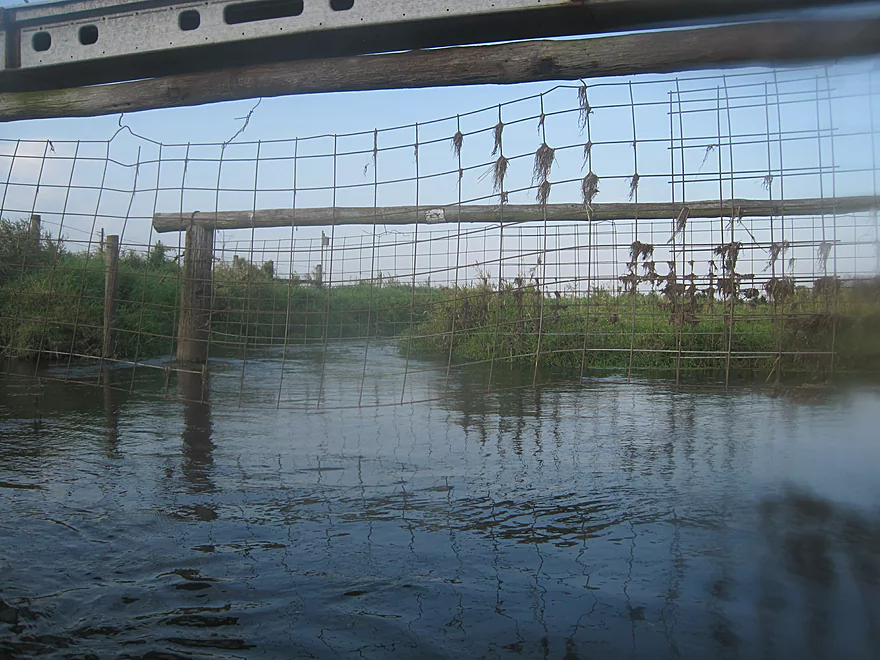
The creek narrows a bit and the current picks up through some small riffles. After a small creek/spring on your right you will encounter your first of 5 sets of cattle gates. The first gate is made up of 2 parallel cables stretched across the creek about 5 feet high with wood fence panels hanging down. On both sections there are spots with a few boards missing where you can get through. The river is only about a foot deep here so it is easy to get out and float your boat through.
The river then widens a bit and there is a nice area with grass banks until you come to the 2nd gate. This gate is similar to the first but made with wood pallets and is a bit lower, but again it is shallow and there are places to walk your boat through.
After a few turns with a nice riffle or two you will come across a sagging barbed wire fence, that seems to serve no purpose except as a danger to kayakers. It is very loose and could probably be ducked under on the right side without getting out, but I did get out, walked the boat under and ducked under on foot.
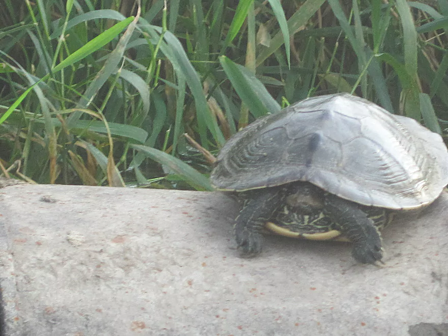
The river now enters a pretty little wooded valley with a small boulder field and kind of an “up north” feel. You will soon pass under Hwy 69, a possible (but not great) take-out point. The river narrows for a bit and the banks get higher, and obscure any view of the surrounding area. Interestingly, every time I have run this river I have seen a (the same?) big old turtle sitting on a half-submerged metal barrel. I believe it is a Wood Turtle, and it does not seem to be at all afraid of kayakers as I have been able to float by very close to it and it never moves unless I actually bang into the barrel.
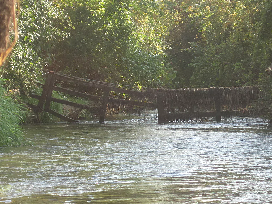
Shortly after you will come to the 3rd gate and this one is a bit of a mess. It is not a true gate as it seems to be designed only as an area for the cows to come and drink, not to cross the water, and while not difficult it requires some caution. This gate is constructed using metal “hog panels” hung from a big wooden beam about 6’ above the water. I believe they were designed to be able to swing downriver, but they are covered with weeds and wired to the supports in some places, so they do not swing very much or easily. The river is shallow and the bottom is all gravel so it is not difficult to get out and float the boat under the fence and then duck under the gate yourself. Immediately after this gate you will be rewarded for all your efforts with a nice 6-12” drop out of a 12’ culvert into a small pool.
After another bit you come to the 4th gate with hog gates that requires getting out and ducking under, a bit more paddling and then the 5th (and last!) gate. Unfortunately this one is the worst, as it is made of heavy metal gates that do not swing much, and are so low that getting under them requires pushing your boat down into the water. The water is shallow, so it is not really dangerous, but it is a hassle, and to duck under requires you to almost put your whole head under water. I have an old boat and I do not care about minor scrapes and scratches, but be aware that this gate can scratch the top of your boat if you are not careful or strong enough to push your boat down in the water and push/lift the heavy metal gate at the same time. Perhaps it would be easier with two people, but I have only done this trip solo.
A few more twists and turns and you will be at the confluence with the Sugar at the Riverside Road Bridge. There is a good take-out option on river left right before the bridge. The rest of the paddle is an easy float on the well-traveled Sugar. There may be few downed trees to dodge around, but local paddlers do a great job of making sure there is always a way through.
The put-in is river left, just downstream form the Hwy PB bridge near the Military Ridge Park and Ride. There is a parking area for the Verona Community Gardens that makes for easy unloading, but it is best to park in the Park and Ride as the gate to the gardens is locked when no one is using the gardens.
The take-out is well marked on river left, right after the Hwy 69 bridge. There are two places to actually take out, one is right at the USGS gauge (a big white PVC tube sitting diagonally in the river) and the other is a few yards further down the river. Both can be a bit muddy and slippery, but I would recommend the second as it is a bit shallower and easier to get your boat, and yourself out of the river.
Bike Shuttle: If you take out at Riverside or Hwy 69, Locust Dr. off Hwy 69 offers an easy bike ride back into Verona. Here you can catch the Military Ridge Bike trail which will take you right back to the Military Ridge Park and Ride.
Car Shuttle: From either take-out, take Hwy 69 north into Verona then turn east.
In the past the river has been plagued with numerous fallen trees and snags in the section between the Military Ridge Park and Ride and Main Street (Hwy M). This section has now been mostly cleared and there are now only three obstacles. Two are fairly simple pull overs, and the other is a big 2 trunked tree across the river that is a combination duck under followed by a float under/crawl over. None of them are too bad but you may have to get your feet wet.
For more information on the fences, see the main write-up above.
There is a nearby gauge in Verona. Around 4.75 feet or 20 CFS is an ideal level. Much lower and you may have to drag your boat through the rapids, and much higher you may have difficulty getting your boat under some of the gates. I would not recommend running the creek above 5.0 feet.
Fish, ducks, kingfishers, hawks, a muskrat, turtles, a heron, a crane, and cows.
Thanks Eric for the review! Sounds like a great stretch. Note, guest reviews are very much welcome on this site. If readers are interested in submitting one, you can do so here.
Trip Map
Overview Map
Photos Size:
Just did the section from Bruce Street to 2nd Hwy 69 bridge, clear water with a good constant current. Water was a bit low so we scraped in a couple of places and most of the cattle gates are still there, but it is much easier with 2 people, One person can hole the gates up as the other person scoots under. Really pretty easy as all the gates are located in shallow areas. A true diamond in the rough for local paddlers, but do it with a friend and on a warm sunny day because someone is going to be getting out of the boat at least 5 times. I’ll certainly be doing it again soon
Definitely on my todo list. This would be a great section to do when most other rivers are too high.
I have walked many times over the past years along Badger Mill Creek in Verona and have noted the foul sewage smell. Badger Mill Creek is suffering from residential and commercial runoff and insufficiently treated wastewater and sewage. It is a lovely creek surrounded by recreational trails, baseball fields, residential homes and playgrounds. In summer kids play in the water by the covered bridge and near the playground. So much potential here but I do think it is a health risk to get in that water or let your kids and animals near it. Trust your nose. If it smells like sewage it probably is sewage! Please make others aware and let’s clean up Badger Mill Creek so it can truly be of recreational use.
It’s unfortunate to hear of your experiences. It is indeed an outlet for MMSD. But maybe this is mostly unfortunate timing. Many creeks and rivers are outlets for sewage, and yet if properly treated these can still be neat paddles (such as Badfish Creek). Perhaps the key with Badger Mill Creek is timing as I’m certain there are certain periods in which the creek is much better than others.
The fence was electrified! We could hear the hum! We were too paranoid to go under it…not enough room to safely get under. Electricity and water is not a safe combination. This has to be a liability issue. Who puts an electric fence over a public waterway?!?!
That’s too bad…hopefully this is removed in the future.
Madison is seriously considering moving it’s Badger Mill Creek effluent discharge to Badfish Creek. This would hurt Badfish Creek (higerh water levels, more erosion, more polluted) and could literally dry up Badger Mill Creek. Many locals are speaking out against this. For more information see: https://wisconsinexaminer.com/2023/05/04/locals-say-madison-sewer-district-phosphorus-decision-threatens-badfish-creek/
Did this stretch at the end of June, about 12 CFS and 4.5′ according to the referenced gauge. The clarity was sublime, and there were some really cool features overall. There were some hiccups that I ran into, however. There was no discernible put-in spot at the Verona Community Gardens; you can make it work on the opposite bank (closer to the park and ride) under the bridge. It wasn’t ideal, but it was plenty doable. For much of the beginning of the trip, the water was VERY weedy, although it thankfully did relent about a mile or so in. There were some ugly logjams in the first half of the trip, but luckily you could squeeze by most of them without too much trouble. Unfortunately, there was a really challenging one just after the Main Street bridge. I couldn’t see a good portage route around the logjam, so I basically had to weave over and under some of the deadfall and feed my kayak through. It was the only really bad logjam, but it was one of toughest ones I’ve ever encountered (the trees weren’t huge, there were just a lot of them and they were very densely clustered- shouldn’t be a terrible clean-up job). The riffles kicked in later and were neat, adding a lot of character, but it was just too low when I ran it. I was able to get by with scooting and clawing through with my paddles. Thankfully, the cattle gates appear to be a much lesser issue now than what previous reports state. There is still the initial double set of gates that I could just squeeze under but wouldn’t have minded getting out of my kayak for if needed. And the barb wire fence is still in place and sits rather low, but there is a lot of flex in it, and I was able to sneak under this one too. I am very happy to report that any other gates had a very clear/easy path cut into them that allows paddlers to get through unscathed, and I saw no signs of an electric fence! All in all, this trip had more cons than pros for me, but I would consider doing it again at higher water levels where I wouldn’t scrape on the riffles (plus it might eliminate the weedy issue early on). I was worried that too high of water would be an issue with the cattle gates, but since there’s really only two gates/fences you have to worry about, I’d much rather have high water and go for a swim with my kayak to get under them (the water clarity is great!) than be stuck in the riffles. If anyone clears out that dicey logjam, that would be a major plus as well. Definitely some potential on this obscure stretch!
Appreciate the feedback!