
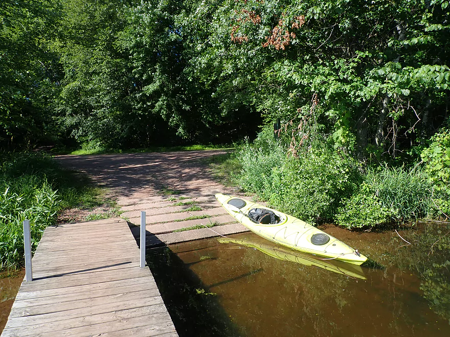
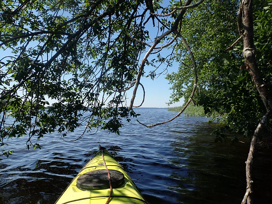
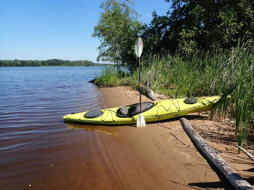
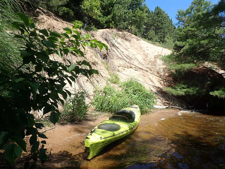
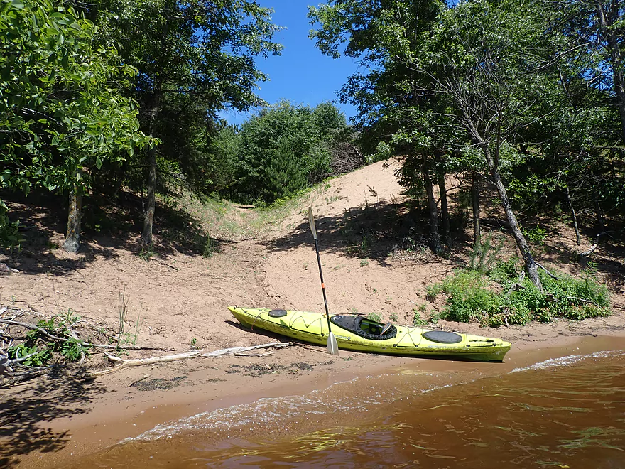
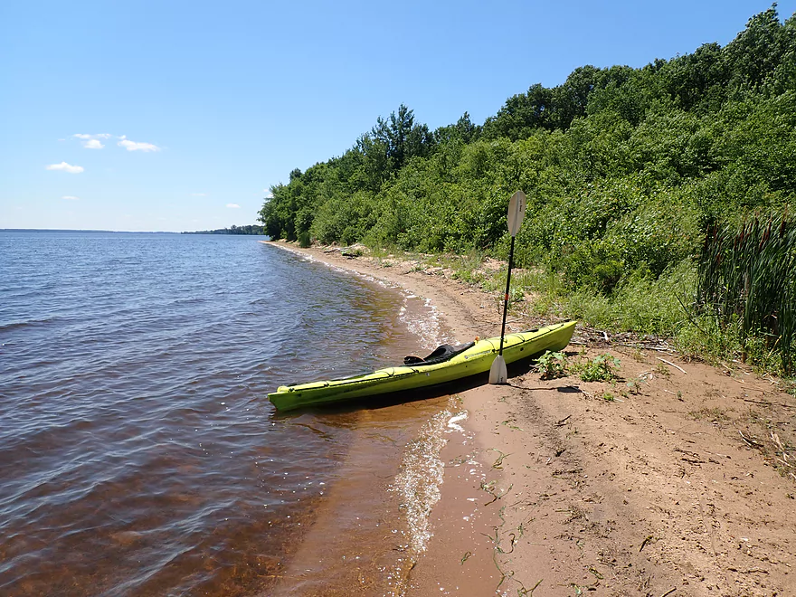
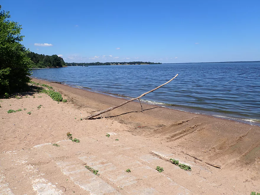
Putting in at 3rd Street
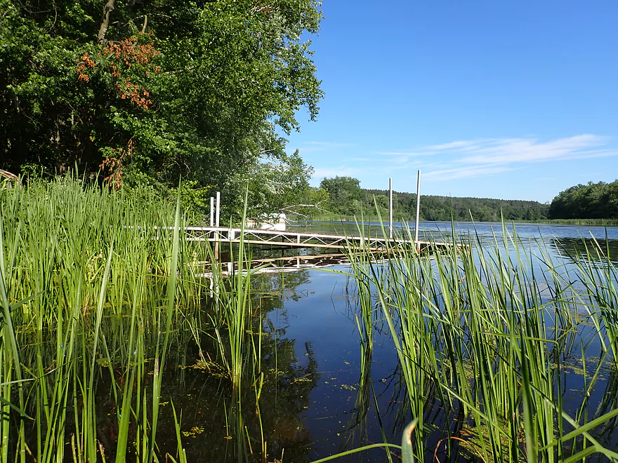
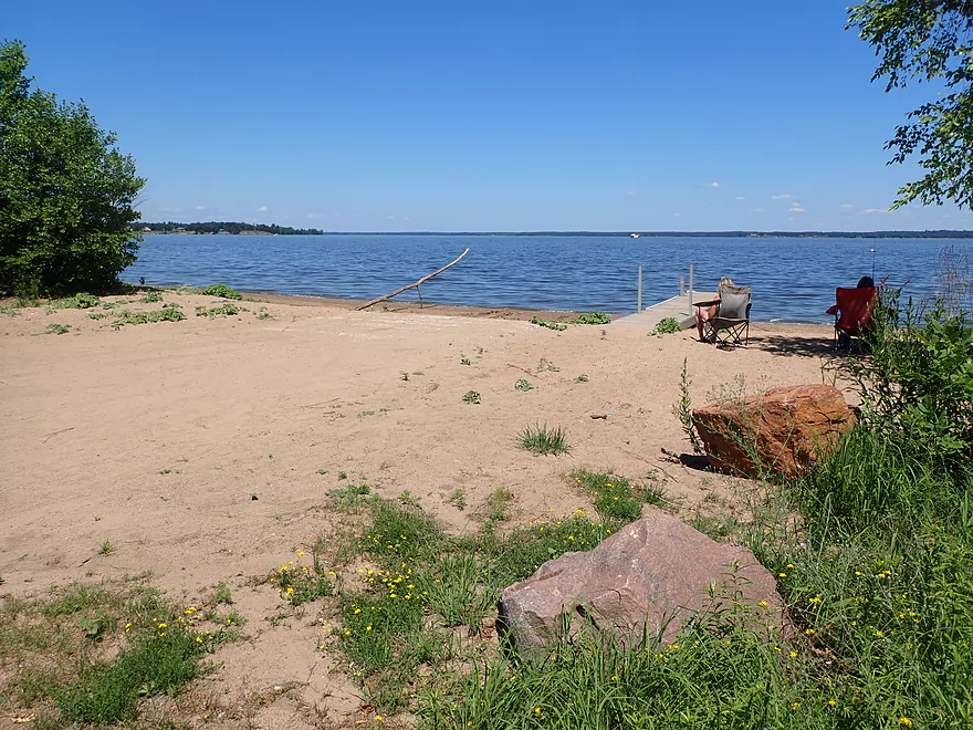
Scenic area by the launch
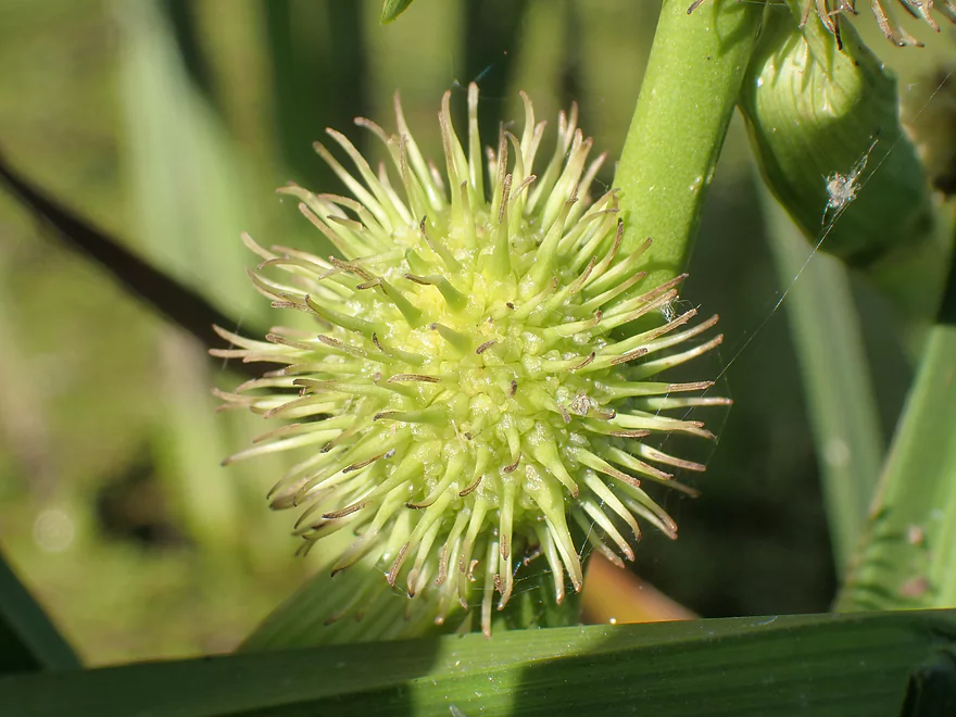
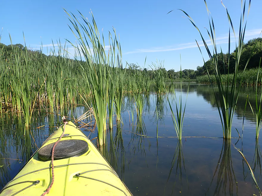
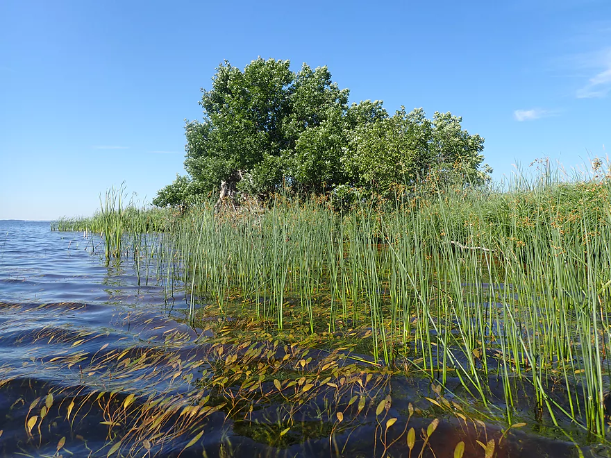
A spikey pod of bur-reed
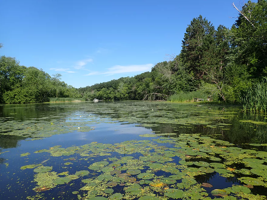
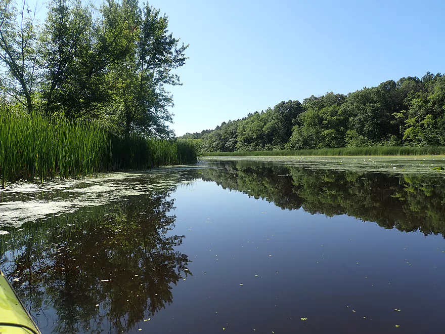
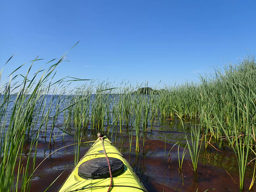
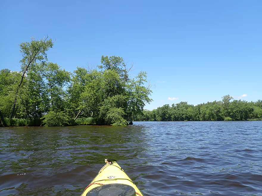
Heading northwest into a large slough
Cattail reflections
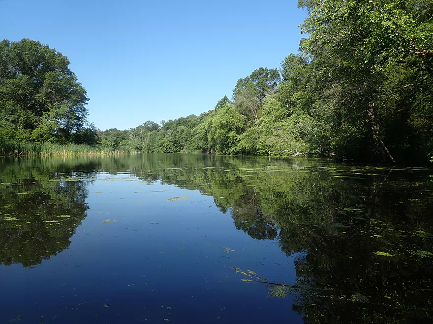
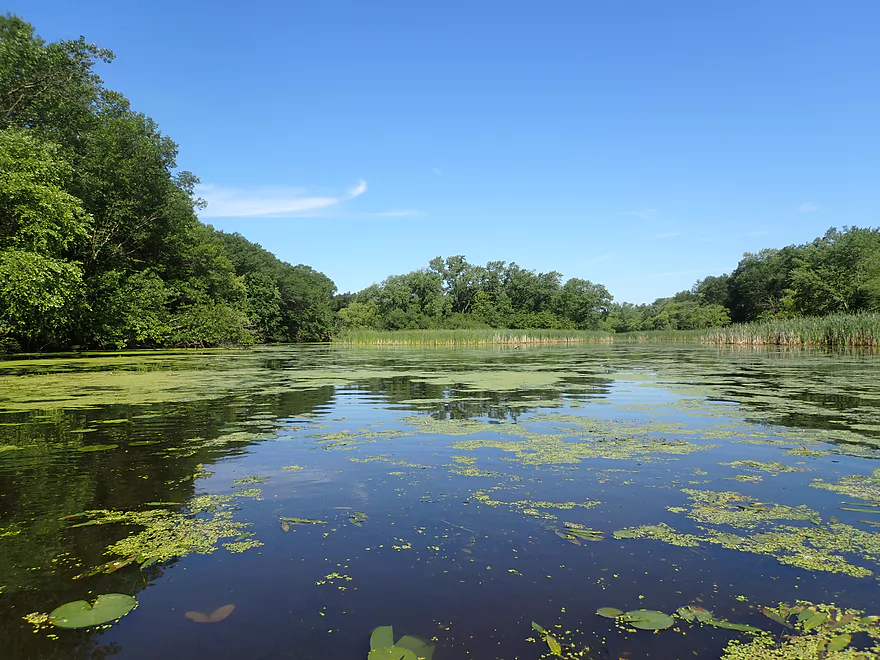
The slough was very flat and peaceful unlike the lake
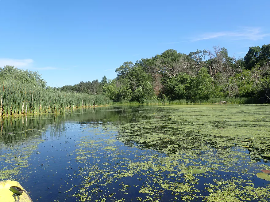
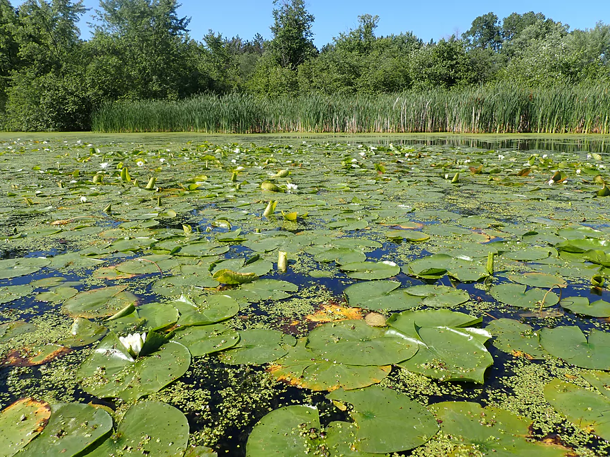
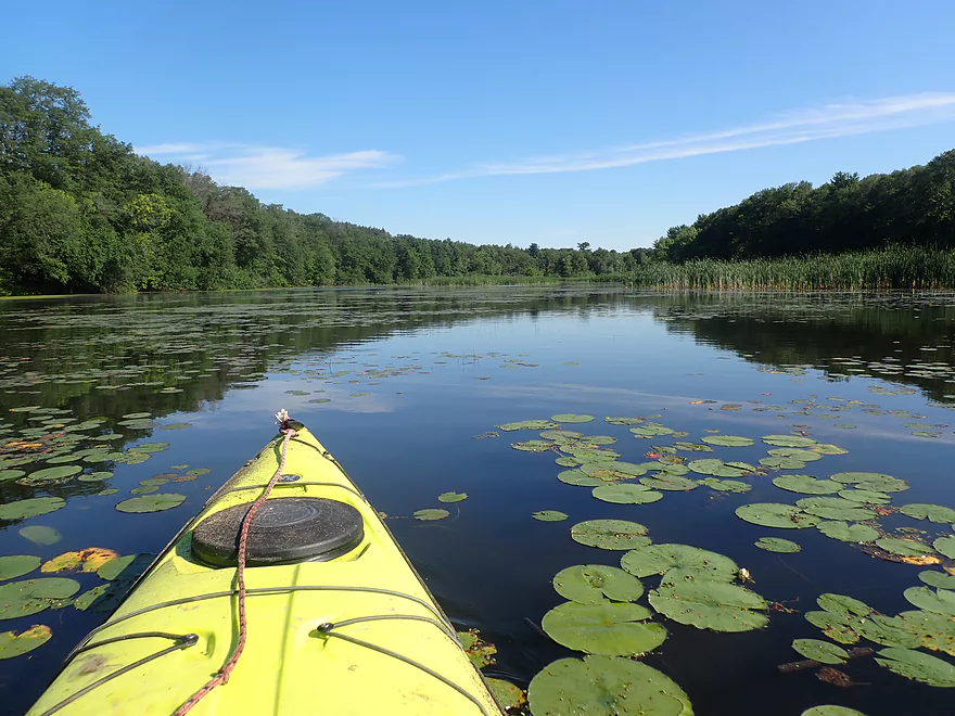
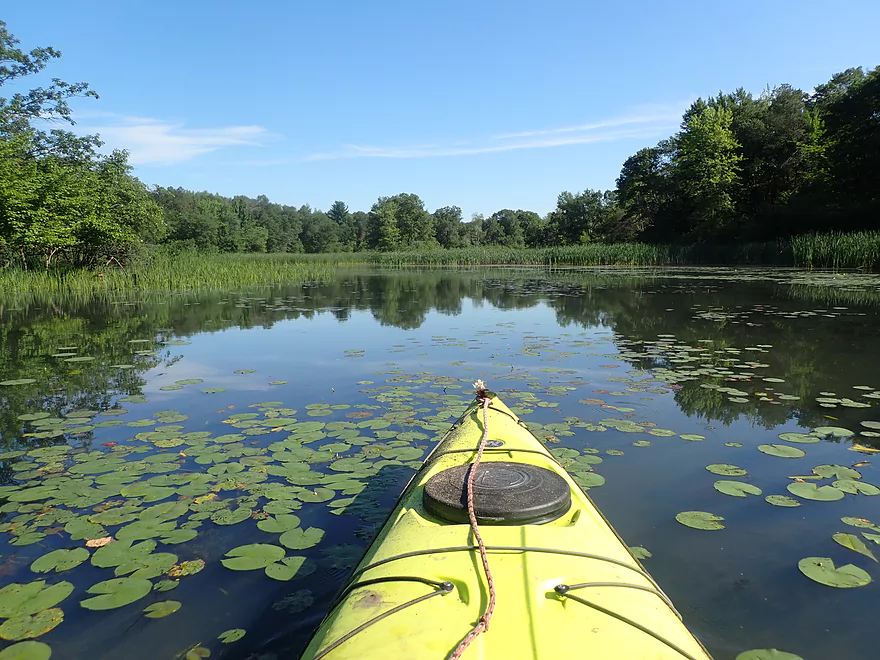
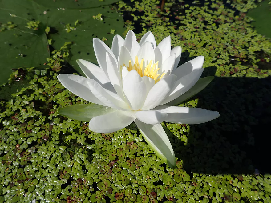
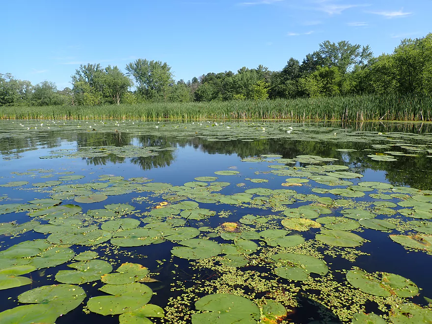
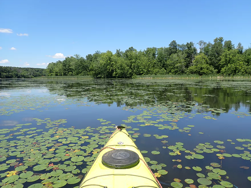
Lot of nice waterlillies
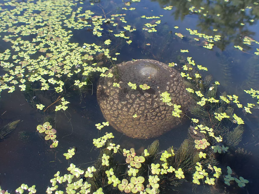
Many large bryozoans floating underwater like naval mines
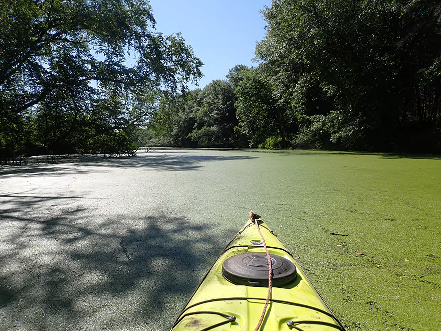
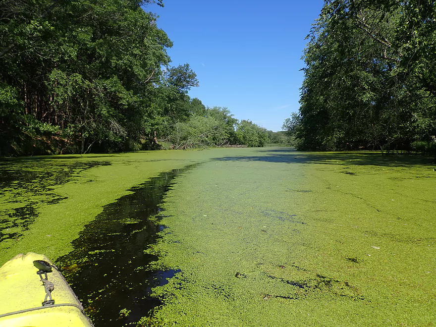
Shore-to-shore duckweed
Creating cool duckweed trails
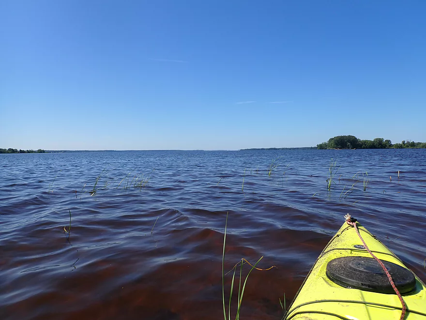
Exiting the slough and entering Lake Petenwell
Don’t worry…they get bigger
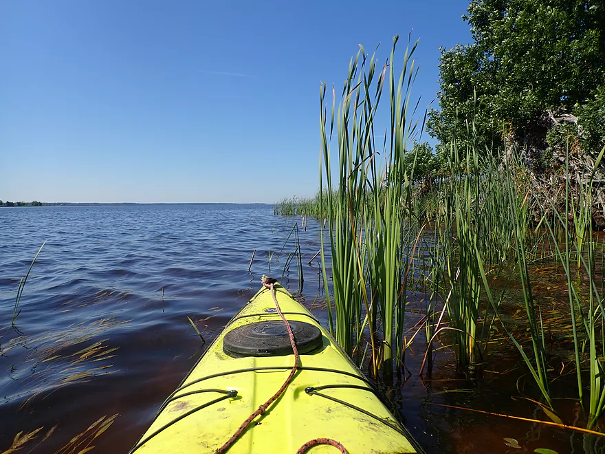
Potamogeton in a bed of bulrushes
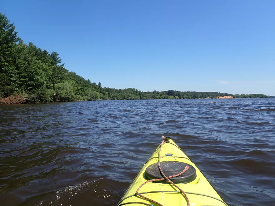
Wisconsin River widens into the lake
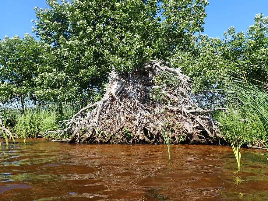
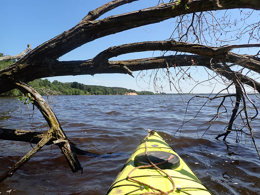
Huge set of roots
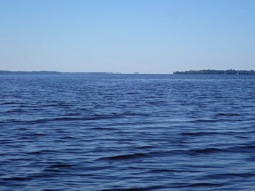
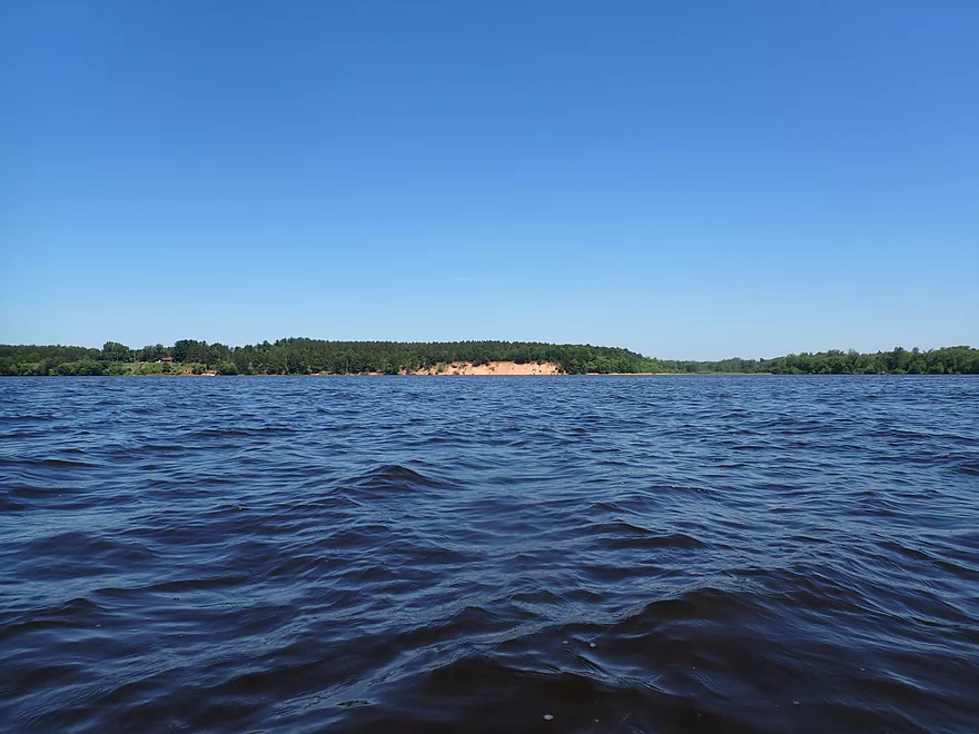
Lake Petenwell is quite large…I can’t see the south end
Mirage makes it look like there is an island where there isn’t
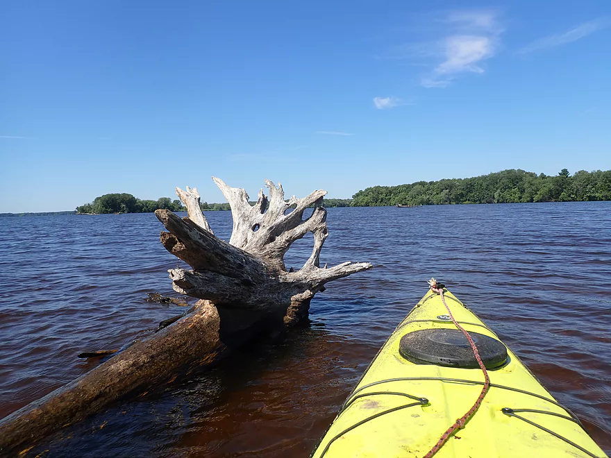
This area used to be woods before it was flooded by the dam
Taking a break on one of the islands
Crossing a large expanse to check out the west shore
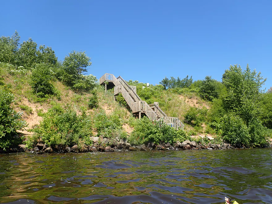
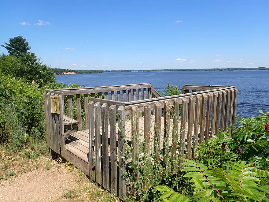
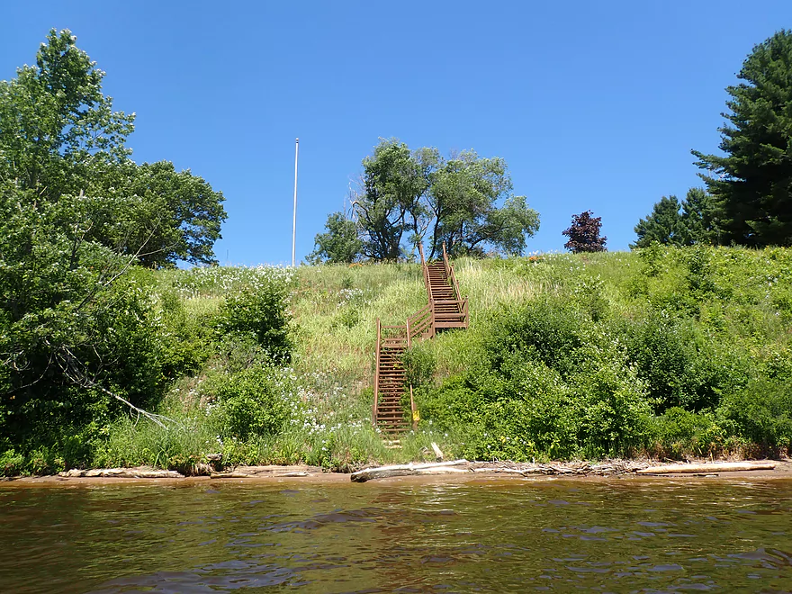
There is a neat park atop this sandbank (located at the end of 4th Street)
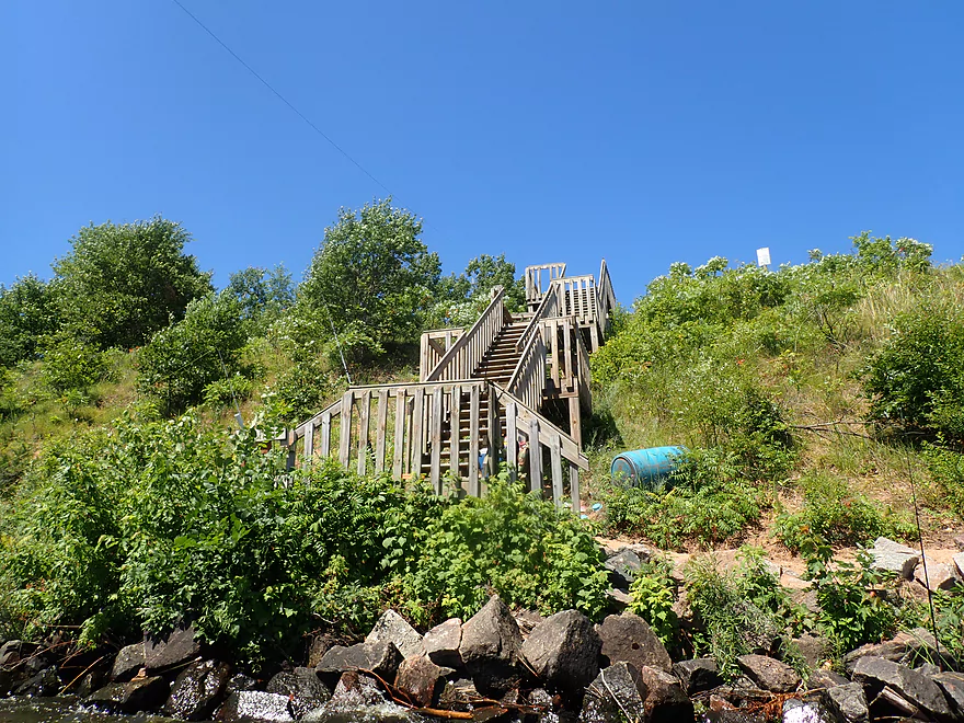
Scenic wood staircase connects the parking lot to the shore
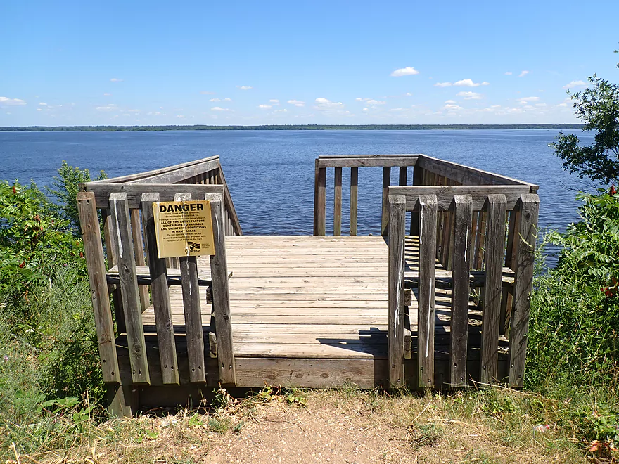
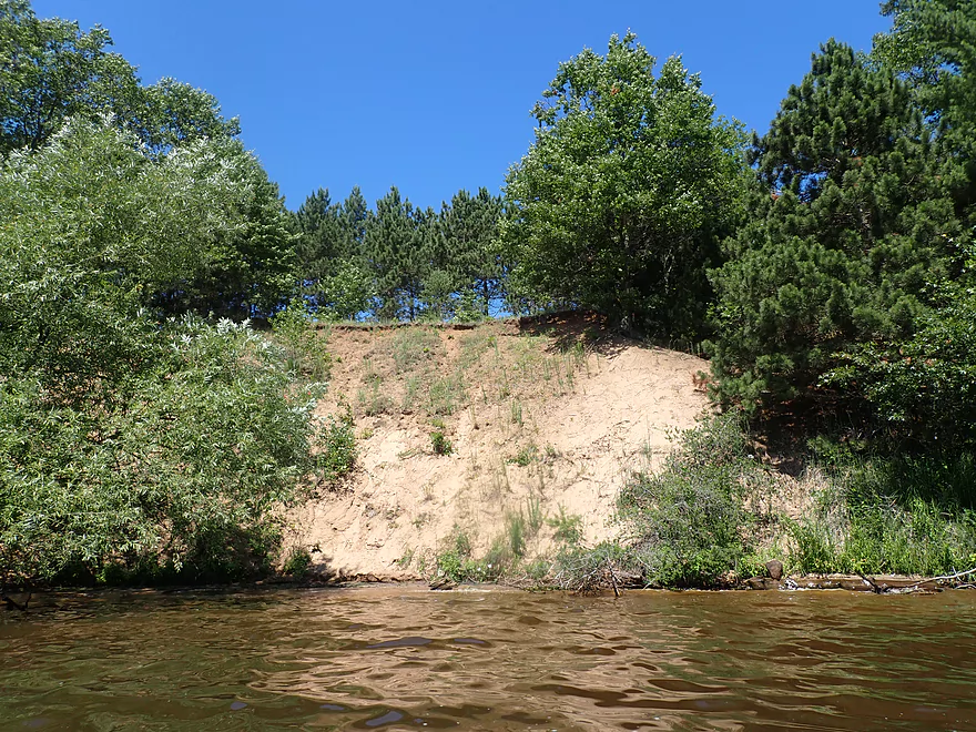
Looking north/upstream
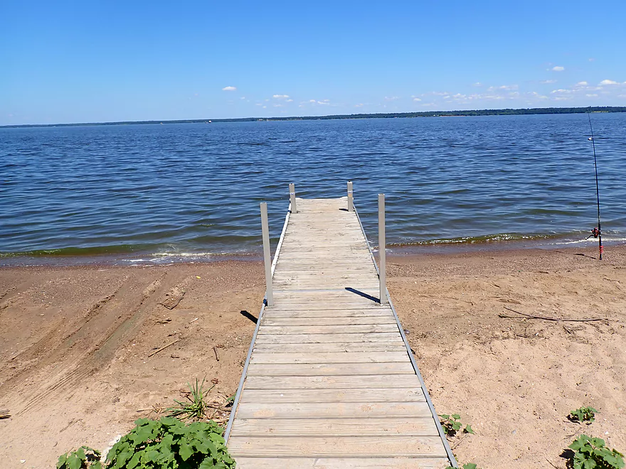
View from the water
Continuing to paddle north

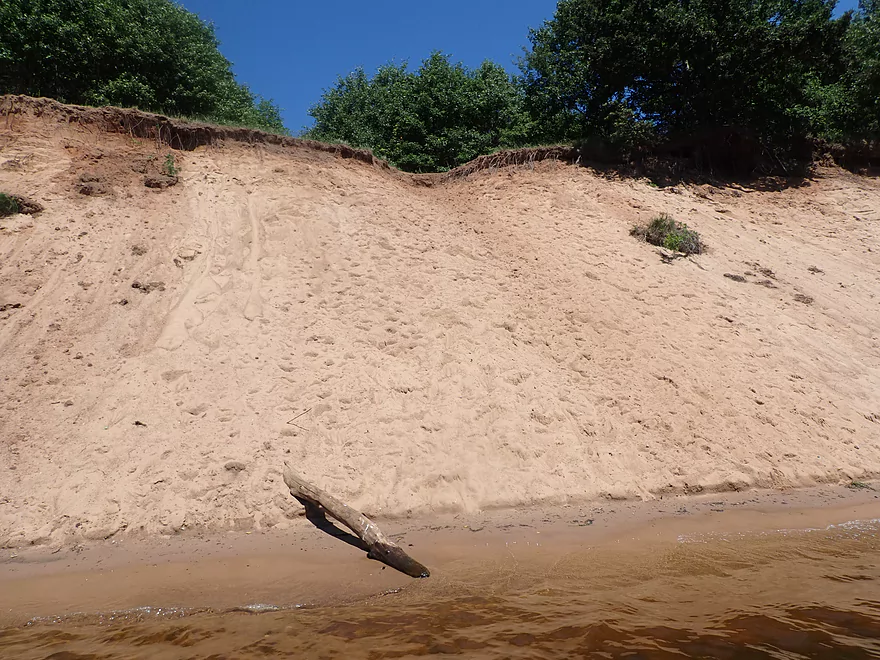
There were several medium-sized sand banks
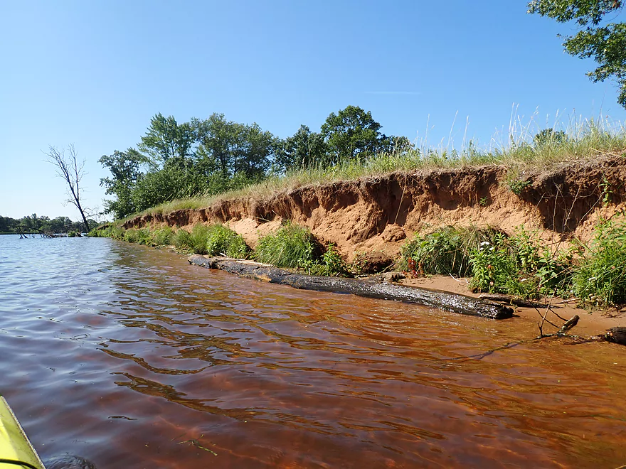
Taking a break at “Yellow Banks”
This is a public natural area
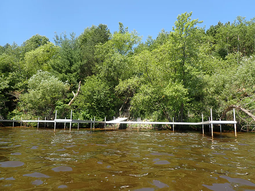
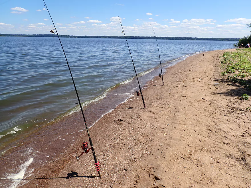
Some huge piers along the shore
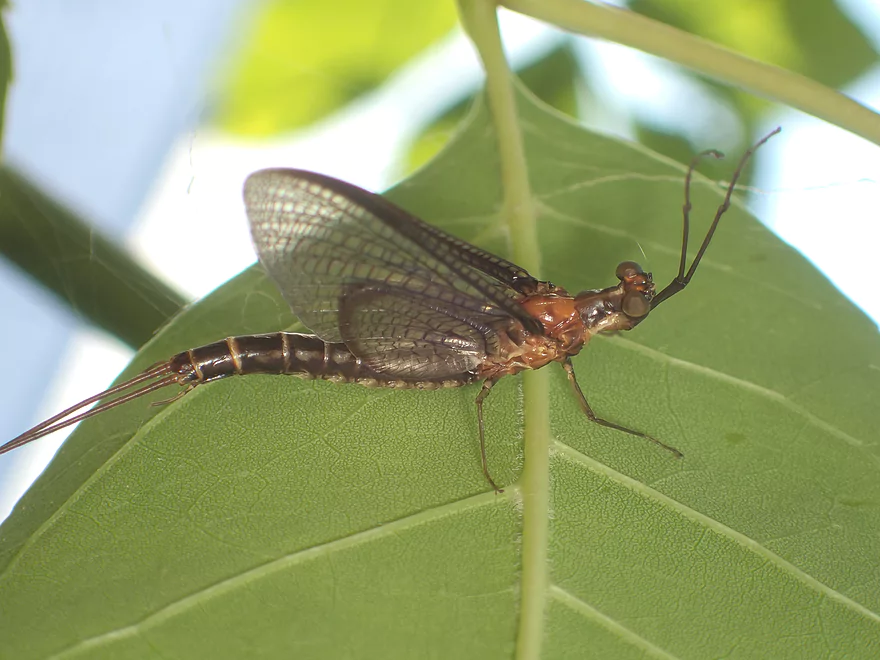
A freshly emerged mayfly
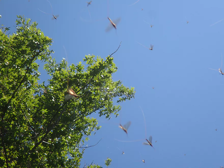
The sky was full of them
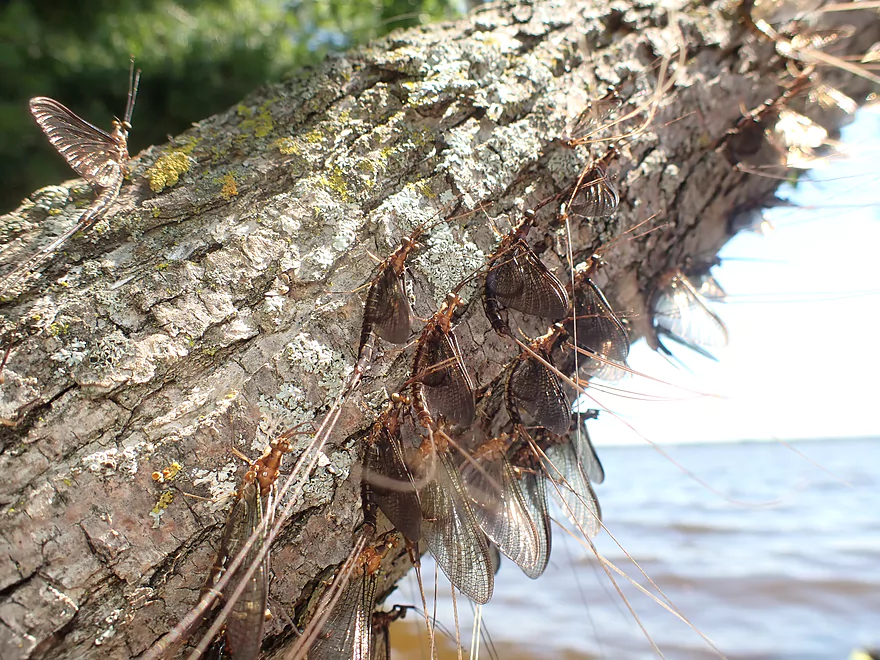
If not in the air, they were clumped on trees and branches
Many shoreline owners have built huge stairs to reach the water
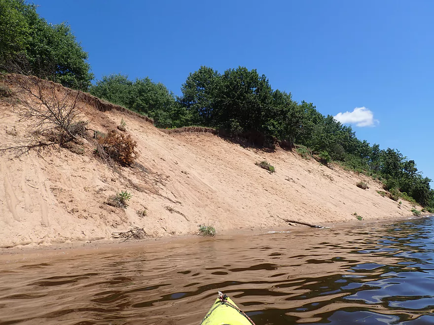
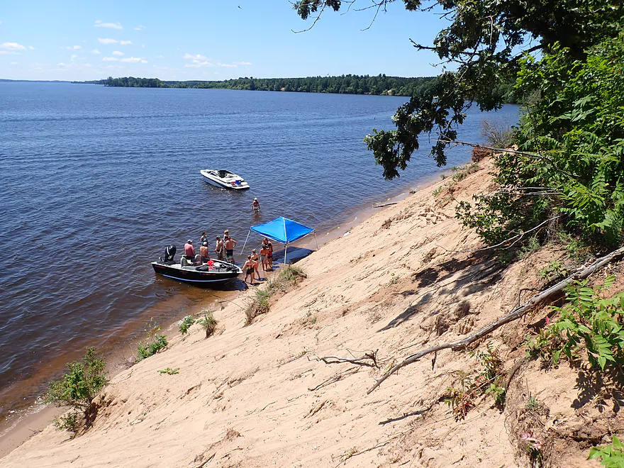
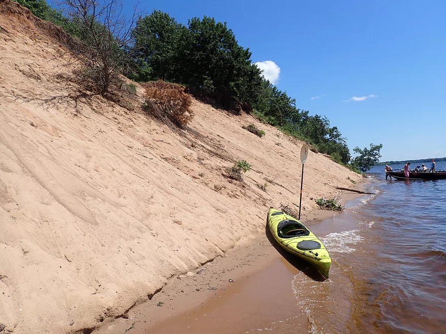
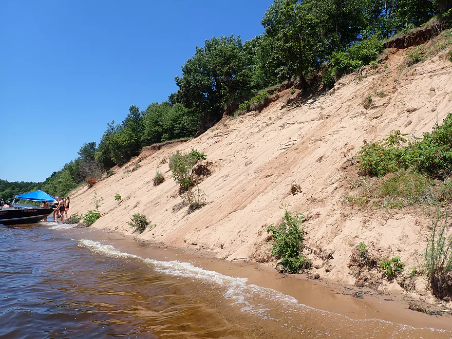
This sand bank by 25th Ave was the largest and best of the trip
Checking out a path at the south end of the bank
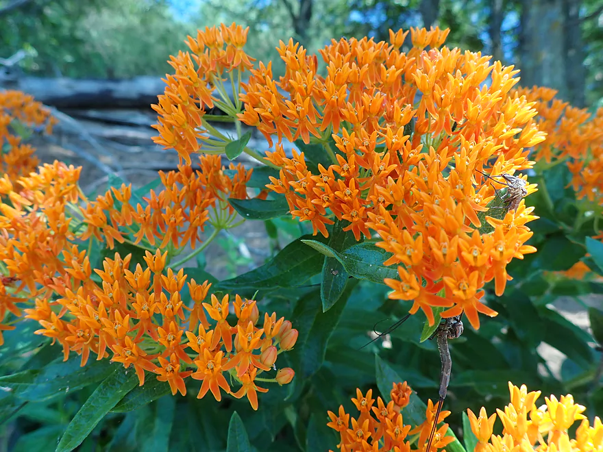
Beautiful orange butterfly weed
The path leads to the top with a great view. Looking north…
…east…
…and south.
Heading back down
Neat area
View from the water
Looking straight up…
…and back
I was going to check out this side slough, but it was sealed in by a low water sandbar
Nice shoreline
Heading back to the slough
So many little Pacmans
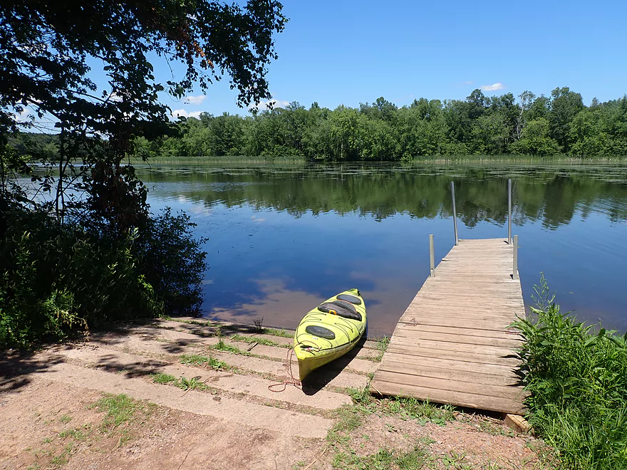
And back where I started
Longview Point was my original take-out plan, but I turned back early because of large waves which since receded
Looking north…
…east…
…and south
Petenwell Lake


The Wisconsin River has many dams and impoundments, but none are bigger than Petenwell Lake located in central Wisconsin. Here a 1948 dam backs up the Wisconsin River and creates the state’s second biggest inland lake at 36 square miles. It’s mostly too big for enjoyable kayaking, but there are exceptions and I hoped to explore some of them for this trip.
My initial plan was to paddle the northwestern end of the lake (3rd Street Launch to Longview Point Access). But when I scouted my proposed take-out at Longview Point, the wind and waves were a bit stronger than I expected. So I settled for a backup plan to just do a more sheltered trip inside the sheltered sloughs.
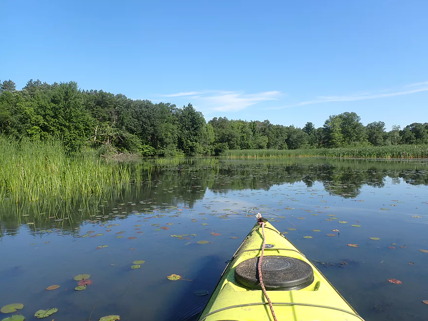
I launched from the 3rd Street launch but instead of proceeding east (into the main channel), I headed west up an old oxbow/slough and around a mile-long island. Despite a few parked motorboats, I didn’t see anybody else and suspect few explore these sloughs. The backwaters weren’t a five-star paddle, but had redeeming qualities. There were attractive marsh plants including lilies, cattails, and even large bryozoans balls that looked like underwater naval mines.
Close to Greenwood Cemetery, the channel narrowed and was filled end-to-end with duckweed, but this was easy to cut through and left artistic trails behind my boat. I was worried that with the lake being low, I would not be able to exit via the north end of the slough, but thankfully this wasn’t a problem.
The northern exit of the slough is next to a large archipelago of islands which mark the start of Petenwell Lake. Here I could see the same huge sandbank behind me that I had seen from last year’s Plank Hill trip. I decided to take a quick sandbar break on one of the islands to think over my trip plans. The wind and waves had died down and I still had a lot of energy left, so I decided to overshoot my put-in/take-out and explore the sandbanks south down by 4th Street.
Just to cross the lake from my island to 4th street, was 1.8 miles of open water paddling (it’s a big lake). I don’t recommend this type of open water paddling for most rec paddlers. You need a good boat and ideal weather conditions, or else you can get into trouble. Petenwell is so large that from the north, I couldn’t see the south end. Instead there was just a shimmering line where the dam was supposed to be. One of the peninsulas falsely appeared as an island and several motorboats looked as if they were floating on air. Kind of a neat experience! …except for that paper mill stench I kept smelling.
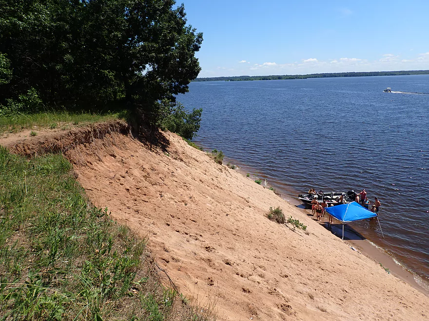
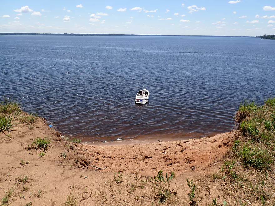
I finally reached a public access at 4th Street. This was actually a neat area with a nice little park sitting atop a large sandbank. Scenic wood stairs lead to the water and from the top there is a great view of the lake. Kayakers could actually take out here if they were willing to lug their boats up the steep stairs.
I then followed the shoreline north to head back to my put-in. The next landmark I encountered was “Yellow Banks”. This is a public area along the shore which included medium sized sandbanks carved out from the shore. It was here where I was mobbed by mayflies. Yellow Banks is a scenic area but trees obscure the best of the sandbanks. Normally I’m not a fan of removing trees, but I actually think it might be justified here.
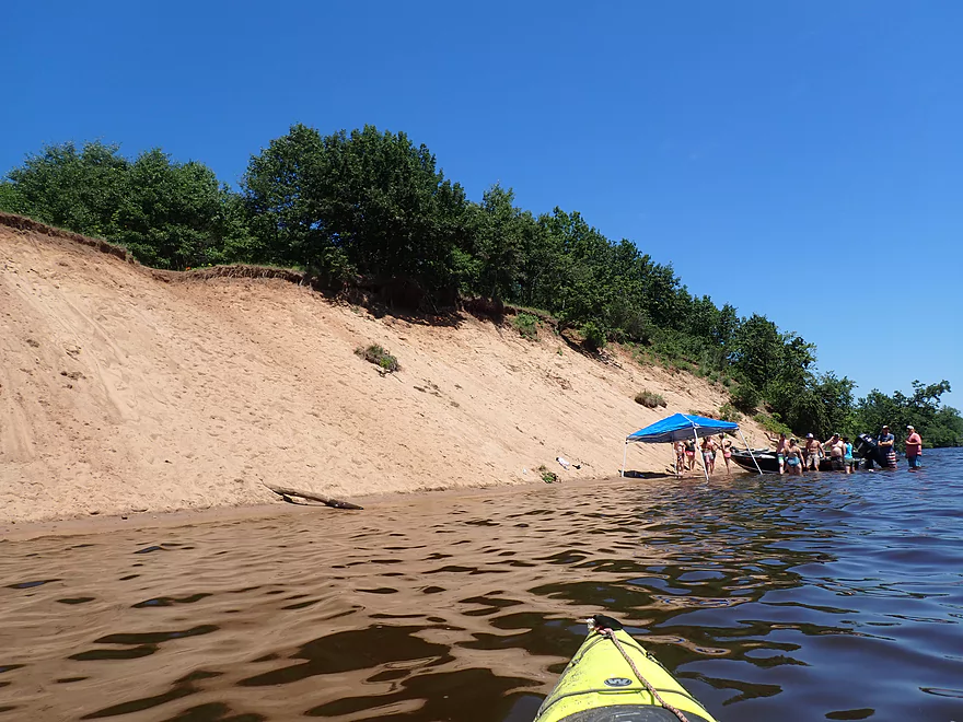
Proceeding north, things got busier as I passed a few homes, piers, and was passed by a number of boats and jet skies. I finally came to the highlight of the entire trip in a huge sandbank (located just east of 25th Ave). While not as large as the Nekoosa sandbanks (or even the one I saw on the La Crosse River), it was still quite impressive. Unfortunately it was a popular hangout for boats who would anchor by the bank and hang out. This can be a bit frustrating for photography. People can think you are being rude by taking a picture of them without their permission…when in reality they are actually photo-bombing nice scenery behind them. South of the main wall, there was a sandy trail that led to the top. From here there was a great vista of the bank and the lake.
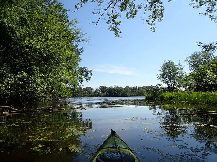
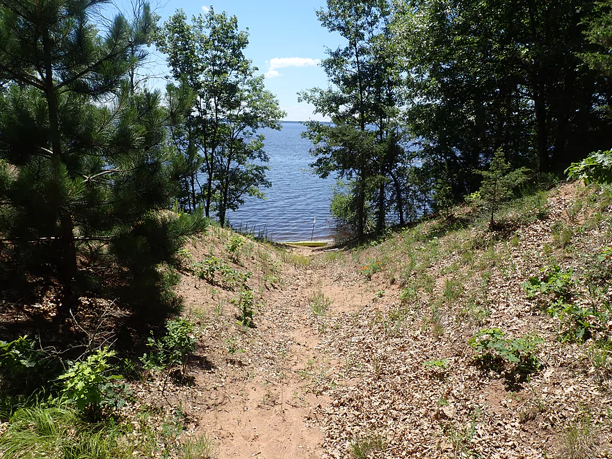
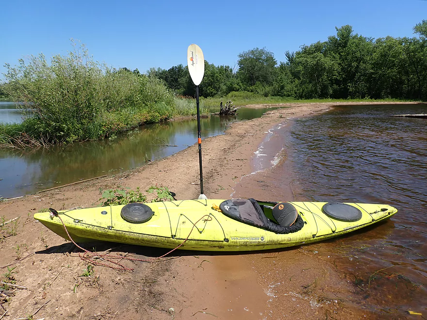
After all that, I continued north to my take-out. To my west was a large lagoon I had previously contemplated exploring, but it had been shut in by a narrow strip of sand due thanks to the low lake levels and was now just a pond. For the last half-mile I was back in the protected slough, which was a bit more boring, but was also more quiet and peaceful.
In summary, this was a diverse trip with different elements that were almost different trips. I doubt most would recreate my exact trip, but would instead focus on either the sloughs, islands, or sandbanks…not all three. Something unfortunate about my cutting the trip short because of the high waves was that I missed two of the sandbanks I had hoped to paddle past and photograph. Kayakers who enjoy this type of scenery might consider a one-way trip from Plank Hill to Longview Point Access (9 miles). This would include seven sandbanks, three of which would be quite impressive and would include the two that I missed.
Sights included some eagles, a great blue heron, ducks, and a number of large flopping fish. Most were carp, but a few weren’t. I did some research and it appears that while eagles mostly don’t take on carp (they are too large) they do occasionally make exceptions. The number and size of the bryozoans in the oxbow was unique and a trip highlight.
3rd Street Boat Launch: This was a good public boat ramp with no fees. Note the access drive to the ramp is quite steep. As this is a small boat ramp, you should probably follow the unwritten rules of good boat ramp etiquette: don’t park where you’ll block cars with trailers and load/unload quickly.
Alternate Access Points: There are many access options on Petenwell Lake. See the trip map for more details. Generally speaking I suspect the south end of the lake is boring, but does have nice parks. The northwest side has great sandbanks and the northeast side has an interesting archipelago of islands. If you like sandbanks, one idea would be to start a one-way trip from Plank Hill Small Boat Access and take out at Longview Point Access. This would be 9 miles and would include seven sandbanks, three of which are quite impressive.
Note, this was a round trip so no shuttle was needed. If paddlers prefer, a bike shuttle along the west shore of Petenwell Lake wouldn’t be bad. The roads are mostly paved, straight, flat, and have little traffic.
Current: None.
Wind: It is very important that you monitor the forecast and know the wind speed/direction prior to a trip. I paddled with a 7 mph west-to-east breeze and wouldn’t have wanted to paddled in anything stronger. Not only can you be blown about, but strong waves can build up on the downwind side of the lake.
Waves: The waves on Petenwell Lake are infamously rough when it is gusty out. Again this correlates with wind speed and direction. Typically the waves will be most mild in the morning and strongest in the afternoon. Motorboats will create their own big waves that kayakers will have to deal with.
Open Water Paddling: Petenwell is about two miles wide and 14 miles long. This means there is a lot of open water which can be surprisingly dangerous for paddlers. Here are some helpful open water paddling tips.
- Stay close to shore: A good rule of thumb is never go further from shore than you are willing to swim.
- Know the water temperature: In the spring, Petenwell Lake can be dangerously cold.
- Sealed bulkheads: Some cheaper kayaks don’t have these and will not stay afloat that great if flipped.
- Re-entry plan: Know how to either do an eskimo roll or a wet re-entry.
- Skirt: A full skirt can be nice to keep waves out of the cockpit. A half-skirt is also a decent option in some contexts.
- Life jackets: Absolutely wear one when on open water. Assume you’ll be rolled by a big wave. Even if you’re a good swimmer, you’ll need the energy a jacket provides to swim to shore or to do a re-entry.
- Use the right boat: Use a boat with good primary and secondary stability.
Nearest Gauge – Wisconsin River @ Petenwell Dam: 923.65′
Because this is a big lake, the depth won’t matter that much. That being said I did it at a low depth, and one of the side sloughs I was going to check out was sealed in by a surprise sandbar. According to NOAA 924.0′ is action stage, and 925.’ is minor flood stage.
Quick Overview
- Upstream of Stevens Point: I don't have information yet on these stretches.
- Stevens Point to Lake Petenwell: ~42 miles. This stretch in Central Wisconsin used to have many natural rapids, but most have been buried under 8 dams, some of which are now difficult portages. Despite this there is still some good paddling to be had in this region.
- Lake Petenwell: 14.9 miles. This is a large flowage lake that is challenging for paddlers because of frequent strong winds and big waves.
- Castle Rock Lake: 14.5 miles. Another large flowage lake that is likely too big for enjoyable paddling.
- Castle Rock Lake Dam to Lemonweir River: 9.4 miles. This pre-Dells leg isn't elite, but is a pleasant stretch.
- Lemonweir River to Indian Trails Landing: 21.7 miles. This includes the famous Upper Dells and Lower Dells which feature many scenic sandstone outcrops.
- Indian Trails Landing to Portage: 16 miles. This is an overlooked section sandwiched between the Dells and Portage. While the scenery isn't top-notch, it does have many sandbars and few people, which is a nice combination.
- Portage to Lake Wisconsin: 14.3 miles. This is a neat stretch of the river with many sandbars and cliffs, but the shoreline is very developed and motorboat traffic can be heavy on weekends.
- Lake Wisconsin: 14.5 miles. This is a challenging lake for paddling because of the huge and frequent waves created by motorboats.
- Prairie du Sac Dam to Port Andrews: 57 miles. This is the first half of the famous Lower Wisconsin Riverway. This is a super popular stretch for paddlers with the highlights being large sandbars, big bluffs, occasional cliffs, and fun side sloughs to explore.
- Port Andrews to Wyalusing: 40 miles. This is the second half of the Lower Wisconsin Riverway which has far fewer paddlers and sandbars. But the bluffs and sloughs are larger and more interesting.
Detailed Overview
- Upstream of Merrill: I don't have enough information yet on these legs to comment.
- Merrill Dam to Riverside Park: 0.5 miles. Might include some light rapids below the dam.
- Riverside Park in Merrill to Wisconsin River Forest Landing: 8.6 miles. A good prospect.
- Wisconsin River Forest Landing to Brokaw Boat Landing: 5.7 miles.
- Wisconsin River Forest Landing to Jesse Park: 1.4 miles. A terrific stretch with small boulder gardens, one set of Class 1-2 rapids, gravel bars and a nice sand bank.
- Jesse Park to Brokaw Boat Landing: 4.3 miles. A good stretch with scenic wooded banks and occasional gravel bars.
- Brokaw Boat Landing to Gilbert Park: 5.1 miles. River slows down and becomes hillier. This stretch is an ok prospect and goes past the old Brokaw paper plant that has been shut down. Paddlers must navigate Class 1 rapids and a 2' drop where the old Brokaw dam used to be.
- Gilbert Park to Wausau Boat Dock: 1.5 miles. An impounded stretch through Wausau. There are numerous alternate access options to choose from.
- Wausau Boat Dock to Oak Island Boat Ramp: 1.2 miles. A nice stretch that includes Barkers Island and Isle of Ferns Park. But the Wausau dam does require a portage. This stretch parallels the famous Wausau Whitewater Park.
- Oak Island Boat Ramp to Rothschild Dam Access: 5.8 miles. Likely mostly uninteresting flowage paddling. There are many alternate access options to choose from.
- Rothschild Dam Access to Zimpro Park: 1.0 miles. This might be a nice stretch.
- Zimpro Park to River Road Boat Landing: 7.6 miles. The first half of this leg is likely nice river paddling, but the second leg is probably just an uninteresting flowage.
- Chucks Landing/Mosinee Dam to Bean's Eddy Boat Landing: 2.8 miles. Likely a nice leg. You might be able to launch by the dam where there should be some nice rapids and boulders.
- Bean's Eddy Boat Landing to Seagull Boat Landing: 5.1 miles. Mostly uninteresting flowage paddling. Although there might be some nice sand banks on the eastern shore.
- Seagull Boat Landing to Dubay Dam Access: 5.3 miles. Mostly uninteresting flowage paddling.
- Dubay Dam Access to River Road Landing: 5.5 miles. This could be a nice stretch of river.
- River Road Landing to Old US 10 Landing: 2.3 miles. Likely an ok leg.
- Old US 10 Landing to Stevens Point Dam: 5.6 miles. Probably uninteresting flowage paddling. Many alternate access options closer to Stevens Point.
- Stevens Point Dam to Blue Heron Boat Landing: 4.2 miles.
- Steven Point Dam to Whiting Dam: 2.6 miles. Starts slow and uninteresting, but the river becomes very scenic after the Hwy HH bridge. The rock formations below both dams are very striking. Many alt access points.
- Whiting Dam to Kimberly Clark Dam/Al Tech Park: 0.6 miles. Incredible scenery with exposed bedrock and boulder gardens below the Whiting Dam. Some rapids, but nothing major. The Kimberly Clark Dam is a dangerous low-head dam and should be treated carefully.
- Kimberly Clark Dam to Blue Heron Landing: 1.0 miles. Class 2 rapids below the dam, but after that the river slows dramatically and splits into many sub-channels and islands. Round trips on this leg are possible. I chose the far western channel where there were some nice rocky stretches.
- Blue Heron Landing to Mill Creek Landing: 4.1 miles. Likely a mediocre paddle with nothing special. Galecke Park is an alternate access.
- Mill Creek Landing to Biron Dam North Gate: 7.6 miles. Mostly uninteresting flowage paddling. Several alternate access options on route.
- Biron Dam North Gate to Veteran's Memorial Park: 4.5 miles.
- Biron Dam North Gate to Biron Landing: 1.0 miles. Super scenic stretch by two islands with many granite boulders.
- Biron Landing to Legion Park: 3.0 miles. A nice stretch by Big Island. The west channel is more undeveloped...but the east channel has several scenic granite islands.
- Portage through Legion Park: 680'. A steep wall separates the park from the river but in two locations the wall is short enough to get over (see map). Paddlers may want to consider a longer portage to bypass some of the shallow rocky stretches by Legion Park.
- Legion Park to Veteran's Memorial Park: 0.4 miles. A scenic stretch that features a large boulder field and the powerhouse for a large paper mill.
- Veteran's Memorial Park to Port Edwards Landing: 3.8 miles
- Veteran's Memorial Park to Demitz Park: 0.8 miles. A pleasant stretch that includes Belle Island.
- Demitz Park to Ben Hansen Park: 1.2 miles. This leg goes by Garrison Island and Edwards Island. Lyon Park is located across the river from Demitz Park and is another access option.
- Ben Hansen Park to Port Edwards Landing: 1.8 miles. Above the Centralia dam there are several small but nice islands. Portage the dam on the left bank (follow the 1000' trail through the golf course). Below the dam there are scenic rock formations. Close to the Port Edwards dam are a few more scenic islands you can explore.
- Port Edwards Landing to Nekoosa/Riverside Park: 3.6 miles.
- Port Edwards Landing to Port Edwards Powerhouse: 1.3 miles. A half-mile portage is required (east bank). A very scenic boulder field is located below the dam. At high levels, the rocks are submerged and produce a half-mile stretch of rapids (some strong).
- Powerhouse to Moccasin Creek Landing: 1.8 miles. A generic wooded stretch that isn't super interesting.
- Moccasin Creek Landing to Riverside Park: 0.5 miles. During the Nekoosa dam drawdown, this stretch had nice boulder fields and rapids.
- Riverside Park to Hwy 73: 0.8 miles. An ok stretch of the river. There are scenic cliffs south of Hwy 73, but these are past the dam warning line. Hwy 73 is not a good access option.
- Hwy 73 to Point Basse Ave (Portage of the Nekoosa Dam): 1.5 miles. A difficult 1.5 mile portage through downtown Nekoosa. Don't try to portage the south bank. There is a steep hill, cliffs, and large Domtar paper mill fences to deal with.
- Point Basse Ave to Jim Freeman Memorial Boat Landing: 0.8 miles. A generic stretch going by historic Point Basse. If you're willing to backtrack to the dam, you can see scenic boulder fields (during low flows) and a few cliffs. Point Basse Ave is a somewhat speculative access, but it seems public and doable for launching.
- Jim Freeman Memorial Boat Landing to Plank Hill Small Boat Access: 2.0 miles. A generic stretch.
- Plank Hill Small Boat Access to 19th Drive Landing: 5.3 miles. Features two epic sand banks. The main channel has some minor sandbars. Several of the side sloughs can provide fun side adventures.
- 19th Drive to the Petenwell Dam: 14.9 miles. This is Lake Petenwell which is a large and challenging lake for paddling. Waves and strong winds are frequently an issue. But when calm there are nice sandbanks on the northwest shore, hidden sloughs, and large islands to explore. See the overview map for more info.
- Petenwell Dam to Ganter Lane Landing: 3.8 miles. This stretch isn't too impacted by dams and may have nice sandbars at low levels.
- Ganter Lane Landing to Castle Rock Lake Dam: 10.7 miles. Castle Rock Lake is likely too big (wind/waves) for enjoyable paddling. There are many alternate launch options along the shore.
- Castle Rock Lake to the Lemonweir River: 10 miles. An ok section.
- Lemonweir River Mouth to River Bay Landing: 7 miles. The first half of the classic Upper Dells.
- River Bay Landing to Blackhawk Island: 6.5 miles. Second half of the classic Upper Dells, known for its fantastic outcrops. Note, the Blackhawk Island landing is no longer accessible without special permission from the Upham Woods Outdoor Learning Center.
- Black Hawk Island to Wisconsin Dells Dam: 2.0 miles. More nice sandstone outcrops. You can take out at a public ramp off Indiana Ave or portage the dam and take out SW of the dam by a launch off Wisconsin Dells Pkwy/Hwy 12.
- Dells Dam to Indian Trails Landing: 6.2 miles.
- Dells Dam to Newport Park: 2.2 miles. This is the heart of the famous Lower Dells with many scenic outcrops. Unfortunately jet boats are a serious plague on this stretch.
- Newport Park to Indian Trails Landing: 4.0 miles. Features the famous "Sugar Bowl" formation and four super cool caves. The outcrops soon disappear and this stretch is mostly uneventful (but peaceful) big river paddling.
- Indian Trails Landing to Pine Island Boat Ramp: 9.8 miles. Few paddle this stretch as it isn't as interesting. But...it does have a good concentration of sandbars and few competing paddlers for them.
- Pine Island Boat Ramp to Portage/Hwy 33 Access: 6.0 miles. Not an elite section that is lacking in cliffs and bluffs. It does have good sandbars though.
- Portage to Dekorra Park: 7.7 miles
- Portage to Baraboo River/Thunderbird Road: 5.2 miles. A good section with great sandbars. Close to Portage there are few motorboats.
- Baraboo River to Dekorra Park: 2.5 miles. River splits around massive Lib Cross Island. West channel has nice sandbars. St Lawrence Bluff has scenic sandstone outcrops and includes a cave you can paddle into.
- Dekorra Park to James Whalen Memorial Park: 6.6 miles.
- Dekorra Park to Camp Rest Park: 5.1 miles. A terrific section with rock outcrops, large island deltas, hidden sloughs, and nice sandbars. Unfortunately this part of the river is popular with motorboats and jet skis which can be a plague. Multiple alternate access options.
- Camp Rest Park to James Whalen Memorial Park: 1.5 miles. Not a great section because of the open water paddling, powerboats and big waves. The west shore though does have nice outcrops.
- James Whalen Memorial Park to Merrimac Memorial Park: 4.4 miles. River turns into "Lake Wisconsin". Generally speaking this isn't ideal for kayaking as motorboat traffic can be heavy and waves can be surprisingly big. The most direct route is the north shore which has a few bluffs, but generally speaking isn't that interesting.
- Merrimac Memorial Park to Veterans Memorial Park/Prairie du Sac: 9.6 miles.
- Merrimac Memorial Park to Moon Valley Landing: 3.3 miles. Includes a lot of developed shoreline. The ferry, railroad bridge, and Moon Bay are highlights.
- Moon Valley Landing to Veterans Memorial Park/Prairie du Sac: 6.3 miles. Other than Moon Bay and the dam, this is a boring stretch. There are numerous alt access options on this route.
- Prairie du Sac to Mazomanie: 8 miles. An ok section of the Wisconsin but lacking in sandbars.
- Mazomanie to Arena: 9.7 miles. A great section with nice sandbars and scenic bluffs.
- Arena to Hwy 14: 8.0 miles. Good section with a high concentration of sandbars. One of the more popular legs on the Lower Wisconsin.
- Hwy 14 to Hwy 23/Spring Green: 2.2 miles. Neat mini-section with sandstone outcrops. Very popular in the summer.
- Spring Green to Lone Rock: 7.4 miles. Another fine sandbar/bluff section with some nice rock outcrops too.
- Lone Rock to Gotham: 8 miles. This stretch has super impressive rock outcrops and sand banks.
- Gotham to Muscoda: 7.6 miles. This leg includes more large sandbars and great outcrops. Bonus highlights include fast current and not seeing as many people.
- Muscoda to Port Andrew: 7 miles. A good stretch with many islands and sandbars.
- Port Andrew to Boscobel: 9 miles. Wooded islands start to get massive.
- Boscobel to Woodman/Big Green River: 9 miles and start of the less paddled stretch of the Lower Wisconsin. Far fewer sandbars from here to the mouth, but good bluffs and side sloughs to explore.
- Woodman to Millville: 7.7 miles. A good stretch with large bluffs and sandbars.
- Millville to Bridgeport: 5.3 miles. Huge islands, bluffs and sandbars are the highlight on this second-to-last leg on the Wisconsin River.
Bridgeport to Wyalusing (the mouth): 9 miles.
Trip Map
Overview Map
Video
Photos Size: