
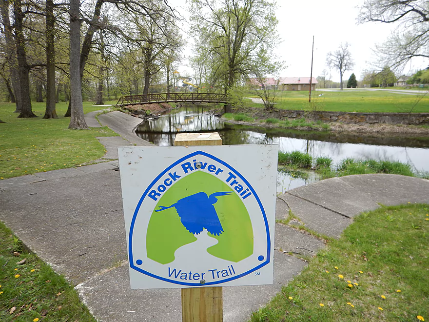
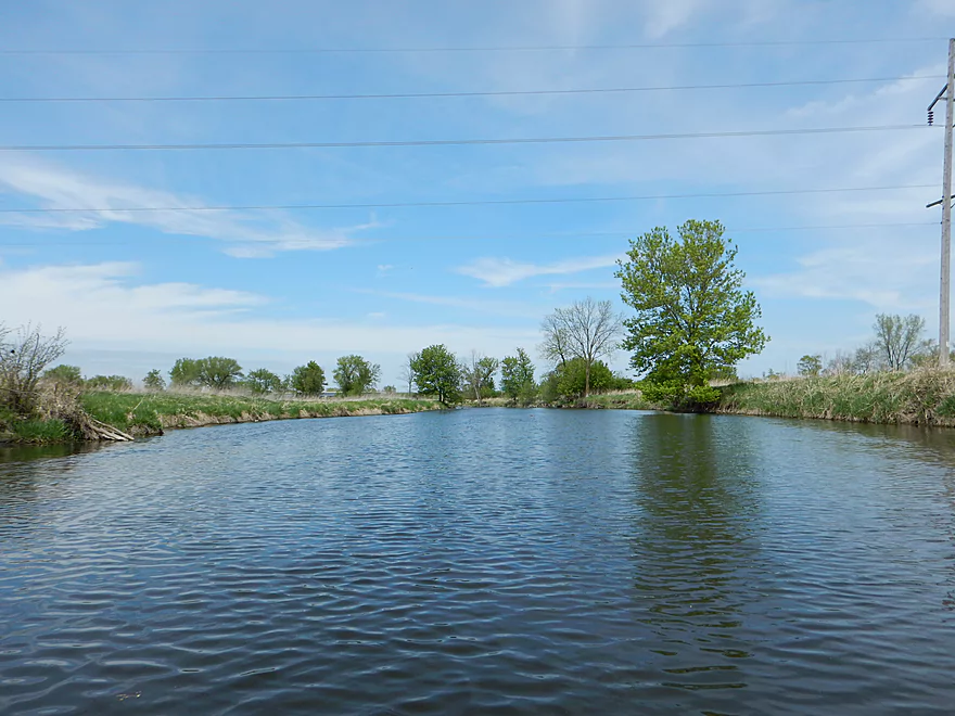
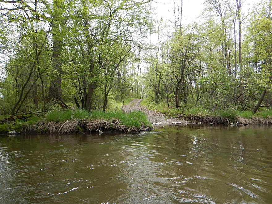
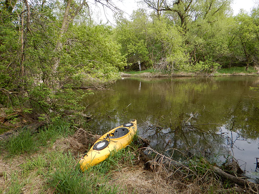
Waupun Park is a great put-in
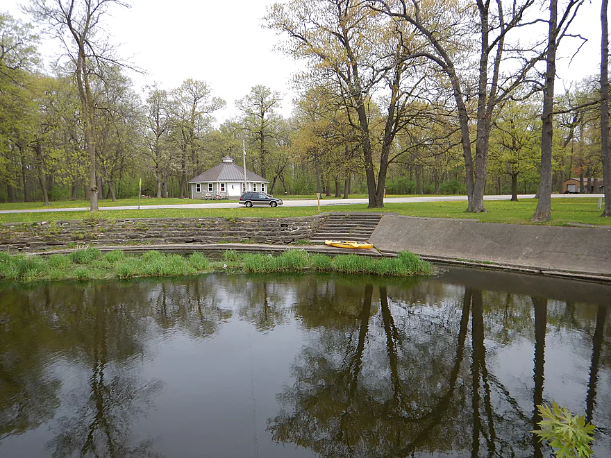
Good parking, launch and outhouse
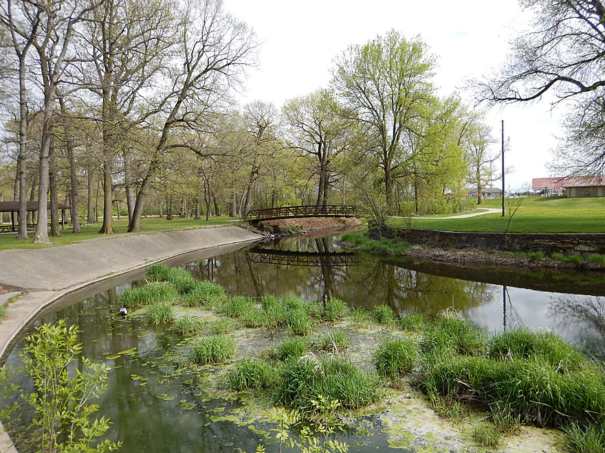
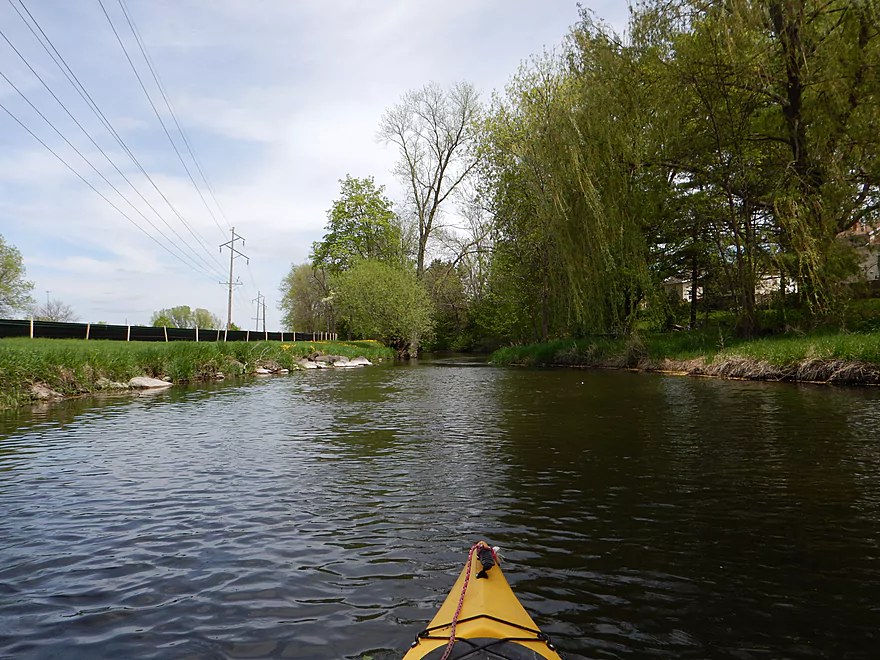
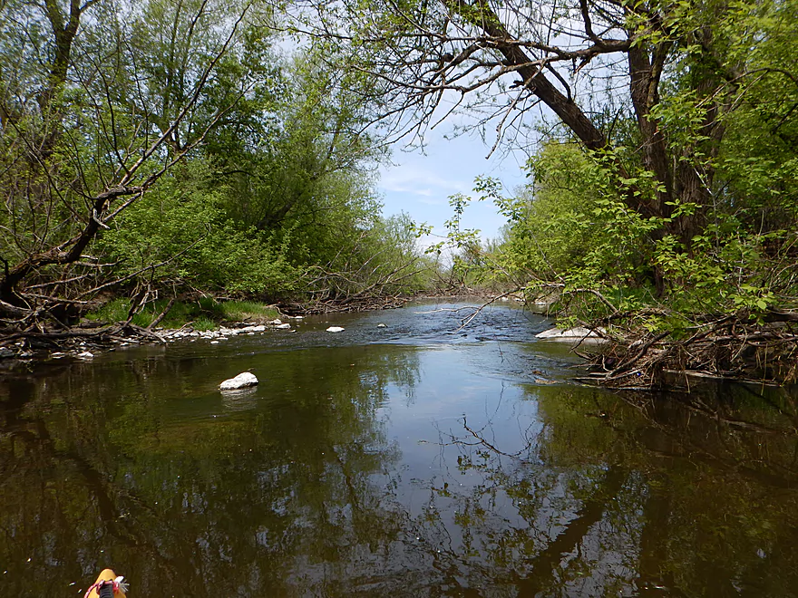
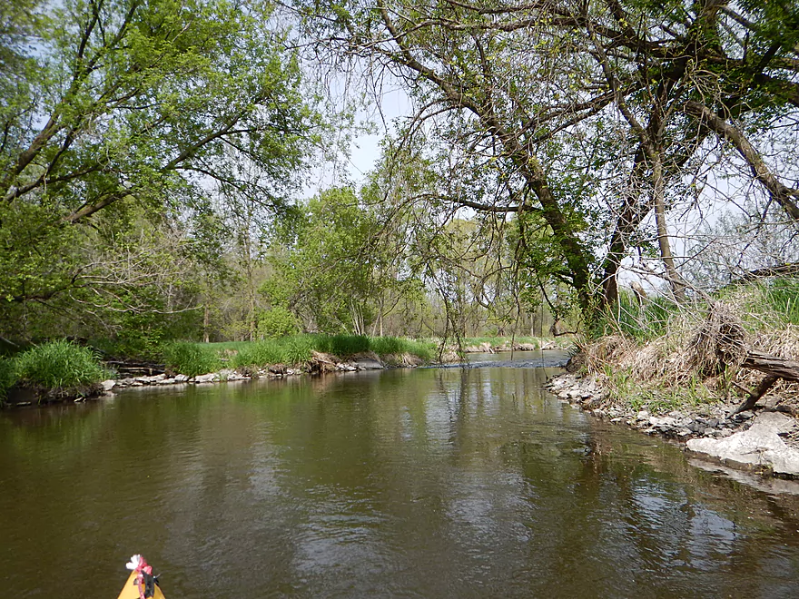
And scenic
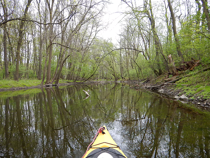
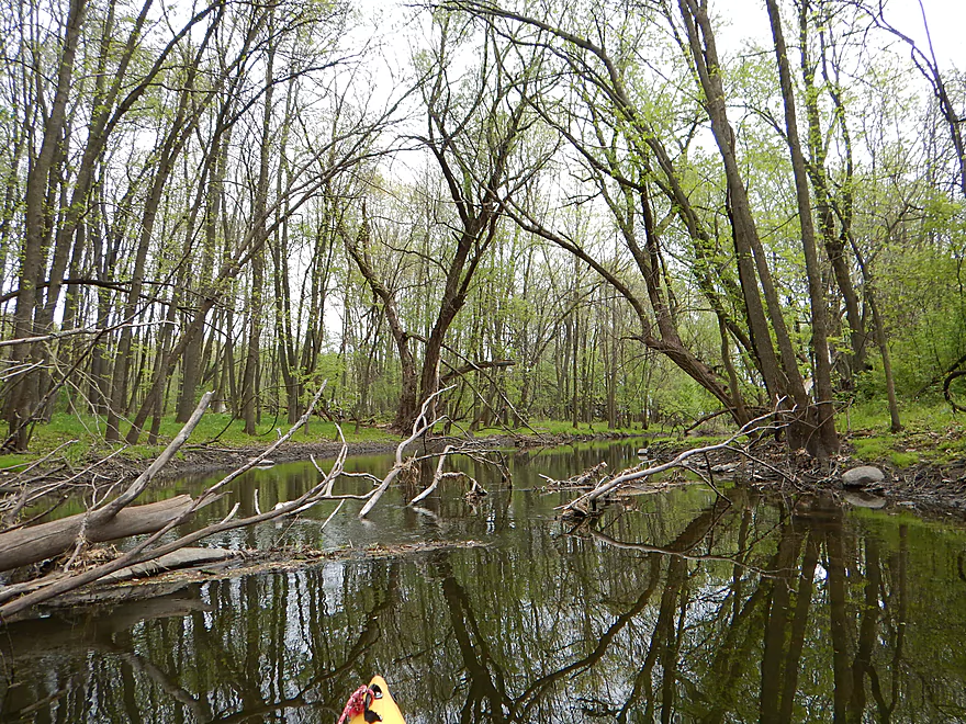
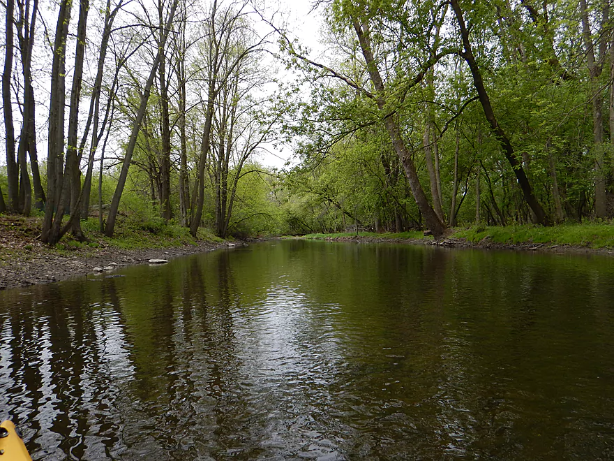
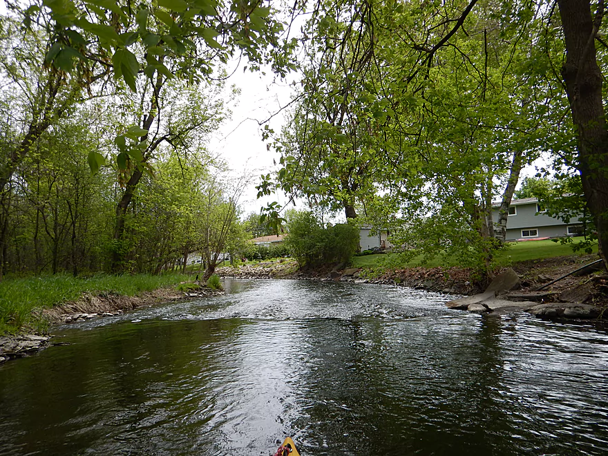
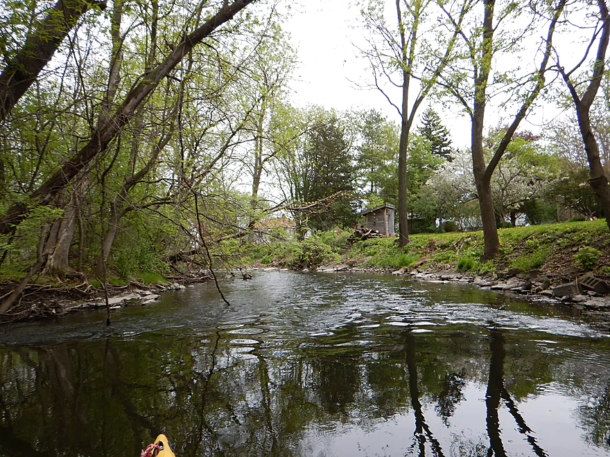
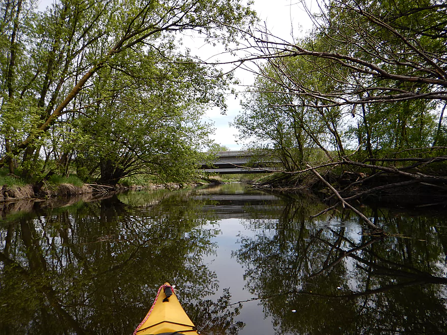
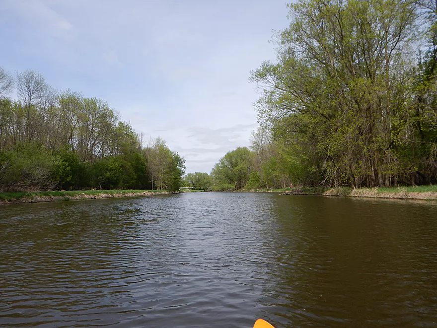
Nice wooded section to kick things off
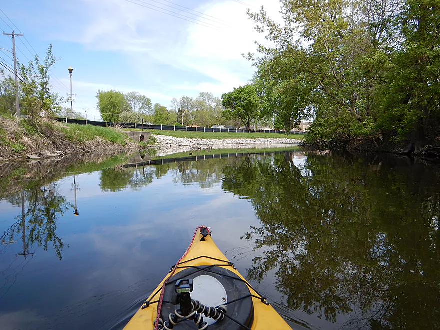
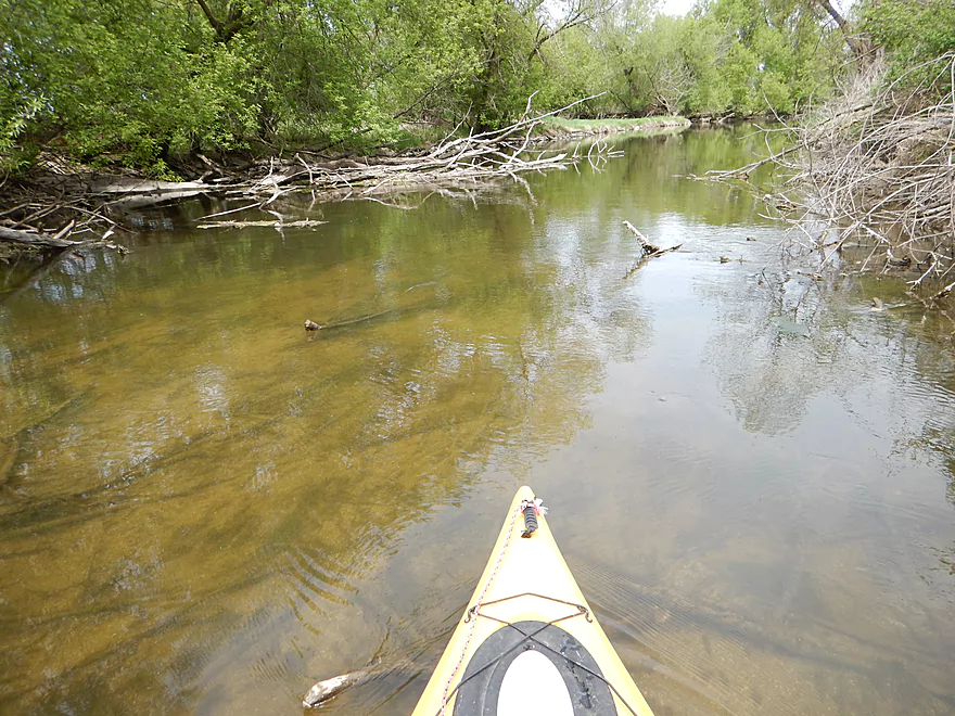
This does get cleared out (mostly)
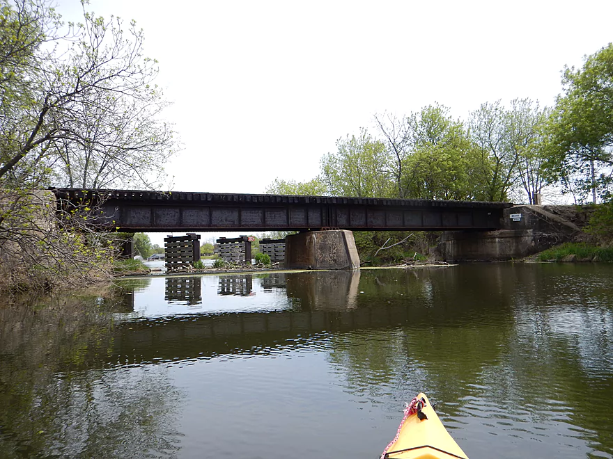
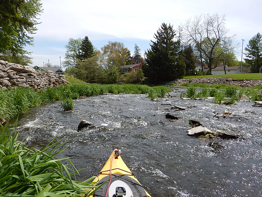
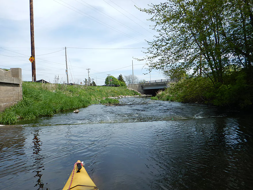
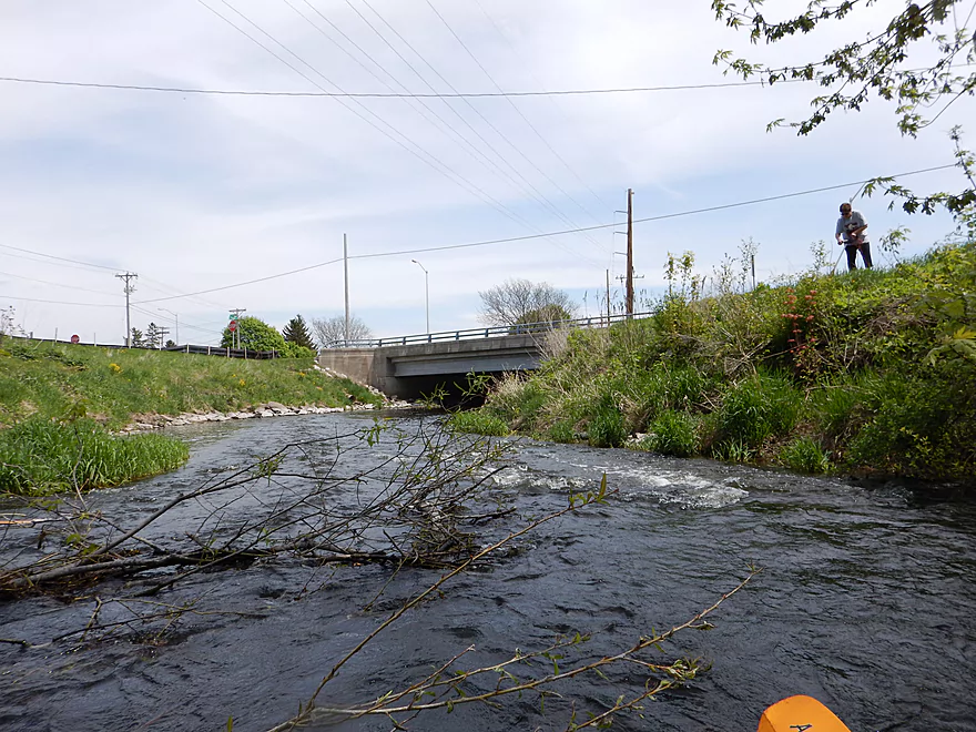
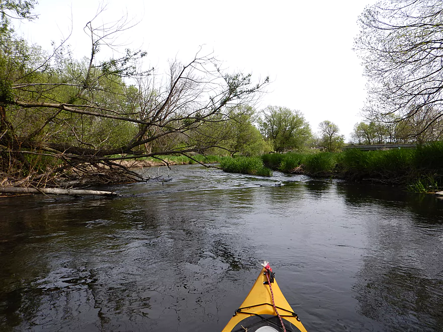
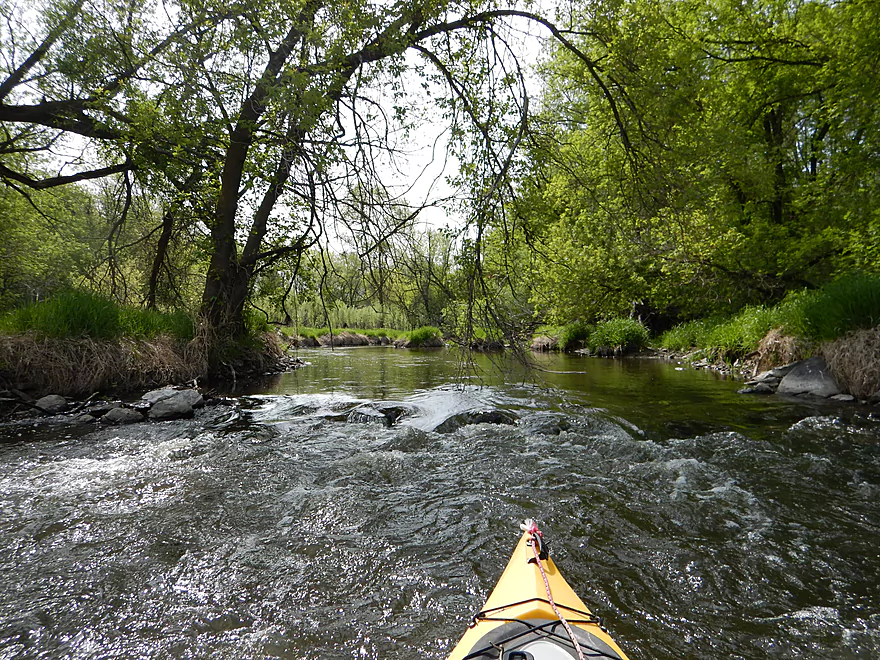
Fun rapids by Pine Street
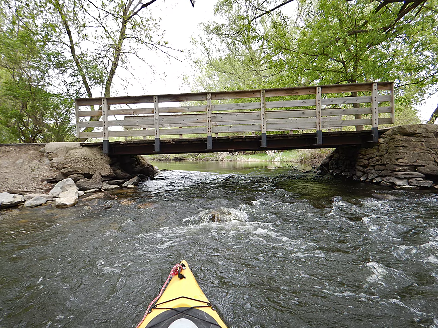
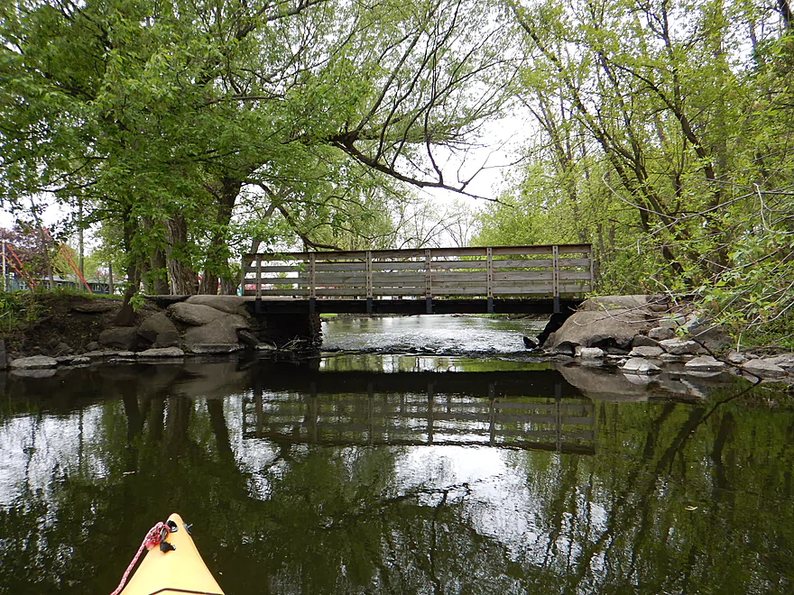
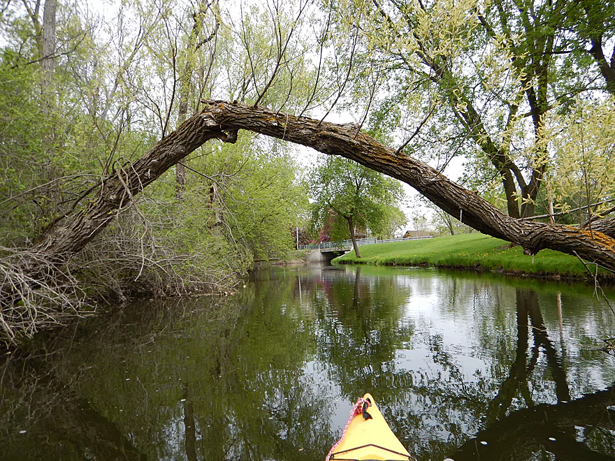
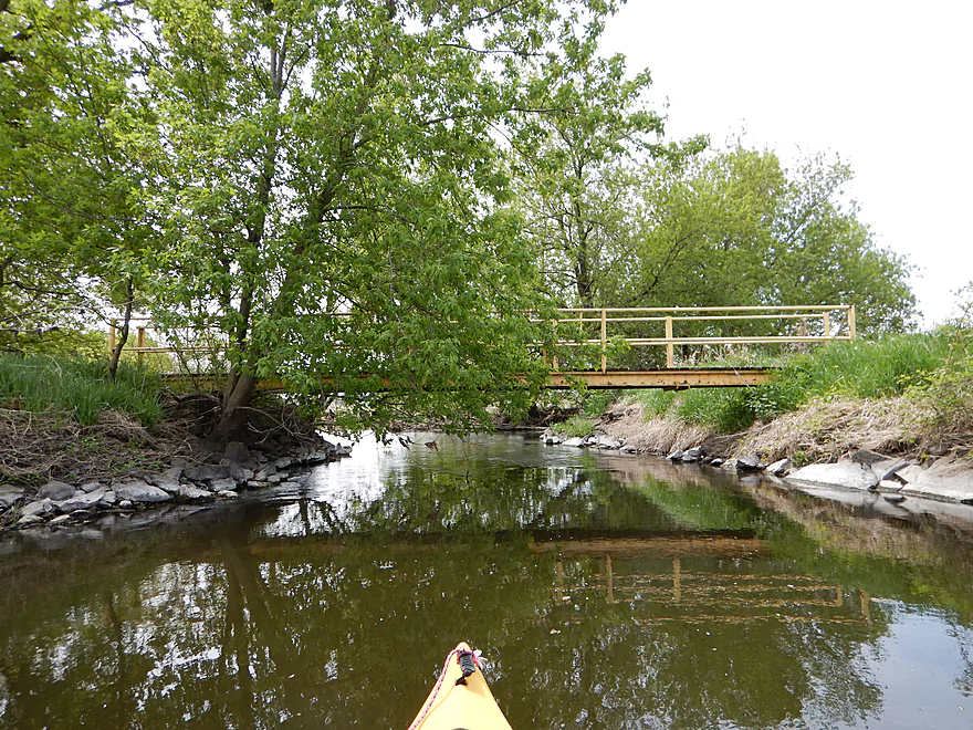
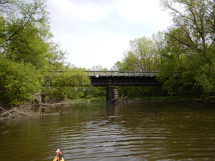
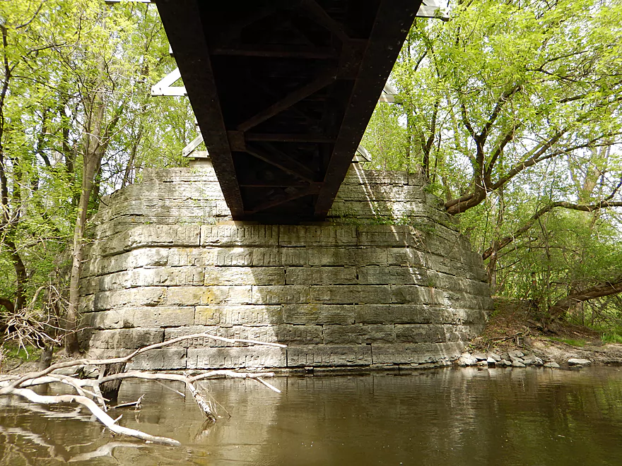
You have to duck under the bridge though
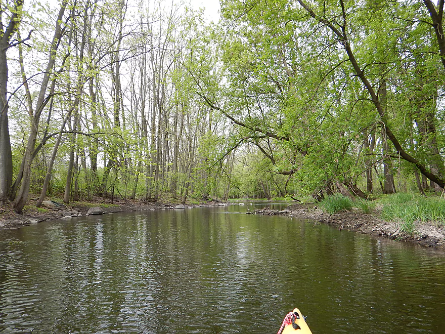
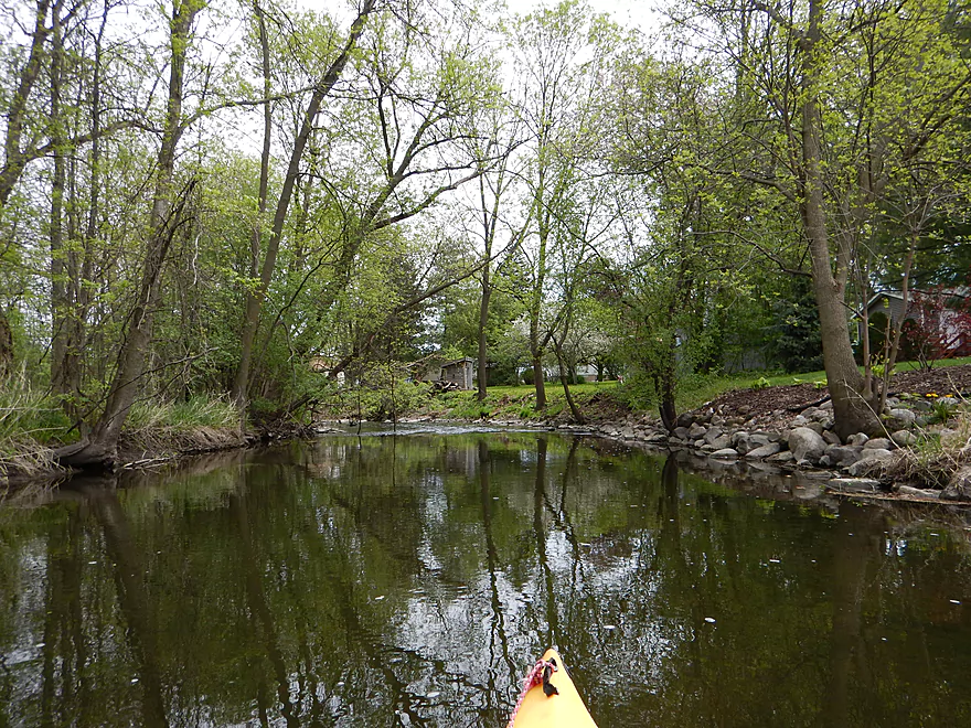
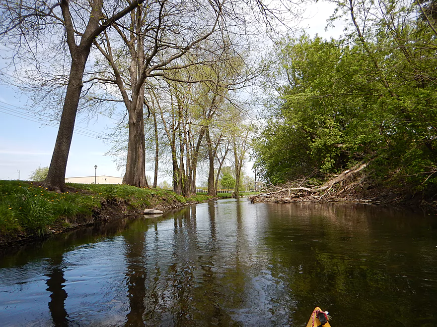
Nice peaceful woods
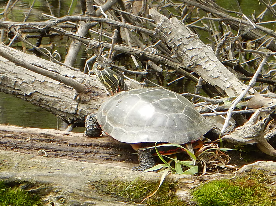
Many, many painted turtles
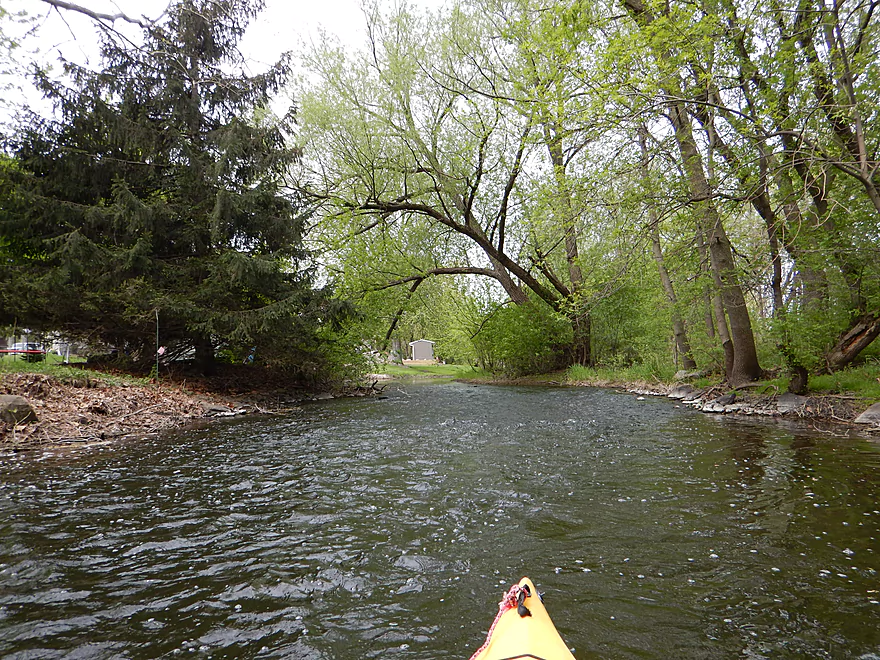
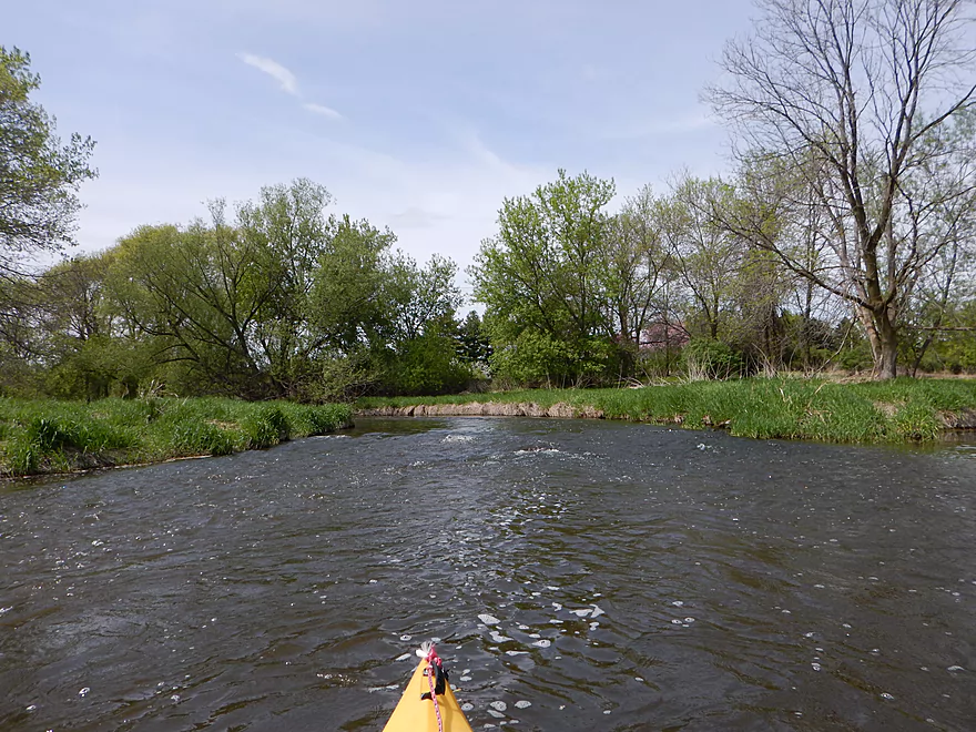
More fun riffles
Favorite section of the trip
Lot of little riffles
A sign of things to come
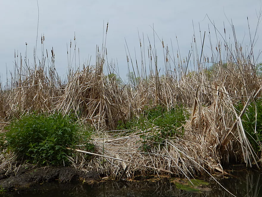
Start of the main flowage
And where there are flowages…
It’s not a big lake
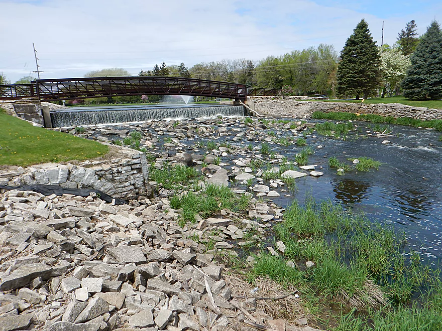
Easy dam portage (avoid the kayak shower though)
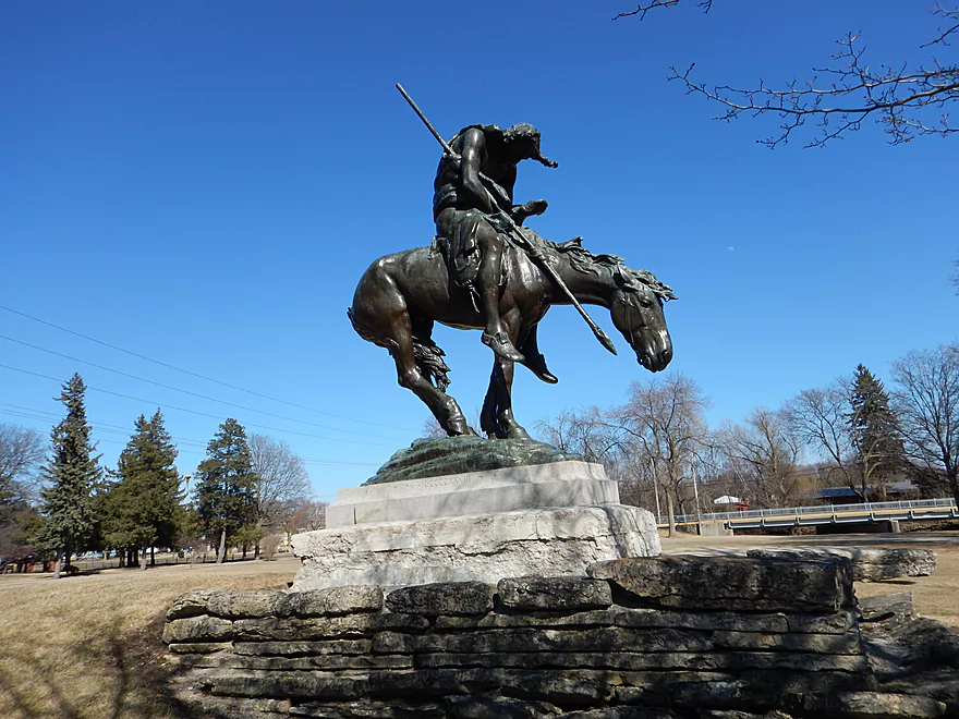
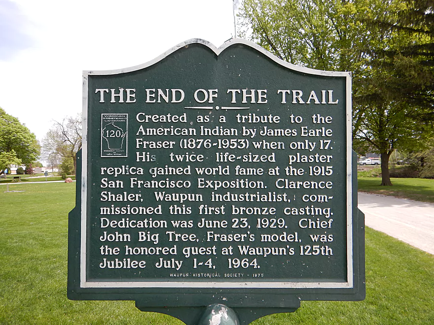
End of The Trail
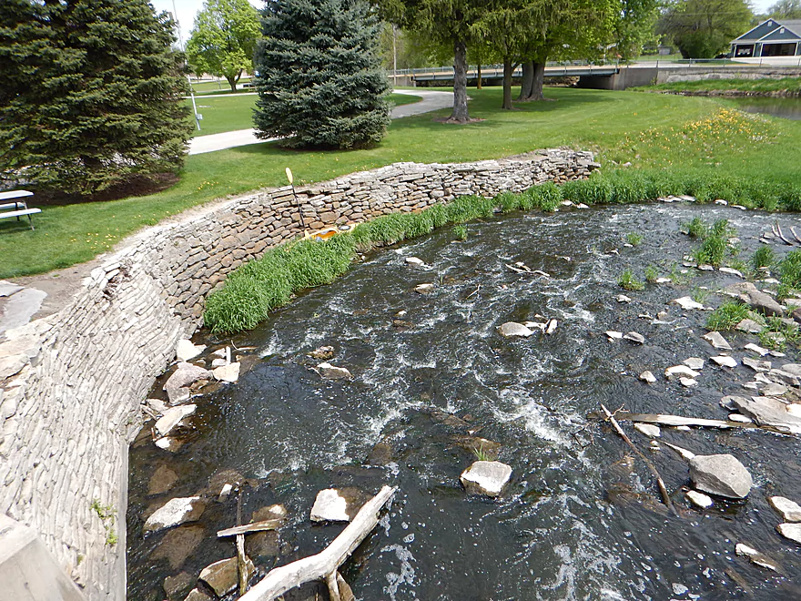
Boulder garden below dam is scenic
Tried running the rapids just below the dam
But it was too bumpy
Favorite picture
Tanner Park is a take-out option
Black fence I think is for construction and you can step over it
Very small lowhead dam
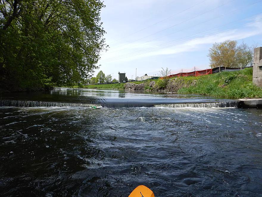
Bottles trapped in the backwash…probably safe but be careful
More fun rapids
Yummy goodness
A very noisy Hwy 151
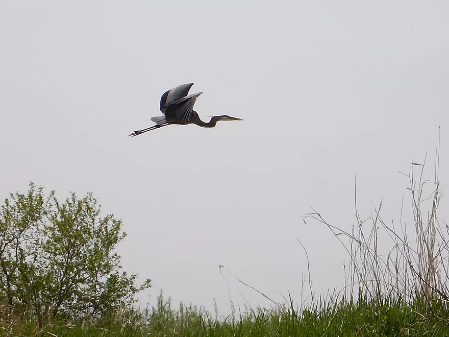
Great blue heron
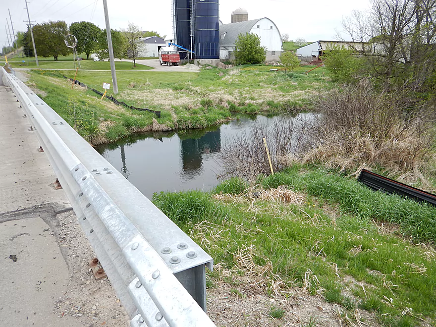
Leaving the city behind and entering farm country
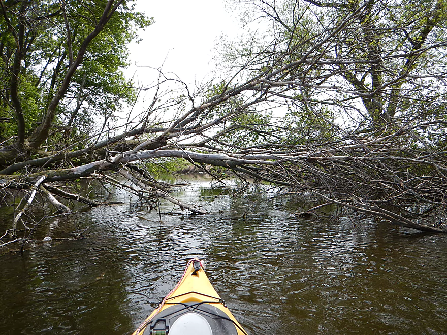
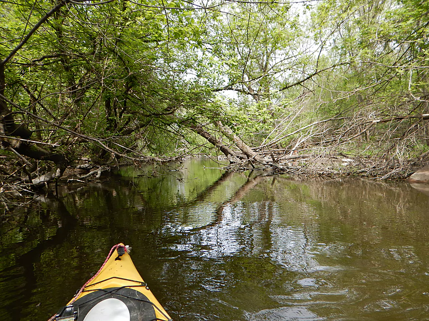
Some snags, but almost always negotiable
Coming up on an outdoor shooting range
Would be a good take-out if you get permission
Rocks on the Rock River
Still occasional clear water
Some ducking required
A road to nowhere
On the other bank a road from nowhere
Kayak puzzle…can you find the route through?
It exists
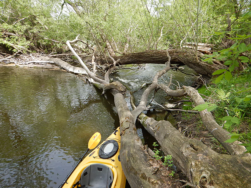
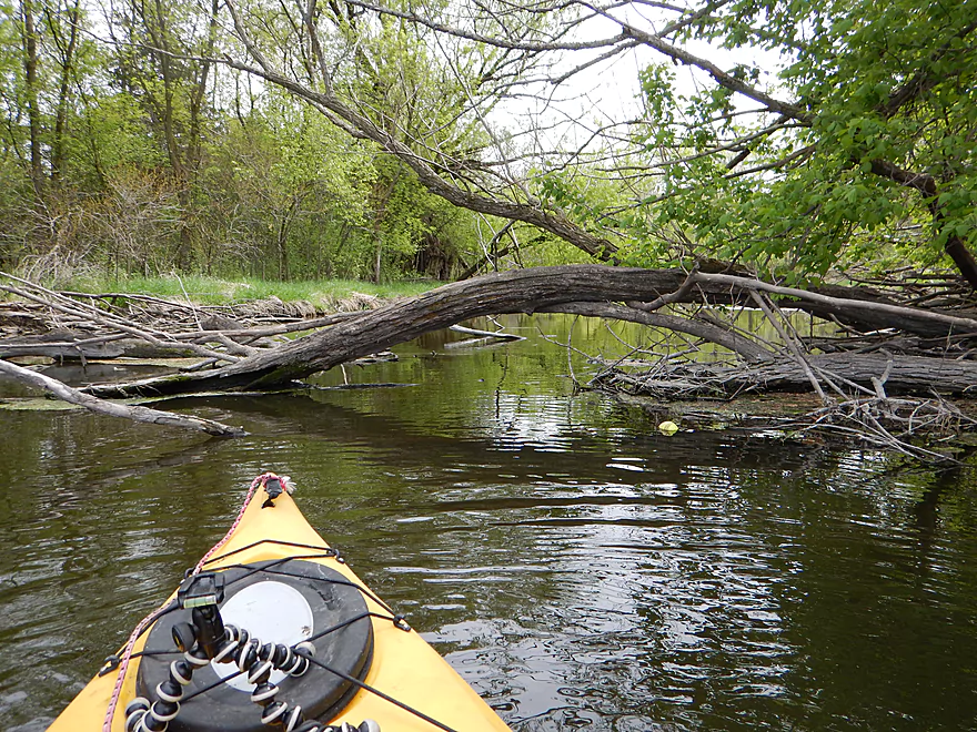
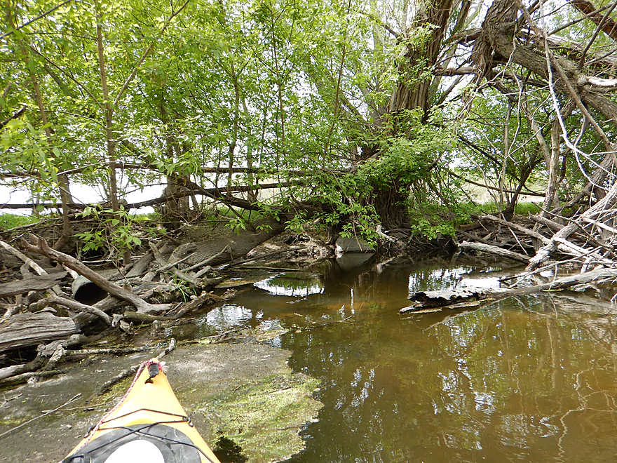
Only log jam portage of the trip

Not fun, but doable
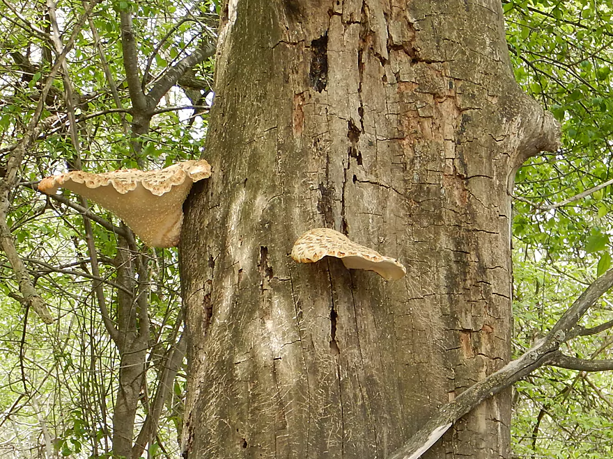
Fungus souffle
More fun rapids
Reverse angle
Roadside park is a great take-out option
Phoebes unlike cliff swallows like their elbow room
After Roadside Park, the river gets big and boring
Wild Goose State Bike Trail
Thankfully this means we are still legal (see writeup)
Fine craftmanship
Last rapids of the trip
A sign that you need to get off the water
Not so fine craftsmanship (second washed-out bridge I came across)
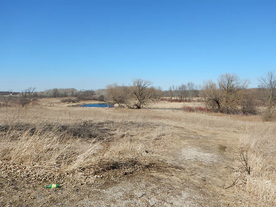
It does mark your take-out by E. Waupun Road
Small hidey trail to road
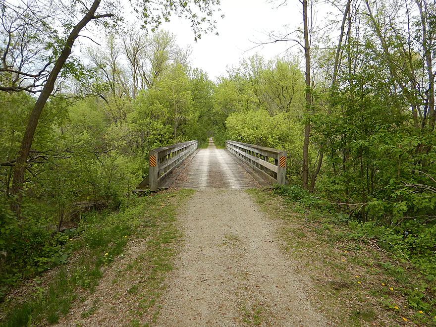
Detour from bike shuttle to explore Wild Goose Bike Trail
Scouting Hwy 49 as an alternate put-in (seems doable)
Scouting the Peachy Road fishing access as a take-out
Does not seem doable
Exploring Horicon Marsh after my trip
Very nice (faint pelicans and wind turbines in the background)
Not all locals were happy to see me
Rock River – South Branch


Another “roll-of-the-dice” paddle that turned out pretty good. The South Branch of the Rock River is one of three branches that form Horicon Marsh. This trip is maybe half urban paddle (quite nice), half hardwood paddle (ok), and finally a little marsh before you legally have to get off the water.
Waupun Park (located on the west end of the city of Waupun) is a great put-in with public parking, nice launching area and outhouses.
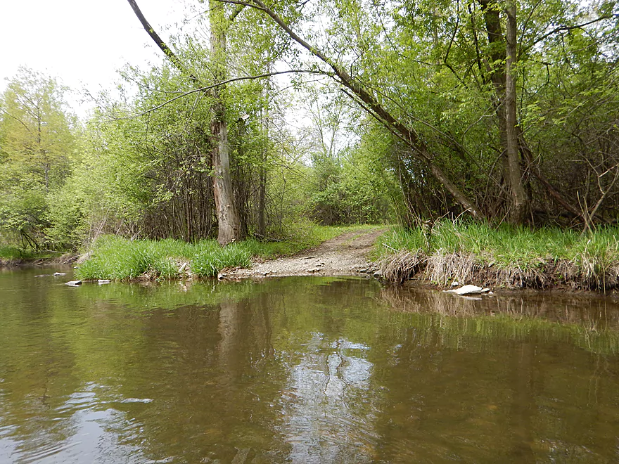
Ok take-out at the end of E. Waupun Road. It’s a dead-end road with a small strip of publicly owned land leading to the water. It’s hidey, but there is a trail leading to the river. Tad mucky for taking out, but doable.
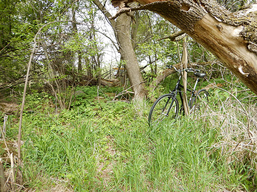
Relatively easy bike shuttle at 5.2 miles with no major hills. Lot of city biking in Waupun, but it is easy to avoid traffic by biking on the side streets.
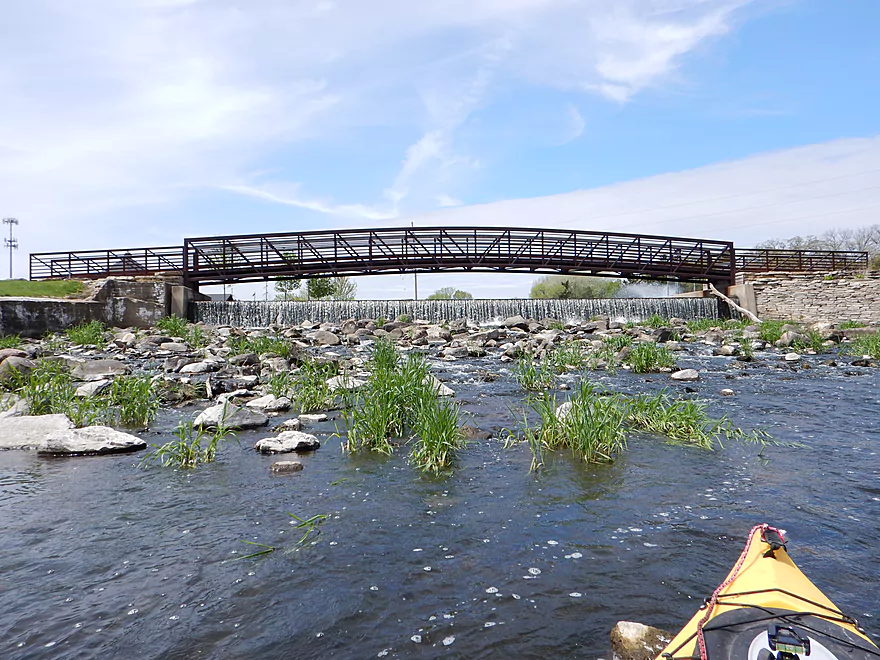
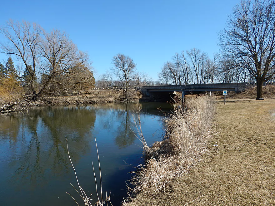
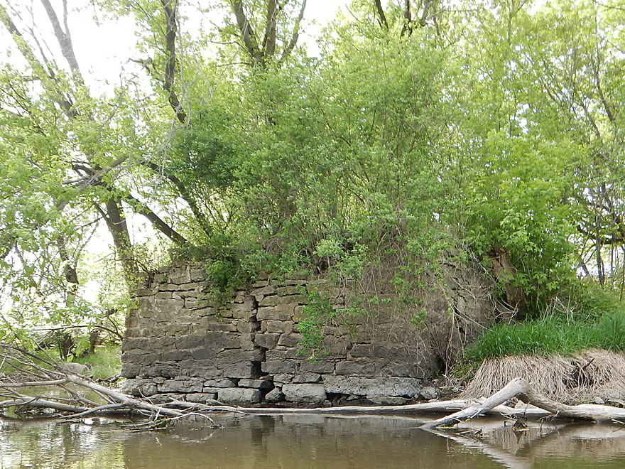
The main dam in Waupun is easy to portage. Just prior to Fond du Lac Street there appears to be the remnants of an old dam and a very small ledge that creates a bit of a backroller. You should be ok as it is so small, but you can portage it if in doubt.
The town section is remarkably free of log jams (it gets cleaned out). However, after the city there are a couple of hoppers and duckers to contend with. I only had to portage once, which was not fun but is doable (this spot is pictured/youtubed/mapped for reference to any log jam clearing angels out there).
2024 update…parts of this trip have filled in with logjams (see comments below). Use caution before attempting this trip.
Do you want clarity or padding for riffles? I went at 29 CFS (typical average) which provided mostly adequate padding for light rapids, but did somewhat obscure the water clarity I had scouted a month earlier (that was 13 CFS). 20 CFS might be a nice target flow rate as a compromise so you can see the attractive rocky bottom of the river. Nice thing about 29 CFS though was that it allowed me to get over some low log jams that I might otherwise not have.
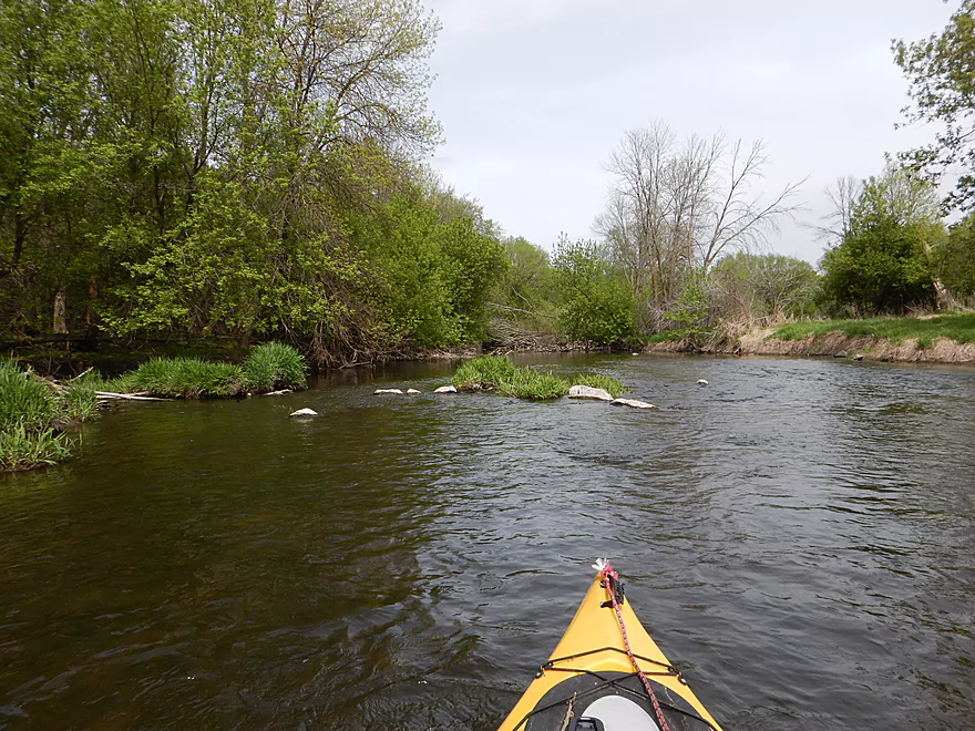
The current is stop and start…and not just because of the dam and small flowage in town. Sometimes it will hardly move (typical Rock River) then will surprise you with a riffle (very atypical Rock River). Most of the riffles are in town, but there are a couple on the eastern leg of the trip (in the “big woods”).
Kind of muddy but really mostly rocky. Again a surprise for the Rock River as you usually don’t associate rocks with it (despite its name).
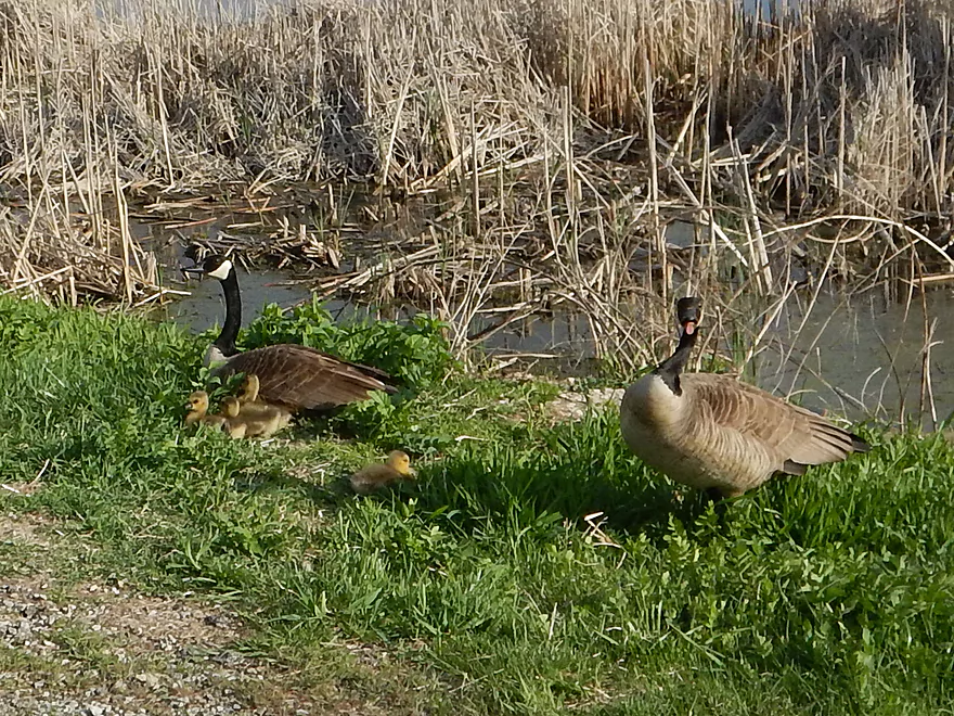
Ducks, geese (+lots of goslings), carp, great blue herons, deer, pelicans (by the marsh) dragonflies, a bronze horse and evidence of beavers. Award for most prolific animal would go to the painted turtle…saw lots.
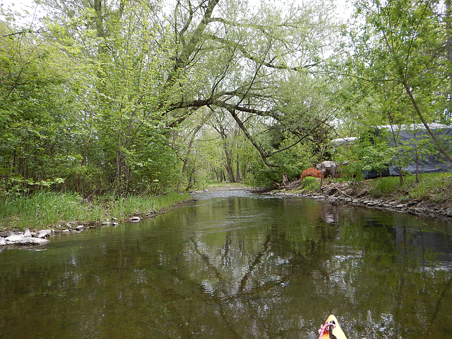
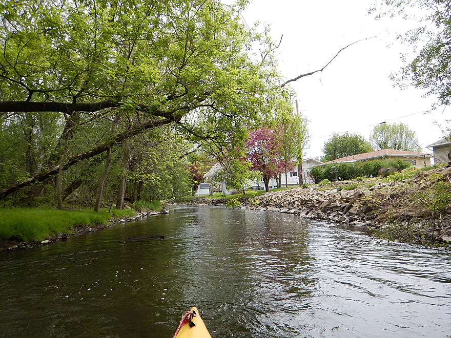
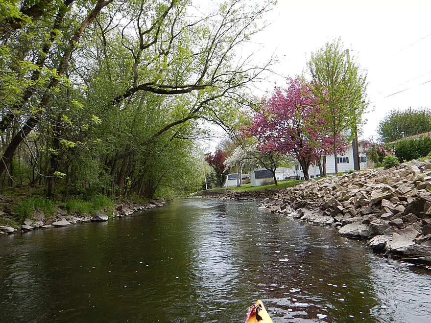
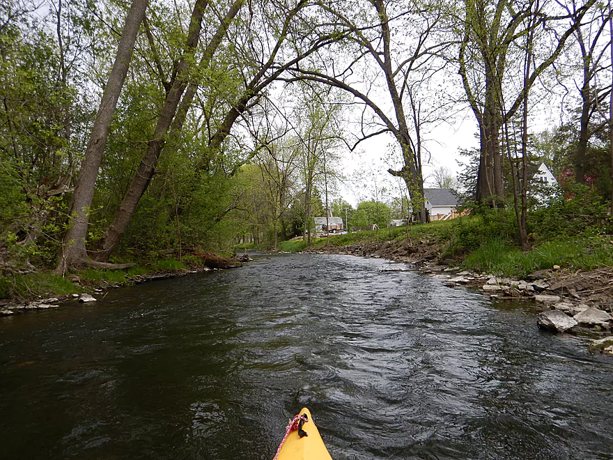
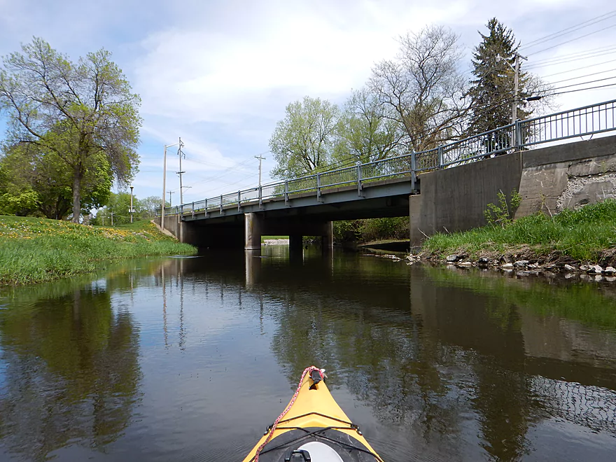
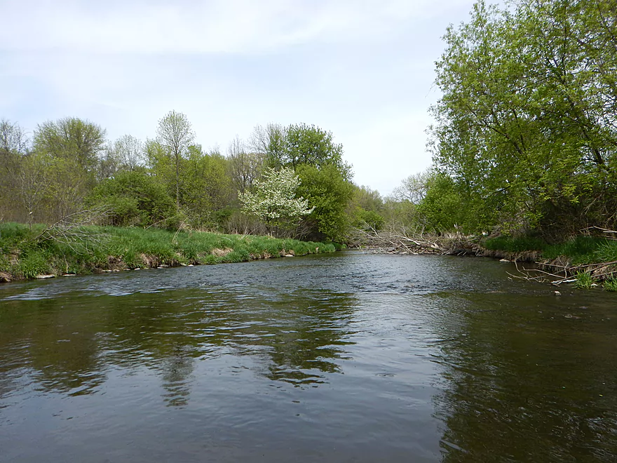
First half of the trip is an urban paddle, but this is not too distracting as the river is mostly flanked by a nice buffer of trees.
There are a number of class 1 rapids (well riffles) on the trip and the first will be by an obscure park on Pine Street. Fun to run, but be mindful of the low pedestrian bridge you’ll need to duck under. The river following Pine Street was my favorite section. Relatively clean banks, nice tree canopies and occasional light rapids.
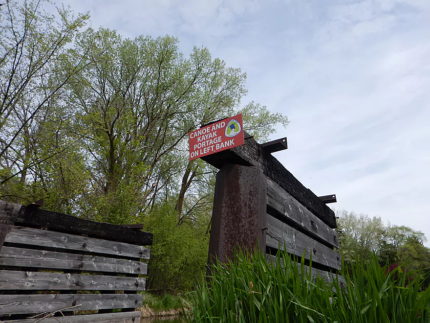
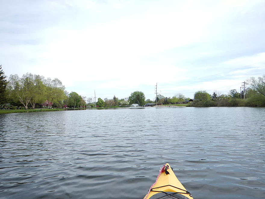
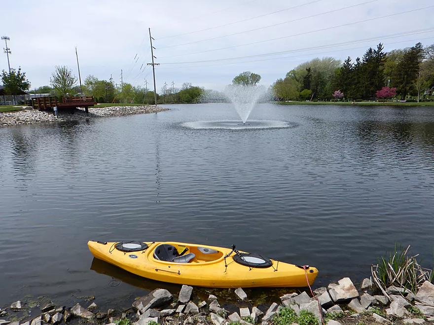
Following the Hwy MM bridge, the river slows down and gets big (and boring). The flowage created by the dam isn’t too long, but is still unfortunate. The dam itself is easy to portage with readily visible portage signs.
There is a park at the dam which is kind of scenic. Below the dam the rocks have been washed clean, leaving a very attractive boulder garden. The park is famous for the “End of the Trail” sculpture (basically a very depressed Indian on an equally depressed horse). I tried to run the rapids almost directly below the dam, but it was too bumpy and I can’t recommend this for others at 30 CFS (much easier to put in below the rapids too).
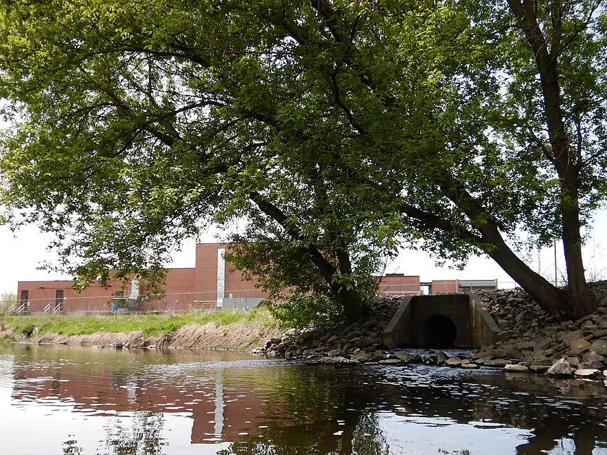
River stays nice after that, but then the character kind of changes by the Hwy 151 bridge and the sanitation plant. Most sanitation facilities actually don’t have an odor, but this did unfortunately and nutrient growth in the water really picked up after that (and occasional scum would start to accrue by down trees). Hwy 151 is of course very noisy and you could hear it for maybe a mile from the bridge. I don’t want to sell short the section after Hwy 151 as it was nice, but some paddlers might want to cut the trip in half here at maybe 3.5 miles.
From Hwy 151, the trip leaves Waupun behind and starts first as an open farm field paddle (pleasant but not exotic) and then continues from there as mostly a hardwood paddle that kind of reminded me of the Baraboo River. A nice peaceful woodland paddle, with attractive tree canopies and the occasional riffle. But not as “clean” concerning substrate, water quality and the amount of deadwood in the paddle. All that being said though, I only had to portage once which is impressive for any woodland paddle.
At the end of the woods, the West Branch of the Rock River (a future prospect) joins the South Branch and significantly changes the character of the river (mostly bigger and more boring). Soon after the confluence, you’ll shoot over some light rapids and come to Roadside Park, which would be a great take-out location.
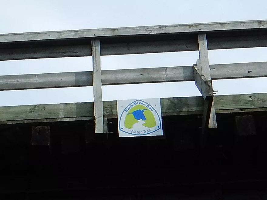
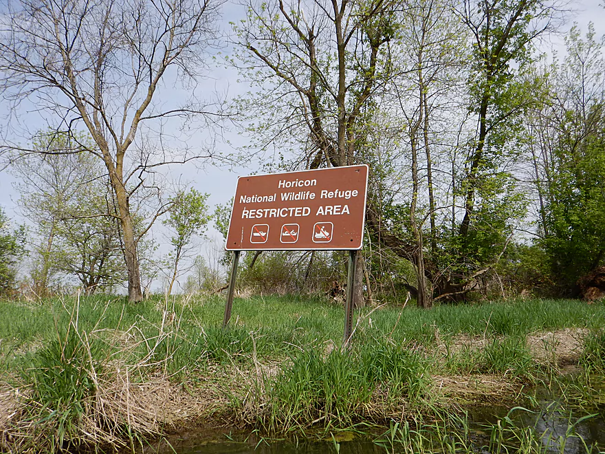
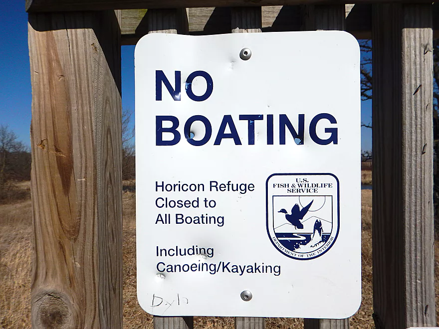
Instead, I paddled another half-mile and experienced classic Rock. Wide, straight, muddy, and boring. Take-out will be shortly after the Wild Goose Trail bridge (a fine bike trail that I do recommend exploring). Why take out here? Well, the signs on the water will make that abundantly clear. While there are a number of paddle-friendly Rock River Water Trail signs throughout the trip (including on the bike bridge), by the take-out there are multiple signs that signify this is the start of the Horicon National Wildlife Refuge. Unlike the south half of Horicon Marsh, which is state controlled, the north half is run by the Feds and has much stricter access rules (which includes no kayaking in the refuge). Shucks.
If you’ve driven this far to do the East Branch, you might as well check out the marsh after the trip. Best ways of doing this?
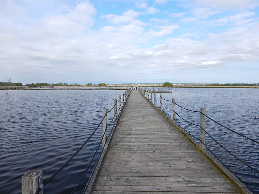
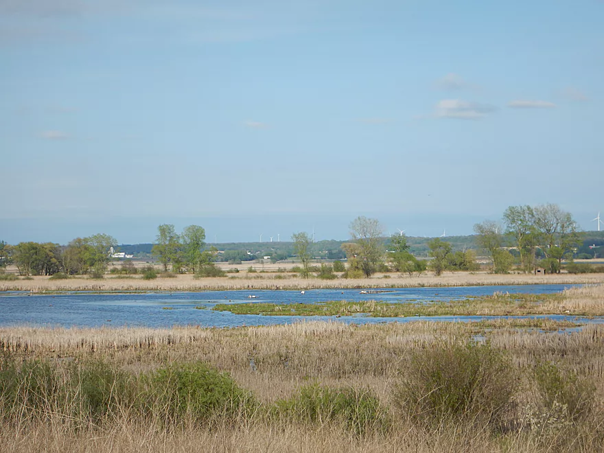
My first suggestion would be take the “car tour” loop located at the north end of the marsh off of Hwy 49. This has a very “national park” feel to it…complete with the small one lane road, pull-offs for viewing and information kiosks, nature trails and of course lots of people. But instead of cars backing up the roads to take pictures of bison, you get backed up cars for photos of goslings (and their hissing, protective parents) as well as pelicans and a number of other birds you can see from the car loop. The best and most popular part of the car loop is an aquatic boardwalk and trail that runs a mile and lets you optimally experience the marsh with expansive views of the marsh, birds and even the wind generators in the background (which I’m sure the birds find scenic).
Maybe the next best way to experience the marsh is by bike. The Wild Goose Trail is a great way to do this but only comes close to the marsh for 4-5 miles before continuing on to Fond du Lac. The trails off of Dike Road and Old Marsh Road look the most interesting, but I think they’re only open in the summer. Here is a nice comprehensive bike map of the marsh.
The visitor center on the east side of the marsh is well done with an attractive overlook.
Best way to see the big picture is to drive up (literally) to Ledge Park which has a nice vista of the park.
Oh…and you could of course paddle the marsh (at least the south end).
East Branch:
- Upstream of Hillcrest Drive: I believe these portions are too congested to paddle.
- Hillcrest Drive to Hwy DW: 4.1 miles.
- Hillcrest Drive to Riveredge Park: 0.9 miles. Scenic stretch through the outskirts of Allenton with good clarity. However there are two major logjams to portage, and several minor logjams to squeak past.
- Riveredge Park to Hwy DW: 2.7 miles. An open stretch through wetgrass and a state natural area. One logjam needs to be portaged.
- Hwy DW to Hwy D: 5.5 miles. Outside of one nasty logjam cluster this is a pretty open creek paddle through a protected wildlife area that might be decent.
- Hwy D Wayside to N. Pole Rd. Launch: 7.3 miles. A good wetland paddle prospect through Theresa Marsh. Maybe 1-2 downed trees on the upper part.
- Kohlsville River: Note, the Kohlsville River joins the East Branch here, but it seems too congested with downed trees to be feasible.
- N. Pole Rd to Gill Rd(East): 6.0 miles.
- N. Pole Rd Landing to River Edge Park: 1.3 miles. Slow, open, and marshy channel. Nice though.
- River Edge Park to Rock River Street/Dam: 0.5 miles. A nice town paddle through the community of Theresa. One dam to portage.
- Rock River Street/Dam to Hwy AY: 3.5 miles. One of my favorite stretches on the entire Rock River. While shallow in spots, it is scenic with nice woods, small boulder gardens and multiple light rapids.
- Hwy AY to Gill Road(East): 0.7 miles. A brief wooded stretch that is a nice paddle.
- Gill Road(East) to Hwy 67/Dam: 8.3 miles.
- Gill Road(East) to McArthur Road/Fink Creek: 4.7 miles. Starts boring, weedy, and slow, but gets nice with clear water and rocks later on. Gill Road(West) may be a viable halfway access.
- McArthur Road to Hwy 67/Dam: 3.6 miles. A less interesting paddle through a flowage and downtown Mayville with numerous alt take-outs.
- Hwy 67 to Green Head Road Ramp: 6.4 miles.
- Hwy 67 to Hwy Y/Ziegler Park: 1.9 miles. One of the best paddling stretches on the entire Rock River with good current and small boulder gardens.
- Hwy Y to Hwy TW/Kekoskee Pond Ramp: 1.9 miles. A good stretch that includes a little bit of flowage paddling.
- Hwy TW to Green Head Road Ramp: 2.6 miles. An ok stretch as the river really slows and starts to turn into marsh.
- Green Head Road to N. Nebraska St. Ramp: 10.0 miles. The most popular route through Horicon Marsh known for its waterfowl.
South Branch:
- Upstream of E. Rock River Rd.: I suspect downed trees are too much of an issue for this to be navigable.
- E. Rock River Road to Hwy 49: 1.6 miles. Perhaps a cluster of downed trees in the middle and an electric fence upstream of Hwy 49.
- Hwy 49 to Waupun Park: 1.7 miles. Hwy 49 is not ideal for launching, but should be doable. A good prospect mostly through a golf course. Maybe 2 logjams?
- Waupun Park to E. Waupun Road: 7.2 miles. A good section.
- Waupun Park to Tanner Park: 3.1 miles. Great section though downtown Waupun. Alt access at Pine Street Park, Meadow View Park and Harris Mill Park.
- Tanner Park to Roadside Park: 3.2 miles. A pleasant paddle through a mixture of woods and open areas. A couple of logjam squeakers and one major portage.
- Roadside Park to E. Waupun Road: 0.9 miles. River widens, slows, and gets less interesting.
- E. Waupun Road to Dike Road: 10.0 miles. This is the northern unit of Horicon Marsh and is off limits to paddlers per National Wildlife Refuge rules.
- Dike Road to N. Nebraska St. Ramp: 5.6 miles. Am 80% sure you can drive on Dike Road from the east to launch in the ditch. Mostly a long straight canal paddle through Horicon Marsh with perhaps interesting side canals to explore. You can also launch in a west canal by Burnett Ditch Road. The city of Horicon marks the confluence of the South and East Branches of the Rock River.
West Branch:
It’s a neat prospect, but I suspect the logjam situation is too much (I could be wrong).
Main Branch:
- N. Nebraska St. to Legion Park/Dam: 0.9 miles. An ok section through downtown Horicon.
- Legion Park to River Bend Park: 1.1 miles. Simple river segment…probably nothing too special.
- River Bend Park to Lions Park: 8.8 miles. A large and probably uninteresting flowage. If you get permission to take out at Ox-Bo Marine, you can avoid much of the flowage paddling.
- Lions Park to Elmwood Park: 7.2 miles. Trip starts nice with a great boulder garden, but becomes less interesting as the current dies.
- Elmwood Park to Hwy MM: 4.4 miles. An interesting prospect recommended by Frank Piraino.
- Hwy MM to Harnischfeger Park: 6.9 miles.
- Harnischfeger Park to Kaul Park/Hwy CW: 5.1 miles. Nice section with more wooded banks.
- Kaul Park to Kanow Park: 5.7 miles. Nice prospect.
- Kanow Park to Hwy F: 5.0 miles. Mediocre prospect.
- Hwy F to Hwy P: 6.0 miles. This isn’t an elite trip with slow current and no exotic scenery. But it is pleasant and one of the nicer legs on the Lower Rock.
- Hwy P to Dam1st/Front St.: 5.6 miles. Probably an uninteresting flowage paddle.
- Dam1st/Front St. to Dam2nd/S. 1st Street: 2.6 miles. Possibly a unique paddle through downtown Watertown.
- 1st Street to Hwy 26 Launch: 3.5 miles. Mediocre prospect.
- Hwy 26 Launch to Hwy B: 10.9 miles. The put-in is SE of Hwy 26 via Jefferson Road. This segment is more undeveloped, but is still probably not interesting with the highlight being I94.
- Hwy B to Lubahn Park/N. Watertown Ave: 4.1 miles. Probably uninteresting.
- Lubahn Park to Tensfeldt Park: 2.3 miles. Paddling through downtown Jefferson might be unique, but there is a dam to portage. Many alt landings in Jefferson.
- Tensfeldt Park to Klement Park: 4.2 miles. Probably an interesting tweener section between Jefferson and Fort Atkinson.
- Klement Park to Lorman Bicentennial Park: 3.1 miles. A weak prospect through downtown Fort Atkinson.
- Lorman Park to Hwy 26 Ramp: 3.3 miles. A weak prospect.
- Hwy 26 to E. Knudsen Road Ramp: 11.8 miles. Mostly boring paddling on Lake Koshkonong. Many other launches on the lake.
- E. Knudsen Road Ramp to Hwy M/Dam: 3.4 miles. Boring flowage.
- Hwy M/Dam to Hwy 14: 8.2 miles. Probably uninteresting.
- Hwy 14 to Century Ave/Dam: 6.4 miles. A trip through downtown Janesville with several dangerous dams to portage (reviewed by AmericanWhitewater.org). There are also many other launch options in Janesville.
- Century Ave/Dam to Happy Hollow Park: 7.8 miles. A very industrial section.
- Happy Hollow Park to Preservation Park Boat launch: 3.2 miles.
- Preservation Park to Wooton Park Boat Ramp: 3.0 miles. Start of urban paddling in Beloit. Numerous other launch options in Beloit proper.
- Further Rock River Trips: From here on, you are in Illinois. For further information see “Paddling Illinois” or Rockrivertrail.com.
Trip Map
Overview Map
Video
Photos Size:
We have put in off 49 when river was pretty high this spring (2018). Had 5 or 6 log jams right away, some may be navigable during lower water levels though. Once passed that it is a very nice paddle, one more log jam just before the golf course. Possibly a bridge or two to go around on the course depending water levels. We just recently canoed the south branch starting by hwy 151. Up steam from there is not passable. There are some ripples/ rapids right away then it’s marsh and woods most of the way. We had to portage around 2 foot bridges that were collapsing or low. Once you get near oak center road there is a short ripple area and then i suggest taking out there. If the water is pretty low you’ll have to carry over a few rock patches also. From there to hwy 49 has at least 6 log jams and many many over grown trees to go through. It wasn’t worth the effort. Thank you for your information!
Ugh…too bad about those logjams. Your updates are very much appreciated and will help out other paddlers. In regards to the your second comment, I assume that was actually the West Branch based on the reference to Oak Center Road? I hope to do this at some point in the future, but yeah that final section where it connects with the South Branch looks like a mess.
Yes apologize, it is the West branch.
Just an update, the south branch upstream before the golf course is no longer navigable. Through town should be clear. Also the west branch is no longer navigable from hwy 151 until I belive the marsh. The last few storms have so many trees down its not worth it.
Thanks for the update…that’s very valuable info.
A warning to paddlers. The Fond du Lac Sheriff’s department rescued two female who were pinned by logjams east of Waupon (by Hwy 49/Church Road). It’s not clear if this was this was the South Branch or West Branch…both both branches now have logjams and currently are very high. Neither should be kayaked unless you know what you’re doing. Video of the rescue was posted online: https://fox11online.com/news/local/video-law-enforcement-good-samaritan-rescue-two-after-kayaks-capsize-in-rock-river-fond-du-lac-county-sheriffs-office-waupun-police-fire-facebook-post-lifejacket-beaver-dam-women