
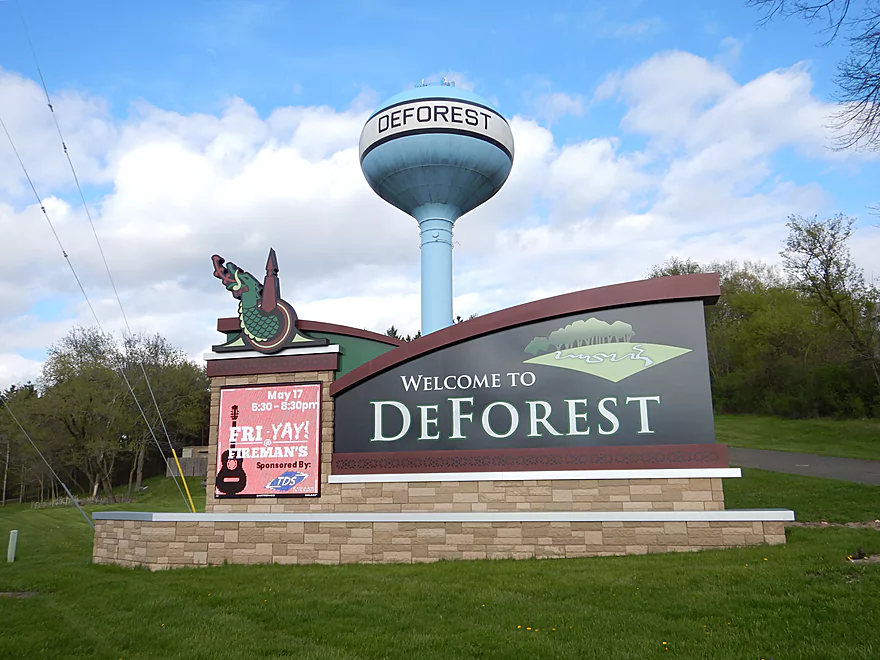
Welcome to DeForest
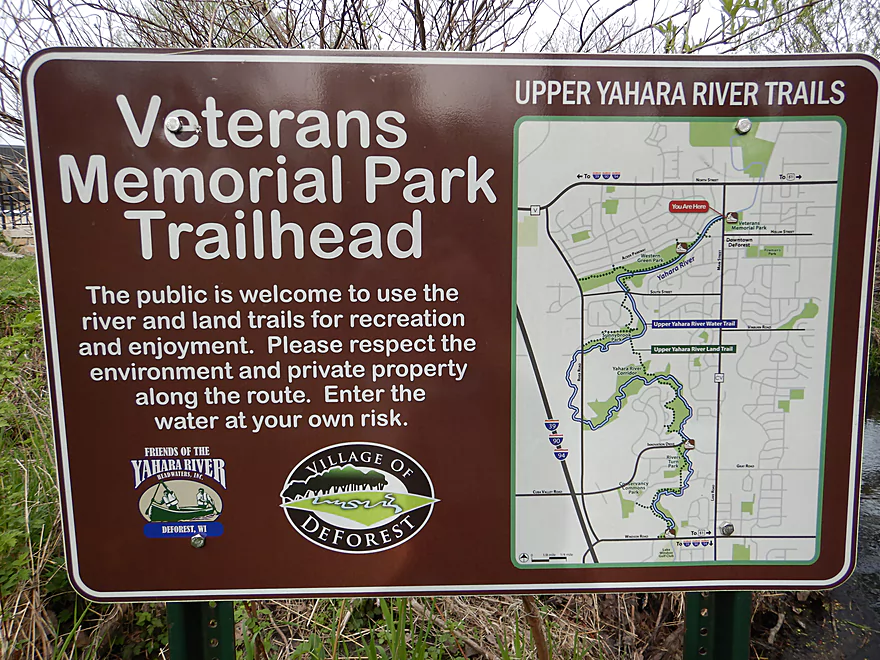
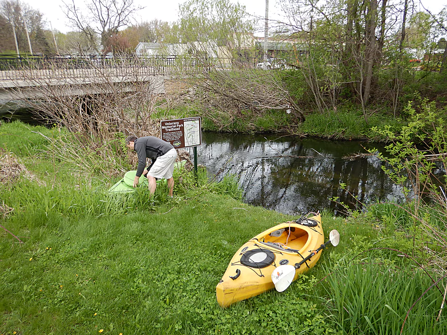
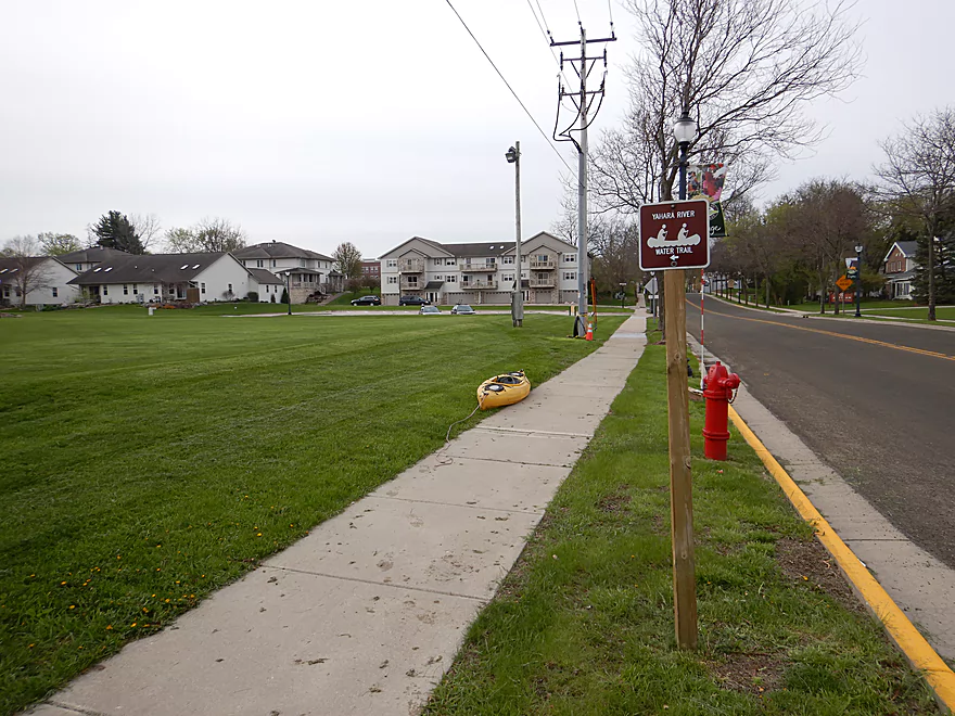
Putting in at Veterans Memorial Park
Nice launch area
But the parking lot is 260′ away
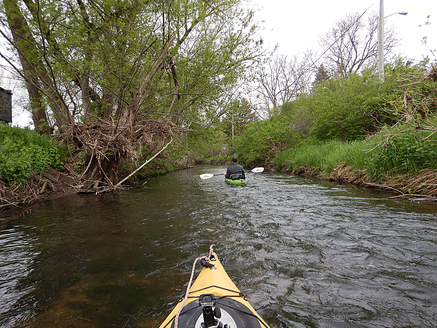
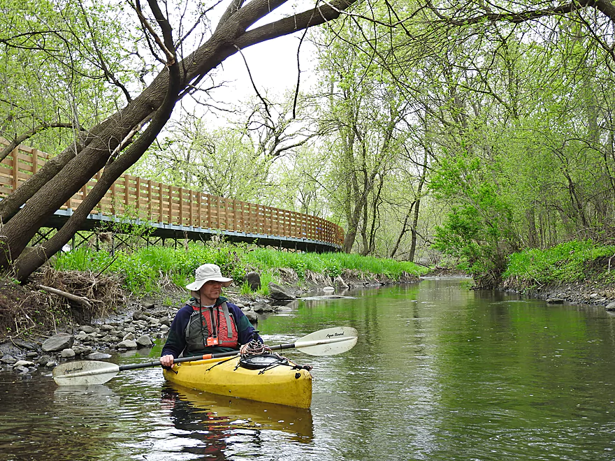
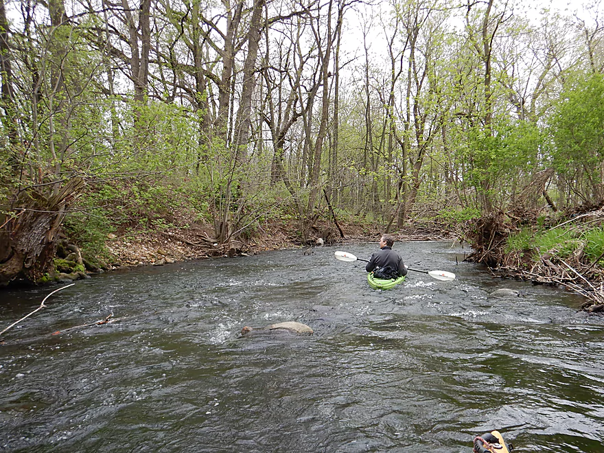
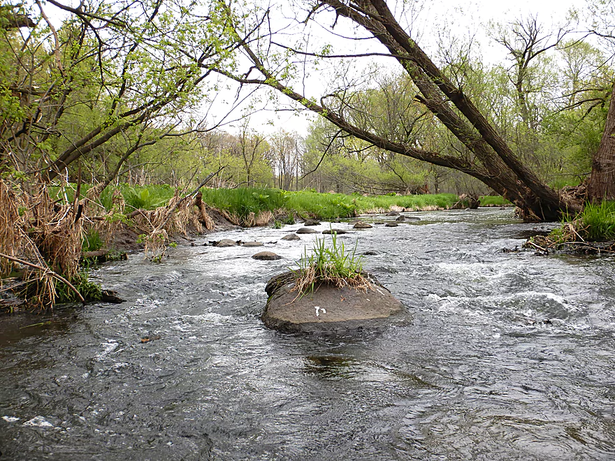
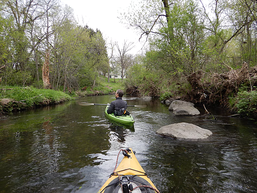
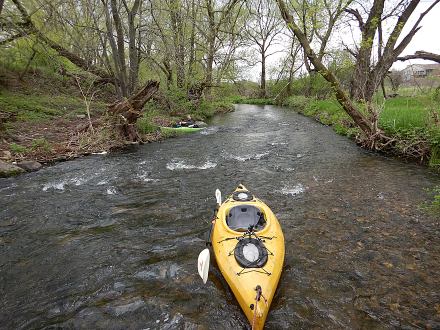
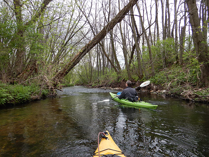
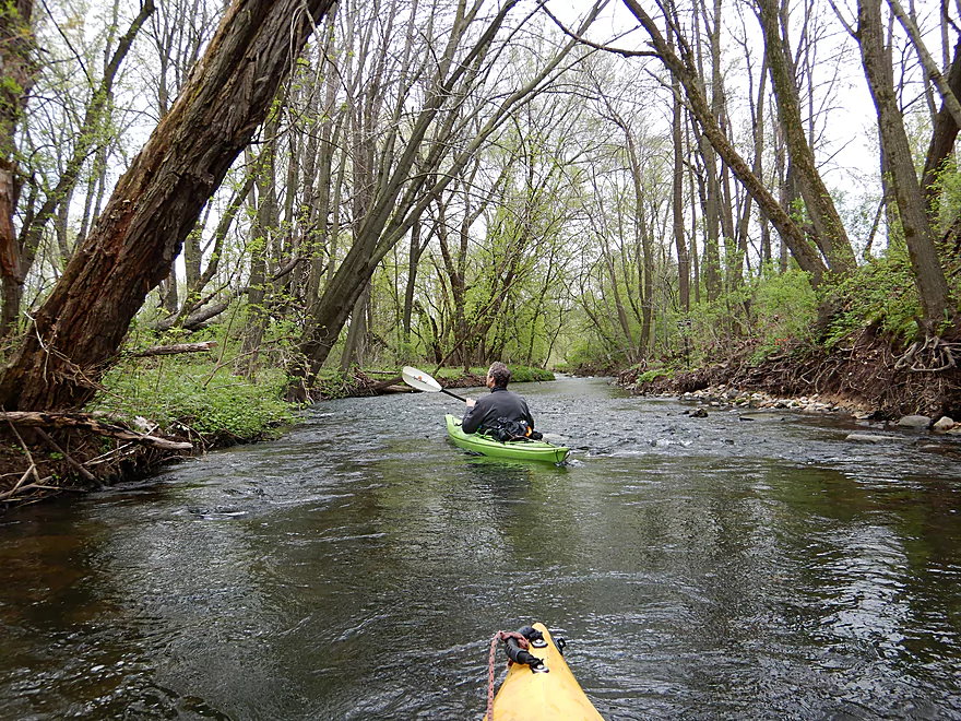
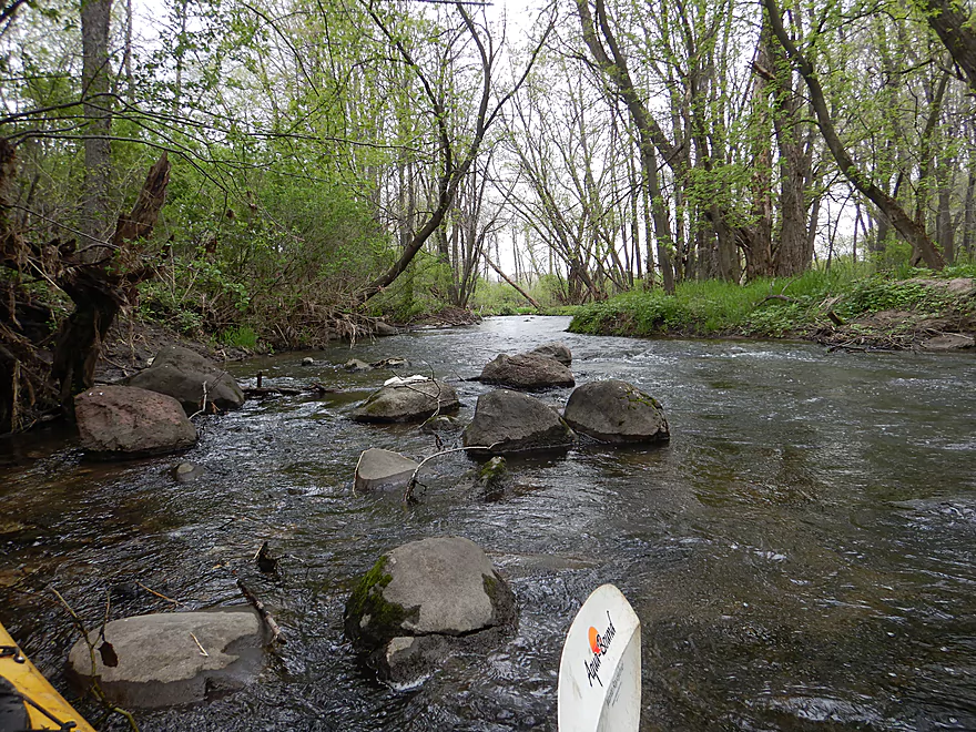
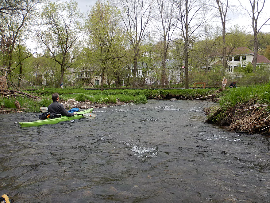
The Yahara River here is no more than a creek
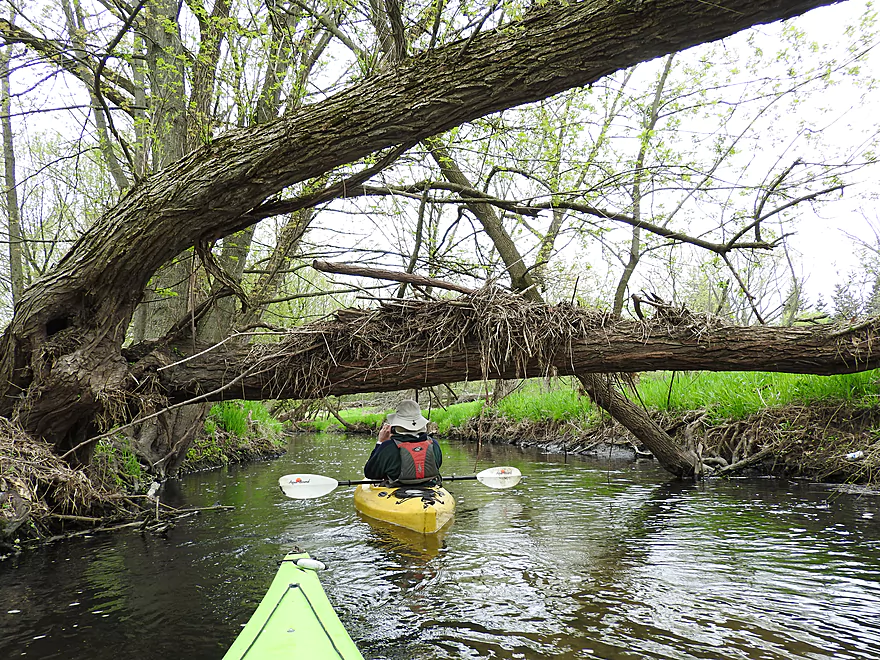
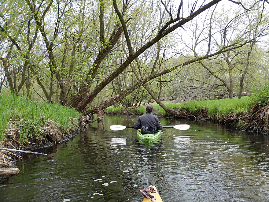
Trees grow close to the river
Creating a neat effect
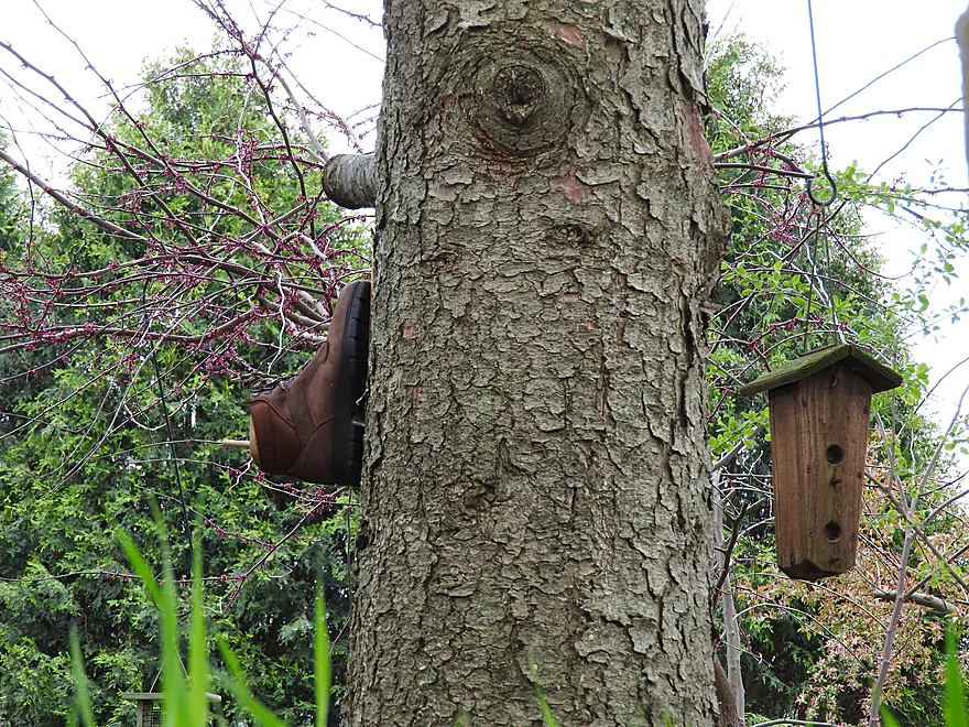
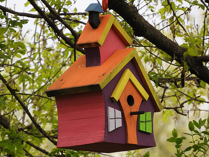
This boot actually might be a birdhouse
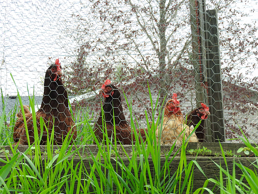
Curious onlookers
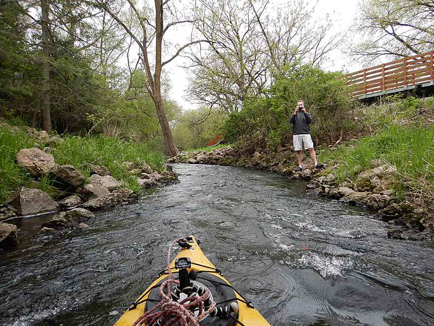
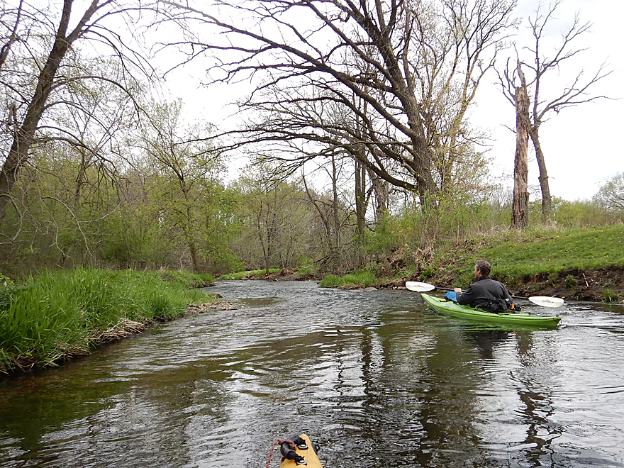
The local trail network frequently crossed the river
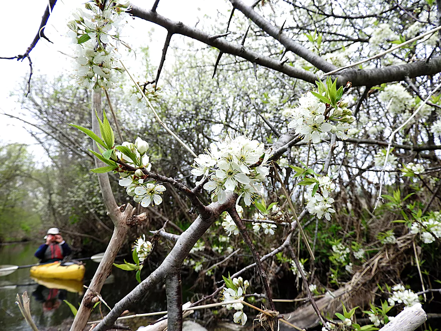
Wild plums
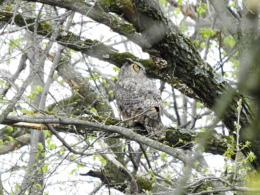
Great horned owl
Coming up on South Street
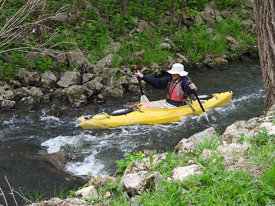
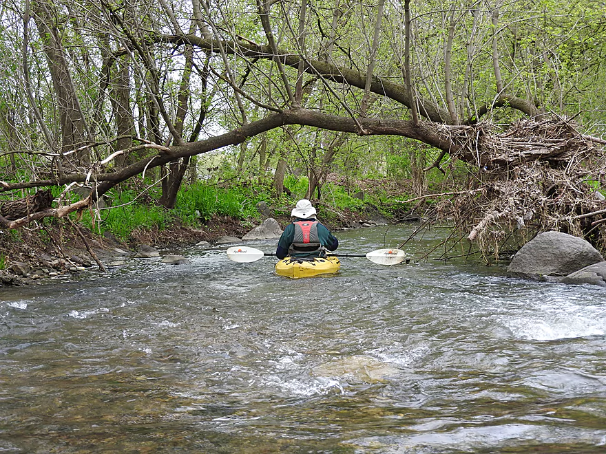
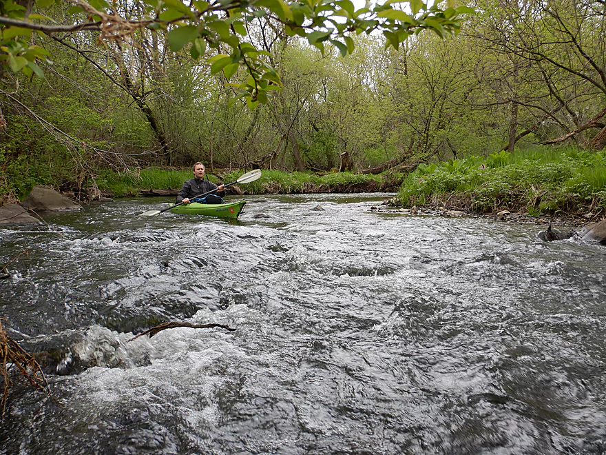
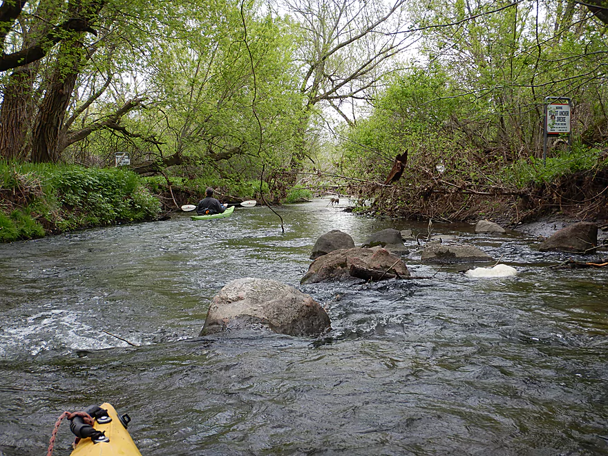
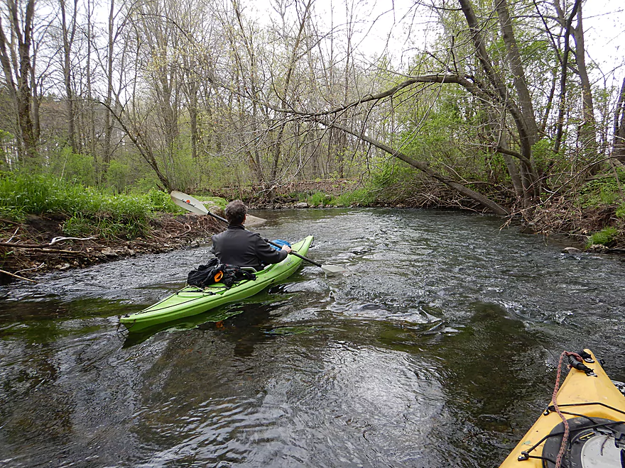
Funnest rapids of the trip
In later summer these could be very shallow
The last ledge
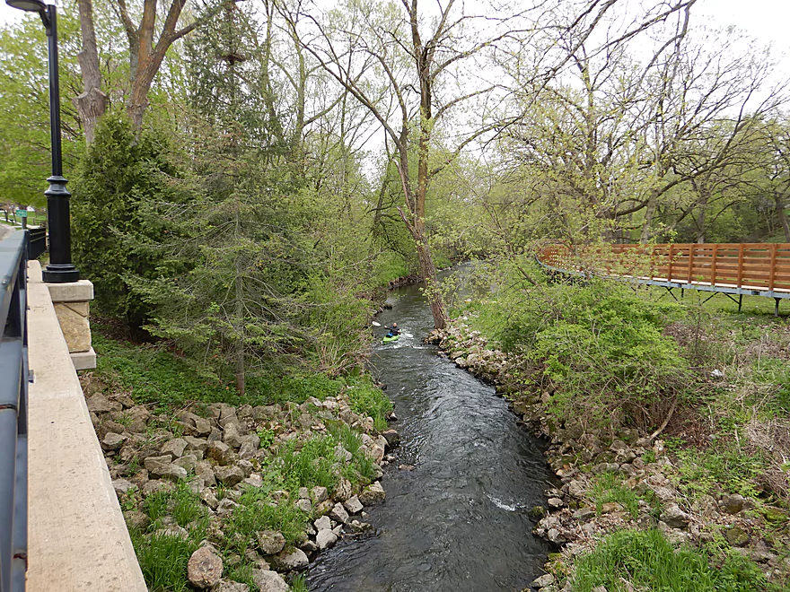
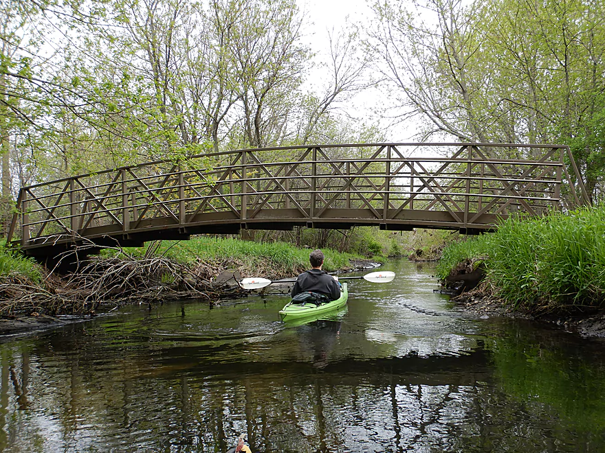
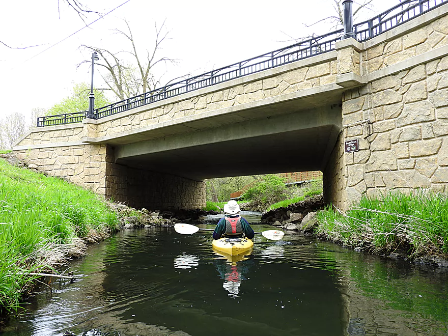
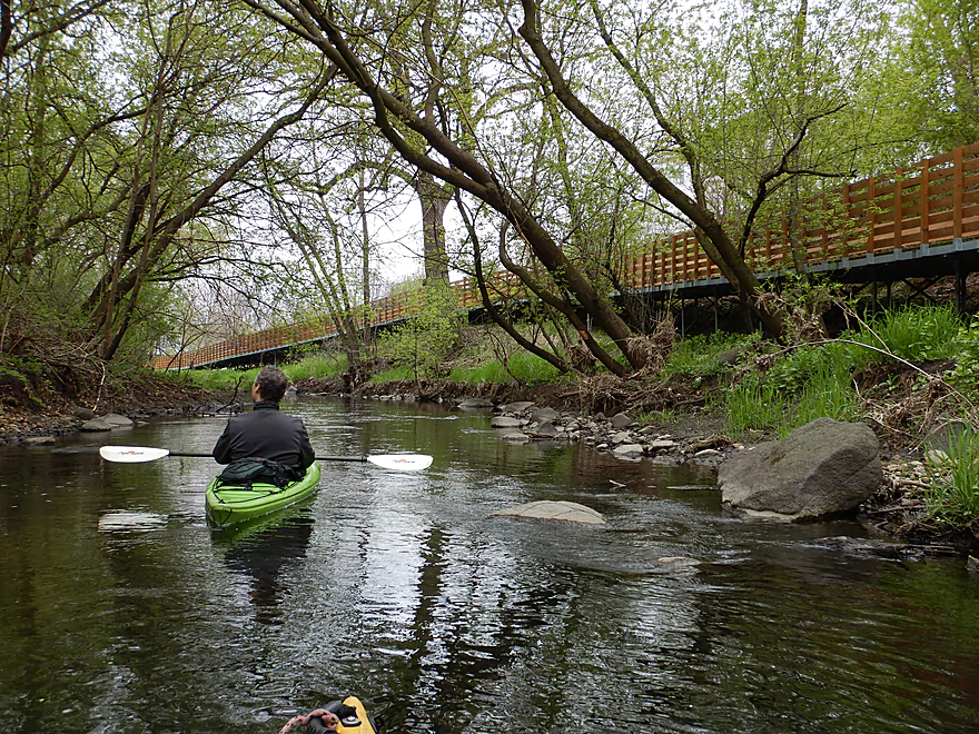
View from the bridge
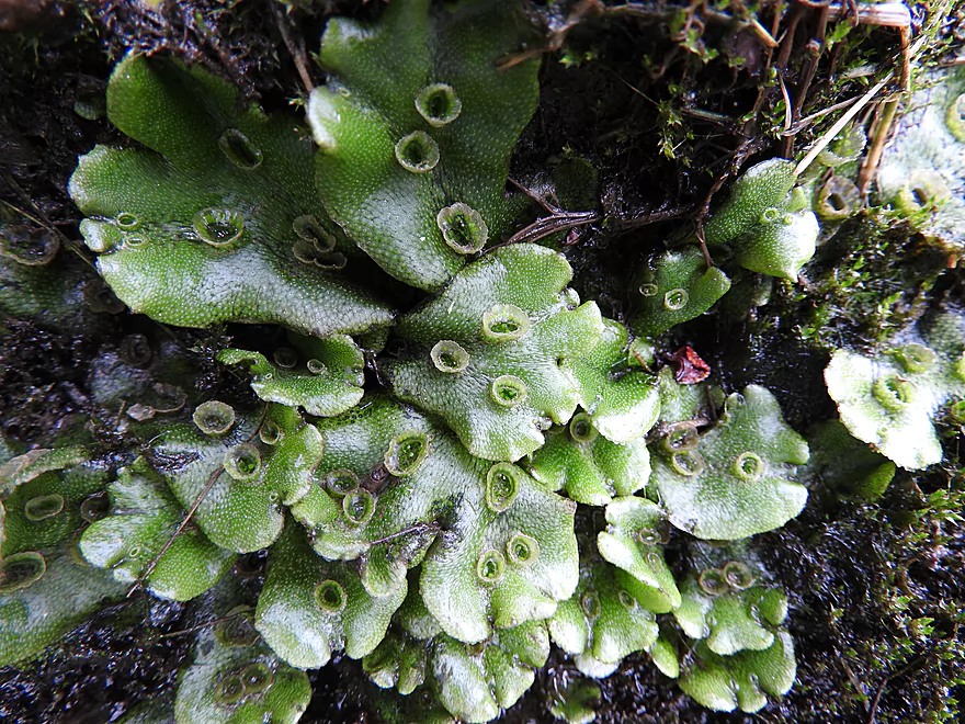
Liverwort
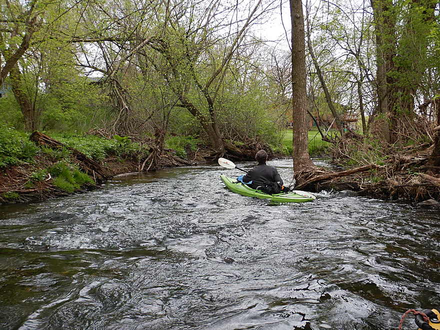
Very rocky section
Part of the local trail network
Reverse view
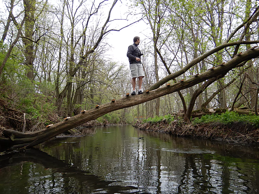
There are steps on this tree
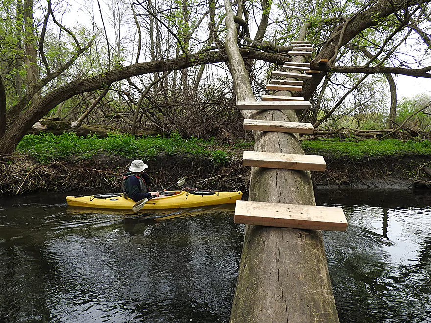
Kind of clever
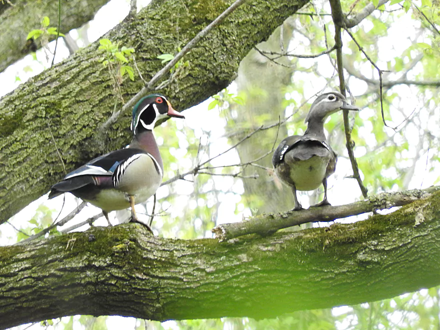
Wood ducks in the woods

Starting to see more rapids
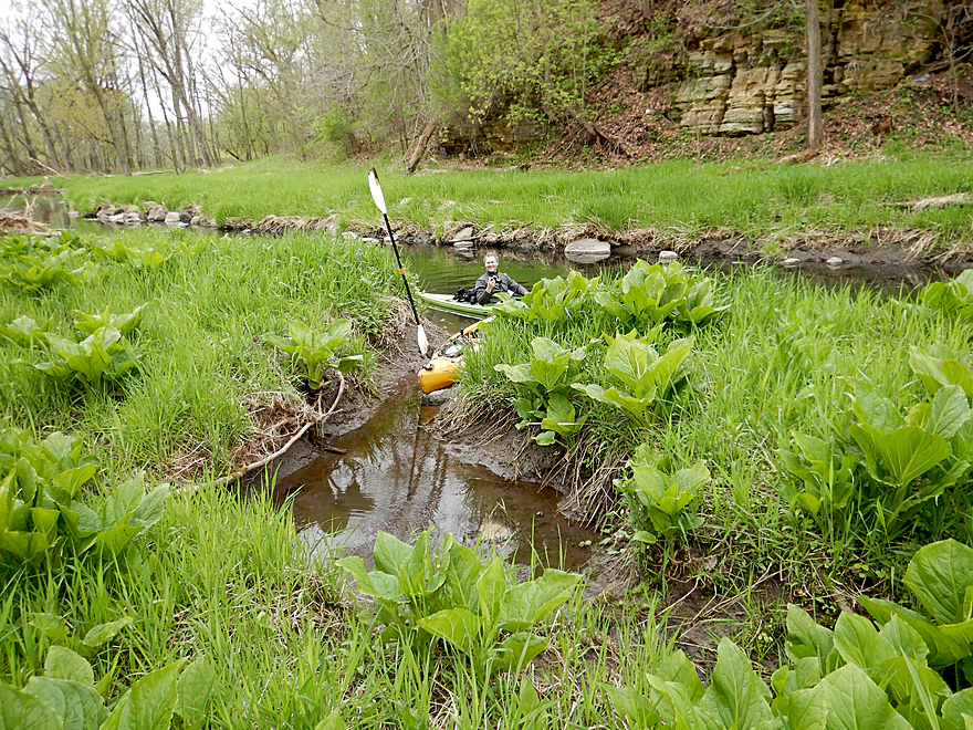
Lots of skunk cabbage
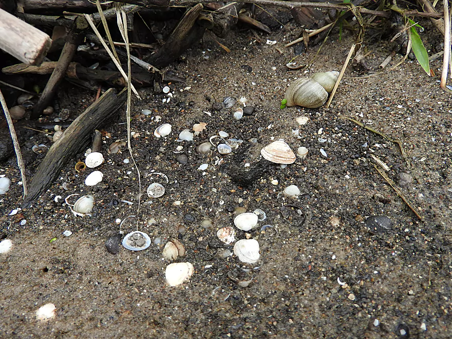
As well as snails and small clams
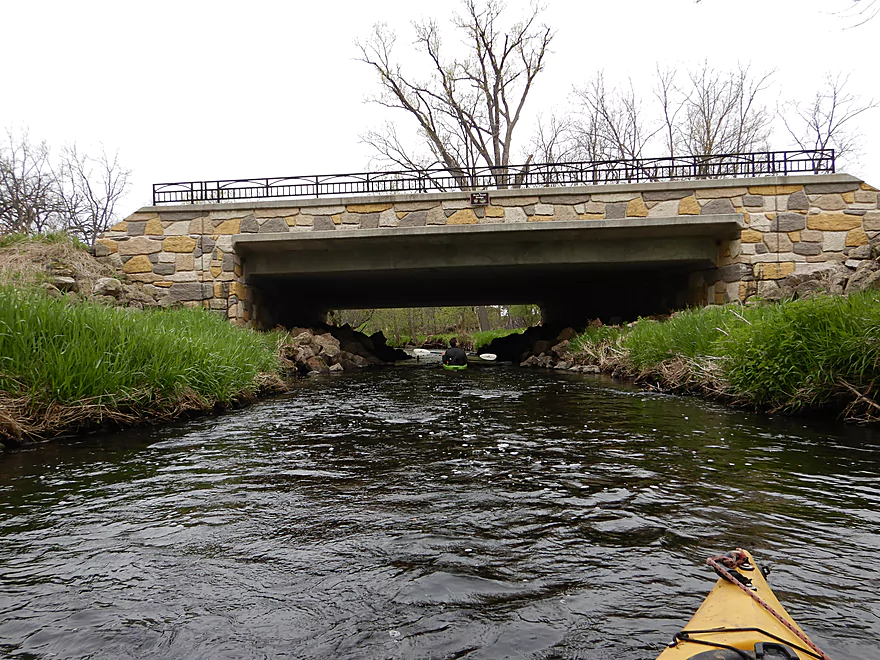
River Road bridge
High water mark
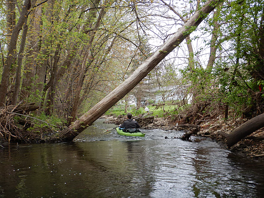
Leaning trees are kind of artsy
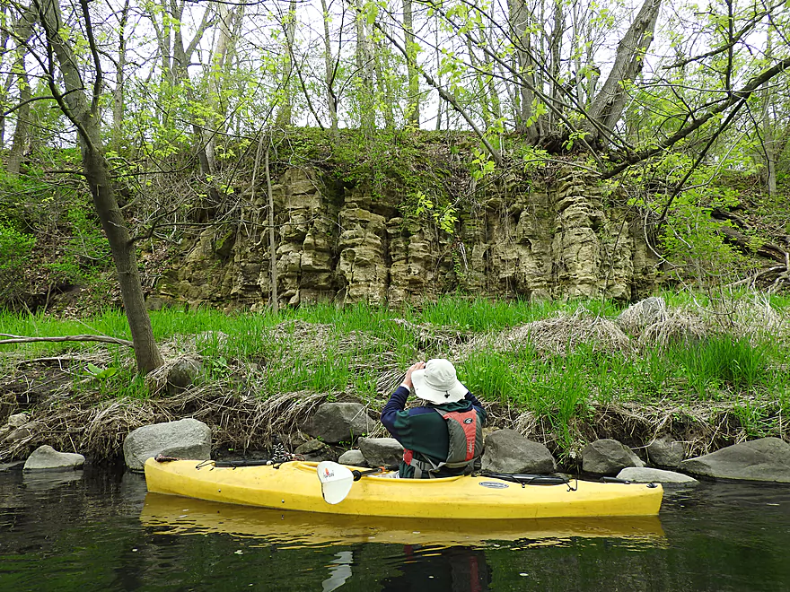
A surprise limestone outcrop
With a spring next door
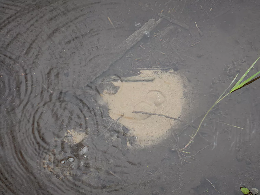
A bubbling volcano
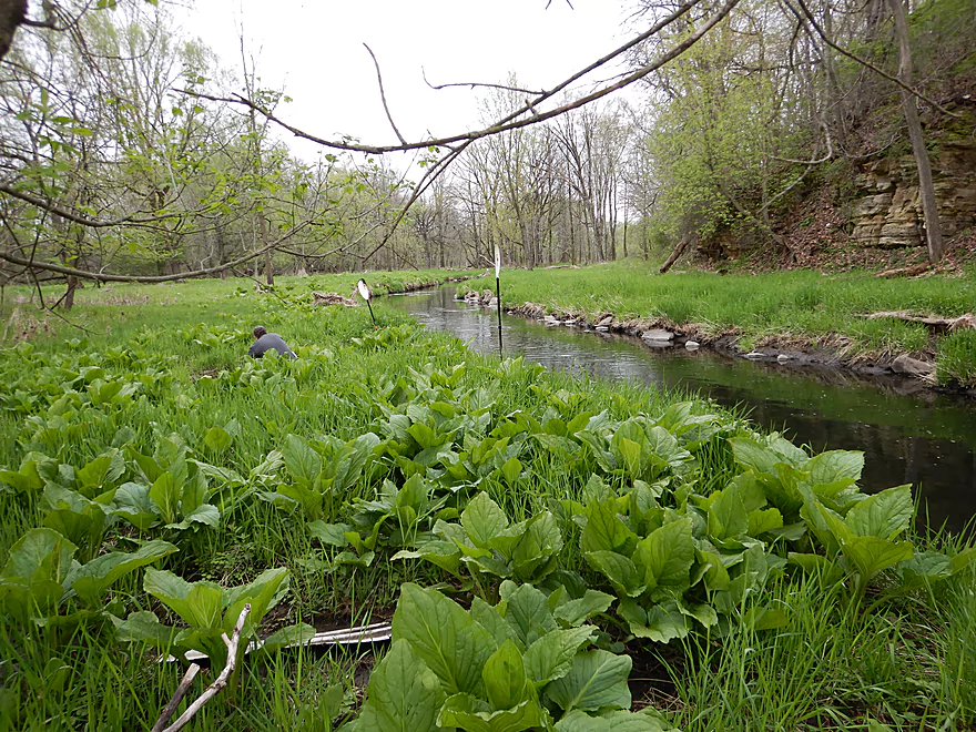
A forest of skunk cabbage
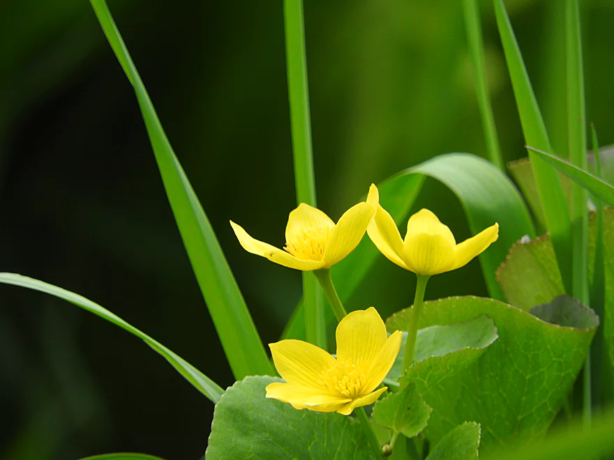
Marsh marigolds

Old tractor hiding in the weeds
One of the nicer boulder gardens
Picking my path through carefully
The only logjam
Portage wasn’t too difficult
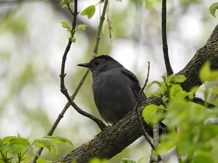
Catbird
Easy re-entry
The higher banks prevented this from being a logjam
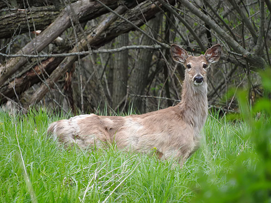
Shedding his winter coat
Some more boulder dodging
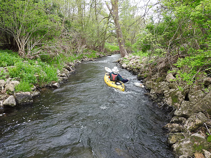
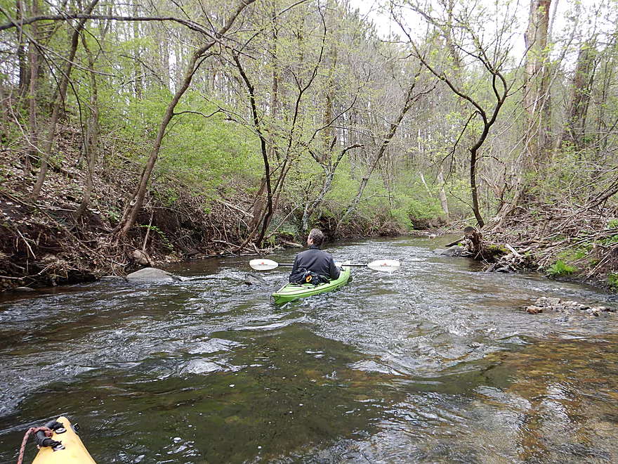
Very scenic
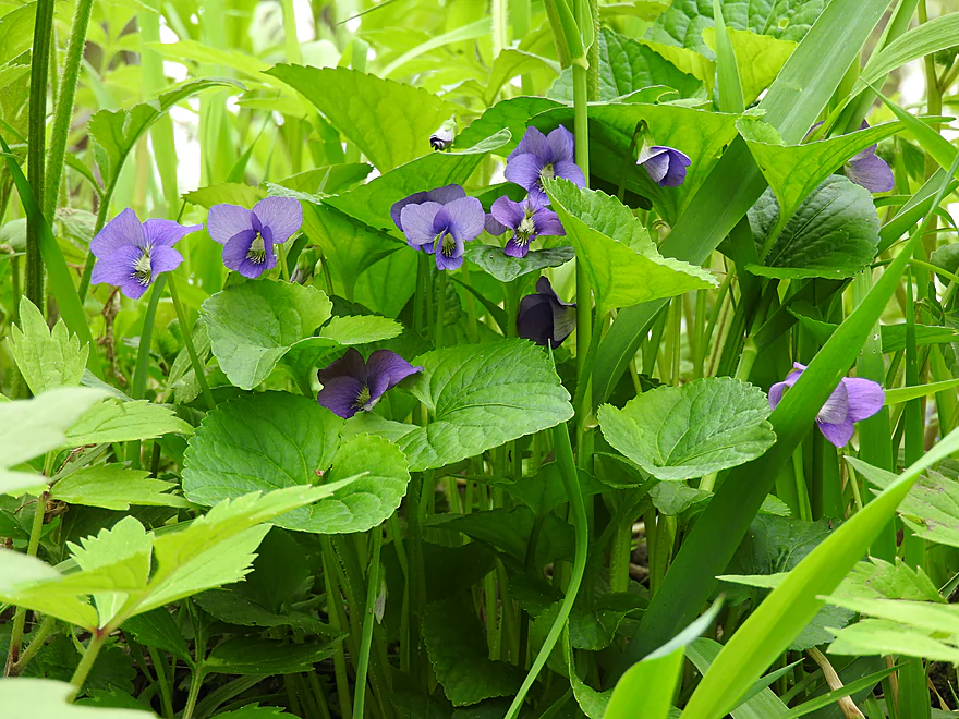
Violets
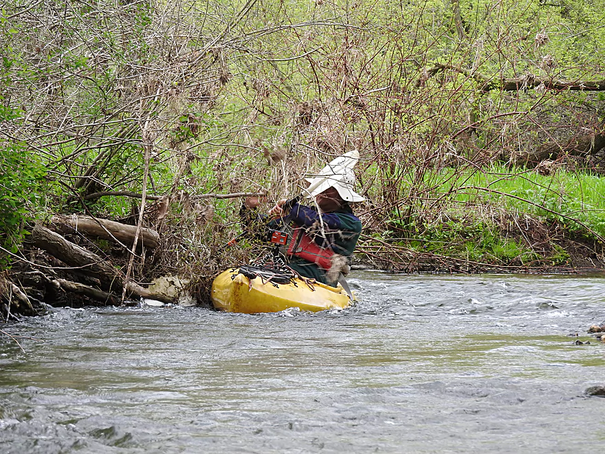
Some of the faster rapids
Approaching yet another stretch of rapids
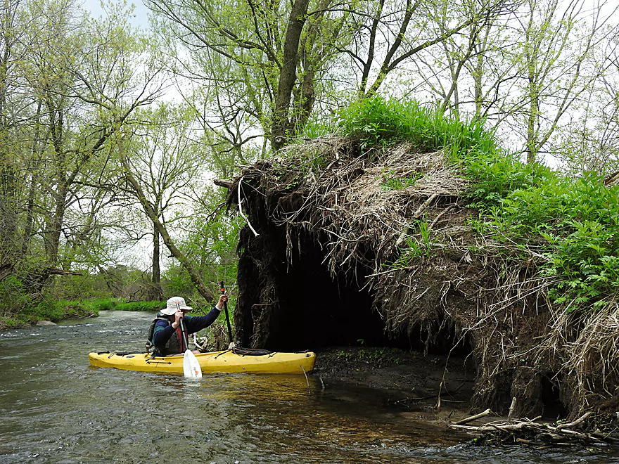
About to be swallowed by the exposed tree roots
Very fast section
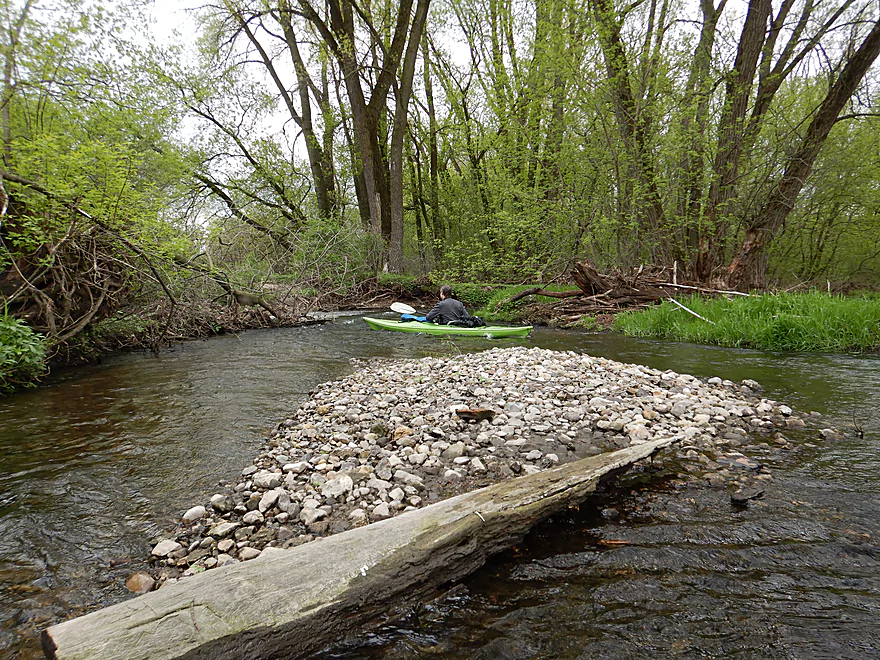
One of several gravel bars
Pushed into a strainer while taking a video
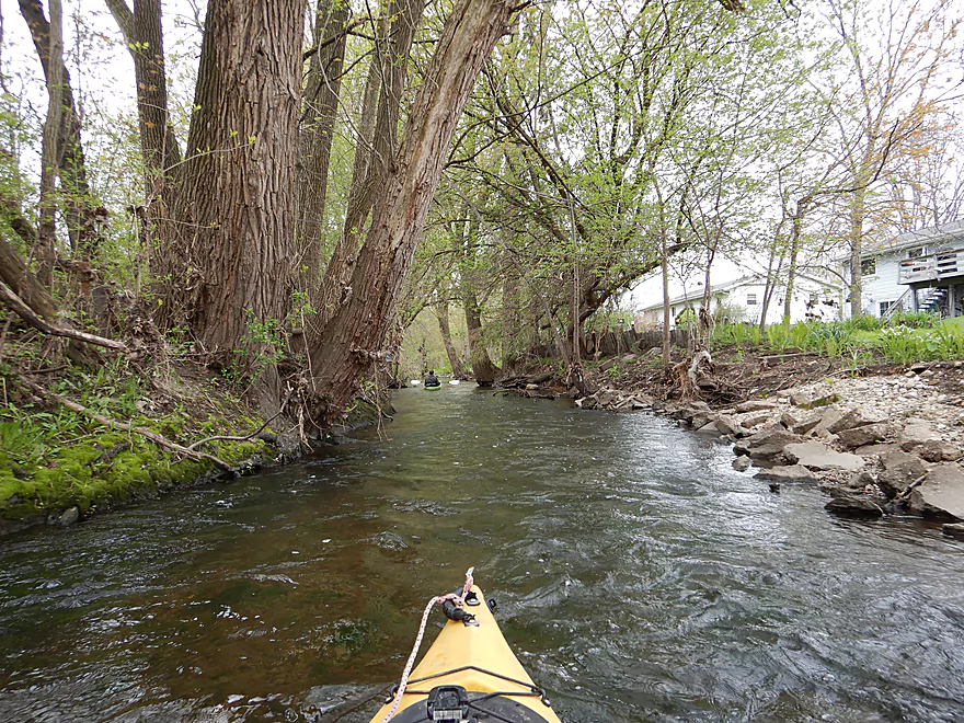
Another nice wooded section
Reminded me of the Waupaca River
Quite the bird house
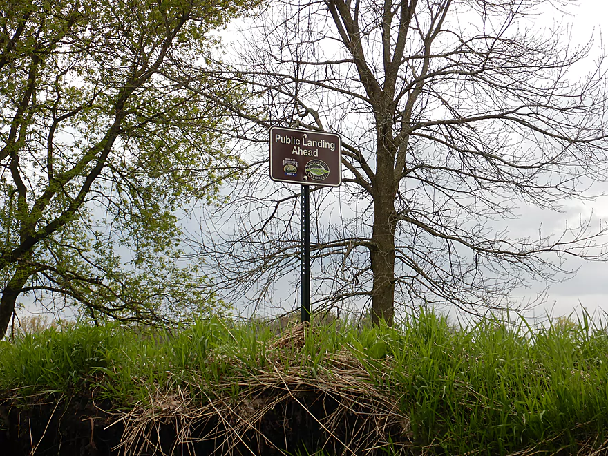
Not visible, but there is a nearby public landing
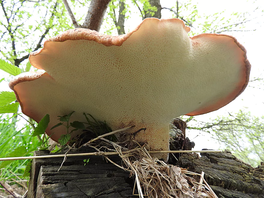
Underside of a mushroom
Missed leaf out by one week
One of the few hills on the trip
Onlookers at the bottom of the rapids asked us about logjams
A very handy notification
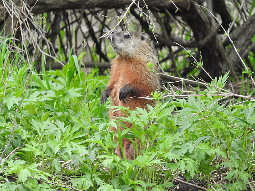
A vigilant woodchuck
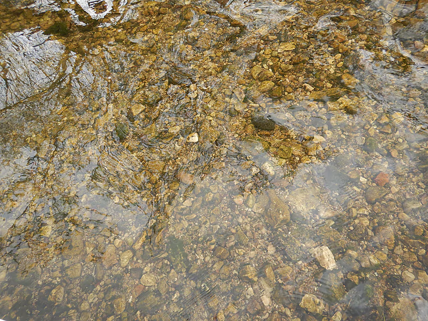
The clarity was great
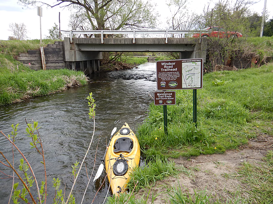
Signs mark the take-out at Sunfish Pond Park
Nice access…but like the put-in, a hike is required to get to the parking lot
Upper Yahara River

A few years ago, a reader by the name of Karl provided an interesting review on the Upper Yahara near DeForest. This proved to be one of this site’s most popular reviews and has been on my to-do list ever since. Relatively recently local groups (Capitol Water Trails and Friends of the Yahara River Headwaters) have further worked to clean up this water trail, which is now in pretty good shape and a favorite paddle among locals.
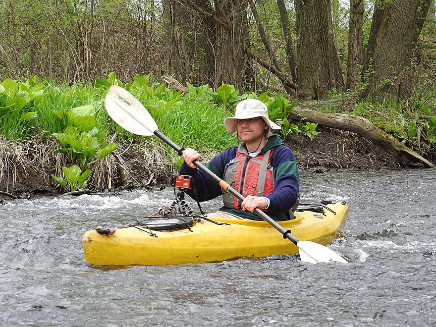
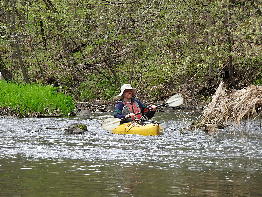
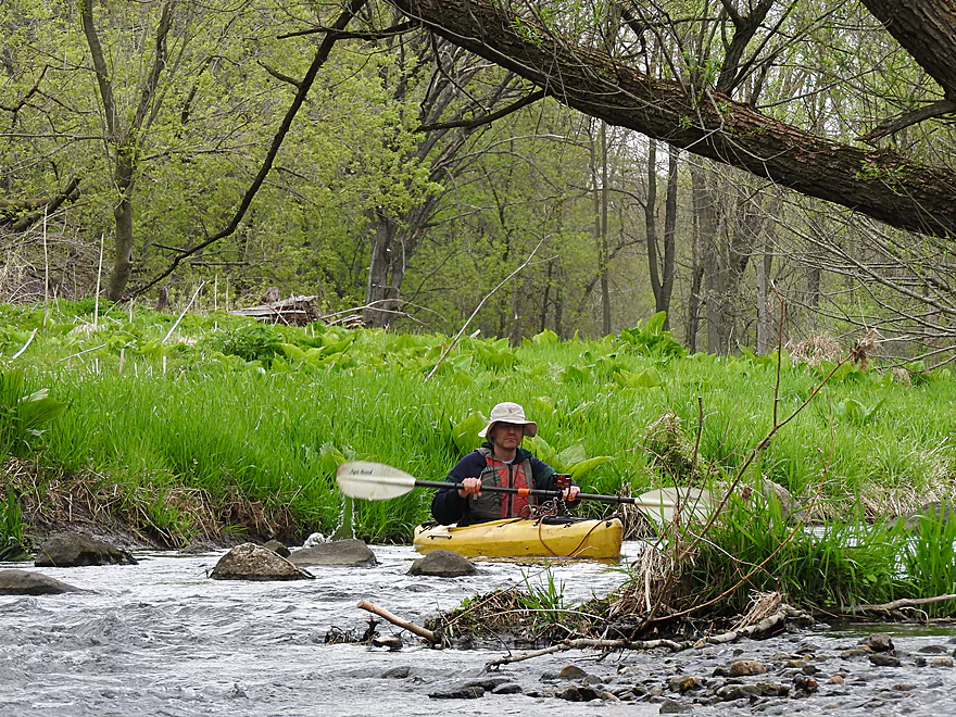
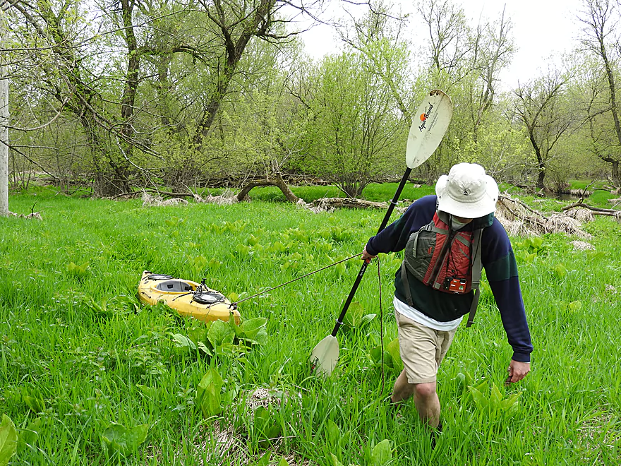
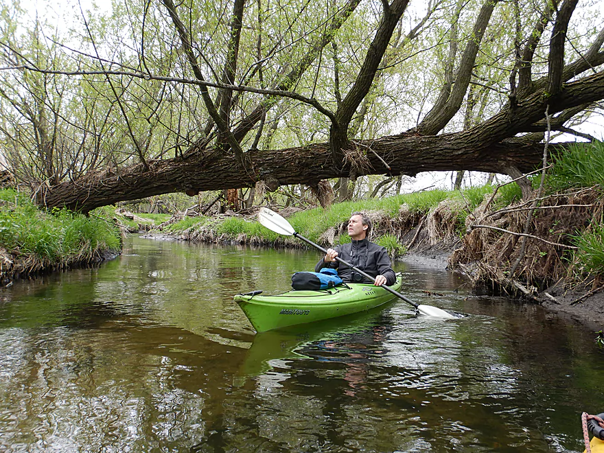
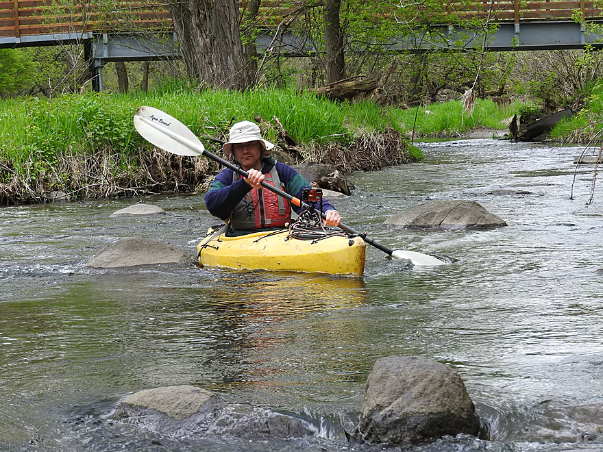
There are four official canoe landings on the Upper Yahara, but practically speaking the best put-in and the one we used was Veterans Memorial Park. Our trip started in a residential portion of DeForest with a narrow, fast and rocky channel. Trees grew close to and over the water, giving this a unique enclosed feeling. Much of the trip flowed through city park corridors, with the first being Western Green Area Park. Here we frequently saw hikers on the local trail system which was extensive and often crossed the river.
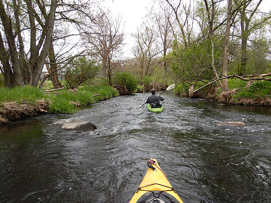
The rapids started pretty light, but by South Street started to get serious. Here the river had been artificially constricted and channelized, creating a really fun and scenic chute. I ran it twice for additional pictures and video.
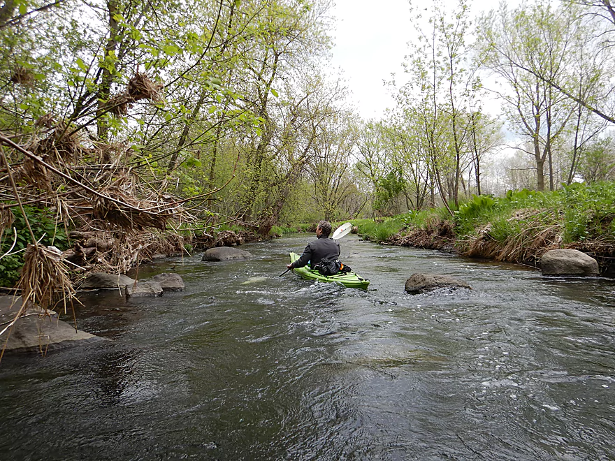
Past this point, the river then flowed by another park in Sunnybrook. This marked a change in character, as the river lost most of its homes and became more wooded and wild. The channel also became rockier and rapids became a more common feature.
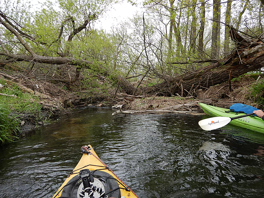
Following River Road was one of my favorite stretches. Here huge swaths of skunk cabbage grew like little forests and there was even a limestone outcrop. In several cases springs fed the river and we could see the underground water bubbling up out of the ground like little volcanoes. As we got close to the infernally noisy interstate we did have to portage a logjam, but that was pretty easy.
Following the second River Road bridge, we started encountering more serious rapids and even some surprise boulder gardens (reminiscent of the Waupaca River). The Upper Yahara is another “Ice Age Paddle” located near the terminal moraine and outwash zone created by our last Ice Age. The section by DeForest was located near the north of Glacial Lake Yahara which drained following the Ice Age. The practical effect of this is that the Upper Yahara is rockier, cleaner, and more boulder strewn than it otherwise would be. Much of this particular section was relatively undeveloped despite its proximity to DeForest thanks to the efforts of the Yahara River Conservancy.
We ended the trip at Sunfish Pond Park, which was the last official take-out (you won’t miss it…there is a large sign here). In theory we could have paddled further…but the ‘highlights’ would have been a golf course, the interstate and likely some logjams after that. It’s still an intriguing section I might do in the future though.
In summary this was a really cool trip that I enjoyed and highly recommend. It compares very favorably to other water trails in the area and might be the best in Dane County (even over other classics like the Badfish, Token Creek and Black Earth Creek).
Webmaster’s Update: As of 2024 July 7th, reader Joey says there are many logjams on this stretch. Paddling this stretch isn’t recommended until they are cleared out.
This was a terrific trip for wildlife, especially birds. Here are just a few of the many highlights:
- Bald Eagle
- Red Tailed Hawk
- Cooper’s Hawk
- Great Horned Owl
- Wild Turkeys
- Sandhill Cranes
- Woodpeckers
- Many small songbirds (the Yahara River corridor is known for being a birding hotspot)
- Groundhogs
- Several deer (they didn’t look very healthy…maybe because they were shedding their winter coats)
Norske Nook: This is a somewhat unique Norwegian themed restaurant known for its huge selection of pies…I think I counted over 50 on their main menu. It’s definitely worth checking out if you haven’t been there before. I had the pie of the month (Rhubarb Crunch) which was quite good. The restaurant is located just next door to Veterans Memorial Park and we could smell the pies cooking as we launched our boats.
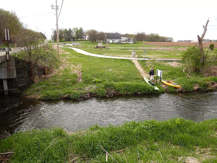
Veterans Memorial Park has an official launch area and is a nice put-in option. Unfortunately the parking lot is located 260′ to the south, so some boat dragging was required. This park (like the take-out) doesn’t have any outhouses so plan accordingly.
There really aren’t many good alternate put-ins. Upstream, you could launch at the “Marvin & Marie Schweers Dog Park” or Yahara Road, but I suspect that stretch might have some logjams. About a half mile downstream from Memorial Park, there is an official launch at Western Green Park…but IMO starting the trip here would cut out a nice stretch of the river.
We disembarked at Sunfish Pond Park located off Windsor Road. There is an official launch here which made getting out easy. …but the parking is over 600′ to the west, so that was a drag.
An alternate take-out about a mile upstream is at Innovation Drive. There is an official launch here, but ending the trip early here cuts out a nice part of the trip.
An alternate take-out 2.8 miles downstream would be at Hwy 19. This should be a suitable access, but this additional leg may have some logjams. A good portion also flows through a large golf course.
We car shuttled, but for those interested in bike shuttling there is an excellent option in the Upper Yahara River Trail. This would be a short leg (3.6 miles) that largely parallels the river and should be very scenic. The portions I saw were paved, which is always a bonus. Here is the official trail map.
Logjams: There was only one logjam that had to be portaged (marked on the map), but I thought this was relatively easy.
Webmaster’s Update: As of 2024 July 7th, reader Joey says there are many logjams on this stretch. Paddling this stretch isn’t recommended until they are cleared out.
Current: The current was very fast with many light rapids (none of which were greater than Class 1). There was only one minor strainer, but otherwise I thought this was a pretty safe trip.
There is a depth gauge conveniently located near the take-out. The Upper Yahara is a shallow and rocky river which will need higher levels to be navigable.
- < 27 CFS: Likely too low for paddling.
- 27-32 CFS: A very low depth. A handful of the rapids might have to be walked.
- 33-38 CFS: A low depth and mostly navigable. Many of the rapids will be shallow.
- 39-48 CFS: An average depth. We did the trip at 43 CFS which I liked and many of the rapids had good padding. But there were still a few bumpy rapids.
- 49-62 CFS: A higher depth and likely pretty fun for the rapids. Some of the nicer boulder gardens and clarity might be submerged at this point though.
- 63-84 CFS: A pretty full river. Great depth for whitewater paddlers.
- 85-100 CFS: River might become pretty pushy at this point. Perhaps only suitable for experienced paddlers.
- 101-200 CFS: Some banks might start to overflow and standing waves could occur. Definitely only for experienced paddlers.
- 201+ CFS: Maybe too high?
Detailed Overview
- Hwy 51 to E. Yahara Road: 1.4 miles. Very small and channelized, it seems open but there might be some snags here.
- Yahara Road to Veterans Park (DeForest): 1.6 miles. Very wooded so good chance of jams if not cleared out.
- Veterans Park to Windsor Road/Sunfish Pond: 5.7 miles. A small but fast stretch that has become popular in recent years.
- Windsor Road to Linden Drive/I90: 1.5 miles. An interesting section through a golf course. Linden Drive access is privately owned by the golf course.
- Linden Drive to Hwy 19: 1.3 miles. There are too many logjams to recommend this.
- Hwy 19 to Cherokee Park: 4.5 miles including 1.8 miles of lake paddling. There are too many logjams downstream of Hwy 19 to recommend that as a put-in.
- Cherokee Park to Tenney Park (aka Lake Mendota): 7.6 miles. A nice lake but really too big and exposed for most paddlers.
- Tenney Canal and Locks to Morrison Park: 1.3 miles. A fun experience. A canal fee might be required.
- Morrison Park to Paunack Park (Lake Monona): 2.6 miles. Mostly too big and busy to paddle, paddlers still do so and enjoy scenic vistas of the downtown.
- Paunack Park to Babcock Park (Lake Waubesa): 4.2 miles. Probably too much flatwater to be interesting.
- Babcock Park to Fish Camp Park (Mud Lake): 4.1 miles. Wide and flat. Probably uninteresting.
- Fish Camp Road to La Follette Park (Lake Kegonsa): 2.4 miles. Probably uninteresting lake paddling.
- La Follette Park to Viking County Park: 3.5 miles. Finally back to river paddling! An ok prospect, but slow and big.
- Viking County Park to Dunkirk/Hwy N1st Bridge: 5.2 miles.
- Viking County Park to Riverside Drive Park (Stoughton): 2.1 miles. A flowage paddle through downtown Stoughton.
- Riverside Drive Park to the Dunkirk Dam: 3.1 miles. A small flowage that is ok but nothing special.
- Dunkirk/Hwy N1st Bridge to W. Stebbinsville Rd: 4.8 miles.
- Dunkirk to Hwy N2nd Bridge: 2.5 miles. A good stretch that starts a bit slow, but speeds up and contains a number of large scenic boulder gardens.
- Hwy N2nd Bridge to W. Stebbinsville Rd: 2.3 miles. A scenic rocky stretch flowing through glacial outwash.
- Stebbinsville Rd to Murwin Park: 6.2 miles.
- Stebbinsville Rd to Hwy 59: 2.1 miles. This is the last super stretch of the Lower Yahara. After Badfish Creek joins up, the river becomes much larger and less interesting.
- Hwy 59 to Murwin Park: 4.4 miles. While not as scenic as upstream legs, this is still a solid stretch and popular with paddlers.
- Murwin Park to the Rock River: 2.8 miles. Final stretch on the Yahara and then a short leg on the Rock River. Probably ok, but nothing special.
Many of Yahara's tributaries are navigable as well.
- Badfish Creek - A classic! One of the better paddles in Southern Wisconsin.
- Token Creek - A surprisingly nice creek located northeast of Madison.
- Nine Springs Creek - An underrated prospect located west of Lake Monona that has some attractive springs.
- Six Mile Creek
- Upper Six Mile Creek - Congested in spots, this is still a really neat paddle with character you don't expect from Southern Wisconsin.
- Lower Six Mile Creek - Recently cleared of logjams, this is a varied paddle that includes both dense woods and open marshland.
- Starkweather Creek - A slow urban paddle, but interesting because of its bridges and Olbrich Gardens.
- Pheasant Branch Creek - Located northwest of Madison, this is a short trip but has some spectacular springs.
- Wingra Creek - A short urban paddle west of the Isthmus that might be fun.
- Dorn Creek - A possible prospect west of Madison that would require a lot of water.
- Seven Mile Creek - West of Lake Monona, I've heard this is a pleasant paddle.
- Swan Creek - Possible prospect but short (south of Lake Waubesa)
- Murphy Creek - Interesting wetland prospect but access on the upstream sections looks tricky (south of Lake Waubesa)
- Door Creek - Small, slow and channelized but might be ok. Has had recent cleanup work on it from I believe Hwy MN.
Trip Map
Overview Map
Video
Photos Size:
Paddled 23May2019 at 40 CFS and 1.7 ft. Lower level than I prefer, but a good paddle for birdwatching. Lots of wood ducks, warblers, plus spotted sandpipers and common nighthawks. Got hung up several times, but was able to scoot over without exiting the kayak
The mandatory portage route around the big tree has nettles which could sting bare skin once they mature later.
A new tree is down, but I managed to ram the bow onto a low spot, then pull my kayak over by grabbing branches.
To get a shorter carry at Veteran’s Park launch: park as close to the bridge, unload, then move car to parking lot.
That’s one advantage of spring paddles…less weeds and understory growth. hopefully both jams get cleared out in the future. Good tip for Veterans Park…in hindsight this might be viable trick forSunfish Park as well.
Love this stretch! I do a lot of my paddling solo so I appreciate the bike trail option for shuttling. Water level is important for optimal paddling experience. Check the USGS streamflow website for Wisconsin for level and cfs daily updates!
https://waterdata.usgs.gov/wi/nwis/current?type=flow
Definitely a gauge dependent stream. The gauge actually nearly spiked to 800 CFS today…wonder if anybody tried paddling it.
I’ve done this section probably 10 times in the past 2 years, it is by far my favorite local paddle. The only problem is that it is hard to catch it at a good level, my target is 2-3 ft or about 40-50 cfs, I find the ft a better indicator for this river. If it is much below 2 feet, the rapids are pretty bumpy, but between 2-3 they are perfect, fast, fun and almost nonstop for a long stretch of the river, too much above 3 might be a bit pushy for some folks. The river rises and falls quickly, it is often only at a good level for a day or less, so you have to watch the gauges or set up a USGS WaterAlert that will send you an email when the river is at or between levels you choose (https://water.usgs.gov/wateralert/subscribe2/?site_no=05427718&parm=00060) Also this part of the Yahara stay open all winter, and because you are always close to a trial,houses and a road it makes for a safe place to try winter paddling. It is beautiful in the winter, and you will see an amazing amount of wildlife, especially deer
Appreciate the depth reference which should help other paddlers. Also good tip on the email alerts. Personally I’m constantly checking the USGS map to see where water levels are at: https://waterwatch.usgs.gov/?m=real&r=wi
Paddled from Veteran’s Park to Innovation Dr. on 23 Sept 2019. Gauge was about 4.6 ft., ~220 CFS. Trip took longer than usual due to 3 mandatory portages. One portage was due to a tree we couldn’t duck under at this level, and another duck-under was extremely tight.
Lots of maneuvering to avoid branches and leaves, and one duck-under that was extremely tight.
The higher level washed out some of the rapids-virtually all the rocks were covered. I’d say 3-4 ft. on the gauge is the sweet spot for swift water enthusiasts with the right skills and boats.
Saw kingfishers, great blue herons, deer, frogs, and an owl – it was drizzling for part of the trip.
That’s good news in a way. I feared the logjam situation would actually be worse. It’s also nice to hear that 220 CFS was navigable.
We paddled the upper Yahara River (Veteran’s Memorial Park to Sunfish Pond) on Aug 17, 2019, in a MadRiver Explorer whitewater open canoe. The online gauge indicated 40 cfs and 2.0 ft. There is now a dangerous strainer midway through the trip. A very large living tree collapsed across the river. The branches extending down into the water have made a massive debris trap through which a significant undercurrent is flowing. Upstream of the strainer, the water is at least 6 ft deep. Downstream it is 1 ft deep. There is a portage on river right with a difficult put-in from a bank about 6 ft above the river channel. A tip-over upstream of the strainer while trying to exit the river could lead to entrapment of a paddler in the debris below the water surface. The debris in the surrounding trees indicated that in flood, the water level was a good 8 or 9 feet above the current water level above the strainer. As an (inactive) ACA whitewater canoeing instructor I would suggest that this section of the Yahara cannot be recommended until this strainer is cleared (and that will be difficult work). We also noted a dozen tires, many plastic bottles and aluminum cans, and a half dozen obstructions that we were able to dodge or wiggle across. The river did not carry its water through the lower third of the run; a half-dozen stretches were so shallow that we could not float and walked the canoe. We will be crossing this one off our once every year list in favor of the other beautiful runs in Wisconsin.
Thanks for the update on that strainer.
We did the creek on Mon 6/30/20 with a bike shuttle. The river was at 40 CFS and 1.8 ft. which is on the low end of my recommended levels 2-3 ft is ideal. We never had to get out and walk the boats but there were several very shallow areas and most of the rapids were a bit bumpy. On the upside there were no complete blockages or portages, and we meet a couple of guys from Quercus Land Stewardship Services (https://quercuslandstewardship.com/) who were cleaning up the river. A big shout out to them! The trip took us just over 2.5 hours and the bike shuttle took us about 15 mins using the adjacent bike trail.
That nasty logjam that Colleen encounted must have been cleaned out…which is great news!
We did the Upper Yahara on Saturday, 7/11/20, and the online river gauge showed 120-140 cfs, which was down sharply from the 600 cfs just 30 hours prior. This was our first time on the UY and we weren’t sure just how dangerous it may be. We put in at Veterans Memorial Park.
However, while there were some tight duck-unders of some bridges and some weaving through branches, we never had to portage around or over anything. The first 30-45 minutes are more scenic than exciting I’d say, but the latter section was really, really fun with some rapids and such. It was the best stretch we’ve been on in our admittedly young kayaking life. There’s quite a bit of bend in this stretch which made it all the more exciting, as we were never quite sure what was around the corner.
It took about 2hrs 15 minutes to get to Sunfish Pond, including a brief lunch break. However, since we don’t live in the area and made the driving effort to Madison, our plan was to keep going all the way to Yahara Heights County Park (a 13-mile trek from Vets Park) to make our effort and trip really worthwhile and memorable….and that’s where the real adventure began. The earlier section from Veterans Memorial Park to Sunfish Pond was for fun, in hindsight. The Windsor golf course immediately after Sunfish Pond was nothing special to paddle through, and it did require a couple of portages and some close duck-unders of some brdiges, so mehh on that section. Once we crossed under Interstate 39 and entered the Cherokee Marsh Wildlife area, holy cow that’s where things really got rough and we got bogged down. No less than 30-40 tree branch blockades, some of which were quite challenging and required portaging over, including a major couple of blockages right past I-39. Some we could pass through even though they were tricky, but make no mistake, this was as much an exercise in determination as it was in kayaking. And occasionally the river would split and we were left wondering if we took the right path (always chose the path where the current was moving strongest towards). Now having looked at the map in closer detail, I guess it all links back up eventually, but in the heat of battle and in the thick marshlands, we weren’t really sure.
Eventually we made it out of the Cherokee Marsh, but this was probably close to a 4-hour adventure itself once we passed Sunfish Pond. But we weren’t done yet…nope. We had to then contend with the Cherokee Marsh Fishery area, a much wider channel branch of the Yahara that was essentially like kayaking on an open lake. We did that for close to an hour and a half before reaching Yahara Heights County Park, and at the end of a long day of kayaking, just to see wide open water in front of you as far as you can see with very little changing landscape, well, let’s just say this wasn’t the most thrilling part of the Yahara for us.
But we eventually made it, roughly 7hrs 30 minutes after we launched at Vets Memorial Park. What an adventure that was! We Ubered back to our car, circled back for our kayaks at Yahara Heights, and then went right back to DeForest for some awesome Mexican fare and margaritas we had our minds set on. Upper Yahara, we will not forget you…and nor you Cherokee Marsh areas!!
Thanks to this website and all its contributors for allowing us to plan a fun kayaking trip from the Chicago area…on Sunday we did the Badfish Creek in Rutland and put some comments there, too.
I’m horrified that you had to face “30-40 tree branch blockades”…3 can be too many! I’ll update my maps/write-ups to warn other users.
Hi Aaron, yeah it was really slow going through the Marsh Wildlife area. I had no idea it would be as rugged with all the blockades. Fortunately, there were no sea creatures and the insects, while plentiful, were of the spider, mosquito, and fly variety. Also fortuitously, we weren’t super pressed for time and we exited the worst of the marsh wildlife by about 5pm. And the temp was probably low 80s, so it could’ve been worse I imagine…had daylight really been a factor, that would’ve added a much more harrowing element to the adventure.
I bet we had to get out of our boat to pull our kayaks over logjams in the Cherokee Marsh Wildlife area at least 10 times it seemed. Some were major blockages that required playing “Frogger” over some floating/half-floating bigger limbs for leg support. The other blockages we were able to maneuver through, but nearly all of these weren’t very straight forward and we definitely had to use our arms and the branches to pull ourselves forward and through or sometimes under. It was an adventure, that’s for sure.
Paddled from Veteran’s Memorial Park to Innovation Dr. (aka Rivers Turn Park Trailhead) on 28Aug2020 with a bike shuttle. Windsor gauge was at 2.3 ft and 55CFS. Scrapey, but never had to exit my boat – someone’s done some major clearing since 2019.
Innovation Dr. no longer dead-ends at the river. A new bridge now allows one to drive between River Rd. and Cty Hwy CV (aka Main St.) This made the car shuttle portion of this trip shorter.
There’s a tree spanning the entire river upstream from the second River Rd. bridge. I barely made it under, but at higher levels it might require portaging. Link to photo taken downstream from the tree: https://photos.app.goo.gl/xYHtYgNB995LzXa38
And, a link to a photo album: https://photos.app.goo.gl/xFASGnzCApyDJxoG7
I saw Great Blue Herons at least 8 times, some were surely repeats. A few times they took off right in front of me as I drifted around a bend.
The takeout at Innovation Dr. is a little steep. I stood in knee-deep water and heaved my kayak onto the bank.
Great photos! Thanks as always for the updates.
First time on this section of the Yahara. Levels at 40.4 cfs and 1.81 feet. The original description remains very accurate, in general. There were no major obstructions at this time. There was a hop-over about 1/2 through that would have been easier with a 1-2 more inches of water. My wife and I each got stuck in shallow areas a few times, and there was a fair amount of scraping. While a few more inches would have made that less of an issue, there were a few duck-under sections that would have been challenging if the water had been a few inches higher. The run at the South Street bridge was one of our favorites. Overall, an enjoyable day. A good opportunity to practice our skills knowing the river tends not to be too deep (if you do get caught up on a boulder). The best part? Stopping at the Norske Nook for some pie afterwards!
Glad you didn’t have too many issues…this is a great stretch…perhaps my favorite paddle in Dane County. Norski is awesome too!
I did this section on 11/11/20, levels were excellent at CFS 65 and 3 ft. I have done this trip many times but never at these levels, and it makes a huge difference.This trip was fun and fast, especially after the first bridge (South Street). Usually there are several shallow spots,bumpy rapids, and it takes a lot of maneuvering to avoid rocks and find the deepest part of the creek to avoid scraping, but at 3 feet that is not a problem and there are many sections with constant riffles and small rapids. Nothing was truly dangerous but good boat handling skills are required if you want this trip to be fun rather than frustrating. There were no blockages but there were three trees to duck under, all of them between the second River Rd bridge and the new Innovation Drive bridge, that would probably not be too bad in lower levels but at 3 and above may require some limboing skills, and may be a problem for some. I was in a solo canoe so I can easily duck down and get below the gunnels. The whole trip took only took me 2 hrs 1:45 mins on the water and 15 min bike shuttle on the trail. A perfect way to spend an unusually warm Nov afternoon. I am always surprised by how wild parts of this trip feel, as it is really a fairly urban paddle. Because of this it would also be a great river for someone who wants to try winter paddling because you are never very far from a street, road or house and the Innovation Drive landing makes a good halfway point if you want to try a short trip.
I appreciate the river updates as always Eric!
I paddled this section today after with a bike shuttle, 60 CFS and just over 2 ft. The trip only took 1 hr 45 mins, but I was paddling hard and fast because I did not know how many blockages I would find, and I wanted to be sure to be off the river before sunset. It was a surprisingly nice trip. Lots of waterfowl,tons of deer, huge muskrat (or beaver?) good fast current,and only one partial/full blockage. I was able to squeak through by laying down in my solo canoe,might be tough for some kayakers, but there looked to be an easy portage on river left. I am planning a cleanup trip this weekend with MadCity Paddlers so hopefully we can get it all cleared out.
Sounds like a great trip! If that one jam gets cleared out, definitely let us know.
We spent a few hour picking up trash, clearing brush, removing snaps, but did not feel we had the manpower or expertise to remove the one major blockage or some other trees that spanned the creek from bank to bank, but there is still only one place that may require a fairly easy portage, it is located just up stream for the 2nd River Road Bridge
Hopefully others will see your notes and will be able to help finish that off.
The blockage has been removed, river is now clear form Veteran’s memorial Park to SunFish Pond
Appreciate the heads up!
Paddled from Veteran’s Park to Innovation Drive on 18Jun2021, 2.4 ft at 70CFS. A bit scrapey, but no blockages, and I never had to exit my boat. The only stream-wide tree was between the Innovation Dr. bridge and the takeout. At higher levels this might not be an easy duck-under. Link to photo: https://photos.app.goo.gl/e71428At4eLgLLns9
I think the City of DeForest cleared some blockages last winter?? I was pleasantly surprised at the absence of major obstacles.
Thanks for the update. That rain storm sure opened up a nice window for the Upper Yahara…I doubt it lasts until Monday though.
I did the same section a few hours after Jon (on river 3:30 off river 5:45), similar report, but either you for got one, or a new one fell in the hours between us. There is a big Bur Oak with a bunch of trunks and branches in and across the creek right at a right hand bend after a big ranch style house on a hill on river left with a big mowed lawn. (I’m pretty sure it is on a line between Prairie Fire Ct on the east side of the river and Diamond Dr on the westside) I was able to get through/over/under so I did not have to get out of my boat, but it took some doing and the current is fairly decent there. The river is not too deep at that spot, so probably not too hard to get out to portage, but I suspect it is private property and in view of the house. As I said it was not that difficult but could be an easy spot to tip if you are not paying attention. I was short on time so did not stop to do any cleaning, but hope to get back in the next week or two to do some clean-up work with saws and loppers
Thanks for the update Eric. If this situation changes, definitely let us know.
we did this trip on 3/6/20, after a day of rain and snow melt. The river was up to 4.5 feet and 200 Cfs overnight, but had dropped to about 70 CFS and 2.5 ft by 1pm , Good levels, good fast current the 5 miles only took us about 1.5 hours. We were worried about obstructions as we were probably some of the first to run it this year, but there was only one fairly easy duck under and no obstructions. The river is in great shape for spring paddles, let’s hope we get some decent rains this spring.
Appreciate the update as always!
We did this trip on 6/8/22 after a spell of good rain, 3.5 ft and 125 CFS. There were no major obstructions and only a couple of places where we had to duck under stuff. This is one of my favorite local trips, and we all had a great time, but I think I like this trip at slightly lower levels. I think some of the fun and challenging rapids were washed out by the higher water, I had expected it to be more fun and more challenging with more water, but it was not the case on this trip. But as I said it is one of my favs, so I will certainly do this trip again, both at higher and lower levels to try to find that perfect sweet spot for this river. Here is a link to a map and pics of our trip https://www.relive.cc/view/vwq1BMP5NLv
I’m probably in the minority, but I actually prefer many creeks/rivers on the lower side for the reasons you mentioned. Great pictures BTW.
I did this trip on 2/28/23, thanks to recent rains and some “warm” weather the river was up to 3 ft and 100 CFS. This part of the river is know for going up and down quickly, 24 hours earlier the river the river was over 5 ft and 275 CFS. We put in about 20 yards up river from the official Zelensky at Veterans’s Memorial Park, because it was much easier and we were able to just “otter” in. As we were probably some of the first people to paddle the river this year, I was worried that they would alot of blockages. While they were several spot where tress had fallen across the river there was only 2 complete blockages. We cleared one out and the other is just a simple portage. There were several places that required go over,under, around or through partial blockages but none require getting out of our boats. The current was good, and there were only a few spots that were shallow enough to scrape a bit. Other than a bunch of deer we did not see a lot of wildlife. Although not 100% necessary,it is nice to have a cart for both ends of this trip as both parking lots are about 100 yards from the water. A Relive video of our trip https://www.relive.cc/view/vDqgemL4mGO
Pictures look nice! Hopefully somebody will clear out that last jam. Nice to see how open the creek was with no ice issues.
Hi, has anybody done this recently as the water’s been over 2 ft for about a week?
That’s an excellent question. I’m not sure what is going on….despite a lack of rain, the Yahara gauge has been steadily increasing for the past 30 days. I suspect a gauge malfunction but I don’t know. https://nwis.waterdata.usgs.gov/usa/nwis/uv/?cb_00010=on&cb_00045=on&cb_00060=on&cb_00065=on&cb_63160=on&format=gif_default&site_no=05427718&legacy=1&period=180&begin_date=2023-06-23&end_date=2023-06-30
Yes I have it set so I get an alert if it’s over 2 ft. That’s the minimum to navigate. But this is an awesome trip! I couldn’t do it last year because of the low water.
Upper Yahara update from Ahnna: “Just a warning for anyone considering a paddle on the Upper Yahara ( Veterans Park to Windsor Park in Deforest).
A few of us were on yesterday – it is a Beautiful paddle and it was my third time on this section- but there were Many downed trees. We portaged around 2-3 large strainers and squeezed through many others. We manually cleared paths where we could.
For reference, it took us 4 hours to paddle 6 miles😂 I love a river challenge but others may not want to encounter these types of situations. With the water running much higher than usual it also created a more dangerous environment.” …Jared also noted: “Capitol Water Trails and Mad City Paddlers will be doing a clearing event on June 29”
The June 29 clearing did not happen. As of July 1, there was a log jam visible from the more northerly River Rd. bridge.
Thanks for the update.
The birdhouse was one of many constructed and placed by the Boy Scouts. Some of them have succumbed to the elements but most of them are still up and you can see them if you walk along the path. :-)
The one with the boot was really cool!