
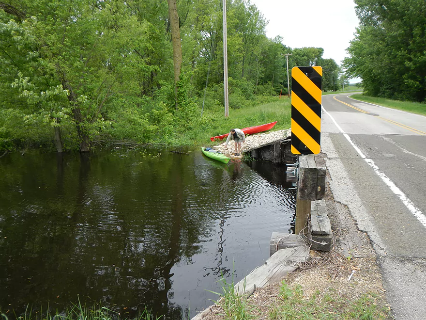
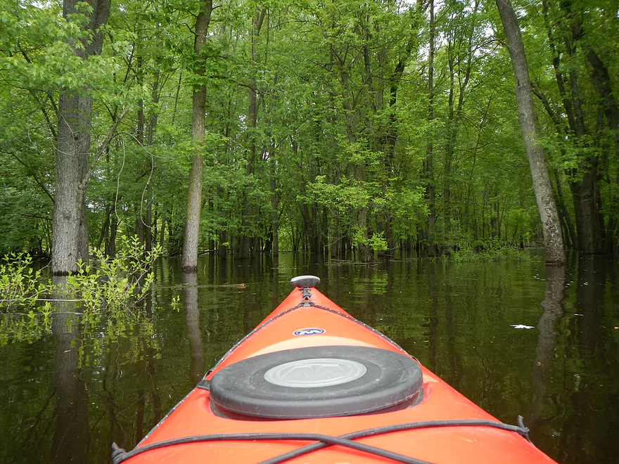
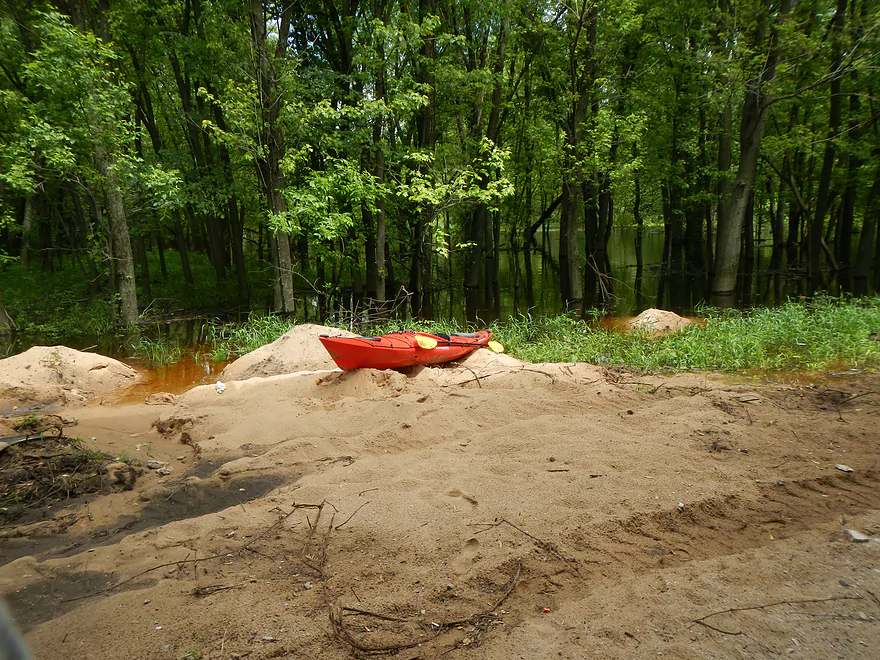
Put in – Cty J Bridge
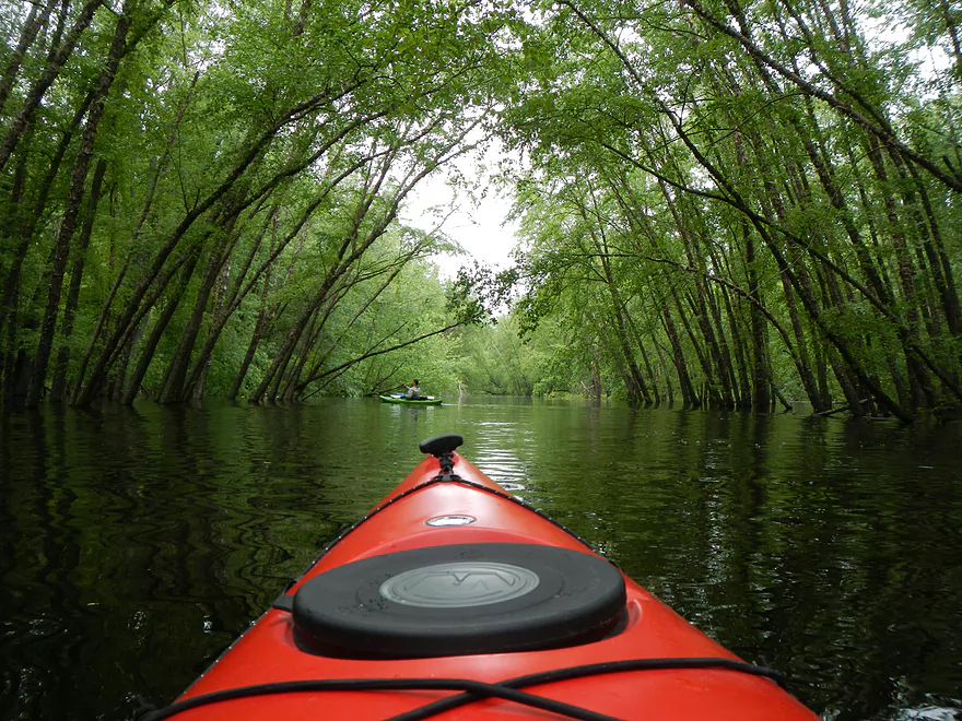
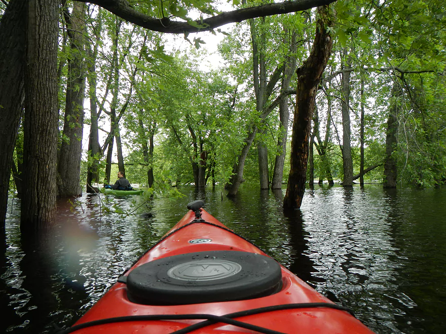
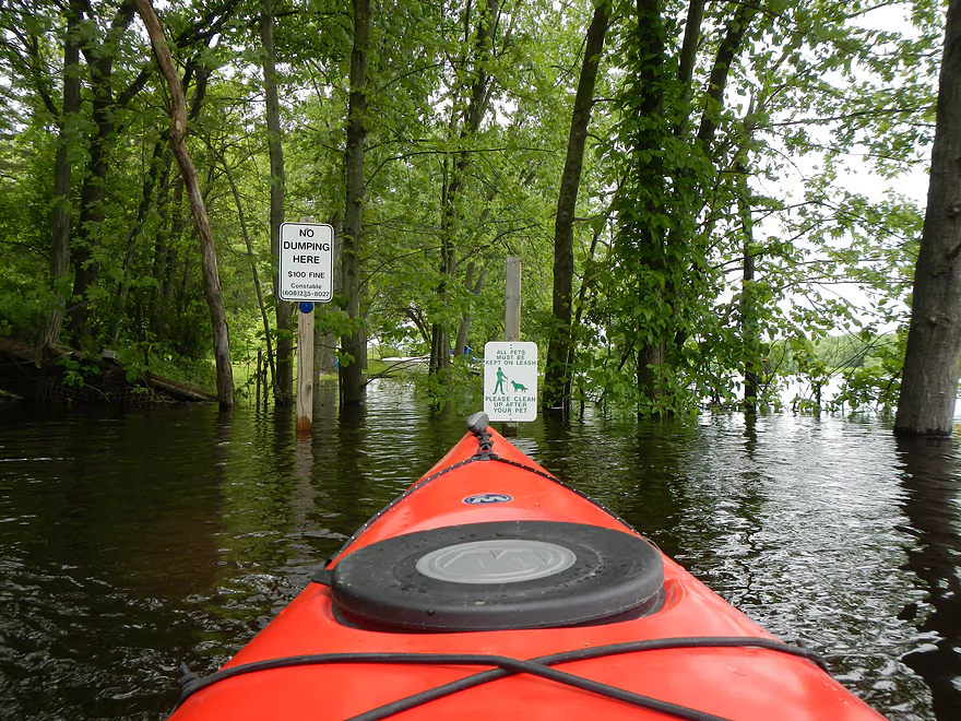
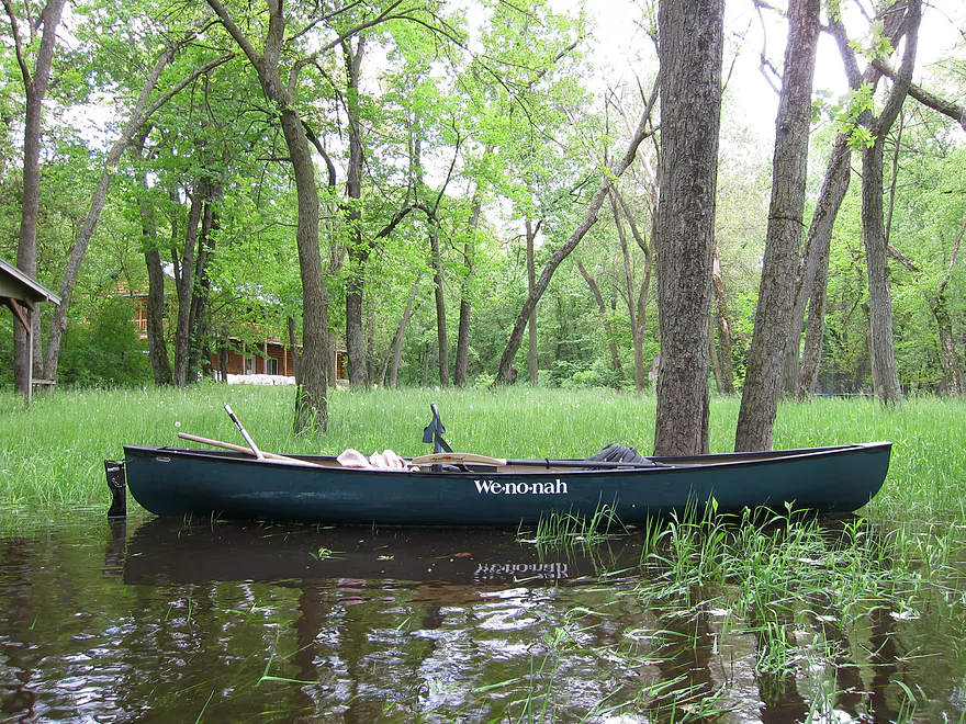
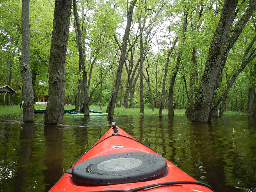
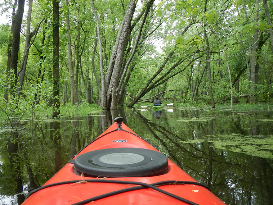
Very flooded
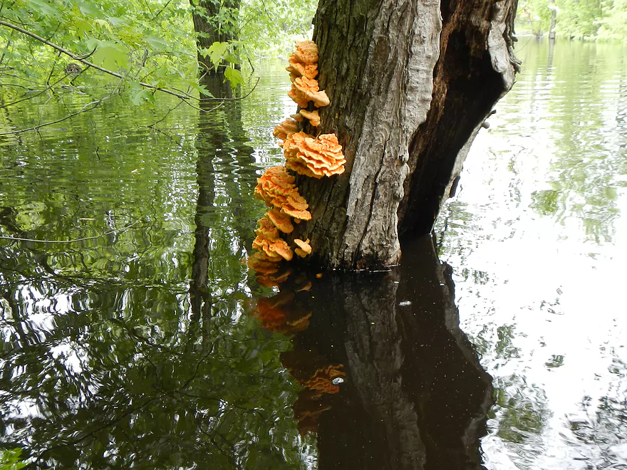
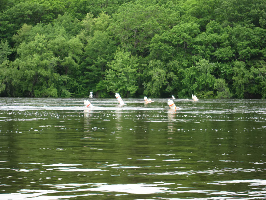
Submarine Fungus
Not the creek, but a canal from Lake Columbia
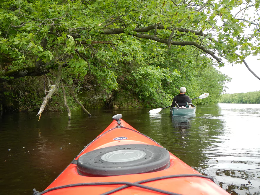
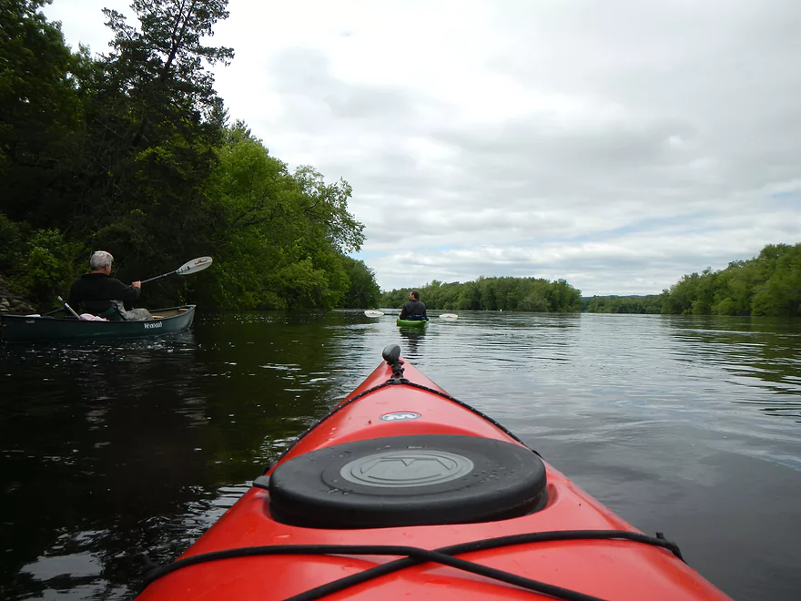
Exiting the creek and entering the Wisconsin River
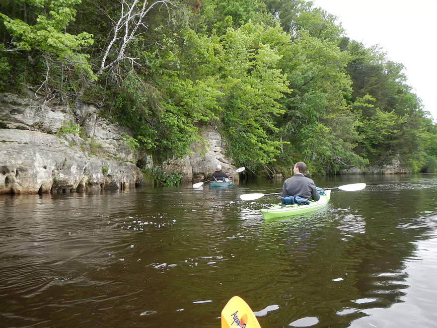
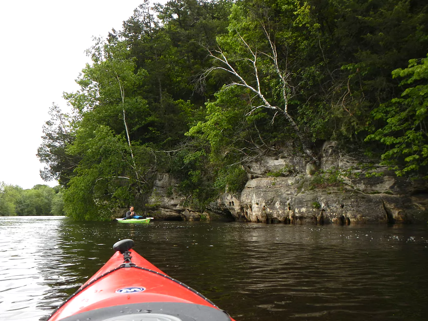
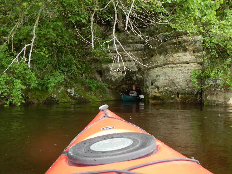
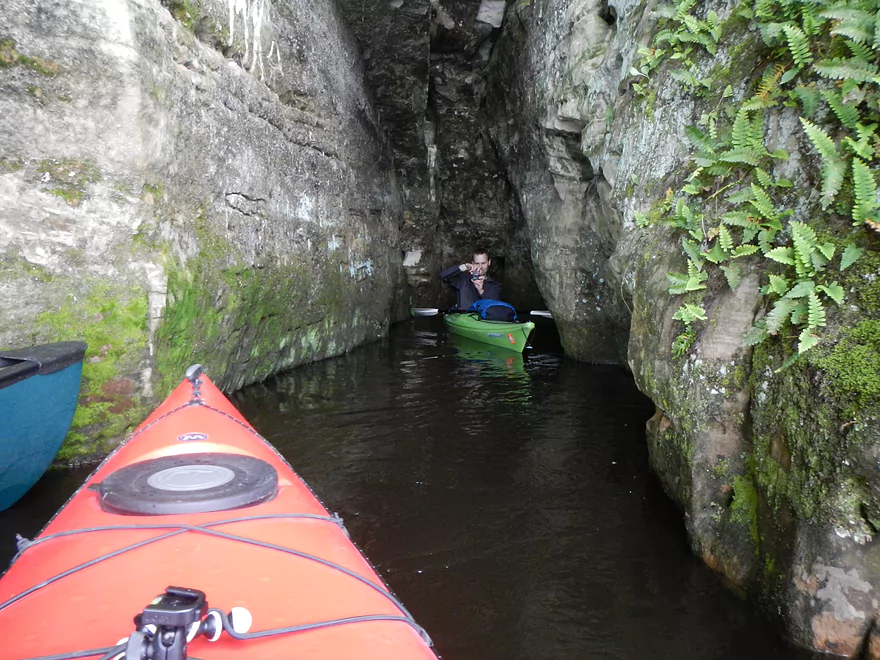
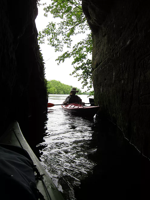
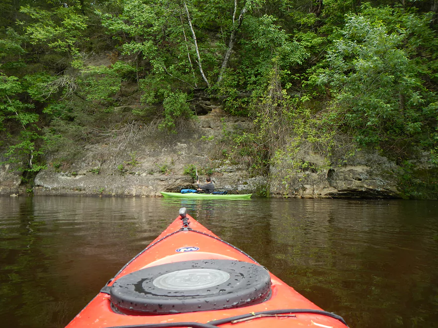
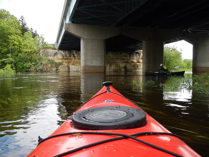
Nice cave in the bluffs

Dekorra Public Landing – Very good but after the creek
See previous photo

About to enter left channel of massive island
Trying a smaller flooded channel
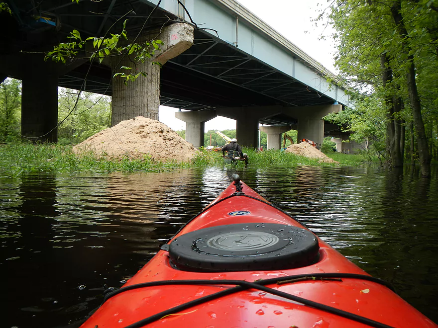
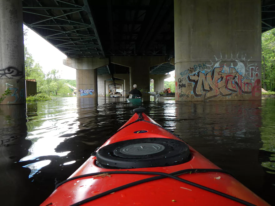
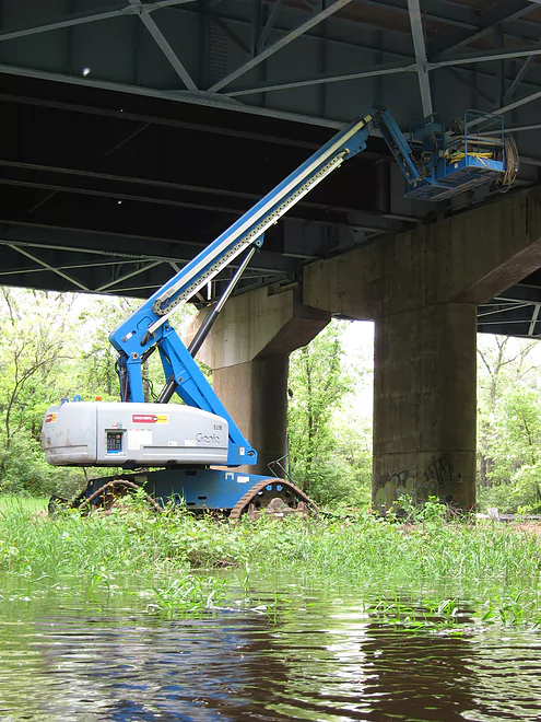
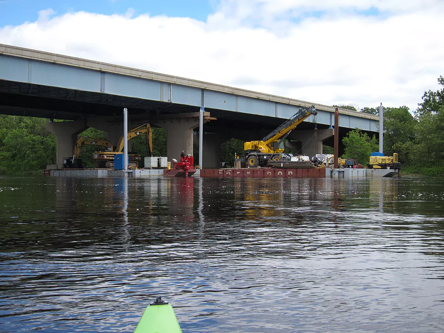
I90 Bridge Construction
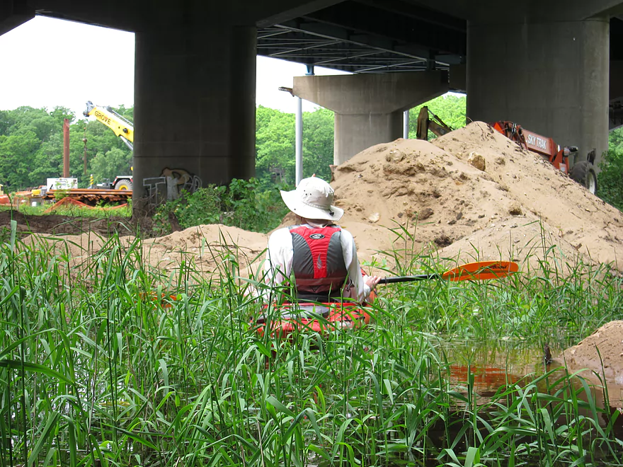
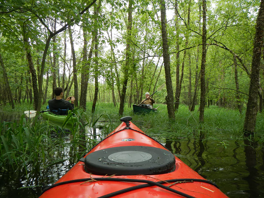
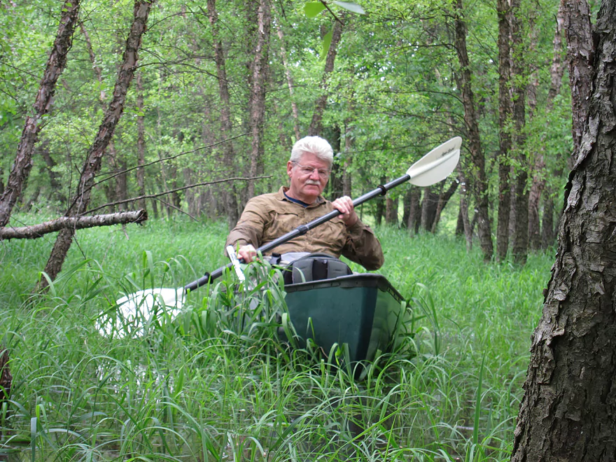
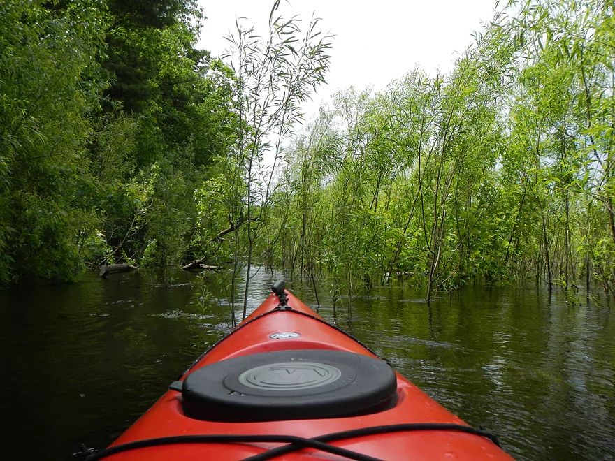
Kayaking through the grass
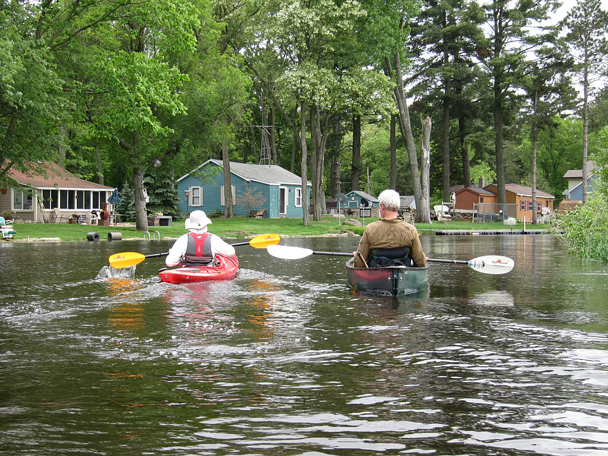
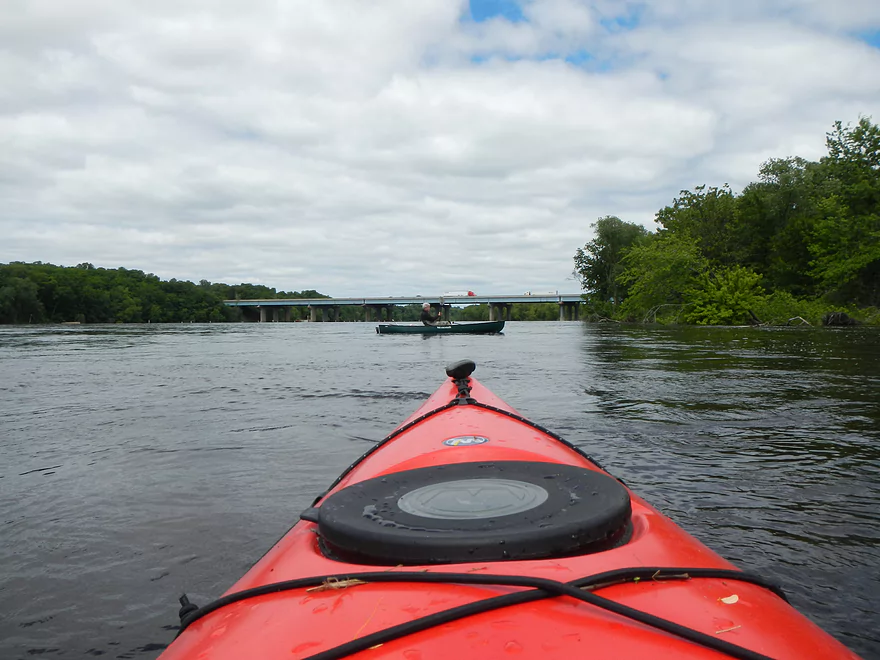
Home Stretch
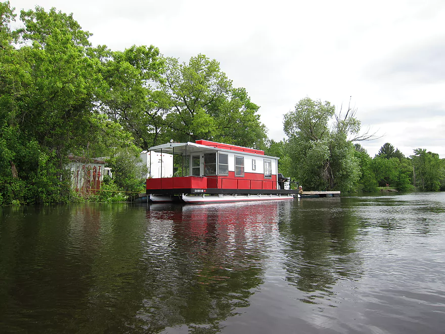
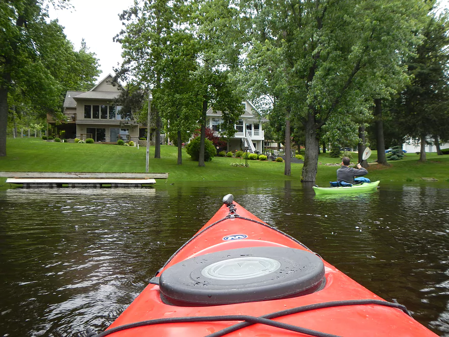
Private Residence – Our Take Out
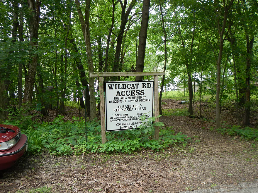
Alternative public canoe landing on Wildcat Road
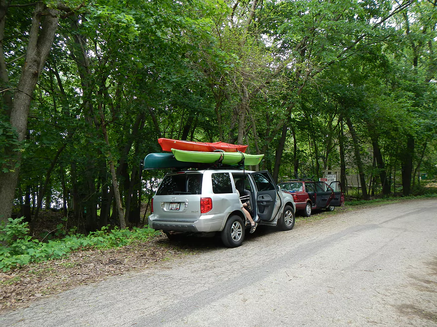
Check out that stacking job…
Rocky Run Creek to Lake Wisconsin

This was a segment run during very high flood water (4.6 feet down by Muscoda and 11 feet up by Wisconsin Dells per USGS). Normally, this would be a bad thing to do on the Wisconsin River, as the high water covers up the sandbars, but in this case the high water was actually a highlight. The stretch we did was on Rocky Run Creek (close to the Columbia Power Plant) for a about a mile, then floated through side-channels on the Wisconsin River until close to the point in which Lake Wisconsin starts. Lake Wisconsin itself is too big/busy/windy to paddle. But, the upstream sections are very cool because of their sandbars, islands, side-channels, wildlife, creeks, and the Baraboo River floodplains.
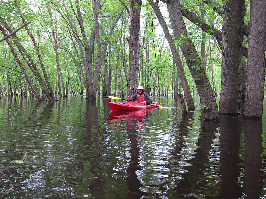
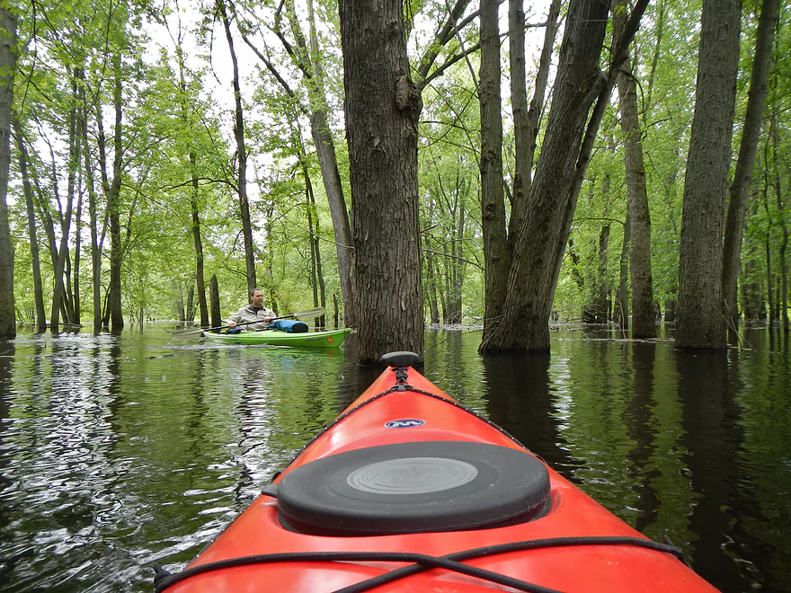
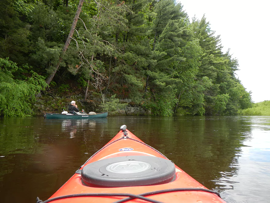
We put into a very flooded Rocky Run Creek at county V/J bridge (Google calls this road by both names). Rocky Run Creek is actually a nice paddling and boating prospect when waters are at normal levels, and some have paddled this creek from much further upstream (I’m not sure how many log jams there are though). The creek (with the help of the Wisconsin River) had spilled its banks and actually allowed us to kayak around the trees, which was a cool experience. Bumping into the creek is one of the canals from the power plant (well, Lake Columbia) which we briefly explored. The area around Lake Columbia, including Duck Creek and the canals, was very neat and I hope to explore it more in the future. I believe there might be a way to actually get into the lake itself…you can definitely put in at one of the upstream bridges on Duck Creek.
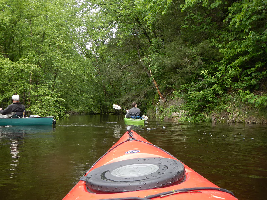
Back to Rocky Run Creek….Duck Creek’s smaller downstream neighbor. After going through the floodplain, exit the mouth of the creek and enter the Wisconsin River. Keep to the left to explore the bluffs and cave on the east bank. As you float down, you’ll pass several landings. If you wanted to skip Duck or Rocky Run Creeks as a starting point (bad idea), you could put in at the Dekorra public landing, which is right after the creek (nice landing). As you pass the landing and a couple of smaller islands (stay left), the channel will split in two and you’ll see the head of what is almost a mile long island.. Make sure to stick left (general rule for the entire trip), as this is a smaller, more scenic channel that will have much less boater traffic on it.
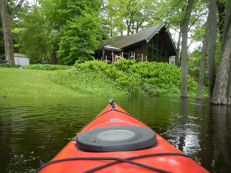
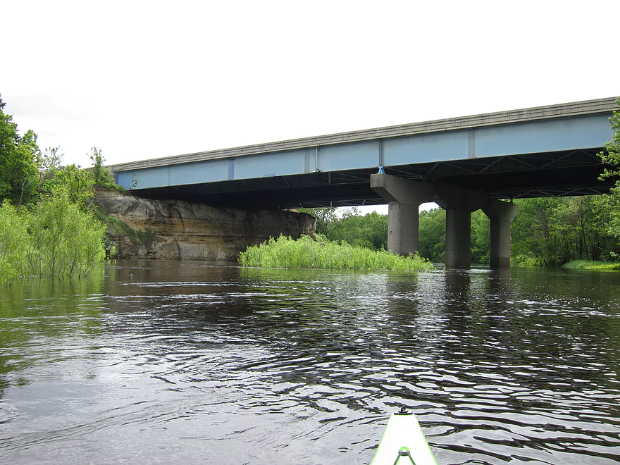
You should encounter more bluffs which kind of remind you of the Dells. There will be more flooded forests you can scoot around as well, in addition to smaller sub-channels you can try to explore. About halfway past the island, you’ll encounter the I90 bridge sitting on a nice bluff. I recommend staying left as we’ve done in past trips, but for this time, we cut across under the bridge (and around construction equipment) and paddled down the rest of the island on the main channel. This was very fast with the flood water. Obviously, you should be very careful while paddling during flood stage as the river is the most dangerous then. Stay well away from piers, pylons, strainers and other down trees where the current is moving fast to avoid getting pinned. While I don’t recommend the main channel, if you do paddle it you’ll encounter (most likely) a lot of power boats and strong winds (check the weather forecast to see if you’ll have a headwind).
After we wrapped around the island, we paddled to a private residence and took out there. This wouldn’t be an option for the public and there aren’t any public landings that I know of in the immediate vicinity. However…there are very good landings just a mile or so downstream. Plus there are very nice bluffs on the east bank (but there is more open water). Just keep to the left, and you’ll encounter lots of options. The first two are a pair of landings on Wildcat Road after the bluffs (the smaller one is in the picture gallery). The Washington Street landing is a very popular boat ramp and there are further options downstream of there as well (see my map of public DNR landings).
All in all, a very nice trip, actually enhanced by the flood water. Other good “flood paddling” prospects include Duck Creek with the Power Plant canals and the Baraboo River floodplain to the mouth (very cool and nicer than Duck Creek’s flooded forest).
Detailed Overview
- Traut Road to Cuff Road: (2.6 miles) Surprisingly open and clear of most deadfall, this is a simple wet-grass prospect but very small and would require above average conditions to be feasible. An intriguing prospect.
- Cuff Road to Dunning Road: (3.1 miles) Deadfall appears to be too much of an issue for this leg.
- Dunning Road to Hwy 51: (3.9 miles) Swift current, gravel, and an attractive marsh are highlights. Unfortunately logjams and low hanging alders are a bit much.
- Hwy 51 to Hwy J: (2.5 miles) An ok section but with several muddy portages.
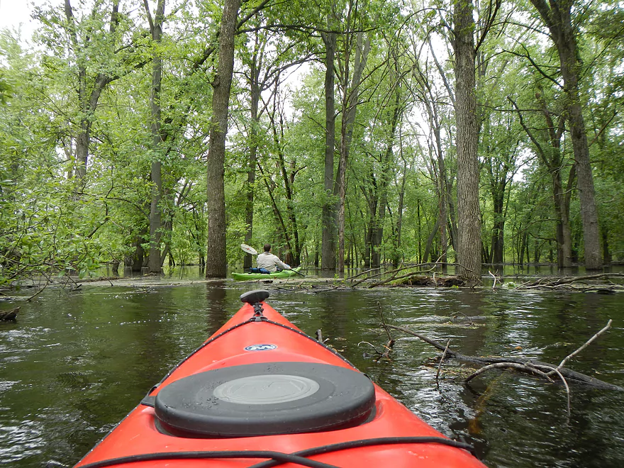
- Hwy J to Dekorra Landing: (2.0 miles) This section has too many jams to be enjoyable. But during high water you can go over these and through the silver maple forest which is an amazing experience.
- Additional Wisconsin River Options: For other take-outs and adventures on the Wisconsin, see my Wisconsin River overview map.
Trip Map
View Rocky Run Creek to Lake Wisconsin in a larger map
Overview Map
Video
Photos Size:
Update on the logjam situation from Karen. “There was a tree down where we wanted to put in by Hy51 but we were starting so late in the afternoon, so we changed our put in to J/V. There were trees down not far from the J/V bridge, but our kayaks moved around them easily. We never had to climb over or portage around anything. We do carry a small handsaw with us just in case, but we were able to maneuver in kayaks.”