
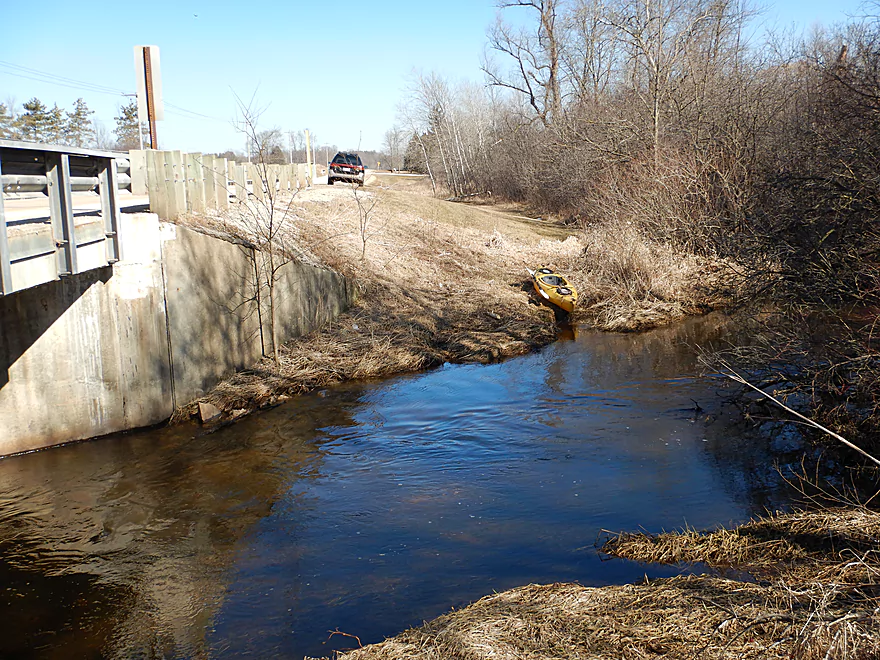
Good bridge access at Hwy O
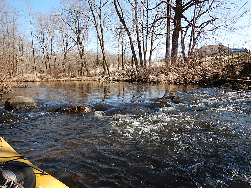
Starts fast and rocky
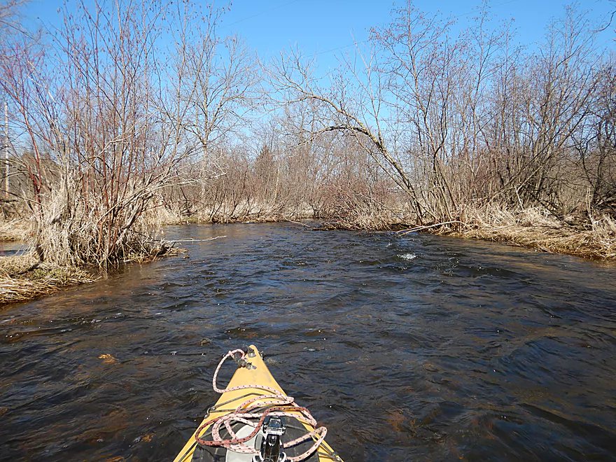
Great section
Nothing dangerous though
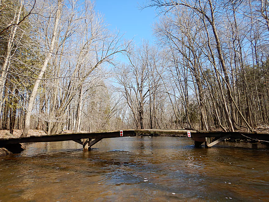
A very low farm bridge
But super easy portage
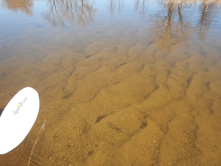
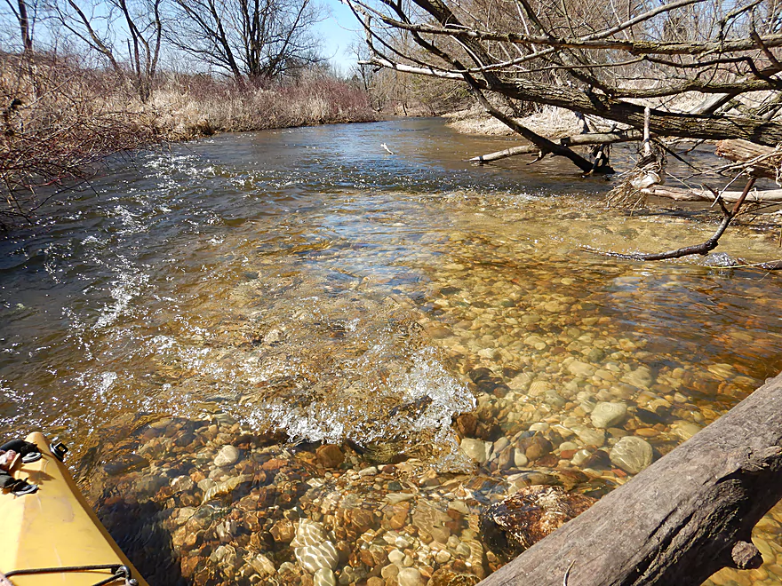
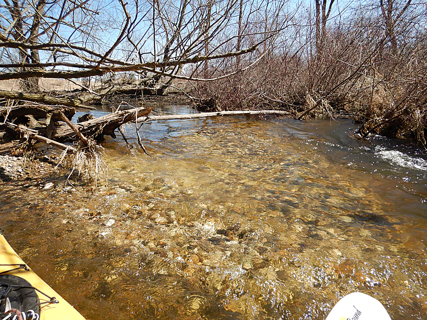
Glacial outwash
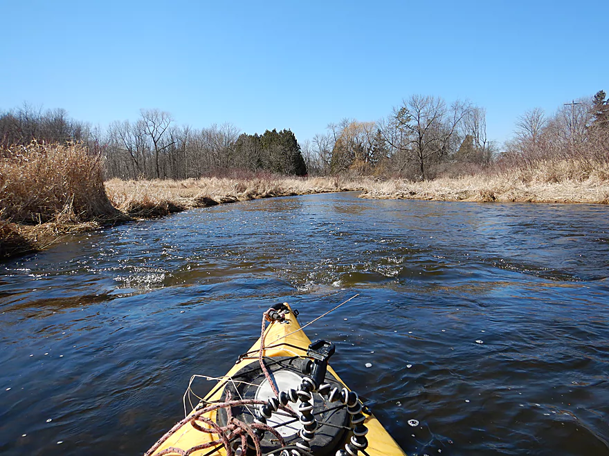
River starts to open up
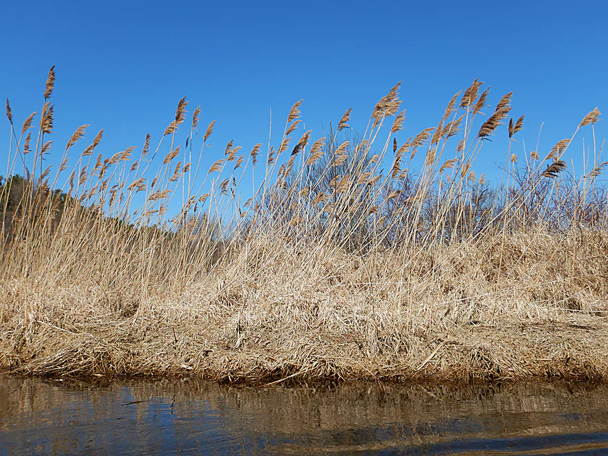
A colony of attractive but invasive phragmites
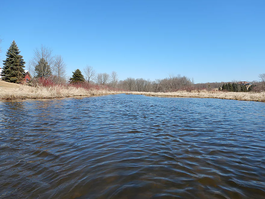
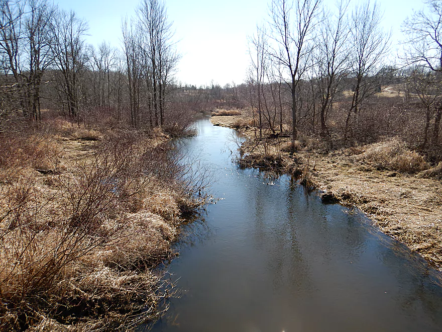
Very peaceful section
Lot of good reflections
Sand starts to replace the gravel substrate
Reminds me of Neenah Creek, but nicer
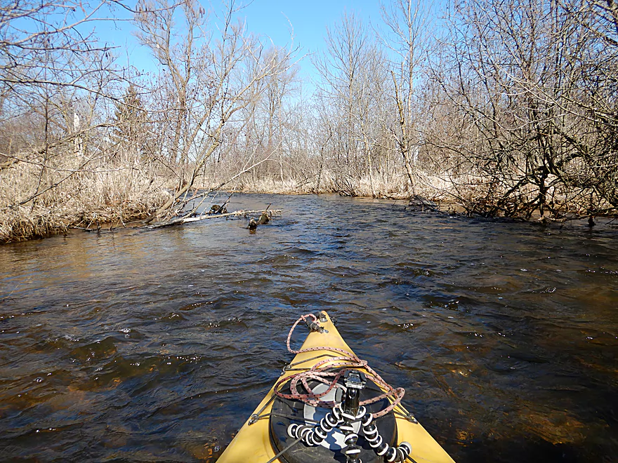
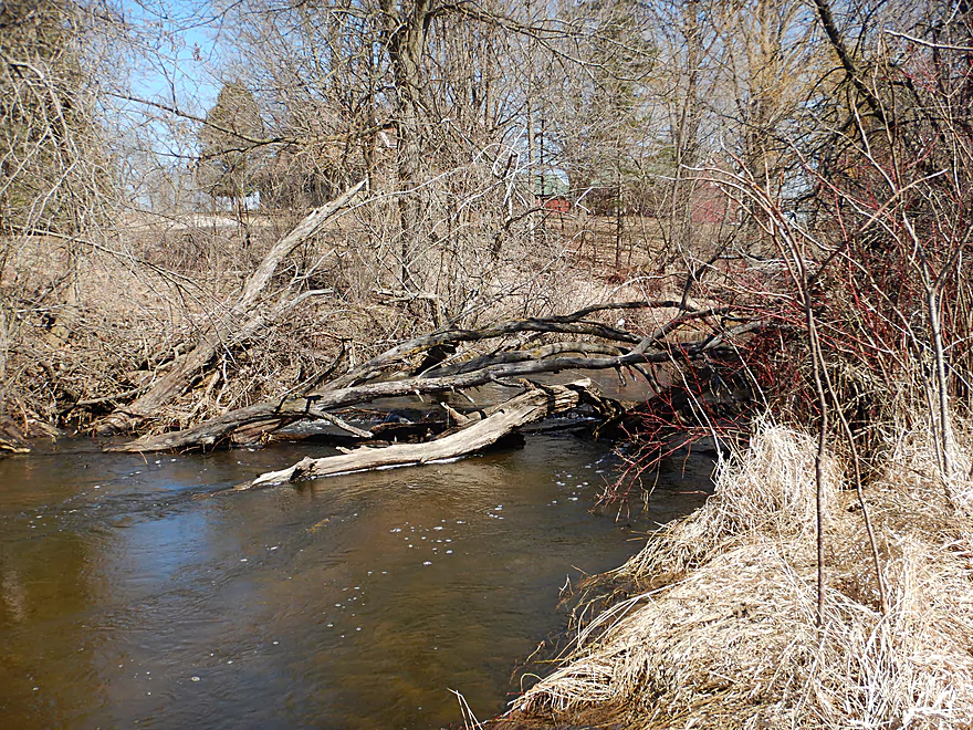
Logjams were not really an issue
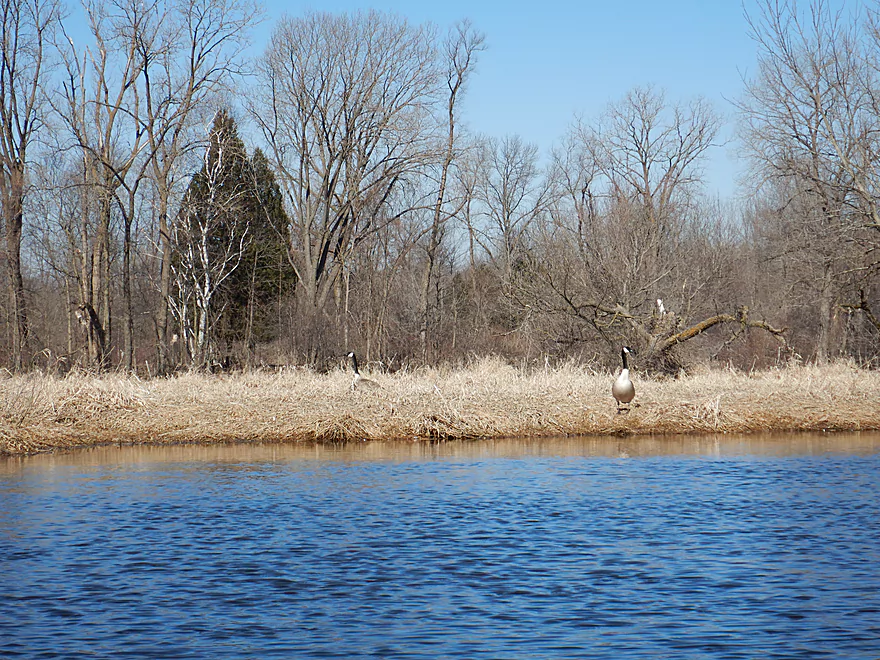
Lot of geese…these are guarding a nest
Trees start to edge out some of the marsh
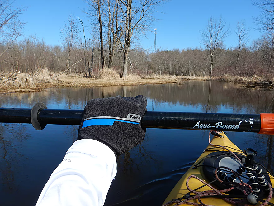
Keeping warm with my new yak gloves
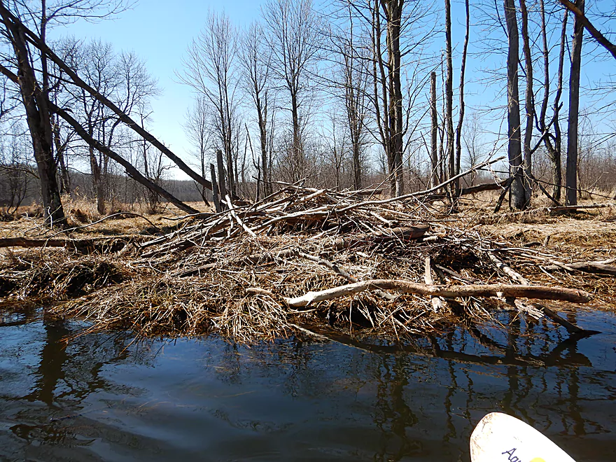
Beaver lodge…no need for a dam as the river here was deep
This would have a different character in the summer
I hopped over…but in low water it would be an easy portage
Entrance of I believe a large spring pond…unfortunately iced over
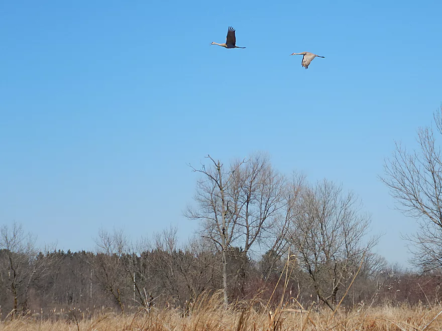
Pair of cranes
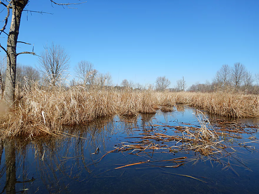
Wetgrass and farmland start to replace the woods
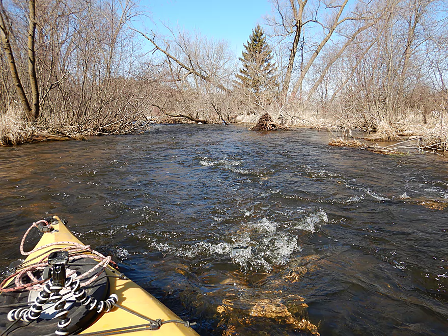
The most noteworthy rapids of the trip
Super easy
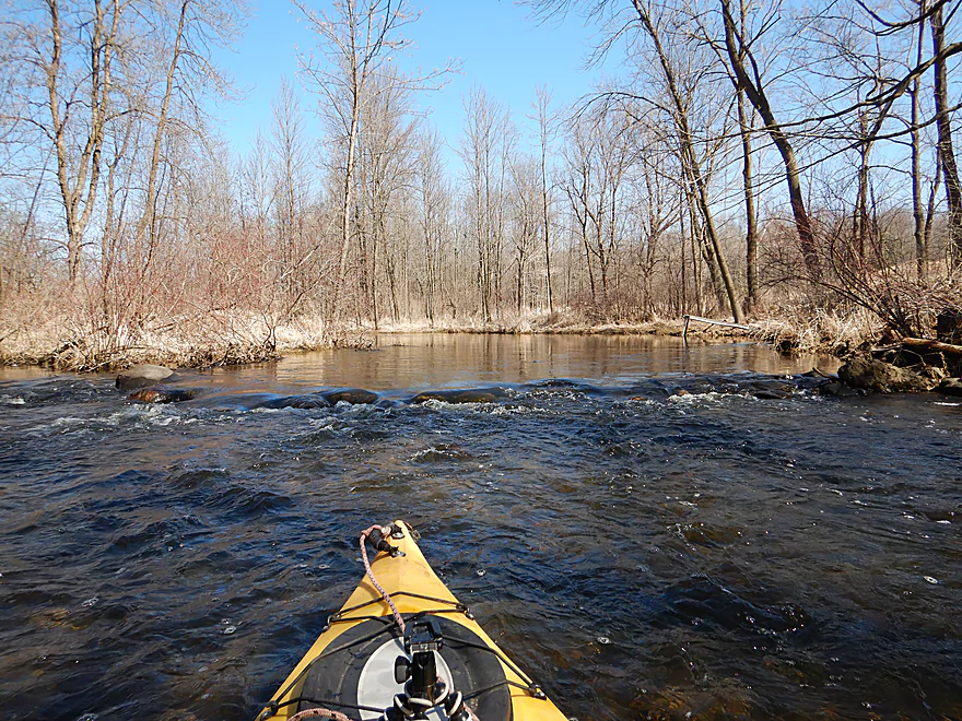
And scenic
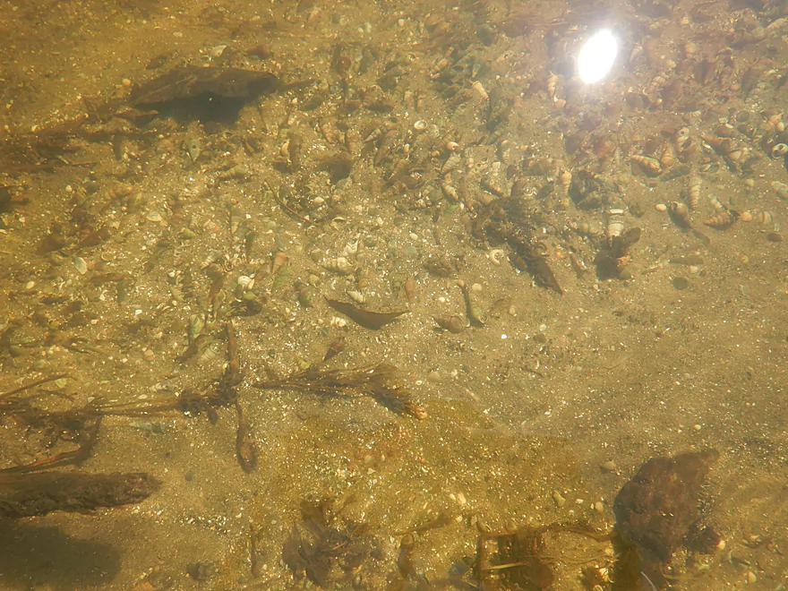
Lots of snails
Paddling past some fields
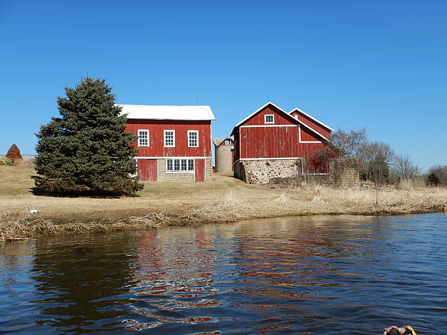
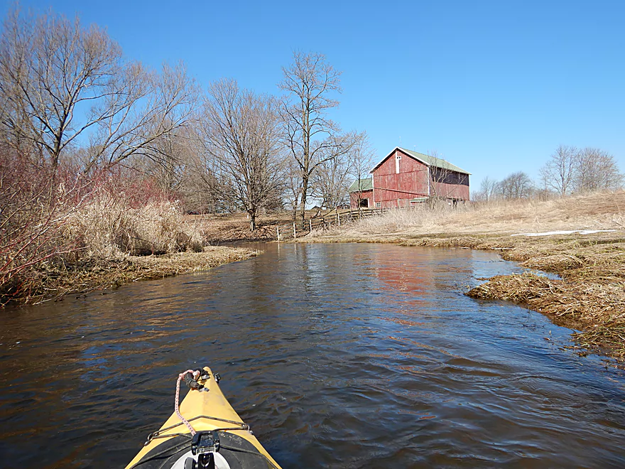
Some attractive farm buildings
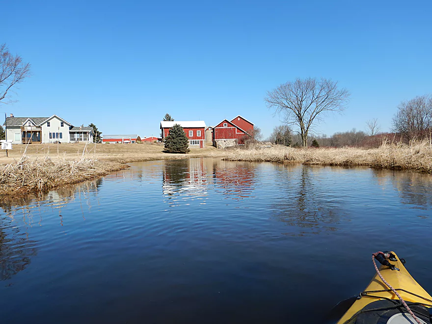
Very photogenic with the river
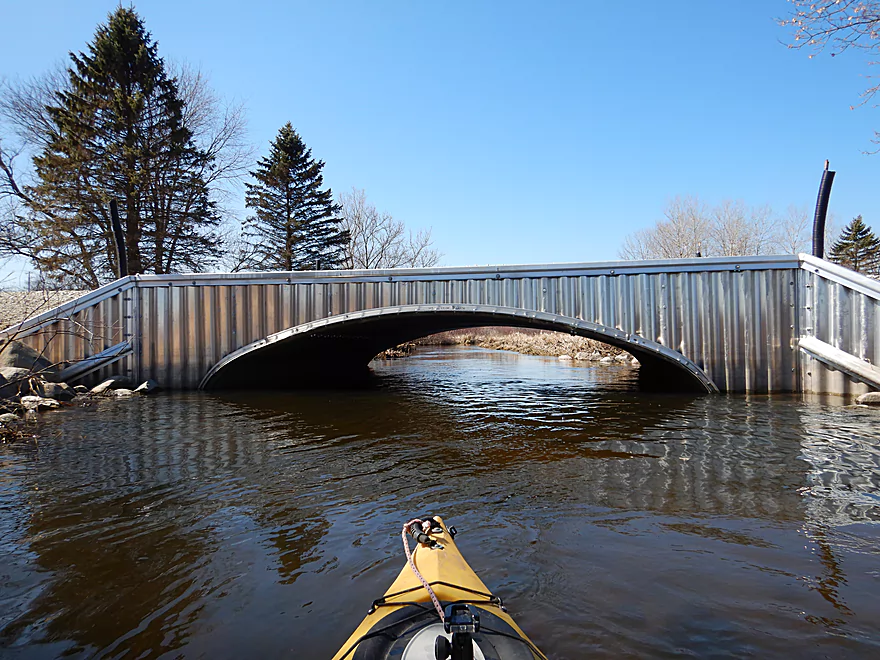
This bridge was easy to get under
A high depth…banks were almost bursting
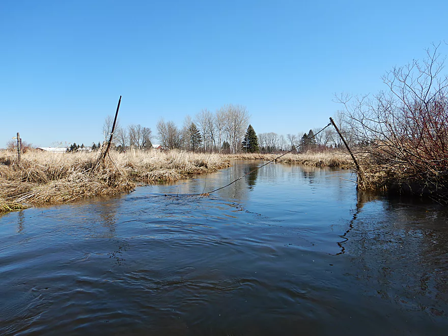
A strange fence…easy to get past
I got past this by sitting on the log and pulling my boat underneath
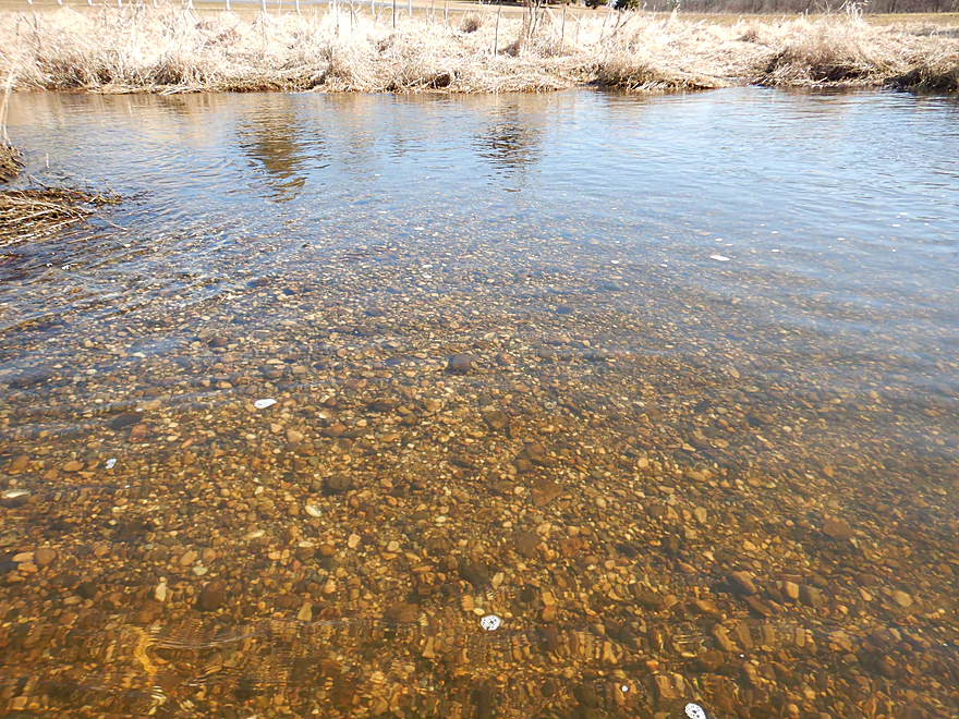
Multi-colored pebble substate
Reverse view
Time for a quick and easy portage
To get past this beast
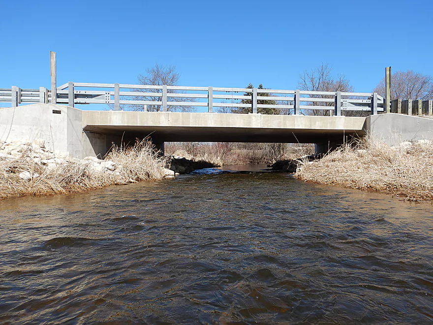
Washington Road is a viable access option
Current starts to pick up
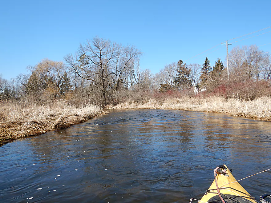
There was a lot of red-osier dogwood along the banks
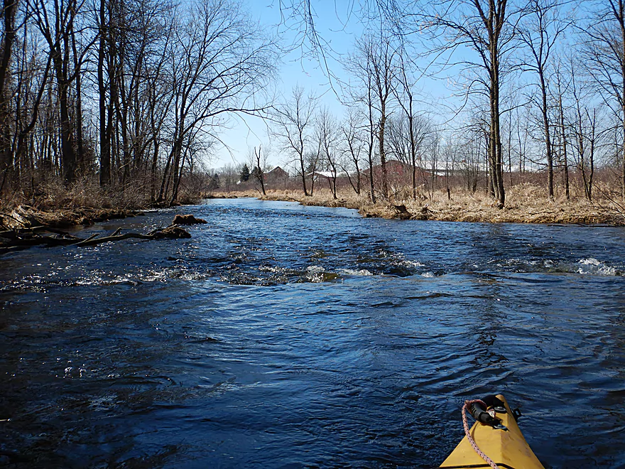
Entering my favorite part of the trip
Very rocky and clear
Starting to see more pines
Some fun riffles
One of the rare shallow parts
Zipping along
Reminded me of the Plover River
Fitting under that was tough
Likely a nice tree canopy in the summer
Hwy P
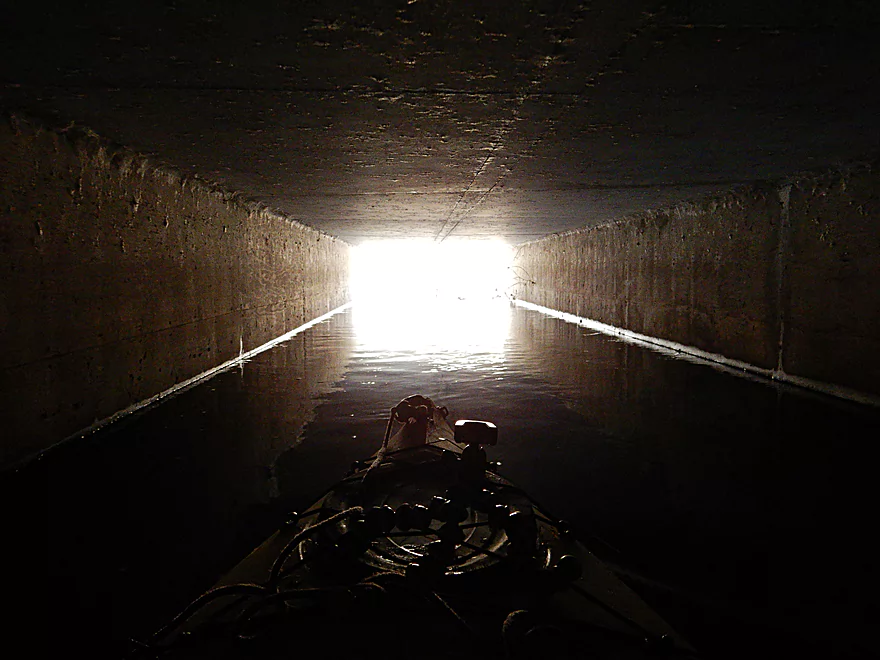
The tunnel was easy to get through
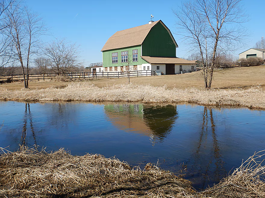
Cool green barn on the other side
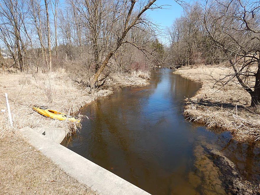
Taking out east of the bridge
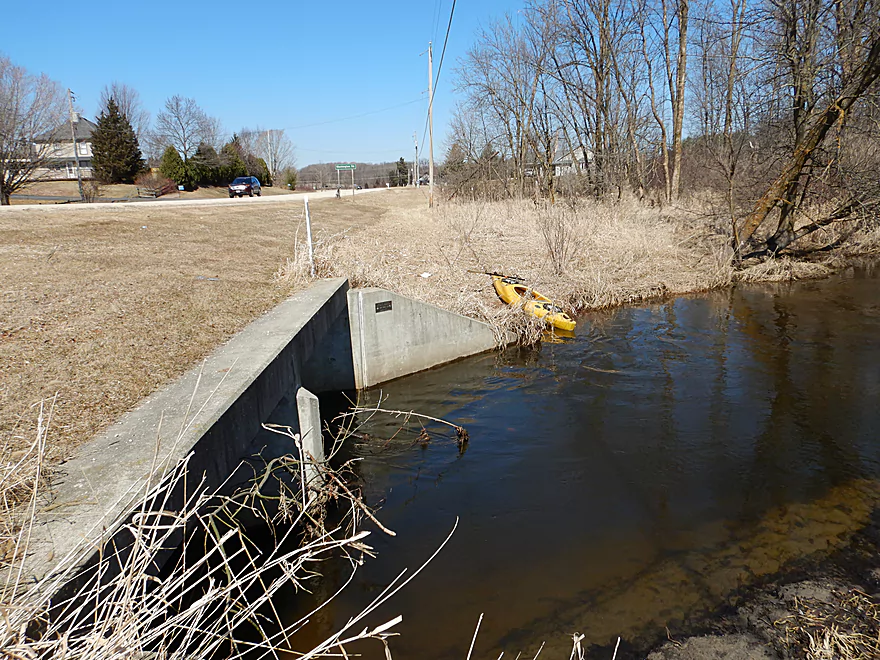
Decent shoulder for parking
Scouting the next downstream bridge (Roosevelt Road)
Scouting the next bridge (Hwy P)
And the next bridge (O). Dam is an ok access option.
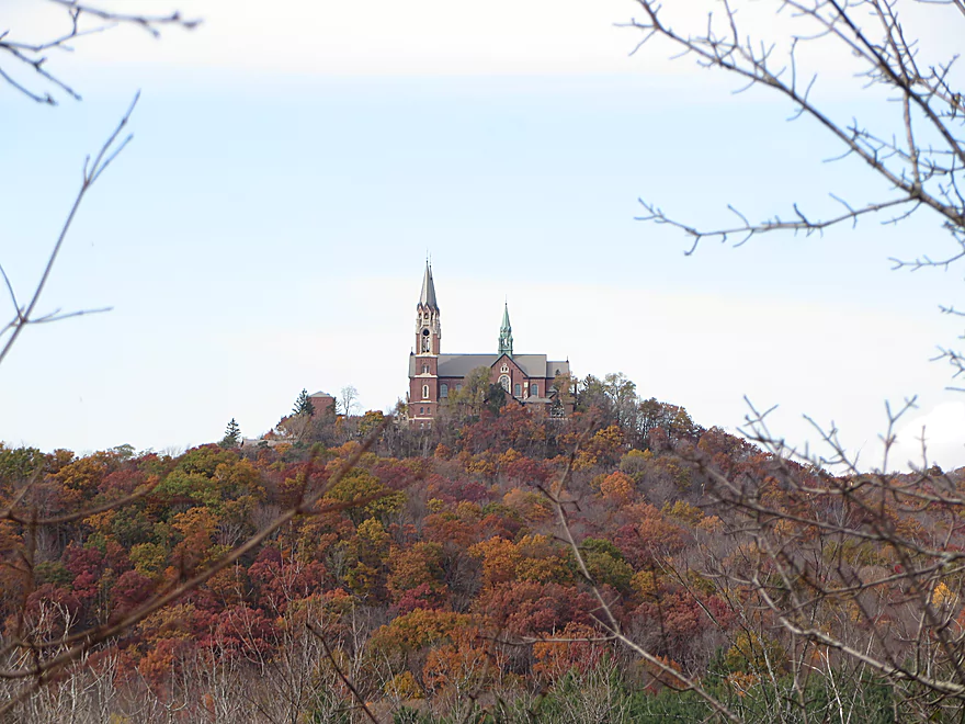
Holy Hill is very nearby
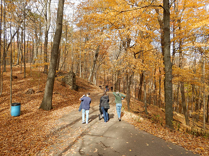
Definitely worth checking out for the fantastic hiking trails
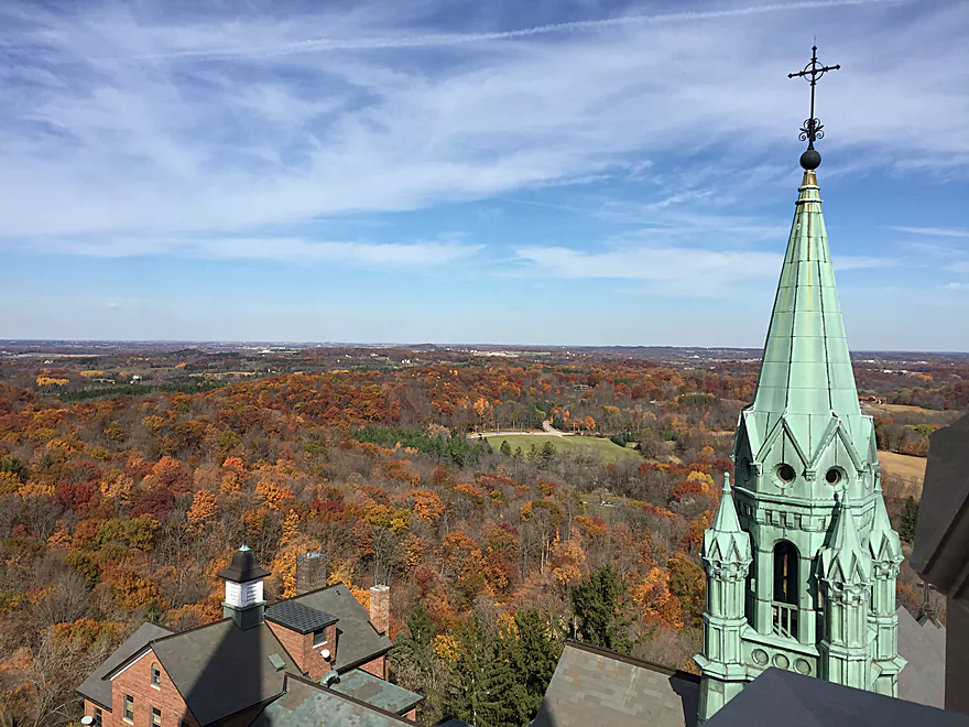
And to climb the towers for a incredible view of the Kettle Moraine State Forest
Ashippun River


The Ashippun River is an obscure tributary to the Rock River located in southeast Wisconsin. Few paddle it as most segments are plagued with logjams, but when perusing satellite photos this winter I came upon an open stretch that peaked my interest.
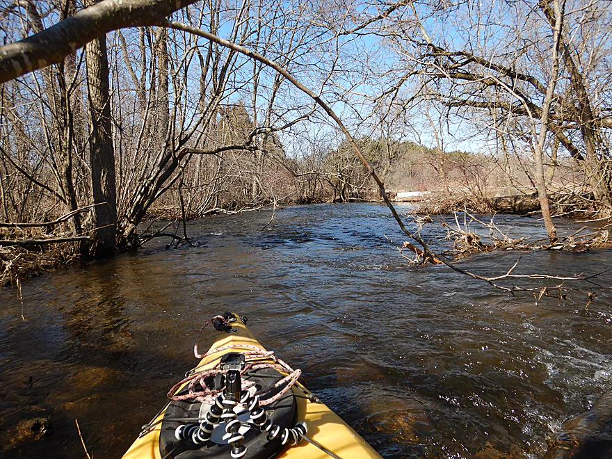
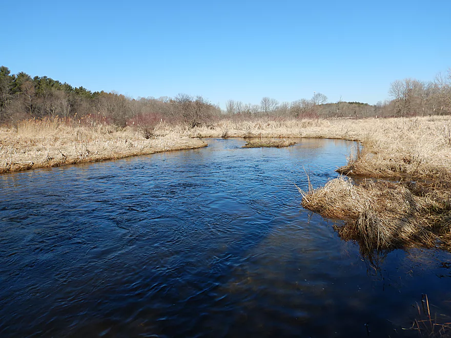
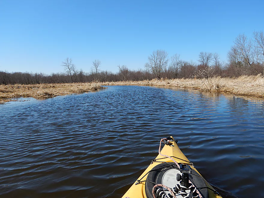
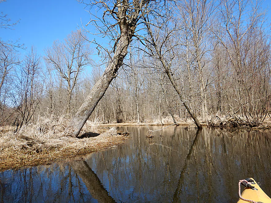
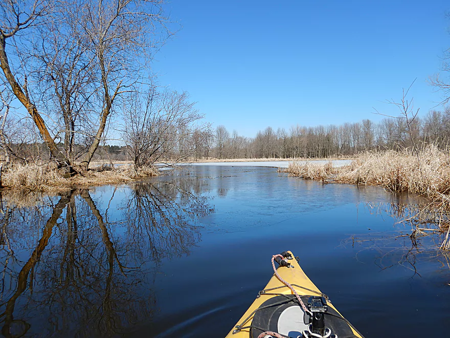
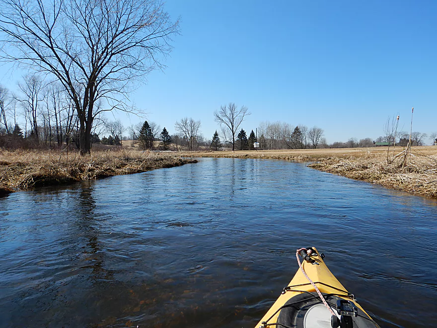
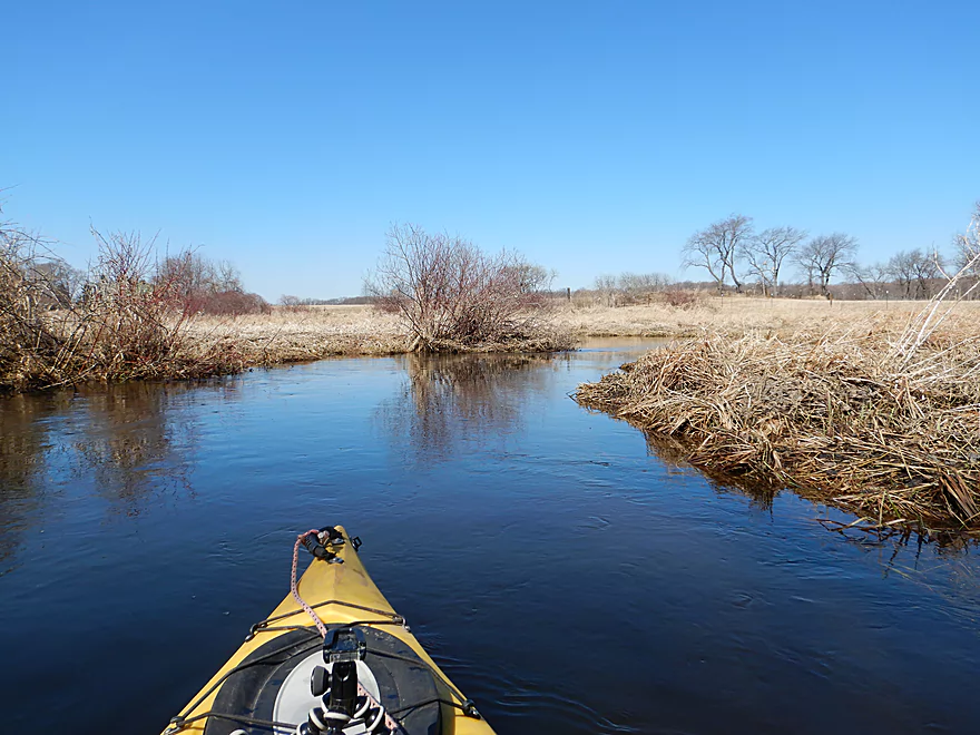
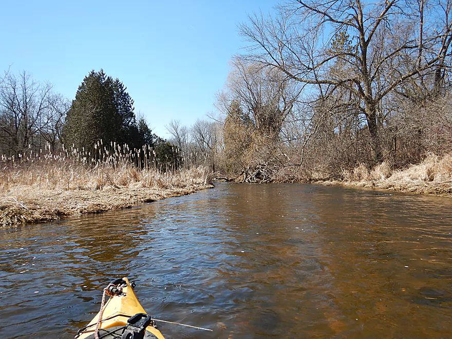
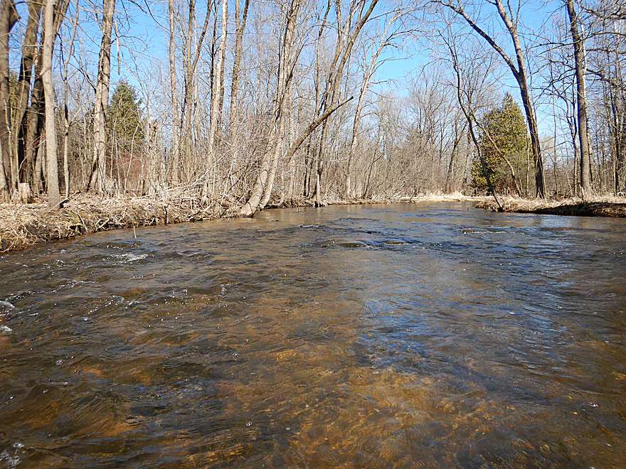
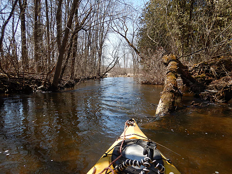
I started the trip at Hwy O, which was a great bridge put-in. Here the water was inviting, with a clear red hue and running swiftly over a rocky substrate. The first 1000 feet of the trip was one of my favorite parts because of its almost continuous light rapids. These are likely the by-product of glacial outwash caused by the retreating Michigan Lobe. It’s been my observation that water trails located along the state’s terminal moraine have a unique character. They tend to be atypically clear, rocky and lacking in tall mud banks…all great for paddling.
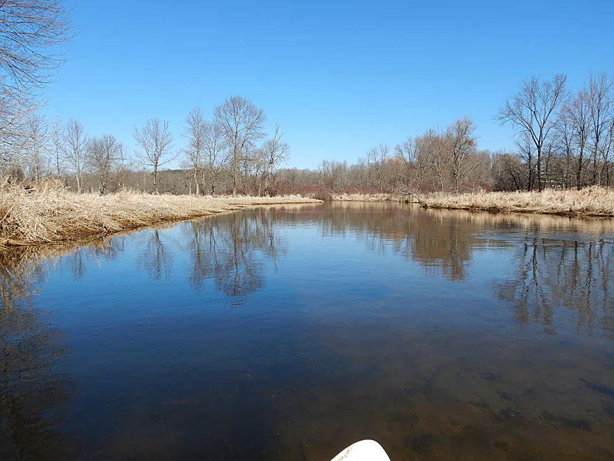
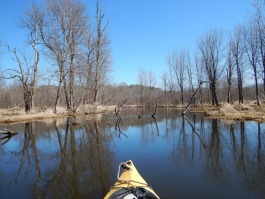
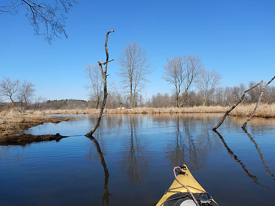
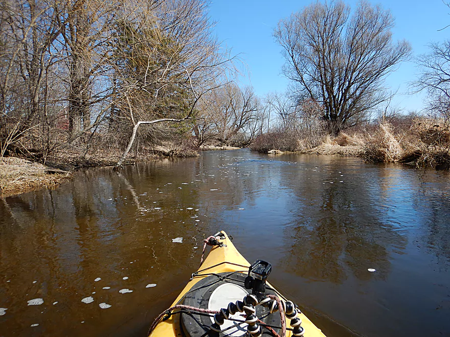
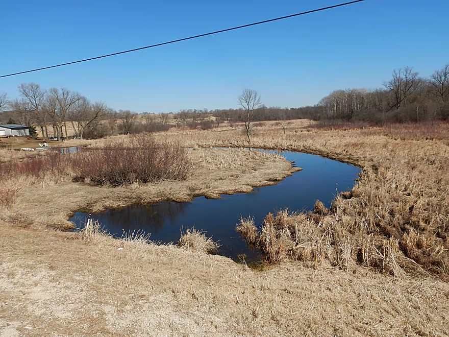
After about a half mile, the river got wider, deeper and slower as is transitioned into a marsh. This was a peaceful and attractive segment accented by a perfect blue sky reflecting wonderfully on the smooth surface and waterfowl singing in the background.
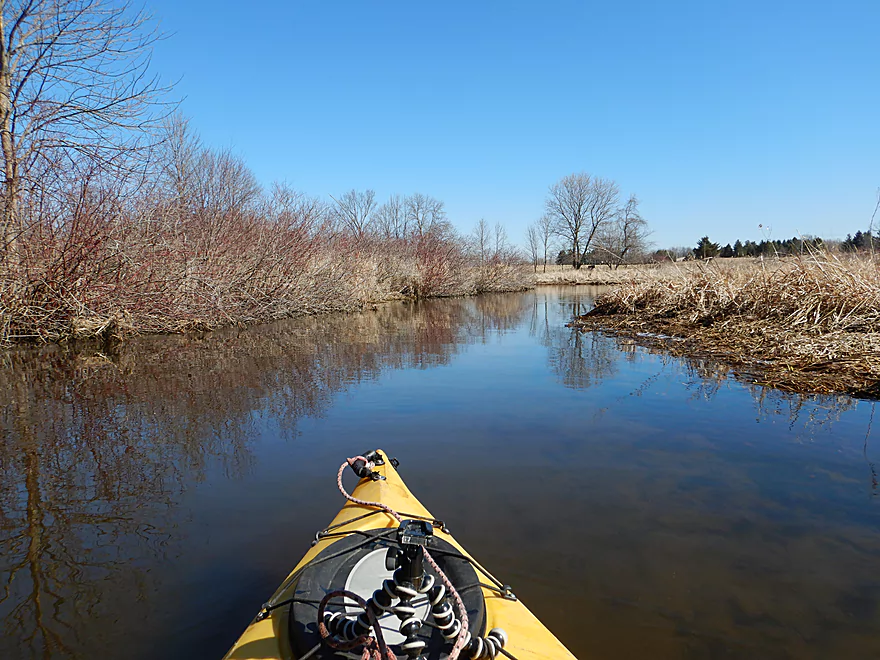
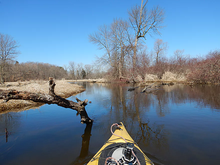
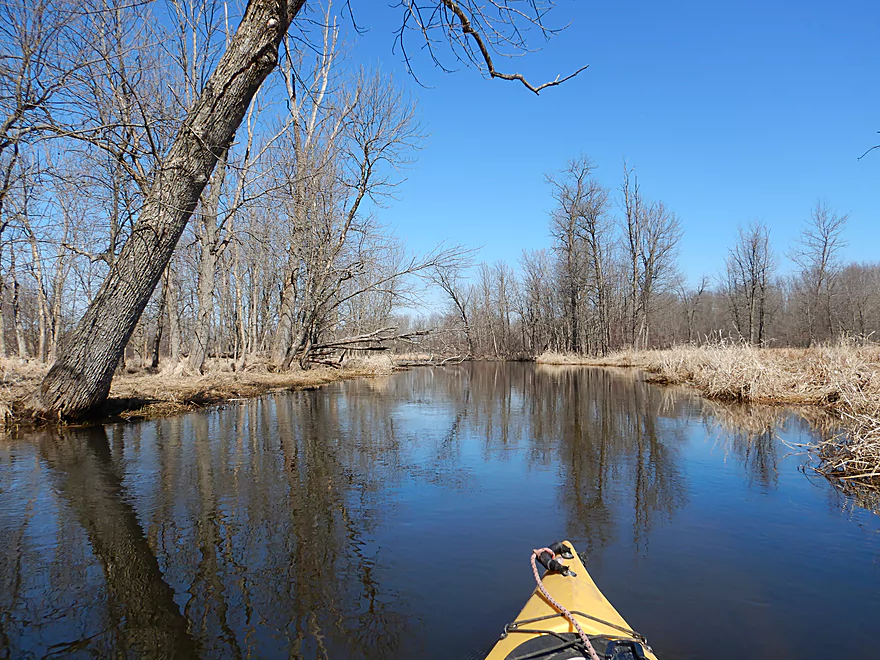
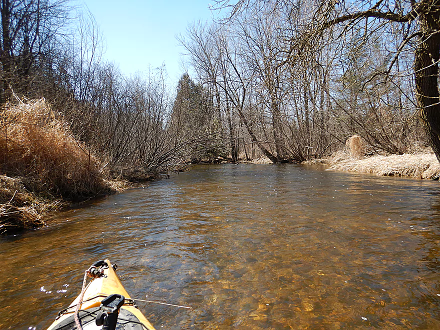
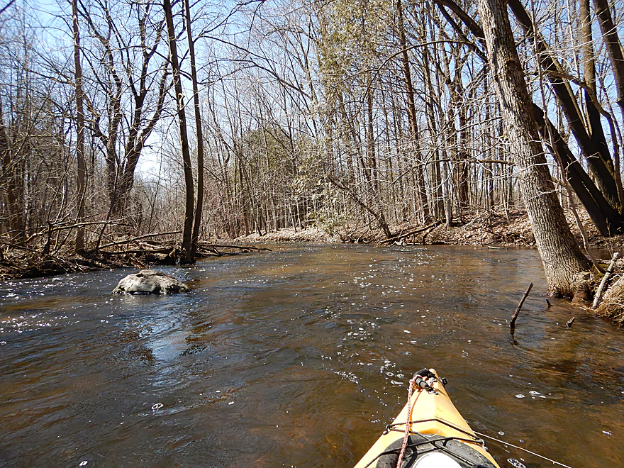
Soon the river transitions again, as woods start to replace the marsh. Usually wooded sections are messy and muddy, but this was clean with flat shallow banks. Not what you typically associate with rivers in southern Wisconsin. This part of the state is famous for its springs and I did pass the inlet of what I believed to be a large spring pond, but it was unfortunately too frozen over to explore.
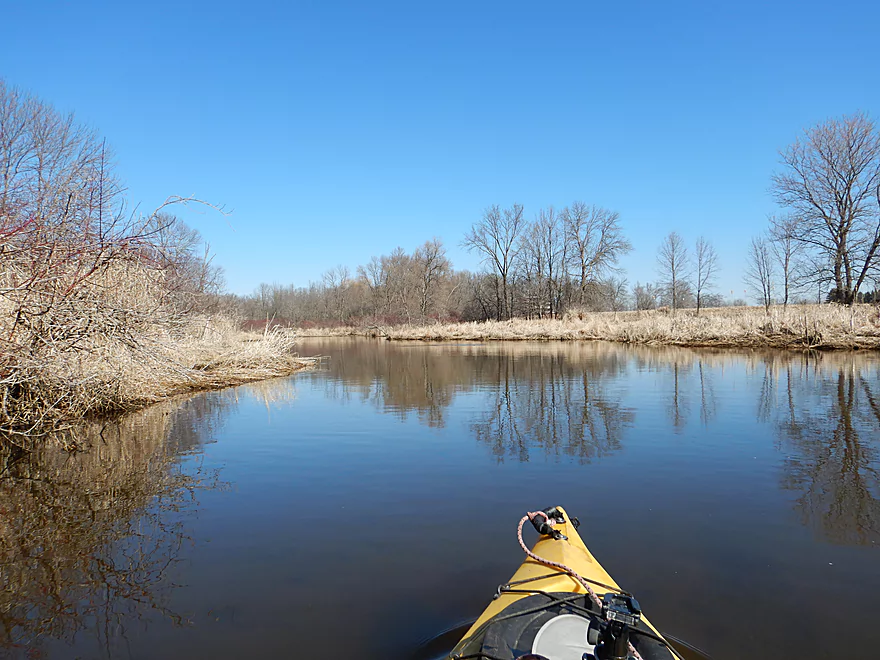
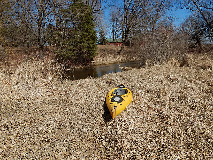
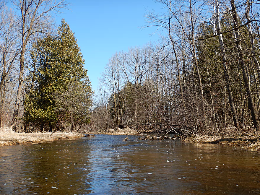
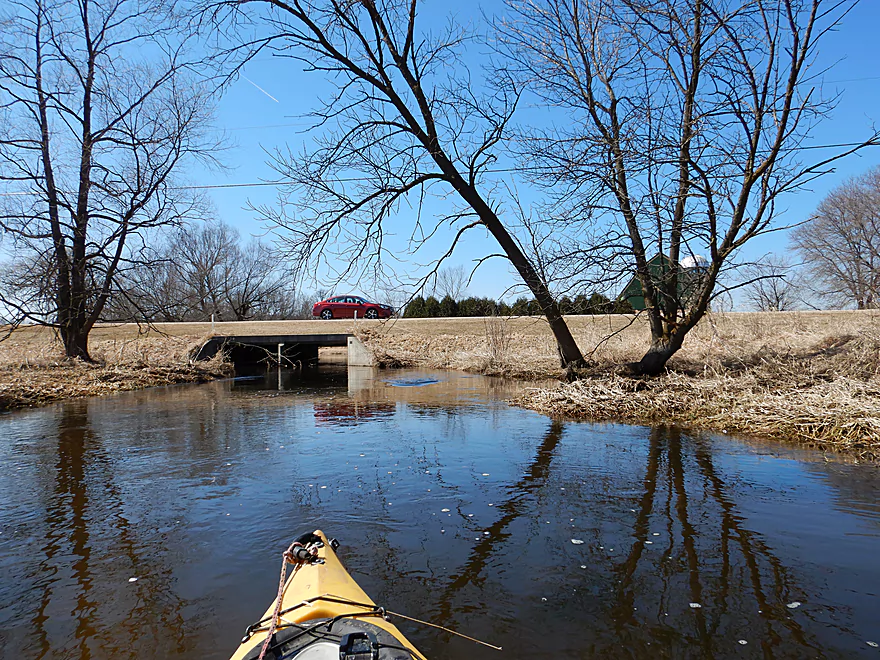
Once the river turns south, the woods start getting displaced by wetgrass and farm fields, while the substrate becomes more sandy. Several of the farm buildings along the river were quite photogenic.
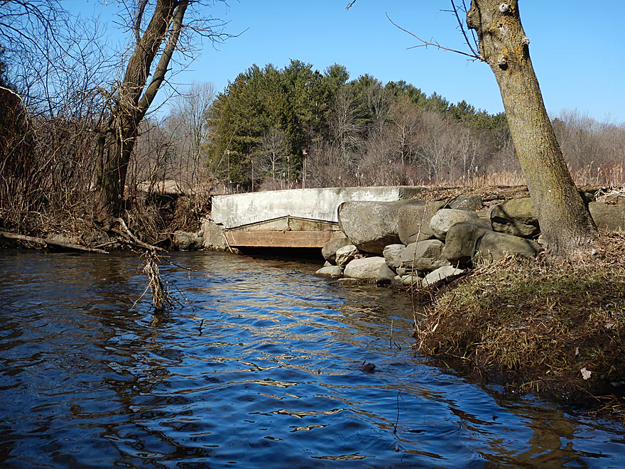
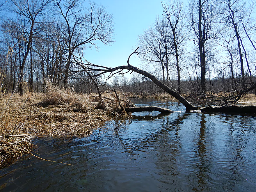
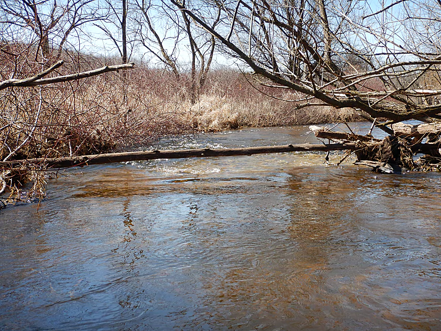
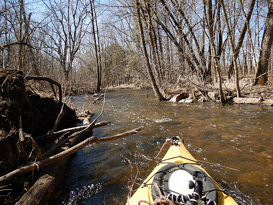
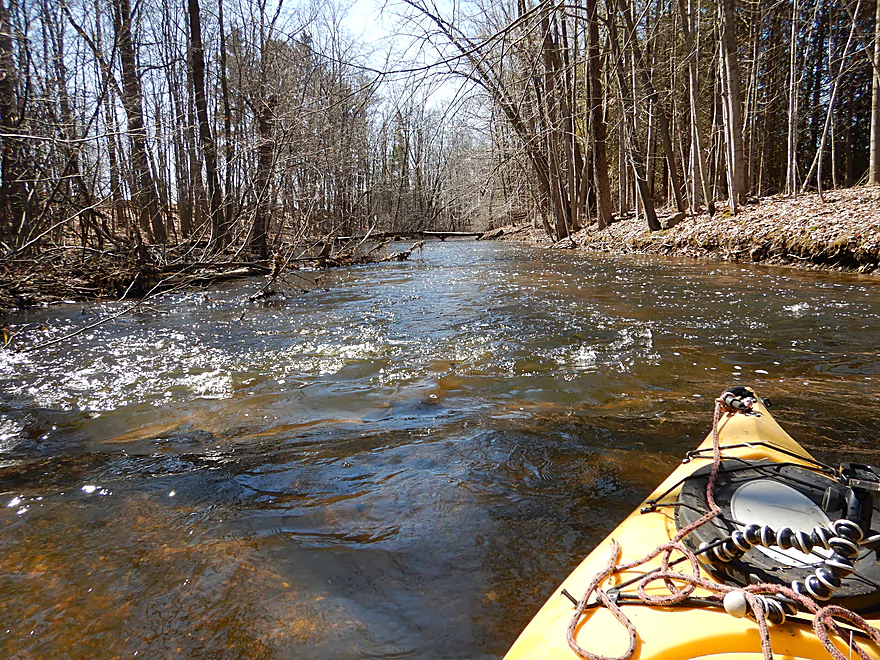
Near Washington Road I encountered what I feared would be my first logjam portage of the trip. Here a low branch blocked passage over some light rapids. I was able to sit on the branch and guide my boat under which worked out ok…but had I brought my camp saw with, I could have made short work of it. This was followed by another logjam, which did require a portage, but was super easy as it was right next to the Washington Road bridge and embankment.
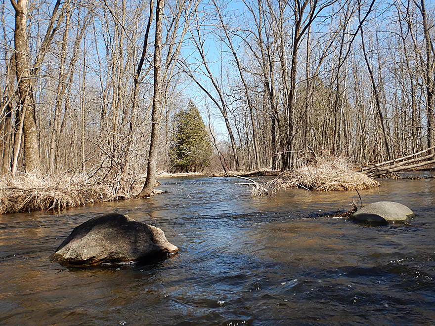
When planning the trip, I was worried that logjams would be far worse than they were and my initial plan was to exit early at Washington Road…but at the last moment I changed my mind and decided to extend the trip a half mile to the next bridge (Hwy P). It was fortunate I did as that little half mile was the best section of the trip. Here the rocks and rapids returned dotted with some occasional pines…very reminiscent of the great central Wisconsin rivers like the upper Plover or Waupaca. There were no logjams in this mini-stretch, but there was a low walk bridge that was tricky to get under.
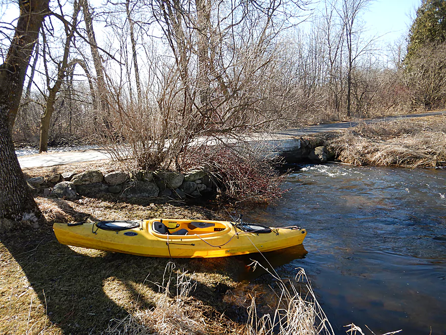
The trip concluded at Hwy P which lacked privacy, but was an ok bridge access. In summary, this was a surprisingly nice trip and a great way to start the 2019 season. Yes, there were a few portages, but when you don’t have to deal with tall muddy banks, these aren’t a problem. I absolutely do recommend this “ice age paddle” especially for locals in southeastern Wisconsin.
This was a good river for waterfowl. I saw ducks, cranes, many geese and two eagles. Other wildlife included a woodchuck, raccoon, a beaver lodge, and clams. The highlight was the many snail shells that stood out in the clear water.
Hwy O was a good bridge access with plenty of shoulder parking. Hwy O crosses the Ashippun three times…the bridge I’m referring to is the north/south one just west of Erin Hills Golf Course.
Hwy P (first bridge) was an ok bridge access, but it is open, near homes, and lacks privacy.
An alternative take-out 0.4 miles upstream would be Washington Road. This is a good bridge access, but if you disembark here, you miss out on one of the best parts of the trip.
The bike shuttle was super easy…paved, mostly flat and only 2.2 miles. For bike shuttlers who lock their bike/kayak at either the put-in or the take-out…I suggest the put-in (Hwy P) as it is more private and there are more locking options.
Current/Rapids: The current varied between slow to moderate in the marsh sections. Near the start and end points of the trip, there were rapids, but these were minor and in no way dangerous.
Logjams: Surprisingly few…
- About a mile into the trip, I did encounter a downed tree that I was able to hop over. In lower water, this would necessitate a super easy portage (the banks are very flat).
- Just upstream of the Washington Road bridge there is low limb over some rocky riffles. With a camp saw, it would be easy to cut through this.
- Also just upstream of Washington Road, there is a logjam within sight of the road. This was super easy to portage.
Low Bridges:
- Just downstream from O is a low farm bridge that must be portaged. Super easy.
- Upstream of Hwy P is a low walk bridge that I was able to duck under, but taller boats may need to portage.
Below is an approximate depth guide based off a gauge on the Bark River. Warning these are really rough guesses.
- < 30 CFS: Likely too shallow to paddle.
- 30-49 CFS: A common average depth. Very good clarity. Some of the rocky sections at the start and end of the trip might be bumpy.
- 50-80 CFS: An above average depth. The marsh section (most of the trip) will be pretty deep (at times over 5′) with the banks on the verge of overflowing. I did the trip at 72 CFS which was a decent depth.
- 81-100 CFS: Many banks likely overflow at this depth. Clarity likely won’t be as good, but a trip should be viable.
- 101+ CFS: Maybe a bit high for paddling? I’m not sure.
Just five miles to the east is “Holy Hill“, the highest point in Washington County and the location of a religious shrine open to the public. The church and grounds are stunningly scenic (especially in the fall) and definitely worth checking out. At the base of the property are a really nice series of hiking trails. The highlight though are two massive church bell towers which you can scale and offer an incredible view of the Kettle Moraine countryside. On a good day you can see the Milwaukee skyline 30 miles away!
For more details on bridge access options and their viability, see the overview map.
- Hwy 83 to Druid Lake (North Landing): 3.8 miles. Maybe 9 logjams. The second half is much more open.
- Druid Lake (North Landing) to Hwy O: 3.3 miles.
- Druid Lake (North Landing) to Druid Lake Road: 1.3 miles. Part lake paddle, part river paddle. Druid Lake isn’t that interesting, but the river portion is nice and flows though an attractive marsh.
- Druid Lake Road to Hwy O: 2.0 miles. Attractive in part with a few small boulder gardens. The problem with this stretch are its obstacles. This included five major logjams and one low bridge that all had to be portaged.
- Druid Lake (North Landing) to Druid Lake Road: 1.3 miles. Part lake paddle, part river paddle. Druid Lake isn’t that interesting, but the river portion is nice and flows though an attractive marsh.
- Hwy O1st to Hwy O2nd: 2.8 miles. Some nice scenory, but barbed wire strainers and many logjams make this an impractical leg for kayaking.
- Hwy O2nd to Hwy P1st: 3.4 miles.
- Hwy O2nd to Washington Road: 3.0 miles. Nice section that is mostly marsh, but some rocky and riffly sections. Two logjams and a low bridge.
- Washington Road to Hwy P1st: 0.4 miles. Terrific rocky section with pines that is very scenic.
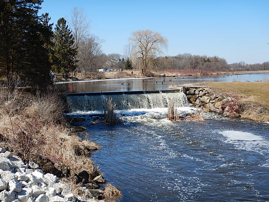
- Hwy P1st to Aldery Millpond Dam (Hwy O3rd): 2.7 miles. Partly reviewed by Rick Kark.
- Hwy P1st to Roosevelt Road: 1.2 miles. Nice prospect but with maybe 3-6 logjams.
- Roosevelt Road to Hwy P2nd: 0.6 miles. Mostly open marsh paddle. Likely no logjams.
- Hwy P2nd to Aldery Millpond Dam (Hwy O3rd): 0.9 miles. No logjams. Mostly open flowage paddling.
- Alderly Millpond Dam to Lincoln Road: 0.6 miles. 1-2 jams. Mostly open with clear water and some rocky riffles.
- Lincoln Road to Norwegian Road1st: 1.9 miles. Maybe 28 logjams.
- Norwegian Road1st to Norwegian Road2nd: 2.1 miles. Maybe 30 logjams.
- Norwegian Road2nd to Mapleton Road1st: 0.5 miles. Maybe 2-3 logjams.
- Mapleton Road1st to Brown Street: 1.0 mile. Likely an attractive section with clear water, many rocks and light rapids. Unfortunately there are many logjams (~15+).
- Brown Street to Mouth of Ashippun Lake Creek: 2.0 miles. A LOT of logjams…maybe 40+.
- Ashippun Lake Access Road Landing to Mouth of Ashippun Lake Creek: 0.6 miles. An alternate way to access the lower Ashippun River. Start on the lake, then work up a side creek before joining the main branch. Maybe 2 logjams. Likely scenic, but could be difficult to navigate unless in high water. See map for details.
- Mouth of Ashippun Lake Creek to Mill Street Dam: 2.3 miles. Half of this goes through an open marsh, then the second half is a flowage pond created by a dam.
- Mill Street Dam to Mapleton Road2nd: 1.0 mile. Wooded section with maybe 2-4 logjams.
- Mapleton Road2nd to Pennsylvania St.: 0.6 miles. More open. Maybe one logjam.
- Pennsylvania St. to Mapleton Road3rd: 1.6 miles. Maybe 3 logjams.
- Mapleton Road3rd to Ski Slide Road: 1.5 miles. Maybe 3 logjams.
- Ski Slide Road to Mouth on Rock River: 0.8 miles. Maybe 1-2 logjams.
Trip Map
Overview Map
Video
Photos Size:
Did this trip today May 24 2020. Very nice trip since River is up due to heavy rain early in the week. Beautiful eagle where river connects to pond by Harding road. I actually own the land where foot bridge is and every winter clear downed trees from Washington road bridge to Hwy p. Last week I did trip from my footbridge south . Four areas with logjams and had to portage each time. but once you get past Roosevelt Road it’s been cleaned out all the way to Mill pond in Aulderly (Hwy O) deertrak golf coarse. The eagleShas been behind the house by me for Last six years. Carp are starting to swim upstream also. Hugh snapping turtles also.
I was wondering why that section was so clear when I did it…I and other paddlers definitely appreciate your hard work. That’s also an interesting observation about Roosevelt Ave and it’s a section I want to do in the future. Thanks for all your tips. If hear anything further about logjams on this river, feel free to share on this website.
I paddled this segment of the Ashippun last Monday (04/10). The river was more shallow than I expected at this time of year given high water across most of SE Wisconsin. However, outside of scraping a bit toward the beginning, this turned out to be a lovely paddle through an area that truly felt more remote and free of road-noise than other paddles I’ve done in SE WI.
Given that I enjoyed this trip so much, I did scope out and paddle the ~3 mile segment to the north through Erin Hills Golf Course. This I cannot recommend to anyone at all. There are multiple residual barbed wire strainers, and the part entirely through the golf course is choked with deadfall and logjams. Your paddle will be scraping brush more than water the first half. However, about 2/3 through it did open up into a shallow/flowage/marsh that was pretty scenic. Although the entire section was technically navigable, it was even more shallow than the southern segment, and I would never try it again sadly.
Thanks for an update as I was curious about the leg by the Golf Course. It is a shame it didn’t work out. I wonder if P to Alderley is better?
I may try it out sometime soon as I fear this river may be too low to run soon. Although it wasn’t super high on my list due to the review from Rick Kark’s comments you had
linked, he says ““I chose the more challenging idea of putting in on County P upstream of the pond. As I feared I encountered countless fallen trees in the bottomland.” Although it’s encouraging to hear Jim say maybe that is clear now since Rick’s review was in 07. I’ll let you know if I complete that section.
I got back on the Ashippun last week (04/5/24) and put in at the intersection with County Road P, and paddled to take out on Lincoln Road. I had fun on this trip although can’t recommend it much due to all the log jams and obstructions near the farm on the County P to Roosevelt Road section. Beyond Roosevelt Road, the river opens up, although the Alderly Mill Pond is very shallow. I had to portage the dam there at the golf course and hit a few more jams going toward Lincoln Road. Not sure if I’m confident enough to take the trip any further due to obstructions, but I have enjoyed the peacefulness of Ashippun Creek.
The Ashippun is a definitely an underrated prospect. Appreciate the intel on the logjams before Roosevelt Road.