
Mecan River
This is one of the twistier and smaller rivers in Central Wisconsin, but is a super paddle. Thanks to the clear calm water it can seem like you’re paddling on air.
Trip Reports
Mecan Springs Boat Ramp to 9th Ave
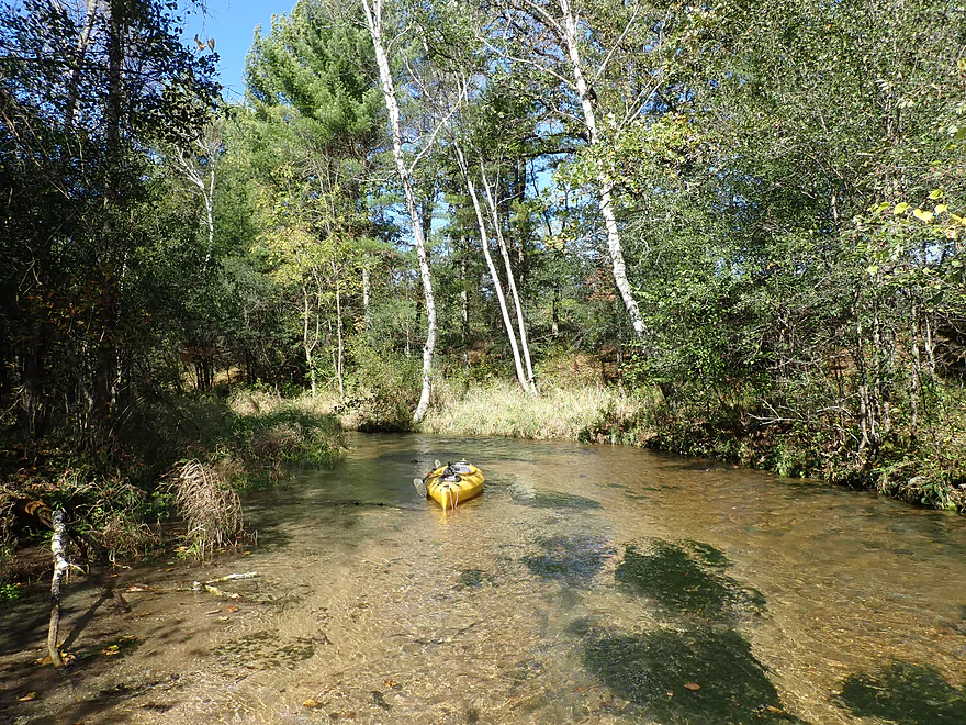
Date Paddled: October 6th, 2019
Distance: 3.9 miles (2.1 miles if paddled directly)
Time: 5 hours 19 minutes (atypical...expect 2 hours)
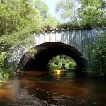
This was a great trip that explored the spring-water origins of the Mecan River.
Read More...Cumberland Road to 11th Road
Date Paddled: October 8th, 2017
Distance: 3.9 miles
Time: 3 hours 35 minutes (2.5 hours would be more typical)
Rarely paddled, the far upper Mecan has a few obstacles but also some of its best scenery, with almost perfect water clarity and beautiful white pines.
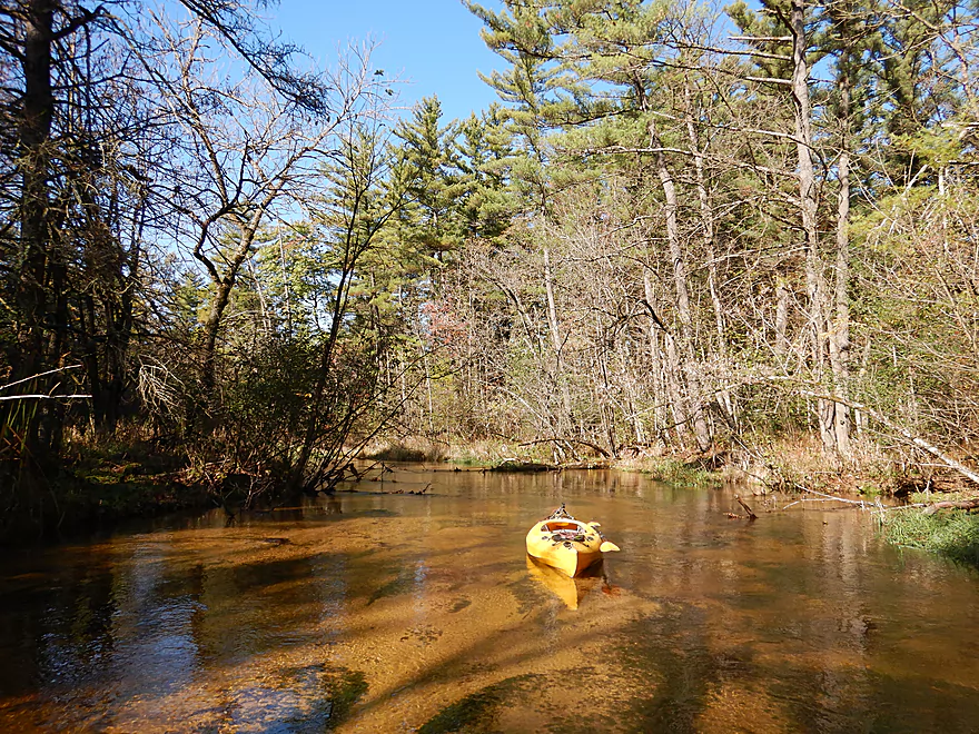
Read More...11th Road Bridge to JJ Road Bridge
Date Paddled: September 21st, 2014
Distance: 3.7 Miles
Time: 2 hours 26 minutes (2 hours would be more typical)
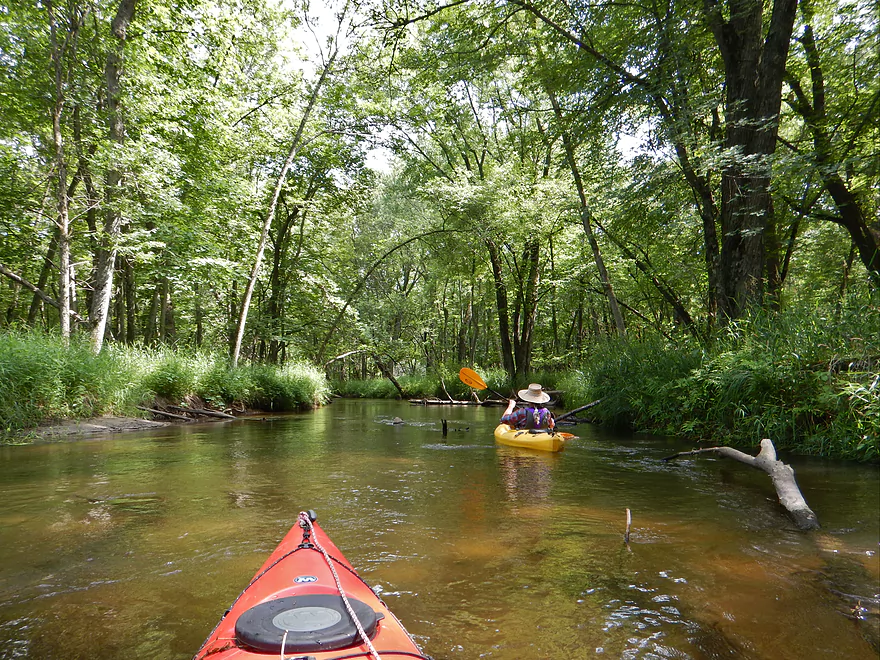
Despite the Mecan being a popular paddle, this section is often overlooked and undeservedly so. This is a fine wilderness paddle and one of the clearest rivers in southern Wisconsin–a must paddle for south central Wisconsinites (you “northerners” already have lots of these type of rivers). Put-in: Very good bridge put-in at 11th Road. Small […]
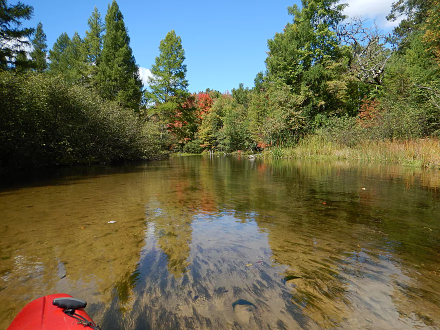
Read More...Hwy Y to Dixie Ave
Date Paddled: August 19th, 2023
Distance: 5.4 miles
Time: Expect 3 hours
Fast, crystal-clear water flows through a pristine "up-north" landscape in one of the best paddling prospects in Central Wisconsin.
Read More...Dixie Ave to Hwy 22
Date Paddled: August 3rd, 2024
Distance: 4.4 miles
Time: Expect 2 hours
This is a less popular leg on the Mecan River. It's not as scenic as the preceding Dakota leg, but is a solid paddle with enjoyable current and clean water.
Read More...Hwy 22 to Germania Marsh Dam
Date Paddled: July 13th, 2025
Distance: 5.8 miles
Time: Expect 2-3 hours
Of all Mecan River segments, this might be the weakest and least scenic. However, it’s still a pleasant trip with good current and clarity. The last portion of the trip included Germania Marsh, which was attractive and featured interesting wildlife.
Read More...Germania Marsh Dam to Hwy N
Date Paddled: July 12th, 2015
Distance: 6.26 miles
Time: 3 hours 32 minutes
A classic south-central Wisconsin paddle with nothing too exotic, but still very pleasant with nice water quality and attractive wooded tree canopies.
Read More...Overview Map
Detailed Overview
Generally speaking, the further upstream you go on the Mecan, the better. Upper Mecan segments tend to have less mud, better current, better clarity, and more attractive shorelines.
- Mecan Springs to 9th Ave: 1.4 miles.
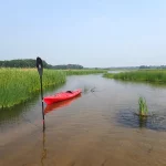
- Mecan Springs Boat Launch to Hwy GG: 0.6 miles. The river starts as a spring-fed lake sandwiched between two moraines. This is a neat lake paddle with clear water and visible springs located mostly along the western end. Trip length can be expanded by 1-2 miles if you explore the various bays throughout the lake.
- Hwy GG to 9th Ave: 1.4 miles. The first mile of the river has a few snags to dodge, but is super scenic with nearly perfect water clarity.
- 9th Ave to Hwy 21: 2.3 miles. Satellite maps indicate there could be many logjams and portages.
- Hwy 21 to Cumberland Road: 2.3 miles. Satellite maps indicate there could be many logjams and portages.
- Cumberland Road to 11th Ave: 3.9 miles. A great section with fast current, clear water and scenic white pines. A few logjams to portage but not bad.
- 11th Ave to Hwy Y/JJ: 3.7 miles. A fantastic section and my favorite on the entire river.
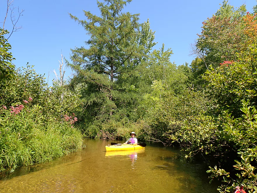
- Hwy Y/Dakota to Dixie Ave: 5.4 miles.
- Hwy Y to 14th Ave: 2.8 miles. An excellent section with white pines, tamaracks, narrow twisty turns and crystal clear water.
- 14th Ave to Dixie Ave: 2.5 miles. While not as good as the previous leg and more open, this is still a good stretch. This includes the "Mecan River Pine-Oak Forest State Natural Area".
- Dixie Ave to Hwy 22: 4.5 miles.
- Dixie Ave to Dover Ave: 2.0 miles. An ok section, but not as good as upstream sections. Even more open and slower, with far fewer pines.
- Dover Ave to Hwy E: 1.8 miles. River starts to become less interesting but is still ok.
- Hwy E to Hwy 22: 0.7 miles. Nothing special about this section. Open and somewhat simple.
- Hwy 22 to Germania Marsh Dam: 5.8 miles.
- Hwy 22 to Duck Creek Road/Electric Fence: 4.2 miles. More open and not as interesting, but the brisk current and good clarity are enjoyable.
- Duck Creek Road/Electric Fence to Dam: 1.6 miles. River slows and empties into a mile long shallow marsh. The Germania Marsh features nice scenery and good wildlife. Take-out is on a small access road off Hwy N.
- Dam to Elk Road: 6.3 miles. The most popular section on the Lower Mecan.
- Dam to Hwy N: 5.2 miles. River turns into a flowage pond and marsh. Take-out is on a small access road off Hwy N.
- Hwy N to Elk Road: 1.1 miles. The river completely moves east, creating a really cool corridor.
- Elk Road to Hwy 23: 2.4 miles. Traditionally a section with many logjams, but it does get cleared out periodically by the local livery. Hwy 23 is a poor access option.
- Hwy 23 to Hwy C: 2.7 miles. Again, this usually has logjams but they are often cleared out by the locals. Hwy 23 is a poor access option.
- Hwy C to Mouth: 1.1 miles. Simple open stretch leading to the Fox River.
- Mouth to the Princeton Locks: 3.1 miles. An uninteresting stretch on the Fox River.
For further information on the Fox River, see my Fox River review.


