
Steep muddy banks by Roller Coaster Road
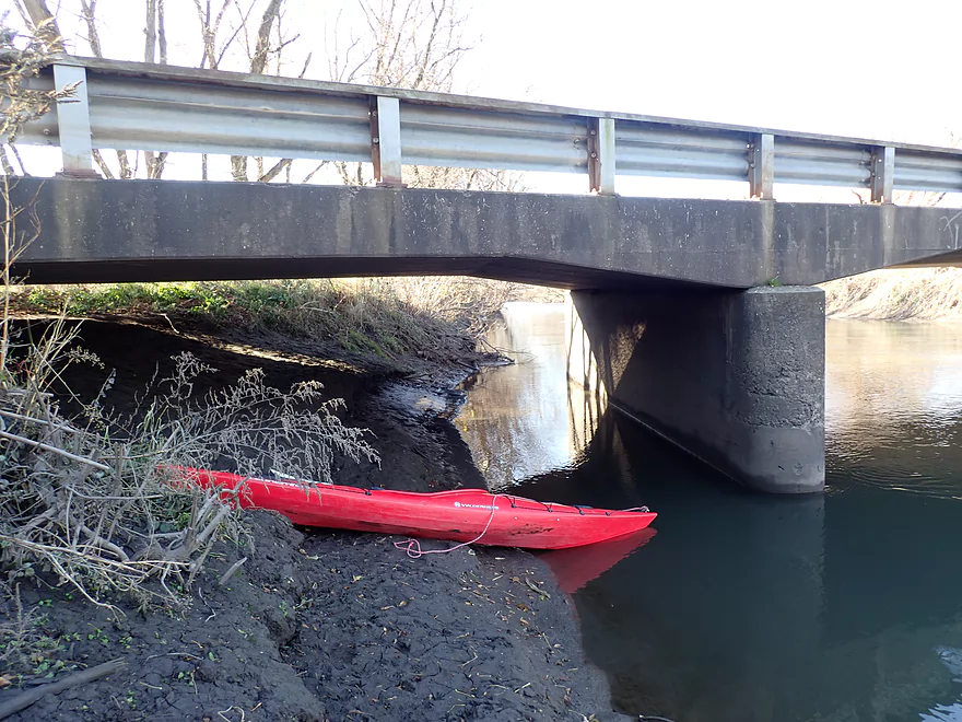
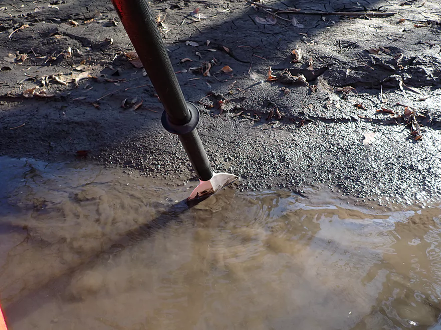
Launching below the bridge–very muddy, but doable
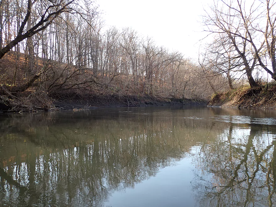
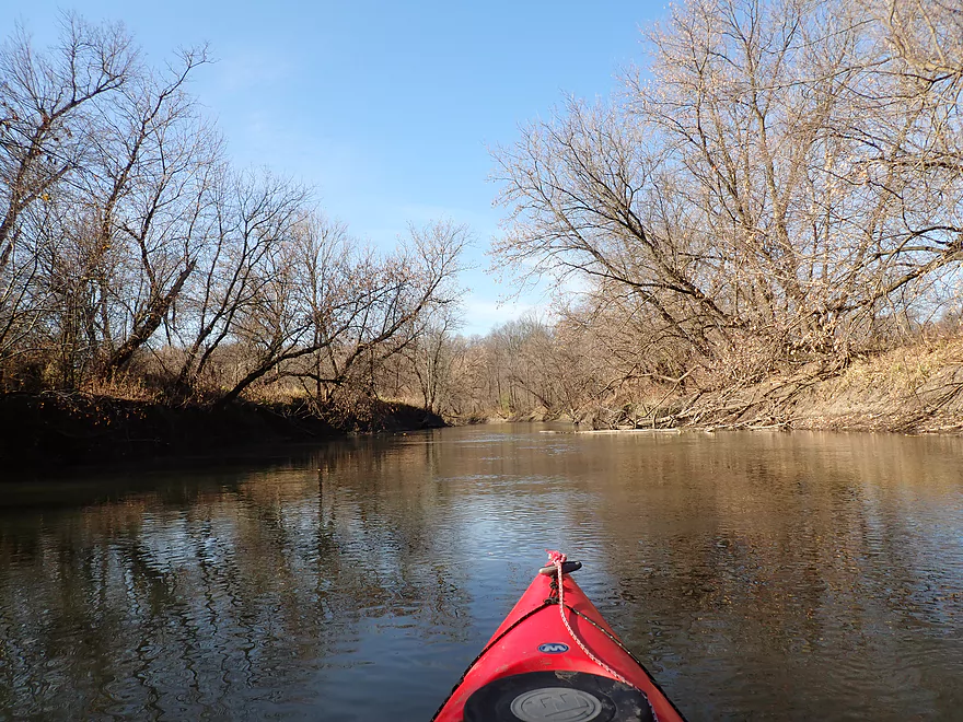
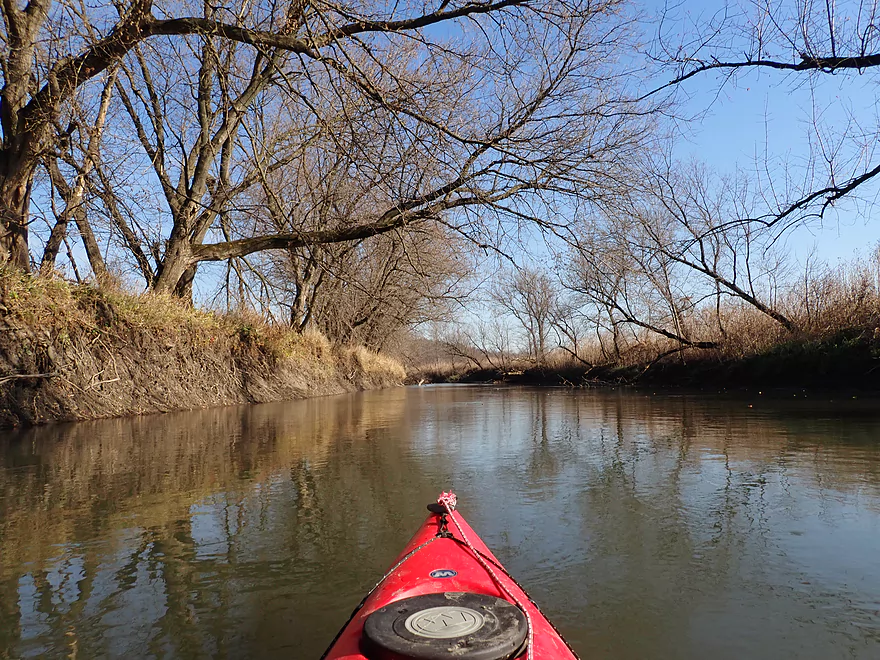
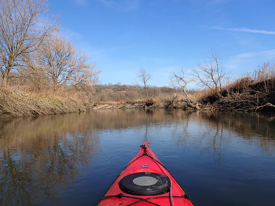
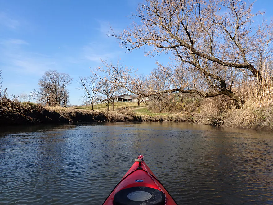
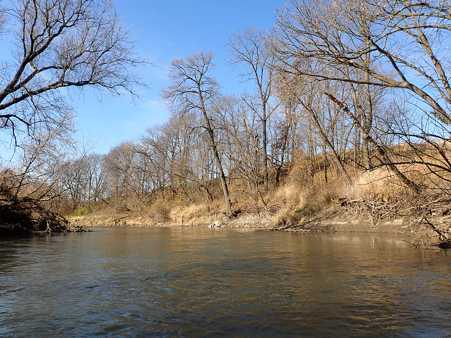
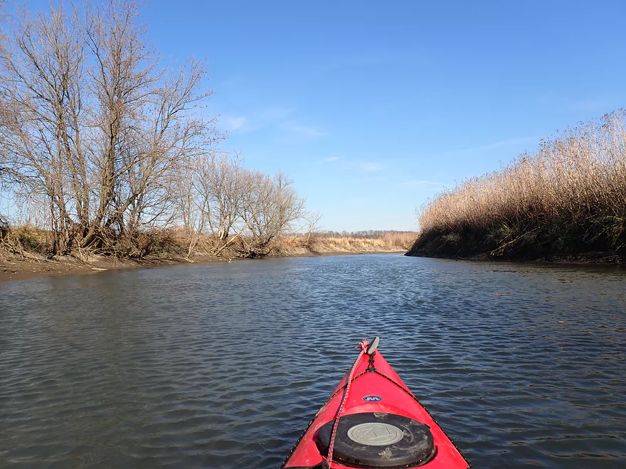
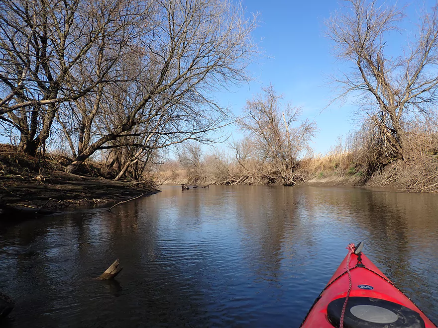
Nice bluff to start the trip
Rocks buried by mud
Mouth of the Ames Branch under the Cheese Country Trail
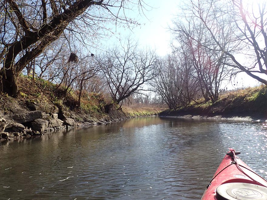
This side creek looks really nice
Back on the main branch
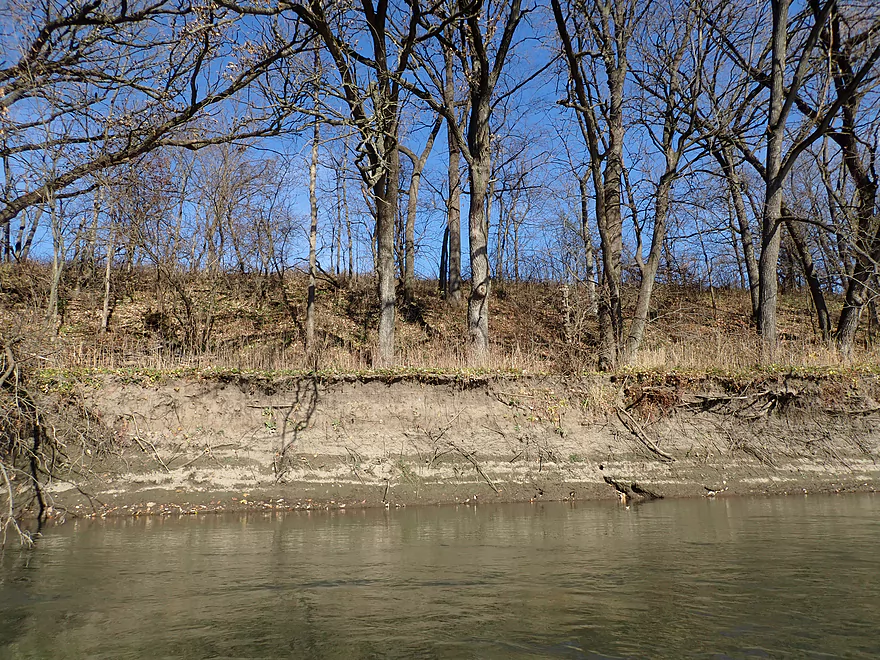
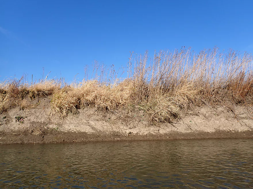
So much mud on the Pecatonica
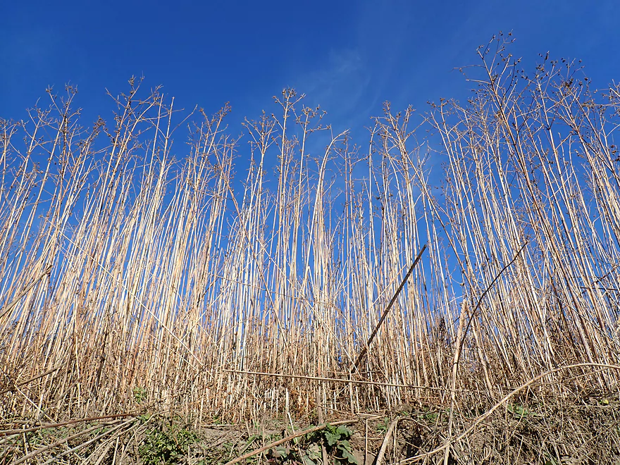
A grove of plant skeletons decorate the blue sky
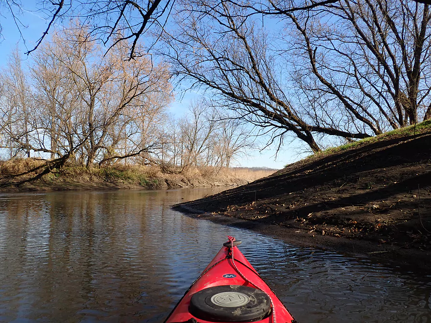
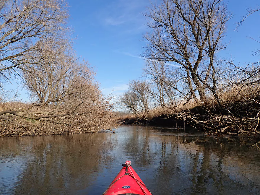
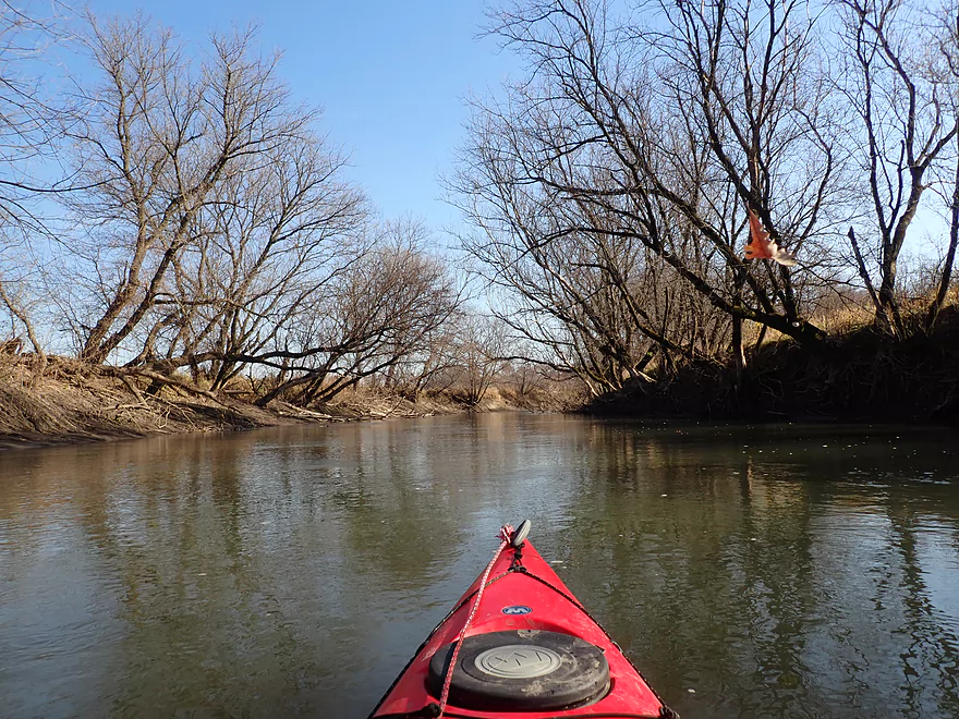
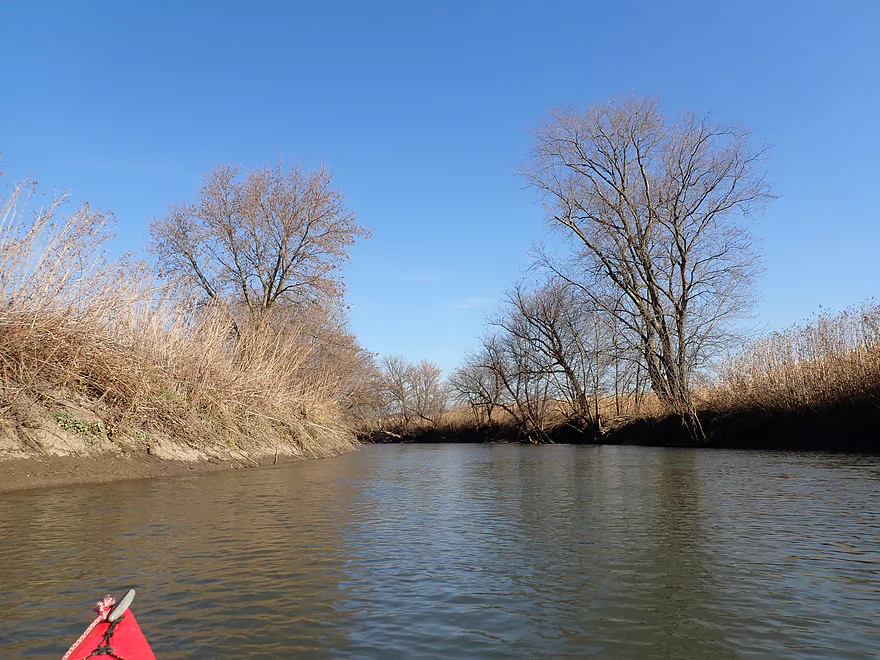
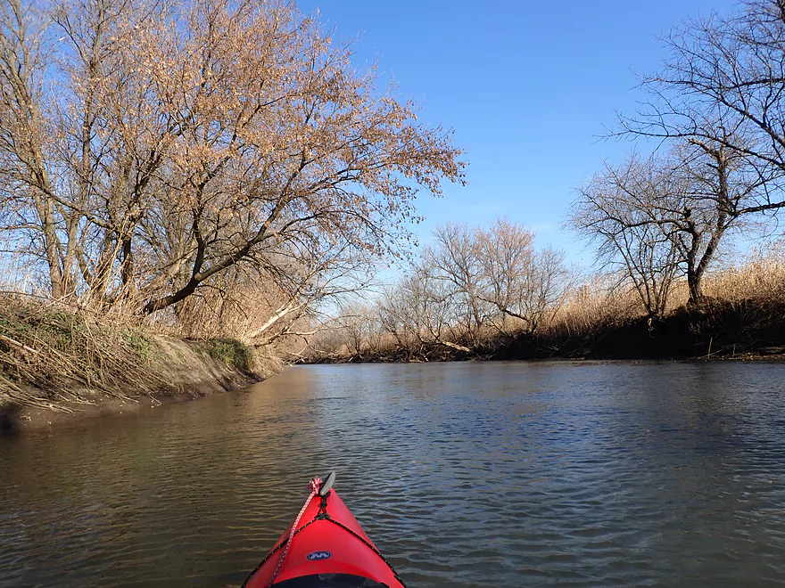
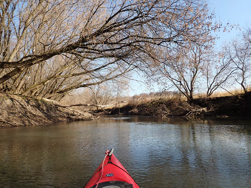
Typical scene…mud banks and a few leaning trees
Another nice bluff
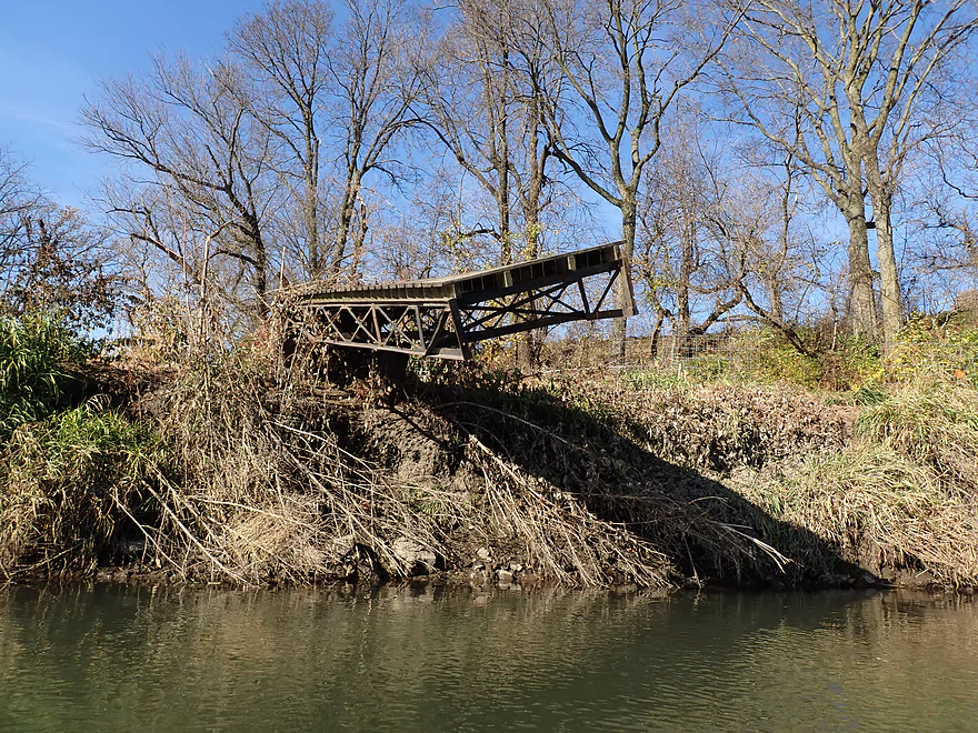
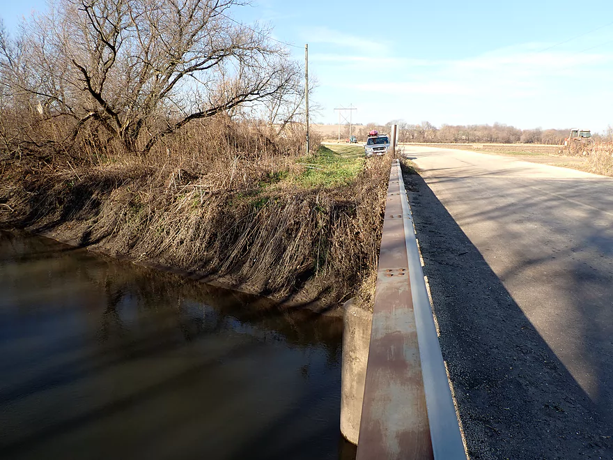
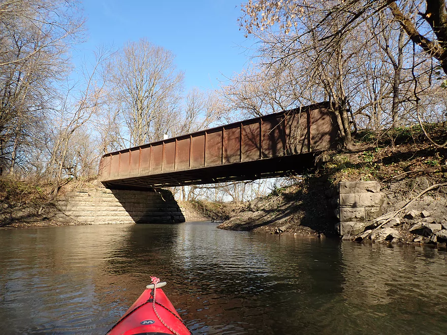
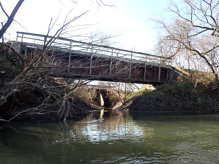
Shoreline erosion undercut this bridge
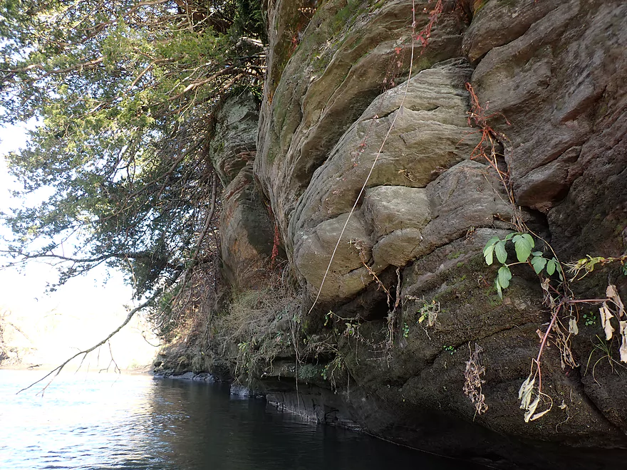
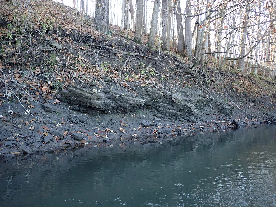
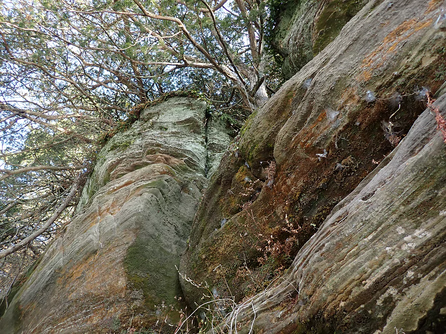
Only major outcrop of the trip
Very nice
Taking a break on the muddy banks to change my camera battery
The mouth of the Thunder Branch
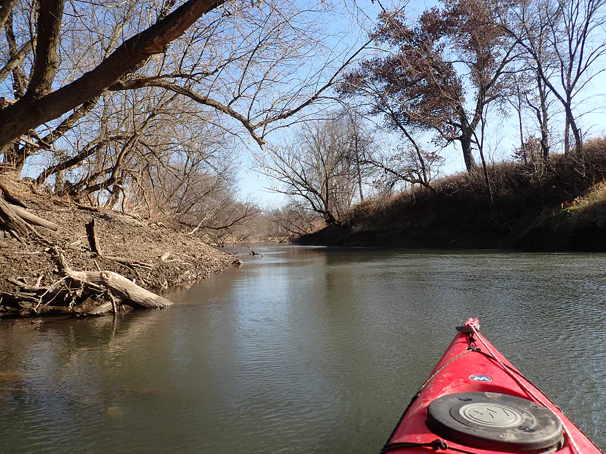
More steep muddy banks
And scraggly boxelders
One last bluff
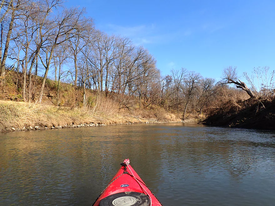
So many trees leaning over the water
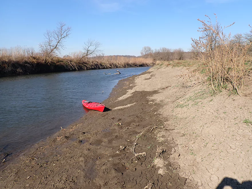
Taking out at Wells Landing
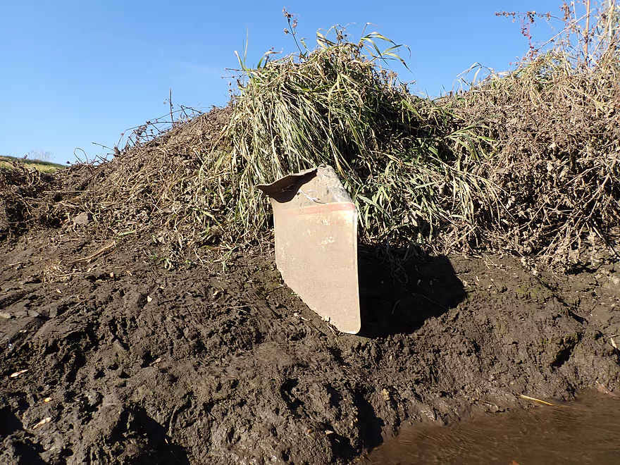
Which is partly buried by mud
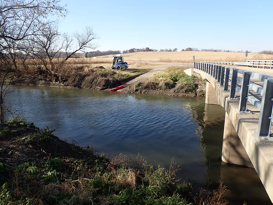
Small parking area by ramp (don’t block tractors)
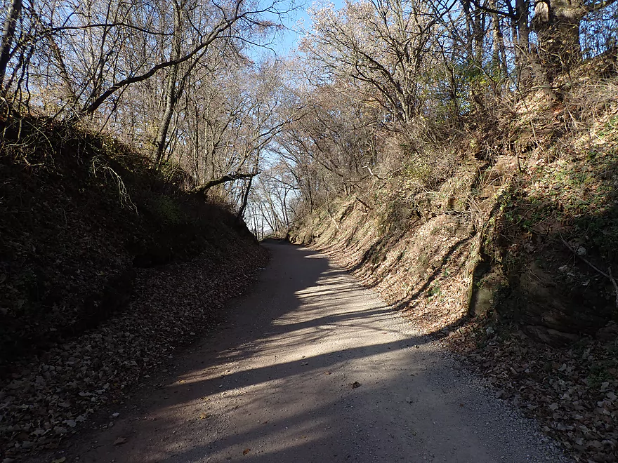
Scenic bike shuttle back to my car on the Cheese Country Trail
Scouting the river by Darlington
Looks nice…this is the main put-in at Black Bridge Park
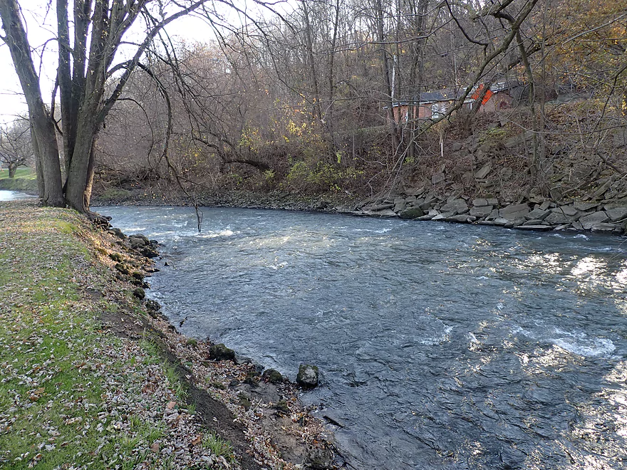
Wish I had done this stretch instead…it has fun rapids
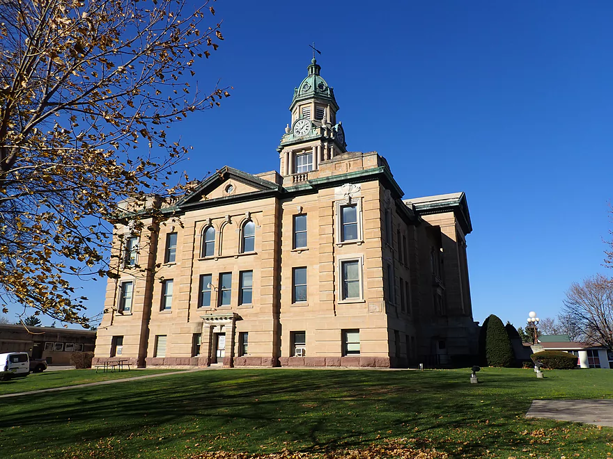
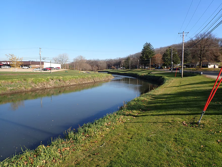
Attractive Lafayette County courthouse in Darlington
Pecatonica River – Roller Coaster Road to Wells Landing


The Pecatonica River is a major watershed located in southwest Wisconsin that flows into Illinois. There are many segments of it (and its branches) that can be paddled. I’ve done multiple segments in the past, but mostly of its upper portion (above Darlington). These tend to be smaller and more interesting. With water levels being relatively low in late fall, I decided it was finally time to try the Lower Pec to see how it compared.
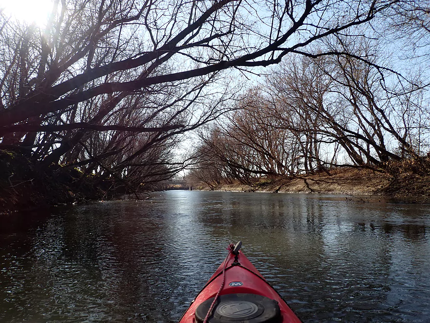
I started the trip at Roller Coaster Road, which is honestly a bad access. The west bank was too steep to launch from and the east bank wasn’t much better. But when I ducked directly under the bridge I found a hidden but acceptable slope for launching my boat. It was very muddy…if you do this stretch, prepare to get dirty. There are nicer launch options upstream in Darlington, but that would have added 4 miles to a trip that I considered a bit on the longish side already.
The first half mile flowed by a steep bluff which was attractive. There appeared to be small outcrops at the base, but these were mostly obscured by mud. Mud is a serious issue with the Pec…in fact I think it is even muddier than the Baraboo River and perhaps takes the prize as the muddiest river in Wisconsin. You wouldn’t want to portage a logjam here (which thankfully I didn’t have to) because the banks are so steep and muddy. Milwaukee Journal Sentinel reporter Chelsey Lewis did a trip from Calamine to Darlington and detailed how frustrating those logjams were because of the steep mud banks…which I can sympathize with.
I would love to see conservation groups focus more on topsoil erosion which is such a major and overlooked issue in Southern Wisconsin. Many of these watersheds drain unnaturally fast because of the lack of shoreline buffers, wetlands that have been filled in, and excessive drainage ditches. The faster a watershed drains, the more apt it is to flood and erode, which creates unstable mud banks that natural rocks and vegetation can’t stabilize. A few hundred years ago, the Pecatonica River would have looked completely different (and way nicer).
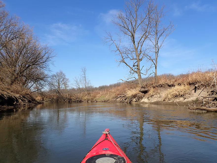
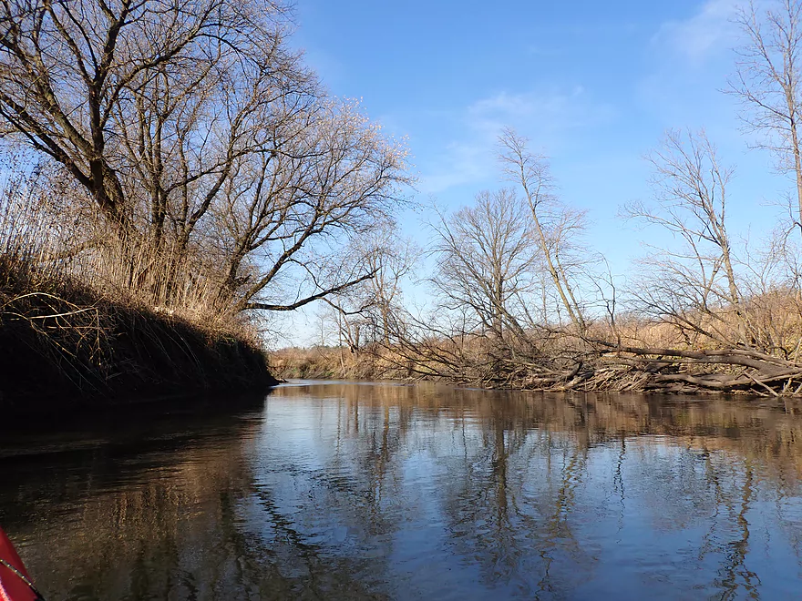
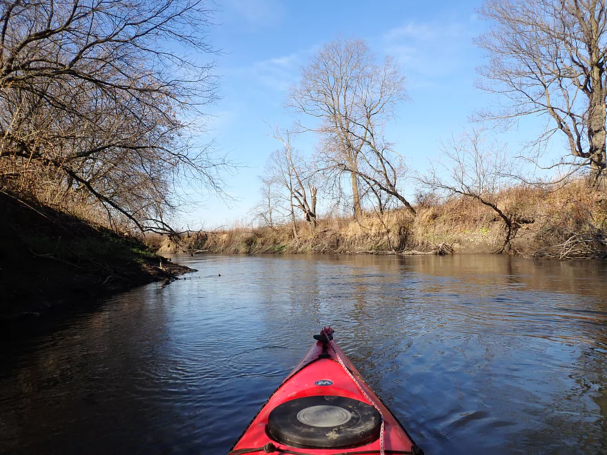
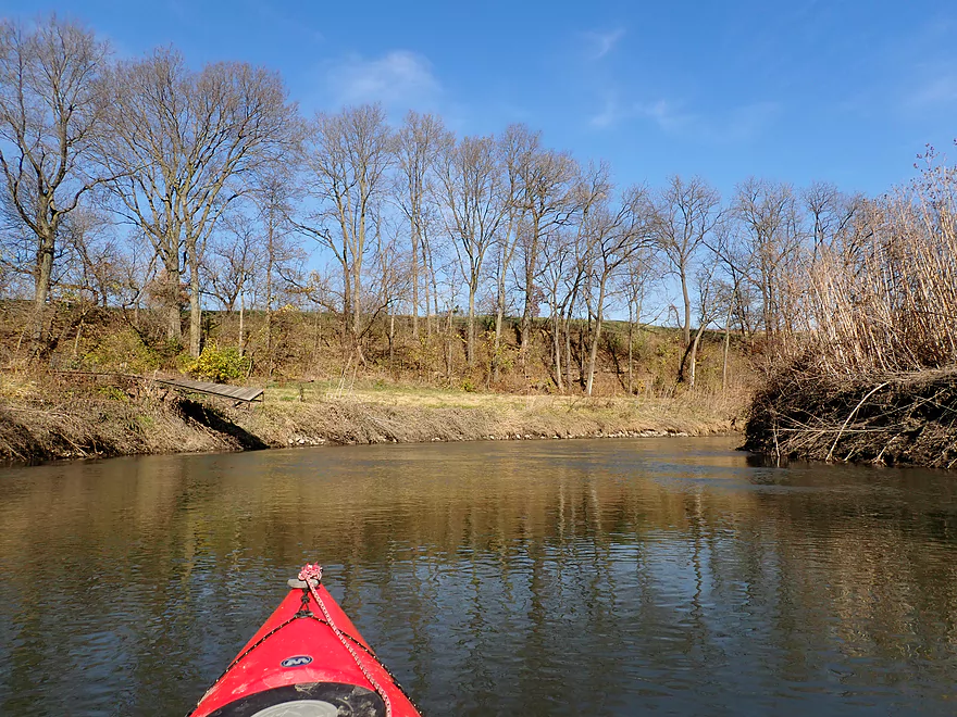
This river flows mostly through open farmland which can’t really be seen because the banks are so high. A thin lining of trees separates the fields and the river, but because the banks are in such bad shape, most were heavily leaning over the river and in the process of falling in. Thankfully the river is wide enough that getting around downed trees wasn’t an issue.
For a couple of miles, the Cheese Country Trail parallels the river. This is a popular trail which had a lot of ATV traffic.
I soon came to the mouth of the Ames Branch. Honestly this seemed more attractive and intriguing than the main branch itself. If I were to redo that weekend, I would have done that instead. Perhaps a future trip…
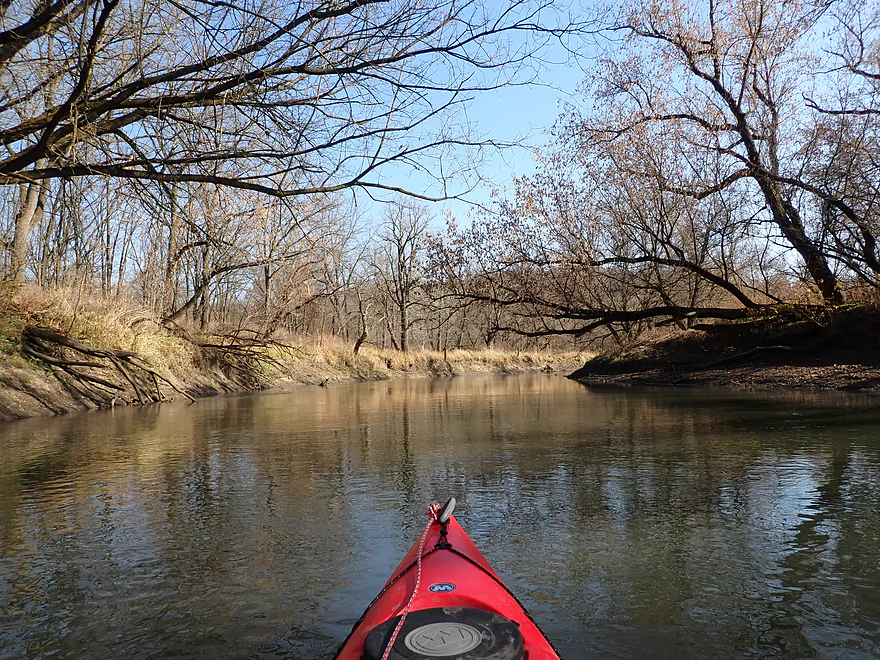
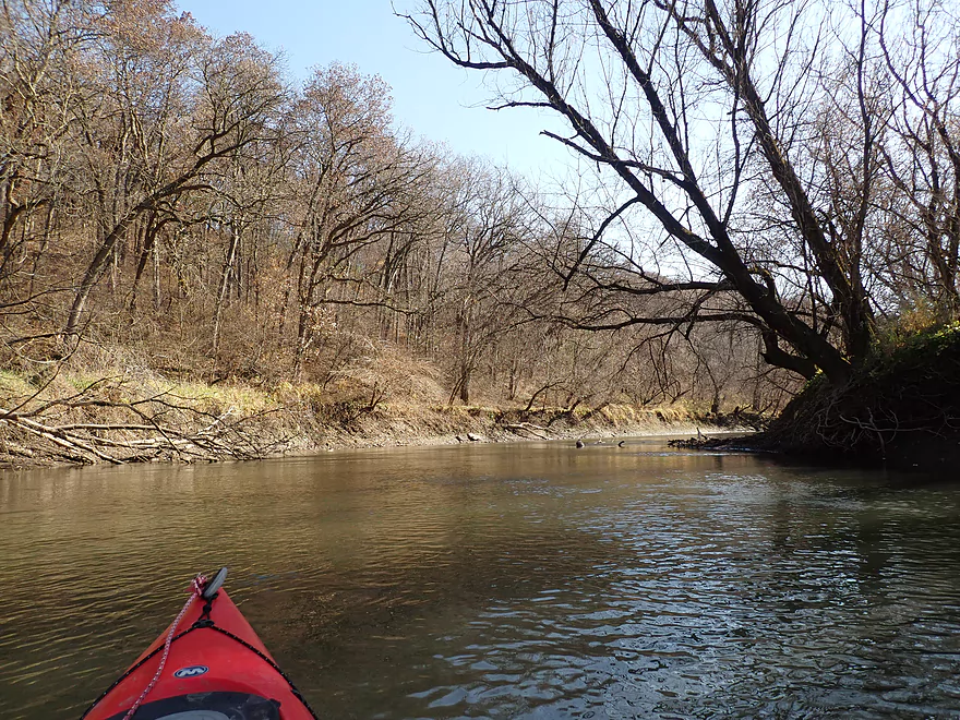
Much of the trip was fairly repetitive and monotonous. It’s basically a big deep river (usually over 4′) flowing in long stretches between steep muddy banks and flood damaged trees. The few highlights were the occasional bluffs which were nice. There was even a decent sandstone outcrop located about halfway into the trip.
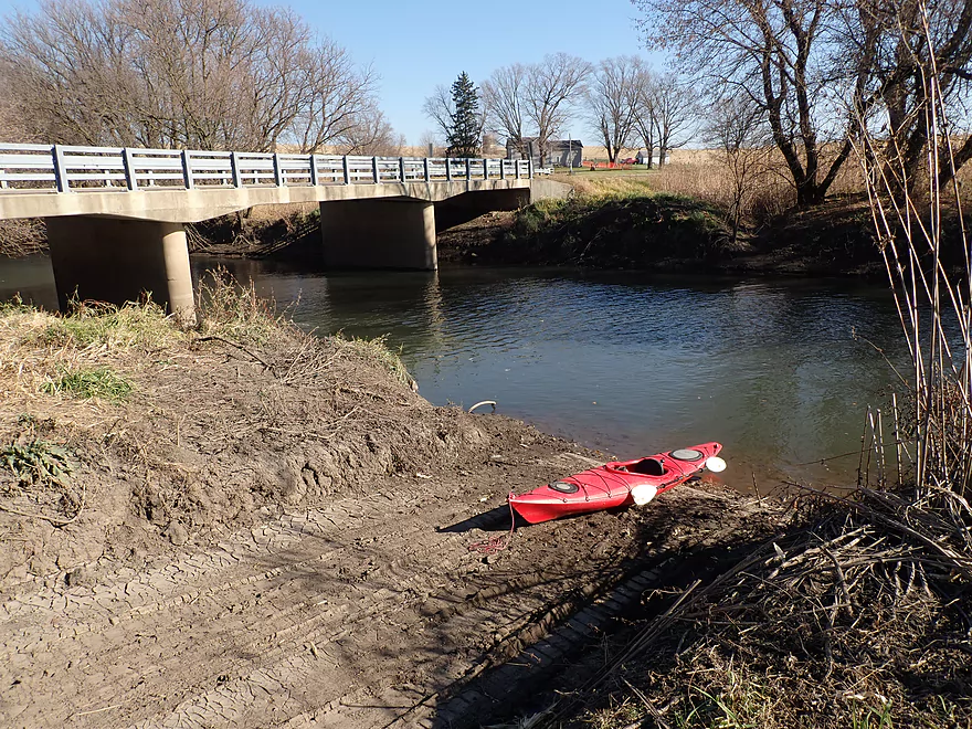
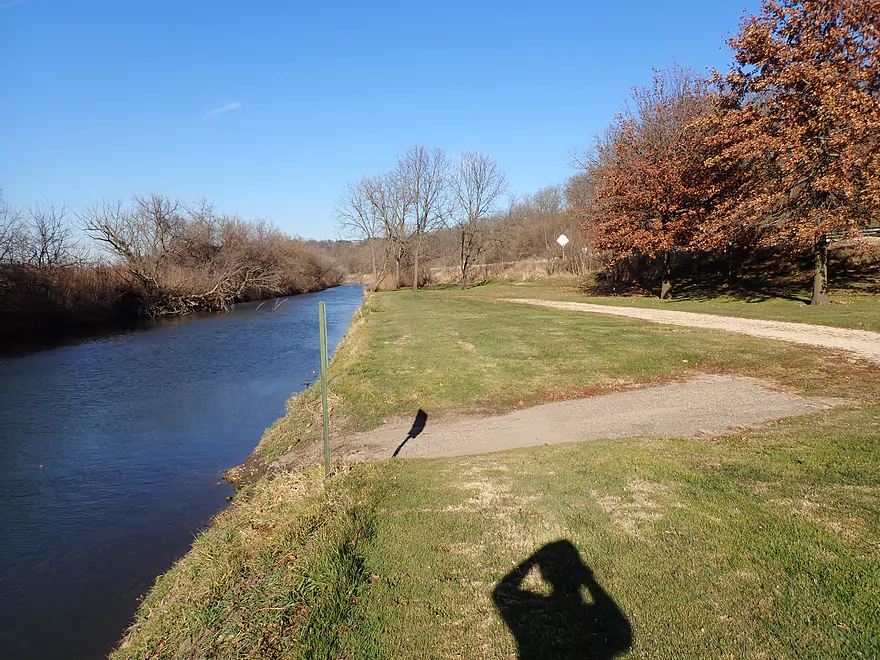
I took out at Wells Landing (Walnut Road) which was a great boat launch, but unfortunately mud has partly buried the main ramp, so prepare here too to get dirty.
In summary, this was a slightly disappointing trip. The few bluffs and one outcrop were nice, but didn’t offset the amount of mud and monotonous scenery. The Lower Pecatonica has really been hit hard by floods these past five years, and I suspect it may have been a much better paddle just a decade earlier. After the trip, I scouted the river by Darlington (the immediate upstream segment) and really liked what I saw. The river here was much more attractive and even featured cool rapids. In hindsight that stretch (Darlington to Roller Coaster Road) would have likely been a much better trip. I think some paddlers will still enjoy Roller Coaster Road to Wells Landing as it’s not bad and doesn’t have a lot of complications. But honestly, the East Branch and the Lower Sugar River are comparable rivers in the area and most paddlers will likely prefer them.
There wasn’t much wildlife but sights included one deer and an eagle. I saw some cow droppings along the river, so I assume cattle graze along its edge.
Darlington Canoe Festival: This is a yearly canoe race that runs from Calamine to Darlington (a bit upstream from this trip). It’s a popular event, but it was cancelled in 2020. Hopefully it will be back in 2021. Typically the Pecatonica River is cleared of logjams prior to the event, which IMO is more noteworthy than the event itself. Updates are posted on their Facebook page.
Roller Coaster Road: This wasn’t a very good put-in. The banks were steep and muddy. If you duck under the bridge there is an acceptable slope for launching, but that too is pretty muddy. In high water, I’m not sure this is even a viable access as you couldn’t even fit your boat under the bridge.
Alternate Put-ins:
- Darlington: (4.2 miles upstream of Roller Coaster Road) Most paddlers will prefer to launch here because of the better launch options…but it means a longer trip. The river by Darlington is very attractive and even features some fun Class 1 rapids by the campground. In hindsight I wish I had launched here.
- Black Bridge Park: This is the most upstream launch option in the city and the best access.
- Peterson Park: This is likely a doable access…but really, Black Bridge Park is a better option.
- Festival Grounds Park: The last of the three launches in town is an ok option (best access is by the Piggly Wiggly parking lot). The downside of starting here though is you miss the fun rapids.
Wells Landing: This is a terrific little landing located off Walnut Road. Sadly, eroded mud has covered some of the ramp area, but it’s still a nice launch.
Alternate Take-outs:
- Riverside Road: (5.5 miles downstream from Wells Landing) I’m not sure this is a good stretch…likely big, straight and muddy. There is a good take-out option at Riverside Road though.
Walnut Road to Roller Coast Road: 3.6 miles with 95′ of ascent. This was actually in some ways more enjoyable than the paddle itself. Most of the bike shuttle is along the Cheese Country Trail. This is a scenic rails-to-trail project that features some attractive outcrops by Walnut Road. The downside is that ATV use is quite heavy on this trail; I must have seen at least 20. Unfortunately these vehicles make a lot of noise and their tires really chew up the trail surface. It’s manageable for bikes (barely), but you do need to carefully choose packed down sections to bike on. You will need a state trail pass to use the Cheese Country Trail (this is enforced by the trail patrol which I saw on their ATV).
Rapids/Fences/Logjams: None. While there are downed trees, it’s usually easy to paddle around them.
Current: By Roller Coaster Road the current is somewhat fast…but for almost the entirety of the trip the river was pretty slow.
Strainers: These mostly aren’t an issue. There are a few minor ones that could be tricky in high water.
Cold Water: This was a “cold water paddle”. While there isn’t a temperature gauge on the river, I suspect it was in the 40s (F). Paddlers should always assume they’ll tip over during a cold water paddle and should be wearing appropriate protective clothing for cold water immersion as well as a life jacket.
Closest Gauge: Pecatonica River @ Darlington
Trip Depth: 240 CFS or 3.5′
Navigability Estimates:
- < 100 CFS: The river infrequently gets this low, but even so, navigability shouldn’t be an issue.
- 101-210 CFS: Very ideal conditions and a good target range for the Lower Pec. The water should be relatively clean at these levels.
- 211-250 CFS: An average depth, fine for paddling.
- 251-290 CFS: A bit above average, but plenty manageable.
- 291-350 CFS: A high depth. Likely manageable, but the river may be very muddy and unattractive. Be mindful of shoreside strainers at these levels.
- 351-500 CFS: A very high depth. Perhaps only suitable for experienced paddlers.
- 501+ CFS: This might be too high and muddy for enjoyable paddling.
Detailed Overview
- Upstream of Hwy X: I think the river up here is too shallow to run.
- Hwy X to Hwy G1st: 4.2 miles. This section is a small creek and may need high water. Some logjams and probably small outcrops. Hwy X is not a great access and lacks privacy.
- Hwy G1st to Hwy E: 3.4 miles.
- Hwy G1st to Hwy G2nd/Mifflin: 2.9 miles. Great section with many rock outcrops and light rapids. Shallow, but becomes much deeper after the Livingston Branch joins up. Two fences, but easy to get past.
- Hwy G2nd/Mifflin to Hwy E: 0.5 miles. Short, open section heavily grazed by nearby beef cattle. Some fun rapids and outcrops are on this segment. One fence to duck under (quite manageable).
- Hwy G2nd/Mifflin to Hwy A: 4.4 miles. An excellent prospect with good current, outcrops, a state natural area, and few logjams. Martin (reader comment) kayaked this section and wrote a nice summary here that you can read.
- Hwy A to Peniel Road/Hwy J: 1.7 miles. Maybe two outcrops and two major logjams.
- Peniel Road/Hwy J to Jones Branch Road: 2.5 miles. Some congested woods with maybe 3 logjams and 2-3 outcrops.
- Jones Branch Road to Powell Road: 3.1 miles. A nice peaceful stretch with a few outcrops, 2 sets of light rapids, and one serious logjam.
- Powell Road to Oak Park Road: 8.0 miles. A very open section with no logjams. Highlights include green rolling hills, oak savannas, a few rapids, and one outcrop. Lowlights include four low fences.
- Powell Road to Hwy 151/Blackstone Cattle: 4.4 miles. The more scenic of the two sections with scenic hills and one outcrop. There are two low electric fences to duck under.
- Hwy 151 to Oak Park Road: 3.6 miles. This section had more corn and trees and wasn’t as interesting, but still was decent. There is one low electric fence and one super low barbed wire fence.
- Oak Park Road to Hwy O: 3.7 miles. Likely some logjams but also some outcrops at the end. Oak Park Road is a muddy but doable put-in.
- Hwy O to Hwy G: 6.0 miles. Some scenic moments, but mud and logjams are detractions. Put-in and take-out are muddy.
- Hwy G to Darlington/Black Bridge Park: 8.5 miles. A decent prospect. As of 2020, there is a large logjam on this leg that requires a difficult portage up steep and muddy banks. This might be cleared out for the 2021 Darlington Canoe Festival.
- Darlington/Black Bridge Park to Roller Coaster Road: 4.9 miles.
- Black Bridge Park to Wells Street Access: 0.7 miles. A great stretch though the town of Darlington. The highlight is a section of Class 1 rapids where the old mill dam used to be.
- Wells Street Access to Roller Coast Road: 4.2 miles. A decent stretch, but no outcrops, the banks are steep/muddy and there are two partial logjams to circumnavigate around. Not bad...not great.
- Roller Coaster Road to Walnut Road: 7.3 miles. While one of the nicer legs on the lower Pecatonica, the river has been too badly damaged by erosion to be an elite paddle. The highlight is a sandstone outcrop.
- Walnut Road to Riverside Road: 5.5 miles. Mediocre prospect flanked by a lot of farmland. Excellent put-in and take-out.
- Riverside Road to Hwy 78 Canoe Landing: 3.2 miles. Likely an uninteresting leg with lots of farmland and large mud banks. I doubt there are many bluffs. There may be one major logjam.
- Hwy 78 Landing to Gratiot Conservation Club Landing: 5.8 miles. A mediocre stretch. Much of this is wide, slow, and straight...but there are a few nice wooded bluffs.
- Gratiot Conservation Club Landing to Sargent Road: 4.7 miles. Maybe a weaker section.
- Sargent Road to Hwy D/N: 4.6 miles. Flows partly through a SNA and by a valley ridge so might be interesting.
- Hwy D/N to Hwy 11 Boat Ramp/Browntown: 8.8 miles. The East Branch comes in and doubles the river (now pretty big).
- Browntown to Brewster's Landing: 12.2 miles.
- Hwy 11 Boat Ramp/Browntown to Hwy B: 4.8 miles. Generic stretch with farm fields and a thin layer of trees. Take-out might be tricky because of a guardrail but I think it’s doable.
- Hwy B to Hwy M: 4.6 miles. A good leg with scenic bluffs and outcrops. Put-in is meh…take-out might be bad.
- Hwy M to Brewster's Landing: 2.9 miles. Mediocre stretch that crosses into Illinois.
- Brewsters Landing to McConnell Bobtown Landing: 7.2 miles. Mostly straight and boring. But there is a wooded section with bluffs that might be nice. Could be an outcrop or two.
- McConnell Bobtown Landing to McNeil's Damascus Landing: 8.5 miles. River flows through a more rugged and varied part of Stephenson County. Still some boring parts, but also some nice bluffs and limestone outcrops.
- McNeil's Damascus Landing to Wes Block Trailhead: 8.3 miles. Mostly a straight and muddy paddle. But there should be a few nice bluffs on the west bank.
- Wes Block Trailhead to Tutty's Crossing: 6.4 miles. River enters Freeport (IL). This should be a pleasant stretch with fewer farm fields, nicer woods, and a few attractive trail bridges.
- Tutty's Crossing to Hancock Ave Boat Ramp: 0.7 miles. Wooded urban stretch.
- Hancock Ave Boat Ramp to Junior's Place/VFW: 2.3 miles. River leaves Freeport. This is likely a mediocre stretch.
- Junior's Place/VFW to Ridott Fishing Park: 14.8 miles. A very long stretch that I'm not sure would be that interesting. There are rapids by the Brown's Mill Dam that may have to be portaged.
- Ridott Fishing Park to Attens Landing: 6.7 miles. I don't know much about this stretch. It meanders more and has thicker woods so may be nicer.
- Attens Landing to Winnebago County Fairgrounds Ramp: 7.5 miles. Much of this flows through the Pecatonica Wetlands Forest Preserve.
- Winnebago County Fairgrounds Ramp to Sumner Park: 0.4 miles. There are tricky rapids where a dam was mostly removed. Depending on water levels, you may have to portage this.
- Sumner Park to Pecatonica River Forest Preserve Ramp: 6.0 miles. A north flowing leg of the river that is mostly undeveloped and contains some floodplain forests.
- Pecatonica River Forest Preserve Ramp to Trask Bridge Ramp: 7.0 miles. This is a relatively good prospect with large clay banks and a few nice woods.
- Trask Bridge Ramp to Two Rivers Ramp: 12.6 miles. Paddling author Mike Svob seemed to like this leg. Here the river meanders and twists more. The woods are also more impressive. Much of this is still likely wide, slow, and boring though. The take-out is close to the mouth of the Sugar River.
- Two Rivers Ramp to Boat Launch Mactown: 9.8 miles. The last leg of the Pecatonica before it empties into the Rock River. Significantly enlarged by the Sugar River, I suspect this is a big and boring leg.
Trip Map
Overview Map
Video
Photos Size: