
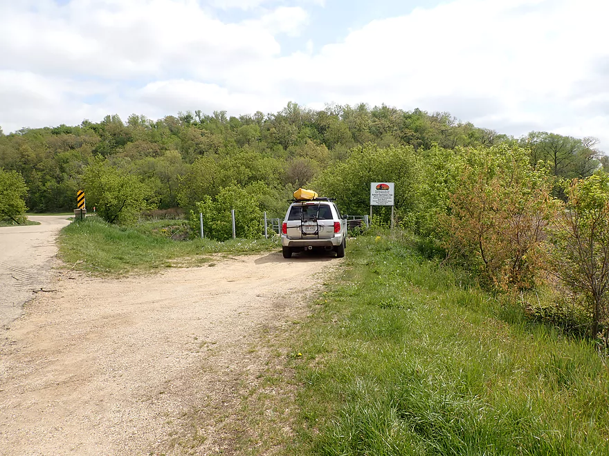
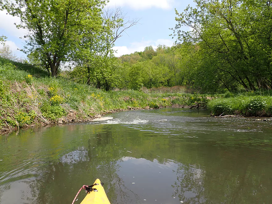
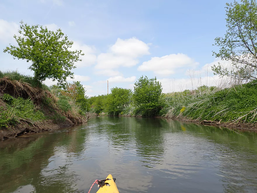
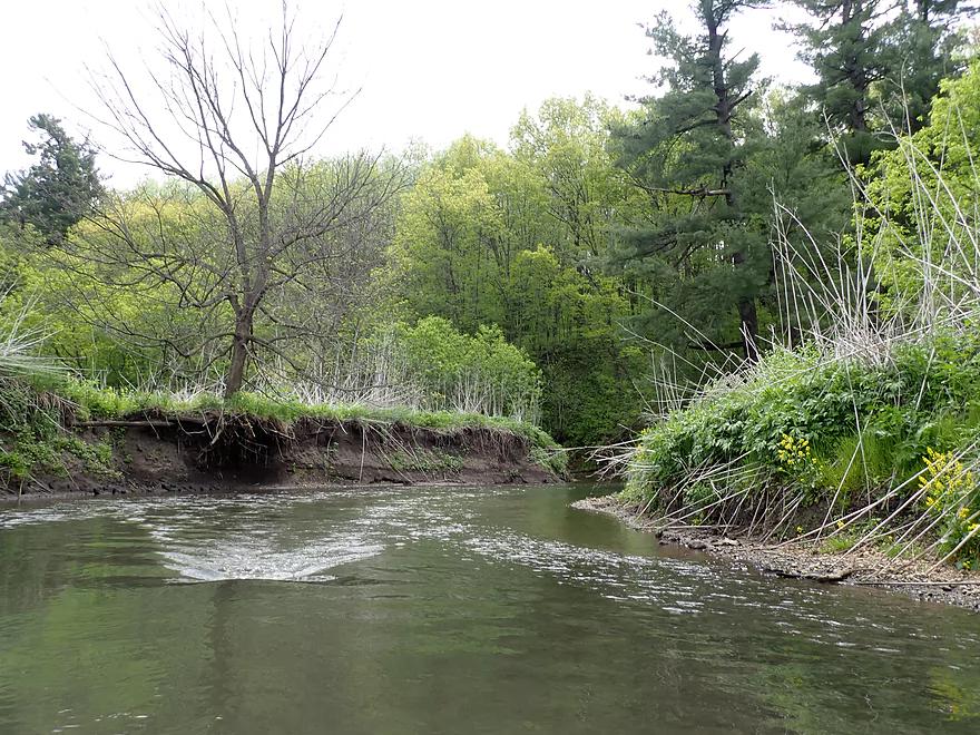
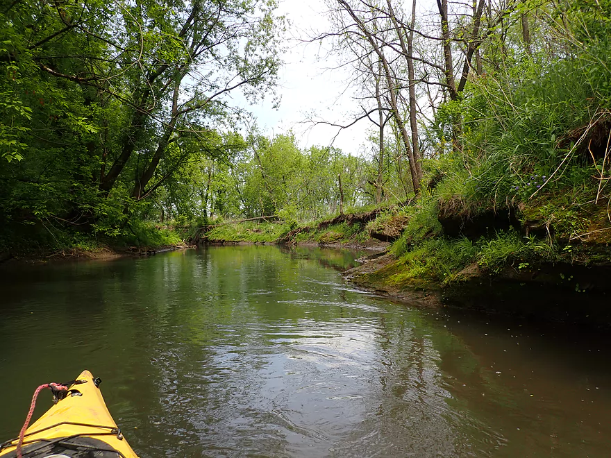
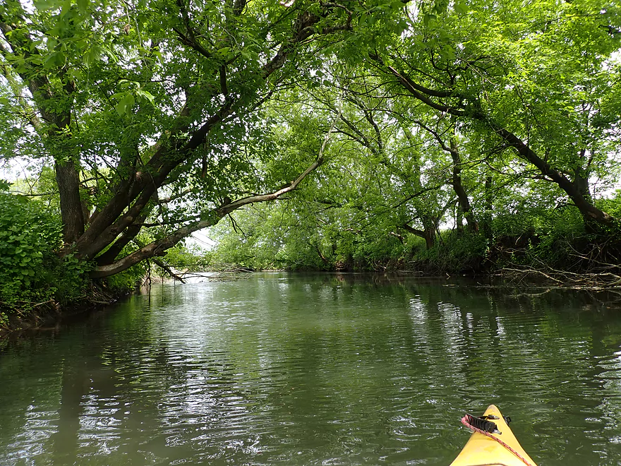
Starting the trip at Jones Branch Road
Where there is a nice public access
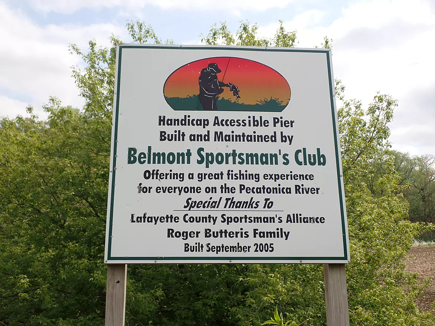
Handicapped fishermen can use this pier
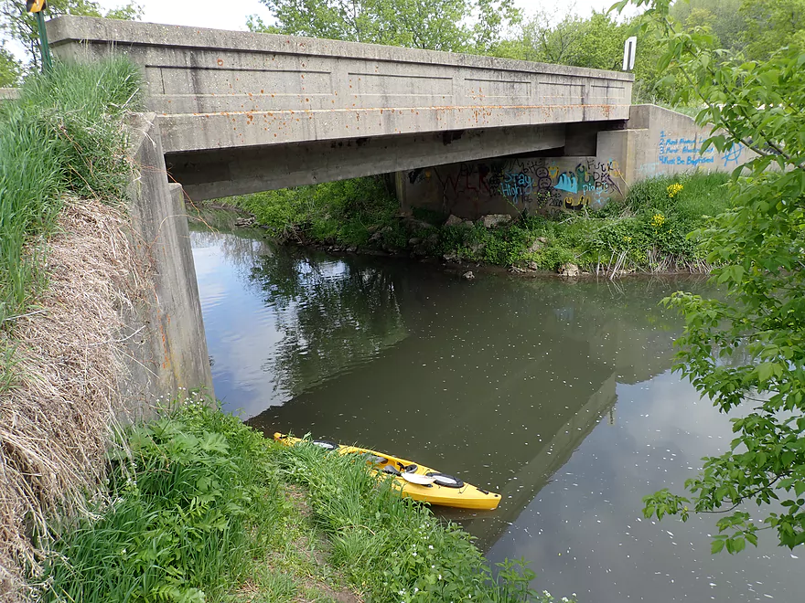
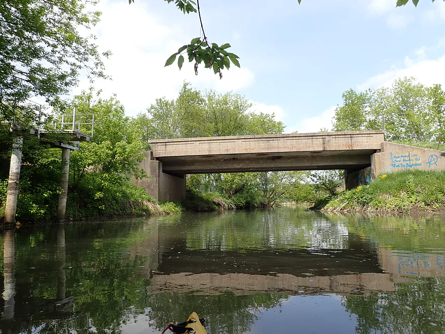
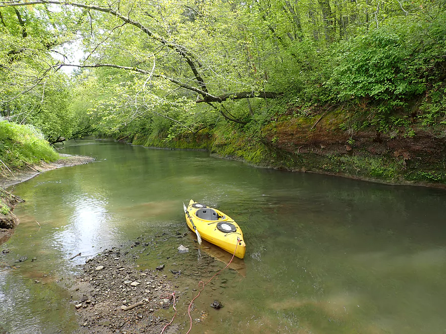
Launching almost below the bridge
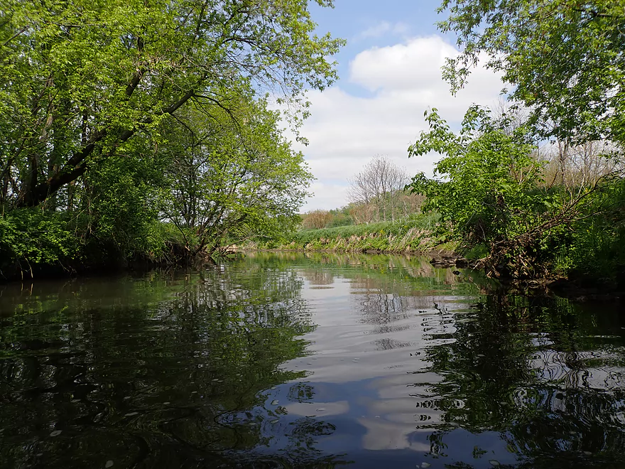
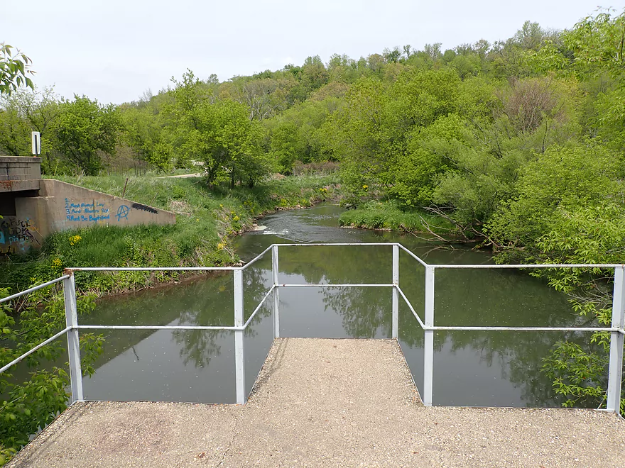
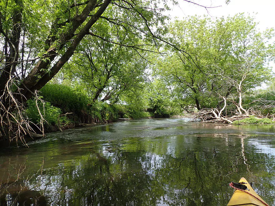
Checking out the river upstream of the bridge
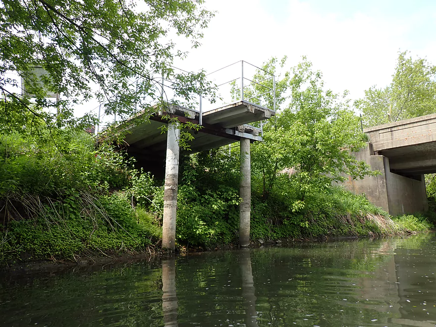
I think locals use the fishing pier as a diving platform
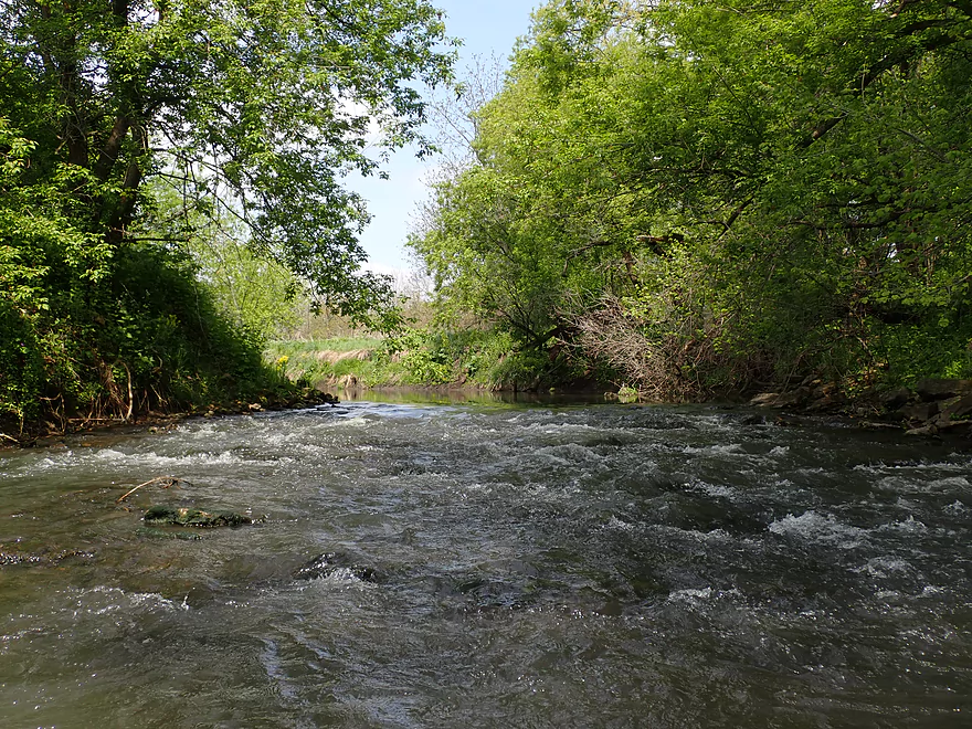
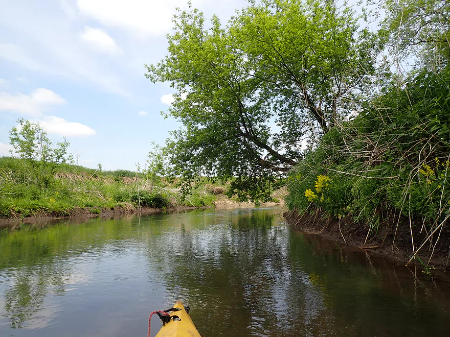
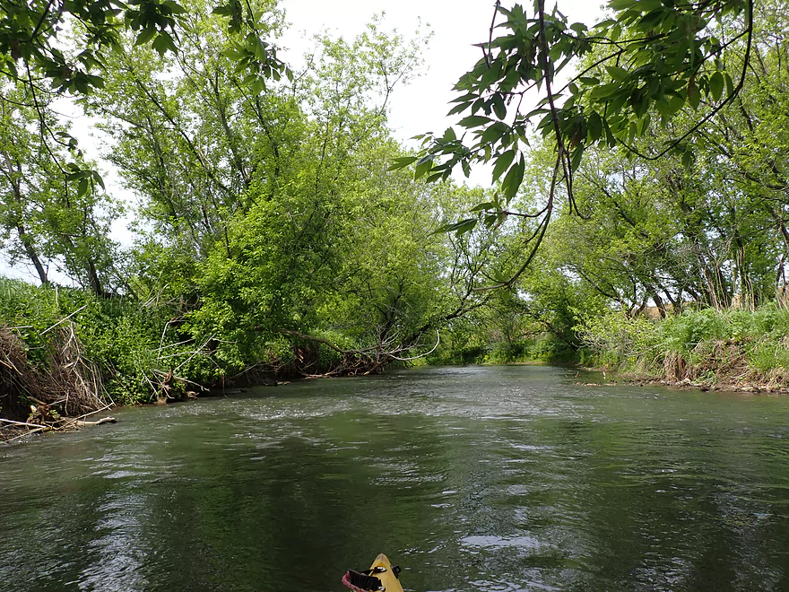
Some rapids right away
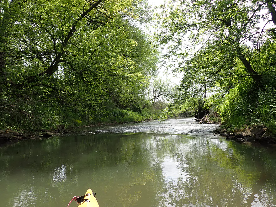
This is soon followed by a second set of rapids
Very easy
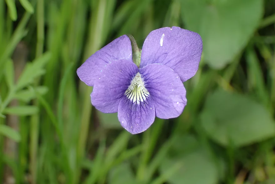
A violet
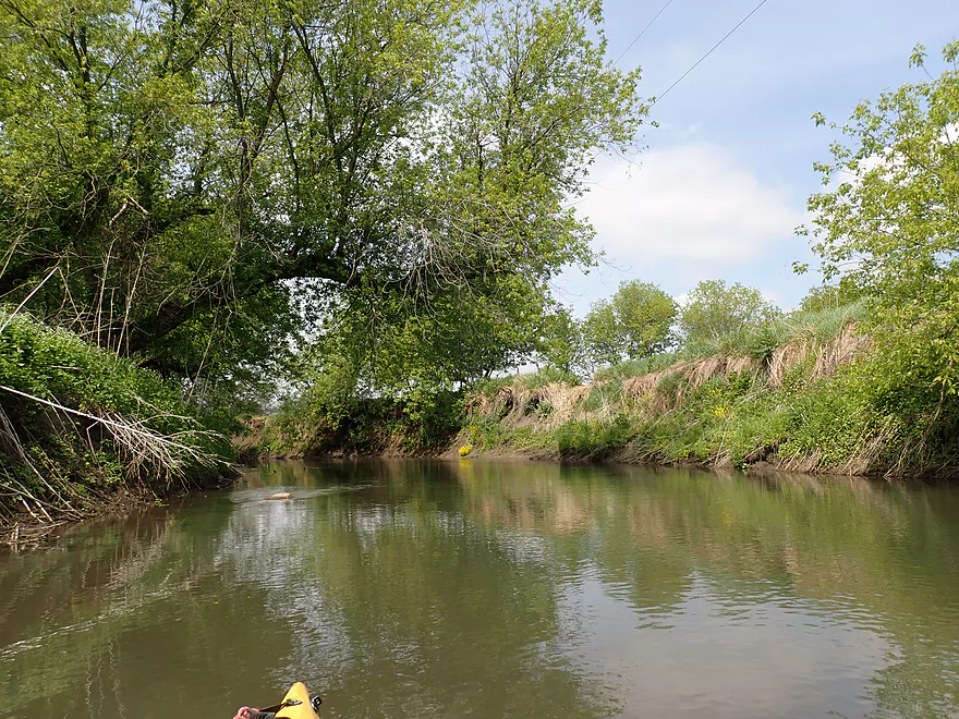
Tall mud banks were a common sight
Some snags but almost always a way through
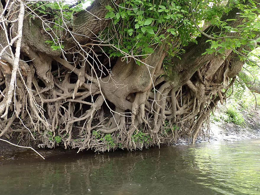
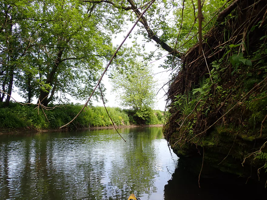
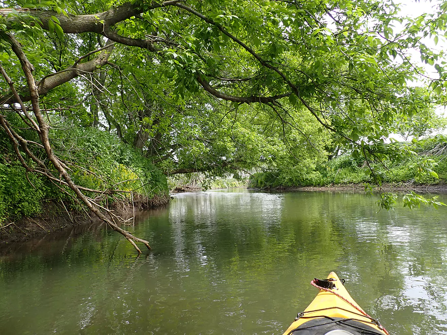
Cool tree roots
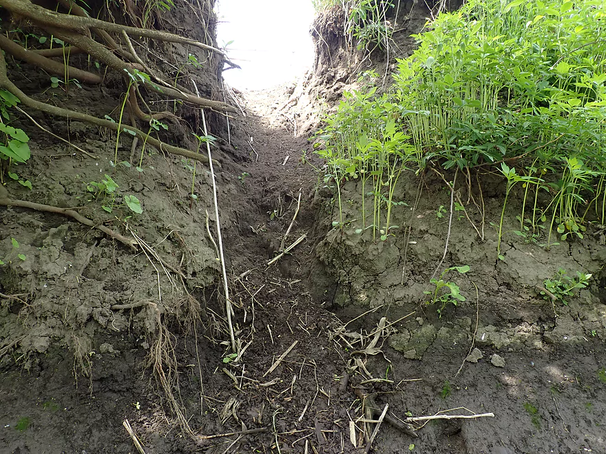
Some type of animal slide…maybe muskrat
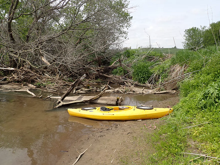
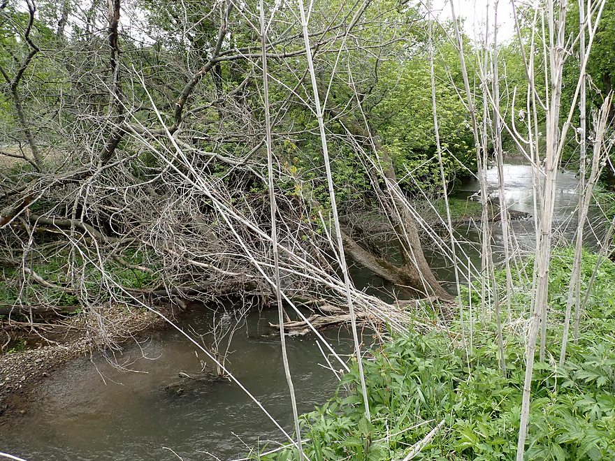
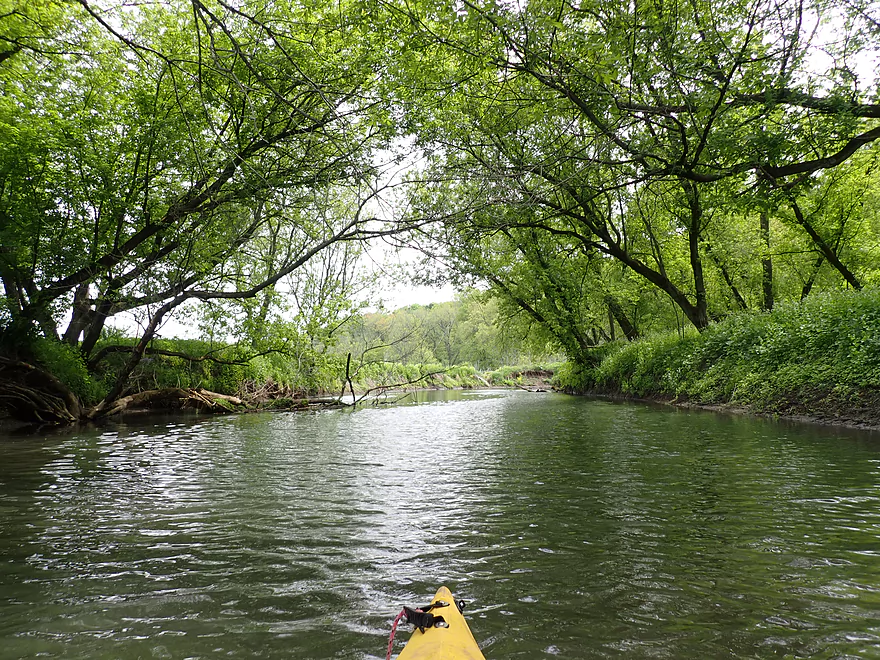
Only major logjam
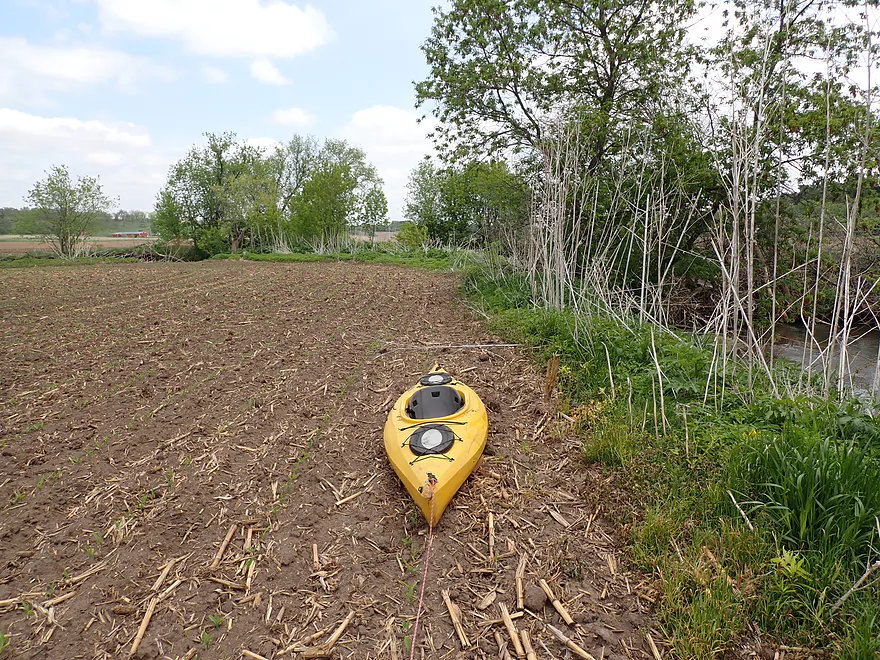
Portaging along a corn field
It’s actually a double portage as one jam is followed by another
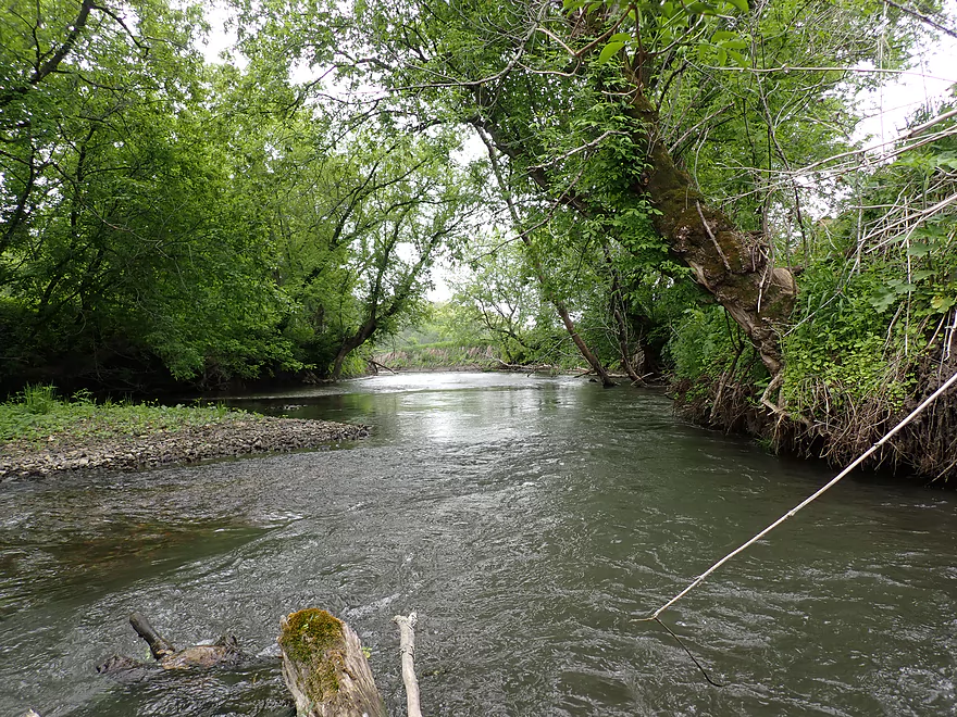
Back on the water
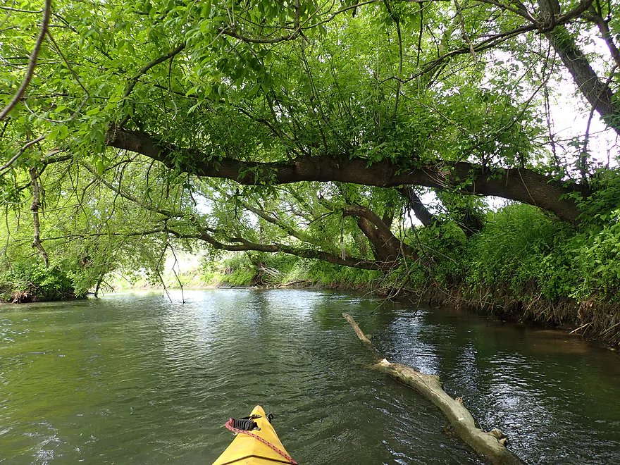
An easy “hopper”
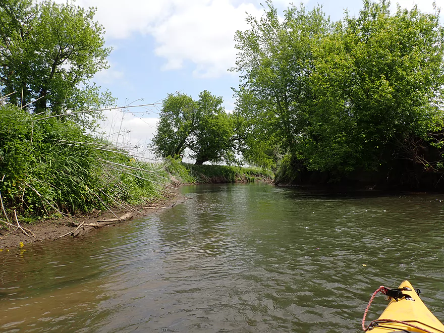
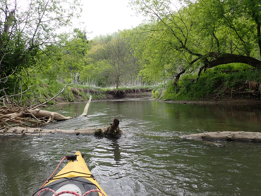
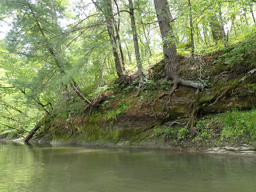
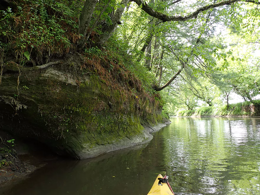
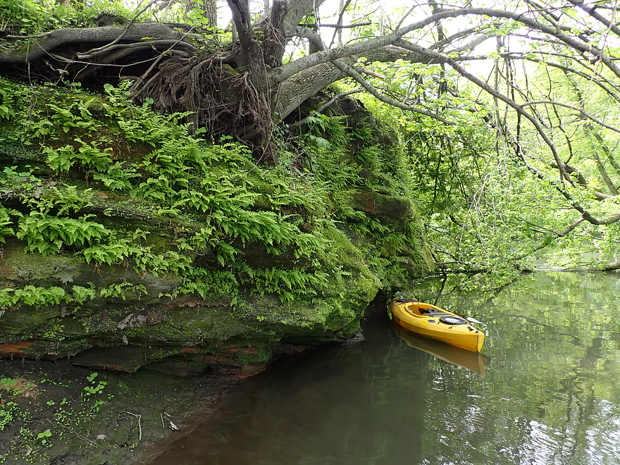
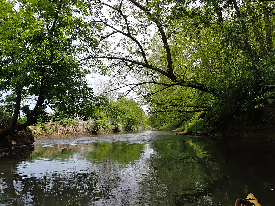
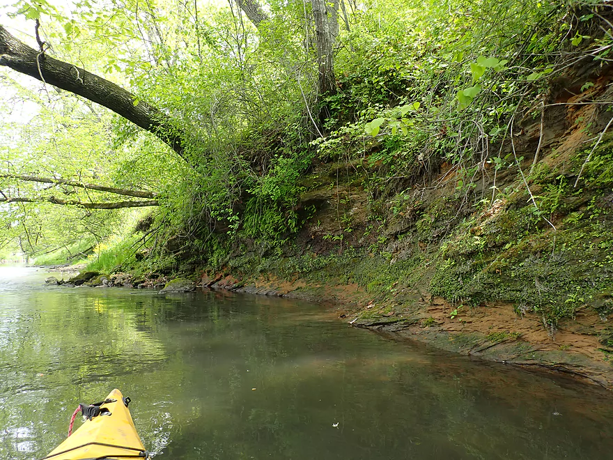
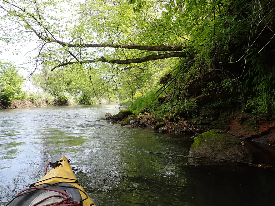
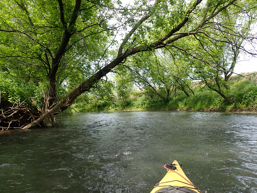
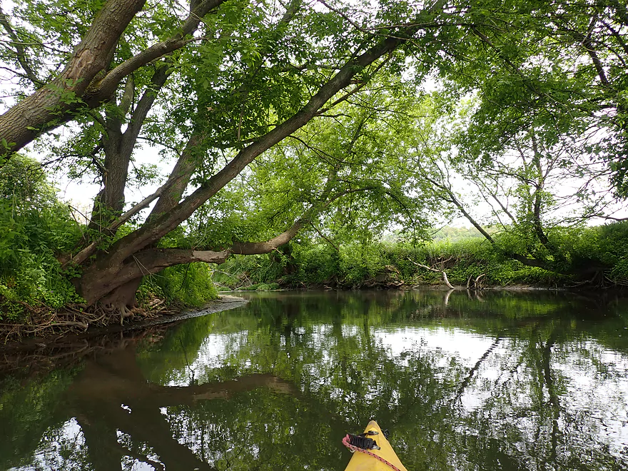
Approaching a nice bluff
Best part of the river
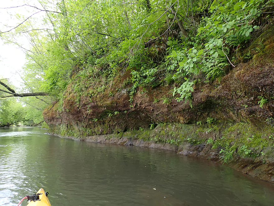
Great outcrop
Reverse view
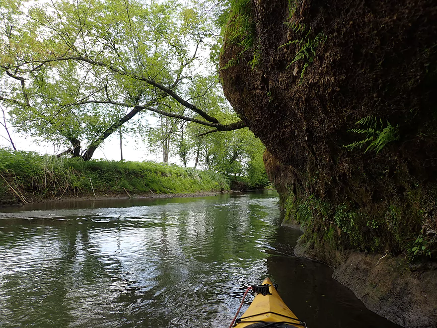
Moss and ferns like these cliffs because they are north-facing
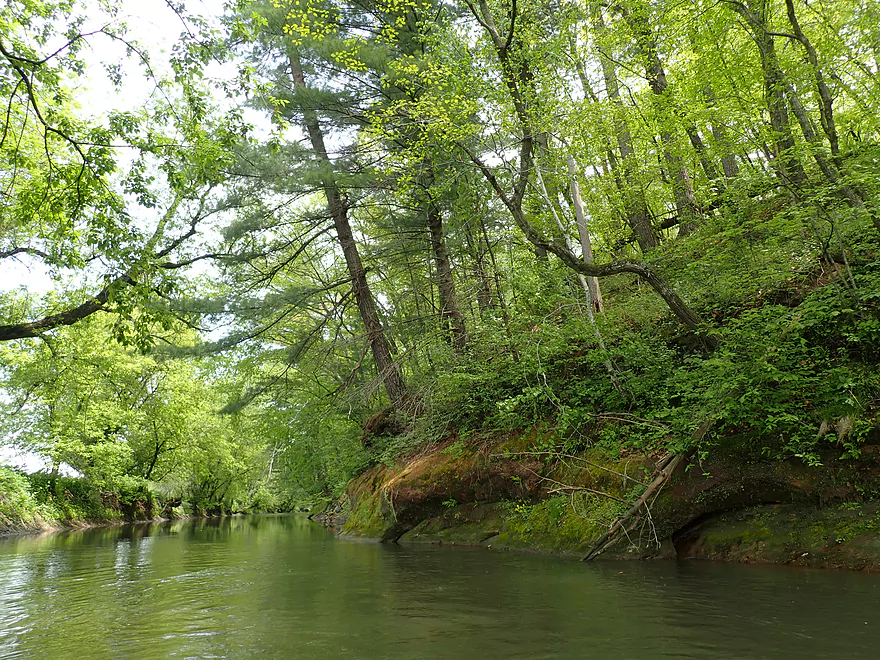
One of several white pines
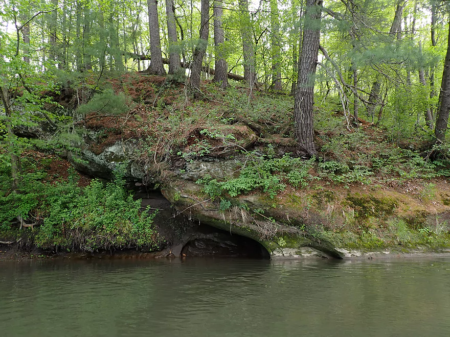
Bit of a cave in the making
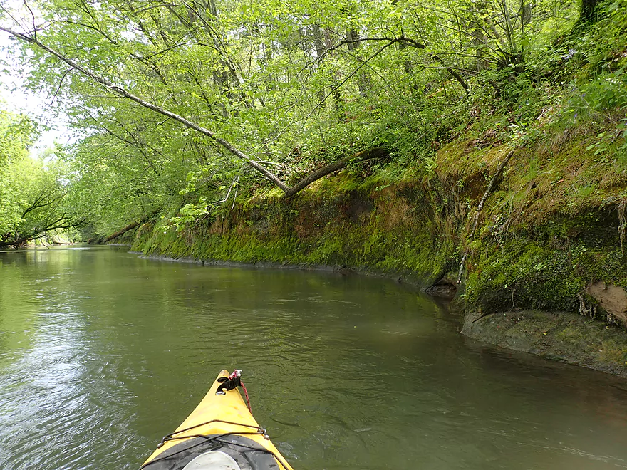
This same outcrop stretches almost 1500′!
Reverse view
Finally the end of the long outcrop
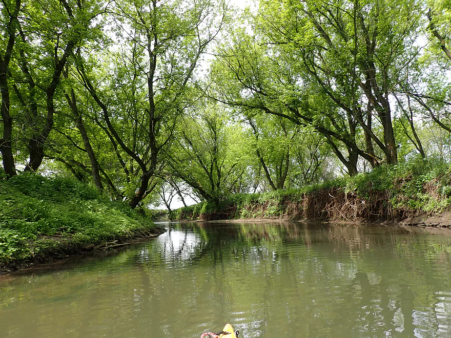
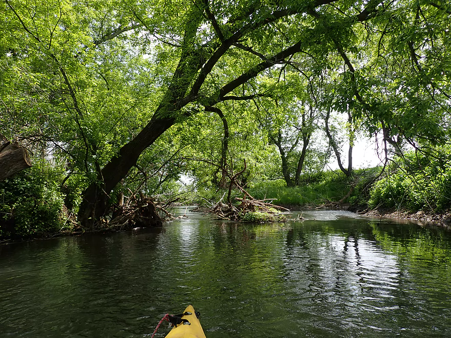
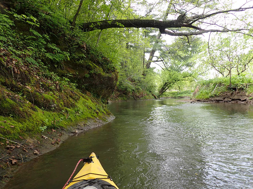
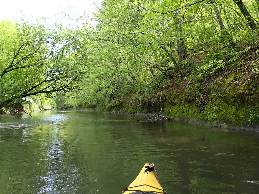
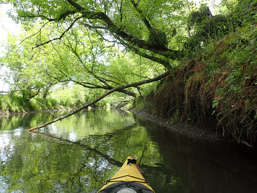
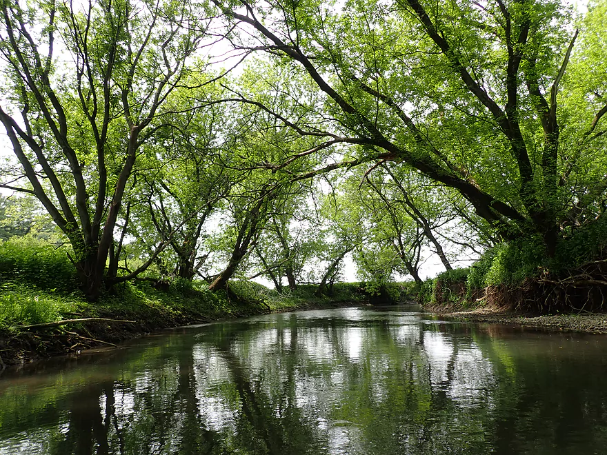
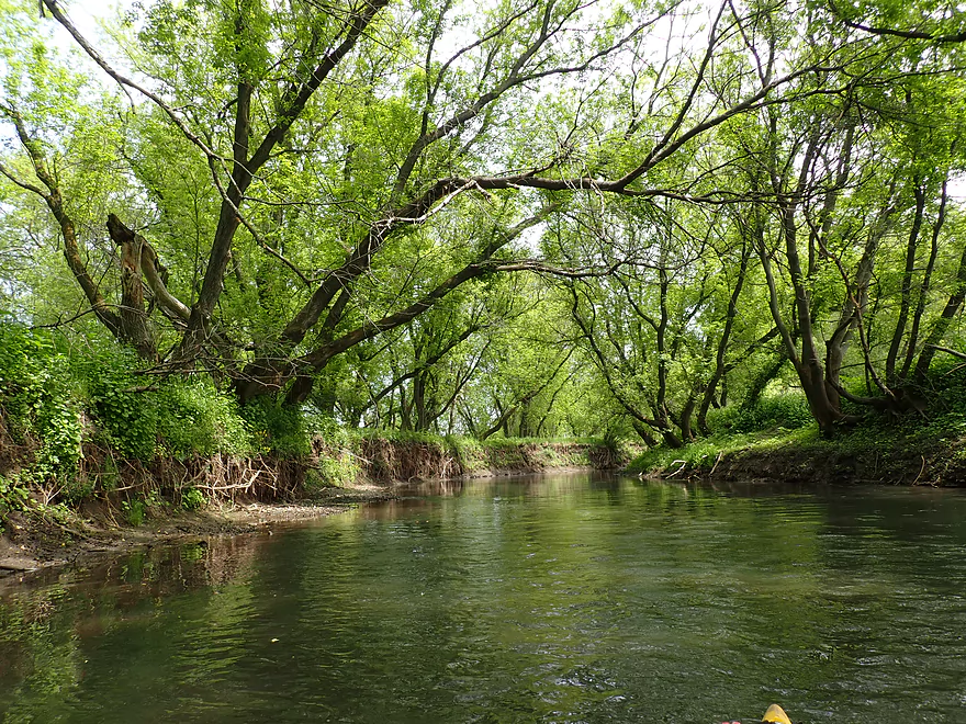
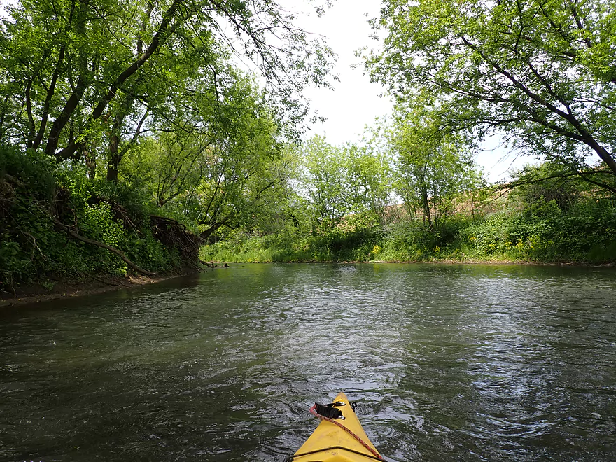
Great tree canopies
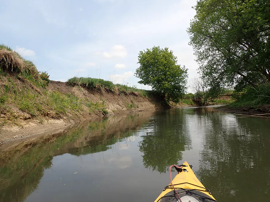
More mud banks…but these are smaller than those on the Lower Pecatonica
Fantastic fern colony
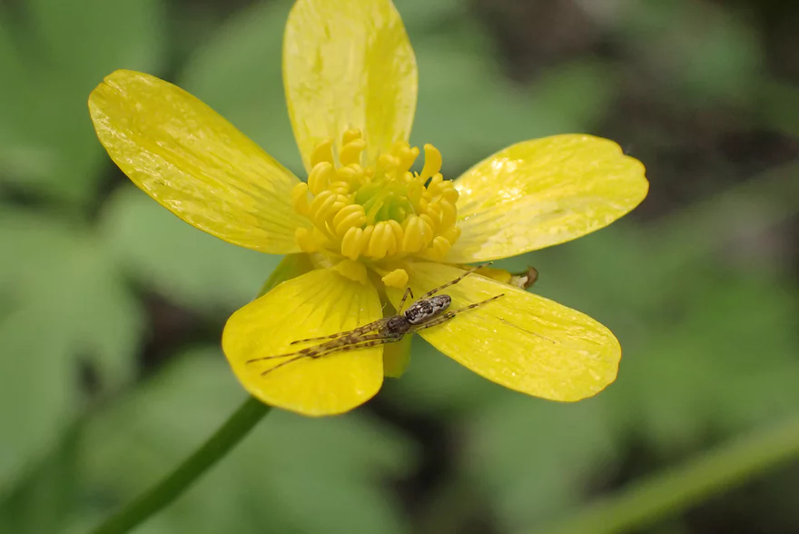
Spider hiding on the flower
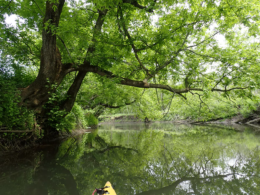
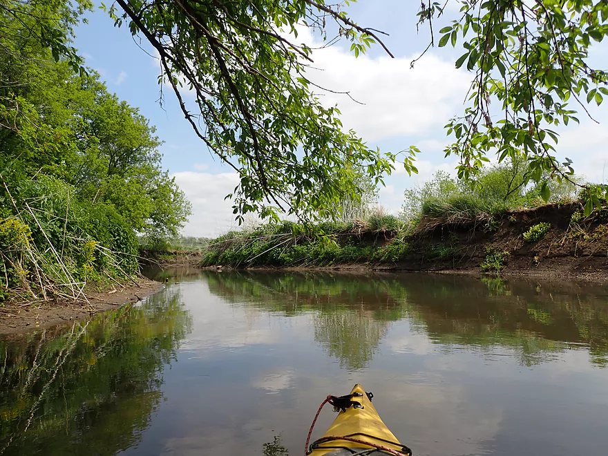
Lot of low branches…gives the river a cool vibe
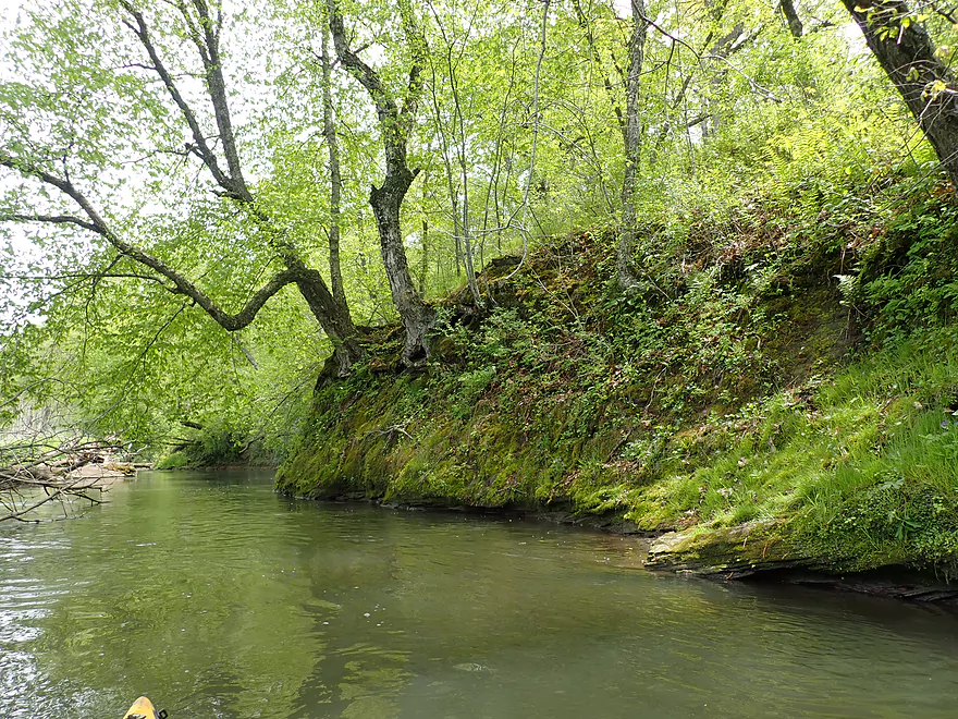
Still a few more outcrops
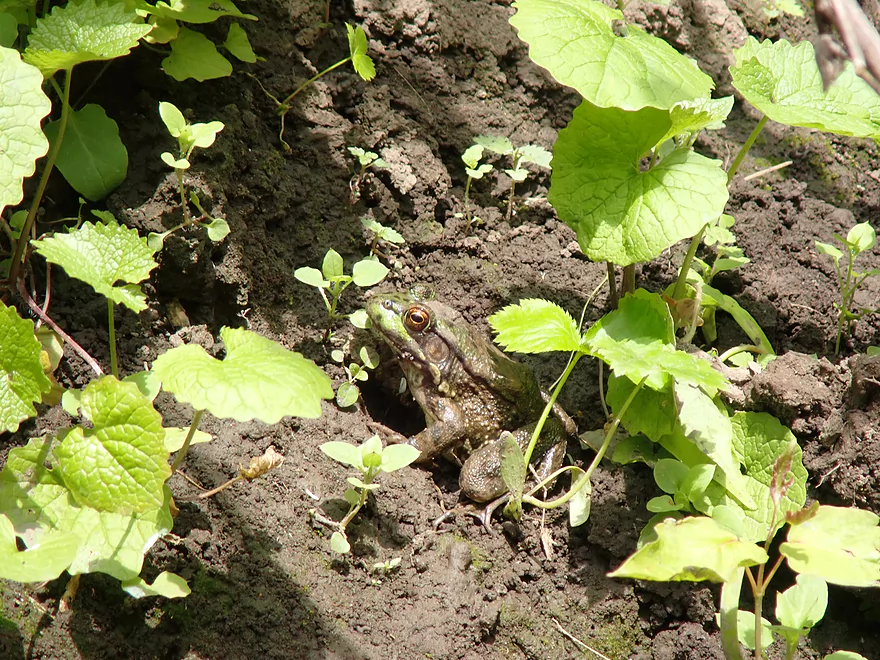
He hopped directly into my boat just after I took this picture
Mostly a slow river, but there were a few minor riffles
Another little riffle
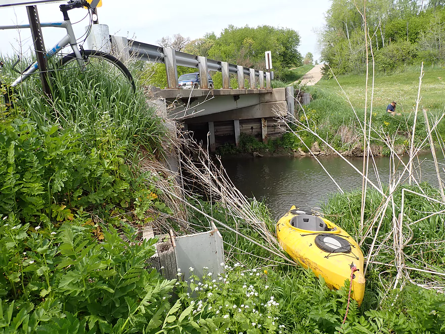
Taking out at Powell Rd where my bike awaits
Pecatonica River – Jones Branch Rd to Powell Rd

The Pecatonica River is a big watershed in southwest Wisconsin that has many viable legs for kayaking. My favorite parts are those upstream of the Mineral Point/Main Branch confluence. Here the river is narrower, faster, more rugged, and has more outcrops. Eventually I want to explore all of the Upper Pecatonica from Mifflin to Hwy 151. To this end, I planned a trip upstream of Powell Rd which seemed intriguing from map analysis but I didn’t know much more and hoped logjams wouldn’t be an issue.
The put-in area by Jones Branch Road was really nice. Here there was a public pull-off and a fishing pier that towered over the river. This access was donated to the public to help handicapped fishermen, which was a thoughtful gesture. Although I suspect most locals use it as a diving platform despite the river’s suspect cleanliness. A narrow, steep trail led to the water which was a bit tricky, but was doable for launching.
Just downstream from the fishing pier were two sets of rapids both of which I rated as easy Class 1’s. These might have to be waded at when the river is lower.
The first mile of the trip was sandwiched between two large cornfields and steep mud banks. Separating the corn from the river was a thin line of trees. This doesn’t sound super appealing, but I actually found it pleasant and relaxing. What wasn’t relaxing was a serious logjam I encountered a mile into my trip. This required a portage on top of a steep mud bank (and ultimately along a corn field). Re-entry was a bit of a problem because of “mud cliffs” along the shore, but I made do. Thankfully this was the only portage of the trip.
The second mile was the best part of the trip. Here the river flowed by a north-facing bluff that had several scenic sandstone outcrops including one almost 1500′ long. While the outcrops were never super high, they were still very cool. Often they were topped with ferns and white pines (which you don’t typically see in this part of the state). The river also became more densely wooded and there were several thick, overarching tree canopies that squirrels could cross without getting their feet wet.
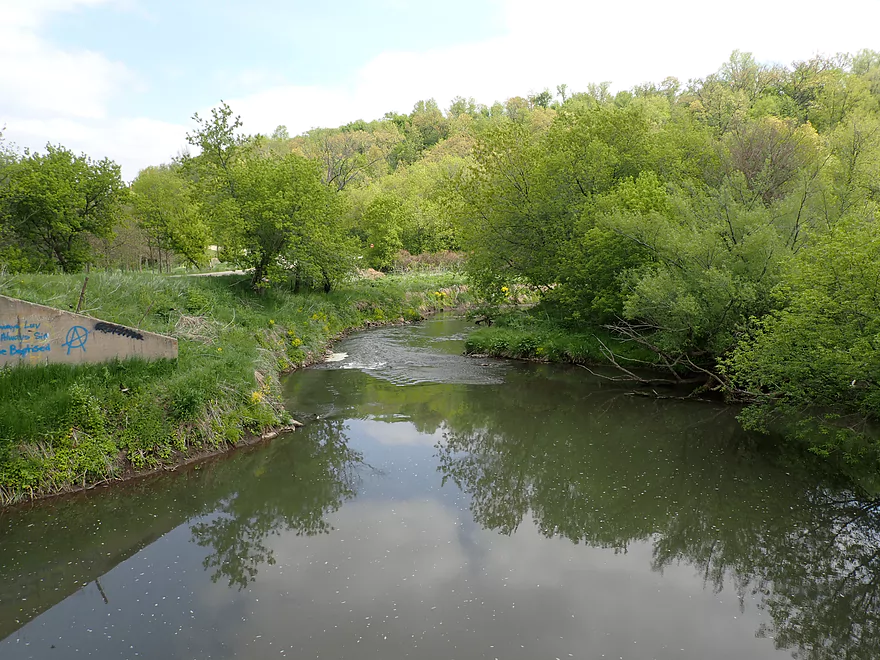
The third and final mile arced away from the bluff and back through open farm fields. This leg wasn’t as interesting, but still wasn’t bad. I took out at Powell Road which happened to be the put-in for a downstream trip I did two years ago.
In summary while this trip wasn’t very long or super spectacular, it was still surprisingly nice. Few paddlers explore this part of the river or even know about it, but those willing to brave one significant logjam can have a nice time. That being said, this is more of a trip for locals looking for a new adventure. Upper Pecatonica newbies should instead start with either Hwy G to Mifflin or Mifflin to Hwy A, both of which are more scenic.
Sights included a raccoon, a few large snappers, a great blue heron, many cliff swallows, and a muskrat with a big wad of leaves in its mouth. The highlight (or lowlight) was a frog that jumped into my boat as I tried to get close for a photo. I tried to evict him, but he was deep in the bow and I gave up. So he stayed there until I took out (which was about a mile later).
Jones Branch Rd: There is a nice pull-off and public fishing pier by the bridge. The only downside was that the path leading to the water was a bit steep and narrow.
Alt Put-ins:
- Hwy J (2.4 miles upstream of Jones Branch Rd): J would be a bit rough but likely doable as an access. This leg would add maybe 3 logjams but also 2-3 scenic outcrops.
Powell Rd: This was a doable bridge take-out with suitable shoulder parking, but the banks were a little steep and overgrown. The best access is along the northeast corner.
Alt Take-outs:
- Oak Park Rd (8.2 miles downstream from Powell Rd). This is a nice leg that I did two years ago, but it would be a long add-on and does have a few fence issues.
Powell Rd to Jones Branch Rd: 1.6 miles with 79′ of ascent. This was a super easy bike shuttle…heck at just 1.6 miles you could just hike it (no bike).
Current: Outside of a few riffles this was fairly slow and steady.
Rapids: There were two noteworthy rapids (Class 1) both just downstream from the Jones Branch Rd put-in. Both were pretty easy. For the rest of the trip there were a few more minor riffles, but nothing really significant.
Logjams: There was one serious logjam (actually a pair side-by side) that required a portage (see map for location). The portage was easy to start, but re-entering the water was a trick because the banks were steep and muddy. Outside of that and two minor hoppers there were no other logjams.
Fences: No problems here.
There is a gauge on the Pecatonica River, but it is about 17 miles downstream at Darlington and past the Mineral Point Branch confluence. For reference I did this trip at 200 CFS or 3.08′.
- < 150 CFS: That’s pretty shallow…but I think this leg would still be navigable outside a few spots that would have to be waded.
- 151-300 CFS: A nice target range.
- 301-500 CFS: On the high side with maybe a few pushy spots and muddy water, but should be doable.
- 501-700 CFS: A very high depth only suitable for experienced paddlers.
- 701+ CFS: Maybe too high for enjoyable paddling.
Detailed Overview
- Upstream of Hwy X: I think the river up here is too shallow to run.
- Hwy X to Hwy G1st: 4.2 miles. This section is a small creek and may need high water. Some logjams and probably small outcrops. Hwy X is not a great access and lacks privacy.
- Hwy G1st to Hwy E: 3.4 miles.
- Hwy G1st to Hwy G2nd/Mifflin: 2.9 miles. Great section with many rock outcrops and light rapids. Shallow, but becomes much deeper after the Livingston Branch joins up. Two fences, but easy to get past.
- Hwy G2nd/Mifflin to Hwy E: 0.5 miles. Short, open section heavily grazed by nearby beef cattle. Some fun rapids and outcrops are on this segment. One fence to duck under (quite manageable).
- Hwy G2nd/Mifflin to Hwy A: 4.4 miles. An excellent prospect with good current, outcrops, a state natural area, and few logjams. Martin (reader comment) kayaked this section and wrote a nice summary here that you can read.
- Hwy A to Peniel Road/Hwy J: 1.7 miles. Maybe two outcrops and two major logjams.
- Peniel Road/Hwy J to Jones Branch Road: 2.5 miles. Some congested woods with maybe 3 logjams and 2-3 outcrops.
- Jones Branch Road to Powell Road: 3.1 miles. A nice peaceful stretch with a few outcrops, 2 sets of light rapids, and one serious logjam.
- Powell Road to Oak Park Road: 8.0 miles. A very open section with no logjams. Highlights include green rolling hills, oak savannas, a few rapids, and one outcrop. Lowlights include four low fences.
- Powell Road to Hwy 151/Blackstone Cattle: 4.4 miles. The more scenic of the two sections with scenic hills and one outcrop. There are two low electric fences to duck under.
- Hwy 151 to Oak Park Road: 3.6 miles. This section had more corn and trees and wasn’t as interesting, but still was decent. There is one low electric fence and one super low barbed wire fence.
- Oak Park Road to Hwy O: 3.7 miles. Likely some logjams but also some outcrops at the end. Oak Park Road is a muddy but doable put-in.
- Hwy O to Hwy G: 6.0 miles. Some scenic moments, but mud and logjams are detractions. Put-in and take-out are muddy.
- Hwy G to Darlington/Black Bridge Park: 8.5 miles. A decent prospect. As of 2020, there is a large logjam on this leg that requires a difficult portage up steep and muddy banks. This might be cleared out for the 2021 Darlington Canoe Festival.
- Darlington/Black Bridge Park to Roller Coaster Road: 4.9 miles.
- Black Bridge Park to Wells Street Access: 0.7 miles. A great stretch though the town of Darlington. The highlight is a section of Class 1 rapids where the old mill dam used to be.
- Wells Street Access to Roller Coast Road: 4.2 miles. A decent stretch, but no outcrops, the banks are steep/muddy and there are two partial logjams to circumnavigate around. Not bad...not great.
- Roller Coaster Road to Walnut Road: 7.3 miles. While one of the nicer legs on the lower Pecatonica, the river has been too badly damaged by erosion to be an elite paddle. The highlight is a sandstone outcrop.
- Walnut Road to Riverside Road: 5.5 miles. Mediocre prospect flanked by a lot of farmland. Excellent put-in and take-out.
- Riverside Road to Hwy 78 Canoe Landing: 3.2 miles. Likely an uninteresting leg with lots of farmland and large mud banks. I doubt there are many bluffs. There may be one major logjam.
- Hwy 78 Landing to Gratiot Conservation Club Landing: 5.8 miles. A mediocre stretch. Much of this is wide, slow, and straight...but there are a few nice wooded bluffs.
- Gratiot Conservation Club Landing to Sargent Road: 4.7 miles. Maybe a weaker section.
- Sargent Road to Hwy D/N: 4.6 miles. Flows partly through a SNA and by a valley ridge so might be interesting.
- Hwy D/N to Hwy 11 Boat Ramp/Browntown: 8.8 miles. The East Branch comes in and doubles the river (now pretty big).
- Browntown to Brewster's Landing: 12.2 miles.
- Hwy 11 Boat Ramp/Browntown to Hwy B: 4.8 miles. Generic stretch with farm fields and a thin layer of trees. Take-out might be tricky because of a guardrail but I think it’s doable.
- Hwy B to Hwy M: 4.6 miles. A good leg with scenic bluffs and outcrops. Put-in is meh…take-out might be bad.
- Hwy M to Brewster's Landing: 2.9 miles. Mediocre stretch that crosses into Illinois.
- Brewsters Landing to McConnell Bobtown Landing: 7.2 miles. Mostly straight and boring. But there is a wooded section with bluffs that might be nice. Could be an outcrop or two.
- McConnell Bobtown Landing to McNeil's Damascus Landing: 8.5 miles. River flows through a more rugged and varied part of Stephenson County. Still some boring parts, but also some nice bluffs and limestone outcrops.
- McNeil's Damascus Landing to Wes Block Trailhead: 8.3 miles. Mostly a straight and muddy paddle. But there should be a few nice bluffs on the west bank.
- Wes Block Trailhead to Tutty's Crossing: 6.4 miles. River enters Freeport (IL). This should be a pleasant stretch with fewer farm fields, nicer woods, and a few attractive trail bridges.
- Tutty's Crossing to Hancock Ave Boat Ramp: 0.7 miles. Wooded urban stretch.
- Hancock Ave Boat Ramp to Junior's Place/VFW: 2.3 miles. River leaves Freeport. This is likely a mediocre stretch.
- Junior's Place/VFW to Ridott Fishing Park: 14.8 miles. A very long stretch that I'm not sure would be that interesting. There are rapids by the Brown's Mill Dam that may have to be portaged.
- Ridott Fishing Park to Attens Landing: 6.7 miles. I don't know much about this stretch. It meanders more and has thicker woods so may be nicer.
- Attens Landing to Winnebago County Fairgrounds Ramp: 7.5 miles. Much of this flows through the Pecatonica Wetlands Forest Preserve.
- Winnebago County Fairgrounds Ramp to Sumner Park: 0.4 miles. There are tricky rapids where a dam was mostly removed. Depending on water levels, you may have to portage this.
- Sumner Park to Pecatonica River Forest Preserve Ramp: 6.0 miles. A north flowing leg of the river that is mostly undeveloped and contains some floodplain forests.
- Pecatonica River Forest Preserve Ramp to Trask Bridge Ramp: 7.0 miles. This is a relatively good prospect with large clay banks and a few nice woods.
- Trask Bridge Ramp to Two Rivers Ramp: 12.6 miles. Paddling author Mike Svob seemed to like this leg. Here the river meanders and twists more. The woods are also more impressive. Much of this is still likely wide, slow, and boring though. The take-out is close to the mouth of the Sugar River.
- Two Rivers Ramp to Boat Launch Mactown: 9.8 miles. The last leg of the Pecatonica before it empties into the Rock River. Significantly enlarged by the Sugar River, I suspect this is a big and boring leg.
Trip Map
Overview Map
Video
Photos Size: