
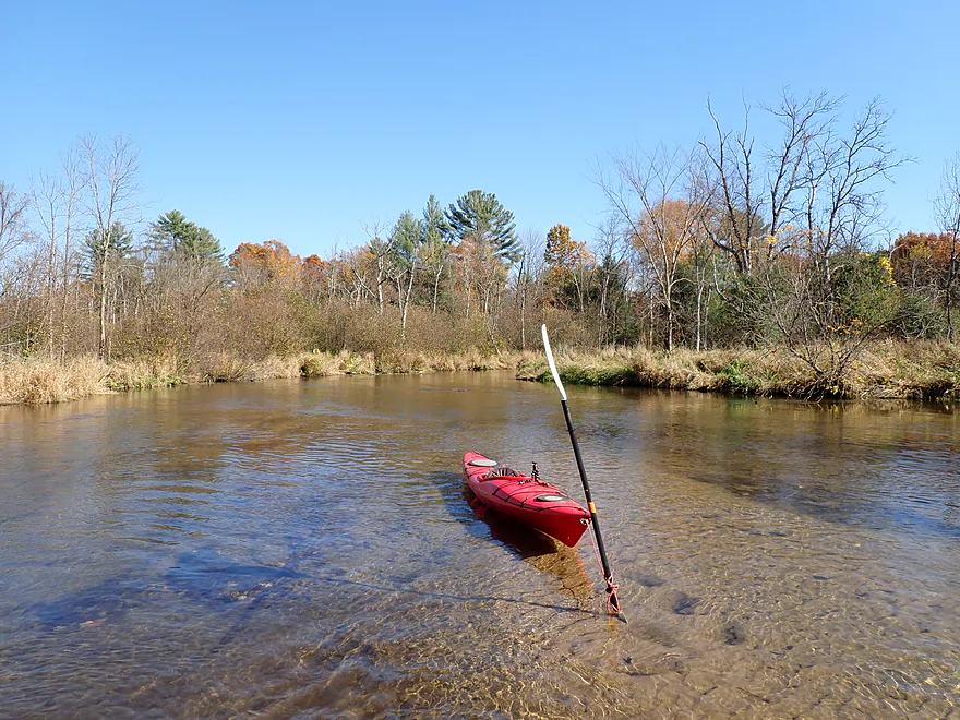
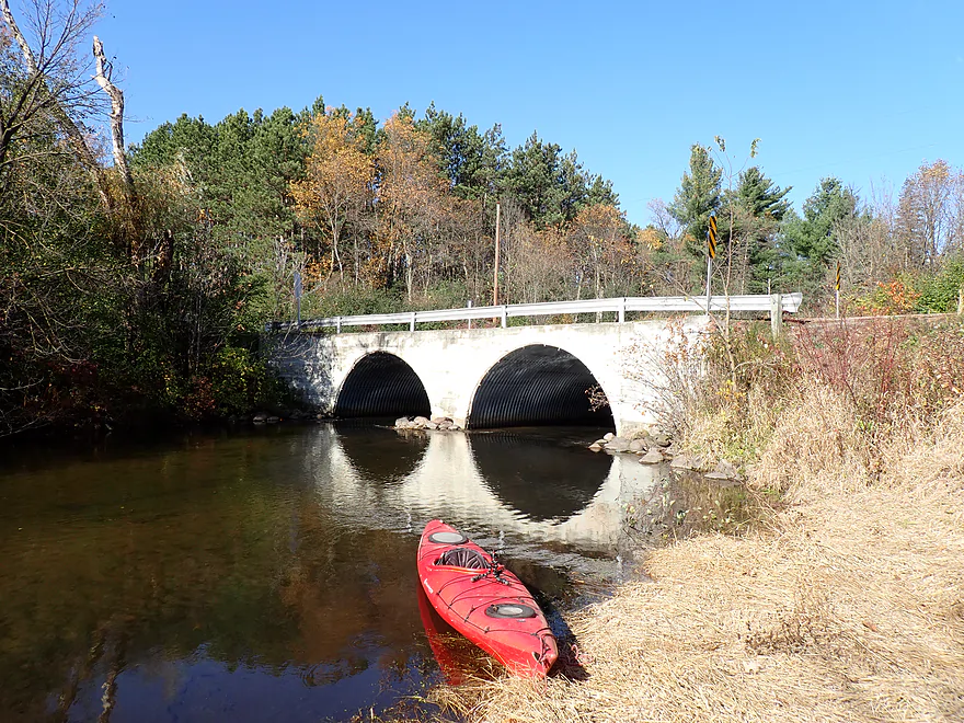
Starting the trip at Stedman Park (Cty DD bridge)
Rocky but doable launch bank
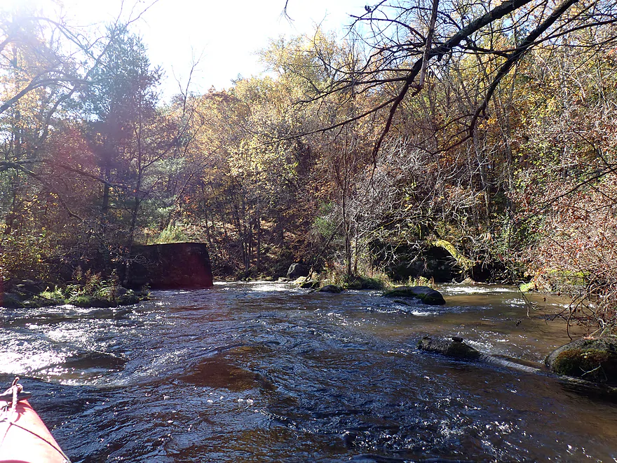
Approaching what looks like an old bridge
Class 2 rapids…reverse view
Terrific downstream scenery
Another pitch of rapids
Reverse view
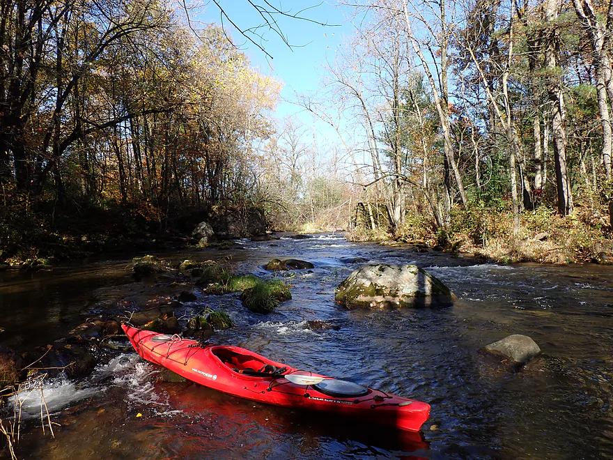
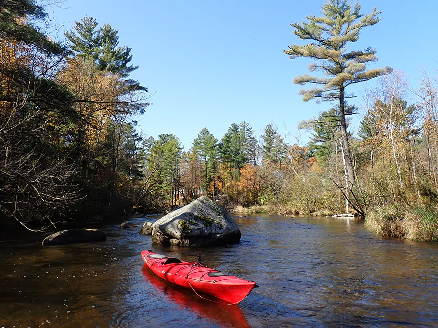
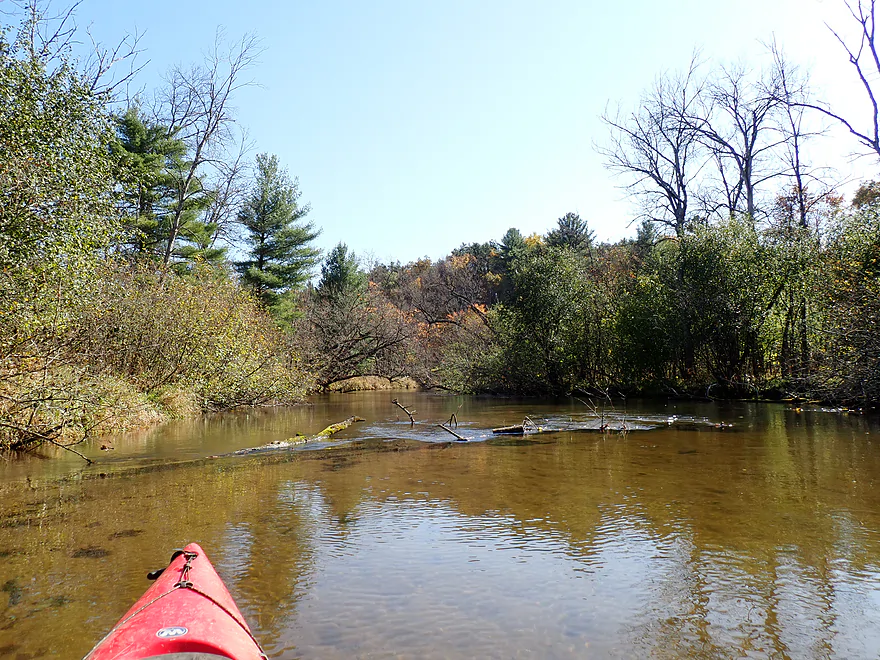
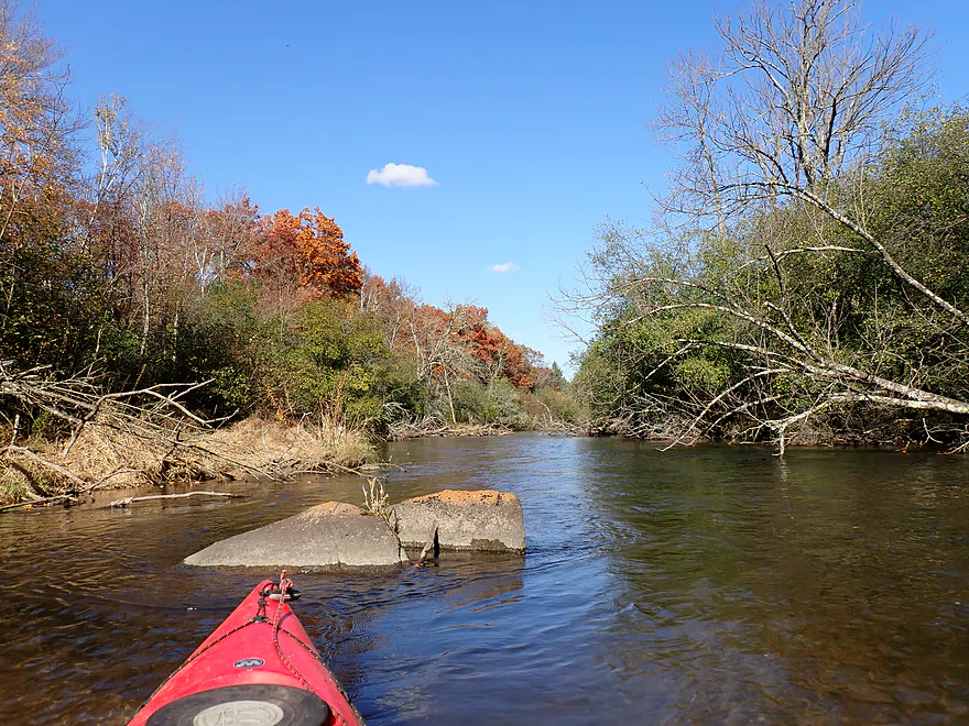
Large boulder field
Reverse view
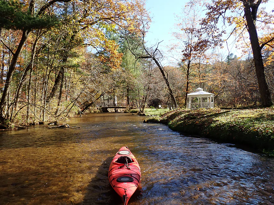
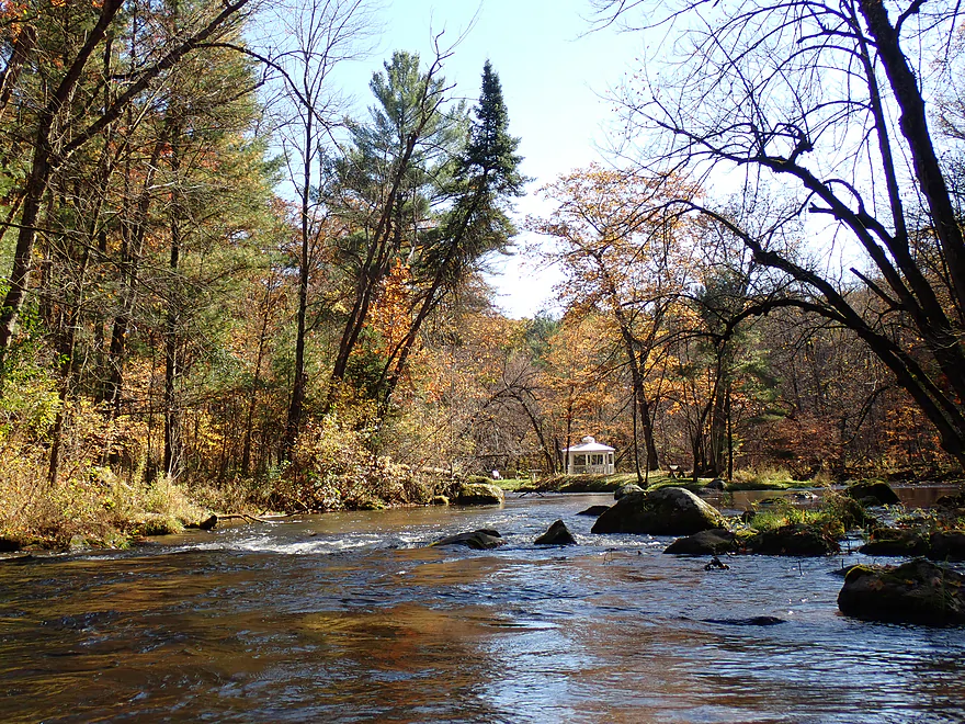
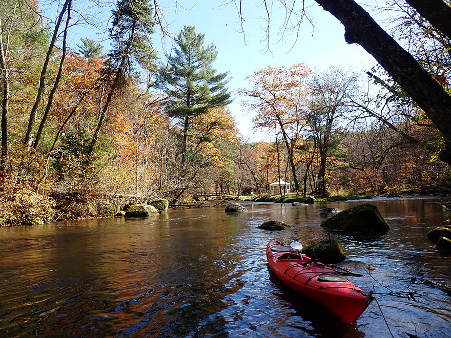
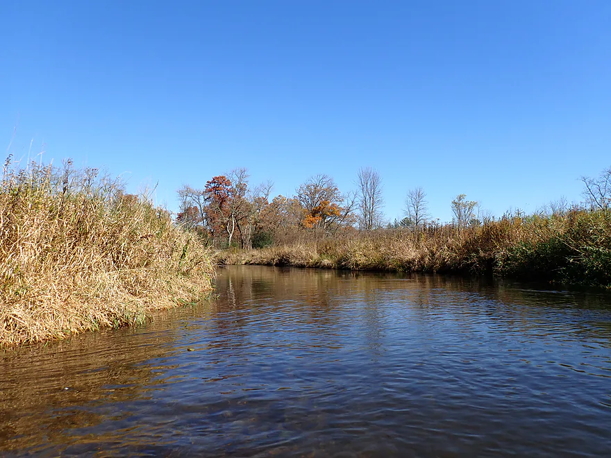
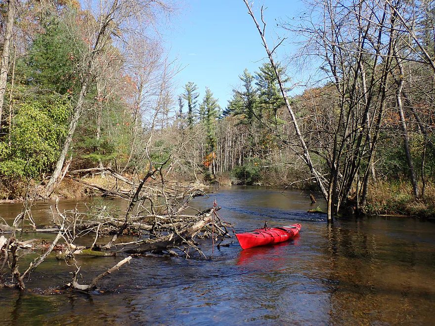
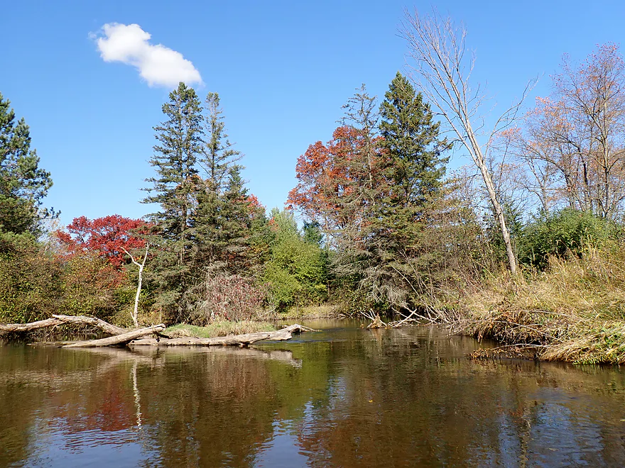
River wraps around an island with a gazebo…I took the left channel
Attractive red-hued substrate
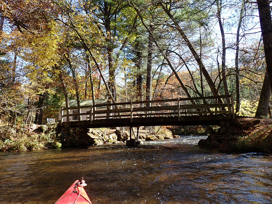
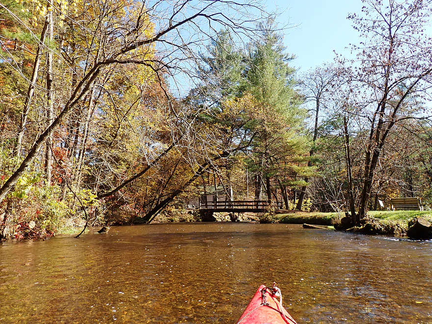
A walk bridge connects to the island
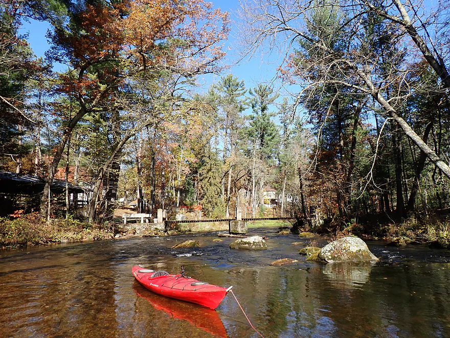
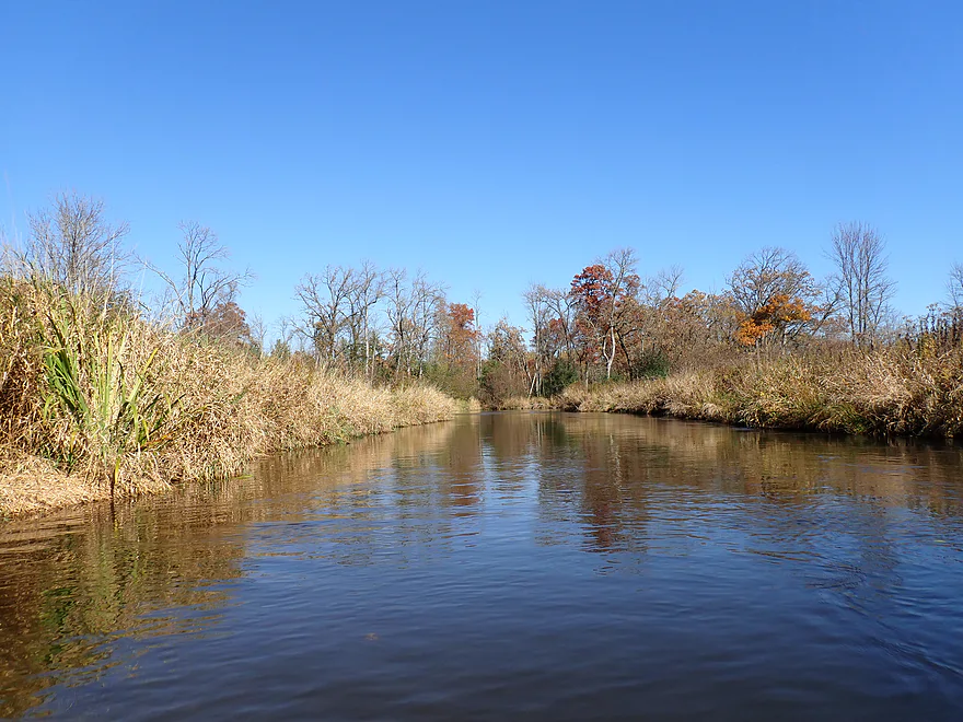
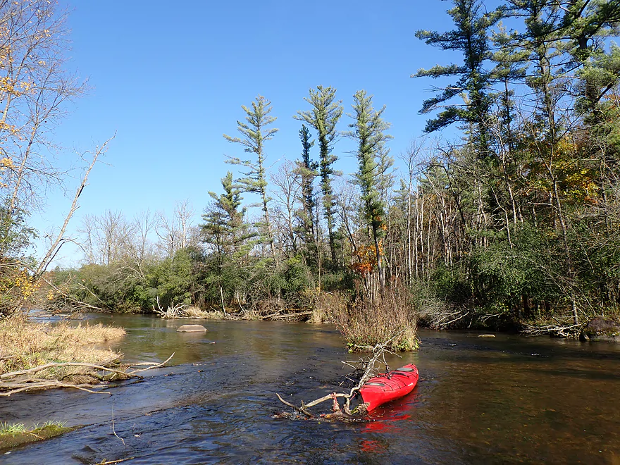
Favorite scene
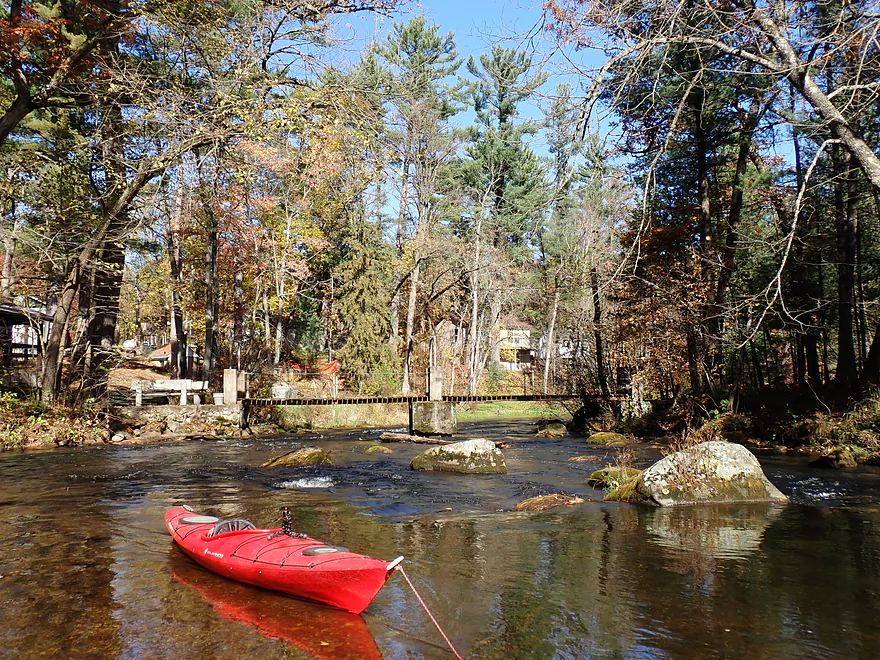
Deserving of a second picture
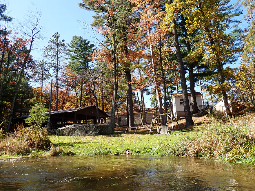
This is all part of a local Christian camp
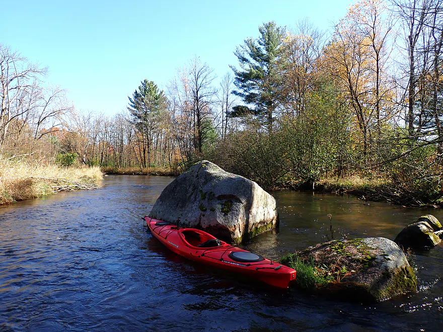
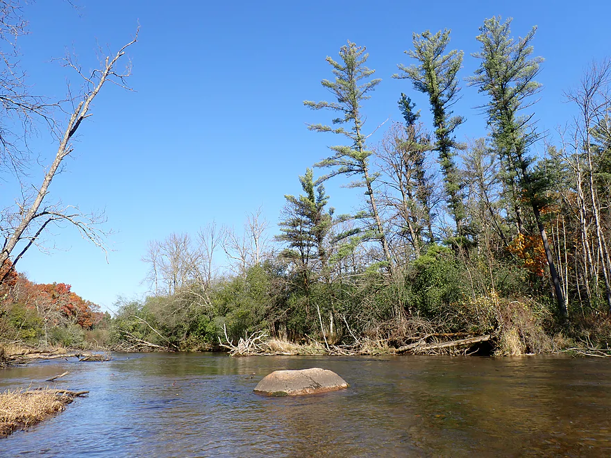
Largest boulder of the trip
Reverse view
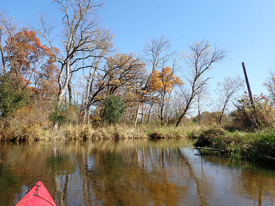
A lot of trees were past peak
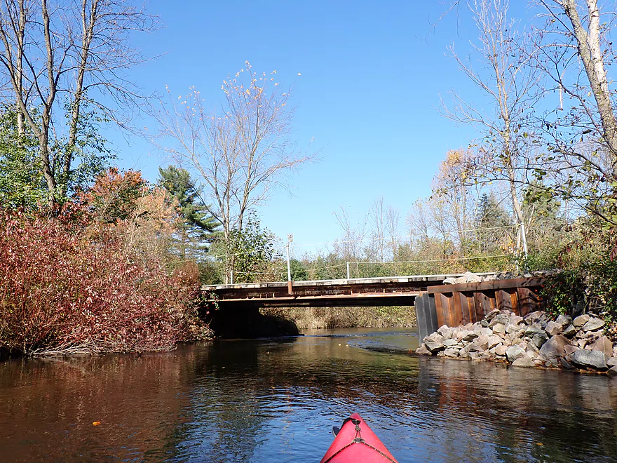
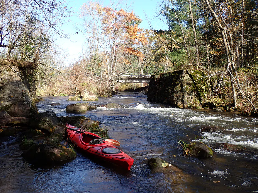
Local bridge
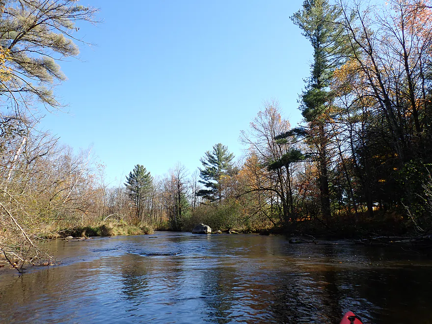
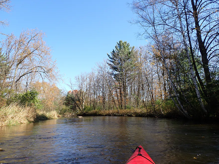
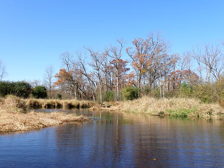
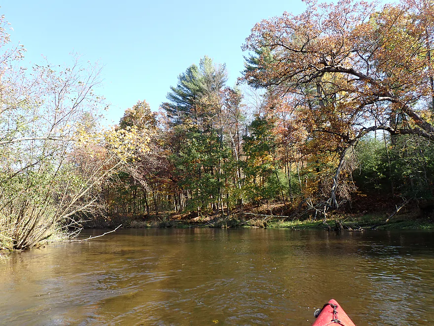
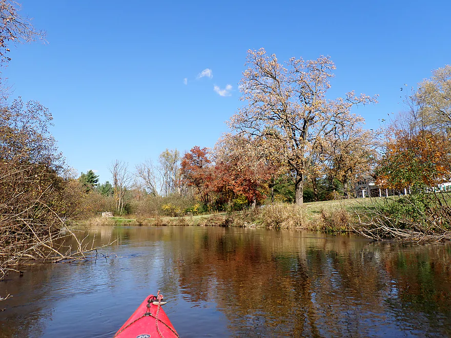
River now opens up and flattens out
Reminded me of the Mecan River
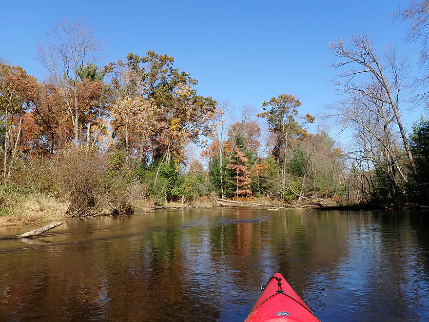
Getting out for pictures
There has been great cleanup work done on the river
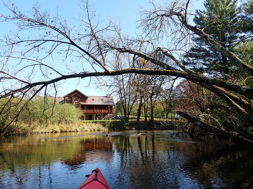
Not too many houses, but a few
Middle stretch was more sandy and not as rocky
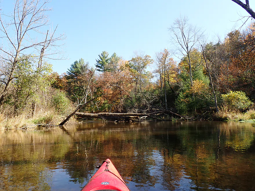
Always a way through (or under in this case)
At times good fall color
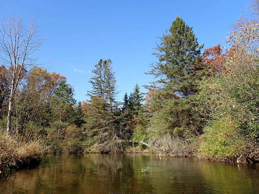
Attractive stretch of white pines
This felt like an up-north river
Not as many boulders in the second half of the trip, but a few
Last house of the trip
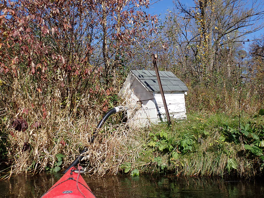
Cool little pumphouse
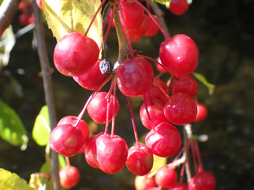
Highbush cranberries–not really cranberries, but I think they are edible.
Taking out at Durant Road
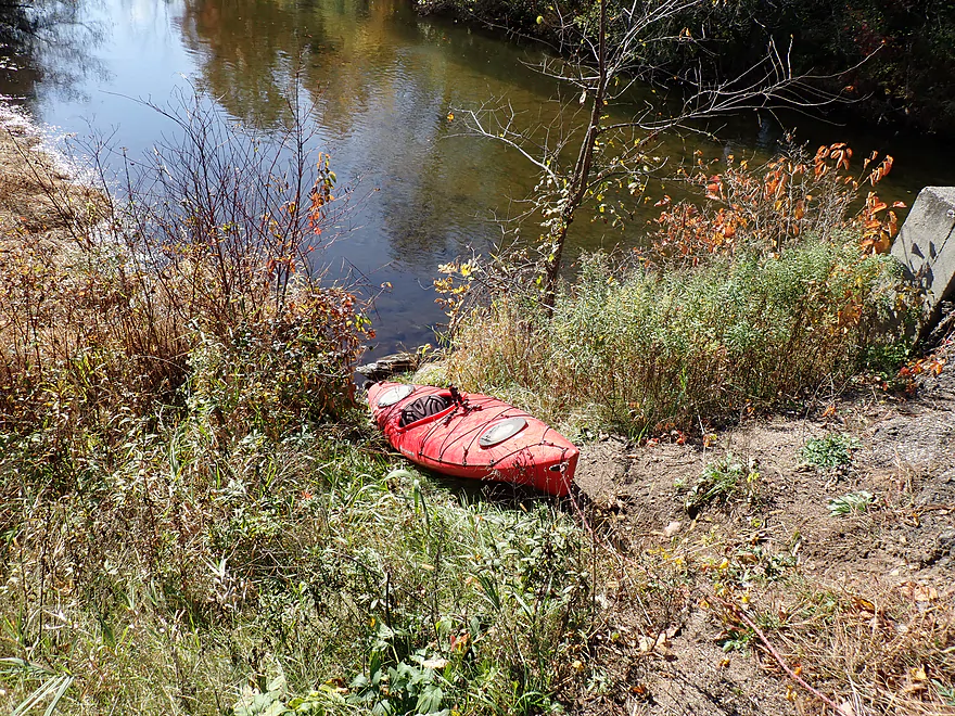
Steep but doable access
Waupaca River – Stedman Park


The Waupaca is one of the great classic paddling rivers of East Central Wisconsin. Anybody serious about kayaking and who lives within a two hour radius should put it on their paddling todo list. I’ve kayaked it 4-5* times before (*Tomorrow River reference), but there are still many sections left that need to be explored. This week, not being in the mood for a long trip and hoping for some fall color, I settled on a short 3.6-mile stretch starting at Stedman Park.
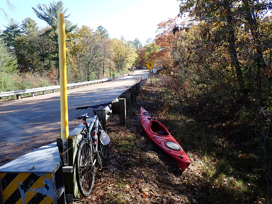
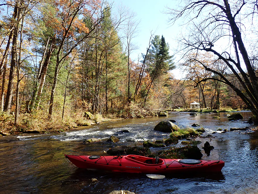
When I arrived at Stedman, I faced a dilemma. The main park was a small but nice wayside with an attractive view of the river…but the launch area was BELOW the Class 2 rapids which I had hoped to run. So instead I backtracked out of the park and left my car on the nearby shoulder of the Cty DD bridge. I then dragged my boat 250′ south of the guardrail and down an embankment of rocks which allowed me to get upstream of the rapids (sounds more difficult than it was).
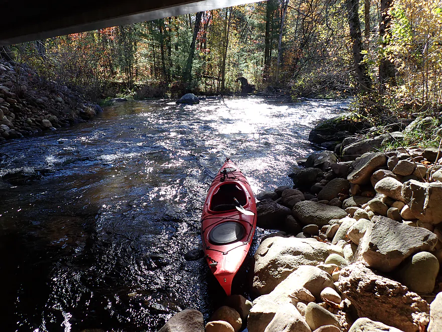
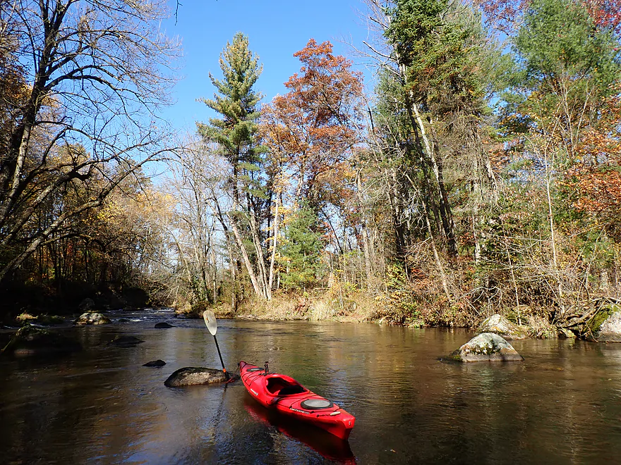
I didn’t have much time to fix my camera and seat as the surprisingly strong current pushed me out into the channel and over the rapids, which included a Class 2 ledge. I suspect there might have been an old bridge or dam there at one time…at any rate it was pretty fun, but I did get some water splashed into the cockpit (why you don’t want to do a trip like this when it’s cold out).
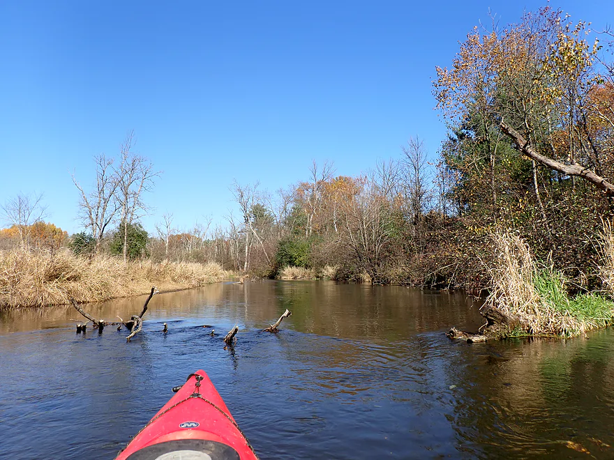
The first 1000′ of the trip was outstanding and the highlight of the day. Here the river twisted through boulder gardens, rapids, and clear water…while back-dropped by fantastic white pines, glacial hills, and some good fall color. Leaves would flutter down over the river like snow…really cool.
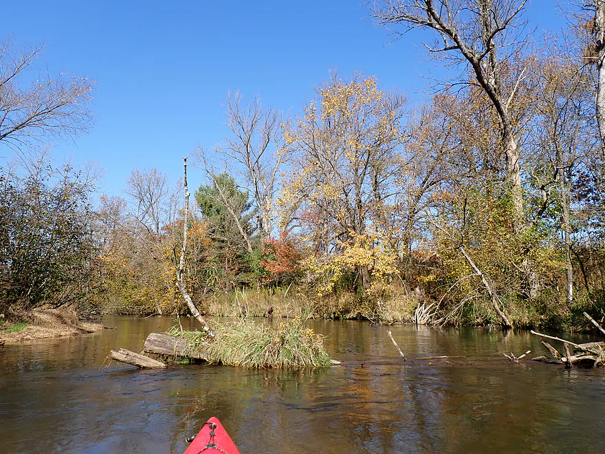
East of Stedman Park there was a large Christian camp (Riverside Bible Conference). The complex included a short trail system and two bridges that connected to an attractive island with a gazebo. The scenery here was stunning and calendar-worthy.
Following the Christian camp, the river changed and downshifted somewhat. Boulders, rapids, and hills would become much more scarce for the rest of the trip (but not non-existent). Geologically the river was transitioning away from the earlier glacial moraines and into a flatter and more open stretch (reminiscent of the Mecan River).
It was still attractive, with great clarity, occasional oak savannas, nice pines, and some decent fall color– despite being maybe a week past peak. Fall color paddling tip: try to choose rivers with the most hills. Sugar maples (the main fall color tree) tend to grow in more upland areas and not in the flat bottomlands.
One of my concerns for the trip was logjams, as I knew storms had done a number on the area and there were rumors of deadfall issues…but thankfully locals did a great job cleaning up the river, leaving only a few minor scoochers or two to deal with.
For the final half mile, a glacial moraine bounced the river northeast. Here the landscape changed again with the addition of some terrific pine stands. This was the second best (and second most photogenic) part of the trip.
I rounded a corner and was surprised to encounter Durant Road (my take-out) sooner than expected. It turns out I messed up somewhat…I knew I had to get out at the bridge before Cobbtown Road, but I forgot this road connects with the river twice. I should have left my car at the next bridge…oh well.
In summary, this was a very enjoyable (but short) trip. The fall color was still nice and the scenery by Stedman Park was spectacular. That being said, I wouldn’t rate this as the top leg on the Waupaca River…there are several stretches I would rank higher (such as between Amherst and Buchholz Road).
I didn’t see much (typical for fall). Just a few deer, ducks, and cranes.
Ice Age Trail – Waupaca Segment: The Ice Age Trail is a well-known path that follows the edge of Wisconsin’s last glacier. Part of the trail parallels the Waupaca River with a trailhead nearby. This should be a pleasant walk with rolling glacial hills, but few (not really that many) views of the actual Waupaca River.
Stedman Park: This features a small wayside and turnaround area where you can park. The bank is a bit steep and rocky, but it shouldn’t be overly difficult to drag your boat over the boulders and launch at the base of the rapids.
Note, if you prefer to run the rapids (as I did), you’ll need to launch instead from the Cty DD bridge just upstream from the park. A long guardrail blocks direct access to the water, so you’ll have to park at the far west end and drag your boat 250′ east and then down a steep bank of boulders (sounds more difficult than it was). From here you can then enjoy the main rapids.
Alternate Put-ins:
- Cty T (3.7 miles upstream from Stedman Park): Parking is a bit tight, but this should be a doable bridge access. The section below T is pleasant…but the only special stretch is the boulder field just upstream from Stedman Park.
- Otto Road (4.6 miles upstream from Stedman Park): This is a good access option. The leg between Otto Road and T is great with attractive boulder fields.
- Buchholz Road (6.1 miles upstream from Stedman Park). Another good put-in option. The leg between Buchholz and Otto is fantastic, with one of the best boulder fields I’ve ever paddled through.
Durant Road: This is an ok bridge access. But the shore is a bit steep…if you’re not athletic, pulling up your boat might be a bit tricky (rope helps). The bank is rocky and firm but there are mucky spots in the area…mind your step.
Alternate Take-outs:
- Cobbtown Road Landing (1.4 miles downstream from Durant): This is a much better access than Durant. Between Durant and Cobbtown there might be a portage or two, but this should be a pleasant stretch.
- Frost Valley Road Access (3.1 miles downstream from Durant): An ok stretch…but maybe four logjams.
- Cty Q Canoe Landing (5.1 miles downstream from Durant): Likely a challenging stretch with maybe 6-8 logjams (plus those above Frost Valley Road).
Bike Shuttle – Durant Road to Stedman Park: 1.2 miles with 26′ of ascent. This is a super easy bike shuttle…but reflects an abnormally short river trip. Shuttling longer distances (such as to T or from Cobbtown Road) though wouldn’t be difficult.
Logjams/Strainers: There are a few downed trees, but the locals have done a good job of opening up holes so you can pass through. I never had to portage and only had to scooch a few times.
Rapids/Current: The first 1000′ features multiple Class 1 rapids and one Class 2. I thought these were pretty easy. After that the river slows down…there are a few more light riffles, but nothing super noteworthy.
Gauge: Waupaca River @ Waupaca
Trip Depth: 1.63′
Navigability Estimates: Note, the USGS stopped reporting historical CFS info for the Waupaca River. NOAA still offers updates (the gauge is fine) but only depth levels with no CFS or long range history. So calculating these estimates is more of an art than a science.
- <= 1.4′: Pretty shallow depth that likely requires wading a few spots.
- 1.5′: Typical late fall depth…on the low end but should be fine for paddling.
- 1.6′: A bit higher than normal, but this should add good padding to the early rapids and make them more enjoyable.
- 1.7′: A high depth with somewhat turbid water…clarity will not be that good.
- 1.8-1.9′: Very high depth and IMO the river will lose some of its magic.
- 2.0-2.2′: Extremely high depth and some of the leaning trees and branches could create difficult strainers.
- 2.3’+: Maybe too high for enjoyable paddling.
Detailed Overview
- Clementson Road to Hwy Q: 0.9 miles. Possible prospect, but the river is very small here.
- Hwy Q/Rolling Hills Road to Hwy 161: 1.2 miles. A good prospect.
- Hwy 161 to Amherst Dam: 5.4 miles. More of an oversized creek than a river, the Tomorrow River is still a nice paddle known for its clear water.

- Hwy 161 to 1st Street: 1.3 miles. Great trip.
- 1st Street to the Amherst Dam: 4.1 miles. Great put-in and trip.
- Hwy 161 to 1st Street:
- Amherst Dam to Buchholz Road: 5.7 miles. This section was great fun because of its many rapids, clear water, narrow channel, boulder gardens and wooded banks.
- Amherst Dam to Hwy A: 1.7 miles. Great segment through Amherst.
- Hwy A to Keener Road: 0.6 miles. A short but good section with a nice boulder garden.
- Keener Road to Buchholz Road: 3.4 miles. Aside from some Class 2 rapids at Keener Road and a few boulders, this is a more open and less interesting section.
- Amherst Dam to Hwy A:
- Buchholz Road to Stedman Park: 6.1 miles. A fantastic paddle that was narrow, fast, rocky, and scenic.
- Buchholz Road to Otto Road: 1.5 miles. Great stretch with some huge boulder gardens.
- Otto Road to Hwy T: 0.9 miles. Another great section with some boulder gardens and light rapids.
- Hwy T to Stedman Park: 3.7 miles. Good stretch with some great rapids and boulder gardens at the end.
- Buchholz Road to Otto Road:
- Stedman Park to Durant Road: 2.1 miles. A really nice leg. Starts with some terrific boulder gardens, rapids and pine stands by Stedman Park. River then flattens out for the middle portion and becomes a bit less interesting. The final leg features some terrific pine stands.
- Durant Road to Cobbtown Road: 1.4 miles. A nice section, but not as good as upstream parts with less boulder gardens and rapids. Maybe one logjam.
- Cobbtown Road to Frost Valley Road Access: 1.7 miles. Starts nice with fun rapids and a decent boulder garden. But satellite images suggests 3-5 logjams that might require portaging.
- Frost Valley Road Access to County Q Canoe Landing: 2.0 miles. Satellite images suggest a number of logjams (maybe 8). I would wait for this stretch to get cleared out before attempting.
- Hwy Q Launch to Brainard's Bridge Park: 7.8 miles. A great trip that is very popular with paddlers.
- Brainard's Park to Elm Street Dam: 0.8 miles. Half of this is a nice river paddle, half a boring flowage. There is a portage path around the dam.
- Elm Street Dam to Kiwanis Park: 3.3 miles. Great prospect, but perhaps a logjam or two. The Mill Street dam is VERY dangerous and preceded by Class 2 rapids. This is also a difficult portage. Scout before committing to a trip.
- Kiwanis Park to Harrington Road: 7.7 miles. A good prospect.
- Harrington Road to Weyauwega Dam: 4.4 miles. Maybe 3 miles is open flowage paddling.
- Weyauwega Dam to Decker Memorial Park (and the Wolf River): 6.2 miles. A mediocre prospect.
Trip Map
Overview Map
Video
Photos Size: