
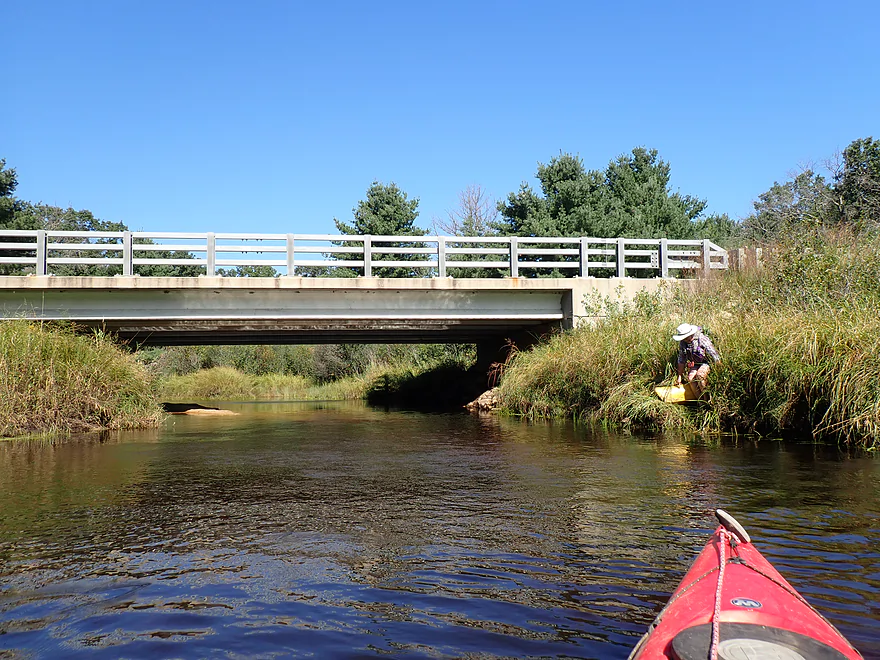
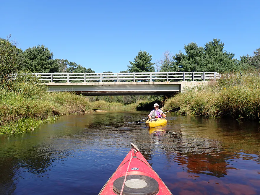
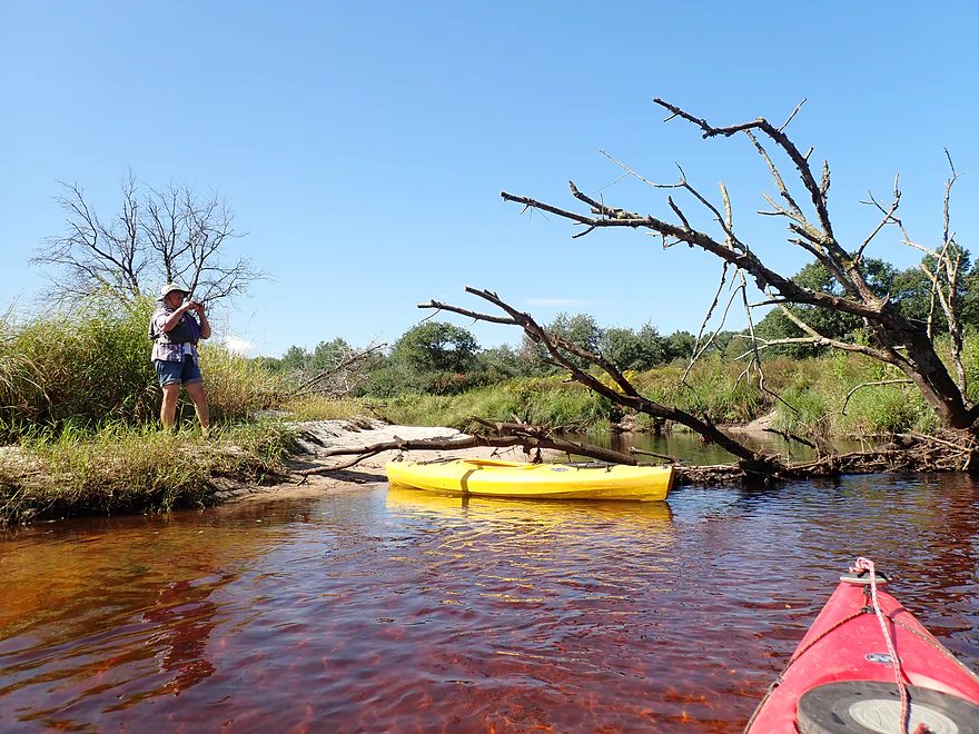
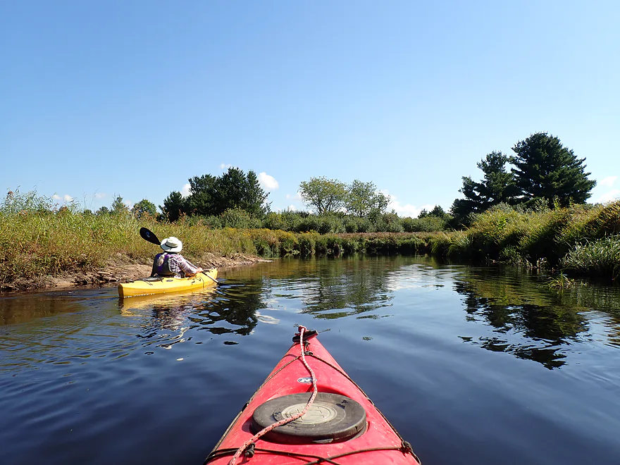
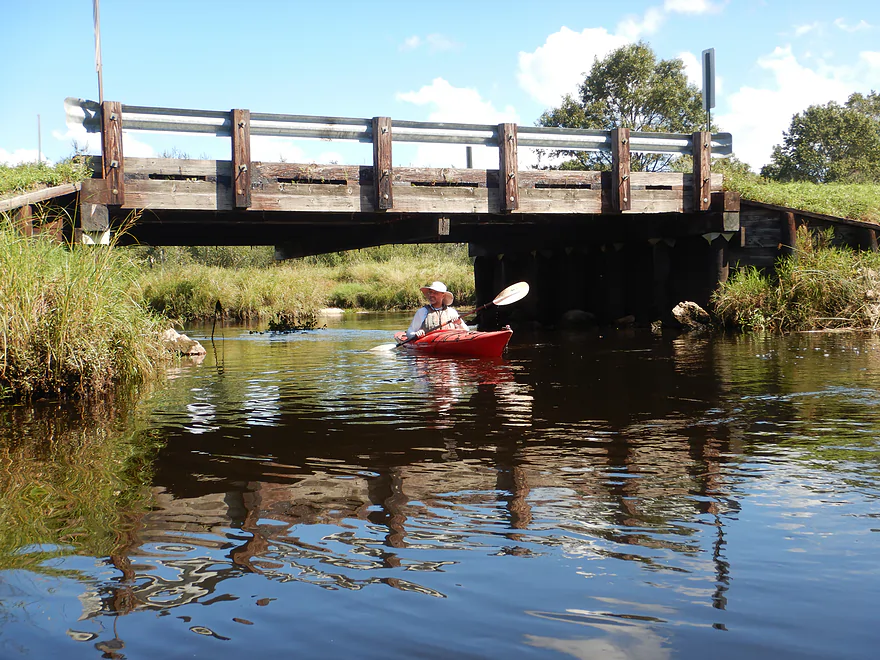
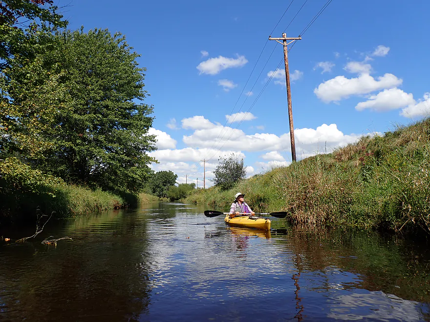
Starting the trip at Hwy 173
Picture from five years ago
Much weedier now, but still an ok access
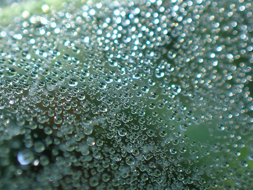
Dew drops on the web of a grass spider
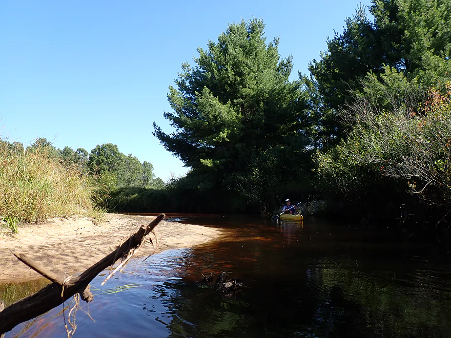
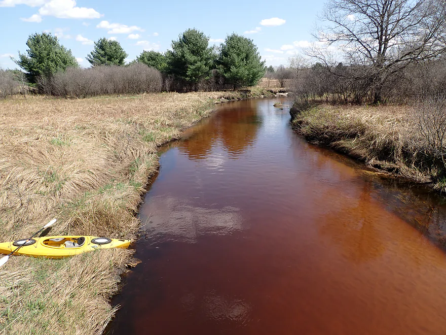
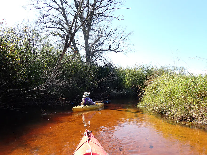
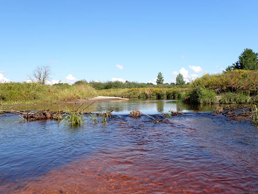
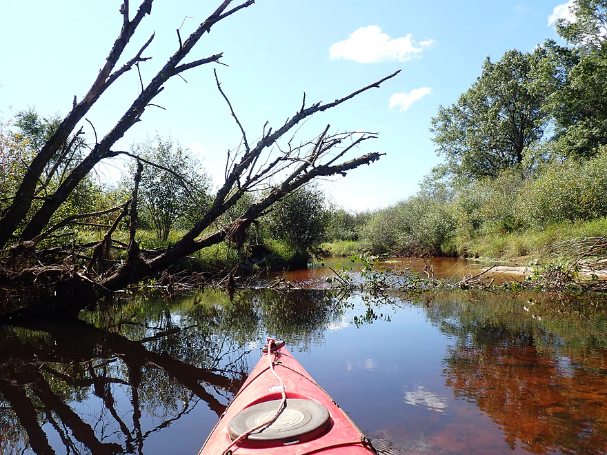
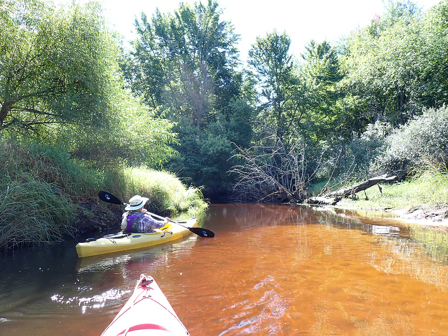
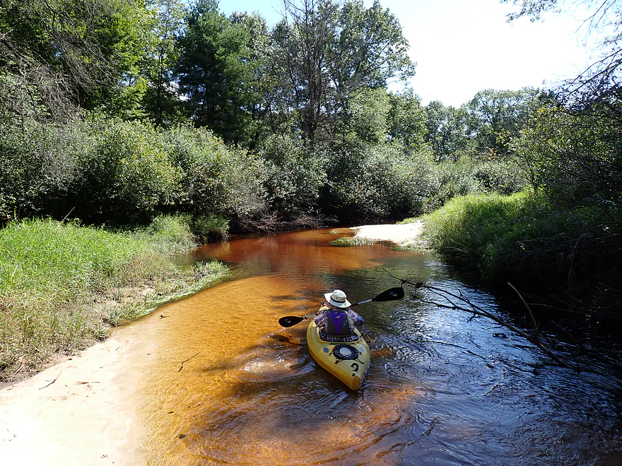
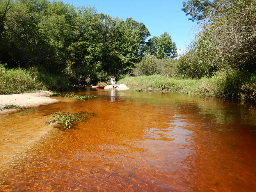
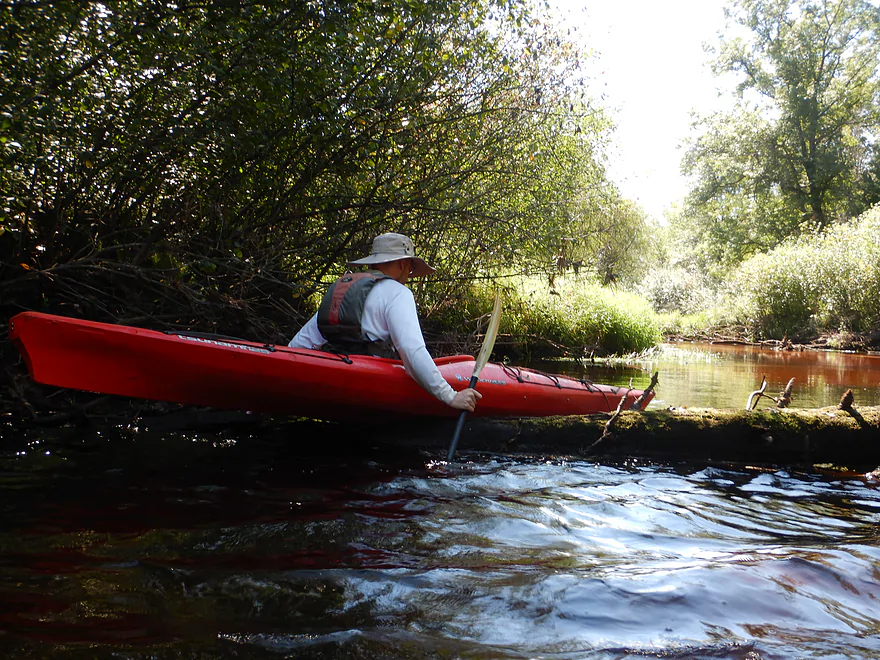
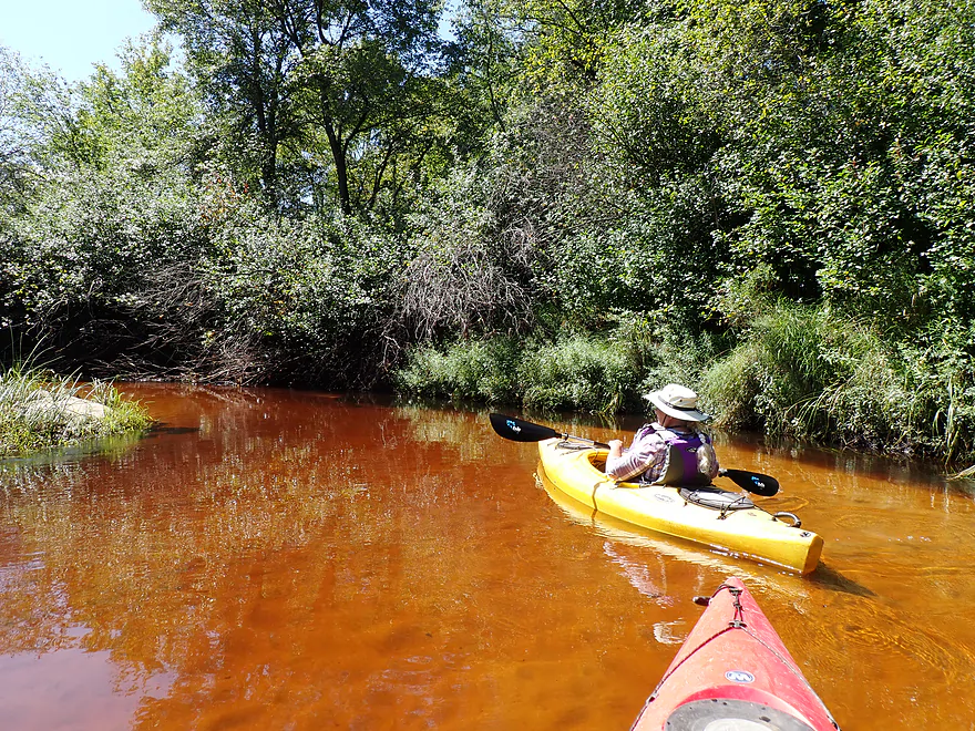
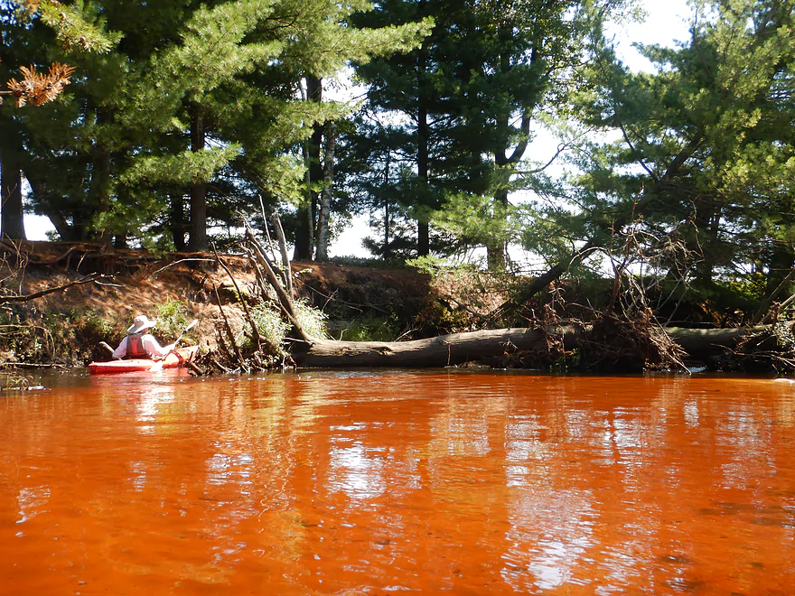
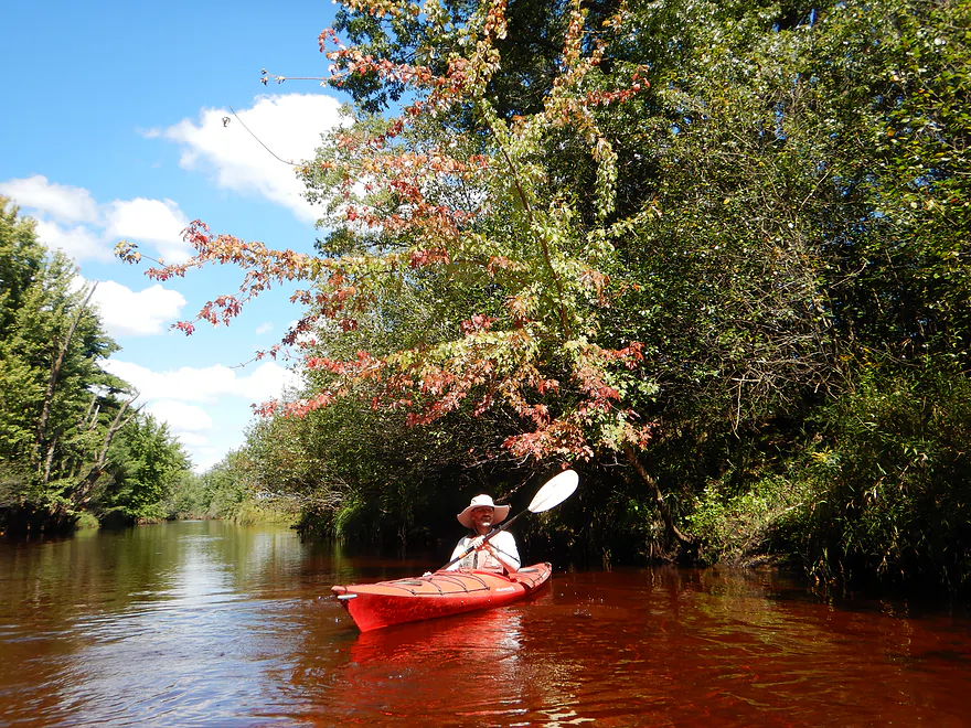
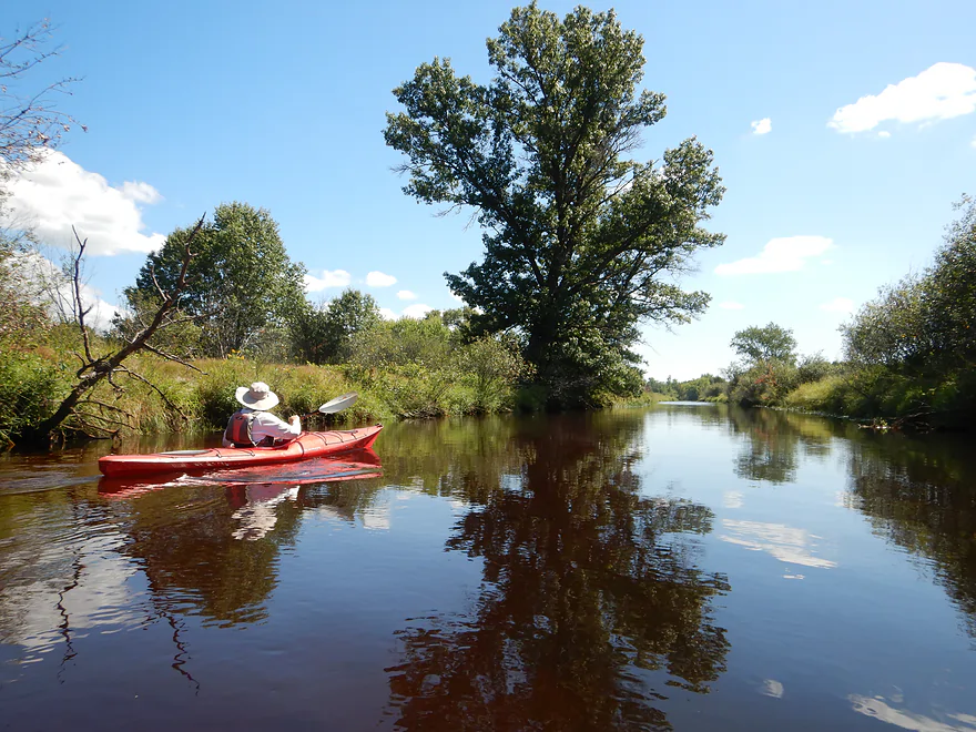
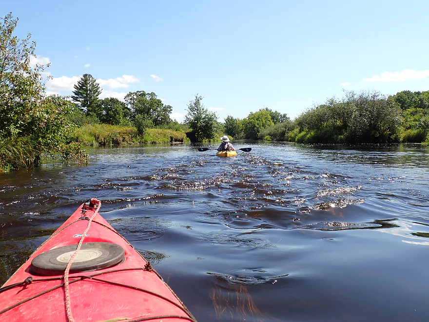
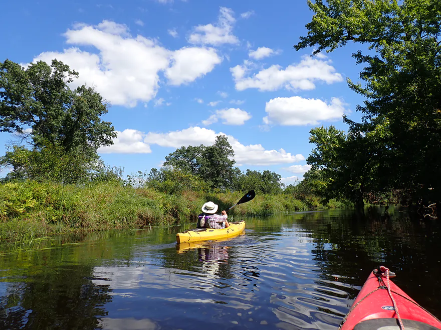
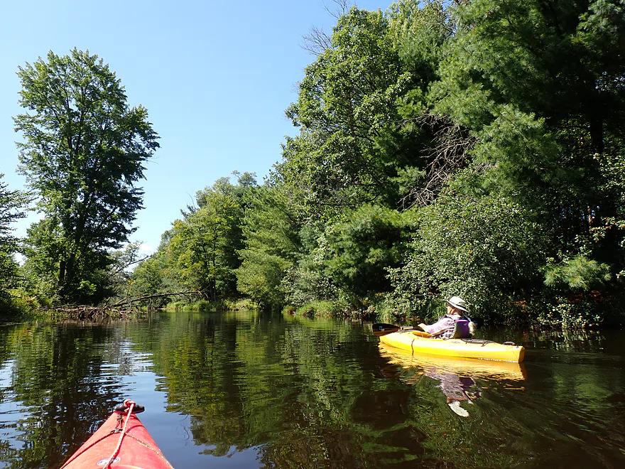
Terrific red clear water
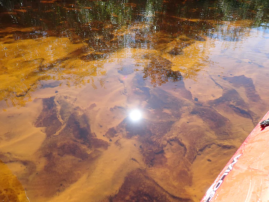
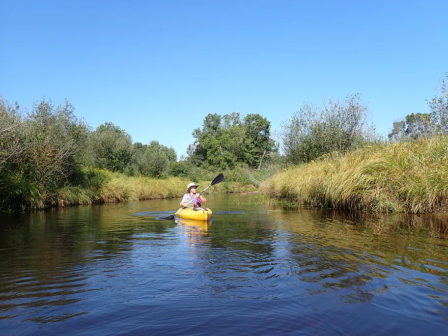
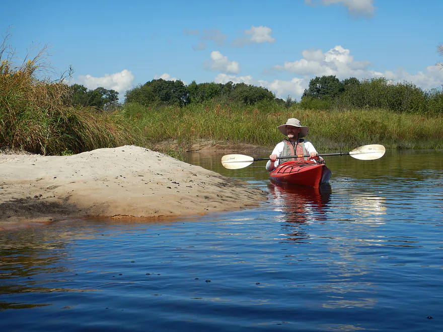
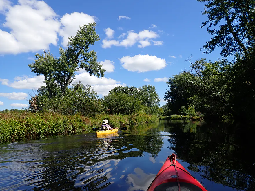
Close-up
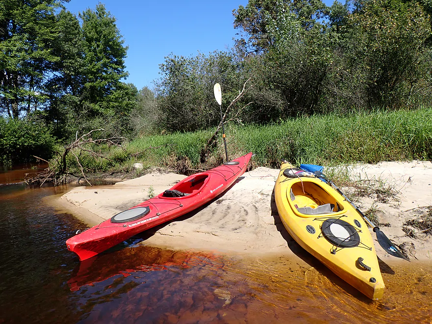
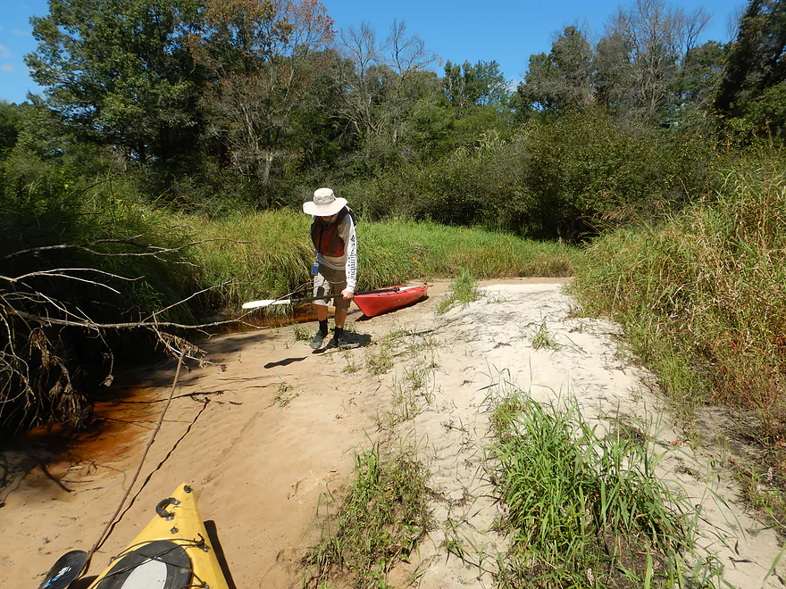
A lot of nice micro-sandbars
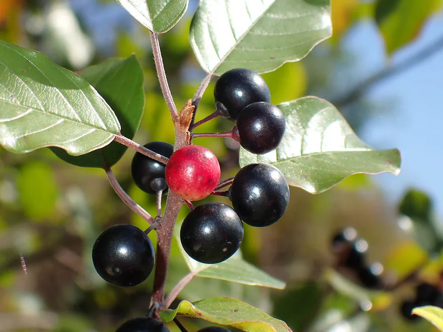
Glossy buckthorn–pretty but invasive (berries are not edible)
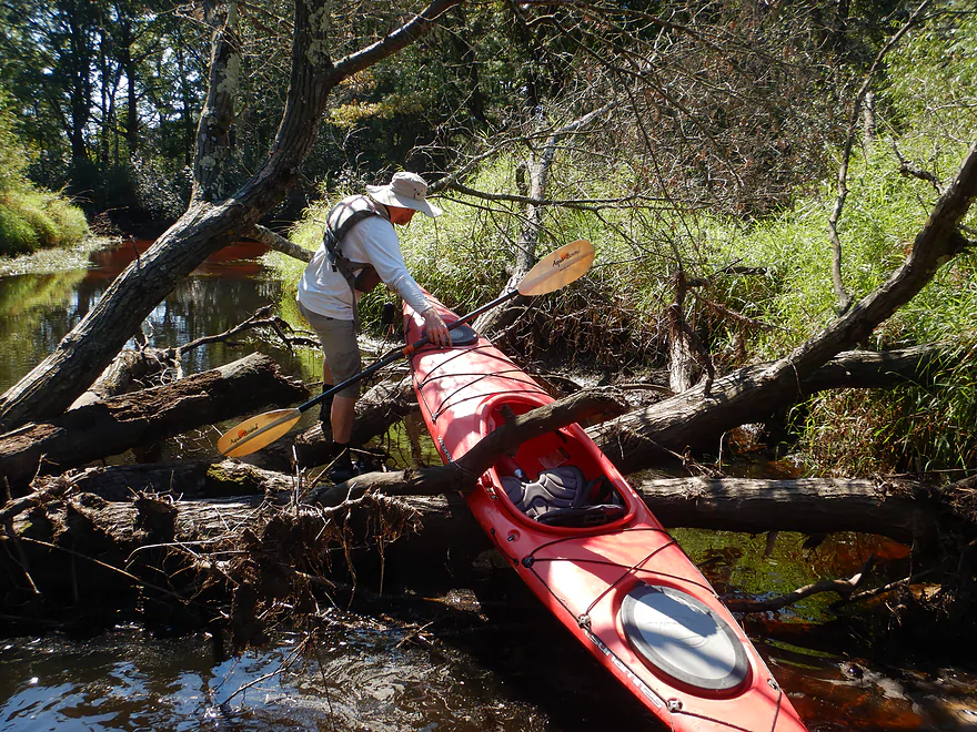
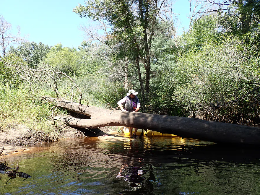
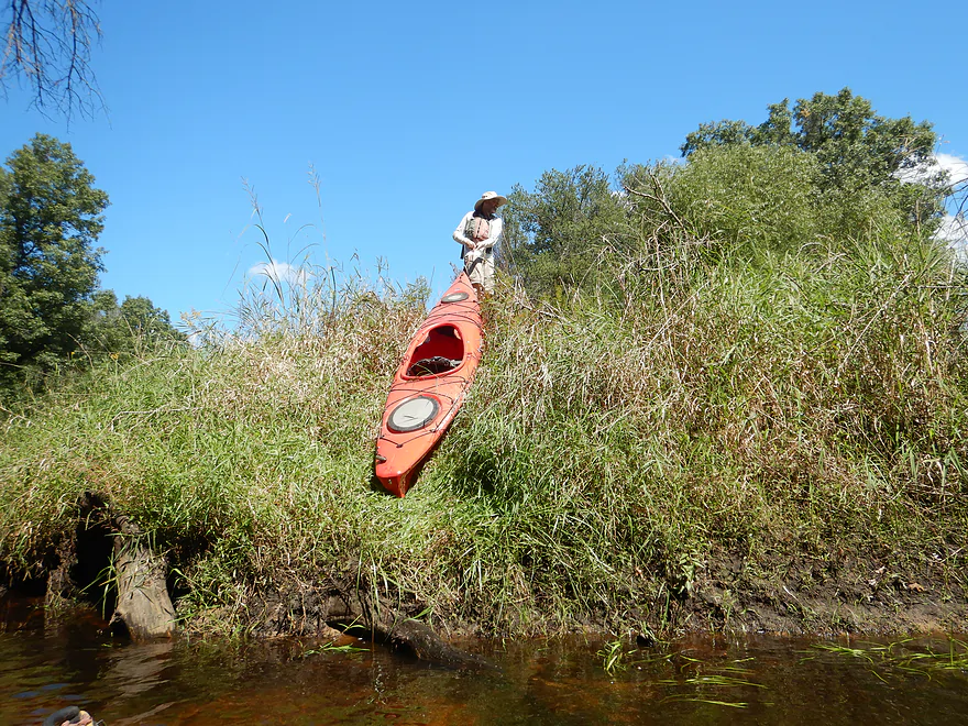
Easy portage
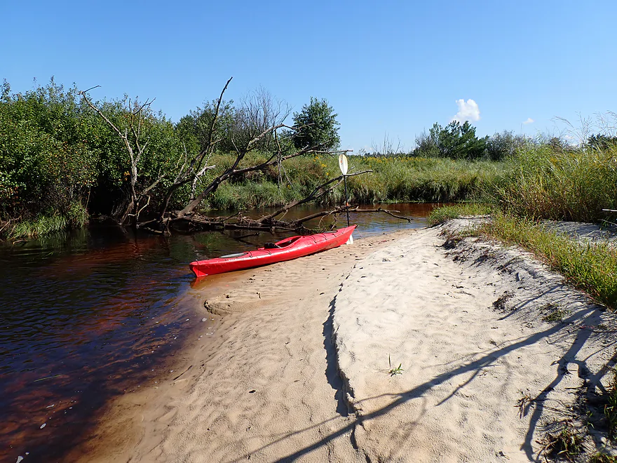
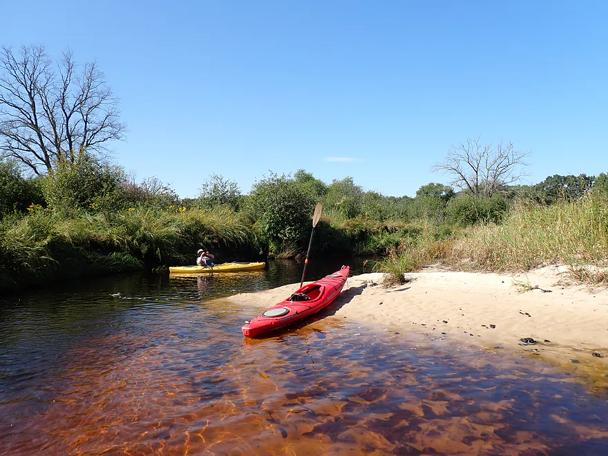
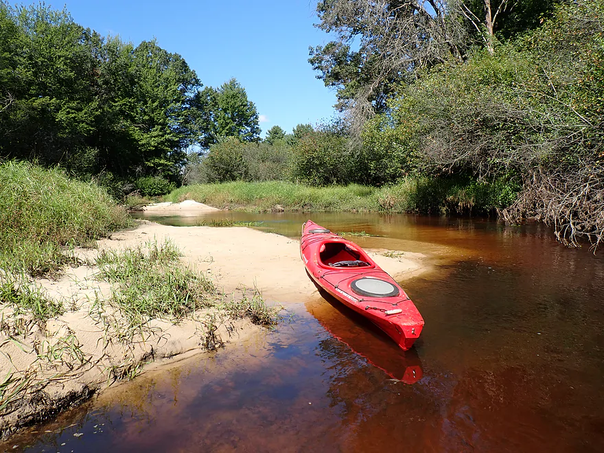
Great sandbar
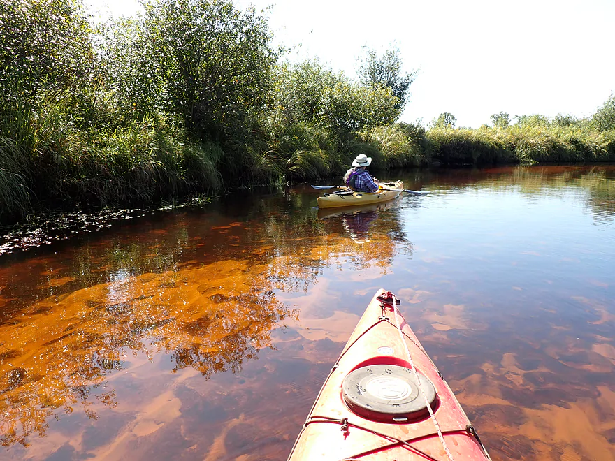
Paddling on fire
A dilapidated beaver dam
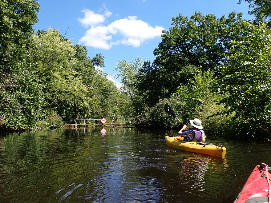
Approaching a horizon line
Sliding down a foot-high beaver dam
Reverse view
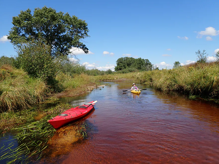
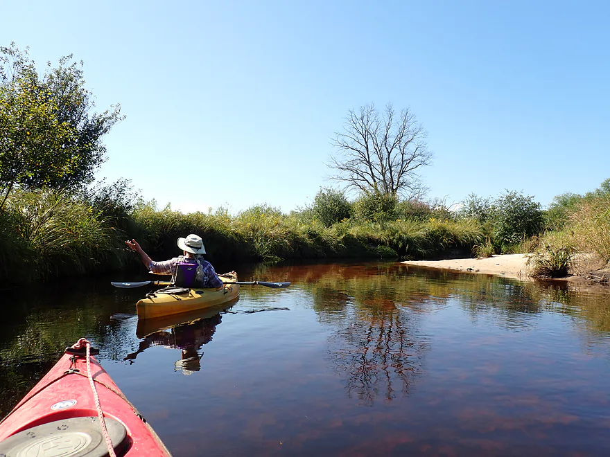
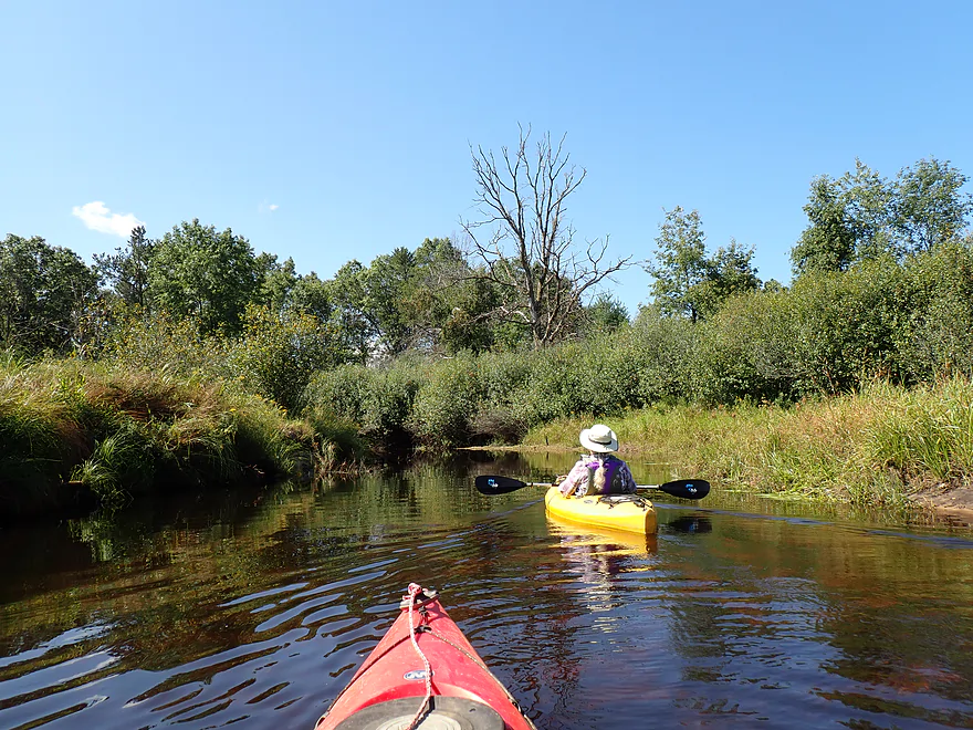
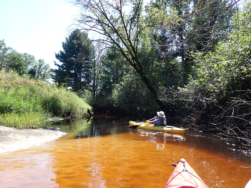
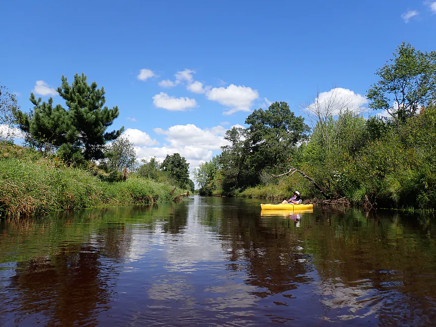
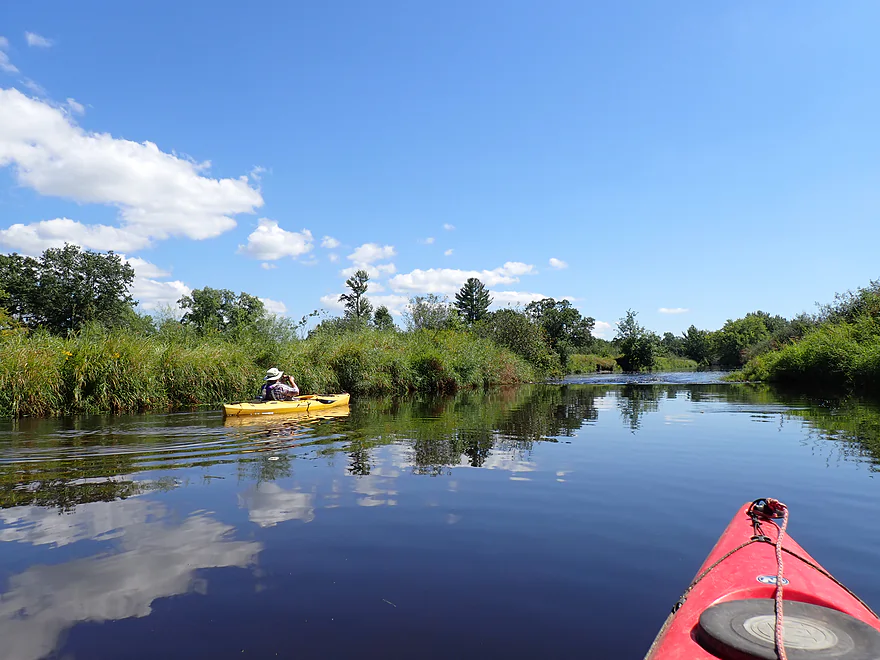
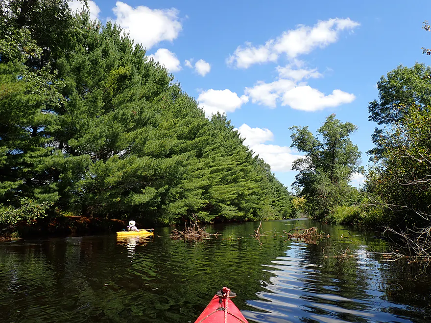
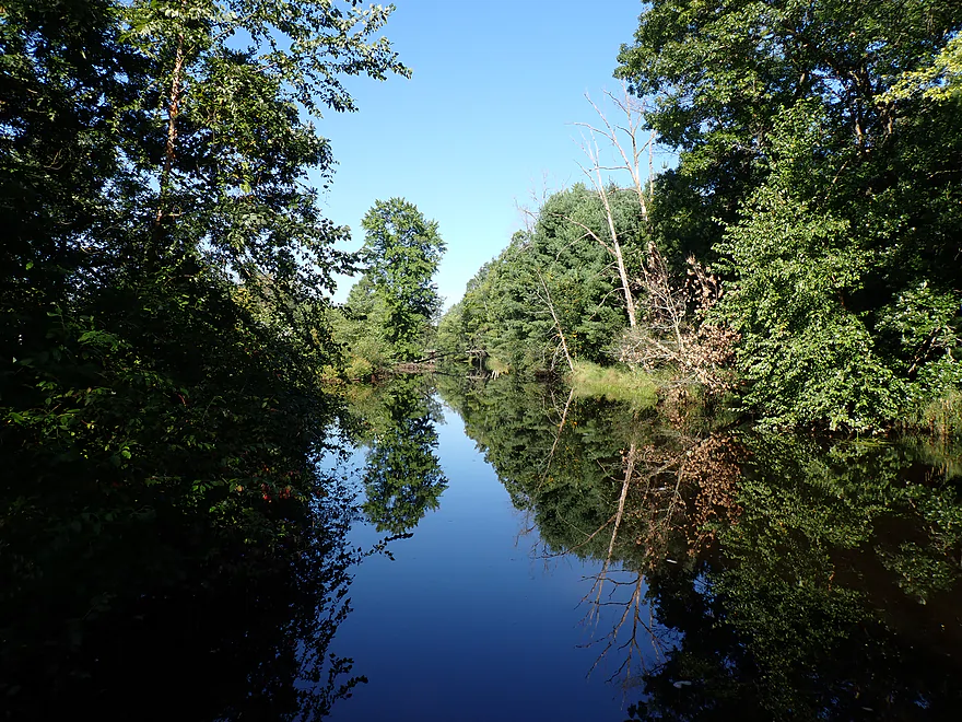
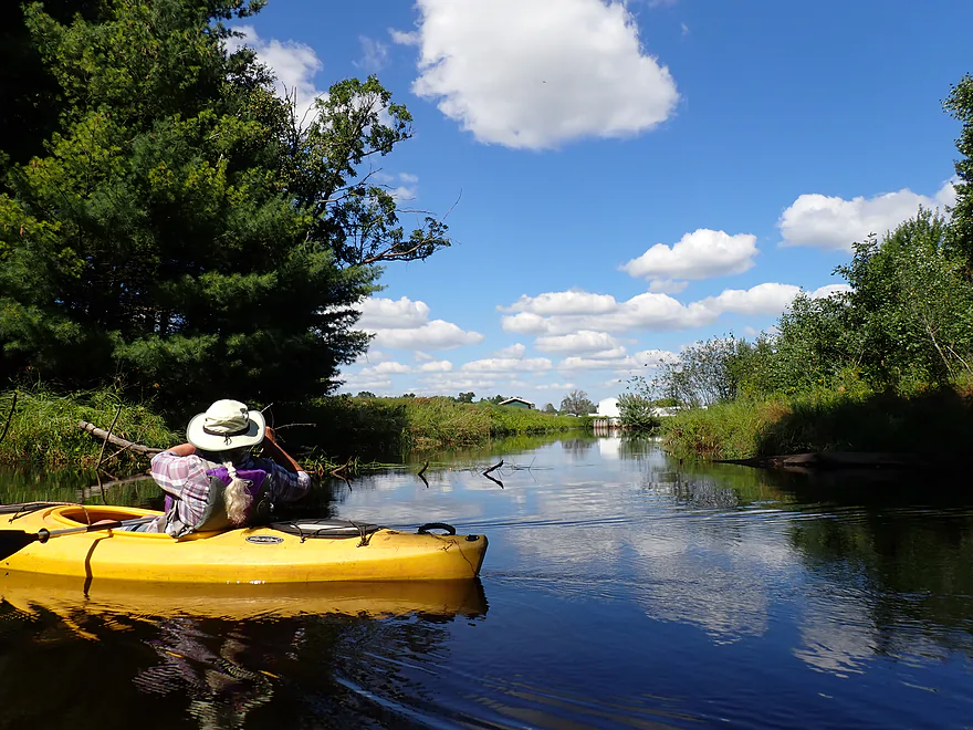
Scenic stretch of river
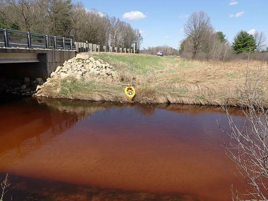
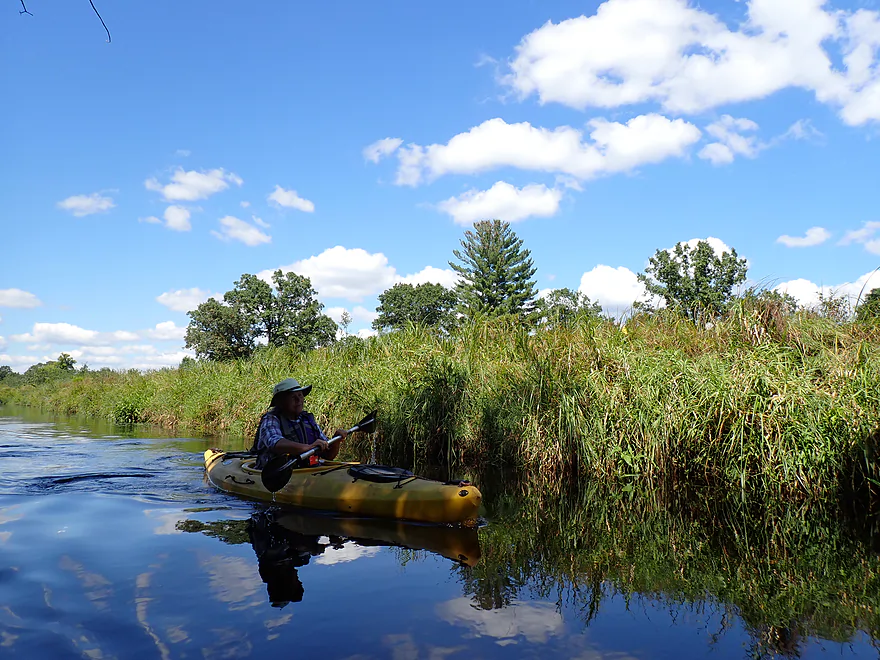
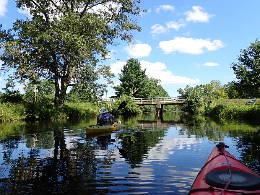
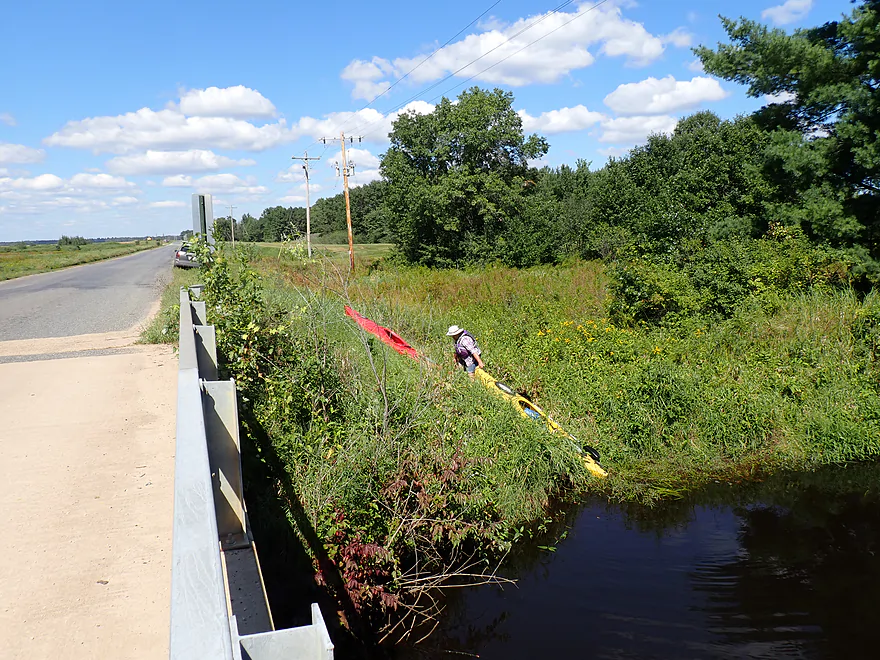
Dove Ave is an access option
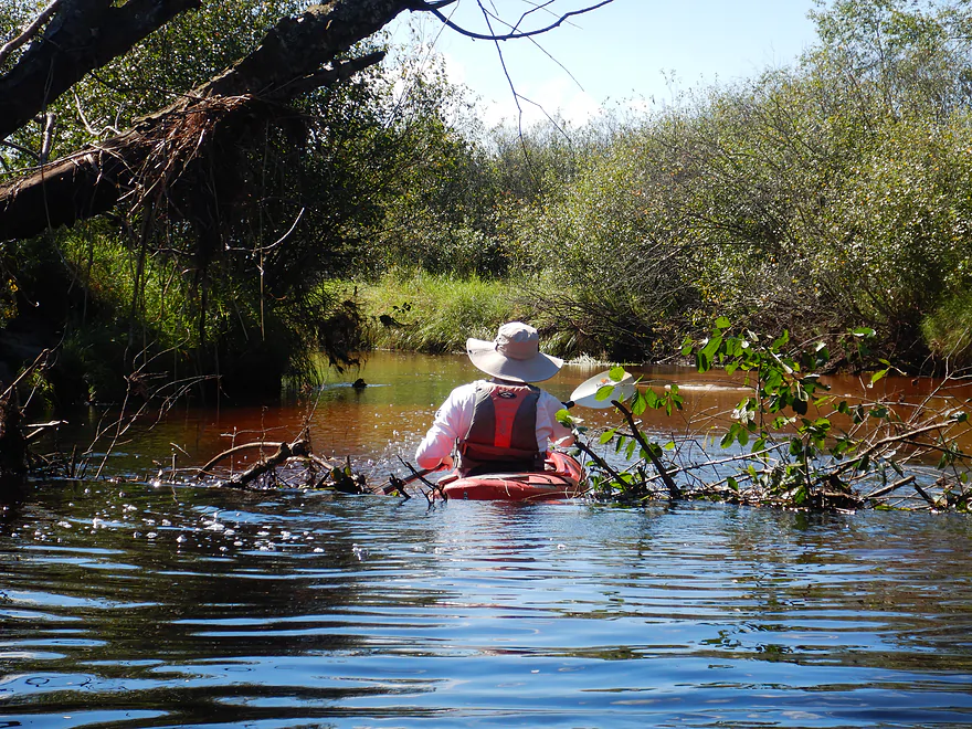
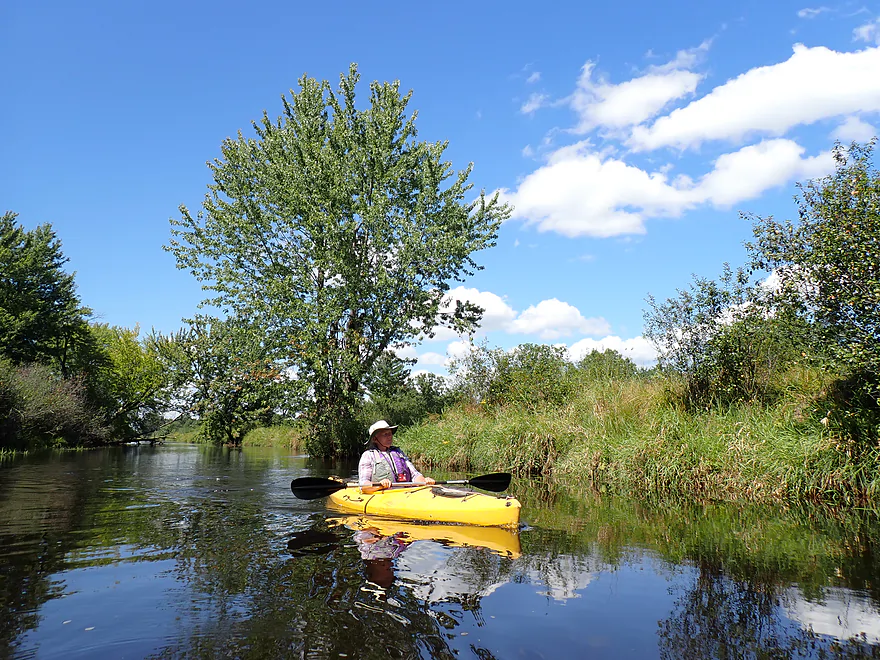
Entering a more wooded stretch
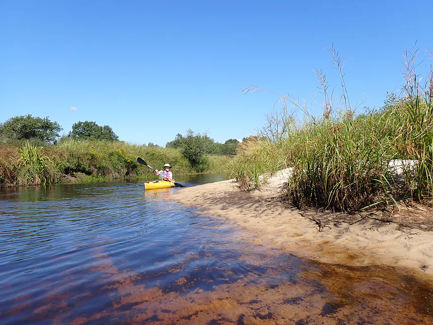
Still some nice sandbars
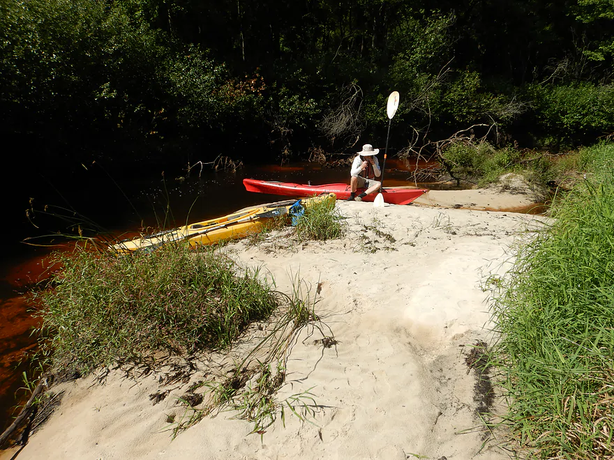
Taking a lunch break
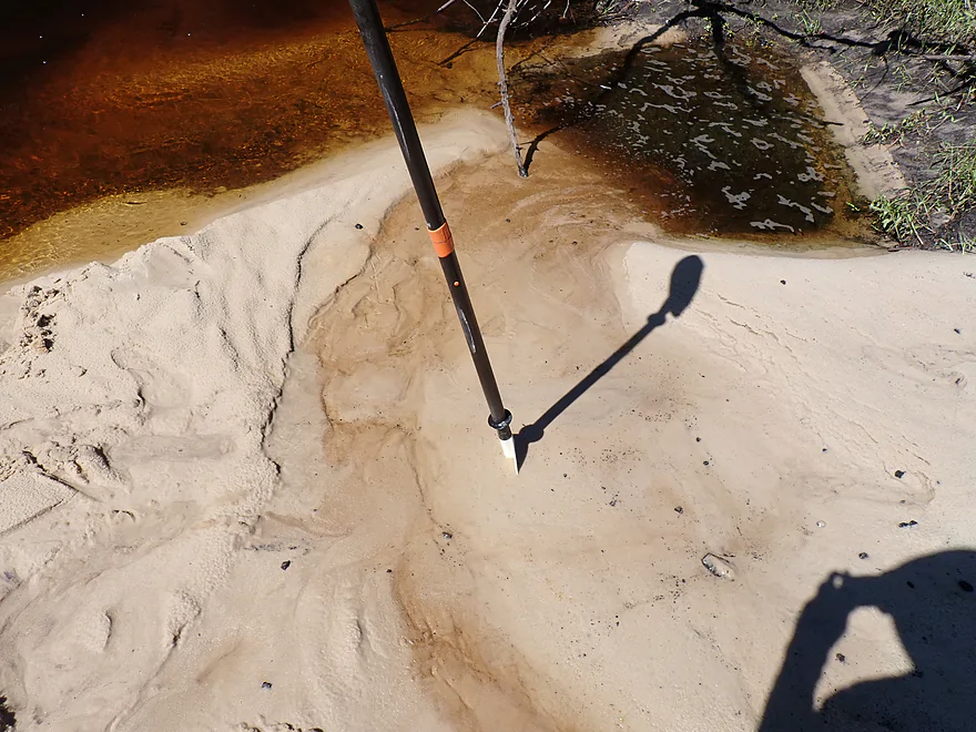
While carefully avoiding some quicksand
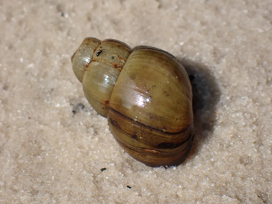
Not a lot of aquatic life, but some snails
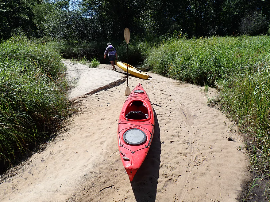
Another great sandbar
Then the major logjams started
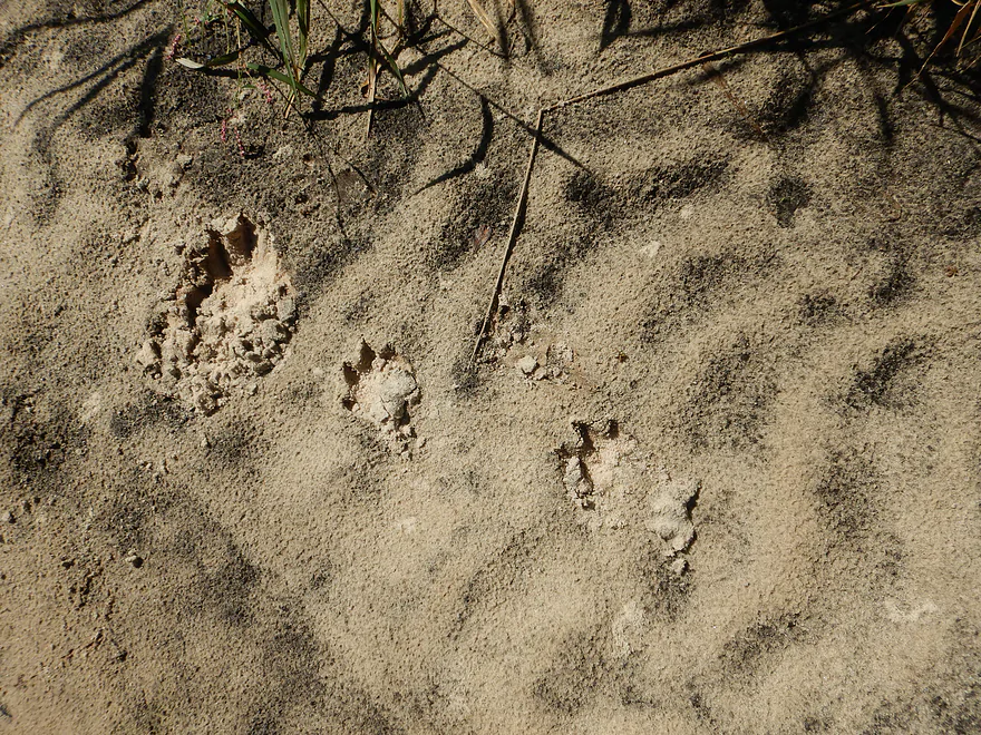
Possible otter tracks
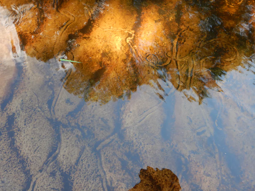
Didn’t see clams, but did see clam trails
Another logjam
The portages by sandbars were easy
Hopping over this logjam
Still great clarity
Pulling our boats up a massive bank to get around another logjam
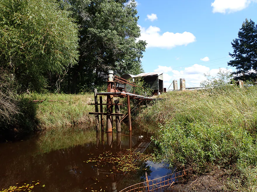
Looks like a cranberry bog pump (they regulate water levels on the bogs)
The last and most difficult logjam
This required careful balancing to get over the tree roots
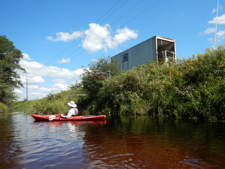
A random trailer in the middle of nowhere
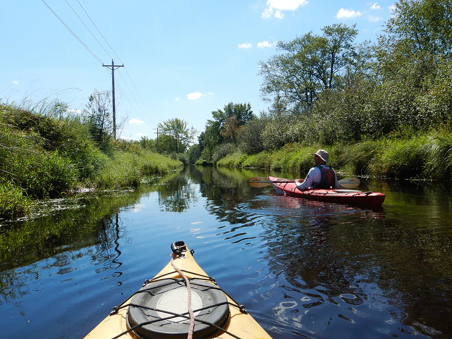
The rest of the trip was very straight and channelized
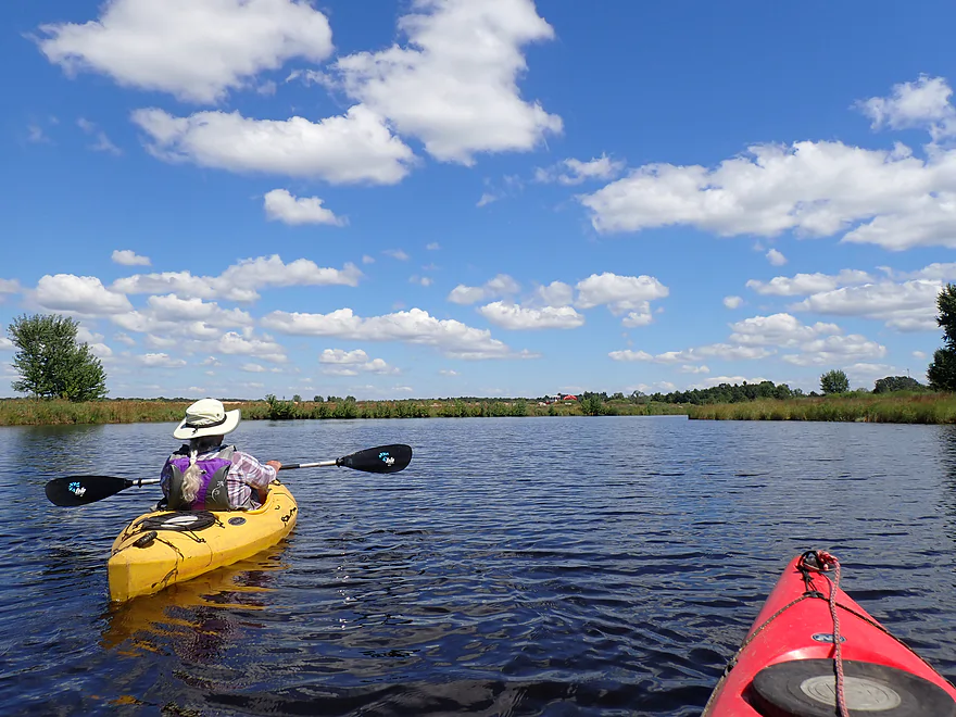
Nice blue sky day
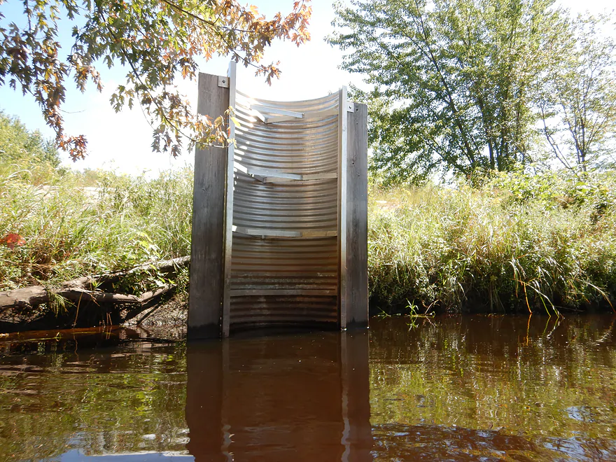
Another cranberry pumping station
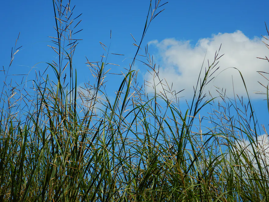
Prairie cordgrass (this was scattered atop banks for most of the trip)
Way too early fall color
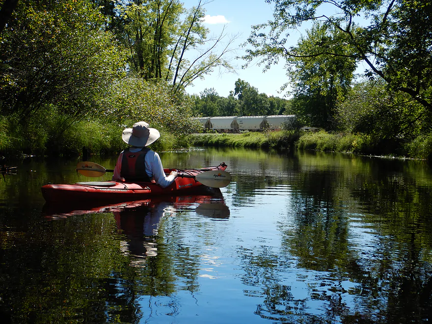
Railroad redirects the river east
River starts to widen
Exploring a side inlet–there is a huge lake just beyond the berm
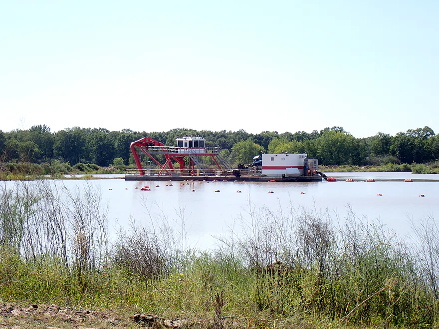
This strange machine was dredging out a random lake
Some light riffles
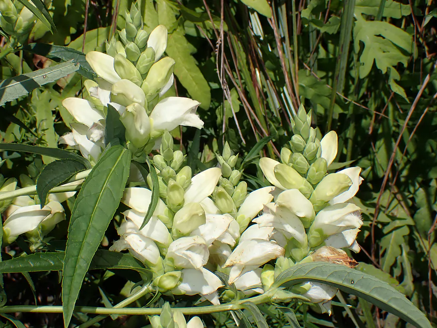
Turtlehead flowers
Approaching Copper Road
Exploring the millpond east of the bridge
River is impounded by a dam
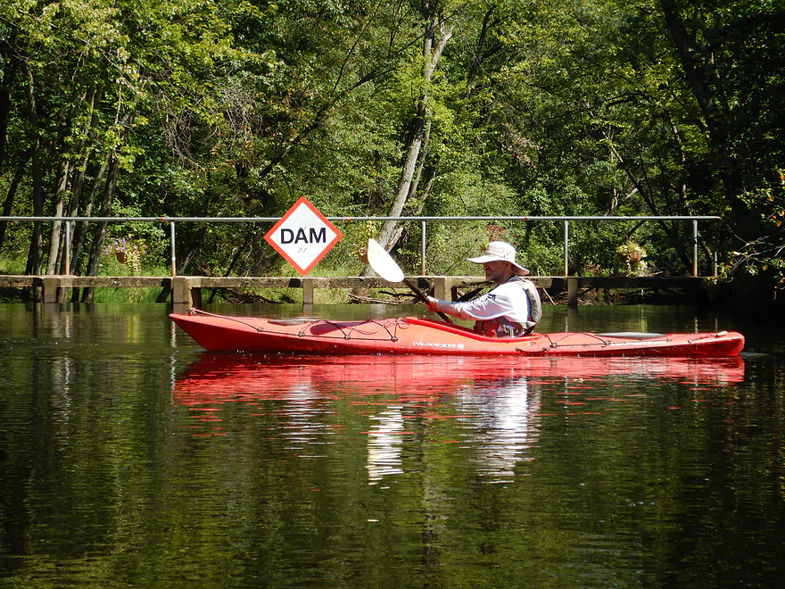
Don’t want to get too close…two people drowned here in May
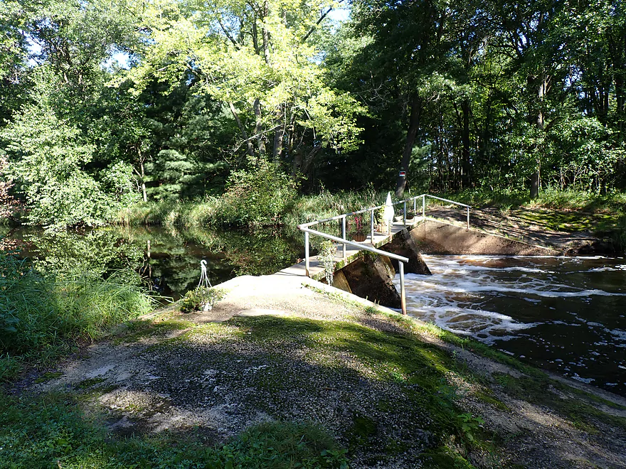
Bottom-right corner is public…but not a good take-out…spillway is too dangerous
Upstream vista from dam
Paddling back upstream to Copper Road
Side inlet for “Rutlin Cranberry”…now we know why the dam exists
Ending the trip at Copper Road
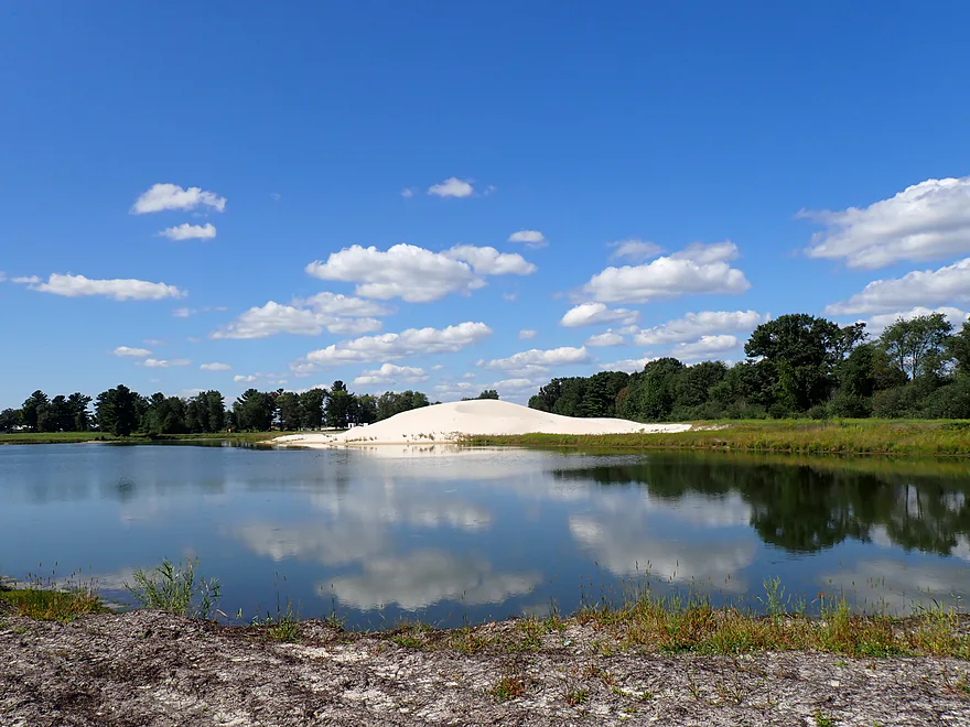
Picture of the the nearby frac sand “mountains”
Lemonweir River – East Fork – Part 2

The East Fork is an obscure tributary to the Lemonweir River tucked away in cranberry country just northeast of Tomah. I’ve paddled the river before…five years ago I started at Buckley Road and enjoyed terrific pine trees and clear red water. This week’s trip is a continuation of my 2020 trip, and starts at Hwy 173 where I previously took out.
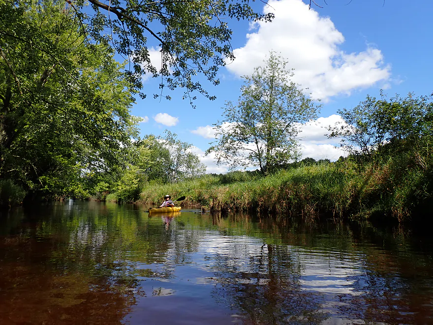
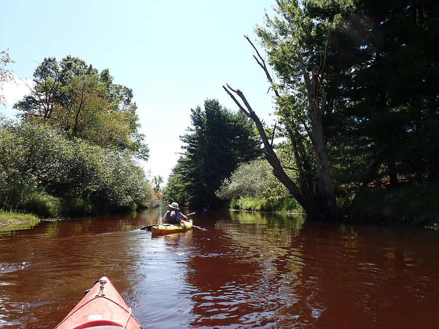
Hwy 173 was a weedier bridge access than I remembered, but it was manageable. The first mile proved to be the best part of the trip. Here the “river” (more so a creek) twisted around small sandbars, past native plant-lined banks, and over gorgeous clear red water. The combination of the upstream pine tannins, the water clarity, and the sandy substrate made this one of the “reddest” paddles I’ve ever done. An early highlight was a small beaver dam that was fun to hop over.
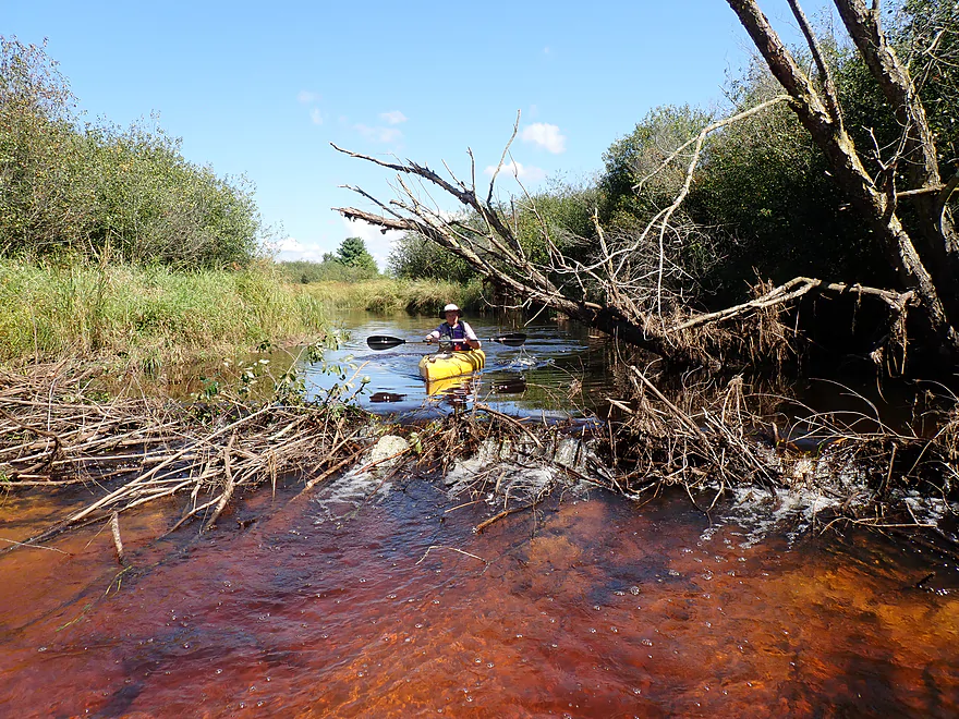
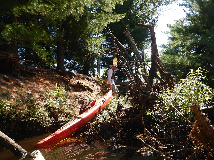
Dove Ave appears at roughly the one mile mark and is actually a good bridge access option. Downstream from here the trip really changed though. It started nice with more cool sandbars and lava red water. Then the banks became more wooded…but not all the trees were content to stay upright. For about a half mile there were 5-6 logjams obstructing the river. Portaging wasn’t too bad–usually because of the shallow sandy banks, but a few jams were tricky to get around or over. One of the worst (and last) logjams was located by a cranberry bog pumping station. This required getting out and balancing on tree roots to pull our boats over.
After the pumping station the river really changed again. No more logjams, but from here to the take-out the channel was significantly straightened, ditched, and deepened. With the deep water, we lost our sandbars and nice red water. It wasn’t a horrible experience paddling this long channelized stretch, but wasn’t super interesting either. I had hoped to see the massive frac sand “mountains” or the cranberry bogs which hugged the river here, but the tall artificial banks largely blocked our views.
After almost a mile paddling straight south, the river took a welcome turn to the southeast as it was redirected by a nearby (and noisy) railroad (likely shipping sand to west Texas for fracking). Several inlets joined the Lemonweir, and we were able to explore one of the larger ones which led up to a huge artificial lake. Here a noisy machine seemed to be engaged in some type of dredging operation. I checked Google Earth and the area north of the river used to be cranberry farms…but over the years has transformed into a lake that has steadily stretched south toward the river. I never did figure out what they were up to (although I suspect it was another sand mining operation).
Right after this we came to Copper Road. This was actually our take-out, but before disembarking we decided to paddle a bit downstream along a small flowage. This was an attractive part of the river with a row of tall white pines lining one bank and a small residential neighborhood (Wyeville) to the south.
Eventually we were stopped by the dam. This was going to be the take-out for the trip initially…but when scouting it out, we happened upon a fisherman who warned that the local landowners were sensitive about people trespassing. To be clear, the land southeast of the dam is clearly public and is used by fishermen. But southwest of the dam (upstream), the owner will call the police if you wander too far west.
In May, two individuals (likely drunk) drowned by the dam. Now the other owner along the north shore is sensitive about trespassers as well so that isn’t an access option either. To use the dam as a take-out, you would have to slide up to the concrete abutment, which is dangerously close to the spillway. Ultimately we decided Copper Road (which is within eyesight of the dam) was the better take-out. We doubled back and ended our trip there.
In summary, this was a tricky trip to grade. The first part was fantastic and very scenic. The clear red water was incredible, and the small sandbars and sedge-lined banks were terrific. But the short stretch with the logjams was a disappointment, while the second half of the trip through the channelized section was somewhat mediocre. I’m not sure I can recommend this trip until the logjams get cleaned out…which I hope will eventually happen.
Sights include one blue heron, a kingfisher, and several ducks. The highlight was the beaver dam.
Hwy 173: Despite a busy road and a somewhat weedy bank, this was a plenty doable bridge access.
Alternate Put-ins:
- Buckley Ave (4.6 miles upstream from Hwy 173): Buckley Ave is a great public access. The preceding stretch is very pleasant and scenic…but does have some logjams.
- Dove Ave (0.8 miles downstream from Hwy 173): Dove Ave is a great bridge access option. However the leg preceding Dove Ave is very nice, so IMO it’s not logical to use this as a put-in.
Copper Road: Take out on the north bank away from the private homes on the south bank. This is an ok bridge access but is a bit weedy.
Alternate Take-outs:
- Backwater Bar and Grill Dam (0.2 miles downstream from Copper Road): There is a nice pine-lined flowage downstream from Copper Road. There is a public access southeast of the dam used by fishermen and there is an area where you can park. However…the land southwest and north of the dam is marked private and the local property owners are sensitive about trespassers. Regardless, getting out at the dam would be deceptively dangerous as the access is by a concrete abutment that is VERY close to one of the spillways. It would be safer to get out further upstream (west) of the dam, but then you run afoul of the landowner west of the dam. Granted, Wisconsin law allows boaters to portage dams, but regardless, I don’t recommend getting out here. Instead, end your trip at Copper Road.
Bike Shuttle – Copper Road to Hwy 173: 3.7 miles with 10′ of ascent. This would be a very simple and easy bike shuttle.
Current/Rapids: Generally speaking the current was slow (especially in the second half of the trip). There were a few minor riffles, but no rapids.
Human Dams: East of the Copper Road bridge and north of the “Backwater Bar & Grill” is a dam that impounds the East Fork of the Lemonweir. While the DNR allows paddlers to portage dams, the local property owners on the north shore and southwest shore are sensitive and will call the police on “trespassers”. The southeast corner is clearly public. Regardless…the dam is deceptively dangerous as the open gates are adjacent to the shoreline where you need to get out. On May 4th, 2025, police recovered the bodies of two individuals at the dam. They likely went for a drunken late night swim and perhaps got caught up in the dam.
Beaver Dams: There was one partially dilapidated beaver dam, but also a fully functional one about a foot and a half high. It was easy to slide over and plenty safe (unlike the human dam).
Logjams:
- Hwy 173 to Copper Road: This stretch was relatively open. There is one downed tree you might need to portage, but it would be easy because of the adjacent sandbar.
- Copper Road to the Channelized Stretch: This was a tricky spot with 5-6 logjams in just a half mile. Most of the logjams were easy portages because of the sandy banks, but two of the downed trees required some effort to get past.
- Channelized Stretch: For whatever reason, a good stretch of the Lemonweir on this trip was artificially ditched and straightened (pretty much the second half of the trip). There are no logjams here.
River Gauge: Lemonweir River @ New Lisbon
River Trip Depth: 234 CFS or 4.3′
River Navigability Estimates: These are just rough guesses.
- 0-150 CFS: Maybe too shallow
- 151-400 CFS: Good clarity and many great sandbars.
- 401-600 CFS: A good depth with some good clarity and sandbars.
- 601-1000 CFS: A high depth with poor clarity, but would be suitable for paddling. You might be able to get over some logjams at this depth.
- 1001-1800 CFS: A very high depth with murky water…but still viable.
- 1801+ CFS: Banks are just about to burst (based on scouting I did a while back). River is likely too unattractive for paddling.
Detailed Overview
Lemonweir River - Main Branch:
- East/South Fork Confluence to Cty PP: 1.0 miles. Likely around 3 logjams.
- Cty PP to Funnel Road: 2.0 miles. Very straight channel with roughly 6 logjams.
- Funnel Road to 2nd Ave: 1.2 miles. Highly channelized and straight with about 3 logjams.
- 2nd Ave to Cty H: 1.8 miles. Roughly 4 logjams. The channel can be poorly defined at times.
- Cty H to River Road: 2.3 miles. Expect 4-6 logjams and confusing side channels where navigation is a challenge.
- River Road to 6th Ave: 5.4 miles. Likely navigable, but expect a high volume of logjams.
- 6th Ave to 37th Street Landing: 4.4 miles. Occasionally paddled but contains several logjams.
- 37th Street Landing to New Lisbon: 6.6 miles. A long, slow stretch that feels more like a lake than a river. While somewhat monotonous, the rock outcroppings, white pines, and fall colors provide some redeeming beauty.
- New Lisbon Dam to Hwy 12/16 Shoulder: 7.9 miles. A promising prospect featuring a “Little Dells” rock outcrop, though hampered by about 6 logjams. The Hwy 12/16 shoulder is a speculative but potentially an access point.
- Hwy 12/16 Shoulder to Riverside Park in Mauston: 4.6 miles. Mostly slow, open paddling through river flowages.
- Mauston Dam to 19th Ave: 4.5 miles. One of the premier stretches on the river.
- 19th Ave to Cty HH: 13.1 miles. Less engaging with a noticeably slower current.
- Cty HH to the Mouth: 3.3 miles. An excellent section with beautiful rock outcrops that serve as a prelude to the Wisconsin Dells.
Lemonweir River - East Fork:
- Cty EW to Buckley Ave: 3.4 miles. Begins in cranberry bogs before transitioning into a sedge-lined creek and concluding with a spectacular corridor of towering white pines. Expect roughly five logjams, mostly near the end.
- Buckley Ave to Hwy 173: 4.7 miles. One of the most scenic and diverse stretches of the Lemonweir, featuring marshes, a lake, cranberry bogs, sandbars, and towering pines. A handful of easy-to-portage logjams are located near the end.
- Hwy 173 to Cooper Road/Dam:
- Hwy 173 to Dove Ave: 0.9 miles. A lovely, open leg with clear red water and numerous small sandbars. Includes one minor, easy portage.
- Dove Ave to Cooper Road: 2.4 miles. A mediocre stretch flanked by frac sand mines and cranberry bogs; much of the channel is ditched and straightened. The half mile below Dove Ave contains several logjams, some requiring difficult portages.
- Cooper Road to Backwater Bar Dam: 0.2 miles. A short but scenic flowage set against attractive pines. The dam is not a practical take-out due to trespassing restrictions and proximity to the spillway.
- Backwater Bar and Grill to Hwy 21: 0.5 miles. Likely congested with near-constant logjams.
- Hwy 21 to East/South Fork Confluence: 0.3 miles. Expect 2-3 logjams.
Lemonweir River - South Fork:
- Butts Park/Lake Tomah to Forbes Road: 4.5 miles.
- Butts Park to Lake Tomah Dam: 0.2 miles. A quick paddle across Lake Tomah to reach the spillway.
- Lake Tomah Dam to Memorial Park: 1.2 miles. A narrow, sandy stretch with a high number of downed trees.
- Memorial Park to Tomah Dog Park: 0.6 miles. Mostly pleasant and open, though one large logjam requires a very difficult portage.
- Tomah Dog Park to Forbes Road: 2.5 miles. The first half is heavily obstructed; the second half is more open but still requires two logjam portages.
- Forbes Road to County N: 6.9 miles.
- Forbes Road to Cty ET: 1.6 miles. A high-quality stretch with good clarity, a sandy bottom, and one manageable logjam portage.
- Cty ET to Cty N: 5.3 miles. Scenic and clear, passing through grasslands, frac sand mines, and a massive cranberry bog. Includes three logjam portages.
- County N to Excelsior Ave: 3.0 miles. Open through the golf course, but the wooded sections likely contain 6-8 logjams.
- Excelsior Ave to East/South Fork Confluence: 0.5 miles. Likely riddled with countless logjams.
Trip Map
Overview Map
Video
Photos Size: