
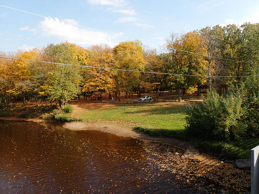
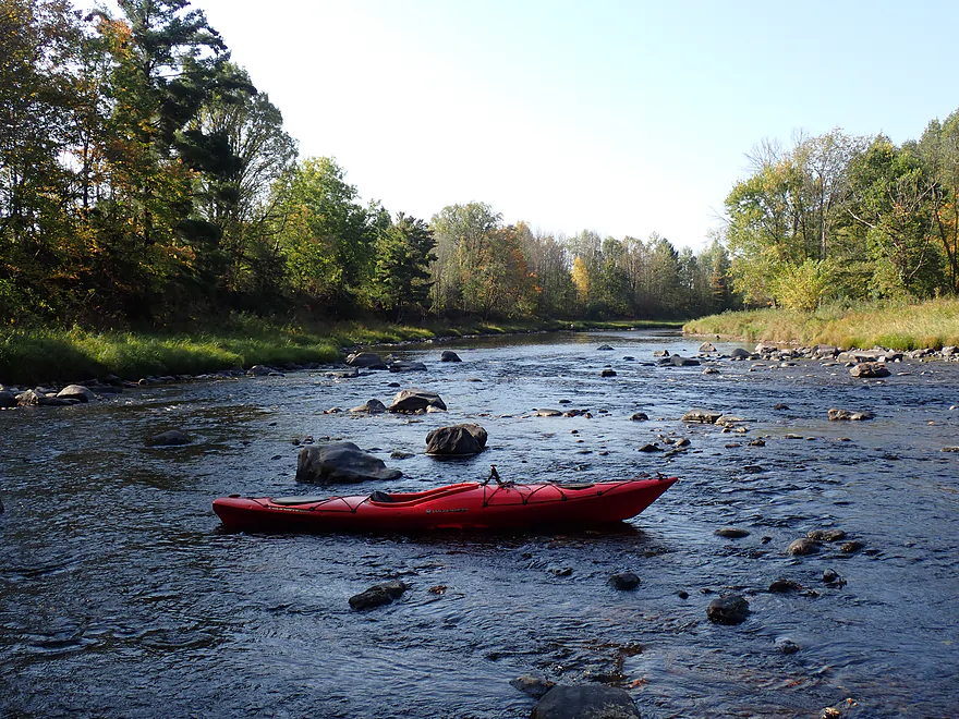
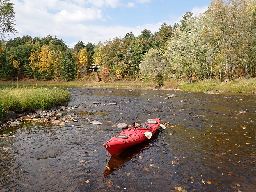
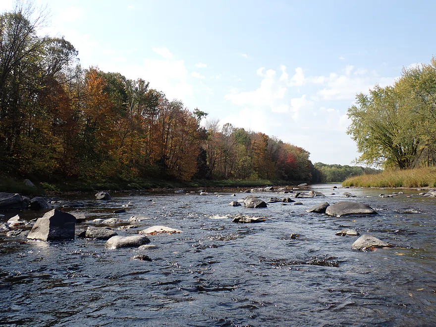
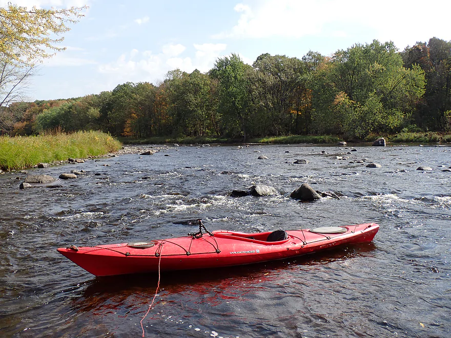
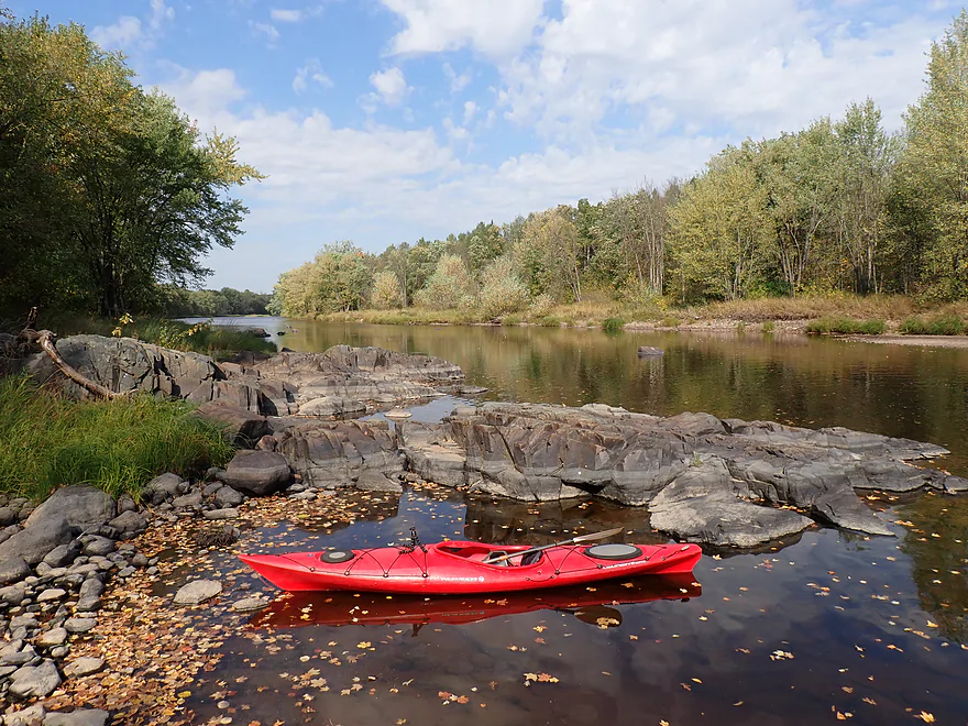
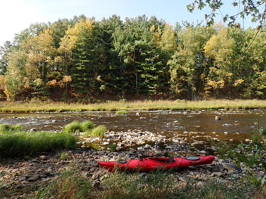
Starting the trip at Haley Park
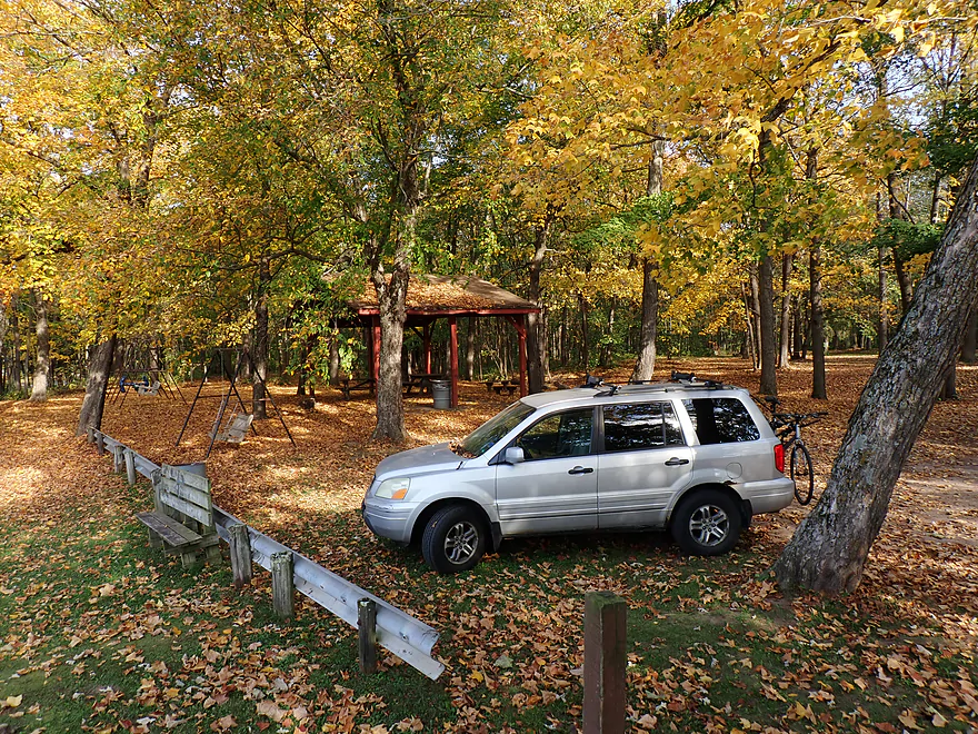
Nice park
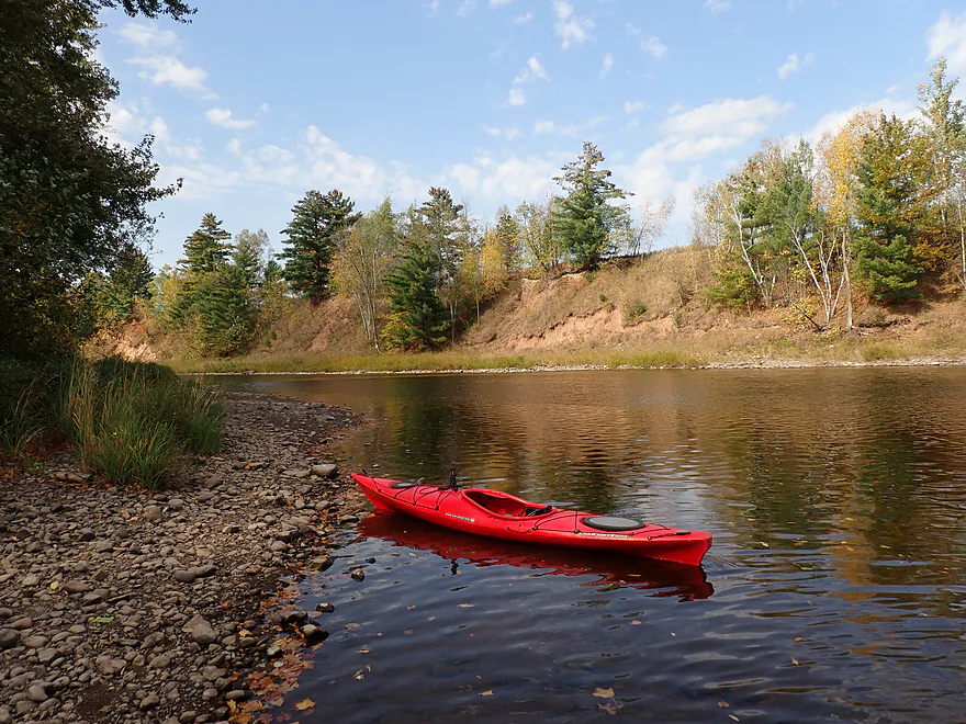
And a good launch option
The first of many
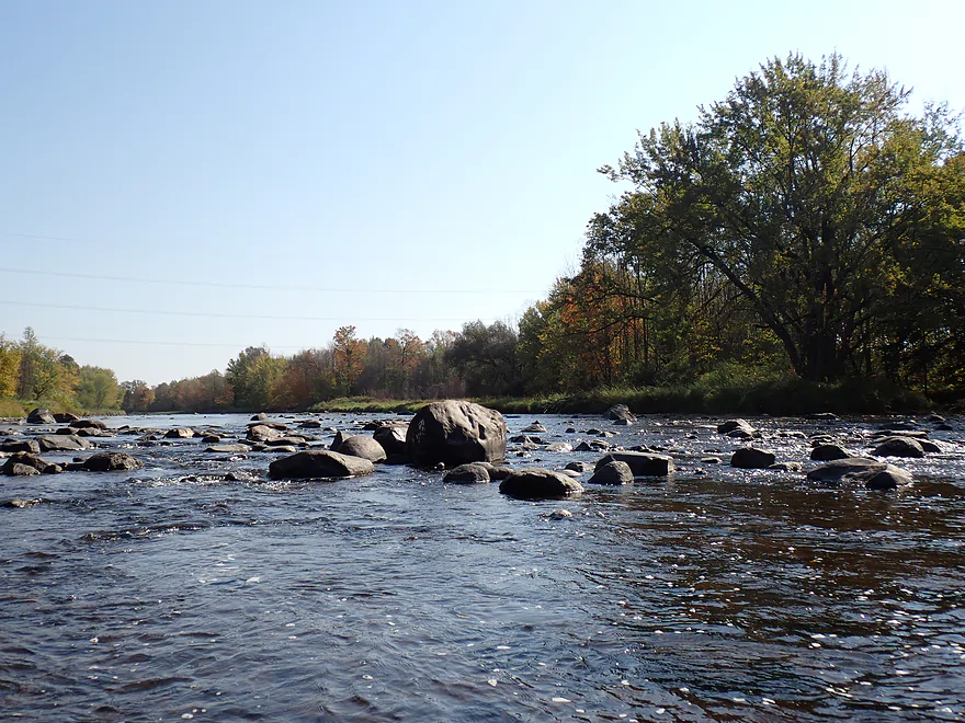
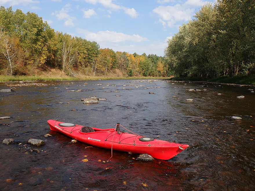
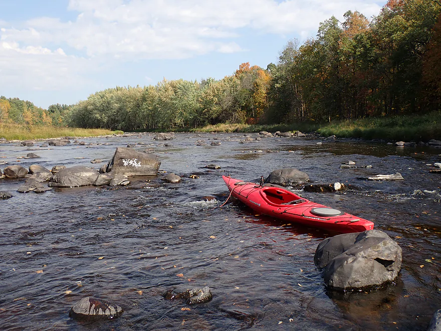
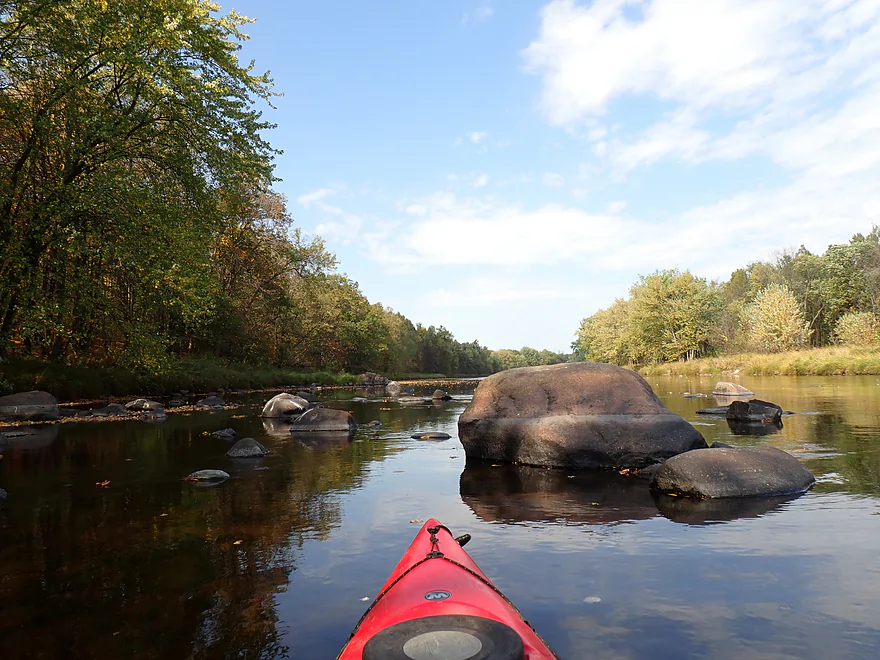
First decent boulder field
One of the few that were somewhat navigable
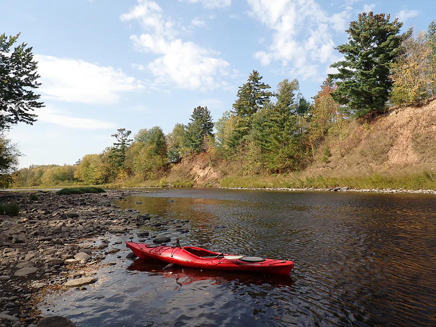
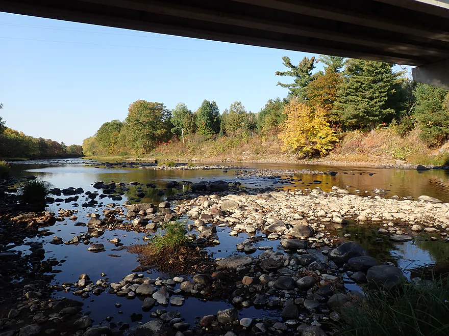
Extremely shallow water forced me to get out in spots
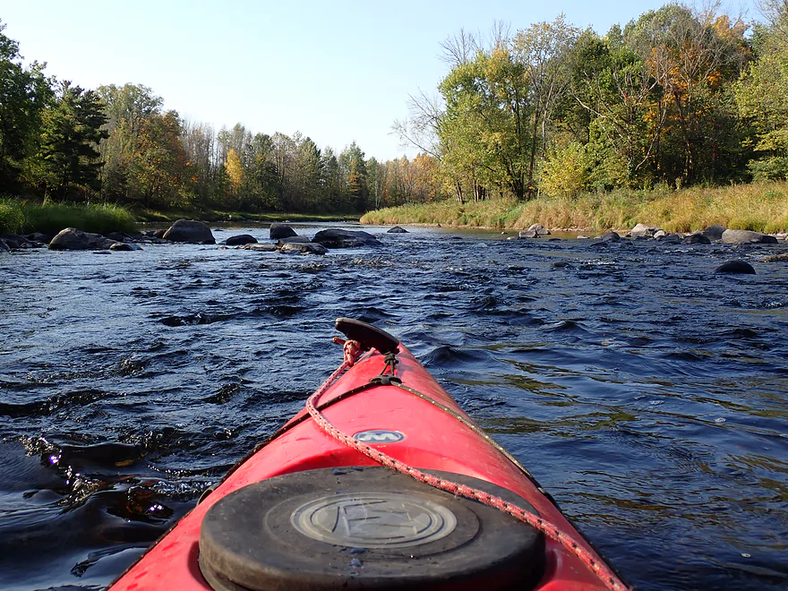
Reverse view
Not going to fit through this
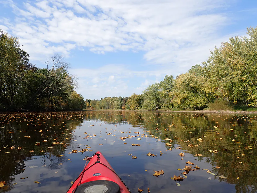
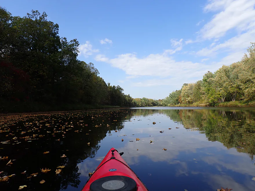
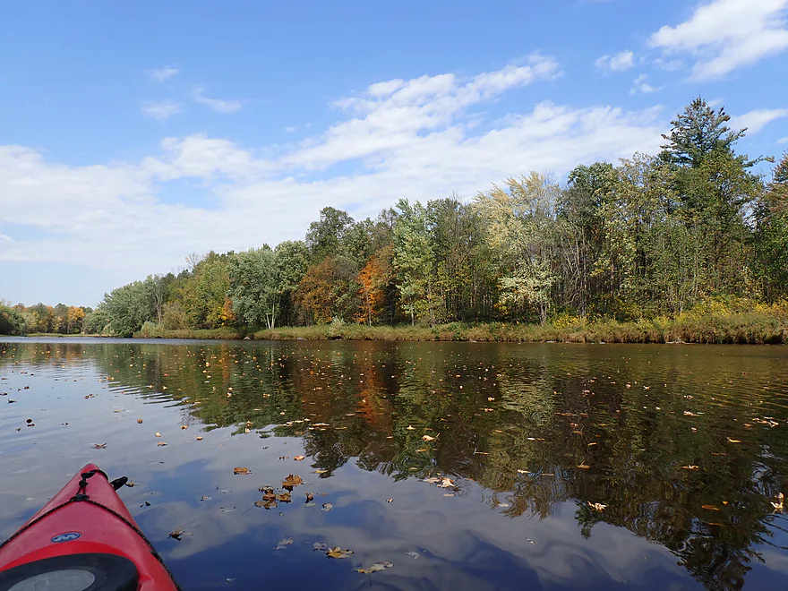
It was snowing leaves…really cool
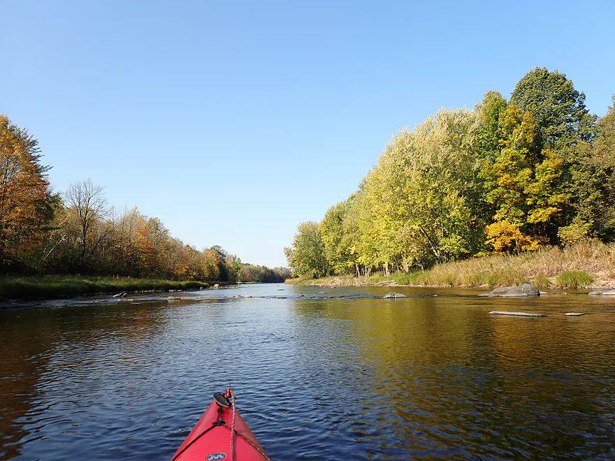
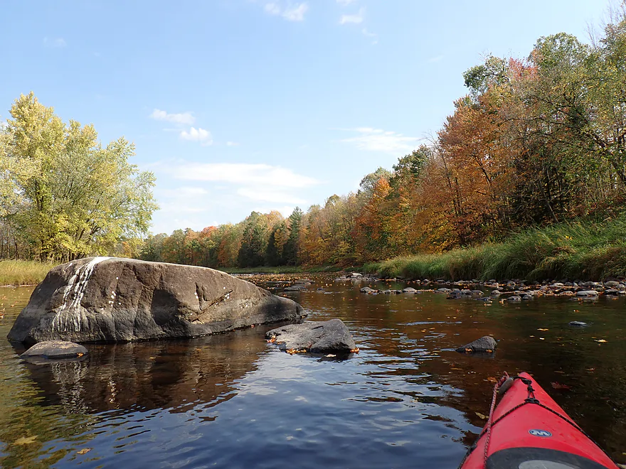
Attractive bend
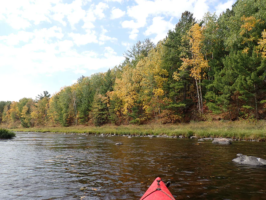
Reverse view

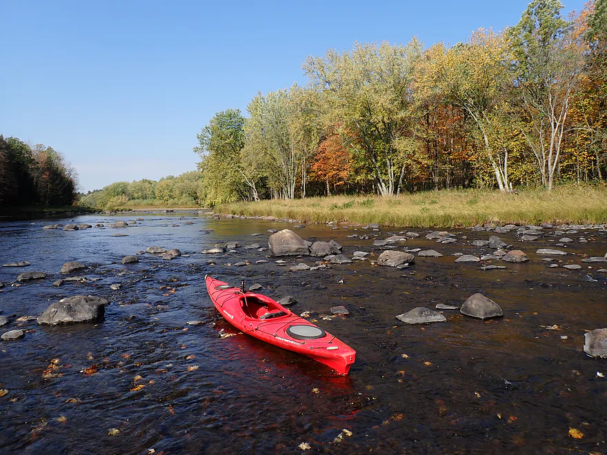
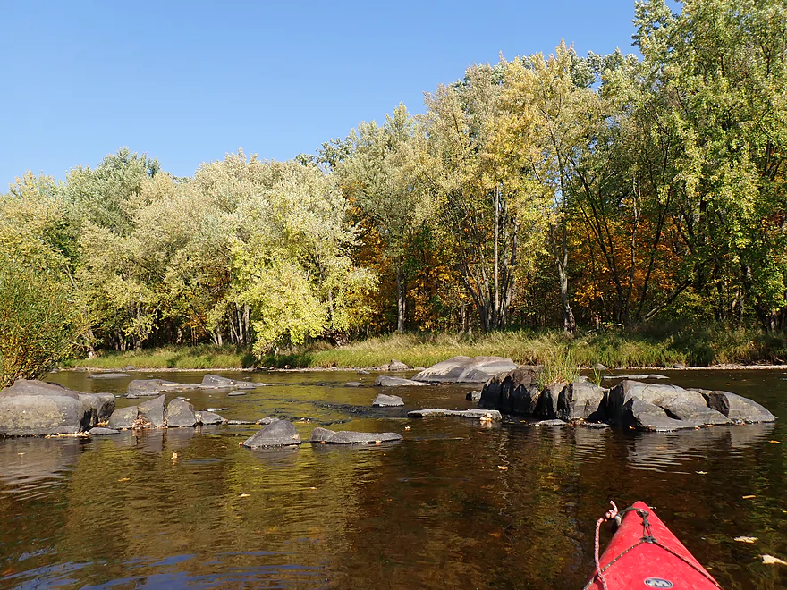
One of the larger boulder fields
Looking back
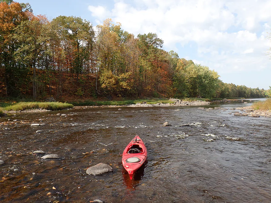
Good fall color
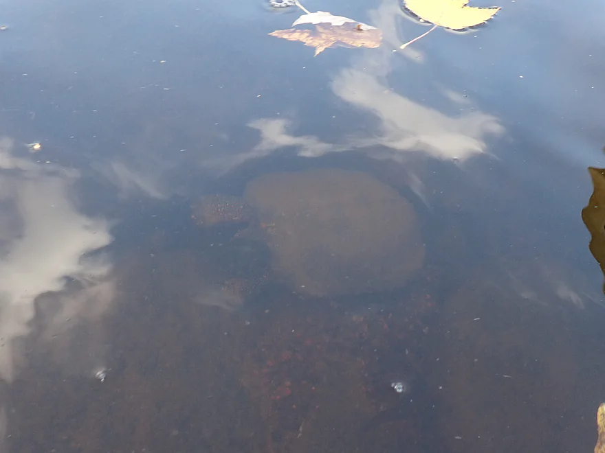
Snapper trying to hide from my boat
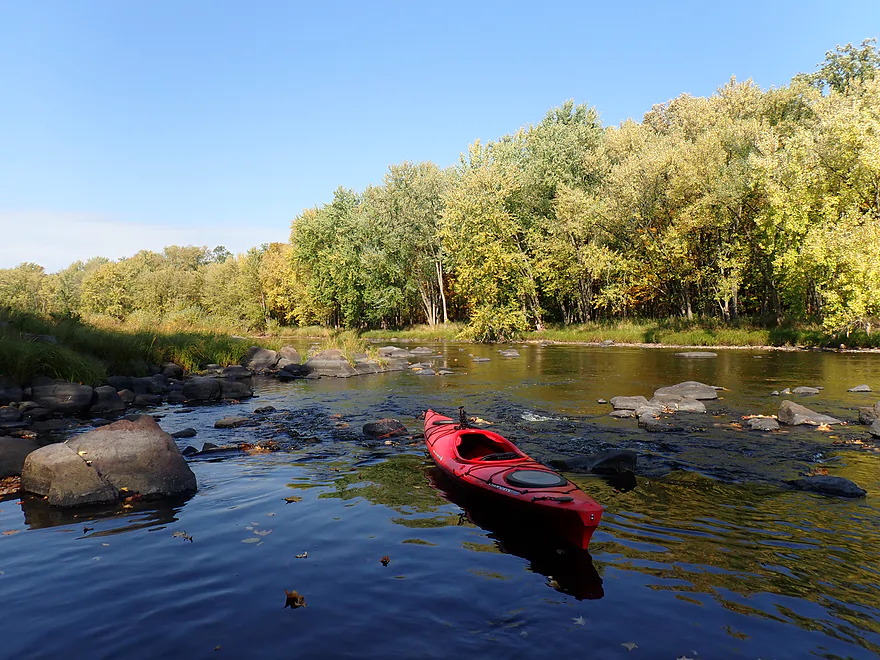
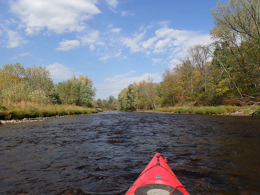
More rapids
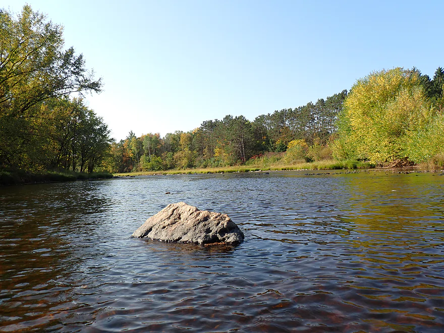
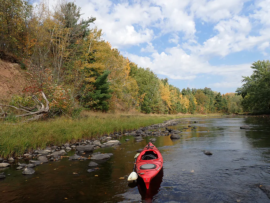
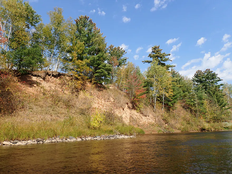
Favorite part of the river
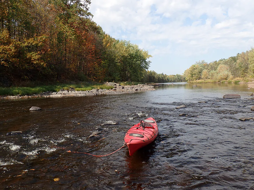
Exposed bedrock redirects the river north
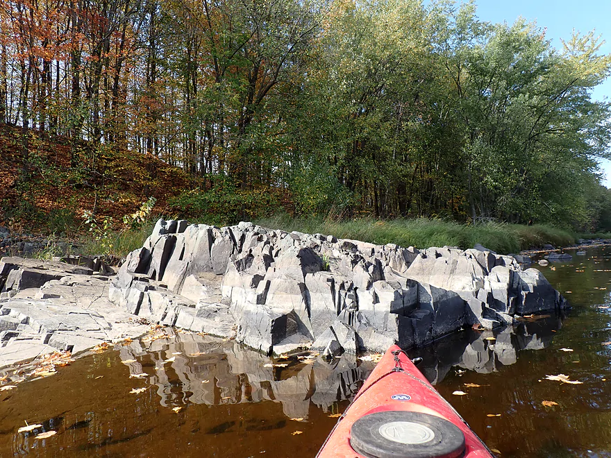
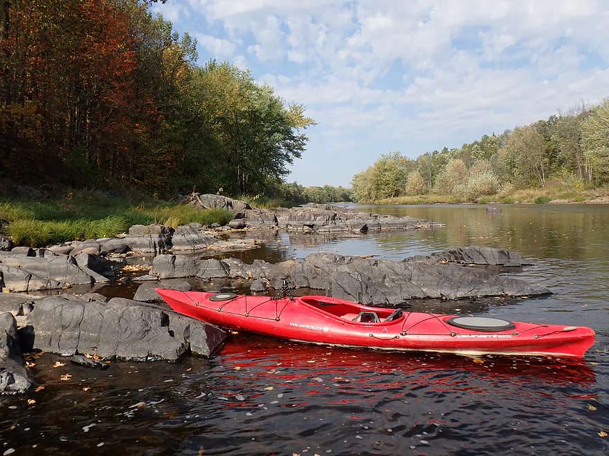
Jagged rocks
Smooth rocks
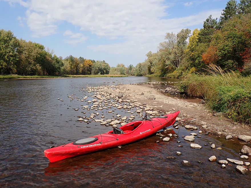
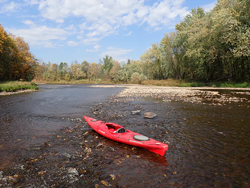
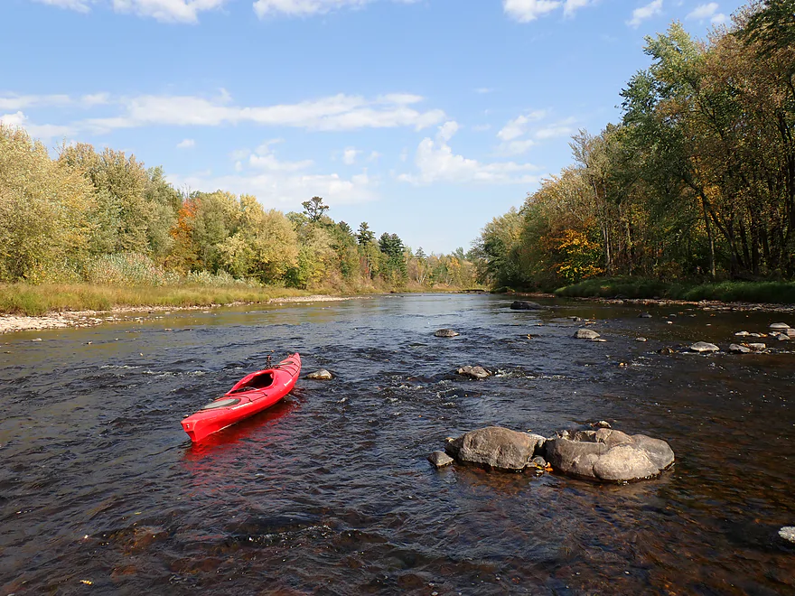
Starting to see more gravel bars
Large gravel bar at the mouth of the Little Jump River (poorly pictured)
Sandbanks redirect the river west
Final stretch
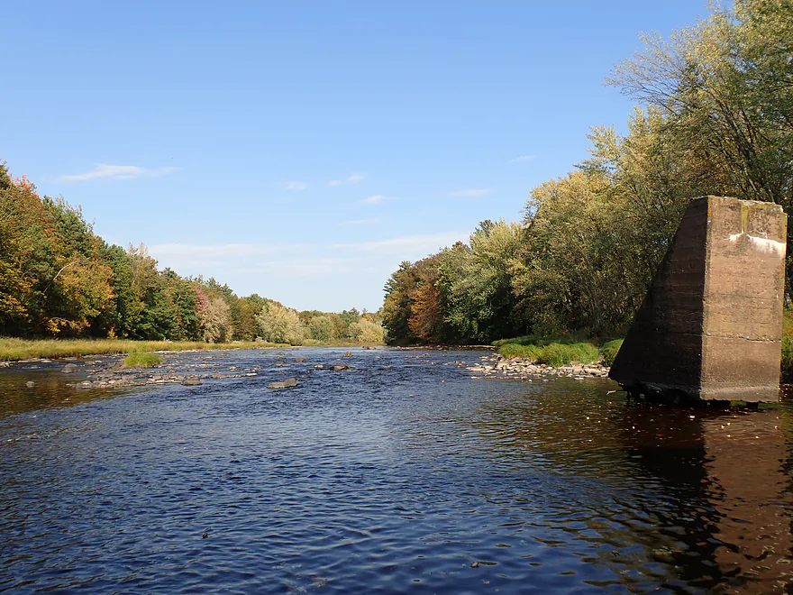
Old bridge pylon
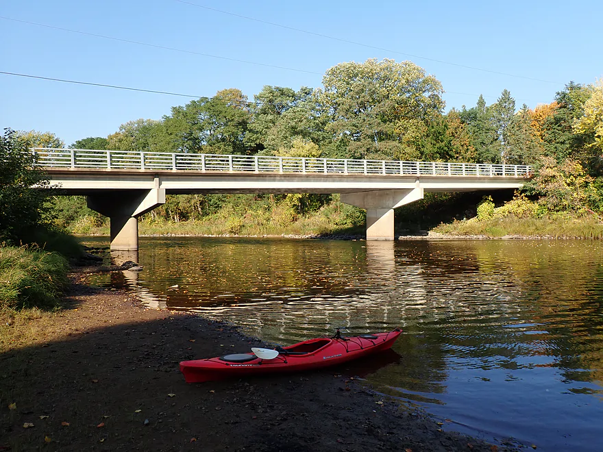
Ending the trip at Cty G
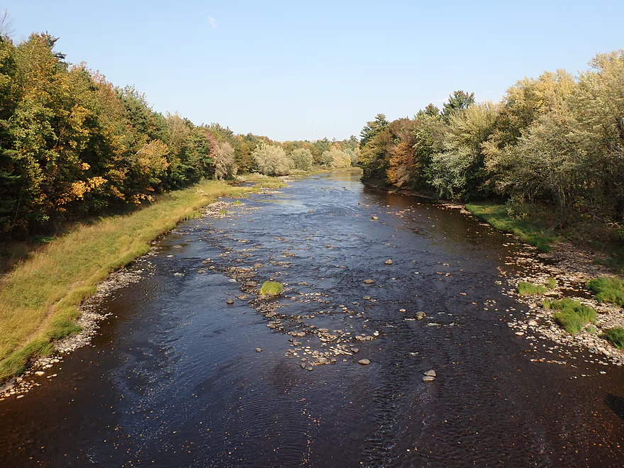
View downstream
View from bridge
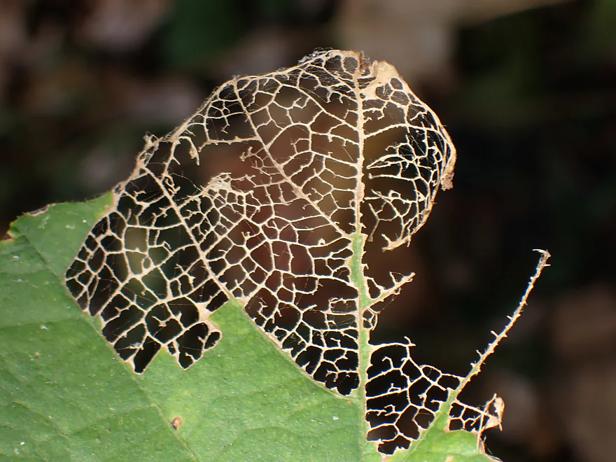
Cool leaf pattern by the take-out
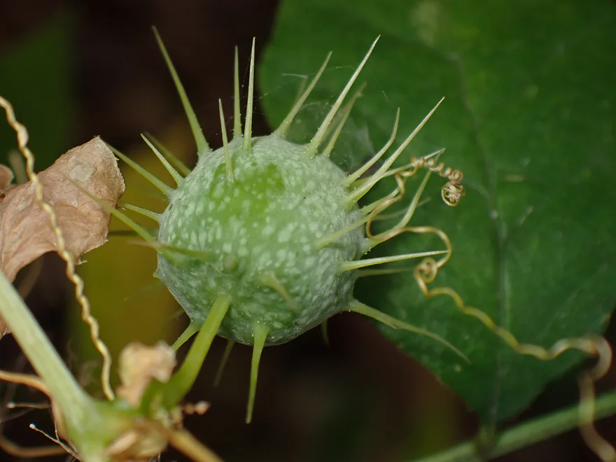
And some wild cucumber
Jump River – Sheldon

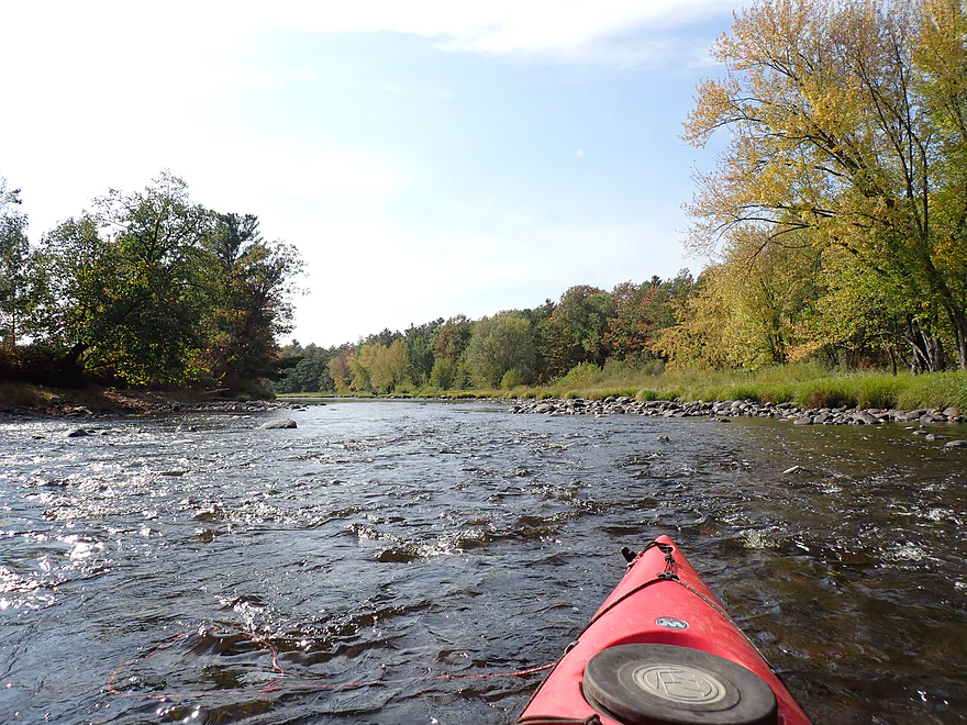
The Jump is a nice river located in northwest Wisconsin near Chippewa Falls. It is one of many fantastic tributaries that feed the mighty Chippewa River. The Jump is actually most known for its two forks which contain the best rapids and scenery. But both forks were running shallow due to low water levels, so I decided instead to explore a more obscure lower leg near the community of Sheldon. I was optimistic from some “Google scouting” I did using Streetview and was hoping to see some of the same nice fall color.
I started my trip at Haley Park (Sheldon), which was a terrific access (Google Maps incorrectly claims it’s closed). The river was attractive, with clear water, almost no mud and plenty of rocks…very much reminiscent of the Upper Black River. Fall color was good, but not yet at peak. The winds were strong and at times hurled large batches of leaves off the bankside maples which then “snowed down” on the river, creating a moving carpet of fall color. Really cool.
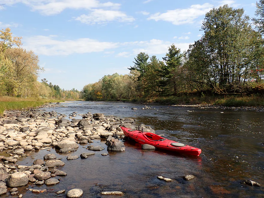
This is a “pool and riffle” river…and unfortunately most of the riffles were too shallow to comfortably float down and I had to get out and wade a number of times. This isn’t typical for the Lower Jump, but it was running abnormally low (like many up-north rivers) due to a lack of rain in the past month.
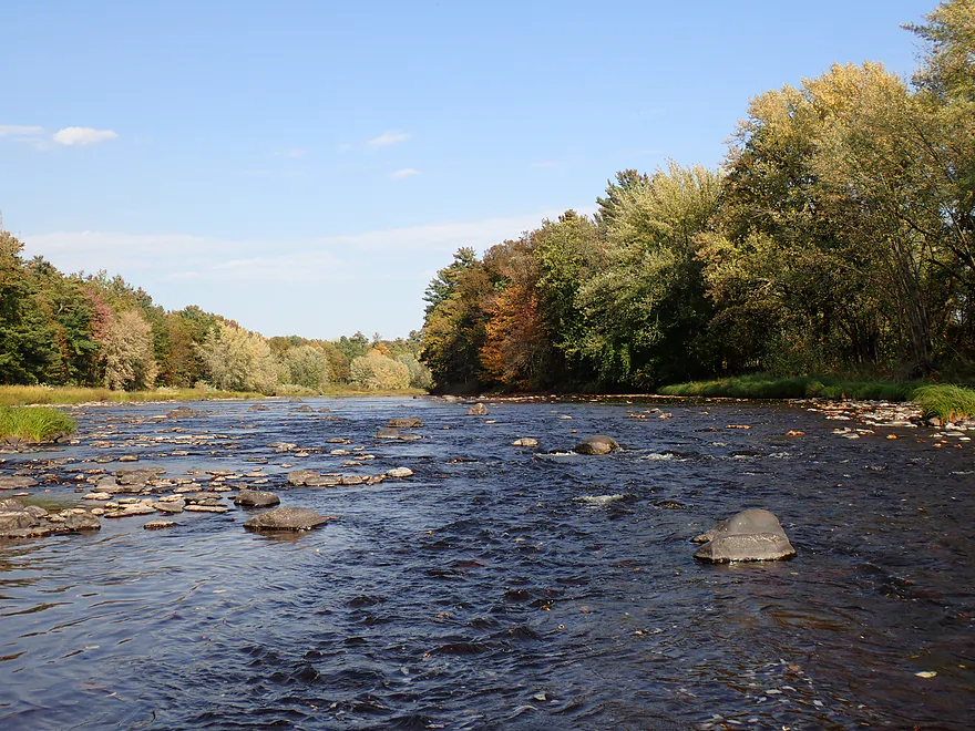
One of the trip highlights were the attractive boulder gardens and light rapids (that would have been more significant and enjoyable at higher levels). My favorite was perhaps at the halfway point where the river turns sharply north by a scenic hill. The combination of fall color, rapids, and exposed bedrock was very nice.
Continuing north, the river changed a bit in character as I started to see more pine trees, gravel bars, and a few exposed sand banks. I passed the mouth of the Little Jump River, but that looked a bit small (and got crossed off my todo list). I concluded the trip at Cty G where there was a public access on the upstream/south bank.
In summary, this was a really nice trip. However…it was too shallow and I had to get out too often. But that wasn’t the river’s fault…rather it was mine for bad timing. Regardless, the fall color was enjoyable, but I suspect it would have been even better had I waited a week. For most, a four-mile trip will be a bit short, but you can easily extend this trip three miles by launching instead from Cty H, which would be a nice bonus leg.
Sights included an egret, several eagles, small fish, crayfish, and a snapping turtle trying to hide from my kayak.
Big Falls County Park: Much further upstream from my trip is a scenic gorge with a series of Class 4 rapids and dells referred to as “Big Falls”. You can see the falls and take pictures via a trail on the east side. Google Photos has some nice pictures.
Haley Park: An excellent public access with an outhouse. Note, the park spans both sides of the bridge and you can launch from either side.
Alternate Put-ins:
- Cty H (3.2 miles upstream from Haley Park): You should be able to launch from the bridge shoulder. This bonus leg will likely be shallow and rocky…but scenic.
Cty G: This is a good (and scenic) public access located east/upstream of the bridge. Note, the access drive is steep and badly rutted. If your car doesn’t have high clearance I suggest simply leaving it by the bridge shoulder.
Alternate Take-outs:
- Whispering Pines Drive Ramp (5.1 miles downstream from Cty G): Figure three miles of nice gravel bars and boulder gardens…then the rest of the paddle will be impounded by the Holcombe Dam. You could continue a few miles to the official mouth on the Chippewa River but IMO it would be mostly uninteresting flowage paddling.
Bike Shuttle – Cty G to Haley Park: 3.0 miles to 30′ of ascent. This was a super easy bike shuttle (admittedly part of the reason I chose this trip).
Wind: This is a relatively open river, so you should be mindful of forecasted wind direction and speed.
Logjams/Strainers: None.
Rapids/Current: The river is mostly a mix of slow pools and then quick riffles. There are many light rapids but most were minor and not greater than Class 1. In really high water it’s possible some of the Class 1’s get promoted to Class 2’s.
Gauge: Jump River @ Sheldon
Trip Depth: 63 CFS or 3.04′
Navigability Estimates: The gauge is local so should be very accurate. The estimates though are just that and could be off.
- 0-100 CFS: Likely too shallow
- 101-200 CFS: A low depth but likely navigable (might have to wade 1-2 spots).
- 201-300 CFS: Average depth.
- 301-400 CFS: High depth…likely ok for paddling, but some boulder gardens will vanish. Rapids should be fun.
- 401-500 CFS: Very high depth. Many of the rapids might wash out…water quality likely won’t be good.
- 501-1000 CFS: Extremely high depth that will occur briefly after a heavy rain. This leg likely is still doable, but you want to be careful.
- 1001+ CFS: Maybe too high for recreational paddling.
Click here to see an overview map of the Jump River.
South Fork:
- Upstream from Luke Heights Lane: Much of the river looks navigable, but there could be strainers and deadfall to deal with. I just don’t know.
- Luke Heights Lane to Copper Dam Campground: 2.0 miles. A good stretch that includes high banks, a rocky bottom, minor rapids, and some white pines.
- Copper Dam Campground to Cty N: 6.8 miles. A scenic leg with more white pines, boulders, and rapids. Best feature is Little Falls (200 yards of Class 2 rapids which can be portaged).
- Cty N to Big Falls County Park South Access: 1.3 miles. A short leg with some light rapids and boulder gardens.
- Big Falls Park South Access to North Access: An incredibly scenic stretch of dells, rock formations and rapids. Paddlers should be warned this contains Class 4 rapids and has killed people. Unless you are a professional whitewater paddler, you should portage this. There is a 900′ portage path to the right. Even if you don’t paddle the rapids, definitely consider checking them out (it’s a local tourist attraction). A trail system east of the river provides good views.
- Big Falls Park North Access to North/South Fork Confluence: 1.7 miles. Includes a mile-long stretch of boulder gardens and Class 2 rapids. Also includes numerous rock outcrops and a small waterfall from a feeder creek.
Main Branch:
- North/South Fork Confluence to Cty M Wayside: 5.0 miles. This section includes high sand and gravel banks and multiple Class 1 rapids.
- Cty M Wayside to Village Park Landing: 5.9 miles.
- Cty M Wayside to Wayside Park by Hwy 73: 5.1 miles. A pleasant stretch. There is no special scenery, but it is consistently good with pine trees, boulder gardens, and light rapids. Rapids are generally safe with none greater than Class 1. There is a short stretch of small but scenic outcrops.
- Wayside Park to Village Park Landing: 0.6 miles. A short stretch by the village of Jump River. There is a terrific series of outcrops along the south bank.
- Village Park to Sheldon: 10.2 miles.
- Village Park Landing to Cty H: 7.0 miles. I think this is one of the more popular legs on the Jump with paddlers. Highlights include Class 1 rapids, boulders, some outcrops, and attractive wooded banks. View from Cty H bridge is scenic.
- Cty H to Haley Park/Sheldon: 3.2 miles. Seems to be more boulder gardens and light rapids. There is a scenic railroad bridge by Sheldon.
- Haley Park to Cty G: 4.0 miles. A pleasant Northwoods stretch with frequent shallow rapids and boulder gardens.
- Cty G to Whispering Pines Drive Ramp: 5.1 miles. First half is nice with large gravel bars and more boulder gardens. Second half is impounded by the Holcombe Dam and is likely slow and less interesting.
- Whispering Pines Drive Ramp to Wayside Boat Landing: 1.7 miles. Likely uninteresting lake paddling.
- Wayside Boat Landing to Sportsman Club Park/Mouth on Chippewa River: 3.7 miles. Likely uninteresting lake paddling.
North Fork:
- Upstream from Hwy 8: There could be navigable sections, but I don’t know. Snags and strong rapids could be issues.
- Hwy 8 to Hwy 1: 10.9 miles. The guide book “Wisconsin’s North Central Canoe Trails” describes this as a mix of minor rapids and quiet water by “meadow-like” sections. Note: this guide is outdated and was likely done at low water. The snags and rapids difficulty may now be worse.
- Hwy I to Riley Road: 4.4 miles. First half has some longer stretches of rapids including what I think are Class 2+ (piecing together clues from Rick Kark).
- Riley Road to W. Forest Lane: 1.7 miles. A few more rapids, but not as many nor as intense (I think).
- W. Forest Lane to Cty N: 2.0 miles. Good leg with what I believe are some longer stretches of Class 1 rapids.
- Cty N to South/North Fork Confluence: 4.3 miles. Rick Kark paddled this when high. He described it as being wooded and fast, but lacking in noteworthy rapids.
Mondeaux River (a tributary to the South Fork): The section north of the dam to the mouth on the Jump is likely too congested to run, but the lake itself (the Mondeaux Flowage) is a nice paddle. You can read a review on the Mondeaux here.
Trip Map
Overview Map
Video
Photos Size: