
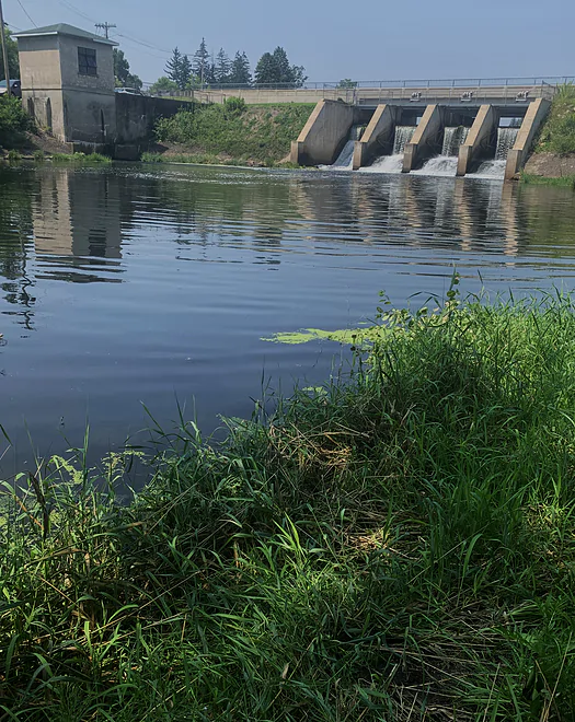
Put-in at the dam in Barron
Here’s the exact put-in spot in Lions Park, Barron
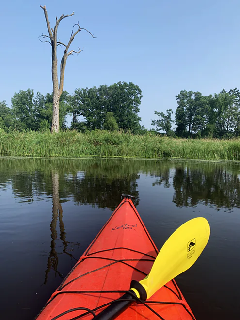
Yellow River skyline
Clear water, sandy bottom, swift current define the Yellow
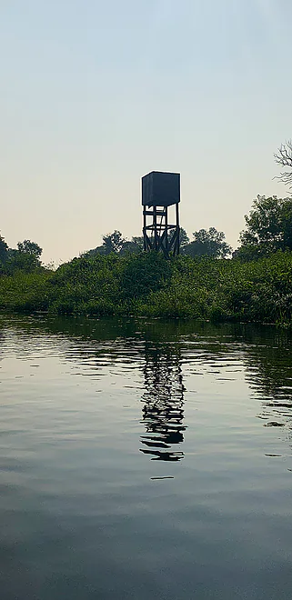
Hazy day, lazy river, old sentinel
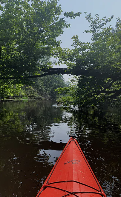
Nice beckoning archway, the closest thing to an obstacle that I encountered
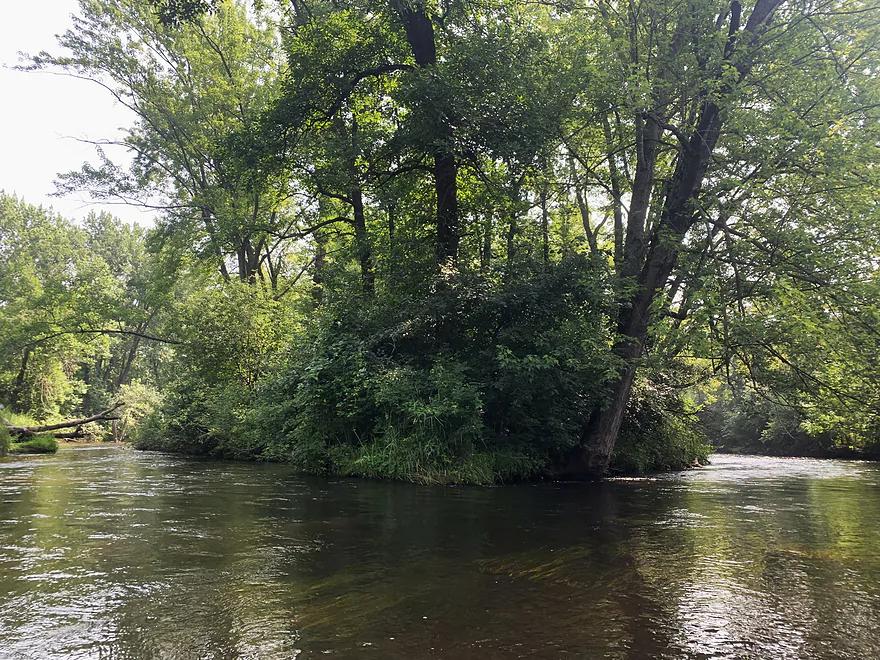
Braided channels tempt you just before the confluence
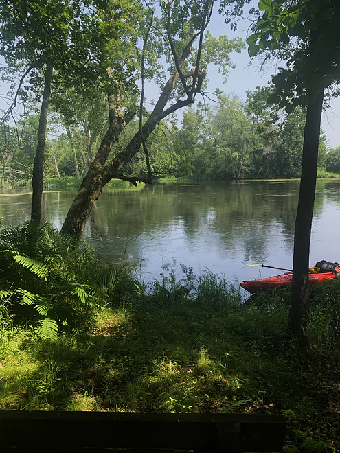
No good rest stops on the Yellow…look for one like this on the Red Cedar
Yellow-Red Cedar confluence. No takeout on the Yellow, you must proceed down the Red Cedar
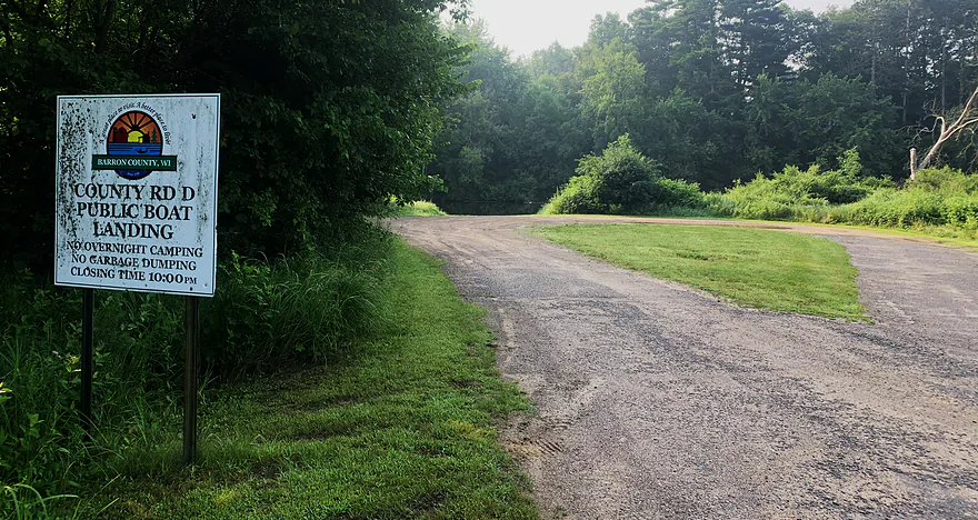
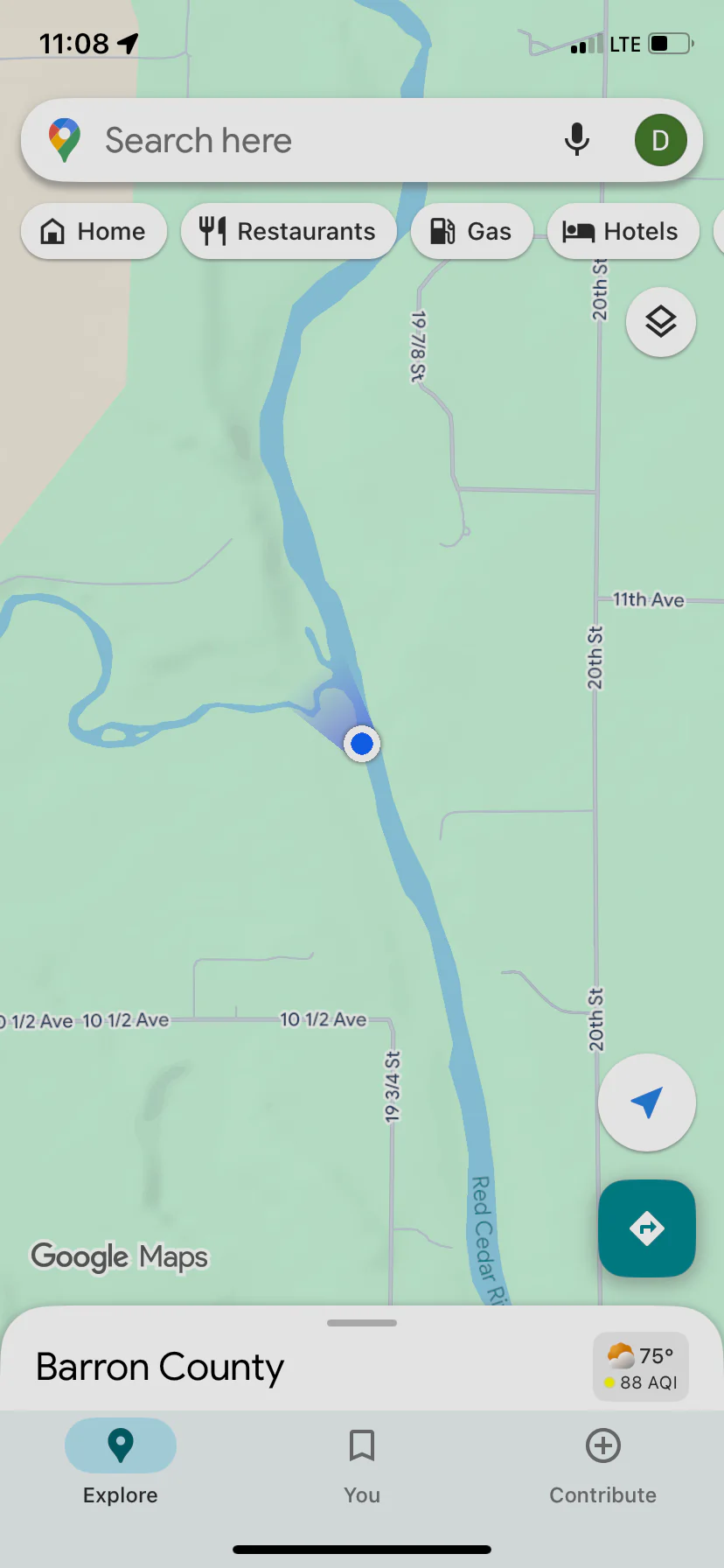
Takeout is this public access
Yellow River – Barron County


This Yellow River, in Barron County, is by far the least traveled of the four navigable Yellows in Wisconsin. But I recommend it as a worthwhile trip, packaged with a run on the far less interesting river to which it is a tributary, the Red Cedar River.
I will admit to padding the list of rivers I’ve traveled when I explored this Yellow River on a steamy day in July. I’d already traveled the other three navigable Yellows and wanted to notch the fourth. The others include the Yellow that originates in the Chequamegon Flowage (Taylor County); the winding, twisting and often marshy Yellow that courses through Spooner on its way to the St. Croix at Danbury; and the central Wisconsin Yellow, with its many facets and moods. See my notes from exploring a piece of that river.
Given the quality of the paddling experience on those other Yellows, it’s no surprise that the Yellow I explored this day doesn’t get much love or attention. In fact, I only found one write-up about the Barron County Yellow, by Rick Kark and he’d traveled it back in the 1990s.
I was surprised that four local people I’d encountered – two in a canoe – had no idea that the Yellow River in their backyard was even navigable. One canoeist claimed he did know but his “insight” defied gravity when he claimed that the Yellow didn’t flow to the Red Cedar. (It didn’t matter that I’d just done that.)
You can’t take out on the Yellow; you have to travel downstream on the Red Cedar River, which has two public landings to choose from – one, at County Road OO, for a short trip, and at County Road D, for a longer run.
For me, this was the point of doing the Yellow: it’s a sweet alternative to paddling the wide, slow and highly developed Red Cedar River.
I put in at Lions Park, located (river left) below the dam in Barron, a hideous structure that creates an equally hideous aquatic plant-choked flowage. (Don’t get me going on dams.) “Civilization” falls away immediately as you wind your way down a river that, all the way to its confluence with the Red Cedar, was obstacle-free, flowed steadily and swiftly, and felt very remote, especially on this classic July day when the air was cloaked in humidity and redolent of corn sweat, and the sky was tinged a dirty blue by Canadian wildfire smoke.
You pass under just two bridges on the Yellow: at 17th Street (which offers a most appealing put-in spot mowed by a neighbor) and County Road O. Adding to the remote feeling is the absence of a lot of residences; this stream doesn’t lend itself to recreational property development, contrary to the counterpart to which is flows.
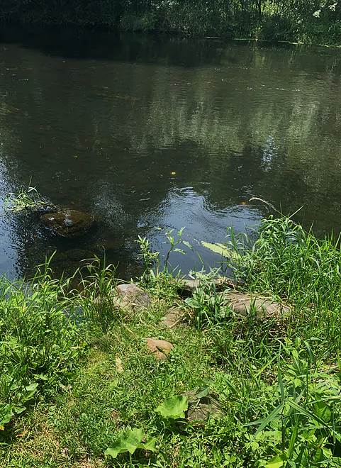
The river widens and slows down past the County O bridge. All along the route, the river bottom is either an appealing gravel or even more appealing sand. I started to keep my eye out for an ideal picnic spot on some high ground along the river, or an inviting sandbar off which you could take a dip. I didn’t find any: for those activities, you’ll have to reach the Red Cedar.
About a half mile above the confluence, the river narrows and braids into a few side channels, offering a small dose of paddling excitement. Then you slide into the Red Cedar.
For a quick trip on the Yellow, take out at Barron County’s public landing less than a mile from the confluence (upstream of the bridge, on the left). For more of the languid Red Cedar, continue to where I took out at County Road D (downstream, river right).
I have never seen more river otters, and evidence of river otters, than on this stretch of the Yellow. They are fascinating to watch, as the bold ones are curious about you and will raise their heads and necks out of the water to get a good look at and smell of you.
Lions Park: Lions Park, in Barron. River left, below the dam. Curiously, the bank here is paved with asphalt but it’s largely grown over. Look for a path at the very lowest tip of the park for the obvious put-in spot.
Alternate Put-in: A nicely groomed spot at the 17th Street bridge (upstream river left).
Barron County river access at County Road D: Downstream river right.
Alternate Take-out: Barron County Rd. OO (upstream-left).
Both these are public landings, thereby leveled off at the shore, tame and accessible.
Same as by car or by bike – a series of township and county roads. Barron County has (IMO) a wacky road numbering system that gives roads names with fractions (i.e. 20 ¼ St.). Pay close attention to that. Biking is easy.
Succinctly put: None, none and swift enough to make it interesting.
There is no gauge for this Yellow River. My sense is it almost always has adequate water. A rough proxy could be the USGS gauge on the Red Cedar River at Colfax, which read 1,000+ cfs on this day. Things were slightly elevated the day I ran it, but the dam at Barron doesn’t appear operable as a hydroelectric facility and has no reason to alter the flow out of the dam, other than for high-water events.
Years ago I mused about taking on this, my fourth, Yellow and explored upstream from Barron to see if it was worthwhile. Short answer: No. Views from two bridges told me deadfall was likely, and even if you plowed through that, you’d face a painstaking slog through the flowage at Barron.
The only decision to make about the extent of a trip on the Yellow is how far down the Red Cedar you want to travel. Getting off the Yellow, at 17th St. or County OO, would not be worth the bother, if starting at the dam in Barron.
Thank you Denny for the review! I’m definitely putting this Yellow River on my todo list. WisconsinRiverTrips.com is always very appreciative of guest reviews, and if you the reader is ever interested in submitting one, you can use this online form.
Trip Map
Photos Size: