
View from Garage Road shows how shallow the creek was
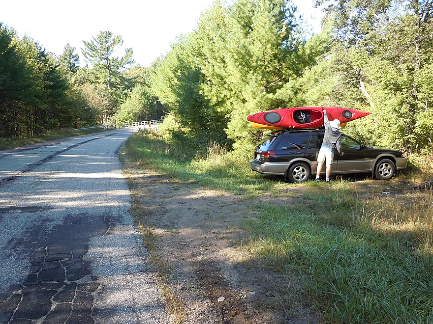
Good parking off Garage Road
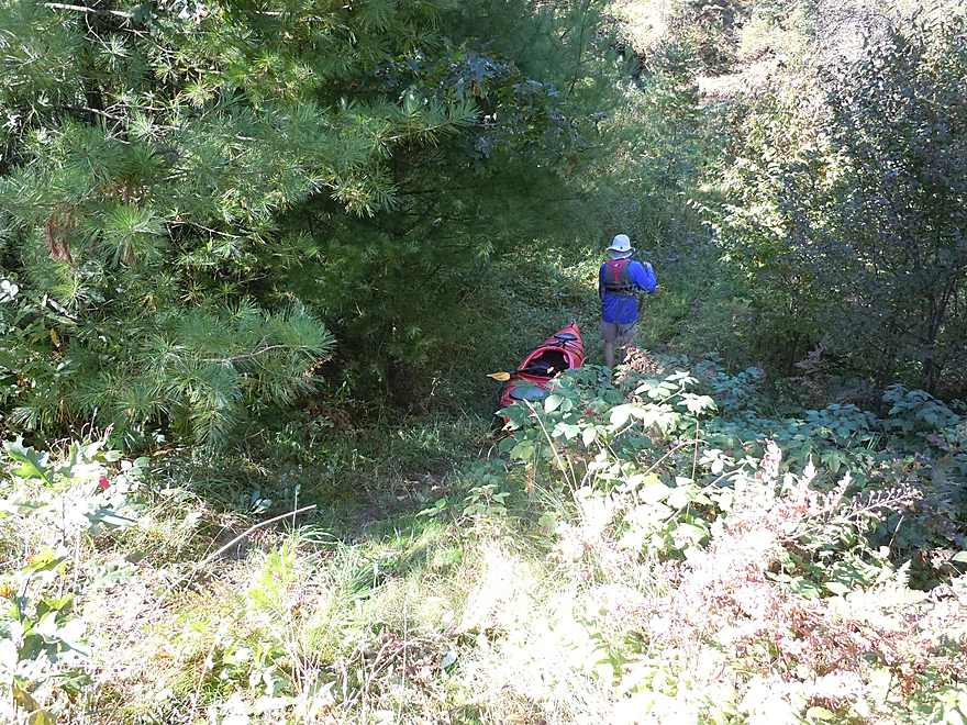
But a bit of a drag to get down to the water
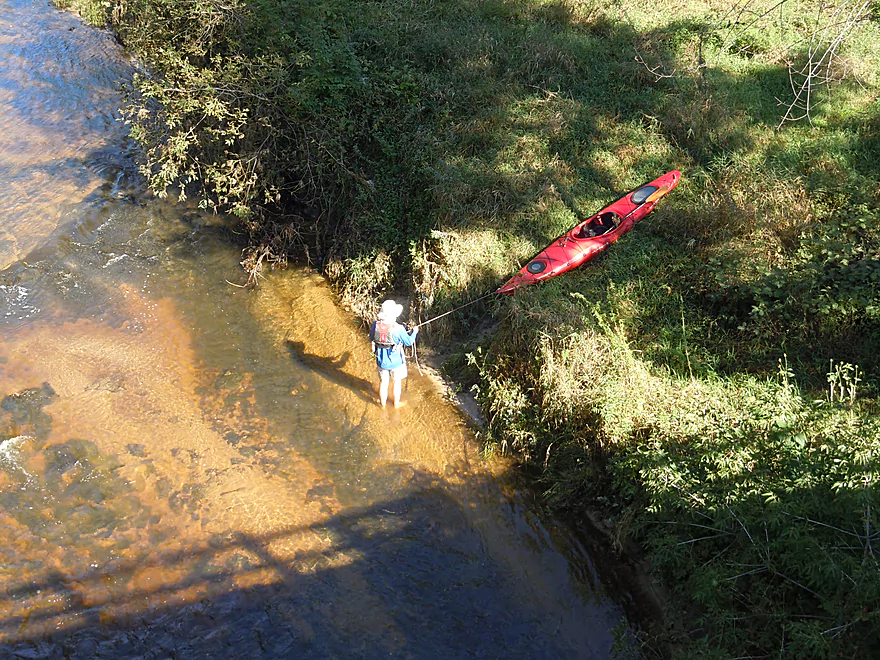
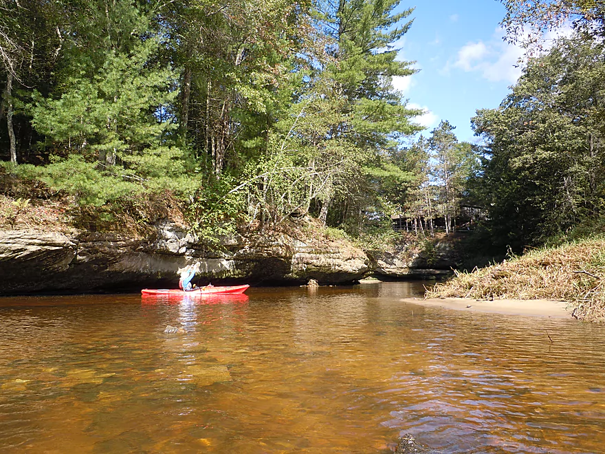
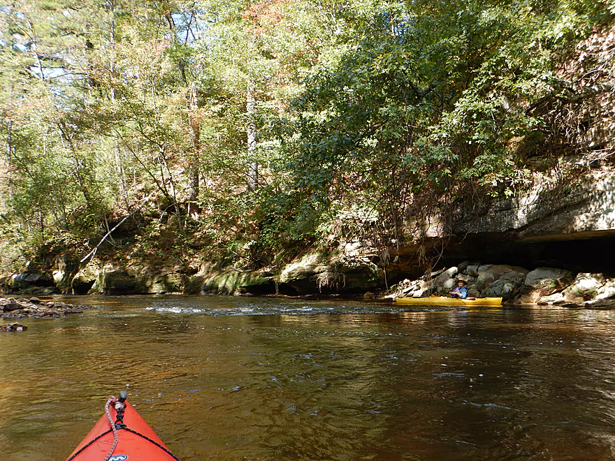
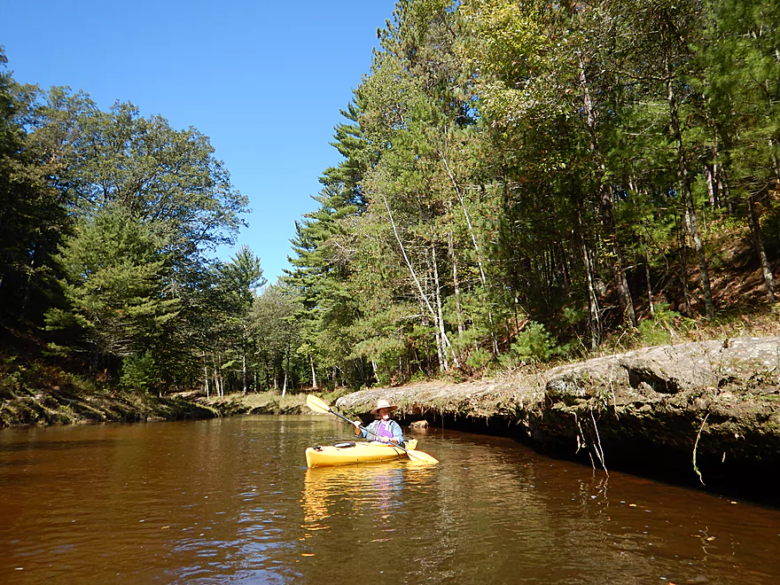
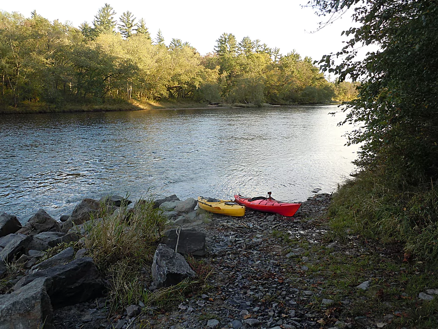
Nice launch area
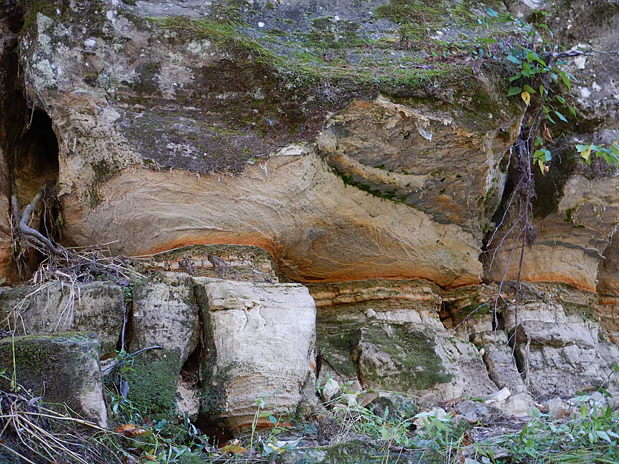
Looks like layered candy
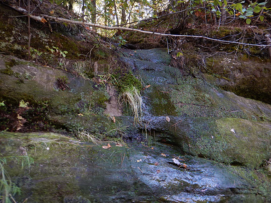
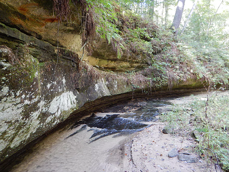
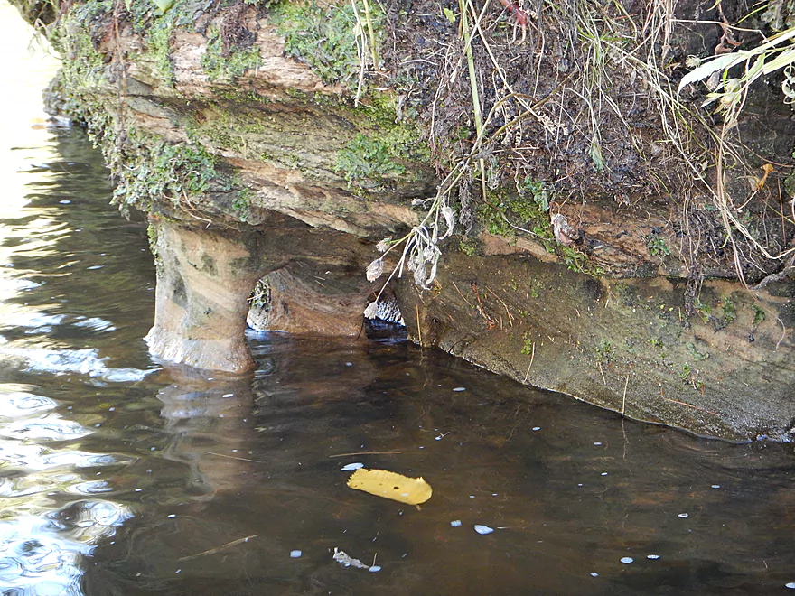
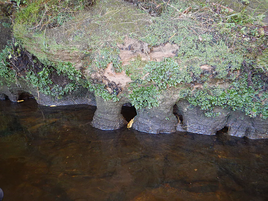
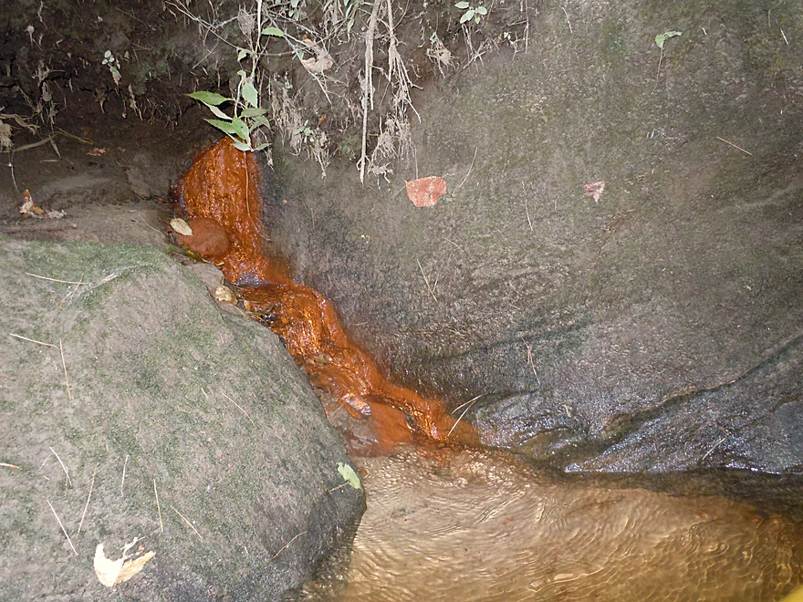
One of many seeps
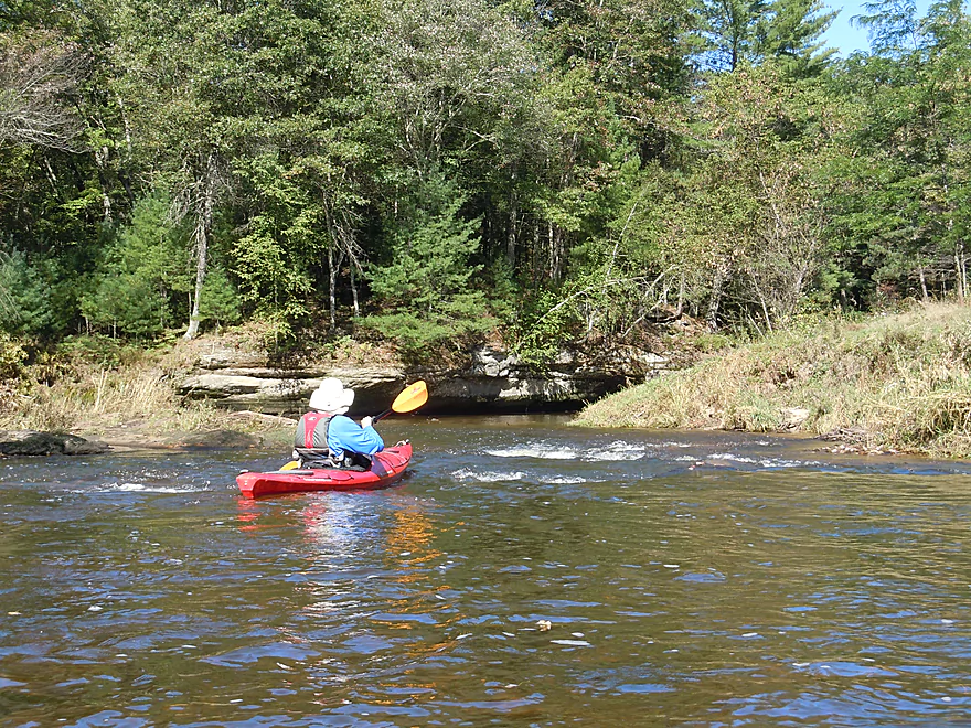
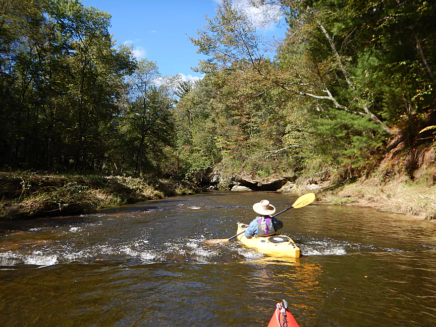
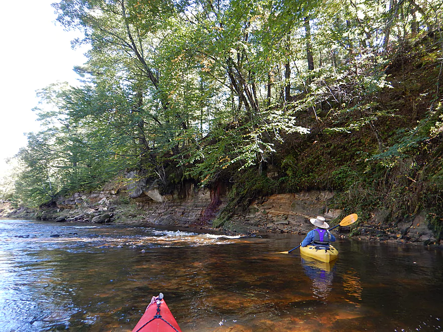
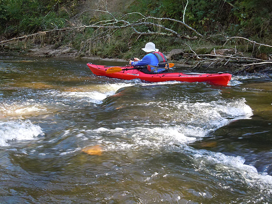
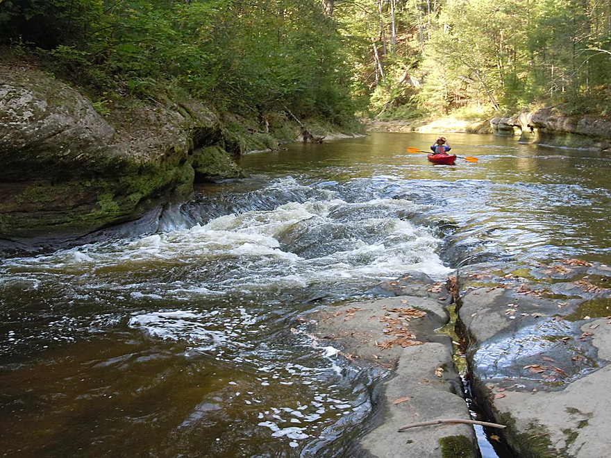
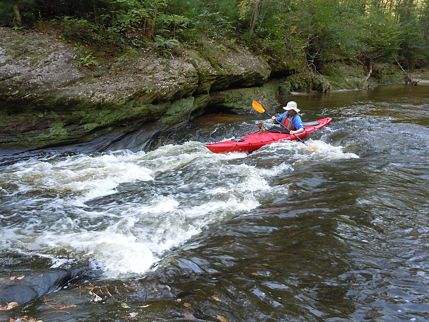
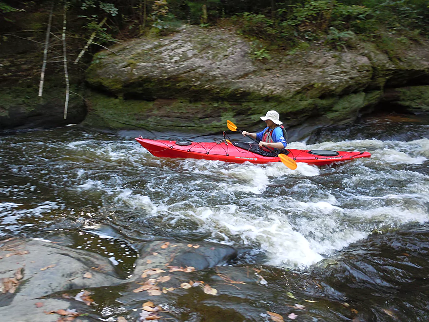
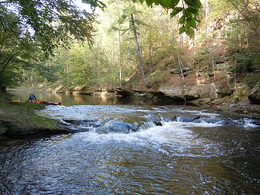
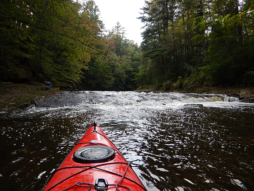
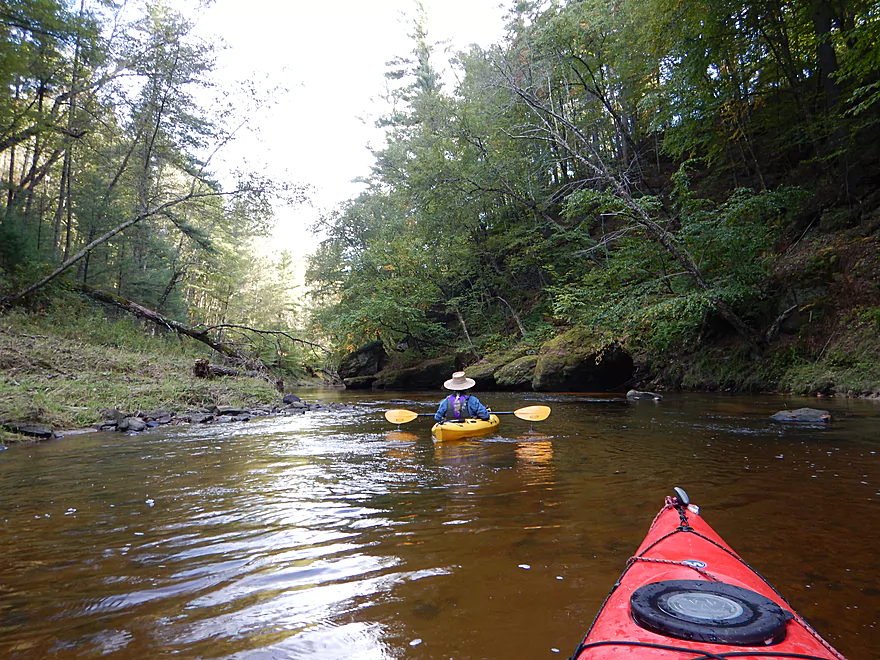
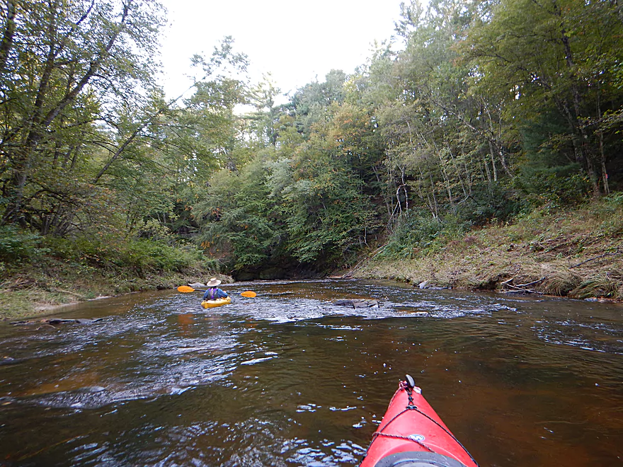
One of many light rapids
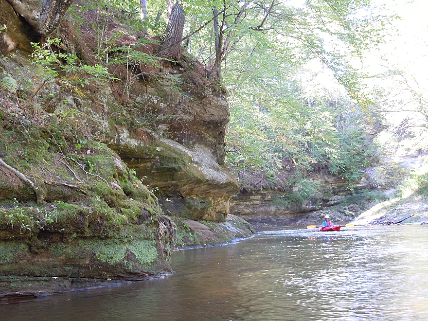
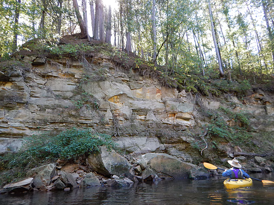
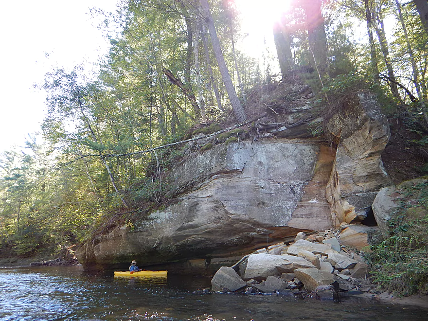
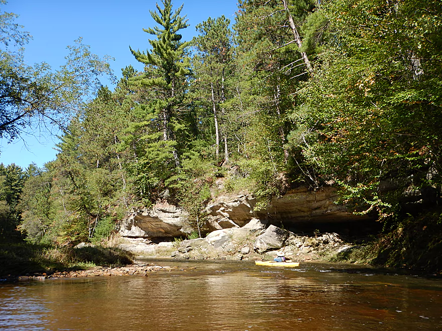
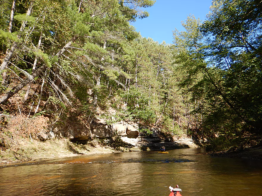
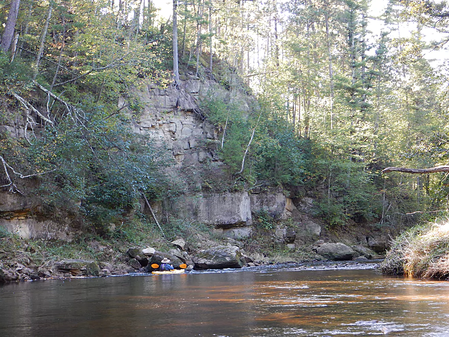
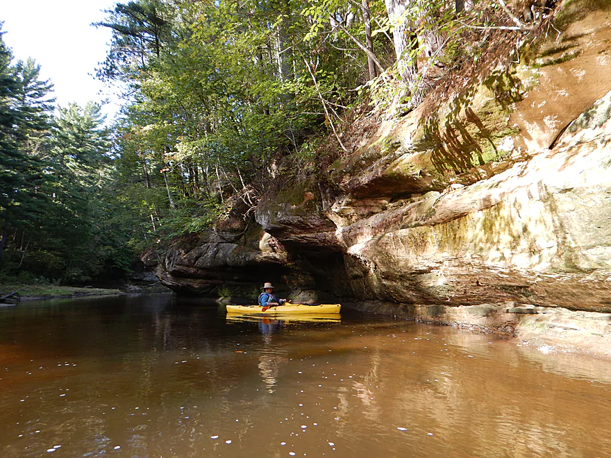
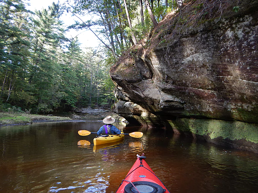
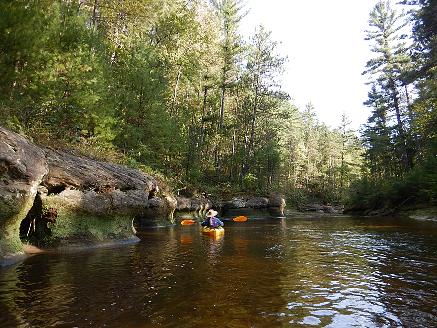
One of many gorgeous rock formations
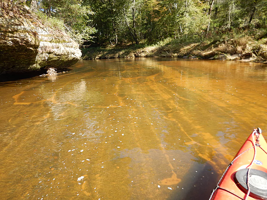
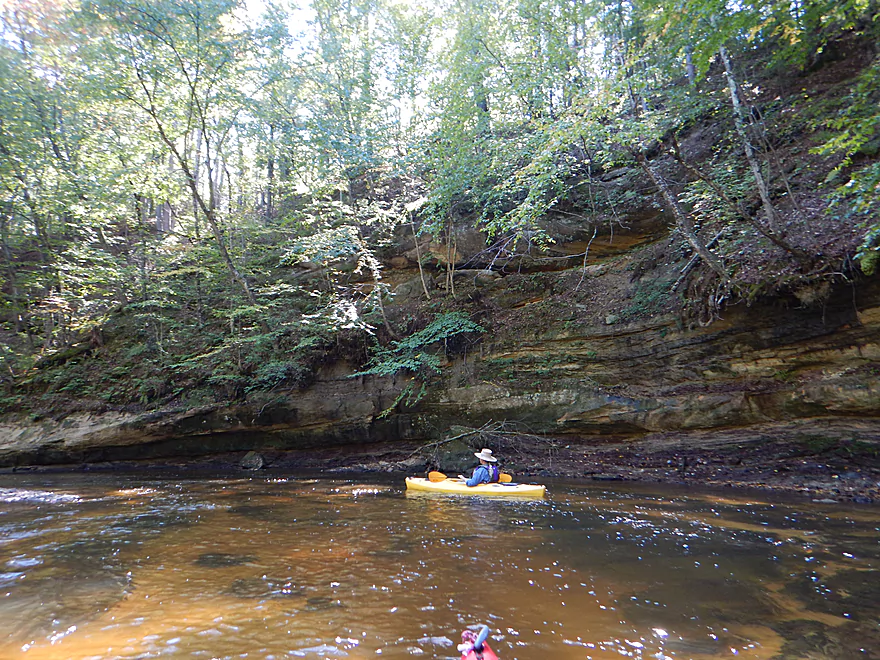
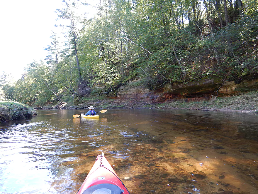
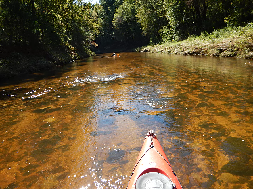
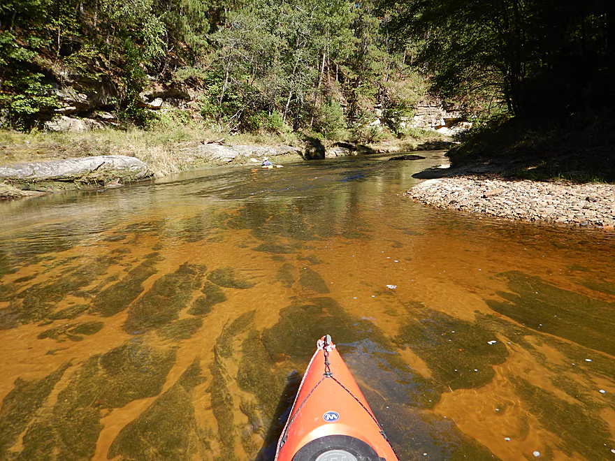
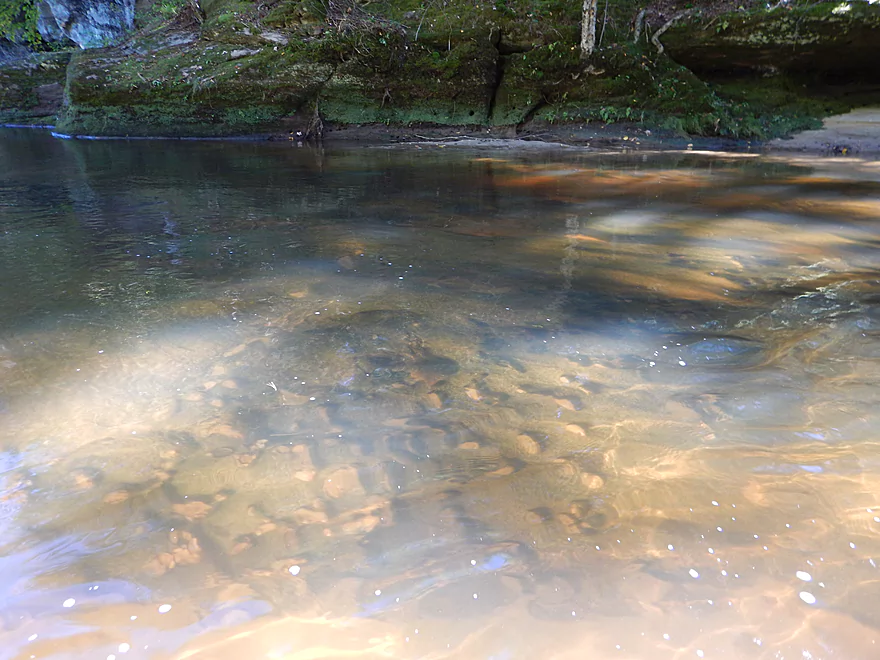
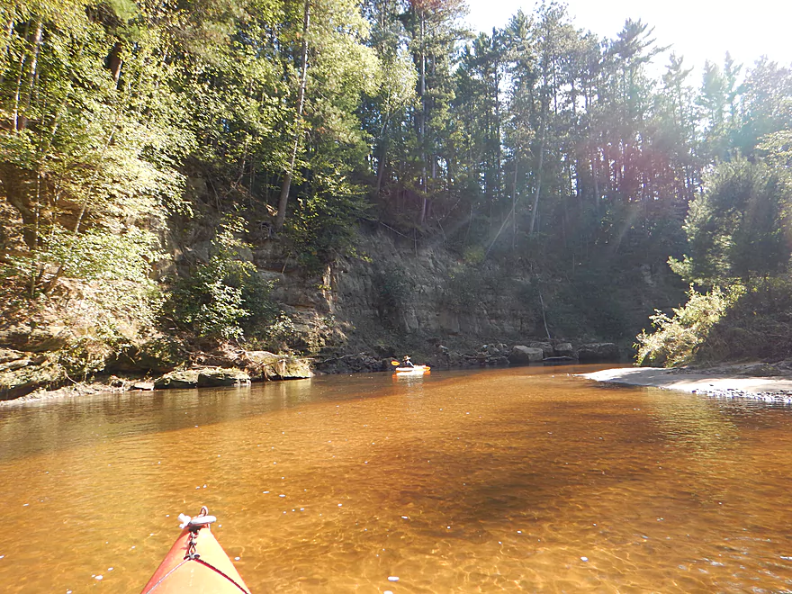
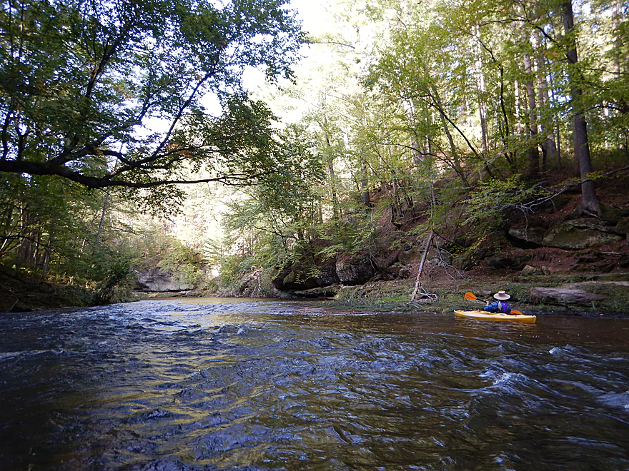
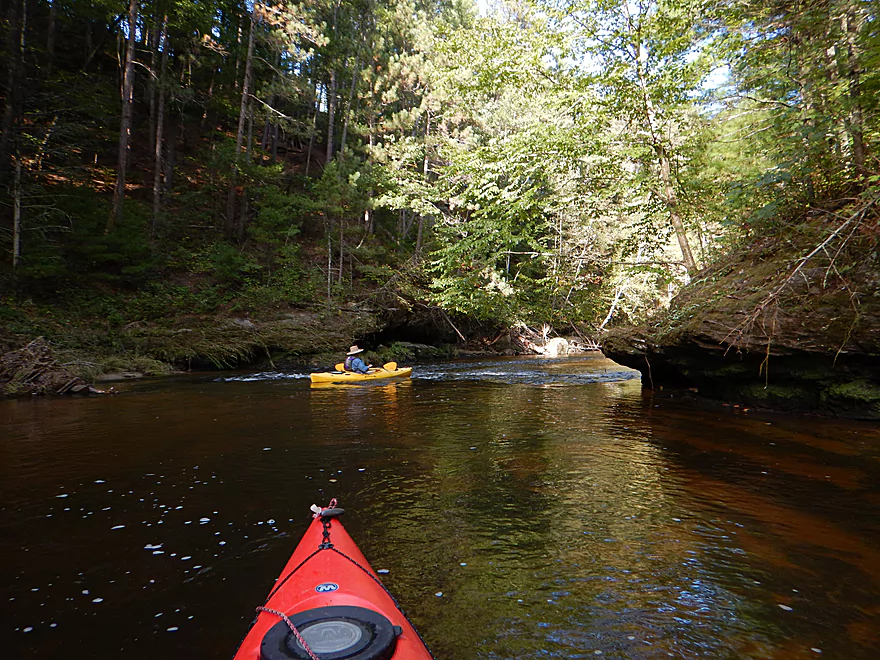
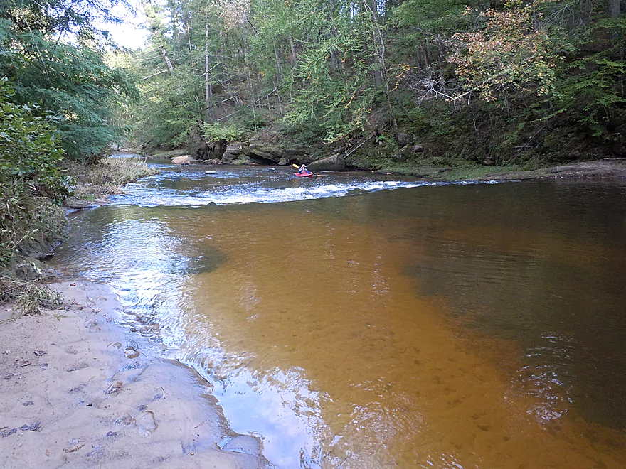
The water clarity was awesome
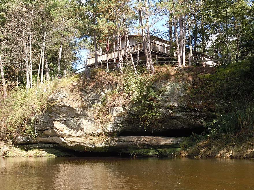
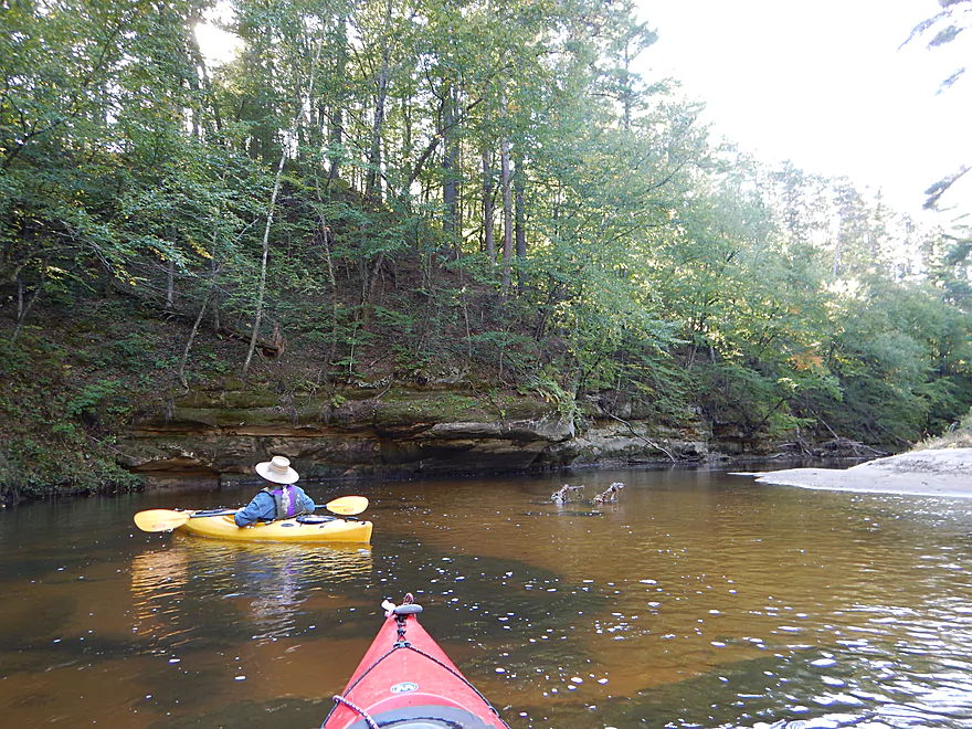
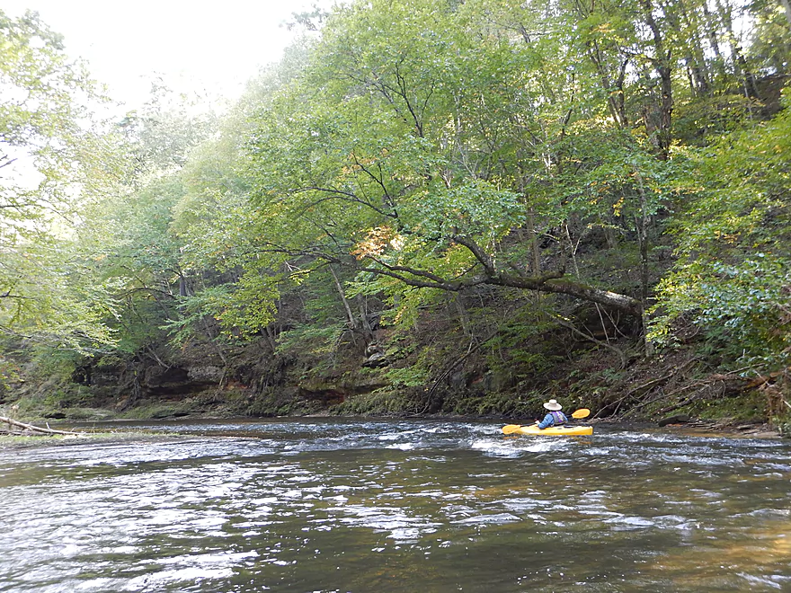
Mostly a private paddle, but some houses
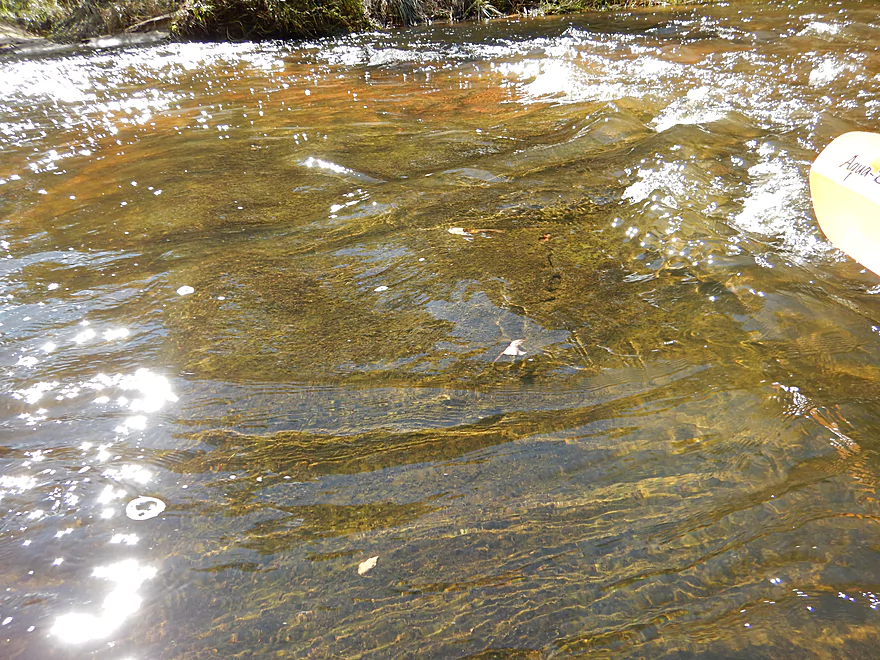
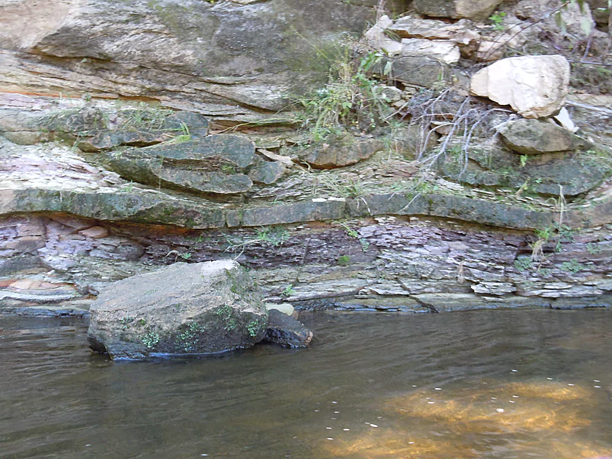
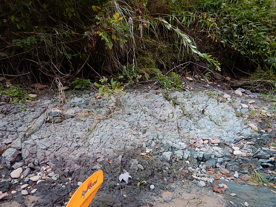
Much of the substrate was flat rock (amazing!)
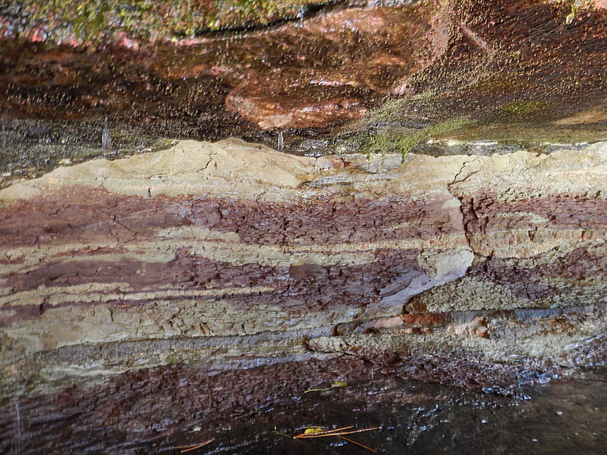
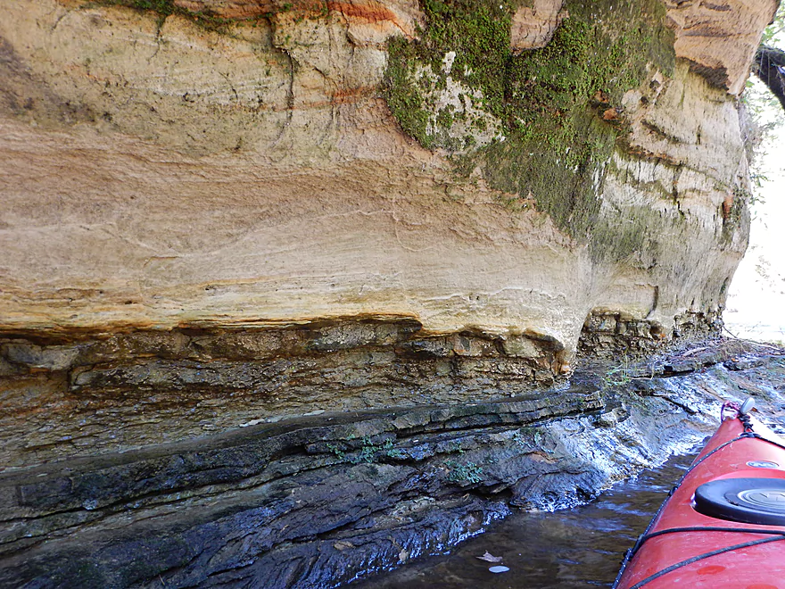
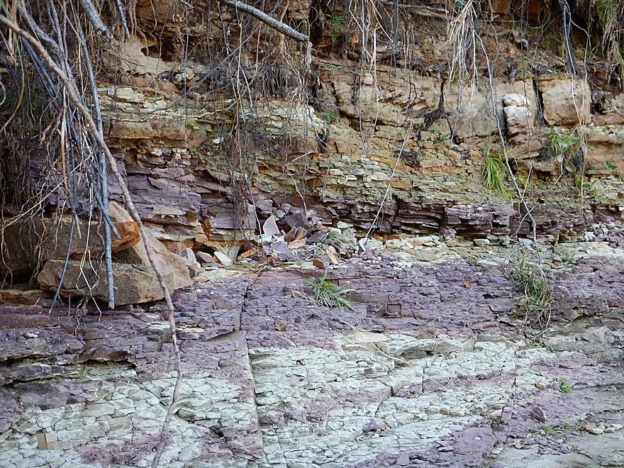
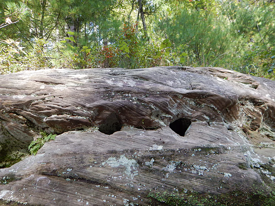
Mauve and tan stratifications
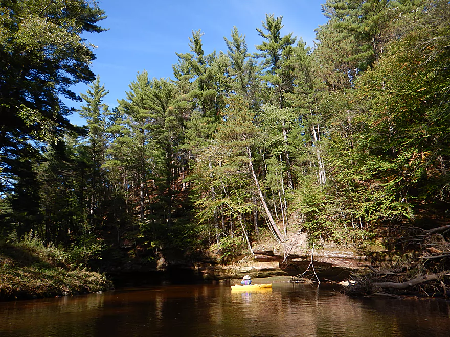
Several nice but small sandbars

Do not paddle past this creek
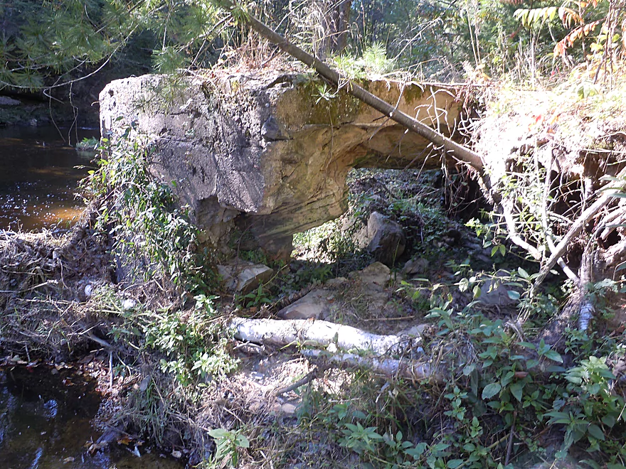
A fabulous draw and rock formations
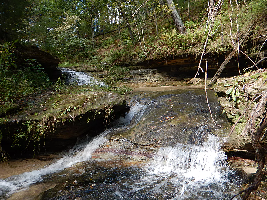
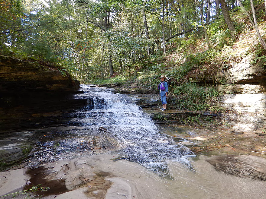
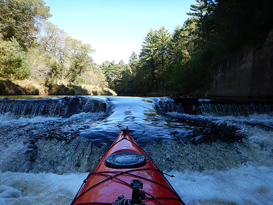
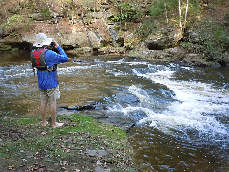
Very scenic double waterfall
Super cool
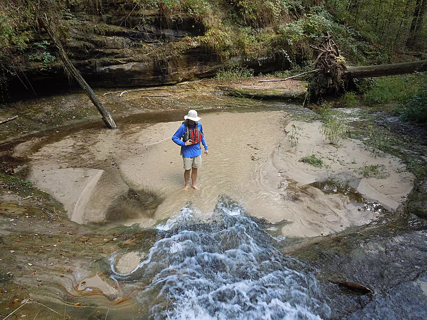
The water in the pool was so clear (and cold)
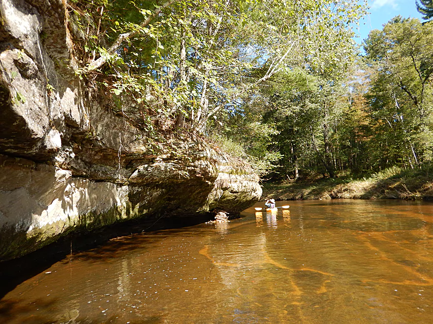
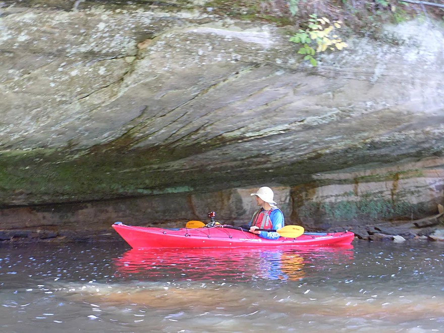
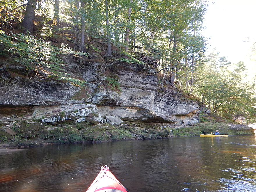
One of many rock wall photos
Did not see much in wildlife, but suspect they were around
A geologist would go nuts here
Wonder what pushed those rocks into the water?
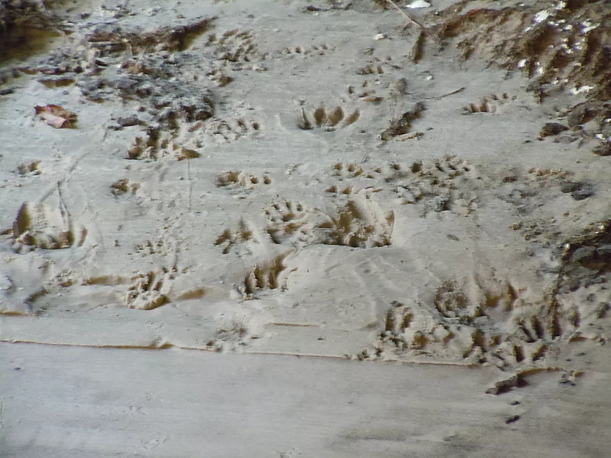
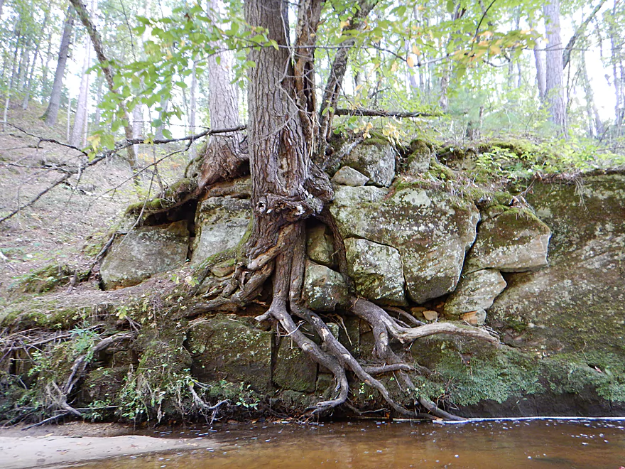
The ghostly imprints of the roots that separated the rocks
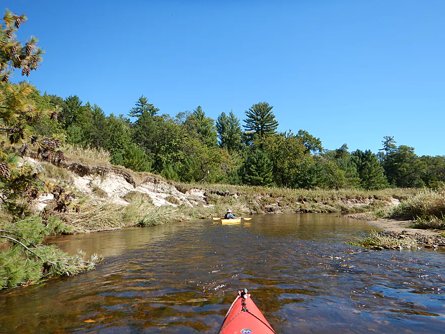
Just a typical scene
The rapids (so far) are very safe
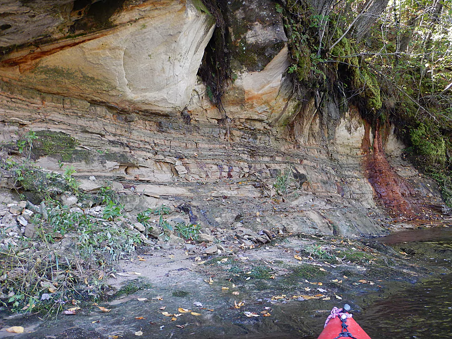
Another amazing rock stratification
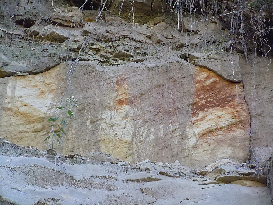
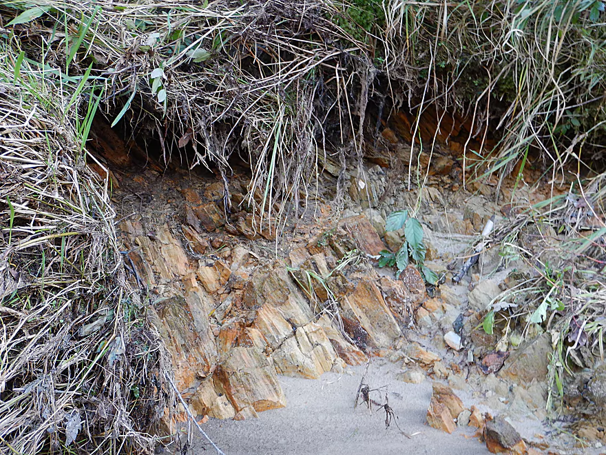
Not sure what causes the color
Ship rudders
Typical water clarity (at low depths)
Like a slice of cheese
Many shady overhangs
A precarious life for trees growing along the creek
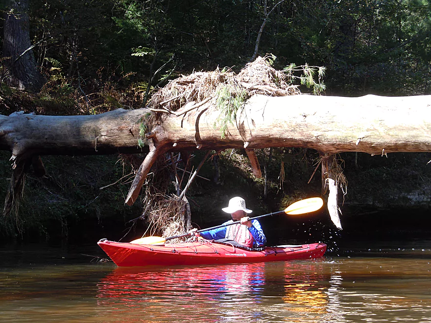
Stuck again…
One of my favorite photos
Deja Upper Iowa
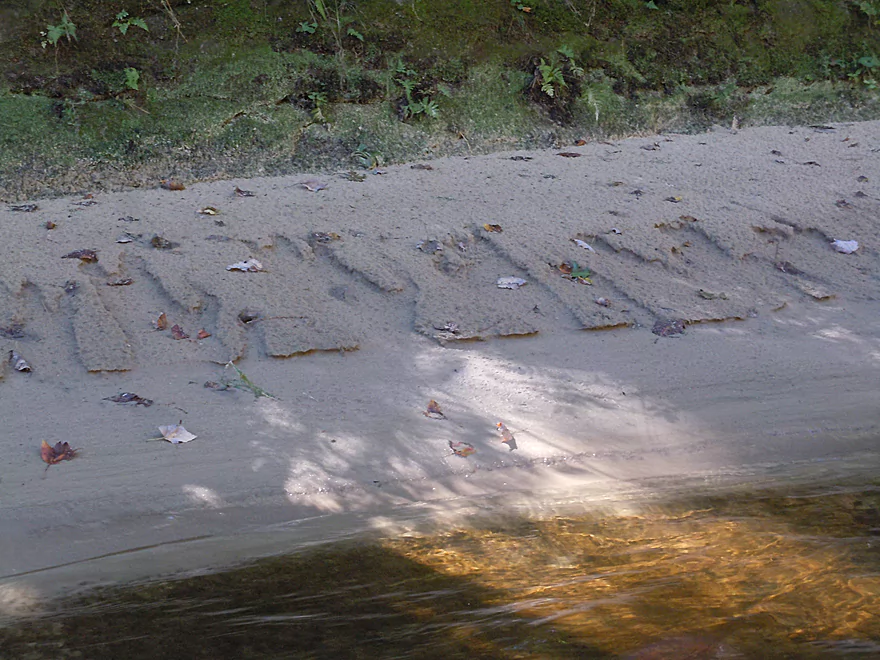
Eroded sand looks like a serif font
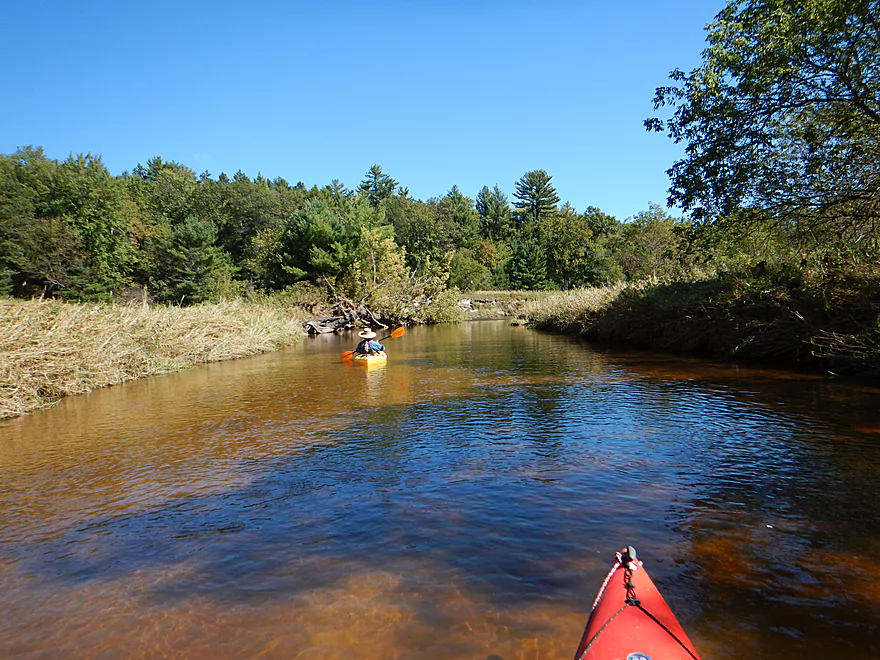
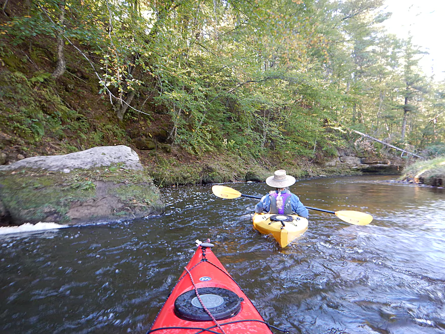
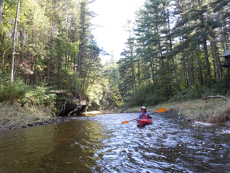
One of a few open sections
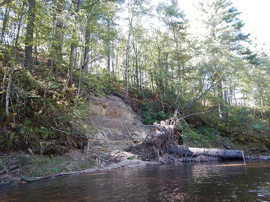
Eroded bluffs end up in sand banks like these
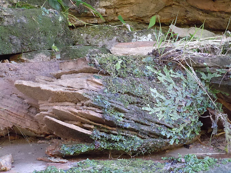
Have no idea what it is, but looks amazing
These rock layers are undulating…
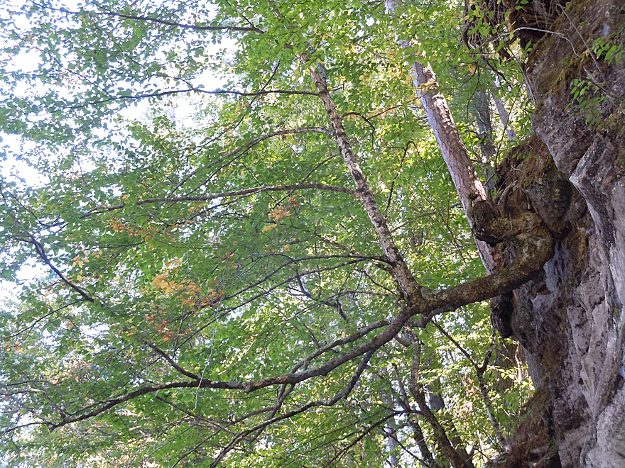
Even the trees are getting bent out-of-shape
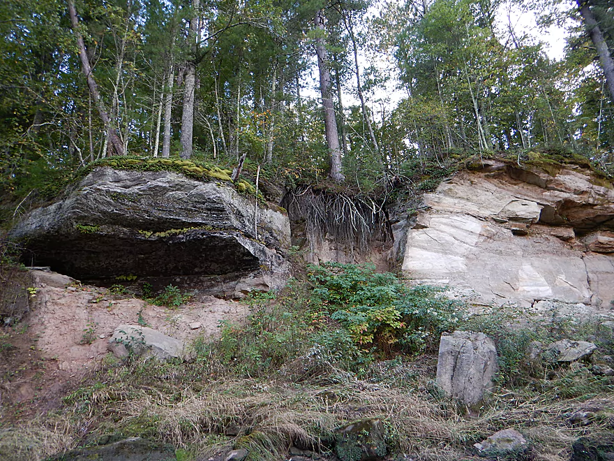
Deja Lake Superior Sea Caves (mini versions)
The current has carved circles into the sandstone
The creek flash floods (super dangerous)
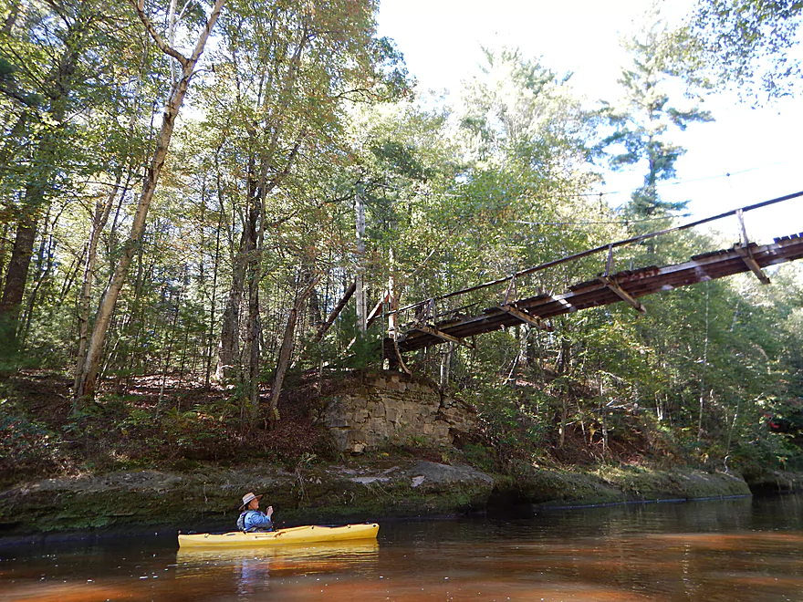
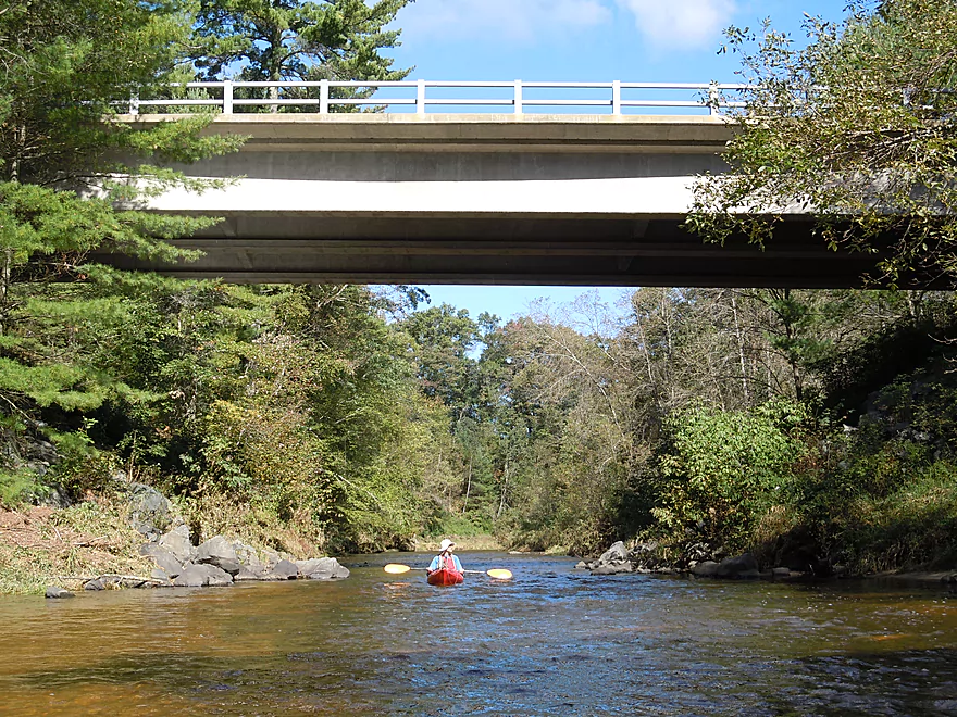
Attractive pedestrian bridge
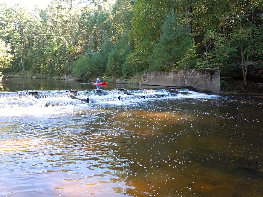
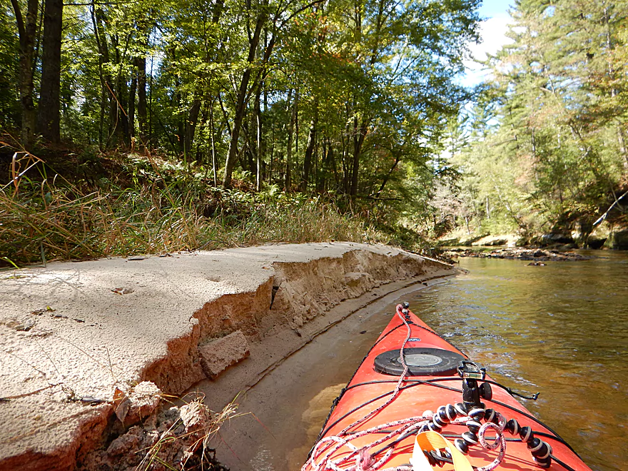
An old dam
There is a concrete ramp on the left far side you can run
Portaging would not be an easy option here
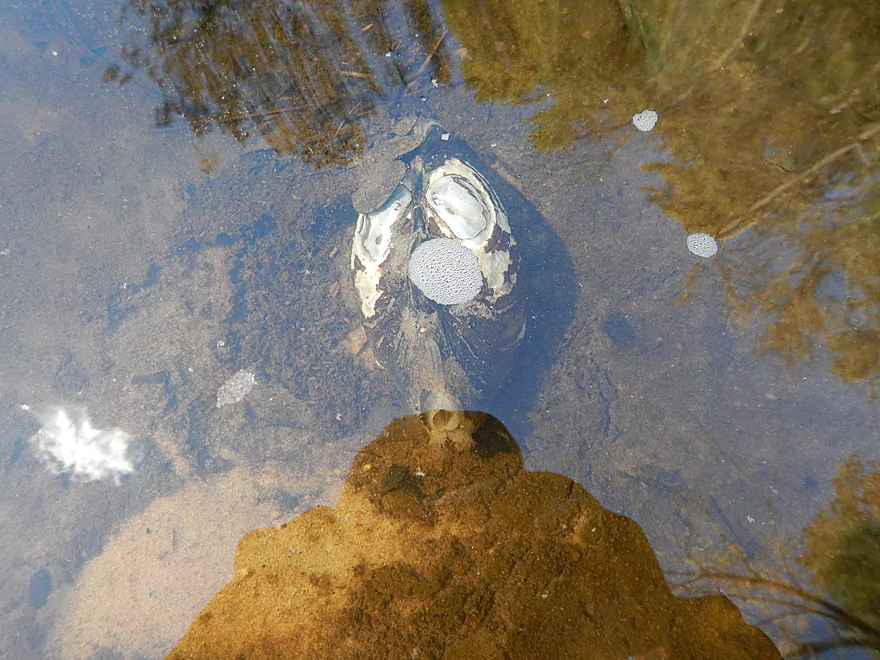
Frustrated clam cannot get past the dam
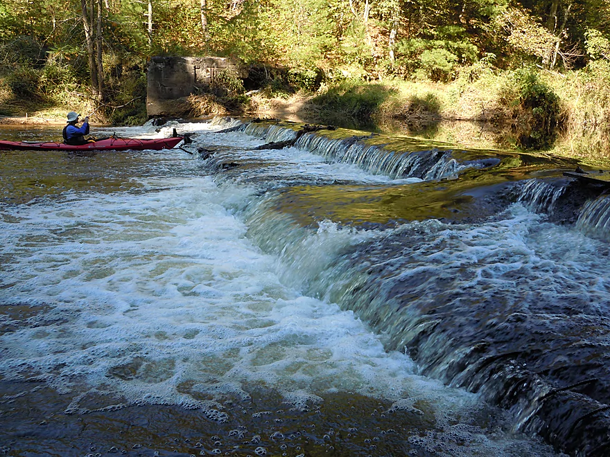
Wide shot of dam
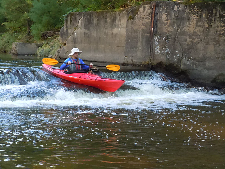
This is the ramp you need to take (do not miss it!)
From here on out is the best part of the trip
Huge rock bluff horseshoe
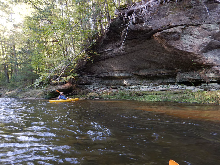
Mammoth overhang
Rapids are starting to get more brisk
Deja Dells
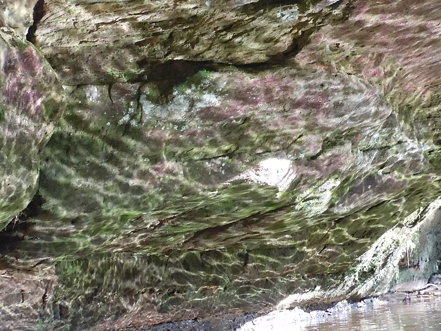
Patterns of reflected light on the underside of a rock
Banks start to close in
Puzzling but cool erosion patterns
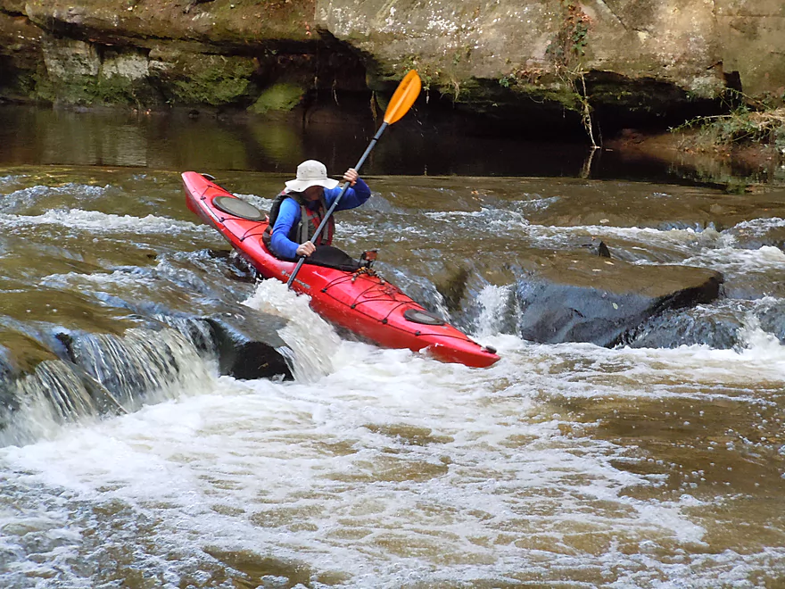
This is a strong class 2
Very easy to portage in low water
I get very wet here

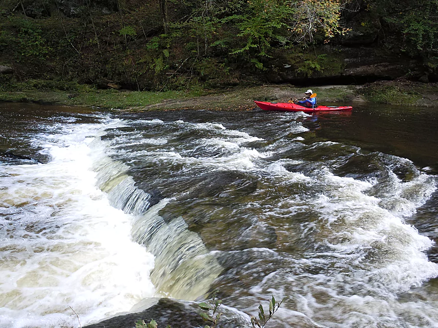
Coming up on a serious class 3
Easy to scout or portage
Tippy rocks and fast current make this tricky
Best spot to run this is in the center (if enough water)
The last major ledge
Most paddle nearside, but there is recirculating current here
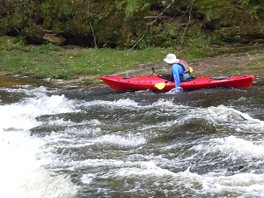
I got really stuck on the far side (easy portage path behind me)
Tough to convey how high this was
Neat scene
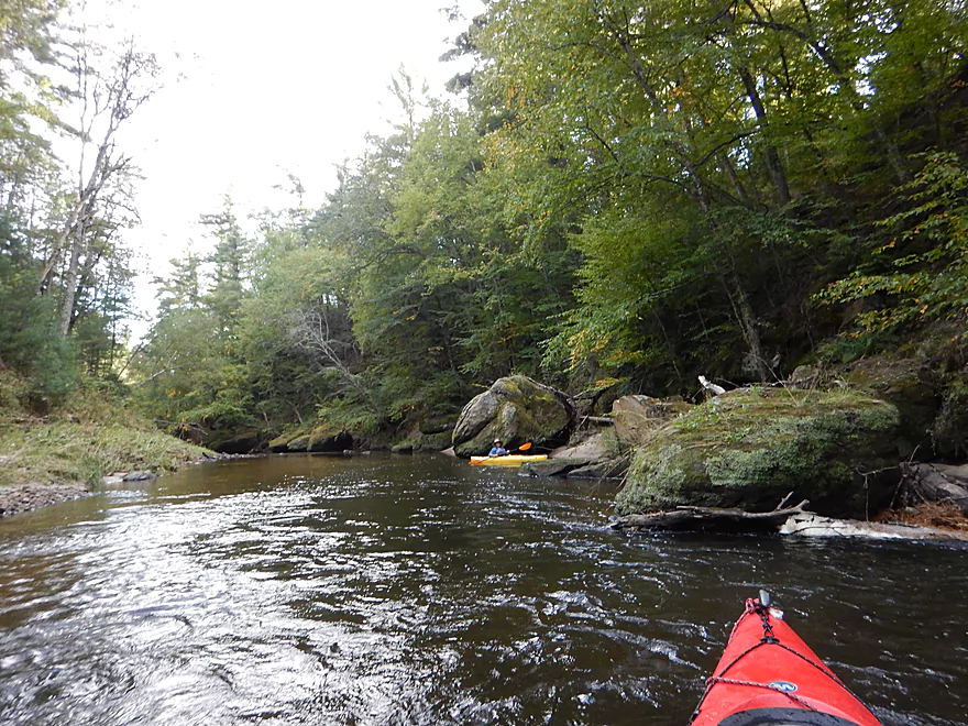
One of many big boulders
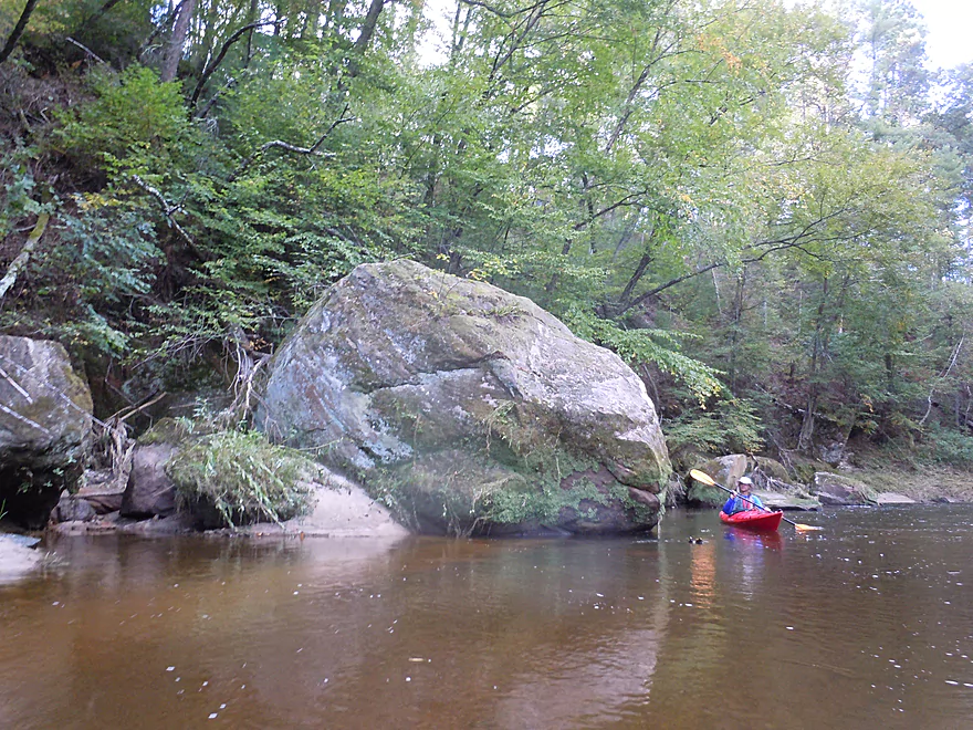
A little scale
Not where you want to walk barefoot
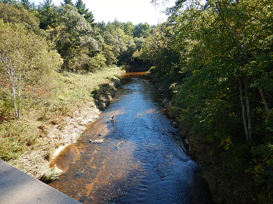
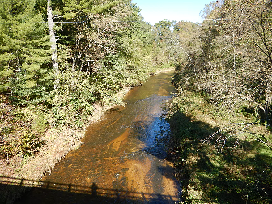
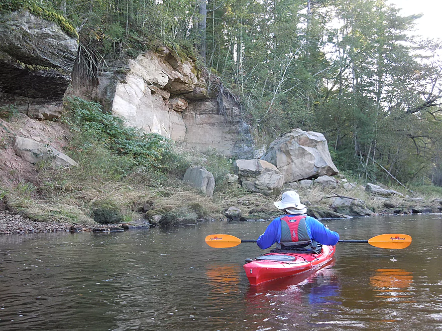
View from Hwy E bridge
Looks like but is not petrified wood
A hill is missing its boulder
The culprit
Red stained rocks from iron
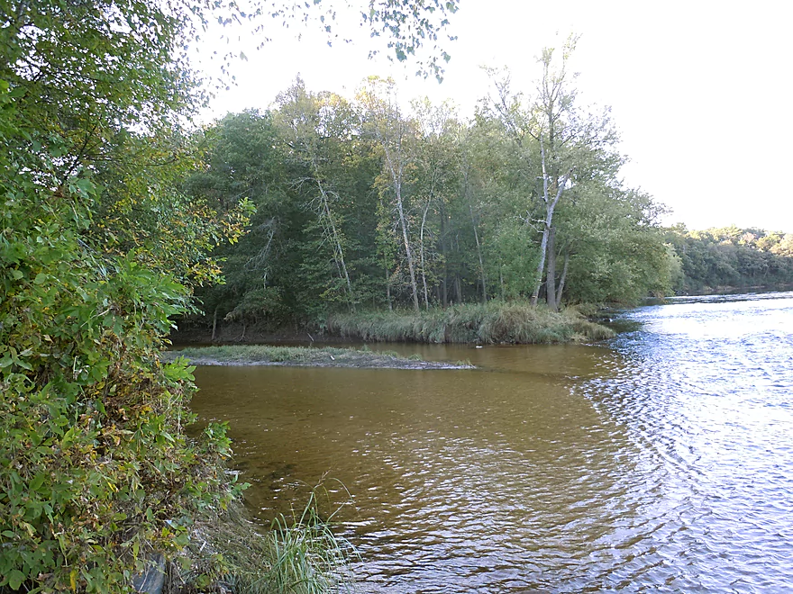
Halls Creek enters the Black River
Very good public landing at the junction of the two waterways
Halls Creek – Part 2

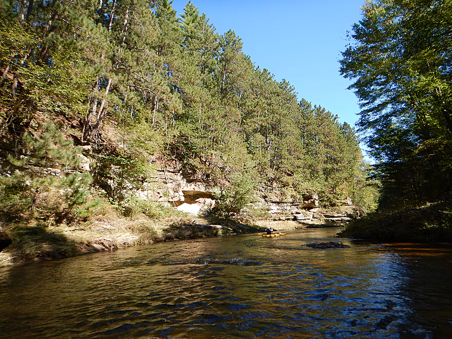
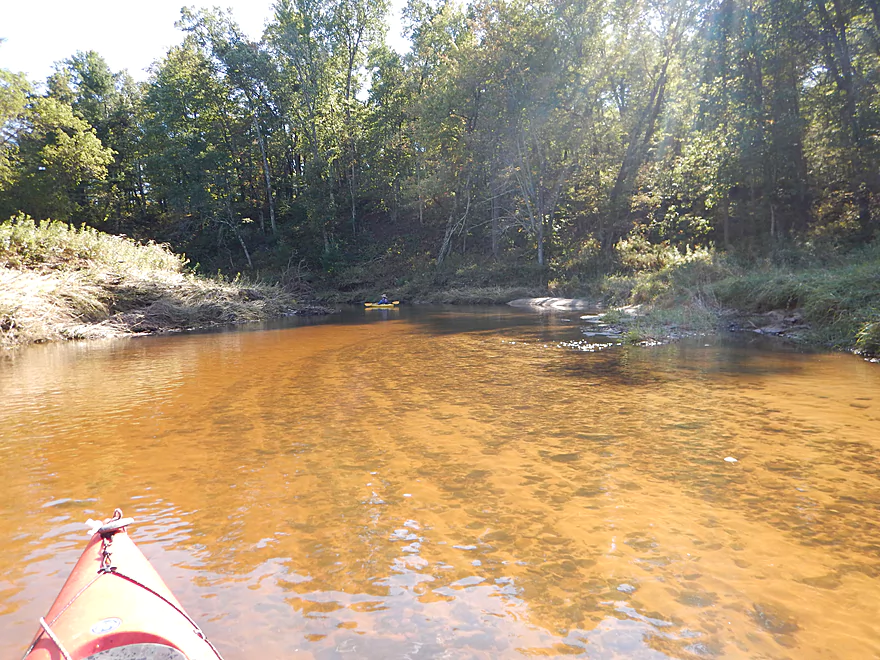
Located in the Black River basin, Halls Creek is an amazing prospect with clear root beer water, fantastic sandstone bluffs, canyons, attractive pines and some fun rapids. The highlight is the sandstone outcrops. And we’re not talking two or three…but oodles, and on almost every bend in the creek. Quite spectacular!
Why haven’t you heard of this prospect before? Outside of my previous upstream review I did a year and half ago, of course? Well, I suspect the shallow water and rapids scare away most paddlers (undeservedly so). Yes, it does have some serious class 3 rapids, but these can be portaged (well, the dam would be difficult to portage but it is not too difficult to run). The creek is typically shallow, which is annoying, but in my opinion is not a deal breaker, and the last third of the trip actually had good depth.
The geology on this trip is truly spectacular, both on a macro and micro scale. You have large overhangs, canyons, cool erosion patterns, amazing stratifications and more (see pictures). Even the substrate was unique in that much of the creek bed was just flat rock. In multiple locations you could see where the trees were throwing boulders into the creek, with incriminating exposed roots where the boulders used to be. Unfortunately, it does seem like many of the nice rock outcrops have been heavily eroded of late and I worry that the significant logging in the Halls Creek watershed is exaggerating the floods and indirectly causing damage to the unique sandstone.
A cool side adventure on this trip, but easy to miss, will be Wrightsville Creek, a small brook that comes in from the right (maybe a half mile after putting in). It’s worth it to get out at the sandy mouth and wade upstream as far as you can. The water is clear as can be and runs over smooth, flat rock. As you wade up, you’ll see a spectacular rock bend that the creek flows under, then a double waterfall with an attractive pool between the two falls and sandstone walls on either side. See photos.
This is absolutely a top-notch creek that I can’t recommend enough. The only downside of the trip…was noise pollution from a techno music concert next door. I don’t want to paint an inaccurate picture, as this is a mostly remote wilderness trip (which is a big plus) and chances are you won’t paddle during a concert. But we did and it was annoying. The culprit is a nearby camp that periodically hosts these mega concerts “in the middle of nowhere” and will amplify their bands to ridiculous volumes. This ‘camp’ is not too popular with the locals (and not just because of the concerts), but that is a whole different matter.
Given that I’ve already done the upstream section previously, and given that they are both five stars, a good question is which should you pick? Ideally both, but the downstream section (this review) is better with more fantastic rock outcrops. On the plus side, the upstream section is easier to do for beginners, with no class 3 rapids and is roughly half the length of the downstream section. But the upstream section is thirstier. Rough rule of thumb…the further upstream you go on Halls Creek, the bumpier the riffles will be and the more water you’ll need. But be careful and don’t wait for a deluge as this creek can and does flash flood, which is extremely dangerous. Timing is everything with Halls Creek.
Small but adequate parking area northeast of the Garage Road bridge. A faint trail leads down the hill to the water where it is easy to launch.
Halls Creek landing is located at the mouth of Halls Creek on the Black River. Very nice and popular with good parking. There is no outhouse at either access through.
Generally speaking, the main Black River Falls liveries don’t like to go this far north. There is a Hatfield livery though that I think would provide shuttle service if you called ahead:
- Hatfield Sports Shop – (715) 333-5009 – County Road J, Hatfield, WI 54754
None. Great work by the locals in clearing them out!
This creek does have rapids, which can be dangerous at higher flow rates (and some even at low rates).
- The first noteworthy drop is a partly removed dam which you can run over a small ramp on the left. This is easy to scout from shore. Because of the old dam foundations on shore, it would be difficult to portage. Do not miss the chute/ramp though as there is exposed rebar everywhere else on the dam. Video reference at 2:38.
- After the dam, there is a class 3 drop (you will hear it and not see the horizon line). This is easy to scout and/or portage on the right bank. Do not underestimate the danger because it is easy to tip over with all the pokey rocks and there is recirculating current at the bottom (which is an issue even with life jackets). The best vector is left-center (do scout though). Video reference at 5:06.
- The second class 3 drop is also fairly easy to scout/portage (assuming flood water doesn’t drown the shore). The right side will be safer but bumpier, with a nice incline. Most, I suspect, run the left side, which is kind of a drop but with some recirculating current. Do scout this before running. Video reference at 5:51.
I have pictures and video galore of all this. Do note, these are again significantly meaner during high water.
Super important you get this correct! The creek is difficult to run because it is usually too shallow or too high/dangerous. We went at 175 CFS per the gauge at Neillsville (on the Black River) which is considered low/normal. This is not a representative gauge though as the Black River is much bigger and Halls will rise and drop much faster in reaction to the rain. In fact we saw evidence of significant flash flooding from a week ago, which, with the canyons, could make the creek deadly.
Recommending a target flow rate is difficult…but if I have to make some type of guess, 200-1500 CFS at Niellsville is a good target range or 892′-894′ on the East Fork (I’m really throwing darts here…we probably went when the East Fork was at 891′). Mentally adjust these figures based on how much and how recent the rain was. Most paddlers would complain our levels were too low (majority of the rapids were bumpy), but this is a safe way to experience the scenery and the flatwater sections were totally fine.
You can scout the creek at the bridges and compare with my photos for reference. But do note that the take-out is an abnormally shallow/sandy section and the Black frequently backfills here, so it is not a reliable visual gauge. The upstream bridges are more indicative of true water levels.
Lot of familiar faces. Eagles, clams, dragonflies, deer, turkeys and ducks.
- Sand Road to Giles Memorial Park: 1.4 miles. This might be scenic, but there could be logjams.
- Giles Memorial Park to Trow Lake Dam: 1.4 miles. Launching below the first dam should be doable, but might be a bit tricky. This stretch might have a neat canyon, but is mostly flowage paddling and there is likely a logjam to deal with.
- Trow Lake Dam to Garage Road: 4 miles. Shallow but a great stretch with some nice outcrops.
- Garage Road to Mouth on Black River: 7.6 miles. Best stretch on Halls Creek, and one of the TOP water trails in the ENTIRE state of Wisconsin.
The Black River basin is very cool and here are some other nearby trips I’ve done that you might be curious about.
- Robinson Creek – The only prospect in the area that can rival Halls Creek (great praise).
- Morrison Creek – Part of the “Big 3” (Halls/Robinson/Morrison). This has the roughest whitewater of the three.
- Wedges Creek – A cool creek with many boulder gardens, but not as nice as the “Big 3”.
- East Fork of the Black River – Nice wilderness paddle with cool granite blobs (not as nice as the “Big 3”.)
- Black River Flowage – Fantastic sandstone bluffs.
- Black River from Mason’s Landing – Start of the Lower Black. No rapids, but nice sandbars and an amazing box canyon.
Ok…not exactly a paddle, but one of the best hikes in Wisconsin with amazing overlooks and sandstone formations, including a cool sandstone arch. Just don’t get run over by the runaway mountain bikes that share the trails with hikers. Here is a park map. I suggest parking in the east parking lot and ascending the mound via the North Face trail. There will be a couple of nice overlooks you can access once you get to the top. I then suggest heading east to the Cliffhanger trail which is a fantastic path located just underneath the mound with amazing exposed sandstone. At the southeast tip there will be a faint trail that lets you re-ascend the mound and connect with the South Point trail. At the tip of South Point are the best overlooks in the park. Keep heading west on top of the mound and connect to the Clarence trail for several more nice overlooks. At the southernmost point of Clarence is a cool sandstone arch that is off the trail and easy to miss but well worth the visit. As you continue west, Clarence turns into Toad Road and you’ll see more spectacular sandstone and go through the classic mountain bike section (with the board walk between the sandstone walls). Heading back east, the Switchback trail has some more nice rock formations, but they mostly peter out by the time you get to the east side of the mound.
Trip Map
Overview Map
Video
Photos Size:
I have a flat bottom, sit-on fishing kayak. Will this suffice for Halls? I would say I am a novice… I had some experience with class 1 and 2’s years ago but haven’t done any serious kayaking besides on lakes in recent times. Also, do you know anything about the fishing? Thanks for any help. I stumbled across this website and it is an absolute gold mine. I have wanted to explore this creek and other parts of the Black River watershed since I have been a young boy spending summers at our family home on the river. My dream is to take my kayak all the way from halls to my dock!
Start with the first segment (to Flood Road). That is much easier and safer.
Then if you’re comfortable then do the second segment. But note, the second segment is rougher. I advise going during low flow rates when the creek is less pushy…you might hit a few rocks but it will be safer for an inexperienced paddler in a non-whitewater boat.
Thanks for the advice.
How dangerous is the old dam on the second part, especially in my kayak?
Not too bad…but maybe don’t go at high levels. You should scout from the right shore before running. A portage would be tricky, but I think it would be doable if you thought it was rough. See https://youtu.be/Gg-Ex9xOLAw?t=159. If you do this trip, let me know how it turned out.
Four of us did this segment on July 3, 2021. At the time, the Black River gauge at Neillsville was about 600 cfs after having a significant rain about a week earlier. However, that flow rate did not correlate to Hall’s Creek at all. The water level was pretty low and we had to get out and walk many, many times, even in flat-bottom boats.
However, the scenery was spectacular, especially the side-trip to see the double waterfall, and it was a beautiful day to be on the water. I know there aren’t any USGS gauges nearby that would help determine water levels, so I suggest going 2-3 days after a decent rain in the immediate vicinity. If we can time it right, we’ll definitely try it again because with enough water, this trip would be incredible.
Appreciate the comments! Yes, the Neillsville gauge isn’t very representative. It’s a tough situation…you almost have do calculations of how much rain has fallen in the watershed and when, but that too can be tough. Hopefully NOAA will eventually add a gauge on this creek.
Ran Halls Creek today July 6, 2024. Black river was at ~2200 cfs at Neillsville. Current was hopping right along. This trip took us 2 hours even with a couple quick stops. 1 large pine is down that may cause a slight portage when water levels go down. The drops were a blast today.
Thanks for the update!