
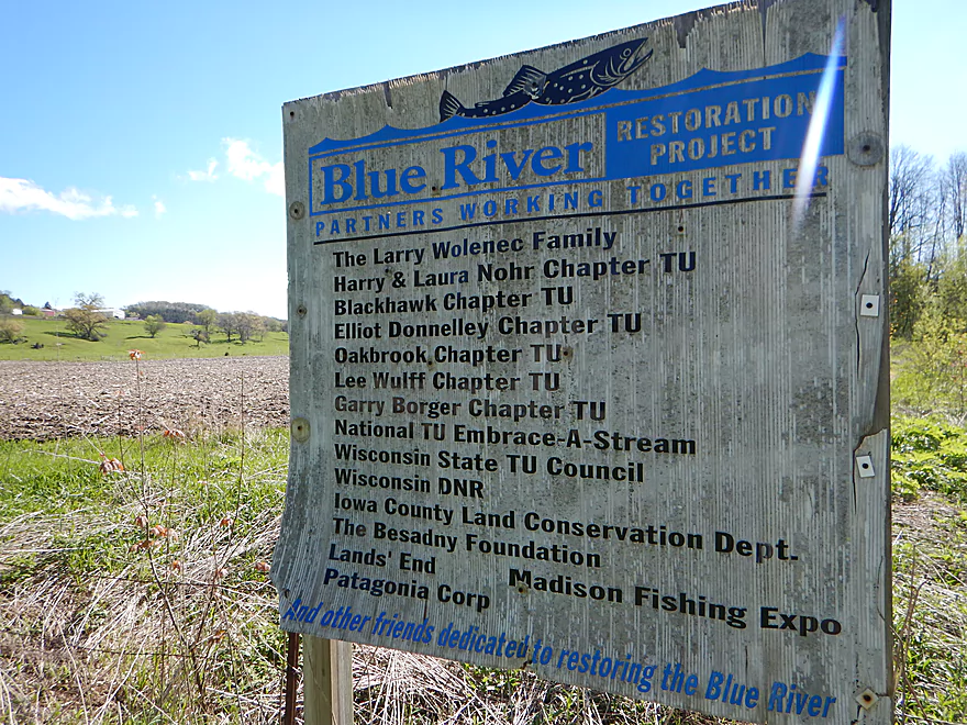
Lot of good groups have worked to protect the Blue River
Almost launched at Hwy I, but was nervous about jams
Instead launched at Bluff Road (good option)
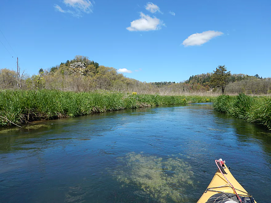
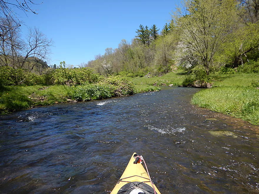
Very scenic
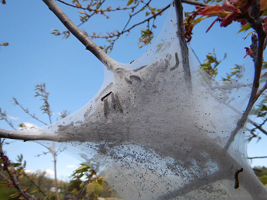
Even the tent caterpillars liked it
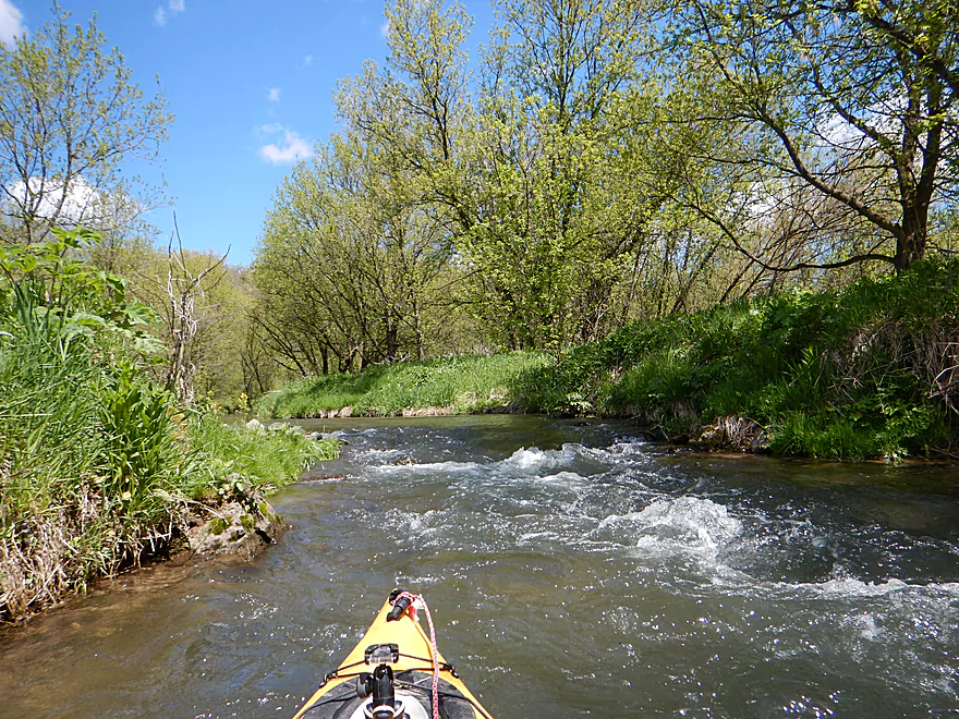
Many riffles and rapids
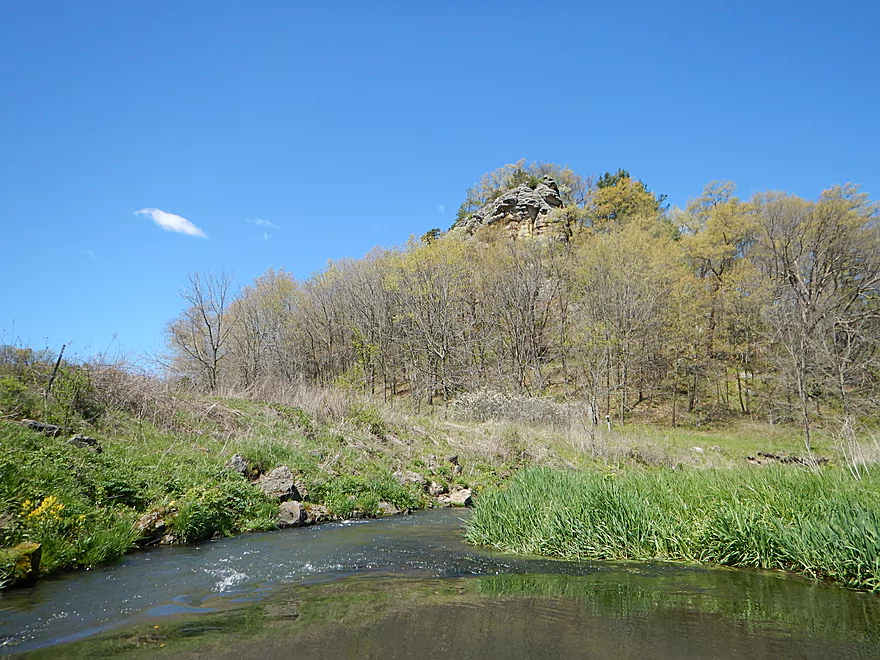
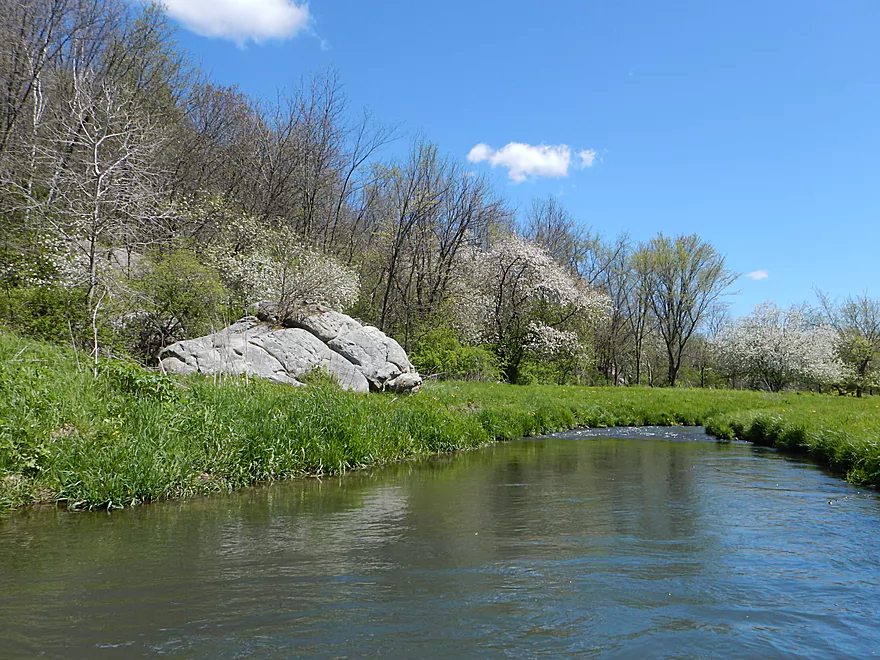
Scenic outcrop
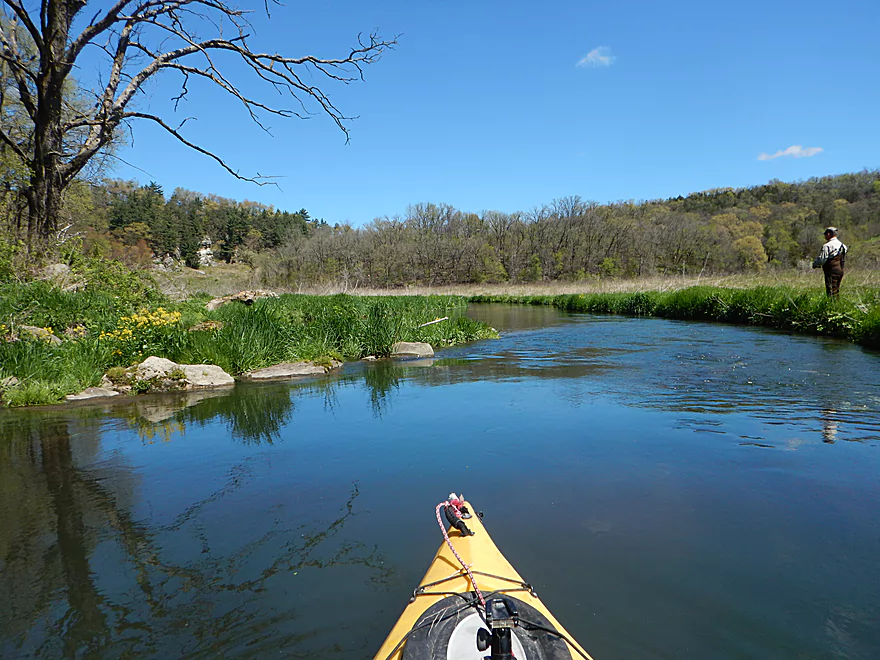
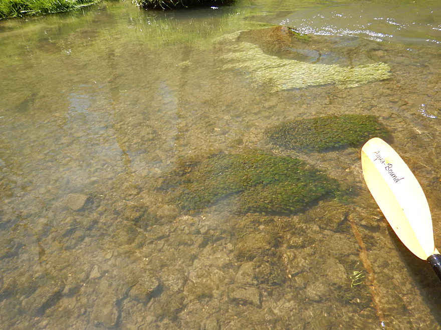
One of several fishermen I passed
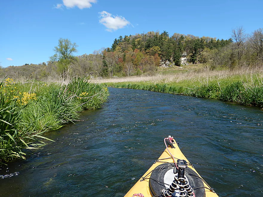
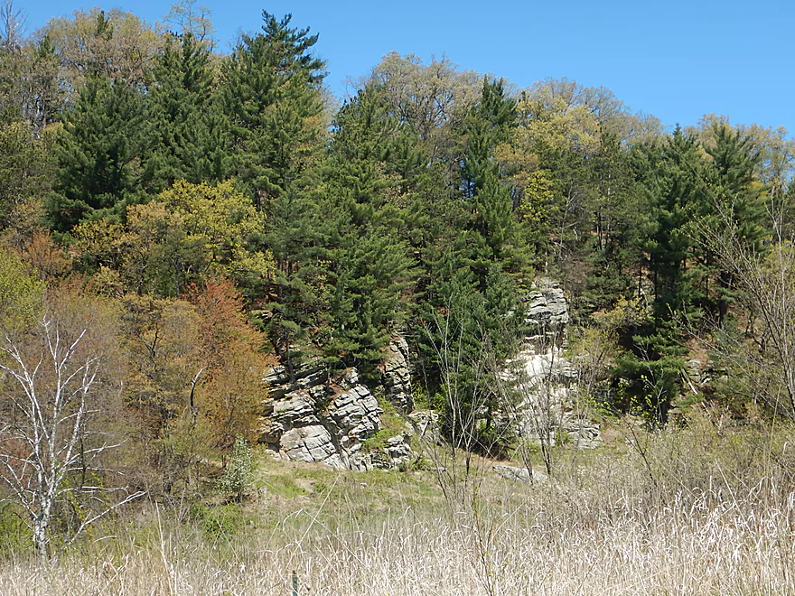
More striking sandstone
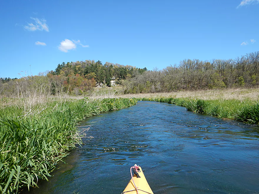
Heading toward a knoll of pines
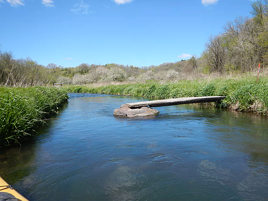
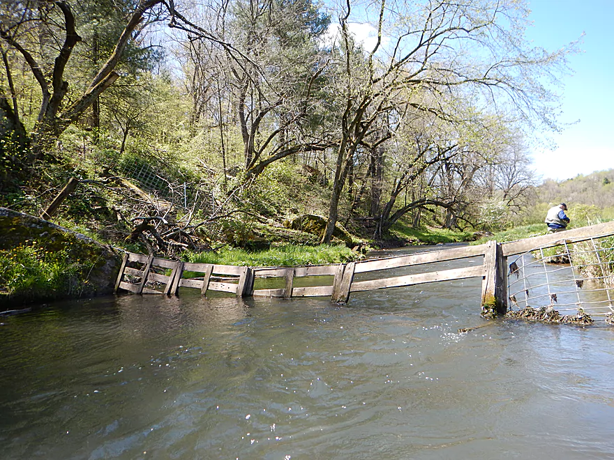
A half bridge…fishermen must hop the remaining gap
First fence…difficult to duck under, but you can portage it
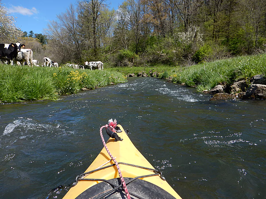
Where there are fences there are cows
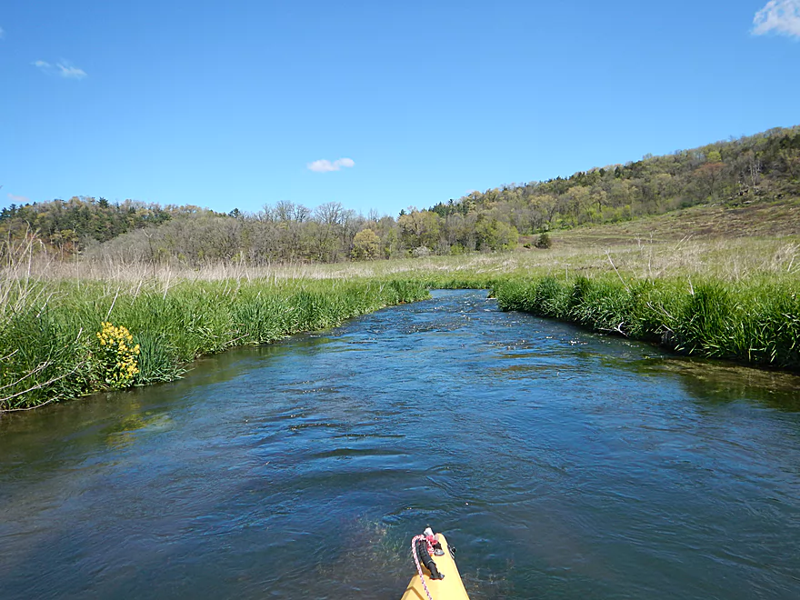
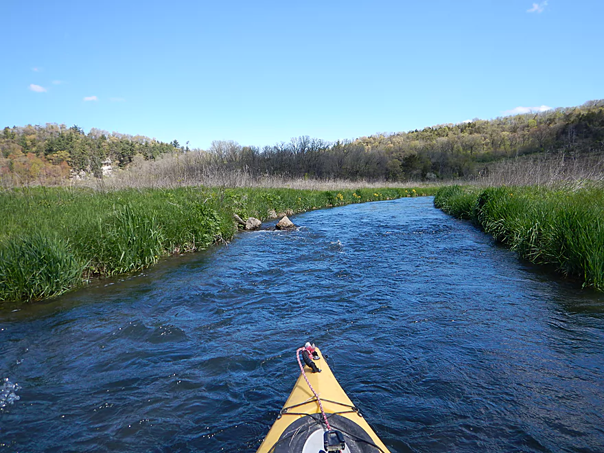
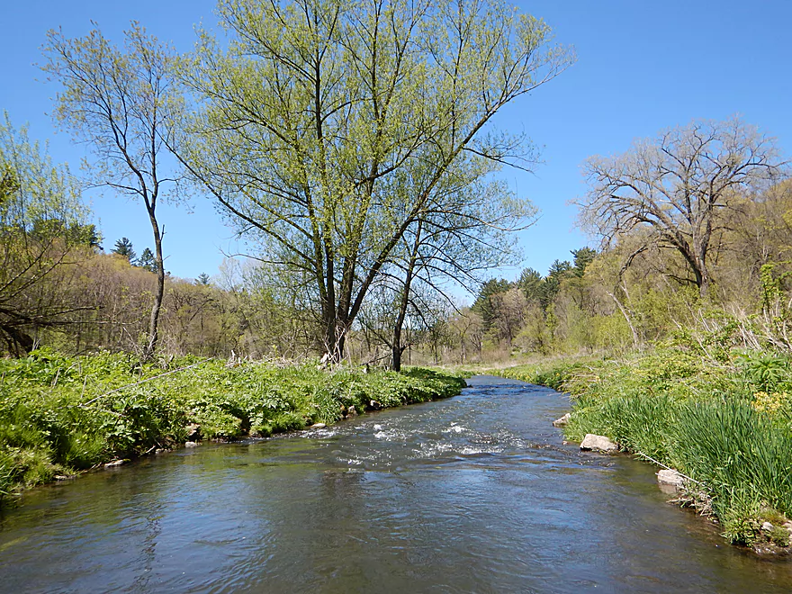
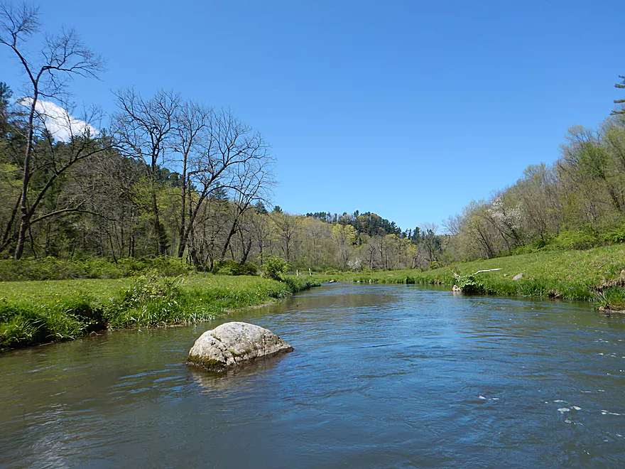
Terrific driftless scenery
The cows are running after me!
First logjam…I barely ducked under…would be an easy portage
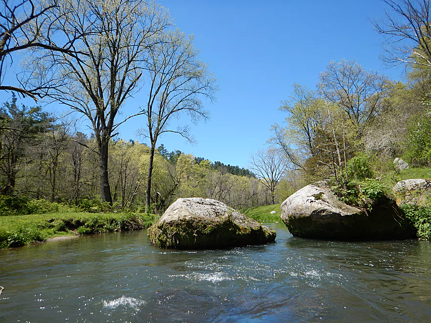
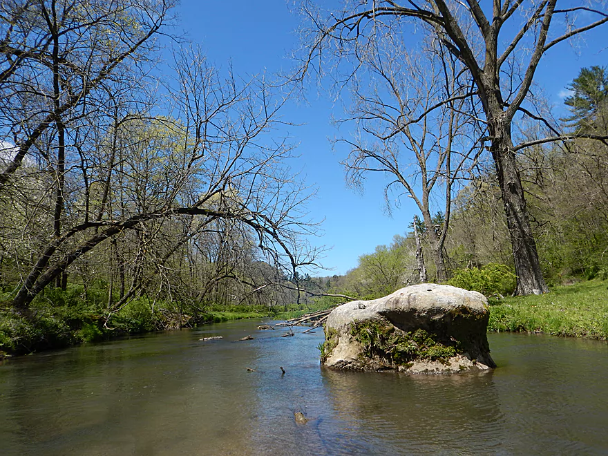
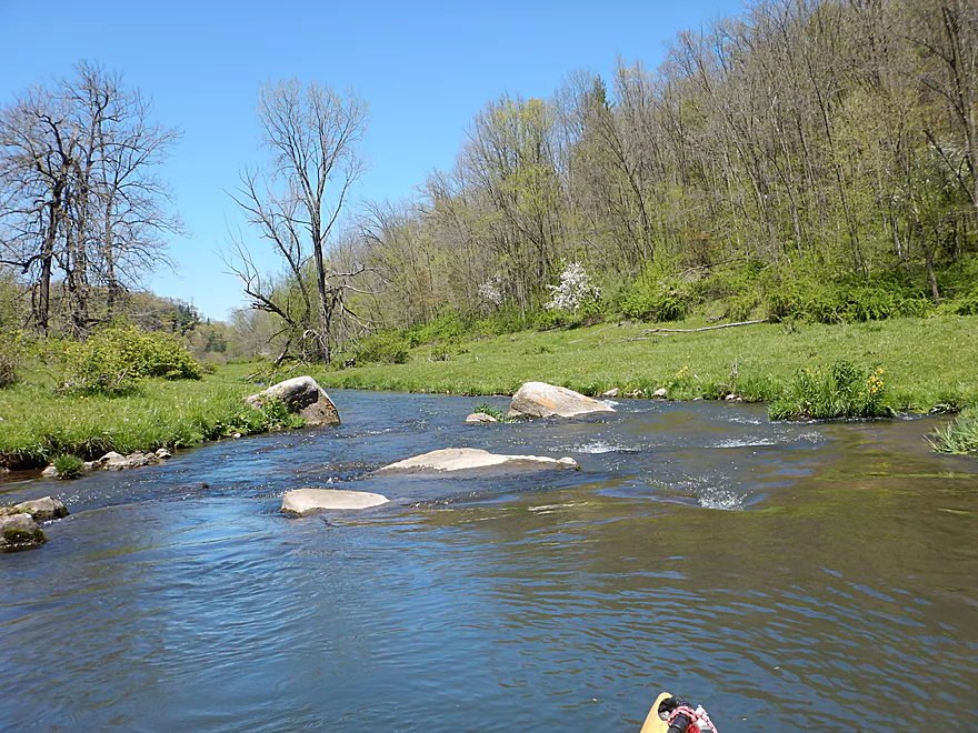
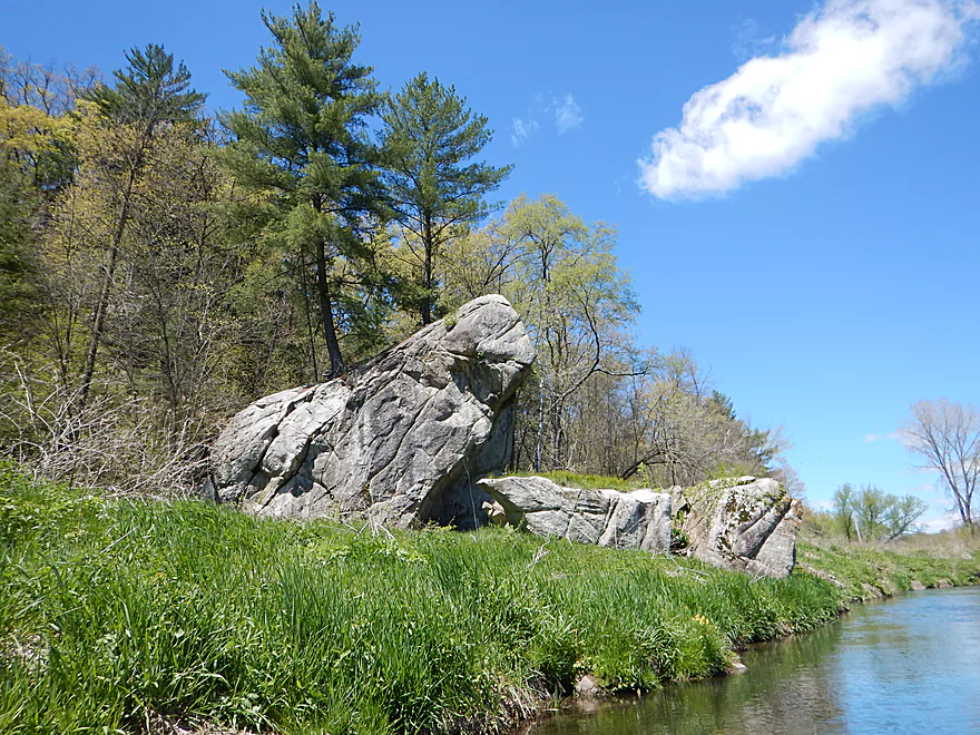
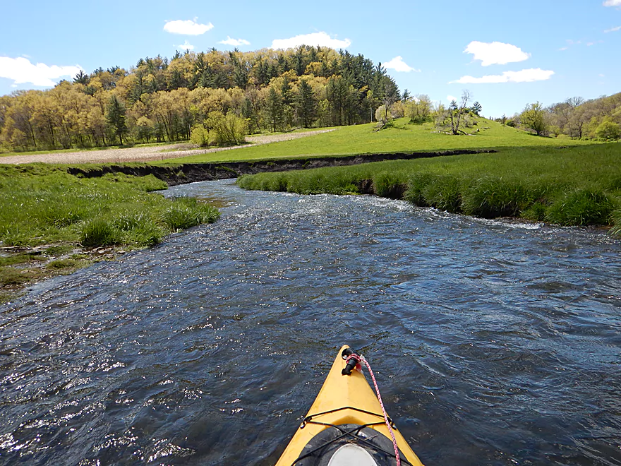
Boulders in the grass…a unique trait of the Blue
Budding apple trees
Coming up on the 2nd fence
This one is much easier to lift over your head
Not exactly the widest of rivers
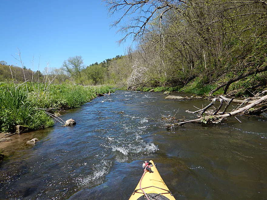
Some debris to dodge…mostly easy
The banks look artificial here
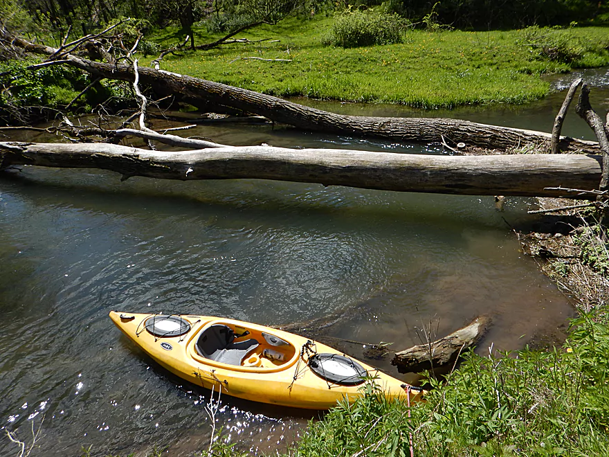
The 2nd logjam
Easy portage though
Can I fit?
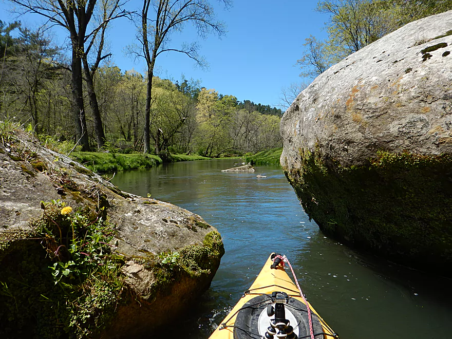
Just barely…
Occasionally clear water
River has a western feel to it
The banks look like a lawn…but are not
One of countless rapids
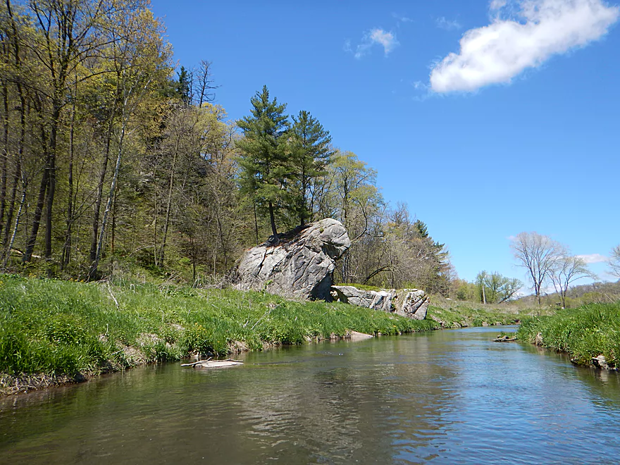
That is a house-sized boulder that fell from the hill
This fence is easy to get past
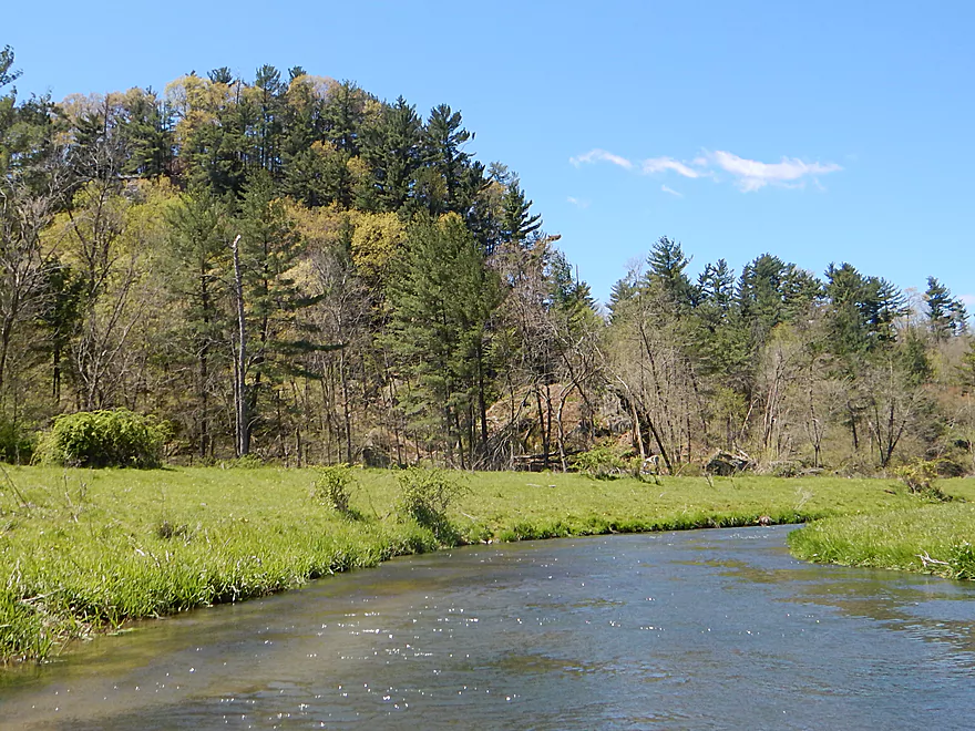
Lot of white pine on the river (rare for southern Wisconsin)
One of the neater sights
Quite striking
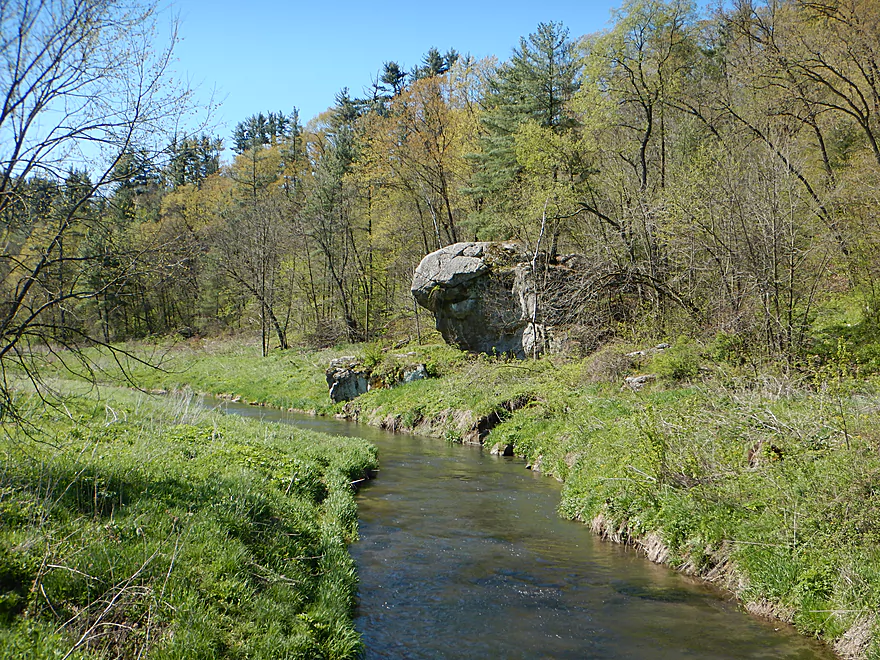
Reverse view
Coming up on Snowbottom Road
You can disembark here if you wish
But I advise continuing on
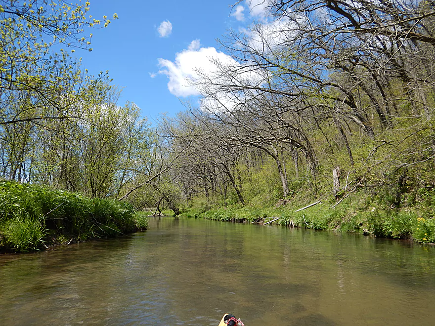
For the next half mile, the river flows through a woods
Very different from upstream portions, but still neat
Maybe the strongest ledge on the trip
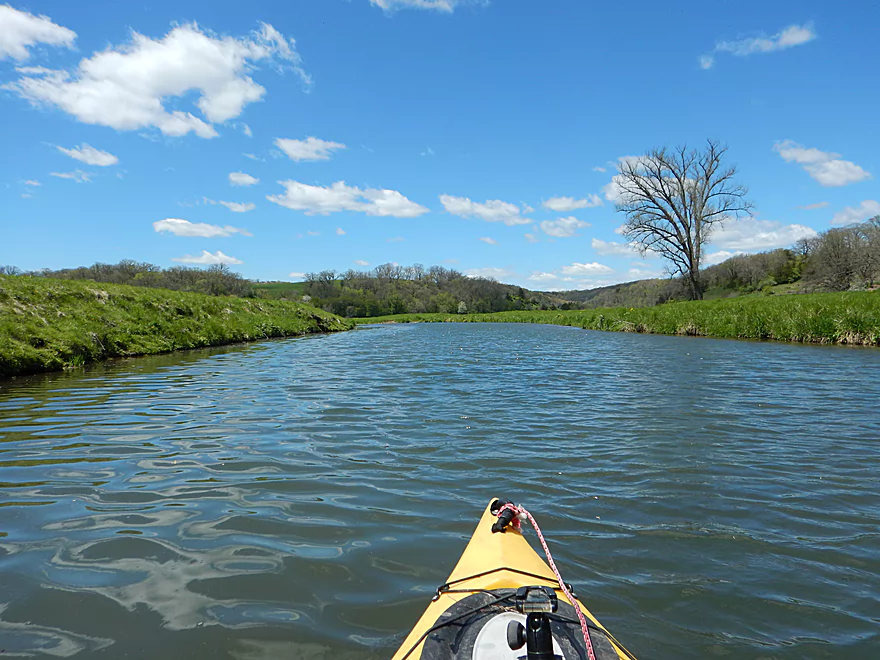
Back into open country
Deja Platte
Mud banks start to become a problem
Still scenic
You do not see many grassy hills in Wisconsin
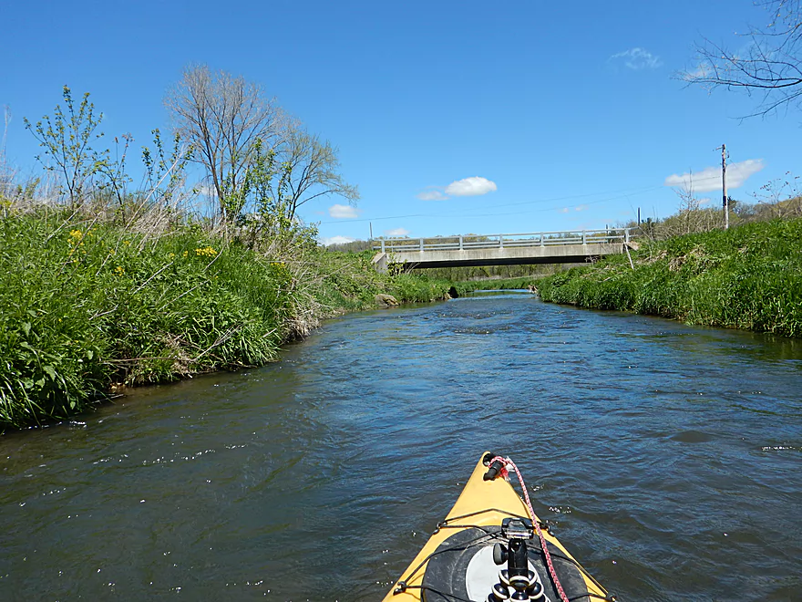
Bowers Road
Keep paddling past the rapids though
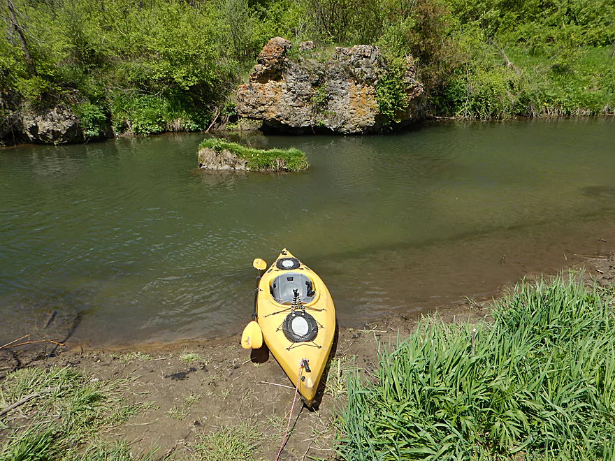
And take out across from the limestone outcrop
A faint trail leads to the parking lot
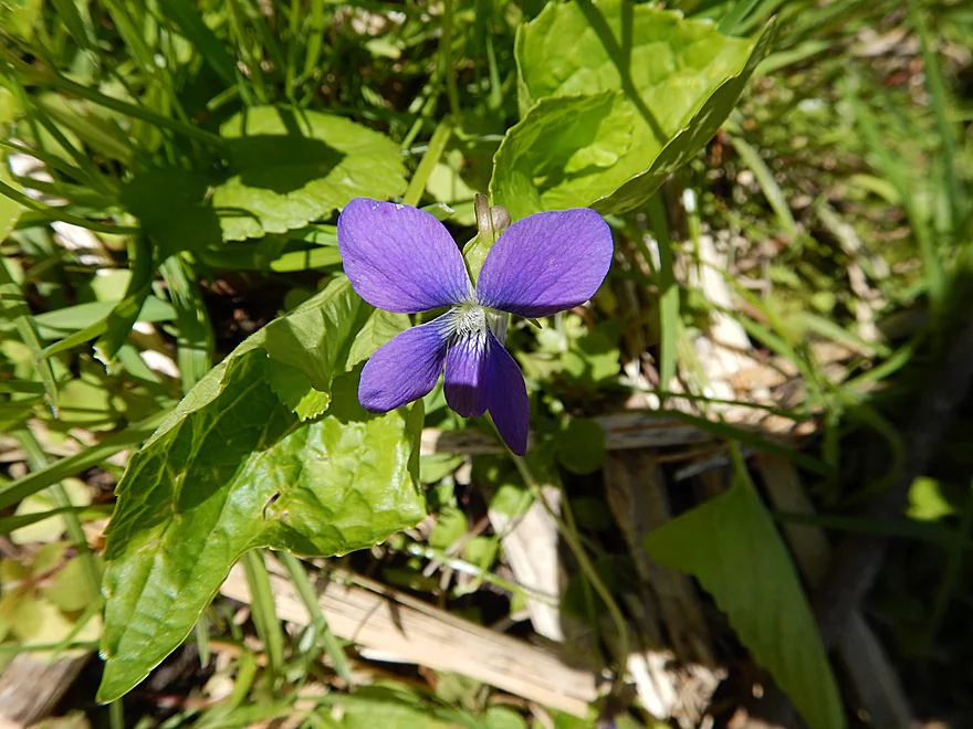
One of the first flowers of spring
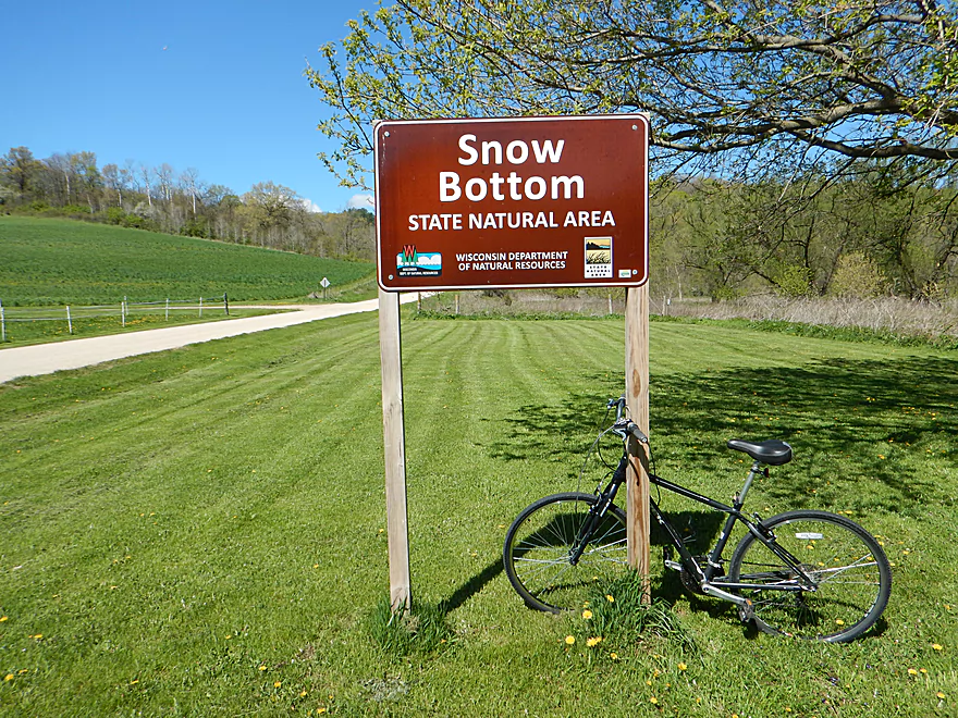
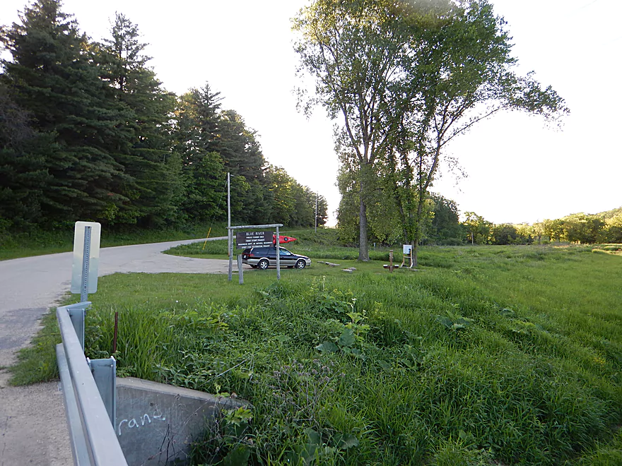
This is the trailhead for the Snow Bottom SNA
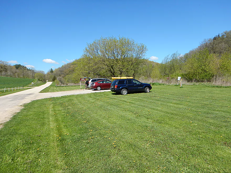
Plentiful parking
Shemak Road is an alternate take-out
Blue River

The Blue River is a popular trout stream located in Grant County. Rarely paddled as the upper segments tend to run shallow, while the downstream segments tend to be plagued by mud and downed trees. Previously, I had positively reviewed the west branch (Fennimore Fork) which had me very interested in the east branch.
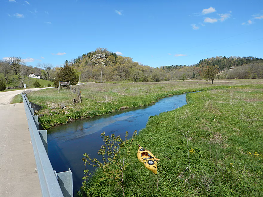
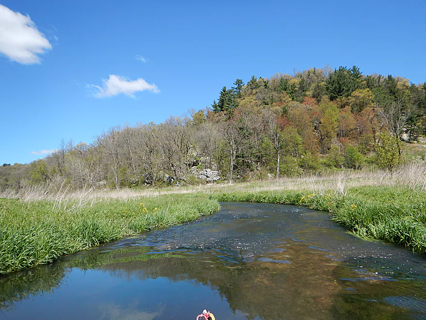
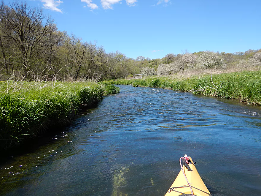
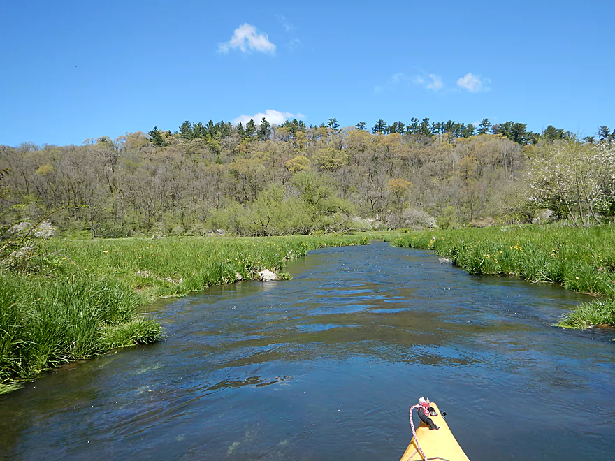
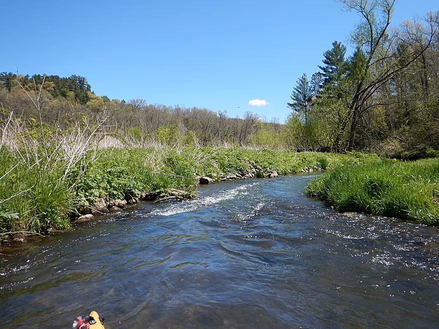
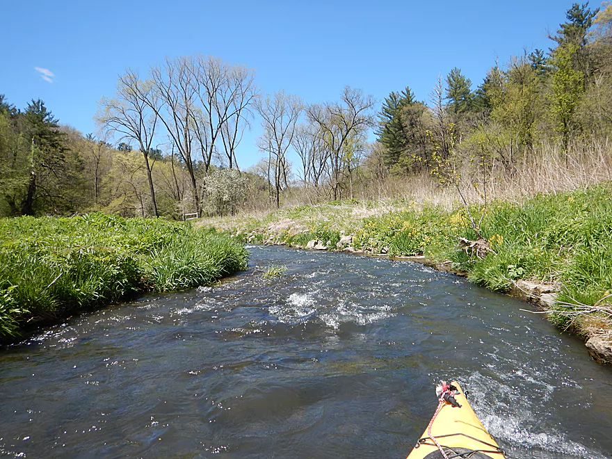
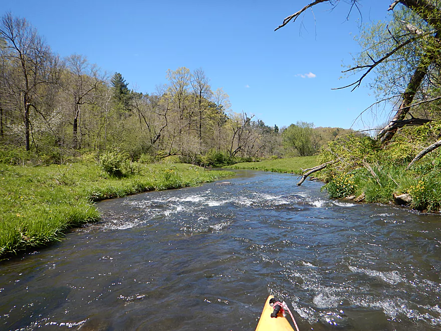
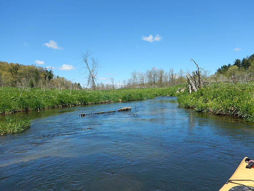
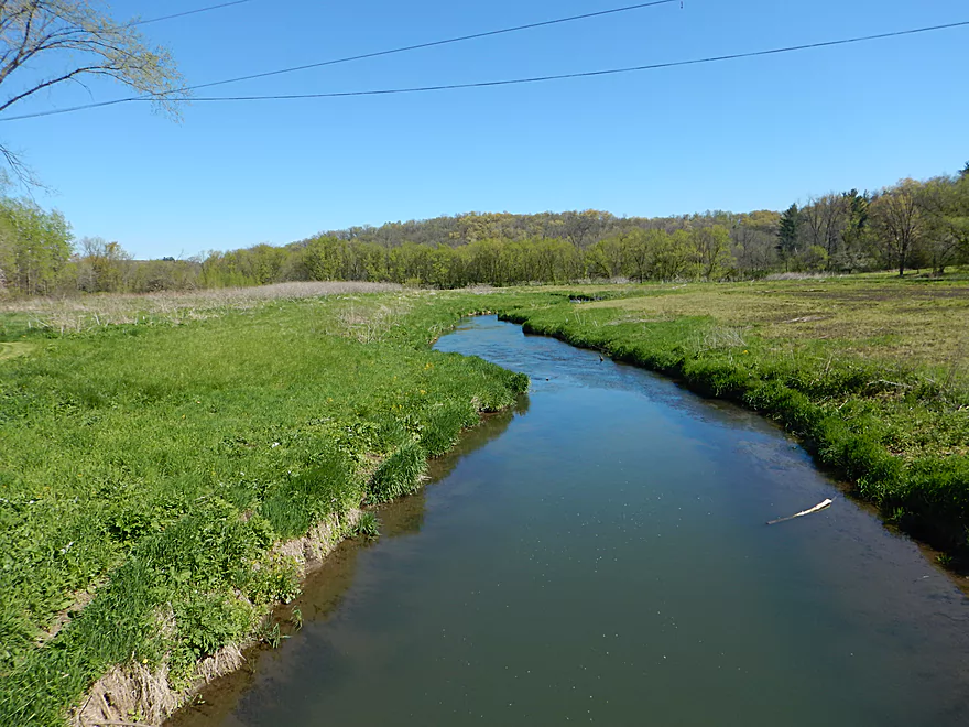
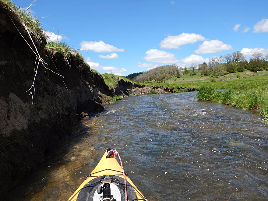
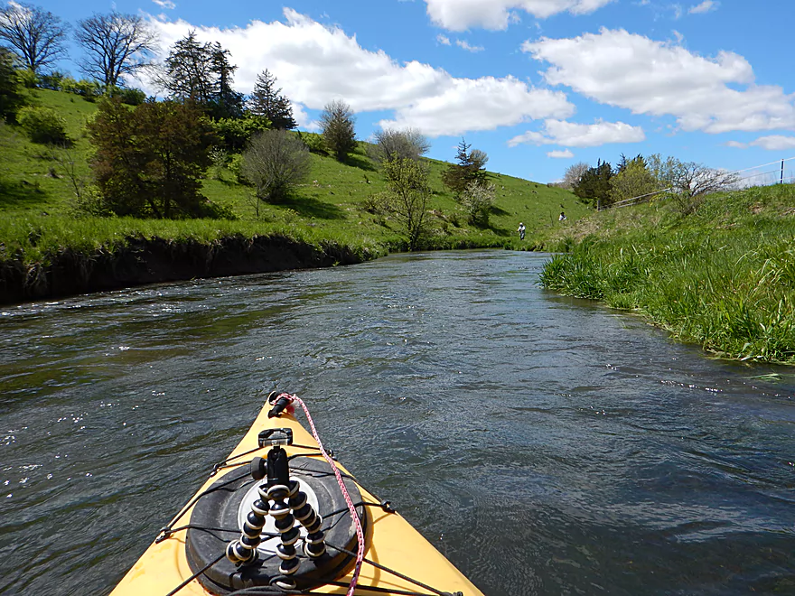
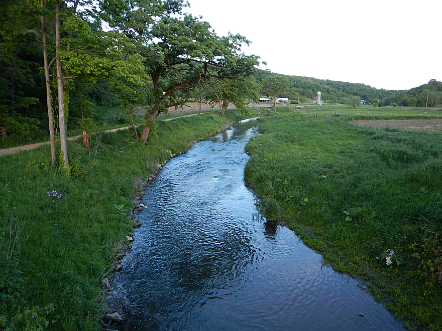
The scene at the put-in (Bluff Road) was quite striking with 80′ tall bluffs and exposed outcrops to your west, north, and east. Here the river runs small, clear, fast and with a hint of blue (perhaps from mineral deposits). Between the bluffs, the valley sprawls out into an attractive open grassland which is protected by the Mississippi Conservancy (great organization!). The colors that day were quite vivid. Bright greens from the grass, yellow from the dandelions and blue from the river and sky. Few rivers in Wisconsin flow north, but the Blue is one of them and you’ll definitely want to paddle this on a cloudless morning to experience the best and most vibrant colors.
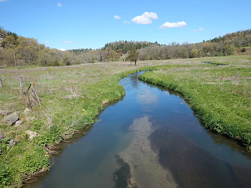
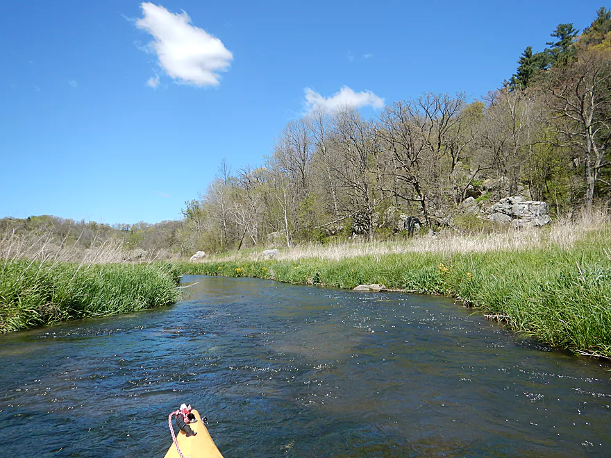
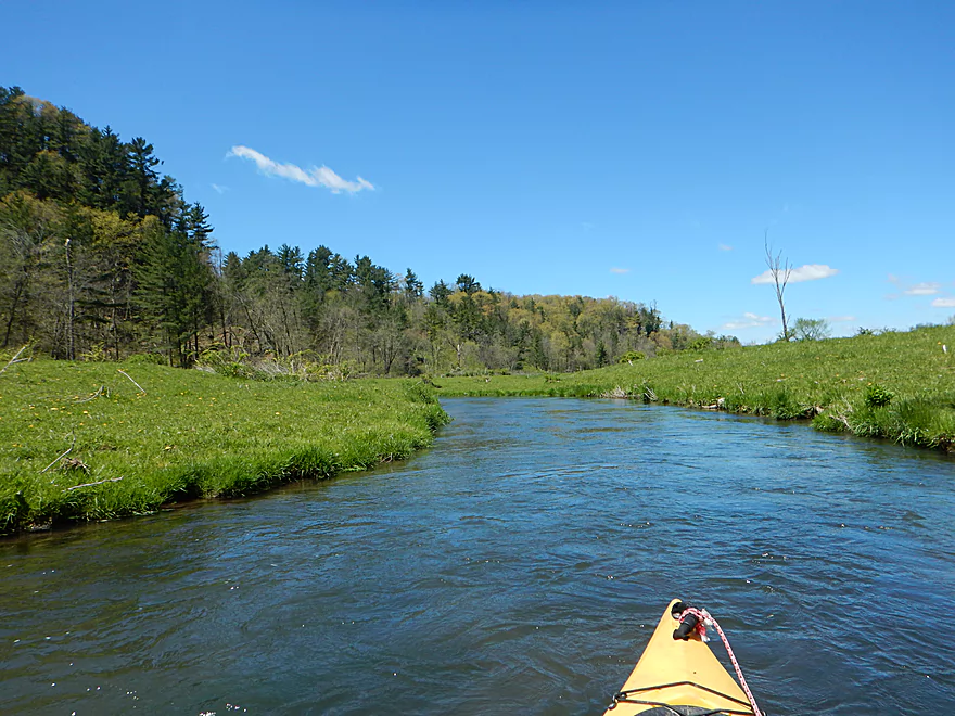
One of the first surprises after launching was how fast the river was. For pretty much the entire trip, you’ll be within earshot of at least one riffle. The second surprise was the number of trout fishermen (maybe 9 cars by the parking lots and 6 fishermen by the water). Ironically I didn’t see that many trout or fish for that matter (unlike the Big Green where they were plentiful). The other striking impression was how wide and open the river valley was. Very few trees or understory which afforded vast views of the driftless scenery.
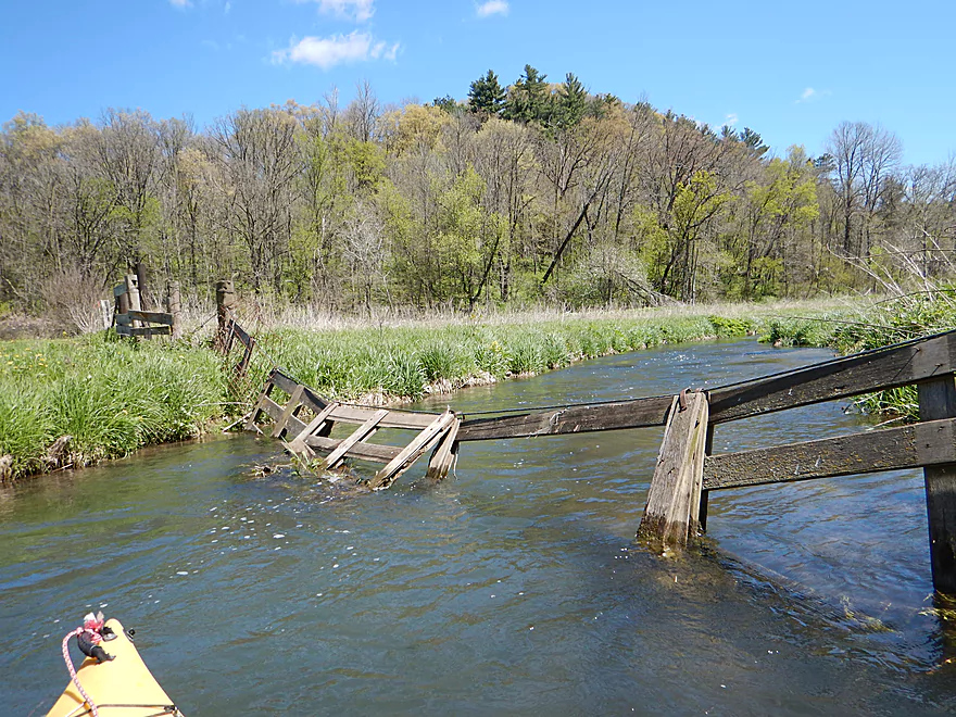
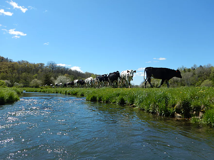
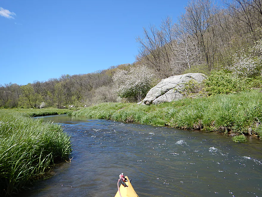
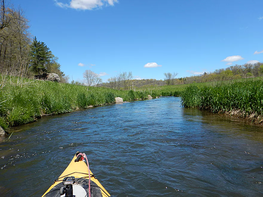
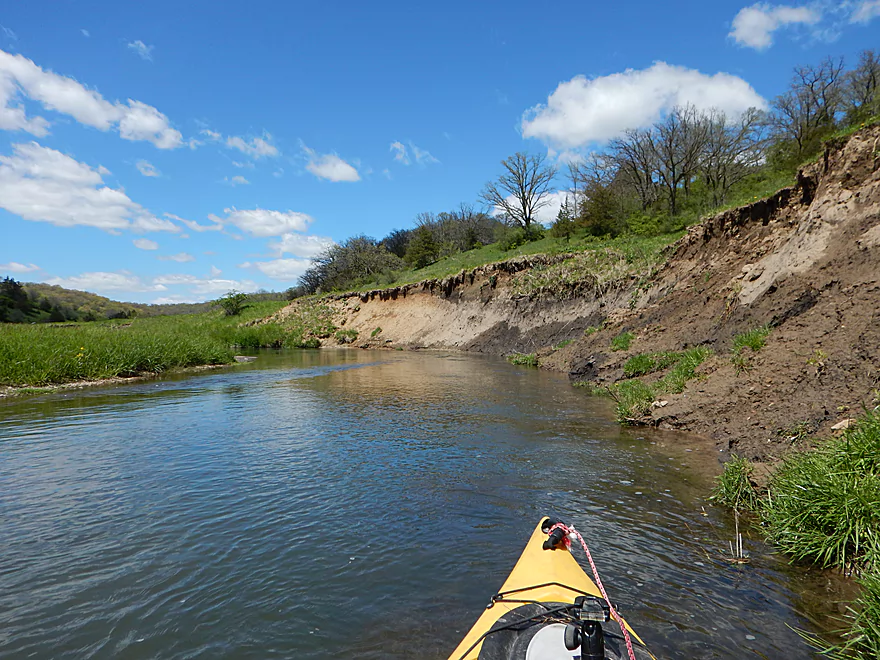
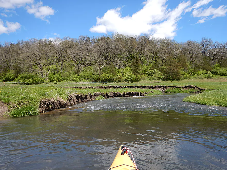
After paddling by two bluffs, I came came across a farm fence that most will likely want to portage. With fences come cows and sure enough…on my next set of rapids I ran into a herd. At first they were scared of me and ran away. But…they changed their minds and came running after me (I don’t think they get to see many paddlers run the rapids here). While they were friendly, it is unfortunate that the cows are allowed unfettered access to the stream as this can and does introduce silt into the channel. Despite the change in landownership, the scenery stays top-notch. The bluffs get bigger and rise to 100′ while rapids stay numerous. I bet this would be a stunning paddle in the fall.
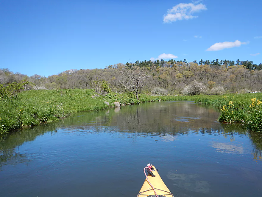
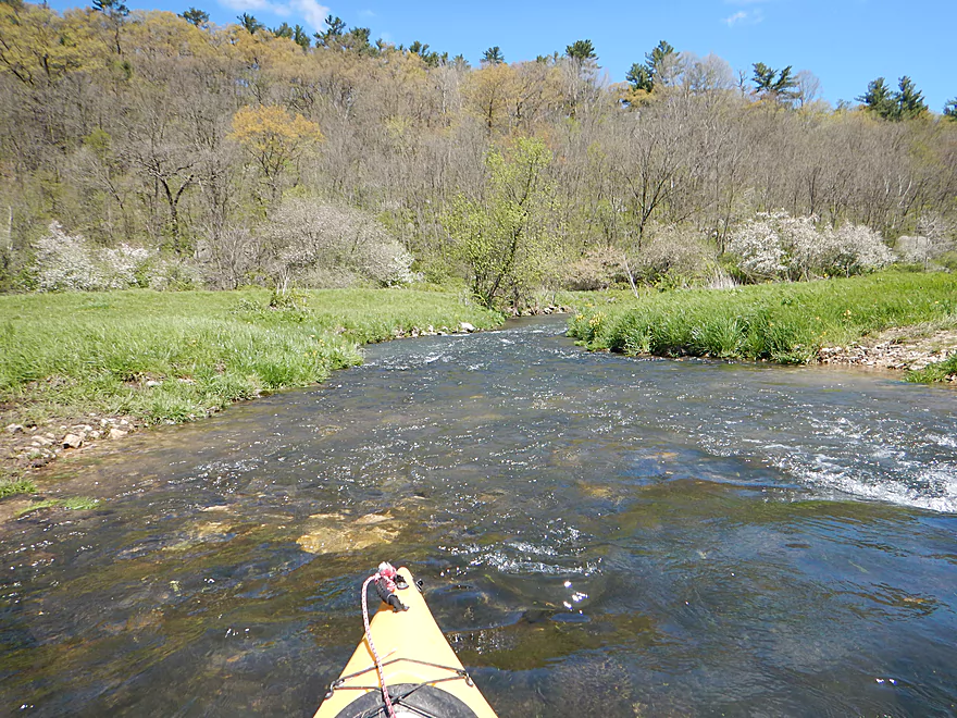
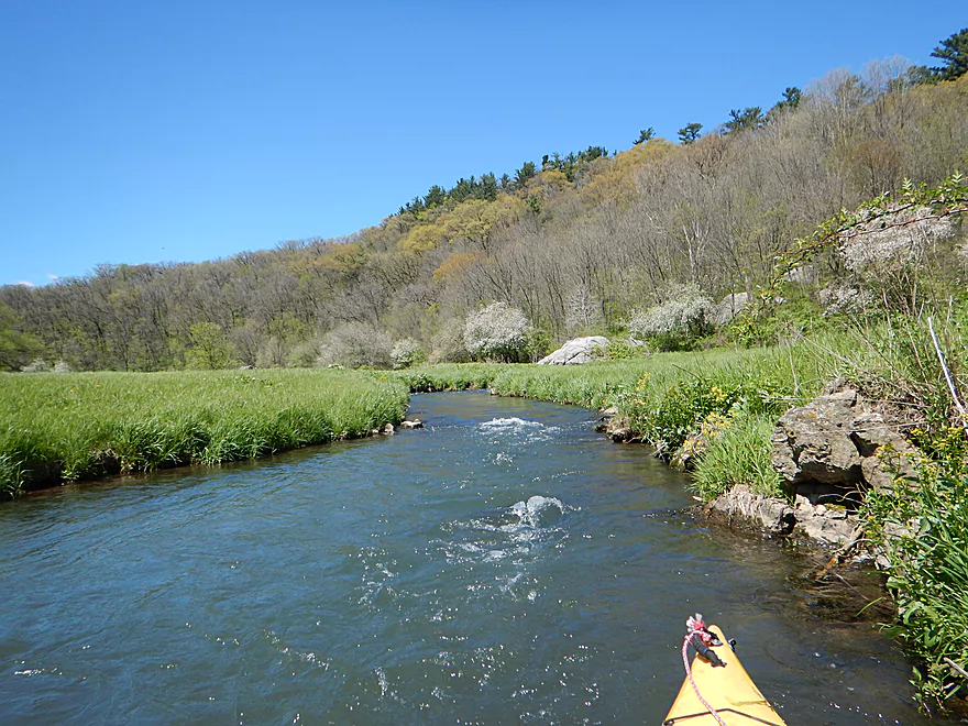
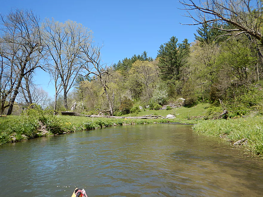
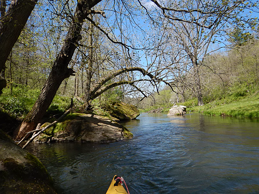
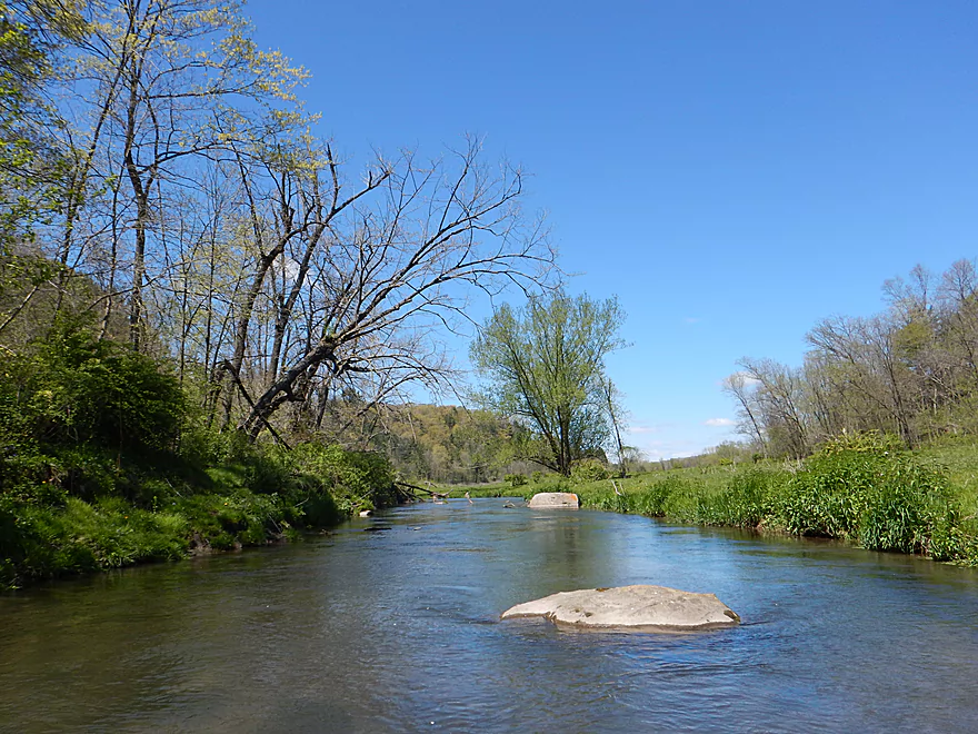
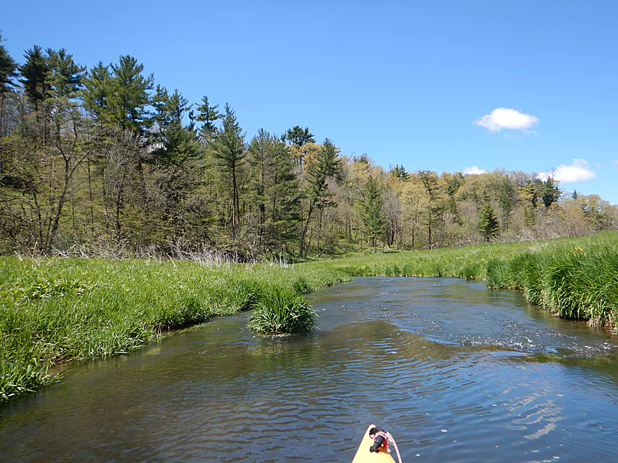
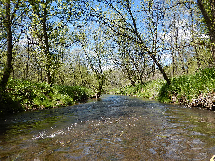
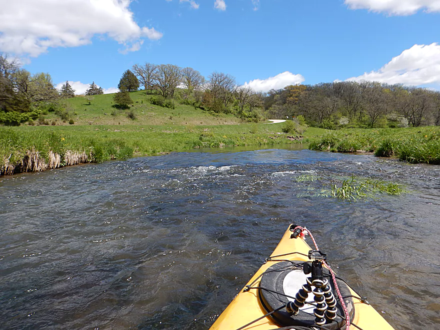
The river then makes a sharp turn left and enters a narrow gorge flanked by 130′ hillsides crowned with white pines. Sandstone boulders are sprinkled throughout the channel and on the banks. The banks on the upper Blue are unique in that they lack mud (so common with other nearby rivers), deadfall, undergrowth, and are carpeted with short grasses, giving you the impression you are paddling by somebody’s lawn…but you aren’t. With no sign of civilization and the exposed geology, this segment felt like a hidden valley that time forgot.
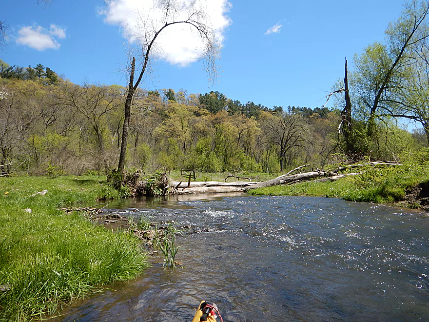
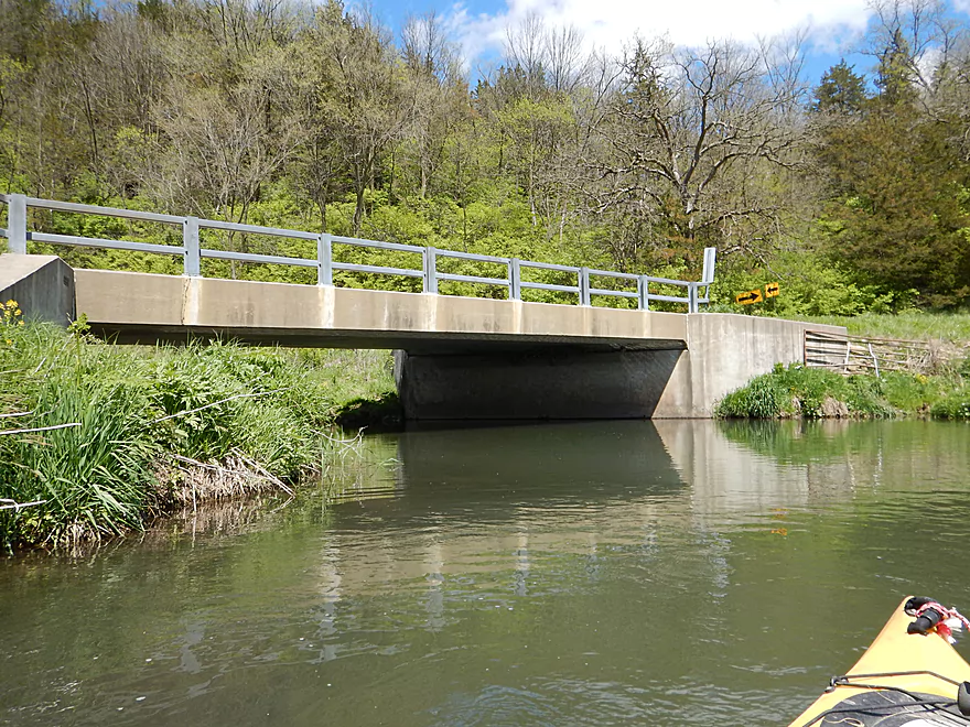
Soon the valley opens up and comes onto Snowbottom Road which is flanked by a unique slab of leaning sandstone. If you really want to, you could take out here (there is a public parking lot by the bridge), but I do advise continuing on.
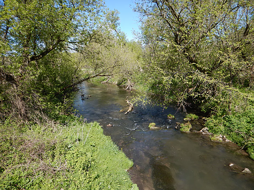
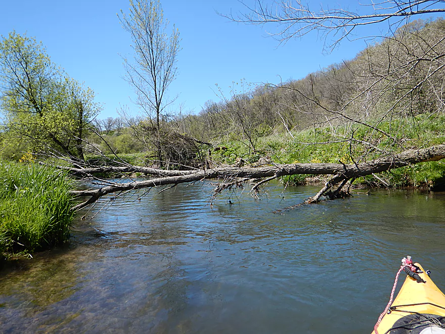
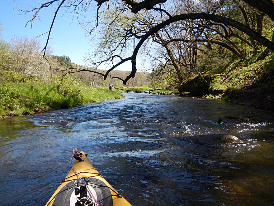
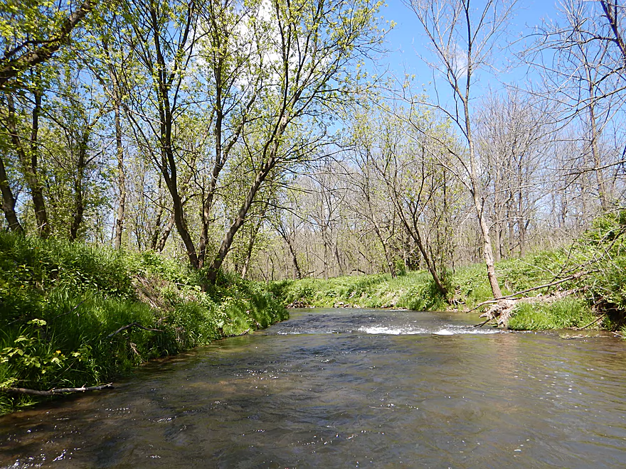
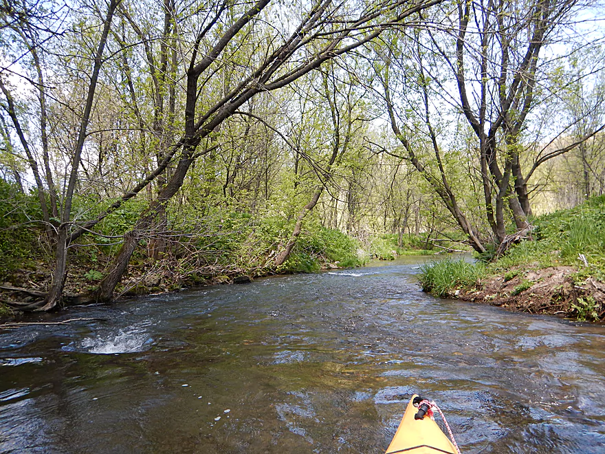
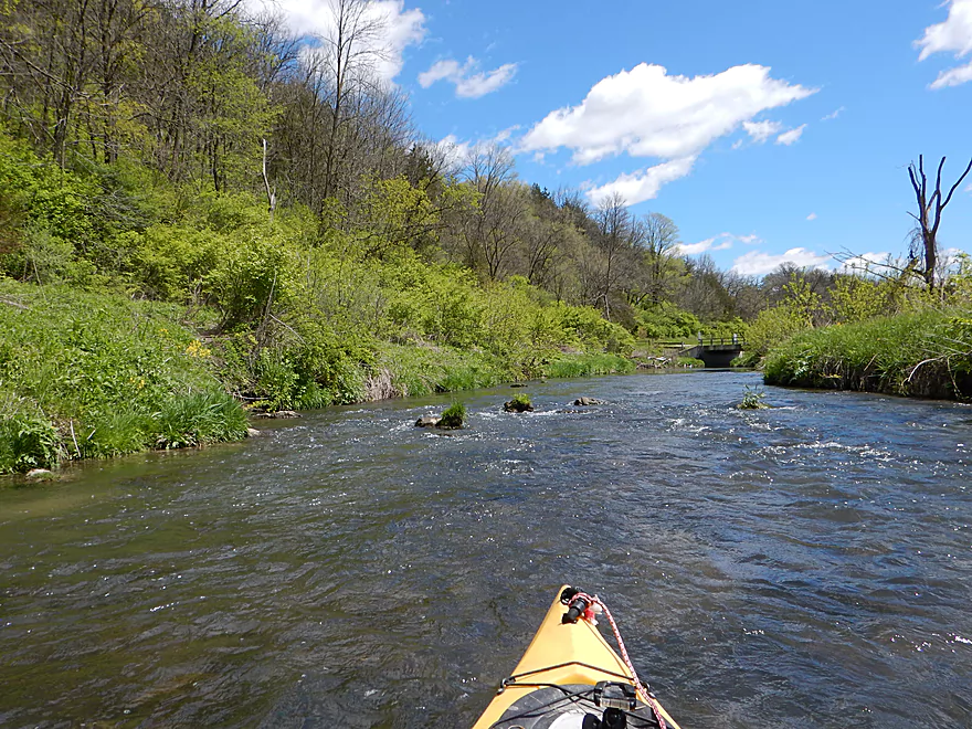
After the bridge, the river changes significantly as woods close in on the banks. Typically rivers + woods = logjams, but not this time (maybe one strainer, but minor). The current stays fast and it was a neat experience zipping left and right over the riffles and under the canopy of trees.
After the woods, the river valley opens up into wide open pastureland with driftless hills visible in the distance. This is a pleasant section and very much reminded me of the Platte River (a neighbor to the southwest). Unfortunately, like the Platte erosion starts to become an issue. Upstream of Snowbottom Road, the creek was remarkably free of mud and flowed over attractive rocky substrate. But by the last mile, mud banks start popping up (some about 8′ high), which was quite unfortunate.
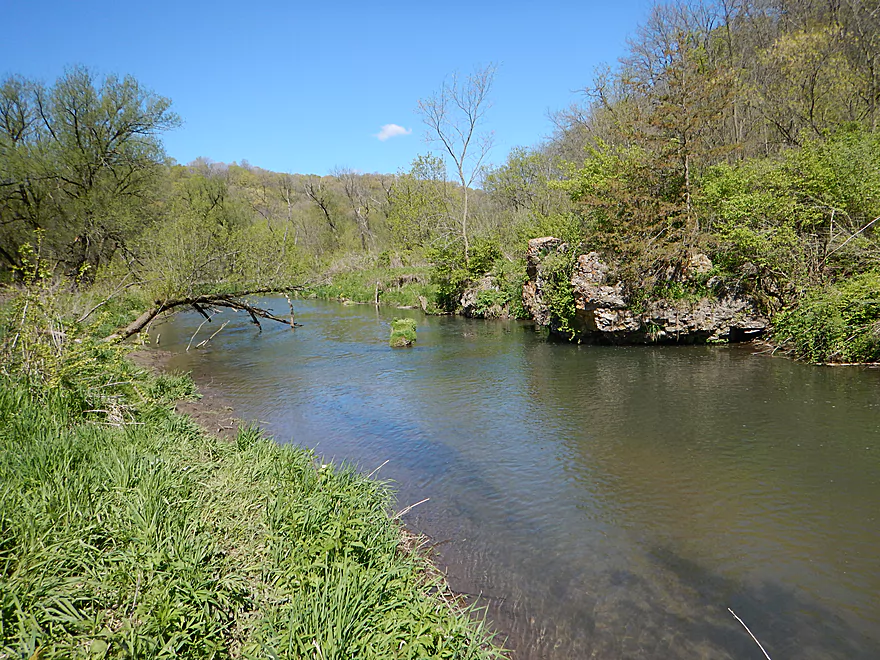
The take-out at Bowers Road is decent. Here you’ll likely see a few parked cars from fishermen trying their luck in the Snow Bottom State Natural Area just to the north. Snow Bottom is a neat area. It’s a protected section of the Blue River flanked by large scenic bluffs, but is somewhat difficult to access. You can paddle its length (about 6 miles), but there might be some logjams and shallow areas. This is a prospect I very much look forward to exploring in the future.
Good access at Bluff Road with ample shoulder parking and access to the water. Popular with trout fishermen. Only downside is you have to drag your boat 200′ over the grass to reach the water (minor).
I suppose if you really wanted to you could cut the trip very short and take out at Snowbottom Road. Good access including a public parking lot.
Most sensible paddlers will continue the extra 1.6 miles to Bowers Road. You can’t really take out at the bridge there (too steep and nasty fences), but if you paddle 200′ more downstream you can disembark on the left bank (just upstream of the outcrop), and drag your boat 100′ south over a faint fishing trail to a public parking lot just to the south. It will all make sense when you get there. This is the trailhead of sorts for the Snow Bottom State Natural Area and is very popular with fishermen.
Extremely adventurous paddlers can continue 6 more miles and take out at Shemak Road (a decent access popular with fishermen and along a public easement corridor). These six miles are likely more interesting than my upstream trip as they flow through the heart of the Snow Bottom State Natural Area. Very much on my to-do list.
I know of no local liveries. The bike shuttle is relatively difficult because of the many steep hills and I ended up walking many of them to the bemusement of passing cars. Total length was 6.9 miles, ascent was 466′ (that is a lot), descent 407′, and the shuttle took 57 minutes. Translated to English…that’s a tough bike shuttle.
Surprisingly few. This is a fast creek and you’re almost always within earshot of a rapids, but none greater than Class 1. The channel at times is narrow and rocky, so this trip is more suitable for smaller and more maneuverable boats (but I would have no issue doing this with my 12.5′ Tsunami). There aren’t too many strainers, but there were a pair near the end of the trip in the woods. If high water or you are not paying attention these might be tricky, but I didn’t think they were a major deal.
There are a few fences and logjams, but they are all pretty negotiable. See map for locations and gallery for pictures.
- Fence #1: A dilapidated swing gate blocks the channel maybe a mile downstream from the put-in. I was able to get under by bench pressing the gate above my head, but this was very difficult. I suggest portaging on the north/right bank. Here you can hoist your boat over a stile in the wooden fence created for fishermen and easily re-enter the creek.
- Logjam #1: I was able to duck under this (barely). However, it would be very easy to portage on either bank. The banks are low, grassy, and free of mud which makes for super easy portages.
- Fence #2: Another swing gate, but this one was much easier to lift over my head. If you prefer, this would be an easy portage on the north/right bank.
- Logjam #2: Super easy portage on the north bank.
This creek (like so many other driftless streams) constantly alternates between pools and riffles. The pools will always be deep enough to be navigable even during summer lows, but the rocky riffles will need some padding to avoid walking. Below are my wildly unscientific estimates based on the Platte River gauge.
- < 69 CFS: Probably too shallow to run.
- 70-100 CFS: Amazing water clarity, but you will likely have to walk many of the rapids (might be worth it). Scouted at 80 CFS.
- 101-165 CFS: Likely doable, but many of the rapids will be very bumpy and a few will have to be walked. Very good water clarity.
- 166-205 CFS: A good target range. I did my trip at 186 CFS and didn’t have to get out once due to shallow water. You’ll hit a few rocks, but this is common with rapids. Occasionally good clarity.
- 206 – 250 CFS: Probably doable, but the higher water will smother the character out of the river. Unlikely to have good visibility.
- 251+ CFS: I assume these are near or at bank breaching levels. Maybe of interest for professional whitewater paddlers but for few others.
Webmaster’s update… My original estimates above are likely far to conservative. Reader Jon did this river at 450 CFS and indicated it was plenty viable. For more information on Jon’s experience read his comment at the bottom of this review.
Not much. A few muskrats, an eagle, a redtail and just a few fish. There were a handful of trout fishermen who were pretty friendly. A highlight was seeing geese perched on some of the tall rocky outcrops watching me as I passed under. On the shuttle, I saw a pheasant which is pretty rare (at least for me).
Detailed Overview
Blue River – Main Branch:
- Upstream of Blue River Road: Likely not practical for paddling.
- Blue River Road → County Road I: 1.4 miles. Mostly clear of logjams, but shallow and would require high water to be navigable.
- County Road I → Bluff Road: 0.9 miles. Nice section that goes through a small woods. Maybe 1 or 2 jams. In hindsight, I wish I had done this. A shallow section but looked just doable when I scouted it during my first trip.
- Bluff Road → Bowers Road: 4.1 miles. Five star trip.
- Bluff Road → Snowbottom Road: 2.4 miles. Fantastic section through driftless valleys with many light rapids.
- Snowbottom Road → Bowers Road: 1.6 miles. A good section through a small woods, then through an open area reminding me of the Platte River.
- Bowers Road → Shemak Road: 6.6 miles. One of the best paddles in Southern Wisconsin with massive boulders, fun rapids and scenic driftless hills.
- Shemak Road → Biba Road: 1.7 miles. Mostly open farm country paddle. Maybe 2 logjams.
- Biba Road → Hwy G: 5.0 miles. Maybe 15-20 logjams.
- Hwy G → Forest Road: 8.0 miles.
- Hwy G → Studnika Road: 1.0 miles. Nice open stretch with an attractive bluff. There are two noteworthy logjams, with one needing a portage. Castle Rock Creek adds significant volume to the Blue River. Note Studnika Road is not a suitable access.
- Studnika Road → Forest Road: 6.7 miles. Nice leg through open pasture and bluffs. There are a couple of downed trees, but I was able to sneak past them without portaging.
- Forest Road → Hwy 133: 6.3 miles. Maybe 3 logjams. The river is wide enough here you might be able to squeak past most of these. Hwy 133 is a busy road with long guardrails, which would make this take-out annoying, but I think it should be doable from the SE side.
- Hwy 133 → Wisconsin River: 1.0 miles. Maybe 6 logjams. This is floodplain forest now.
- Wisconsin River – Cross Slough: From here you can paddle a mile north to reach the Port Andrews Boat Landing. Alternatively, you can paddle down Cross Slough for 3 miles which is like a mini-river and might be a unique paddling experience.
—
Castle Rock Creek (aka Blue River – Fennimore Branch):
- Upstream of Hwy Q1st: The creek is probably too small to run.
- Hwy Q1st → Homer Road: 0.5 miles. Very small. A simple cow pasture paddle that probably isn’t special. Homer Road is not a great take-out…small, near a home, and a nasty pit bull chased me when I tried to scout this bridge.
- Homer Road → Hwy Q2nd: 0.3 miles. Simple open section through overgrazed and eroded banks. The second Hwy Q bridge is a decent access used by fishermen, but there is nowhere to park.
- Hwy Q2nd → Church Road: 0.4 miles. Paddle goes by a steep hillside and quarry. Maybe some interesting geology.
- Church Road → Hwy Q5th: 3.1 miles.
- Church Road → Hwy Q3rd: 1.2 miles. A nice open pasture section with many riffles, but one I-beam to portage.
- Hwy Q3rd → Hwy Q4th: 1.1 miles. A neat section with many rapids that goes by Cedar Cliff.
- Hwy Q4th → Hwy Q5th: 0.7 miles. Shallowest part of the creek during low water. Some neat geology in this section with more great rapids and a spectacular view of Castle Rock. Hwy Q5th is a doable take-out but does require some dragging to get past the guardrails. Many hikers park by the bridge before climbing Castle Rock.
- Hwy Q5th → Witek Road: 7.3 miles. River flows through a massive hidden valley flanked by steep hillsides. Includes the western unit of Snow Bottom State Natural Area. While mostly open, the river does have three logjams that must be portaged. After Snow Bottom, the river loses most woods, gains a lot of mud, and flows through farm country.
- Witek Road → Neff Road: 3.9 miles. A farm pasture paddle with likely a number of downed trees (maybe 7 portages).
- Neff Road → Hwy M: 1.9 miles. Mostly open farm pasture paddle. Maybe one logjam.
- Hwy M → Confluence with Blue River: 3.8 miles. Maybe 3-5 logjams.
Trip Map
Overview Map
Video
Photos Size:
Hello! Thanks for bringing this wonderful waterway to my attention. We ran it today. Platte levels were @ 155 & we found that to be OK–no dragging, but a few bumps. Big deal. Can’t wait to do another stretch. One small item–at the top of the post, it states the takeout to be Snow Bottom Road, should be Bowers Road. Love the pictures & video–very enticing! Thanks!!
Thanks for the comment and the heads up about my typo. Not sure how I missed that…
Paddled Bluff Rd. to Shemak on 25May2019 (Aaron, feel free to add these comments to your Bowers to Shemak section if you like). Platte gauge was at 450 CFS @5.3 ft. We put in on the opposite bank from Aaron’s photo because we saw the fishery access sign on that bank.
Lots of debris was weighing down the old cattle gates. Until debris is removed, most paddlers would portage the gates, at least at these water levels. Some barbed wire was also weighed down with debris. We brought y-shaped lifting devices to help us sneak under (collapsible hot dog fork with a plastic handle for me, custom-made PVC “y-er” for companions). A few logjams, (mostly downstream from Bowers Rd.) One portage had lots of nettles, but I was wearing long pants.
There was a fresh skin of mud along many stretches due to the river being higher the day before. This made the take-out at Shemak and some of the portages a bit slippery.
We’d been hoping to catch the Blue with enough water in it, and the beautiful scenery and made it worth the portaging and fence lifting.
Aaron, you might want to update your CFS guide (quoted below) to reflect our experience. We’re by no means advanced whitewater paddlers. Backferrying and river reading skills help, but one of us was in a 12′ Tribute (sporty rec boat with a keel). Shorter boats with more rocker help on most twisty/riffly streams. The Blue is seldom more than waist deep, so wading a boat to shore after tipping/swamping should be doable for many paddlers. (Yes, one of us hit a tree and swamped.)
Aaron wrote: “251+ CFS: I assume these are near or at bank breaching levels. Maybe of interest for professional whitewater paddlers but for few others.”
As always, assess the risks and conditions to make sure your skills and boat are suited for your trip.
Thanks Jon for the update. I definitely think my 250 max estimate before was too low and will update my estimates with a reference to your summary.