
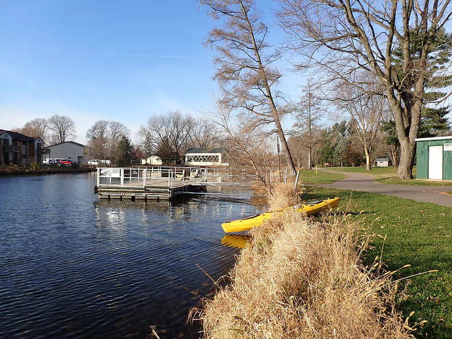
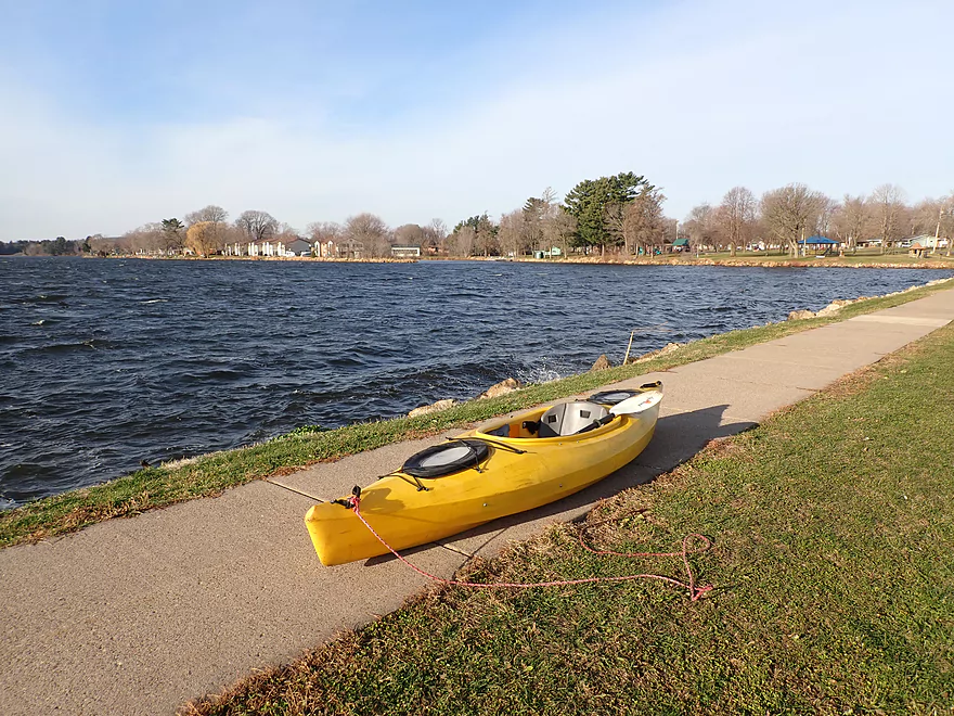
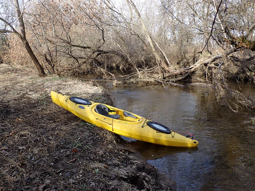
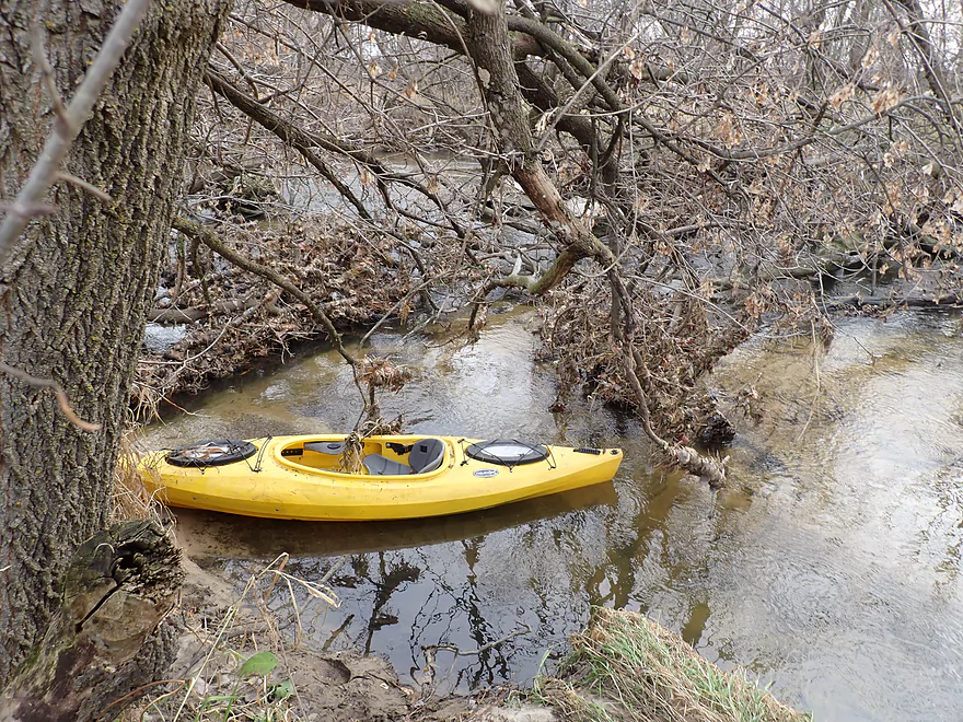
Starting the trip at Butts Park
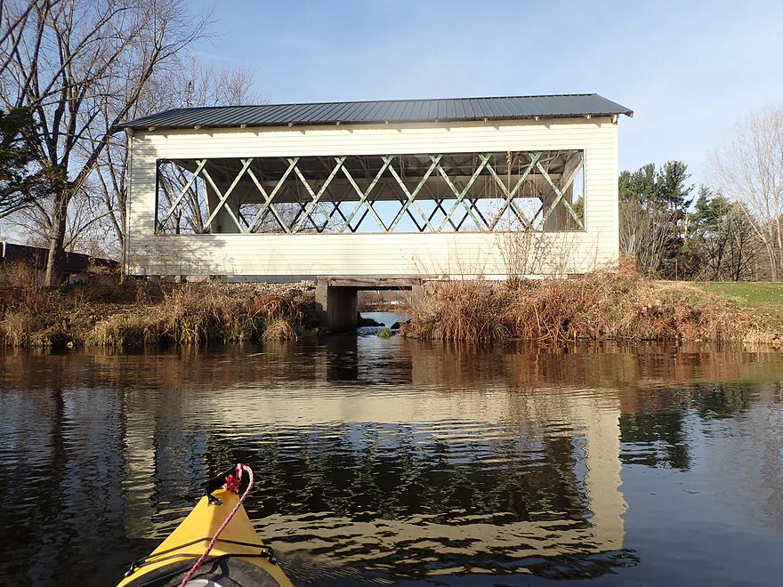
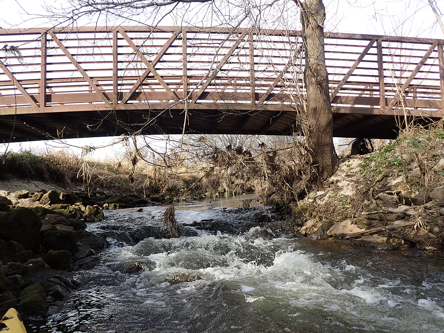
A nice covered bridge
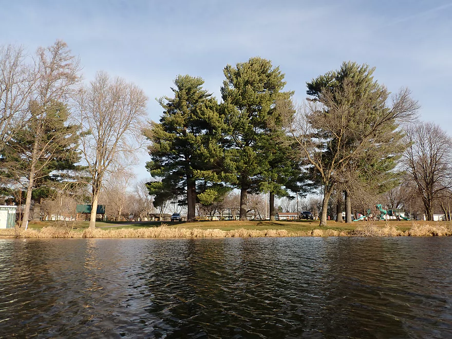
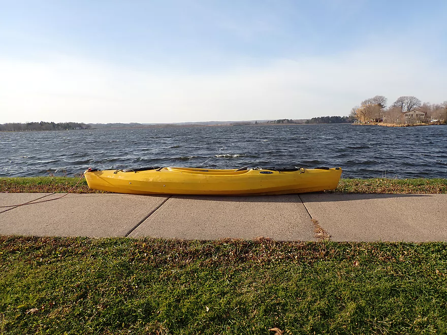
Looking back at the park
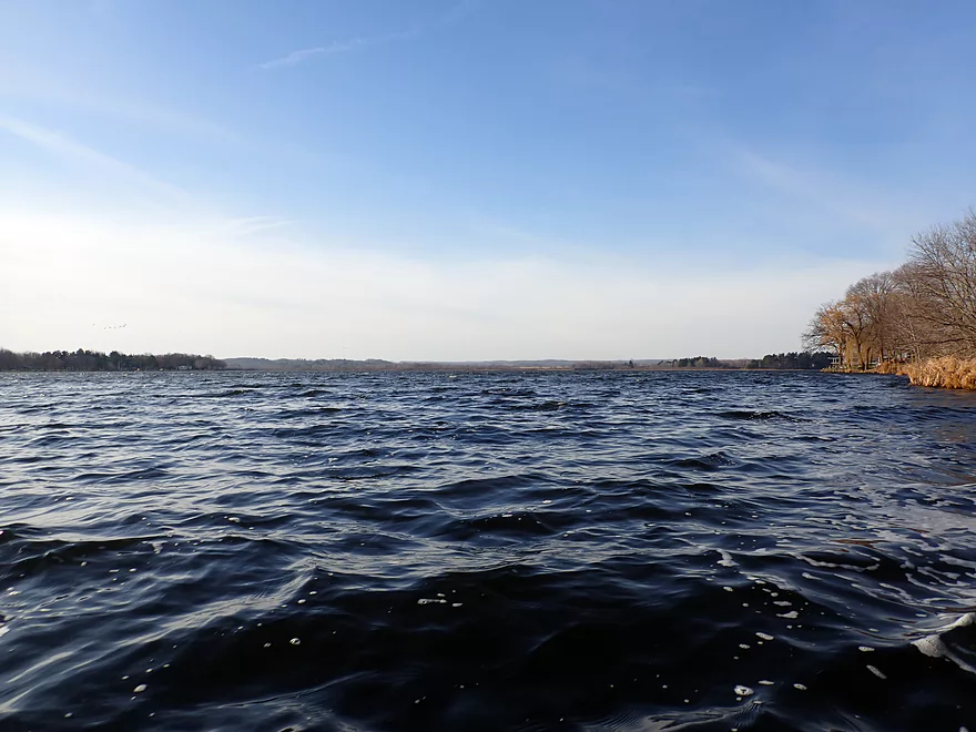
Lake Tomah
Getting off early as it was a little rough
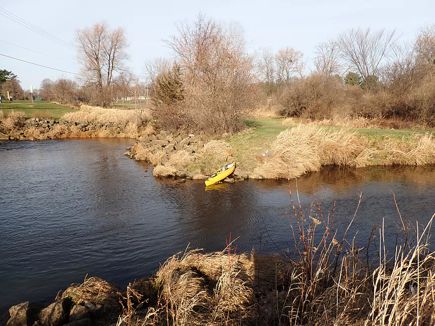
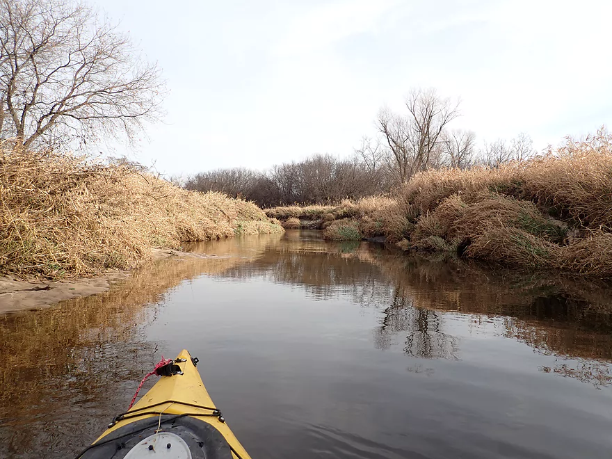
View of lake from behind
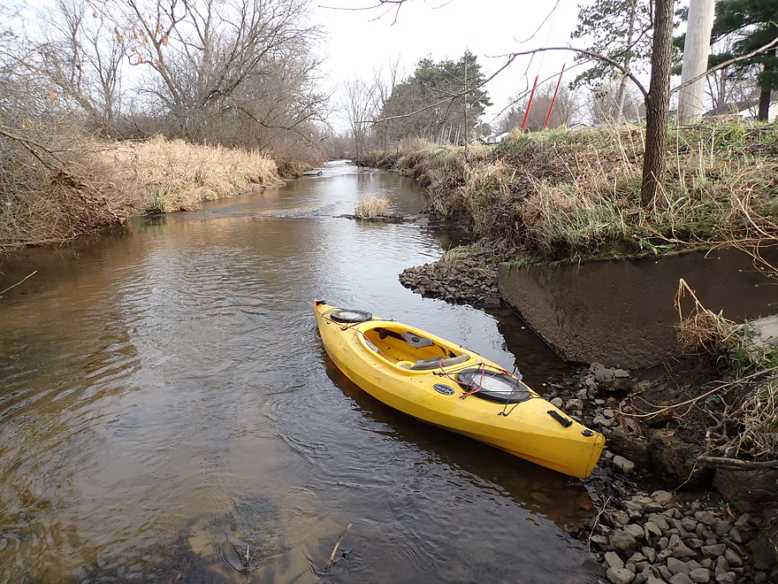
Portaging the Lake Tomah dam
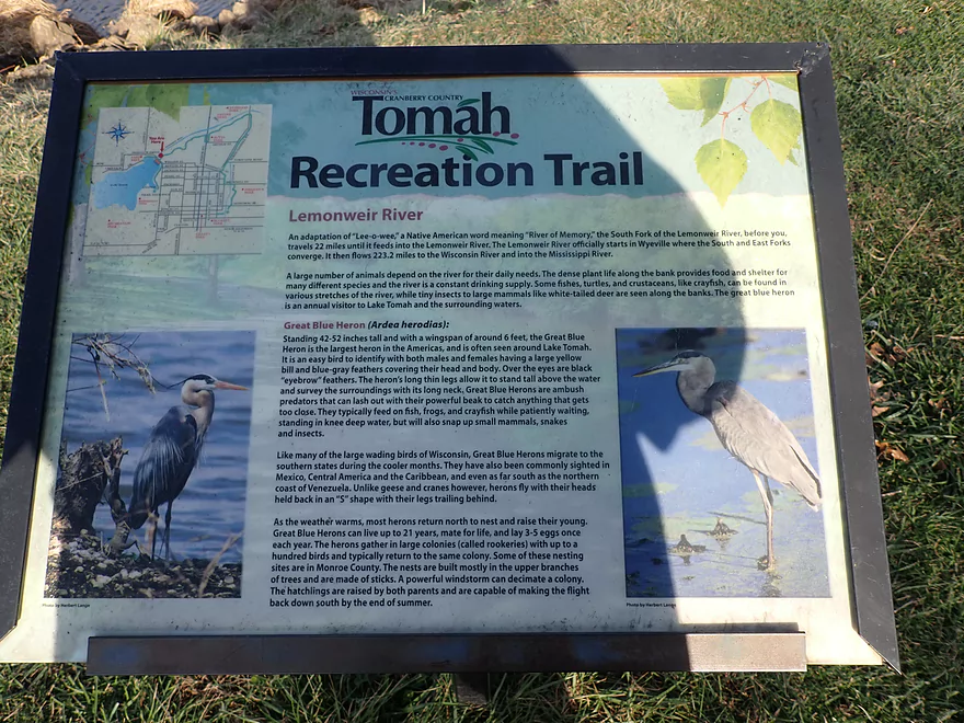
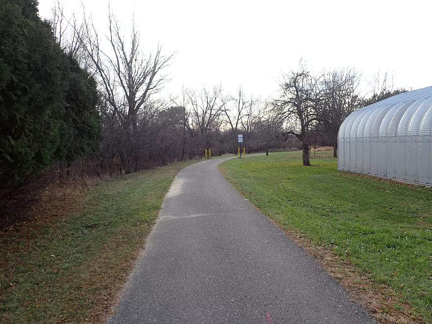
The Tomah Recreational Trail parallels the river and is really nice
View downstream from dam
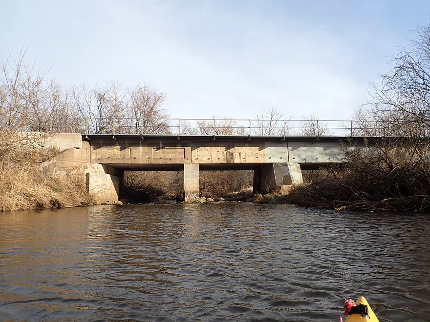
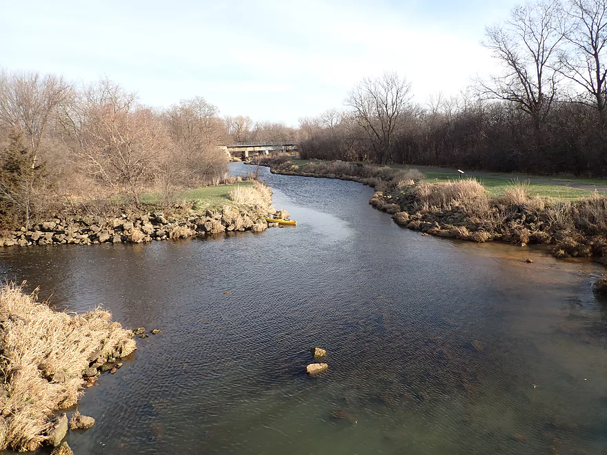
Railroad bridge
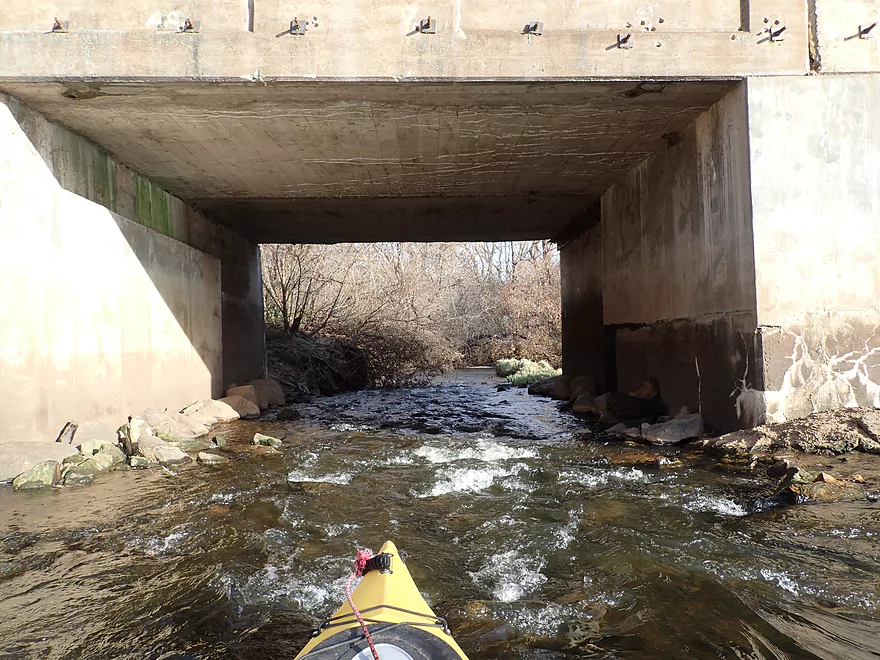
Some bumpy rapids
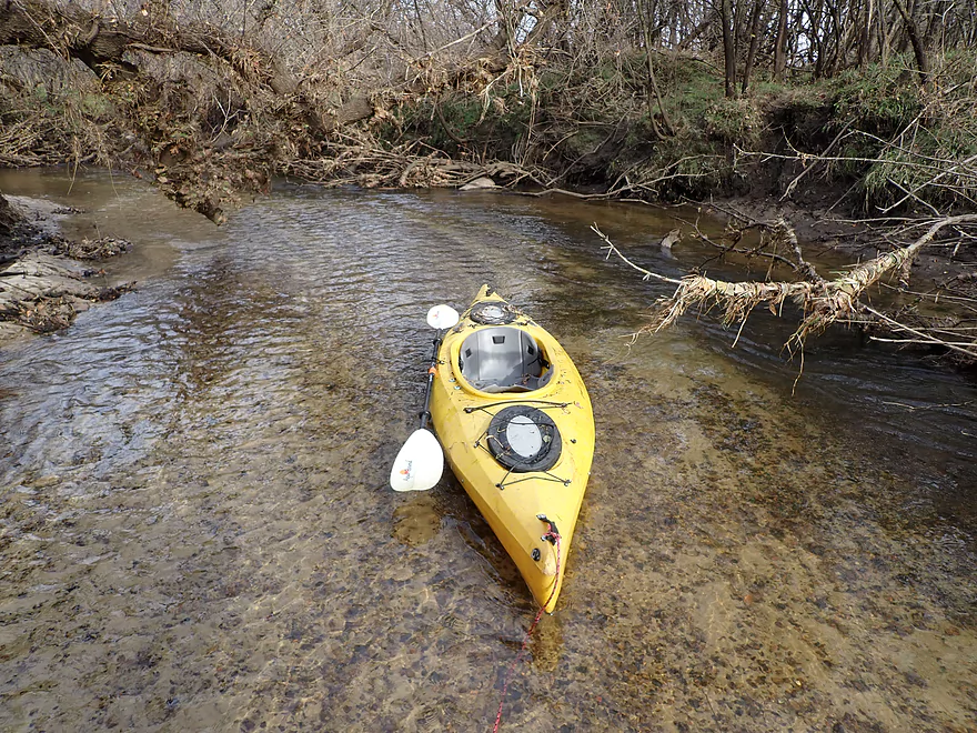
Which I waded through
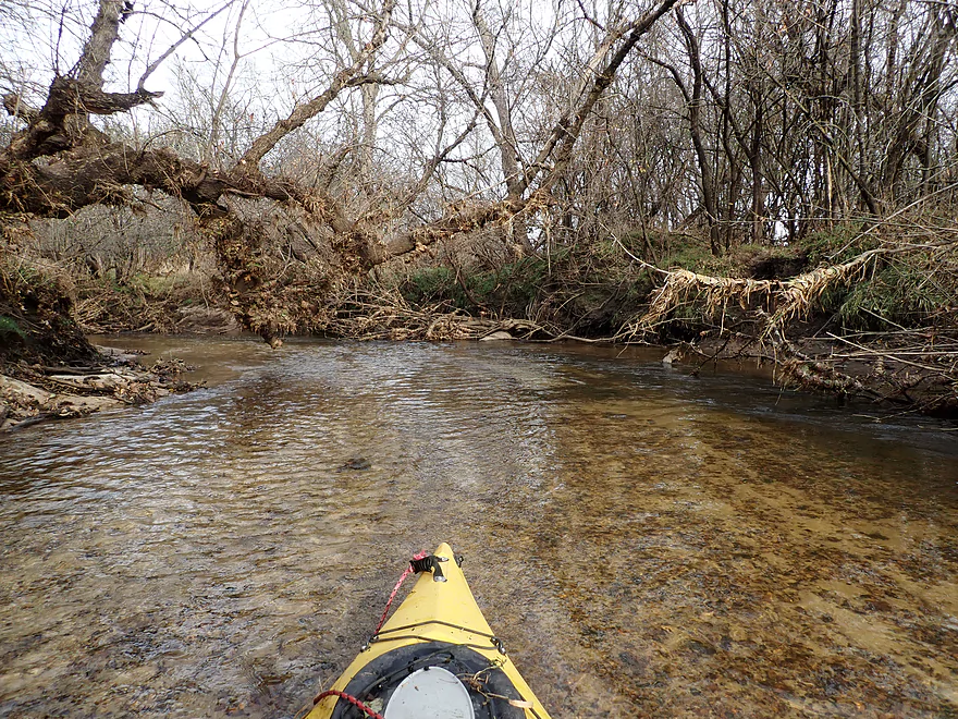
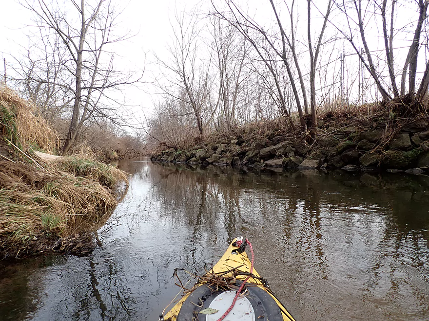
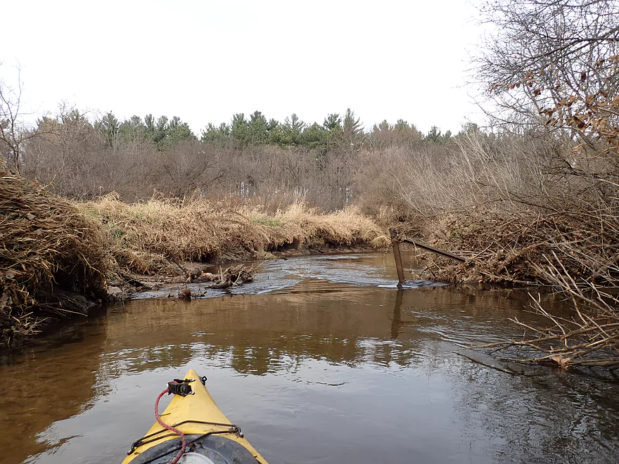
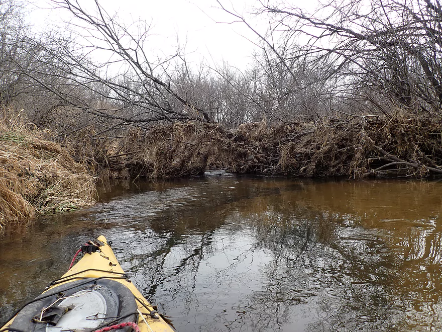
The first of many logjams
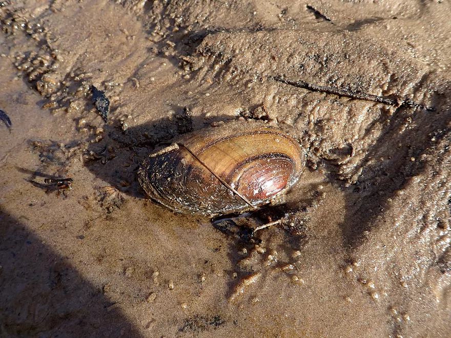
A few clams on the river
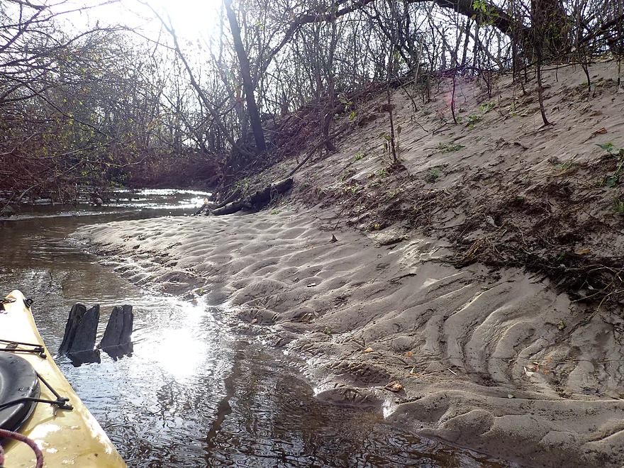
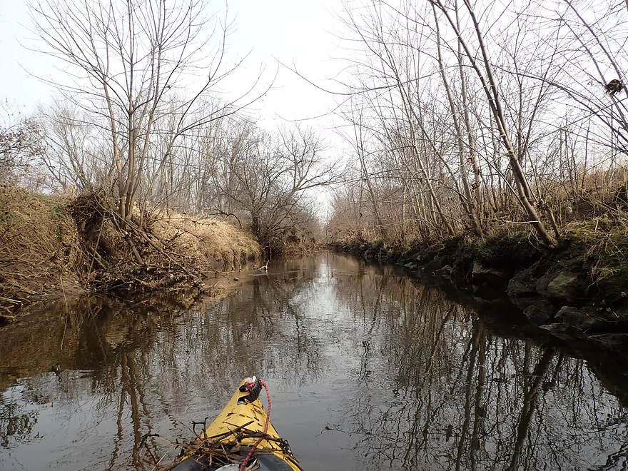
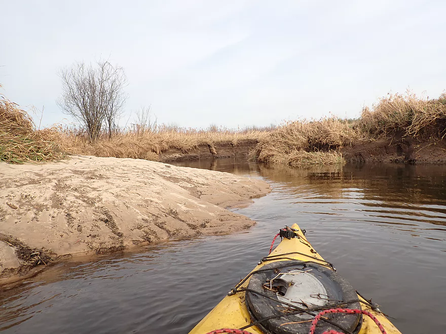
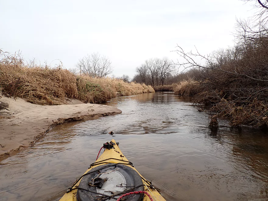
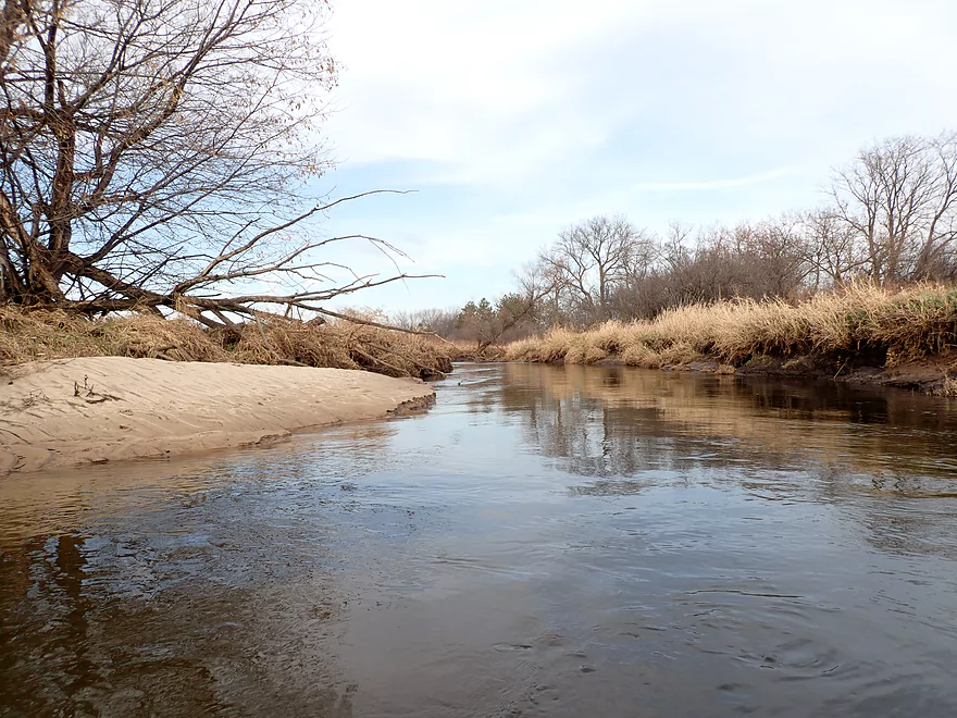
This was a super sandy river
Another logjam
The second set of rapids
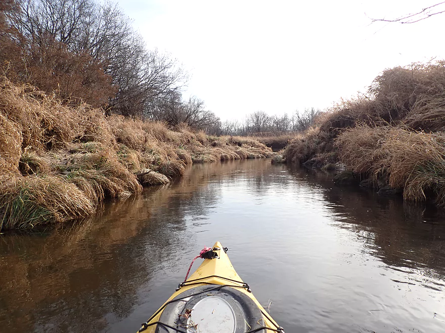
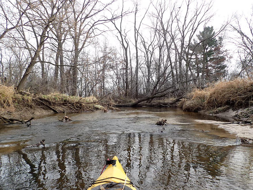
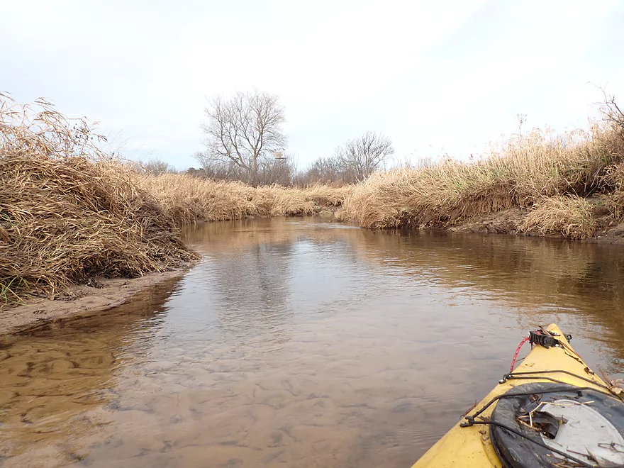
River starts to open up a bit
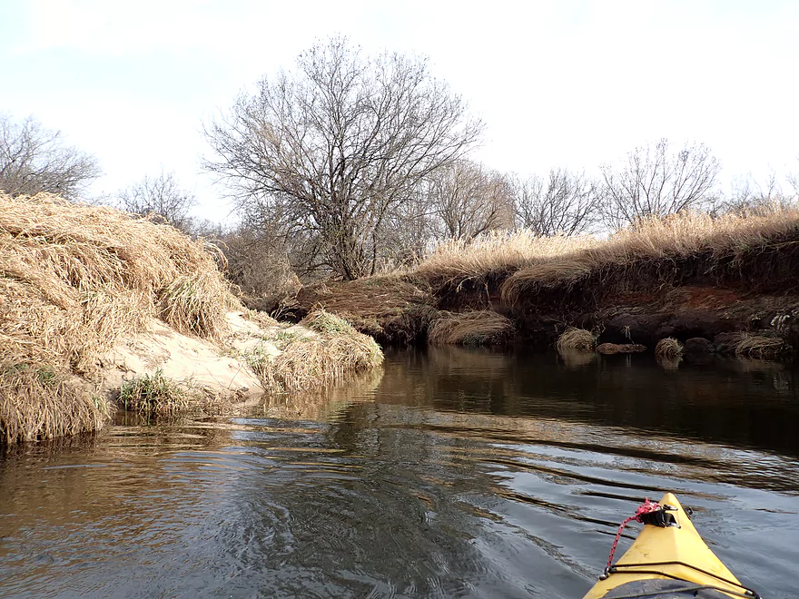
Tall sandy banks
Thick piles of reed canary grass look like haystacks
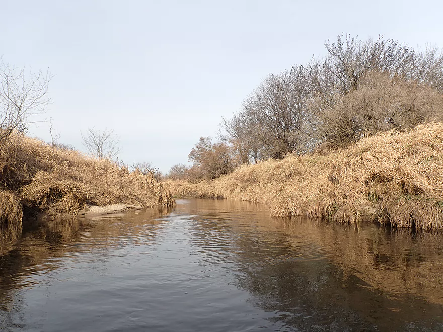
This was a nice part of the trip
Back to logjams
Nice clarity
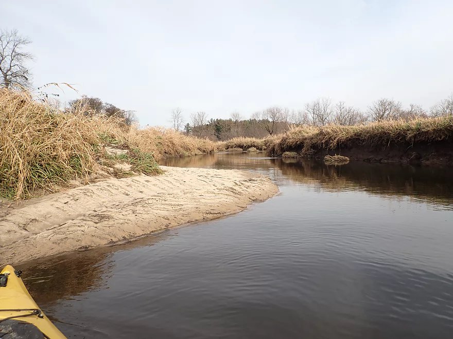
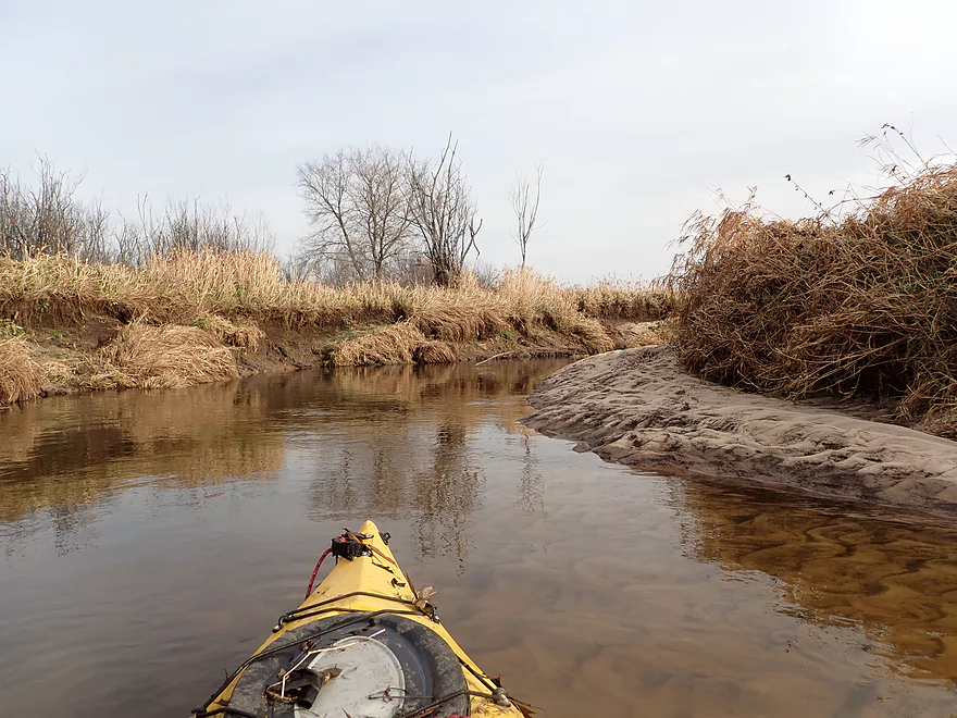
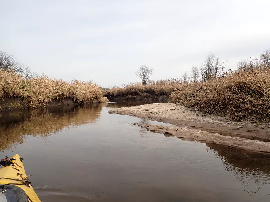
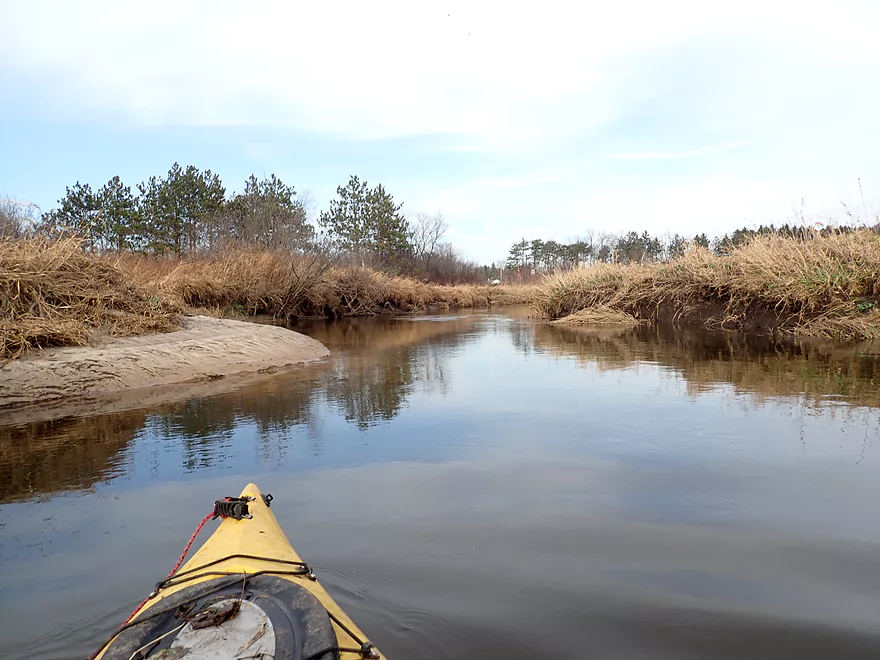
Large sandbar by Memorial Park
Much of the next half mile through Tomah had been straightened and riprapped
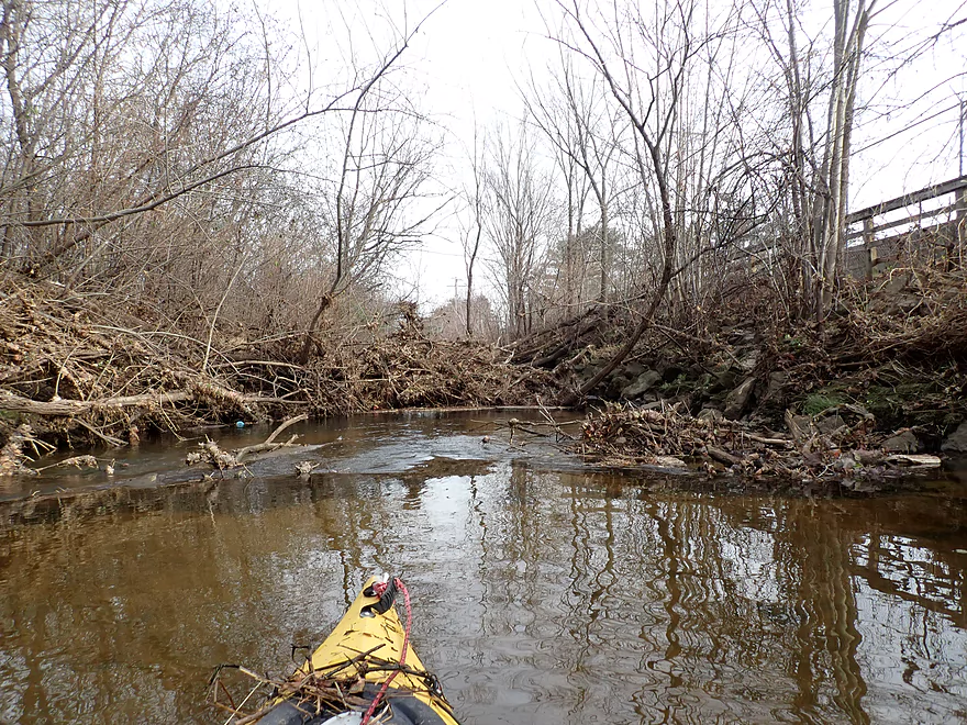
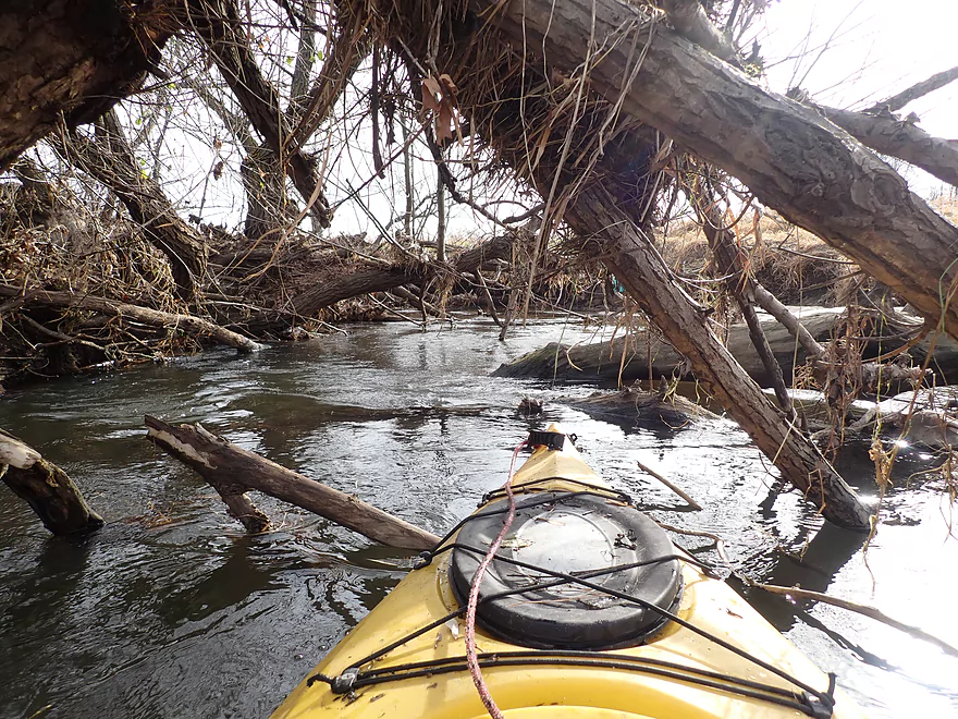
Worst logjam of the entire trip
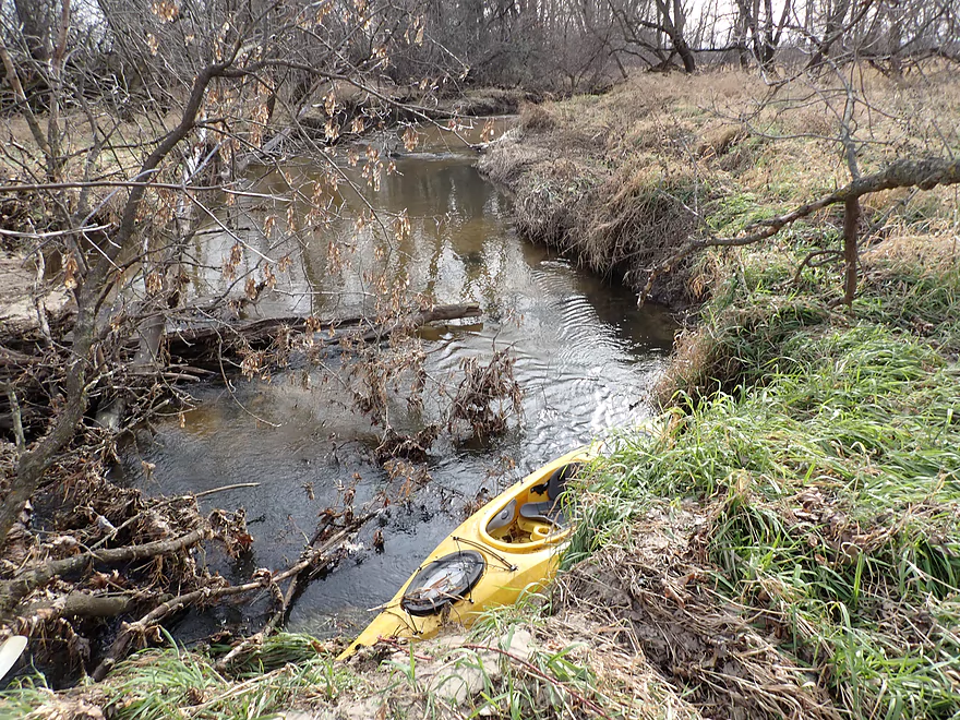
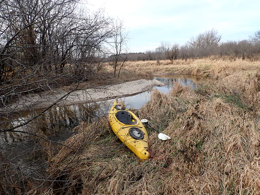
Required a difficult portage up and over the trail fence
Finally back on the water
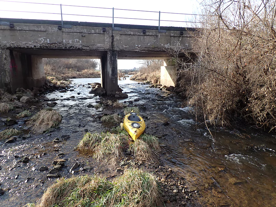
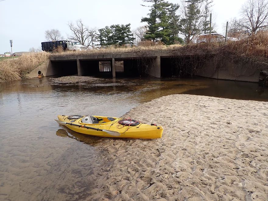
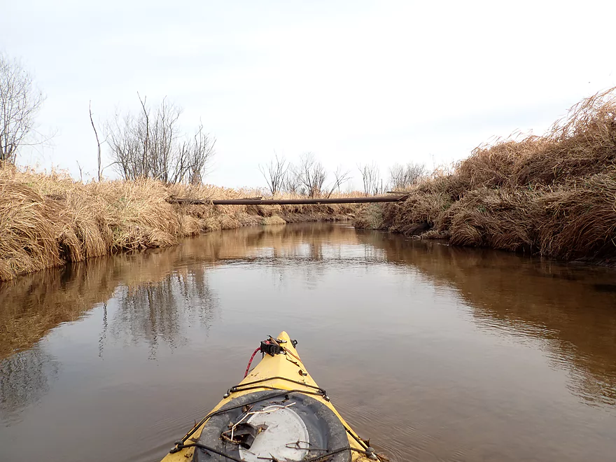
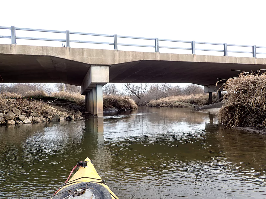
Trail bridge next to the Tomah Dog Park
After the bridge I started encountering major jams
Some require herculean portages
Another difficult portage up a steep bank
A nice respite
Then more jams
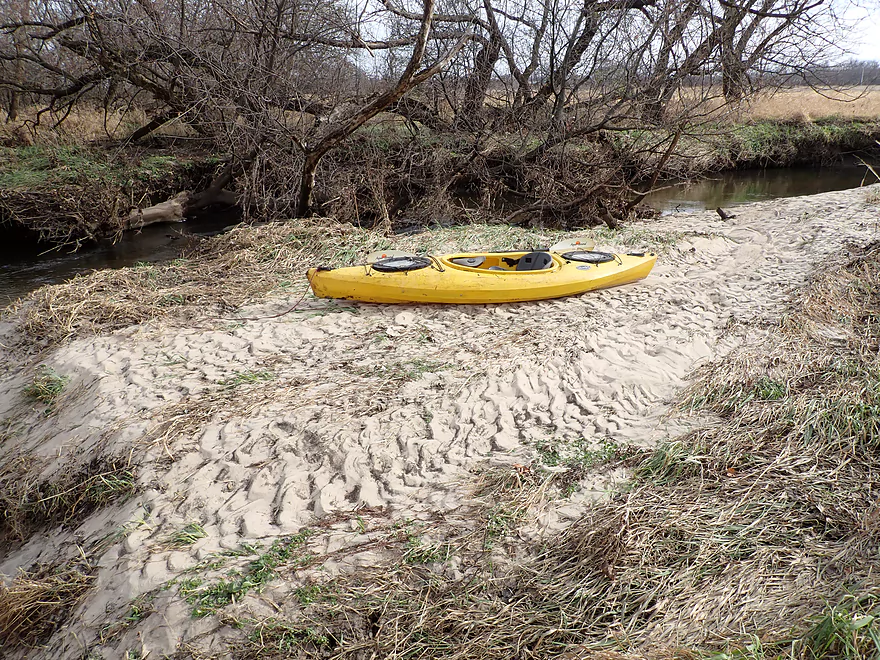
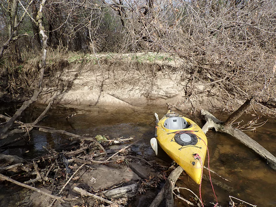
This portage was on a nice sandbar though
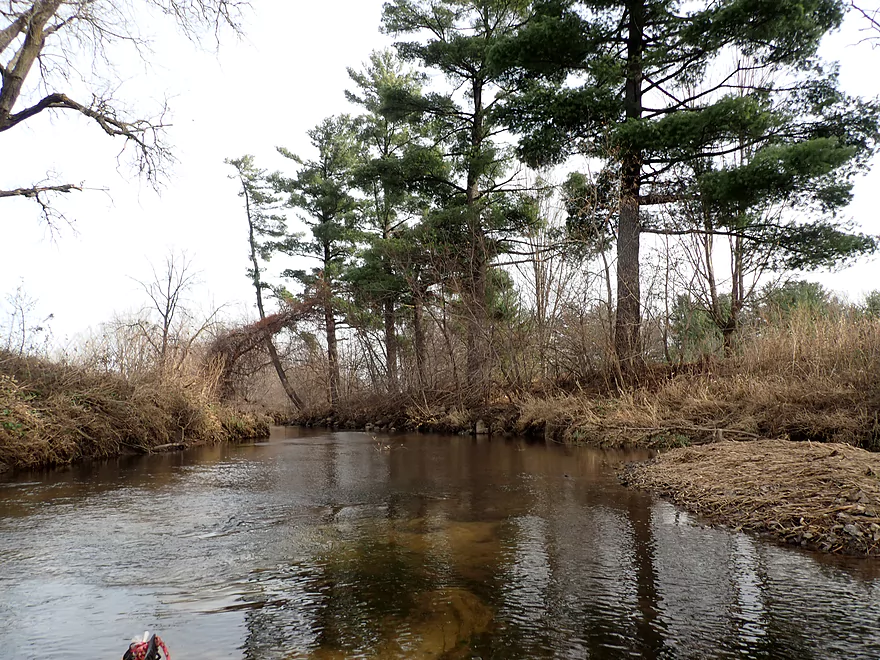
Some pines on this trip, but nothing like the East Fork
River really opens up after that
Some gorgeous sandbars
Great part of the trip
This bridge was easy to duck under
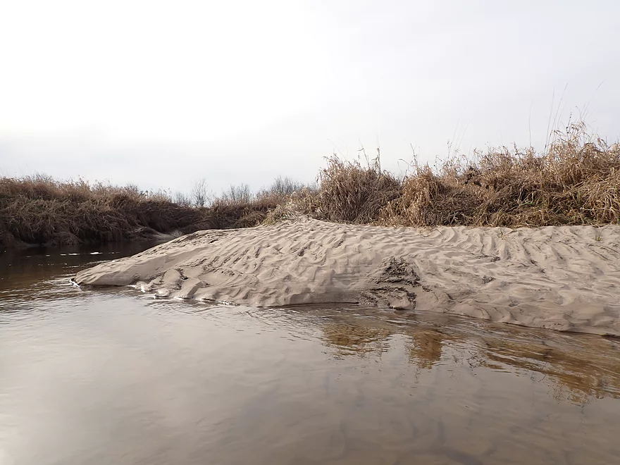
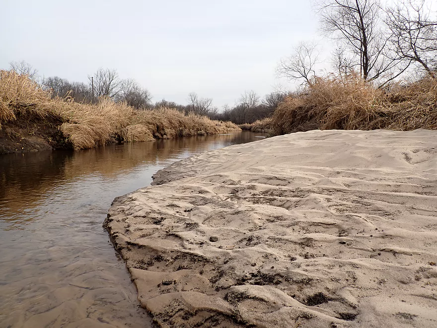
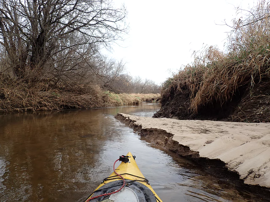
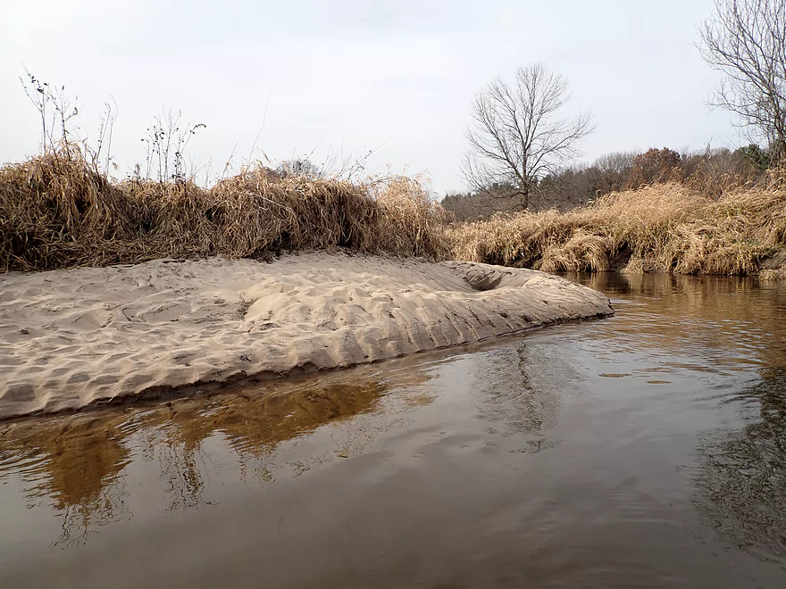
Great sand…very light colored and fine
Another logjam
Another portage
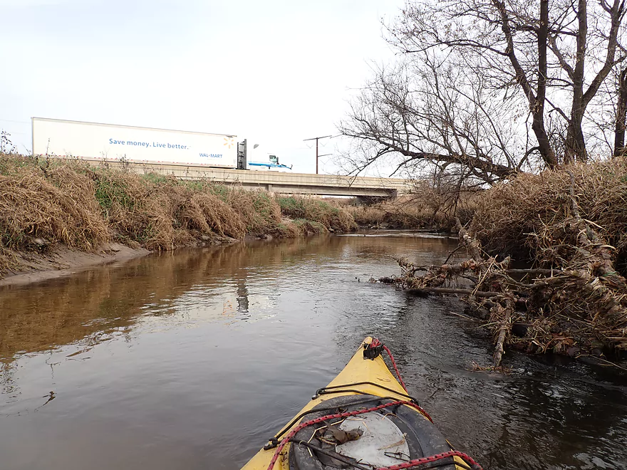
Busy I-94
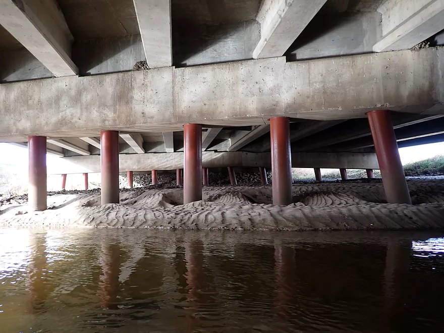
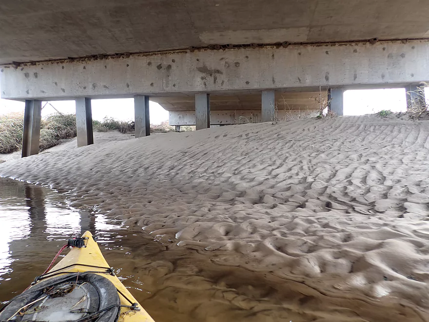
Large sand deposits hiding under the bridge
Last logjam portage of the trip
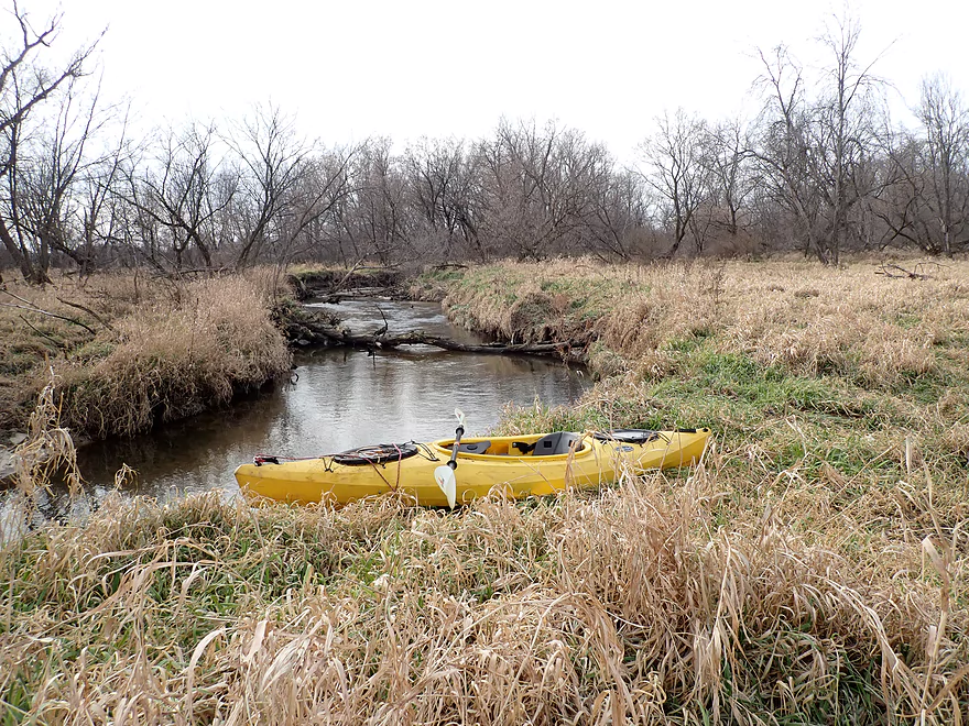
Ending the trip at Forbes Road
The best sandbar of the trip was hidden under it
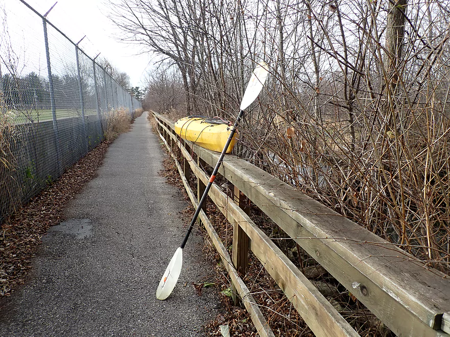
Great bike shuttle back on the Tomah bike trail
Scouting the bridge at ET…river looks very open
Scouting at Hwy N…river looks really nice here…future trip
Lemonweir River – South Fork


The Lemonweir is a mediocre paddling river known for its sandbars and logjams. It largely parallels busy I-94 before emptying into the Wisconsin River by Wisconsin Dells. I suspect many paddlers traveling up the I-94 corridor size it up as they cross over the Mauston and New Lisbon bridges. What most don’t realize is I-94 actually crosses the river a third time by Tomah, a stretch I had been curious about for some time. Earlier this year I did a trip on the East Fork of the Lemonweir which, despite a few jams, was surprisingly nice. For this final paddle of the year, I hoped to recreate some of that magic with a trip on the nearby South Fork through Tomah.
My first preference for a put-in below the Lake Tomah dam, but I decided against this because of the No Parking. I could have (and should have) still put in here and just parked on nearby Williams Street, but instead decided to start the trip at Butts Park on Lake Tomah.
Lake Tomah itself is a pleasant lake, but not a special destination paddle for most kayakers unless you’re a local. Unfortunately it was incredibly windy that morning which kicked up some fairly rude whitecaps. This was especially problematic as the waves were blowing in the direction of the dam which I had planned to portage. After seeing the waves smash into the shoreline and with no easy way to get out, I backtracked to the park and did a long portage along Parkview Drive. The locals were quite perplexed at seeing a kayaker portaging the dam…one guy called me “crazy”.
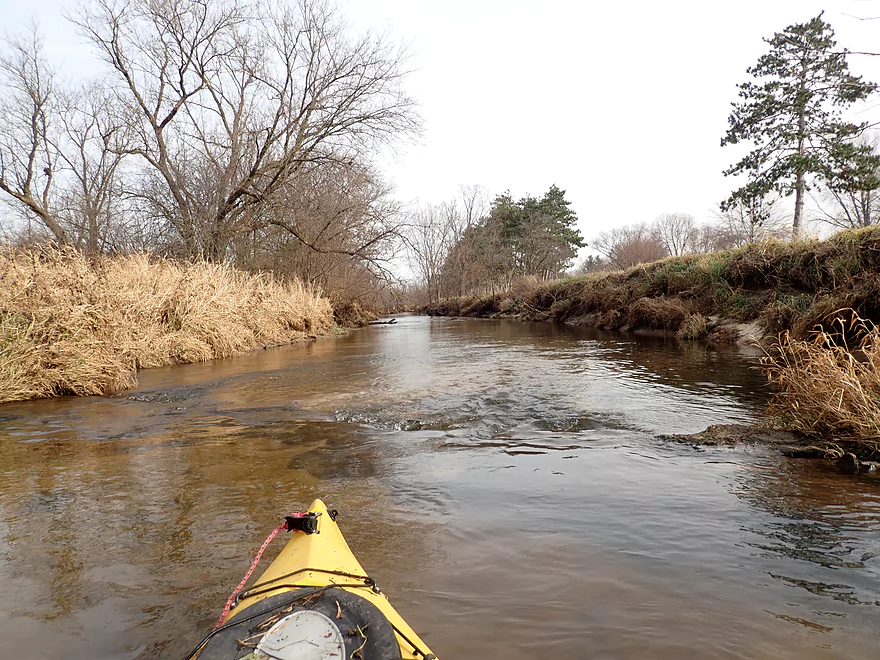
The area below the dam is very nice and popular with area hikers and fishermen. Launching back on the river was a piece of cake. Soon after the dam I came to a railroad bridge with some surprise rapids underneath. These were too rocky to run, so I waded through. Even had there been more water, I’m not sure the rapids would have been runnable as a low hanging branch would likely clothesline paddlers.
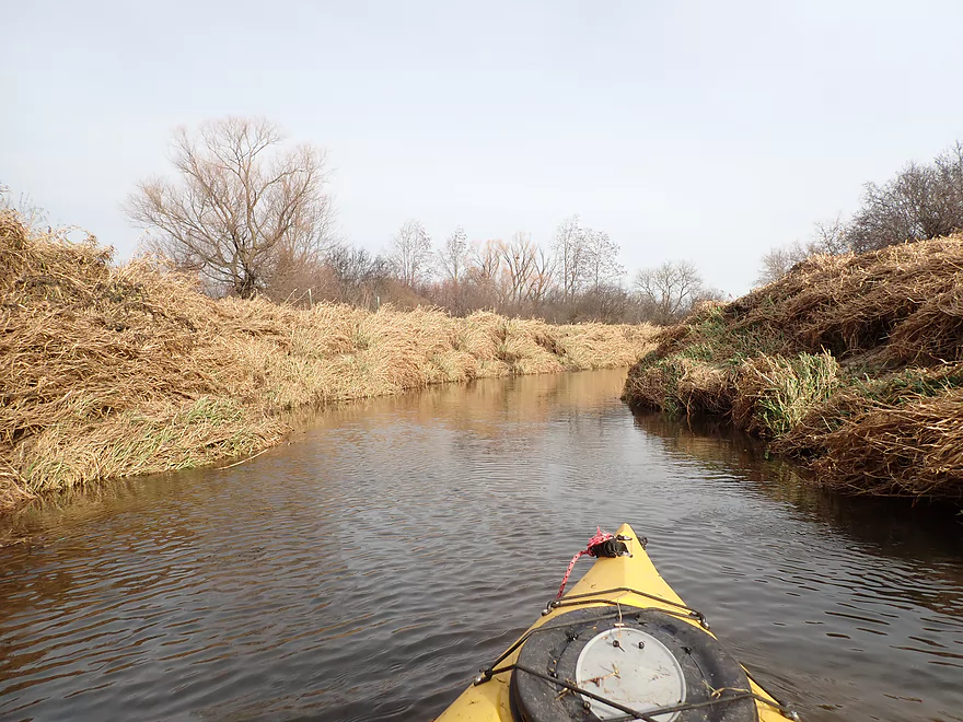
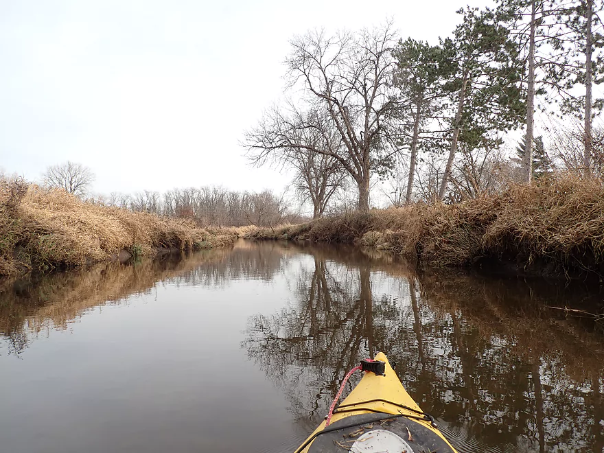
Then it started…for the next half mile I encountered one snag after another. Often I could squeak though (barely) but got filthy from contacting the dead leaves and debris that resided on the branches. In several cases I had to get out and portage. Now I had anticipated some logjams on this stretch based on my prior satellite analysis…but not this many. The river here paralleled the Tomah Recreational Trail and its many hikers ogled me curiously, likely perplexed that a kayaker would even attempt to paddle this stretch.
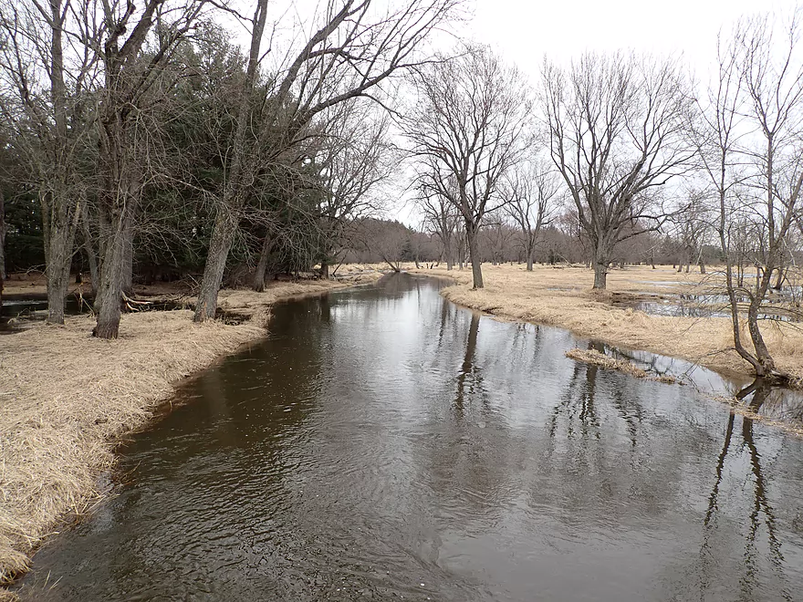
One of the main disappointments was that it was nothing like my East Fork trip, which had cool red tinted water and many pine trees. The South Fork instead was a mess with high banks. The only perk was its clear water and occasional small sandbars.
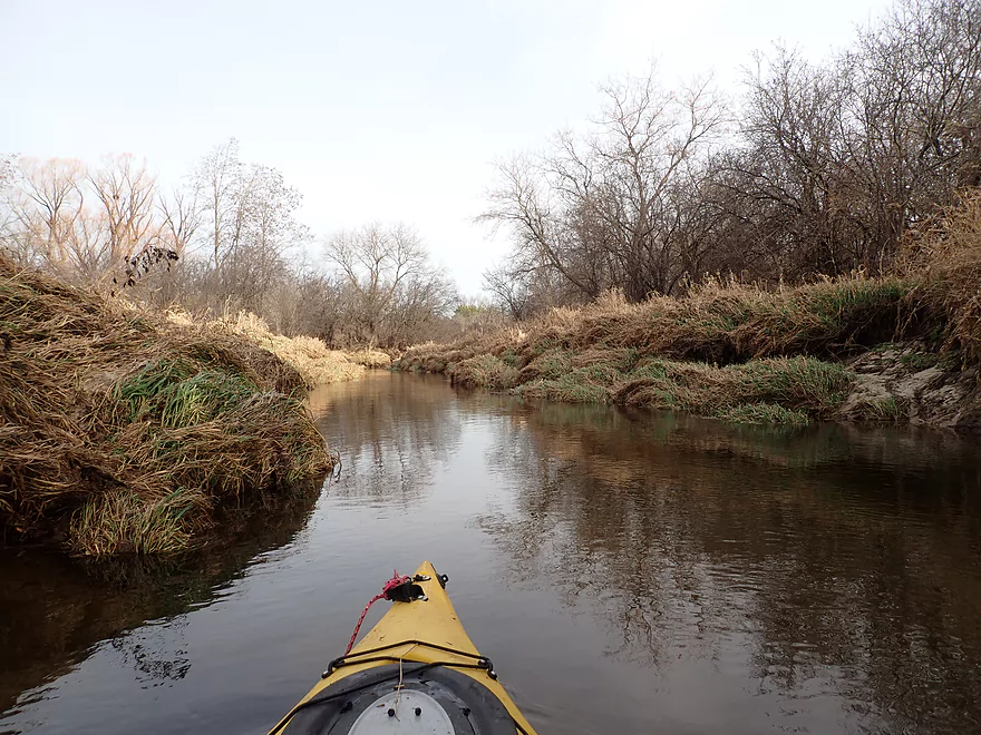
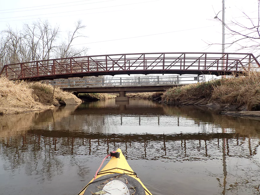
The river opened up somewhat by the trail bridge. Under of which there was a second set of rapids which also had a “clothline”, but I was able to dodge this ok. As I neared Superior Ave though, the deadfall returned and once again became a plague.
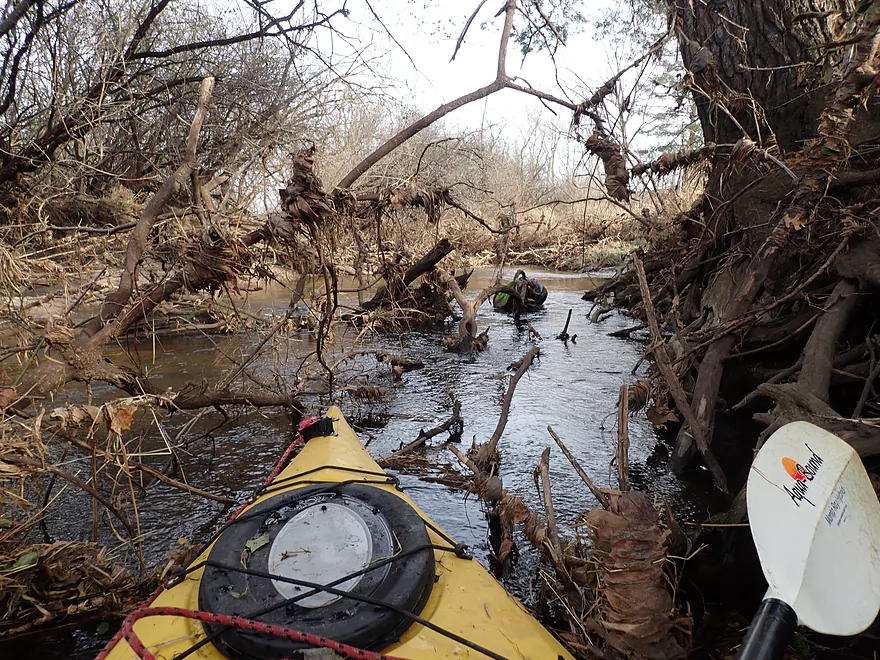
Memorial Park is located by Superior Ave and could be an access option if paddlers desired. From here to the next bridge (Glendale Ave) the river was incredibly open and straight. But with one exception…a monster logjam that completely blocked the river. The portage up the steep bank was exceptionally difficult as I had to plow through thick undergrowth and even pull my boat over the nearby trail bridge (not easy). This was the straw that broke the camel’s back, and I no longer considered this a trip that could be remotely recommended to paddlers.
I finally came to the Glendale Ave bridge by the public dog park which I had scouted previously. From here the river looks deceptively nice and open.
After the bridge, the river left the Tomah urban area. I hoped this second half of the trip would be more navigable, but it wasn’t. In fact the next mile had the worst logjams of the trip. Unlike the Tomah stretch where you could often sneak through the smaller snags, these logjams were significantly larger and steep banks made portaging unpleasant. In multiple spots I had to do “super portages” which meant circumnavigating multiple logjams at once. I don’t mind some logjams on a river trip if the scenery is top-notch, but this was mostly just generic grassland with a smattering of trees beat up by years of flooding.
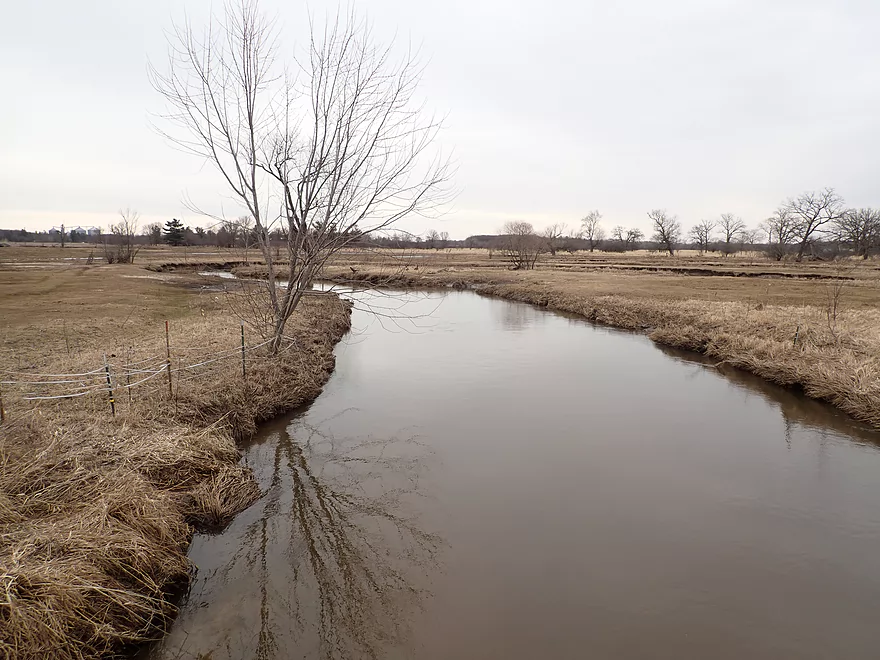
After the Tomah Church of the Nazarene (whose steeple could be seen from the river for some ways), the river dramatically opened up for the last mile and became much more enjoyable. In some ways this reminded me of Upper Neenah Creek with its sandy oxbows, grassy banks, and clear water. Many of the bank corners had tiny little sandbars with bright light sand (the same stuff that local frac miners love). Even despite the open nature of the last mile, it still had two medium difficult portages…all of which were getting old.
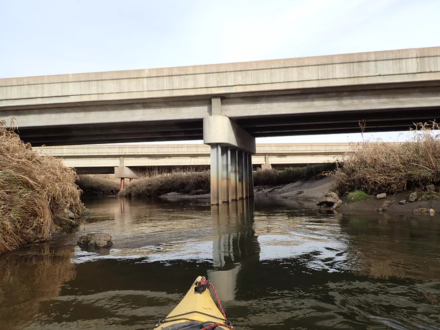
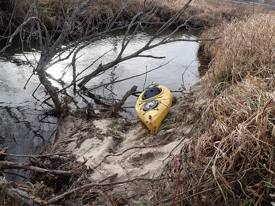
After hearing I-94 for some time, I finally came to the spot that I’ve driven over countless times. Most cars couldn’t see me let alone the river because of the steep embankments. Obviously you don’t want to take out by an interstate, and instead I was able to end the trip at nearby Forbes Road. This wasn’t an ideal bridge, but did have the best sandbar of the entire trip hiding underneath it.
In summary, this trip was a big disappointment. In fact perhaps the biggest of the year and not an ideal way to end the season. It could be made navigable, but it would take considerable cleanup effort. I’ve not given up on the Upper Lemonweir though and am anxious to return. One trip idea would be the South Fork leg downstream from this trip which looks much more open and nicer than what I did. I also want to do another East Fork trip (Hwy 173 to the Wyeville Dam), as well as brave the stretch from 6th Ave to 37th Ave (which paddling authors Mike Svob and Morrall Films have done). Lastly, I know it is a long trip, but I do want to attempt New Lisbon to Mauston. This features the outcrop “Little Dells”, but is a very long trip.
This will conclude the 2020 paddling season. Special thanks to all my readers who followed along for a record 35 trips this year (we had great weather!). It was a somewhat unique season to say the least, because of you know what…
Things got off to a great start this spring because of unusually early warm weather. I was able to explore a number of obscure water trails that are rarely reviewed by other sources. This included Otter Creek, Scuppernong Creek, Rattlesnake Creek, Little Turtle Creek, Lower Robinson Creek, the Lemonweir EF, and the Pine River). A surprising number of these trips turned out well…which often isn’t the case when doing trailblazing paddles. Even the one challenge in spring (the Baraboo River by Schultz Park) had some unique scenery.
I switched gears by late May to my “summer paddles”. Usually I like to do smaller and more challenging creeks in the spring when the ground is more stable and the undergrowth is still died back which makes portaging easier if need be. Usually by summer the grass and mud are too much for portaging and I focus on bigger water trails. This summer I did a number of classic water trails that had been on my todo list for a long time. The highlight was the Black River below Hatfield which was the best paddle of the year, if not one of the best water trails in the state.
Interest in outdoor activities and especially kayaking reached an all-time high for the summer of 2020. I kept hearing stories of kayak shortages, and saw so many kayaks atop roof racks when I was on the interstate. This website experienced a record number of visitors this summer which I’m very appreciative of. At times the website got a bit bogged down, and I hope to improve site performance by 2021.
Fall color paddles have always been a season highlight for me, but 2019 was awful because of horrible weather. Thankfully 2020 had ideal conditions and I was able to sneak in four great fall color paddles (Rock Springs, Wisconsin Rapids, Little Wolf SB, and Maunesha). For my last four trips of the season, I rolled the dice and my good luck ran out. Three of the four last trips were disappointments (Lemonweir SF, Upper Otter Creek, and the Lower Pecatonica River). Not exactly a bookend to the season I had hoped for, but Story Creek (despite a few logjams) was a fun trip and a cool discovery.
I’m definitely looking forward to the 2021 paddling season. There were some surprise prospects I had planned for 2020 but didn’t get to that I’ll feature for 2021. If readers have any suggestions for water trails you want to see reviewed, or just have general feedback on how this website can be a better experience, definitely let me know in the comments at the bottom (I try to respond to all). This year featured many helpful comments and feedback from readers which you can read here. Sadly, there was a bug with my Facebook page and I was unable to make a number of updates to it. It’s as if it’s stuck in an experimental beta mode and Facebook won’t fix it. For a reliable way to be notified of my new reviews I highly recommend subscribing and hitting the bell icon for my Youtube channel. See you in 2021!
Butts Park: This is located at the north end of Lake Tomah and is a nice spot to start a lake paddle. For those wanting to continue downstream however, it’s not a great launch because you need to portage the dam. Note, Google Maps incorrectly refers to Memorial Park (by N. Superior Ave) as Butts Park. The real Butts Park is by Lake Tomah.
Alternate Put-ins:
- Winnebago Park: This is the other park located on Lake Tomah. Adventurous lake paddlers could venture west and paddle upstream on the Lemonweir River all the way to Hwy CM.
- Parkview Drive Dam: In hindsight I should have launched here…as the riprapped shoreline was difficult to portage with the high waves. The best launch is likely east/downstream of the bridge. You can’t park on Parkview Drive…but you can shoulder park on nearby Williams Street.
- Memorial Park: It would be easy to launch SE of the N. Superior Ave bridge. Note, Google incorrectly calls this Butts Park.
- Tomah Dog Park: Access by the recreational trail bridge. This isn’t a bad option, but you would have to hike 300′ to reach the parking lot.
Forbes Road: This isn’t an ideal access as it’s by a busy road and next to two private homes. There are also steep banks to deal with. On the plus side there is a gorgeous sandbar underneath the bridge which act as a natural ramp.
Alternate Take-outs:
- Hwy ET (1.6 miles downstream from Forbes): This is a doable access but not ideal as the shoulder parking is steep and the bridge is a bit close to a home. This additional leg would be mostly open and pleasant…but may have 1-2 logjams.
- Hwy N (6.1 miles downstream from ET): This is a good bridge access option. From ET to N is a good leg and a future trip idea, but there are maybe 3 logjams to deal with.
Forbes Road to Butts Park: 3.6 miles with 46′ of ascent. The bike shuttle along ET was doable but a bit busy with a small shoulder. After I turned left by the massive VA hospital (which looks like a fortress), I was able to finish the shuttle on the Tomah Recreational Trail which was really nice. The only quirk is the trail has a confusing split by Memorial Park and I almost got lost (see map).
Current: Mostly pretty slow.
Dam: Because I started on Lake Tomah, I had to portage the Lake Tomah dam. The portage take-out was difficult because of the high waves and steep rocky shoreline. The portage put-in was easy. I recommend avoiding this dam portage.
Wind: This was mostly a non-issue for the river portion…but if you paddle Lake Tomah, it is an important consideration.
Logjams:
- Lake Tomah Dam to Memorial Park: Numerous smaller jams. I was able to squeeze through a handful, but had to portage a few. Likely too congested for enjoyable paddling.
- Memorial Park to Tomah Dog Park: Fairly open and mostly nice. Only one logjam, but it was the most difficult portage of the trip because of the steep banks and undergrowth.
- Tomah Dog Park to I-94: Many logjams and much bigger than those by Lake Tomah. Figure 5-6 portages and 7 tight fits.
- I-94 to Forbes Road: Mostly open but one logjam requires a portage up a steep sandy bank.
Rapids: There were two sets of rapids between the Lake Tomah Dam and Memorial Park. The first is under the railroad bridge. This was too shallow and rocky so I waded it. There is a low branch that obstructs a clear path through, so I would rate that as a Class 2. The second set of rapids is under the trail bridge. These are more runnable but are slightly irregular and also contain a low hanging branch that must be ducked. This too I would rate Class 2.
Closest Gauge: Lemonweir River @ New Lisbon, Wisconsin
Trip Depth: 800 CFS or 6.75′
Navigability Estimates:
- 0-600 CFS: Likely too shallow upstream of Memorial Park, but downstream it is likely navigable.
- 601-1000 CFS: A manageable depth.
- 1001-1400 CFS: A high depth that would make dealing with all the deadfall somewhat difficult.
- 1400+ CFS: I wouldn’t mess with the river at these high depths.
Detailed Overview
Lemonweir River - Main Branch:
- East/South Fork Confluence to Cty PP: 1.0 miles. Likely around 3 logjams.
- Cty PP to Funnel Road: 2.0 miles. Very straight channel with roughly 6 logjams.
- Funnel Road to 2nd Ave: 1.2 miles. Highly channelized and straight with about 3 logjams.
- 2nd Ave to Cty H: 1.8 miles. Roughly 4 logjams. The channel can be poorly defined at times.
- Cty H to River Road: 2.3 miles. Expect 4-6 logjams and confusing side channels where navigation is a challenge.
- River Road to 6th Ave: 5.4 miles. Likely navigable, but expect a high volume of logjams.
- 6th Ave to 37th Street Landing: 4.4 miles. Occasionally paddled but contains several logjams.
- 37th Street Landing to New Lisbon: 6.6 miles. A long, slow stretch that feels more like a lake than a river. While somewhat monotonous, the rock outcroppings, white pines, and fall colors provide some redeeming beauty.
- New Lisbon Dam to Hwy 12/16 Shoulder: 7.9 miles. A promising prospect featuring a “Little Dells” rock outcrop, though hampered by about 6 logjams. The Hwy 12/16 shoulder is a speculative but potentially an access point.
- Hwy 12/16 Shoulder to Riverside Park in Mauston: 4.6 miles. Mostly slow, open paddling through river flowages.
- Mauston Dam to 19th Ave: 4.5 miles. One of the premier stretches on the river.
- 19th Ave to Cty HH: 13.1 miles. Less engaging with a noticeably slower current.
- Cty HH to the Mouth: 3.3 miles. An excellent section with beautiful rock outcrops that serve as a prelude to the Wisconsin Dells.
Lemonweir River - East Fork:
- Cty EW to Buckley Ave: 3.4 miles. Begins in cranberry bogs before transitioning into a sedge-lined creek and concluding with a spectacular corridor of towering white pines. Expect roughly five logjams, mostly near the end.
- Buckley Ave to Hwy 173: 4.7 miles. One of the most scenic and diverse stretches of the Lemonweir, featuring marshes, a lake, cranberry bogs, sandbars, and towering pines. A handful of easy-to-portage logjams are located near the end.
- Hwy 173 to Cooper Road/Dam:
- Hwy 173 to Dove Ave: 0.9 miles. A lovely, open leg with clear red water and numerous small sandbars. Includes one minor, easy portage.
- Dove Ave to Cooper Road: 2.4 miles. A mediocre stretch flanked by frac sand mines and cranberry bogs; much of the channel is ditched and straightened. The half mile below Dove Ave contains several logjams, some requiring difficult portages.
- Cooper Road to Backwater Bar Dam: 0.2 miles. A short but scenic flowage set against attractive pines. The dam is not a practical take-out due to trespassing restrictions and proximity to the spillway.
- Backwater Bar and Grill to Hwy 21: 0.5 miles. Likely congested with near-constant logjams.
- Hwy 21 to East/South Fork Confluence: 0.3 miles. Expect 2-3 logjams.
Lemonweir River - South Fork:
- Butts Park/Lake Tomah to Forbes Road: 4.5 miles.
- Butts Park to Lake Tomah Dam: 0.2 miles. A quick paddle across Lake Tomah to reach the spillway.
- Lake Tomah Dam to Memorial Park: 1.2 miles. A narrow, sandy stretch with a high number of downed trees.
- Memorial Park to Tomah Dog Park: 0.6 miles. Mostly pleasant and open, though one large logjam requires a very difficult portage.
- Tomah Dog Park to Forbes Road: 2.5 miles. The first half is heavily obstructed; the second half is more open but still requires two logjam portages.
- Forbes Road to County N: 6.9 miles.
- Forbes Road to Cty ET: 1.6 miles. A high-quality stretch with good clarity, a sandy bottom, and one manageable logjam portage.
- Cty ET to Cty N: 5.3 miles. Scenic and clear, passing through grasslands, frac sand mines, and a massive cranberry bog. Includes three logjam portages.
- County N to Excelsior Ave: 3.0 miles. Open through the golf course, but the wooded sections likely contain 6-8 logjams.
- Excelsior Ave to East/South Fork Confluence: 0.5 miles. Likely riddled with countless logjams.
Trip Map
Overview Map
Video
Photos Size: