
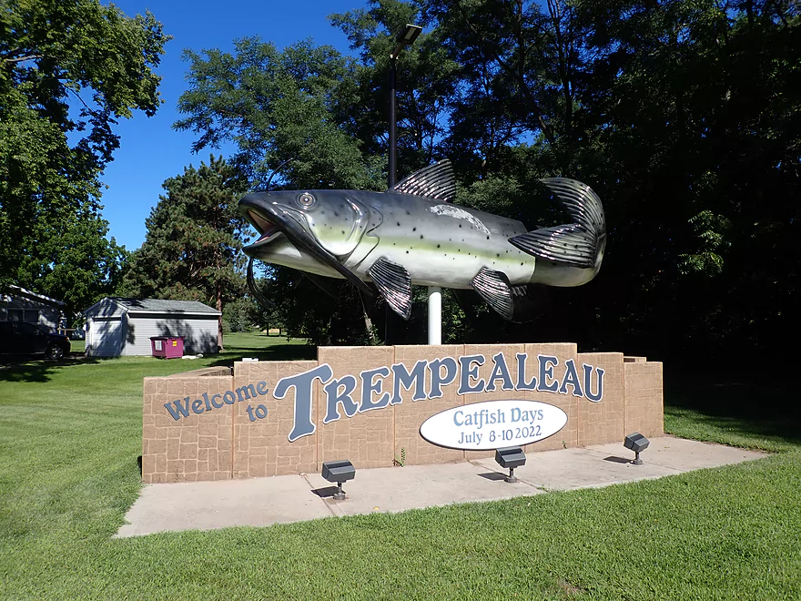
Welcome to Trempealeau
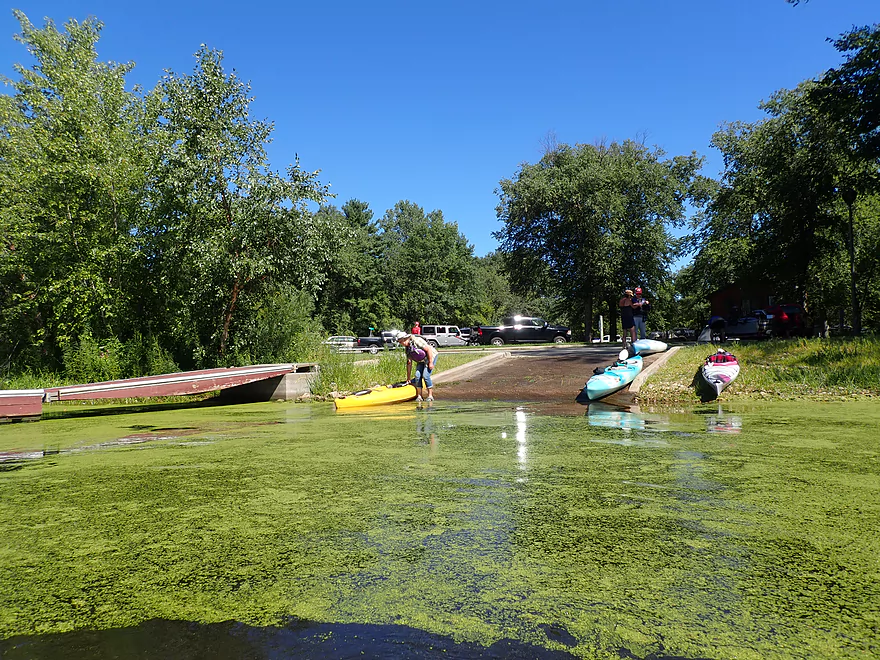
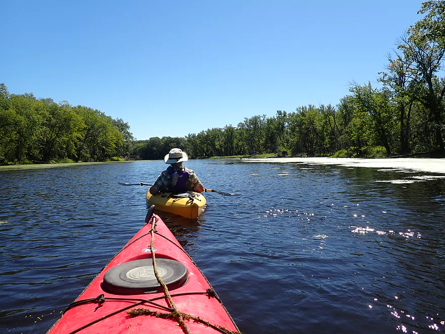
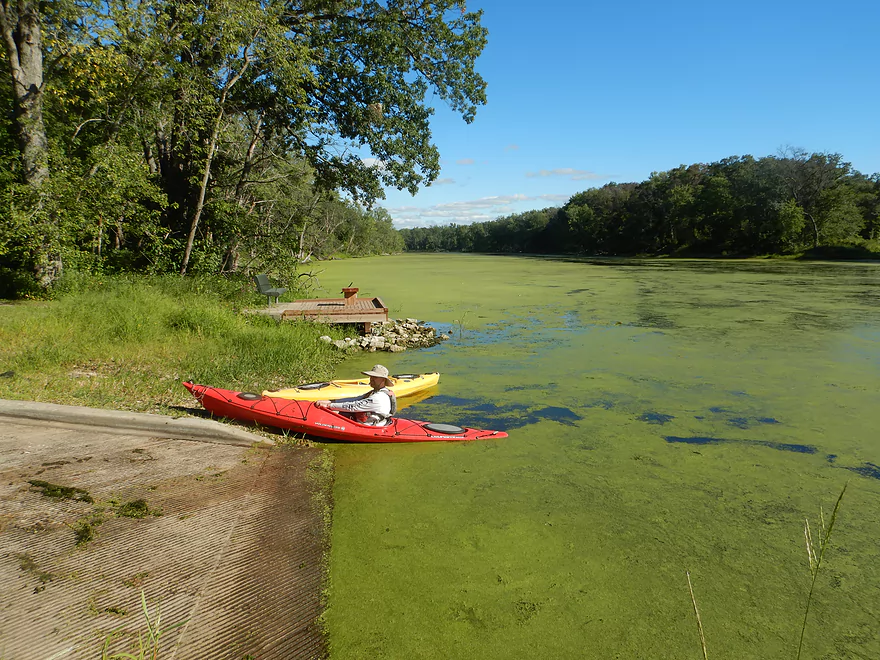
Starting the trip at the Long Lake Boat Ramp
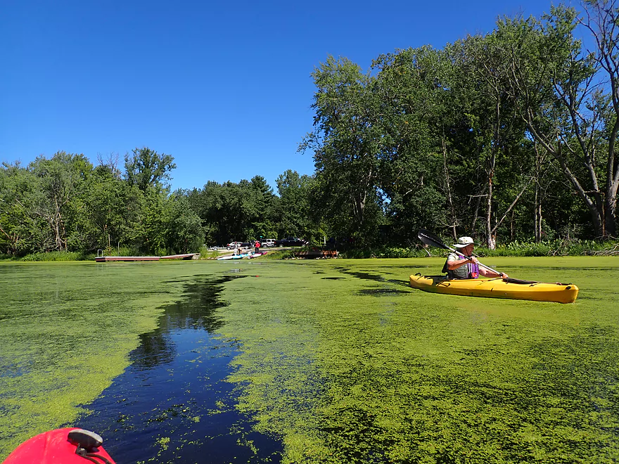
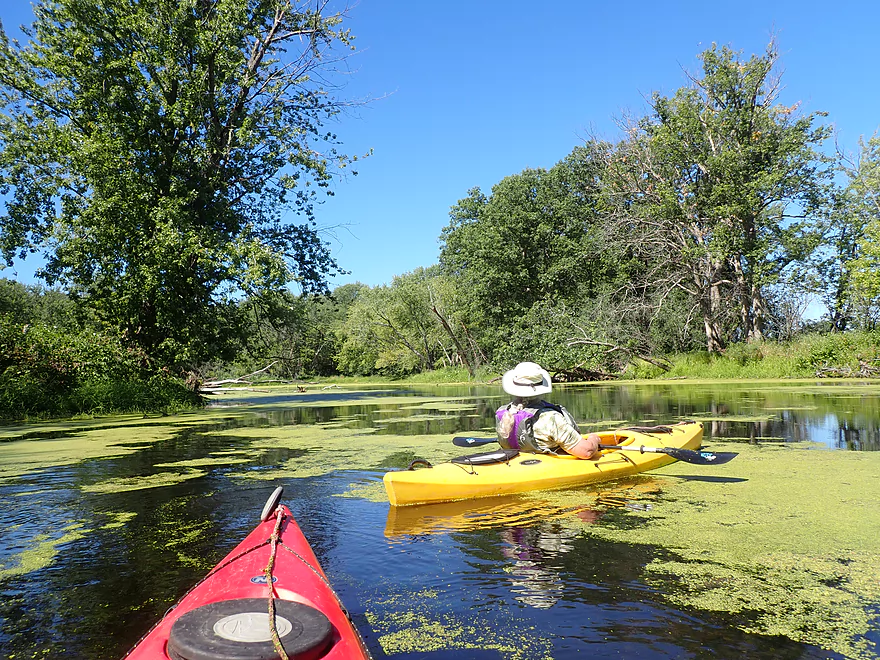
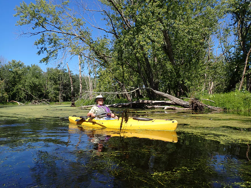
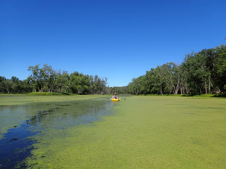
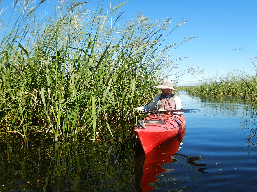
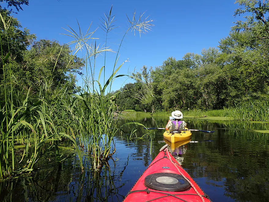
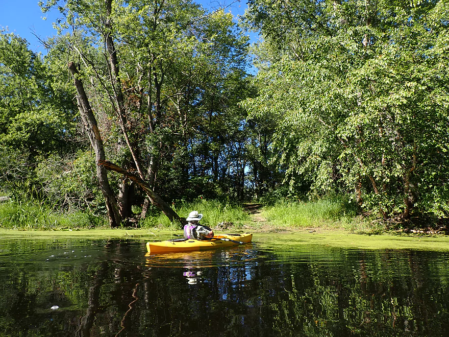
Creating kayak trails through the duckweed
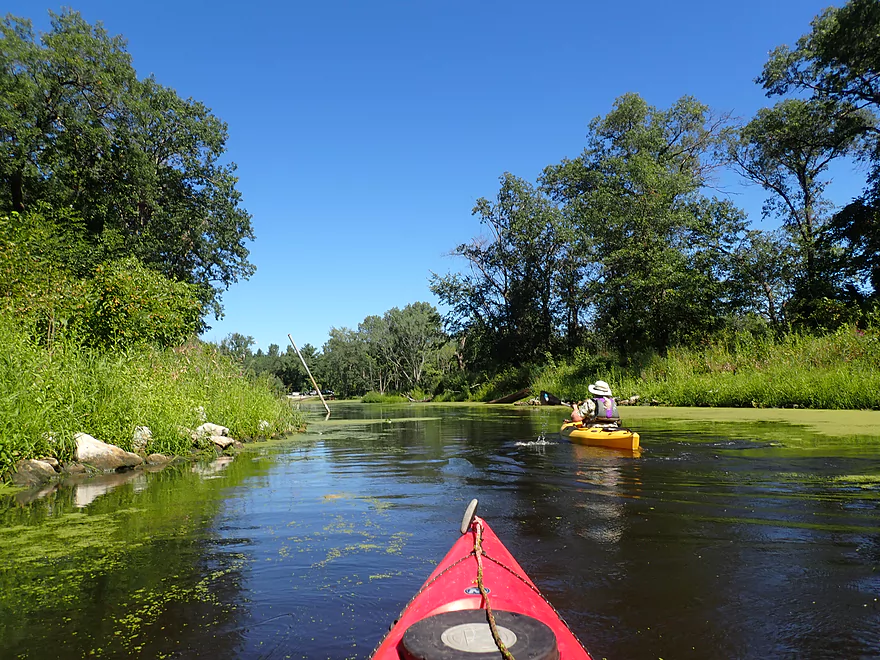
Exploring a side channel (that dead-ends)
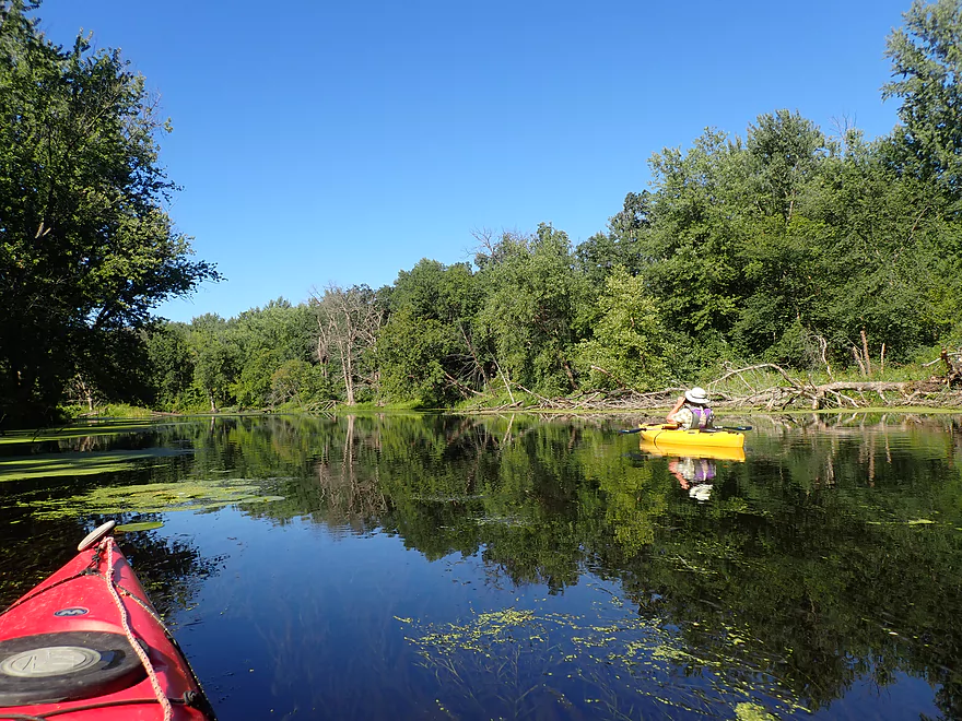
This part of Long Lake is pretty boring
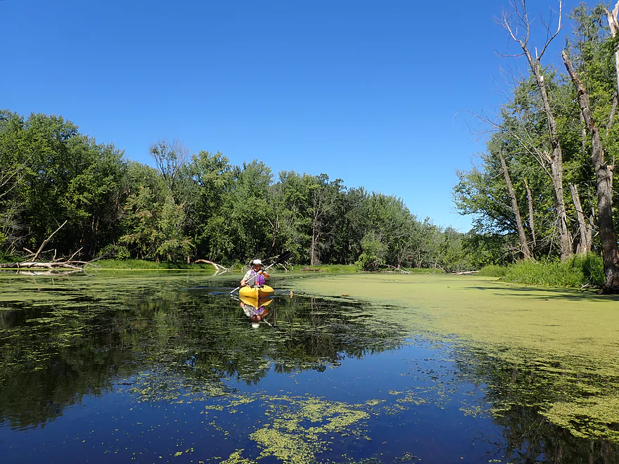
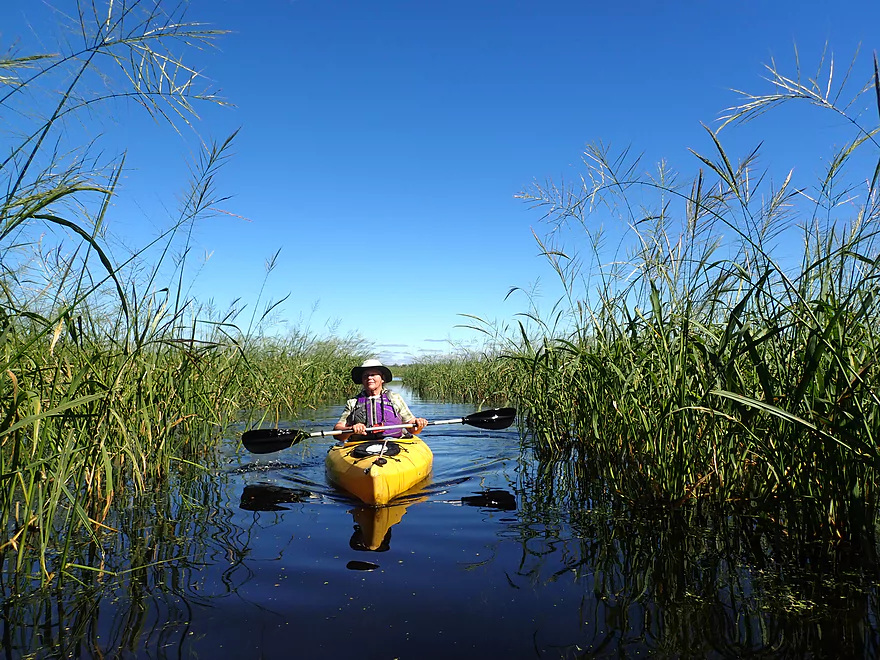
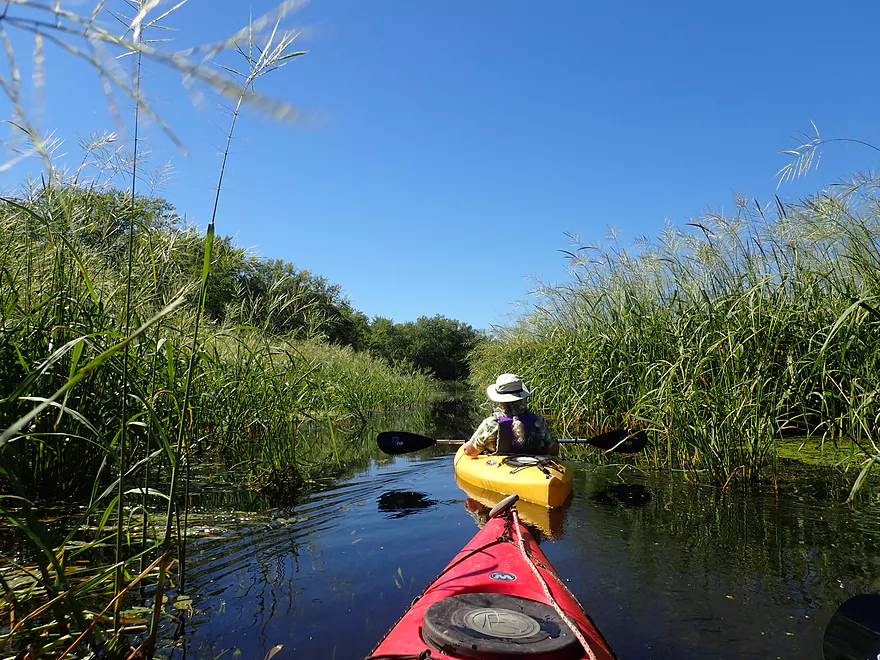
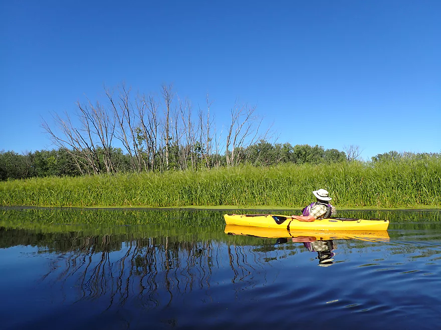
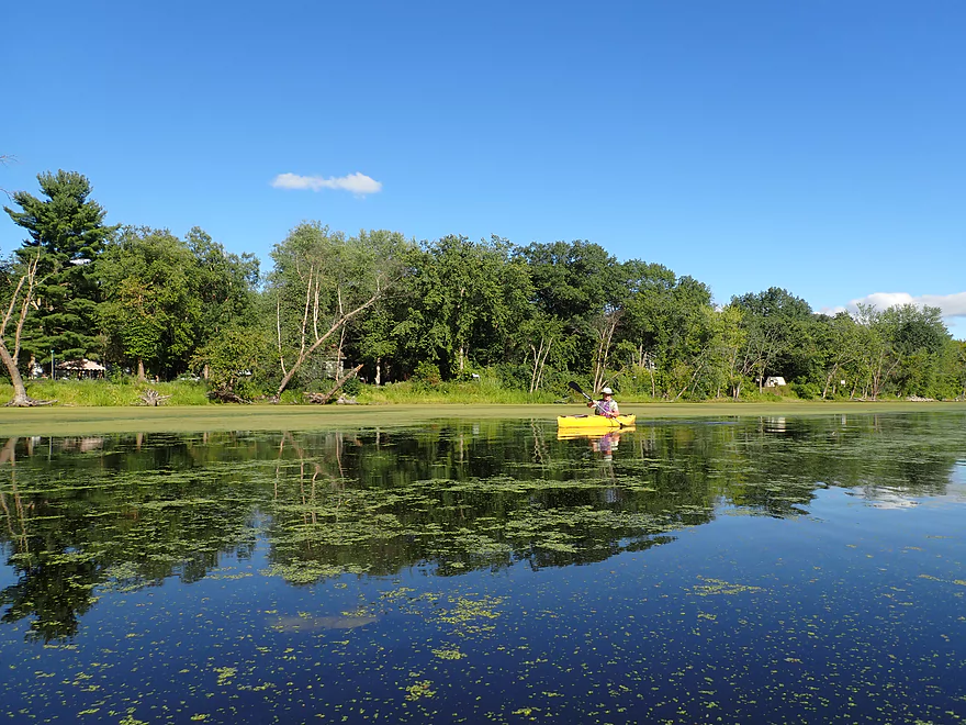
Turning off onto French Lake
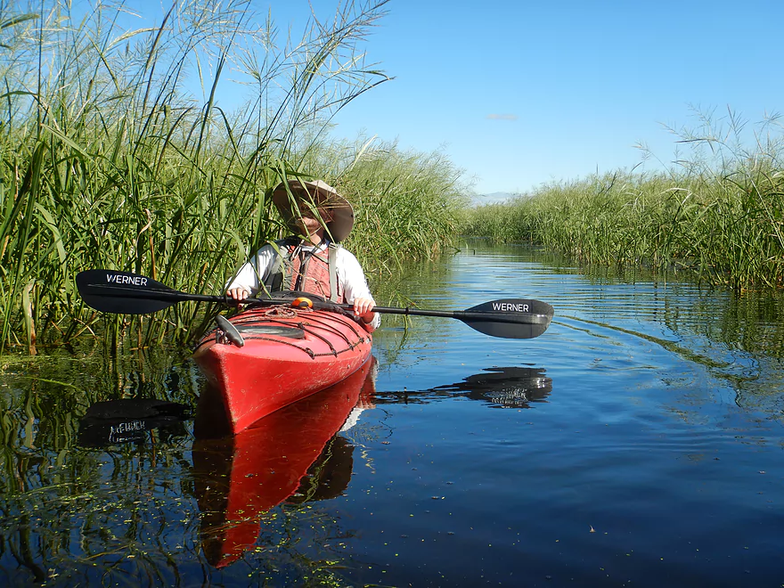
Almost no current
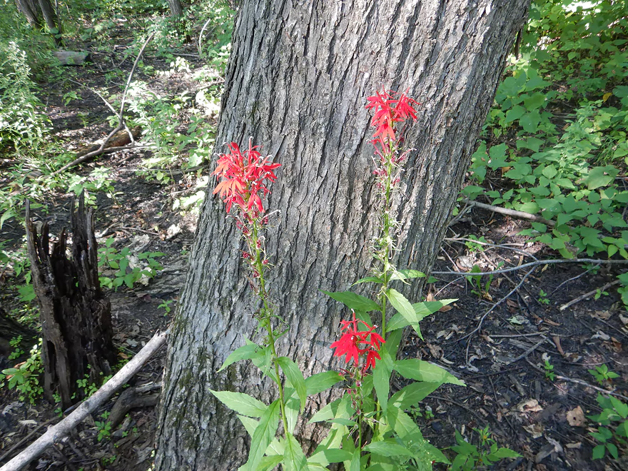
Bright red cardinal flowers were scattered in the woods
So many aquatic weeds
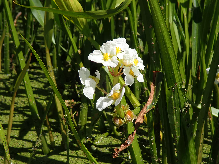
Arrowhead flowers
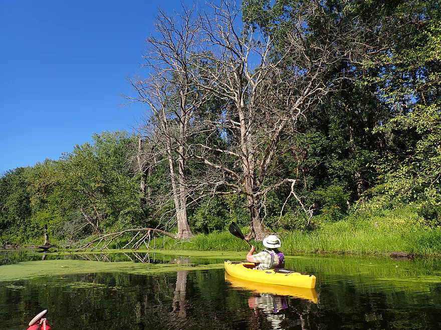
So many dead trees
Duckweed almost fills the channel
A logjam that somebody thankfully cleared out
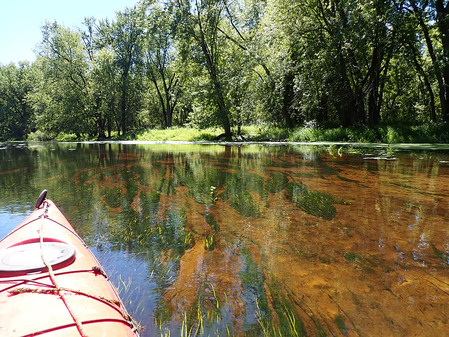
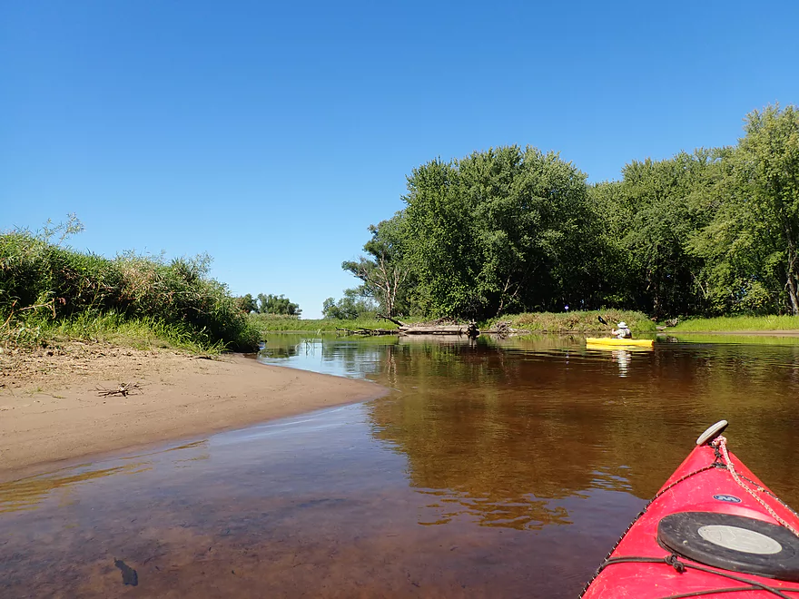
Dark red hue in the water…a reminder this slough is fed from the Black River
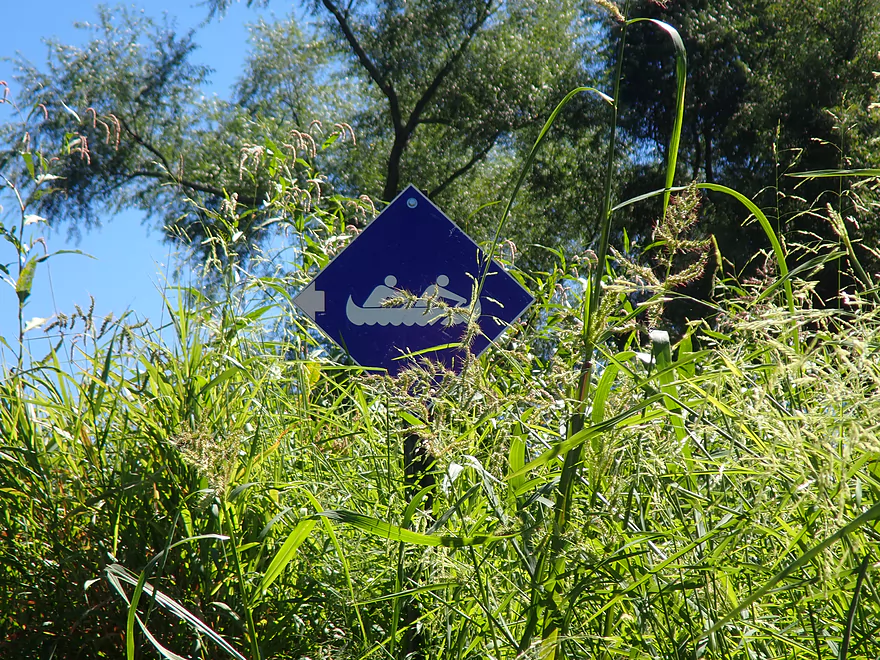
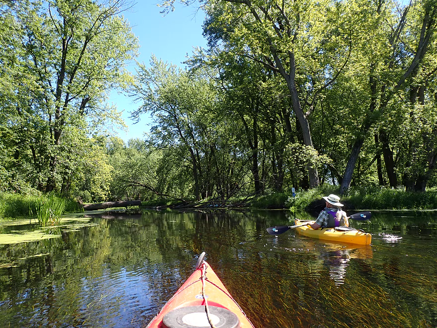
Little blue signs (mostly) mark the way
Coming out onto the Mississippi
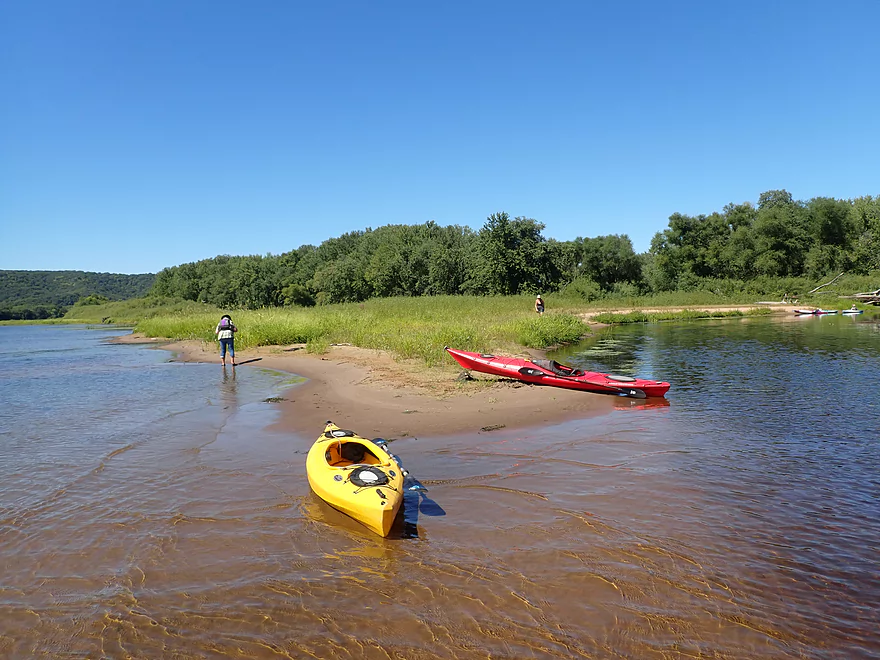
The area by the mouth is known as “Bodega Point”
Reverse view of the confluence
Scenic Mississippi bluffs to the north
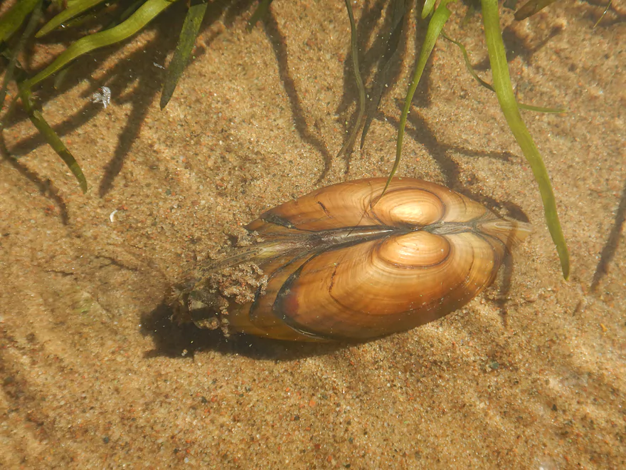
One of several live clams
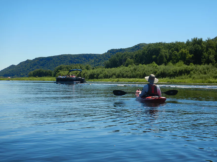
Continuing south on the Mississippi
Fantastic view of Great River Bluffs State Park
Taking a break on Pigeon Island
As is almost everybody else
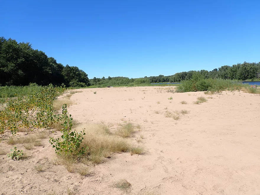
This is one of the nicer sandbars in the area
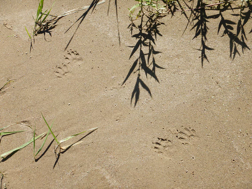
I think these are mink tracks
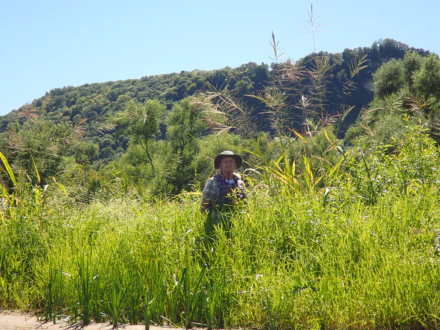
Wild rice over 10′ high!
Leaving the Mississippi…
…and rejoining the slough and official water trail
Paddling upstream on some surprise current
Coming up on a large marshy area called Big Marsh
We were warned against entering, but did anyways
Wild rice has mostly taken over, but left a fantastic corridor to paddle through
This would look very different in the spring when the rice has died back

The current completely switches directions here–we are now paddling downstream
More dead trees
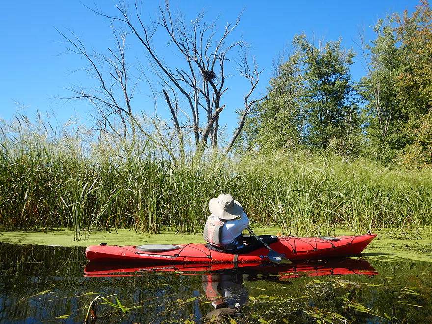
Second eagle nest of the trip
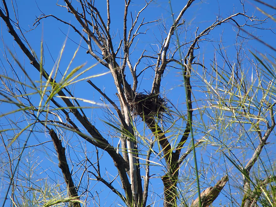
Wild rice photobombing the nest
Exiting the marsh and the last of the rice
Southeast end of Long Lake was nice
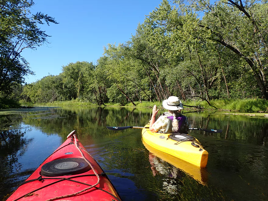
No problem with water weeds on this section
One of two minor landings off Lone Tree Road that paddlers could launch from
With little wind or wake, reflections on the sloughs are really nice
The Long Lake and French Lake sloughs combine
Most houses in the area were on stilts
Back to duckweed country
Back where we started
Scouting a northeast access to the lake…unusable because of wild rice
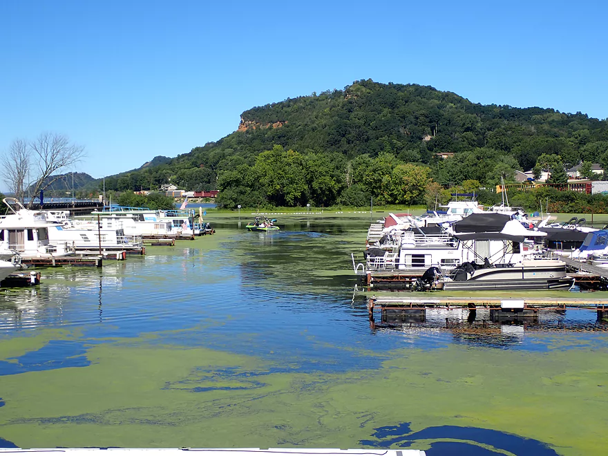
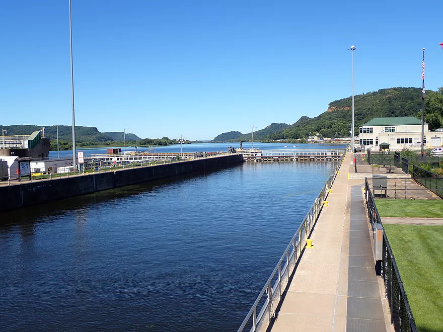
It’s worth it to check out Trempealeau after a trip
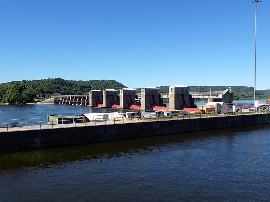
This is the main dam
Boaters (and paddlers) can use the adjacent locks
Mississippi River – Long Lake

The US Fish and Wildlife Service has designated 11 official water trails on the Mississippi along the Wisconsin border for paddling. I previously did the Goose Island Trail and Wyalusing Trail which were positive experiences, and it’s my eventual goal to do the rest of the official trails. The Long Lake Trail is located just north of La Crosse in a series of sloughs and islands sandwiched between the Mississippi and Tank Creek (a Black River distributary).
The trail officially starts at the Long Lake Boat Ramp which was surprisingly busy. The “lake” itself is nothing more than a long, narrow slough, but it splits at several points around various islands. The first side channel to the west deadends end shortly with a weedy dead-end dike. In theory you could portage this small dike to reach the Mississippi, but that wasn’t part of the official trail, so we continued south on the “lake”.
Long Lake itself wasn’t very interesting. It was covered with duckweed and filled with water weeds (mostly coontail) which wasn’t fun to paddle though.
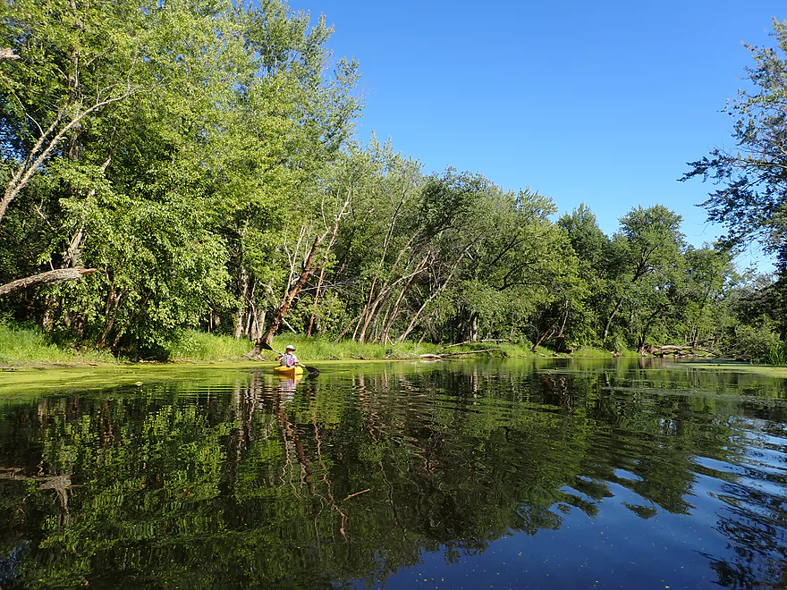
Following the little blue “Fish and Wildlife” trail signs, we turned south out of Long Lake and onto French Lake (another long slough). This was even weedier and more congested (which is saying something). Perhaps this was just unfortunate timing on our part as it was late in the year (September) and water levels were slightly below average. Aside from the bright red cardinal flowers on the banks and huge whirligig swarms, the trip (Long Lake + French lake) so far was disappointing and had we turned back then, it would have been just two stars.
French Lake would constrict sharply and we passed a logjam that somebody had thankfully cleared out. Here we encountered several kayakers taking a break. They warned us ominously that the marsh (at the back-end of the trail loop) was not navigable, and they personally planned on turning back once they hit the Mississippi.
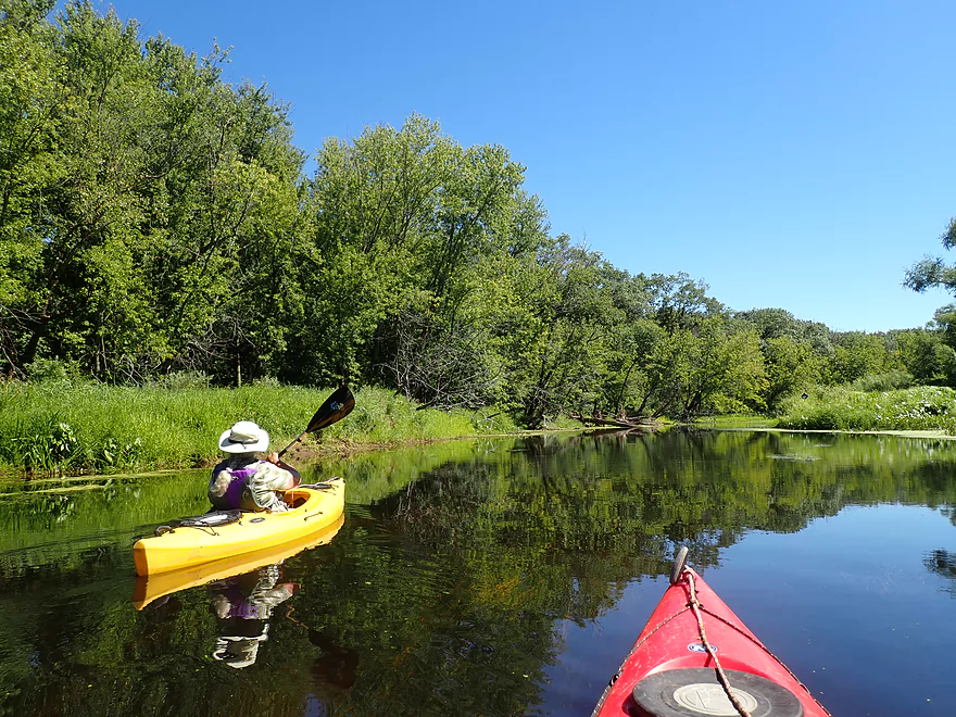
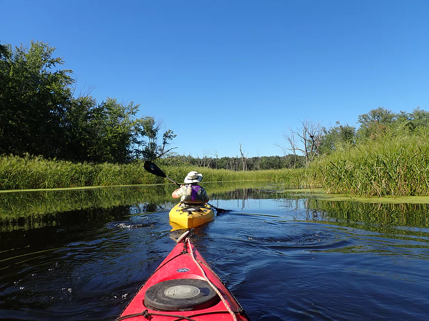
Following the constriction, French Lake opened up into a much nicer slough. Here the channel was much sandier and less weedy. The water quality improved with good clarity and a dark red hue (a gift from the Black River). What’s interesting is that when the Mississippi is high, the current will actually reverse into the slough lakes.
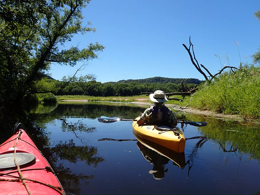
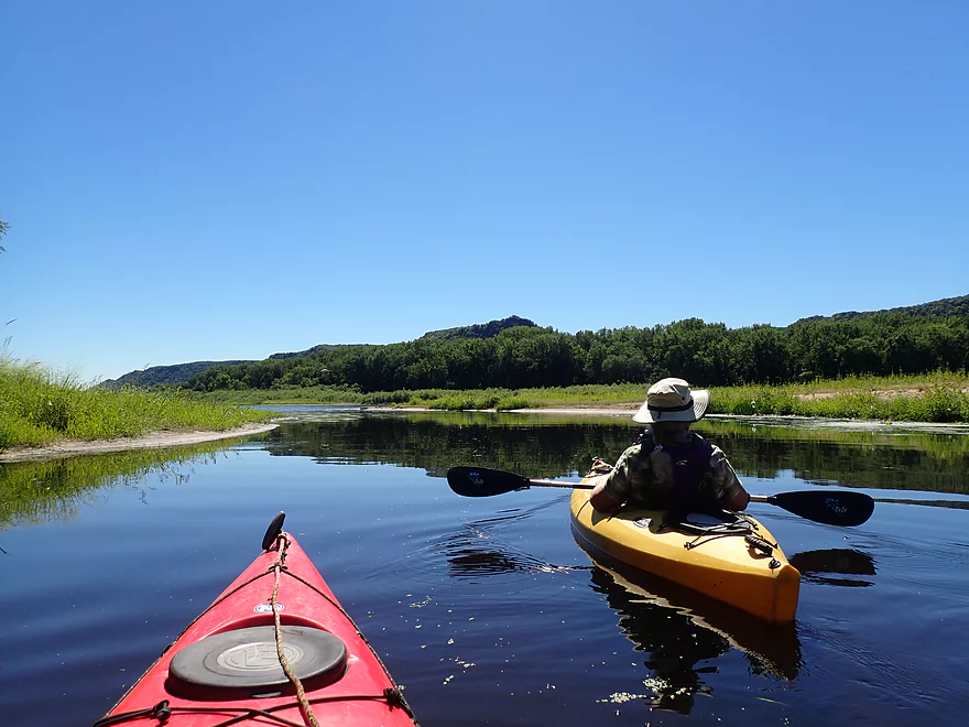
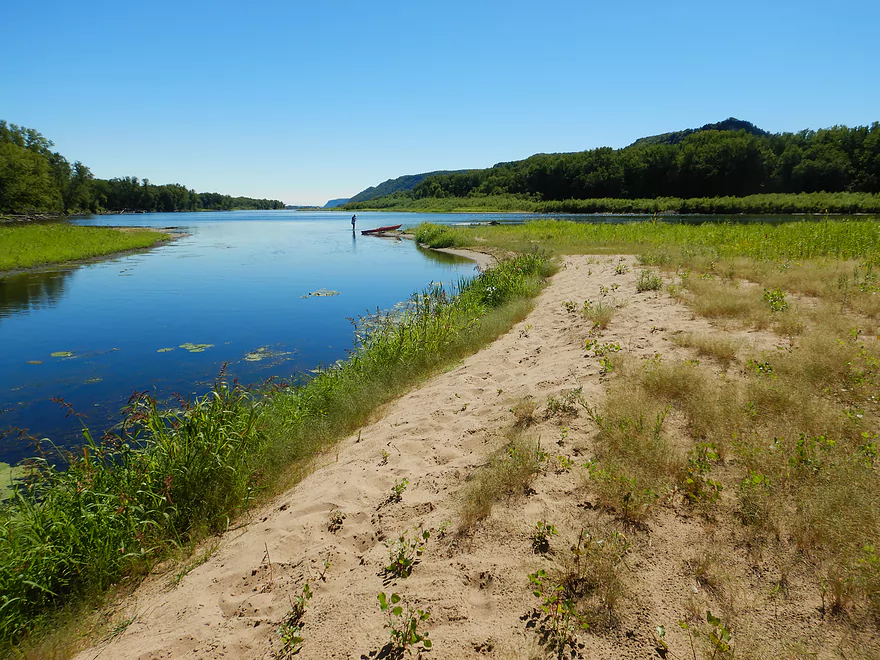
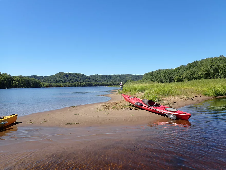
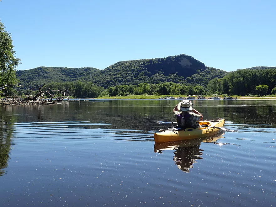
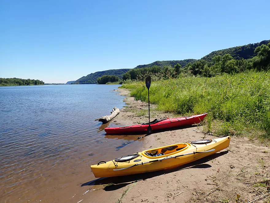
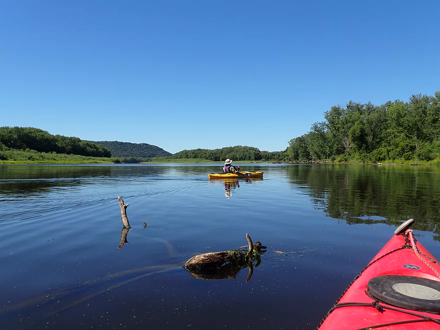
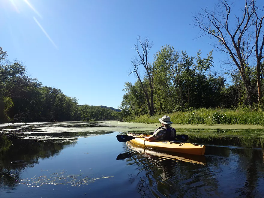
We finally arrived at Bodega Point, which was where French Lake joined the Mississippi River. Because water levels were a bit below average there was a nice sandbar at the point which made a nice spot for a break. The area is incredibly scenic, as there are large sand banks on nearby Richmond Island and fantastic huge river bluffs looming on the Minnesota side of the river.
While many consider the Mississippi too large to paddle, this often isn’t the case. Yes, the “pools” above the dams are huge, which results in unattractive and boring flowage paddles…but below the dams, the river is surprisingly kayak-friendly, with many fantastic river bluffs, countless islands and some sandbars. In its native state, the Mississippi would have been smaller and contained many braided islands and sandbars. Sadly, the series of dams and locks have ruined some (but not all) of the Upper Mississippi–at least for paddlers.
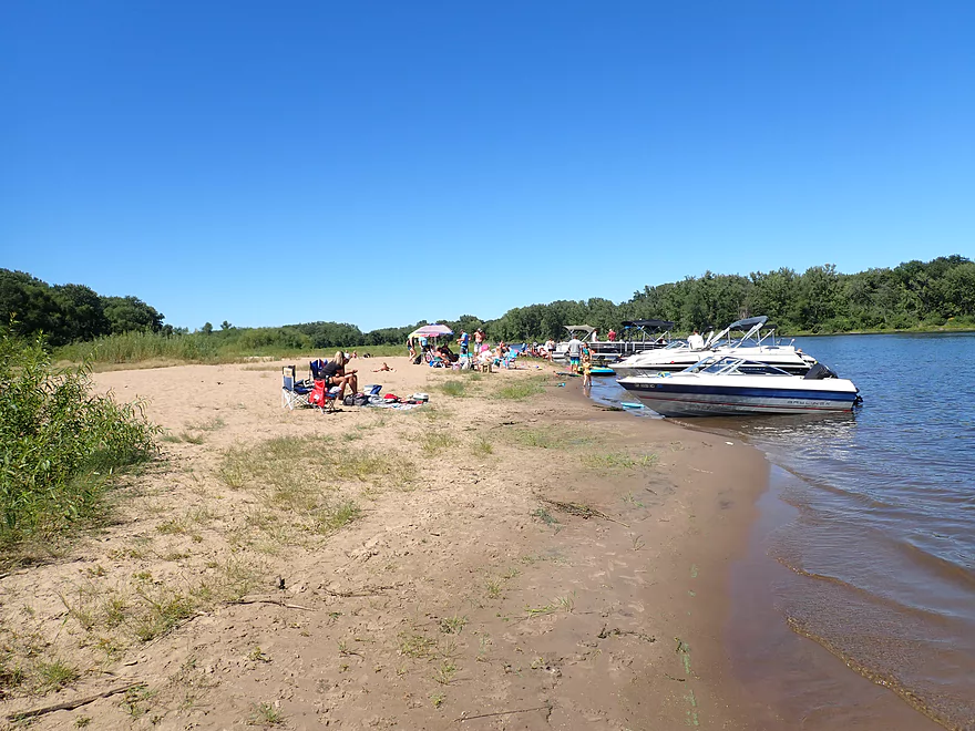
Following Bodega Point we headed south across a Mississippi channel and took another break on Pigeon Island, which has one of the better sandbars in the area. Unfortunately, everybody else knows this too and there were a lot of boaters parked here. Regardless, it is a great island and is back-dropped by a terrific bluff and cliff on the Minnesota side.
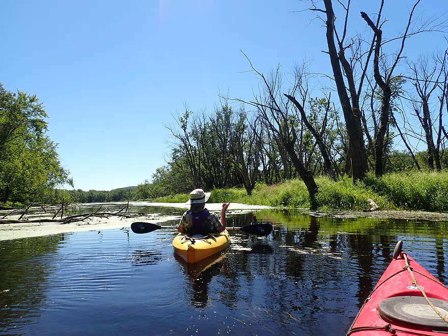
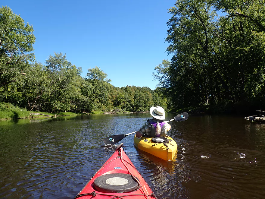
Following our “mini-Mississippi” adventure we headed back into the sloughs to resume our trip on the water trail. Signs mostly marked the way, but these weren’t always easy to find and at times were partly hidden by tall weeds. This southern slough was sandy, nice, and had surprisingly few weeds. It was surprising that as we paddled south and then north on it, we had to paddle upstream, but in hindsight this made sense as we were entering the massive Black River delta.
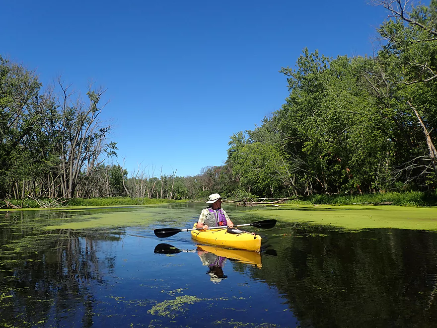
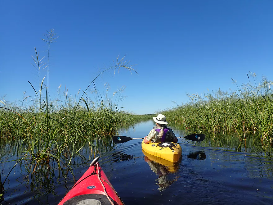
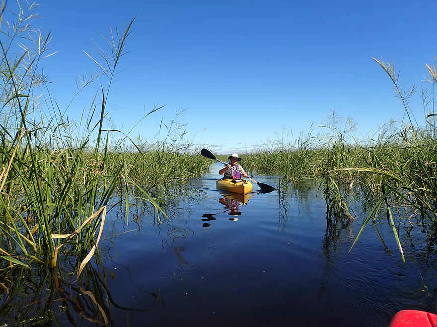
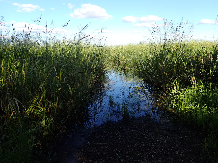
The trail soon entered Big Marsh which we had been given dire warnings to not enter. We did so anyways. Big Marsh is part of a large lake about a mile big. We expected another slow slog through shallow water and coontail, but we got a major surprise–99% of this lake was filled with wild rice!
This can be a blessing or a curse for paddlers. On the downside wild rice can constrict and even choke off channels, which could create surprise deadends. But on the plus side, the huge 10’+ tall stalks were incredibly scenic and provided proverbial tunnels though the lake that were super fun to paddle though. We feared the narrow wild rice channels might completely block the channel and force us to turn back, but that proved never to be the case thankfully (although in the future if the rice continues to expand this could happen).
The rice did push the trail much further east away from the shore which may cause confusion for some paddlers. Interestingly the current completely switched as we were paddling through the rice…first it was upstream and then downstream (a byproduct of Tank Creek going around a large island).
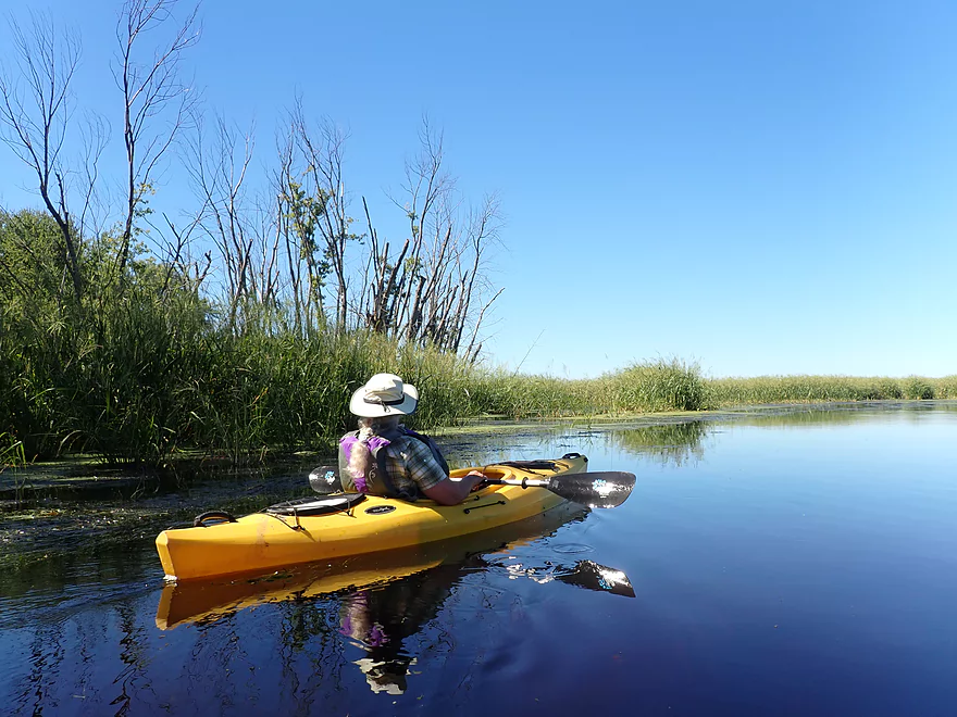
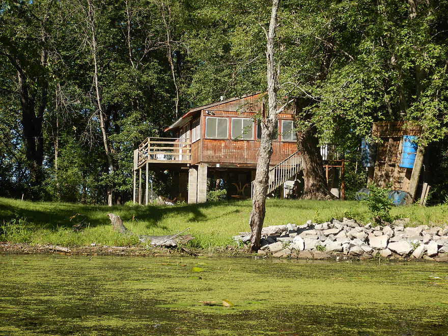
Following Big Marsh and the rice, we re-entered Long Lake and enjoyed a nice stretch. Here there were fewer weeds, more woods, attractive water reflections, and a number of small houses on stilts (part of I believe a Ho-Chunk Reservation). We soon passed the French Lake “off ramp” and were back where we started. Many other paddlers were taking out at the same time which makes me suspect this is a popular paddling trail.
In summary this was a trip that started weedy and uninteresting, but ended on a really nice note. The Mississippi itself was fantastic with its islands/sandbars/bluffs and could have been a trip unto itself (say Trempealeau Landing to Fred Funk Boat Landing). The other highlight was the wild rice corridors which were super fun to paddle through. Timing is everything for a trip like this. Aug-Oct will likely be the best/worst time for wild rice. Here it will be at its largest/most scenic, but with wild rice you playing Russian roulette that it completely blocks the channel. Spring and early summer likely won’t have as much wild rice, but could feature nice blooming lillies and far fewer weeds. October could feature some fantastic fall color on the river bluffs and could be a good option.
Long Lake Boat Ramp: This is a good free public access, but you do have to compete with powerboaters to use the launch and parking is limited. If you park, try not to use the trailer parking spots, but instead leave your car along the west or south sides. Some even park on the Lake Road shoulder, but I’m not sure you can do that. There are no outhouses at the landing, so plan accordingly.
Alternate Access Points:
- Lake Road Carry-in Access Points: Just southeast of the landing are two small dirt pull-offs where you could launch. This is more private than the main landing and might be a better choice for paddlers. Be careful not to block the main road when parking. The pull-offs only have room for about one car, so this isn’t an ideal option for groups.
Round Trips: Most paddlers will simply do a loop which negates the need for any type of shuttle.
Wind: This does contain some open water paddling, so don’t attempt a trip during strong winds.
Getting Lost: While the main route is marked with little blue signs, these aren’t always appropriately placed and it is possible to get lost (especially in the wild rice). Definitely bring a GPS unit along and study satellite images of the route beforehand.
Wild Rice: In fall (Aug-Nov), Google Earth suggests that Big Marsh fills in almost completely with wild rice. While this can be quite scenic, it can also cause you to get lost. If the wild rice continues to spread, it may even seal in some of the outlets to Tank Creek, which would close part of the paddle loop and force paddlers to backtrack.
Current: For the most part there wasn’t much current. The exception is the southern inlet to the marsh and its outlet. This required a bit of effort to paddle on, but it was brief and not too bad. Note the current can change direction and speed depending on the relative depths between the Black River and the Mississippi River.
There is a nearby gauge on the Mississippi at Brownsville which will accurately reflect water levels. My trip was done at 31.45 CFS. Below is my rough depth guide:
- < 30.5 CFS: A shallow depth common for late fall. The main water trail should still be plenty navigable. Sandbars will be at their most ideal.
- 30.6-31.5 CFS: A good depth.
- 31.6-32.0 CFS: Starting to get on the high side. Should be doable, but the currents at the south end of the canoe trail might be strong. Most of the sandbars will be under water.
- 32.1+ CFS: Likely pretty high and with some shoreline flooding. If you enjoy flood paddles, this might be your thing though.
Paddlers don’t necessarily have to do the main loop around the island, but can instead do customized trips.
- Long Lake Boat Ramp to Bodega Point and Back: ~3 miles. This is what the group ahead of us did, but I don’t recommend that as it’s actually the weakest part of the trip (mostly weedy with uninteresting scenery).
- Using a Lake Road Access: These are located east of the main ramp and are more private. From here you can still do the main loop, or maybe just do a down-and-back into the wild rice marsh which was the trip highlight.
- Doing a Longer One-way Trip: You could in theory launch from the Trempealeau Boat Landing, stick to the main channel while avoiding most sloughs, and paddle ~11 miles to Fred Funk Landing. For those who prefer the big bluff scenery of the main channel, this is your better bet.
Detailed Overview
The Mississippi is both a blessing and a curse for paddlers. While rich in beauty and majesty, it can be problematic to paddle due to high wind, current, wakes, powerboats, and barges. The Upper Mississippi is frequently dammed and subdivided into “pools”, of which there are roughly 11 in Wisconsin. Generally speaking, just upstream of a dam the river is the least interesting (few islands, deep, monotonous, few sloughs, and a wide channel). But on the downstream side of pools there are often many sheltered islands and sloughs that offer unique paddling experiences.
For a list of Mississippi water trails see my overview map or use the bullet list below. Thanks to the US Fish and Wildlife Service for many of these suggestions. Check out their website for more details. Water trails are listed in order from north to south.
—
Chippewa River Trail: 6.8 miles. Chippewa River Landing to Tim’s Slough Landing. Basically the last part of the Chippewa River that connects with a slough on the Mississippi. Avoid in high water.
Nelson-Trevino Trail: 4.5 miles. South of the Chippewa River, Hwy 25 cuts across the river through a slough and over a grade. Many landings to pick from. Most paddlers venture south and then back north to one of the landings. The main water trail is roughly the biggest loop you can take south of Hwy 25 while remaining in the slough. Avoid in high water and high wind.
Finger Lakes Trail: 6.1 miles. North of the Zumbro River mouth, there is a sheltered collection of sloughs and lakes you can paddle. The main water trail skirts the south edge. In low water, some portages may be required. For a launch/take-out, use Pioneer Landing in Minnesota.
Halfmoon Trail: 5.1 miles. A scenic mix of sloughs, the main channel, and open marshlands, with a chance to explore two massive dredge piles. Note that timing is tricky: low water can dry out the interior channels, while high water makes completing the loop against the current difficult.
Verchota Trail: 11.3 miles. A long upstream paddle up the main slough then you double back mostly on the same trail. Use Verchota Landing for an access. Difficult because of its long length and upstream paddling.
Aghaming Trail: 6.7 miles. Start at the park in the main channel and float downstream until you find a gap in the slough which you can paddle upstream to explore. Turn back when done. Access at Latsch Island Park and Landing. Some upstream paddling in the main channel. Not usable in high water.
Voyageurs Canoe Trail/Perrot State Park: 6.5 miles. Your best bet is to do a one-way trip from Hwy 35 to S. Park Road. Very scenic. Completely sheltered from the main channel and is technically the Trempealeau River.
Long Lake Trail: 5 miles. A counter-clockwise circle through mostly backwater sloughs. Long Lake is mediocre and French Lake is boring and weedy. But the main channel is nice with good sandbars and bluff vistas. When in season, Big Marsh can contain scenic wild rice corridors.
Brown’s Marsh Canoe Area: More of a lake paddle and a way to experience Brown’s Marsh. Access at Lytle's Road.
Lake Onalaska Trail: Technically the last few miles on the Black River. Been on my to-do list for a while… Lytle's Road to Fred Funk Landing is 4 miles, while Lytle's to Mosey Landing is 8 miles.
Root River to Crater Island: This is mostly attractive slough paddling inside the vast Goose Island archipelago. It does include a bonus stretch on the fast Root River and some main channel paddling by Brownsville. The highlight is "Crater Island," a large man-made sand island.
Goose Island Trail: 8 miles. A nice paddle around Goose Island. Mostly simple sloughs but there are nice bluff views .
Reno Bottoms Trail: 3-14 miles. Put in on the Minnesota side and float down a long slough. Many intermediate take-out options. Access at Reno/Hwy 26 and New Albin. Some of the launches can be under water during high depths.
Blue Heron Trail: 9 miles. Located south of the Minnesota/Iowa border, this water trail features a fantastic labyrinth of islands and side sloughs. A trip highlight is being able to paddle up to the historic Black Hawk Bridge.
Ambro Slough: 8 miles. Very similar configuration to Wyalusing. You can paddle up the slough then downstream on the main channel if you wish. The upstream slough by Harper’s Ferry also looks interesting. Access is at North Ambro Road. 8.2 miles if you do a full loop on the main channel.
Yellow River to McGregor: ~4 miles. A scenic stretch featuring impressive river bluffs and a large arched bridge.
Wyalusing: 5 miles. A marked trail starts at the lower Wyalusing State Park landing, then weaves through bottomland before heading back to the landing. One of the neater areas on the Mississippi and it’s always fun to visit the park.
Johnson Slough: 6.2 miles. Just downstream of Wyalusing on the Iowa side is another nice slough to explore. Most launch at the landing, cut north through the slough, and then float back on the main channel. Some current to paddle against.
Jay's Landing to West Haven: 4.6 miles. This is a nice leg with many islands that protect paddlers from the main channel. Highlights include scenic bluffs.
Cassville Bluffs/McCartney Lake: 4.17 miles. There is a protected series of sloughs and islands on the Wisconsin side that features many scenic bluffs and outcrops.
Dubuque Water Trail: 9 miles. Start south of the dam by A.Y. McDonald Park. Float down the western shore by urban Dubuque, past the Mines of Spain to Massey Station Road. Easy to subdivide or to do round trip loops. For further information see the official webpage for the trail.
Trip Map
Overview Map
Video
Photos Size: