
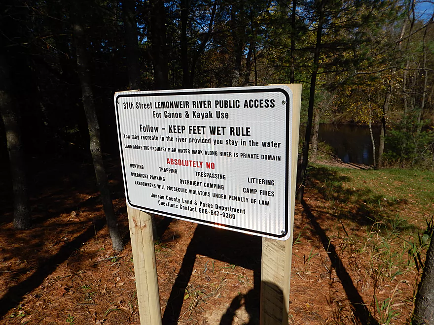
The new 37th Street public access landing
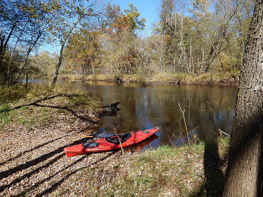
Very nice landing
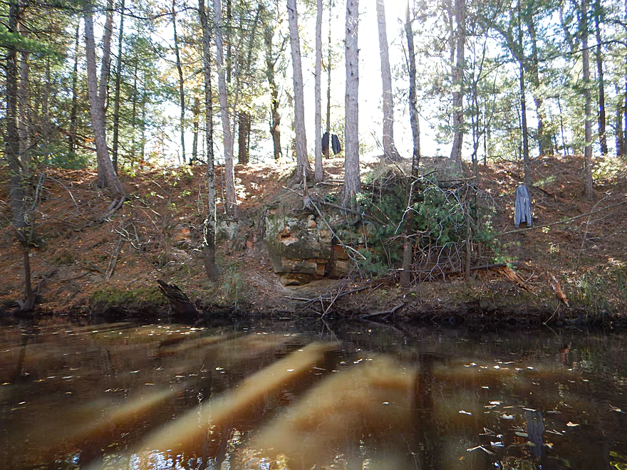
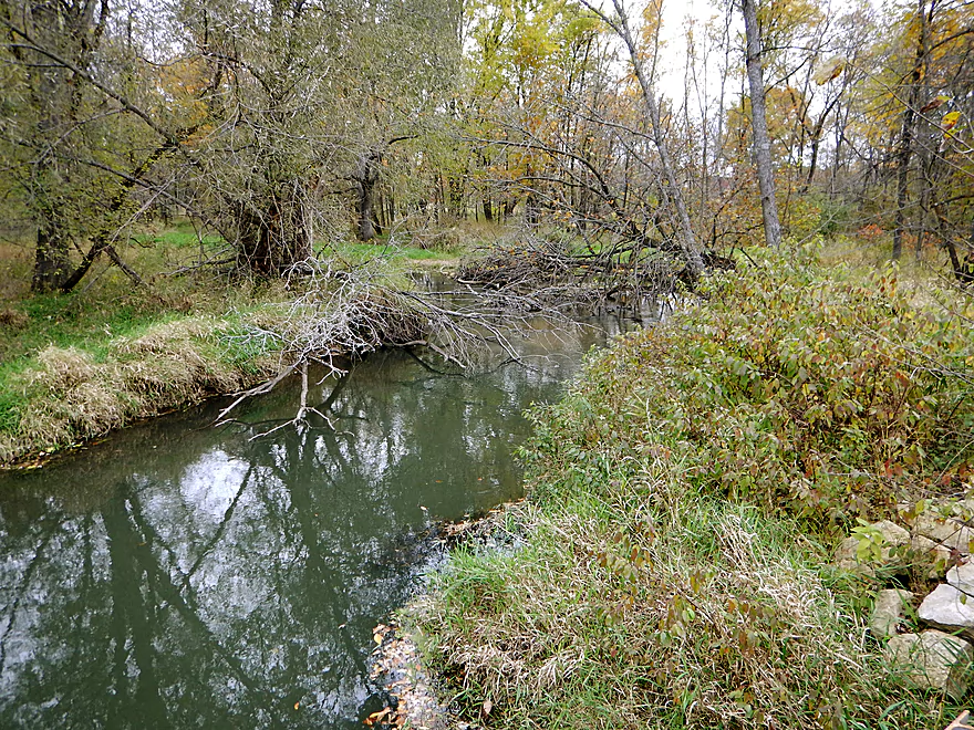
Local kids were chipping away at one of the only rock outcroppings on the river
Deep river as evidenced by the powerboats
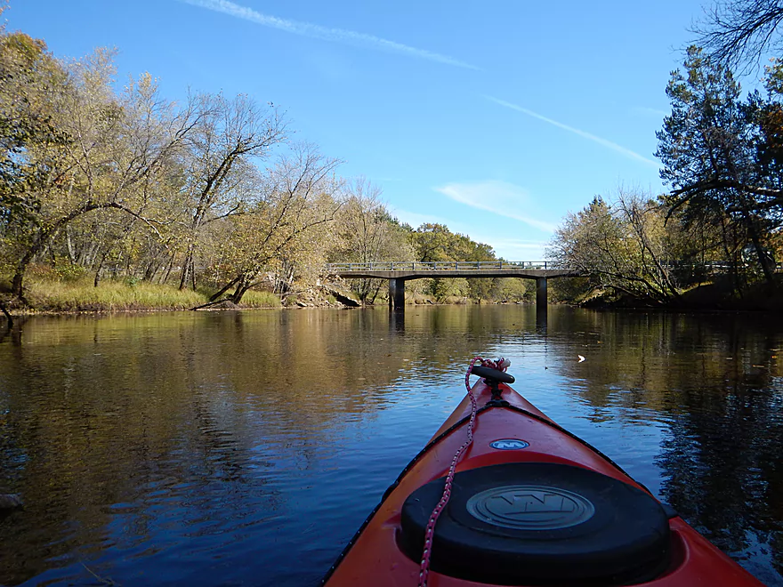
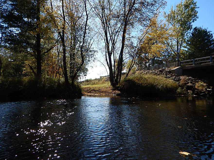
Hwy M bridge
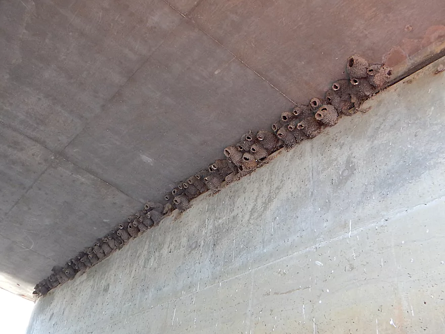
Nice cluster of cliff swallow nests
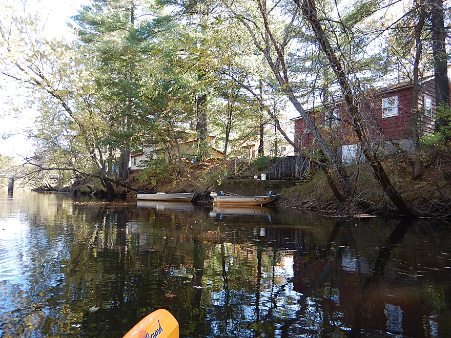
The old Hwy M landing (no longer public I believe)
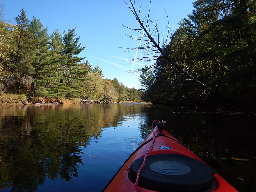
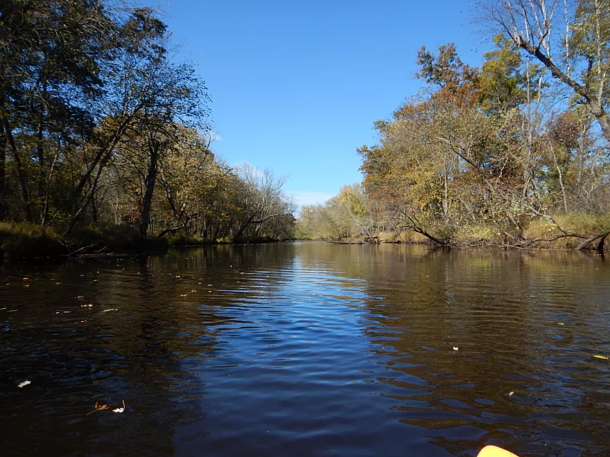
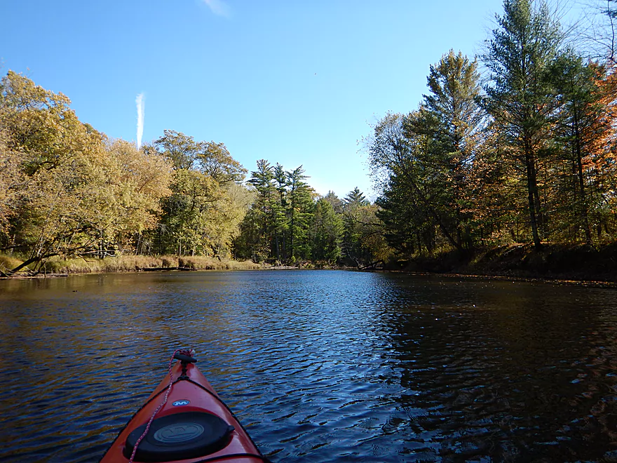
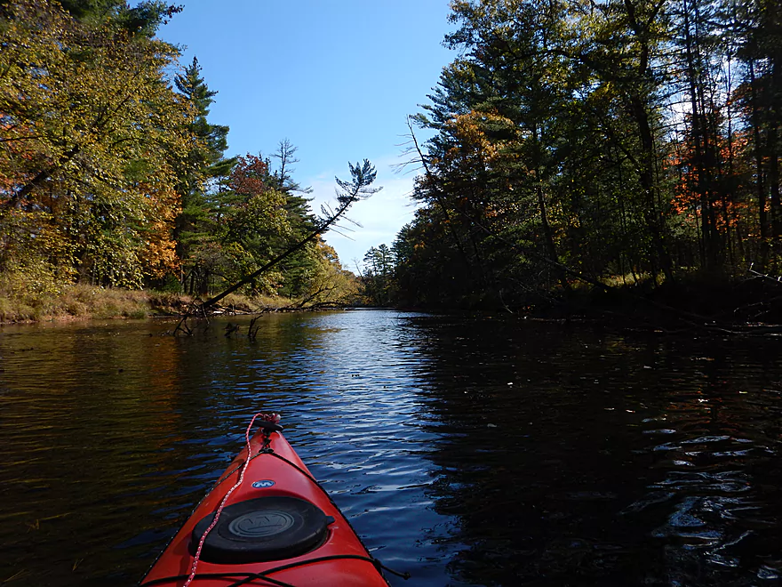
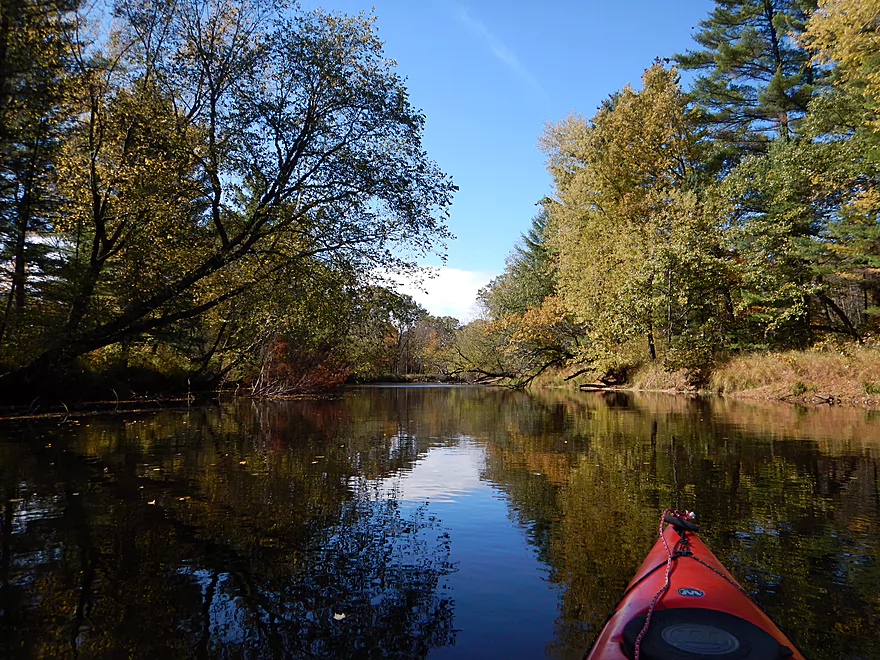
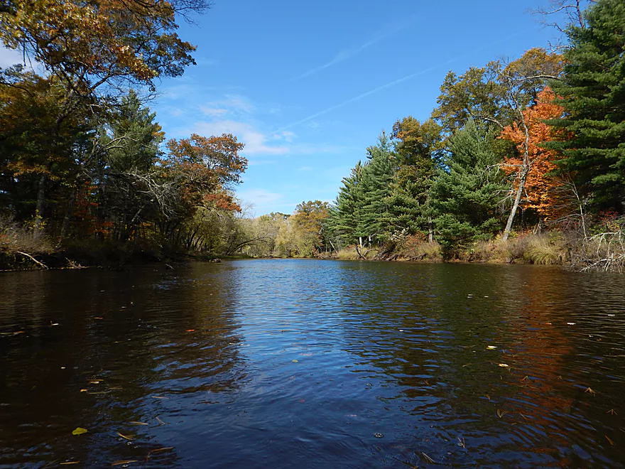
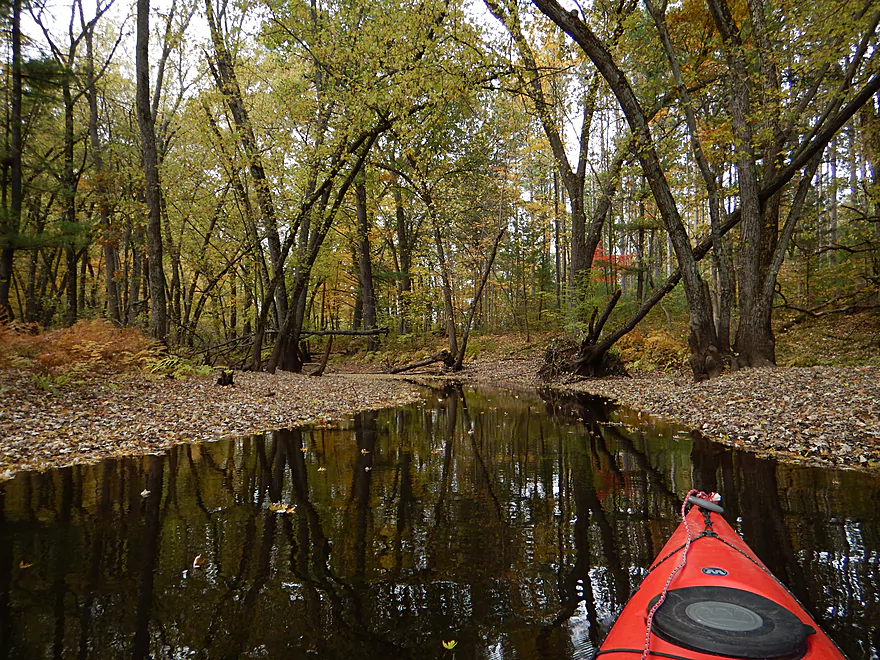
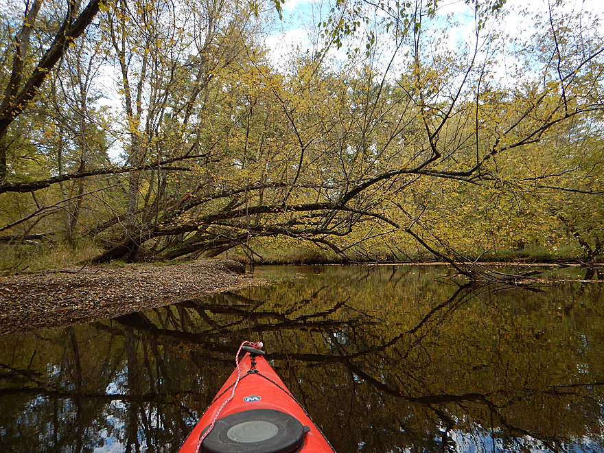
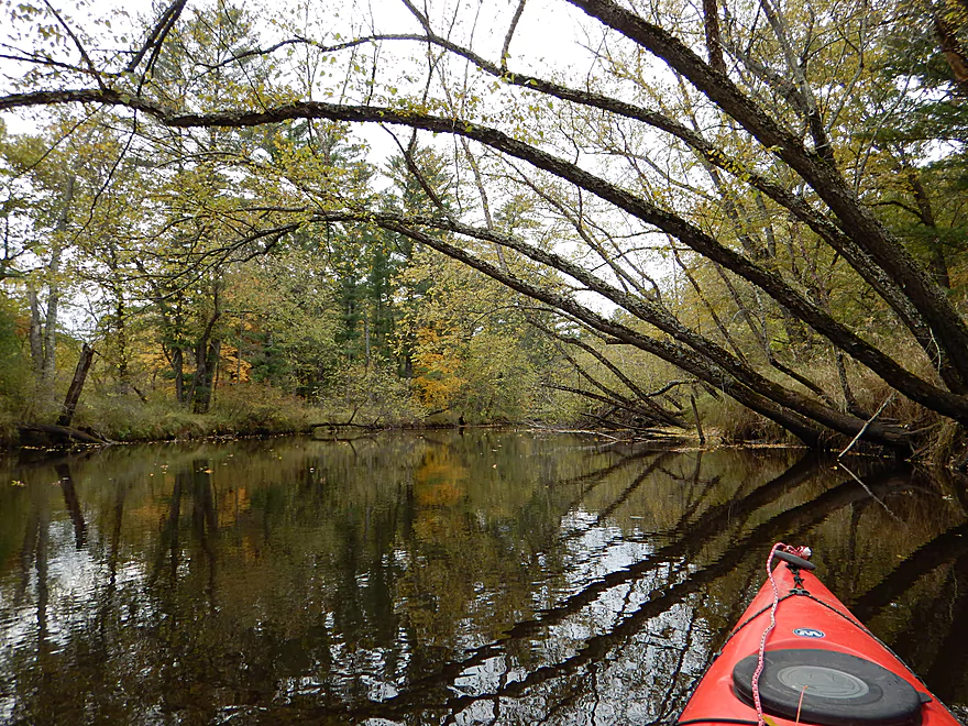
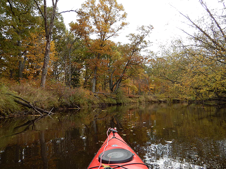
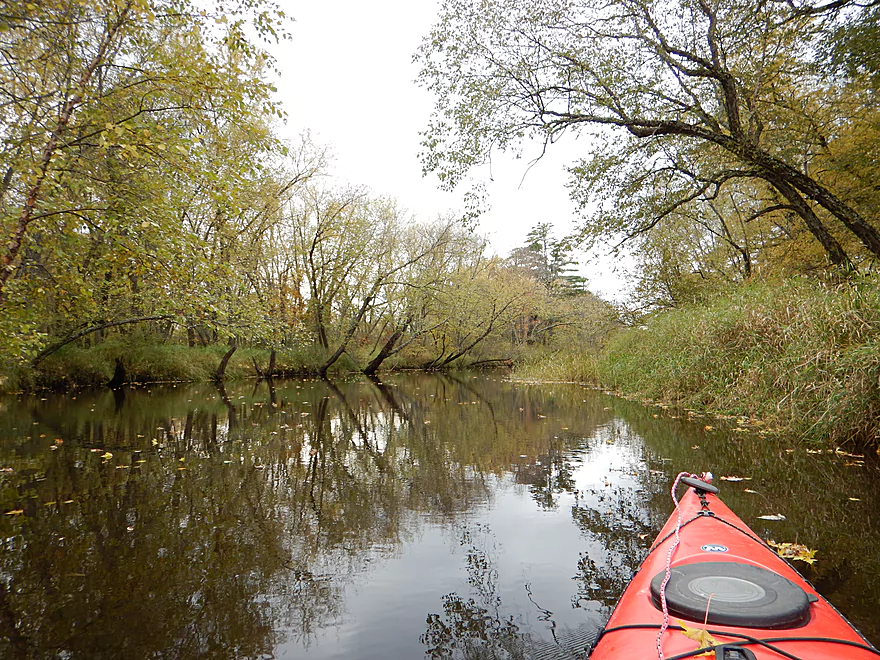
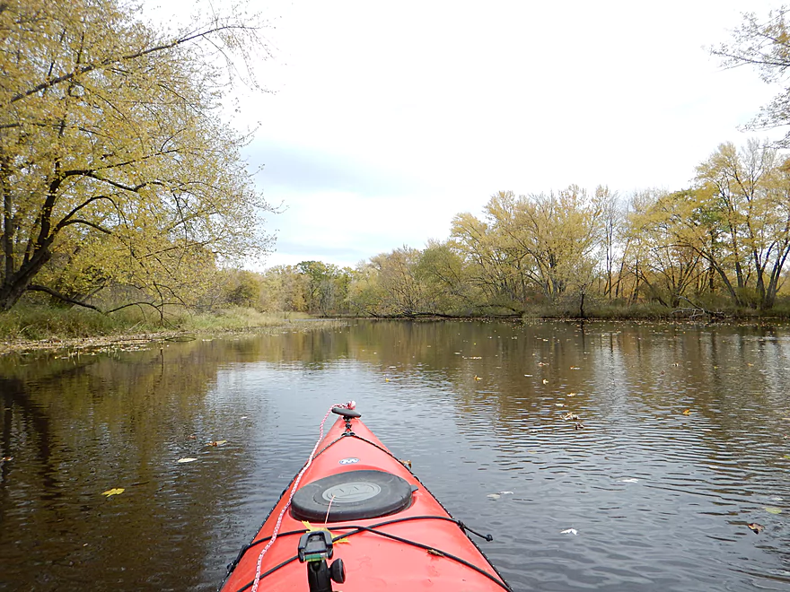
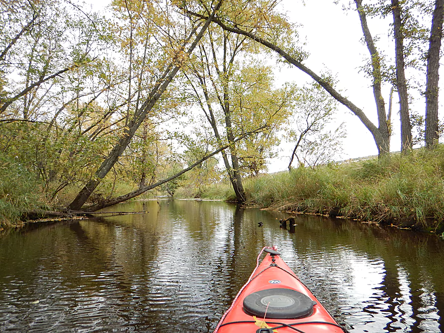
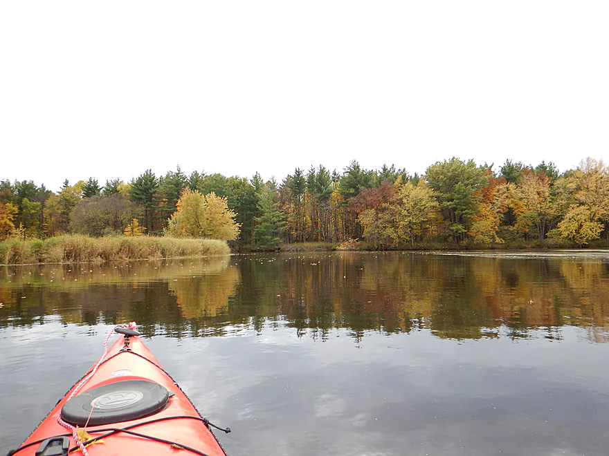
One of several scenic sections
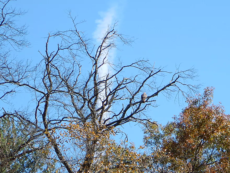
Looks like a red-tailed hawk
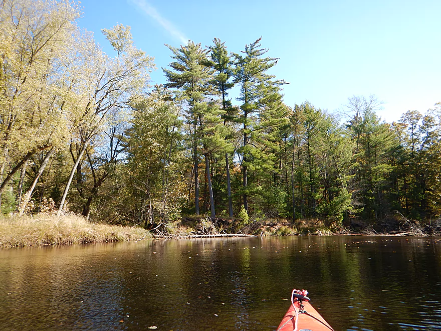
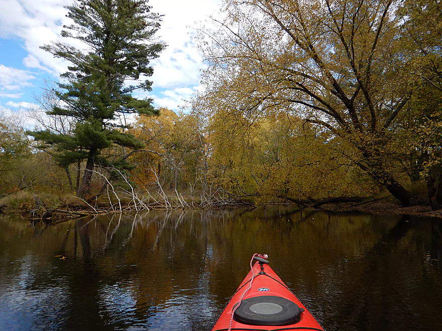
Quite a few white pines
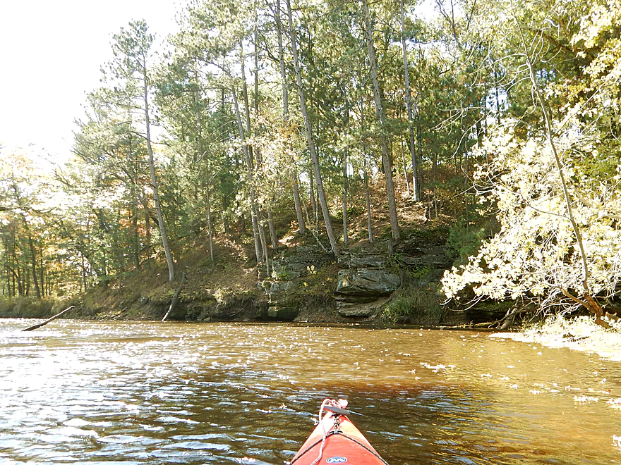
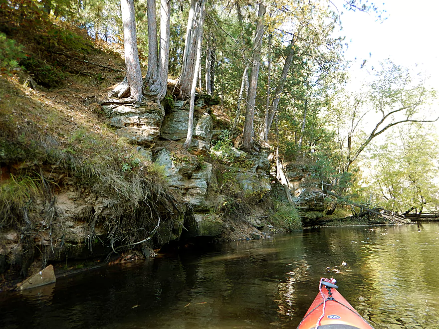
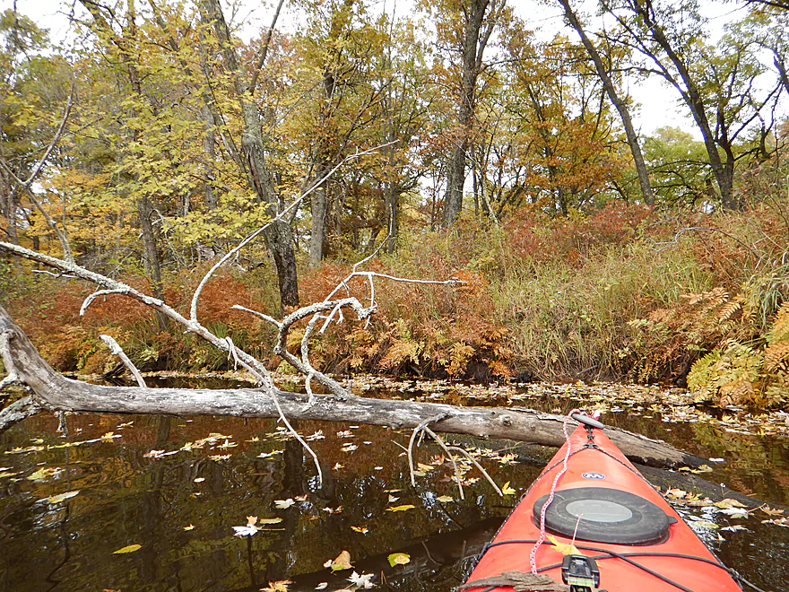
A rock outcropping on the river
Reverse angle
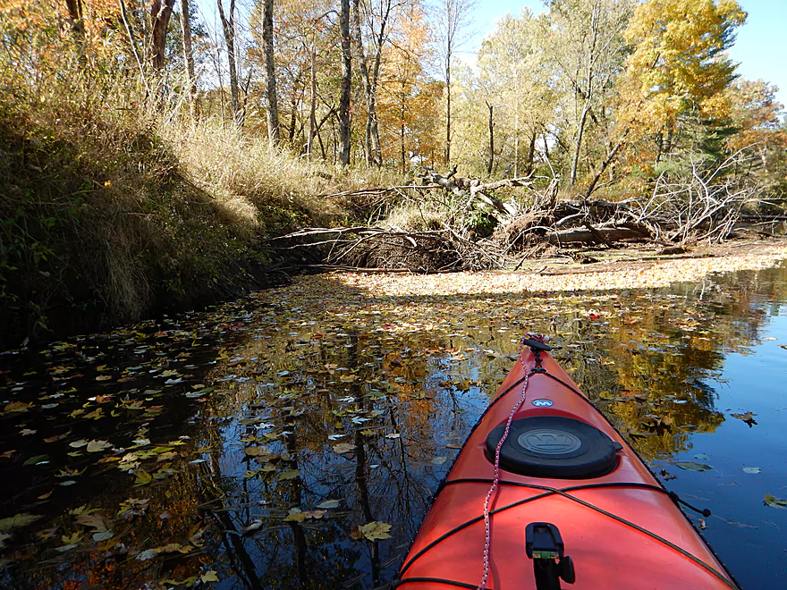
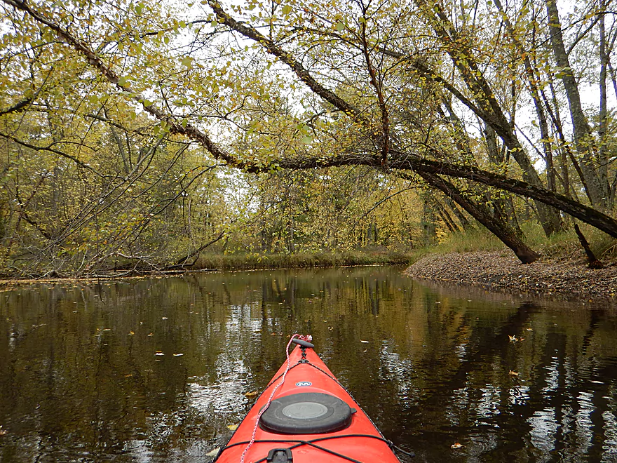
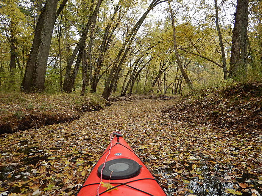
Trees did not have many leaves, but the river did
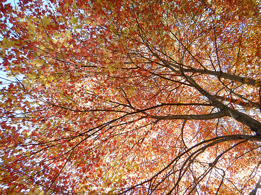
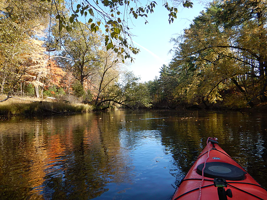
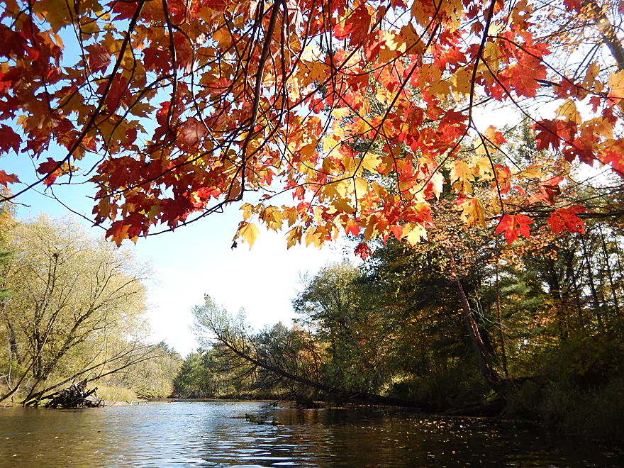
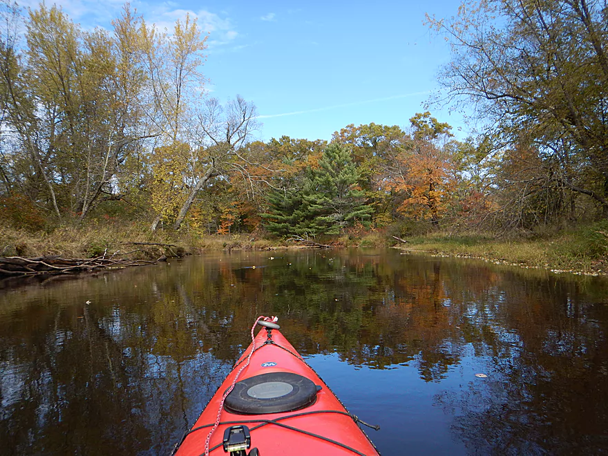
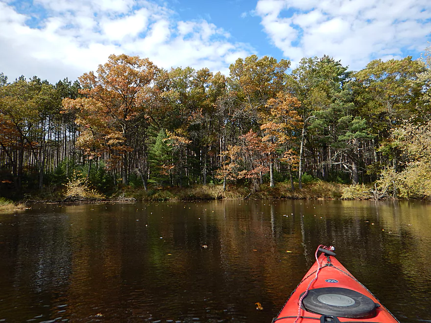
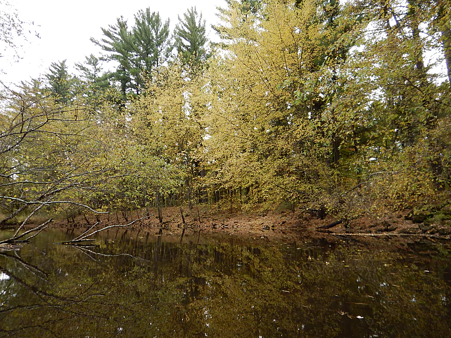
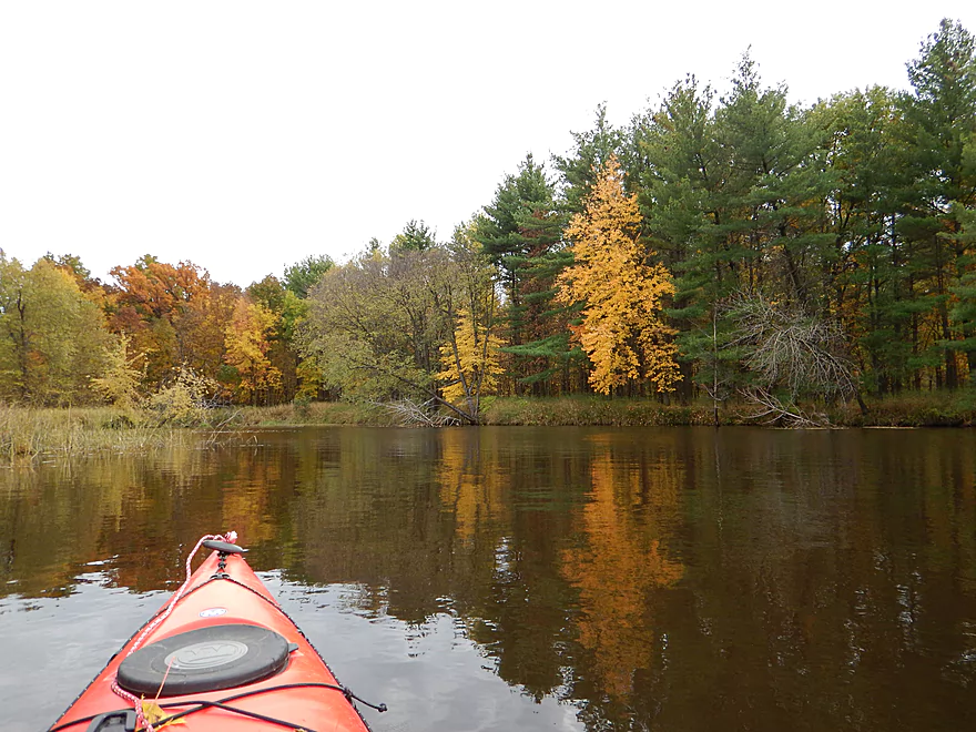
Some nice fall color (but the area was mostly past prime)
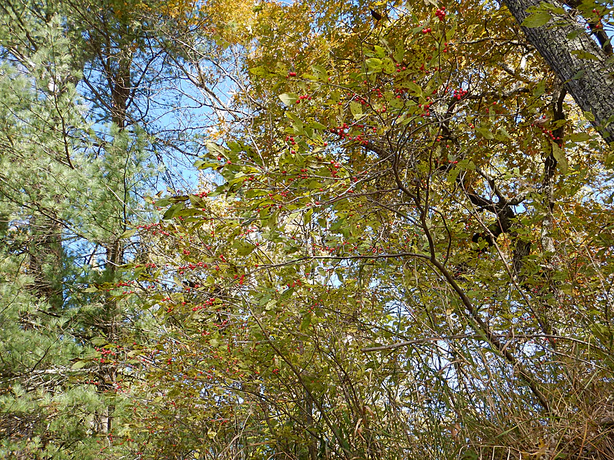
Winterberry holly
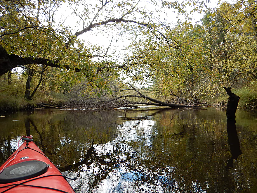
Not many down trees and always a way through
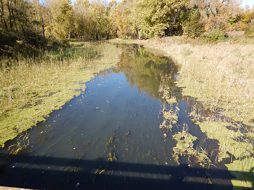
Cool little inlet
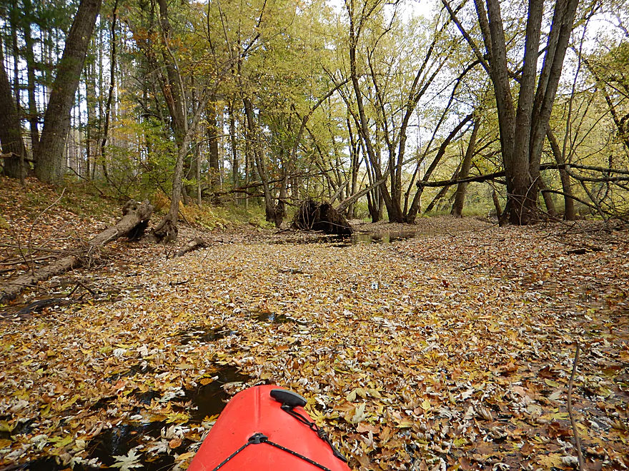
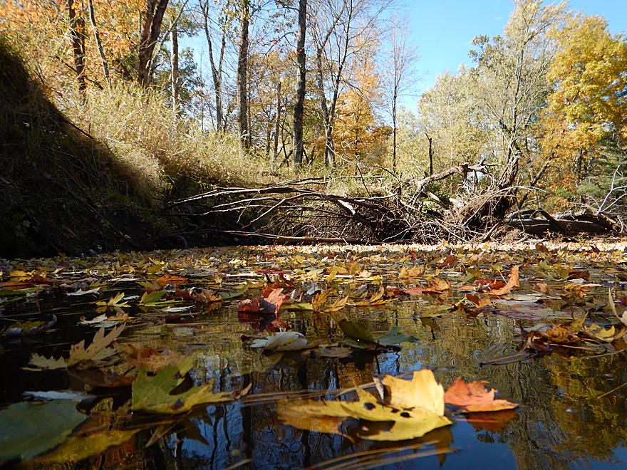
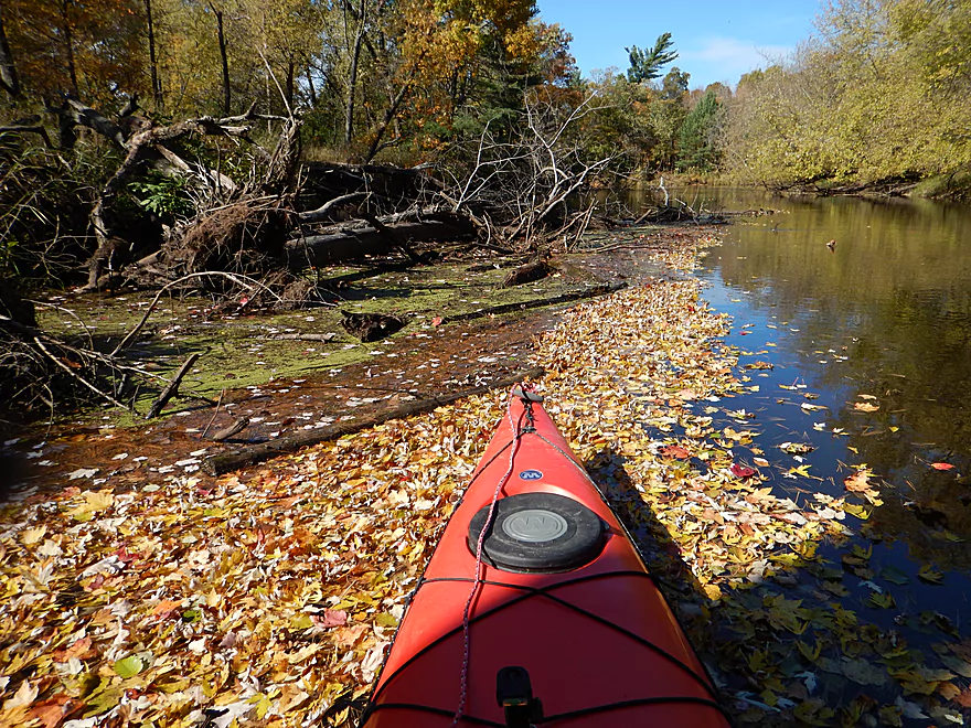
Leaf city
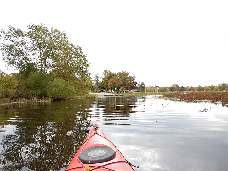
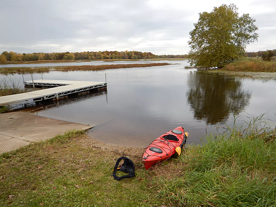
This is the canoe landing for Kennedy County Park
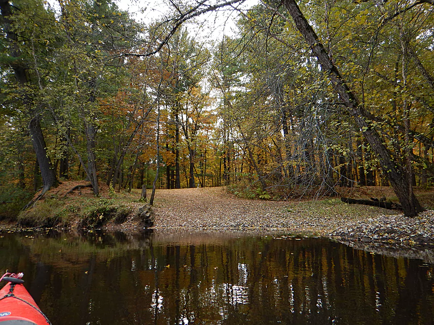
Could be a nicer scene with full foliage
Leaning trees of Pisa
Another cool leafy nook
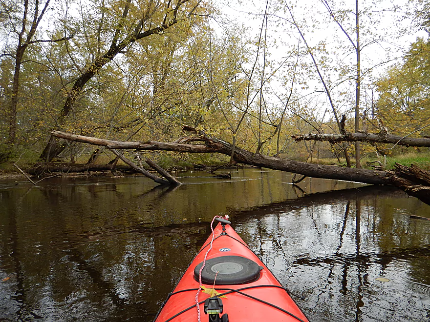
Another rare snag (easily circumvented)

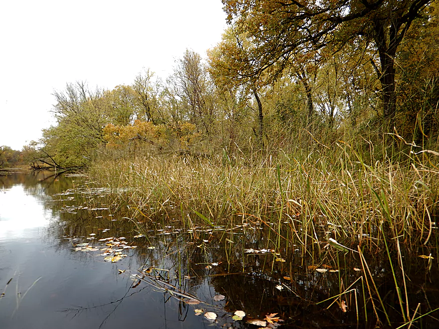
Some well cooked ferns
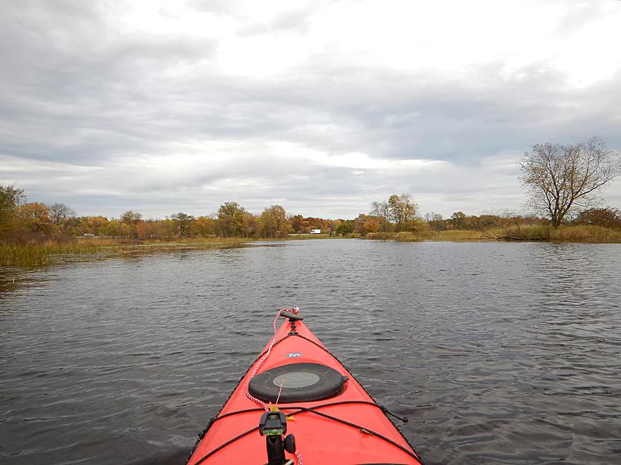
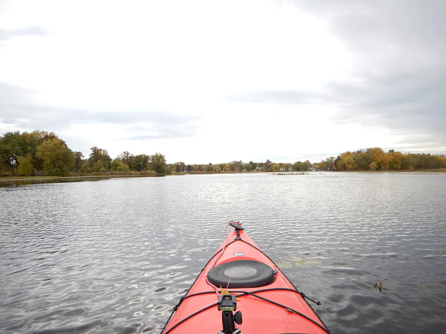
Flowage is starting to kick in
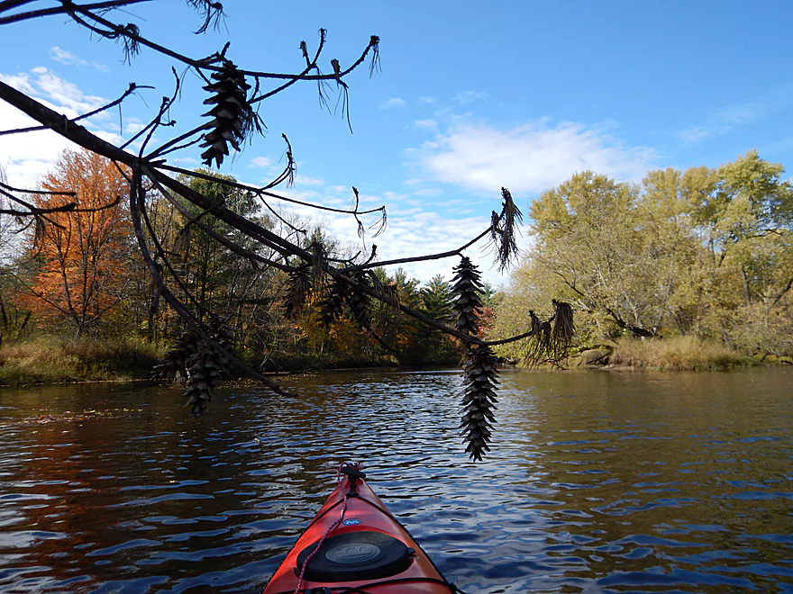
Wild rice
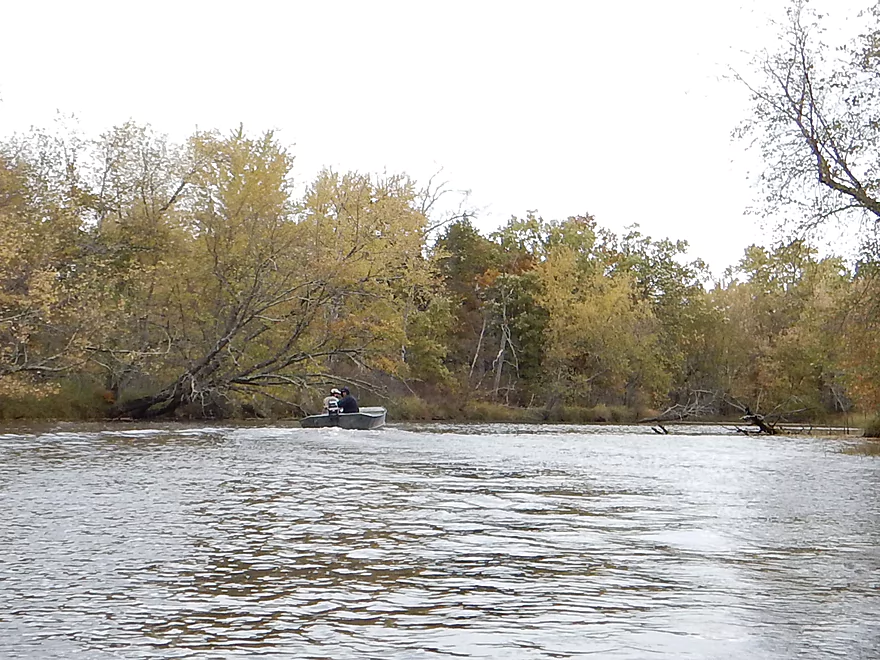
One of several motorboats I saw
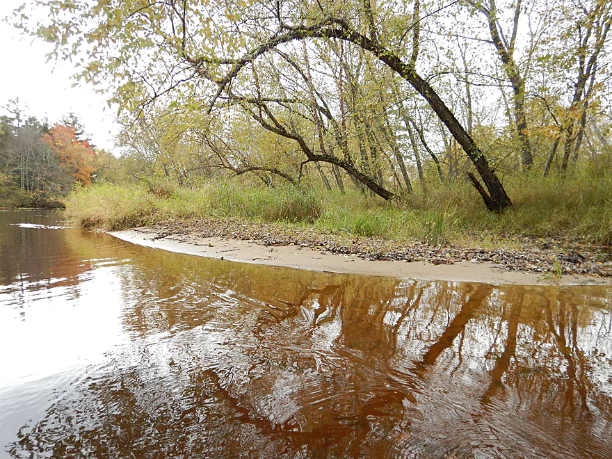
A rare sandbar
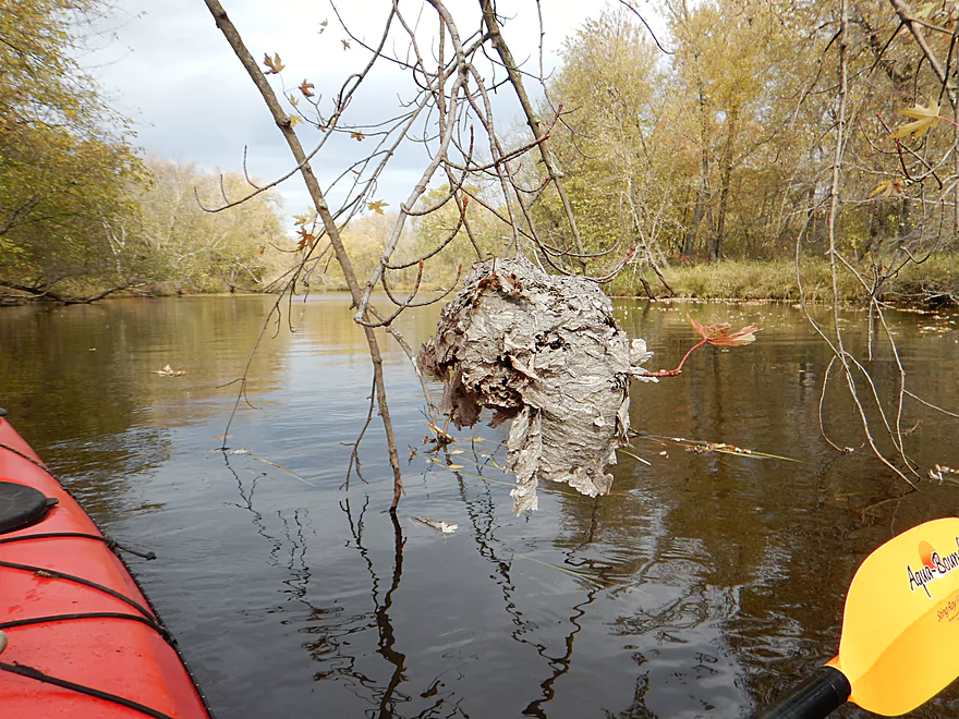
Paper wasp nest that has seen better days
Most boring part of the trip
Trying to find the bridge under I-90
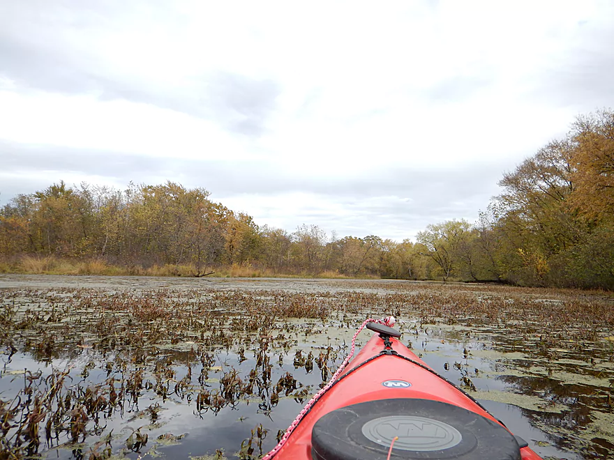
Doing some swamp paddling
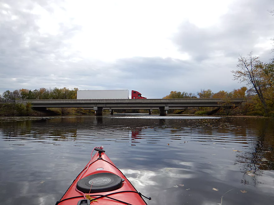
I-94 at last (I could hear it for miles away)
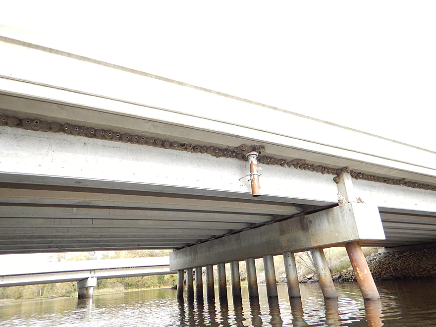
Another bridge, another cliff swallow colony
Think the name of the flowage is New Lisbon 490 (not a great name)
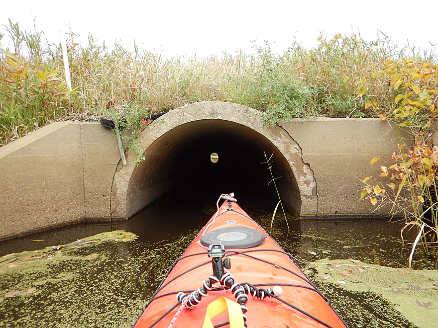
A tunnel you could take instead of the I-94 bridge
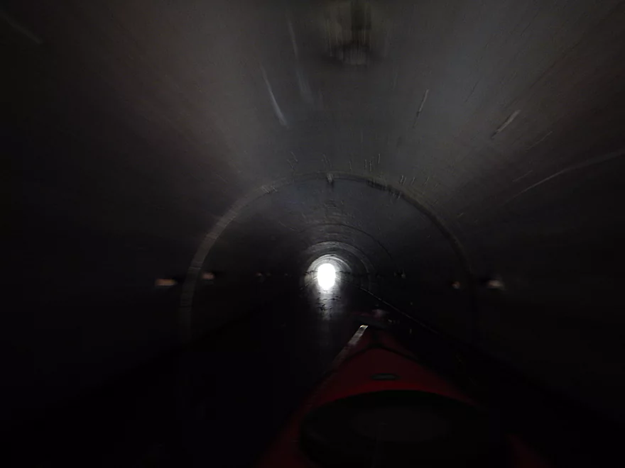
A little dark and small though
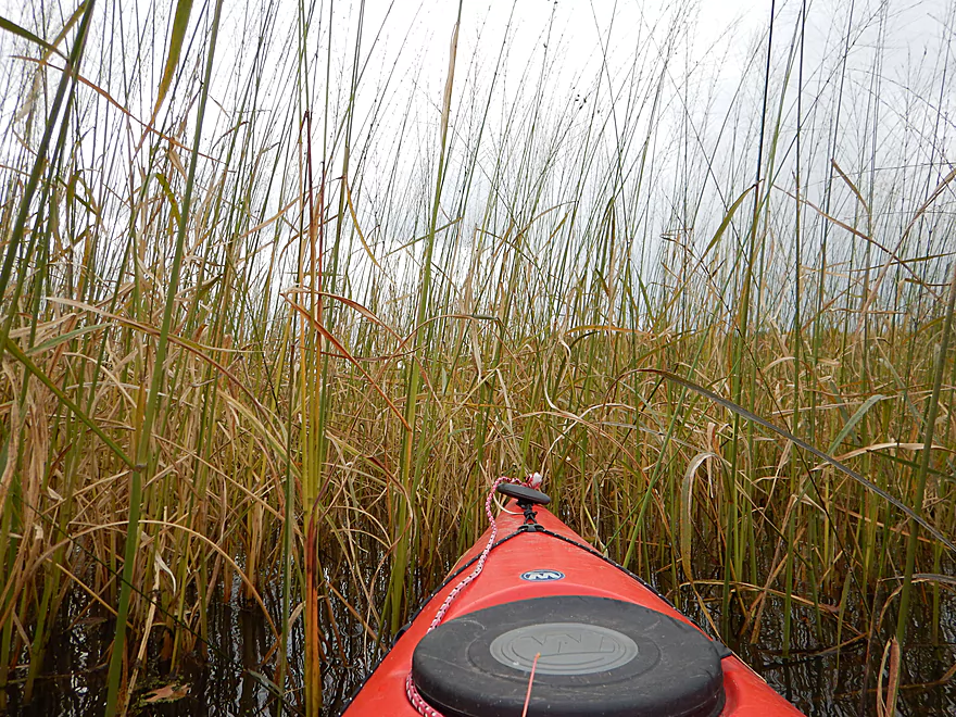
Nosing through the wild rice
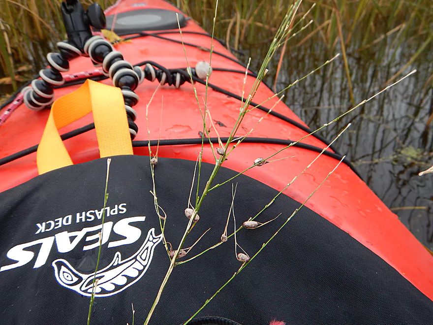
Not many seeds left
City of New Lisbon is dead ahead
The take-out
Riverside Park is a great landing
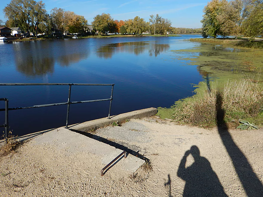
Nice view overlooking the flowage
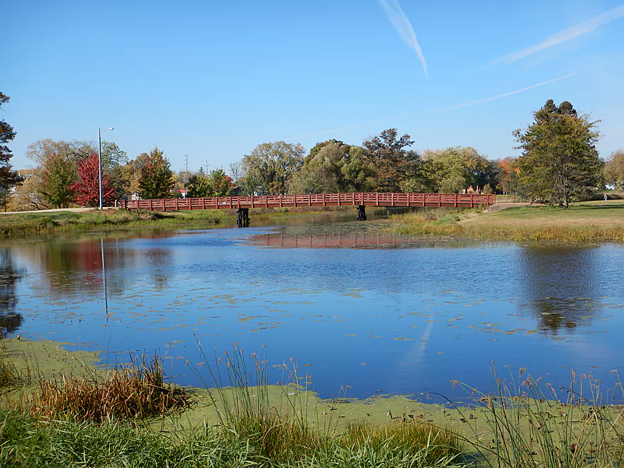
Attractive pedestrian bridge
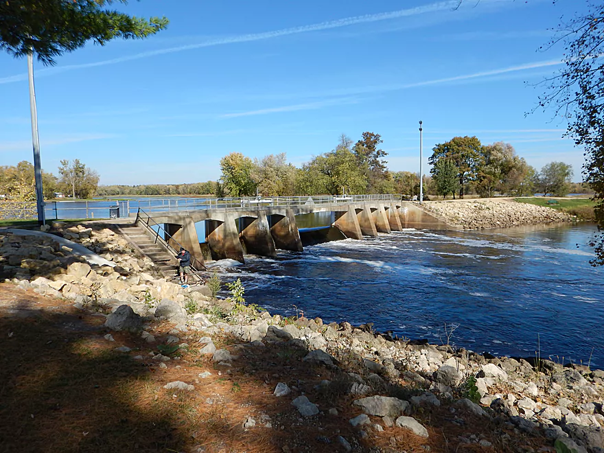
Small dam + big flowage = bad gradient
If you want to, you can portage the dam on the east side
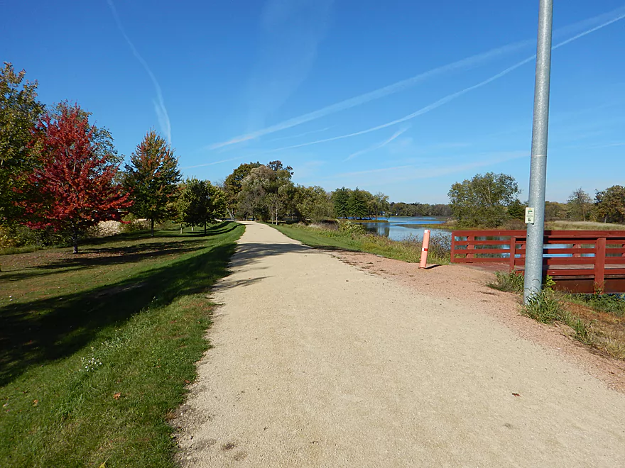
There is a nice bike trail in New Lisbon

Bike shuttle on Hwy M is very pleasant
Scouting the Little Lemonweir, which looks nice
Looks a little congested at McEwen Road
Scouting the Big Lemonweir at 6th Ave
Upstream on River Road the river appears inviting
Lemonweir River – New Lisbon

A big, long lake pretending to be a river. Honestly, somewhat boring, but a nice rock outcropping, fall leaves and attractive white pines gave it redeeming value.
The old put-in for this stretch used to be the Hwy M bridge (southeast side). While there still appears to be a launch there, there are “no trespassing” signs along the road, so this is not very inviting. Somewhat recently the county purchased land maybe 1000′ upstream of Hwy M and set up a public canoe launch on the south bank. It is a small launch, but there is space to park. The drive leading into the park is very steep and if the ground is wet, you may just want to park on the shoulder instead. There are no facilities at this launch.
While the lower Lemonweir is serviced by a livery, this upper section, I’m fairly certain, is not. Not a big deal, as this is actually a pretty good bike shuttle at only five miles. Starting from the take-out, there is a nice half-mile public bike trail that runs along the waterfront and crosses over the New Lisbon dam. From here it is some easy town biking and then onto Hwy M, which is very pleasant, with little traffic and few hills.
Negligible current, especially once you get toward the main flowage. In fact…I was never sure where the flowage started because the river was so slow and deep. I went at 350 CFS according to the very local New Lisbon gauge, which was maybe a tad above normal, but was significantly higher than my previous three trips on the Lemonweir. Because of the deep water, the river had little character and I wish I had paddled this during summer and a low of say 100 to 150 CFS.
Mixture of sand and mud. Not too messy but not too clean either. The water clarity was not good, but it wasn’t that the water quality was so bad (wasn’t great) but more so that the river was so deep.
Skittish beaver, a falcon and a couple of deer. Supposedly this is a rich area for wildlife but maybe not as much in the late fall. The highlight for plants were the white pines (always a treat) and the wild rice beds (some of which looked ready for harvest).
While having done the Lemonweir three times before, it has always been the lower sections below the city of Mauston, as I’ve heard horror stories of log jams on the upper river. While doing some research, I was able to determine there was an open stretch from Hwy M to New Lisbon and annual canoe races were actually held on this stretch. Relatively new, Juneau County has constructed a canoe launch west of Hwy M, which was also a good sign (thanks to Ray Feldman for the tip). With this in mind, I definitely wanted to paddle this stretch.
The river starts out nice enough, with a little current and nice tree walls. Right past the landing will be a couple of houses and this will be all you see before you get to New Lisbon…so, in a sense, a good wilderness trip (minus the infernal I-90 road noise). Near these houses is a very small rock outcropping where I saw two little kids furiously hammering away at the rock (think they were trying get the tree the outcropping was supporting to tip over). They should not have been doing this…
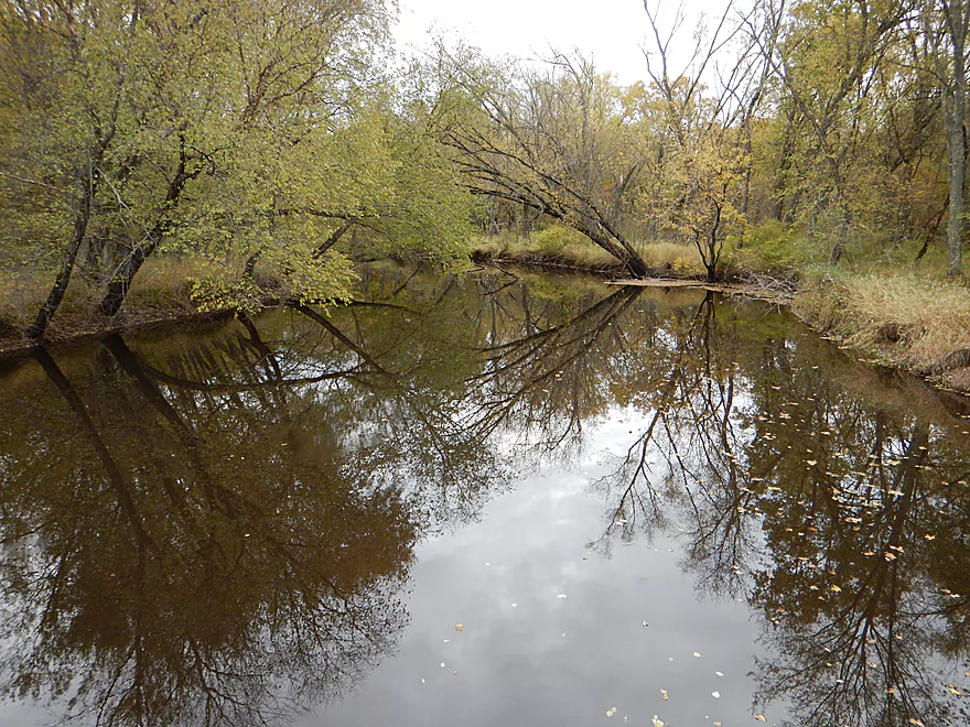
The second rock outcropping is maybe a mile later and much larger and nicer.
The feel of much of the river is one big, slow, deep lake. The bank quality isn’t too bad and is definitely more tidy than the lower Lemonweir. What was unique about this trip was the timing. Fall color was past prime (unfortunately) but many leaves had ended up in the river instead which offered some unique scenes that few paddlers see on rivers like these.
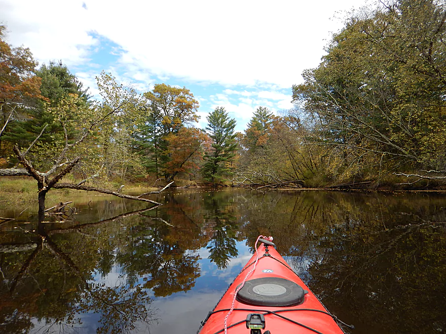
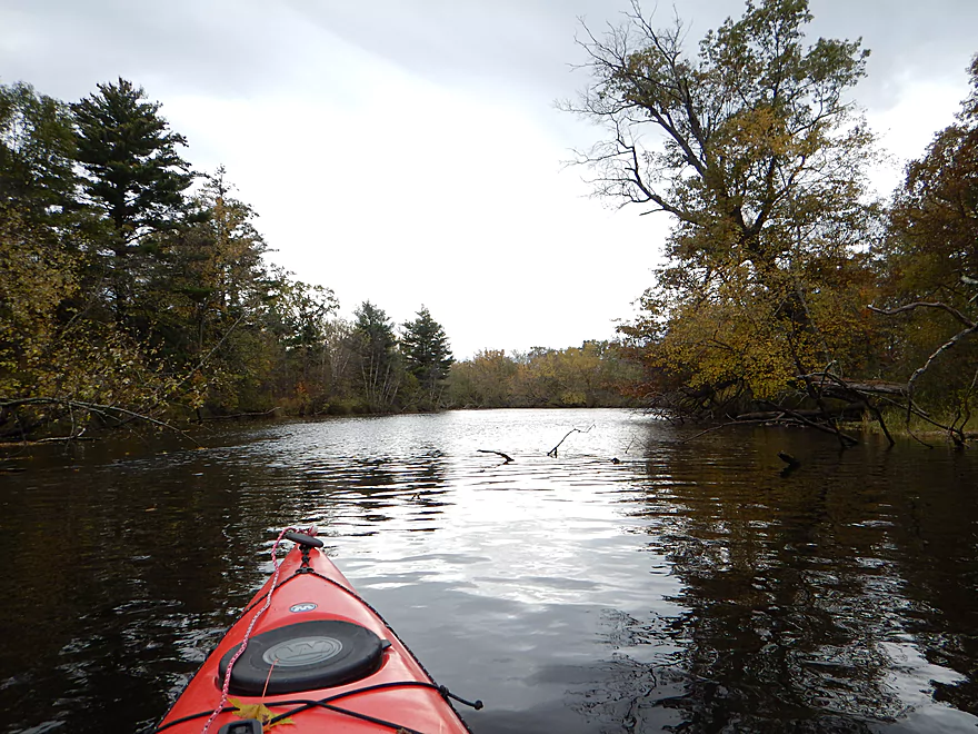
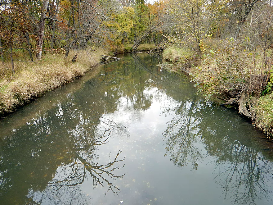
Soon you’ll paddle by a public canoe ramp which marks the start of Kennedy County Park. Quite large, this protected area is a nice stretch of the river. There are numerous oxbows and islands and it is possible (as I did) to end up paddling the wrong way. Just read the current (not always easy) and follow the largest channel to find the best path.
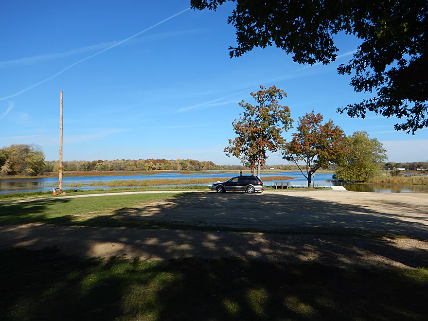
Close to I-90 the flowage kicks in at full force (I was never sure where it “technically” started) and the channel becomes open and stagnant. Once past I-90, you are in the main lake and it is an easy paddle to Riverside Park on your left.
My review might be coming off more harsh than is deservedly so. Really, I paddled when there was little foliage on the trees, the water levels were twice what was optimal, and it was cold and windy. So, I might be jaded by the context and this section of the Lemonweir could actually be a three-star prospect.
None. Well, maybe a low-hanging branch that required a little bit of ducking, but that was nothing. If you are disappointed and actually like log jams, don’t worry, as there are plenty upstream of the Hwy M bridge. The dam at New Lisbon is something to be mindful of, but really, the take-out is well away from that. There is a portage path on the northeast side of the dam if you really wanted to portage it.
Riverside Park is a convenient public landing on the south side of the flowage. The park has a nice boat ramp with good parking, bathrooms and even showers. Riverside doubles as an RV campsite, so is kind of busy (I preferred to lock my bike/kayak at the put-in instead!).
The Lemonweir has numerous “human” issues. The upstream sections have been heavily rerouted and straightened, which artificially drains the upper watershed faster than normal, which in turn exaggerates the high and low flow rates, which in turn contributes to erosion and poor bank quality.
There are many cranberry marshes on the upper sections of the Lemonweir, which are never a good thing for a watershed because of the pesticides they use and the disruptions they cause to the water table.
The big issue for this trip is the dam at New Lisbon. Already a slow river, the small dam creates a huge (and boring) flowage that really robs the river of recreational potential. It also (like all flowages) disrupts and weakens the local ecosystem.
You probably won’t see too many people on the river (unless you happen to go during the annual canoe race), but I did see three motorboats (all hunters).
Final rant will be for the noise caused by I-90. You can hear this, literally, miles away and it started about at Kennedy County Park. Most unfortunate.
Detailed Overview
Lemonweir River - Main Branch:
- East/South Fork Confluence to Cty PP: 1.0 miles. Likely around 3 logjams.
- Cty PP to Funnel Road: 2.0 miles. Very straight channel with roughly 6 logjams.
- Funnel Road to 2nd Ave: 1.2 miles. Highly channelized and straight with about 3 logjams.
- 2nd Ave to Cty H: 1.8 miles. Roughly 4 logjams. The channel can be poorly defined at times.
- Cty H to River Road: 2.3 miles. Expect 4-6 logjams and confusing side channels where navigation is a challenge.
- River Road to 6th Ave: 5.4 miles. Likely navigable, but expect a high volume of logjams.
- 6th Ave to 37th Street Landing: 4.4 miles. Occasionally paddled but contains several logjams.
- 37th Street Landing to New Lisbon: 6.6 miles. A long, slow stretch that feels more like a lake than a river. While somewhat monotonous, the rock outcroppings, white pines, and fall colors provide some redeeming beauty.
- New Lisbon Dam to Hwy 12/16 Shoulder: 7.9 miles. A promising prospect featuring a “Little Dells” rock outcrop, though hampered by about 6 logjams. The Hwy 12/16 shoulder is a speculative but potentially an access point.
- Hwy 12/16 Shoulder to Riverside Park in Mauston: 4.6 miles. Mostly slow, open paddling through river flowages.
- Mauston Dam to 19th Ave: 4.5 miles. One of the premier stretches on the river.
- 19th Ave to Cty HH: 13.1 miles. Less engaging with a noticeably slower current.
- Cty HH to the Mouth: 3.3 miles. An excellent section with beautiful rock outcrops that serve as a prelude to the Wisconsin Dells.
Lemonweir River - East Fork:
- Cty EW to Buckley Ave: 3.4 miles. Begins in cranberry bogs before transitioning into a sedge-lined creek and concluding with a spectacular corridor of towering white pines. Expect roughly five logjams, mostly near the end.
- Buckley Ave to Hwy 173: 4.7 miles. One of the most scenic and diverse stretches of the Lemonweir, featuring marshes, a lake, cranberry bogs, sandbars, and towering pines. A handful of easy-to-portage logjams are located near the end.
- Hwy 173 to Cooper Road/Dam:
- Hwy 173 to Dove Ave: 0.9 miles. A lovely, open leg with clear red water and numerous small sandbars. Includes one minor, easy portage.
- Dove Ave to Cooper Road: 2.4 miles. A mediocre stretch flanked by frac sand mines and cranberry bogs; much of the channel is ditched and straightened. The half mile below Dove Ave contains several logjams, some requiring difficult portages.
- Cooper Road to Backwater Bar Dam: 0.2 miles. A short but scenic flowage set against attractive pines. The dam is not a practical take-out due to trespassing restrictions and proximity to the spillway.
- Backwater Bar and Grill to Hwy 21: 0.5 miles. Likely congested with near-constant logjams.
- Hwy 21 to East/South Fork Confluence: 0.3 miles. Expect 2-3 logjams.
Lemonweir River - South Fork:
- Butts Park/Lake Tomah to Forbes Road: 4.5 miles.
- Butts Park to Lake Tomah Dam: 0.2 miles. A quick paddle across Lake Tomah to reach the spillway.
- Lake Tomah Dam to Memorial Park: 1.2 miles. A narrow, sandy stretch with a high number of downed trees.
- Memorial Park to Tomah Dog Park: 0.6 miles. Mostly pleasant and open, though one large logjam requires a very difficult portage.
- Tomah Dog Park to Forbes Road: 2.5 miles. The first half is heavily obstructed; the second half is more open but still requires two logjam portages.
- Forbes Road to County N: 6.9 miles.
- Forbes Road to Cty ET: 1.6 miles. A high-quality stretch with good clarity, a sandy bottom, and one manageable logjam portage.
- Cty ET to Cty N: 5.3 miles. Scenic and clear, passing through grasslands, frac sand mines, and a massive cranberry bog. Includes three logjam portages.
- County N to Excelsior Ave: 3.0 miles. Open through the golf course, but the wooded sections likely contain 6-8 logjams.
- Excelsior Ave to East/South Fork Confluence: 0.5 miles. Likely riddled with countless logjams.
Trip Map
Overview Map
Video
Photos Size:
I paddled the Lemonweir this morning, 7/12/20, putting in at 6th Ave and taking out at Kennedy County Park. I was solo so did a nice, easy bike shuttle. I had the most pleasant, splendid solo canoe paddle. Water was high so I was able to paddle around or through any jams I encountered- not a big deal and I like the adventure of it. Saw many, many deer, bald eagle, ducks and otter, and I’m in love with the stretch just before Kennedy County Park with its’ stands of white pine. I really enjoy paddling the Lemonweir. Hope you do, too!
It’s a cool stretch…and a great bike shuttle.
Ty for all this information , I appreciate your tips and experience
No problem! There is actually a new public area below New Lisbon(Carl Walter Nelson Wildlife Area), and I hope to do a trip from New Lisbon to there to check out the Little Dells.