
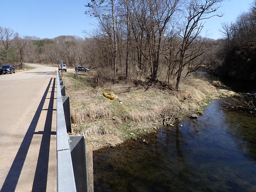
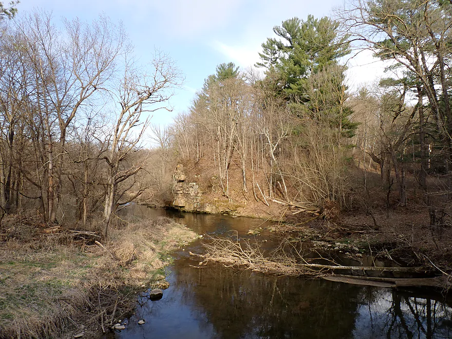
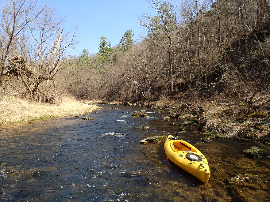
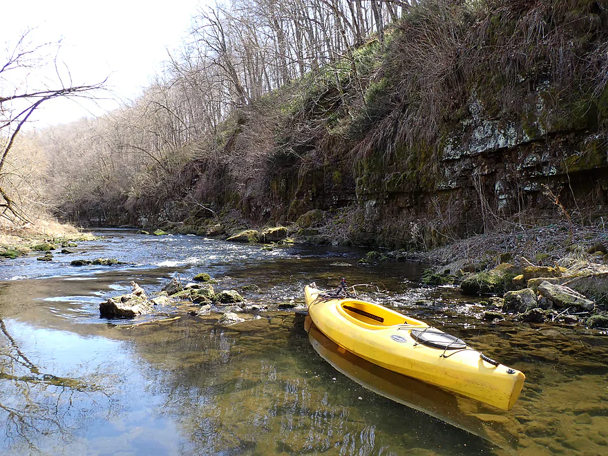
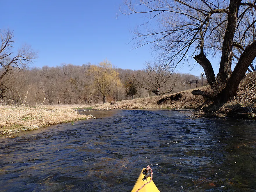
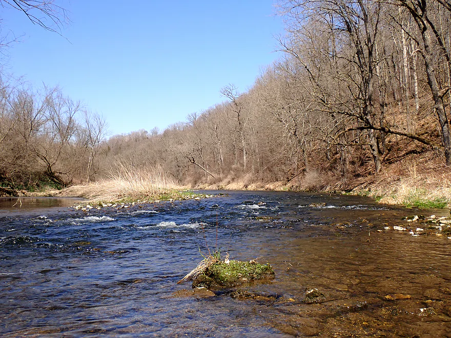
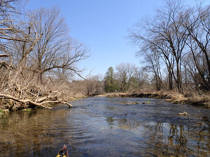
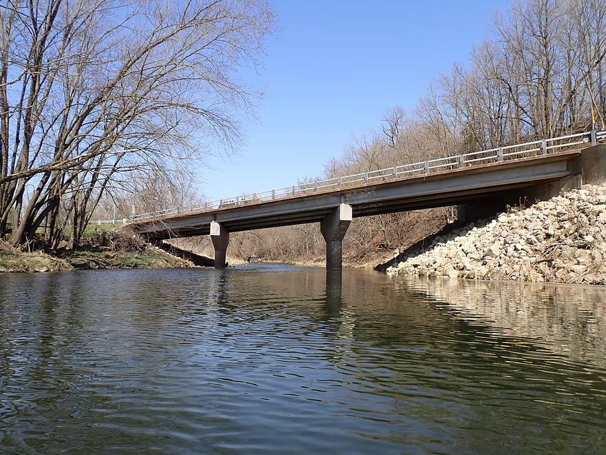
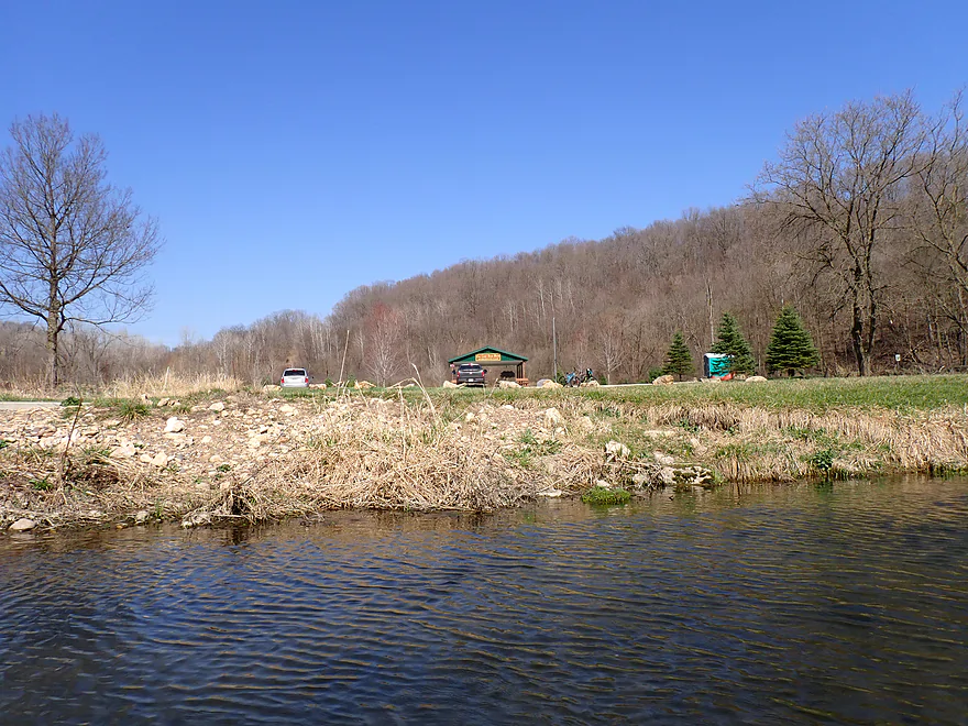
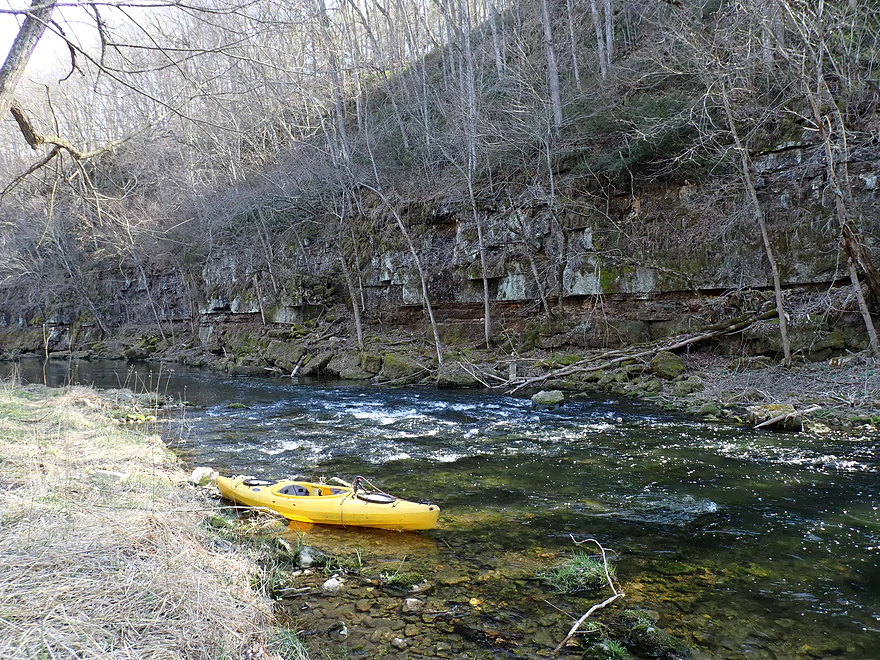
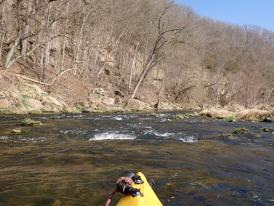
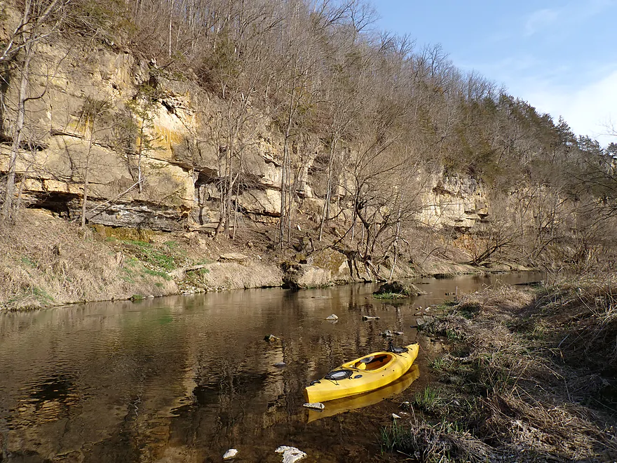
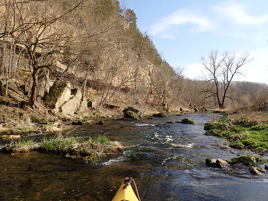
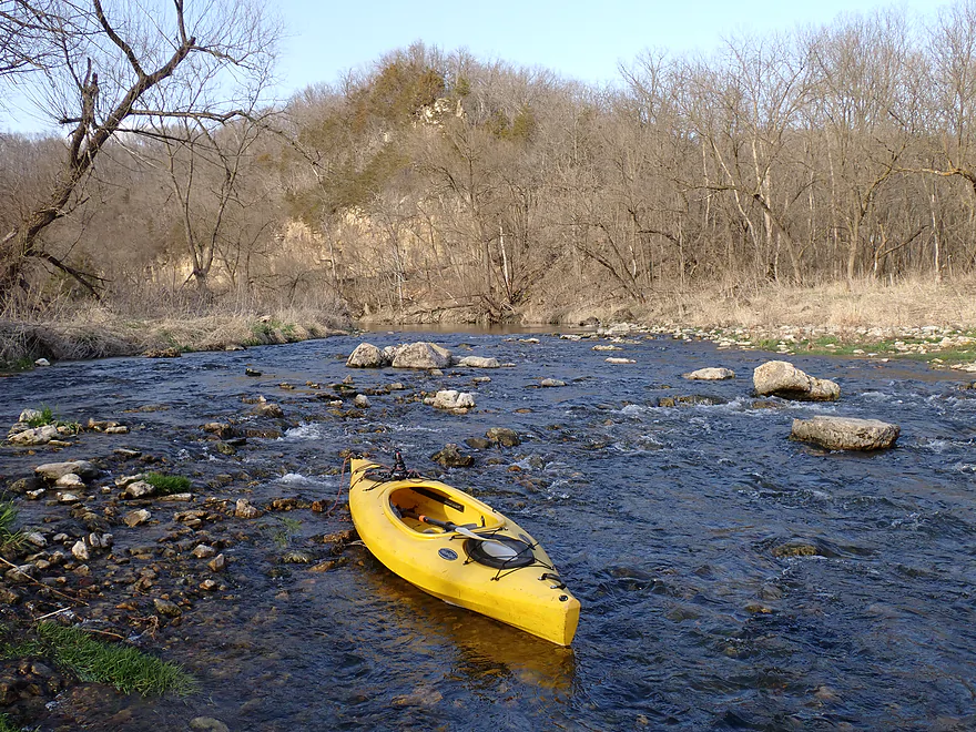
Starting the trip at 690th Ave (3 cars parked in 3 directions!)
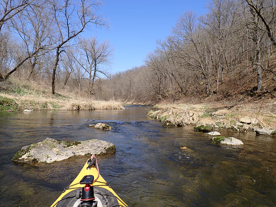
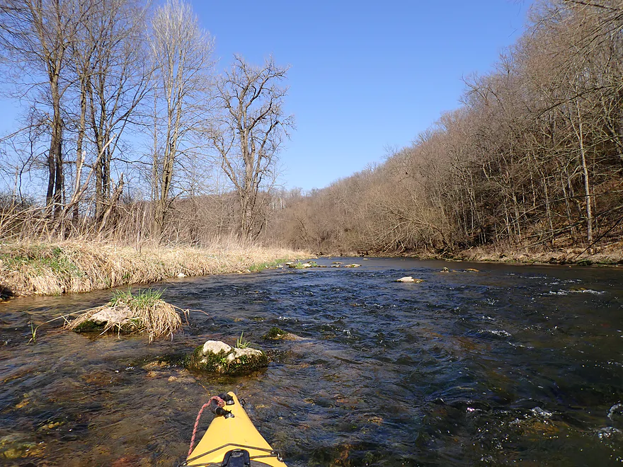
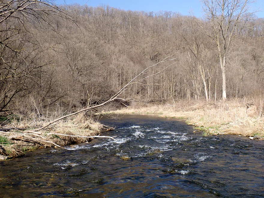
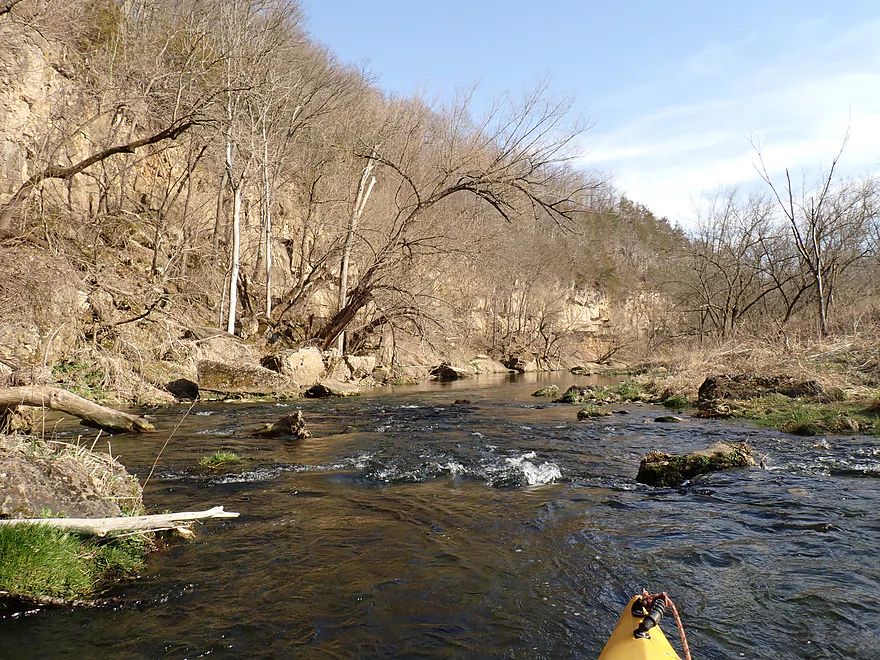
Heading upstream to check out a nice gorge
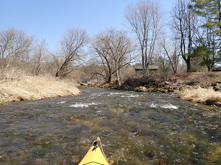
Nice way to start the trip
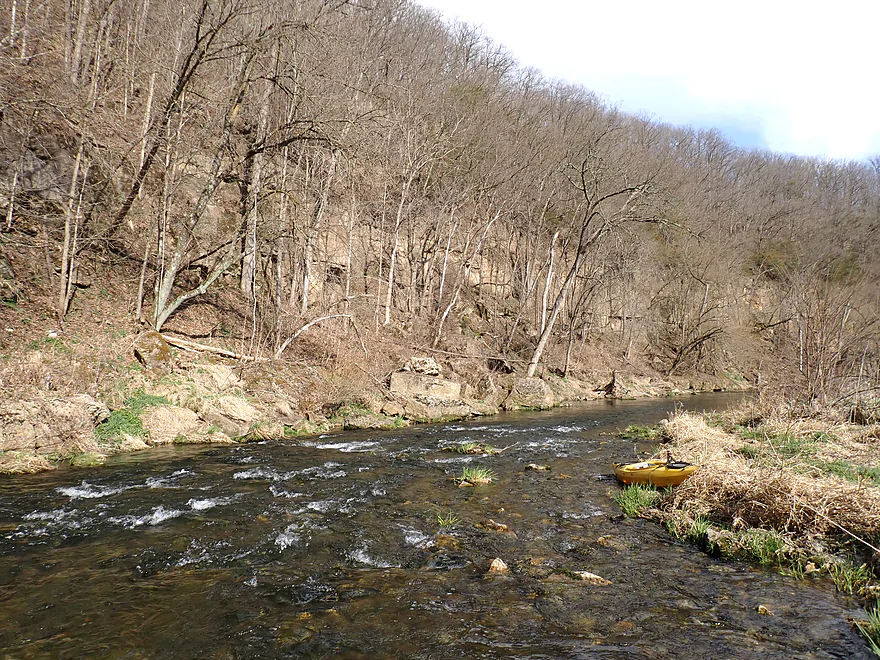
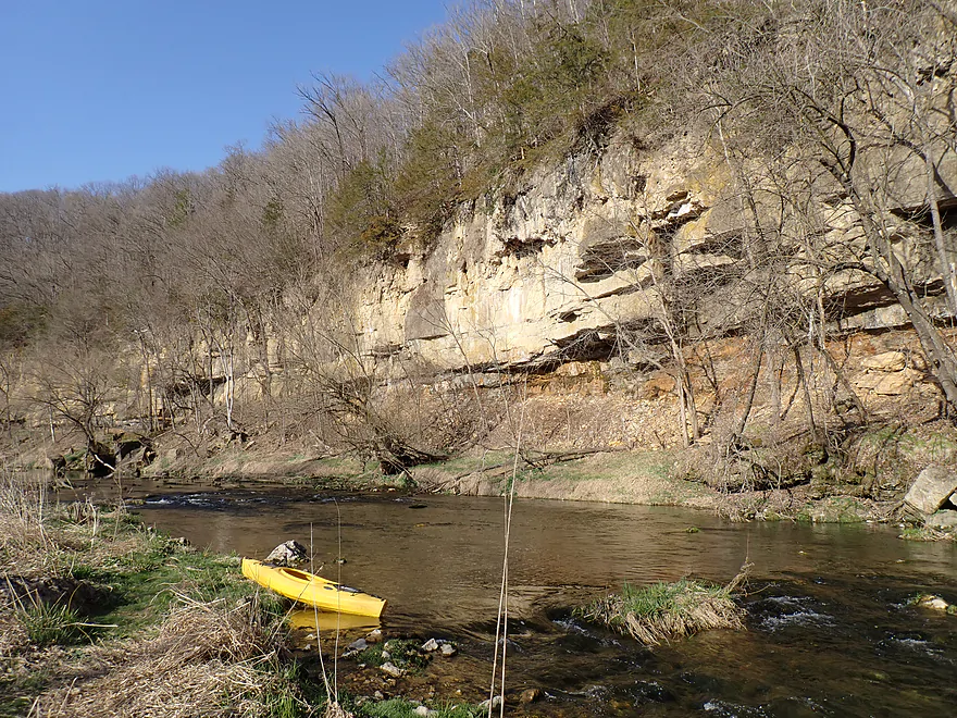
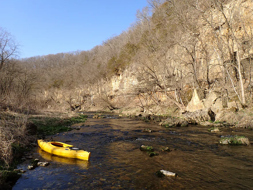
Returning to 690th Ave
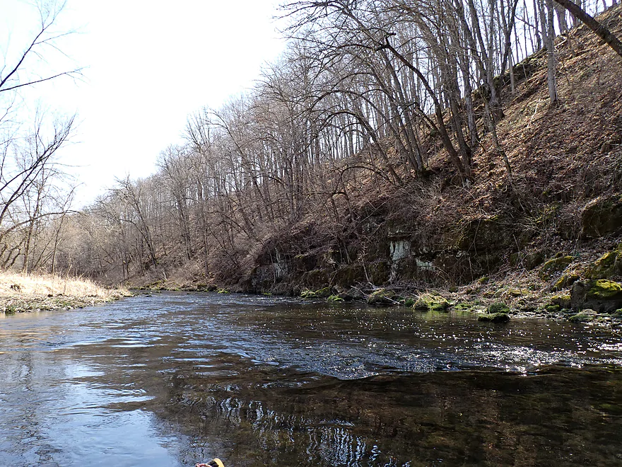
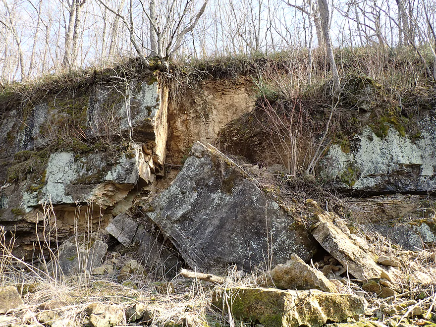
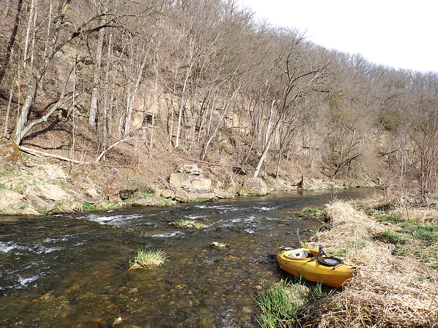
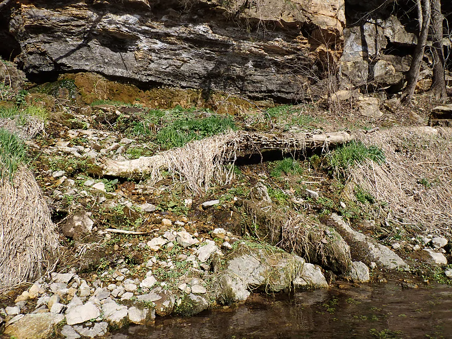
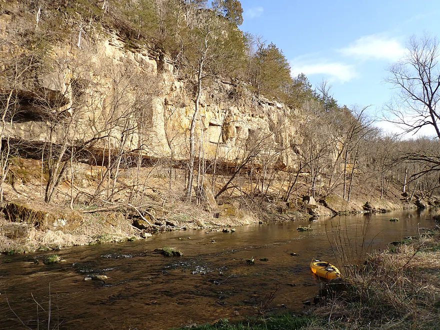
Also a nice outcrop downstream from the bridge
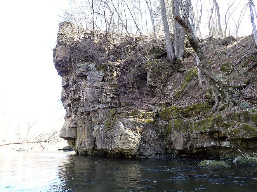
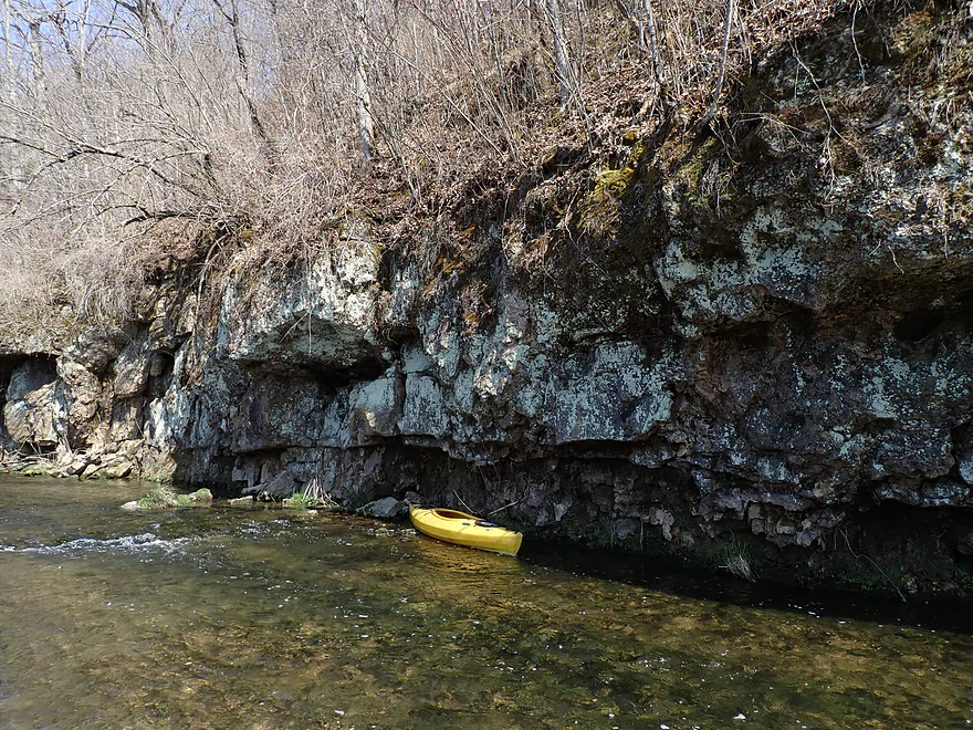
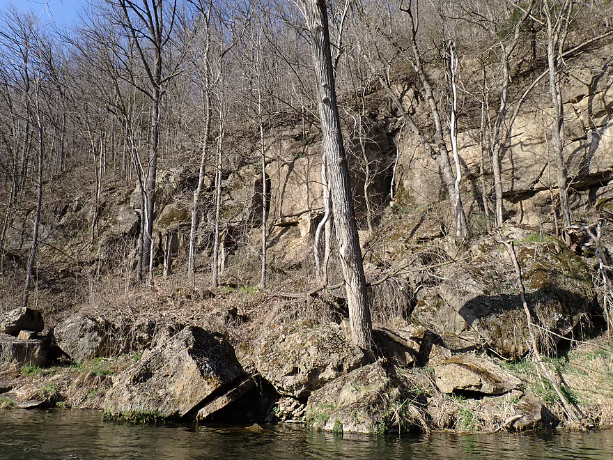
A closeup view
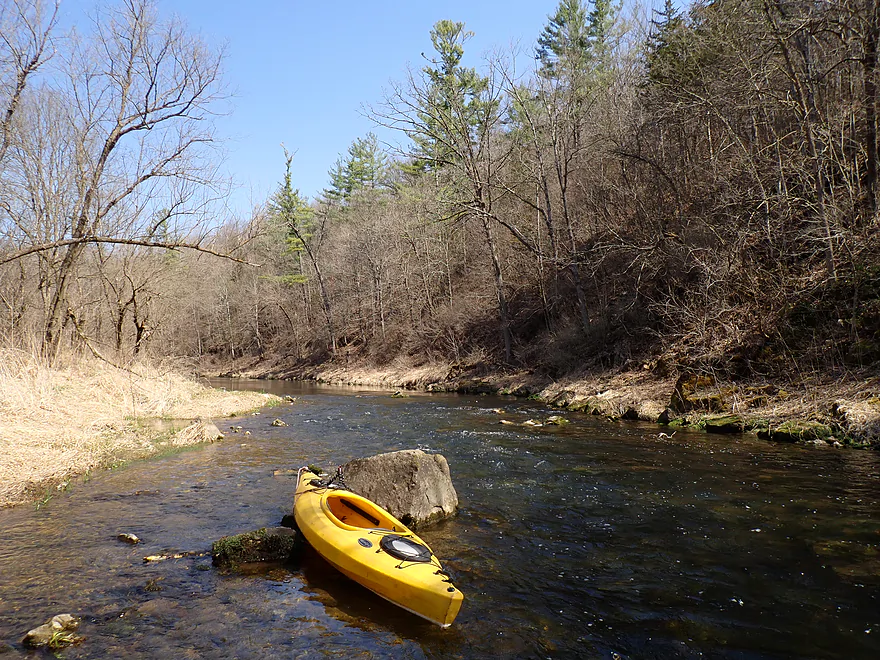
Attractive stretch with pine trees and boulders
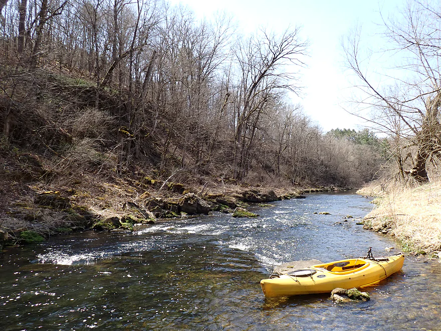
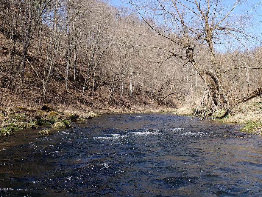
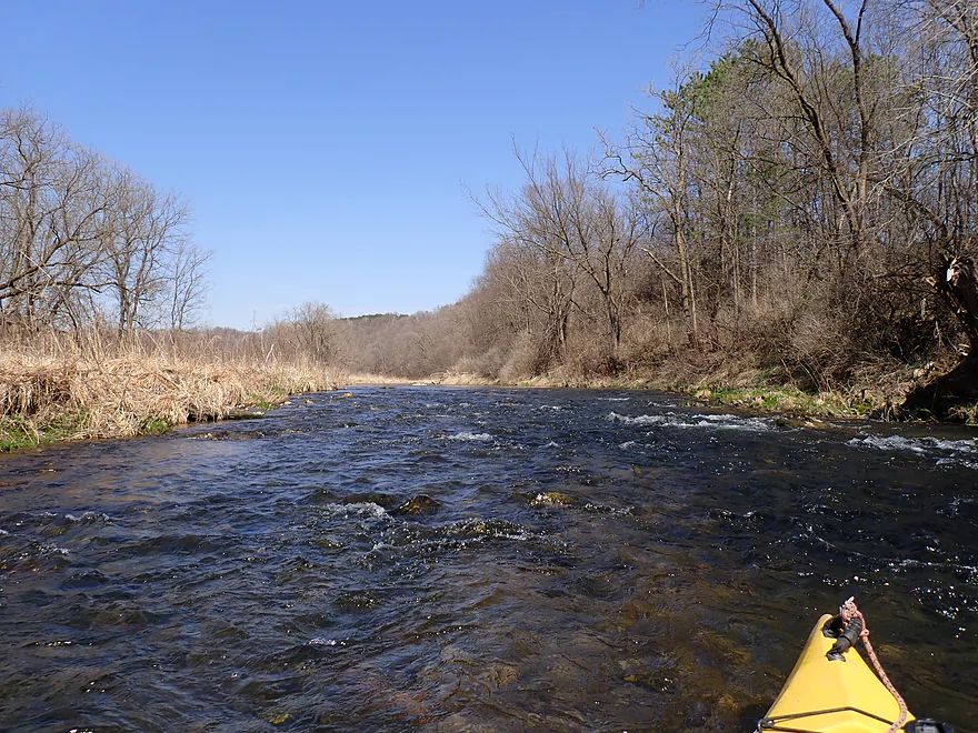
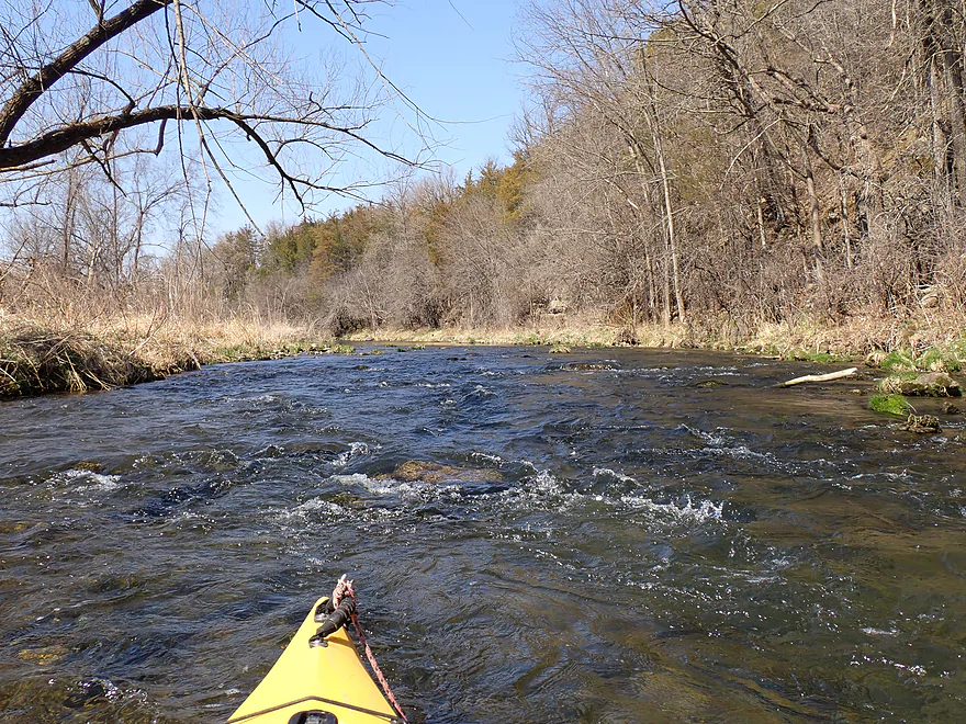
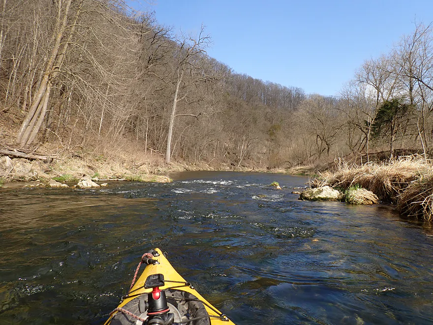
Fun rapids
Good water clarity
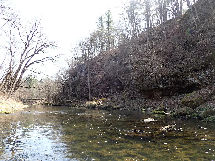
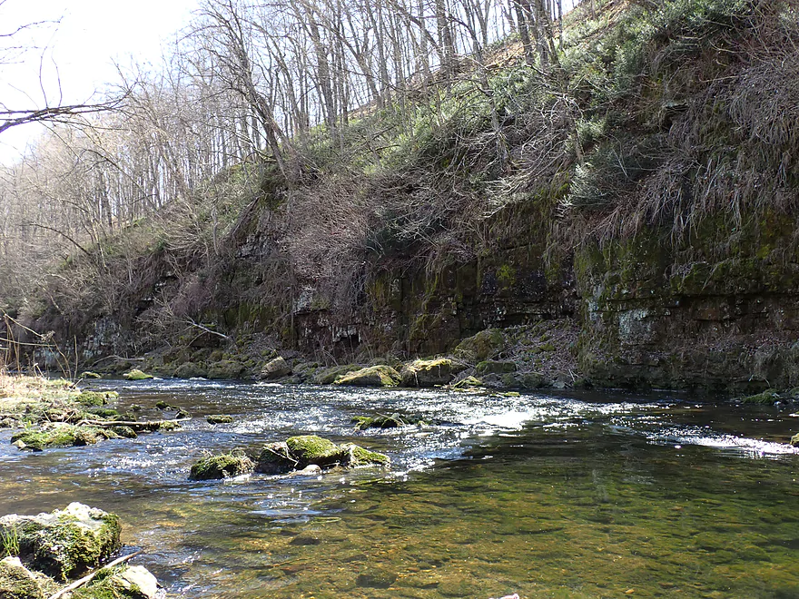
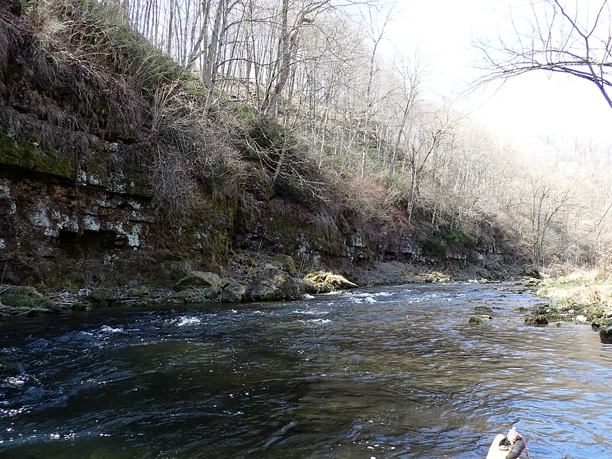
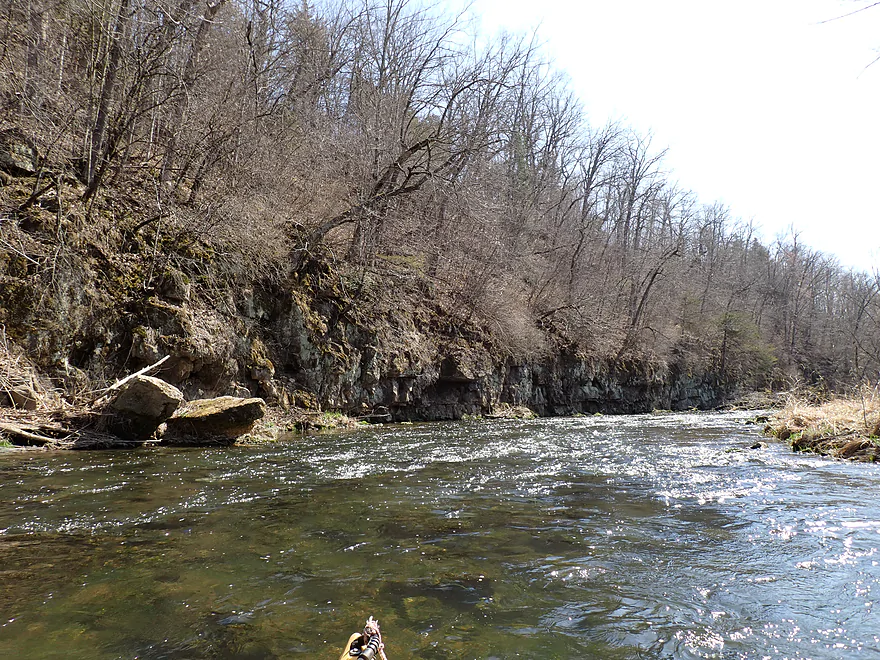
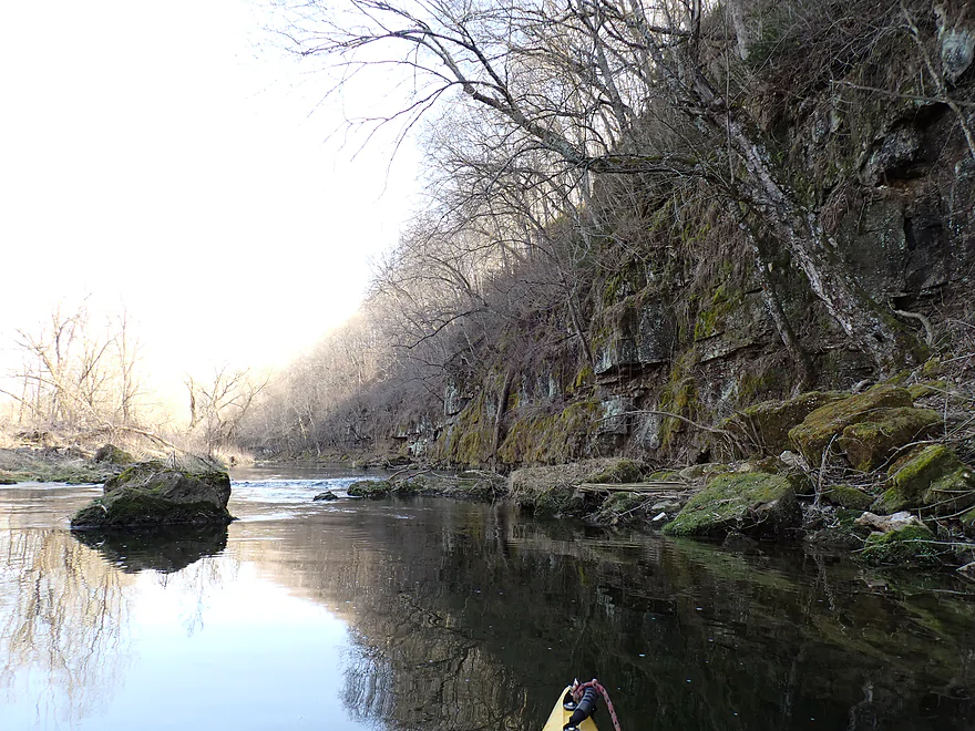
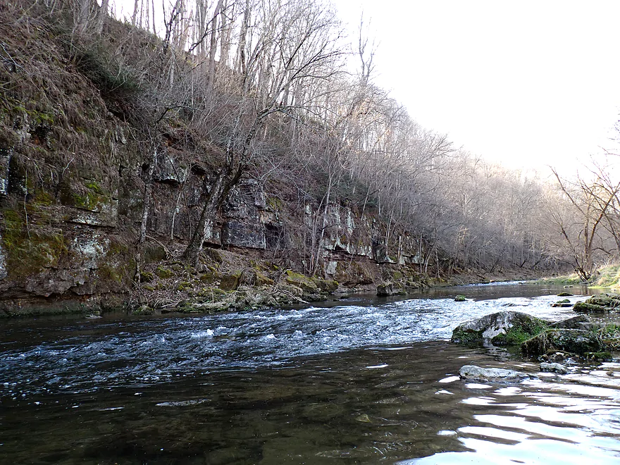
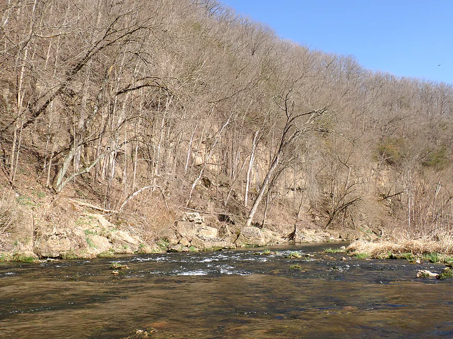
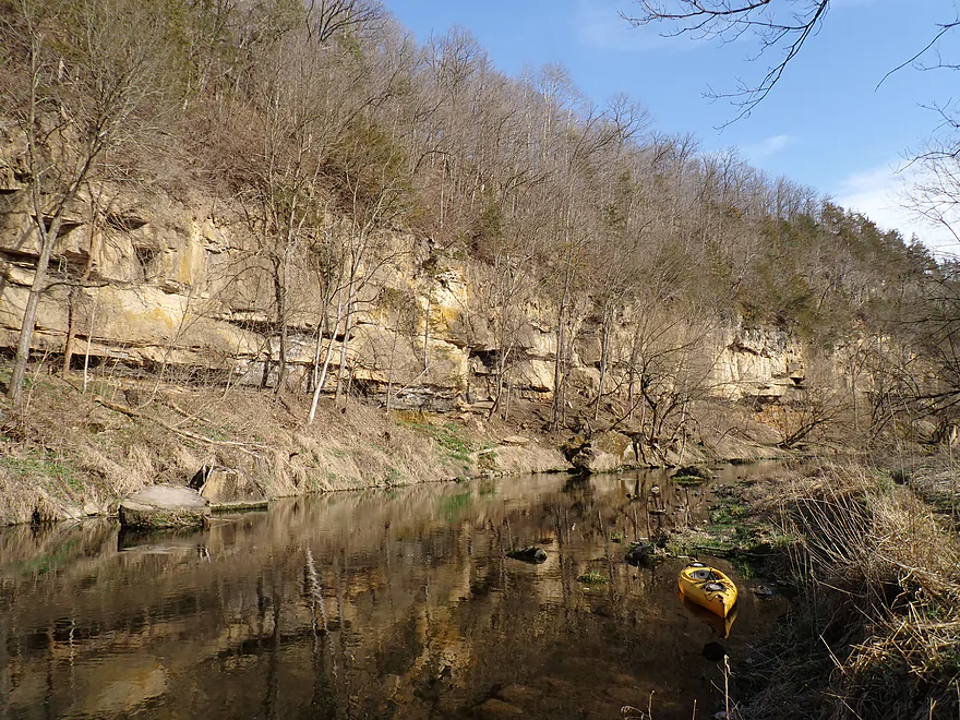
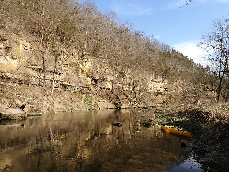
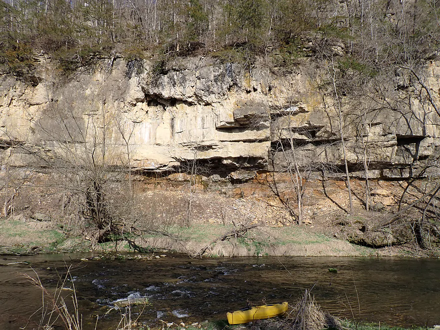
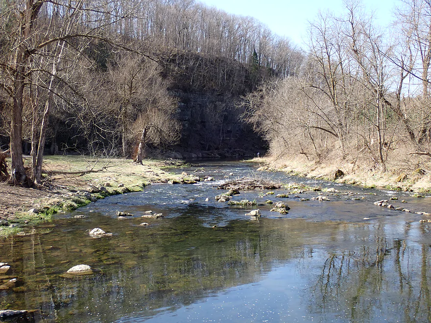
Approaching a big bluff
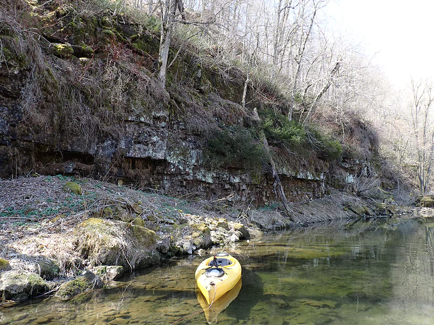
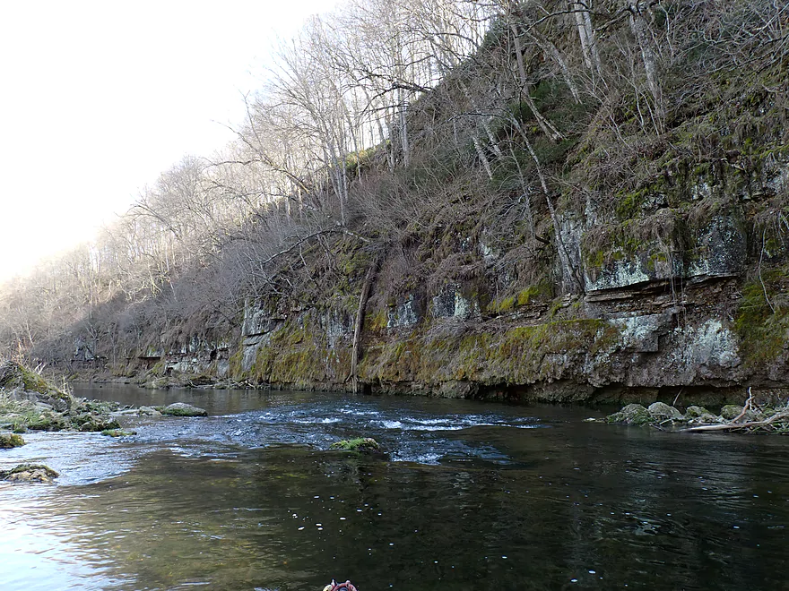
Very old limestone layers capped with yew
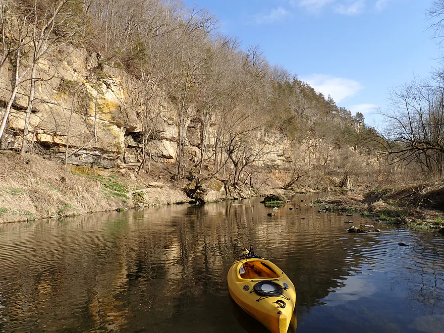
Terrific stretch of rapids and rock walls
Lots more yew on top of the rocks
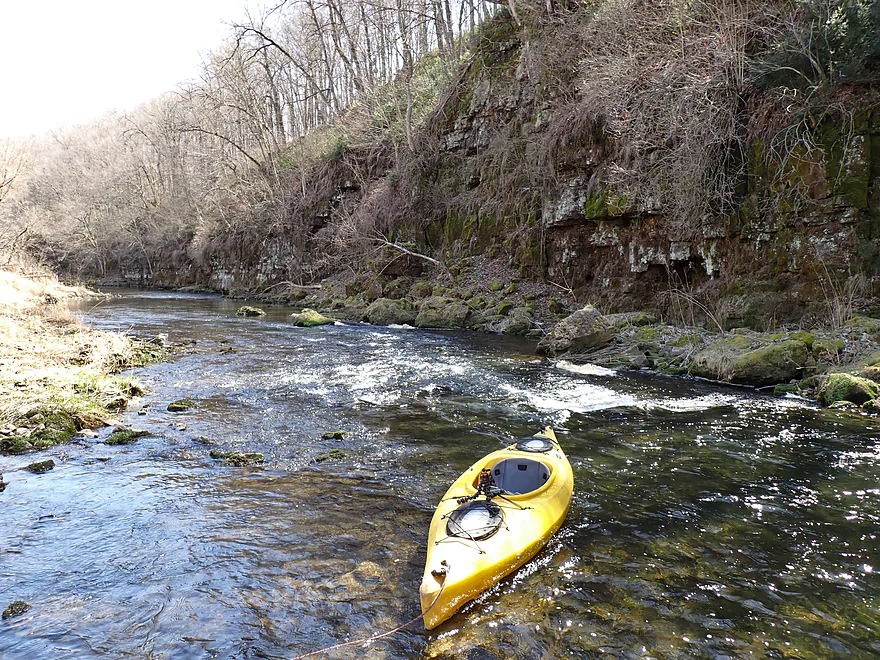
Rapids are followed by a second pitch
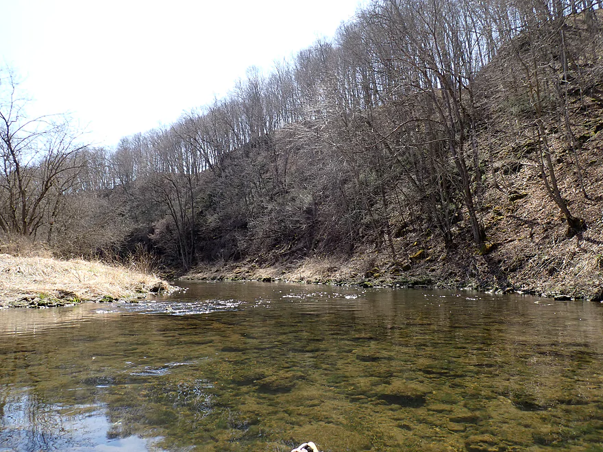
Reverse view
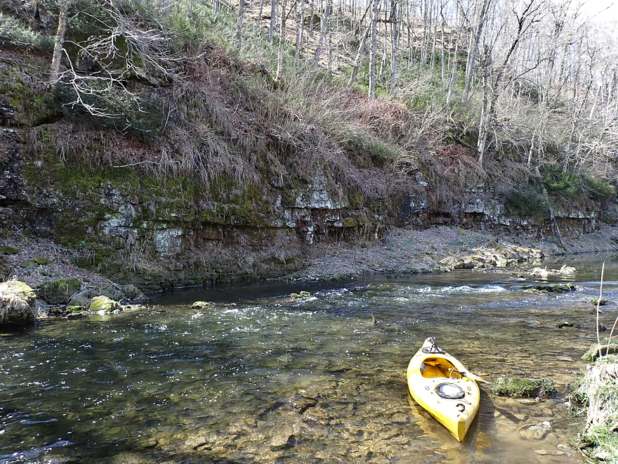
A third and much smaller pitch
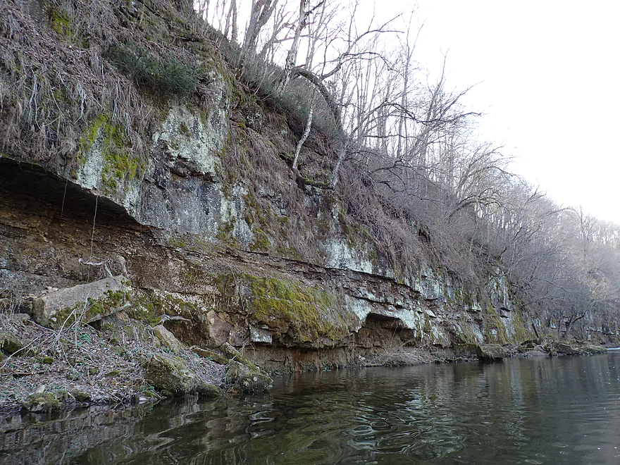
In the summer this cliff face probably has a lot of small plants growing on it
Tree roots breaking up some of the cliffs
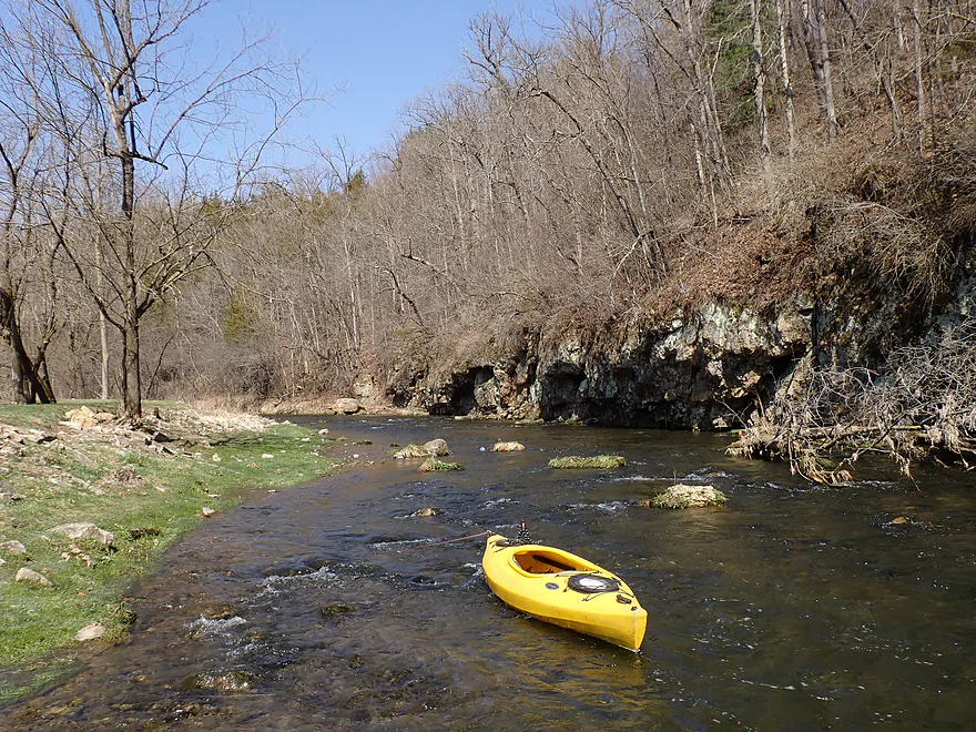
An open stretch…looks like a fish camp on the right
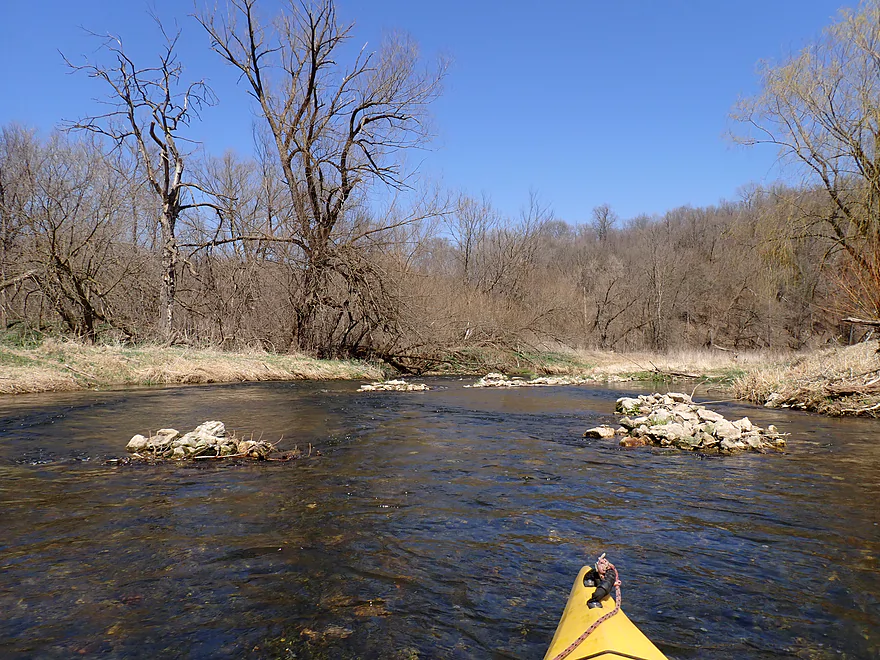
Some of the piles of rocks didn’t look quite natural
Red cedars bordered this stretch
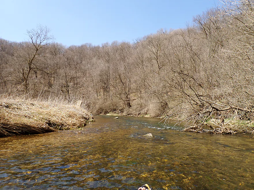
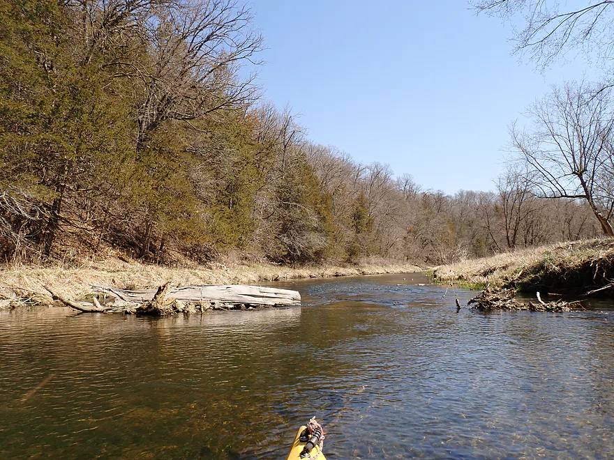
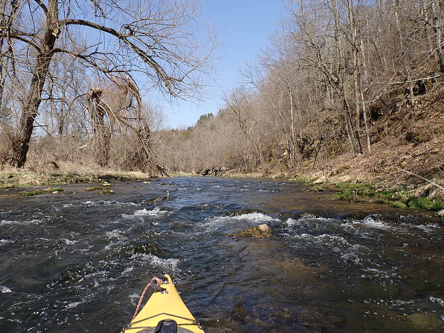
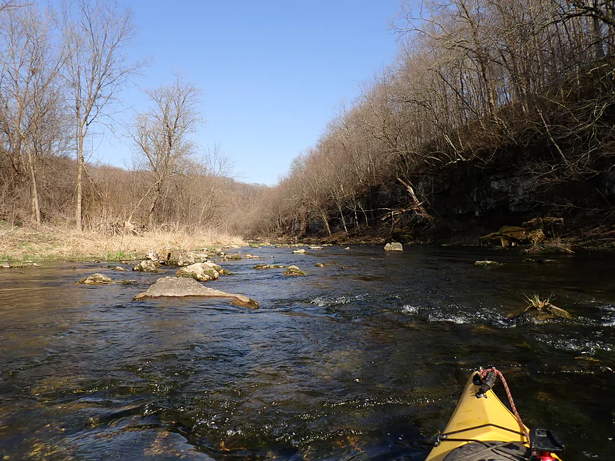
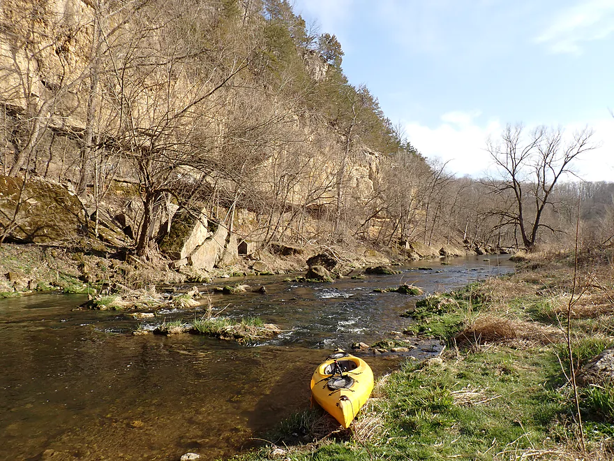
Part of a longer straight stretch
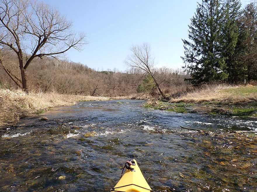
Still many rapids
Boulders keeping things interesting
Many of the rapids were on the shallow side
Approaching another bluff
Some of the faster rapids
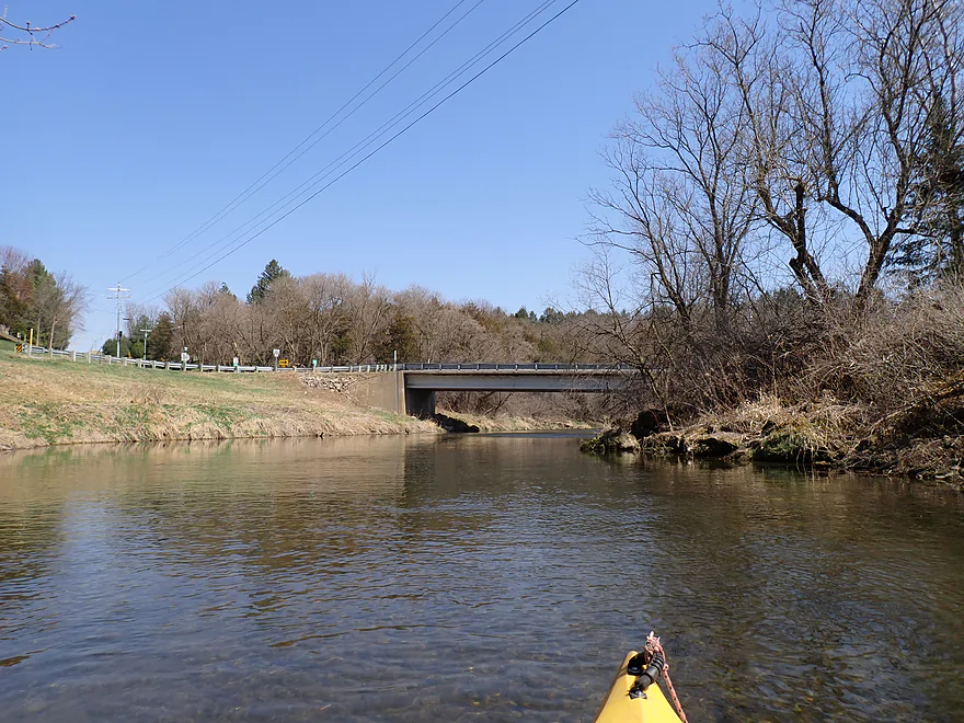
County Road N is an access option
Nice stretch by the town of El Paso
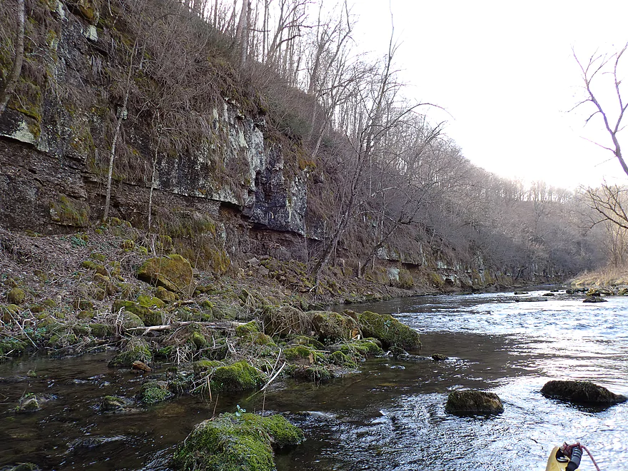
Approaching a rugged rock wall
Rapids are undercutting the rock…really cool
Nice scenery
Final rapids of the El Paso stretch
Crty Trunk G would also be an access option
Left channel of an island…I got a lapful of water here
Another pitch follows the first (eagle nest in background)
Koch Landing is an access option
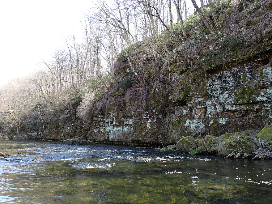
Approaching a significant bluff
Another great combo of rapids and cliffs
Reverse view
The rock wall just goes on forever
Another set of rapids
Reverse view
Nice moss and lichen-lined cliff
It just keeps going
Navigating a shallow boulder field
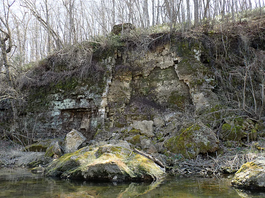
This looks relatively recent
Note the strainer…this would be an easy portage if you prefer
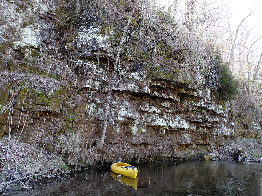
Paddling along a fantastic bluff
Scenic turn in the river
Fun rapids
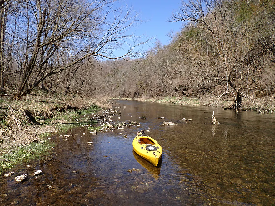
Getting out for pictures
A rugged, rocky shoreline
Fun paddling around the boulders
Terrific palisades (this could be a state park)
Best part of the trip
Couldn’t decide which photos to delete…so some duplicates
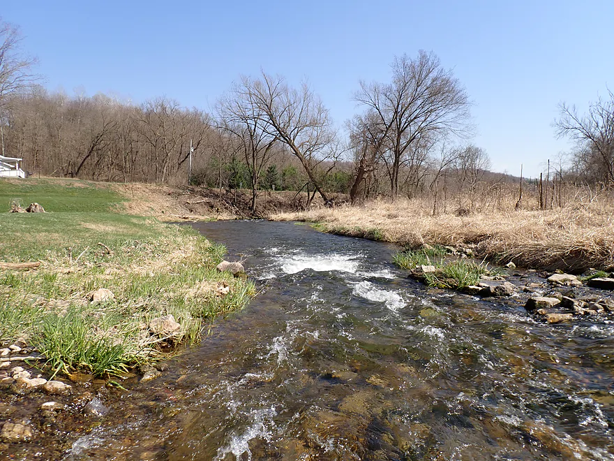
A bubbling spring
Side view
Palisades continue after another pitch of rapids
I had to wait for a fisherman to leave to get this shot
Super cool
Near the end…shallowest rapids of the trip, created by artificial fill
Taking out at 570th Ave…nice access
Looking downstream…there would have been more cliffs if I had extended my trip
Rush River

Rush River is a tributary to the Mississippi located roughly halfway between the Twin Cities and Eau Claire. It’s not very big (really just a creek) and on your average summer day it won’t be navigable (too shallow). The sweet spot of the river is its middle (730th Ave to 465th Ave). The far upper portions are too small, shallow, and flat (relatively) to be of much interest to paddlers…while the last sections flow through a wider flood plain valley with far fewer cliffs.
I had multiple options for starting the trip, but decided to roll the dice on 690th Ave. I was pleasantly surprised to discover a trail leading to the water and a decent parking area. The local fishermen hadn’t seemed to figure out the parking situation though…some were parked horizontally and some vertically, which I found funny. The access by the bridge was incredibly scenic..there were outcrops downstream AND upstream of the bridge (always a good omen to start a trip).
The gorge upstream from the bridge looked inviting so I paddled against the current ~1000′ upstream to check it out. That had me wondering if I should have launched from the upstream bridge instead (730 Ave), but I knew I wouldn’t have too much time that day.
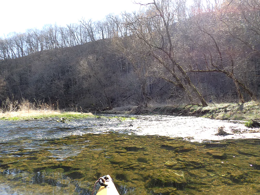
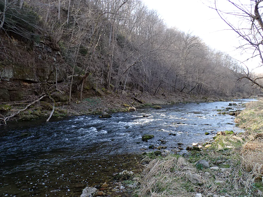
Downstream from the bridge I passed a cool “Kickapoo-ish” outcrop on my right and then a series of shallow Class 1 rapids. Rush River used to have a depth gauge, but unfortunately (and completely unnecessarily) it was inactivated. I knew from the nearby Eau Galle gauge that the watershed had received a decent amount of rain about 5 days before, but since then the river had been dropping fast. Most of the Rush River itself is actually plenty deep…but the issues are its many rocky riffles and rapids. At 24 CFS it was manageable in my case because I had a shallow drafting boat and could read the chutes between the rocks well, but I still hit a number of rocks and got hung up a few times. Most paddlers will want to do this at a higher depth (which is unfortunately tricky to time).
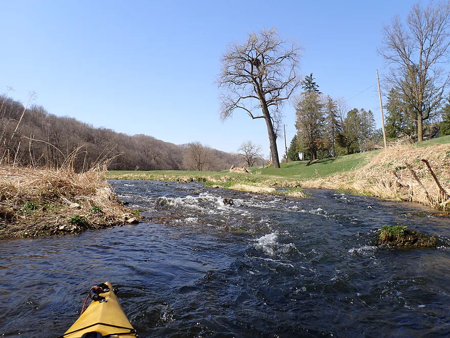
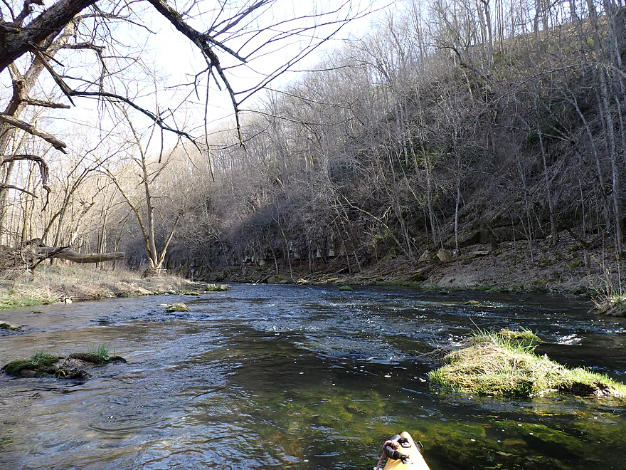
The river channel twisted sharply between and through incredibly scenic bluffs. I believe the Rush River is at the northernmost border of the Driftless Area which would explain the steep terrain, but I honestly don’t know. So many Driftless Area maps show completely different and contradictory borders! In many ways the Rush reminded me of the Kickapoo with its tight turns set against steep cliffs and bluffs. The scenery was incredible and often better than the Kickapoo. Imagine the Kickapoo but with more boulders in the water, clear water, and rapids.
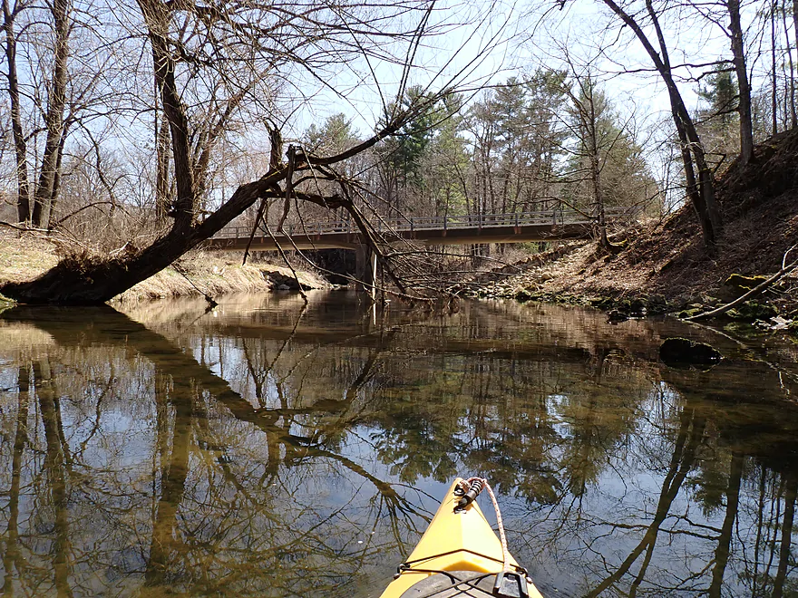
After passing some fellow kayakers, I reached El Paso, which was roughly the halfway point (3 miles) in the trip. Paddlers could certainly take out here (either town bridge) if they wished. The short quarter mile stretch between the El Paso bridges was scenic with fun rapids and a fantastic undercut rock face (perhaps a future cave in the making).
The second half of the trip (570th Ave) was very different. It wasn’t as intimate or scenic (to start), and the rapids were noticeably rougher (more Class 2’s as opposed to Class 1’s). While most of the trip flowed past undeveloped shoreline (really nice), there was a collection of houses along the river by El Paso. There were a few outcrops just downstream from the town, but they weren’t as nice as the ones further upstream.
After paddling a long, flat, slow stretch that had me thinking I was coming up on a dam, I came to a fork in the river and the start of a 500′-long island. The right channel looked shallow, while the left had some rough rapids around tight turns, including a two-foot drop to start. I opted for the rapids and did ok, but I could see how beginner paddlers could struggle with these. I don’t want to make the rapids sound too dangerous though as portaging would be pretty easy. Also the rapids were typically shallow so would be somewhat forgiving (although in very high water it would be a different story). I did portage one set of twisty shallow rapids with a strainer I didn’t feel comfortable running. No shame in that.
At the end of 425th Street, I discovered a nice park (Koch Land Fishing Area) and made a mental note to add it to my map as an access option. This section of the river, while scenic, was much more open and not as striking as the previous legs. There were boulders and you could see an inviting bluff in the distance, but I was thinking at the time that the second half of the trip just wouldn’t measure up to the first. That would change though…
The river made a sharp horseshoe bend east and flowed past a series of incredibly scenic limestone cliffs and rapids. These bluffs I would rank second best of the entire trip.
The Rush is one of the most popular trout streams in the state with fishermen. But I actually don’t think it is the fish per se that attract so many anglers (although there were many above El Paso), but more so the river scenery.
The best would be saved for last though. For one final hurrah, the river is redirected south by a huge bluff and series of palisades. While most of the previous outcrops were more of a rough limestone, this final rock was a smoother and lighter limestone which really lit up nicely from afternoon sunlight. The scenery with the boulders, rapids, and palisades was incredible…among the best I’ve seen on a paddle.
Just around the bend was the take-out at 570th Ave. This was a great public access, but ironically the shallowest rapids of the ENTIRE trip were located here. I suspect there was artificial riprapping done by the access and they went overboard and created an almost unnavigable boulder field. In the downstream distance I could see more cliffs and bluffs, which were inviting, but those would have to be saved for another trip.
In conclusion this was a terrific trip…best so far for 2024. If I had a six star rating system, it would get that sixth star. If I had a hall of fame for paddling trips, it would be up there. Unfortunately I doubt the Rush will ever be that popular with kayakers (I can hear trout fishermen letting out a sigh of relief). On average, it’s just too low. I did this at above normal levels, and that was still pretty low and only barely viable by my lenient standards. On the flip side, the river immediately after a heavy rain will be too pushy and dangerous. On top of this, paddlers should ideally do a trip outside of summer when the many cliff faces won’t be so hidden. Timing that perfect trip on the Rush won’t be easy, but it is worth it. Even if water levels are perfect, you will still need good boat control to go through and around the rapids. Paddlers looking for a similar water trail but with more reliable depths may want to consider the nearby Kinnickinnic River.
Sights included geese, a few eagles, and several fishermen. The highlights were the large schools of fish (more so upstream from El Paso). The Rush is famous for its many natural and stocked trout populations.
Crystal Cave: Crystal Cave is over a mile in length, making it the longest cave in Wisconsin. It is only 6 miles NE of El Paso.
690th Ave: This is a great public access with a small parking lot to the north and a trail leading to the water. It’s also super scenic.
Alternate Put-ins:
- 730th Wayside/Wonderland (2.4 miles upstream from 690th Ave): There appears to be a public fishing access by what Google calls “Wonderland”. This bonus leg would have elite scenery with incredible wooded bluffs and outcrops.
- 730th Ave Bridge (2.9 miles upstream from 690th Ave): I think 730th Ave would be a doable bridge access. This would be the same leg as above, except it would be a half mile longer and include one additional scenic bluff.
- El Paso (~3 miles downstream from 690th Ave): You could certainly launch from either bridge in town…the fishing signs will show where you can park and access the water. But launching here would exclude a really scenic stretch of the river.
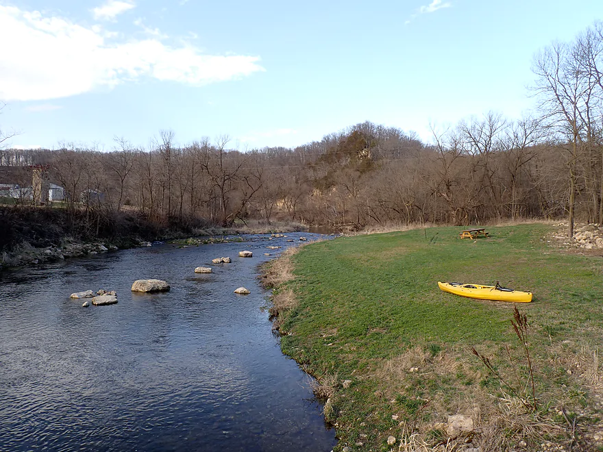
570th Ave: This is a great access (aside from the crazy shallow rapids by the bridge). A parking lot is available northeast of the bridge with a lawn and picnic table nearby.
Alternate Take-outs:
- Koch Fishing Area (1.5 miles upstream from 570th): I mean you could take out here and it would be a good access, but then you are getting out RIGHT BEFORE the best leg on the entire river.
- Hwy 72 (1.5 miles downstream from 570th Ave): This is not a great bridge access…parking is not allowed on the west side and there is a guardrail and big bank on the east side. But…I think it should be doable. This bonus stretch should include three tall bluffs with multiple outcrops.
- 465th Ave (4.0 miles downstream from 570th Ave): This seems like a viable bridge access used by trout fishermen. This bonus leg would likely be the last of the “great” Rush River legs…from here to the Mississippi I suspect the river would be much less interesting.
Bike Shuttle – 570th Ave to 690th Ave: 5.8 miles with 348′ of ascent. This shuttle has some pretty big hills to climb and there is one mile of gravel to bike over, but all in all it seemed pretty manageable.
Logjams/Dams/Fences: None.
Rapids/Current: There were a large number of rapids on this trip. Upstream from El Paso they were mostly minor (Class 1). Many were shallow and required tight maneuvers to get around inconveniently placed rocks.
Downstream from El Paso the rapids are stronger and trickier (Class 2+). In high water several of these pitches will reach Class 3 difficulty, mostly because of the incredibly tight turns required (see video). I don’t want to discourage paddlers too much though, as portaging any problem rapids would be incredibly easy.
Strainers: If memory serves me correctly there were two instances below El Paso where the current flowed under low hanging branches. There was also a minor strainer above El Paso. Paddlers could easily portage these issues if need be.
Closest Gauge: Eau Galle River @ Spring Valley
Trip Depth: 35 CFS or 12.77′
Navigability Estimates: Note the Rush River gauge was needlessly decommissioned. Paddlers will instead have to rely on the nearby Eau Galle gauge which isn’t a terrible analog, as both rivers are similar and located side by side.
- < 16 CFS: The river rarely gets this low.
- 16-23 CFS: A very low depth. Likely too low for paddling.
- 24-30 CFS: A low depth. A number of rapids may have to be waded. Only suitable for adventurous paddlers.
- 31-40 CFS: Many of the rapids will be bumpy and require tight maneuvers. Acceptable at my 35 CFS depth (barely in my book) and for the other kayakers on the water, but I presume most will want more padding…especially if you have a deep drafting boat.
- 41-60 CFS: Some of the rapids may have some bumps, but IMO this is a good target depth range.
- 61-80 CFS: All rapids should be well padded at this point. Some too much. There could be some tricky Class 3 rapids to deal with. Paddlers should be vigilant and portage anything they don’t feel comfortable running.
- 81-100 CFS: A high depth. Likely suitable for those with whitewater experience and having maneuverable boats.
- 101-150 CFS: A very high depth. Only for those with good whitewater skills.
- 151-200 CFS: Only for advanced whitewater paddlers.
- 201+ CFS: Maybe too high for any skill level? I don’t know. If you know more feel free to leave a comment.
Click here to see an overview map of the Rush River.
- Upstream from Hwy 29: The Rush in its upper reaches may yet be navigable, but I don’t know. I suspect it is a bit small and lacks good scenery.
- Hwy 29 to Hwy 63/Martell: 1.9 miles. A relatively flat section that might have a few outcrops. Satellite images suggest rapids and maybe one major logjam.
- Hwy 63/Martell to 780th Ave: 0.7 miles. Here the river is a small creek with steep cedar-topped banks and occasional outcrops. This was part of a trip done by paddling author Rick Kark who liked it. Streetview of the area is scenic.
- 780th Ave to 730th Ave: 1.7 miles. Likely a good prospect with multiple outcrops and light rapids.
- 730th Ave Bridge to 730th Ave Wayside: 0.5 miles. River is turned east by a major bluff that is likely scenic.
- 730th Ave Wayside to 690th Ave: 2.4 miles. An elite prospect with incredible wooded bluffs and outcrops.
- 690th Ave to 570th Ave: 6.0 miles.
- 690th Ave County Road to N/El Paso: 2.9 miles. One of the best and most scenic stretches of the river with many trout, outcrops and four scenic bluff stretches. There are many rapids and most are easy class 1’s but rocky and congested. In high water these may be more difficult. Portaging the rapids should be easy in most cases.
- County Road N to County Trunk G: 0.3 miles. Scenic stretch with multiple undercut outcrops and rapids.
- County Trunk G to Koch Fishing Access: 1.1 miles. A relatively open and straight stretch with “just” a few outcrops. Warning this stretch has by my count three tricky rapids that require tight turns. Figure Class 2+…Class 3 in high water. These should be easy to portage if you prefer.
- Koch Fishing Access to 570th Ave: 1.5 miles. One of the best and most scenic stretches of the river. Includes an amazing gorge filled with limestone outcrops and Class 2 rapids. This is followed by a tall bluff with light colored limestone palisades…really cool looking. The rapids are not as strong as the preceding subleg, but could be tricky in high water. Most should be easy to portage if need be.
- 570th Ave to Hwy 72: 1.5 miles. A great prospect with what appears to be three large and steep bluffs.
- Hwy 72 to 465th Ave: 2.5 miles. I think this is the last of the segments with good scenery…rest of the downstream sections will be less interesting.
- 465th Ave to 450th Ave: 1.0 miles. This is a flat, sandy stretch with at best one outcrop. Lost Creek adds significant volume to the Rush River.
- 450th Ave to Hwy 10: 3.0 miles. This stretch should be less rain dependent and have pleasant scenery, but nothing elite or like the upstream legs. There might be one outcrop though. Warning, satellite images suggest there may be some strainers or downed trees by fast current.
- Hwy 10 to 385th Street: 4.5 miles. Likely a generic stretch. Be careful of downed trees in fast current.
- 385th Street to Hwy 35: 5.6 miles. I don’t know much about this leg, but I doubt it is anything special. There could be a logjam.
- Hwy 35 to Maiden Rock Boat Ramp: 2.4 miles. Half of this goes through the Rush River Delta which appears to be mostly floodbottom paddling, but does contain a monster logjam visible from satellite. Second half is the Mississippi and could include some decent sandbars.
Trip Map
Overview Map
Video
Photos Size:
I just paddled from Martell to 570th & 570th to 5 miles south of US10 (County A intersects East Rush River Road) when the river had the rare good water depth, incredible! FYI, the rapids around 570th are low because of a bridge blow out a few years back and reconstruction.The Rush River gauge is not out of comission, just delisted probably due to inaccuracy, see 05355322 https://waterdata.usgs.gov/monitoring-location/05355322/#parameterCode=00060&period=P7D&showMedian=true Any reading over 86 cfs is highly suspect. IMO, you are vastly underestimating the required depth from Eau Galle, it should be at least 50cfs in combination of a high cfs of nearby Kinnickinnic. Look for a large blip (increase) in both rivers, and go quickly, it won’t last long. Then Rush will be a rush.
Thanks Mark for the info and updates.
Your attention to details here is remarkable! We’re just in area to hike the SNA’s. Started with Morgan Coulee. Looking at creating a hiking and maybe combo kayaking on River. Your info was invaluable! Many thanks!
Here is a recent video taken on 5-22-2025: https://www.youtube.com/watch?v=lJUV_xZtKt8 . You can see the water levels are much higher (350 per the Eau Galle River gauge) and the main bluffs are mostly buried behind vegetation.