
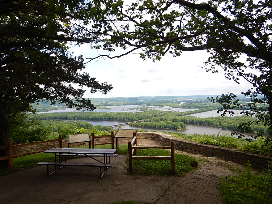
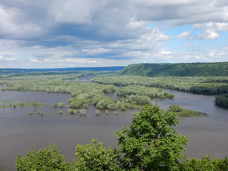
Confluence of the Wisconsin and Mississippi Rivers from Point Lookout
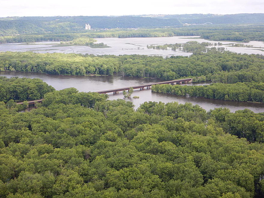
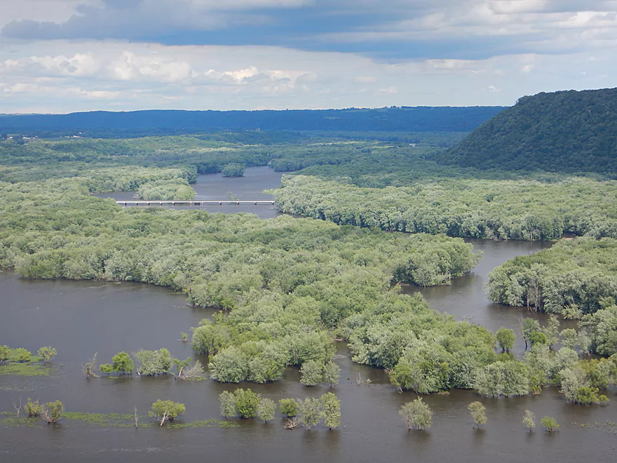
Close-up of the railroad bridge and delta filled with silver maple
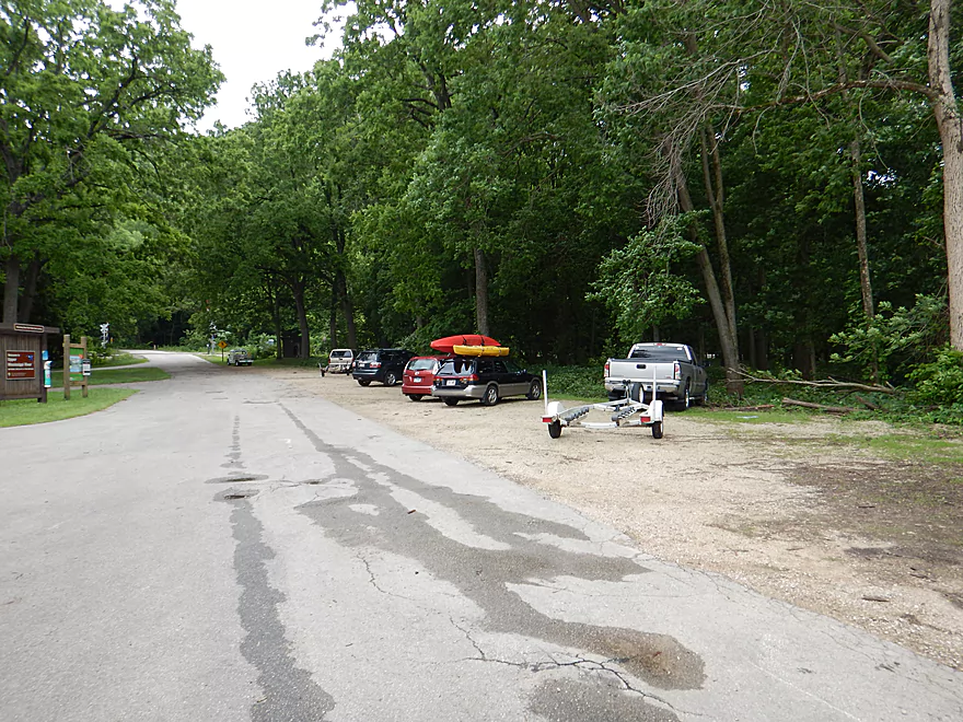
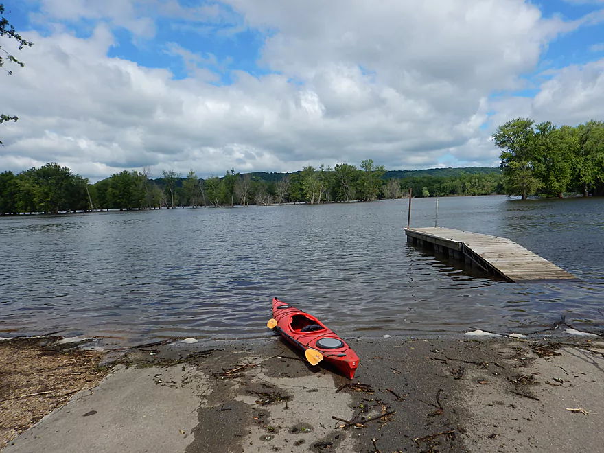
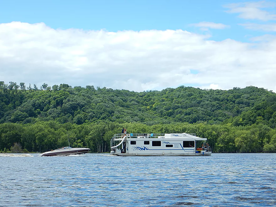
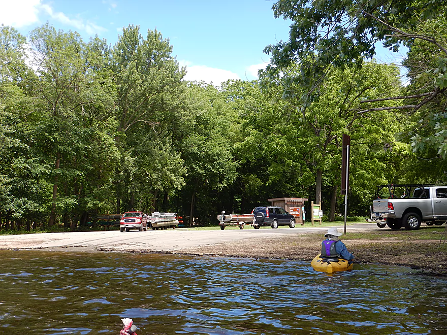
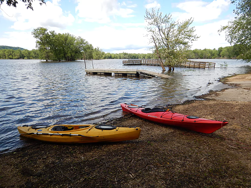
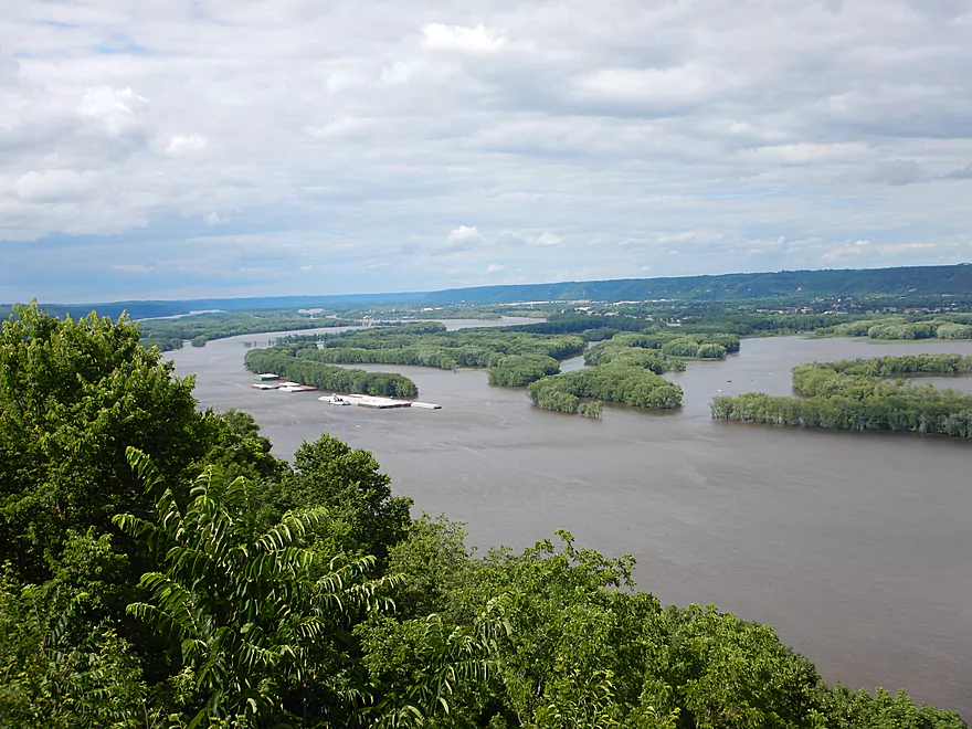
The main boat ramp at Wylausing
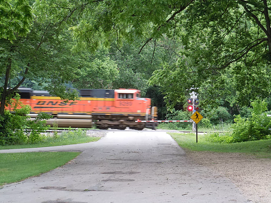
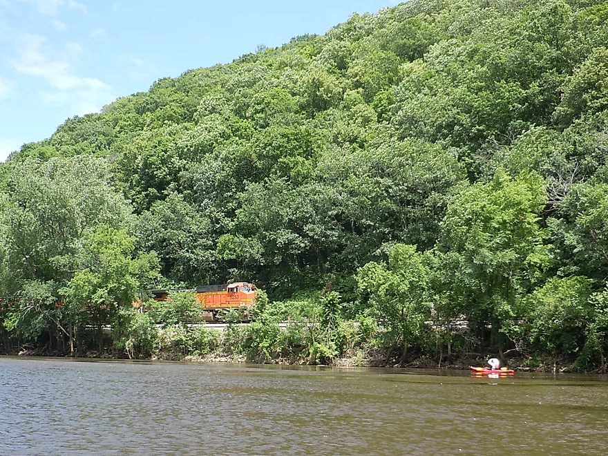
Trains are fast and frequent
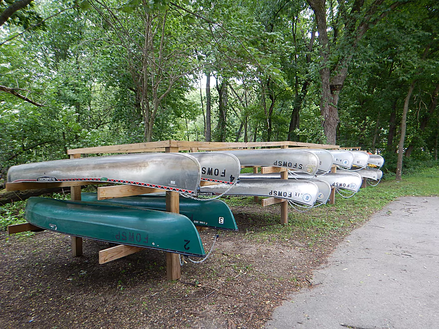
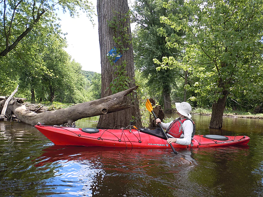
Canoe and kayak rentals are available
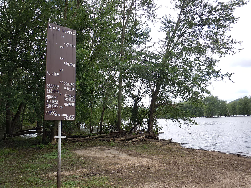
The Mississippi can get quite high…
But only minor flooding that day
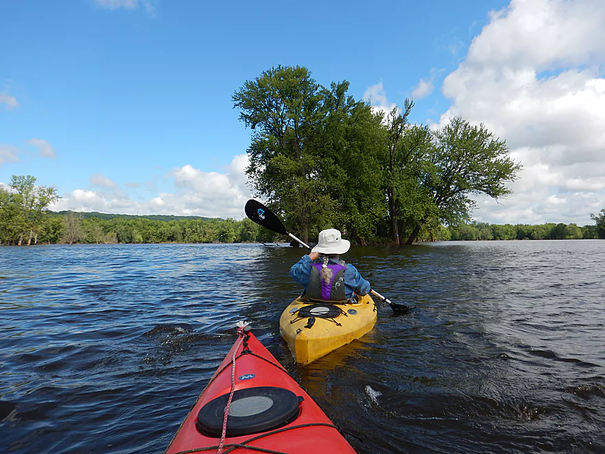
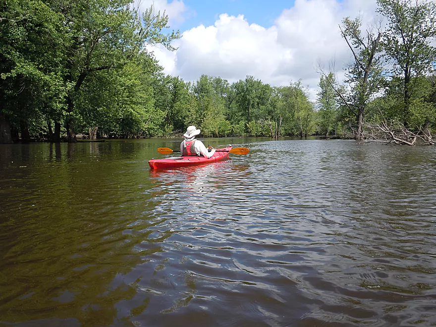
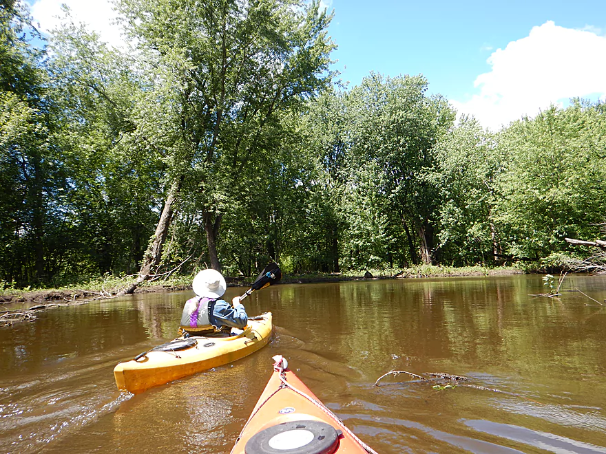
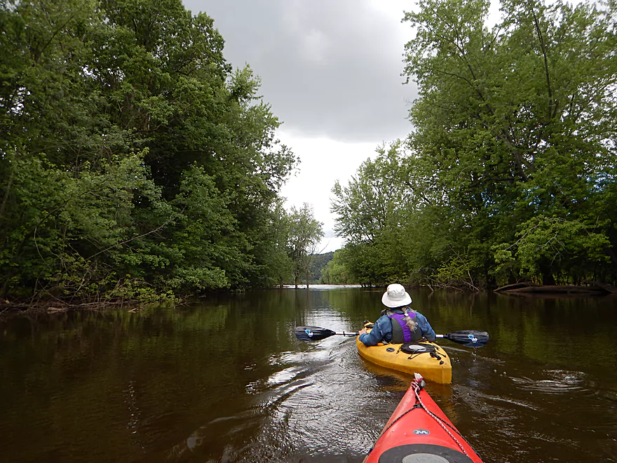
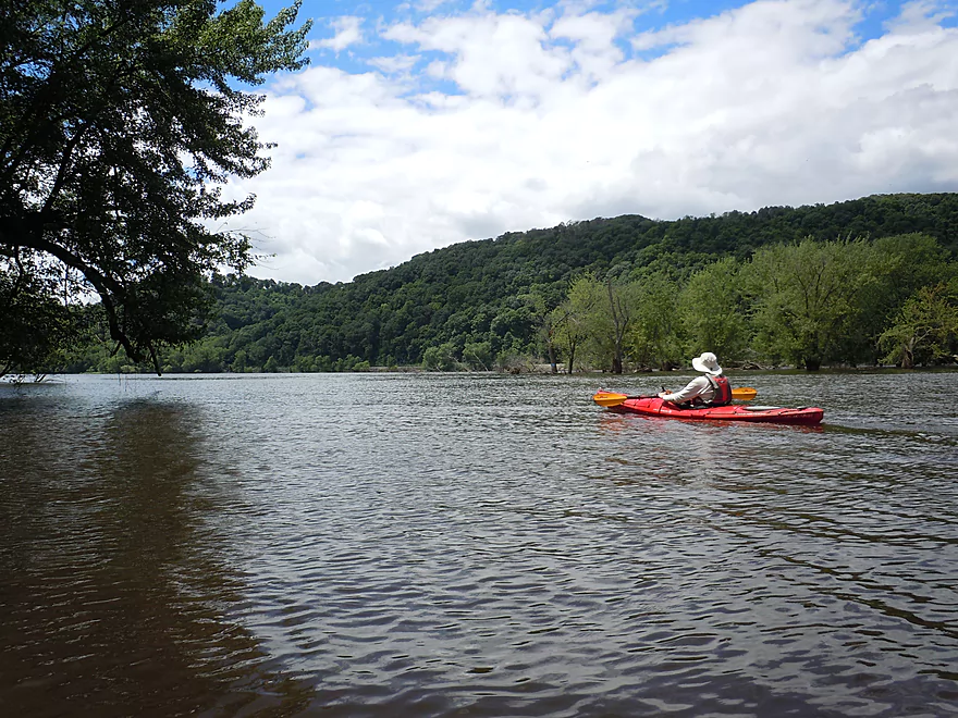
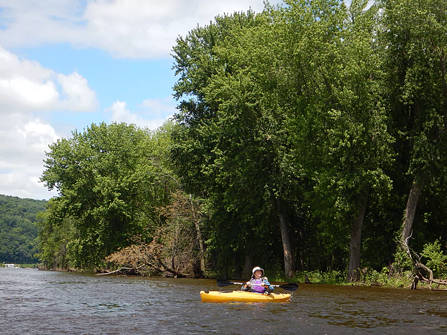
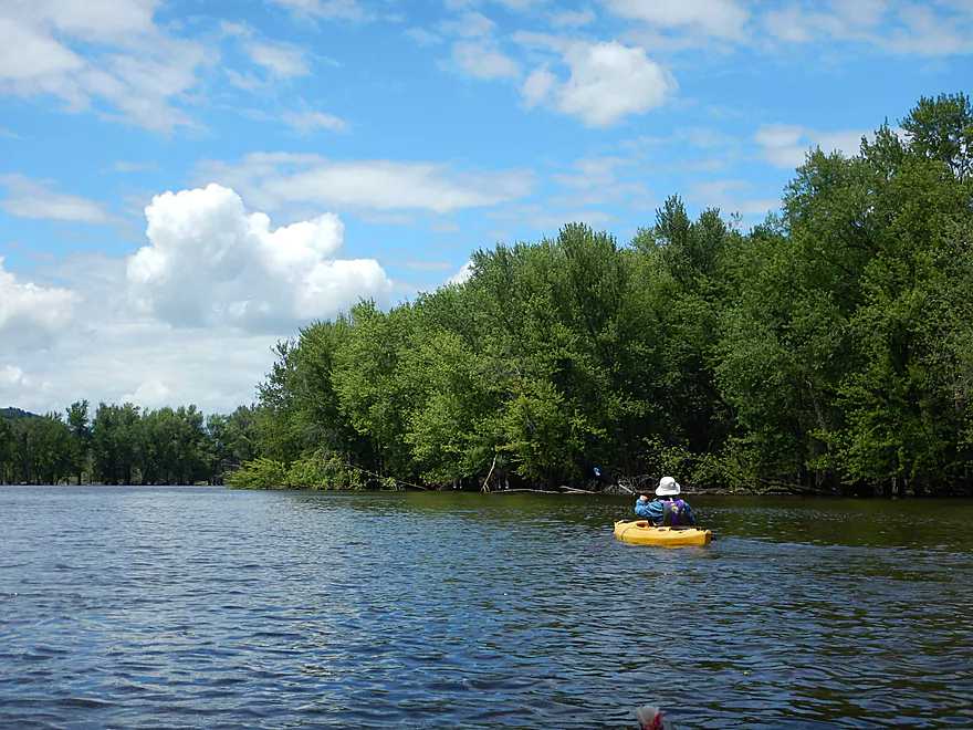
Starting the trip on Glenn Lake
The first of many water trail signs
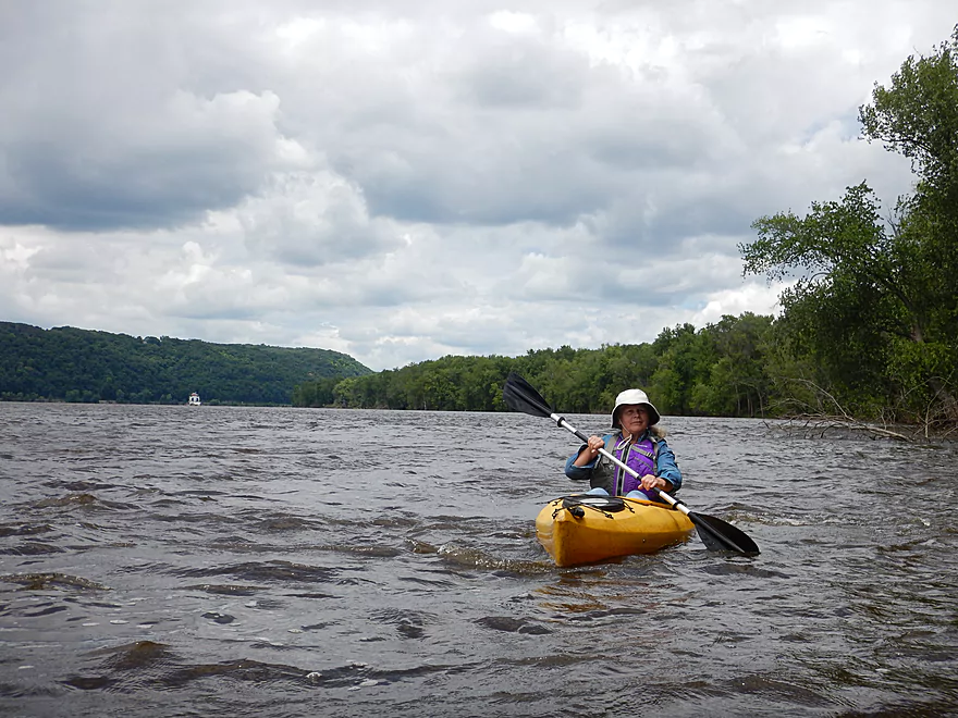
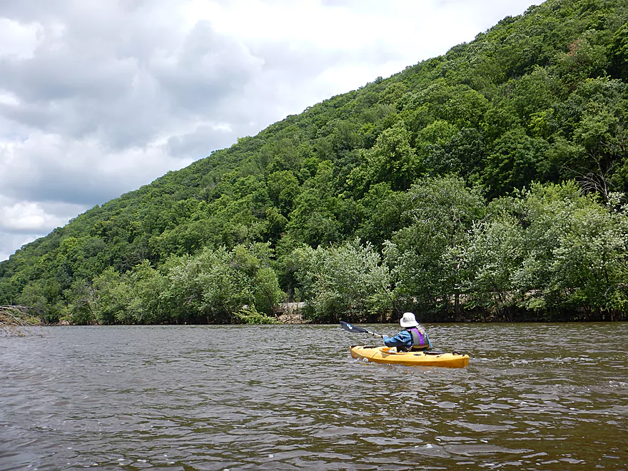
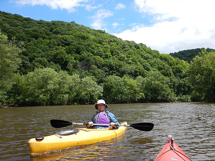
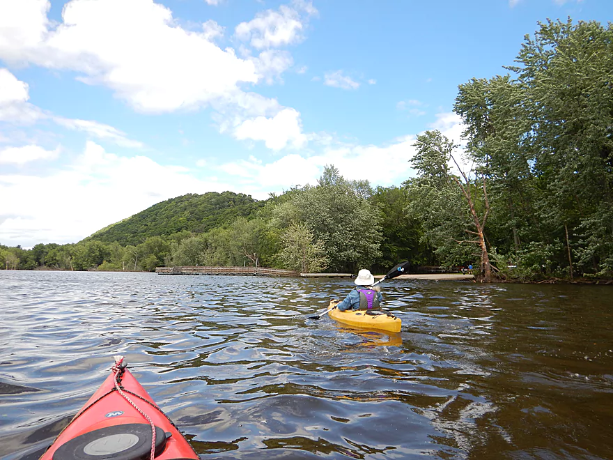
Scenic bluffs to the right
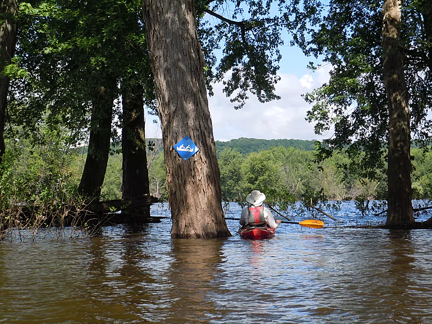
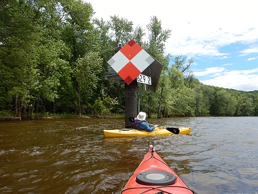
Another trail marker on a partially submerged island
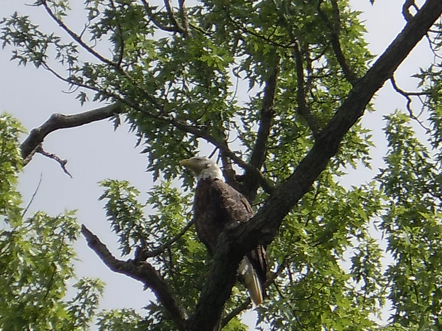
Saw many eagles (or the same eagle many times)
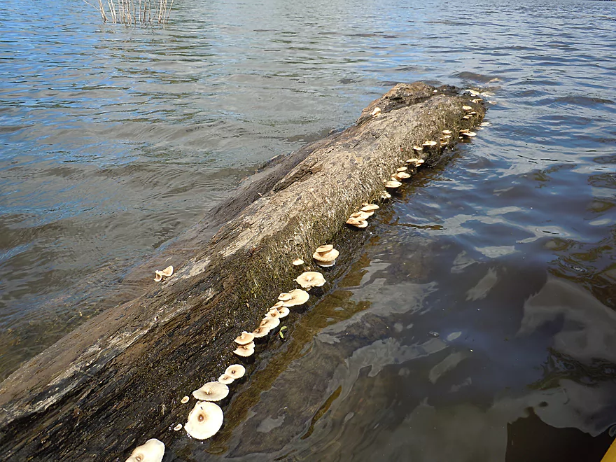
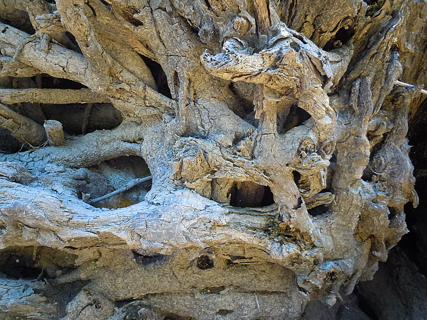
Fungus staying just above the water line…
Ahead is the proper water trail mouth
Which we skipped and instead took the wrong channel to the right
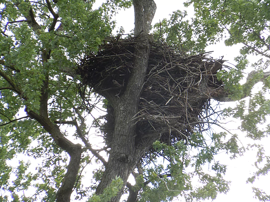
Massive eagle nest
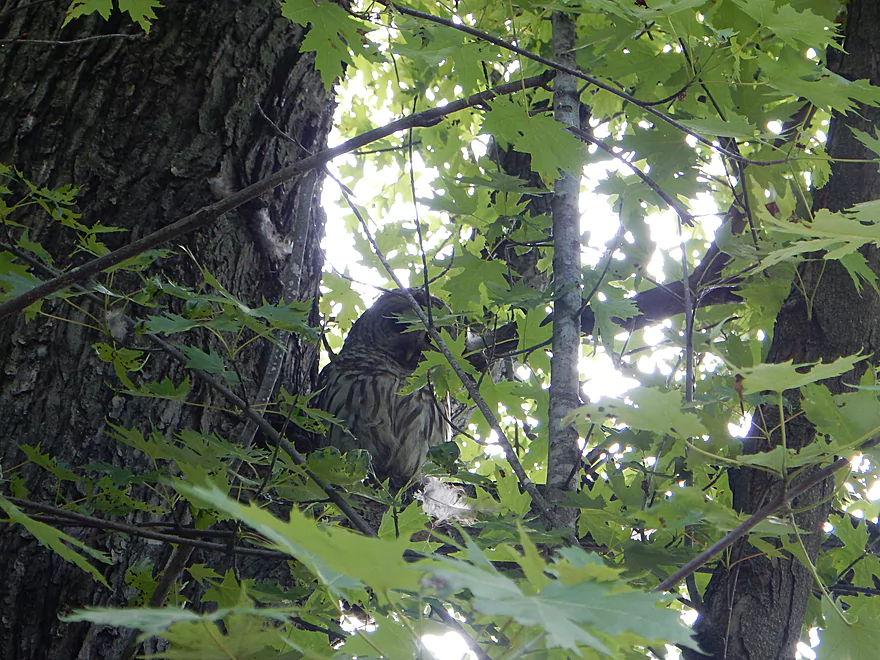
A juvenile barred owl
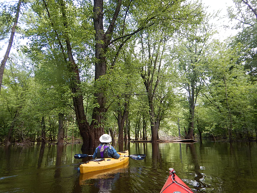
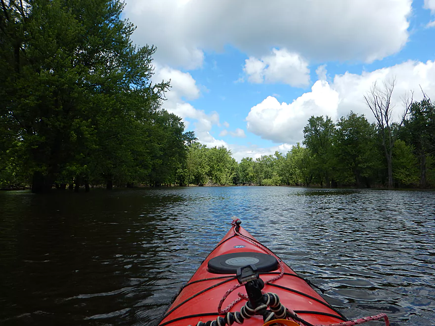
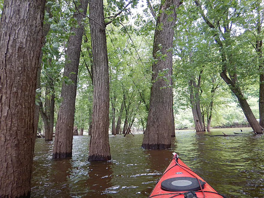
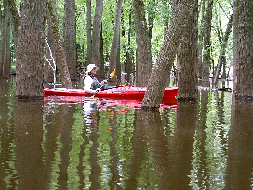
Getting lost in a floodplain forest
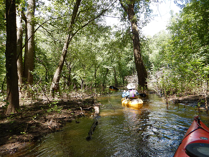
Desperately trying to find current
Giving up and backtracking
Glad we did not portage…
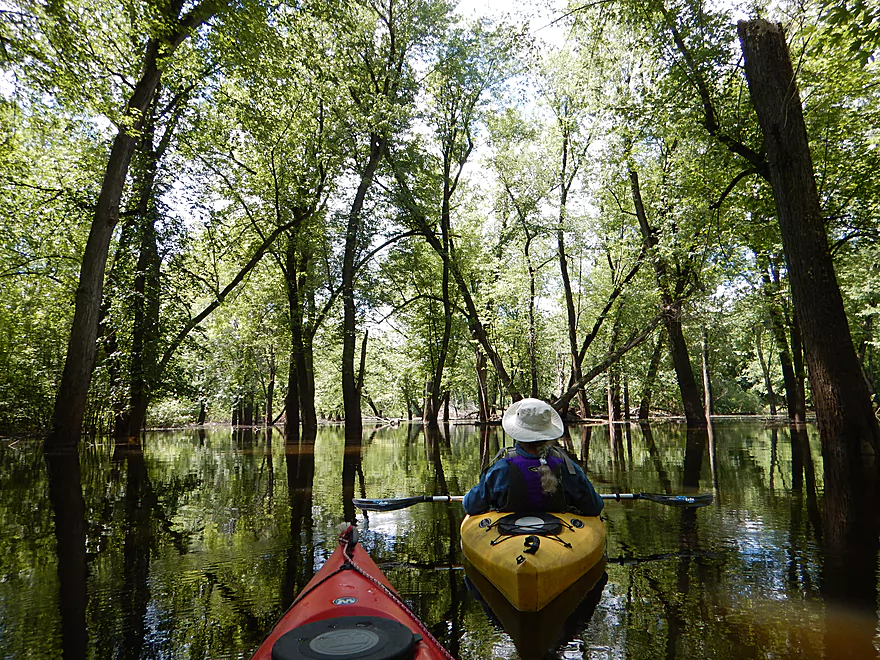
Finally on a proper slough
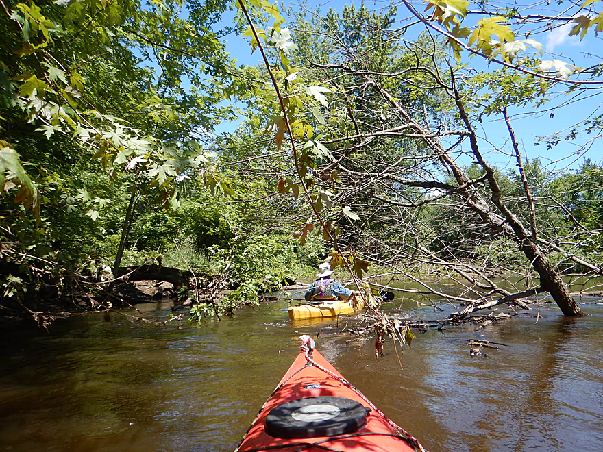
Some tree dodging, but easy
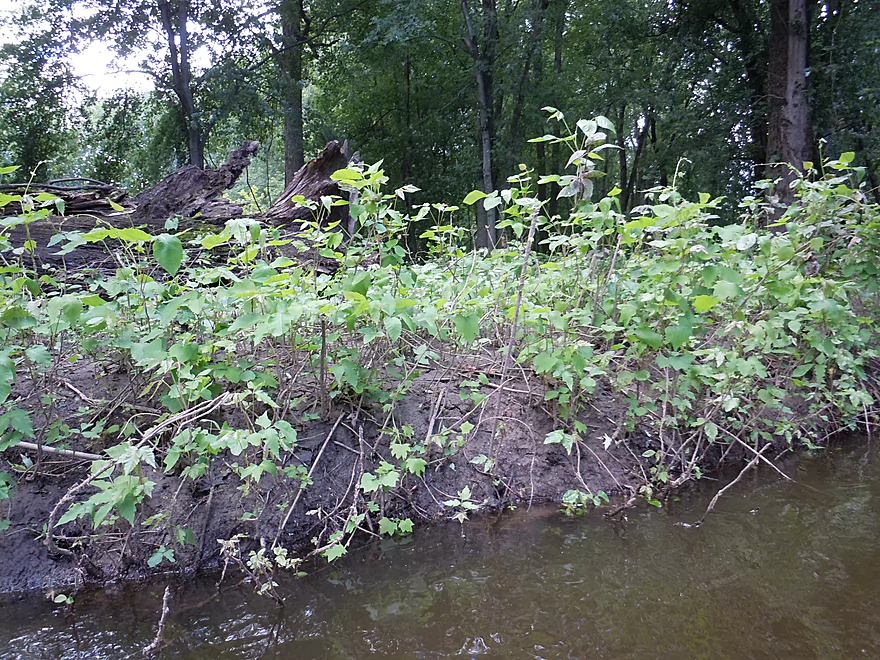
Baby silver maple growing on a dead silver maple
A tree skeleton
Big relief to finally see a blue trail sign again
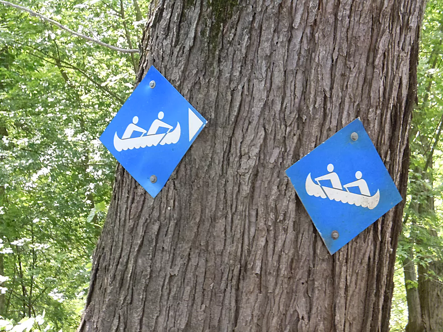
Some of the trail signs were quite confusing
Entering historic Woodyard Slough
Steamboats would sail up this slough for firewood
Lot of beaver activity on the sloughs
Woodyard Slough starts to get bigger
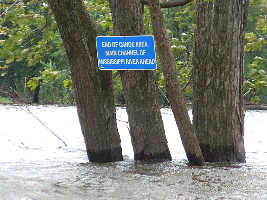
Officially the end of the slough (renters must turn back)
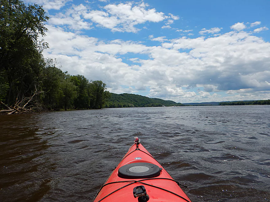
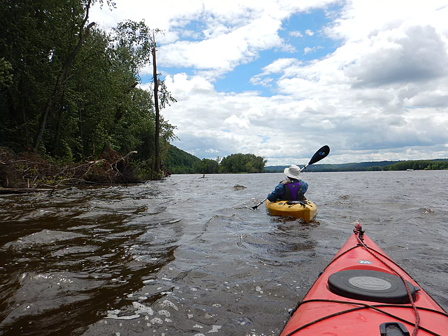
Out onto the mighty Mississippi
So very different from the sloughs
Very scenic bluffs on the Iowa shore
Looking back at Pikes Peak
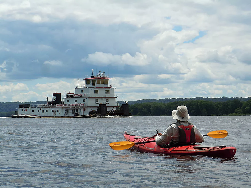
Some of the boats on the Mississippi are huge
Hugging the shore to avoid traffic
More scenic bluffs
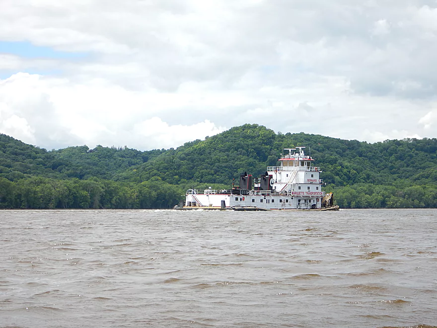
This towboat seems to be missing something
Heading to a nearby grain elevator by McGregor, Iowa
A warning sign for barges
Wake was not a big issue that day
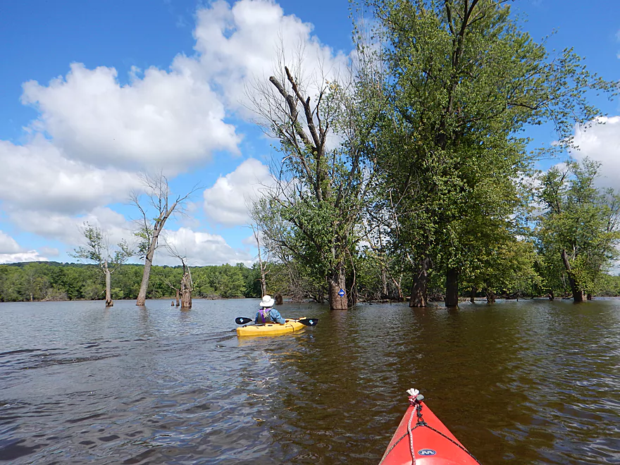
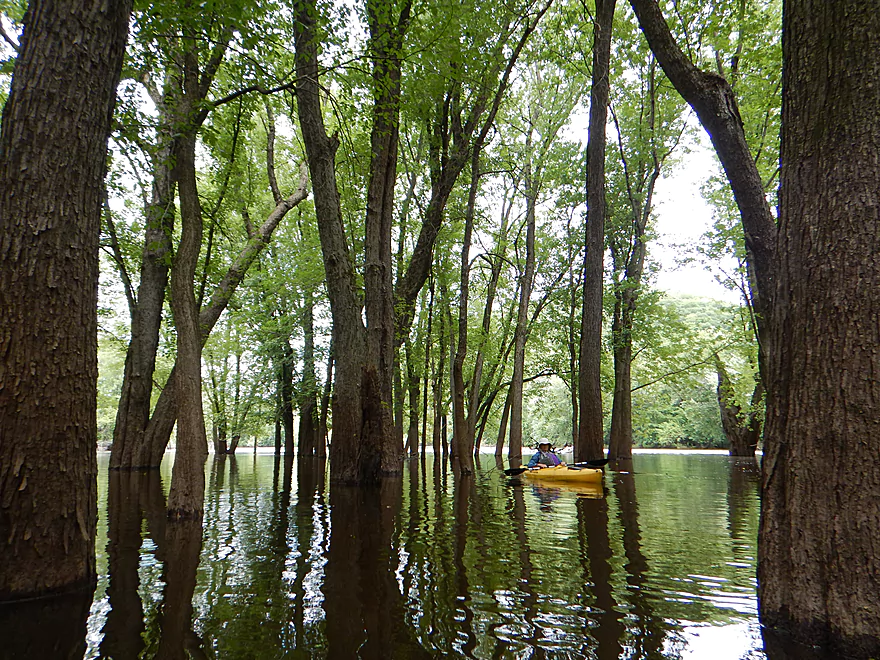
Some neat floodplain forest to the east
Entrance to the South Trail
Now paddling upstream
The South Trail was very scenic
Massive limestone boulder
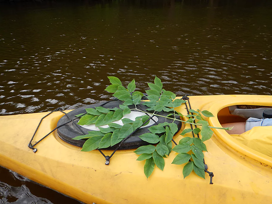
Kentucky Coffee Tree…that is actually one leaf
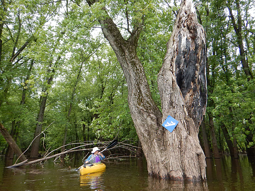
Navigation sign survives a lightning strike
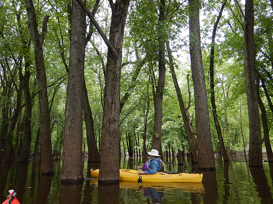
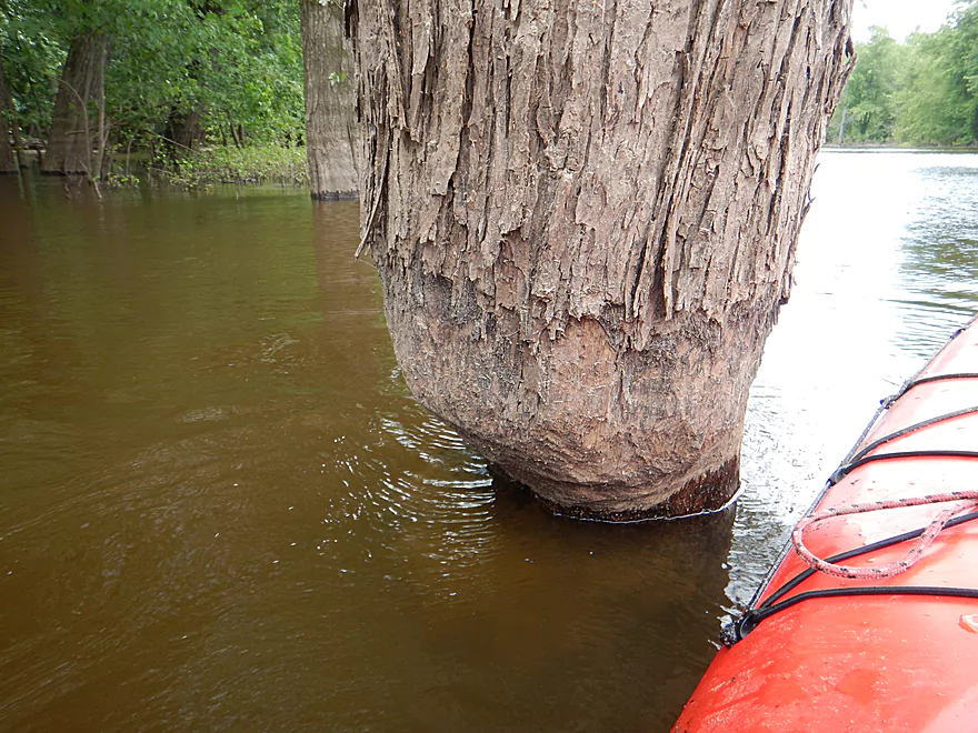
Checking out the flooded forest
Neat experience
Very busy railroad tracks
Looking back at the bluffs
Back on Glenn Lake
And back where we started
People were still using the piers
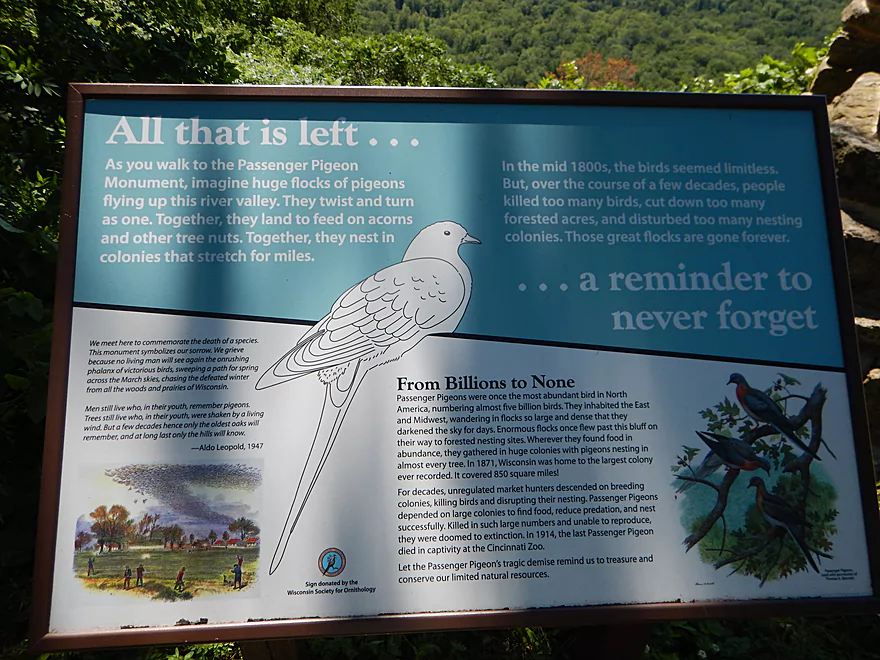
Checking out Passenger Pigeon Monument
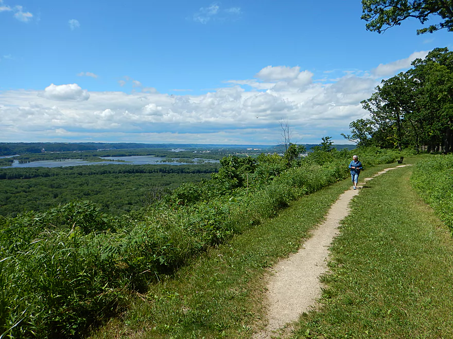
It connects with a scenic hiking trail
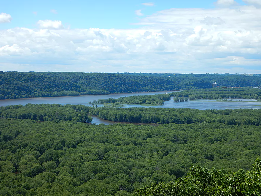
View of the Wisconsin entering the Mississippi
Overlook from Pikes Peak State Park
Close-up of the railroad bridge with Point Lookout to the right
Looking upstream at parked barges
Wyalusing

The mouth of the Wisconsin River empties into the Mississippi at Wyalusing. This results in a large delta with a number of interesting backwaters and sloughs which are protected and isolated from the main channel. These sloughs are fun to explore by canoe or kayak, and Wyalusing State Park has created two water trails in them to promote paddling.
If you decide on paddling the park, the very first thing you actually want to do is to check out its famous overlooks so you don’t miss morning light. The main overlook (Lookout Point) is located at the north end of the park (west of concessions). From here, you’ll see the massive Hwy 18 bridge to the north, the gigantic bluffs of Pikes Peak, Iowa to the west, and the large bottomland delta to the south that you’ll soon paddle. It is quite striking. The other overlook I advise checking out is Passenger Pigeon Monument (which most visitors ignore). It is another fine overlook but further to the south with a better view of the Mississippi. It also junctions with a neat hiking trail that runs along the ridge with frequent vistas of the river valley below.
You will start your trip at the main boat ramp which is located in the heart of the slough. Here is an open area referred to as Glenn Lake, which is a nice quiet no-wake area. There are a number of fingers to the lake you can explore, but most paddlers will either want to check out the north trail or the south trail.
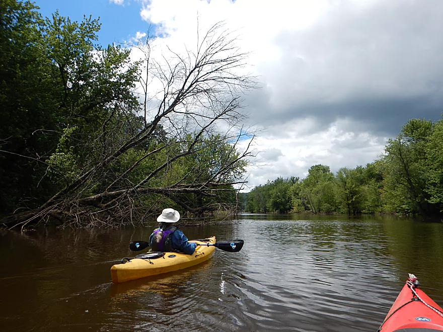
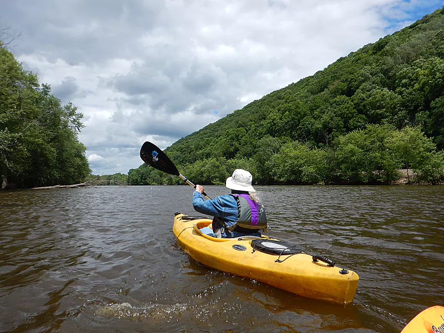
I suggest starting on the north trail. This entails some upstream paddling but this isn’t too difficult at all. What is tricky…is finding the darn trail. The local friends group has done a commendable job of promoting the trail and placing little blue navigation signs on various trees. But honestly, there aren’t enough markers, they aren’t placed in the right locations, and it is easy to get lost. In fact we did!
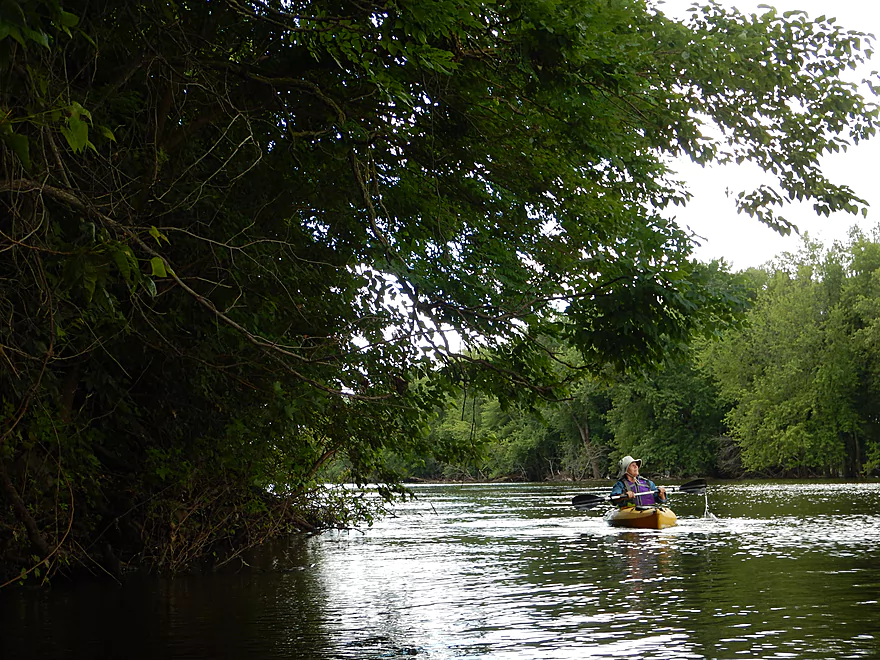
The water levels were high and many trees were submerged creating “water trails” everywhere. We went almost due north to the largest looking channel, but it dead-ended and we despaired somewhat, and even considered cancelling the trip. On the plus side, it was here we paddled under two barred owls and kayaking through a floodplain forest (during a flood) was cool. We ultimately backtracked to search for telltale current and finally found a side slough which to our eternal relief connected to the main water trail.
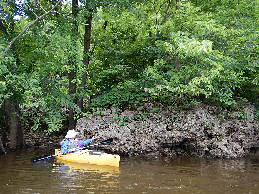
The northern trail is like a small river with banks and current, which you can easily paddle upstream against. In the summer this can be a sandy area that you will actually have to portage at times, but not today which was a pretty high mudfest. This was a pleasant section…but not special. A classic slough…with maybe 99% of the trees being silver maple and poison ivy being the understory plant of choice. Trip was at 2.5 stars at this point.
Soon the slough makes a sharp turn to the left and you’ll have a choice to make. You can in high water keep paddling upstream to reach the Wisconsin River at the railroad bridge. There are a few downed trees in this connecting slough, but you should be be able to get over these no problem in high water. You could then float briefly down the Wisconsin before meeting the proper mouth on the Mississippi. This option would add 3-4 miles to the trip but it would be a neat experience to paddle the main mouth while directly facing Pikes Peak.
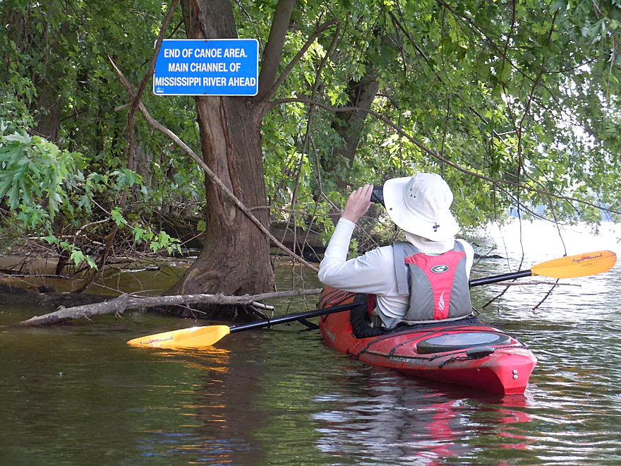
What most paddlers do (and what we did) was to instead turn left downstream onto Woodyard Slough. There the slough straightens and broadens in preparation for meeting the Mississippi. Back in the day, steamboats would actually travel up this slough to get firewood for their boilers (hence the name). This is an ok section but nothing special.
At the mouth of Woodyard Slough two blue signs warn that you are about to enter the main channel. If you rented a canoe from the park, you must turn back here (they don’t want their boats on the main channel…which is why you want to bring your own boat instead!).
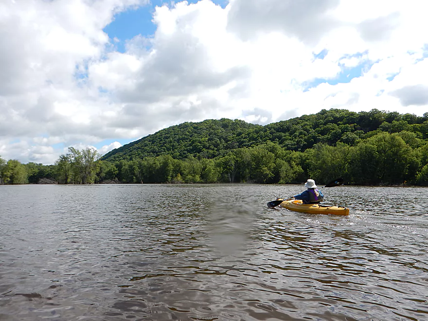
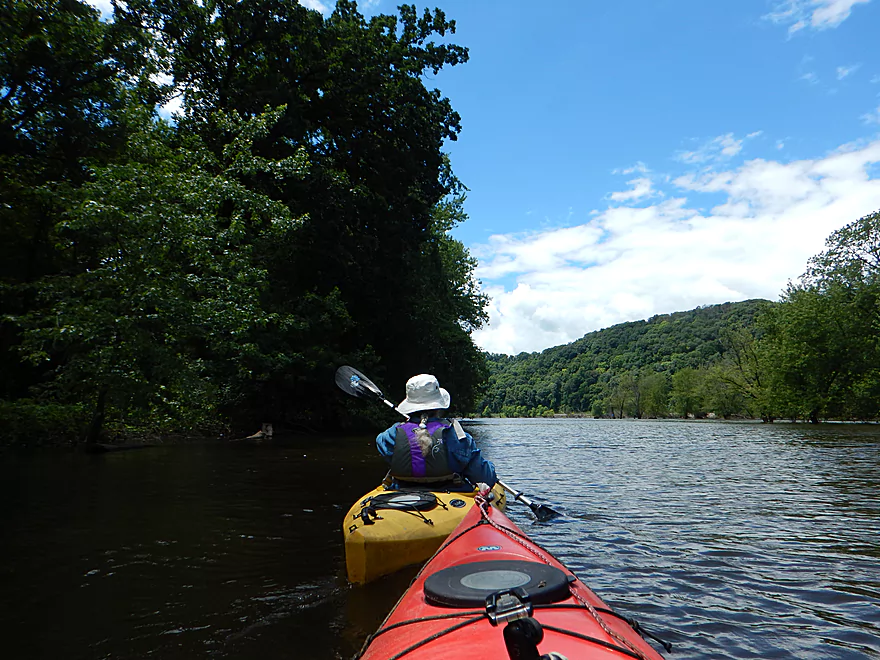
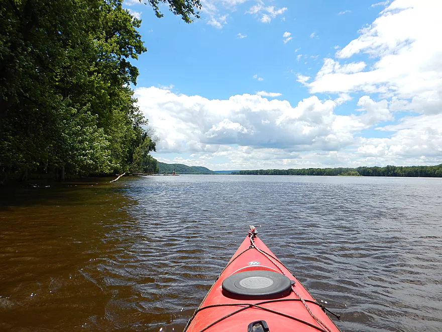
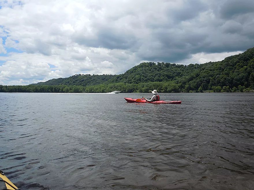
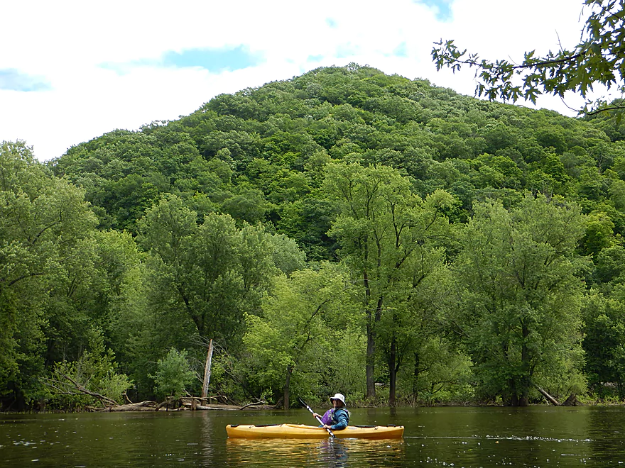
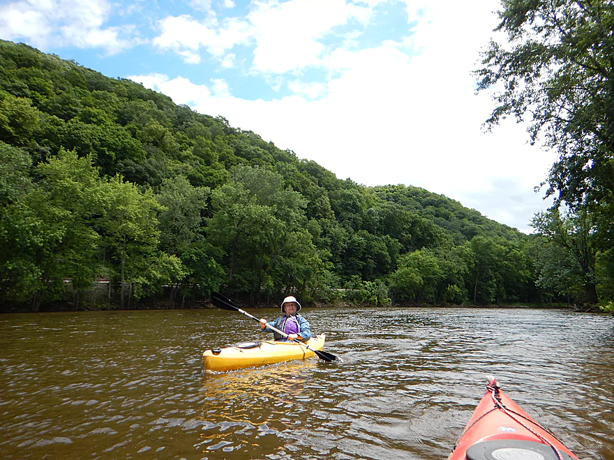
Entering the main Mississippi is quite the experience. It is the land of giants. Everything is large, including the hills, the boats, the waves, the barges, the bridges, and the channel, which is quite the contrast to a creek paddler like myself. There is a unique energy to the Mississippi that makes it special. You have four sets of very busy railroad tracks (two on each side of the river), massive barges, huge cabin cruisers and houseboats bigger than my previous apartments. The finest part was the massive bluffs that rise along the river which makes this so scenic. This was by far the best part of the trip.
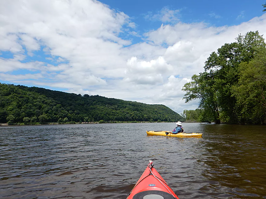
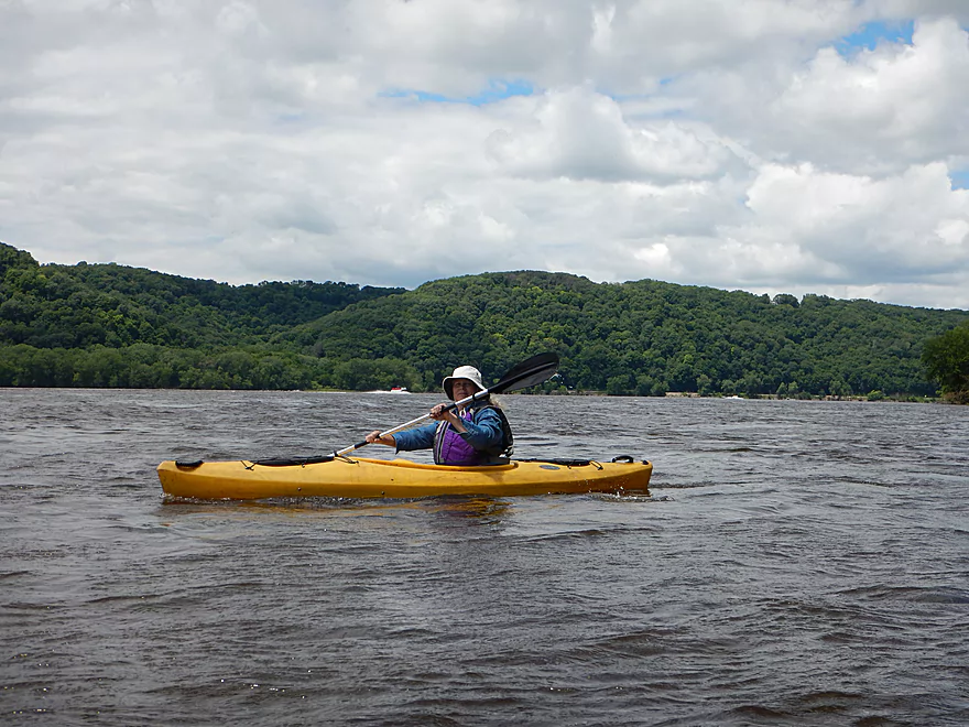
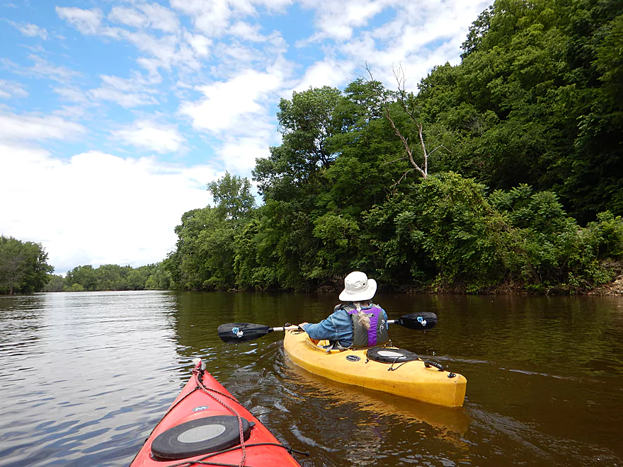
After a mile and a half on the main channel, you’ll want to turn sharply left to re-enter Wyalusing via another slough. This is pretty easy to find as the Wyalusing delta is a massive island with a well defined tip at the south end, and you simply need to paddle around it and up to the railroad tracks. We were now on the “south trail” which is quite different from the “north trail” as it is much straighter and wider. The reviews I read previously indicated the north trail was better, but I actually liked the south trail better. It had a cleaner feel to it and there were large scenic bluffs flanking the channel. To the west there are really neat floodplain forest with large trees that you can slalom through. Soon we were on Glenn Lake and back where we started.
Following the trip, we visited Pikes Peak State Park which is Iowa’s equivalent to Wyalusing State Park. Despite being two miles to the west, it took a half-hour to cross the bridge and get to the park, but I think it is worth it as the overlooks allow you to look directly east up the Wisconsin River and I actually liked these overlooks better than Wyalusing’s. As an interesting side-note, Pike’s Peak was packed with visitors while Wyalusing barely had any people. …perhaps this is because Iowa unlike Wisconsin does not require state park entrance fees?
In conclusion this was a neat trip and a fun way to experience the Mississippi. Getting lost was a downer and the north slough wasn’t as exciting, but the main the channel was a neat experience and the massive bluffs were gorgeous.
The best and most popular option is to launch from the boat ramp at the end of Long Valley Road. Great ramp with plenty of parking and public outhouses. Note this is technically in Wyalusing State Park and you will need a state park sticker to park here.
Same as the put-in.
As the best option is to do a circuitous roundtrip, you don’t need a shuttle.
Wyalusing State Park does have canoe rentals (and a few kayaks). You can pay for these at concessions (north end of the park), where the attendant will unlock a boat for you to use at the landing. Note, the park does not rent out these boats at very high or very low levels. Nor do they let you go out on the main river channel. For these reasons, I suggest bringing your own boat if possible.
Also note, if you want to combine a trip on Wyalusing with one on the Mississippi or Wisconsin River, I believe “Captains Cove Motel” (608-994-2860) can help with shuttles and liveries.
For the most part there aren’t logjams on the water trail. The park service clears these out and it is mostly clear sailing for paddlers (might be a branch or two to duck under on the north section but pretty easy).
Big waves can be an issue on the Mississippi but weren’t on our trip. The north trail is too small for power boats and is pretty calm. The main channel of course has a lot of powerboat traffic and the bigger/faster boats can create big waves. But really this wasn’t a problem on this trip perhaps because of the high water. At shallower levels, the waves may be much bigger, but you should be ok as long as you stay vigilant and stay close to shore. The south trail gets some powerboat traffic but is pretty calm, and I think it has no-wake rules.
The current is mostly pretty mild and easy, but I do advise doing your upstream paddling in the sloughs and to save the downstream paddling for the main channel where the current will be stronger (as in a counterclockwise route).
Wind can be an issue. You are somewhat protected in the sloughs but will be very exposed on the main channel. Monitor the forecast to make sure you don’t paddle into a headwind.
But really…the biggest hazard is getting lost. The entrance to the north channel is very narrow, hidey, and there are many similar looking dead-ends you can paddle up. Yes, there are signs but they can be difficult to follow. I suggest bringing a printout of a satellite map (everything else will be out of date) and to study it very carefully. Or better yet use your phone’s satellite map and GPS to guide you. A trick for finding the north channel is to paddle against the strongest current. If there is no current…you’re likely in a dead-end.
For the most part, the trail is usually navigable. The park service does shut it down during high and low water levels though, and it can be a good idea to call them (608-996-2261) in advance to verify the trail will be open. There is a gauge on the Mississippi just downstream at Clayton, Iowa which I’ll use as a reference. Note these are REALLY rough guestimates.
- 0-12.5′: The north trail might be difficult to navigate and you may have to portage several sandbars. Here is a picture of people walking their canoes on the north trail during low water.
- 12.6′-13′: Likely an ideal depth with well-defined sloughs but no flooded forest.
- 13.1′-15′: Quite doable, but sections of the sloughs will likely be partly flooded (which can be a good thing). This trip was done at 14.7′ where there was much flooding.
- 15.1’+: A very high depth. You could likely do the trail but the navigation signs might be underwater and finding your way through could be difficult. Could be a neat experience padding through large tracts of flooded forest though.
Multiple great blue herons, one huge beaver (and many snacked upon trees), 7-8 turtles, many eagle sightings, many lowland songbirds, and one water snake. The highlight was paddling underneath two barred owls.
See my map for further details. Again, the most popular and best option will be to launch from the main boat ramp, and do a large loop (landing > north trail > main channel > south trail > landing).
At the top of Woodyard Slough, a side slough from the Wisconsin River that enters from the north. Adventurous paddlers in high water can paddle upstream to reach the Wisconsin River by the railroad bridge. You can then paddle the final section of the Wisconsin out to its mouth by Pikes Peak which would be very scenic. Taking this side detour might add 3.4 miles to your trip.
Just west of Wyalusing is the Johnson Slough Canoe Trail. This is Iowa’s Wyalusing. Basically you paddle downstream on the main channel then upstream on the slough. Round trip it is 6.1 miles and could be combined with Wyalusing. Most paddlers that do this trail, launch from the Sny Magill boat landing in Iowa.
One-way paddlers, might prefer to launch on the Wisconsin River at Hwy 18. From there it is about 4 miles to the railroad bridge and the start of Wyalusing where there are a number of options paddlers can then take.
If you are into Mississippi paddling, a fun one-way option might be to put in at Prairie du Chien (see map for landings) and float down the side channels to Wyalusing.
Detailed Overview
The Mississippi is both a blessing and a curse for paddlers. While rich in beauty and majesty, it can be problematic to paddle due to high wind, current, wakes, powerboats, and barges. The Upper Mississippi is frequently dammed and subdivided into “pools”, of which there are roughly 11 in Wisconsin. Generally speaking, just upstream of a dam the river is the least interesting (few islands, deep, monotonous, few sloughs, and a wide channel). But on the downstream side of pools there are often many sheltered islands and sloughs that offer unique paddling experiences.
For a list of Mississippi water trails see my overview map or use the bullet list below. Thanks to the US Fish and Wildlife Service for many of these suggestions. Check out their website for more details. Water trails are listed in order from north to south.
—
Chippewa River Trail: 6.8 miles. Chippewa River Landing to Tim’s Slough Landing. Basically the last part of the Chippewa River that connects with a slough on the Mississippi. Avoid in high water.
Nelson-Trevino Trail: 4.5 miles. South of the Chippewa River, Hwy 25 cuts across the river through a slough and over a grade. Many landings to pick from. Most paddlers venture south and then back north to one of the landings. The main water trail is roughly the biggest loop you can take south of Hwy 25 while remaining in the slough. Avoid in high water and high wind.
Finger Lakes Trail: 6.1 miles. North of the Zumbro River mouth, there is a sheltered collection of sloughs and lakes you can paddle. The main water trail skirts the south edge. In low water, some portages may be required. For a launch/take-out, use Pioneer Landing in Minnesota.
Halfmoon Trail: 5.1 miles. A scenic mix of sloughs, the main channel, and open marshlands, with a chance to explore two massive dredge piles. Note that timing is tricky: low water can dry out the interior channels, while high water makes completing the loop against the current difficult.
Verchota Trail: 11.3 miles. A long upstream paddle up the main slough then you double back mostly on the same trail. Use Verchota Landing for an access. Difficult because of its long length and upstream paddling.
Aghaming Trail: 6.7 miles. Start at the park in the main channel and float downstream until you find a gap in the slough which you can paddle upstream to explore. Turn back when done. Access at Latsch Island Park and Landing. Some upstream paddling in the main channel. Not usable in high water.
Voyageurs Canoe Trail/Perrot State Park: 6.5 miles. Your best bet is to do a one-way trip from Hwy 35 to S. Park Road. Very scenic. Completely sheltered from the main channel and is technically the Trempealeau River.
Long Lake Trail: 5 miles. A counter-clockwise circle through mostly backwater sloughs. Long Lake is mediocre and French Lake is boring and weedy. But the main channel is nice with good sandbars and bluff vistas. When in season, Big Marsh can contain scenic wild rice corridors.
Brown’s Marsh Canoe Area: More of a lake paddle and a way to experience Brown’s Marsh. Access at Lytle's Road.
Lake Onalaska Trail: Technically the last few miles on the Black River. Been on my to-do list for a while… Lytle's Road to Fred Funk Landing is 4 miles, while Lytle's to Mosey Landing is 8 miles.
Root River to Crater Island: This is mostly attractive slough paddling inside the vast Goose Island archipelago. It does include a bonus stretch on the fast Root River and some main channel paddling by Brownsville. The highlight is "Crater Island," a large man-made sand island.
Goose Island Trail: 8 miles. A nice paddle around Goose Island. Mostly simple sloughs but there are nice bluff views .
Reno Bottoms Trail: 3-14 miles. Put in on the Minnesota side and float down a long slough. Many intermediate take-out options. Access at Reno/Hwy 26 and New Albin. Some of the launches can be under water during high depths.
Blue Heron Trail: 9 miles. Located south of the Minnesota/Iowa border, this water trail features a fantastic labyrinth of islands and side sloughs. A trip highlight is being able to paddle up to the historic Black Hawk Bridge.
Ambro Slough: 8 miles. Very similar configuration to Wyalusing. You can paddle up the slough then downstream on the main channel if you wish. The upstream slough by Harper’s Ferry also looks interesting. Access is at North Ambro Road. 8.2 miles if you do a full loop on the main channel.
Yellow River to McGregor: ~4 miles. A scenic stretch featuring impressive river bluffs and a large arched bridge.
Wyalusing: 5 miles. A marked trail starts at the lower Wyalusing State Park landing, then weaves through bottomland before heading back to the landing. One of the neater areas on the Mississippi and it’s always fun to visit the park.
Johnson Slough: 6.2 miles. Just downstream of Wyalusing on the Iowa side is another nice slough to explore. Most launch at the landing, cut north through the slough, and then float back on the main channel. Some current to paddle against.
Jay's Landing to West Haven: 4.6 miles. This is a nice leg with many islands that protect paddlers from the main channel. Highlights include scenic bluffs.
Cassville Bluffs/McCartney Lake: 4.17 miles. There is a protected series of sloughs and islands on the Wisconsin side that features many scenic bluffs and outcrops.
Dubuque Water Trail: 9 miles. Start south of the dam by A.Y. McDonald Park. Float down the western shore by urban Dubuque, past the Mines of Spain to Massey Station Road. Easy to subdivide or to do round trip loops. For further information see the official webpage for the trail.
Trip Map
Overview Map
Video
Photos Size: