
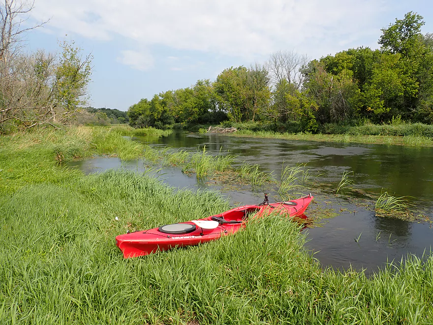
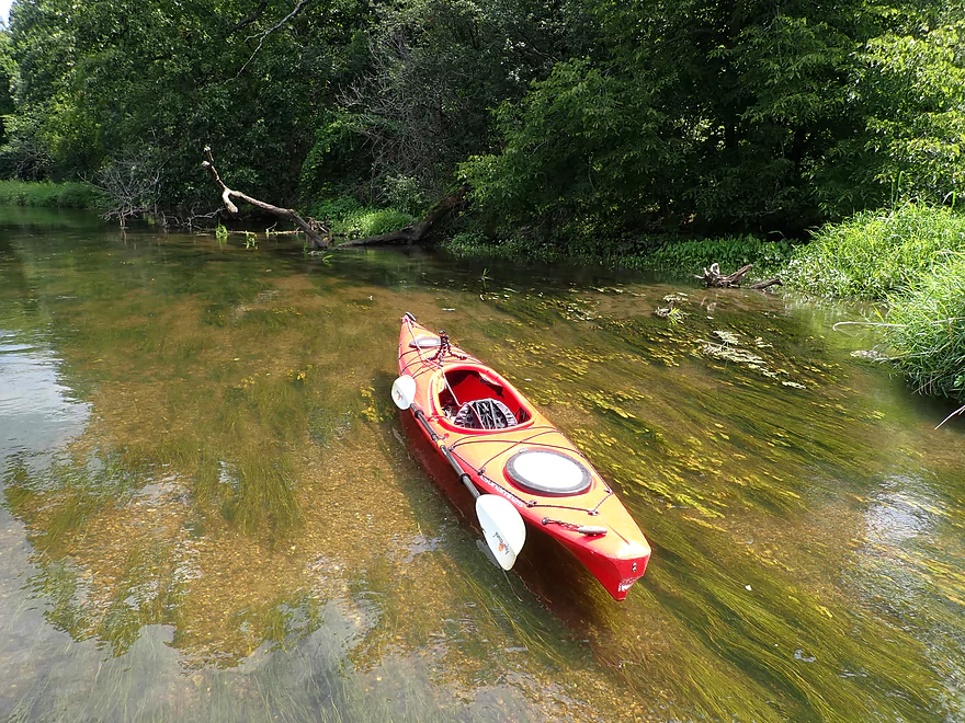
Starting the trip at East Creek Road
Good put-in
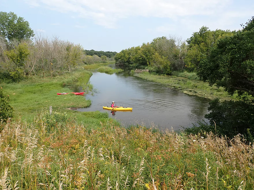
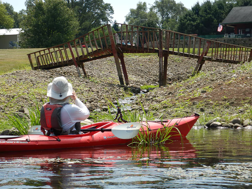
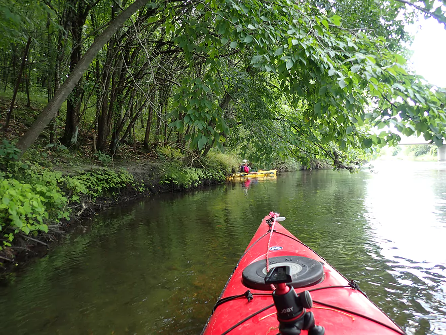
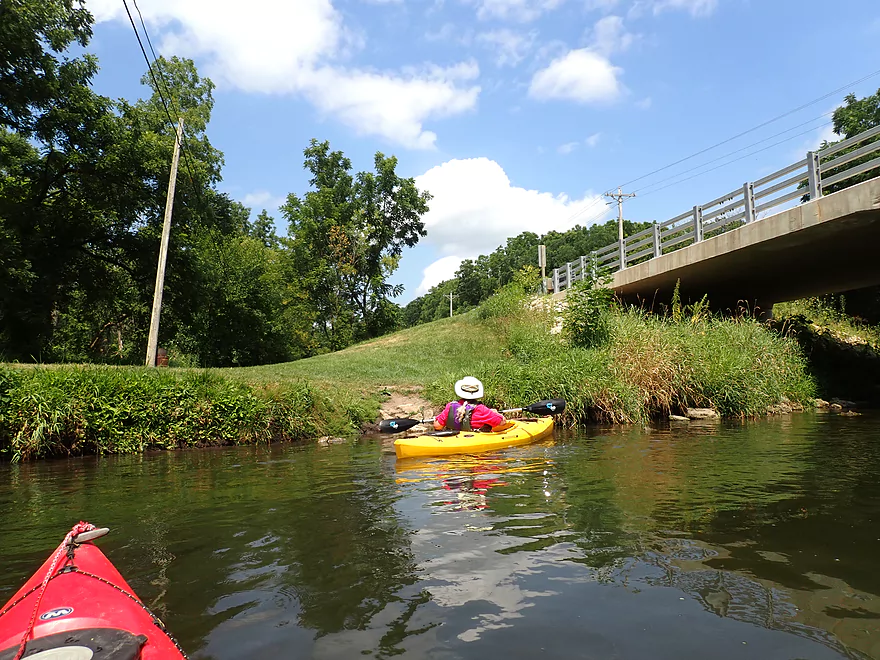
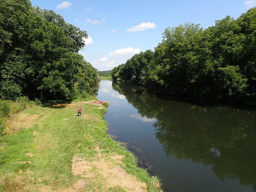
Looking back at the East Creek Road bridge
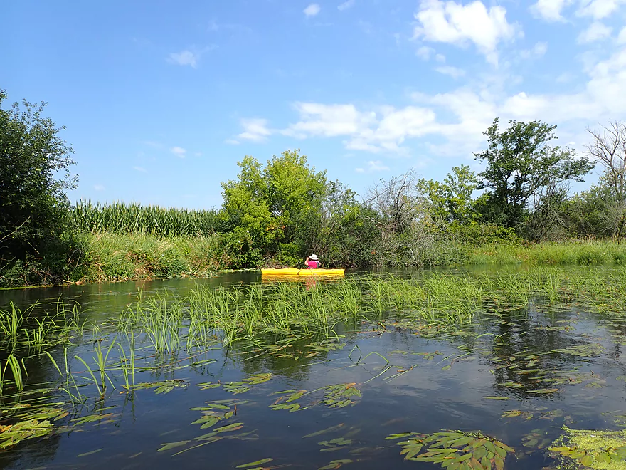
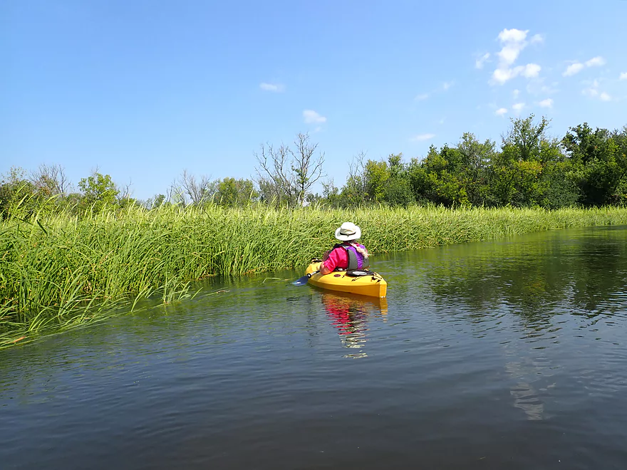
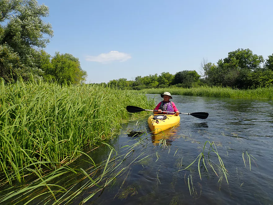
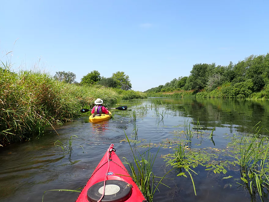
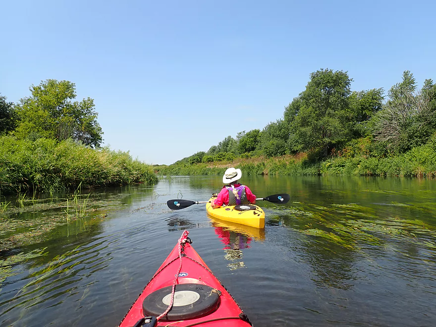
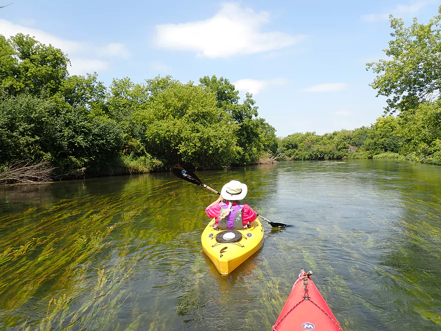
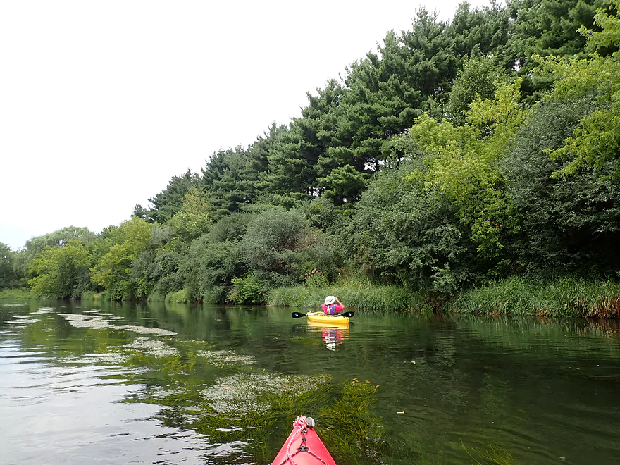
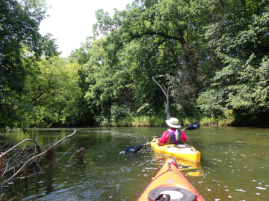
The first mile had a lot of wild rice
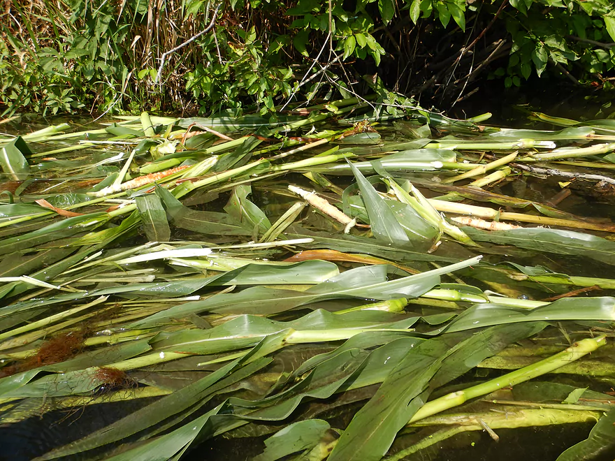
This beaver liked corn on the cob
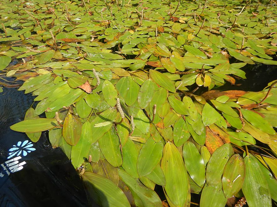
Potamogeton in flower
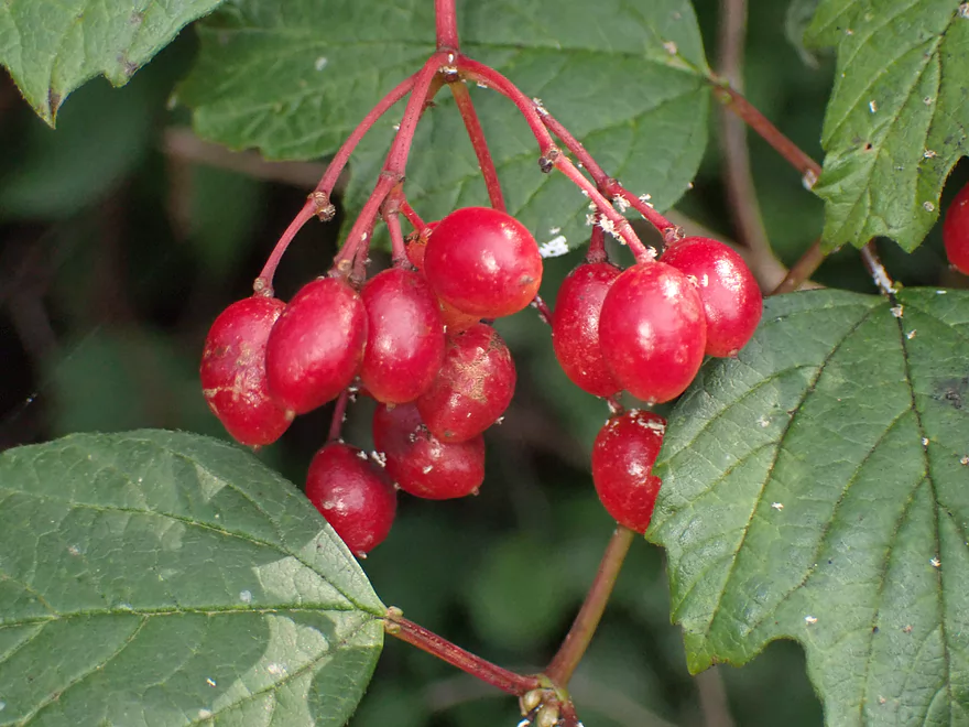
Highbush cranberries
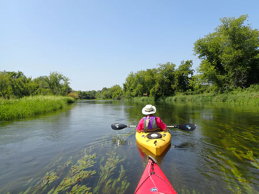
Flowing potamogetons
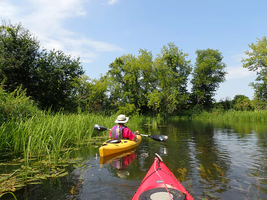
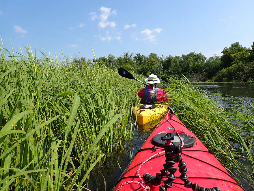
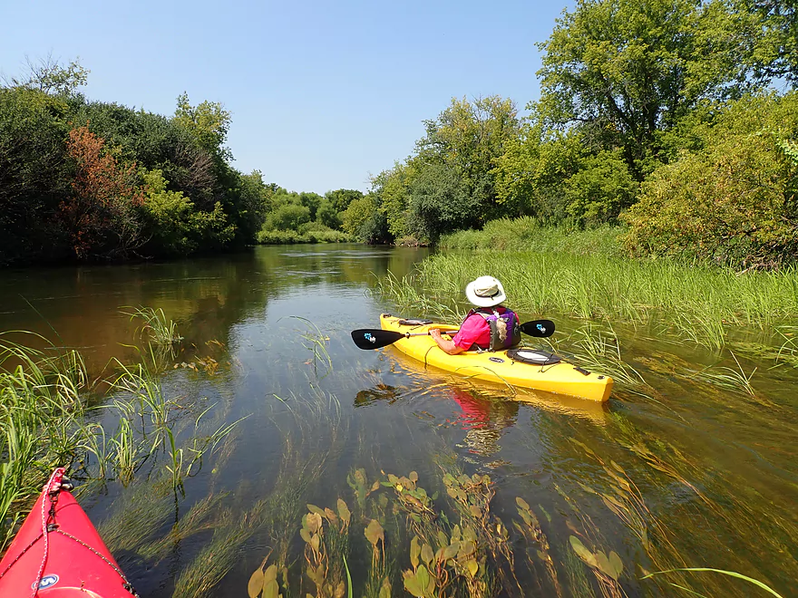
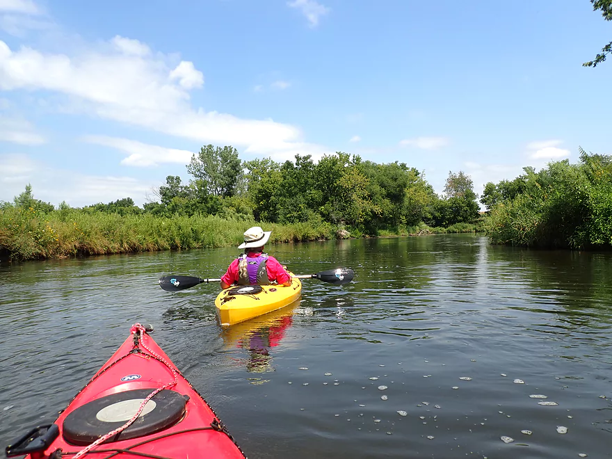
Wild rice getting thicker
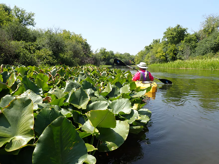
A huge bed
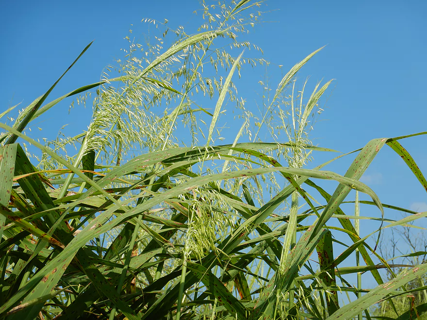
The wild rice was in flower
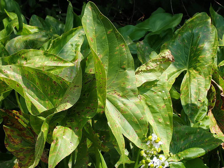
Arrowheads (these have some strange blight)
You can’t even see the shoreline the wild rice was so thick
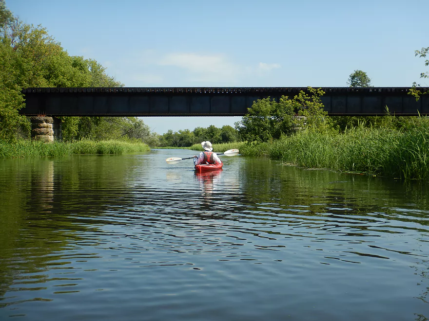
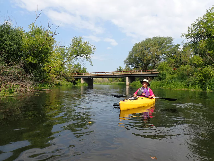
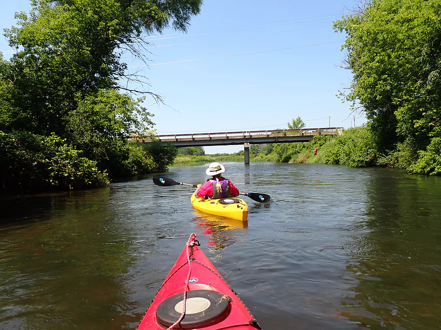
Railroad bridge filled with graffiti
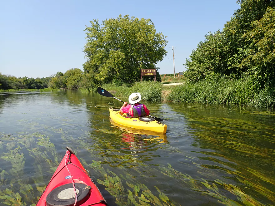
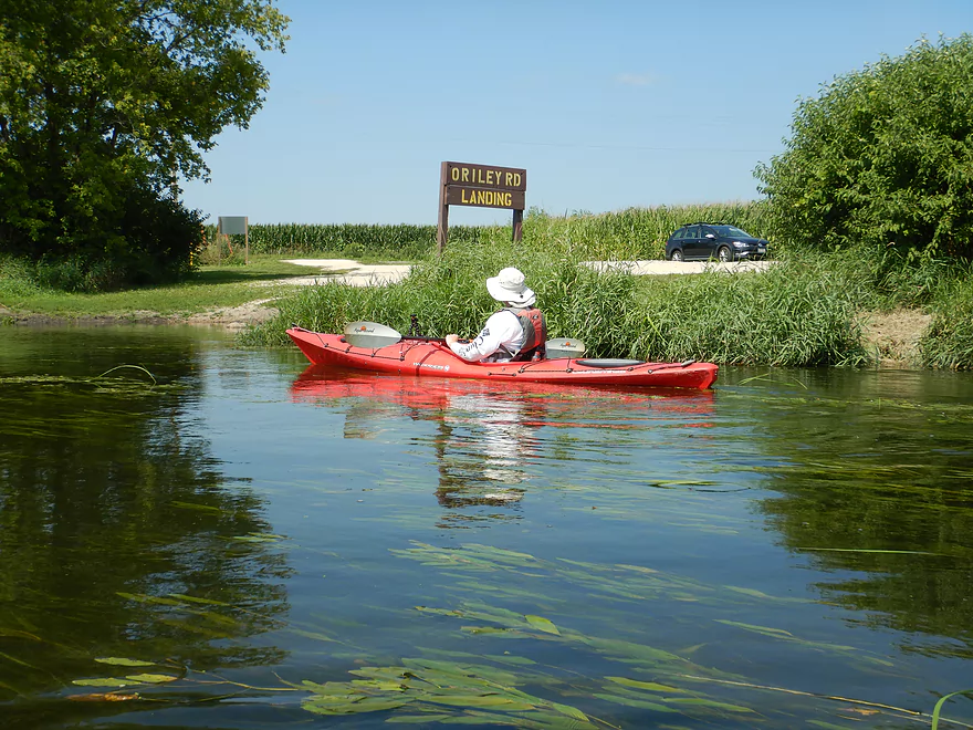
O’Riley Landing
Very nice public launch
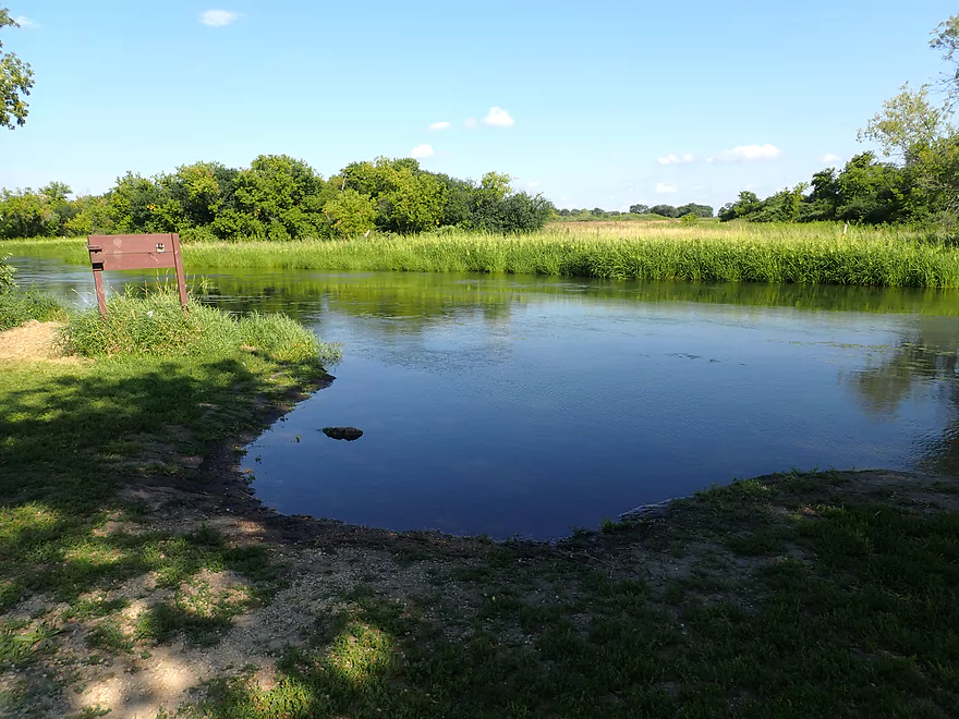
Nice alcove for launching
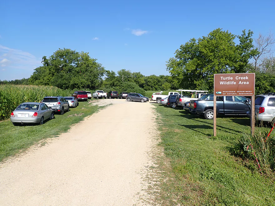
This can get very busy
A thick bed of waterlilies
More potamogeton
Little Turtle (right) joins the Big Turtle (left)
O’Riley Road (an access option)
After the Little Turtle the banks become taller and weedier
Still nice though
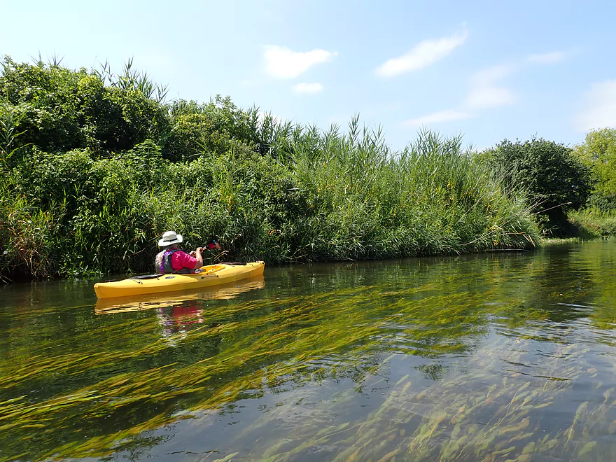
Phragmites growing along the banks
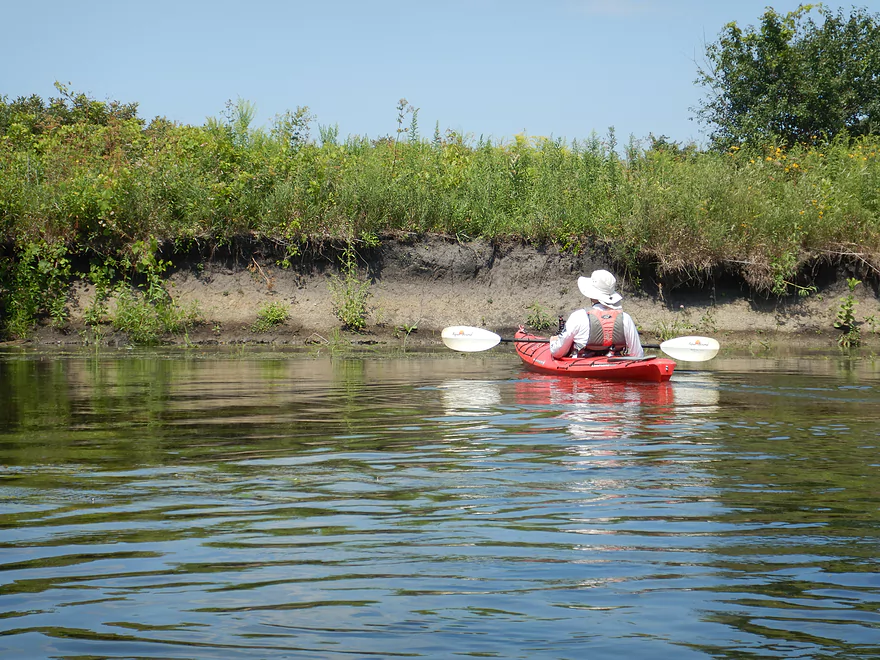
A few mud banks…not many
Woodland sunflowers
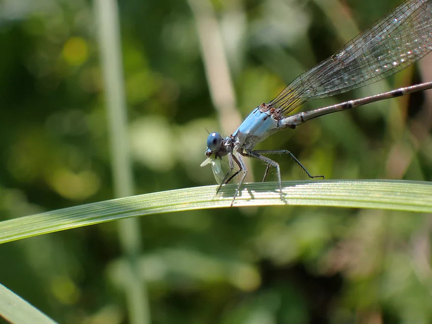
A damselfly eating an insect
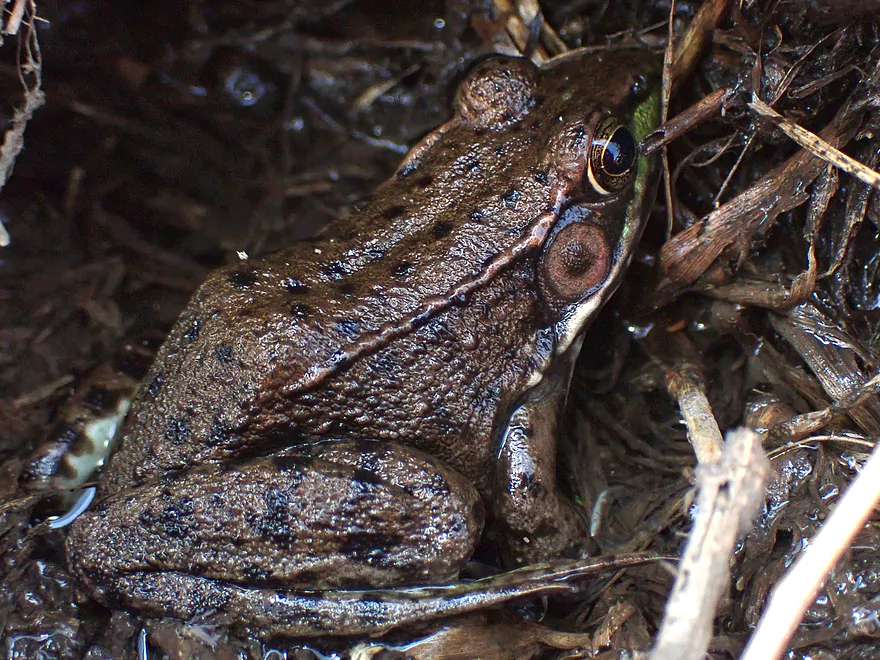
A green frog
This stretch was mostly undeveloped…but there were a few homes
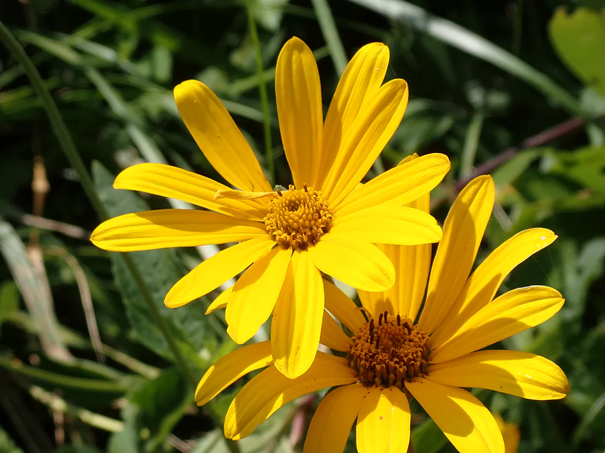
Nice assortment of prairie plants
Turtle Creek is much wider after O’ Riley Road
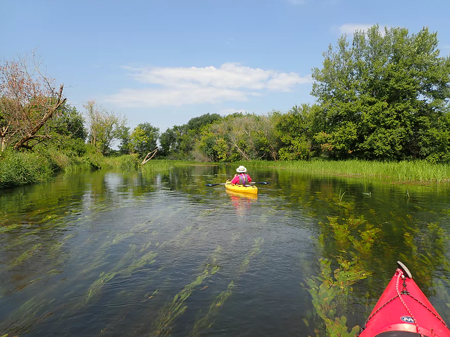
Cool scene with the plants flowing with the current
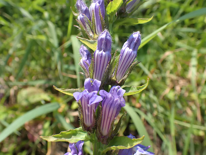
Great blue lobelia
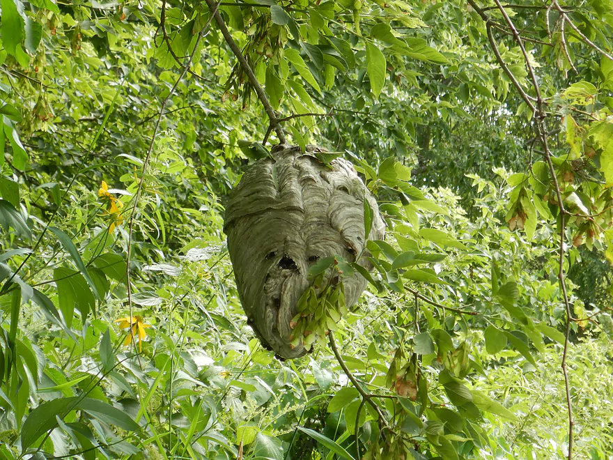
A bald-faced hornet nest
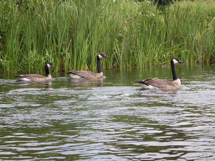
Some tame geese
A long-jawed orbweaver (look at those giant jaws!)
Very nice gravel substrate
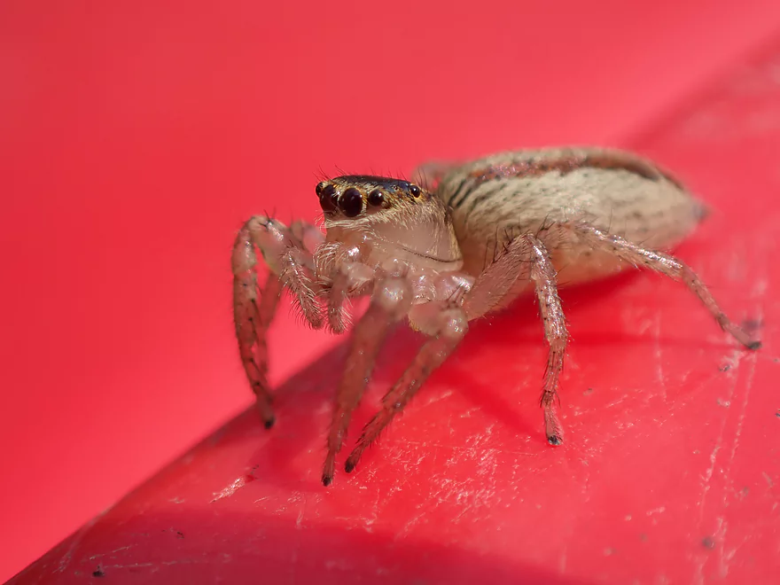
A friendly jumping spider
S. Carvers Rock Road
A landing on the northwest corner
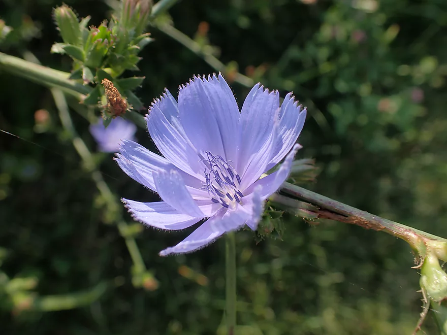
Chicory
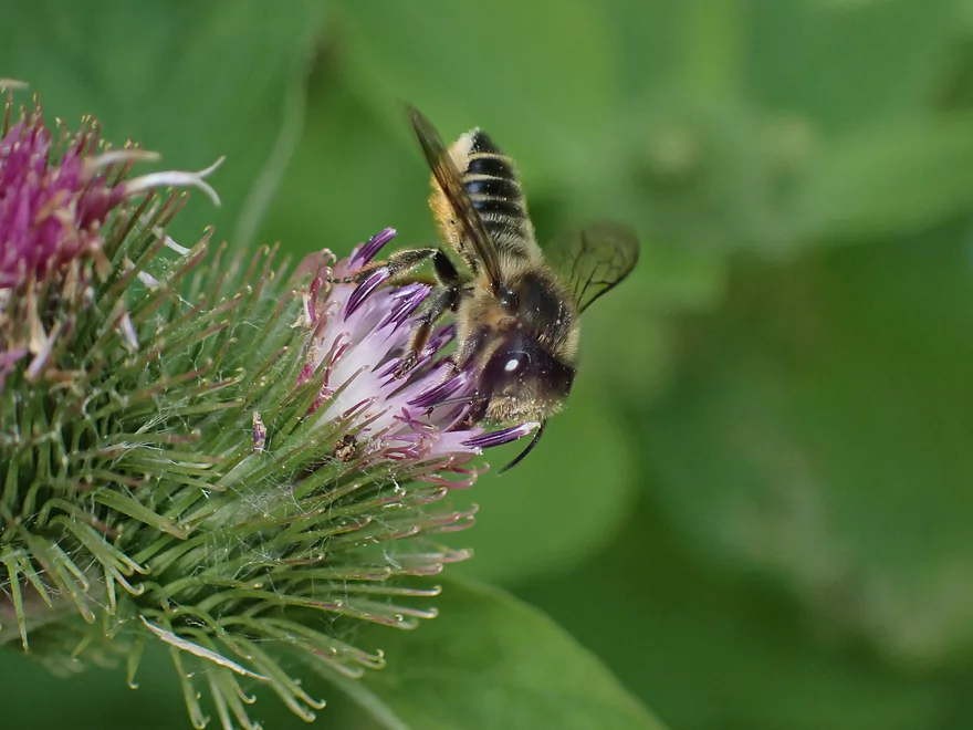
A small bee checking out the flowers
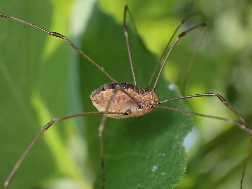
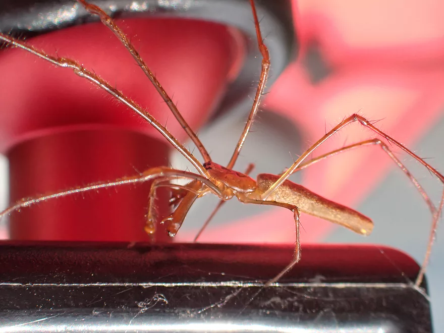
A daddy longlegs
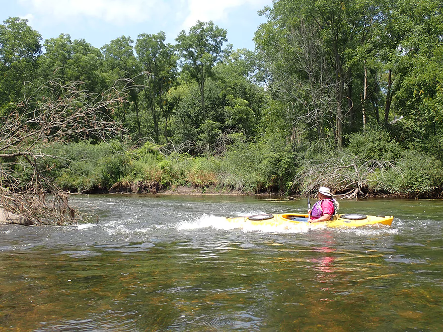
Only rapids of the trip….pretty fun
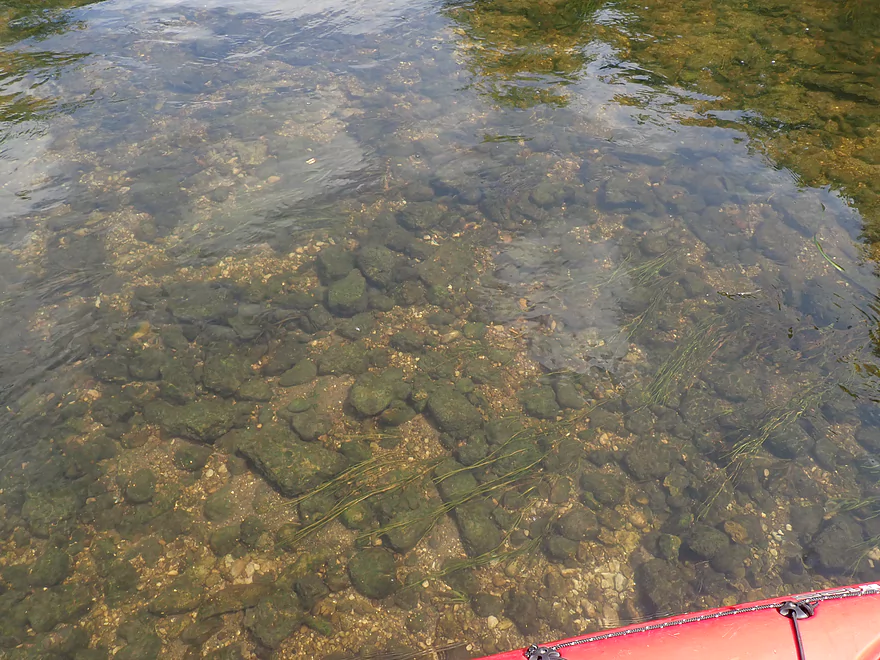
More good clarity
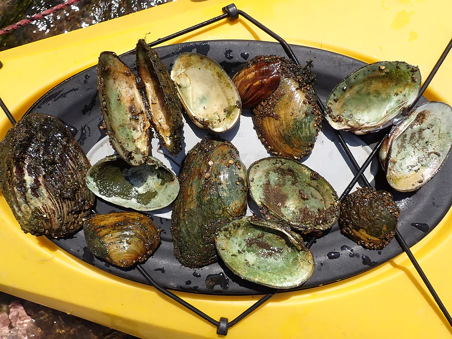
There were many clams…but most were dead
Creek becomes much more wooded
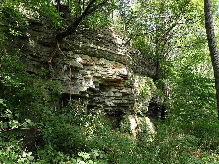
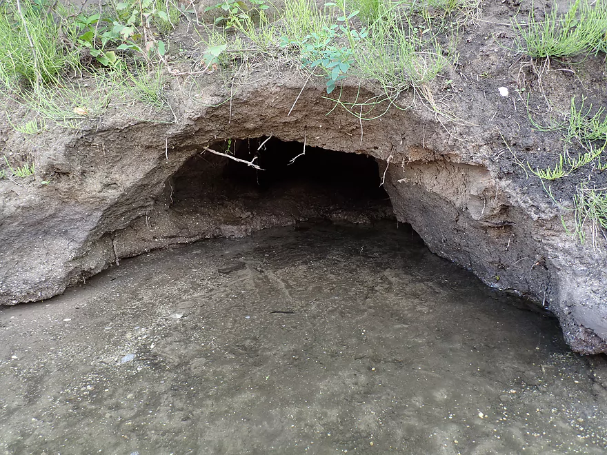
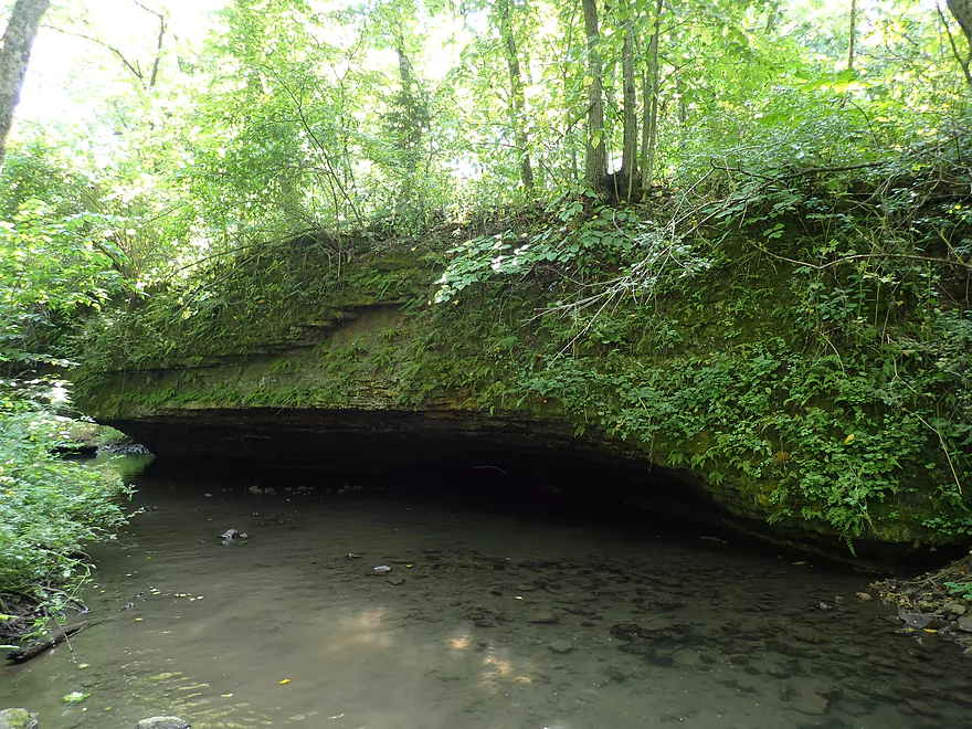
Some surprise limestone outcrops along the banks
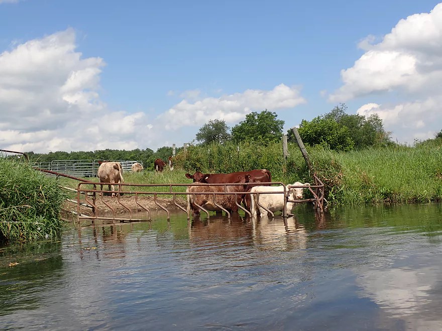
Cows in the creek…at least they are partly contained
More beaver activity
This long moraine was topped with bur oaks
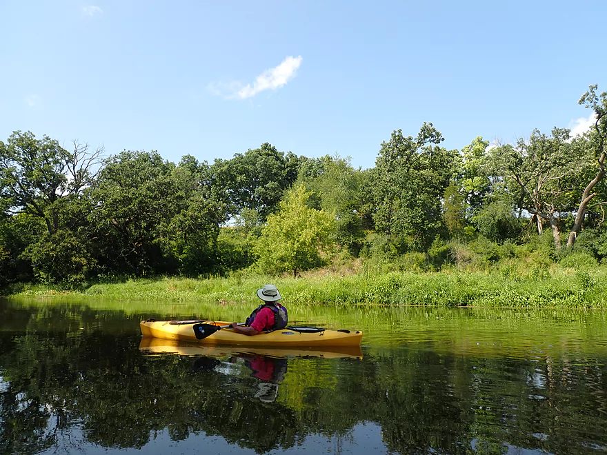
Great day for reflections
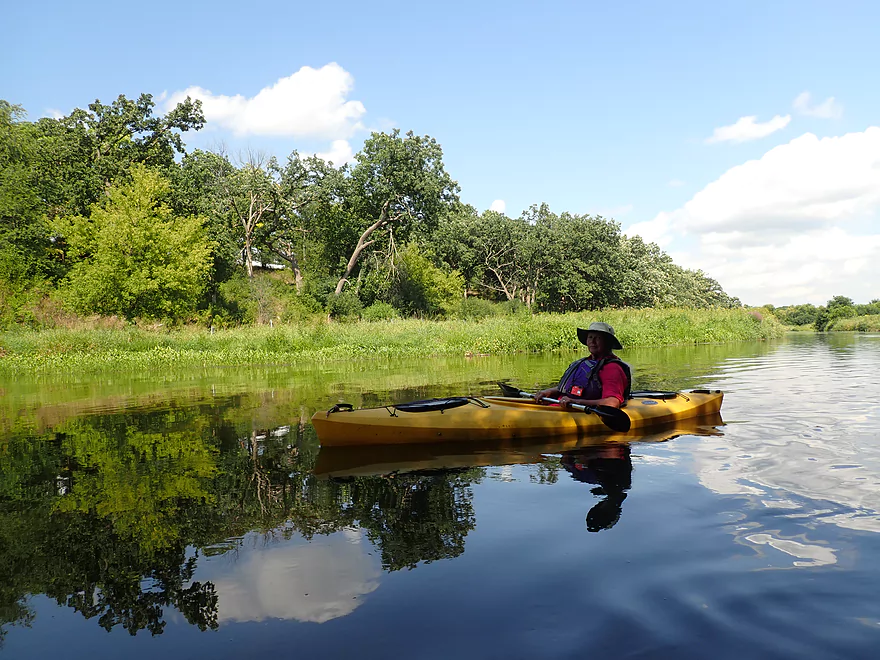
Top-notch clarity
Taking out
View from Hwy 140
A nice path leads to a public parking lot
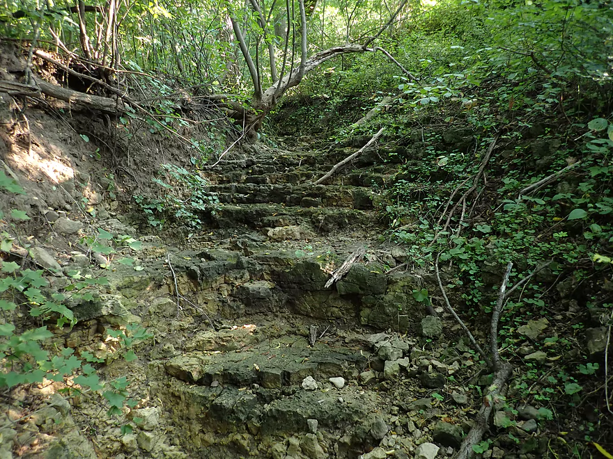
Mini limestone gorge next to take-out…would be scenic after a rain
Checking out Carver-Roehl Park
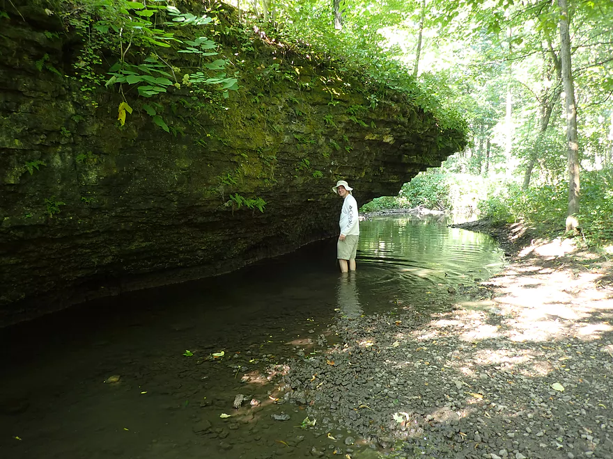
Which has many outstanding limestone outcrops
Turtle Creek – East Creek Road


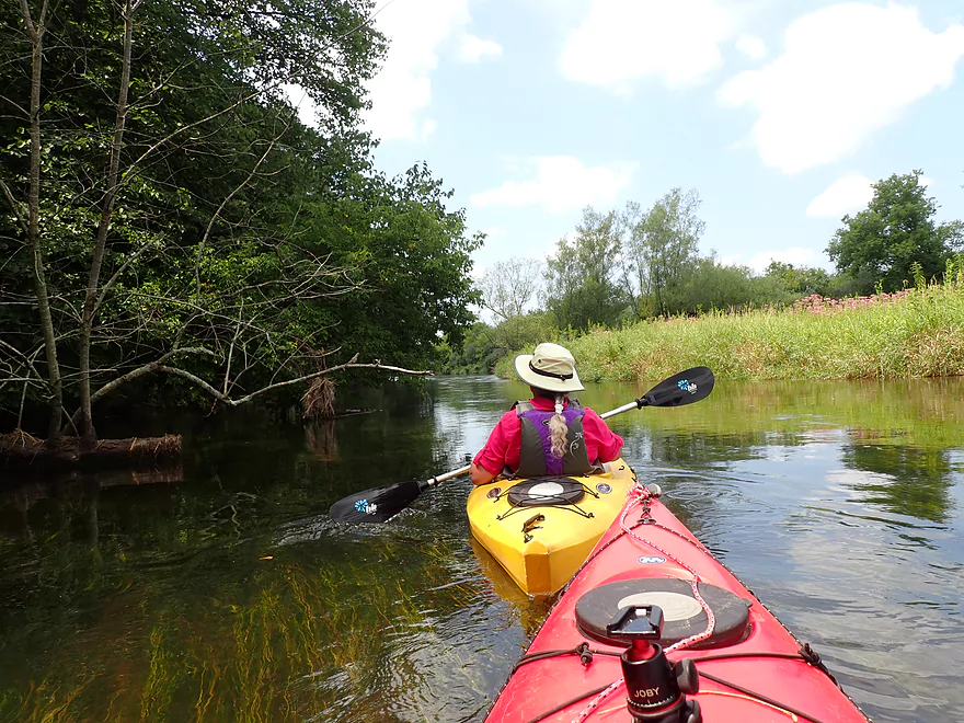
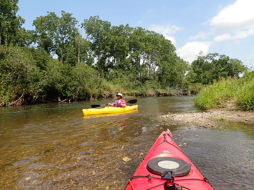
Located in southeast Wisconsin, Turtle Creek is one of the nicer water trails in the area. It’s a somewhat unique “Ice Age paddle” as it flows along the Lake Michigan Lobe’s terminal moraine. This results in a lot of deposited gravel and springs that keep the current fast and clear. The Turtle also lacks the high mud banks and crazy meandering you associate with most other southern Wisconsin creeks.
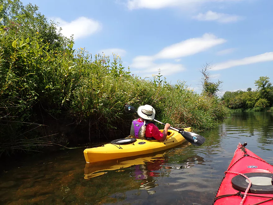
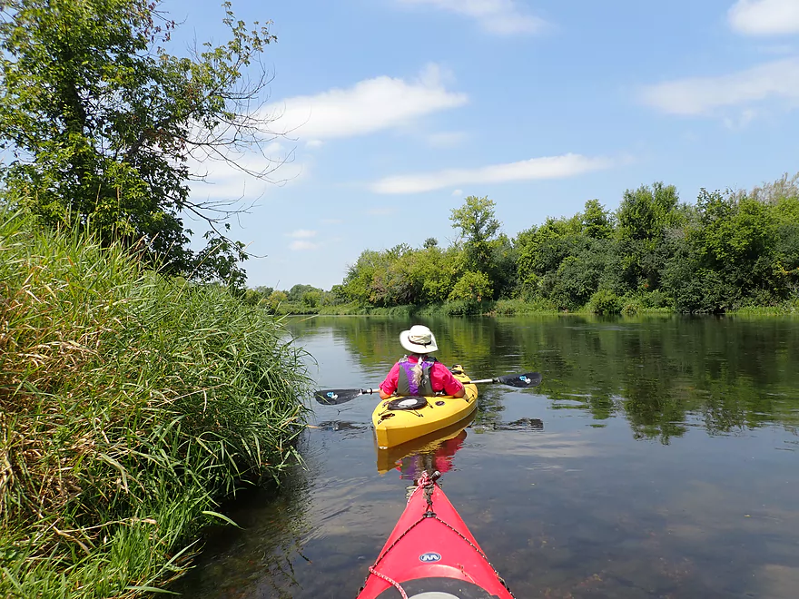
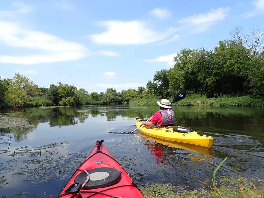
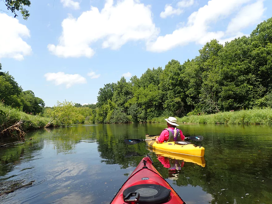
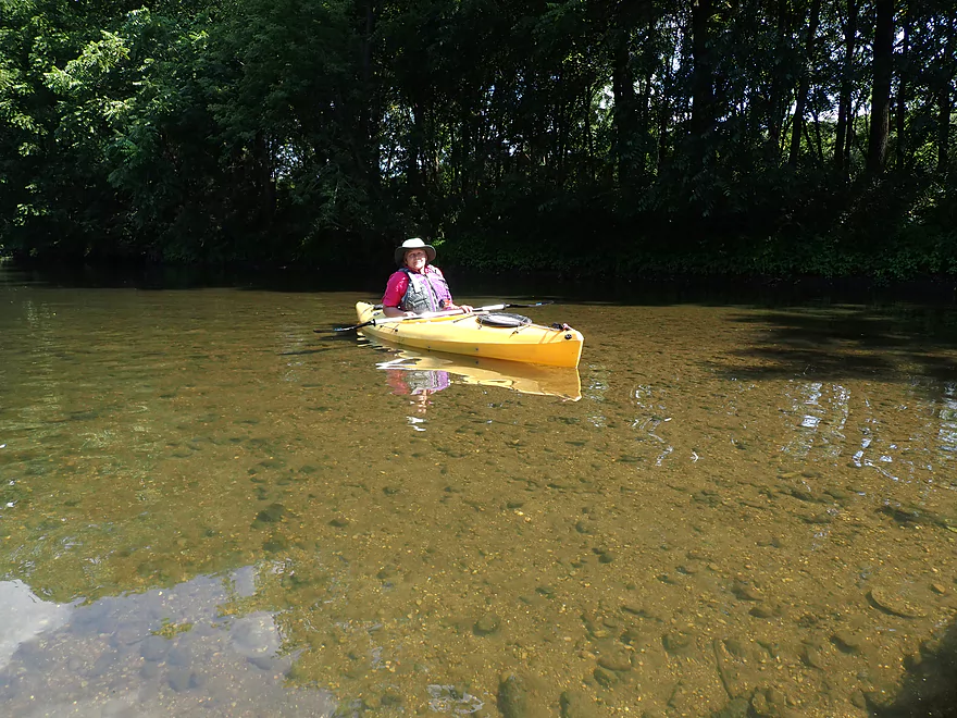
We started our trip at E. Creek Road which was where we took out from our first Turtle adventure. The first two miles were the best part of the trip as the river was moderately narrow, intimate, and filled with a large diversity of plants and shrubs. Here the banks were flat and filled with attractive aquatic plants like arrowhead and wild rice. The wild rice was a trip highlight as it was in flower and grew in large beds that were fun to paddle through. Water clarity was good, but it was a step down from our first trip which had excellent clarity. This was likely because water levels were higher for this trip (198 CFS vs 110 CFS).
Shortly after the railroad bridge we came to O’Riley Landing which is a great access with a decent-sized parking lot and a nice gravel alcove for launching. The landing is back-dropped by attractive wild rice and graceful potamogetons swaying in the clear water. It was surprisingly busy and I suspect its one of the most popular landings on the creek.
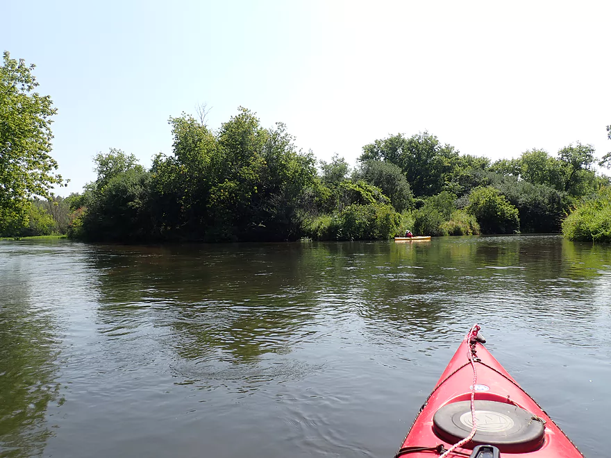
Little Turtle Creek soon entered the “Big Turtle” from the left. The Little Turtle is also a good paddle although it is shallower, which makes it a nice complimentary paddle to do when the Big Turtle is too high.
Things really changed after the Little Turtle. The main channel became much wider and we started to see some small mud banks. On the plus side the creek became a bit shallower, faster, and clearer after the confluence. The wild rice (which was such a highlight for the past 8+ miles) virtually vanished and we started to see more disturbed plant species along the banks. Another reason things changed was that at roughly this point, a nearly ~14 mile long DNR wildlife corridor along the creek would come to an end.
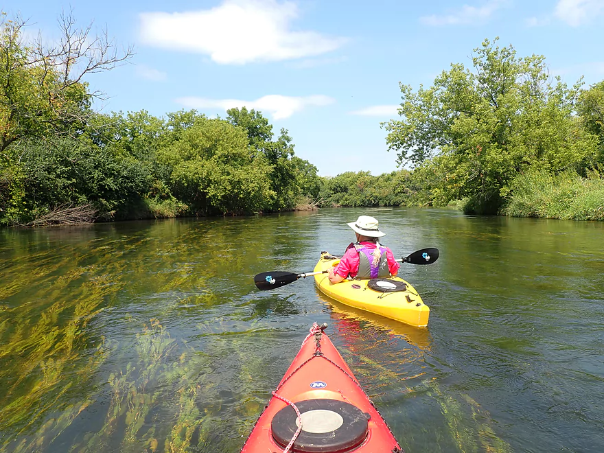
The second leg of the trip was still nice with great clarity. There were virtually no riffles, but you could always tell you were heading “downhill” as the water in many places often flowed in a vast wide “sheet” over the sand and gravel substrate–very cool.
Random paddling tip… This was a west-facing trip, which makes it an ideal morning paddle. Once you start paddling into the sun you start seeing haze and harsh lighting. But with the sun at your back the scenery will look much nicer (usually more saturated and vibrant).
Just after S. Carvers Rock Road bridge was “Spring Brook” which is a unique creek known for its limestone cliffs. Had water levels been higher I would have tried to explore upstream on it. Just downstream from the mouth were some small rapids (the only ones of the trip). These were just Class 1 and quite manageable.
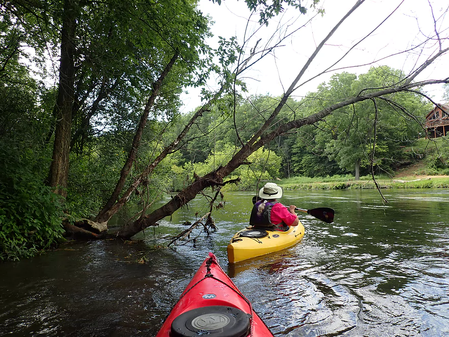
The third leg of our trip was hillier and more wooded. We also saw a few more signs of civilization, including some expensive homes and cows along the banks…but these were the exceptions and not the norm as typically the banks were undeveloped. In several locations (we counted three) limestone outcrops appeared kind of reminiscent of Grant County. These were easy to miss though as the adjacent banks were quite wooded. This leg might be best done in the fall or spring when the hills are more open.
We ended the trip at Hwy 140 which was yet another nice access….but also surprisingly busy. Hidden just east of Hwy 140 is a narrow limestone gorge which “stair-steps” down the hillside. During a rainstorm this should produce some spectacular (albeit small) waterfalls.
In summary this was a nice trip that we enjoyed. It should be noted that paddlers certainly don’t have to do the exact route that we did. The Turtle has so many good access points that it is easy to customize a trip to your personal preference. While almost the entire creek is good for paddling, I will generalize by saying that the legs above the Little Turtle confluence are nicer and more wild. Whereas the legs below the confluence might be a bit faster and enjoy a bit better clarity.
Carver-Roehl Park: Spring Brook empties into Turtle Creek just downstream from S. Carvers Rock Road. This is a very scenic creek and features many outstanding limestone cliffs. The feature is a trail system that runs almost the length of the park. While I’m sure the official trail is nice, the best way to experience the park is to actually wade up into Spring Brook itself so you can see the limestone cliffs up close. Spring Brook itself was too shallow for paddling, but in theory it might be viable in very high water and super scenic (although there would be a few jams).
Sights included a snake with a suspicious bulge in his stomach, a handful of fish (most were small but there were some big ones), several great blue herons, one green heron, several beaver slides, a damselfly eating another insect directly in front of me (which I photographed), many dragonflies, and a large bald faced hornet nest. Spring Brook had countless crayfish…among the most I’ve ever seen. The highlight was likely the many clams…unfortunately nearly all of them were dead. It’s as if some clam catastrophe had hit the creek.
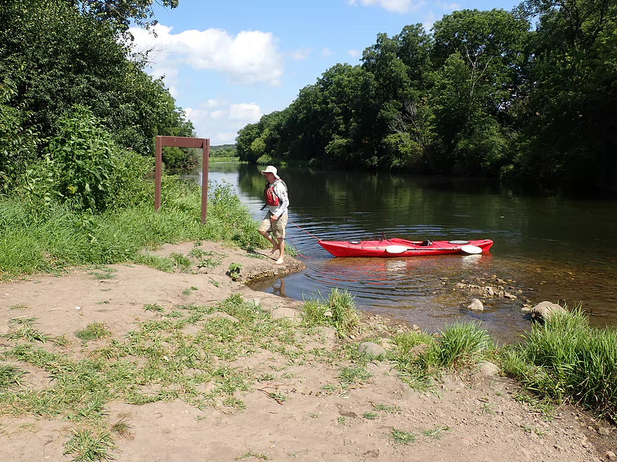
East Creek Road: This was a good put-in and had a public pull-off for paddlers west of the bridge. While some of the landings on Turtle Creek can get crazy busy, this one tends not to (we saw only 3 cars here). The only downsides are you need to drag your boat 280′ from the parking lot to the creek and there is no outhouse.
Alternate Put-ins: Note, there are many access points on the Turtle. Below are just some of the main options. For even more see my overview map.
- Hwy C (2.2 miles upstream of East Creek Road): A good bridge access. This stretch is scenic with the highlight being some attractive springs.
- O Riley Landing (1.9 miles downstream of East Creek Road): This is a relatively new kayak landing that is quite popular. Despite having a large parking lot, it was mostly full by the end of the day. This landing marks an important divide in the river as Little Turtle Creek enters the “Big Turtle” and significantly changes the main channel. After this, the creek becomes much wider and maybe even a bit faster. The banks also become a bit bigger and weedier with far less wild rice.
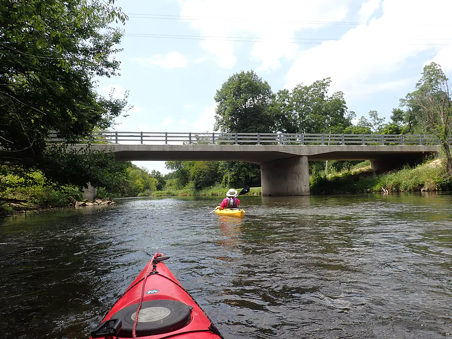
Hwy 140: North of the bridge is a wayside and parking area. A 160′ long trail leads to the water. All in all, a great access. It can get super busy though…when we started the day we were the only car in the lot. At the end of the day there were 14 cars. This access (like many on the Turtle) doesn’t have an outhouse.
Alternate Take-outs:
- S. Carvers Road (1.9 miles upstream of Hwy 140): This isn’t a popular bridge access, but we did see a few cars parked here. The northwest corner of the bridge looks like a nice public access…but there are no signs signifying if it is public or private. I assume it is private, but the public can use it…you’re just not supposed to park on the drive. Most park on the opposite side of the bridge (south end). If you take out here, you do miss out on a nice downstream stretch that features some hills and several hidden limestone outcrops.
- S. Smith Road (3.8 miles downstream of Hwy 140). There is a public park off of Smith Road (for the nearby stone arch bridge) that should be a decent access. I don’t know much about the leg between Hwy 140 and Smith Road, but assume it is nice.
Bike Shuttle: 4.5 miles and about 50′ of ascent. We car shuttled but this wouldn’t be a difficult bike shuttle. Note…if you do this in 2020, parts of East Creek Road are closed for construction…so the 4.5 mile shuttle would actually take 6.1 miles.
Logjams/Fences: None…despite its fast current, I actually think of the Turtle as a relatively safe creek.
Rapids: There is only one set of Class 1 rapids on this trip and they are located just downstream from S. Carvers Rock Road. They’re quite manageable.
Local Gauge: Carvers Rock Road @ Turtle Creek – Trip 198 CFS.
- 0-100 CFS: 60 CFS in years past would have been an average summer depth, but now the creek rarely gets this low. If it does, expect fantastic clarity although some spots may become congested with aquatic weeds.
- 101-150 CFS: A good depth with a lot of clear water.
- 151-250 CFS: A decent depth with some clear water.
- 251-350 CFS: The creek will still be navigable but some of its neat character will be submerged under water.
- 351-500 CFS: This is a high depth and the creek is likely viable for paddling, but it won’t be as scenic. There’s likely no clarity at this depth.
- 501+ CFS: This might be too high for enjoyable paddling.
Detailed Overview
Special thanks to Friendsofturtlecreek.com for many of these tidbits.
- Turtle Lake Boat Ramp to Turtle Lake Road: 0.8 miles. Half of this would be a lake paddle on spring-fed Turtle Lake. The other half would be over an extremely small channel that would likely require very high water to be navigable.
- Turtle Lake Road to Island Road: 3.2 miles. Artificially straightened, and perhaps requiring a few culvert portages, this marshy section would likely not be for most but could have its appeal. Google has a nice street view image of this section.
- Island Road to Dam Road: 2.5 miles. More straightened channels running through thick marshes. This could have some subtle beauty to it. An alt take-out would likely be Hwy P.
- Dam Road to North Terrace Street: 2.8 miles. For 1.5 miles the creek finally meanders naturally for the first time, but in the last mile, the creek is impounded by a dam to form Comus Lake. Take out above the dam at the public Comus Lake boat ramp.
- North Terrace Street to School Section Road: 6.3 miles. Good marsh prospect with perhaps a logjam or two. Launch below the dam but be wary of a second lowhead dam. On my to-do list.
- School Section Road to East Creek Road: 6.9 miles.
- School Section Road to Hwy 14: 2.2 miles. Great section, with terrific water clarity.
- Hwy 14 to Hwy C: 2.4 miles. A bit more weedy, but still a great section with good water clarity. Spooner Park is an alternate access.
- Hwy C to E. Creek Road: 2.2 miles. A nice section with some scenic springs.
- East Creek Road to Hwy 140: 6.8 miles.
- East Creek Road to O'Riley Landing: 1.9 miles. Good stretch with scenic wild rice.
- O'Riley Landing to S. Carvers Rock Road: 3.1 miles. Little Turtle Creek comes in and significantly increases the size of the main channel. This is still a pleasant stretch with good clarity and an attractive gravel bottom.
- S. Carvers Rock Road to Hwy 140: 1.9 miles. This stretch is more wooded and hilly. There are several hidden limestone outcrops on this leg.
- Hwy 140 to Sweet Allyn Park: 5.2 miles.
- Hwy 140 to Turtle Creek Parkway/Smith Road: 3.8 miles. A good leg with deep clear water. The latter parts are a bit weedy though.
- Turtle Creek Parkway to Sweet-Allyn Park: 1.4 miles. A more shallow, but terrifically scenic stretch with fantastic clarity. The highlight is a historic five arch stone bridge.
- Sweet-Allyn Park to S. Lathers Road: 1.5 miles. Likely a nice prospect. The take-out at S. Lathers Road is good and used by paddlers…but vague No Parking signs don’t make it clear where you can park.
- S. Lathers Road to Town of Turtle Creek Canoe Launch: 2.2 miles. Likely a nice prospect.
- Town of Turtle Creek Canoe Launch to Milwaukee Road/Turtle Creek Greenway Trail: 5.5 miles. A nice trip through the Turtle Creek floodplain and outskirts of Beloit with occasional riffles, an attractive gravel bottom, and lush jungle-like vegetation.
- Milwaukee Road to Colley Road: 0.4 miles. Good prospect.
- Colley Road to Turtle Creek Park: 1.6 miles. Good prospect. Take-out is west of Dearborn Street. Disembark north of the creek and park to the west. Bank is a bit steep here. A nicer launch is south of the creek by Turtle Tap. Turtle Tap is private, but supposedly there is a strip of public land you can use to launch from.
- Turtle Creek Park to Dickop Street: 1.0 mile. A very good prospect.
- Dickop Street to John Jose Canoe and Kayak Launch: 0.8 miles. A final short section on Turtle Creek, then a paddle upstream on the Rock River to reach a take-out.
Trip Map
Overview Map
Video
Photos Size: