
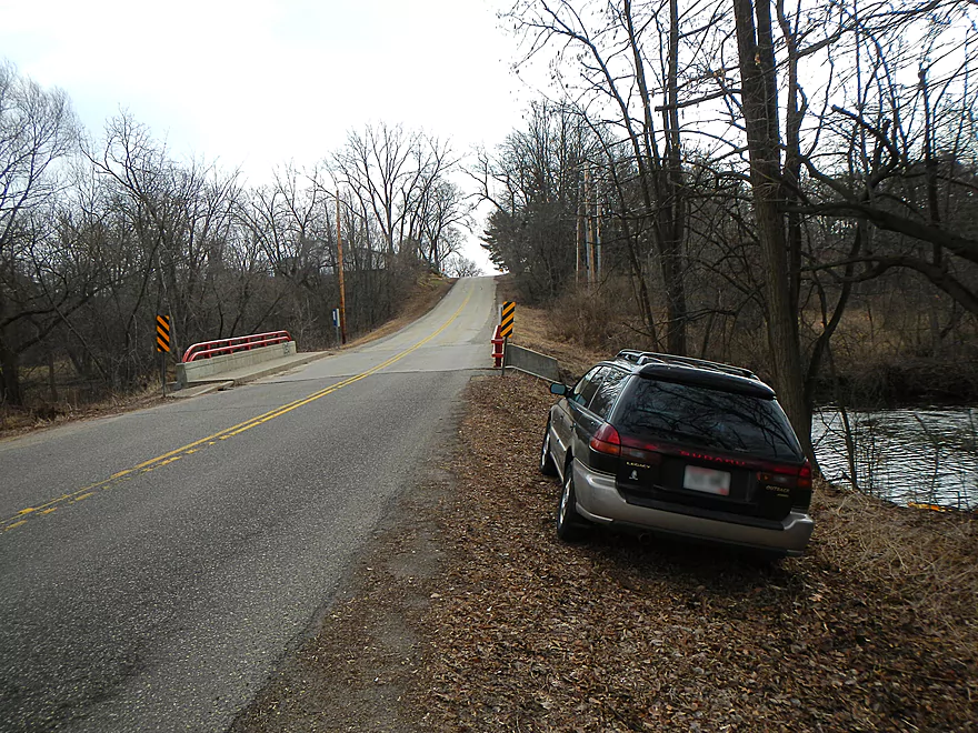
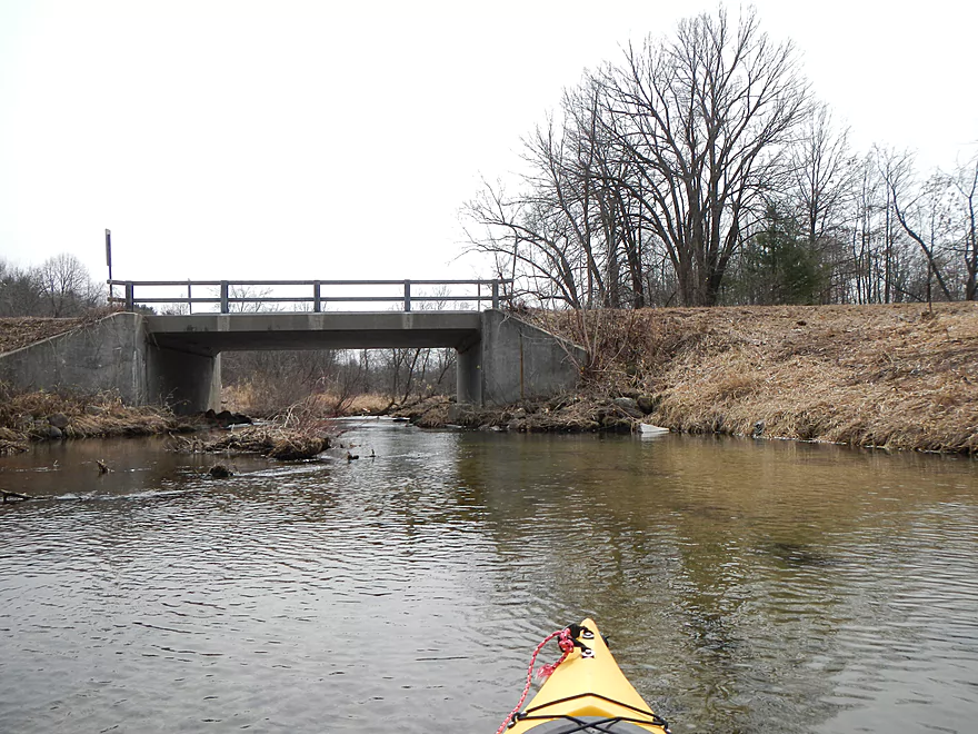
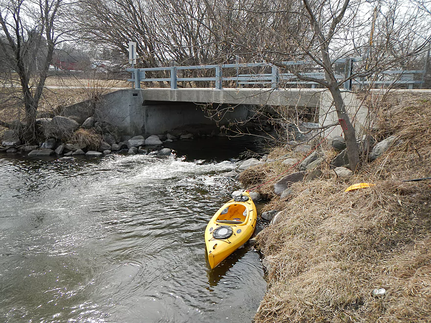
W. Chauncey St. Put-In
Ok launch area
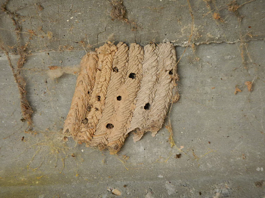
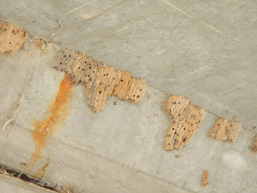
Mud dauber nest…filled with dead spiders for little wasplings.
Boney drop if you put in upstream of I
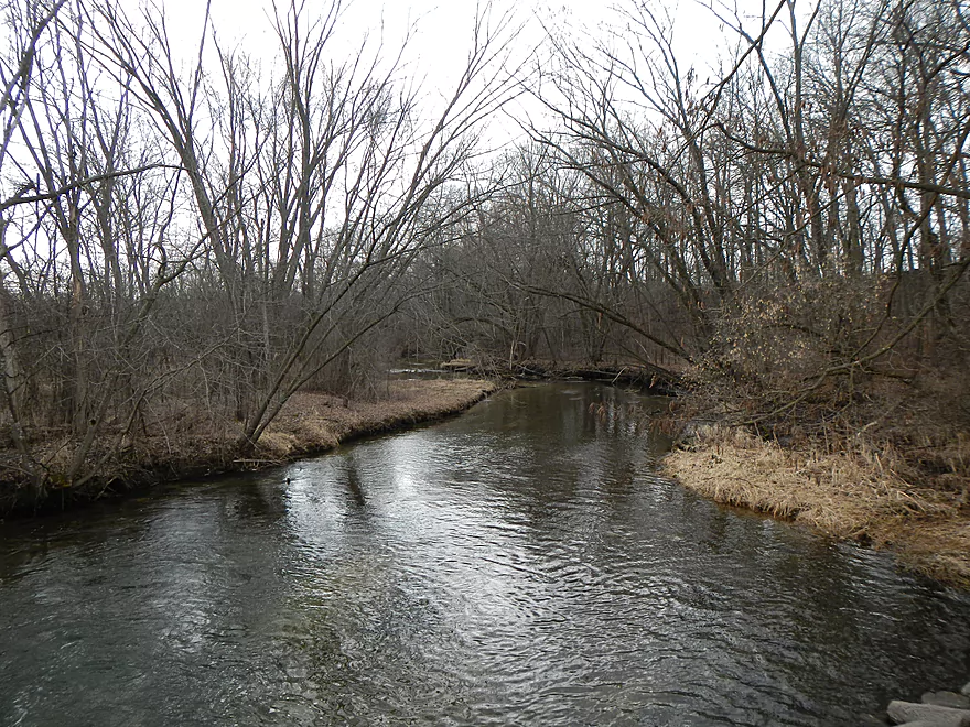
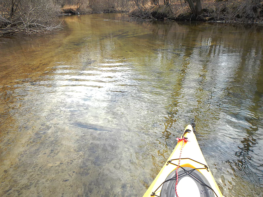
Terrific water quality
Very sandy, too
Interesting sand lines
Mystery sewer odor in this area
Culprit (ironically next door to the spring water bottling plant)
Only barbed wire obstacle (easy to go around)
An old wing dam?
At least this one doesn’t span the creek
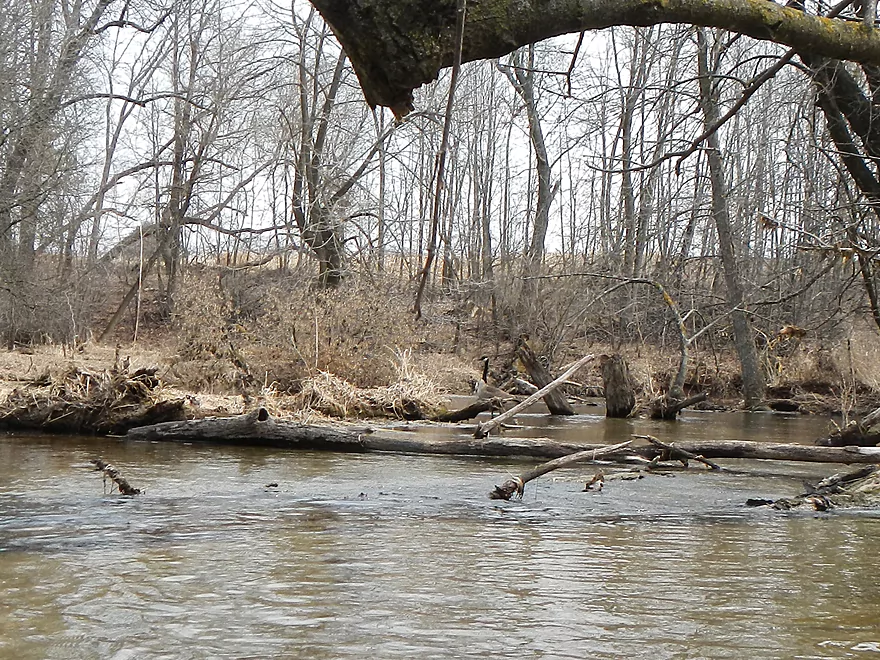
First of many geese

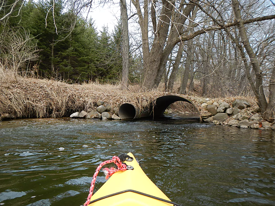
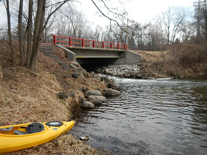
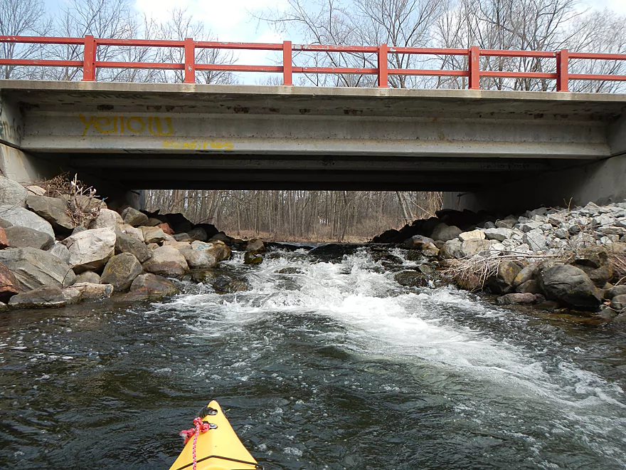
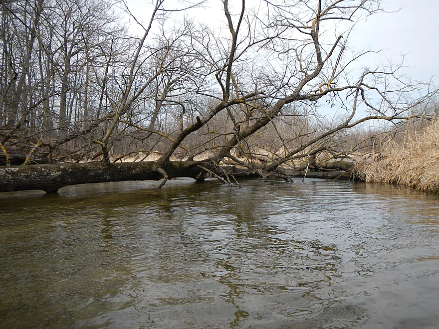
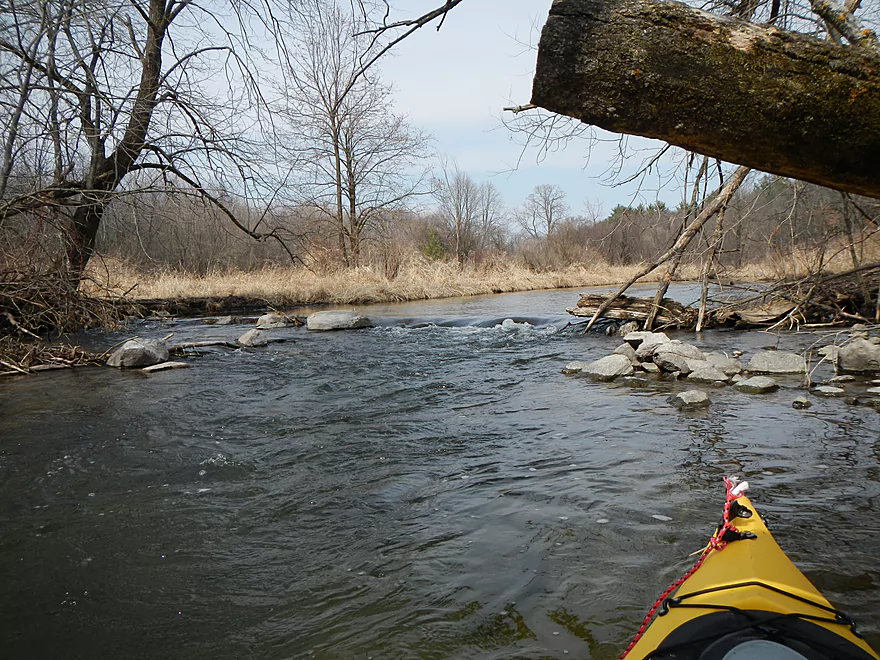
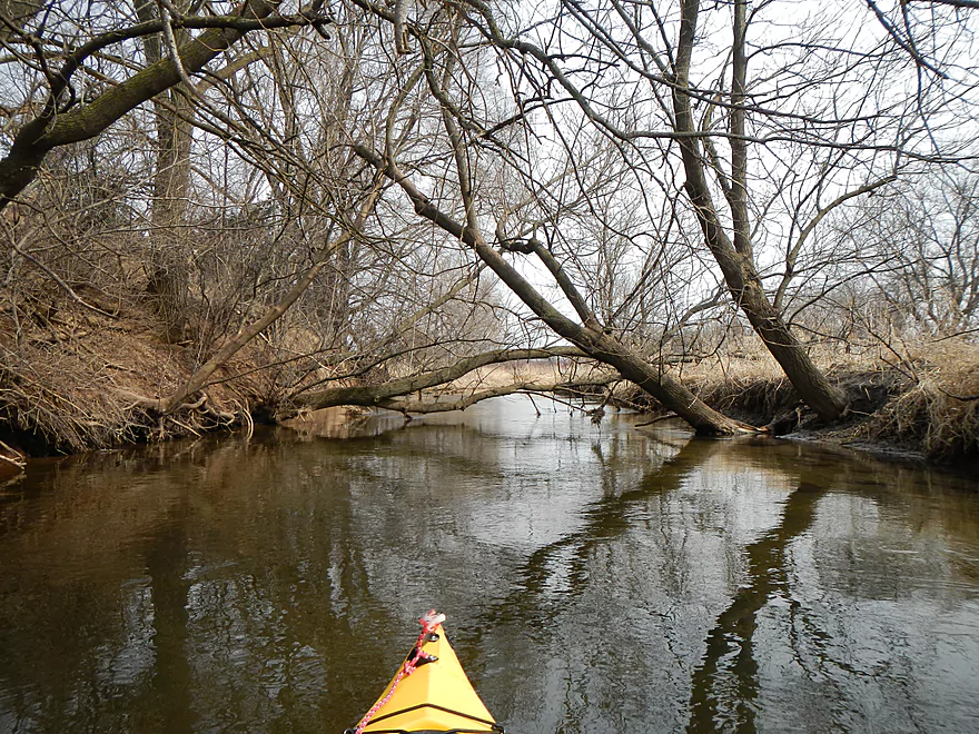
Cool culvert and riffle
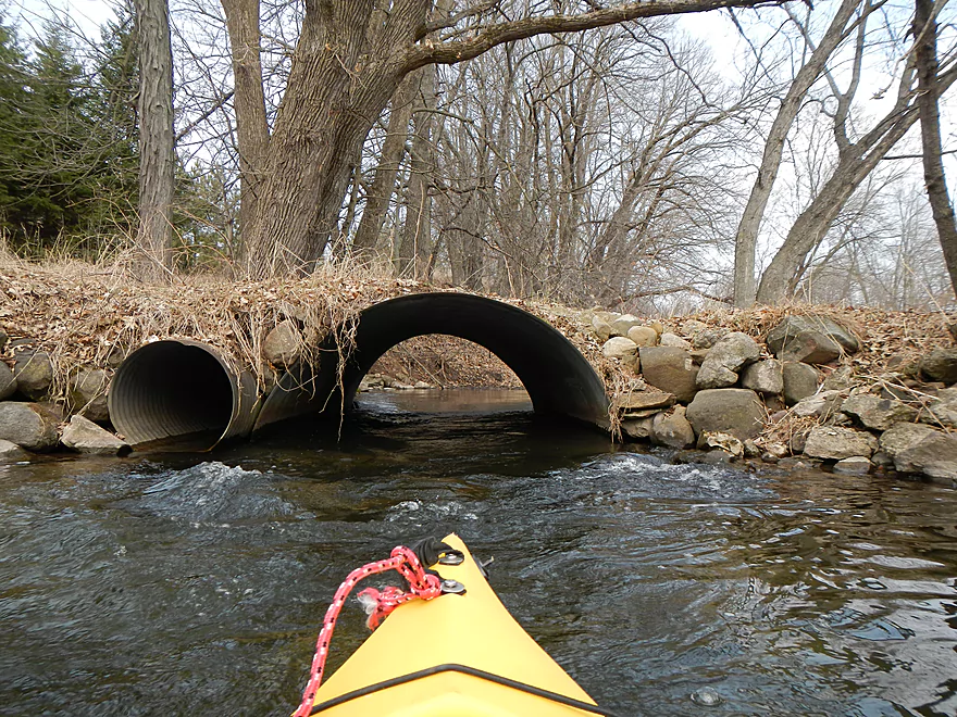
I fit easily ducking…canoer might have issues

Micro-fall
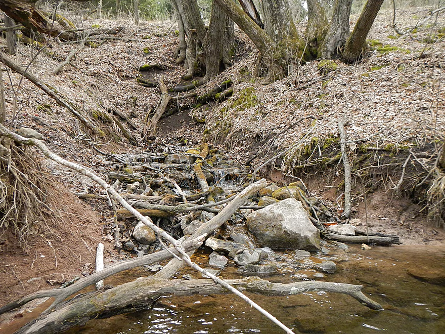
Evidence of ancient logjam clearing
I cleared this out (still an annoying hopper)
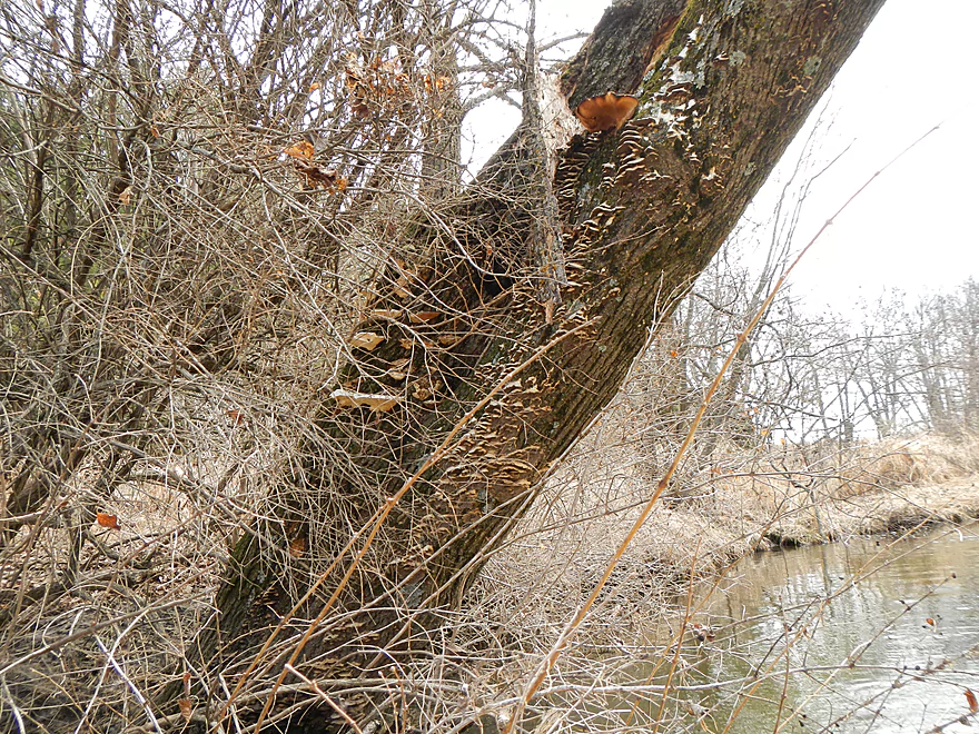
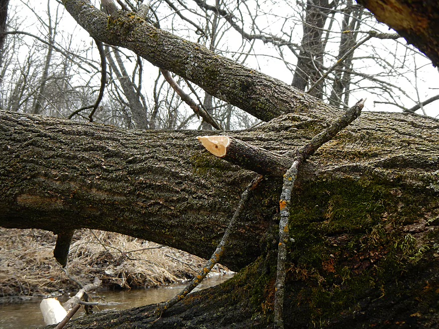
Nice fungus
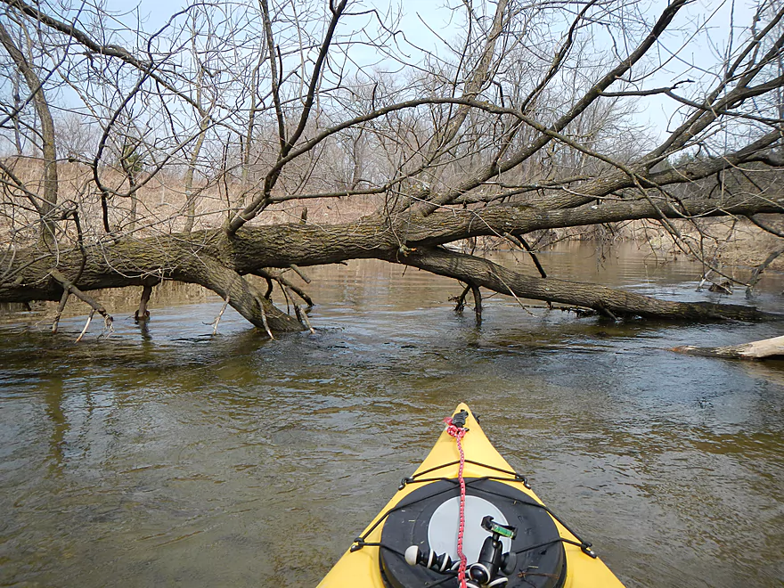
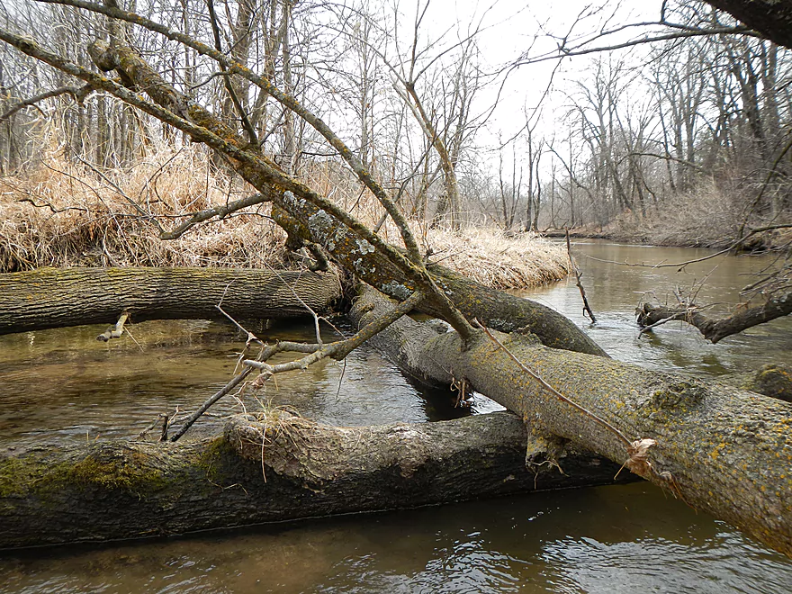
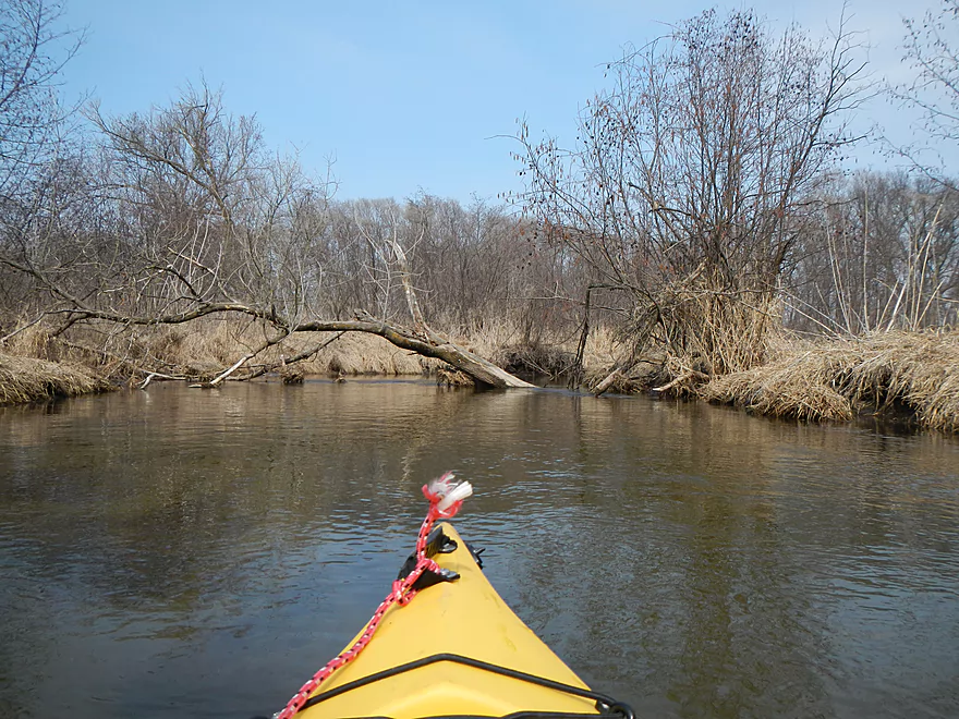
Logjam before
After…mostly cut through now
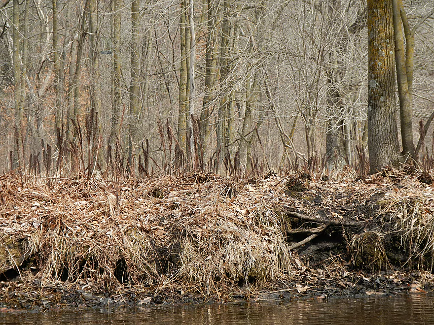
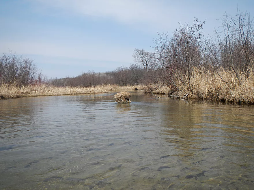
Lot of beaver evidence
Serious ducker, canoes would not fit
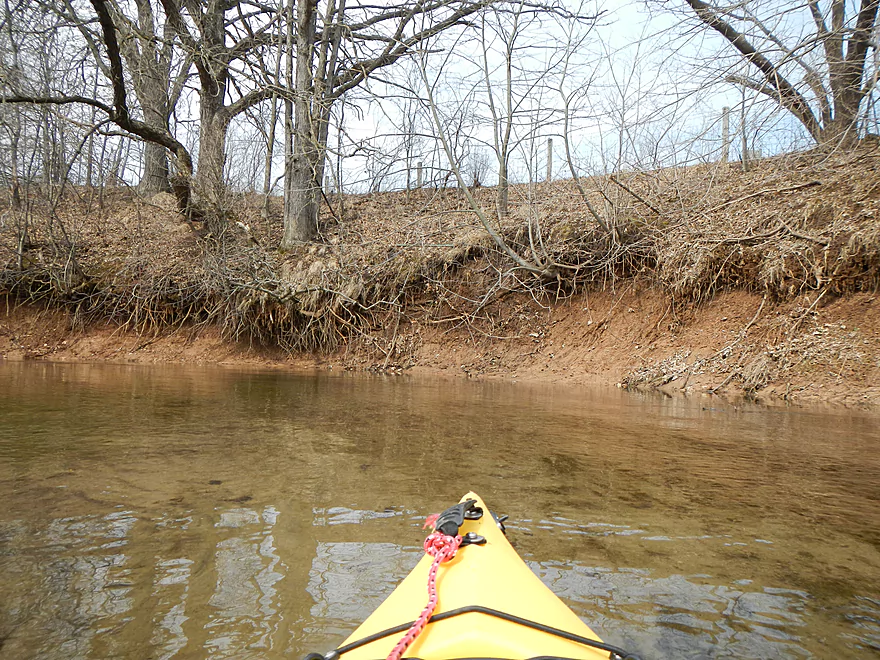
Unique clay banks
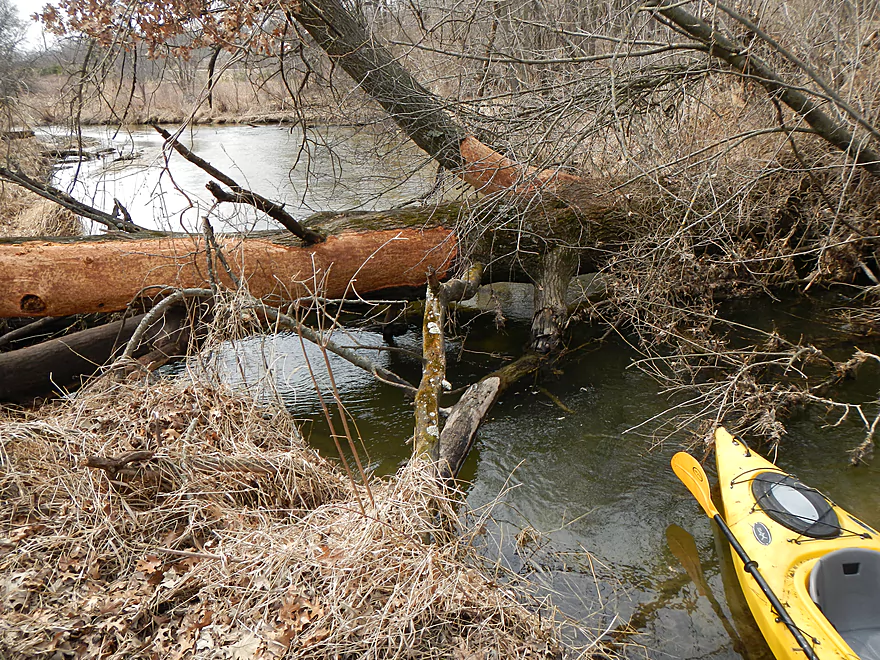
First “get out of the boat” jam
Easy with shallow banks though
Discovered this with my nose
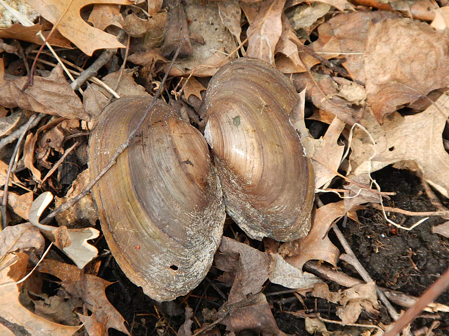
Some clams on the creek
More honkers
Lot of Red Osier Dogwoods
Lot of Red Osier Dogwoods
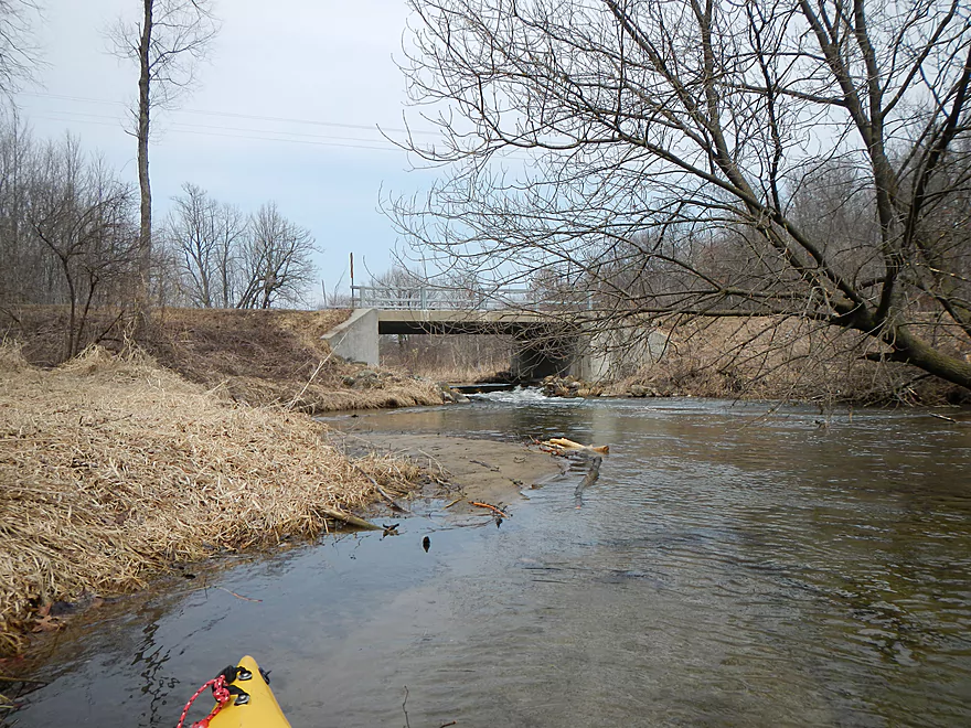
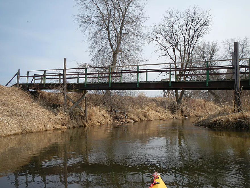
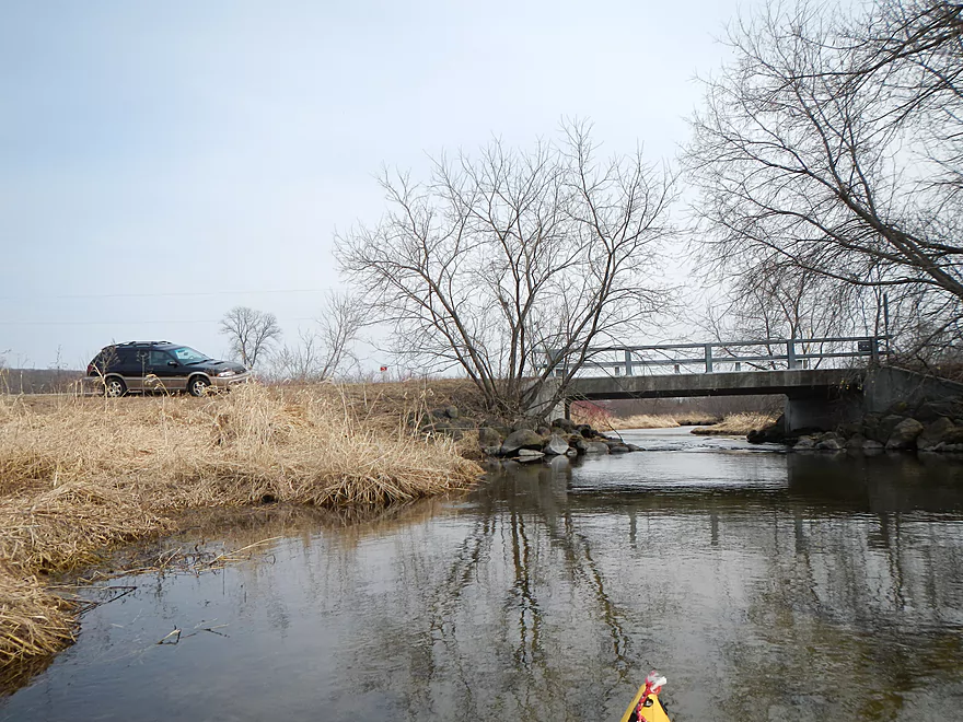
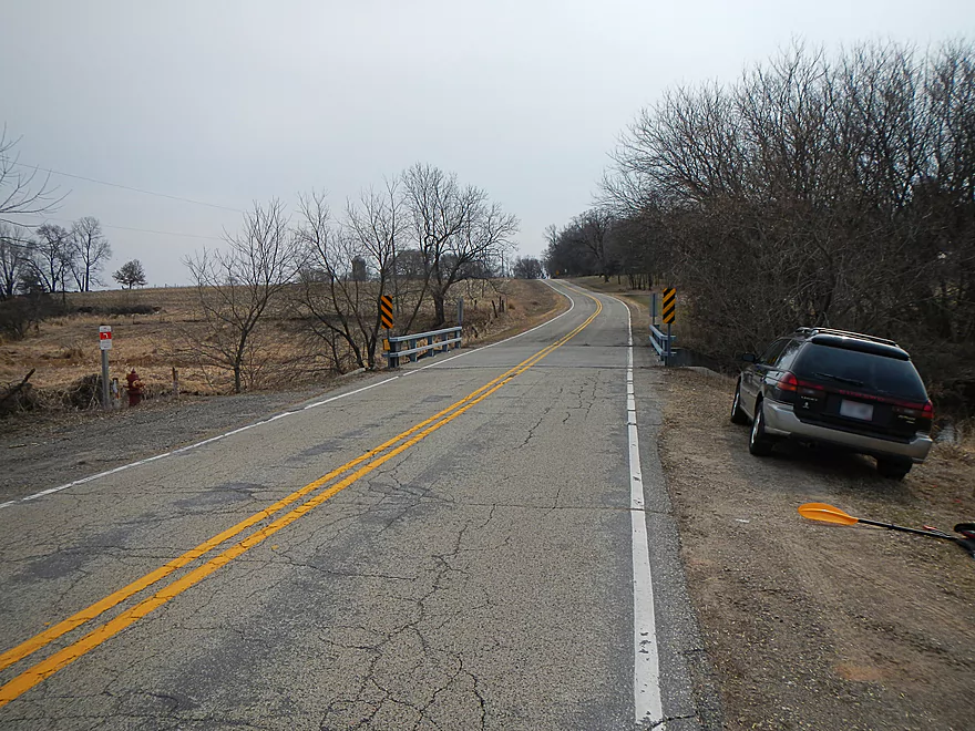
Fox Road Bridge…good take-out option
Probably a class 2 drop
More mud dauber nests…like organ pipes!

All 3 bridges had rapids on them
Good take-out area
Moldy corn dogs
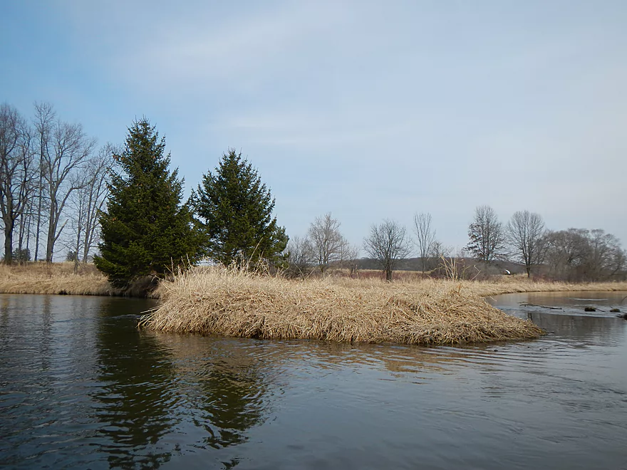
Occasional pines on the creek
Logjam and shallow water forced me out
Nice underwater clay texture

Cool clay banks
Third portage…not too bad
In the rear view mirror
Red-osier Dogwoods
Minor riffle (noisy though)
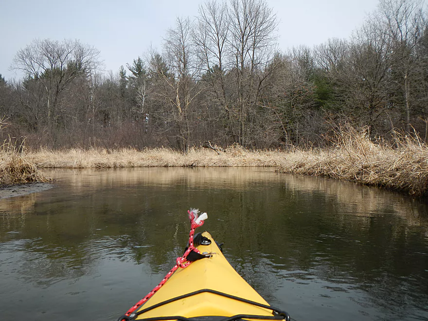
Entering an open area
Grassy stump…
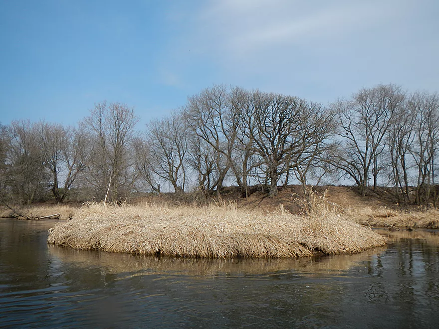
Lots of oxbows

Less interesting section of the creek
More oxbows
More beaver evidence (did see one in the water)
Short-cut through an oxbow
Mostly the end of the open area
But not of the oxbows…
Serious ducker…cut through some of it which may help future paddlers
Silos are a good guage of where the take-out is
Hwy A Bridge
Another fun riffle
Decent take-out area

Just don’t park here
Plenty of room over here
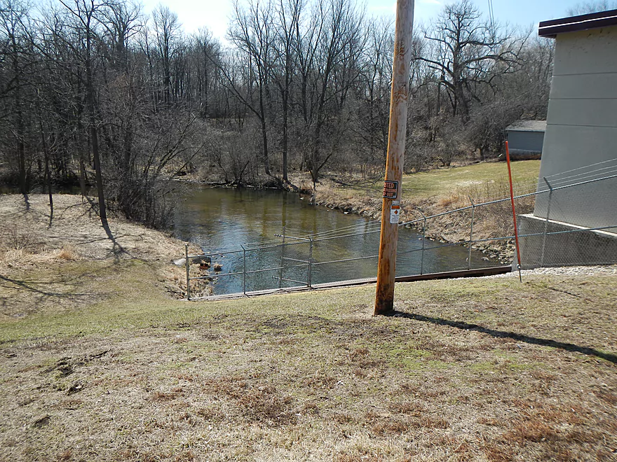
Alt put-in @ Oxford Dam with no tresspassing sign
Ok parking by “portage sign” but small trek to water.
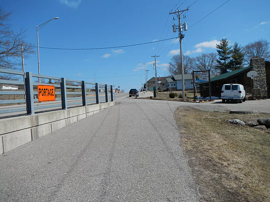
Neenah Creek – Oxford

Neenah creek is an occasionally paddled creek that is normally known for its open grassy areas, wetlands, waterfowl, and for being the first major tributary of the historic Fox River. A far more obscure segment of the stream, rarely paddled, is the far upper section, which I learned about from Small River Canoe Adventures of Wisconsin by Frank F. Piraino. Last week, I decided to give this a try and was glad I did, as it is a pleasant stream (but with quirks, which I’ll cover).
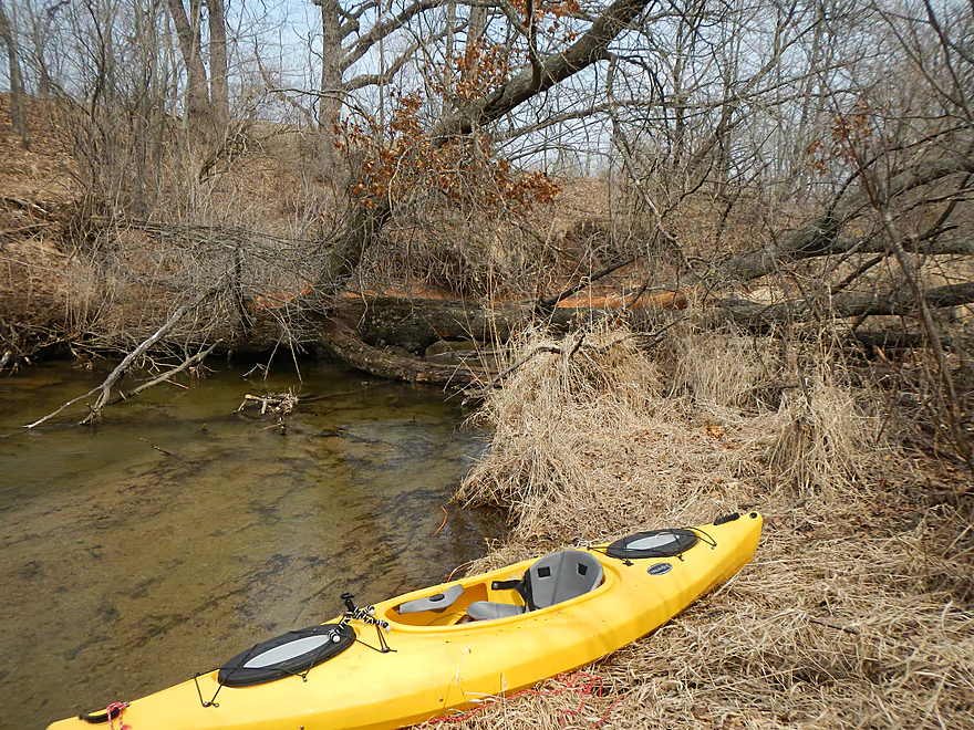
For put-in options, I’m not sure you can go much further upstream than the Oxford dam. Granted, you could do some flowage paddling (and Google terrain view actually shows the potential for bluffs far enough upstream), but the chances of deadfall and insufficient water are pretty high IMO upstream of the flowage. Putting in at the dam is an option, as there is parking on the street, a portage sign, and a grassy area where you can launch. I don’t recommend this though, as there is a no trespassing sign (not sure if this is for the dam), it is a decent hike to the landing, and I thought I saw one log jam from the road. A better option is to put in just a couple hundred yards downstream on the other Oxford bridge at Chauncey Street.
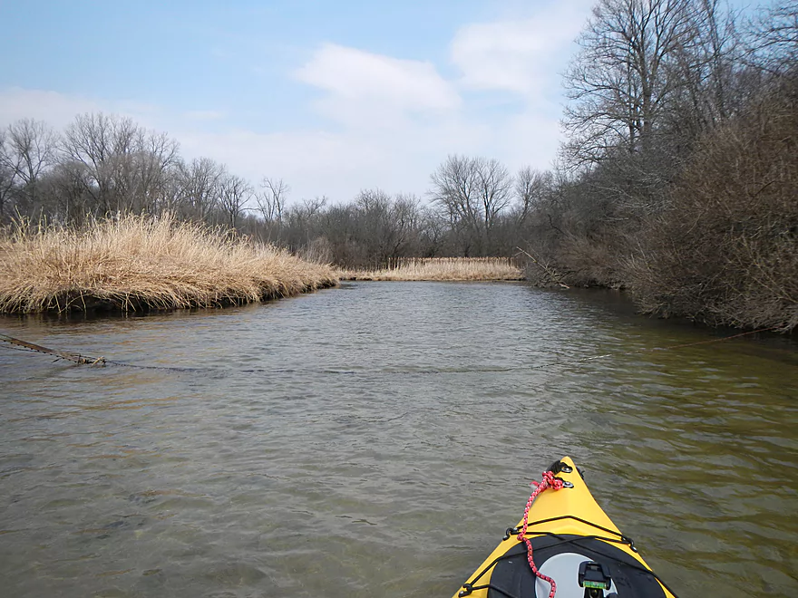
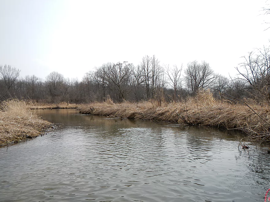
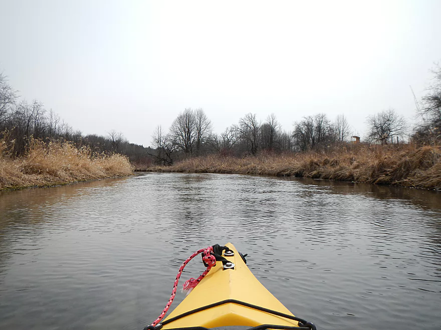
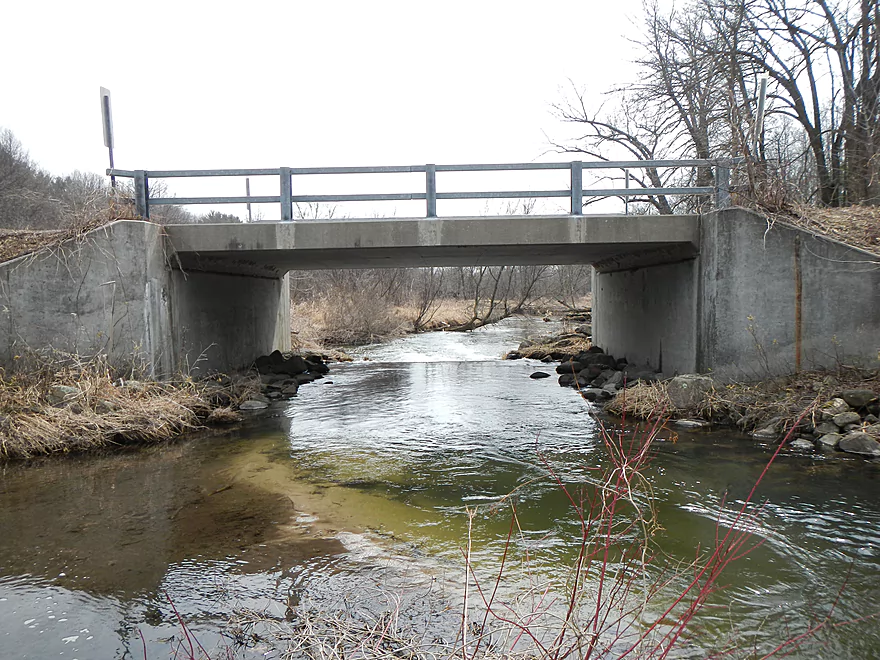
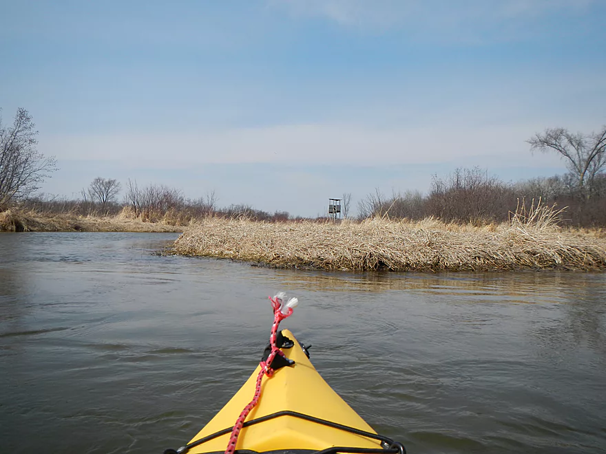
This is not a bad bridge–with light traffic, decent access, and a pull-off area for parking. There is no shuttle service for this area, so I do recommend a bike shuttle (or a friend). It’s a pleasant route that actually just happens to be a promoted bike route by the local tourism agencies: the Oxford/Briggsville Loop (which roughly parallels the creek). Once you put in at the Chauncey Street bridge, the first thing you’ll notice is the mini-rapids under the bridge. You can run this by putting in upstream of the bridge, but IMO it looked a little boney, so I passed.
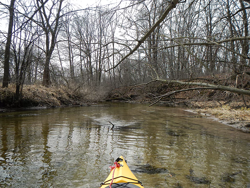
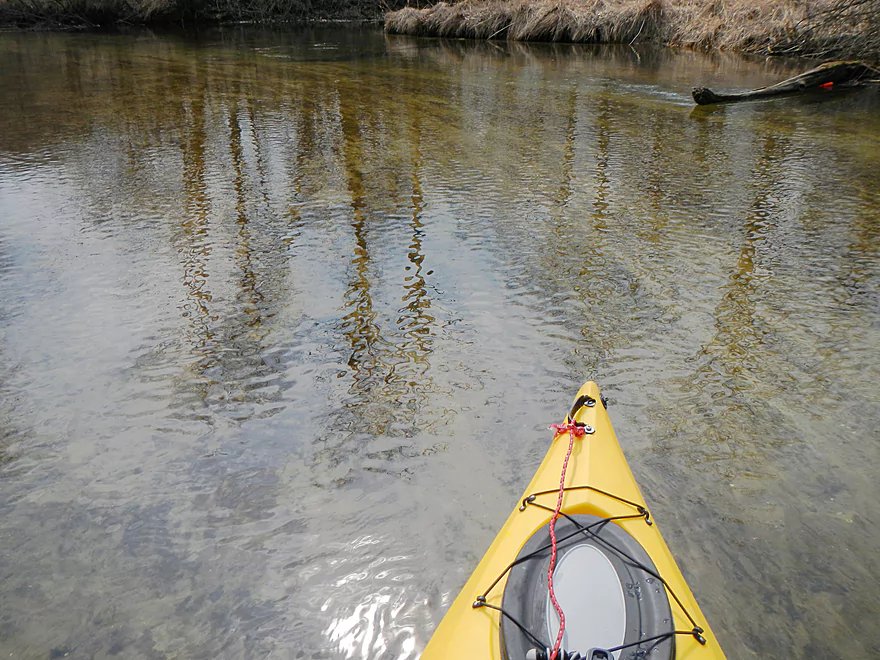
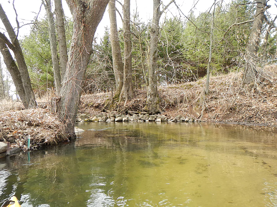
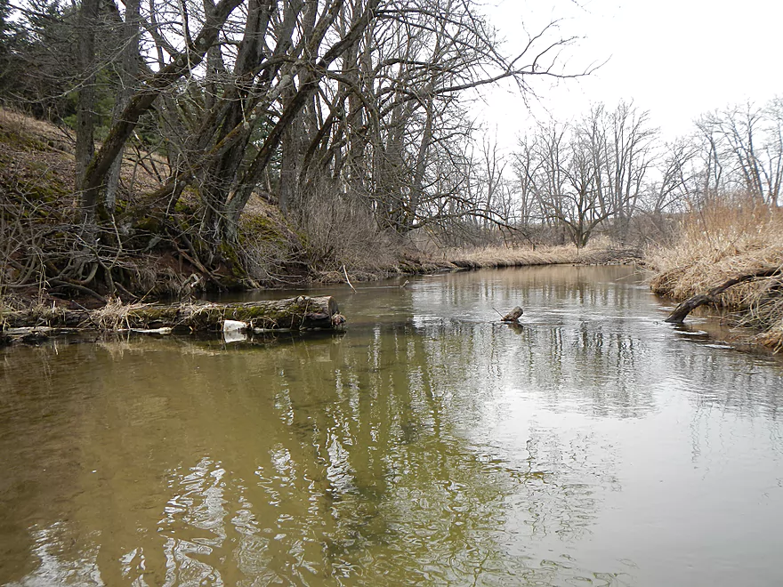
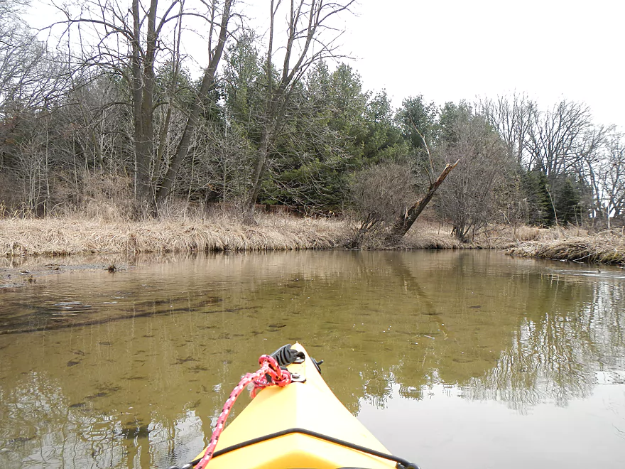
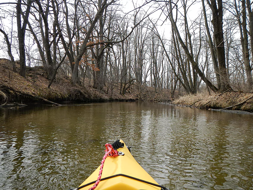
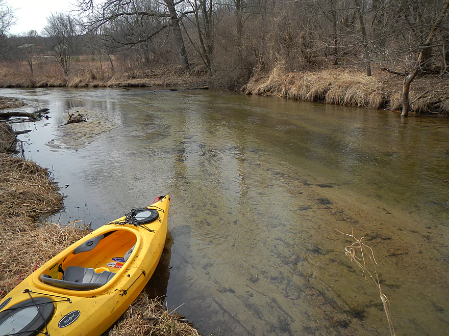
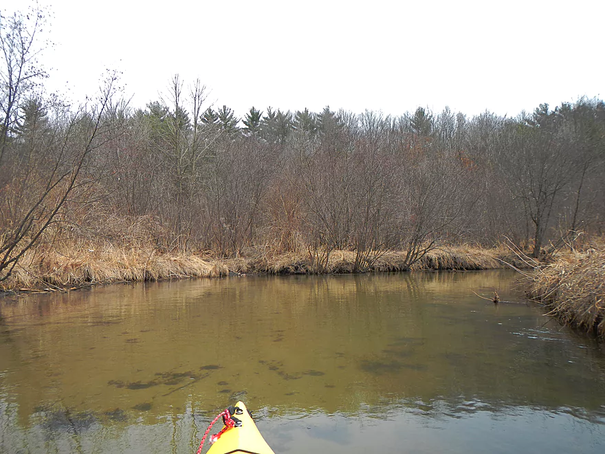
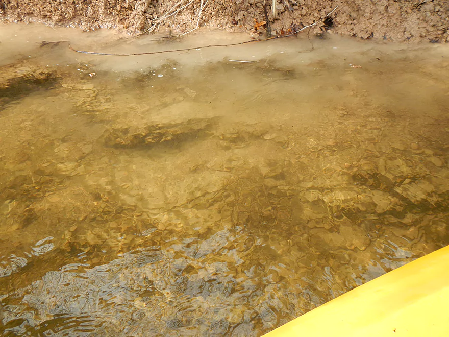
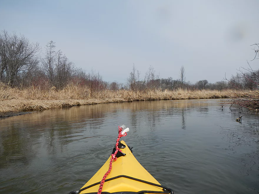
What will impress you after putting in is how clear the water is. Remarkably so. And how sandy it is (although there is some gravel substrate close to the put-in and unique clay areas in the later half of the trip). The creek does run shallow in the upper section and I honestly don’t know if it runs dry in the summer (as opposed to my early April paddle). I’ve included a gauge of the closest creek of similar size in Ten Mile Creek…but I doubt that is accurate. For the most part, the water level wasn’t an issue. I had to “wheelchair” a couple of times (not fun in the cold) and only had to get out once because of the shallow water (more on that later).
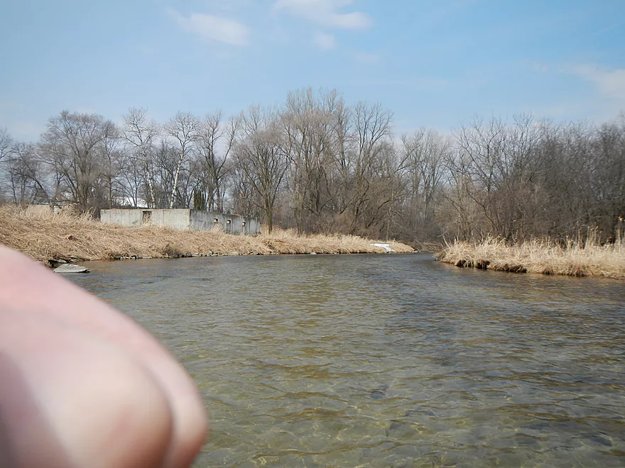
Soon into the paddle, you will pick up the smell of the local waste water treatment plant. Encountering these is old hat for paddlers and they tend not to be a problem, but this particular one stood out for about a half mile. I don’t want to discourage you though, as it wasn’t an overpowering smell and the water still remained clean. Funny coincidence…the Neenah Spring Water bottling plant (where I get some of my water) is right next door to the waste-water facility.
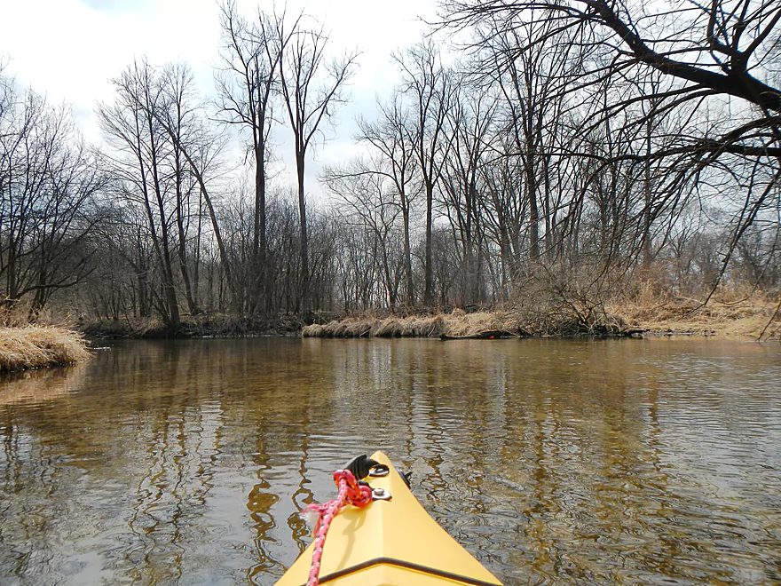
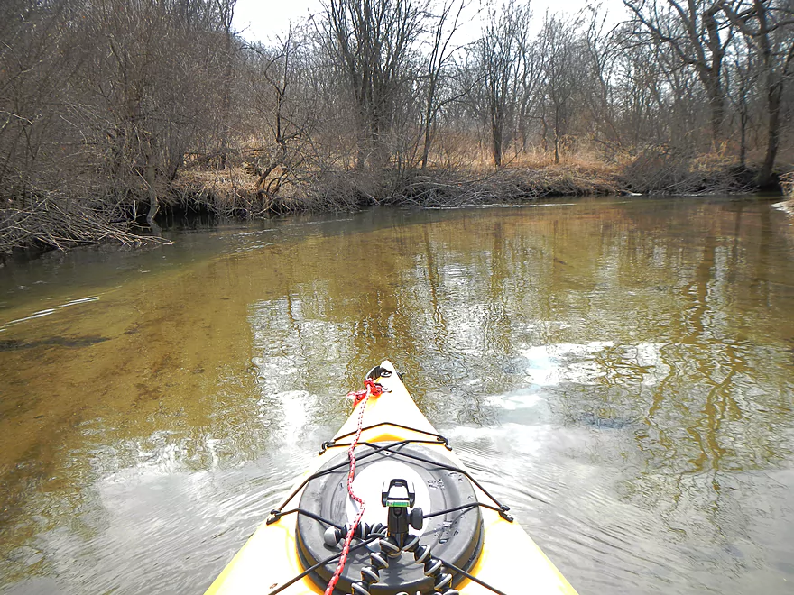
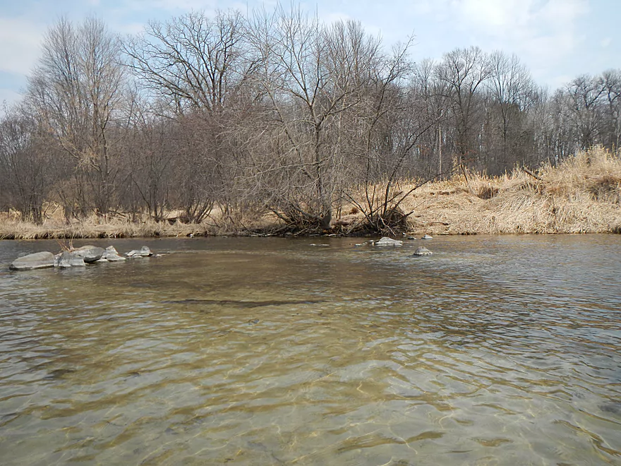
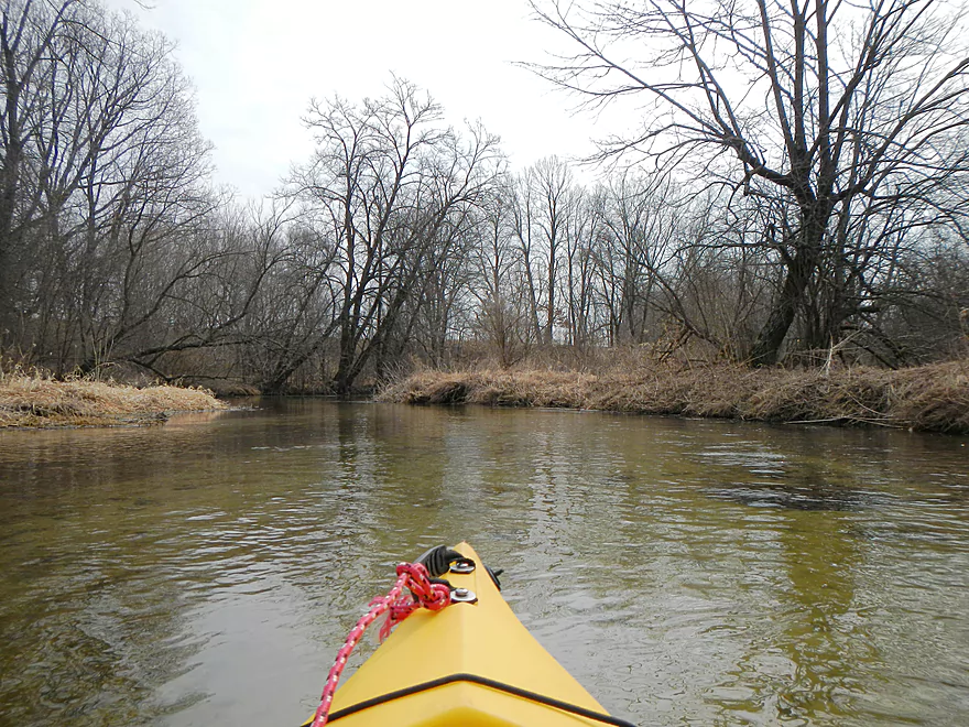
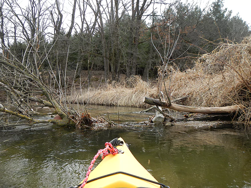
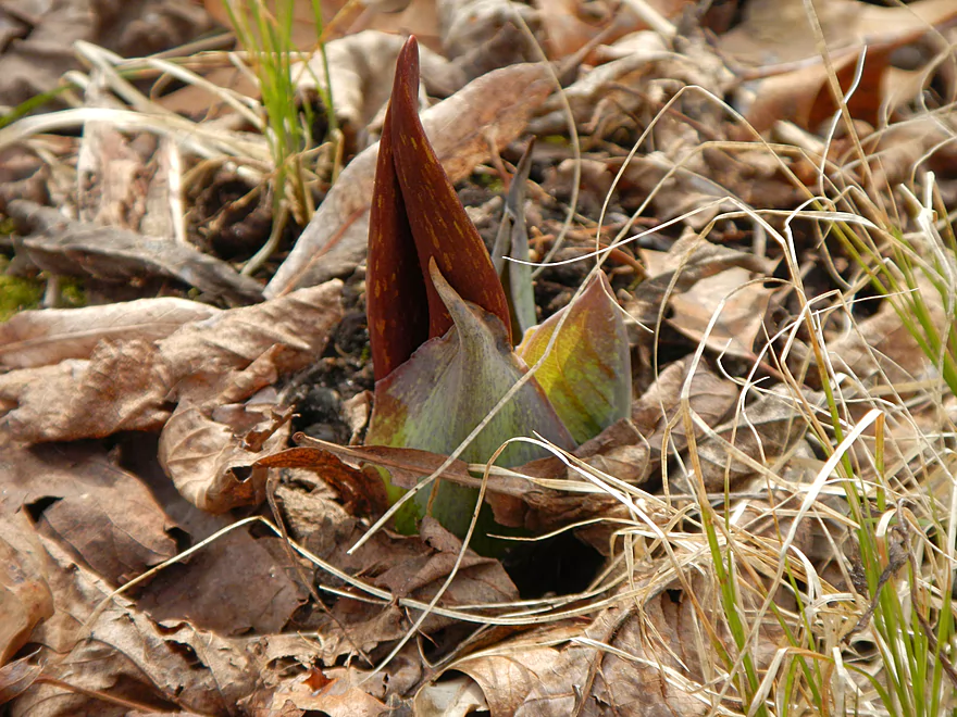
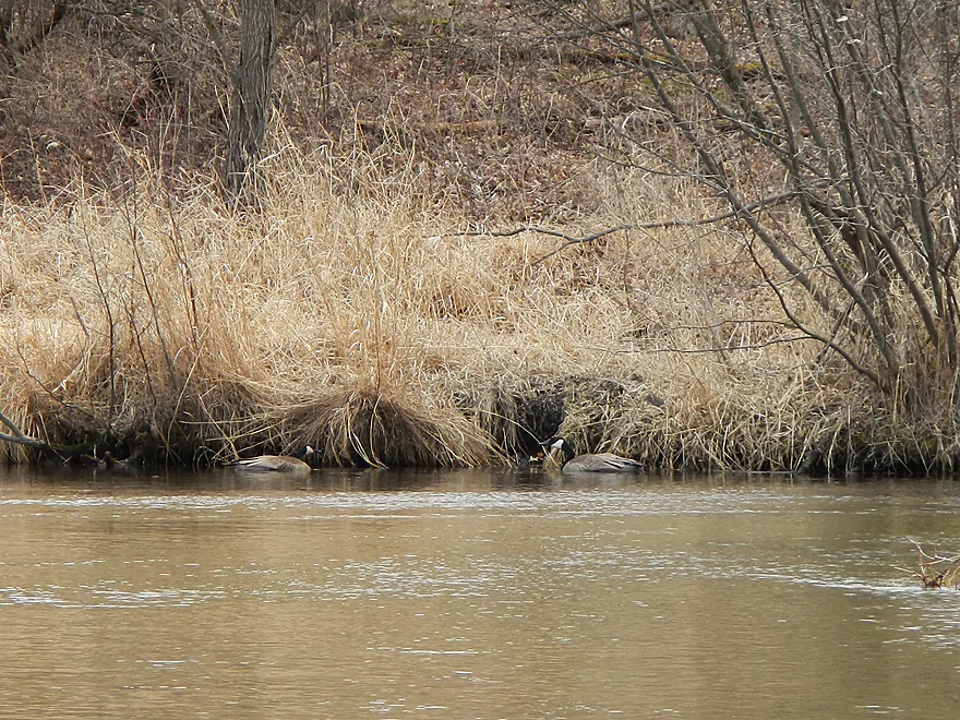
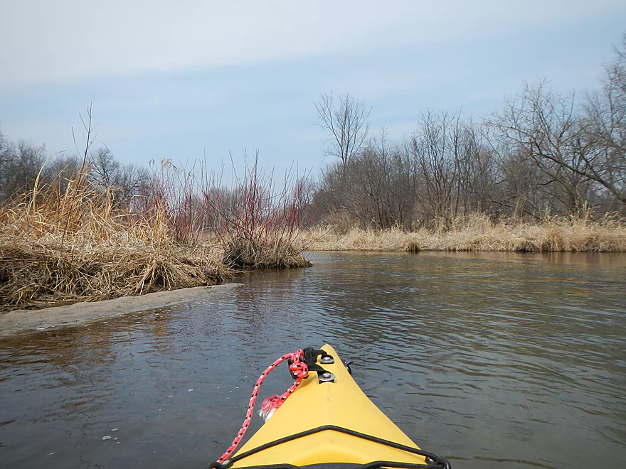
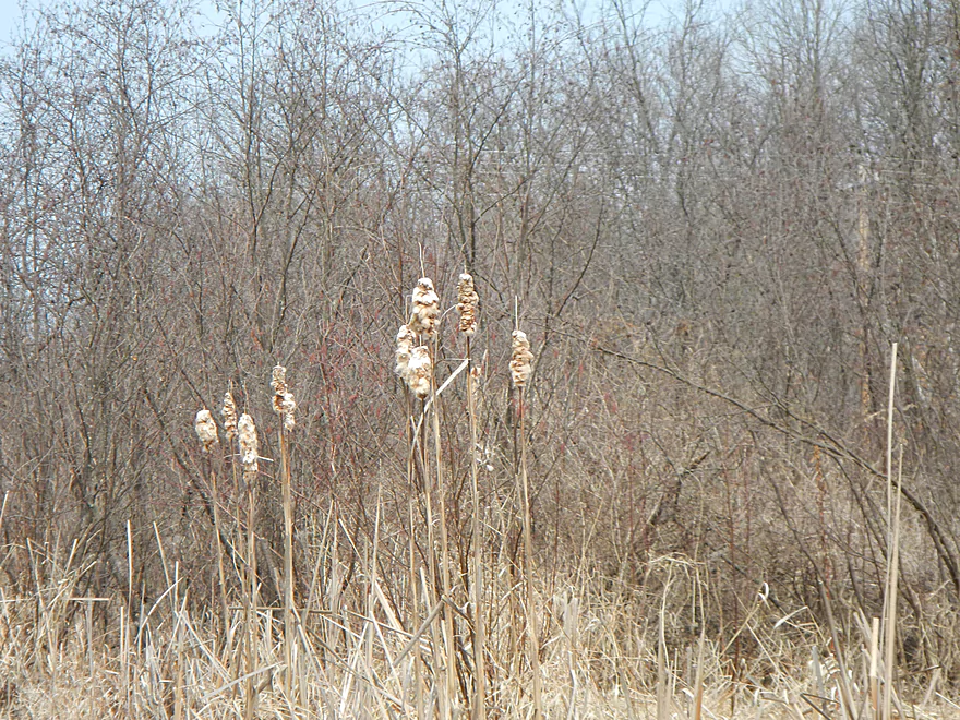
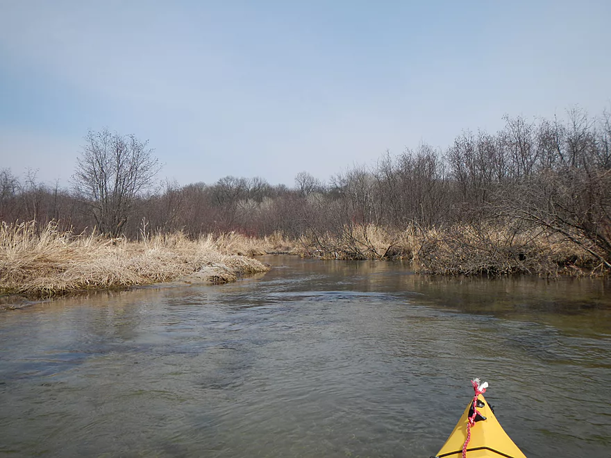
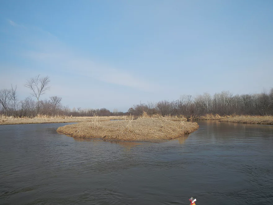
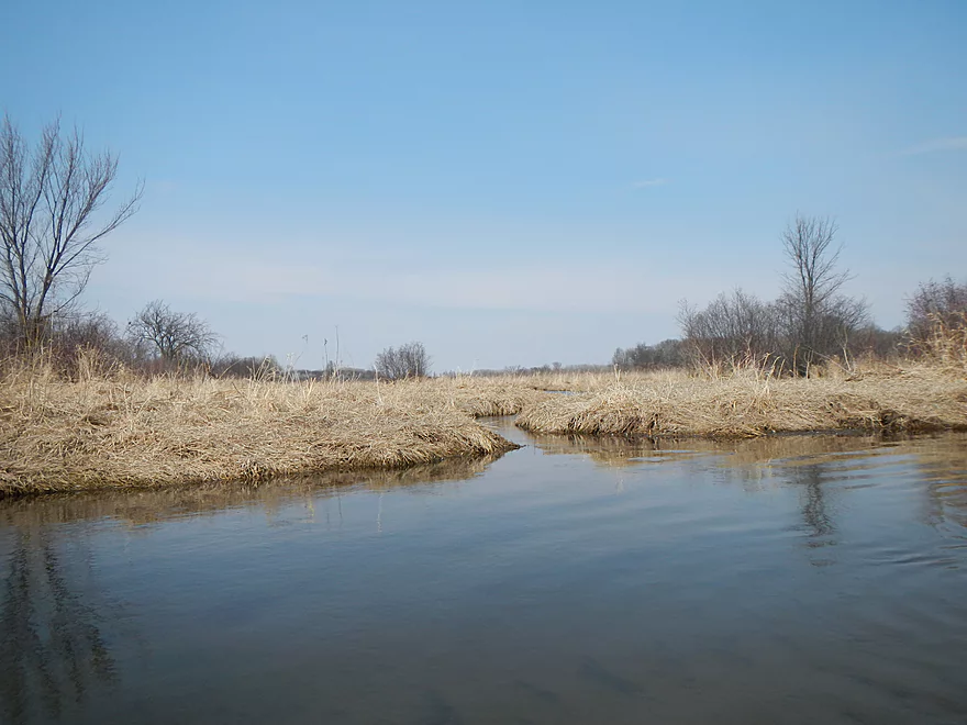
This upper section of the upper creek is my favorite, which meanders though some grassy areas, but through a lot of wooded areas, too, with a decent current. Thanks to the clear water, you’ll, for the most part, be able to see the cool sandy lines in the water and occasional minnows. Didn’t see any big fish, but did see a LOT of birds. Mostly geese and ducks. Some swans close to the end of the trip. During the summer the water plants could make this very scenic (like Cedar Creek, that I reviewed earlier). Other wildlife included a beaver (tons of beaver handiwork as well), birds I couldn’t identify, some clams, and some terrific mud dauber nests on the undersides of the first two bridges.
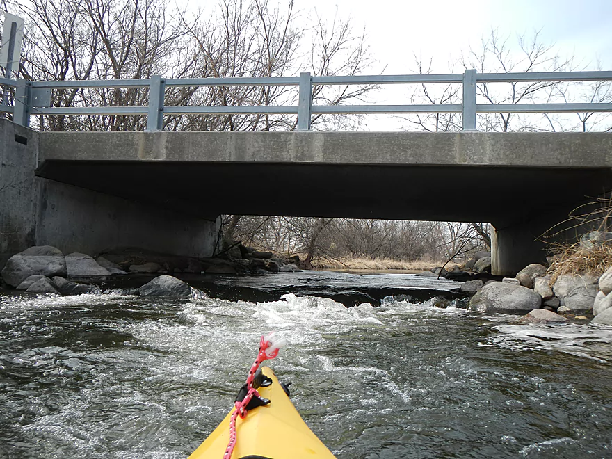
The current is a little on and off. The latter section is a tad slow, but the upper section is respectable, but in no way dangerous except for the rapids. These are all marked on the map. The first is the Chauncey Street drop that again looked a little rocky (maybe class 2). The next section (that at least makes noise) is a culvert (I have video/pictures of all of these). This is actually fun to go through and is probably only a .5 riffle. The danger here is getting high-lowed because the culvert is low. I was able to duck forward–no problem in a kayak, but a canoe might have to portage this. The Fox Road bridge has a nice drop (maybe class 2) that was fun to go over. Canoes and skinny v-bottom boats may want to avoid this one. There is a smaller rapids later on that isn’t much of an issue. Then there is the take-out on the Hwy A bridge, which is maybe a class 1–fun to go over, but easy to avoid by taking out on the upstream side of the bridge.
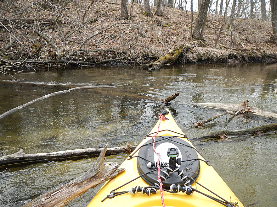
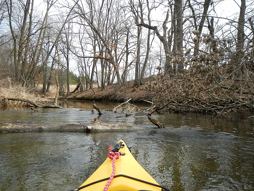
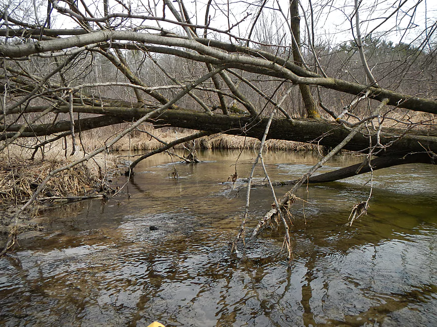
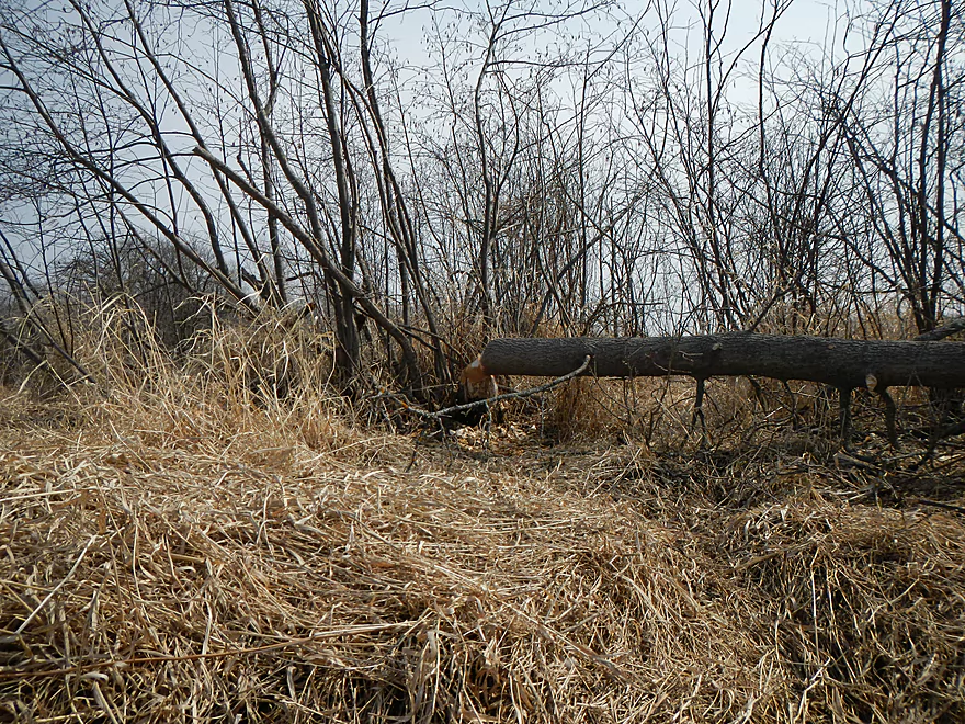
A paragraph does have to be devoted here in regards to the logjams. Normally, a creek like this is filled with them…and Neenah was remarkably free of them, but there were multiple issues (mostly minor IMO). All in all there were only two instances where I had to get out of my boat because of a logjam, and this was easy to do because of the sandy shallow water and shallow grassy banks. On top of these, there would have been more logjams, but I brought my camp saw and was able to cut through three of them, which should help future paddlers. By my account, what remains would be: 2 major log jams, 2-3 hoppers, 2-3 duckers (one serious…both probably can’t be ducked by someone in a canoe), and one shallow area that required me to get out. A couple more shallow areas required “wheelchairing.” But, all in all, for a creek like this, this isn’t bad. There is evidence that this has been cleared out in the past and hopefully can be properly cleared out in the future. I think I took a picture of every single problem area to give you a feel for what you would encounter should you paddle this route. Lastly, there was one barbed wire stretching the creek, but that was super easy to lift and to go under. The current is never pushy (except by the rapids), so this isn’t an issue.
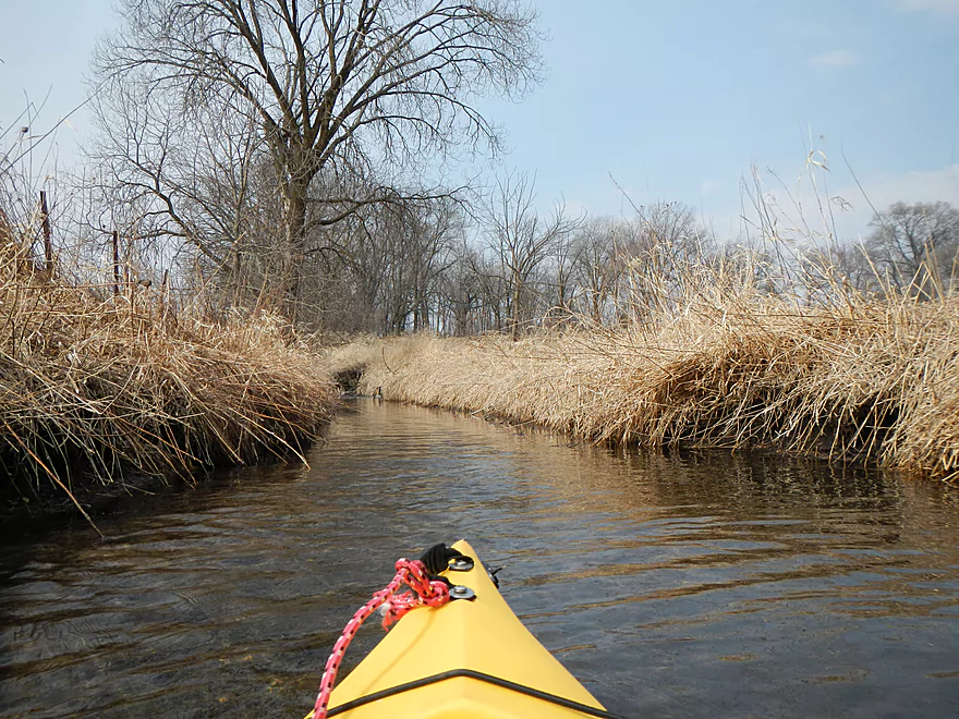
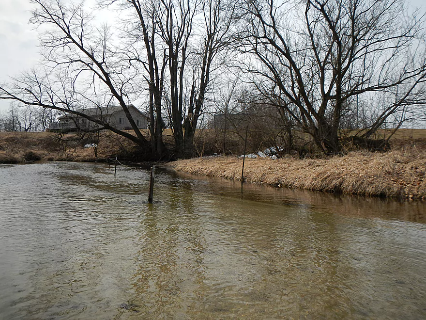
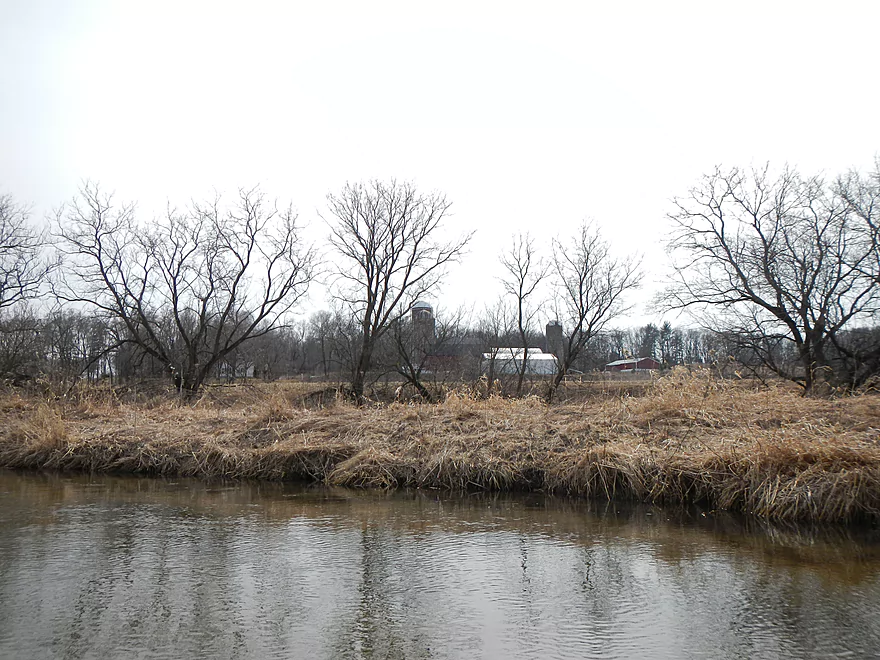
Maybe a mile past the second bridge (Fox Road), the creek changes quite a bit. It slows down, gets bigger, loses its trees, and gets very curvy. It’s one oxbow after another…. The water is still clean though and the grassy areas have a certain charm to them…but it can get a tad repetitive after a while. This section had the most birds (which really makes Neenah Creek famous) and is more representative of the creek at large then the far upper section I started at. You’ll see three silos in the far distance…and these will mark the next bridge at Hwy A (a good reference to know how far you are…but an eternity to paddle to in a 10′ kayak). Close to A, the terrain changes to more wooded, you’ll pass under a nice pedestrian bridge, and encounter that serious ducker I mentioned earlier. Always lean forward with these for safety, so you can fall back if needed. My kayak rides high and water levels were up, so this might be easier for other boats (not canoes), but I had issues and had to take off my life jack to fit under the last tree.
Take-out at Hwy A is good for a bridge landing. There is a fire hydrant in the middle of nowhere and a “no parking” sign, but it is easy to park on the other side of the bridge. If you don’t want to run the last rapids, you can again take out before the bridge. I didn’t find the rapids to be difficult, but the water levels were up a bit, so it might be too boney to run normally.
Webmaster Update: Paddlers are reporting this section now has serious logjams. See comments at the bottom of this review.
Detailed Overview
Main Branch: Click here to see an overview map.
- Upstream of Peppermill Creek: I suspect the creek is too congested to run
- 1st Lane (Peppermill Creek) to 1st Court: 1.1 miles. First half is a nice, clear, and open stream but there is congestion after that.
- 1st Court to Seeley Lake Access: 2.8 miles. Amazing clarity, nice riffles and steep hills…but serious logjams issues. Been on my to-do list for a while…
- Seeley Lake Access to West Chauncey Street: 0.6 miles. Mostly pleasant lake paddling with a dam to portage.
- West Chauncey Street to Hwy A: 6.8 miles.
- West Chauncey Street to Fox Road: 1.9 miles. My favorite section with incredible clarity. This stretch is more wooded and hillier than other legs. Logjams can be an issue. Cleanup work has been done, but 2-3 logjams may remain.
- Fox Road to Hwy A: 4.4 miles. Attractive leg with good clarity. Starts wooded, but quickly transforms into an open wetland paddle with many tight turns. There could 1-2 logjams.
- Hwy A to Hwy P: 4.1 miles. My second favorite section. Very nice wetgrass paddle with great clarity and no logjams...best saved for a sunny day.
- Hwy P to Grouse Drive: 6.4 miles.
- Hwy P to Hwy 23: 3.9 miles. A pleasant stretch that starts nice with clear, sandy seeps but becomes less interesting when it flows though the marsh.
- Hwy 23 to Grouse Drive: 2.5 miles. A mediocre stretch...less marshy than before, but still very open.
- Grouse Drive to Muskrat Road: 3.1 miles. Creek slows down and widens significantly.
- Muskrat Road to Hwy CX: 4.6 miles. A big, open, and wide wetgrass paddle...at times pleasant with good water fowl, this is likely my least favorite section.
- Hwy CX to Hwy CM (on Fox): 5.8 miles.
- Hwy CX to Dixon Road: 4.1 miles. This is more varied, narrower, and nicer than the preceding leg. It's mostly open marsh paddling but is attractive with a lot of waterfowl. At the end there is a stretch with a lot of dead trees. Sounds worse then it was...the trees skeletons were attractive and we never had to portage (as of 2024).
- Dixon Road to Mouth on Fox River: 1.1 miles. Final leg of Neenah Creek. Attractive bottom-land paddle with many silver maple. This stretch can have logjams, but as of August 2024, none required a portage.
- Mouth to Hwy CM: 0.7 miles. A short leg on the Fox River to reach the next bridge. There is slow current and unremarkable scenery, but it's not a bad stretch. The highlight is the rustic wooden CM bridge.
Tributaries:
- Big Spring Creek: A small, but neat creek with incredible transparency.
- Neenah Creek – South Branch: A slow, simple but pleasant marsh paddle.
- Big Slough Creek: A very slow, broad creek with a lot of history.
- O’Keefe Creek: Too small to run above Mud Lake, but it is navigable downstream of the lake.
Trip Map
Overview Map
Video
Photos Size:
Mcginnis lake is the start of Neenah Creek. This beautiful 28 acre lake provides over 600 gallons of water per minute to the creek. Anyway being new to kayaking we’ve only paddled around our lake and now are looking to get a little more adventurous. (we just purchased your book) Looking to do the lower creek dropping in a Chauncey St. but are afraid the trip to County “A” will be too much for us. Do you recall if it is possible to pull out at the Fox Rd. overpass? This point appears to be lees than 1/2 of your trip.
Thank you for the wonderful and informative information of your trips. we hope to utilize your experiences and knowledge of these local areas.
—
Edit and Update:
We dropped in at Chauncy Street and everything was going wonderful until we ran into a large amount of downed trees that had fallen from last week’s unconfirmed tornado. The creek became inpassible after about a quarter mile.
On to the next adventure. We’re going to drop in Goose Lake and paddle around there for a while.
Thanks Jim for the comment and the question.
When I scouted Fox Road bridge it looked like a great take-out option. There are rapids under the bridge, but you can disembark before them if you wish.
Heading out tomorrow.
Thanks!
We dropped in at W Chauncey St Bridge qnd took out on Hwy A. There were 2 of us and 2 dogs. We made it but the trip took 5 hours, the river has about 7 log jams between Chauncey street and Fox Rd. , another 3 from Fox to Hwy A. How we made it I don’t know.Do not do this section!
Thank you for the comments. I believe a tornoda do blow through this area and create a big mess, which is unfortunate.
The creek is beautiful! Seen so much wildlife! But unfortunately the log jams were so numerous that the trip became stressful. I think the 1st 4 hours were were out of the kayaks as much as we were in them. There were many trees that were across the river that we just squeaked by either under or around. some log jams were huge. I gotta give my dogs credit they were troopers. ( a 10 lb rat terrier and 40 lb mutt!) Lost my cell phone! the last big log jam had a deep ( > 5′) kinda whirlpool. I went sideways and a branch hit my dog , me and the dog fell in! it was hell! still sore and feeling stupid! Lesson: never go on an unexplored part of a river with 2 dogs! I was scared more for my dogs than anything. seen lots of deer which made my dog Sam happy :)
I feel bad that you had such a trying time. It was a very different situation when I did the paddle. I have posted an updated message in the main review which hopefully should help other paddlers.
I did this section on 7/3/19. There were a lot of obstacles, I stopped/lost count around 12… a lot of ducking under, scooting over, pulling through, and few easy portage… but it is still a trip I will do again and that I would recommend for those who are up for an adventure and are willing to do a bit of work. the water clarity and wildlife is great for the entire trip, I saw fish, snapping turtles, deer, hawks, cranes, heron, ducks and more. The trip has a variety of landscapes and even the flat marsh like section at the end was enjoyable due to the amazing water clarity, the decent currant and amazing wildlife. it seemed there was a deer,goose, duck or heron around every bend. Another highlight was a great swimming hole at the take out. A nice big deep hole after the little rapids at the bridge. For anyone willing to work for it, it is a great trip on a hot summer day.
Yeah there was a tornado that blew through that area after my trip and that kind of messed things up. Nice to hear you still had a nice trip though. Would be great if some locals adopted this creek and worked on its upkeep.
I did this section on 8/11/21 (10 Mile Creek gauge was at 62 CFS and 4.82 Ft) so the level may have been lower than on your trip, but the levels seemed fine. All the rapids were runnable and there seemed to be plenty of water the whole way. The water clarity and wildlife (deer, snapping turtles, heron, geese, ducks, beaver muskrat were amazing, especially the fish. I have never seem the number or variety of fish in any stream in Wisconsin. We saw numerous large trout and countless other fish. we had to get out of the boats 4 times, 2 for portages that required going up on shore and 2 that just required getting out of the boats to pull/lift over obstacles. There were several other places that required ducking under or sliding over/through stuff but nothing was too difficult or dangerous, as the creek was usually not deep nor was the current too strong. While this trip is far from a ‘Lazyy River’ paddle, for those who are looking for a stunningly clear river, with very little development, an abundance of wildlife, plus a nice swimming hole at the takeout, and are willing to put up with a few easy obstacles, I would highly recommend this trip
That’s a major update…as I wrote off that section as having too many logjams. Four portages for that trip is definitely worth it IMO. Thanks as always for the intel.
Eric’s comments from Aug. 11 are spot-on. Casual paddlers would find the obstacles and maneuvering annoying, but we enjoyed the problem solving. (we had two canoes, one kayak.)
Paddled from W. Chauncey to Hwy A on June 13, 2021. Level was lower than August 16, 2020. The portage around several downed large trees (1/2 mile upstream from Fox Rd.) ended in warm mud rather than ankle-deep water. Link to portage photo from 2020: https://photos.app.goo.gl/nBGmjvQQB8w5arwZ7
We had to exit our boats more often due to getting hung up in shallow water. I think there are more obstacles than in 2020, mostly between Chauncey and Fox Rd. Lots of pull-overs, duck-unders, ram overs, etc. to test one’s problem-solving and boat handling skills.
Wildlife was outstanding, as usual. Orioles, wood ducks, mergansers, sandpipers and killdeer, damselflies and dragonflies, plus lots of small fish. We suprised deer in the creek at least 3 times, and saw a beaver den along one bank, complete with a food cache of several branches.
It took us almost 4 hours to paddle 6.2 miles, but we took two breaks for refreshments.
With some clearing, this stretch could appeal to more paddlers, rather than just those willing to deal with lots of obstacles.
Thanks for the update. I wonder if this leg is best done in early spring or late fall when some of these snags won’t be so overgrown and difficult to get past.
The following is a recent video review of Upper Neenah Creek that readers may find interesting. https://www.youtube.com/watch?v=6lJpe7jY7DU
An update on the logjam situation from another paddler: “3-4 logjams remain. We chopped anything and everything we could but there was couple spots where we would drain an entire battery just to get 1 tree .. but it is pretty runable now. All the portages are easy.. just get out of boat and drag over a tree… no need to get on river banks”