
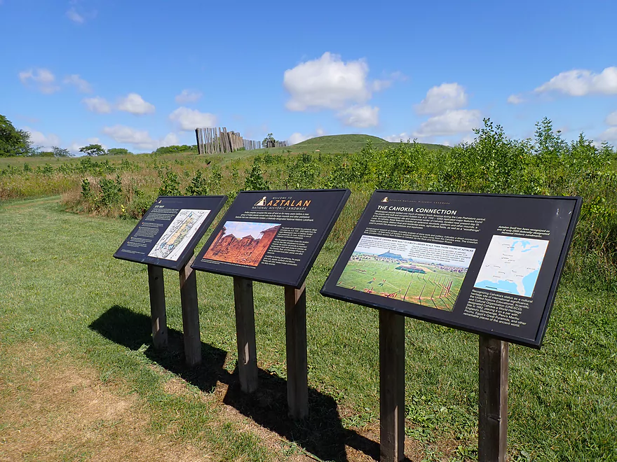
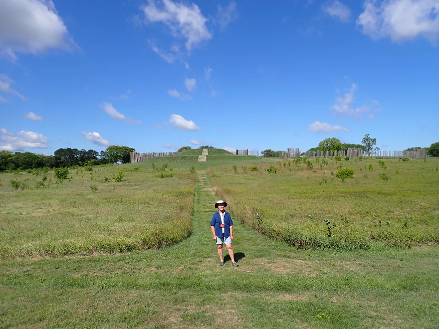
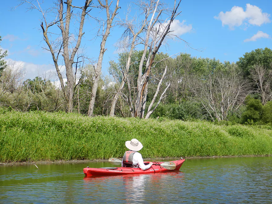
Starting the trip at Aztalan State Park which is worth checking out
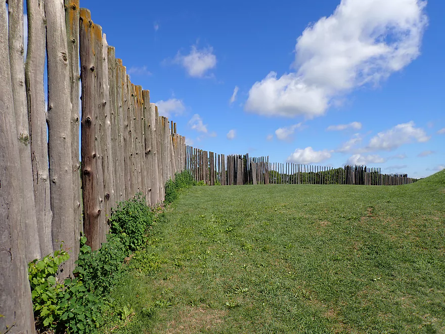
A main feature is the re-created wooden stockade
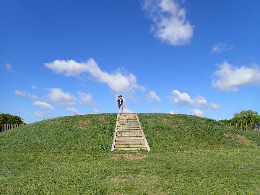
And the main step pyramid
Nice park
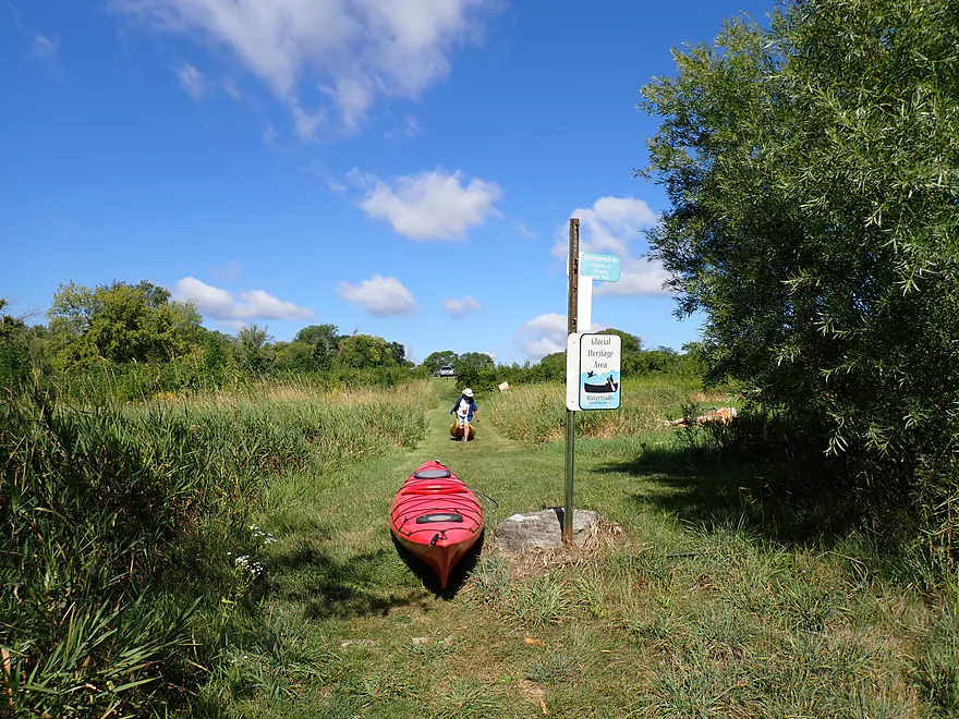
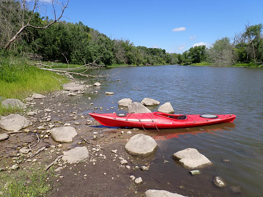
A trail leads to the water where you can launch
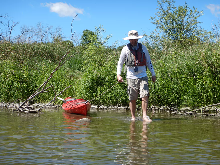
Shallow launch area at the end of the trail
You can just barely see the pyramids from the river
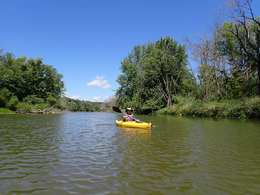
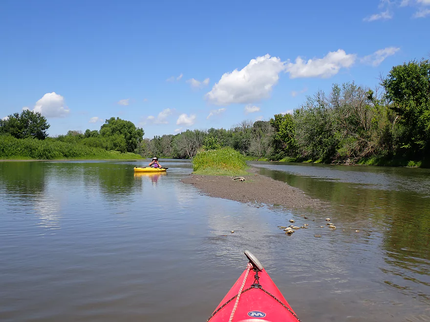
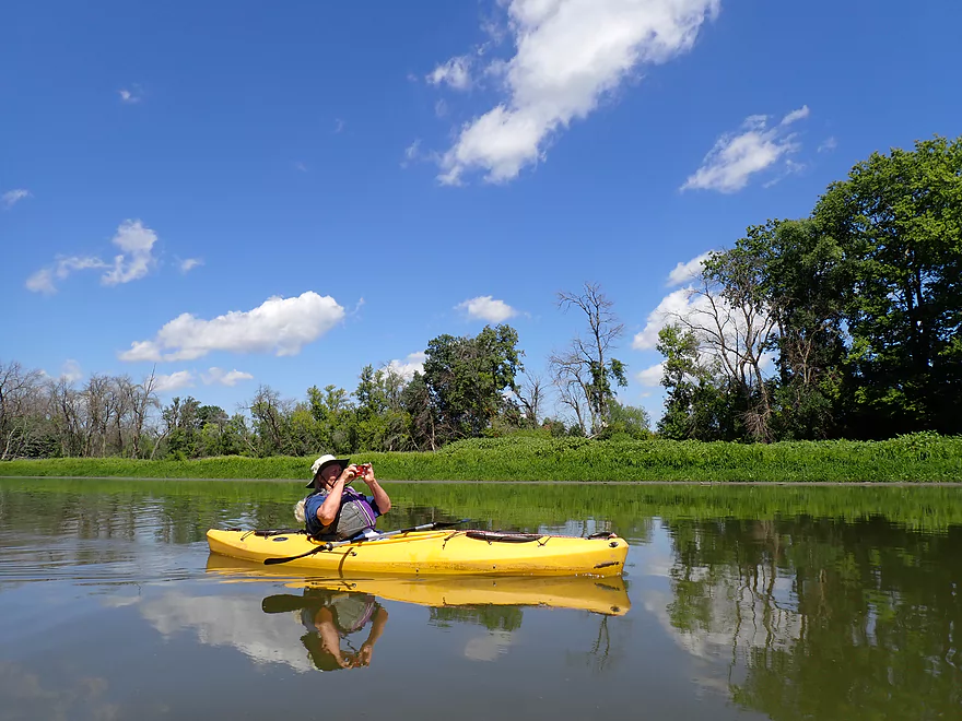
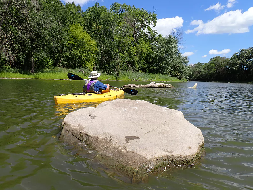
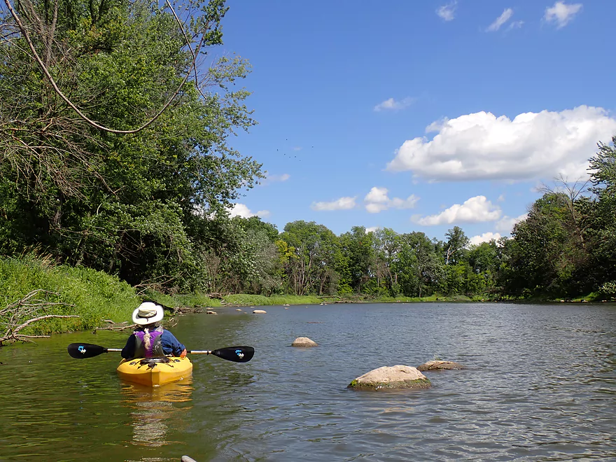
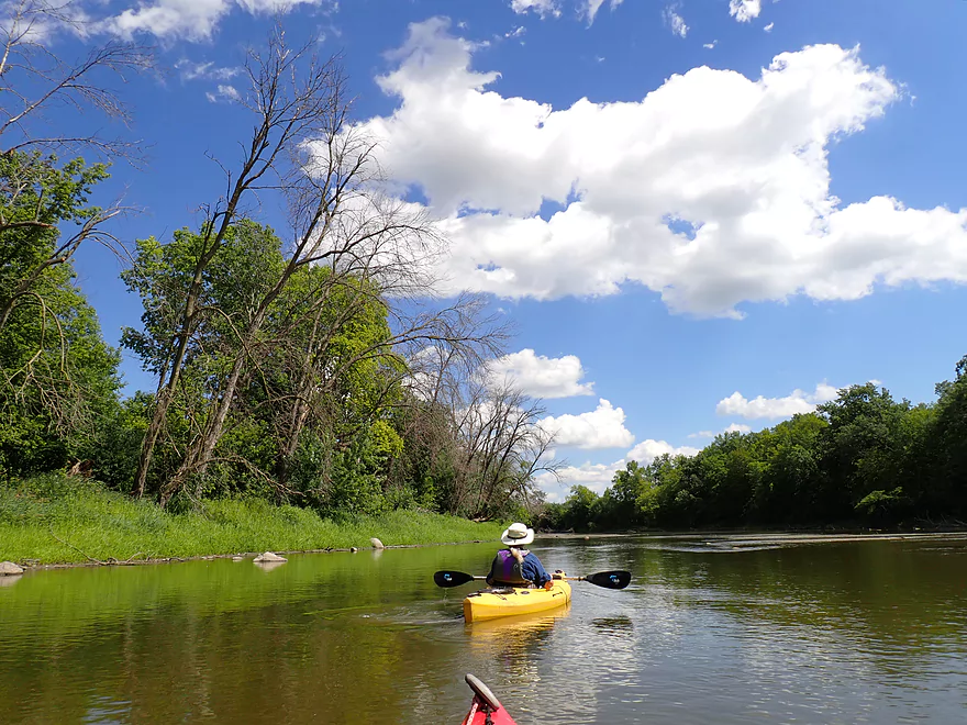
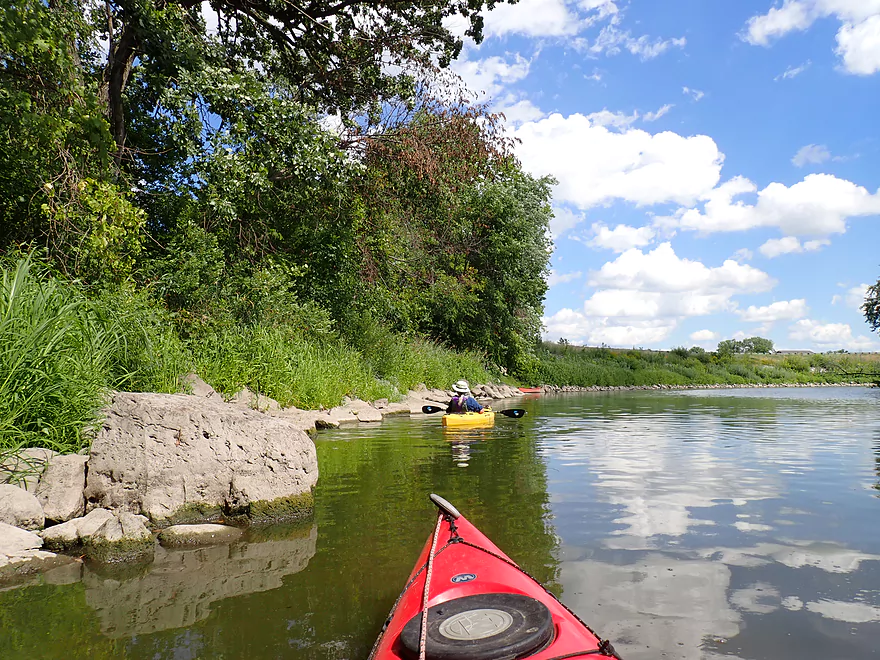
A surprise boulder garden at the put-in
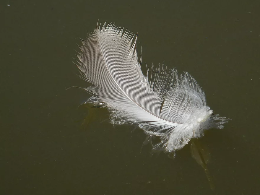
A Canada goose feather–one of many floating on the water near the landing
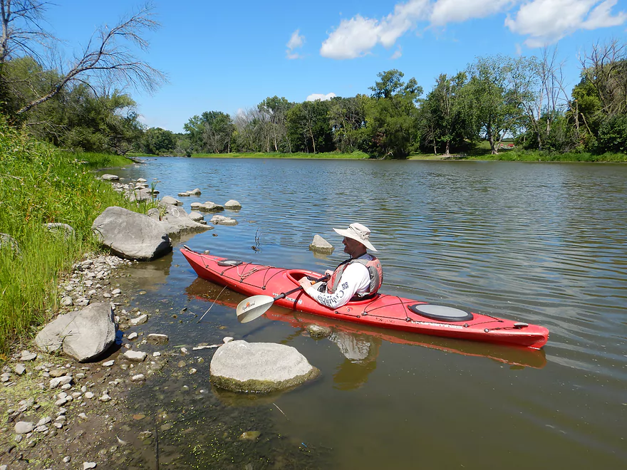
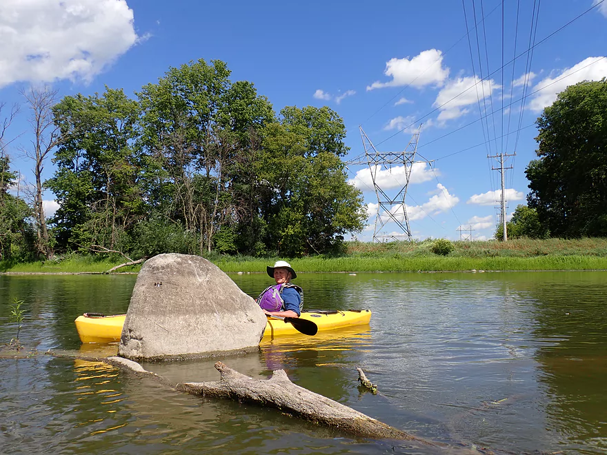
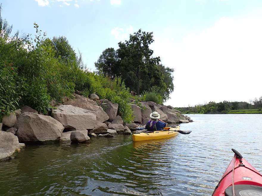
More boulder gardens
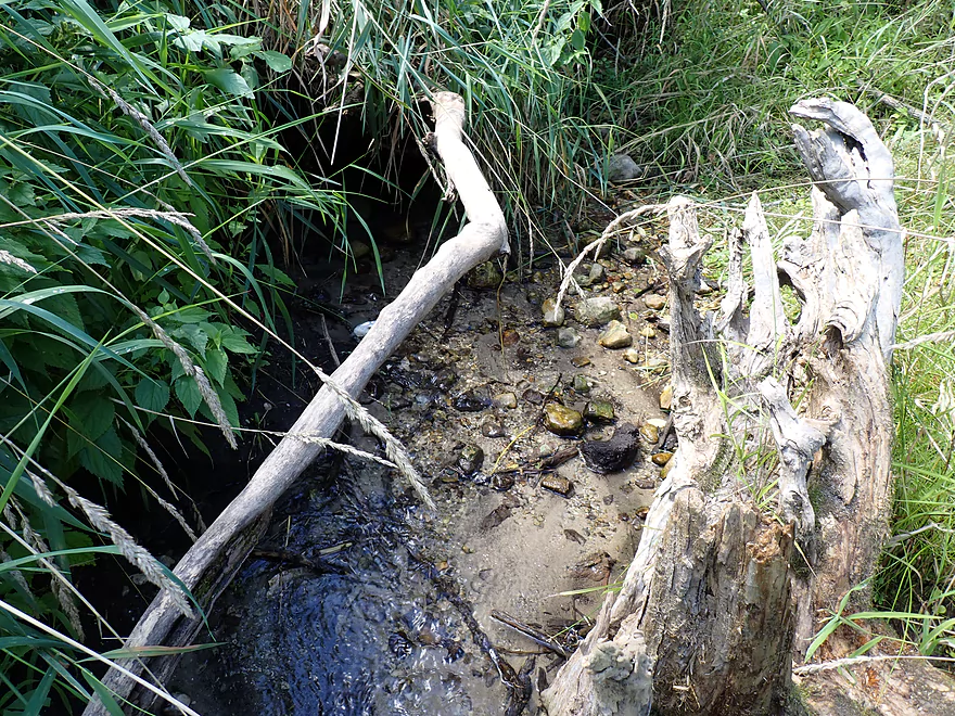
There is a nice little drumlin spring creek here
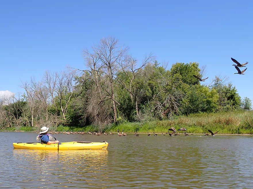
Huge flock of geese
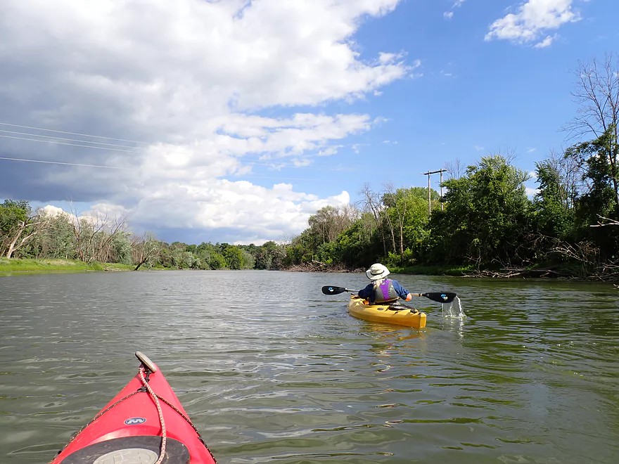
The lower Crawfish is known for being very wide and flat
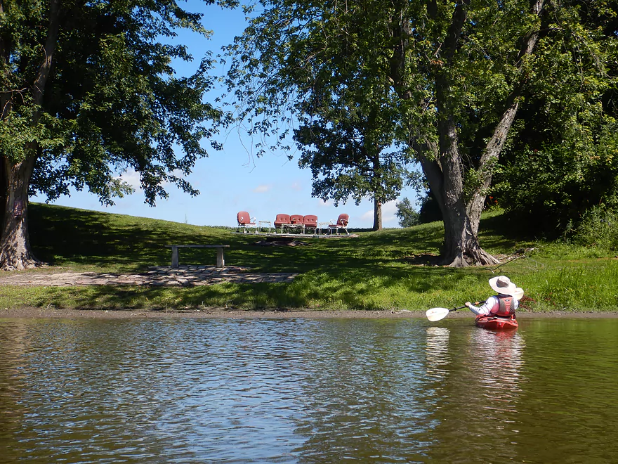
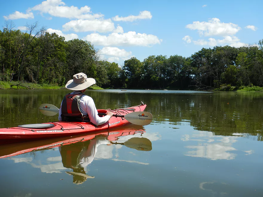
Seats with views of the river
Another great boulder garden
Some shallow spots, but most were easy to paddle around
Glacial Drumlin State Trail
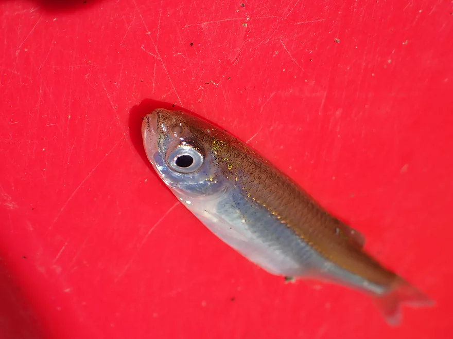
Lots of jumping fish on the river…this jumped onto my boat and got stuck
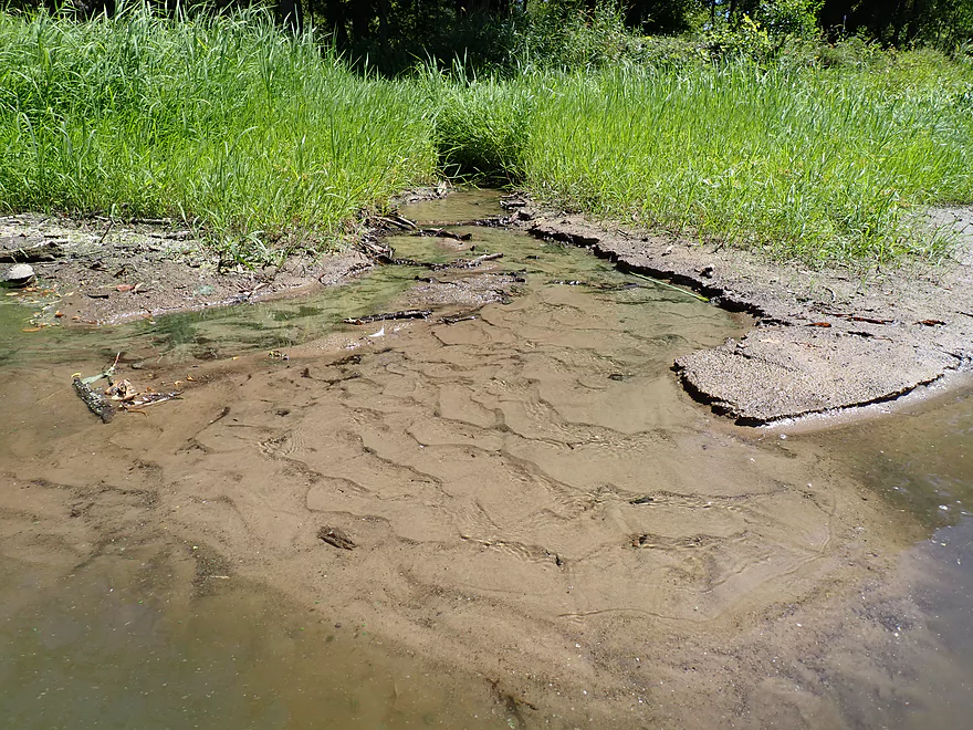
Another ice cold drumlin spring creek
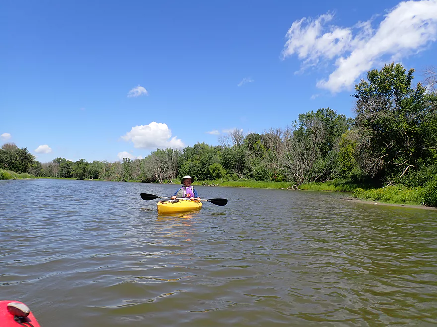
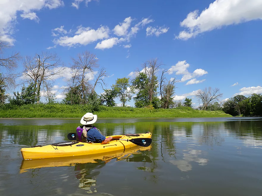
Entering a nice stretch of river
I had no idea the Crawfish was so rocky
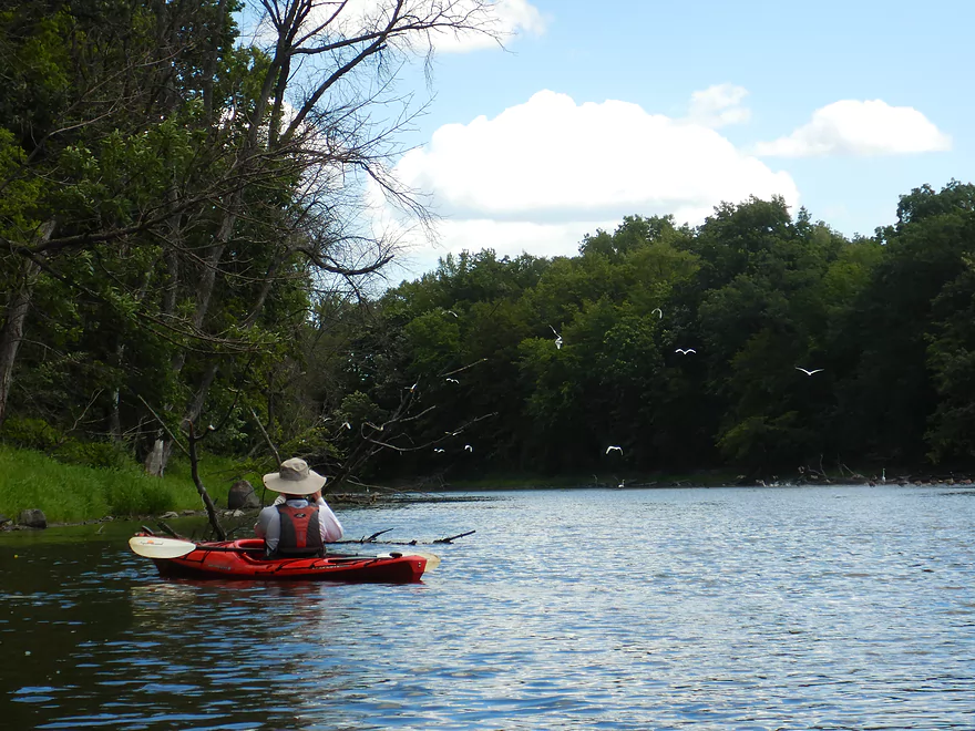
Spooking a huge flock of great egrets (18 were counted before they took off)
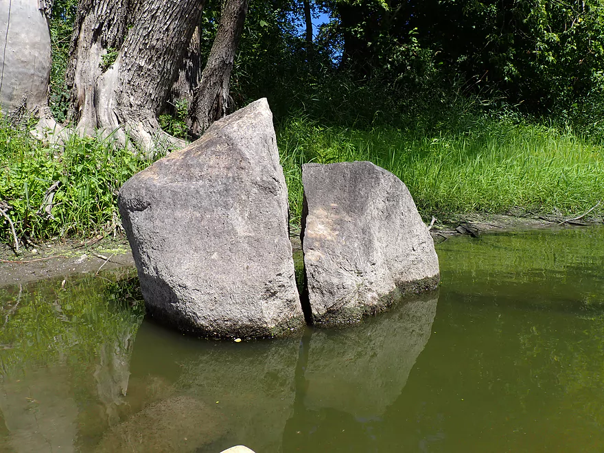
A cleanly “sliced” boulder
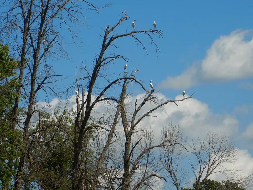
Roosting egrets
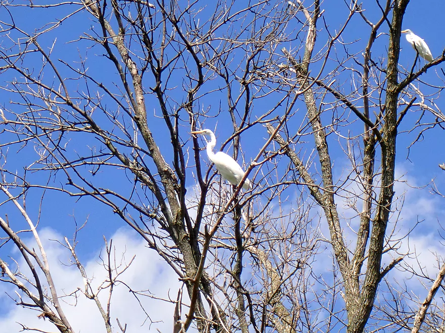
Closeup
Great cloud day

A Roseate Spoonbill (not native to Wisconsin)
A rocky bend by Popp Road
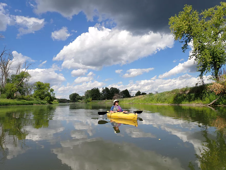
Nice reflections
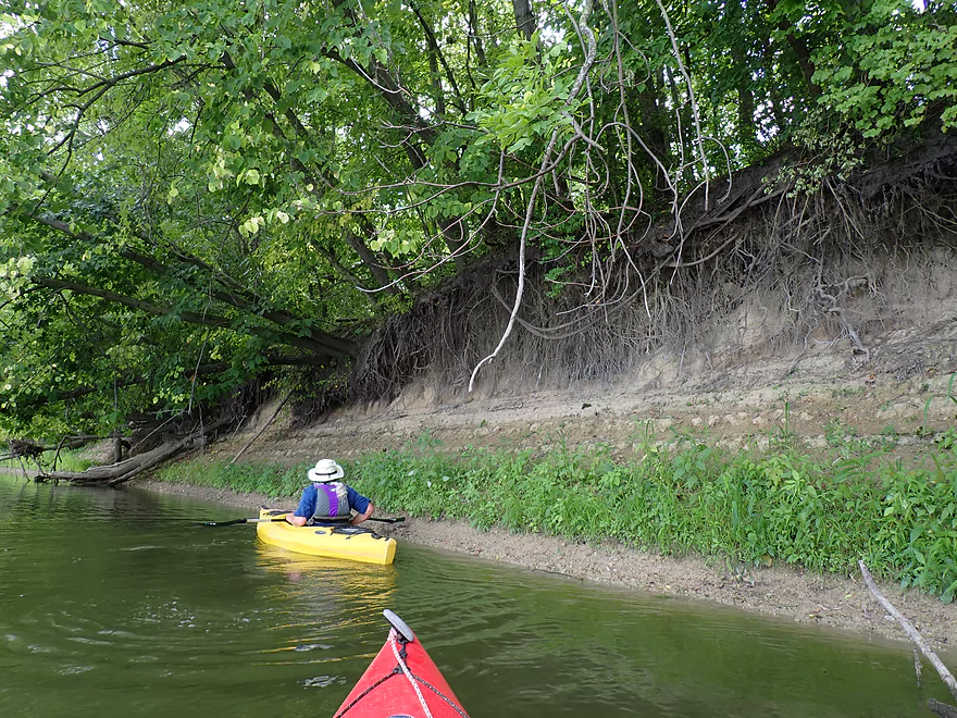
Large clay bank
More reflections
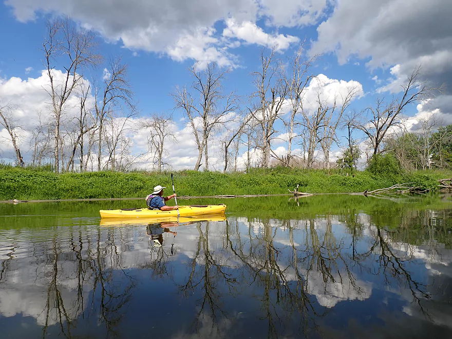
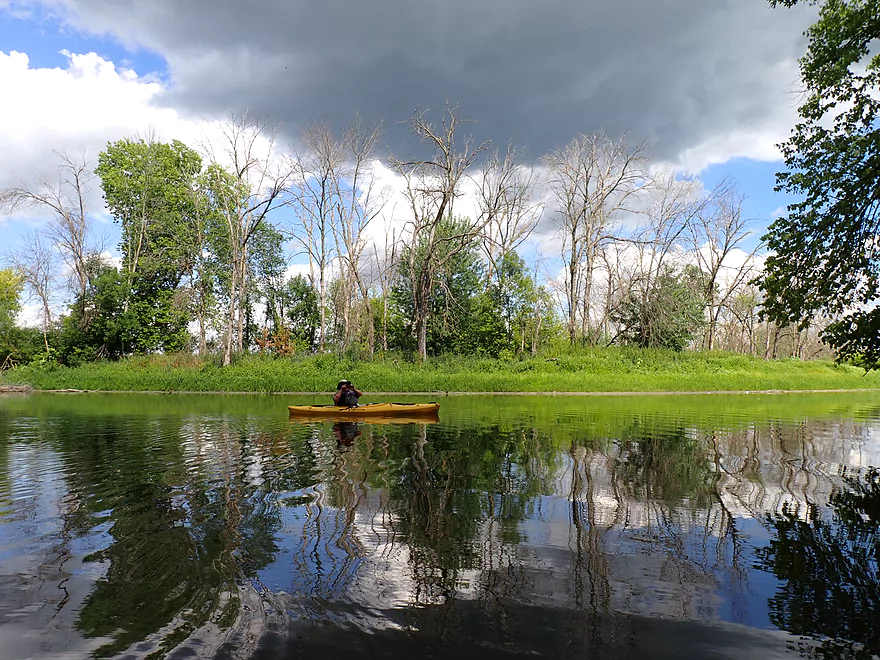
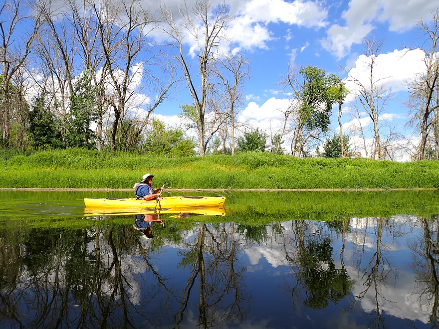
So many dead ash trees (at least the egrets like them)
A long bed of smartweed
Hwy 26 had mud splatters on the support
Where a tire had just slammed into the ground (weird)
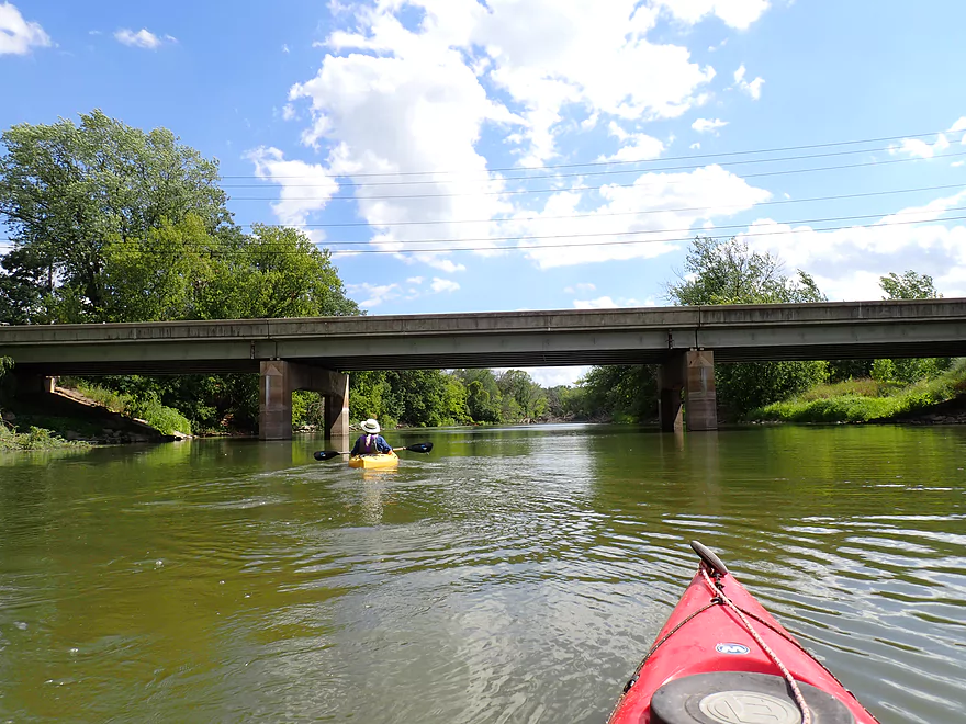
Hwy 18 soon follows Hwy 26
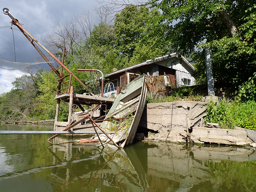
This boat has seen better days
The next two miles were slow, wide, and boring
HIgh water mark
Overshooting our take-out at Riverfront Park to check out the confluence
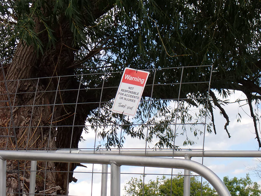
An ominous sign
The reason for the sign
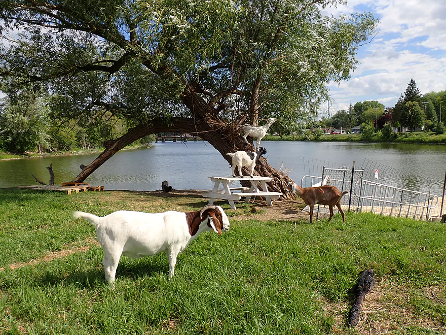
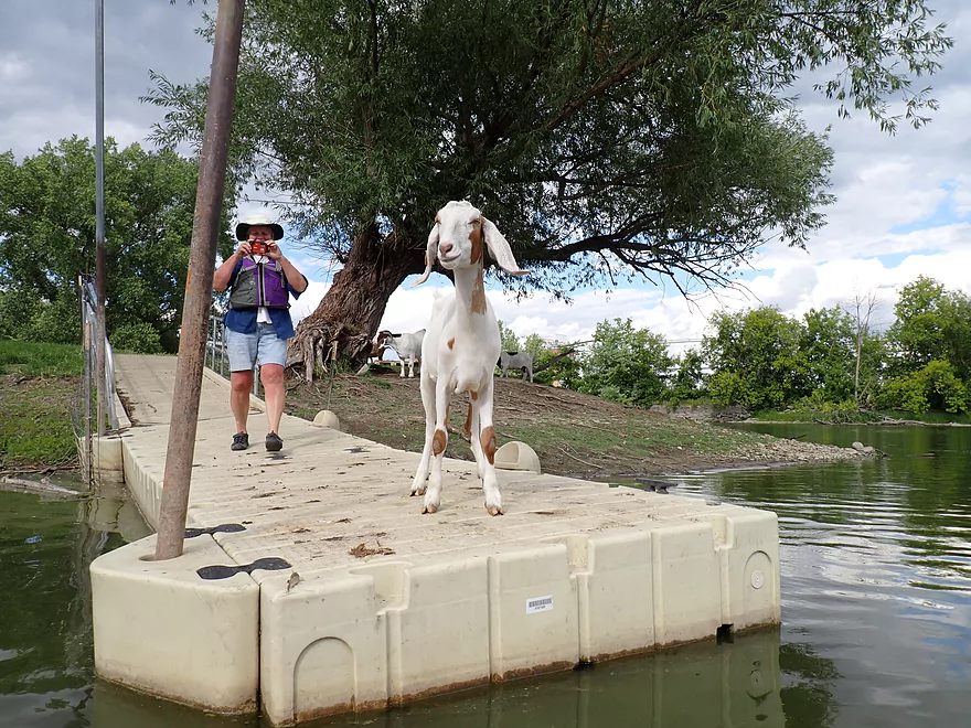
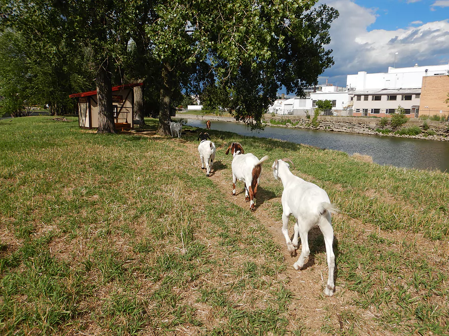
Welcome to Goat Island where there are goats on tables and in trees
They associate kayakers with food
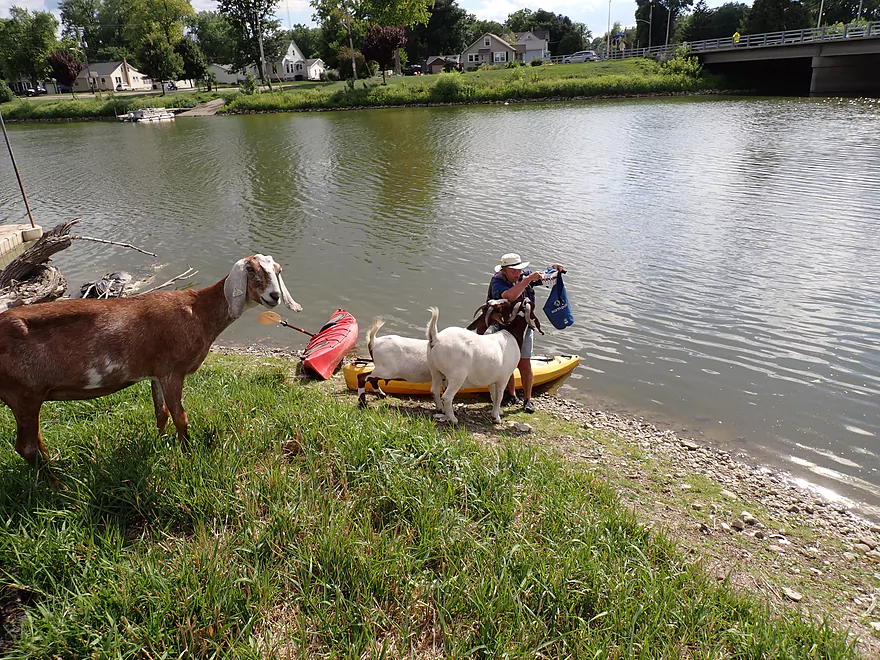
Hiking to the snack hut
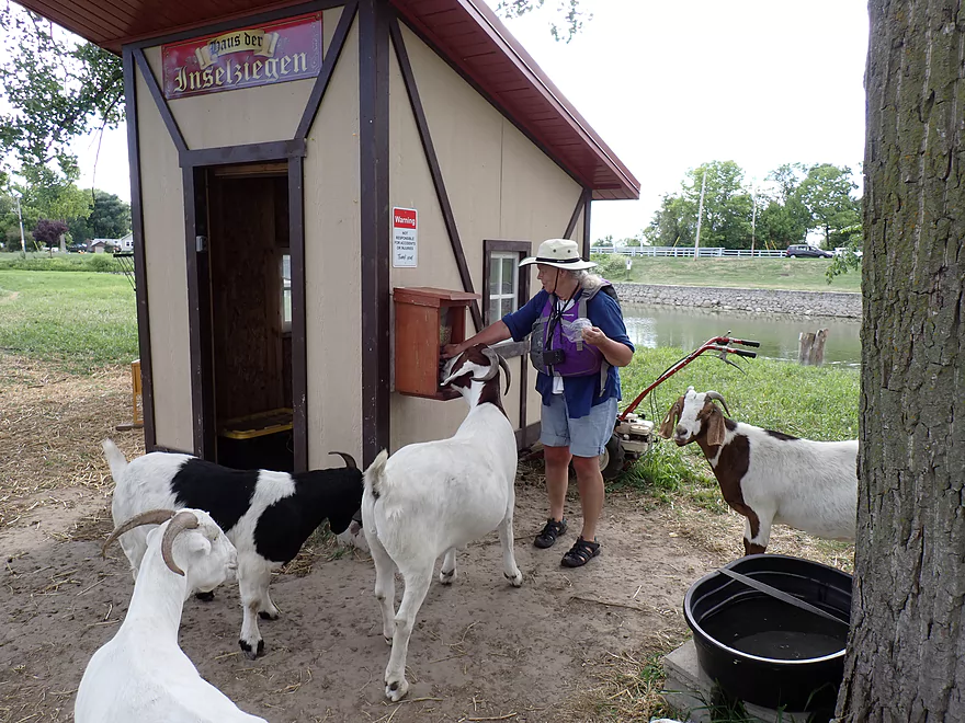
The big goat was aggressive in immediately eating the grain pellets from the dispensary
Saying goodbye to Goat Island
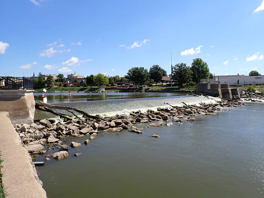
The Jefferson dam on the Rock River is located just upstream from Goat Island
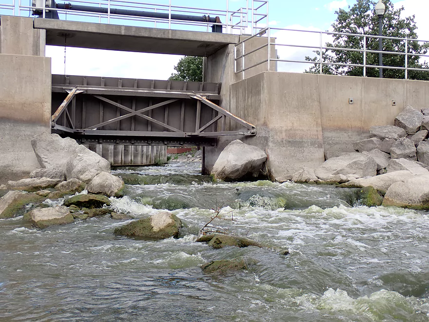
A side fish passage might be kayakable by whitewater paddlers
The area by the dam is scenic
Ending the trip back at Riverfront Park
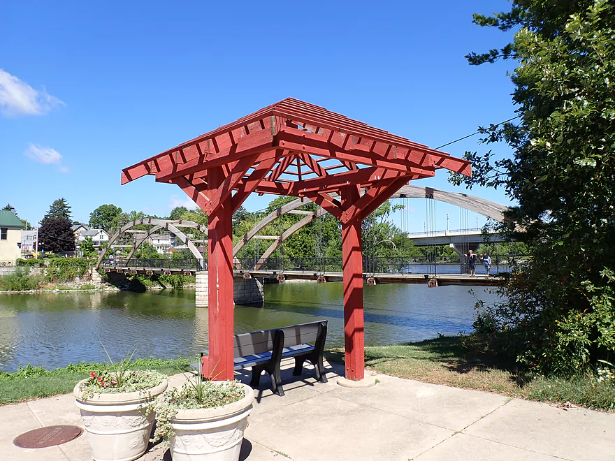
It’s worth it to check out the Jefferson Riverwalk after a trip
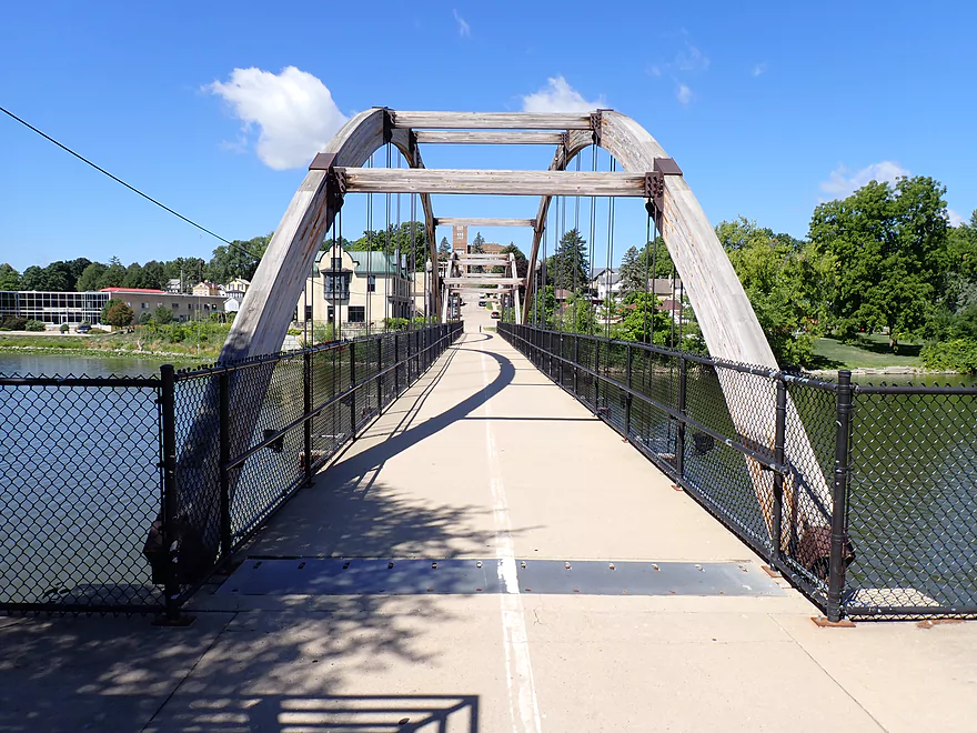
An impressive wooden suspension bridge
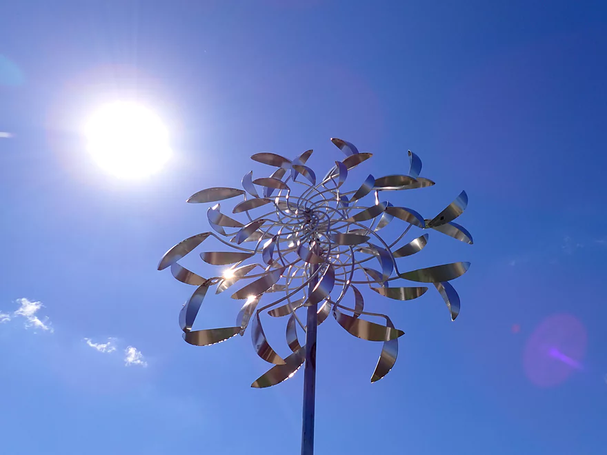
A kinetic sculpture next to the river
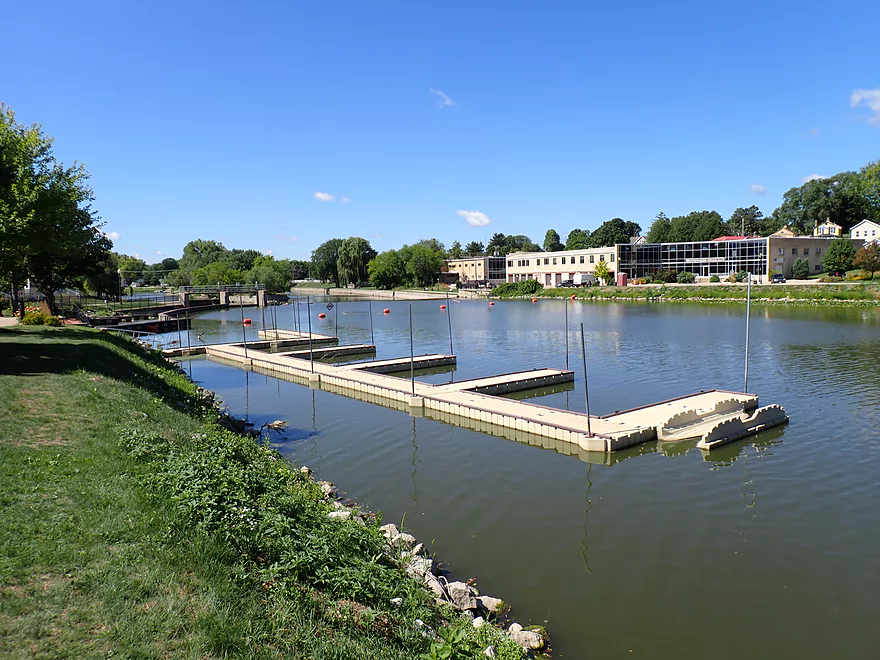
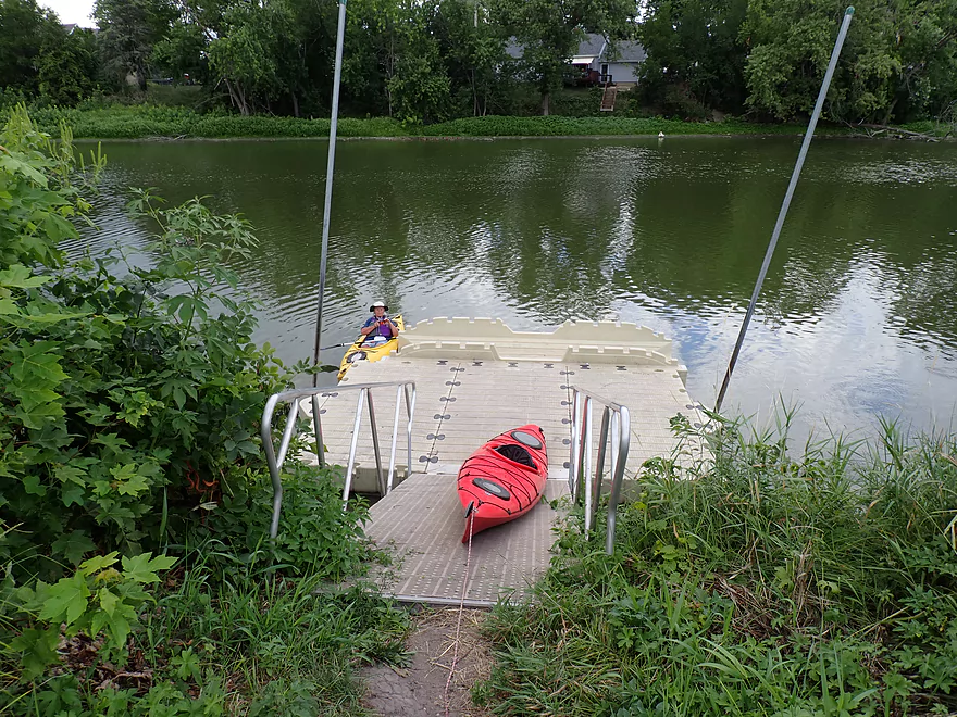
A dock area lets you take out above the dam
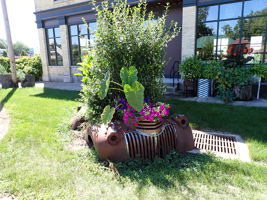
The area south of Racine Street is very artsy
Crawfish River – Goat Island

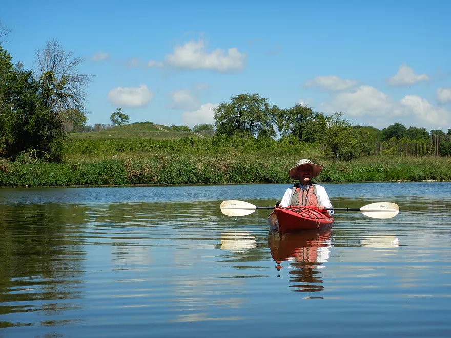
The paddle started at Aztalan State Park, which, while not exactly a “Devil’s Lake” caliber state park is still scenic and was a great way to start the trip.
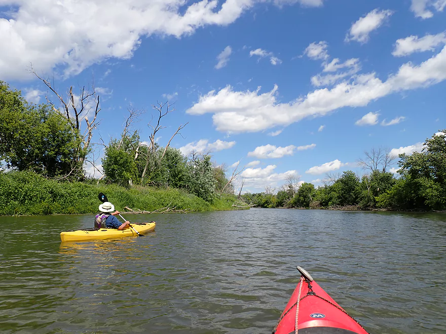
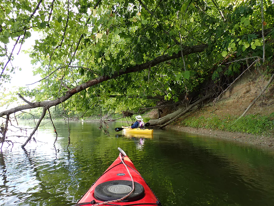
First impressions of the river weren’t great with brown turbid water, scruffy banks, countless dead ash, and a monotonous wide, straight channel. However first impressions can be deceiving as this segment would prove to have some nice scenery.
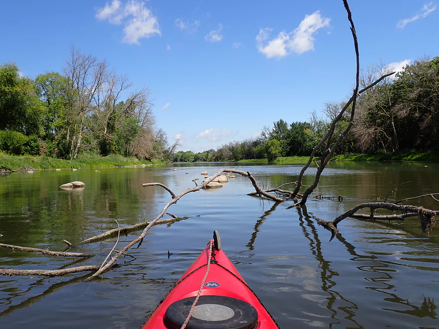
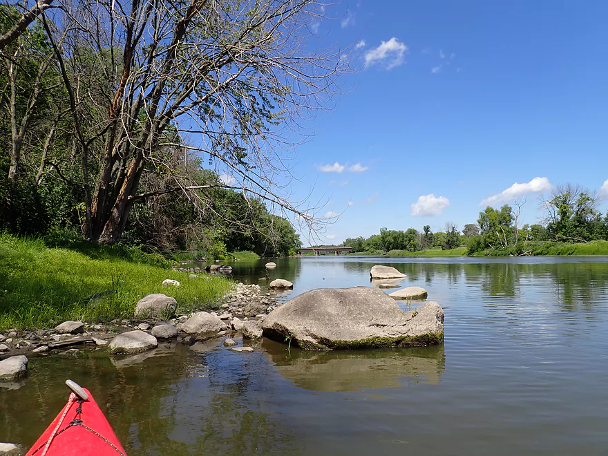
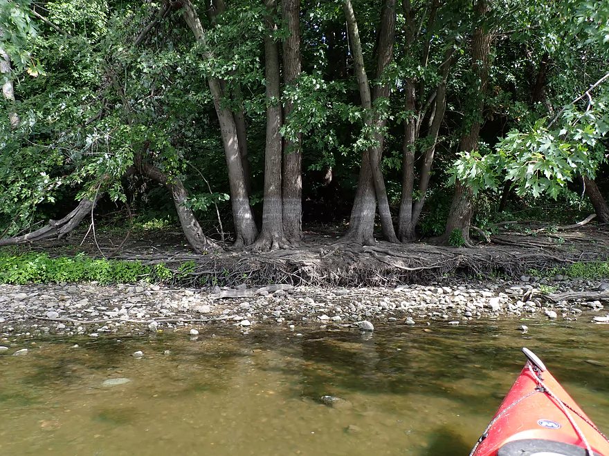
The first pleasant surprise was how rocky the river was and we saw a number of small boulder gardens along the shore. If you were to wade across the river it would be mostly over firm rocks and clam shells with not that much squishy mud. The second pleasant surprise was the glacial drumlins. At the base of several of these hills, ice cold spring water entered the river (a sharp contrast to the relatively warm Crawfish).
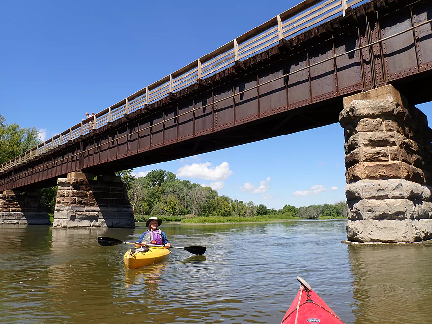
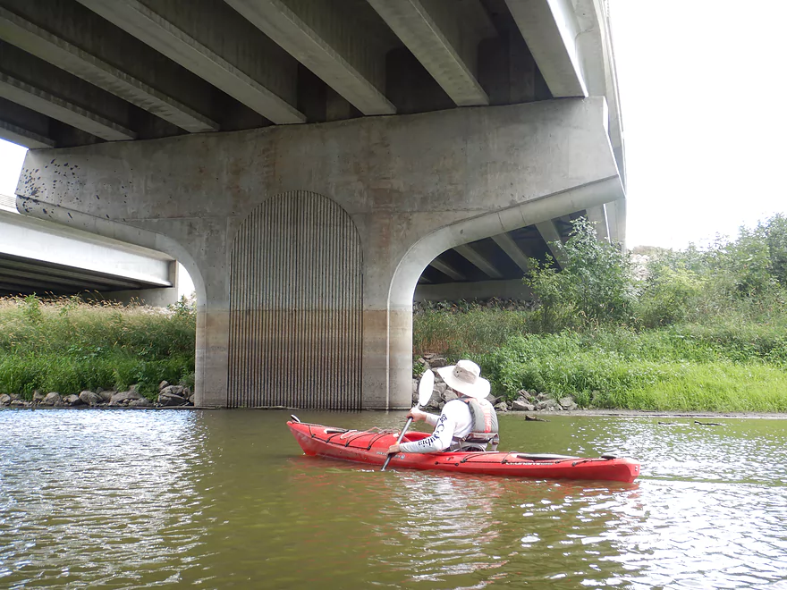
About a mile into the trip we passed under the Glacial Drumlin State Trail. Today it serves as a bike trail between Madison and Milwaukee, but back in the day it was used by the railroads. The bridge itself is old and features some fantastic stone supports.
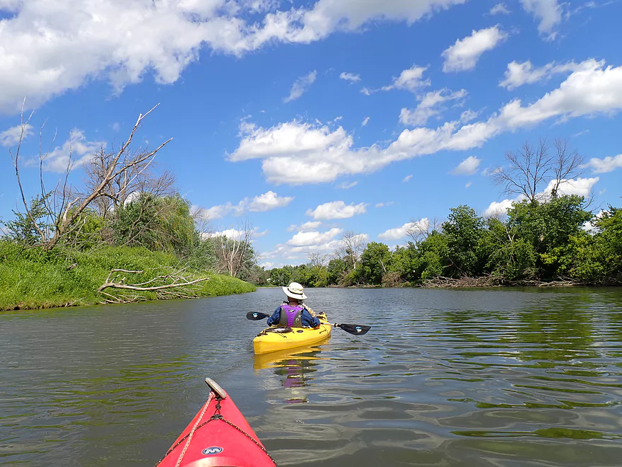
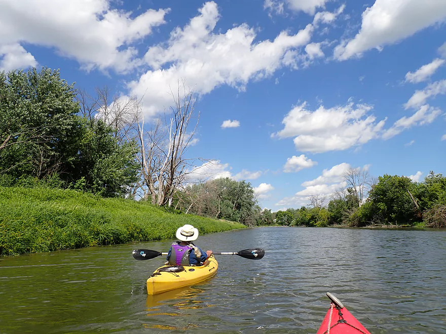
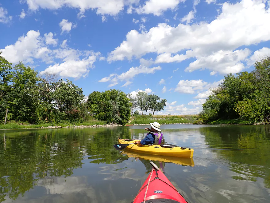
At roughly the three-mile mark, the river finally started to meander as it is first redirected sharply east by a drumlin. The following two miles were my favorite of the trip and featured some relatively nice boulder fields.
Wildlife and specifically waterfowl on this trip was fantastic. The highlight was a large (~18) flock of great egrets (large white wading birds). One of the egrets in the flock didn’t look like the others as it was pink and had a spoon-shaped bill. It turns out this was not a native Wisconsin bird but rather a juvenile Roseate Spoonbill. This is an exotic coastal bird that likely got redirected to the Midwest via a storm, and to see one in Wisconsin was fairly unique. A week prior, a sighting in Green Bay (probably the same bird) was featured by three separate TV stations and was a story in the NY Post. We were going to submit this incredibly rare sighting to ebird.com (the go-to site for reporting rare birds), only to find out a kayaking group ahead of us already did this!
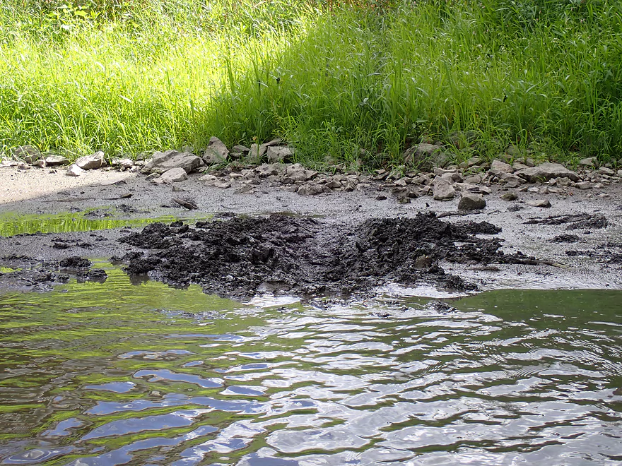
Hwy 26 roughly marked mile five. It was incredibly noisy and could be heard for at least a one-mile radius. As we were about to pass under, a tire was launched ~40′ into the air from a fast moving car. It landed in the river and then bounced into the median between the bridges. Mud from the touchdown splashed high up on the concrete pylon. It was kind of a bizarre occurrence…good thing we hadn’t been on that part of the river when it happened.
The final 2 miles of the trip through the outskirts of Jefferson were the worst of the trip. Other than seeing some impressive flood damage and having a pair of domestic ducks escort us downstream, there wasn’t much going for this stretch. The first half of this trip, while never fast, at least had some current. The last two miles in contrast had virtually none, which made it a slog to paddle and allowed pollen, weeds, and scum to collect on the surface.
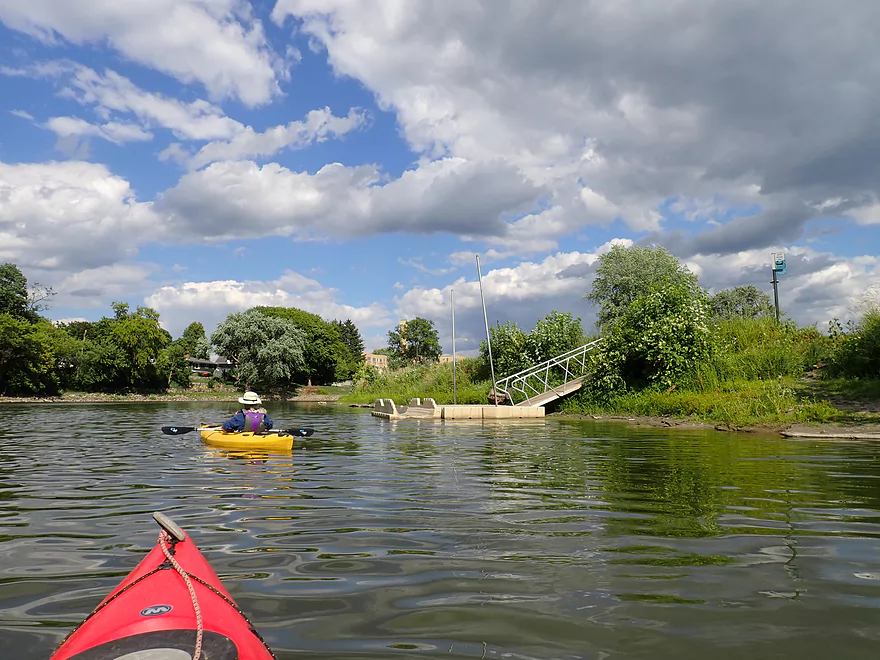
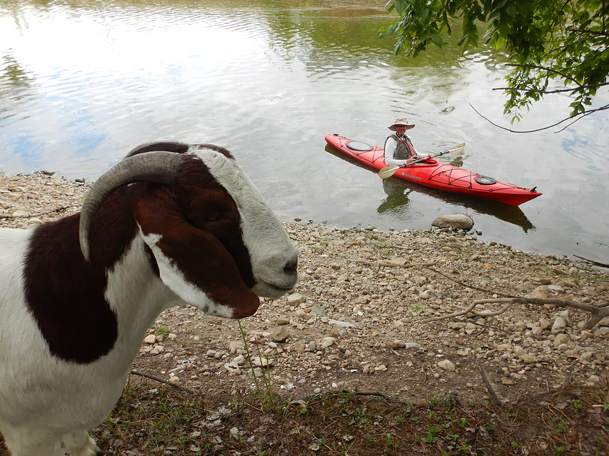
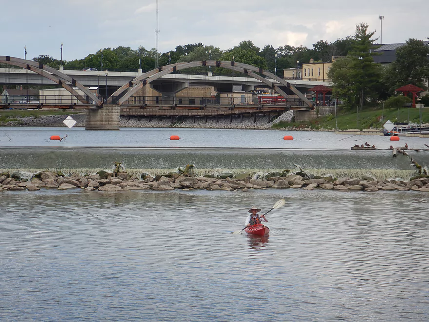
We overshot our take-out at Riverfront Park (on purpose) and headed under the Hwy W bridge where the Crawfish River empties into the Rock River. At the confluence is a 600′-long island which is a local favorite for kayakers. A dock on the south side lets you take out and you are greeted by a strange sign warning you that there is no responsibility for accidents or injuries.
The reason for the sign are the goats that occupy the island. Officially they are there to eat invasive species, but unofficially it’s a local tourist attraction and zoo. These are adventurous animals..the first one we saw was ten feet up in a tree, another was on a picnic table, and a third was using a fence as stepping post to eat part of a tree. They came running when they saw us, as they associate paddlers with food (well, tastier food than the grass and trees they are accustomed to eating).
A trail leads to a small shed in the middle of the island where there is a grain pellet dispenser. You can feed it quarters to get pellets. Unfortunately one large “alpha” goat was very aggressive and would stick her snout directly into the dispensary as soon as you inserted the quarters which made it tough to share with the other goats. She even attempted to head butt another goat that got too close. Other than that the goats were pretty friendly.
Paddlers could and should do a loop around Goat Island as it is an attractive area with a stone seawall, dam, and wooden arched bridge. The nearby Jefferson Riverwalk is artsy and worth checking out. After that, we doubled back to Riverfront Park to end the trip.
In summary, this was a tough trip to grade as it had good and bad extremes. Parts of the river (especially the last part of the trip) were slow, wide, straight and boring. The shoreline was mostly uninteresting with many dead trees. However…the boulder gardens, the sheer number of birds, the bridges, Goat Island, the drumlin springs, the Jefferson Riverwalk, and Aztalan State Park were all fantastic.
Aztalan State Park: The park serves as a way of preserving and remembering a settlement built by the Mound Builders (Cahokians). Highlights included a mowed path system that connects various mounds, a small step pyramid, and several replica wooden stockades. The official history is provided at the local museum or the following audio tour. The unofficial history of Aztalan is actually more interesting. This includes human sacrifice, dark occult magic, exotic copper trade routes that connected to Mexico, natives with red hair, conflicts with local tribes, and ghost sightings at night. If you are into this type of thing I highly recommend the book “Lost Pyramids of Rock Lake: Wisconsin’s Sunken Civilization“.
Glacial Drumlin Bike Trail: This is a great bike trail that roughly connects Madison to Milwaukee. The trail crosses the Crawfish north of the city of Jefferson.
Goat Island: This is a decent sized island located below the Rock River dam and at the confluence of the Rock and Crawfish Rivers. The local city council initially authorized goats to graze on the island to clear out invasive species. Today they are kind of a tourist attraction especially for kayakers since the island doesn’t have any bridges to the mainland. The goats are ferried off of the island during inclement weather and in the winter. Typically you can expect to see goats on the island from June to September, but you should check with Friends of Goat Island to make sure they are there before committing to a trip. Bring quarters, as there is a grain pellet dispensary in the middle of the island which the goats are a big fan of.
Jefferson River Walk/Rotary Park: Located by the dam, this is a really nice section of Jefferson that is worth checking out. Highlights include a wooden suspension bridge, sculptures, stone block seawalls, an attractive river walk, and flowers.
Aztalan State Park: This is a good public launch option with restrooms and plenty of parking (a state park sticker is required). The landing is located by the southeastern parking lot. Here a 400′ mowed trail leads to the water. Note, don’t launch immediately at the trail’s end, as it is shallow there and partly blocked by a tree. Instead follow a side trail 100′ north where there is a small concrete area which is a much nicer (and deeper) spot for launching.
Alternate Put-ins:
- Milford (3.1 miles upstream from Aztalan): Paddling.com claims there is a public access by the Hwy A bridge. I don’t see this on Google Maps, but I assume it exists. This bonus leg would likely include a generic leg of the river which would be ok but likely nothing special.
Riverfront Park: This is a very good public access. It’s also very popular…we saw a lot of paddlers parked in the circular parking lot by the water.
Alternate Take-outs:
- Hwy 18 (1.3 miles upstream from Riverfront Park): It looks like you could take out southwest of the bridge if you really wanted to. This would skip a boring stretch of the river…but, you would miss a chance to see Goat Island and the Rock River confluence which are nice.
Bike Shuttle: 7.2 miles with 82′ of ascent. This would be a longer bike shuttle, but…2.6 miles would be on the Glacial Drumlin Bike Trail and include an attractive bridge crossing. If you use the bike trail, don’t forget your state trail bike pass. Note Aztalan State Park has a very windy access road. You can shave almost a mile off your bike shuttle by heading directly west on a service road, then crossing a grassy ditch to access Hwy Q directly.
Current/Rapids: There are no rapids on the trip. Generally speaking the current is slow on this stretch…and especially slow in the second half of the trip.
Logjams/Hazards: None. This is a pretty easy & safe leg.
Wind: This is an open river so a headwind could be a major problem. Timing a trip for a north-to-south tailwind though could be a great idea.
- 0-60 CFS: Exceptionally low. A handful of stretches may need to be waded.
- 61-120 CFS: Low depth. The river has shallow spots but with careful navigation you should be able to mostly stay in your boat.
- 121-250 CFS: An average summer depth and a good target range.
- 251-400 CFS: An average spring depth. Some of the interesting river character would be submerged at this point.
- 401-600 CFS: A high depth. Water clarity may suffer.
- 601-1000 CFS: A very high depth, but the river is still quite viable for paddling.
- 1001-1400 CFS: Water quality will be exceedingly bad at this point (a mud fest).
- 1401+: This might be too high for paddling.
Detailed Overview
- Upstream of Columbus-Fall River Road: The Crawfish splits into two branches upstream of the bridge. Both branches are very scenic and have some rocky sections that I've scouted extensively before. Unfortunately, logjams are a major problem this far upstream and I'm not sure there are many if any viable legs in this stretch.
- Columbus-Fall River Road to Old Hwy 73: 3.8 miles. A mostly wooded section with perhaps 4 logjams.
- Old Hwy 73 to Udey Dam/Columbus: 3.2 miles. Mostly slow flowage paddling. Somewhat of an urban paddle that goes through the northern outskirts of Columbus. Area parks are alternate access options.
- Udey Dam to Danville Dam/Hwy T: 9.5 miles.
- Udey Dam to Columbus Wastewater Plant: 0.8 miles. An attractive fast section. Rapids and rocks will be visible at low flow rates. As of Sep 2019, there were two logjams, but they can be hopped over.
- Wastewater Plant to River Road (Creek Bridge): 2.9 miles. A mediocre section with one logjam to sneak around. Current slows and the banks consist of a mix of woods and open sections.
- River Road to Ninabuck Road: 3.2 miles. Terrific section with good current, healthy woods, light riffles and small boulders. This would be a very scenic section at low water levels.
- Ninabuck Road to Astico Park (West Landing): 1.0 miles. Mostly uninteresting flowage paddling.
- Astico Park (West Landing) to Astico Park (East Landing): 1.1 miles. A nice hilly section by Astico Park. Current is almost nonexistent though.
- Astico Park (East Landing) to Danville Dam (Elba Street): 0.5 miles. A half mile of paddling a very silted-in flowage. The dam can be easily portaged along the eastern bank. Take out southwest of the dam. The mill here is very scenic.
- Note: While local fishermen regularly use the shoreline south of the dam, it is private property. The owner is very nice about letting people use the shoreline to access the water. But be considerate if you take out here. If you want a more public access option, you could take out at Hwy T just downstream.
- Hwy T to County Road TT: 5.1 miles. Artificially straightened by farmers, I suspect this might be an uninteresting segment.
- County Road TT to Austin Road: 3.1 miles. Likely wide, slow and muddy.
- Austin Road to Hwy I: 3.0 miles. Likely a mediocre section.
- Hwy I to Hwy BB: 4.8 miles. A mediocre section that features the mouth of the Maunesha River.
- Hwy BB to Hwy G: 2.3 miles.
- Hwy G to Hubbleton: 4.3 miles. The Beaver Dam River adds considerable volume to the Crawfish.
- Hubbleton to Olson Road: 1.3 miles. Wide, slow, muddy and likely boring.
- Olson Road to Hwy A: 7.7 miles. Likely an uninteresting section.
- Note: I'm not sure if Hwy A is a viable access.
- Hwy A to Aztalan State Park: 3.1 miles. Likely a boring paddle. The highlight is Aztalan State Park.
- Aztalan State Park to Riverview Drive Boat Launch: 7.4 miles. A mediocre trip with a few nice boulder gardens. The highlights are the start (Aztalan State Park) and the end (Jefferson/Goat Island).
- Aztalan State Park to Hwy 18: 5.6 miles. A nice rocky stretch with good waterfowl and a number of boulders.
- Hwy 18 to Riverfront Park: 1.3 miles. A weak uninteresting section with slow current. The highlight at the end is Goat Island which in the summer will have goats on it.
Trip Map
Overview Map
Video
Photos Size:
From https://www.facebook.com/photo?fbid=636694428674347&set=a.478807194463072
—
Five (5) of our six (6) four-legged Friends of Goat Island passed on to the Great Farm in the Sky this month (Oct 2023).
• Each contracted caseous lymphadenitis (CL), a chronic bacterial infection that primarily affects sheep and goats.
• CL presents itself with abscesses around the neck & abdomen, eventually impeding the animal’s ability to eat, breath and cognitively function.
• No known treatment or cure, but a vaccine does exist, though currently in limited supply.
As a result, the FOGI Board of Directors is taking the following preventive measures:
• Goat Island will be cleaned of debris, refuse & other areas of potential contamination.
• All goats on Goat Island will be “FOGI goats” moving forward.
• All goats will be taken care of by the same farm/organization during the “offseason”. If other goats are present, FOGI goats will be kept separated/segregated.
• All goats will be inoculated for CL (and other concerning illnesses) prior to visiting the Island.
Thanks to the actions taken, thus far, Sweetie-Janester has been given a clean bill of health and will be returning to Goat Island next year as an official FOGI…along with three more.
FYI, the goats are back on Goat Island: https://www.facebook.com/friendsofgoatislandwi