
An old mill race below Rome Pond
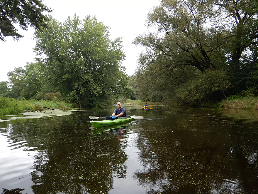
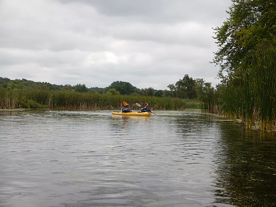
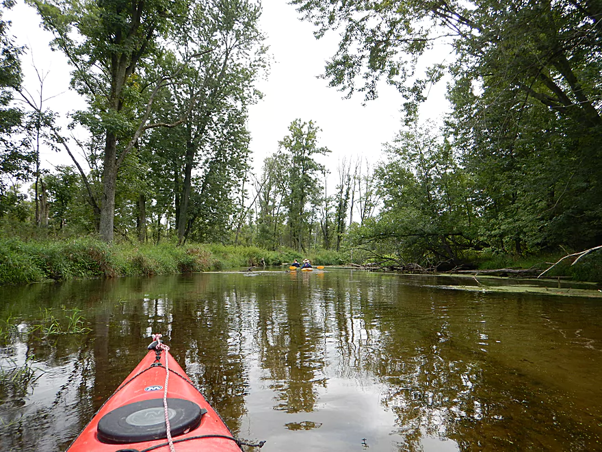
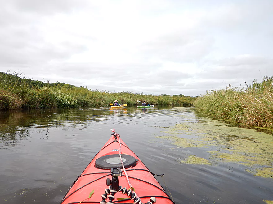
The Rome flowage
You have to drag your boat 470 feet to the dam (easy)
A giant duckweed engine
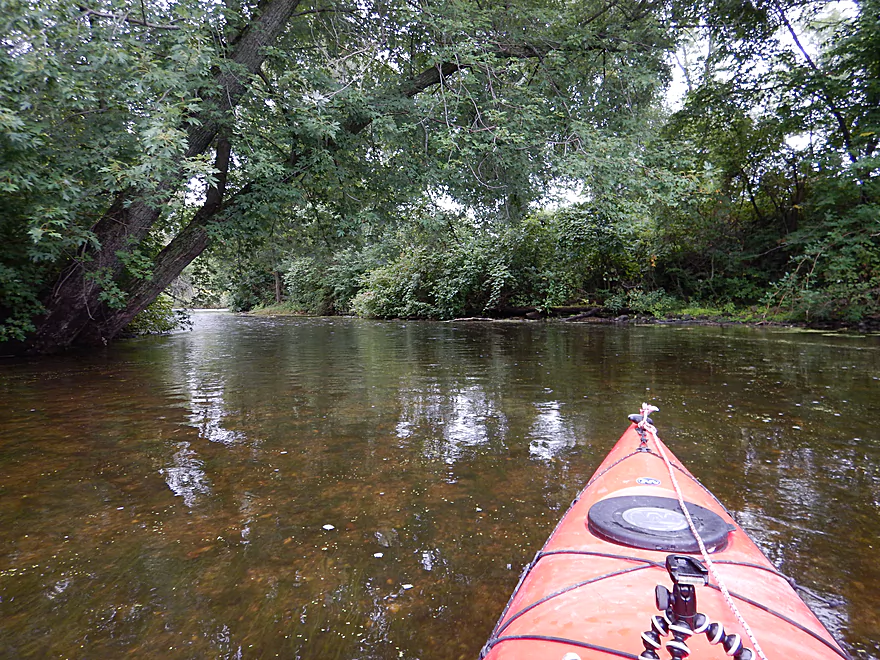
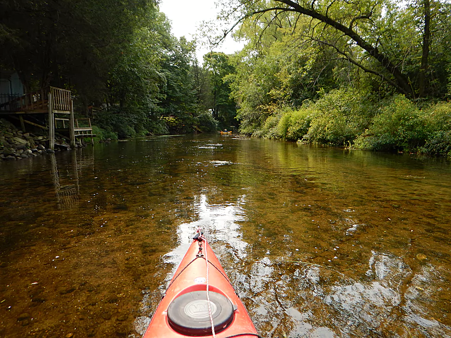
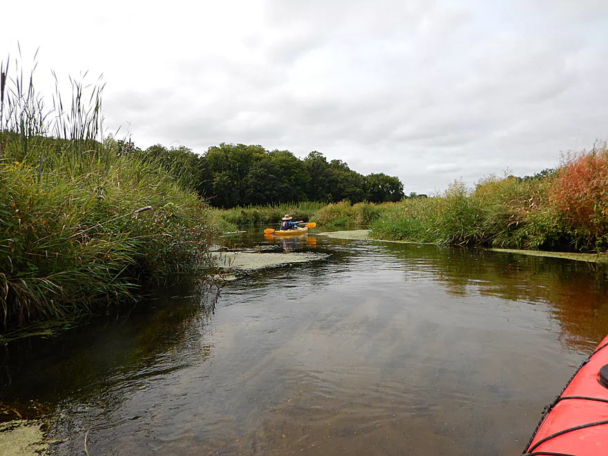
The short stretch between the dam and Main Street is really nice
A rope swing that has seen better days
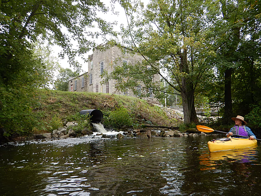
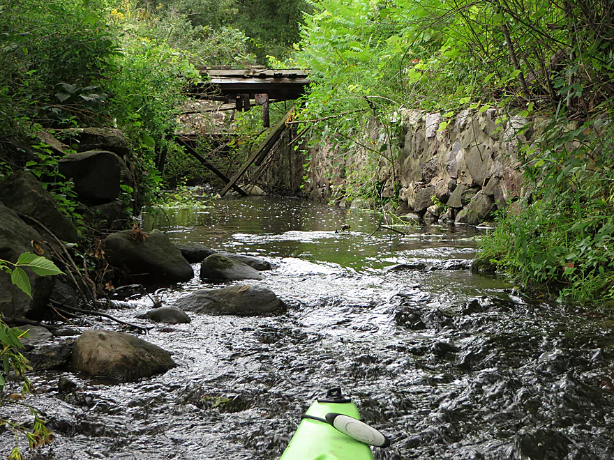
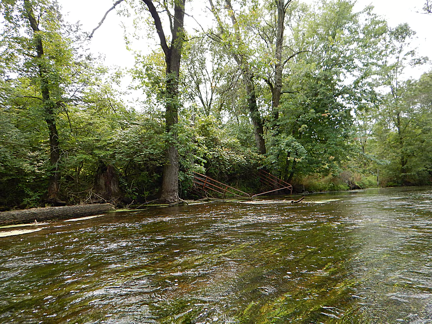
The old mill and outlet for the mill race
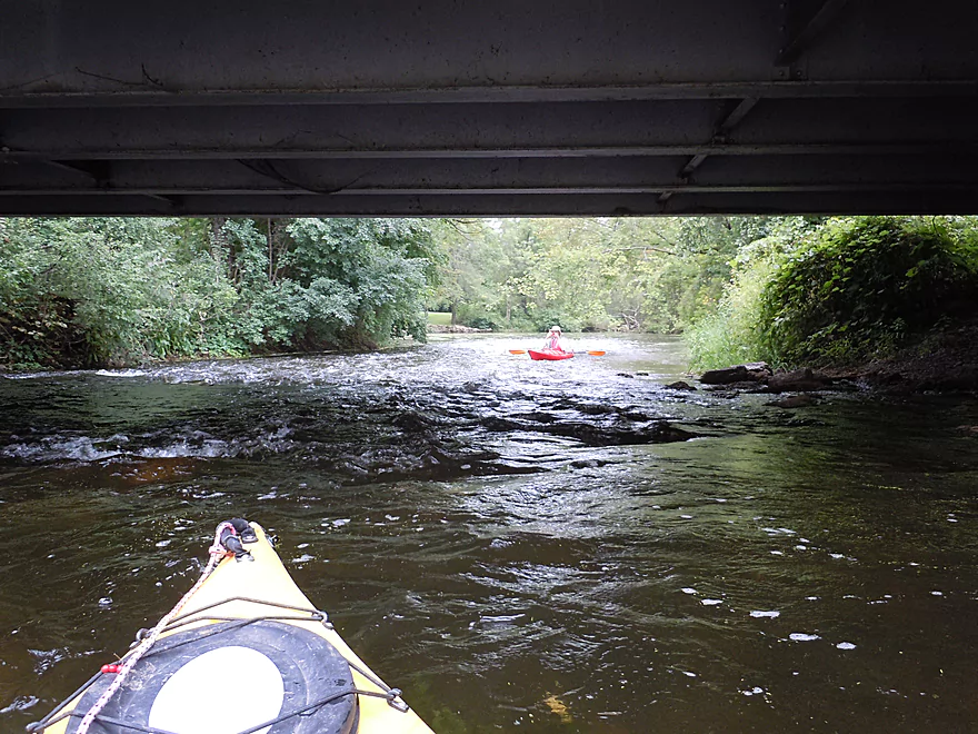
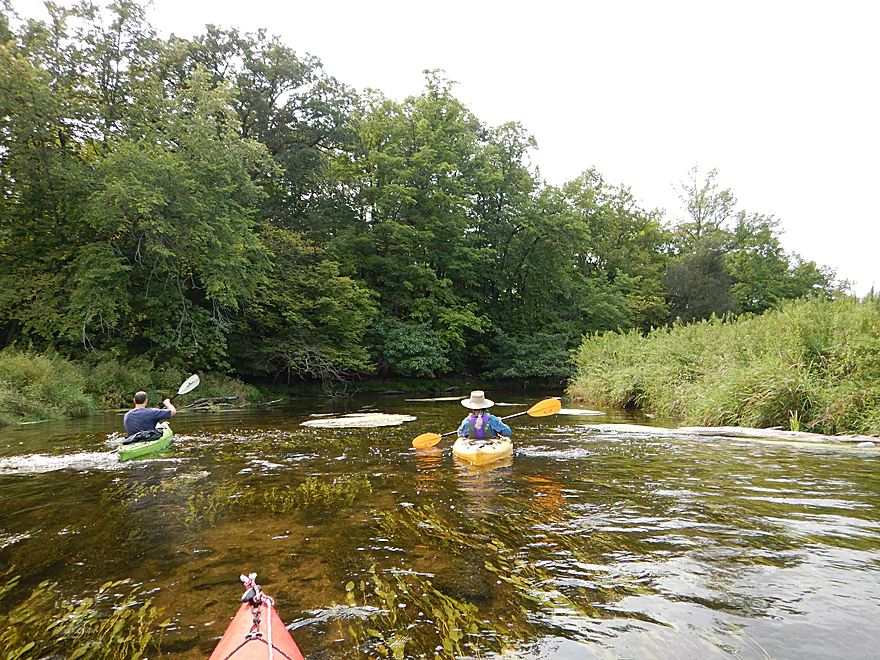
Some fun rapids below Main Street
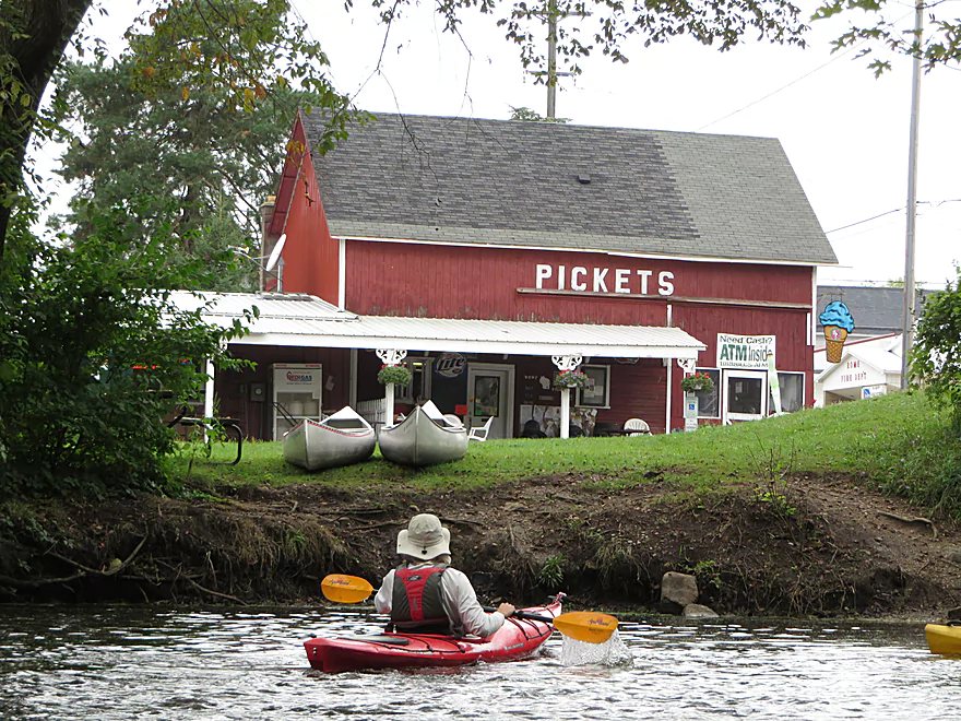
Most paddlers put in at Pickets Landing (but then you miss a nice section!)
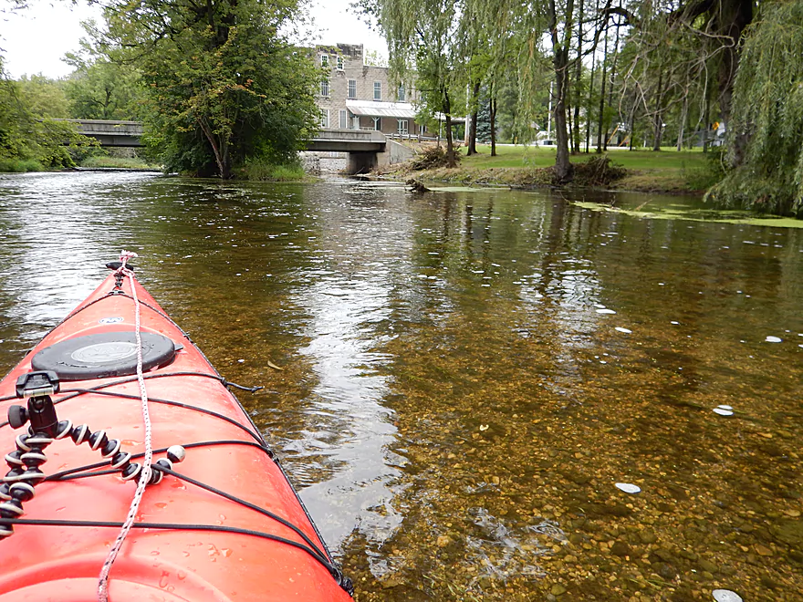
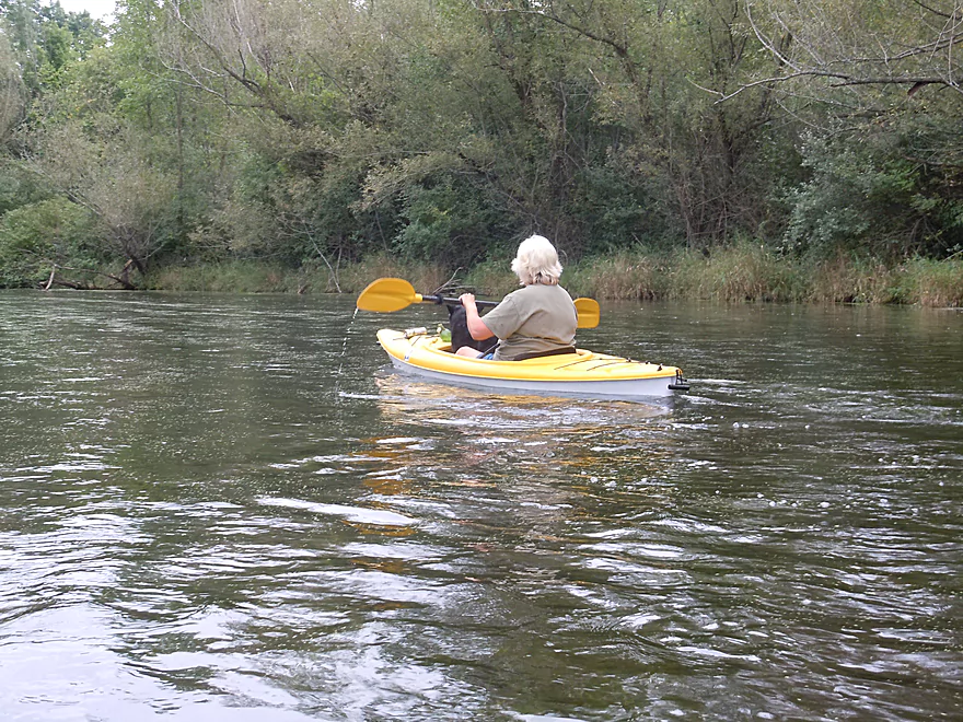
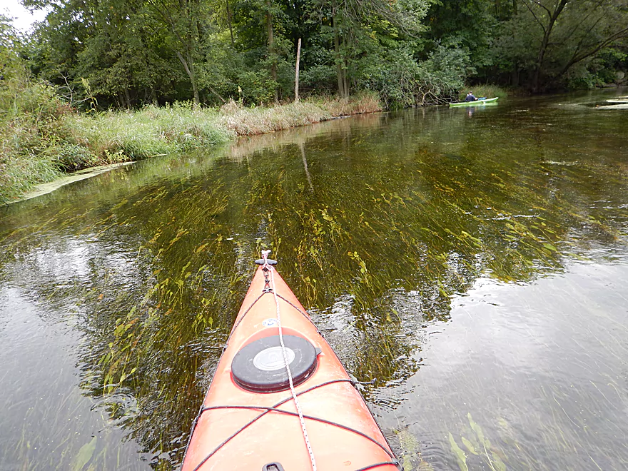
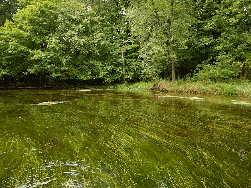
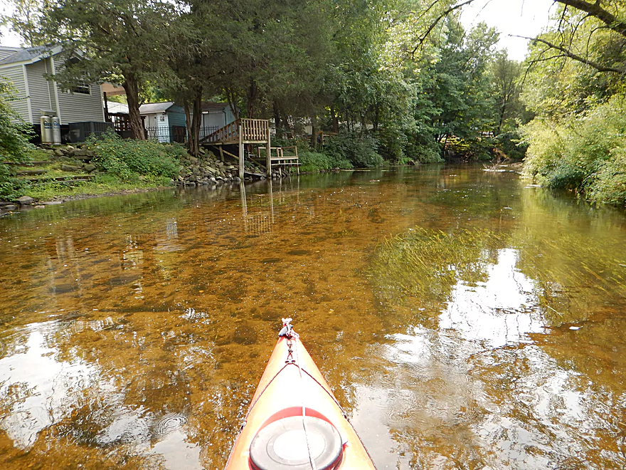
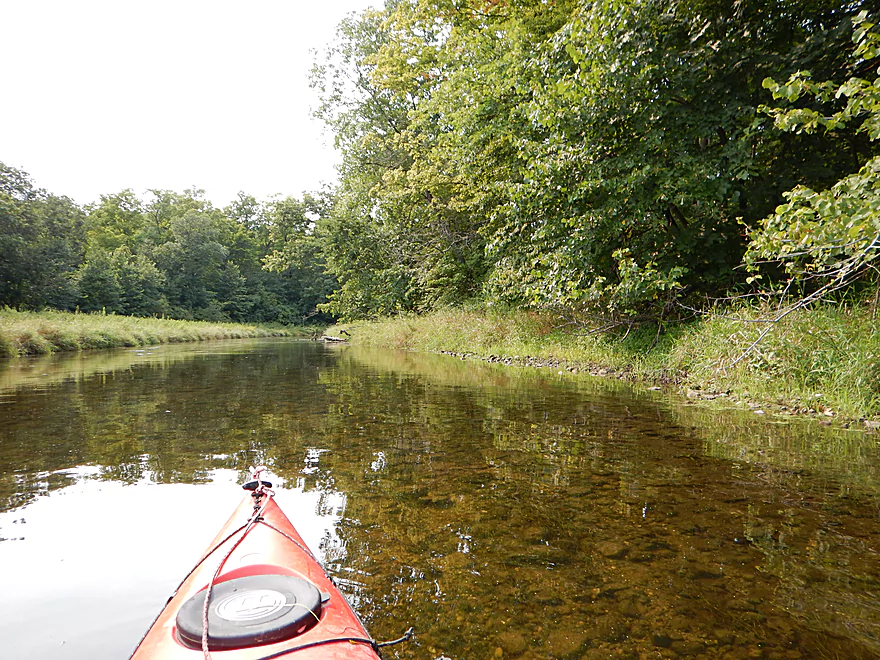
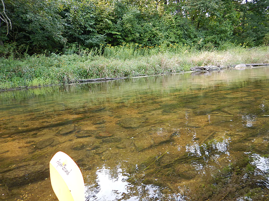
Really nice water clarity
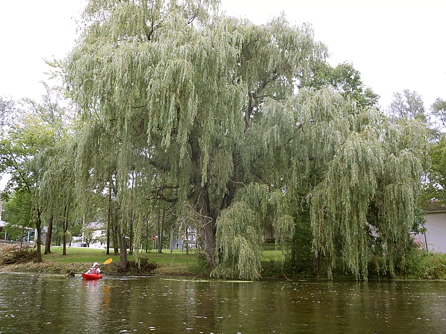
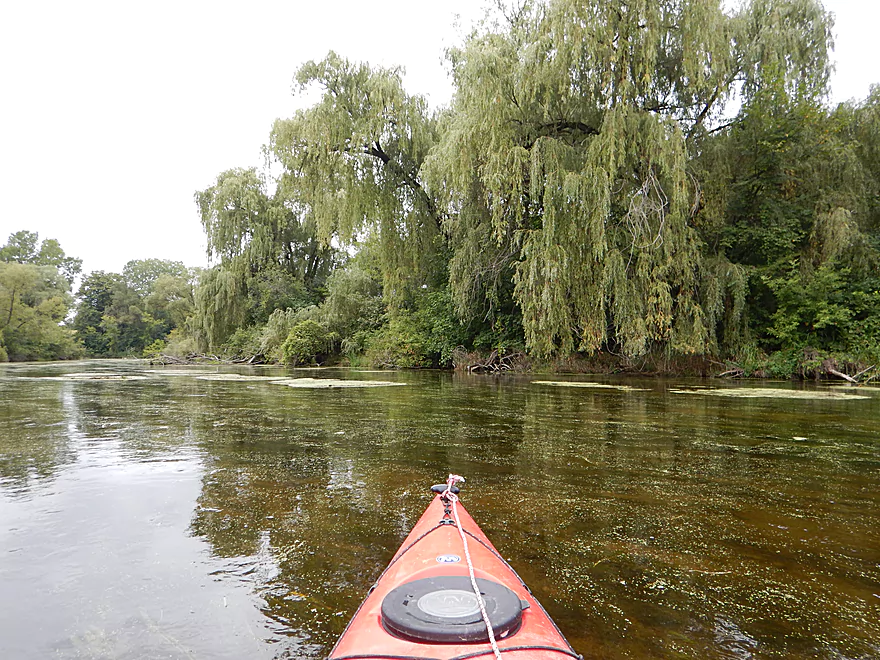
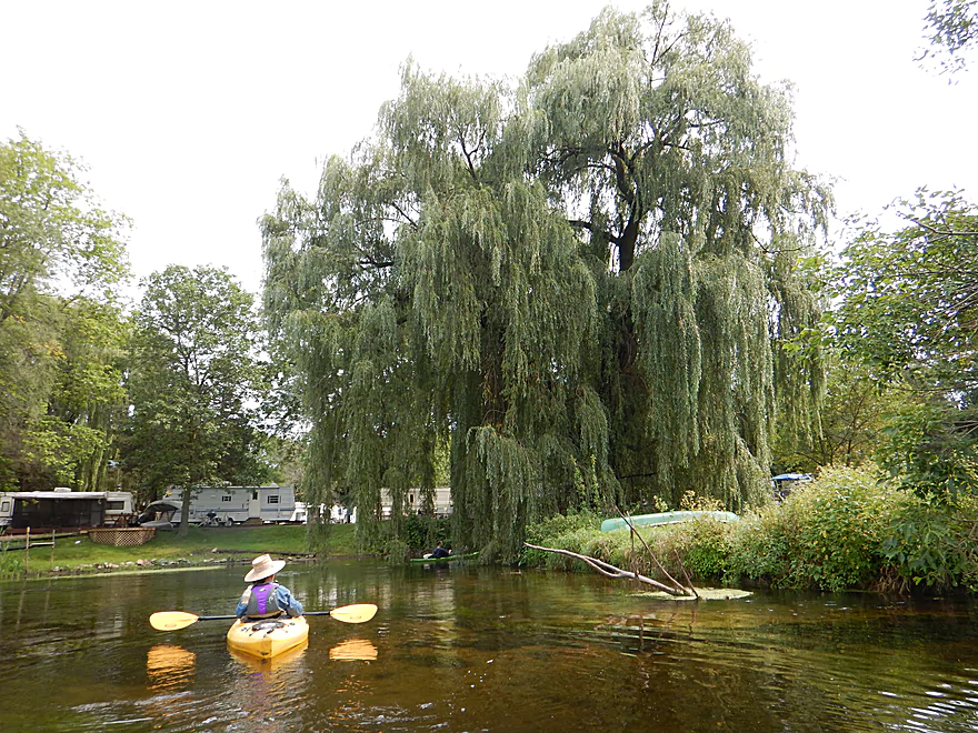
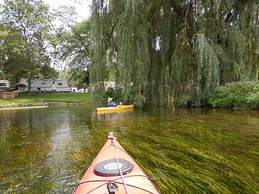
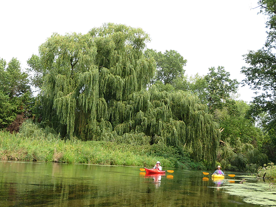
One of many epic weeping willows
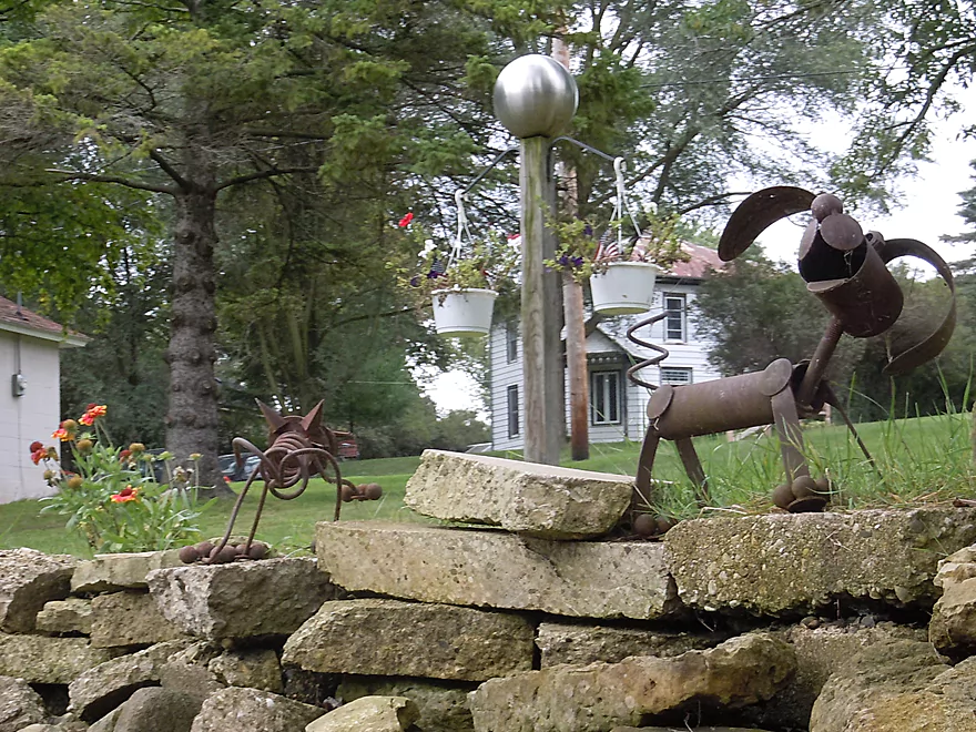
Nice riverside sculptures
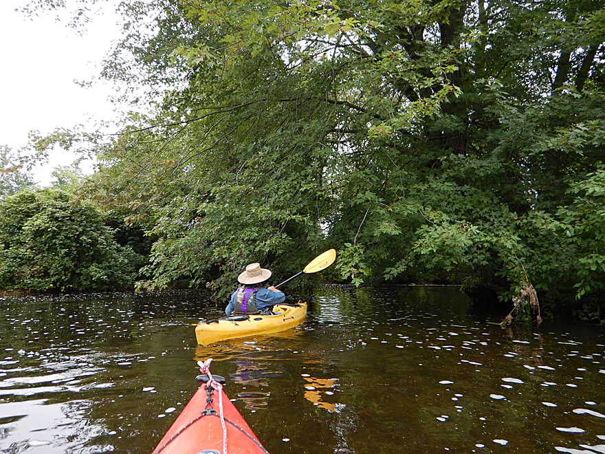
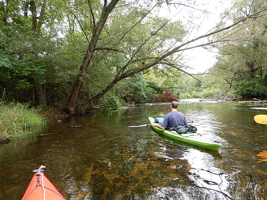
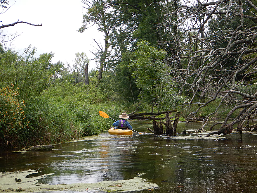
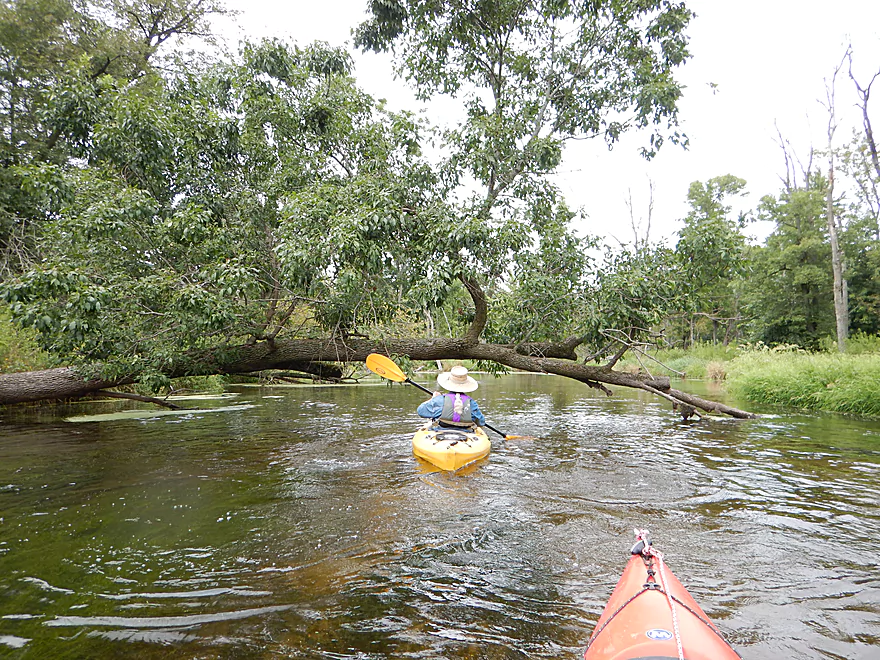
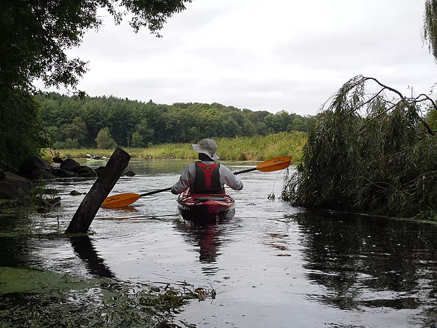
Overhanging limbs and thick brush gives this a cozy feel
Remnants of perhaps an abandoned mill race
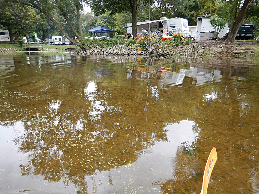
One of many private campgrounds along the river
Lots of bottlebrush barnyard grass
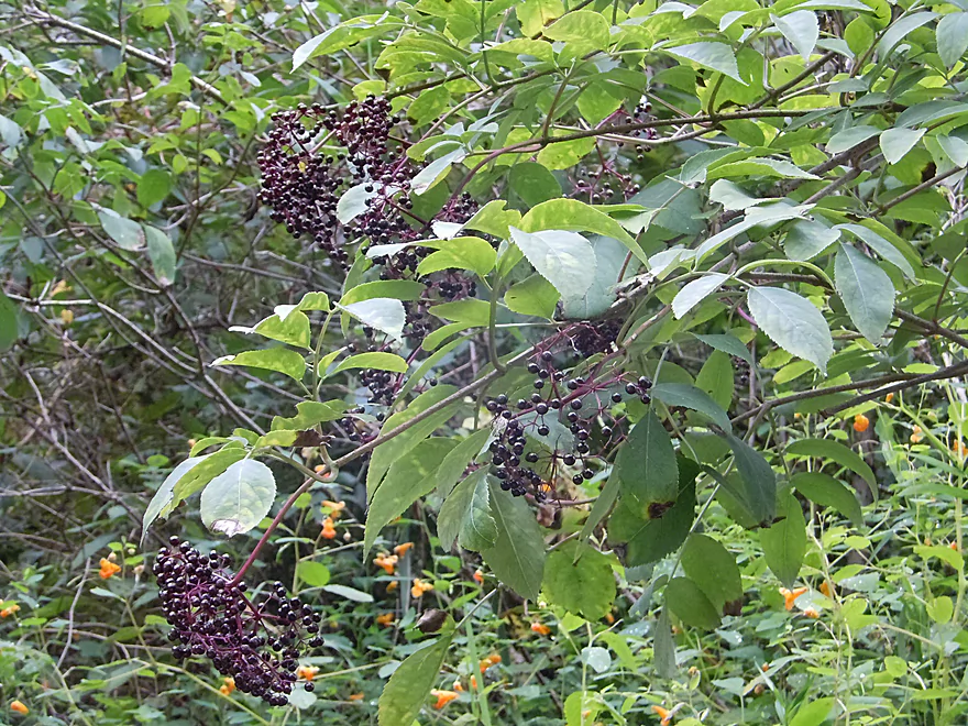
Ripe elderberries…ready to eat
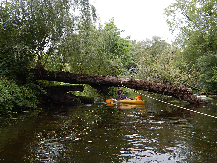
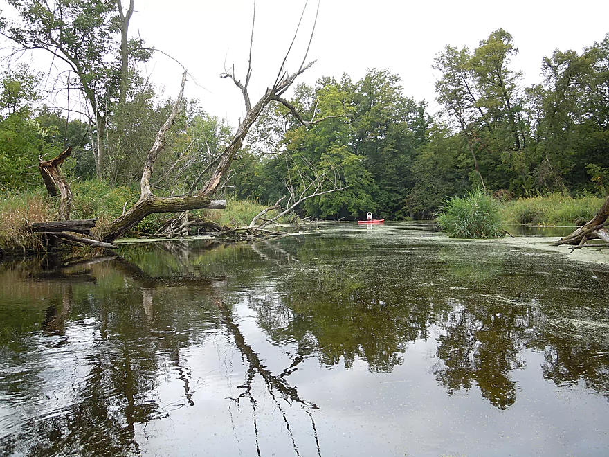
Log jams were never an issue
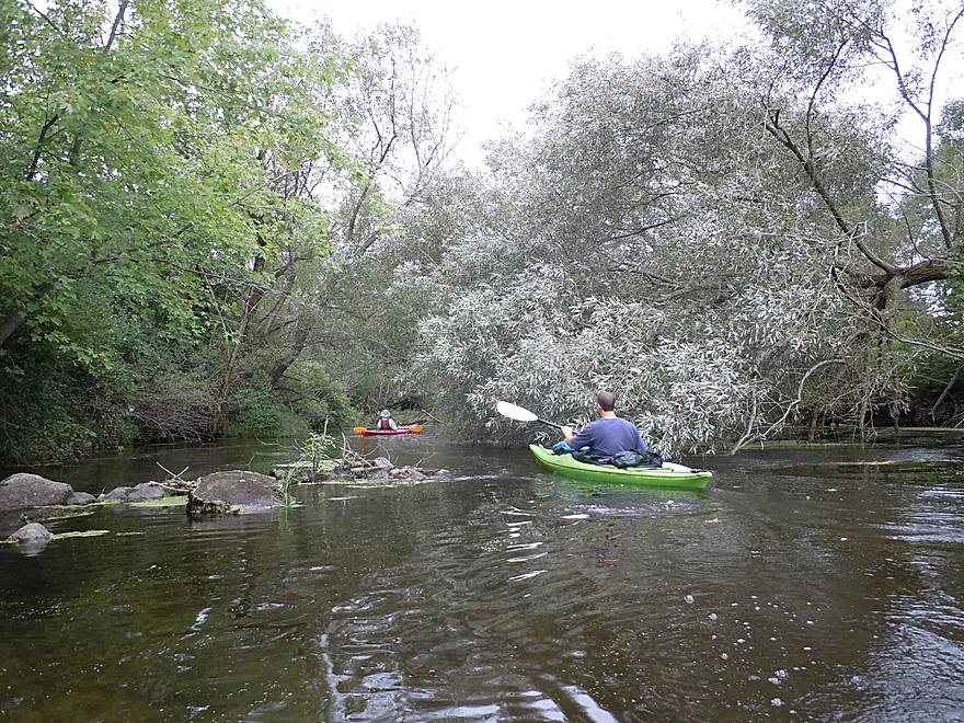
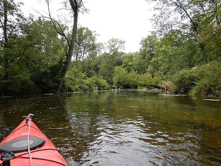
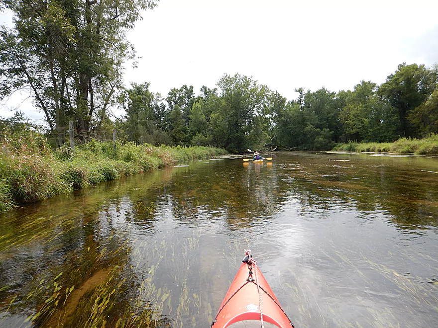
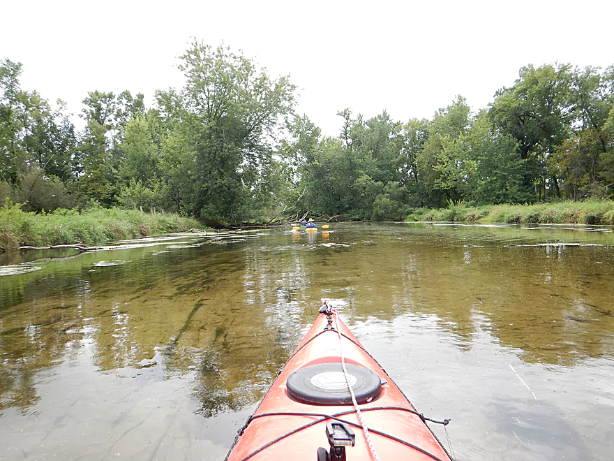
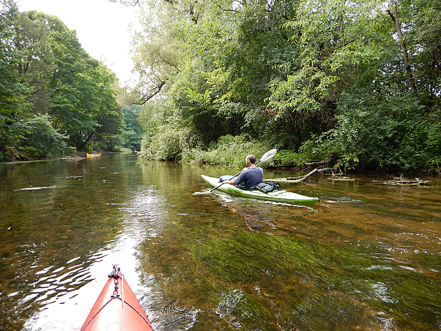
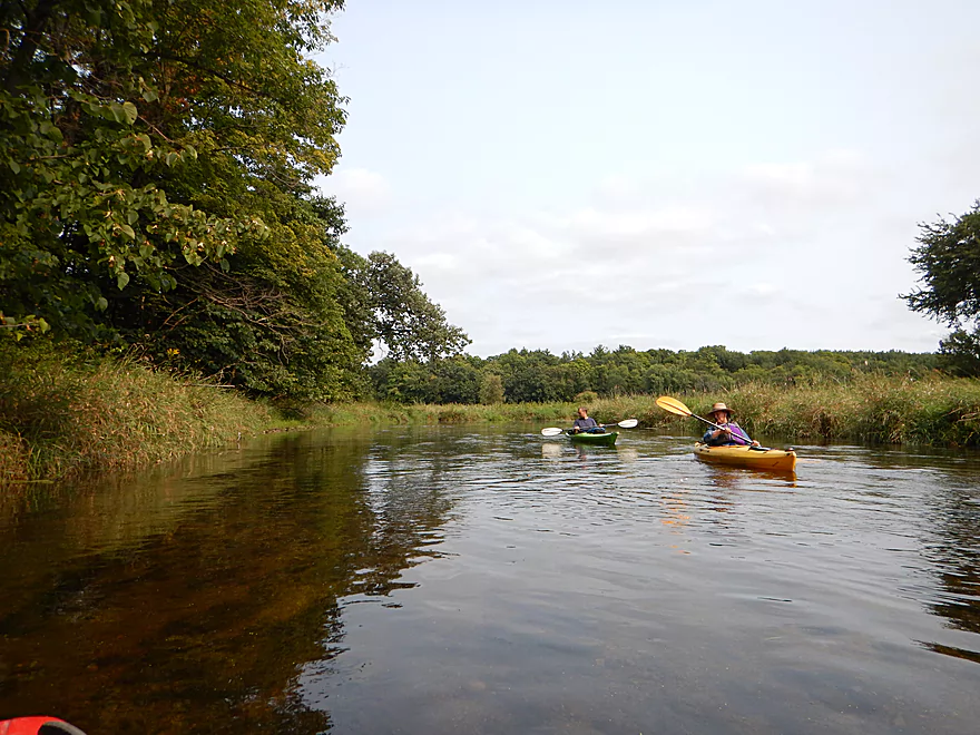
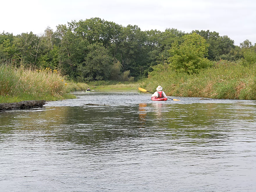
Some other yakkers (and dogs) on the water
River starts to open up and slow down
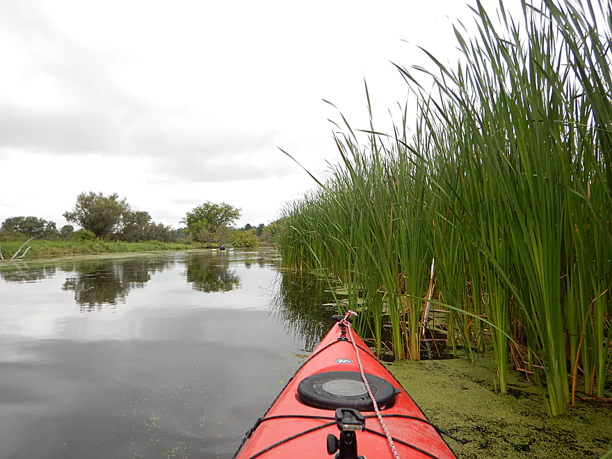
We are now in a cattail marsh
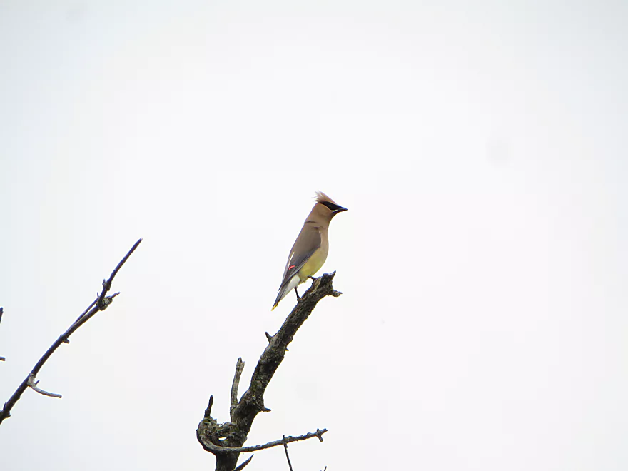
Migrating cedar waxwing
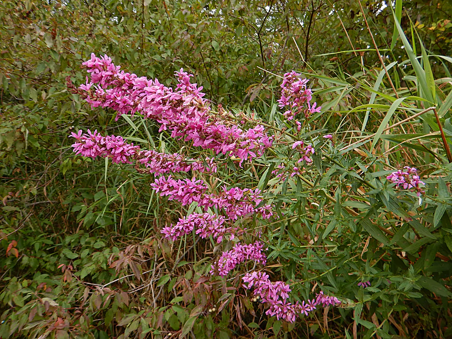
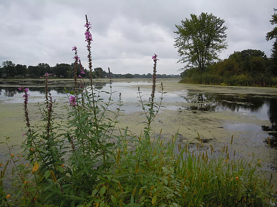
Purple loosestrife
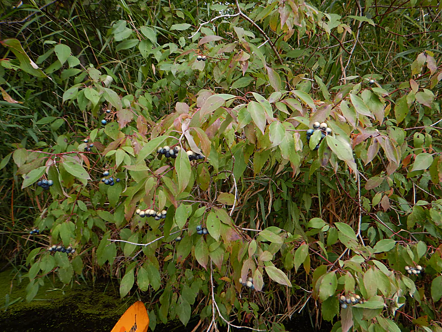
Looks like silky dogwood
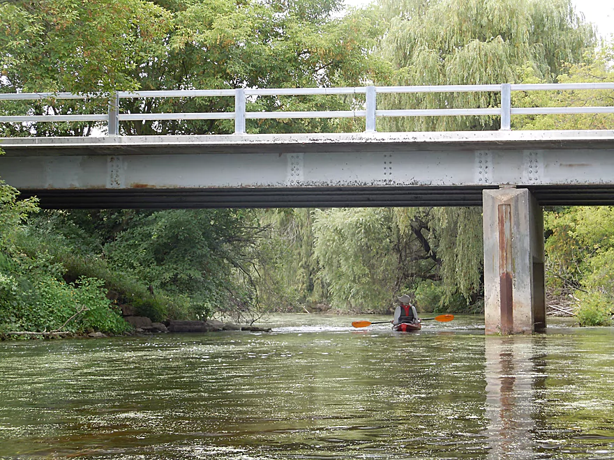
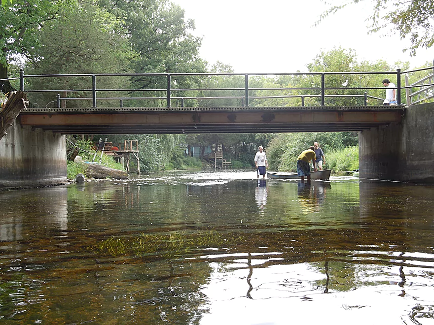
Palmrya Road bridge
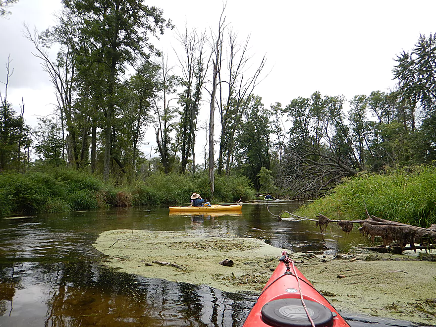
So much duckweed…
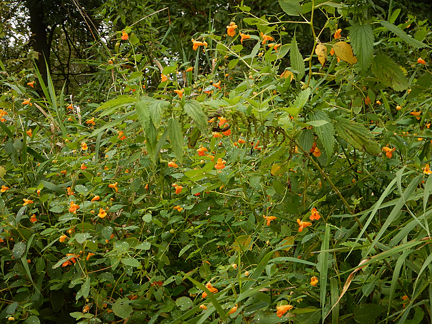
Dew drop-covered touch-me-nots
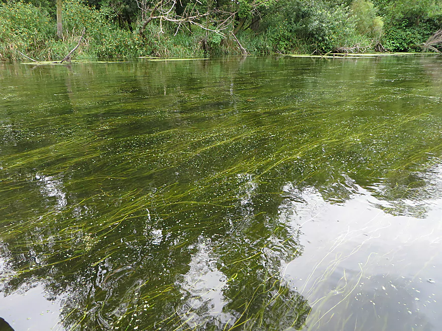
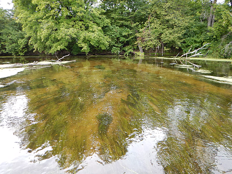
Very cool flowing pondweed
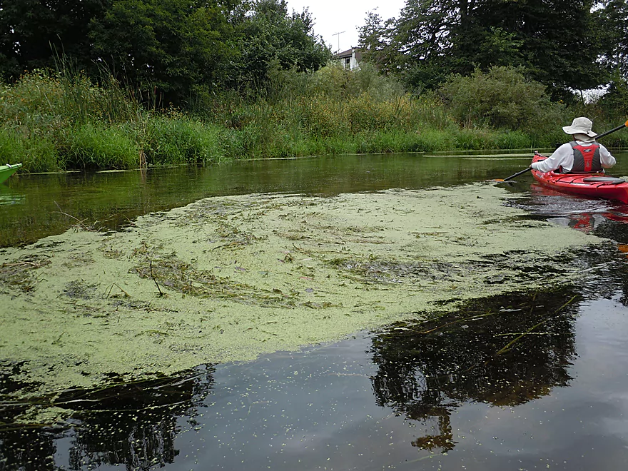
One of many duckweed barges
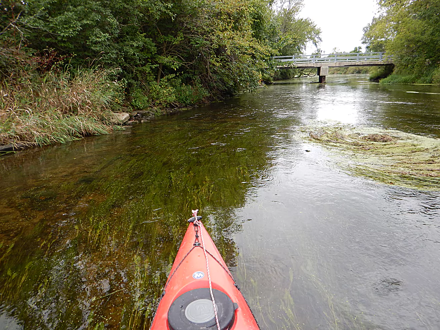
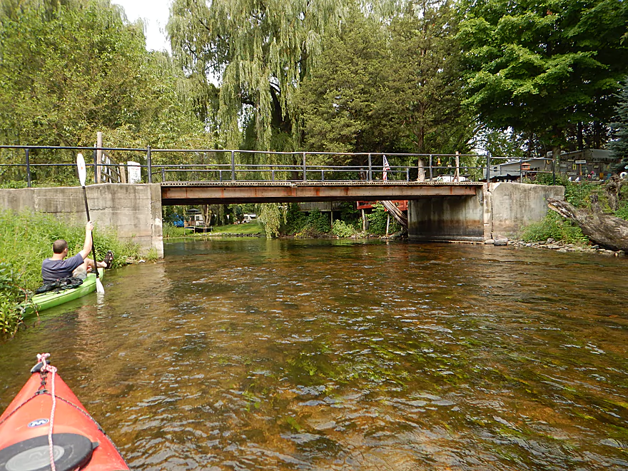
Turner Road bridge
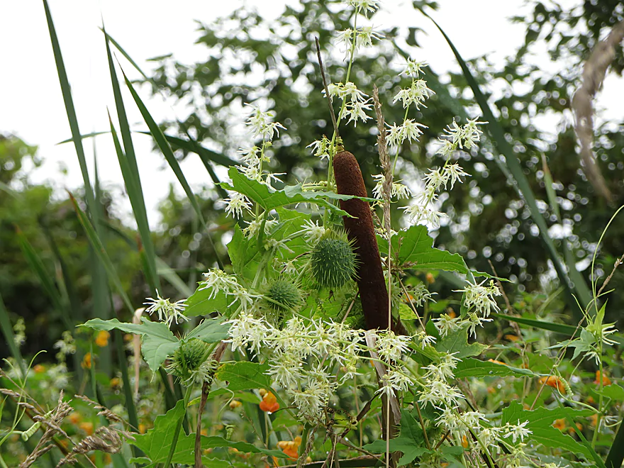
A medieval flail (or wild cucumber wrapped around a cattail)
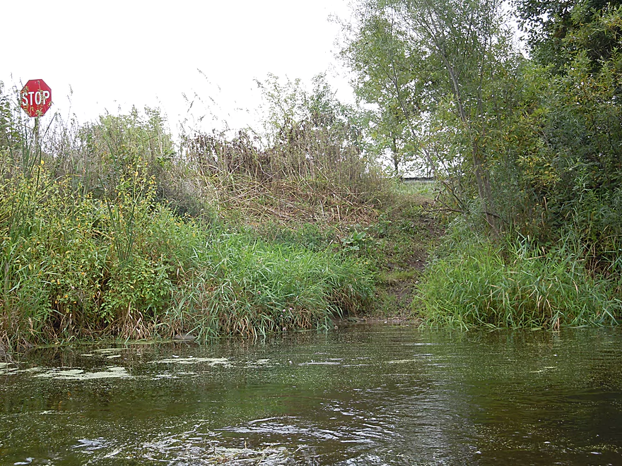
Turner Road is a put-in option
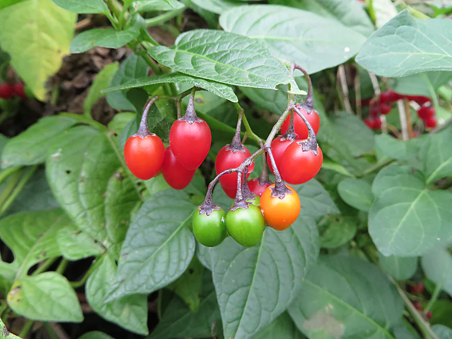
Nightshade berries (look like Christmas tree lights)
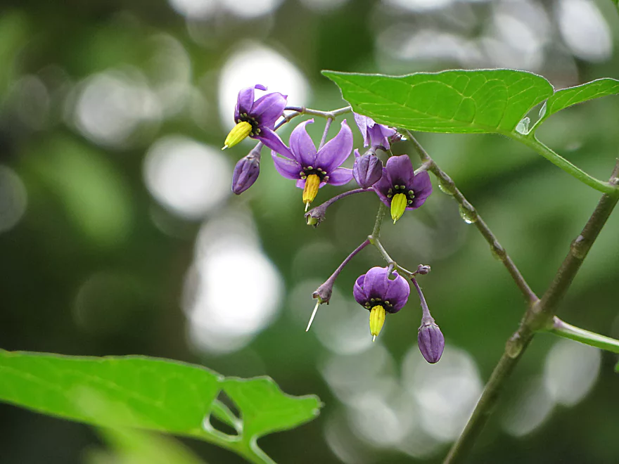
Nightshade flowers
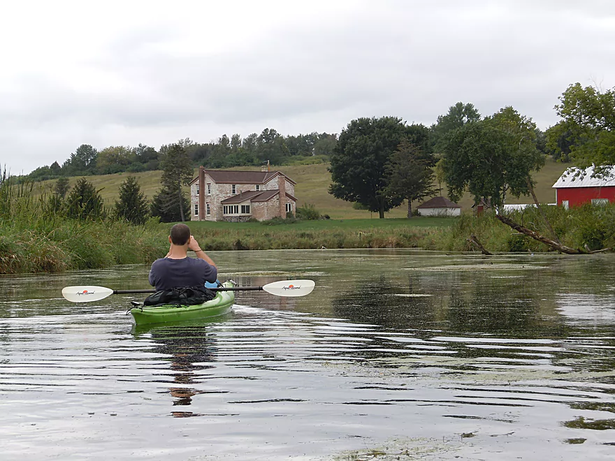
A historic house and drumlin–one of the few houses on the river
Super clean water and sandy substrate
Evidence of a lot of good cleanup work
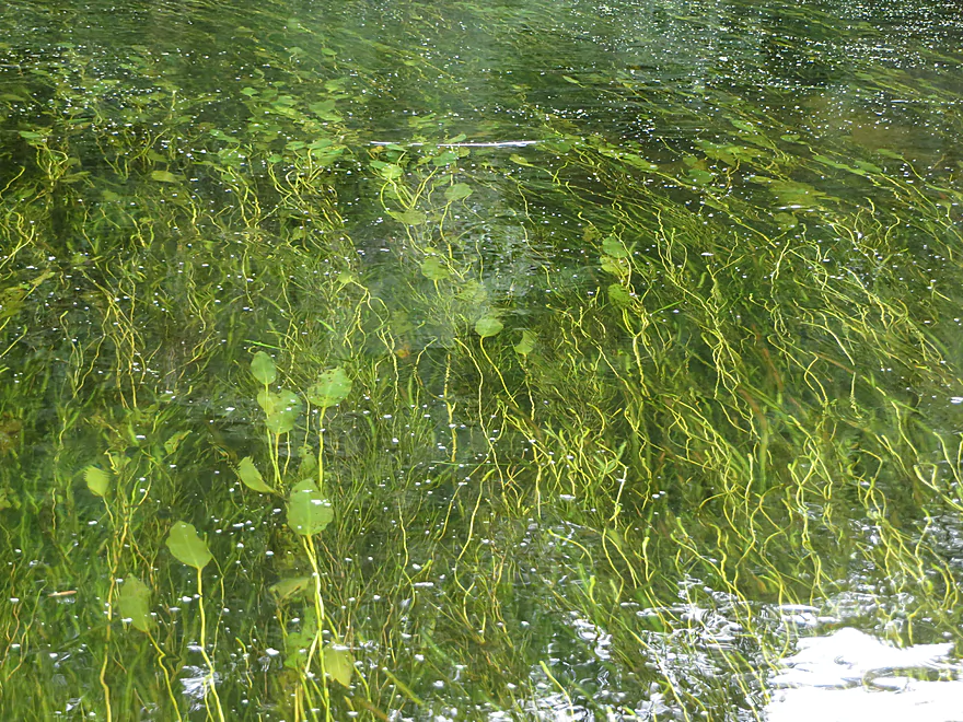
Gorgeous pondweeds, with a sprinkling of duckweed
A glacial drumlin (or kame)
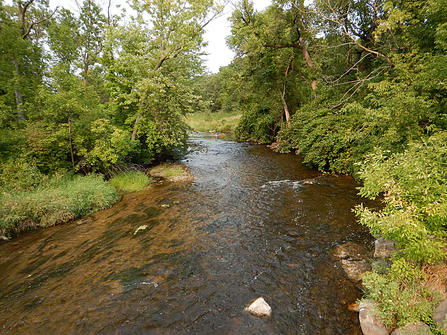
The river narrows and is really nice from here to the take-out
Not sure if these are glacial deposits or human deposits
One of multiple small riffles
Nice to see that cows have only limited access to the river
Clear flowing water and pondweeds
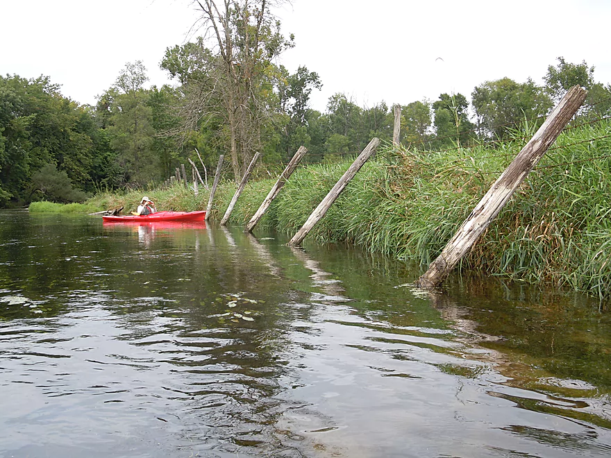
Cow fence has seen better days
At lower depths, the water clarity would be even better
At times quite sandy
Easy to navigate around obstacles
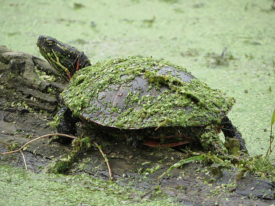
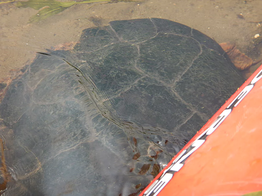
Turtle with his duckweed camouflage
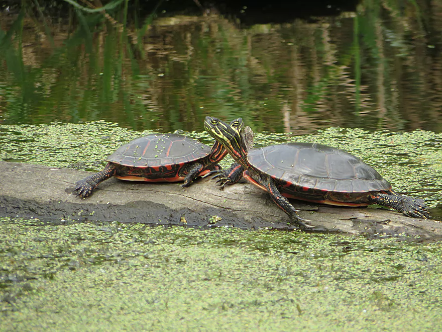
Dueling turtles
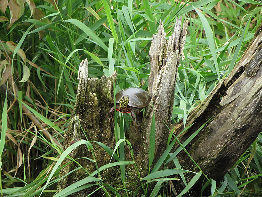
He was honestly stuck! (We rescued him)
Yet another amazing weeping willow
And more nice pondweed
Trying to figure out how to empty a leaking canoe
The section by the Bark River Campground was really nice
Looking back at the local campground bridge
Really cool stretch
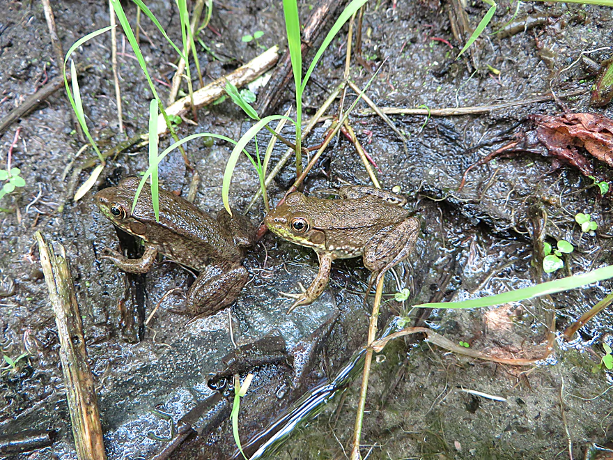
Green frogs…which are sometimes brown
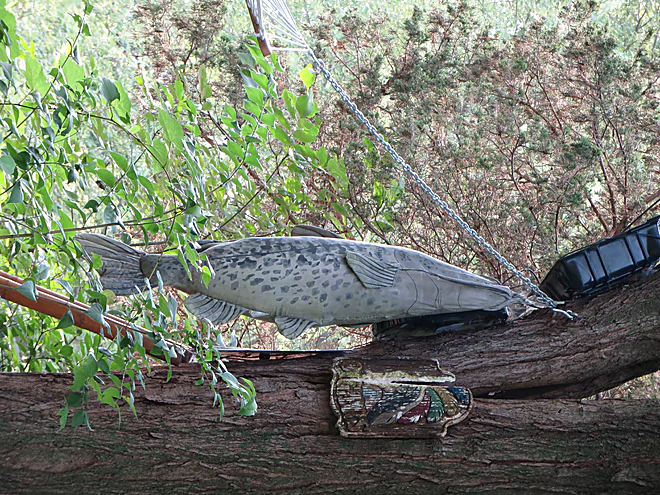
A fish pillow
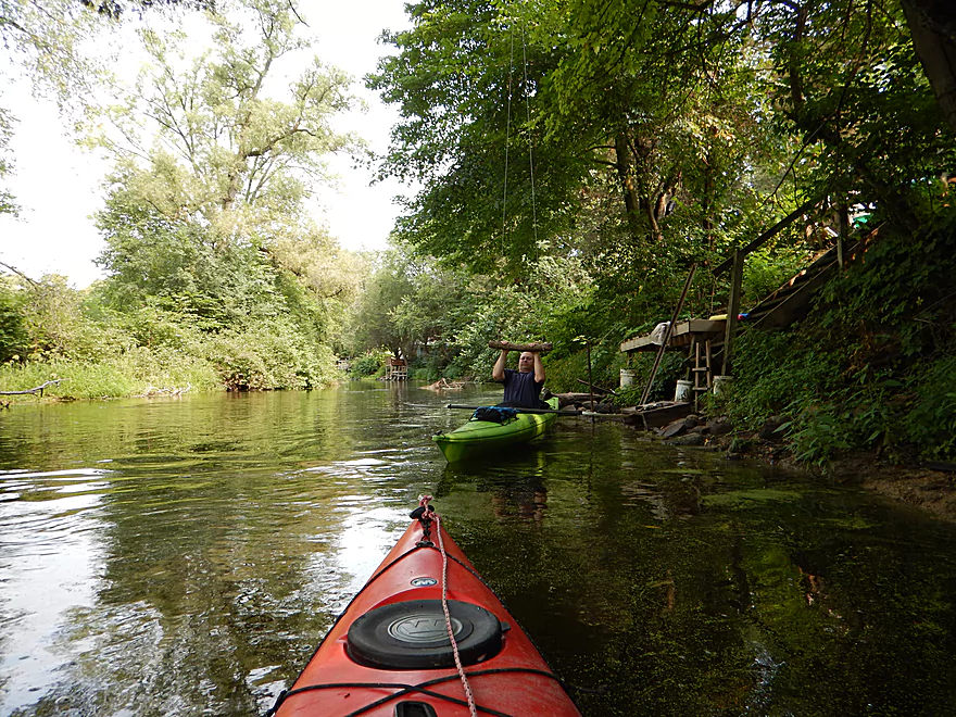
Time for some kayak pull-ups
Entering the remants of the old Cushman flowage
Final weeping willow shot (I promise)
Removed in 2008, the land is still recovering
Don’t get lost on the side channels
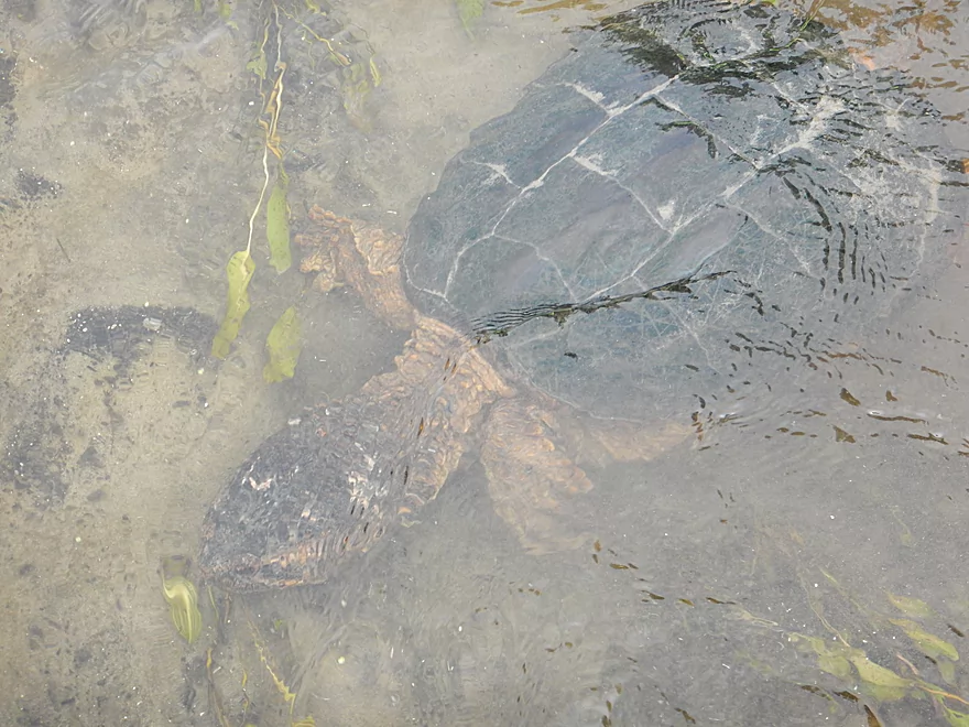
Huge snapper
He tried to hide under my kayak but did not fit
LOTS of big fish in this stretch–one of the highlights of the river!
This section had the best water clarity
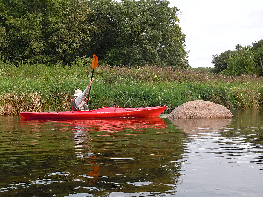
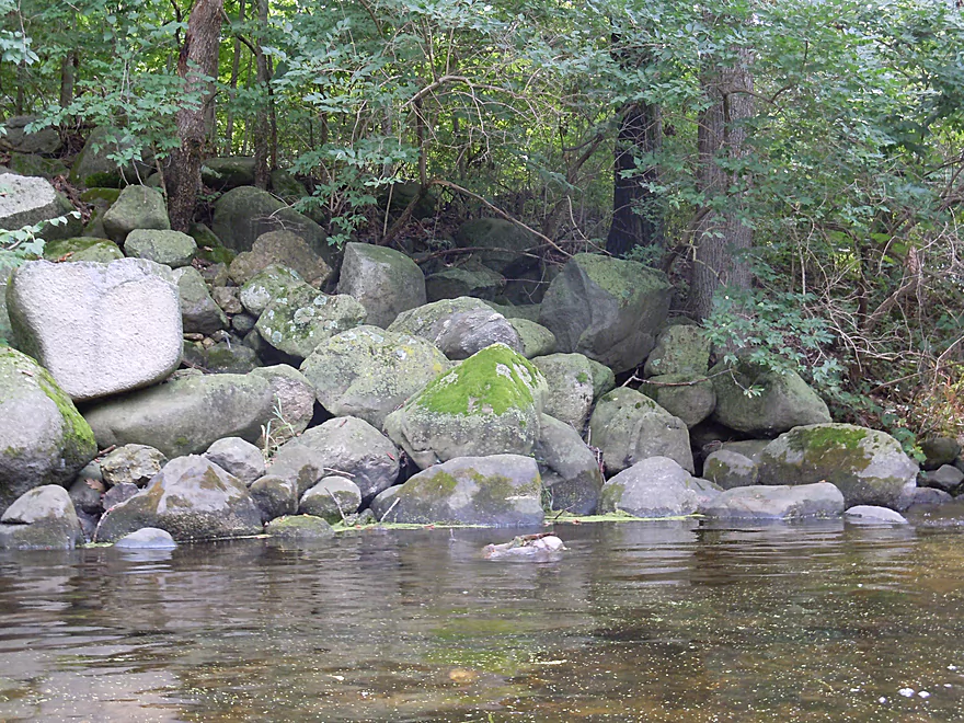
An impressive and random granite boulder
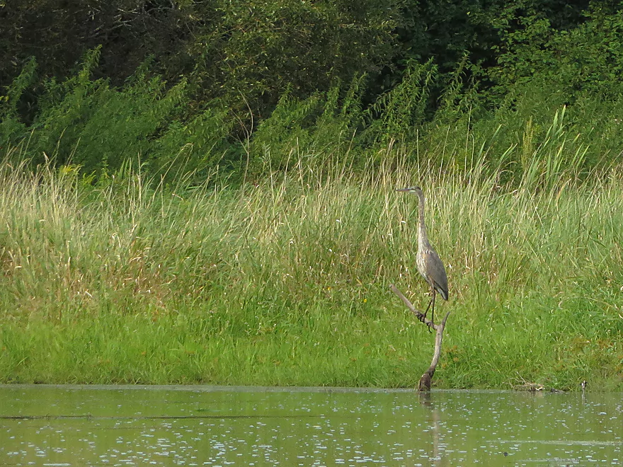
Great blue heron
More fun riffles
Substrate starting to get rocky
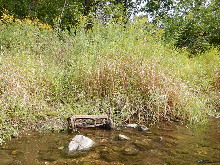
Juxtaposition: Unmowed grass and an unused mower
What is left of the old Cushman dam
Now a fun series of easy rapids
Not difficult
Looking downstream from Cushman Road
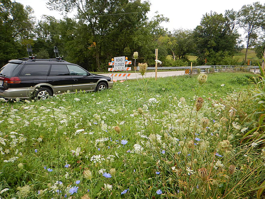
Park southwest of the bridge
There is a nice local landing at end of drive, but it is private and requires permission
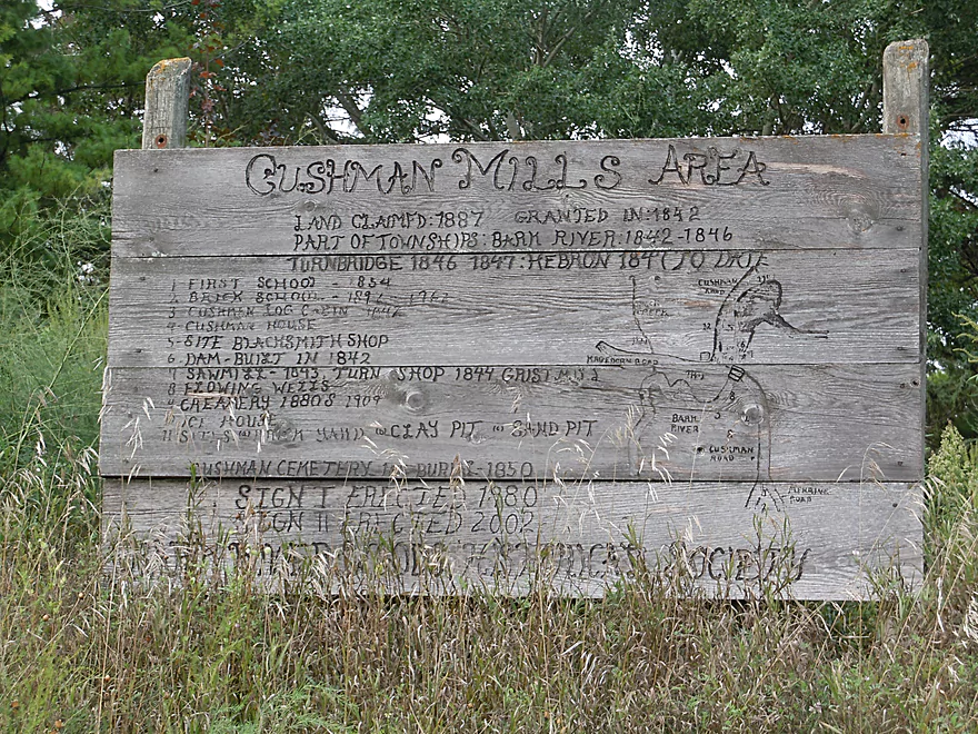
History of the Cushman Mills area
Bark River – Rome


The Bark is a nice little river that originates in the western suburbs of Milwaukee and flows west to meet the Rock River at Fort Atkinson. Most paddling review sources cover the very last section of the Bark, which is honestly perplexing as it appears to be a messy, dirty floodplain forest. After finding an obscure canoe trail map showing a section starting from Rome and liking what I saw from Google Street View, I decided to give this upper section of the Bark a try and am glad I did.
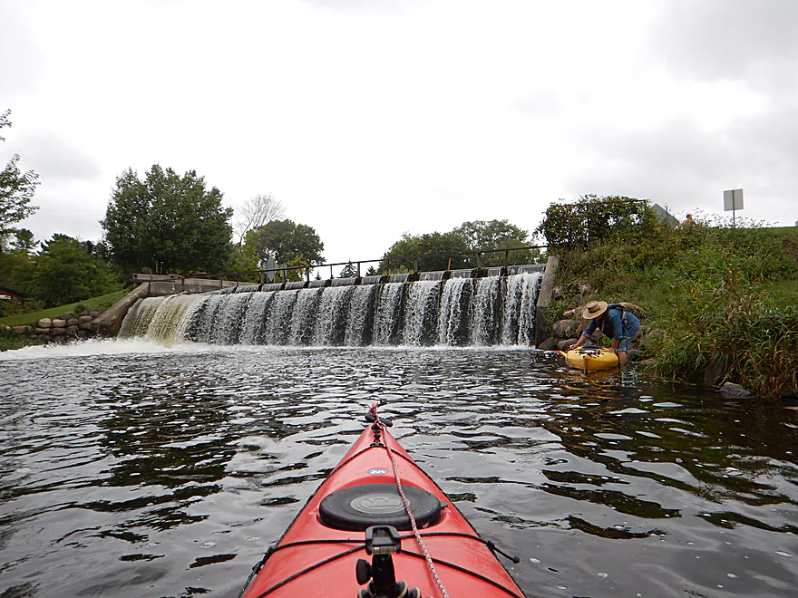
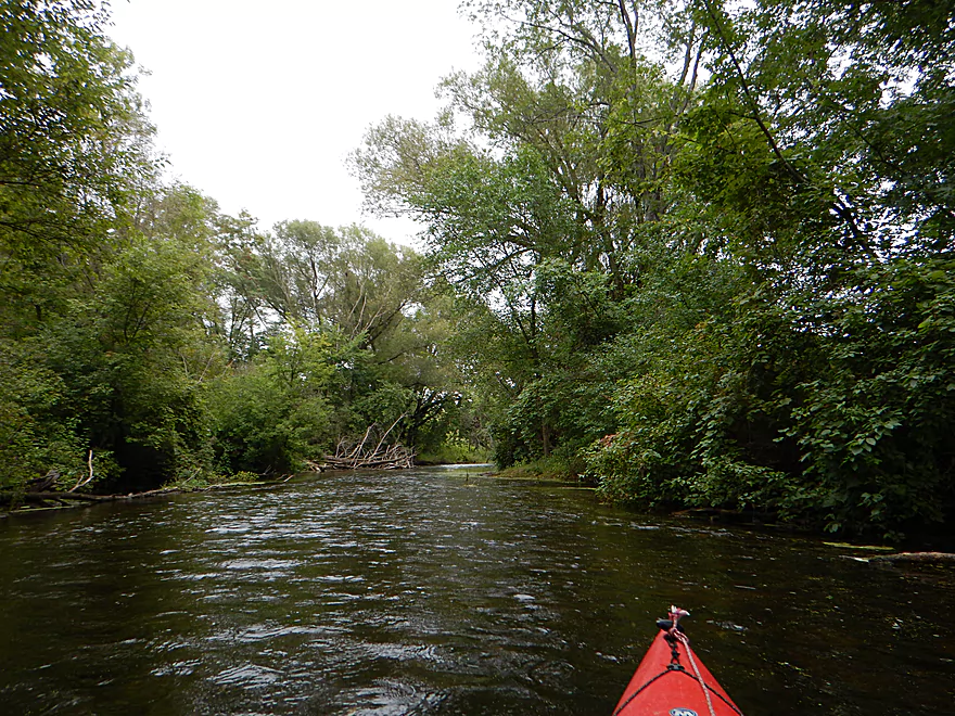
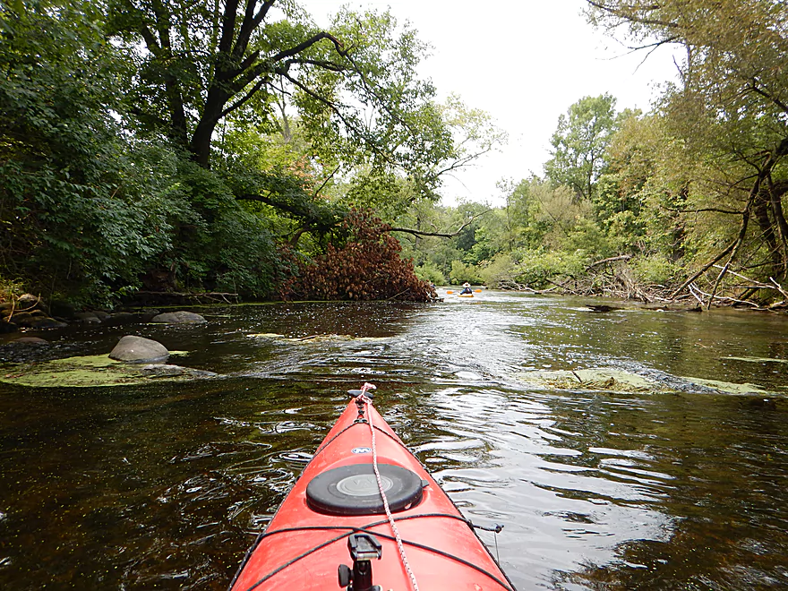
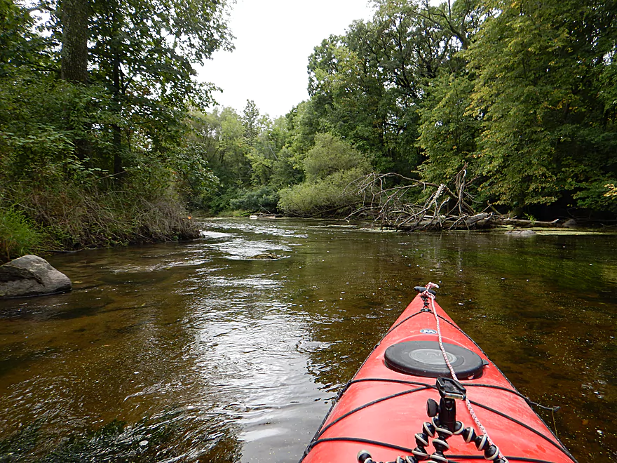
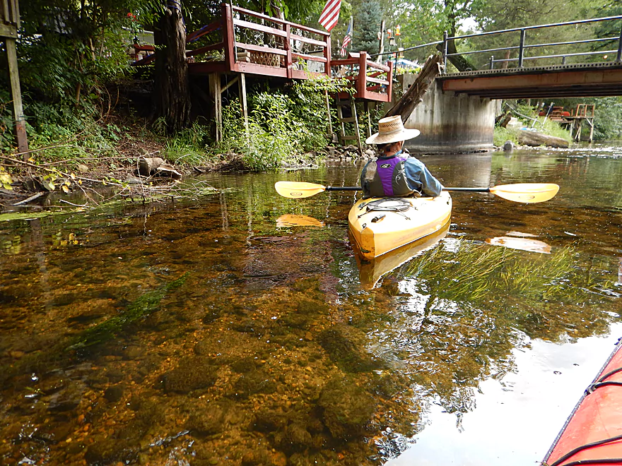
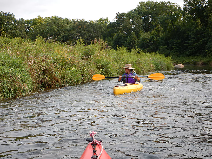
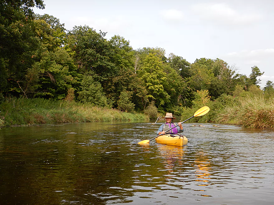
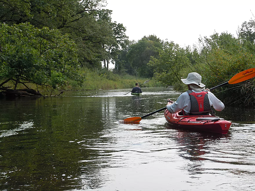
The short stretch from the dam to Pickets’ launch is very nice, with intimate overarching branches, clear water and a fun set of rapids which is again why you want to put in by the dam instead of by Picket’s landing. In this area, you’ll see the remnants of an old mill and mill race (no longer operational). The dam, however, is still operational and creates a large flowage upstream. The lower section of the river is filled with an inordinate amount of duckweed and I suspect the stagnant waters of the Rome flowage are to blame.
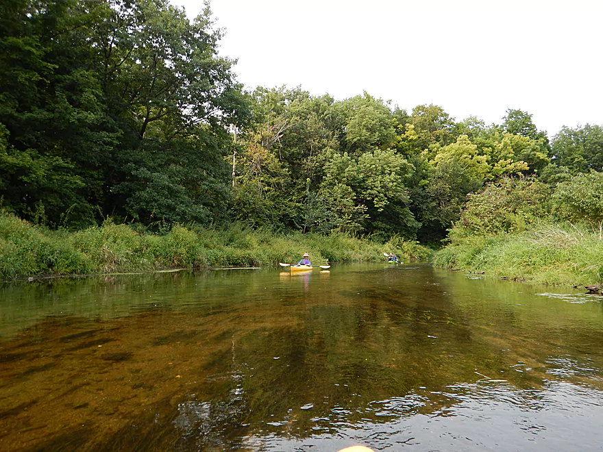
Just outside of Rome is the first of two RV parks on the river, which is Rome Campground. After this, the river opens up into a cattail marsh and slows down. The next quarter mile is where the Slabtown flowage was before the removal of the Slabtown dam in the early 70’s. The duckweed is everywhere, like snow on the water, but is not unsightly.
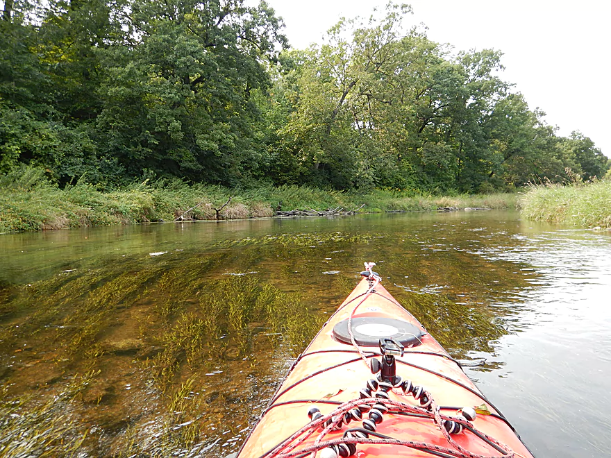
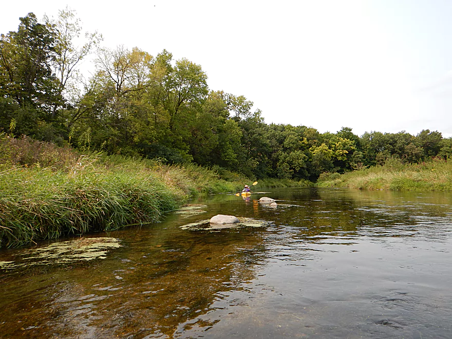
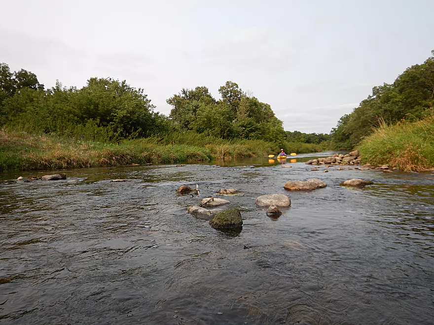
After you pass an old brick house (one of the few you’ll see on the trip) and a massive glacial drumlin on the left, the river starts to narrow and really changes character. The current picks up, the water clarity (already good) gets better and the substrate gets sandier with more gravel. From this drumlin to the take-out is the best part of the trip.
Soon you’ll pass by the Bark River Campground, which is a high density RV park next to the river. This is actually a really neat section, with red-hued substrate you could easily see from above, good current and attractively wooded banks intermixed with the trailers. Here we encountered some other paddlers (two of which were dealing with a serious hole in their canoe).
This river, despite not being reviewed by Mike Svob’s paddling bible, had a surprising amount of traffic on it. The put-in had a number of j-bars and canoe trailers in the parking lot, a local store owner told us there was a massive group of paddlers coming later in the day, we encountered two kayakers doing cleanup work, and then finally there were the paddlers from the campground.
After the RV park, the river opens up into what used to be the old Cushman Dam flowage. In 2008 the dam at Cushman Road was severely damaged by a flood which led to its removal. This final mile of the river is still recovering from being submerged and, at this point, is mostly a wetgrass paddle (but still very nice). Good current here with some riffles. A lot of gravel and even occasional boulders in the river give this section a very clean feel.
A sign of a good river is the lack of high muddy banks, and the Bark is a great example of this. I’m not sure why it is so clean. Perhaps because of the lack of agriculture (I didn’t see a single farm from the water). What was really cool were the number of fish we could spot from our kayaks (many were quite big).
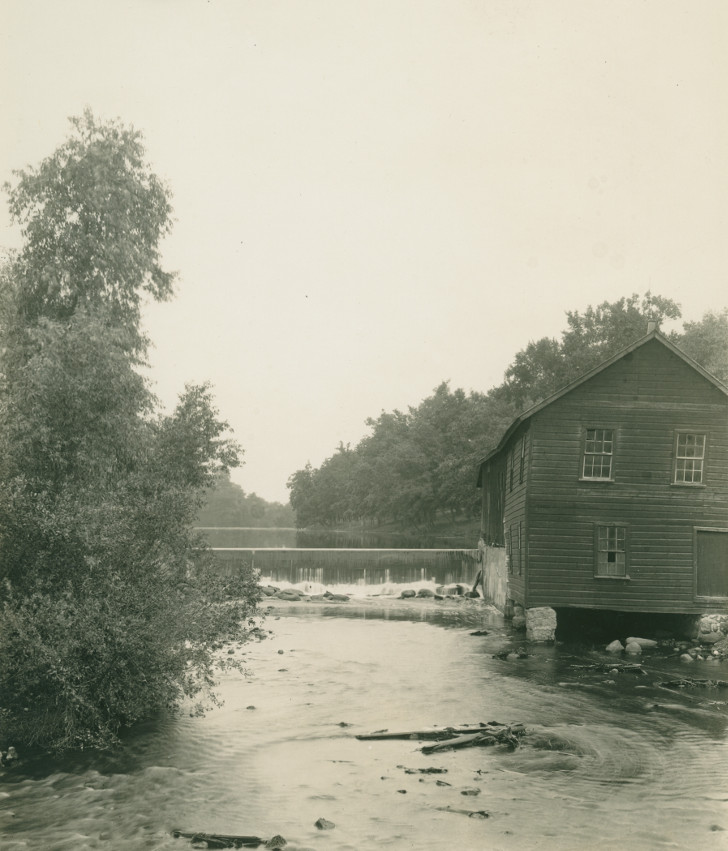
The take-out ends on a great note as you’ll paddle over some light rapids (what remains of the Cushman dam) before disembarking just below Cushman Road. [Editor’s update…thanks to the Hoard Historical Museum in Fort Atkinson for providing a historical picture of the dam and mill (early 1950s), which you can see here.]
Again, the local landowner is sensitive about trespassers, so be considerate (see my put-in write-up above). You easily could paddle four more miles to the next bridge at Hwy 106 where there is a good landing. I think this bonus section would be mostly clear of jams, but might necessitate a couple of portages.
As a side note, I do recommend reading the book: The Bark River Chronicles. It is the fascinating account of one man’s canoe journey on the entire Bark River and the economic, geologic, native, and pioneer history of the land and river along the way. It is not a guide book per say like this website, but it does contain practical navigation tips from the headwaters at Bark Lake to its confluence with the Rock River.
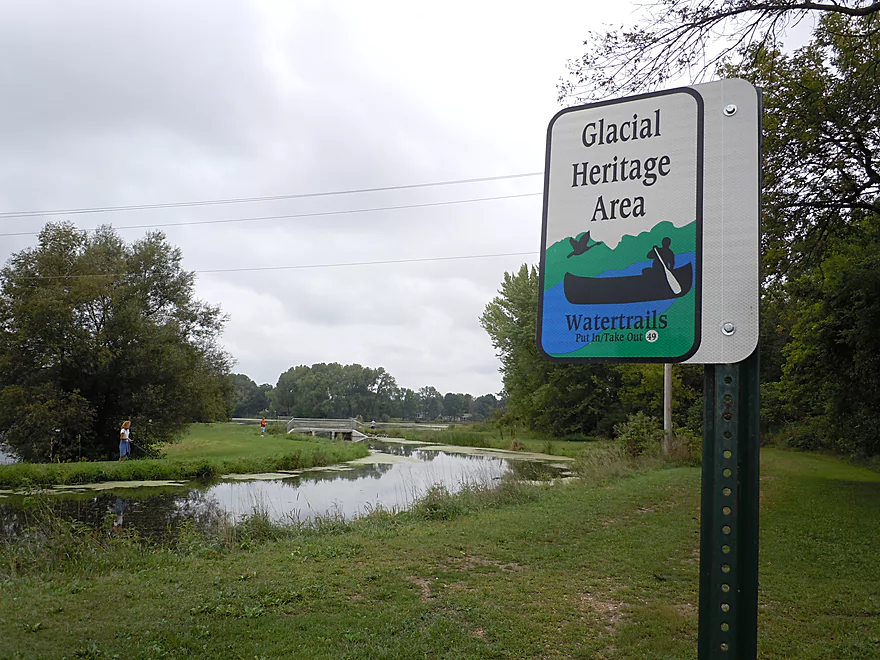
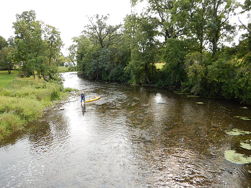
Most paddlers in Rome launch from a yard behind Picket’s store (just downstream/west of the Hwy F bridge). The store owner has given permission for the public to use this launch, but not to park in the store parking lot. Instead, you have to park at a local park maybe 500′ to the northeast and walk back (not a big deal).
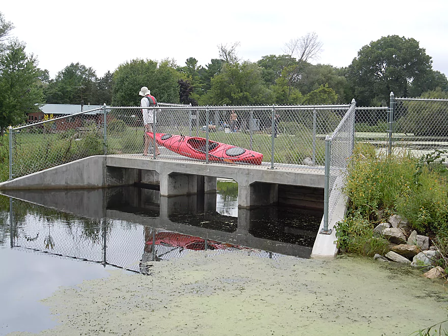
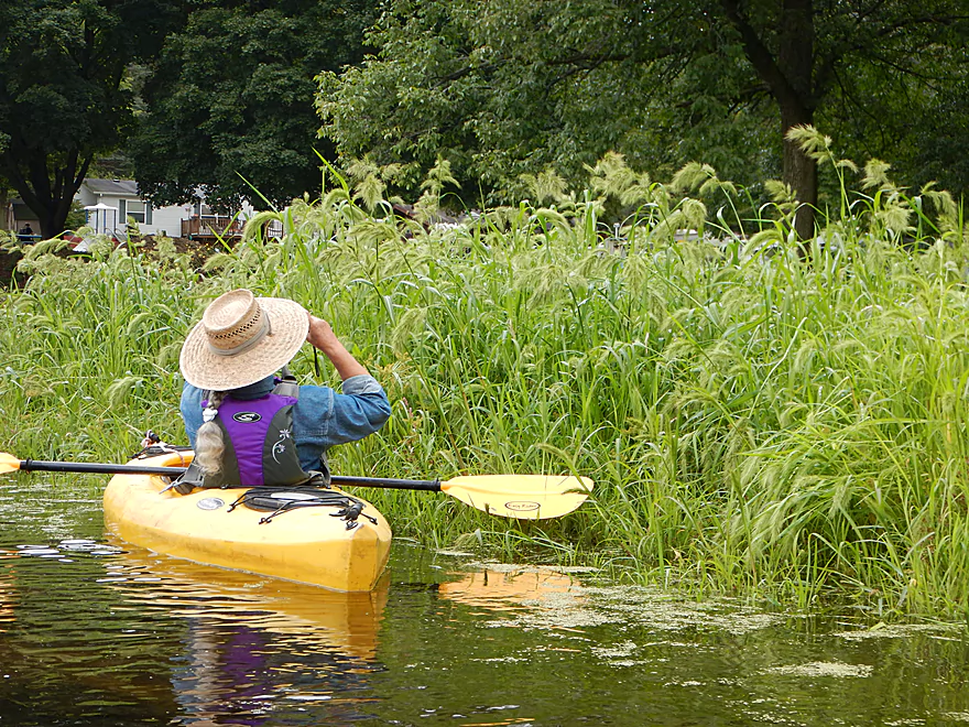
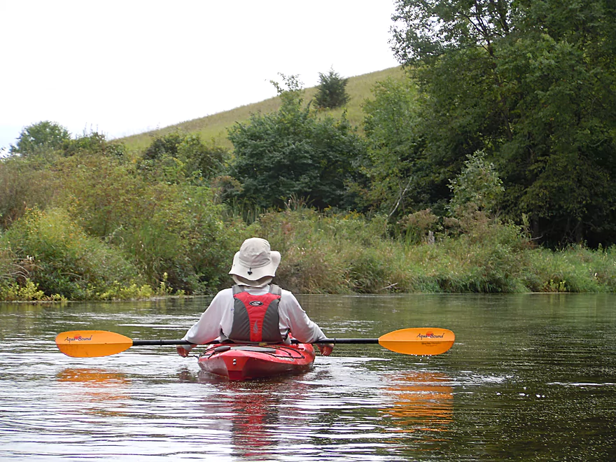
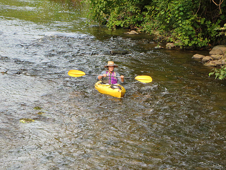
However, I suggest putting in upstream by the dam instead. You’ll park in the same spot (marked on the map), but instead walk north over a mill race bridge and put in just east of the dam. Yes, you have to drag your boat maybe 500′ over grass, but you have to walk a bit either way for this put-in. By putting in below the dam, you’ll enjoy one of the nicer sections of the river and some fun class 1 rapids.
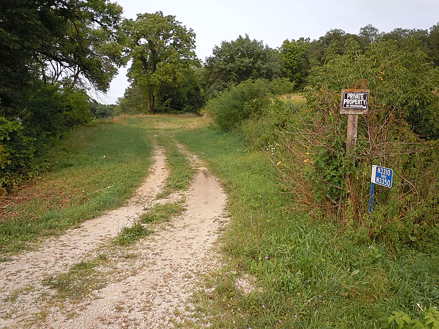
The take-out is at Cushman Road southwest of the bridge. There is a nice pull-off northeast of the bridge that would make a perfect landing, but it is posted as no trespassing. The local property is owned by the Cushmans and they are sensitive about paddlers trespassing on their property. They request that you ask permission in person (I’ve marked their residence, N3279, on the map) before using their land. If they are not present, there is a phone number on the door so you can explain that you are parking on their land for a trip (that way they know not to call the police on you).
I’m not aware of any local liveries.
The bike shuttle is easy at 3.13 miles, with not too much traffic and only a few hills.
There are no log jams (well there were, but they get cleaned out by the locals).
There are occasional riffles on the river, with the most noteworthy rapids being just north of Hwy F (by the put-in) and just upstream of the take-out bridge (Cushman Road). These are plenty safe at class 1, but could be a problem at higher water levels…especially since there is a strainer just upstream of the bridge.
This was paddled at 41 CFS according to the local gauge, which is about average and provides plenty of padding (rarely more than 1-2 feet though). I suspect you can paddle this as low as 20 CFS…am not sure though. One of the reasons you want to paddle this river is for the clarity which you would lose at high flow rates. My guestimate would be to try to paddle at least below 50 CFS and ideally 30 CFS for the best experience.
A lot of animals, including great blue herons, an osprey, lots of fish (mostly suckers and bass), clams, crayfish, dragonflies, a lot of song birds and a ton of painted turtles. Well into the trip I mentioned that we hadn’t seen a snapping turtle…two seconds later we find one. Talk about coincidences… This guy was huge. He was wary and would try to hide under the kayak but didn’t fit because of the shallow depth, which was quite amusing. Speaking of amusing turtles, one of the painted turtles we found was stuck between two tree stumps (pictured below). Weirdest thing…as I’m not sure how he did that, but we did free him.
Detailed Overview
For more information on access options, see my Overview Map. For a background on area human interest stories, I recommend the book “The Bark River Chronicles“.
- Cty Q to N Road: 0.1 miles. Small, channelized and weedy…this may require high water to run.
- N Road to Hillside Road: 1.4 miles. Small and marshy with maybe 2-4 logjams. High water is likely needed to run this part.
- Hillside Road to Hwy 164: 2.0 miles. Maybe 5-10 logjams. Very small and marshy. Likely needs high water to run.
- Hwy 164 to Lisbon Park: 2.9 miles. Maybe 2-4 logjams. The channel here is small, shallow, weedy and bog-like. High water is recommended.
- Lisbon Park to Merton Dam/Firemen’s Park: 1.3 miles. Mostly simple flowage paddling.
- Merton Dam to Bark River Park: 4.9 miles.
- Merton Dam to Dorn Road: 1.2 miles. Very scenic section with great fall color. Highlights include some boulder gardens, springs, clear water, and pine trees. Diverse banks with some woods and some marsh. There is one tricky logjam by the old mill.
- Dorn Road to Hartling Road: 0.7 miles. A short but pleasant open section with no logjams.
- Hartling Road to Rybeck Road: 1.0 miles. A scenic mix of light woods, marsh, and a few boulder gardens. There was one easy logjam to portage and a few hoppers/duckers, but it is mostly open.
- Rybeck Road to Centennial Park: 1.0 miles. Starts open and has a fantastic boulder garden. The last part is more cluttered with a number of logjams to hop over. I never had to portage though.
- Centennial Park to Bark River Park: 1.0 miles. A fast wooded section with multiple logjams. There are about four major logjams in a row, but you can skip them all by portaging on the boardwalk to the east (super easy). There are some additional hoppers beyond this stretch, but I didn’t think they were too bad.
- Bark River Park to Delafield Post Office: 6.1 miles.
- Bark River Park to Nixon Park: 0.7 miles. Terrific stretch through the heart of Hartland. Highlights included many fun Class 1 rapids and one Class 2.
- Nixon Park to Cottonwood Ave: 0.5 miles. Nice stretch with a mix of light woods and suburban homes.
- Cottonwood Ave to Hwy 83: 1.4 miles. Mostly an open marsh section. A few portages are required for downed trees.
- Hwy 83 to Lake Nagawicka Mouth: 1.3 miles. Less marsh and more woods…this is a nice stretch with good water clarity.
- Lake Nagawicka Mouth to Delafield Post Office: 2.2 miles. This is almost all lake paddling. Lake Nagawicka has good clarity and some attractive shoreline homes, but it is heavily developed and suffers from excess motorboat traffic. Several alternate access options exist along the lake shore.
- Delafield Post Office to Hwy 67: 7.7 miles.
- Delafield Post Office to Nemahbin Lake Boat Launch: 1.8 miles. Likely the best stretch on the entire river. Highlights include attractive rocky sections and stunning clarity.
- Nemahbin Lake Boat Launch to Sawyer Road: 0.7 miles. Mostly a simple paddle on Lower Nemahbin Lake. Highlights include great water clarity, an attractive cattail corridor and the “Blue Hole”.
- Sawyer Road to Genesee Lake Road: 2.2 miles. Very nice marsh paddle.
- Genesee Lake Road to Summit Ave: 3.0 miles. A good stretch with ecologically diverse banks.
- Summit Ave to Hwy 18 Wayside: 3.8 miles. A decent prospect. The take-out is a small park/wayside and the last of the three Hwy 18 bridge crossings. Note, a recent reader comment says this stretch has many serious logjams.
- Hwy 18 Wayside to Hwy E: 6.2 Miles. Heavily channelized, but some of it still seems like it has potential. Note a reader noted that this stretch has many serious logjams, some of which are difficult to portage.
- Hwy E to the Rome dam: 4.2 miles. Half of this leg would be a flowage paddle on Rome Pond.
- Rome to Cushman Road: 5.6 miles. A fantastic stretch and one of southeast Wisconsin’s paddling gems.
- Cushman Rd to Hwy 106 Canoe Launch: 4.4 miles.
- Cushman Rd to Hagedorn Rd: 0.6 miles. A great leg with clear, fast water and many rocks. Only downside is, it can get shallow.
- Hagedorn Rd to Hwy 106: 3.8 miles. The first half is pleasant, clear and rocky. The second half is more of a floodplain paddle with more mud and downed trees, which was less interesting.
- Hwy 106 canoe launch to Prince's Point Wildlife Area: 5.5 miles. Be careful of the partly removed dam at Hebron. There are definitely downed trees in this section.
- Prince's Point to Burnt Village County Park: 7.1 miles. Much of this was a mediocre wetgrass paddle through a large marsh. However kayaking through the floodplain forests of the Prince's Point Wildlife Area was very cool.
- Burnt Village County Park to the Rock River: 5.5 miles. Does not seem super interesting. Landing is just upstream of the mouth on the east bank.
Trip Map
Overview Map
Video
Photos Size:
Thank you so very much for your excellent review. We kayaked from the Rome Pond Dam to Hwy 106 for a total of 9.6 miles, on October 9, 2015, @ 45 CFS. We did not have to portage at all. There were some areas where we scraped, but we could either scoot over those areas or walk our kayaks. Rapids were very mild and not quite class 1. The river was shallow enough to walk almost the entire distance. The highlight of the trip was the crystal clear water and ever changing scenery. Lots of maples were lit up with beautiful fall color and the wildlife was amazing! This truly was one of the best kayak outings of the year! Thank you, thank you, thank you for your awesome review!
One thing: I worry about for future paddles on this stretch of the Bark, I noticed, after returning home, that the CFS climbed to above 70 CFS. There was no rain that day, so I’m assuming that water was released upstream for some other reason. I worry that I would unknowingly be in a situation of high/fast water. Do you know anything about the Bark’s CFS fluctuations?
I’ve been on this segment of the Bark as high as 90 cfs, and it is by no means dangerous. I’ve been on it as low as 40 cfs, and the difference between the trips in terms of depth or current speed was not terribly notable. Except for in times of intense rain, this segment is typically below 80 cfs due to the decent gradient.
FYI, I paddled this exact trip yesterday, Dec. 12, 2015, at 125 cfs. The riffles were delightful, and the 1-2 light rapids were fun play! It was an overcast drizzly day, but still the river was clear. Water clarity was not compromised at all despite the higher level. 125 cfs is the highest I’ve paddled this mid-section of the Bark, and I absolutely recommend it!
Thanks Tim for the update!
One final update: I paddled this again yesterday, 12/19/15, at a shocking 250 cfs. Put in at Rome, took out at Green Isle bridge in Hebron, just below the 2′ drop. The current was swift from Rome to the Duck Creek confluence, the riffles were exquisite, and the light rapids approaching Cushman were wavy and rollicking. Water clarity was hardly compromised at all despite the higher level, and rarely was the river deeper than 2′.
After Duck Creek the gradient disappears in a floodplain forest more reminiscent of the lower Bark by Prince’s Point and Burnt Village. The notable exception to that is the short mile-and-change segment below Hwy 106. There the current picks up again, the gradient increases, and it’s constant riffles and light rapids. At 200+ cfs there were fun standing waves below the pedestrian bridge, and the rapids at the dam remnants in Hebron, immediately upstream from Green Isle Rd bridge, were raging. There’s a formidable backroller hydraulic at the bottom of the drop in the center section — be careful. My friend got caught in it and capsized — and it was 23 degrees outside! (He’s fine; the car was right there.)
It’s a rare river than can be paddled at 41 cfs and 250 cfs without its appearance or the experience of paddling it changing drastically!
Thanks for the info! That the next 4-5 miles is free is huge news.
Unfortunately, I don’t know much about the Bark River dam situation. Often times in fall, dam operators will wind down their flowages in preparation for next spring’s flood. Usually they don’t do this on a weekend…but not always. I’m not sure if this is the case?
If you hear anything else about the Bark, let me know!
Also, for point of reference, there are two alternate takeouts in between Rome and Hebron. The first is at the confluence of Duck Creek and the Bark River, along Hagedorn Rd (hard to find but easy to access; there’s a walking trail that many others have used — plus it’s a great alternative to the “ask for permission” dilemma at Cushman Rd immediately upstream). The second is at the Hebron Campground just downstream from the fun drop at the dam remnants at Green Isle. The owners of the campground, Ralph and Joann, are very nice and supportive of paddlers. There’s no official launch, but it’s easy to use the grassy banks, and parking is nearby.
We paddled yesterday from Slabtown to Cushman. It was very pleasant. We like it better than Princes Point to Rock River.
Thanks for the feedback Barry. I totally agree…and frankly am not sure why so many paddlers focus on the far downstream sections.
I have kayaked the Bark on 3 different occasions. Saturday was our best trip. Put in Prince’s Point. Take out Burnt Village. Easy put in…gravel ramp. Take-out had improved concrete. Portapotty & picnick table at the take out.
The bark has been cleared with no snags. 2 1/2 hrs-3 hrs. Mild current. No nearby farms or bridges crossing over the river. Abundant wildlife: eagle, cooper hawk, many blue herons, green herons aand kingfishers.
Worth highlighting on the web site.
Appreciate the update Jack!
Paddled from Pickets to Hagedorn Rd. on 09Dec2020. Rome gauge at 74 cfs at ~2.06 ft. Some scraping and hanging up, especially below Cushman Rd. I’d recommend taking out at Cushman if in doubt about how much water you need to avoid knuckle walking your kayak.
Thanks for the feedback Jonathan. I’m surprised that you had some hangups at 74 CFS.
We “paddled” from Rome to Hebron on 06/07/21. ~1.54ft… Super low! We walked our kayaks a lot! Still a beautiful stretch. Saw a ducks, herons, turtles – maybe even the snapper you saw and a young bald eagle with a mature eagle.
I believe it! Southeast Wisconsin is I believe technically in a drought and it’s really affected local rivers.