
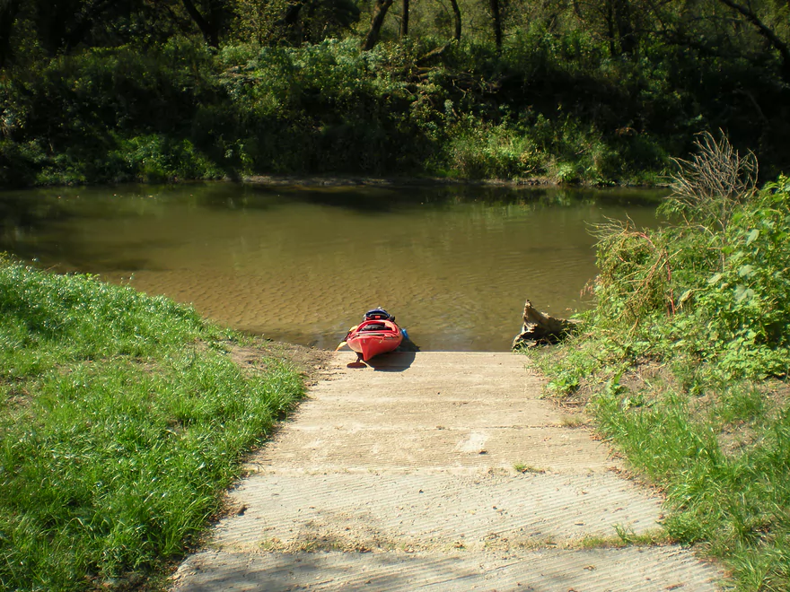
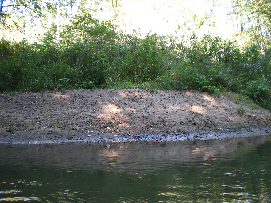
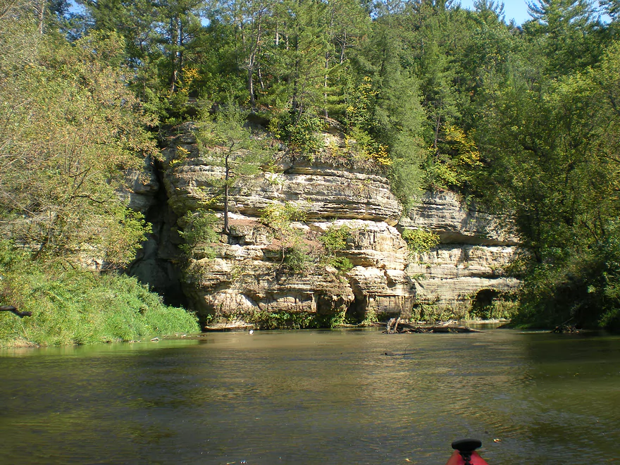
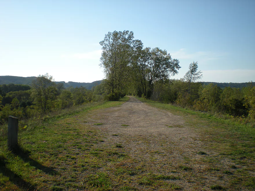
Putting in at the Rockton Landing
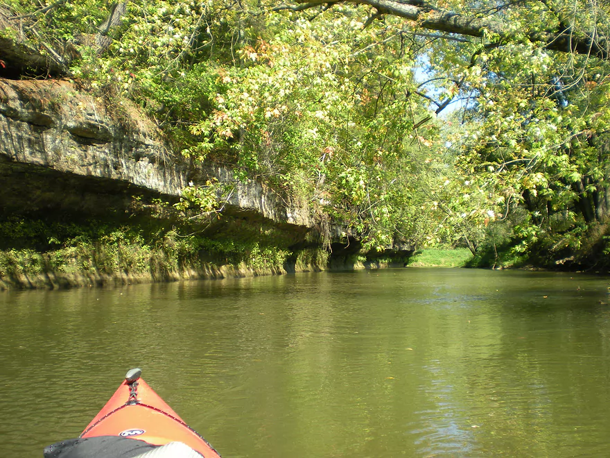
The first of many outcrops
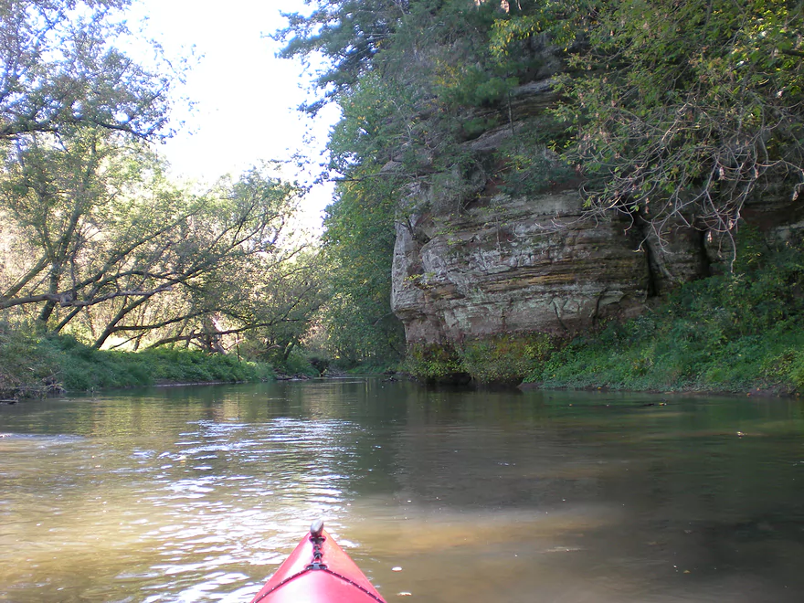
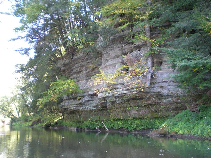
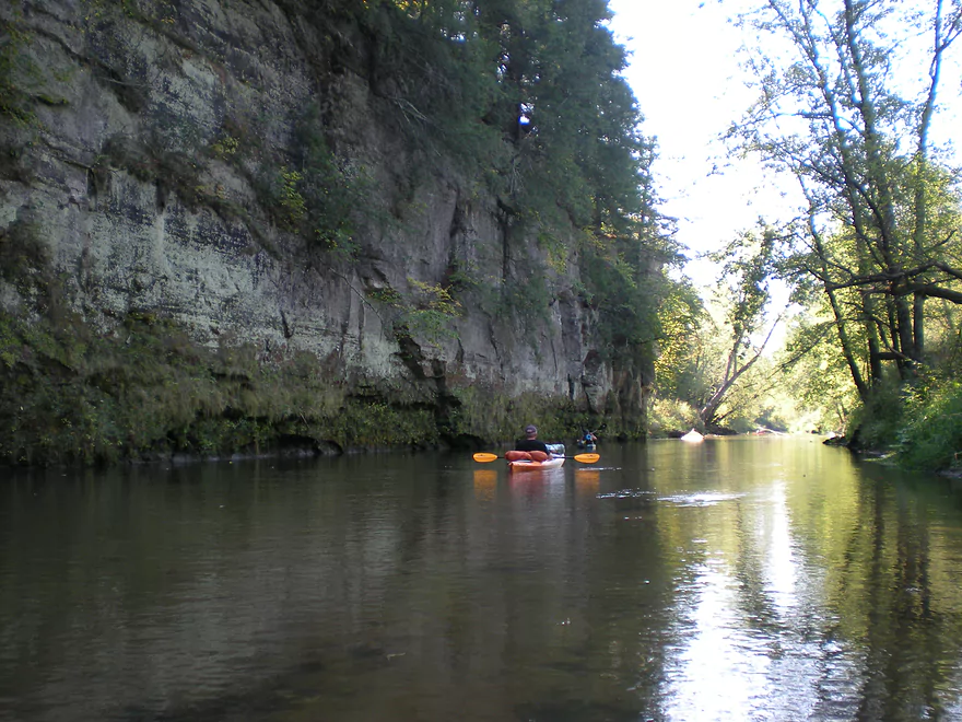
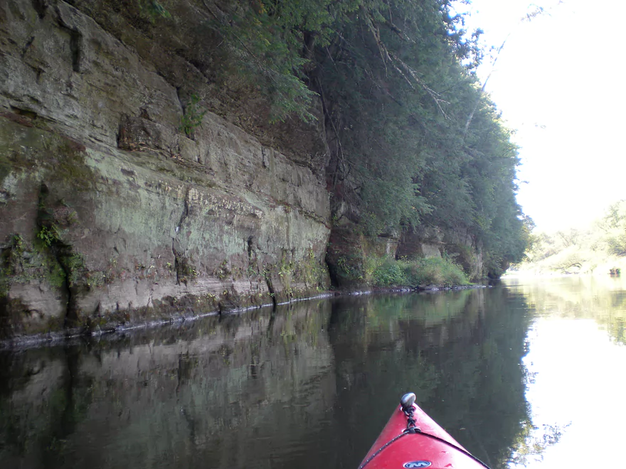
These tend to be taller than those on the upper Kickapoo
Bridge 13 / Hwy P
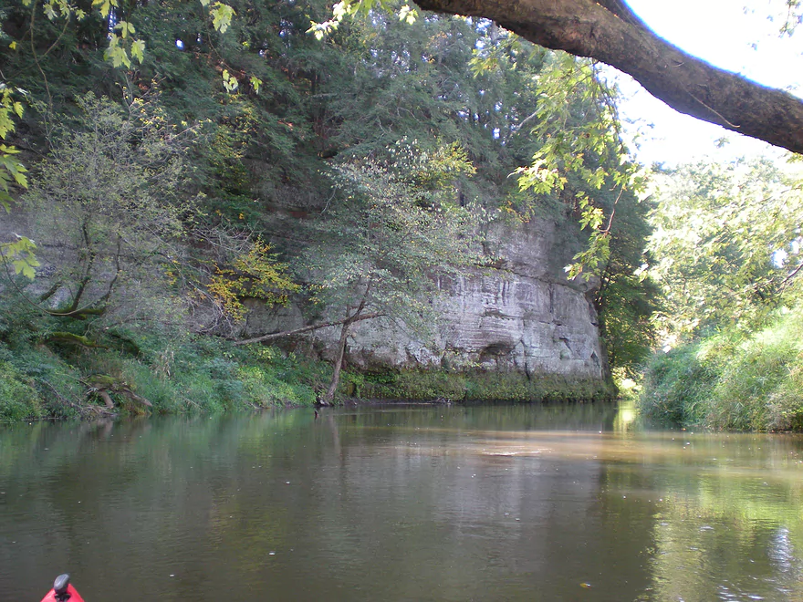
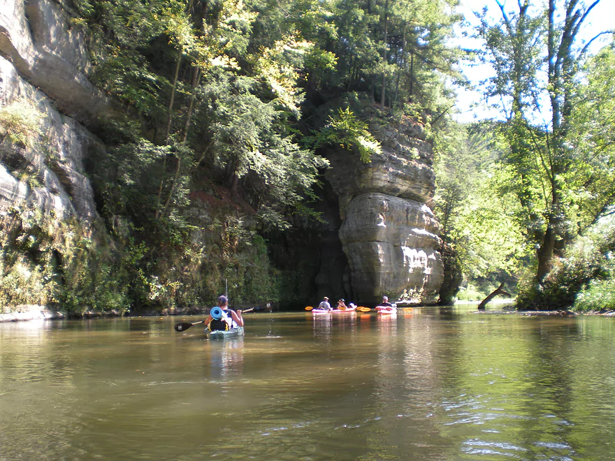
Much of the sandstone was being eroded
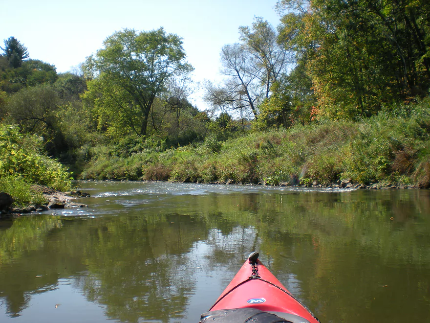
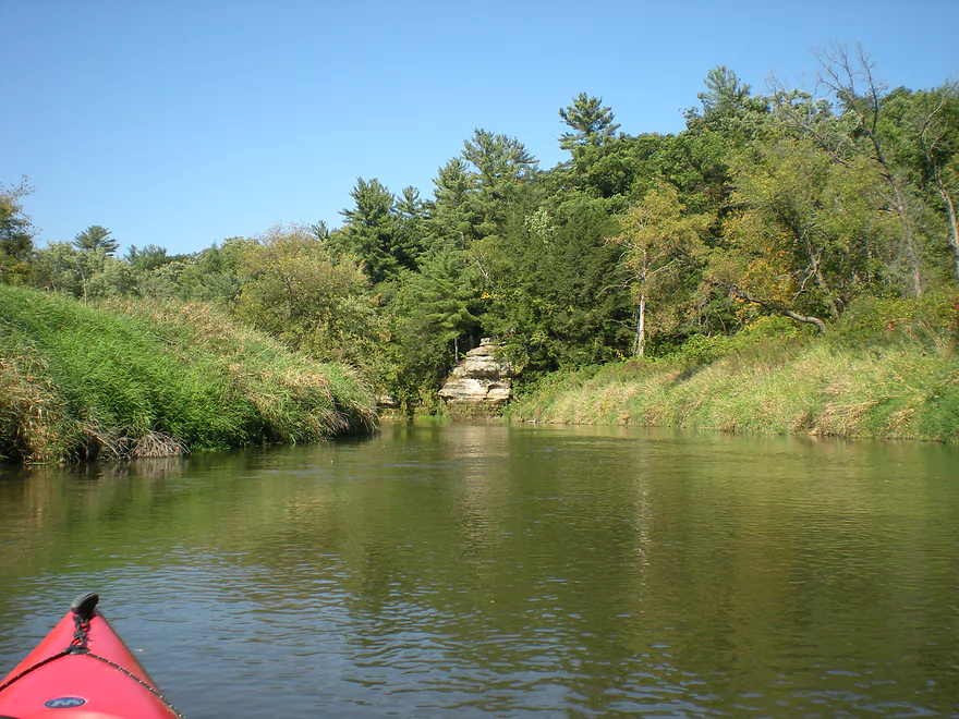
This can be a nice fall paddle
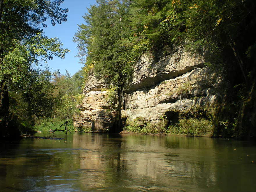
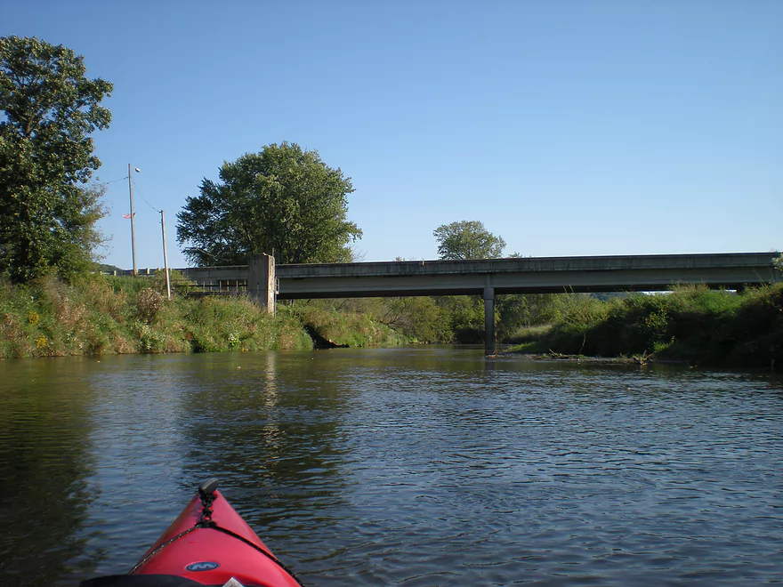
Bridge 14 / Hwy P
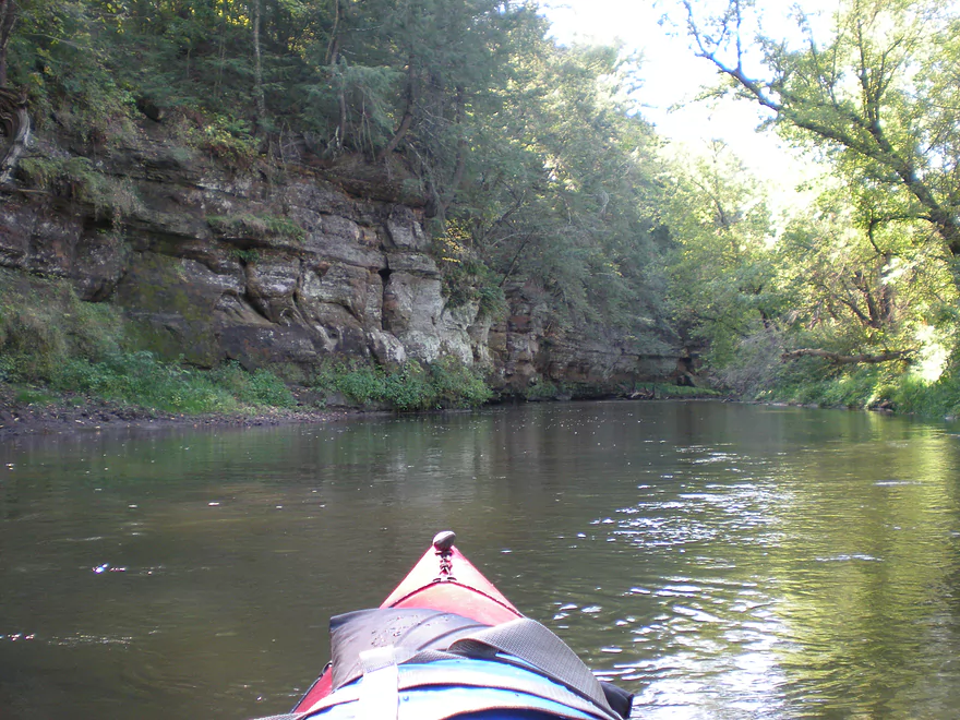
There is an adjacent landing
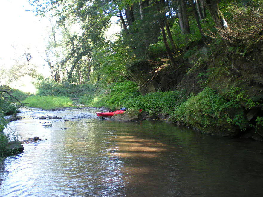
Exploring Weister Creek
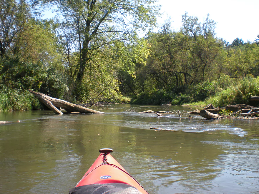
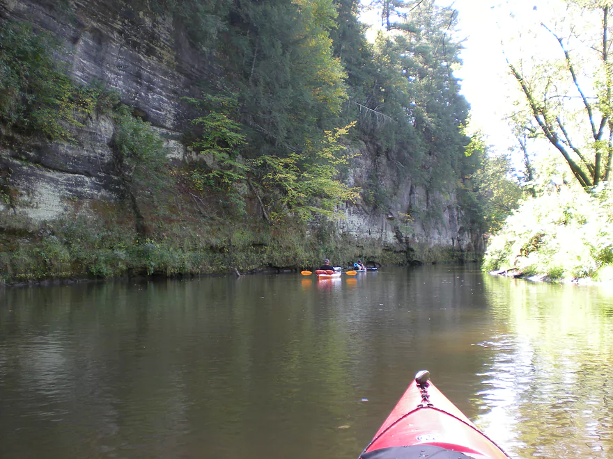
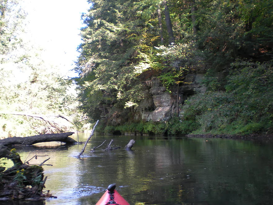
Some debris, but no jams during my trip
Not as many sandbars compared to the Upper Kickapoo
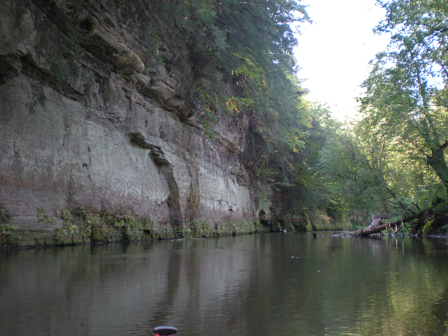
Outcrops starting to get taller
Some kayakers on this stretch…not too many
Part of a local trail system
Finally get good lighting
My favorite photo
The best part of the river
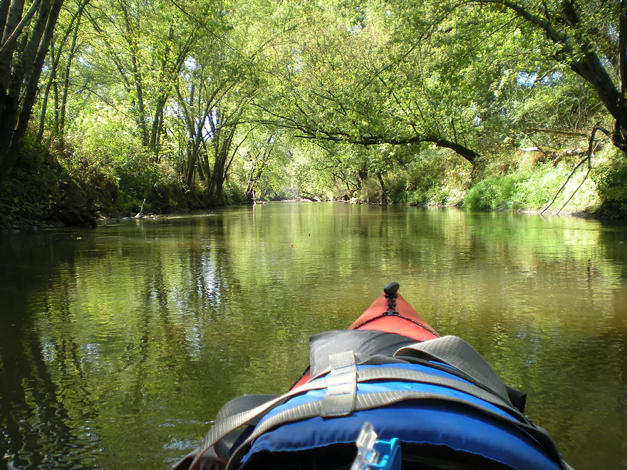
Shady woods
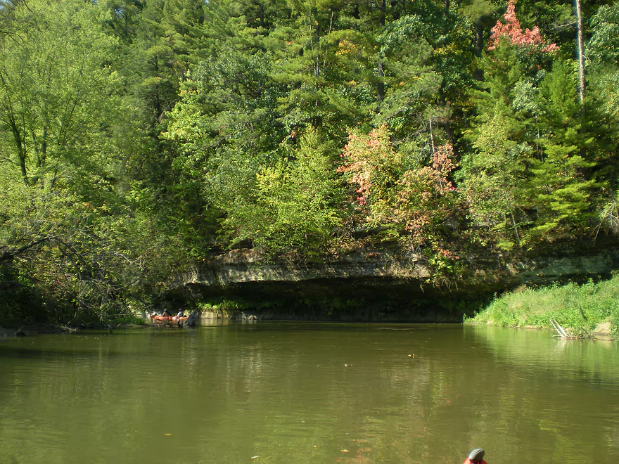
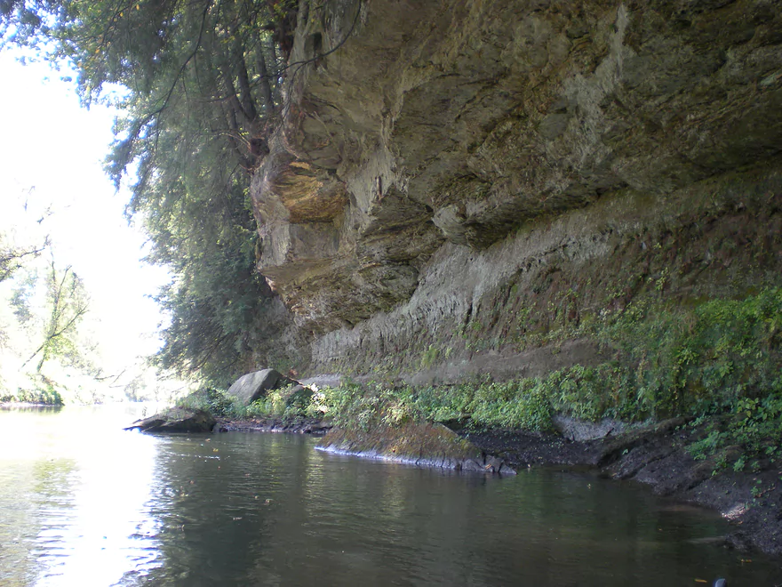
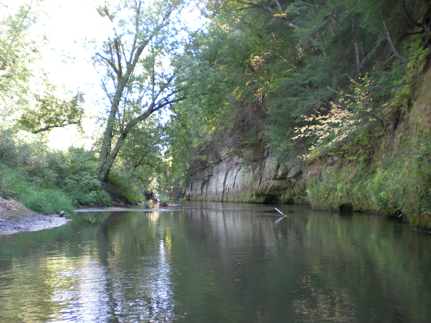
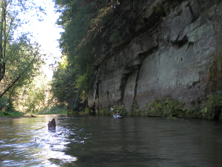
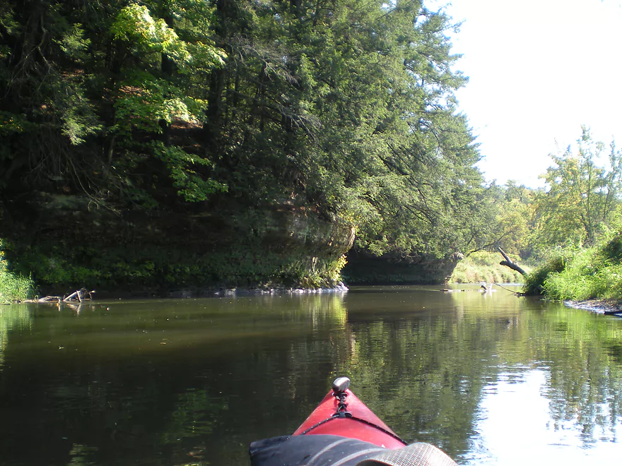
Attractive overhang
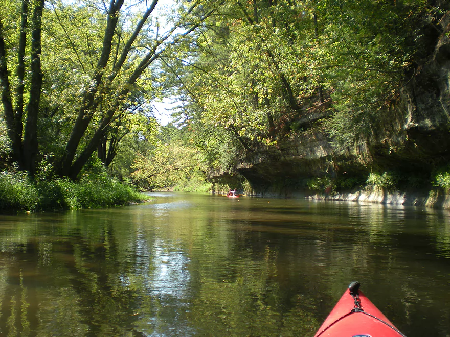
Reverse view
Brief riffles
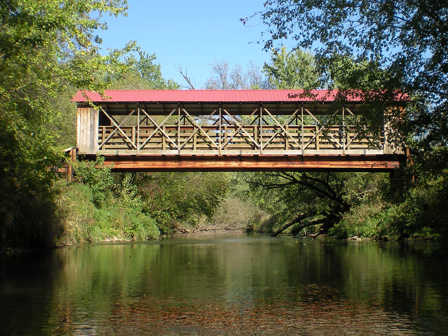
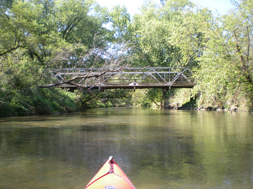
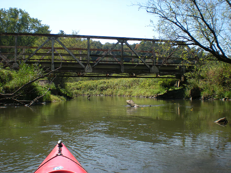
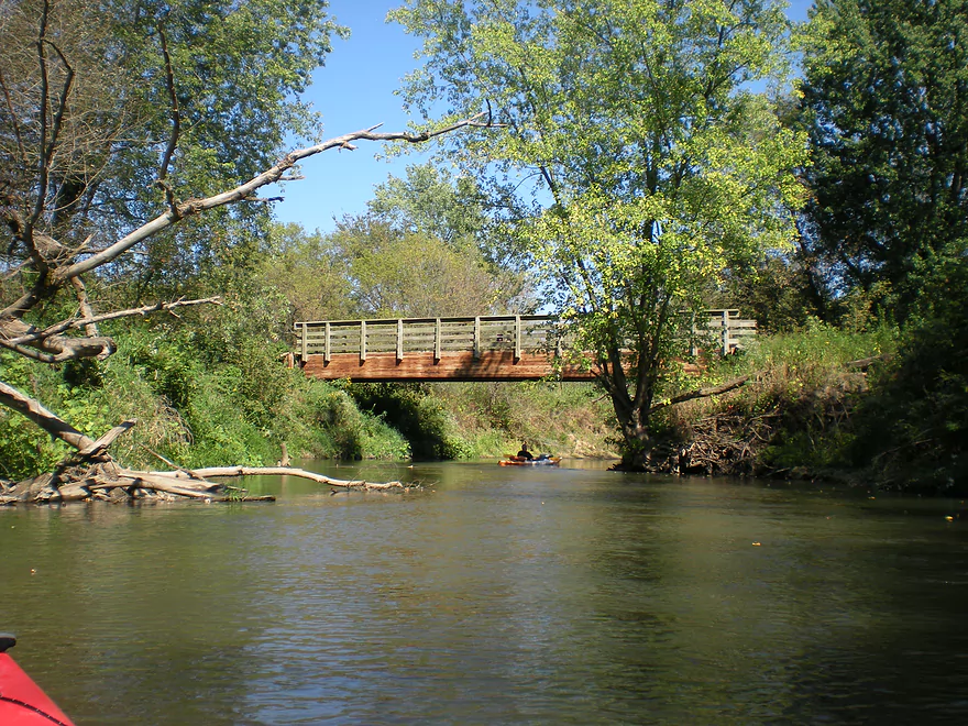
Scenic covered bridge
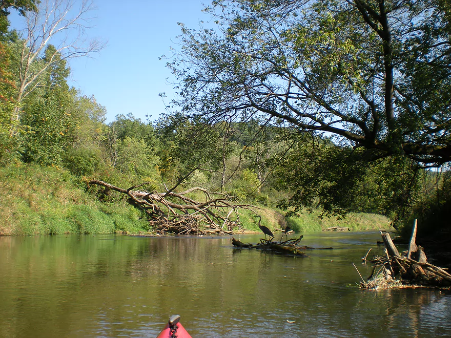
I kept herding this GBH downstream
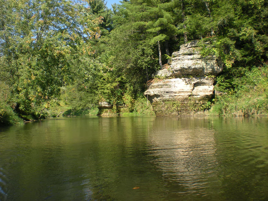
Pines and outcrops usually hung out together
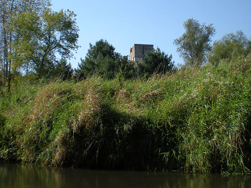
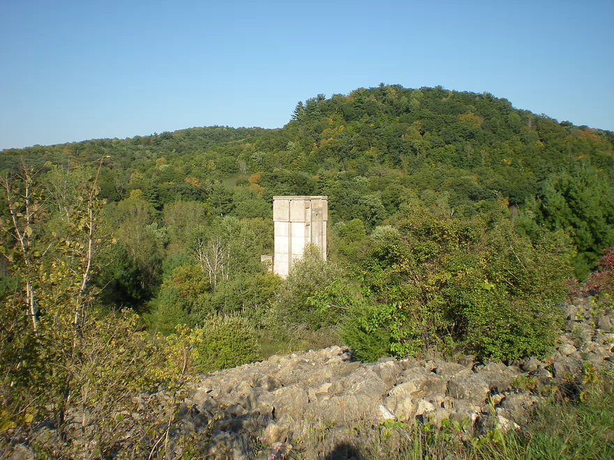
Remnants of the abandoned dam
Better view from shore
A massive embankment that was to be part of the dam
Last sandstone wall of the trip
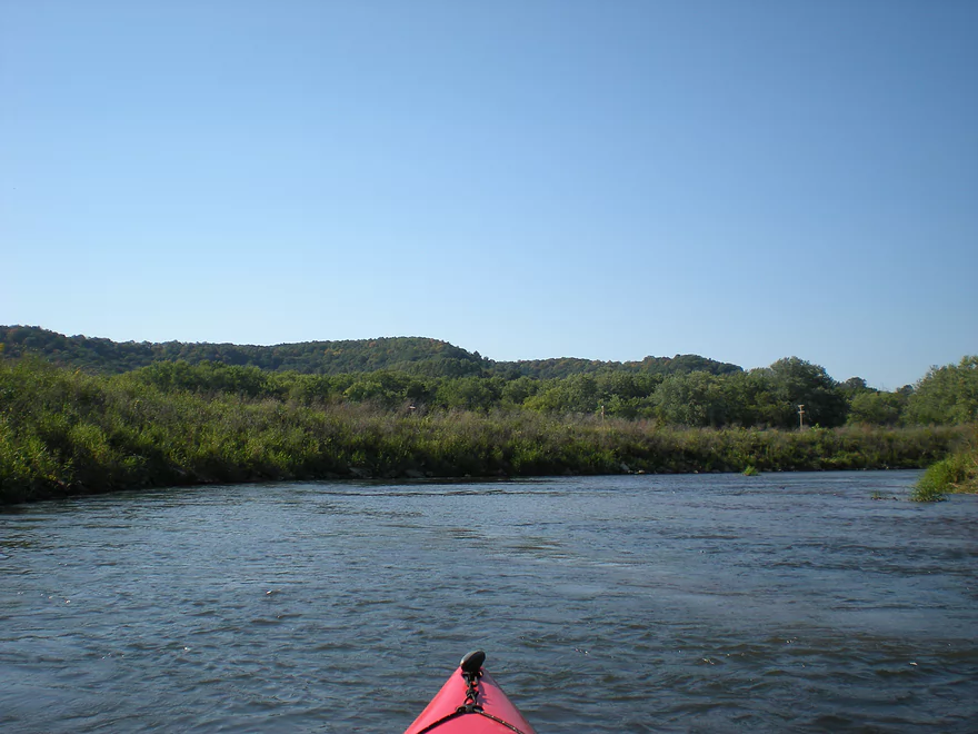
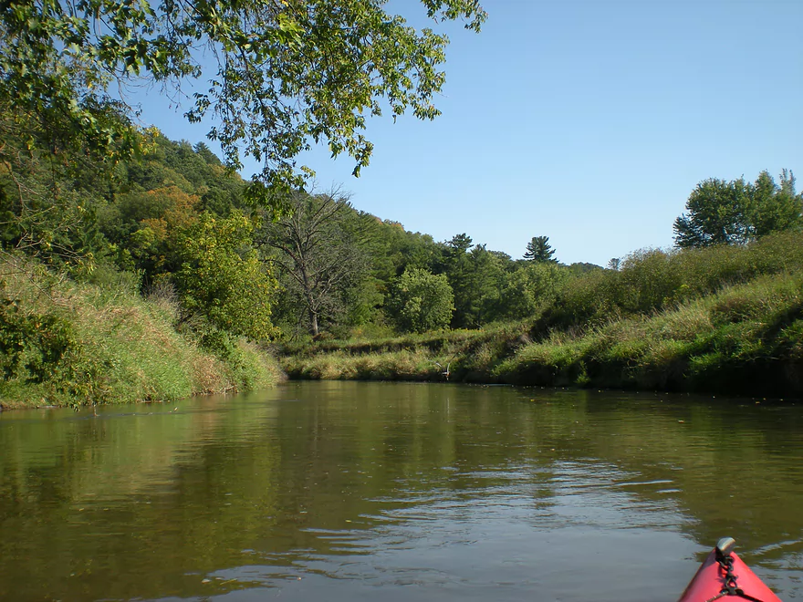
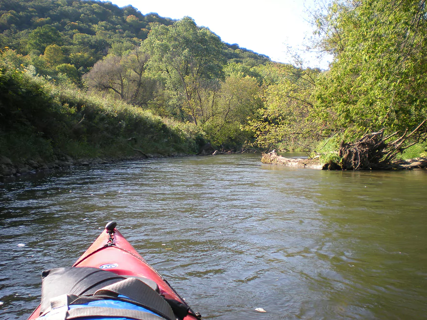
Driftless hills in the distance
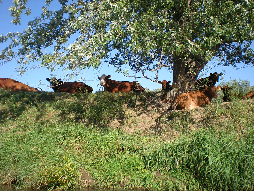
Some lazy cows
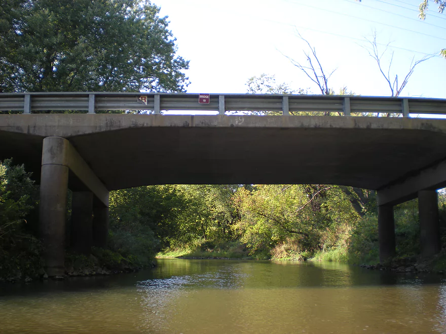
Bridge 19
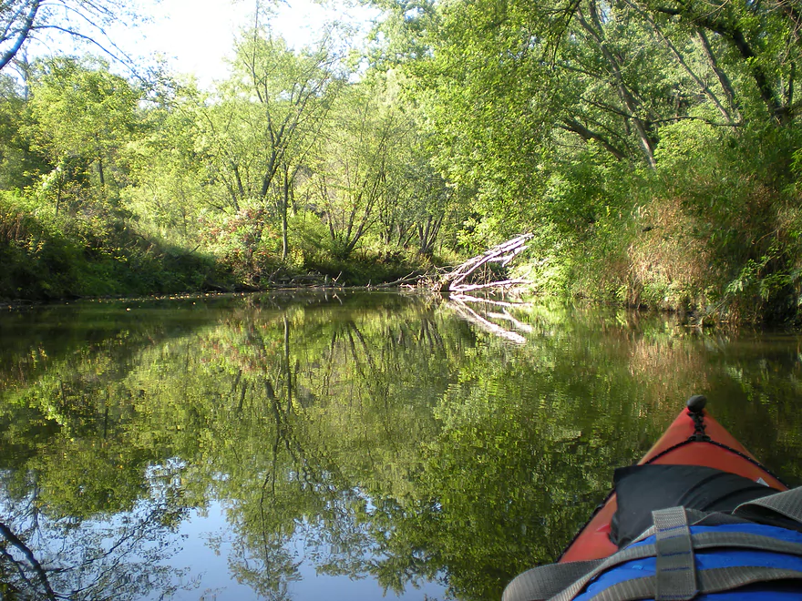
Nice reflection
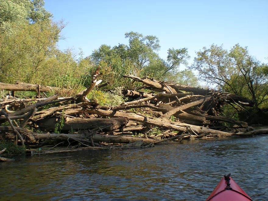
The locals have used dynamite to clear some jams
Some artificial banks
Coming up on Main Street
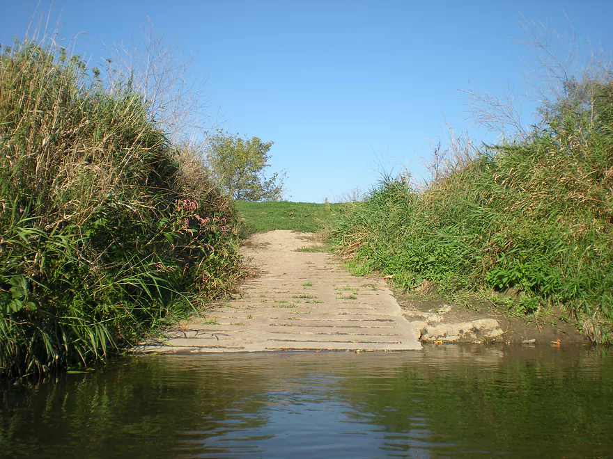
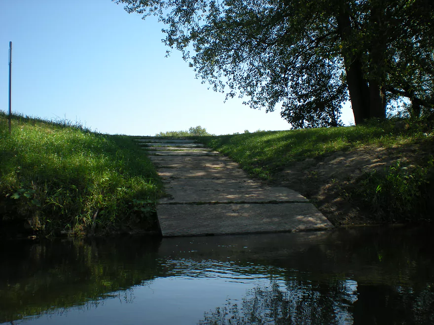
NIce landing here
Kickapoo River – Rockton to La Farge

Of all paddling rivers in Wisconsin this might be the most popular. And of all sections on the Kickapoo, this is probably the second best stretch to run after Ontario to Rockton. There are a large number of landings on the river, at least shuttle/rental services, so you do have a lot of options as to how and where you want to tackle the river. You can even camp on the river as well (you do have to register in advance for these though).
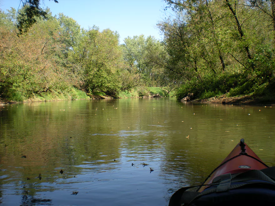
For my part trip, I put in at a landing just south of Rockton and a massive bridge going over the river. This is a nice landing that has a bathroom and was very nice (like most landings on the upper Kickapoo). I do not know if the landings charge a fee (I used a shuttle service). This stretch of the river isn’t as popular as Ontario to Rockton for good reason… The water quality isn’t the same…the sandbars are much more scarce, there aren’t that many inviting swimming holes and there are more mud banks. On the plus side, this stretch of the river has lots of bluffs that are gorgeous. In fact, I actually believe these bluffs are larger than the ones on the upstream section. The other plus for this section is that there are hardly any people on the river. When I paddled Ontario to Rockton, the river was packed with a lot of paddlers; many of whom were drunk and disruptive. On the La Farge section, I only encountered one convoy of 5 paddlers and that was it.
You can kind of divide this trip into thirds. The first third goes through a nice sheltered section with occasional bluffs. In the second section, the bluffs get much bigger and nicer. The third section honestly isn’t as interesting as (with exceptions) the bluffs largely disappear and the banks start to open up. While you paddle downstream you will be able to see the uncompleted dam intake tower on your right. There is a dike in the same area that you can walk out on, but because of the tree cover you can’t see this from the river nor the river from the dike. Around this area, there are a number of very minor riffles. This area finally opens up into a little bit of farmland and cow country unfortunately. One of the last bridges (they’re all numbered) is a very cool red covered one that is pretty photogenic. Generally speaking the Kickapoo from Ontario and to La Farge is cleaned out by the livery companies but there are occasional squeakers. Water levels were considered down when I went but I never had to get out and this wasn’t a problem.
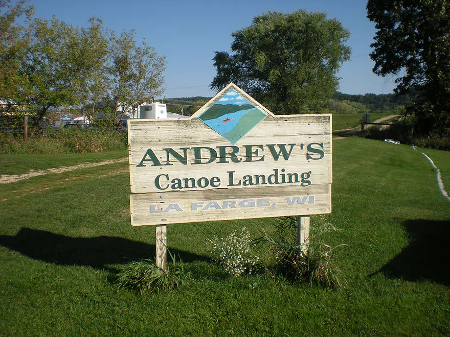
Takeout at La Farge is another nice landing with a bathroom. You can in theory paddle downstream of La Farge and there are infrequent bluffs hiding here and there…but according to my shuttle driver, there are some nightmarish log jams plus steep banks down there (bad combo). Some people he ferried said they absolutely would never do that stretch again. On the flip side, there have been some major clearing operations down there (costs 100k+) so this may have improved. Others have paddled downstream of La Farge and not complained, so I don’t really know. Titanic canoe rentals won’t service this area though.
Google says this was only 11 miles, but this felt more than that. You can split this up…but don’t omit the last section as it had the best and largest bluffs.
Once you get out of the water, there you might consider doing a little exploring. This is ‘Organic Valley’ (one of Wisconsin’s highest concentration of organic farms in the state) and there is an organic outlet store in La Farge south of the landing (with awful hours though). There is also a visitor center where you can learn about the abandoned Kickapoo dam and a trail that leads over the dike. While technically possible, I don’t think you can drive out on the dike (there was a warden watching the area with binoculars so I think this is enforced).
- Kickapoo Valley Reserve Map – Very well done with detailed bridge numbers. The Rockton landing had free printouts of this map that you can take on your trip. Don’t trust their distances though.
- Kickapoo Valley Reserve – Visitor Center
- Shuttles/Rentals
- Drifty’s Canoe Rental : 608.337.4288 – Hwy 33 & 131 North, Ontario, WI 54651
- Kickapoo Wild Adventures : 608.337.4522 – 30352 State Hwy 131, Norwalk, WI 54648
- Mr. Duck Canoe Rental : 608.337.4711 -100 Main Street, Ontario, WI 54651
- Ok Corral Canoe Rental : 608.337.4517 – 30531 St Hwy 31, Norwalk, WI 54648
- Titanic Canoe Rental : 608.337.4551 – 300 State Highway 131 Ontario, WI 54651
- Kickapoo Yacht Club : 608.625.4395 – S2463 Rockton Loop Road La Farge, WI 54639
- Crooked River Resort : 608.629.5624 – S. 8019 Hwy 61, Readstown, WI
- Flasher’s Canoe Camping Trips : 608.435.6802 -PO Box 114, Wilton, WI 54670
Quick Overview
- Wilton to Ontario: 12 miles. This stretch is seldom paddled, but is cleaner and faster than downstream legs. Those willing to endure weedy bridge accesses and occasional snags will be rewarded with spectacular outcrops. A very underrated part of the river.
- Ontario to Rockton: 13.5 miles. This is the most popular section for kayaking on the river (if not the entire state). Highlights include many spectacular sandstone outcrops. This stretch can easily be subdivided. Shuttle services are plentiful, but this leg can get crowded and noisy during summer weekends.
- Rockton to La Farge: 11 miles. This is the second most popular stretch of the river. While the outcrops here aren’t as numerous as the Ontario leg, they do tend to be larger and more impressive.
- La Farge to Mouth: ~90 miles. After La Farge there are few rock outcrops and the river becomes much less interesting. The Lower Kickapoo is a generic hardwood floodplain that is at best a mediocre paddle.
- Tributaries:
- Kickapoo River – West Fork: While lacking the outcrops of the main branch and a bit shallow in spots, this is a very underrated river with many fun rapids.
- Billings Creek: I actually like this creek better than the main river itself. There are just as many outcrops, and the water and banks are much cleaner.
- Tainter Creek: While not very big and lacking in outcrops, it’s still a cool creek with very swift current.
Detailed Overview
- Upstream from Lincoln Ave: The river is likely too small and degraded by open pasture to have much appeal for kayaking. Although "Kickapoo Springs" (the primary source of the river and a public DNR area) might be interesting.
- Lincoln Ave to Keystone Road: 2.5 miles. The river is small here (likely too small for most paddlers) and more scruffy with fewer outcrops. Figure 1-2 logjams and 3 outcrops. Several of the Elroy-Sparta Trail bridges over the river are quite scenic/rustic. High water will be required to do this stretch.
- Lincoln Ave to Hwy 131 (East of Midge Road): 6.3 miles.
- Lincoln Ave to Hwy 71: 1.6 miles. Section includes five outcrops, including one really nice one. River is shallow here with many Class 1 rapids. There is one strainer that has to be portaged, but no other logjams. I encountered a bull on this stretch (here) which might be a deal breaker for most paddlers. You could possibly portage around the farm in question along the Elroy-Sparta Trail but it would be a long and difficult portage.
- Hwy 71 to Wilton Campground/Library: 0.7 miles. A nice stretch with ~3 mediocre outcrops and one really nice one. Water clarity is stunning here. There is a low tree that requires some tight ducking to get under.
- Wilton Campground/Library to Hwy 131 (by Posey Creek): 1.4 miles. Less attractive stretch but still ~4 mediocre outcrops. There is a serious logjam by Water Street that must be portaged.
- Hwy 131 (by Posey Creek) to Hwy 131 (by Mica Rd): 1.3 miles. A terrific stretch with scenic pine trees, several mediocre outcrops and one fantastic sandstone outcrop.
- Hwy 131 (by Mica Rd) to Hwy 131 (East of Midge Rd): 0.7 miles. More of a scruffy stretch, but still a few mediocre outcrops. The Black Valley hills in the distance are very scenic from this leg.
- Hwy 131 (East of Midge Road) to Hwy 131 (near Nicollet Ave): 4.1 miles.
- Hwy 131 (east of Midge) to Hwy 131 (by Michigan Ave): 0.5 miles. A good leg with one nice set of outcrops.
- Hwy 131 (by Michigan Ave) to Hwy 131: 0.6 miles. Another good leg with 3 outcrops. Some minor rapids, including a 4-6" ledge.
- Hwy 131 to Hwy 131 (by Nisswa Rd): 0.6 miles. One of the best legs on the Upper Kickapoo which features 6 noteworthy outcrops and terrific ice flows in February and early March.
- Hwy 131 (by Nisswa Rd) to Hwy 131 (by Nordale Ave): 1.1 miles. Not as scenic as other legs with messy shorelines and eroded banks. There are still a few nice outcrops.
- Hwy 131 (by Nordale Ave) to Hwy 131 (by Nicollet Ave): 1.3 miles. Another one of the Upper Kickapoo's best legs with ~6 outcrops, including a small natural bridge you can paddle through.
- Hwy 131 (near Nicollet Ave) to Ontario: 5 miles.
- Hwy 131 (by Nicollet Ave) to Hwy 131 (Oil City): 2.3 miles. Two long stretches of bluffs contain great outcrops.
- Hwy 131 (Oil City) to Hwy 131 (Kickapoo Wild Adventures): 1.4 miles. Terrific stretch with two major outcrops. One set of Class 2 rapids.
- Hwy 131 (Kickapoo Wild Adventures) to Ontario (Brey Valley Road Park): 1.5 miles. Three sets of outcrops.
- Ontario to Hwy 131/Bridge #4: 3.6 miles. A more open and flatter stretch of the Kickapoo. There are still 3-4 outcrops. This is THE most popular leg on the entire river.
- Bridge #4 to Bridge #7: 6.0 miles.
- Bridge #4 to Wildcat Landing: 3.1 miles. A super popular stretch and the most scenic on the Kickapoo. River flows past steep hillsides and many outcrops (at least 16).
- Wildcat Landing to Bridge #5: 0.9 miles. River opens up a bit, but still has three super sandstone outcrops.
- Bridge #5 to Bridge #7: 2.1 miles. A good stretch with seven major outcrops and one cave.
- Bridge #7 to Bridge #14: 7.7 miles.
- Bridge #7 to Bridge #8: 1.2 miles. From bridge #7 onward, the Kickapoo becomes much less interesting. There are still some good spots though. This stretch has maybe 3 outcrops.
- Bridge #8 to Bridge #10: 2.5 miles. A good stretch with 5-6 outcrops.
- Bridge #10 to Rockton/Landing #12: 1.4 miles. This stretch is more open, and less interesting. But there are still 3-4 mediocre outcrops.
- Rockton to P/Bridge 14 Canoe Landing: 2.4 miles. A scenic stretch with 5 noteworthy outcrops–three of which are huge.
- Bridge #14 to La Farge: 8.0 miles. A great stretch with a covered bridge and 4-5 outcrops...several of which are huge (the largest on the river).
- La Farge to Hwy 131 (by Ski Hill Road): 6.8 miles. Nice section but with a few jams.
- Hwy 131/Ski Hill Road to Viola (Banker Park): 7.0 miles. Maybe 2 bluffs, but mostly open I think. Have been told there are 26 portages between La Farge and Viola, so beware.
- Viola to Hwy 131 - Bridge 1: 5.8 miles. Maybe one outcrop and 14 major logjams.
- Hwy 131 - Bridge 1 to Hwy 131 - Bridge 2: 4.3 miles. Maybe one outcrop and 13 major logjams.
- Hwy 131 Bridge 2 to Readstown Tourist Park: 3.0 miles. Maybe one outcrop and three major logjams. The river grows significantly with the addition of the West Fork.
- Readstown Tourist Park to Soldiers Grove: 6.9 miles.
- Readstown to Hwy 61: 3.1 miles. A surprisingly nice stretch with impressive hills and good current. On the downside there is a lot of tree debris although it is always avoidable. Hwy 61 is not a good access.
- Hwy 61 to Soldiers Grove: 3.8 miles. Not as good as the previous leg with fewer hills, muddier banks, and slower current, but still not bad. The highlights include a few impressive bluffs and two minor rapids in Soldiers Grove.
- Soldiers Grove to Hwy B: 9.0 miles. I doubt there are logjams, but I think this stretch would not be very interesting. The river flows through one of the wider flood bottoms on the river.
- Hwy B to Hwy S: 8.6 miles.
- Hwy B to Gays Mills: 4 miles. Fast stretch with some strainers. Bank quality is poor, but the bluffs are attractive. A dam in Gays Mills slows the last mile of this leg.
- Gays Mills to Hwy S: 4.6 miles. A pleasant but not elite leg with some nice bluff vistas.
- Hwy S to Haney Valley Road: 5.8 miles.
- Haney Valley Road to Taylor Ridge Road: 3.6 miles. Likely an ok prospect. Note, Taylor Ridge Road is aggressively fenced by the local farmer and would be a difficult access.
- Taylor Ridge Road to Steuben Landing: 5.0 miles. A good prospect with likely some nice bluffs. Note, Taylor Ridge Road is aggressively fenced by the local farmer and would be a difficult access.
- Steuben Landing to Hwy 179: 2.9 miles. A mediocre prospect.
- Hwy 179 to Plum Creek Landing: 11.8 miles. A good prospect with nice bluffs.
- Plum Creek Landing to Hwy 60: 6.7 miles. Starts uninteresting with fast current, but features some surprisingly nice bluffs and overall was a decent trip.
- Hwy 60 to Lowell Geitz Memorial Boat Landing: 2.7 miles. This stretch mostly lacks interesting bluffs but does feature wetgrass and floodplain forests as part of the Wauzeka Bottoms State Natural Area.
- Take-out options on the Wisconsin River:
- Lowell Geitz Memorial Boat Landing to Adiantum Woods State Natural Area: 2.5 miles. This is mostly a downstream trip on the Wisconsin River.
Trip Map
View Kickapoo River - Rockton to La Farge in a larger map
Overview Map
Video
Photos Size:
Five of us did the run from Rockton to LaFarge September 5, 2017. CFS at La Farge USGS 05408000 was 266, river depth 3.63 ft. We did the 10 miles in 3 hrs. 10 mins. with no stops. Portable toilets were at both the put in and take out.
We moved along nicely with no log jams, although 2 miles from the take out, one tree crossed the river, and we just squeaked under it. All in all, the unparalleled beauty of Wisconsin is showcased on this section of the Kickapoo River. We’ll be back.
Thanks Gail. This is good to hear that the logjam situation isn’t worse given the horrendous floods the Kickapoo faced earlier this year.
I think if the river had been much lower than the 266 CFS, 3.63 ft, it may have been a challenge to past a lot of trees that were laying across the river, although it would have been easier to get under that one squeaker.
Logjam update from Kickapoo Valley Reserve:
“The blockage between Landing 12 and Bridge 13 has been cleared as well as the large duck under tree just below Landing 7. Let us know if there are more trouble spots. The blockage between bridge 16 and Bridge 18 has not been removed just yet. It is a single log but challenging portage.”
https://www.facebook.com/photo?fbid=1321612300180912&set=a.486060780402739