
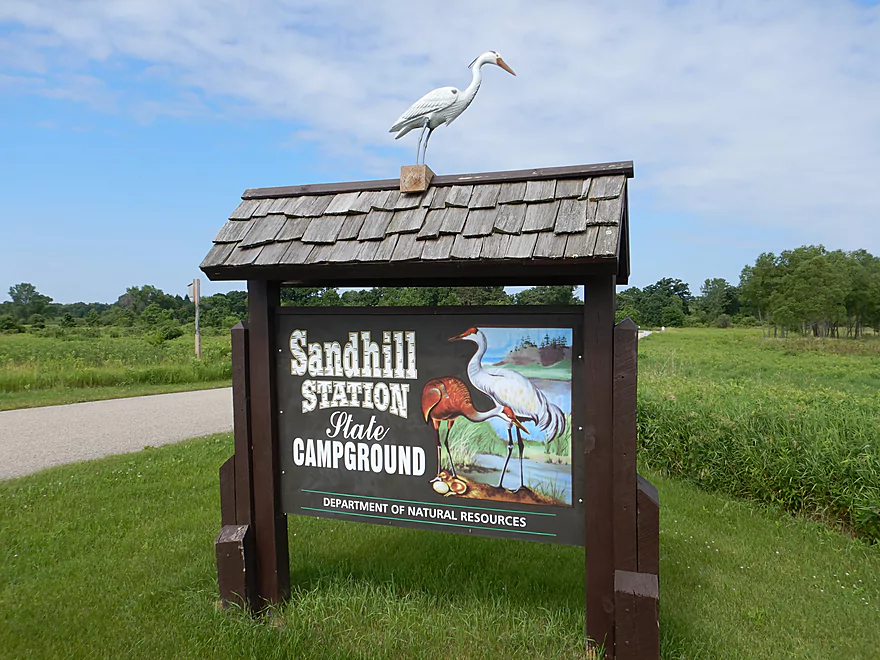
Starting the trip at Sandhill Station
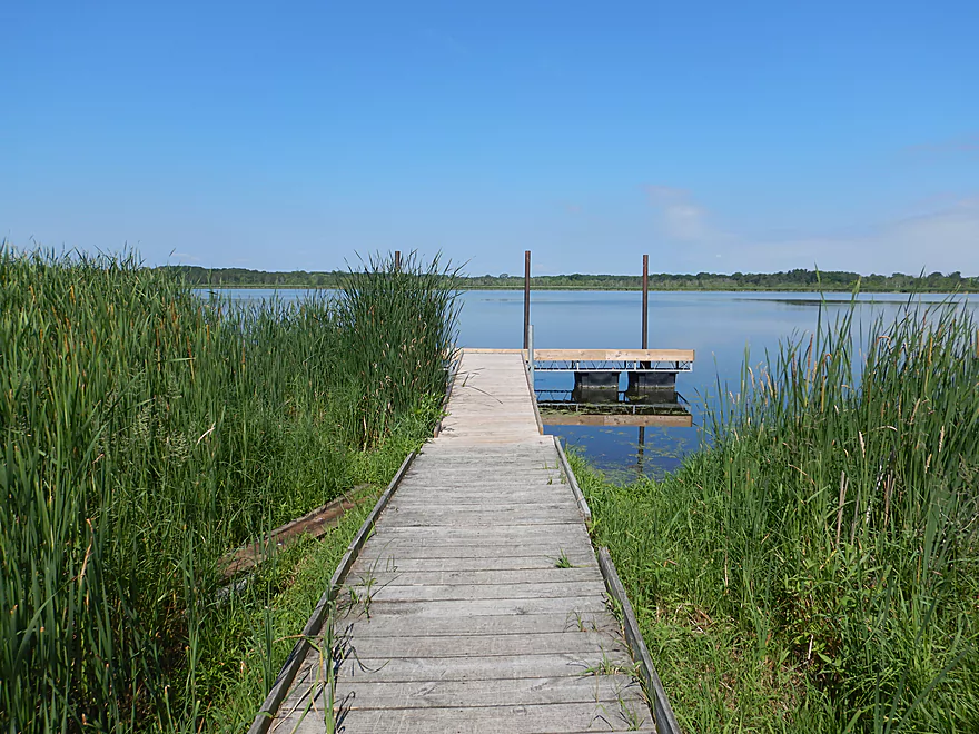
Where there is a terrific boardwalk
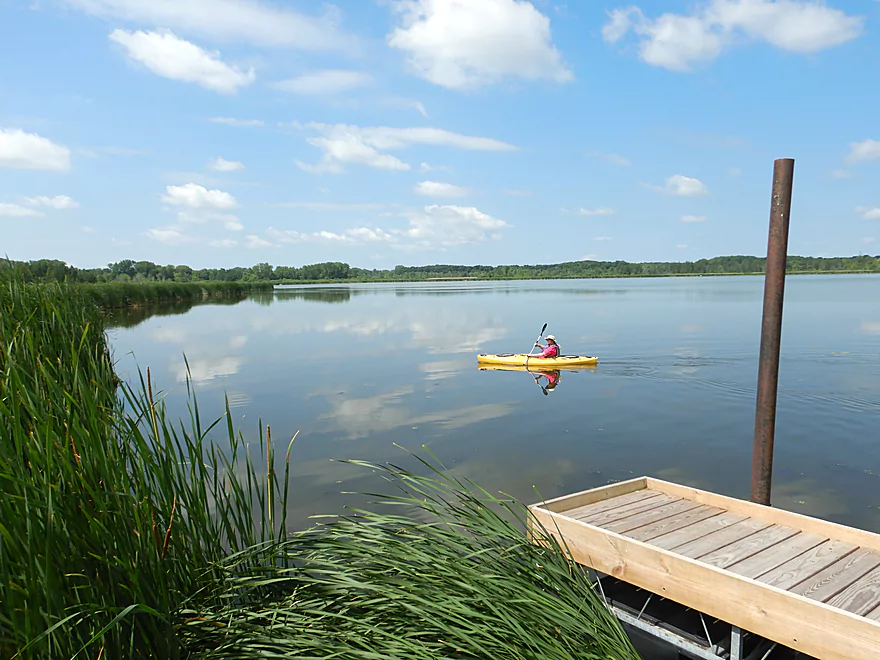
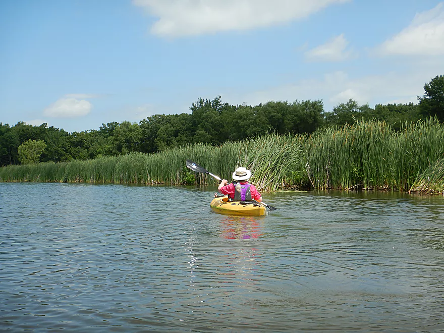
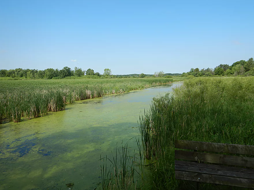
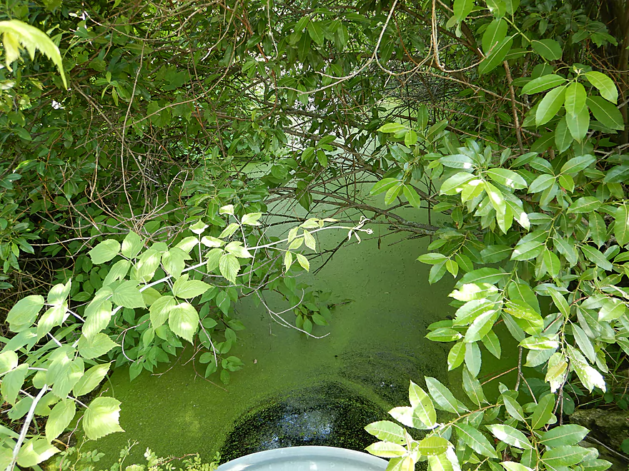
View of Mud Lake
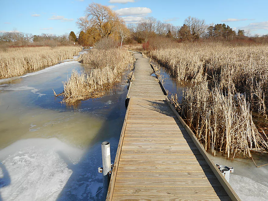
This is a neat hike even in spring
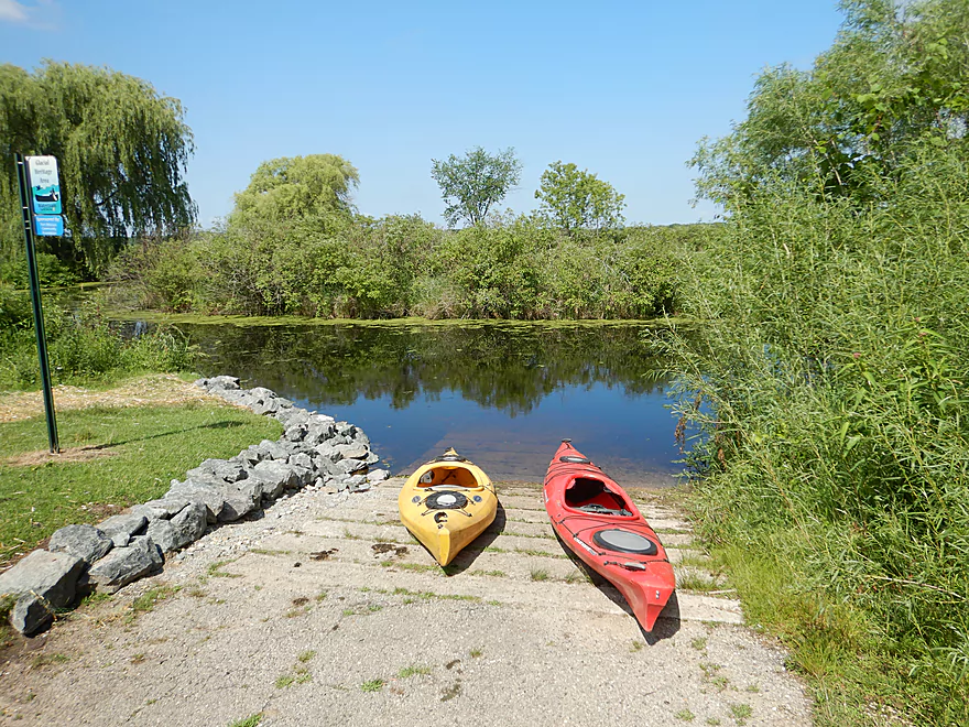
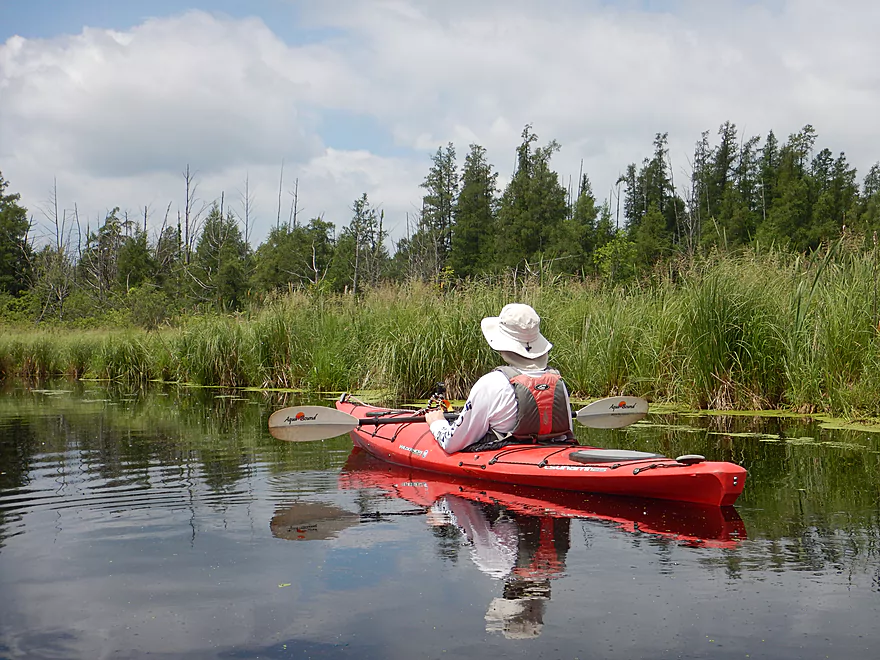
Putting in at the main boat ramp
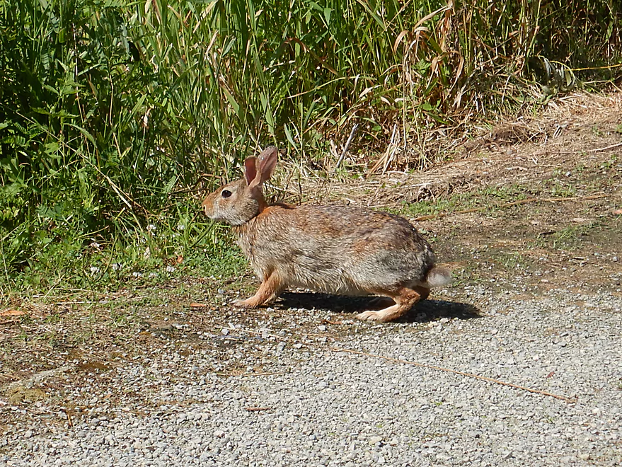
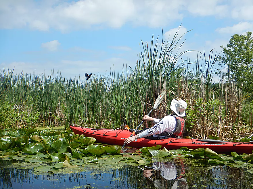
This place was hopping with wildlife
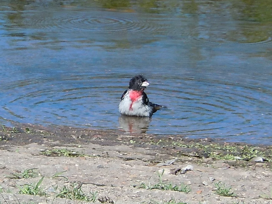
A rose-breasted grosbeak, using the ramp as a bath
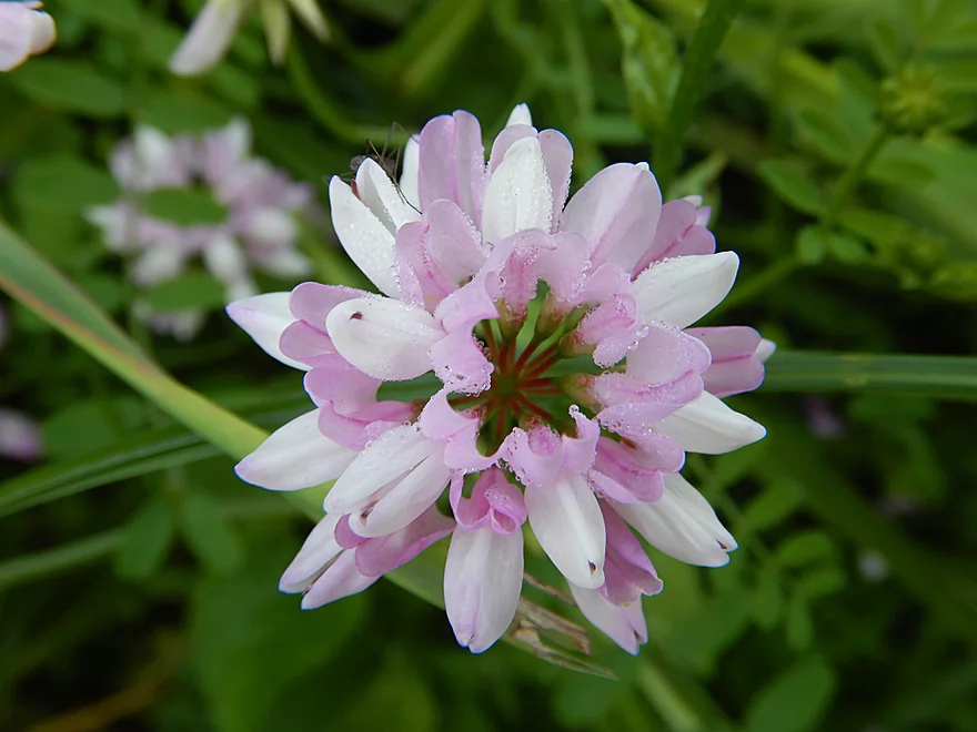
Crown vetch…attractive but invasive
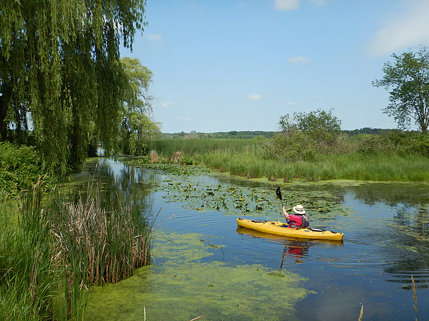
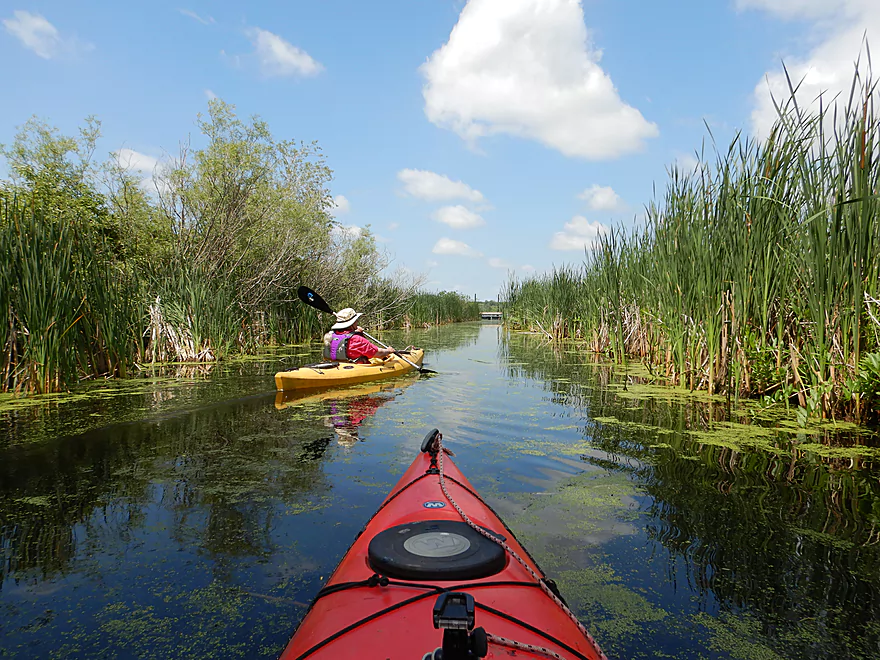
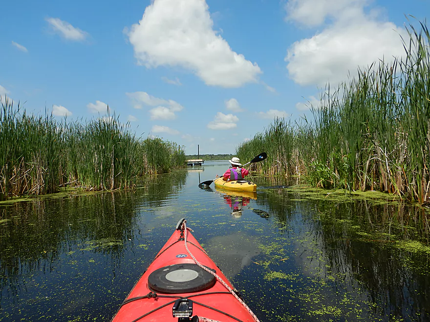
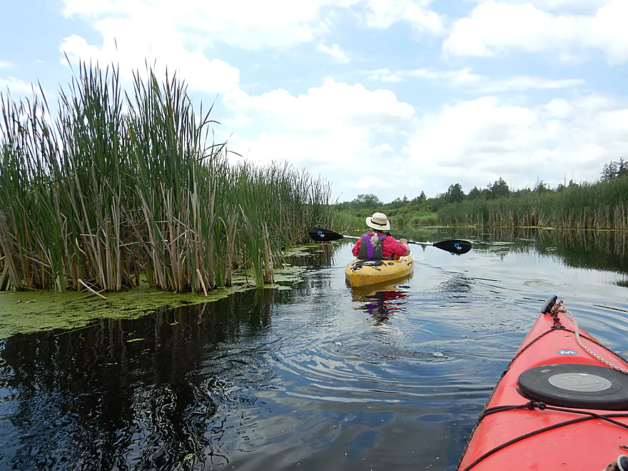
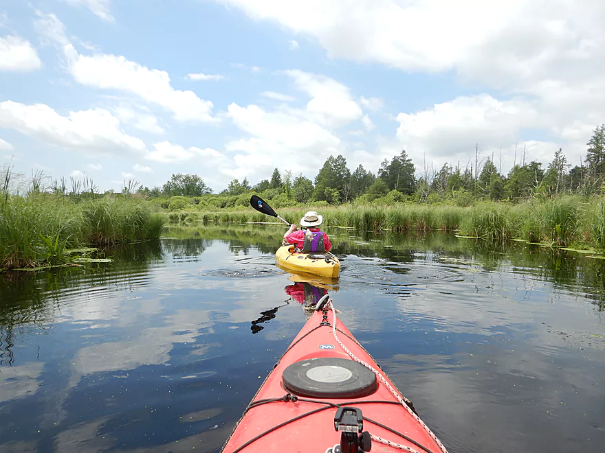
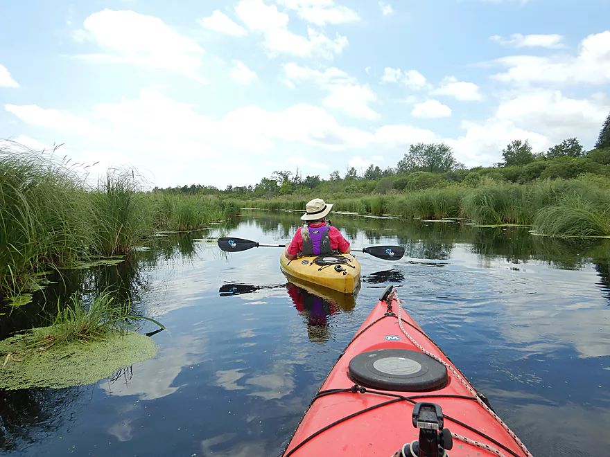
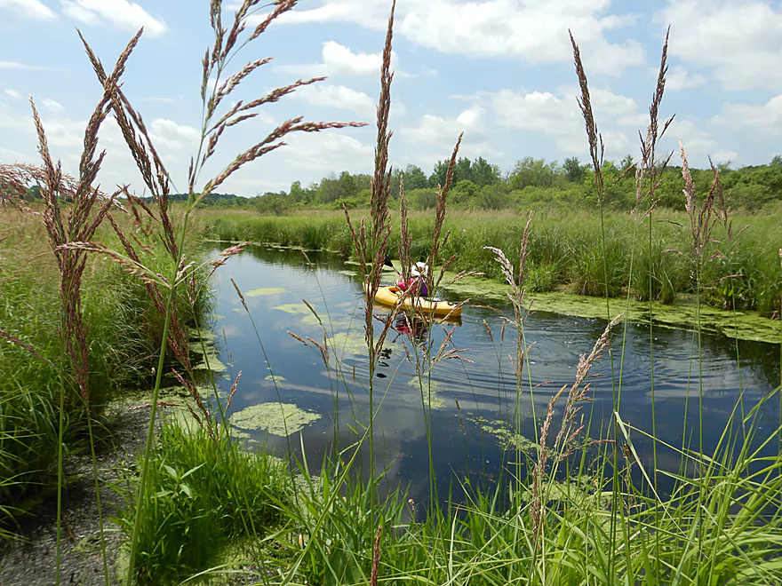
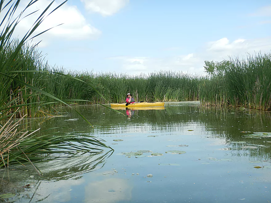
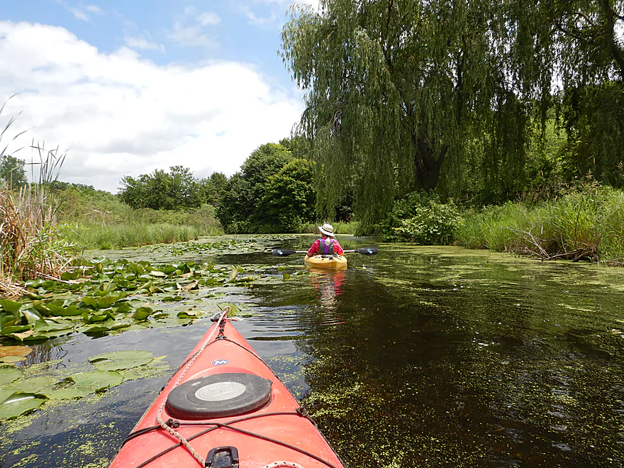
The first section on the canal is really nice
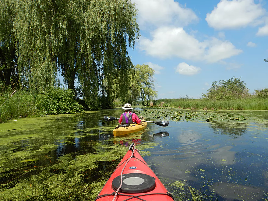
Framed by a weeping willow
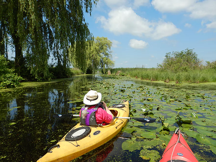
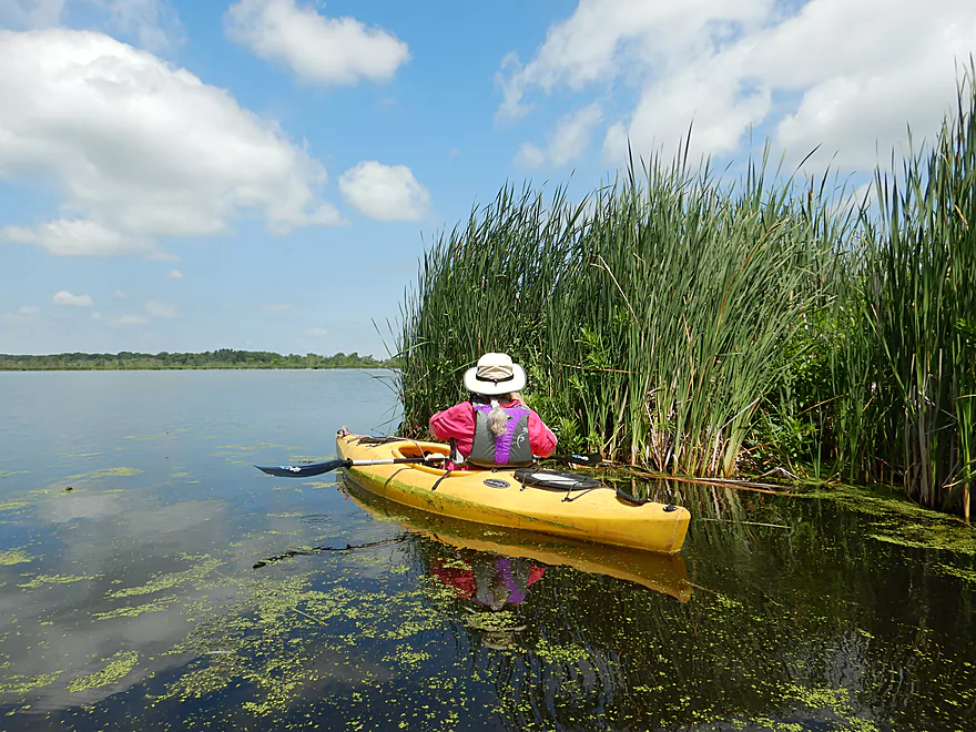
Attractive lily beds
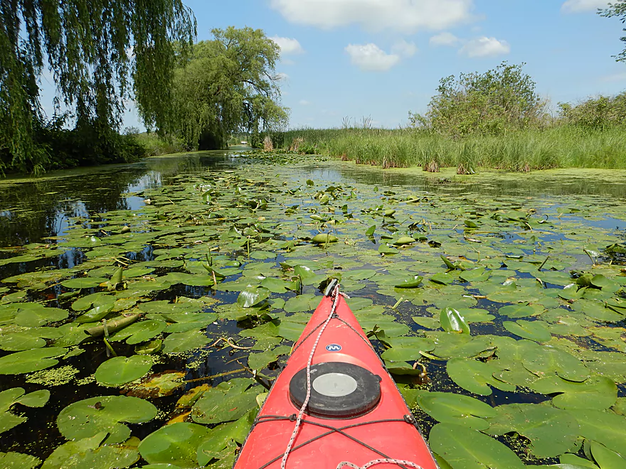
Although something has been eating them (muskrat perhaps)
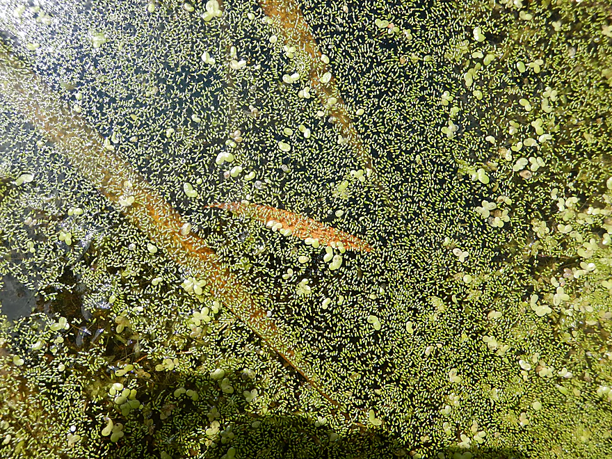
A tiny species of duckweed called watermeal
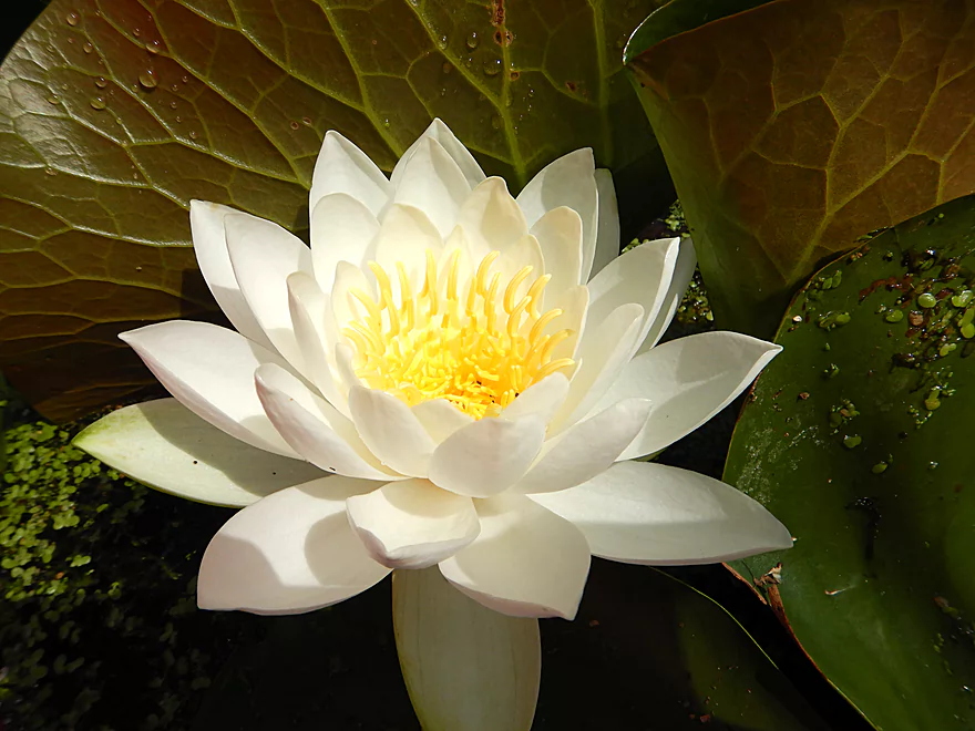
White waterlily
Blackbirds would get upset when you got too close to their cattail nests
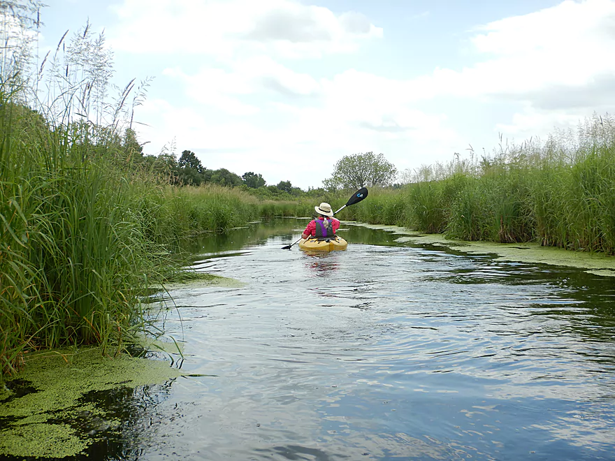
Final section of the canal
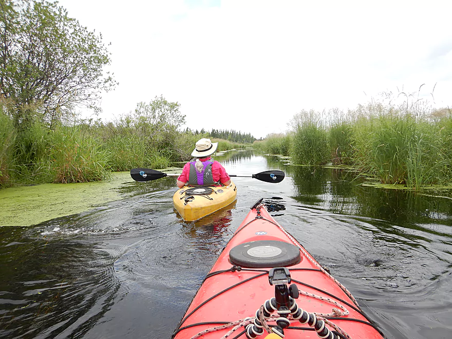
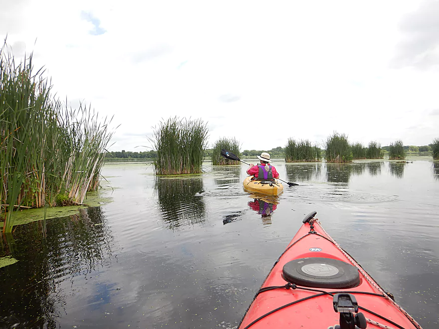
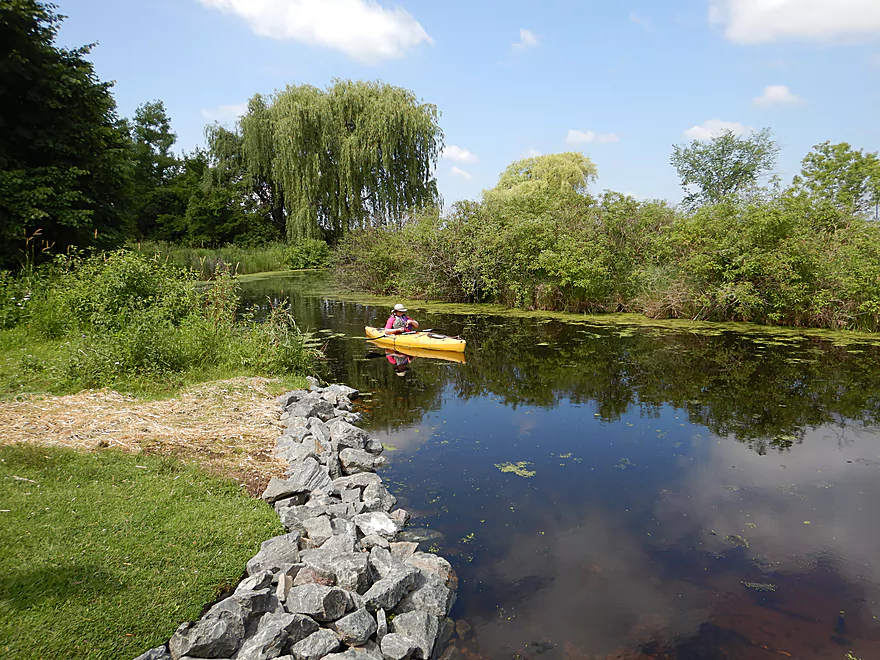
Entering Mud Lake
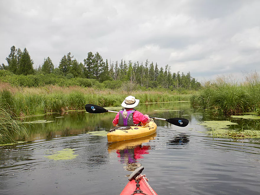
A peaceful and quiet lake
…dominated by cattails
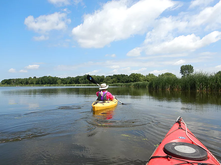
Paddling the lake counter-clockwise
Looking for the Rock Creek outlet
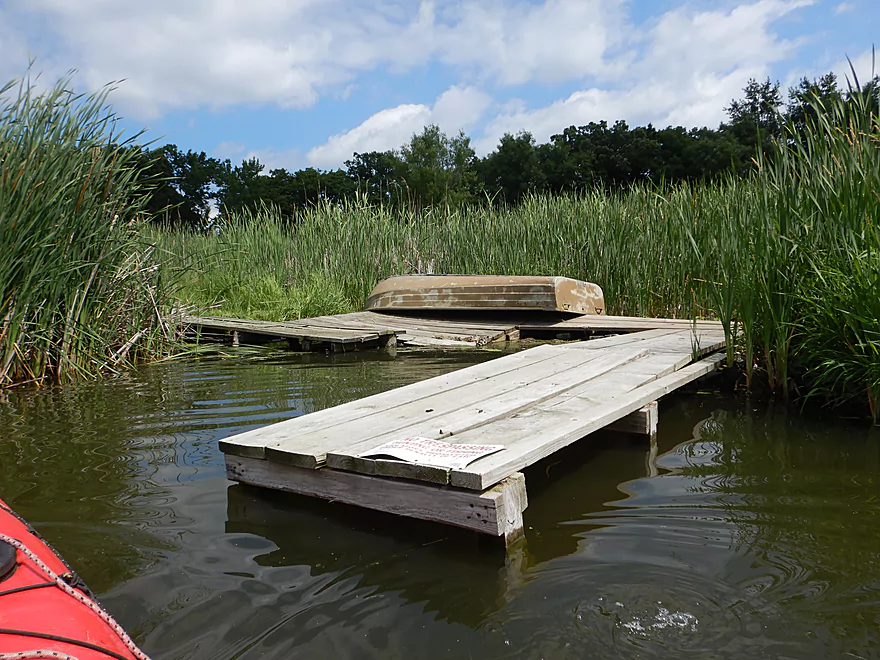
I believe this pier leads to some springs, but it is private
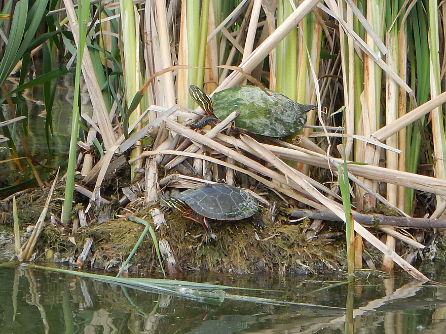
A turtle with algae stains
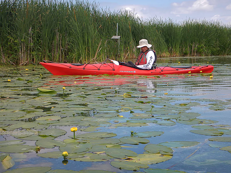
Some more lilies but not as nice as the ones by the put-in
We finally find Rock Creek
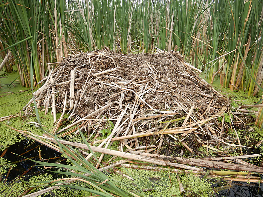
Quite the Muskrat house
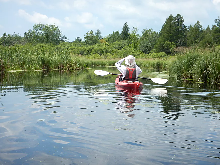
Scenery starts to change
No more cattails
A nice stand of tamaracks
Very natural looking marsh…like what marshes looked like pre-settlement/pre-invasive species
Something is odd…the current is going the wrong way
I don’t see Hwy A
It turns out we were paddling the Mud Lake inlet…not the outlet
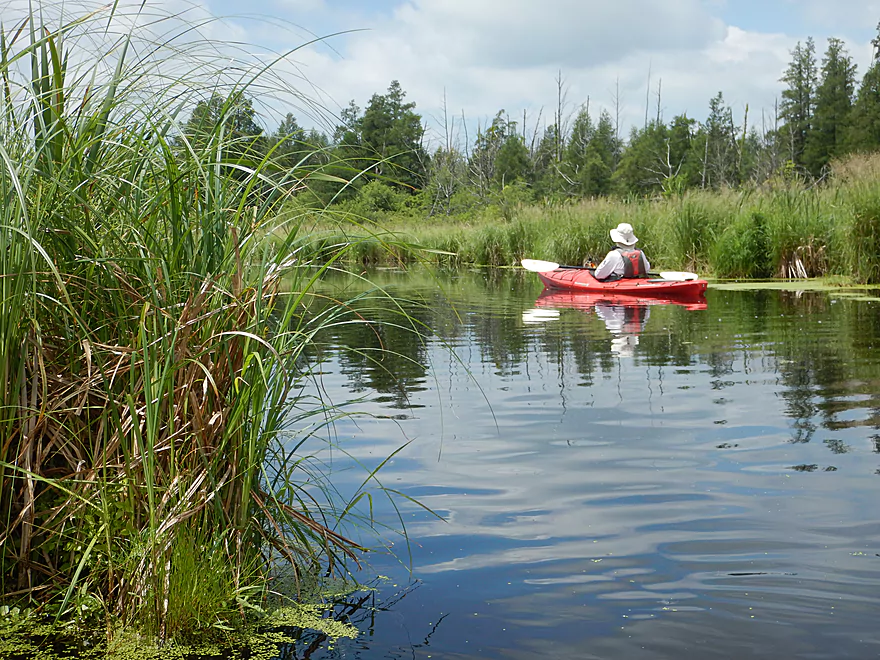
Exploring upstream a bit further
Time to turn back
Great view of the tamaracks

Entering cattail country again
Cattail islands growing at the mouth of Rock Creek
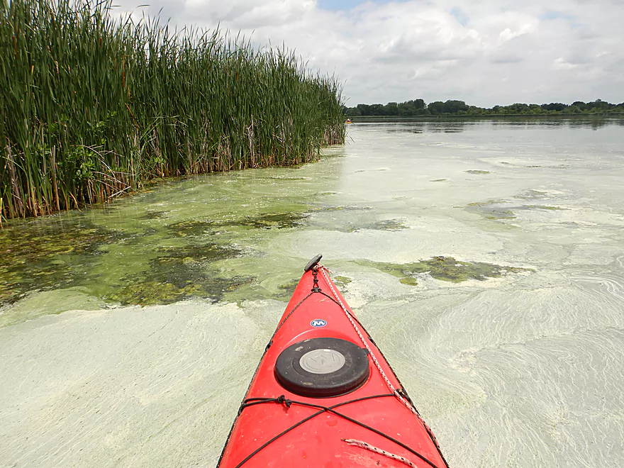
Some odd looking scum on part of Mud Lake
We found the Mud Lake outlet
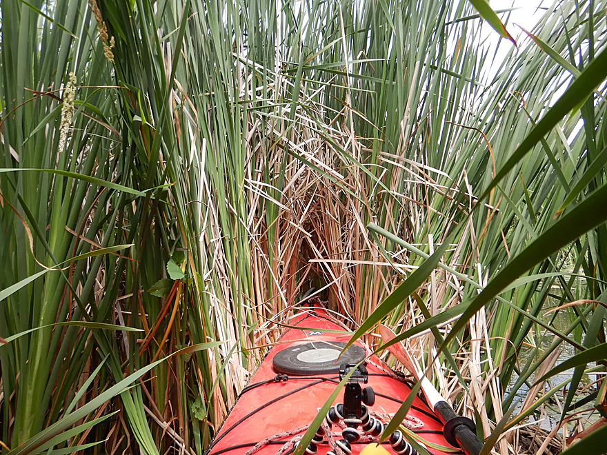
But it was sealed shut
Paddling back to the put-in
And back where we started
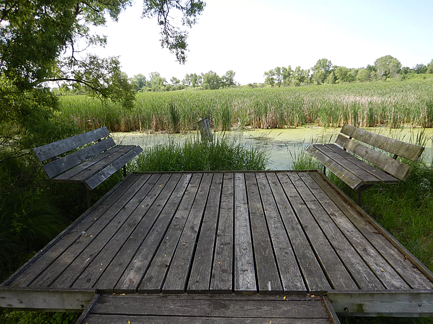
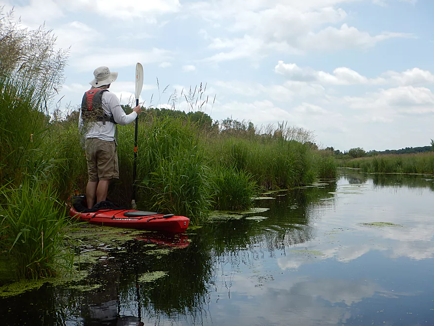
Scouting the southern boardwalk
You could launch here to lengthen a Mud Lake trip
But it is a bit weedy with some congestion issues
Mud Lake

Earlier this spring I came across a brochure called “Glacial Heritage Area Water Trails” which provided some interesting kayak access locations between Madison and Milwaukee. Included were a number of landings along upper Rock Creek which I didn’t realize existed. A few weeks later I had the opportunity to car scout the area and liked what I saw…so on my paddling to-do list it went.
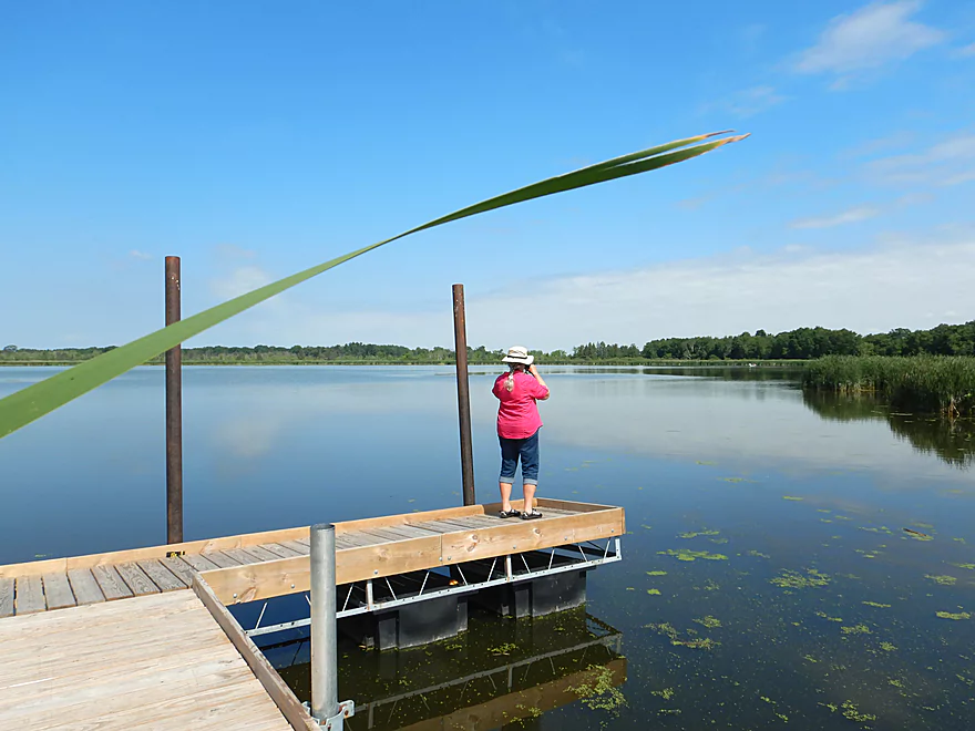
We started the trip at Sandhill Station Campground which is a state park located south of Lake Mills. A series of canals and old drainage ditches flow west through the campground and then combine at the main boat ramp. Connecting the landing to the lake, was a 500′ long canal which happened to be one of the trip highlights. Here the channel was teaming with wildlife and with marsh plants like lilies. A boardwalk paralleled the canal and at the mouth there was a nice fishing pier overlooking the entire lake.
Mud Lake is an undeveloped kettle lake surround by a monoculture of cattails and a few nice patches of bullhead lilies. It’s a peaceful and ok paddle, but nothing special. A while back it supposedly used to be much deeper (65′ in spots) and locals used to water ski here, but since then the lake has filled in considerably for unknown reasons, and motors are now prohibited.
We hugged the right shoreline looking for the outlet of the lake (aka Rock Creek). We did encounter one bay at the north end that seemed like it was the outlet, but it was walled shut by cattails. We kept circling the lake counter-clockwise until we finally found Rock Creek.
After we entered the creek, the scenery changed dramatically. The water started to clear up, and native grasses and sedges displaced the invasive cattails. This is a big deal as most marsh paddles tend to be cattail and reed canary grass cities and to see native marsh plants is a big deal. In the distance there were attractive stands of tamaracks very much giving this an up-north feel. In fact this was one of the nicer marsh paddles I’ve ever done.
But soon we discovered a problem. The current was flowing in the wrong direction…we were not paddling on the Mud Lake outlet, but rather the Mud Lake inlet. Oops. So we backtracked to the main lake where we talked to some local fishermen in a rowboat. According to them, the first bay we saw WAS the outlet, but it had indeed been sealed shut by cattails. This was a bit of an issue as our plans were to paddle Mud Lake > Rock Creek > Marsh Lake > Rock Lake where we had left our second car. I did try to ram my kayak through the cattails to see if I could blaze a trail, but it was too impenetrable and I only succeeded in getting stuck.
So, on that down note, we had to cancel the second half of our trip and return to our put-in. This trip wasn’t a total failure though as the eastern inlet to Mud Lake (by the landing) was very nice, and the western inlet was a fantastic accidental discovery. In hindsight, I can recommend this as a nice marsh paddle but you’ll just need to plan this as a round trip and you need to try to go as far upstream as you can on the western inlet (aka upper Rock Creek). The lake itself is ok, but a bit mucky with a peaty bottom. The real highlights were the two inlets which had the best scenery and wildlife.
After the trip I checked historical satellite maps (Google Earth > View > Historical Imagery) and discovered that the Mud Lake outlet had only recently been plugged up. On a previous satellite snapshot it looked navigable and I suspect our unseasonable amount of rain these past few years had enabled the cattails to sabatoge the Mud Lake outlet.
Sights included a great blue heron, painted turtles, many dragonflies, tadpoles with little legs, one rabbit, a muskrat lodge, an eagle flying overhead, and many singing songbirds. At the put-in a rose-breasted grosbeak was using the concrete ramp as a birdbath. Along the western edge of the lake there were a lot of carp and a few really thumped my kayak. The highlight might been been the blackbird nests. These were precariously nestled in the cattails which made them quite raccoon proof. The parents would go berserk whenever we got close to a nest.
Sandhill Station State Campground: This is an obscure but nice state park along the Mud Lake marsh. Highlights include campsites, picnic areas and boardwalks. This is well taken care of by the DNR and is a good park for hiking, birding or paddling. Here is a video intro to the park.
We used the Sandhill Station State Campground launch which was very nice (and scenic). Because this is a state park, you’ll need a state park sticker and a self-pay station is located at the entrance. Parking is plentiful and outhouses are just east of the main landing. The only downside is that there are a lot of goose droppings at the ramp…watch your step.
There aren’t too many alternate access options for Mud Lake. We checked the upstream bridge by Hope Lake Road, and while Rock Creek is navigable at the bridge, it isn’t just downstream where satellite images reveal it has been gobbled up by cattails.
In theory you could launch at the southern boardwalk here. This would add 0.3 miles of canal paddling to the trip and would have its nice parts, but it is mucky in spots and there is one small culvert and logjam to deal with.
Cattail Jams: These are like logjams, but much worse because they can’t be portaged and they block your view. There is a cattail jam at the outlet of Mud Lake. The western inlet also has a cattail jam but it is located a few miles upstream so you can still explore upper Rock Creek in depth…just as a round trip.
Wind: Mud Lake is open and therefore vulnerable to wind. Ideally marsh paddles are done with almost no wind to get spectacular reflections and color gradients off the still water.
Current: There is none on the main lake or the eastern inlet. The western inlet has a little current, but it is easy to paddle up.
There is no gauge on Mud Lake. I’ll use the nearby Crawfish River gauge as a reference, but it is a poor representation.
- 0-200 CFS: Low depth and maybe a bit mucky in spots. Paddling up the western outlet may be more difficult.
- 201-1800 CFS: Likely fine for paddling.
- 1800+ CFS: Also likely fine for paddling but the dock, boardwalks and landing area might be submerged.
- Hope Lake Road to Mud Lake: 2.2 miles. Not viable because of significant cattail jams.
- Mud Lake Round Trip: 2.4 miles. A quiet lake paddle with highlights being the eastern inlet by the landing, and the western inlet which is very cool and can be explored upstream in depth.
- Mud Lake to Hwy A: 0.5 miles. A narrow creek paddle flanked by thick and tall clumps of cattails. An intriguing “maze-paddle” but not viable because of cattail jams. Adventurous paddlers could launch at Hwy A and try to head as far upstream as possible before turning back.
- Hwy A to Bartel’s Beach: 2.3 miles.
- Hwy A to Sandy Beach: 1.4 miles. A short but attractive creek segment that soon opens up into Marsh Lake. Marsh Lake suffers from muck on the far east end…but does have a fantastic lily bed east of the main island.
- Sandy Beach to Bartel’s Beach: 0.9 miles. A short paddle over just a small portion of Rock Lake. Rock Lake can be very busy with most of the traffic located along the southern end. Note there are many other viable routes on Rock Lake.
- Bartel’s Beach to Rock Lake Dam: 0.2 miles. Bit of a mucky area known as Mill Pond. Note the dam is not portageable.
- Rock Lake to Lake Mills Municipal Building: 0.1 miles. After the dam, the creek flows underground for a significant length before finally emerging behind the municipal building. I don’t think this section is navigable.
- Lake Mills Municipal to Hwy A: 6.2 miles. Likely a future trip.
- Lake Mills Municipal to Stony Road: 1.2 miles. An intriguing paddle past a huge fish farm and then parts of Lake Mills. There could be some logjams and other unknown hazards.
- Stony Road to Manske Road: 3.1 miles. Also an interesting prospect More open and and less developed, but likely still some logjams.
- Manske Road to Hwy A: 1.9 miles. A short trip to reach the mouth then a longer trip on the Crawfish to reach the Hwy A bridge.
Trip Map
Overview Map
Video
Photos Size:
Thank so much for all of these amazing information. It was very well-explained, and hopefully will help us with our trip this weekend. The pictures are so good as well the video. Thanks.
Thanks for the comment!