
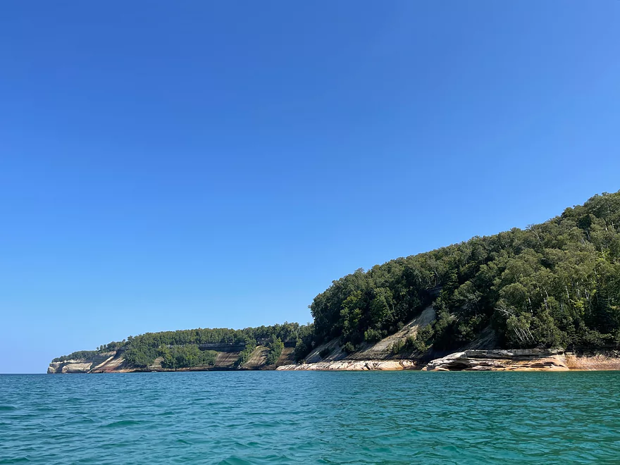
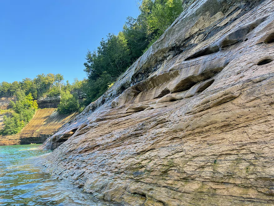
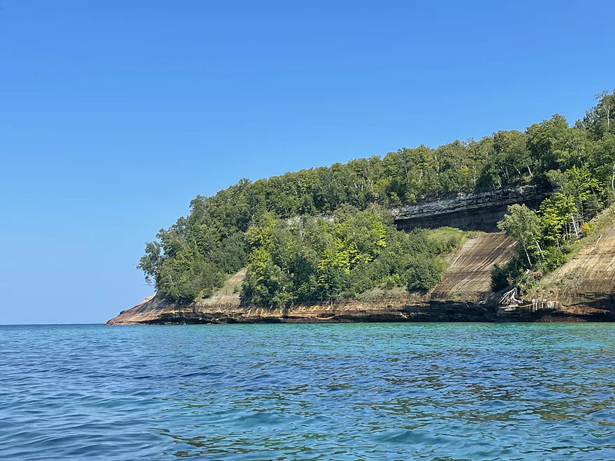
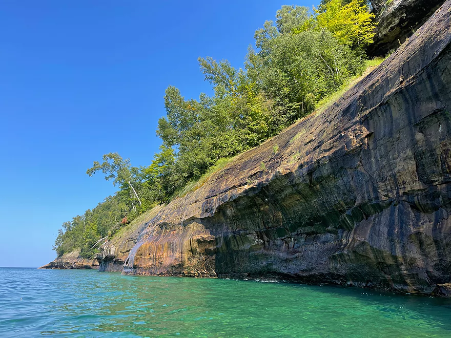
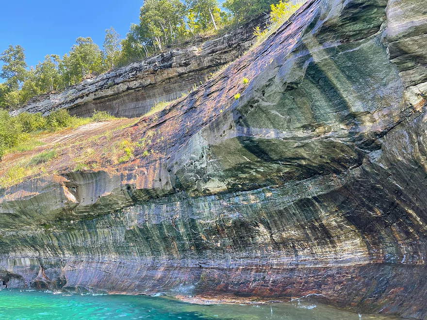
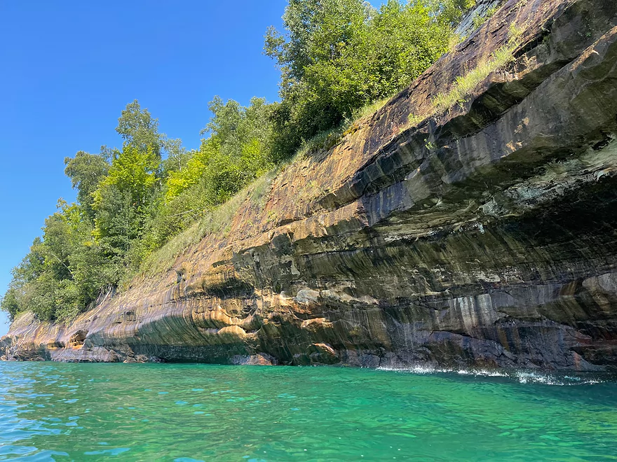
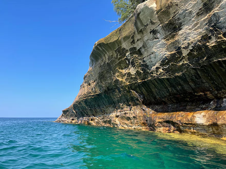
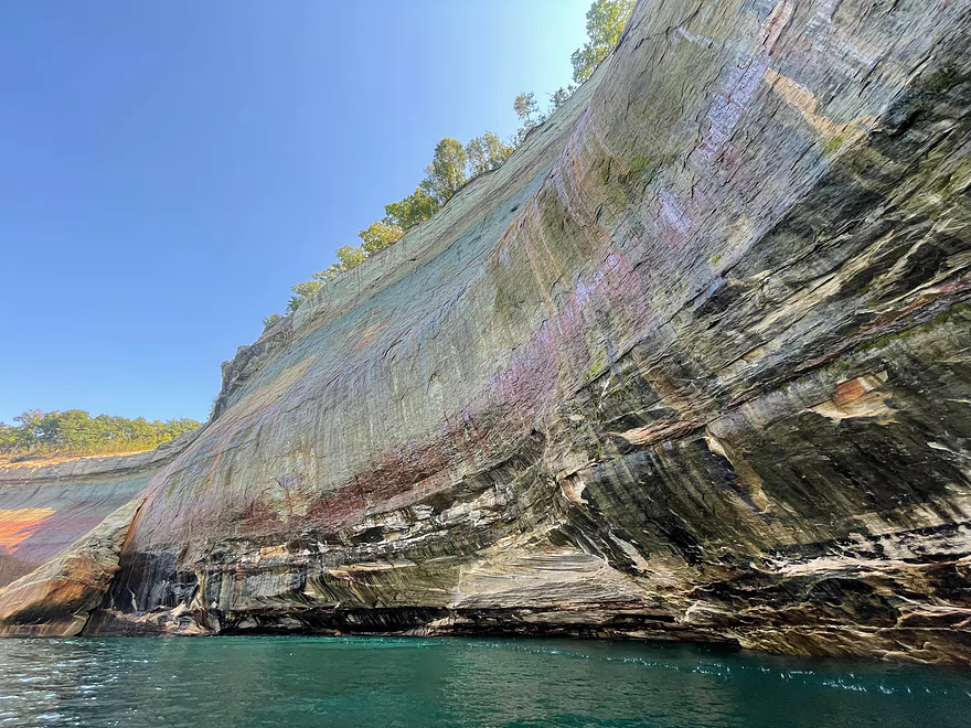
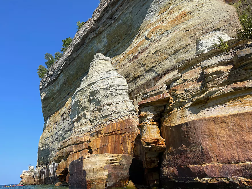
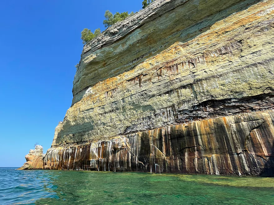
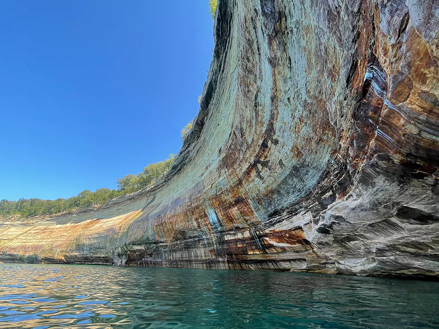
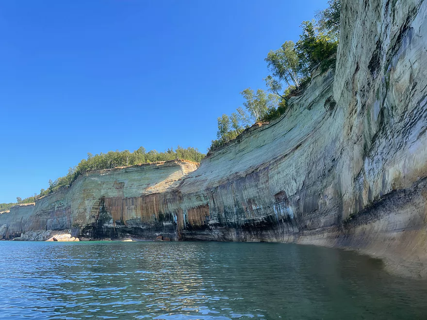
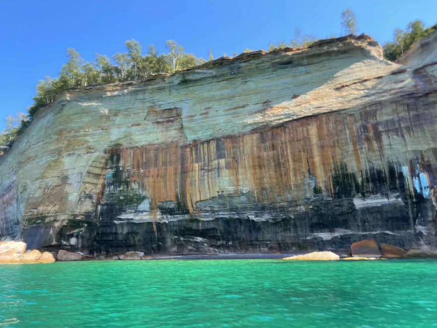
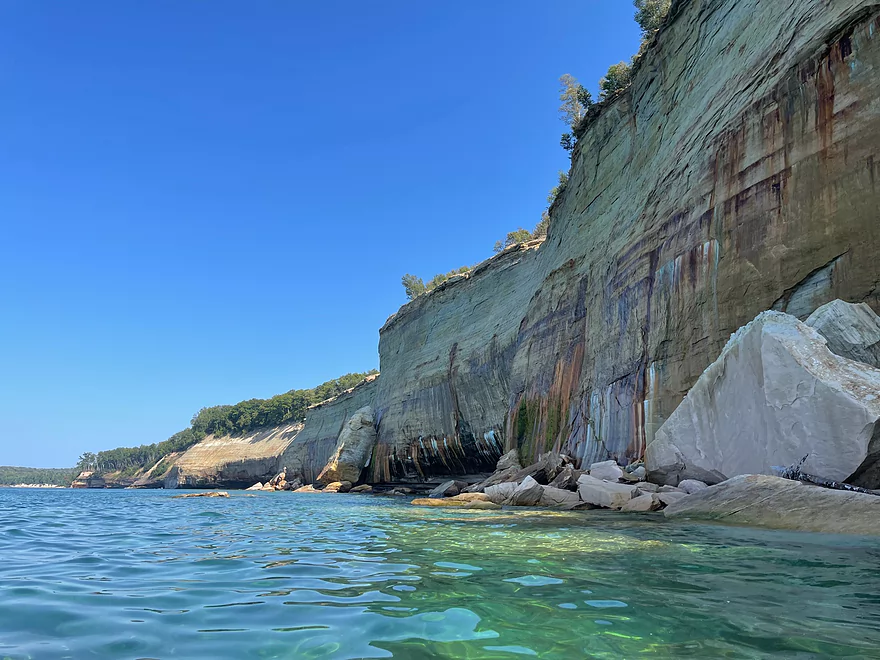
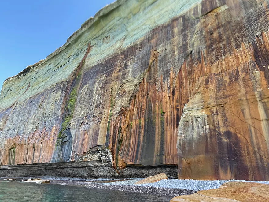
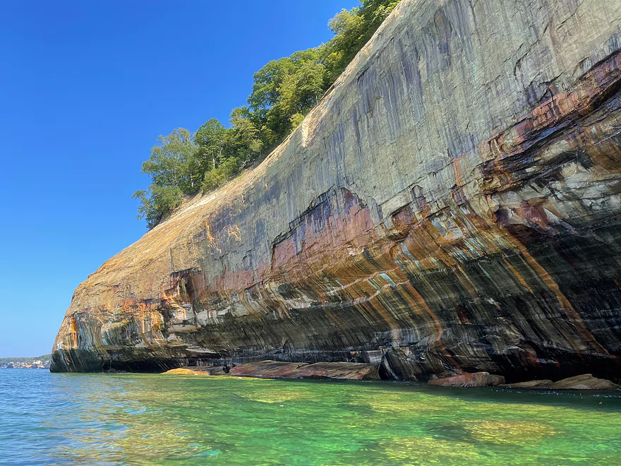
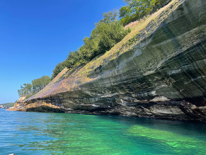
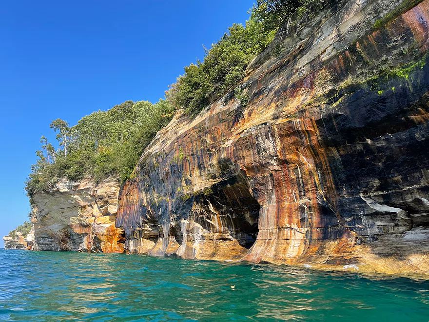
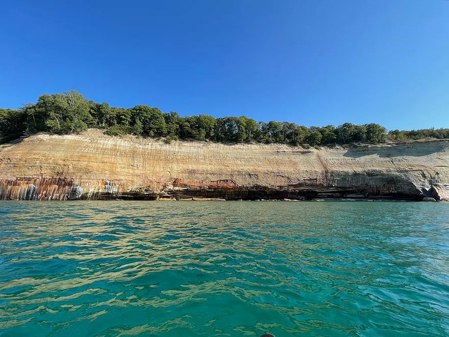
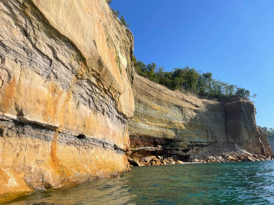
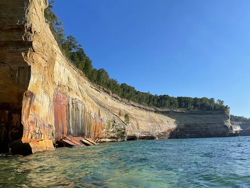
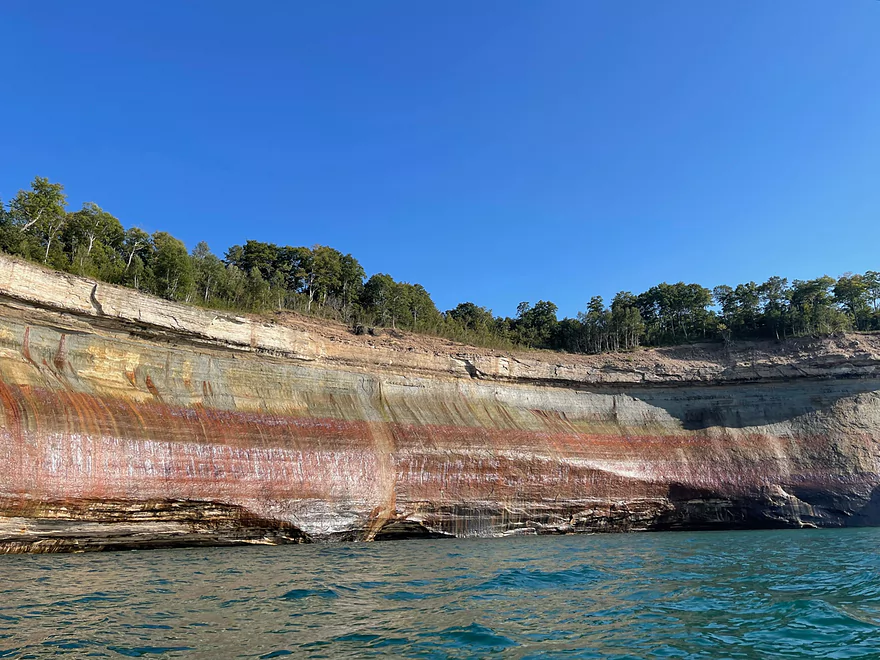
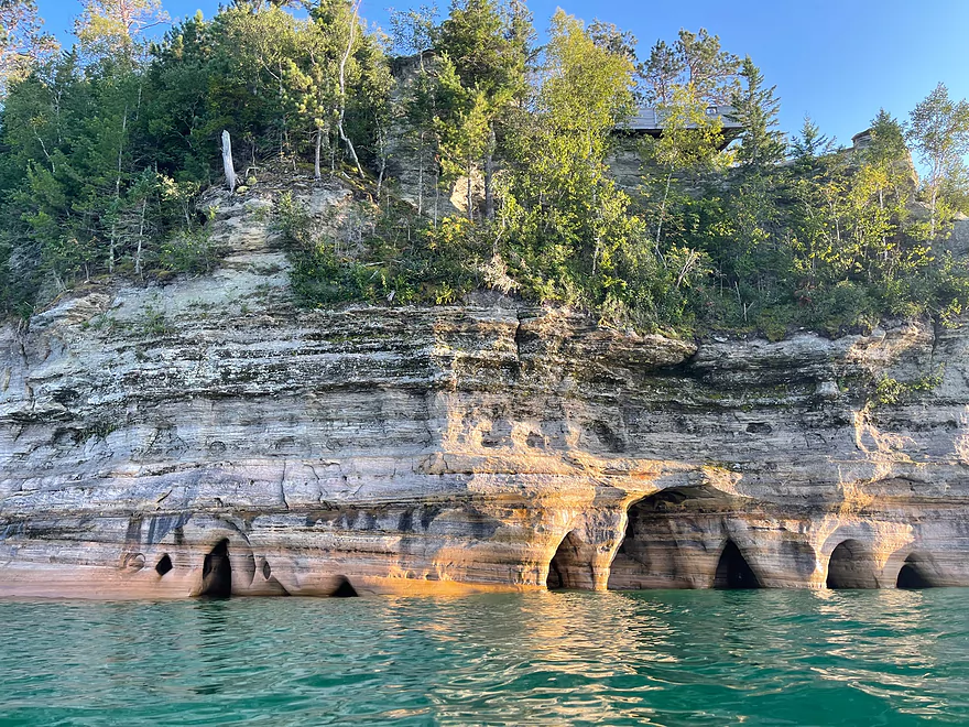
The start of the rocks heading east after Miner’s Beach
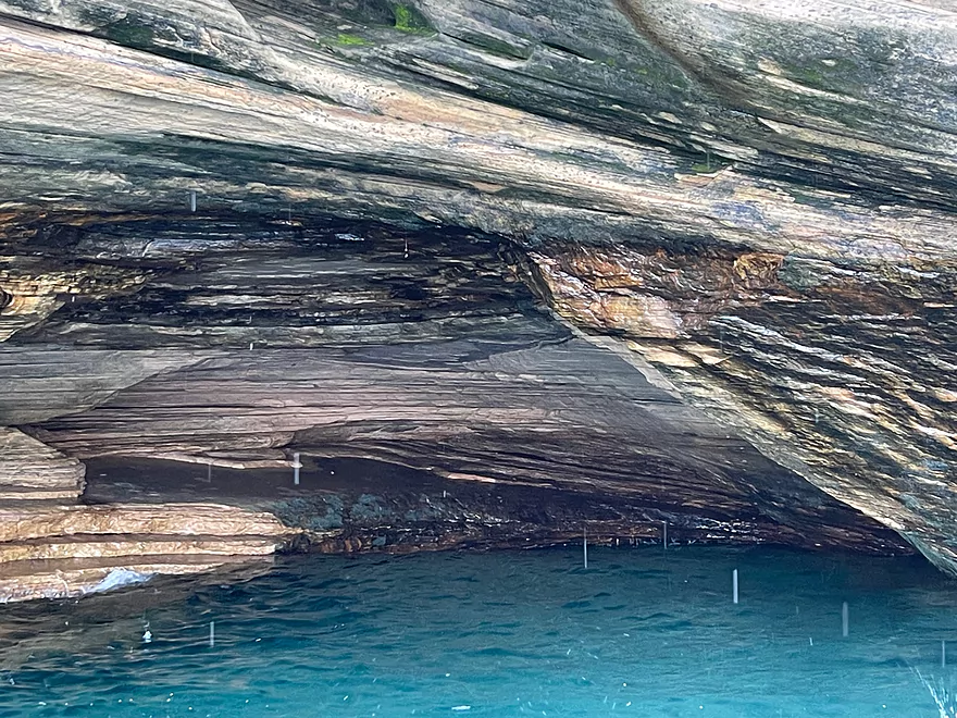
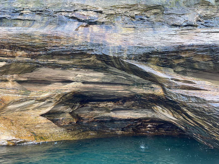
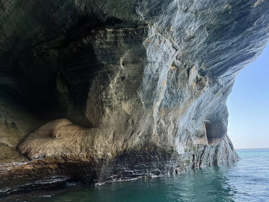
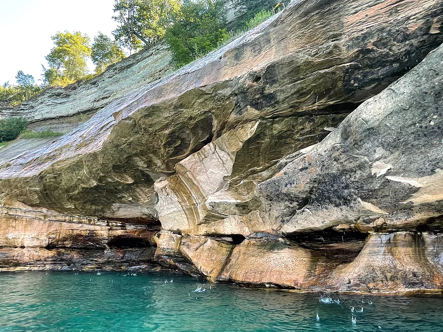
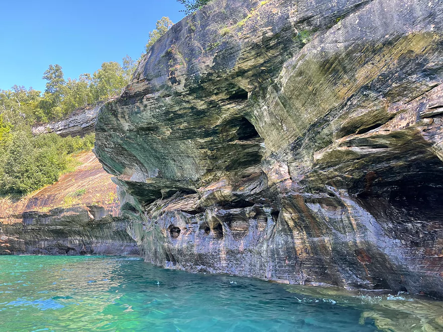
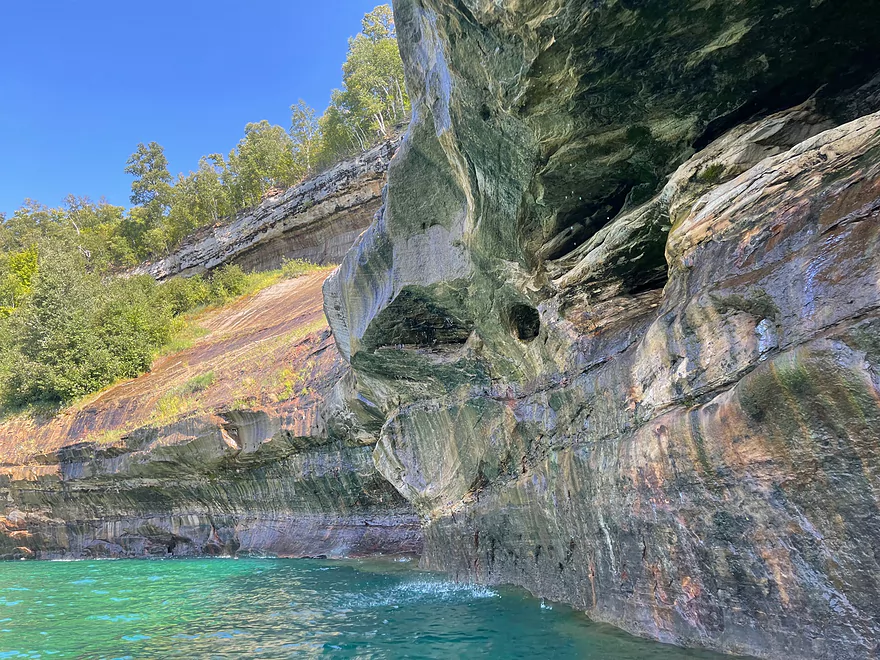
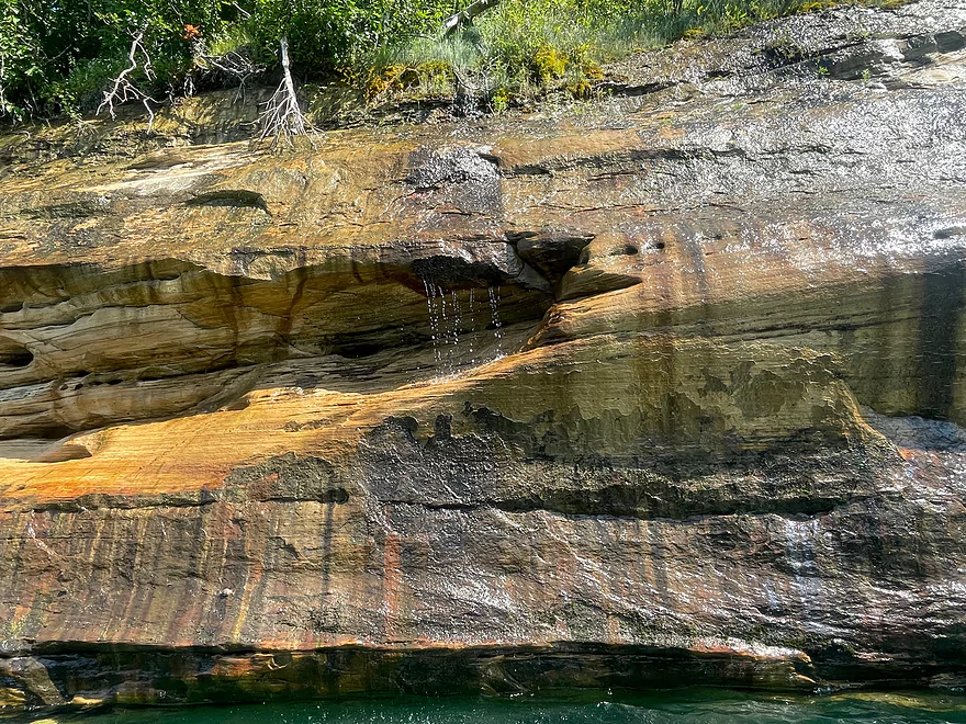
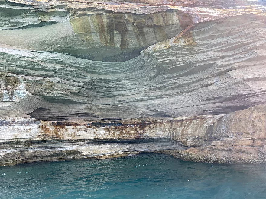
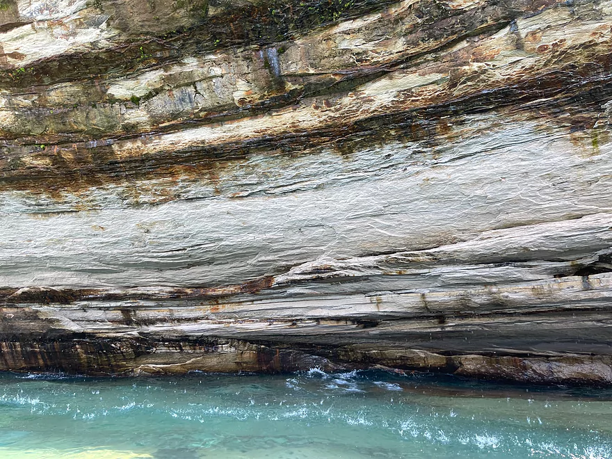
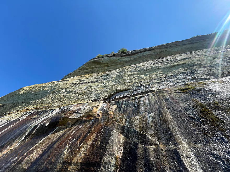
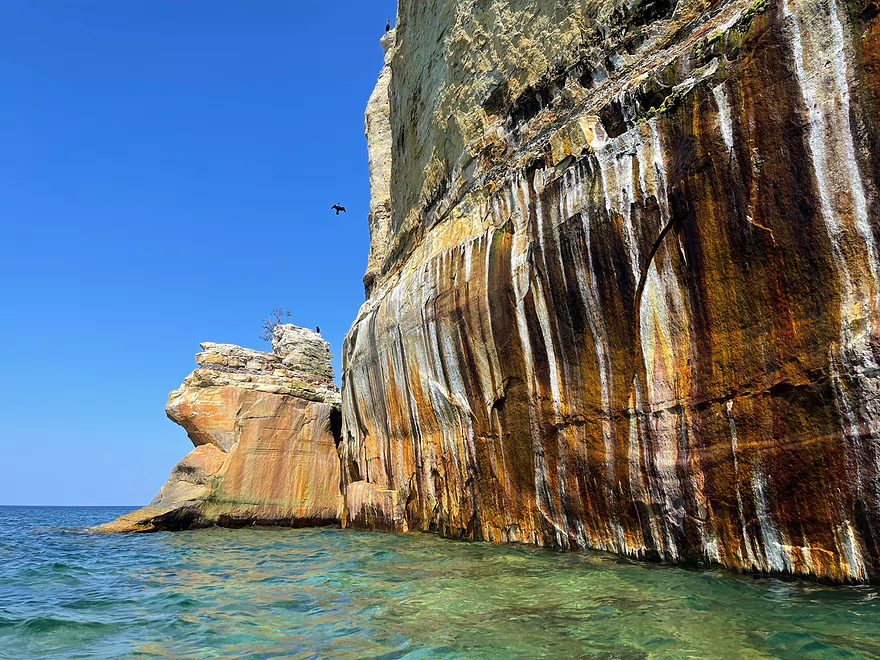
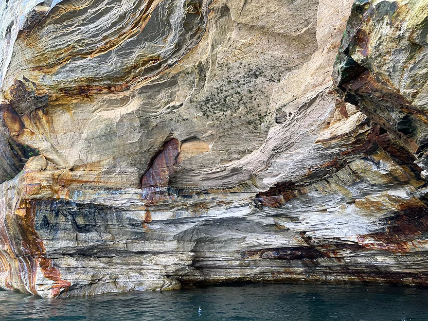
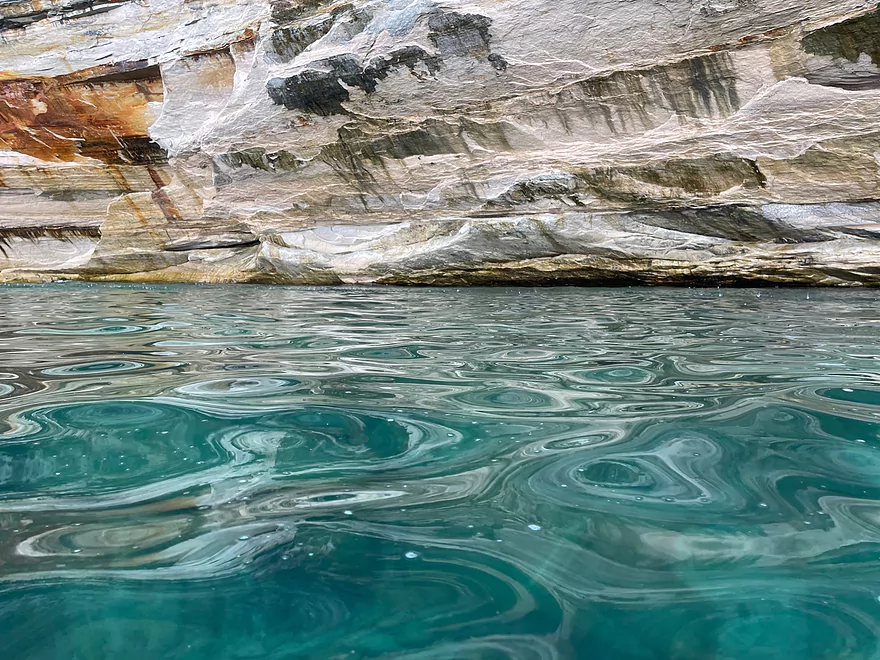
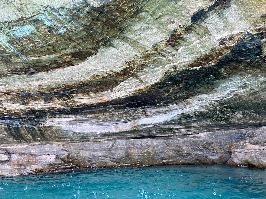
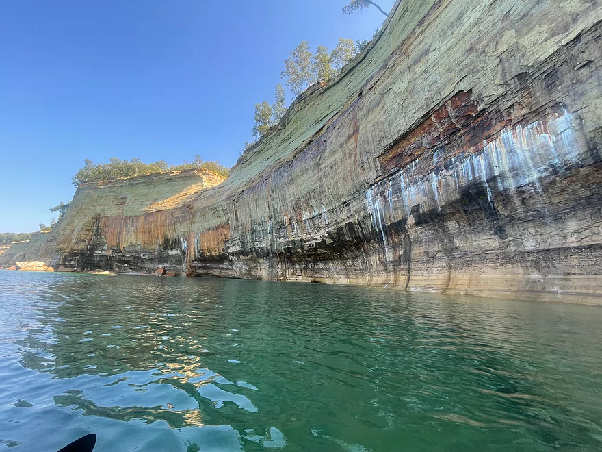
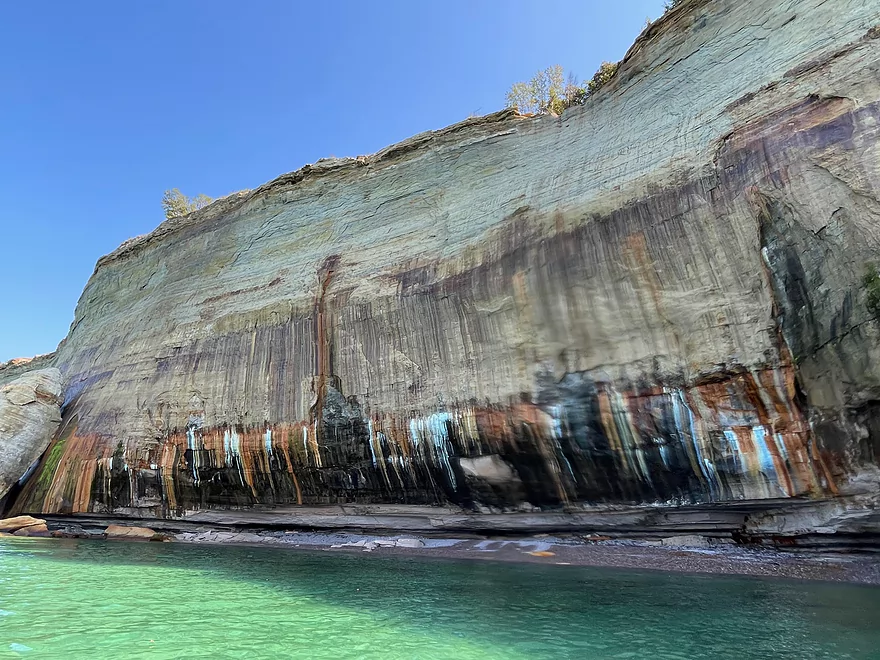
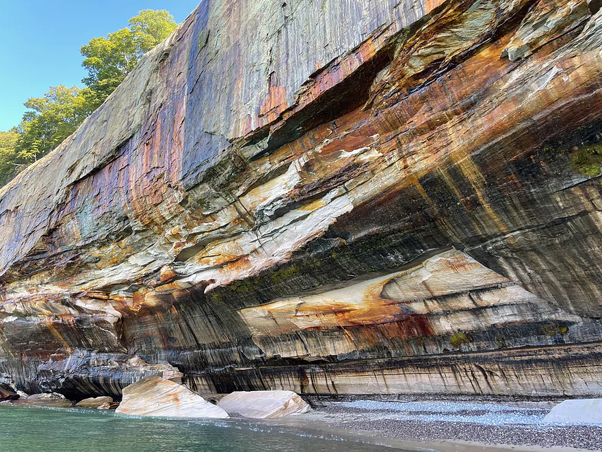
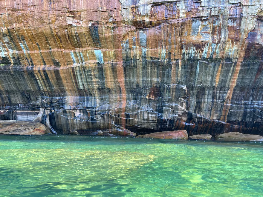
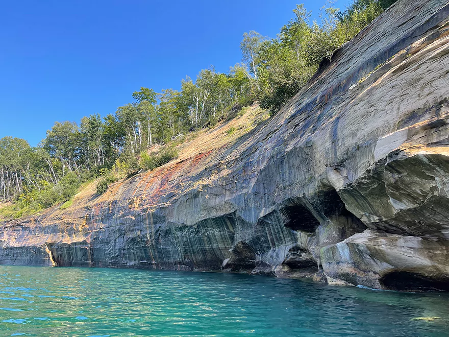
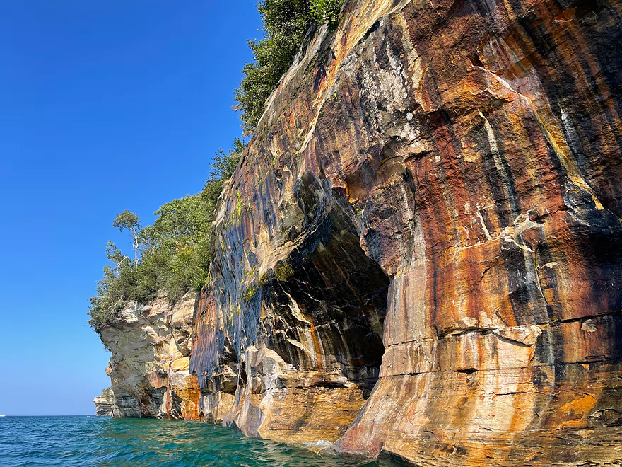
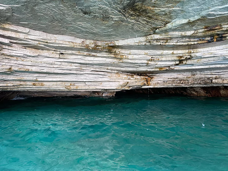
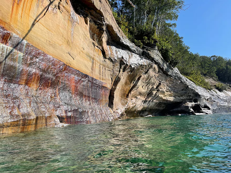
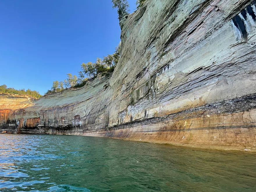
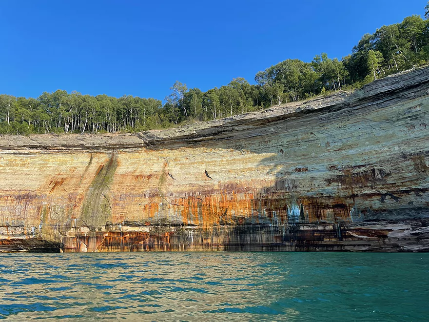
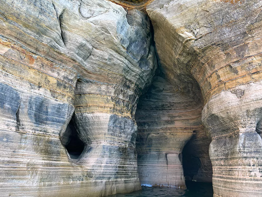
Water dripping from the rocks
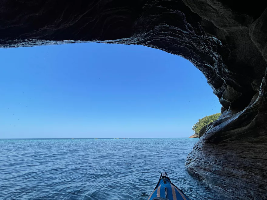
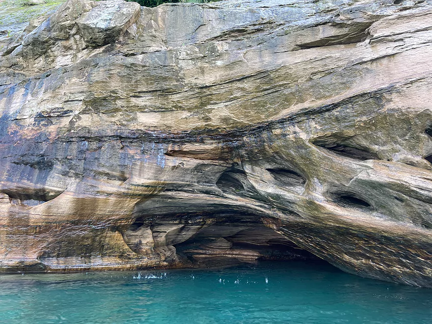
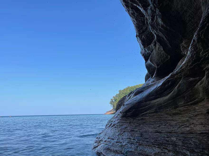
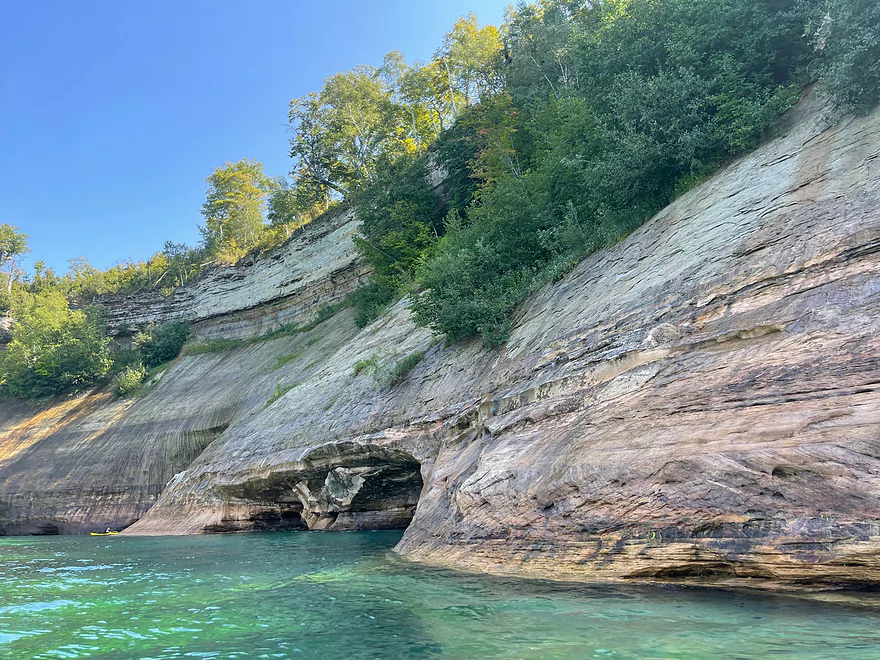
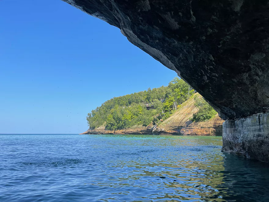
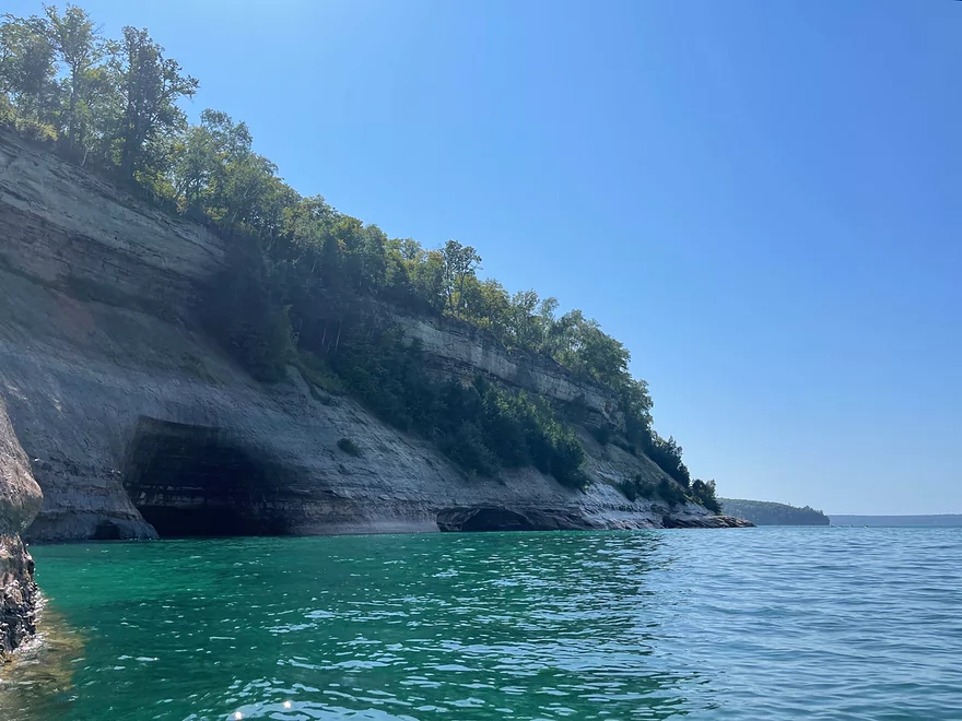
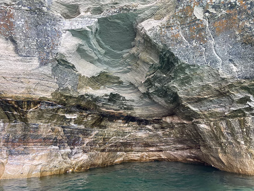
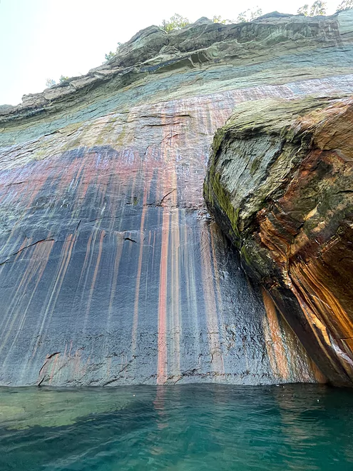
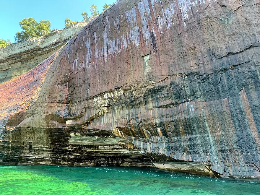
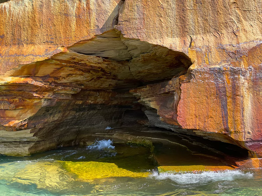
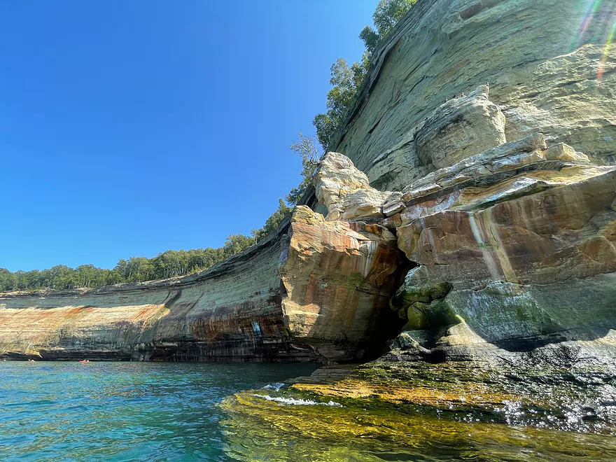
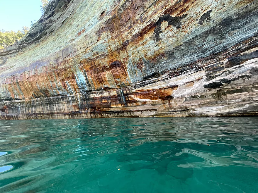
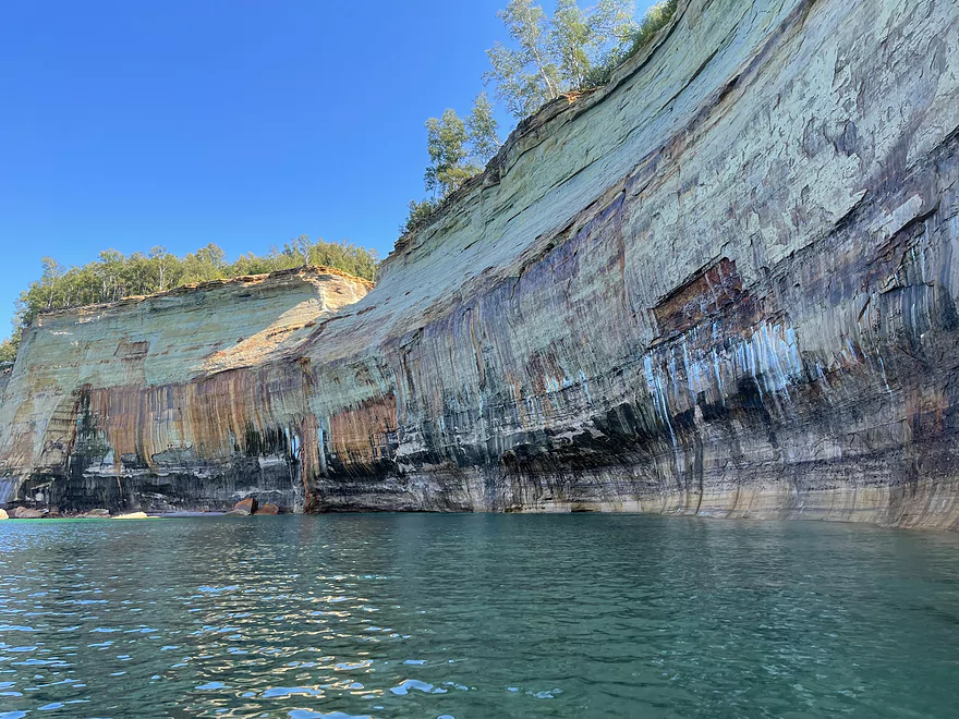
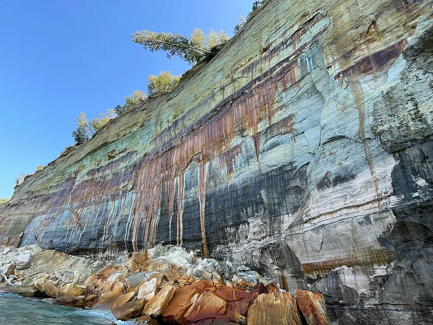
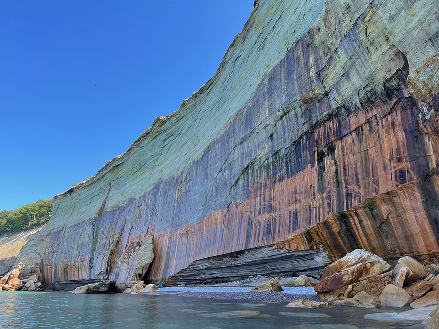
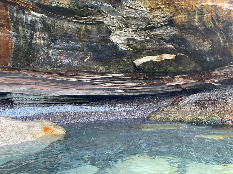
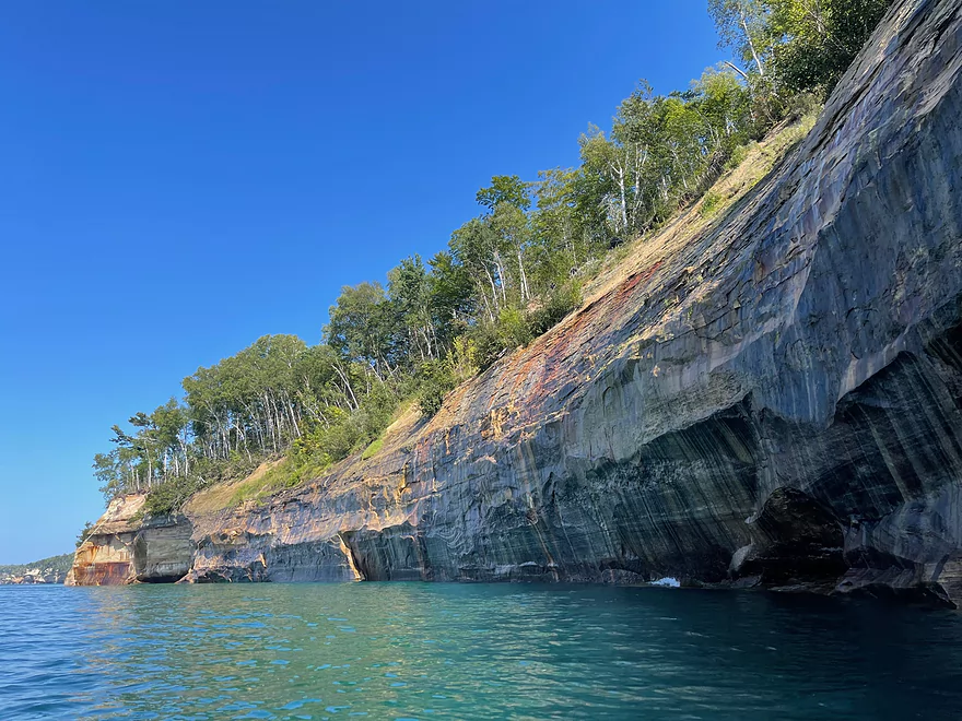
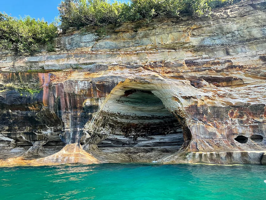
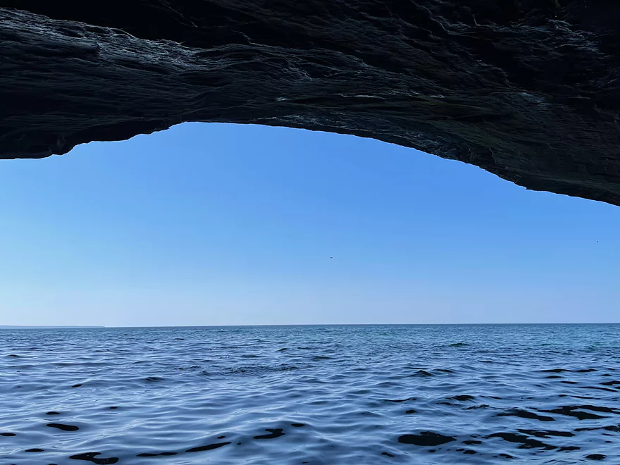
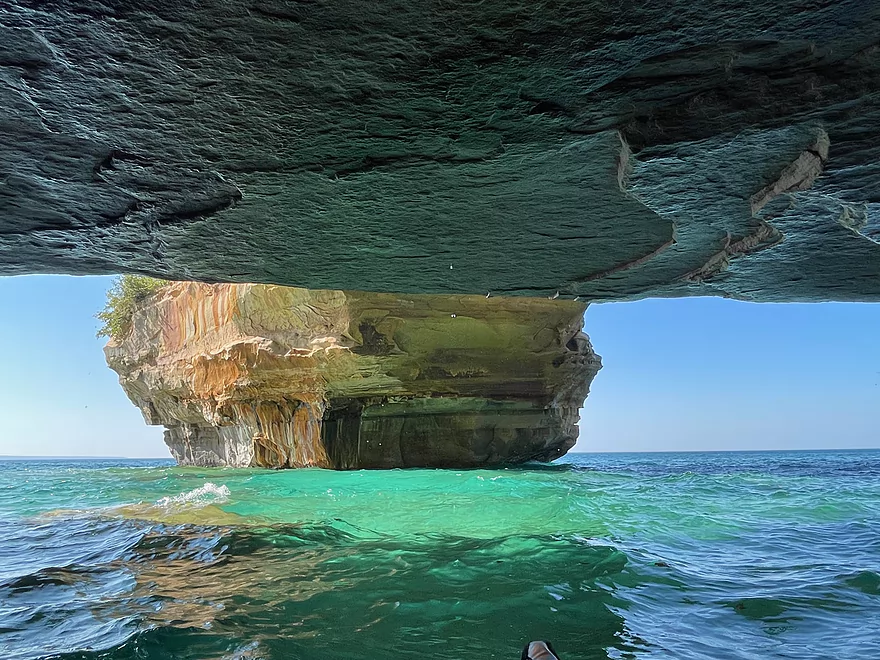
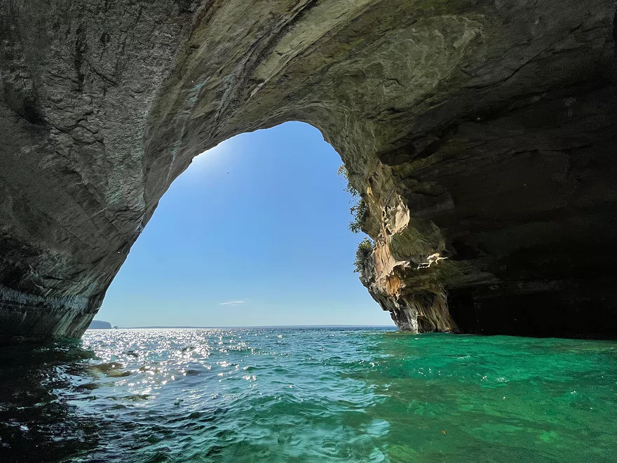
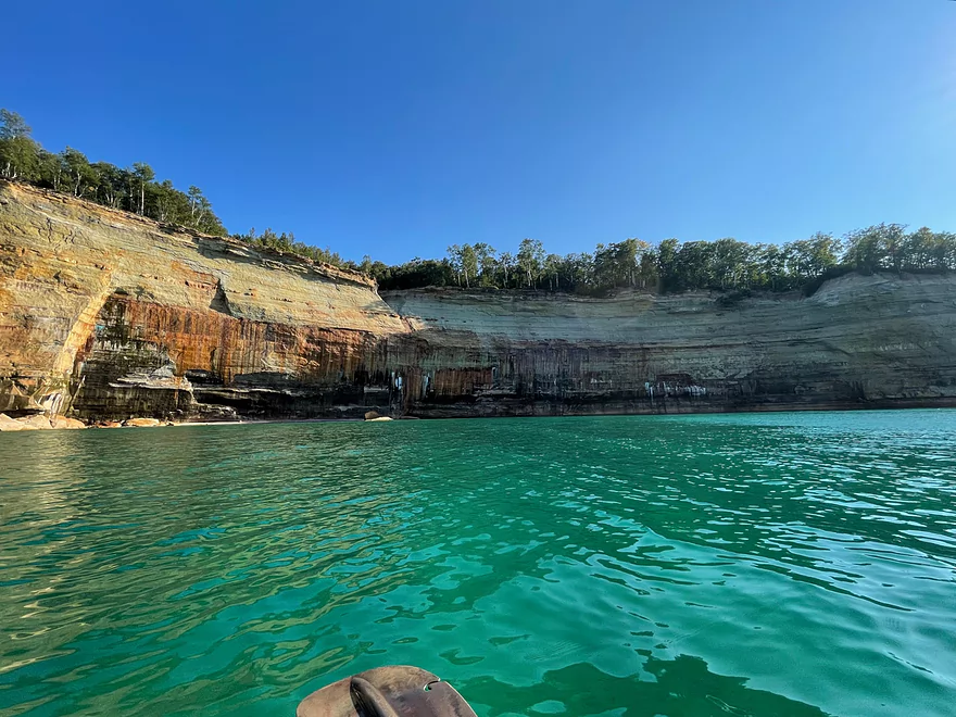
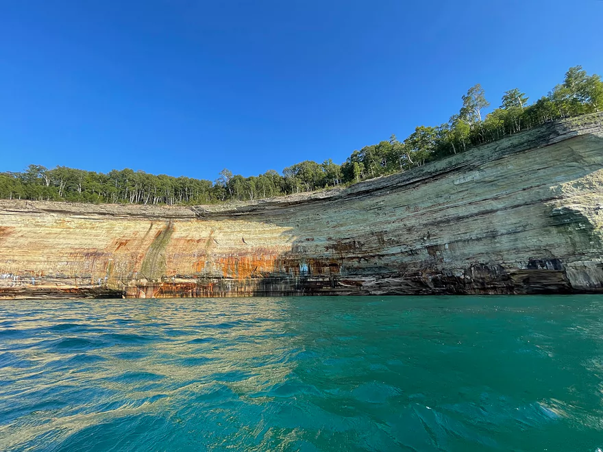
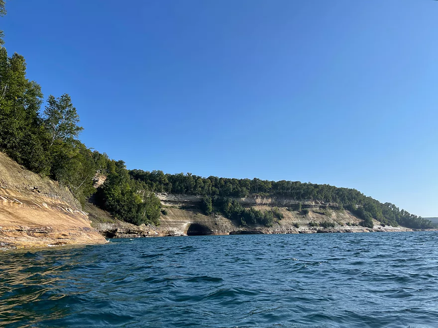
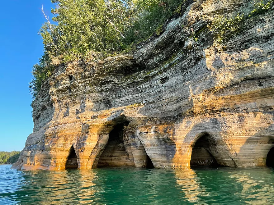
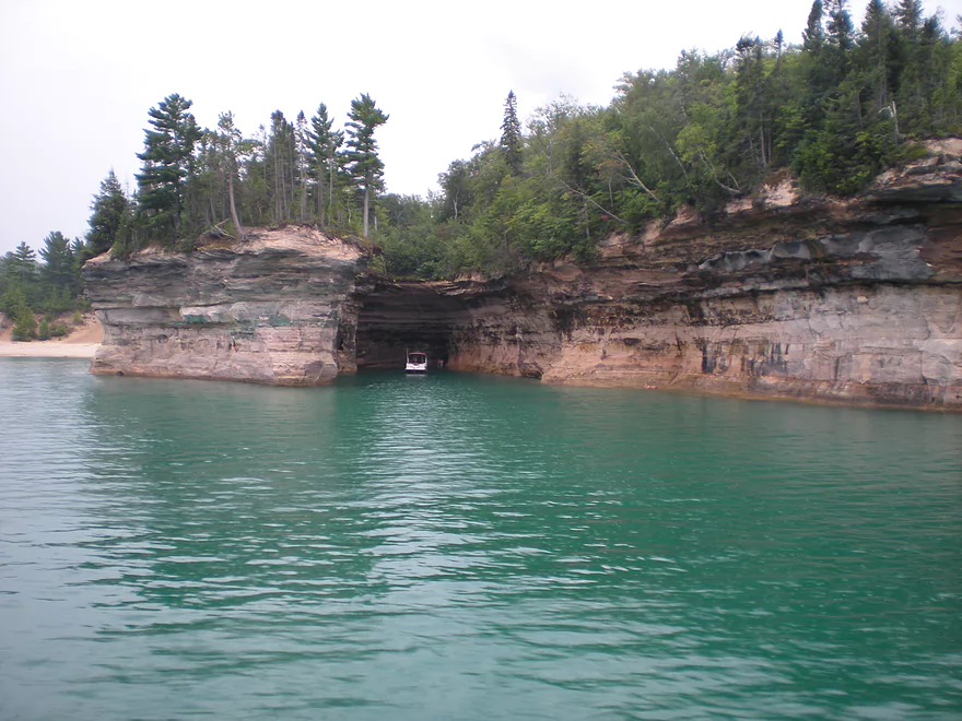
Looking out from a sea cave
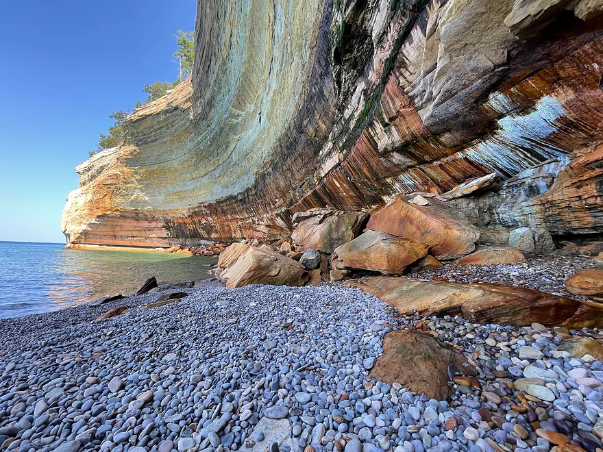
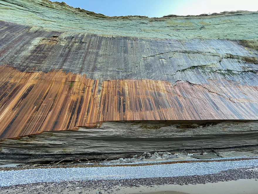
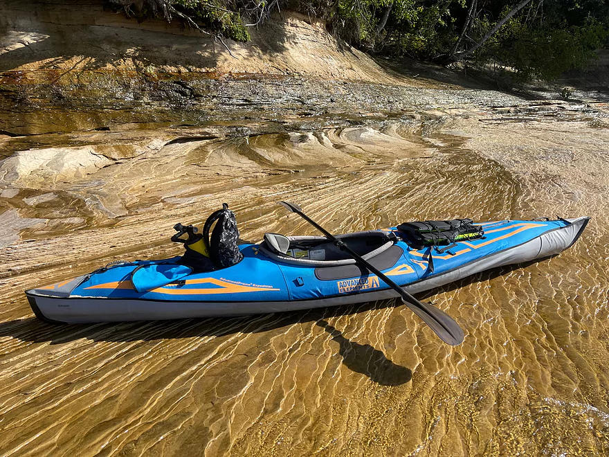
Taking a break at a pebble beach
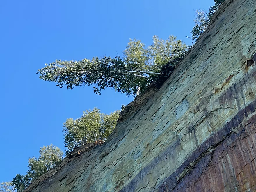
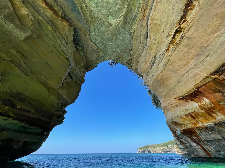
Tree barely hanging on
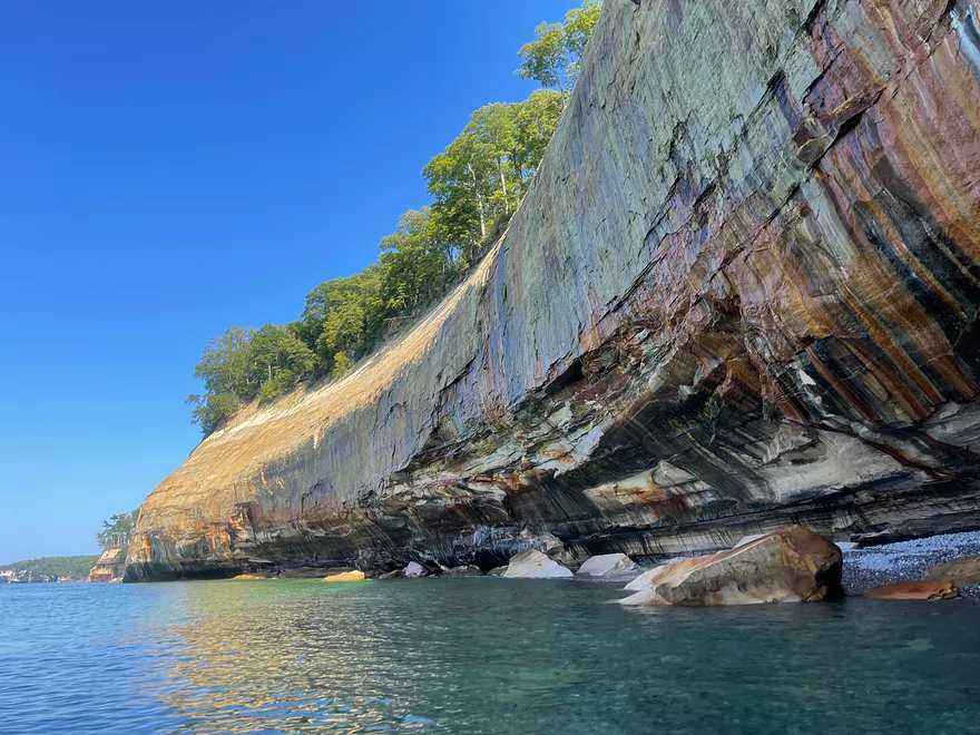
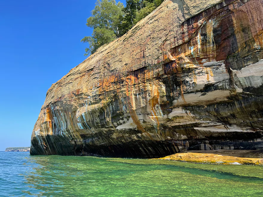

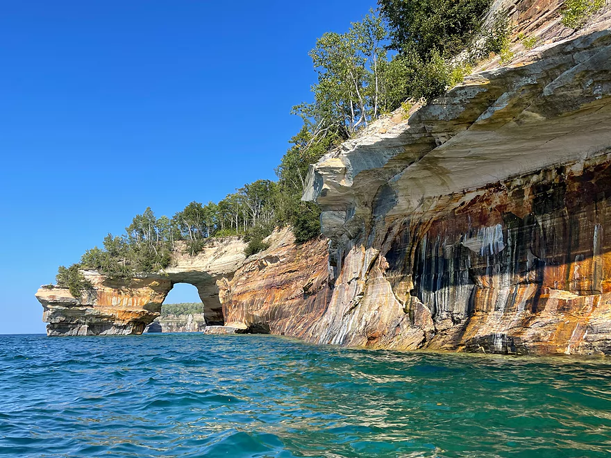
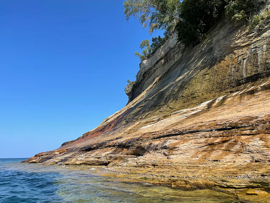
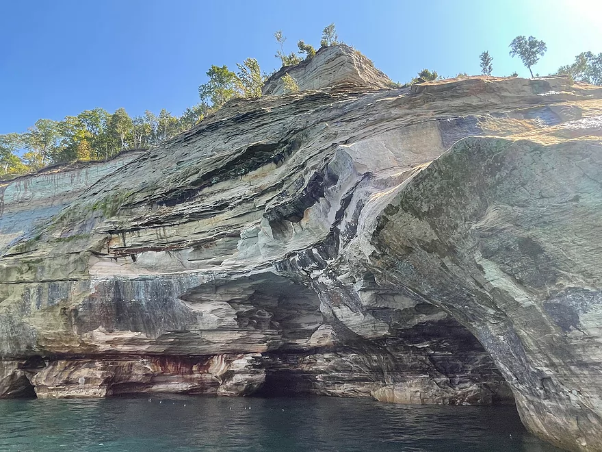
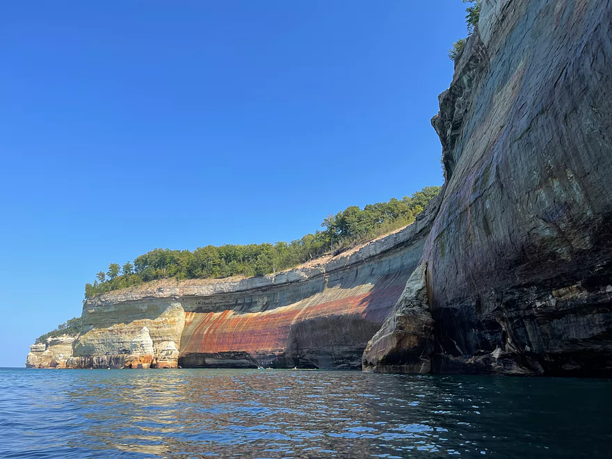
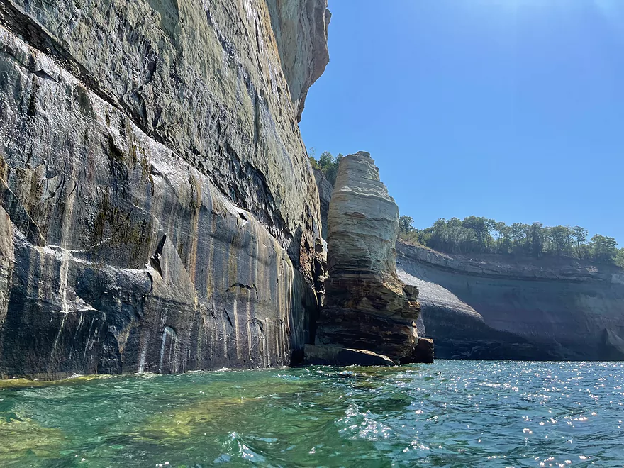
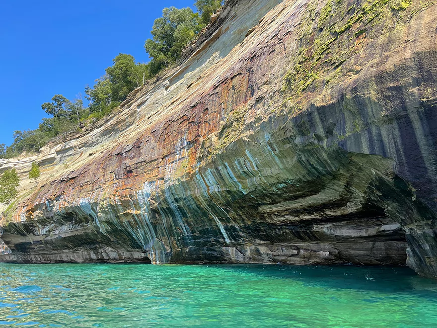
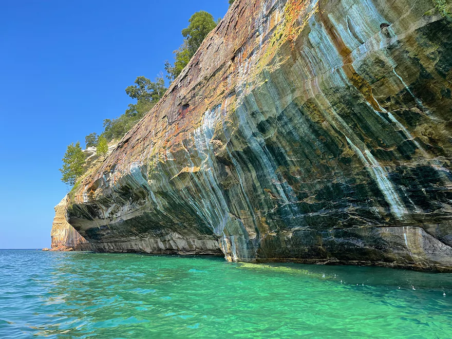
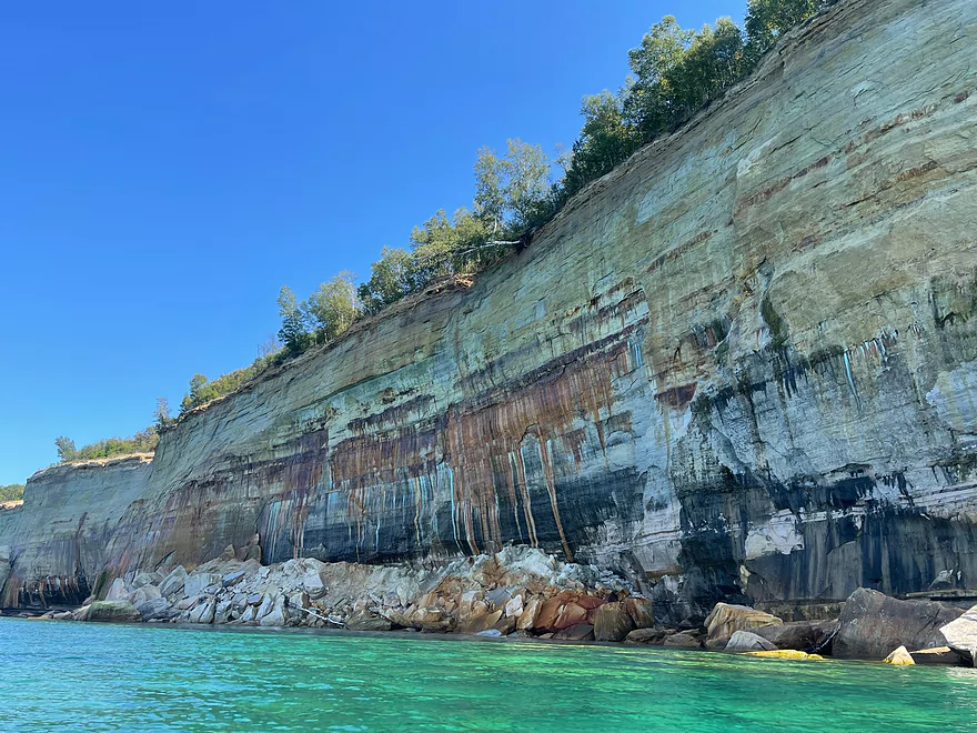
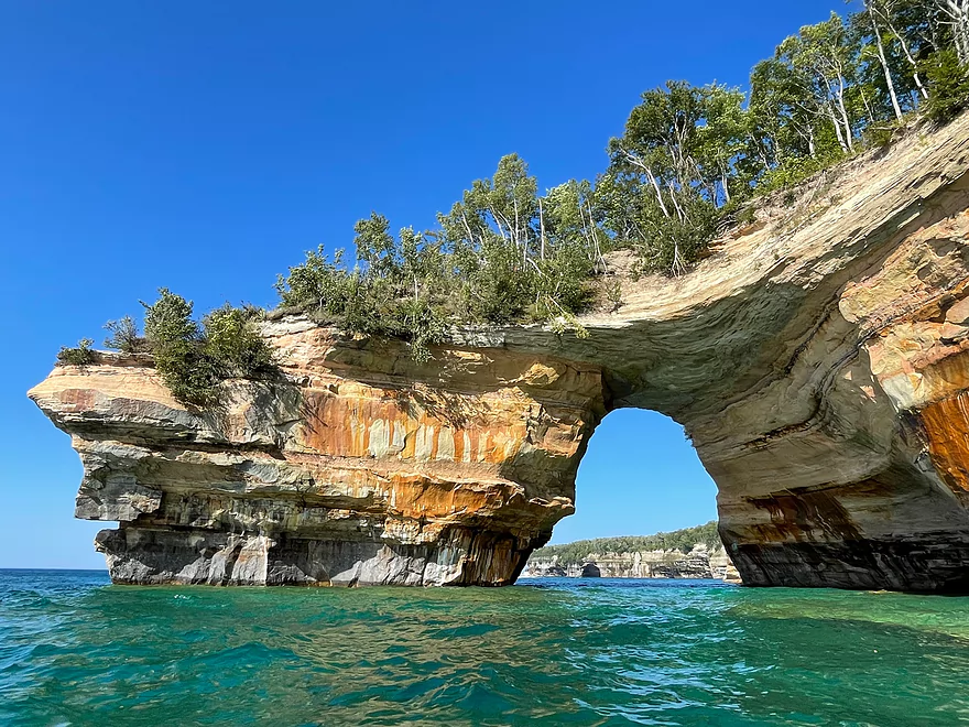
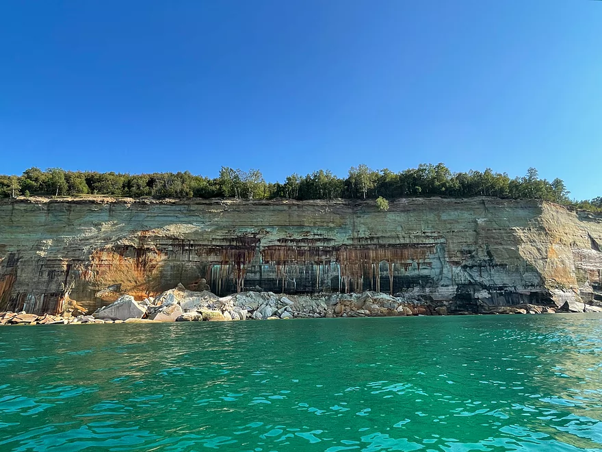
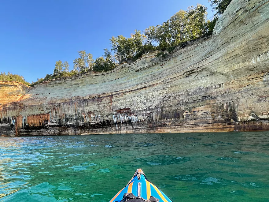
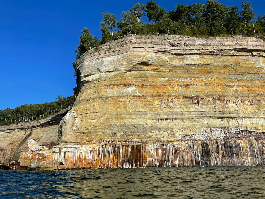
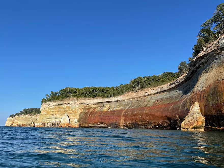
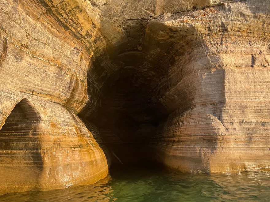
Approaching Lover’s Leap
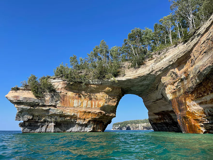
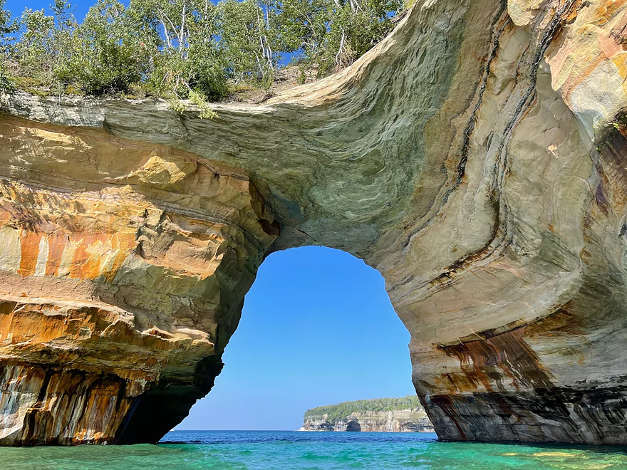
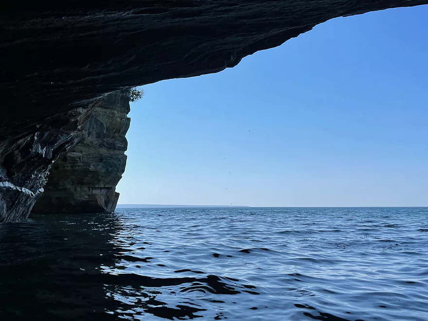
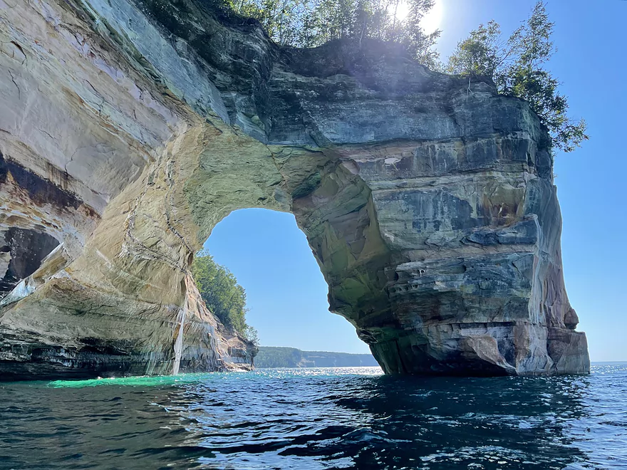
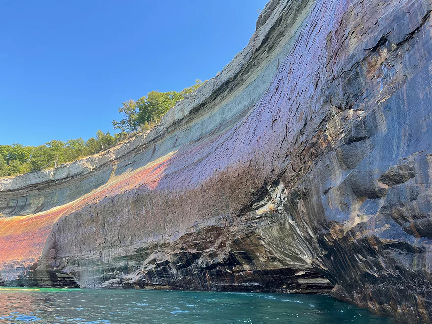
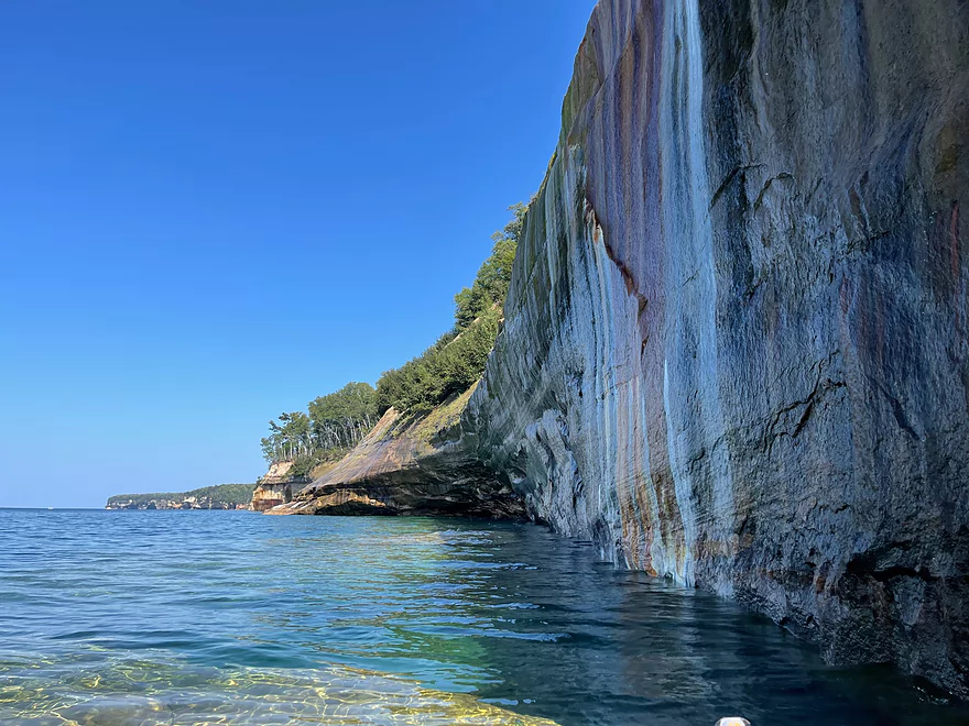
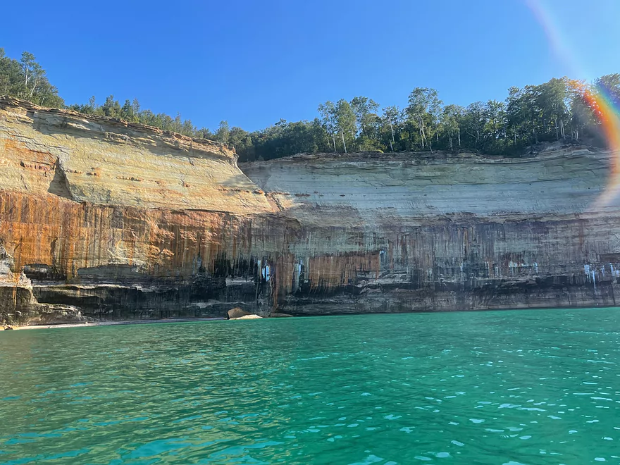
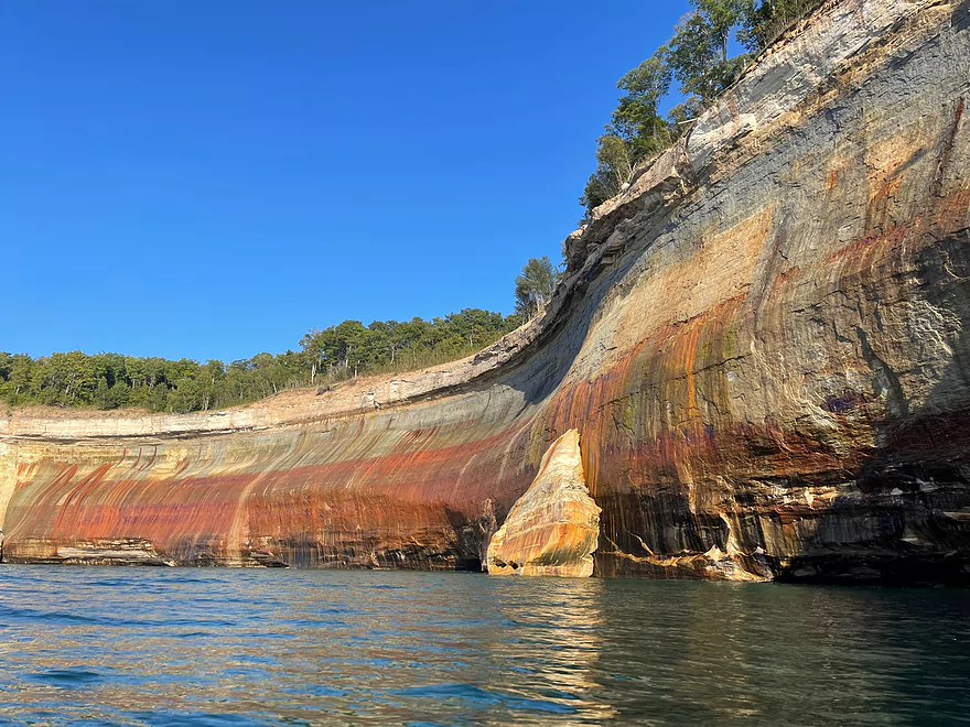
Lover’s Leap looking west
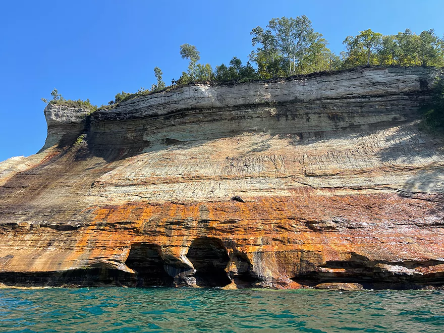
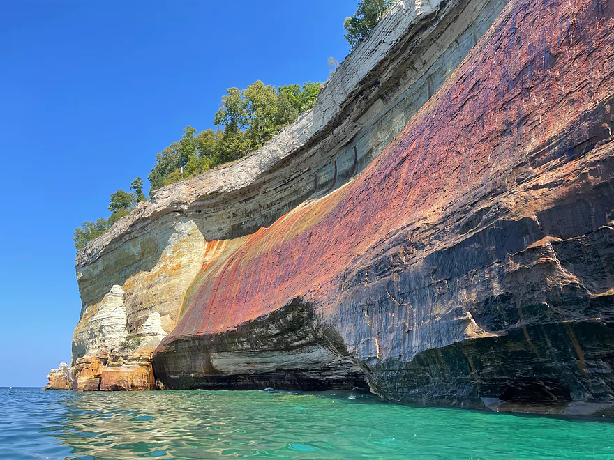
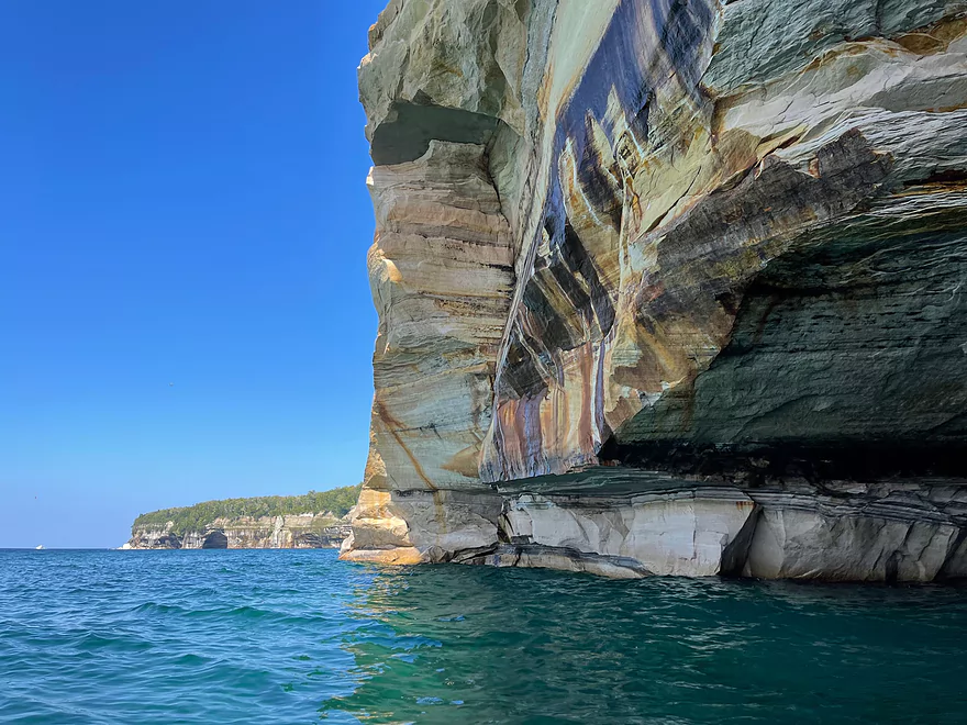
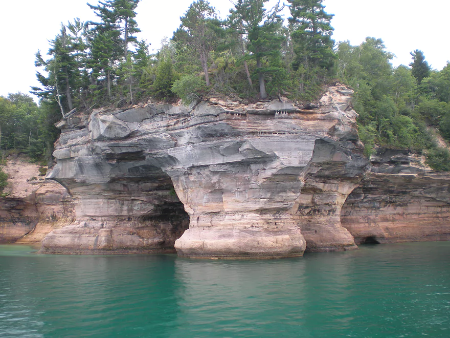
Approaching Miner’s Castle
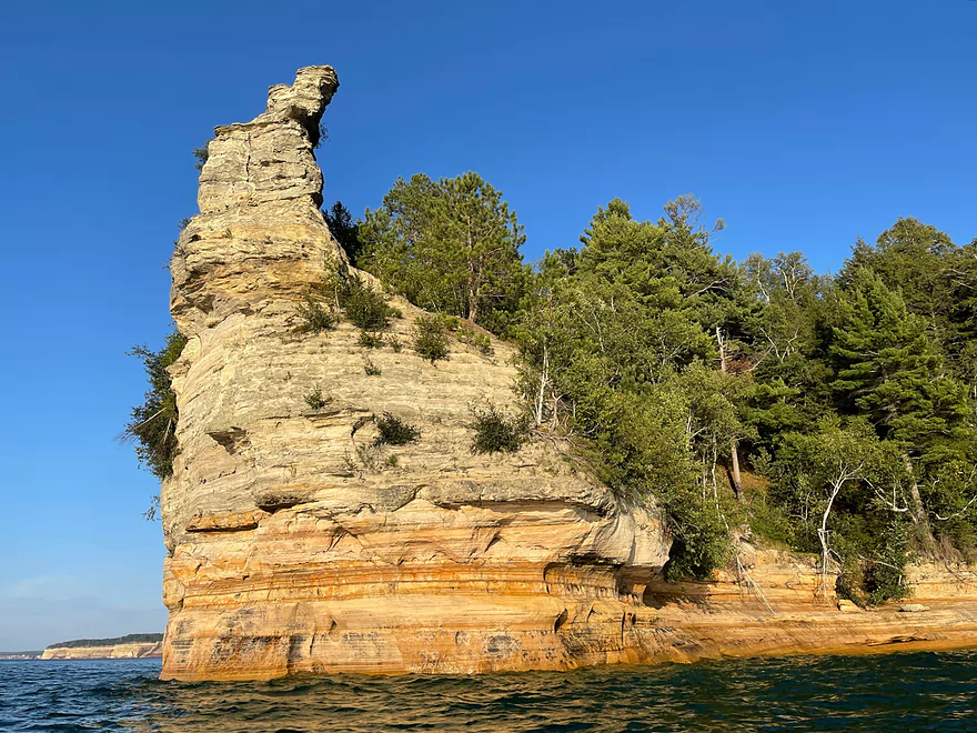
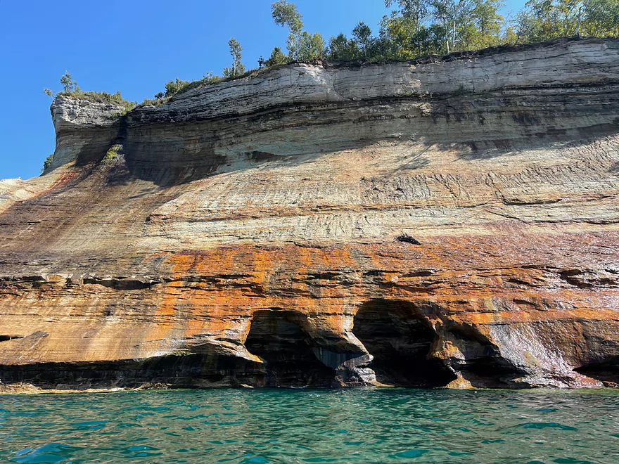
Miner’s Castle looking east
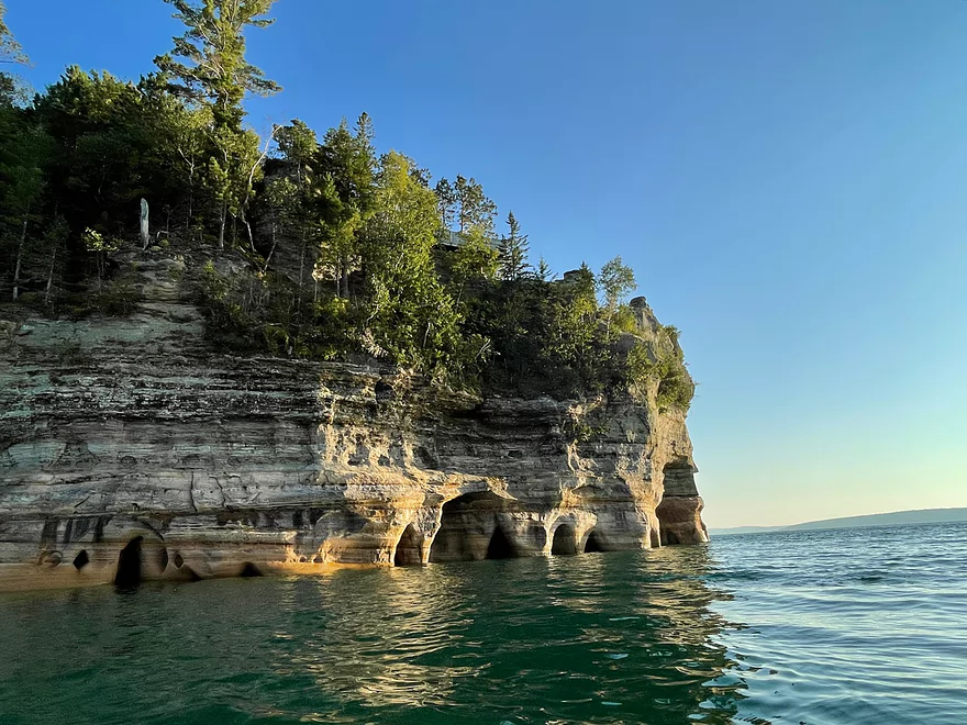
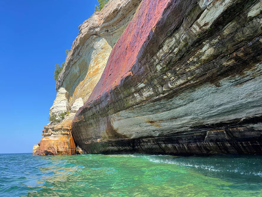
Miner’s Castle looking west
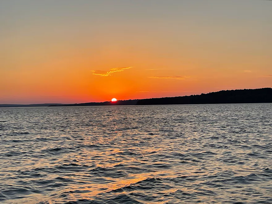
Sunset at Sand Point
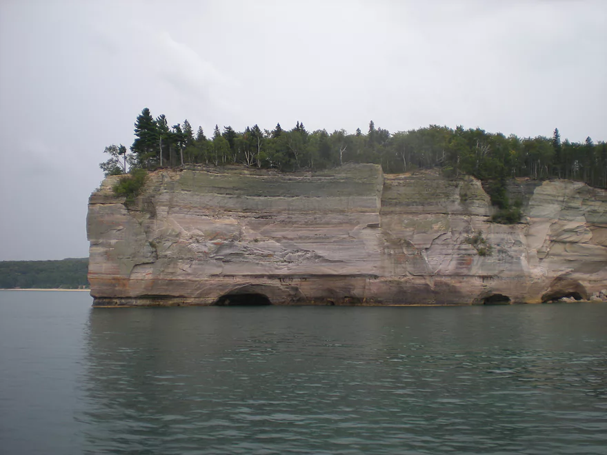
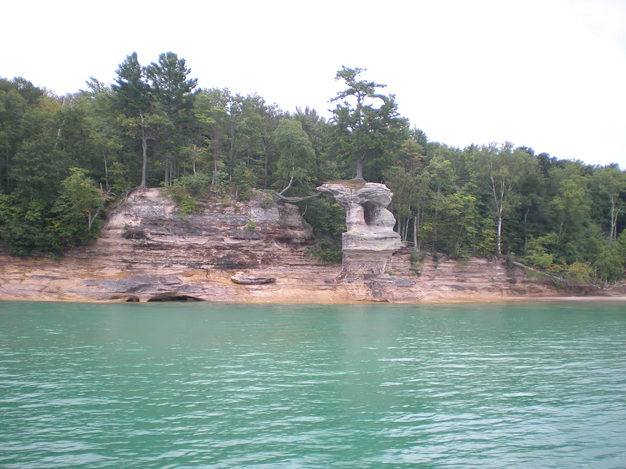
Additional reference photos from the webmaster, mostly beyond Lover’s Leap…this is Indian Head Rock
Battleship Rock
Chapel Cove
Chapel Rock
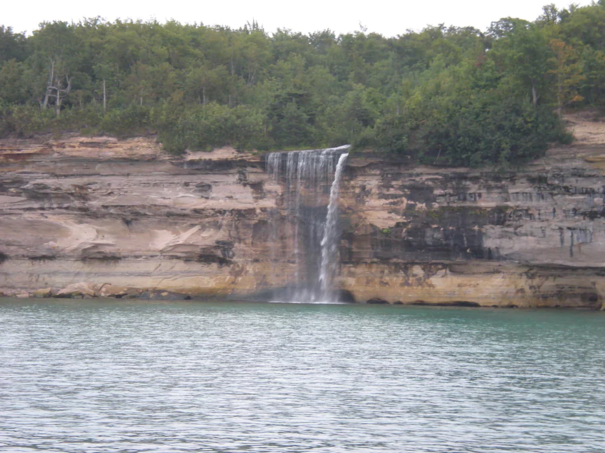
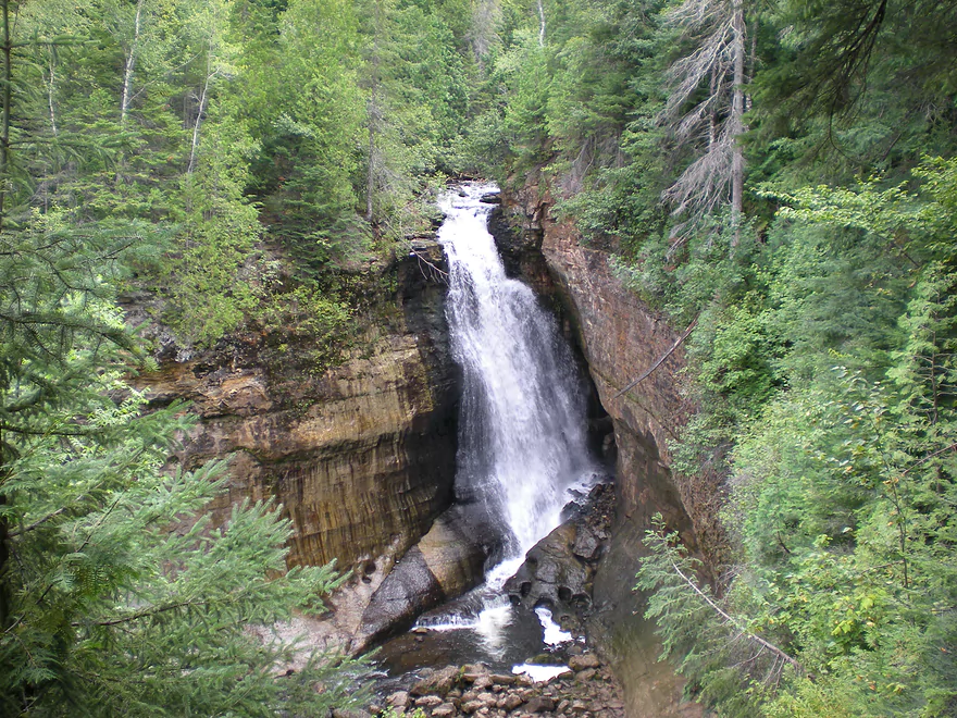
Spray Falls
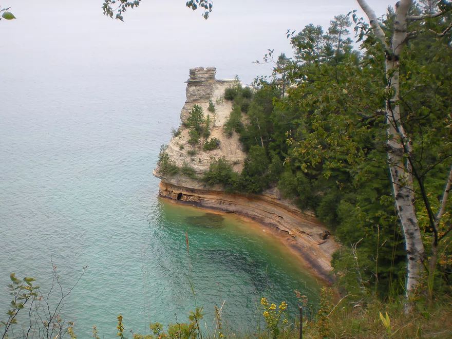
View of Miner’s Castle from an overlook above the formation
Munising Falls
Pictured Rocks National Lakeshore

Pictured Rocks is a challenging, yet rewarding kayaking experience. The conditions need to be just right and it’s better tried in late summer when the water is warmest.
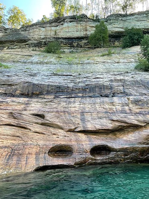
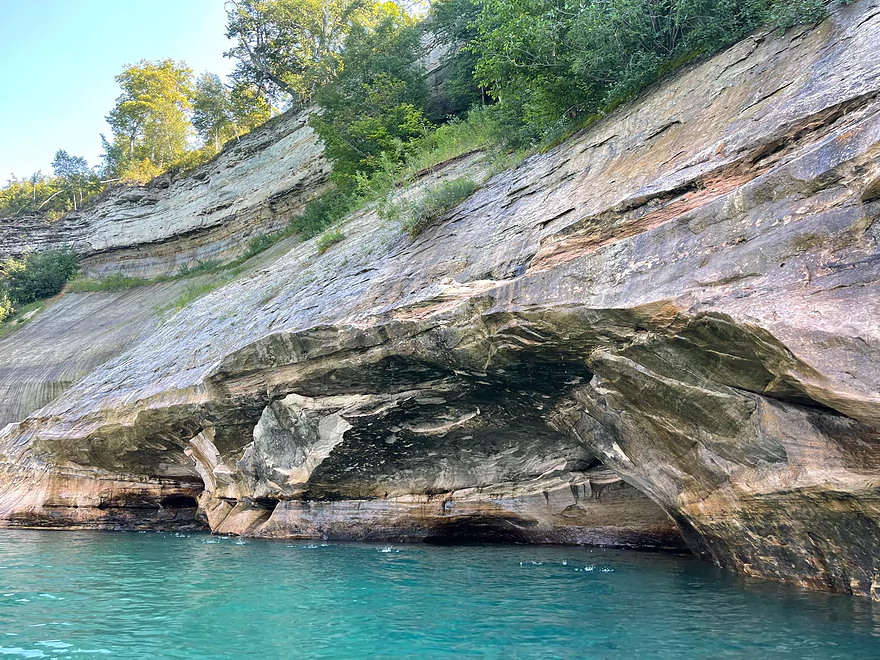
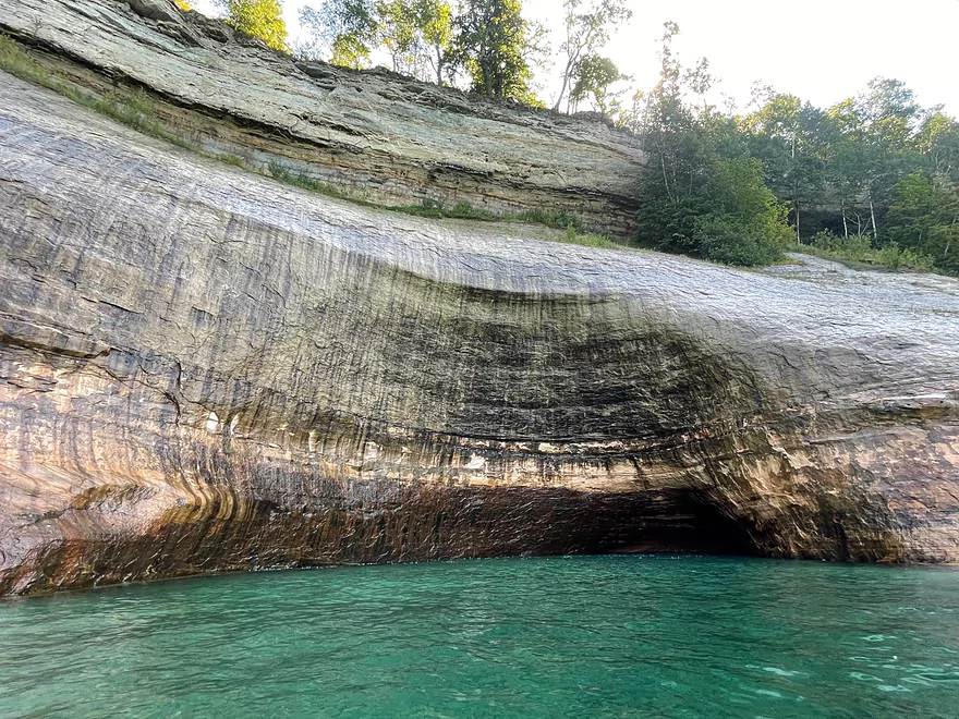
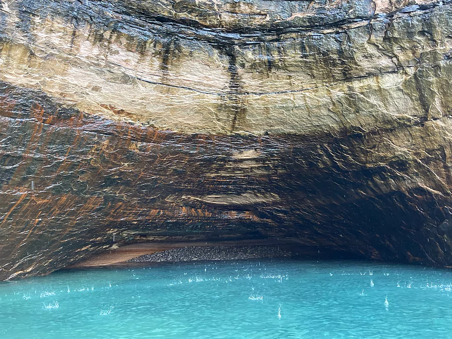
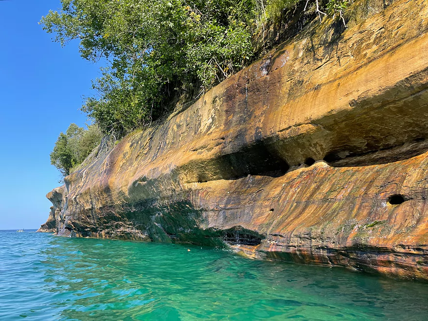
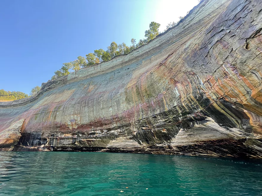
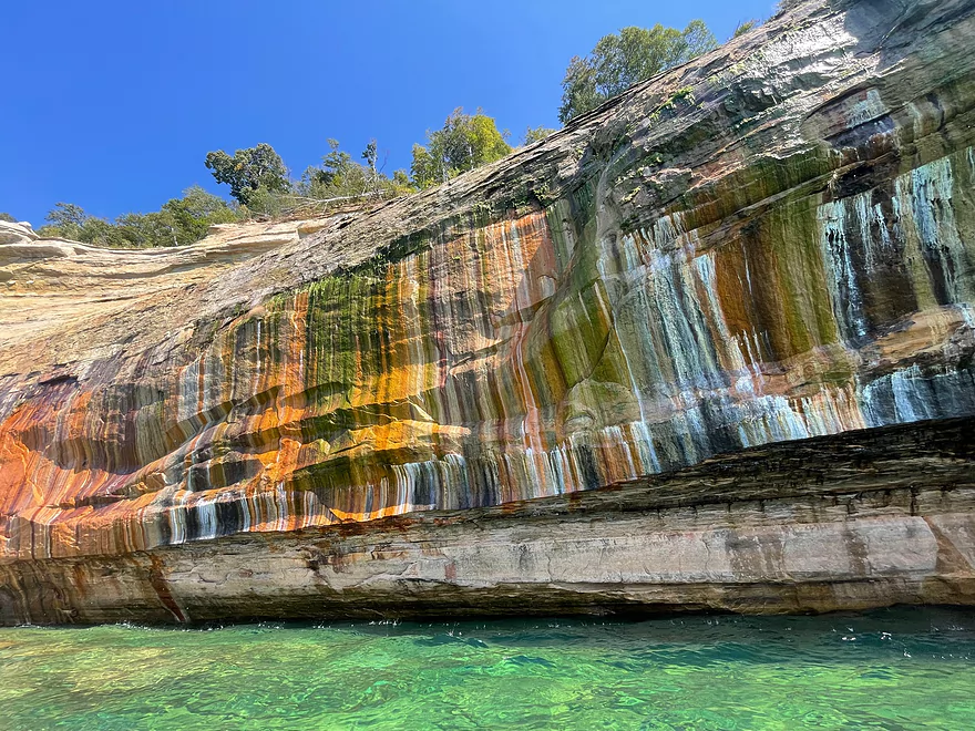
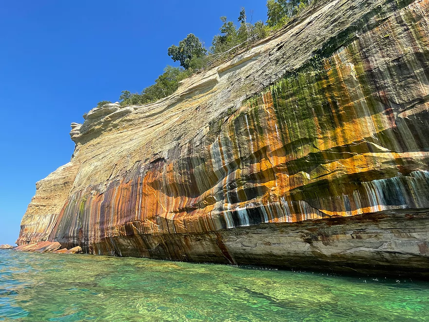
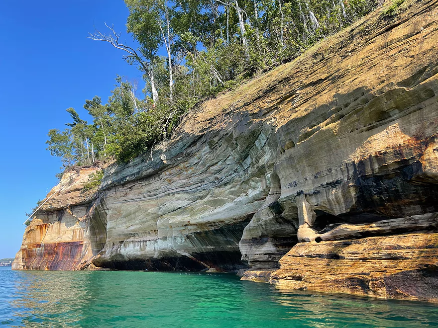
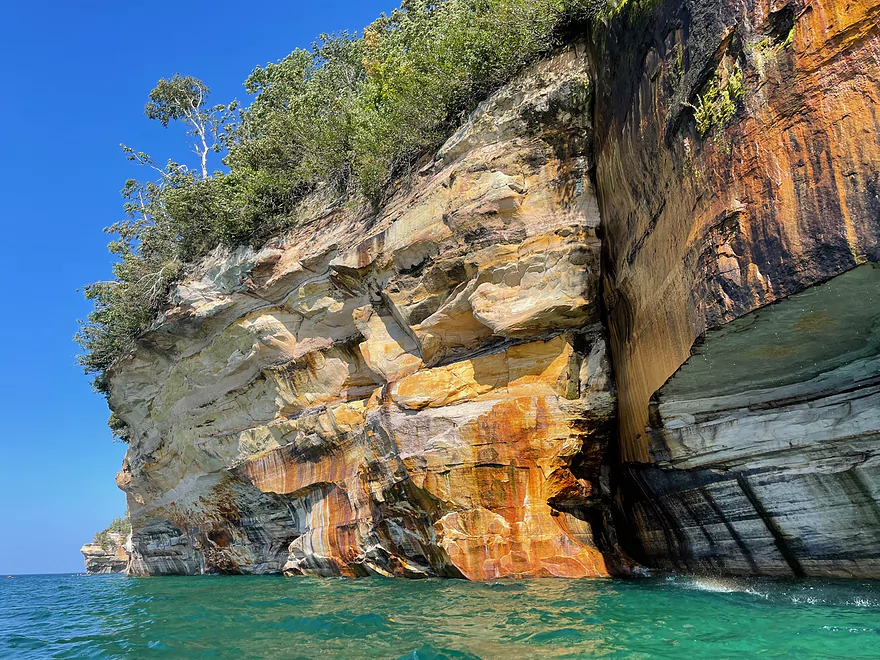
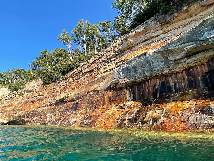
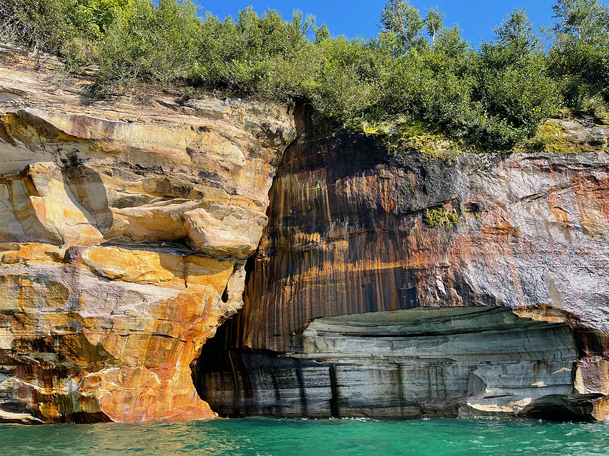
The trip started at Miner’s Beach which requires an 800 foot carry to the beach. The trip started by heading east which starts out with the beach. After paddling about 1/2 mile, the rocks appear and the cliffs rise in elevation. There are a few sea caves that can be entered with water dripping from the ceilings. Water is constantly seeping out of the cliff walls. The colors become more vivid as the trip continues east. There is a break in the cliffs at Mosquito Beach which is a popular rest stop. Lover’s Leap is visible in the distance.
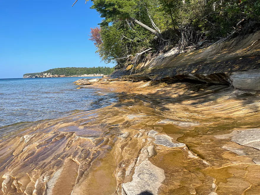
Lover’s Leap was the highlight of the trip with the huge arch and natural bridge that rises 140 feet above the water. The cliffs continue for many more miles to the east which may be tempting to paddle. However it is a 4 mile paddle back to Miner’s Beach and a grueling trip back awaits so the trip turned back west. On the return trip, there was a stop at a rocky beach and the colors changed with different sun angles. After approaching Miner’s Beach the trip continued to Miner’s Castle just to the west of the beach. After paddling around the famous rock formation the trip ended where it started 5 hours earlier.
Overall the trip is challenging paddling in Lake Superior, but the sights are some of the most spectacular that can be seen during a kayaking trip.
Thanks Peter for the review! WisconsinRiverTrips.com is always very appreciative of guest reviews, and if you the reader is ever interested in submitting one, you can use this online form.
Note to readers. This Pictured Rocks review supplants a previous review that had become outdated. I (the webmaster) have added some additional information below on Pictured Rocks to help paddlers plan a trip along Pictured Rocks.
Wind: Lake Superior obviously lacks cover, so wind can be a major problem. Kayakers should carefully monitor forecasts and avoid the lake if winds are stronger than say 7 MPH. There are many wind/forecast websites out there…I like Windy.com. Note, typically winds are calm in the morning and build up by the afternoon. It can be worth it to set an alarm clock for an early start to beat the winds. Also strong winds usually correlate with big waves….especially if the winds are blowing toward shore which allows the waves to grow for long distances.
Cold Water: Lake Superior is infamously cold…especially further away from shore. July to October are the ideal times to paddle the lake. Outside of that, the lake will be too cold for most paddlers. Even in later summer, Lake Superior away from the beaches and coves won’t be much above 50 degrees. Protective clothing (mostly neoprene) is highly recommended. I’m a big fan of NRS apparel especially their hydroskins. NOAA does feature an experimental water temperature forecast which you can see here.
Waves: Paddlers should stay off the Great Lakes when there are decent waves. Ideally wave height should be less than 1′. You can check wave heights from a number of sources:
Distance: Much of the Pictured Rocks Lakeshore is very steep, with few spots to get out for a break or to recover from an emergency. Paddlers should carefully study the maps and know where the beaches and break areas are. Also paddlers should be careful not to plan trips that are too long.
Splash Protection: Paddlers may want to consider a half-skirt or full-skirt to keep water from splashing into their cockpit. A simple bone sponge is also recommended to remove water. The best way to keep splashing waves out of your boat though is to simply time your trips when Lake Superior is calm.
Rock slides: If paddlers are extraordinarily lucky, they may get to see a rock slide.
- 2019 rock face collapse video – drone video
- 2019 rock face collapse video – kayak video
- 2021 rock face collapse video
There are a number of campsites along the shore. Some can only be accessed by kayak and some via the “North Country Scenic Trail”. Many of the campsites lack amenities and are a long hike or paddle from civilization. Prepare carefully before doing a camping trip. Also note, the National Park Service has created countless rules for camping. For starters, you must obtain a backcountry camping permit before you use any campsites. Here is an expanded list of rules and a map of campsites.
- Pictured Rocks Kayaking: This is a unique service that stores the kayaks on a larger boat. When you get close to the cliffs, you do an off-shore launch with your boat and are able to get very close to the cliffs. They feature a short tour by Miners Castle. But they also feature an “Ultimate Kayak Tour” that launches by Painted Coves and includes Lover’s Leap and Chapel Rock. This is the best way to kayak the cliffs, but they are weather dependent and expensive (adult costs $168).
- Pictured Rocks Cruises: They offer boat tours for much of the coast. This is an easy way to see the cliffs…but a kayak can still get closer to the cliffs and provide a more immersive experience.
- Munising Kayak: They offer multiple trips including Miner’s Beach to Lover’s Leap. Their website is down, so hopefully that doesn’t mean they are out of business.
- Paddling Michigan: They offer guided kayak tours of the cliffs.
- Yooper Yachts: They offer guided kayak tours of the cliffs.
- Northern Waters Adventures: Kayak rental option along the lake shore.
- UpVacation.com: These guys offer kayak rentals and mostly service the local rivers and lakes. They do however offer trips by Paradise Caves in good weather. Paradise Caves feature ok cliffs but aren’t as the nice as the ones to the east.
- Northwoods Canoe & Kayak Rentals: This is a kayak/shuttle service for the Au Train River. The rivers and lakes are good backup plans in case Lake Superior gets too rough.
- Au Train River Kayak Rentals: Another Au Train River rental option.
- Superior Pontoon Rentals: Renting a pontoon boat is one way to explore the cliffs.
- Seaberg Pontoon Rentals: Another pontoon option.
- Grand Island South Ferry Terminal to Munising Municipal Boat Ramp: 2.0 miles. West edge of South Bay.
- Munising Municipal Boat Ramp to Anna River Fishing Pier: 1.4 miles. South edge of South Bay which includes the city of Munising.
- Anna River Fishing Pier to Sand Point Beach: 3.6 miles. East edge of South Bay. Mostly developed with many shore side homes. Sand Point has a north and west access, and is a convenient staging location to reach Grand Island.
- Sand Point Beach to Miner’s Beach Access: 4.5 miles.
- Sand Point Beach to Miner’s Castle Rock: 4.1 miles. Some ok cliffs. But the cliffs northeast of Miner’s Castle Rock are way better.
- Miner’s Castle Rock to Miner’s Beach Access: 0.4 miles. Short stretch of beach.
- Miner’s Beach Access to Twelvemile Beach Road Access: 20.3 miles. A long span between public put-in and take-out options.
- Miner’s Beach Access to Elliot Falls: 0.5 miles. Another short stretch of beach.
- Elliot Falls to Bridal Veil Falls: 0.8 miles. Start of the best cliffs on the lake shore.
- Bridal Veil Falls to Mosquito Beach: 1.9 miles. Fantastic stretch of cliffs.
- Mosquito Beach to Lover’s Leap: 0.7 miles. Scenic stretch of cliffs. Lover’s Leap is a fantastic rock bridge you can paddle under…the most iconic part of the lake shore.
- Lover’s Leap to Indian Head Rock: 1.7 miles. Scenic stretch of cliffs.
- Indian Head Rock to Battleship Rock: 0.9 miles. Scenic stretch of cliffs.
- Battleship Rock to Chapel Beach: 0.7 miles. Scenic set of cliffs with multiple inlets including Chapel Cove.
- Chapel Beach to Spray Falls: 1.7 miles. Scenic stretch of cliffs. Highlights include Chapel Beach Falls, Chapel Rock, and Spray Falls.
- Spray Falls to Big Star Cove: 1.7 miles. Cliffs start to wind down.
- Big Star Cove to Twelvemile Beach Road Access: 9.7 miles. This is mostly “Twelvemile Beach”, a nice long beach with numerous camping options.
- Big Star Cove to Beaver Creek Campground: 1.4 miles.
- Beaver Creek Campground to Pine Bluff Campground: 1.2 miles.
- Pine Bluff Campground to Sevenmile Campground: 4.0 miles.
- Sevenmile Campground to Twelvemile Beach Road Access: 3.1 miles.
- Twelvemile Beach Road Access to Hurricane River Campground Access: 2.3 miles. Last stretch of Twelvemile Beach. Does include an overlook accessible by car.
- Hurricane River Access to Grand Marais Public Beach: 9.6 miles.
- Hurricane River Access to the Au Sable Light Station: 1.4 miles.
- Au Sable Light Station to Sable Falls: 6.8 miles. Section parallels the famous Grand Sable Dunes. These are impressive and rise 300′ above the water.
- Sable Falls to Grand Marais Public Beach: 1.4 miles.
- Grand Marais Public Beach to Bayshore Park: 2.2 miles. Another Grand Marais take-out would be to wrap a few miles around the harbor and take out inside West Bay.
Note also…paddlers can paddle out to Grand Island which is scenic and features sea caves on the eastern shore. To go from Sand Point to Trout Bay and back would be roughly an 11 mile trip. Here’s more information.
- Sand Point Beach (pictures): Gorgeous beach and a great way to access Grand Island.
- Miner’s Castle Rock (pictures): Iconic rock peninsula. There is a great view of this from the public overlook to the south.
- Miner’s Beach (pictures): Great beach and a nice staging area for accessing the cliffs.
- Elliot Falls (pictures): Small set of waterfalls located by Miner’s Beach.
- Bridal Veil Falls (pictures): Cool waterfall that flows over a long slanted cliff.
- Mosquito Beach (pictures): Nice break area.
- Mosquito Falls (pictures): Attractive waterfalls on the Mosquito River. This requires a long hike to access.
- Chapel Falls (pictures): Really nice waterfall. Requires a long hike to access.
- Lover’s Leap (pictures): One of the most scenic features of the lakeshore. You can paddle under a large rock bridge.
- Indian Head Rock (pictures): Iconic rock face.
- Battleship Rock (pictures): Iconic rock face.
- Chapel Cove (pictures): Scenic set of cliffs with multiple inlets including Chapel Cove.
- Chapel Beach (pictures): Nice beach and break area. Camping is possible. Is preceded by Chapel Cove and followed by Chapel Rock and Chapel Beach Falls.
- Chapel Beach Falls (pictures): Scenic waterfall on the beach.
- Chapel Rock (pictures): Iconic rock pillar with a unique tree bridge that connects to another rock face.
- Spray Falls (pictures): Iconic waterfall which descends over a cliff.
- Big Star Cove (pictures): Popular and attractive cove. Is located next to a campsite.
- Twelvemile Beach (pictures): Very long beach. Numerous camping options.
- Au Sable Light Stations (pictures): Iconic lighthouse back-dropped by huge sand dunes.
- Grand Sable Dunes (pictures): Famous 300′ high sand dunes. The best view of the dunes is from Log Slide Overlook or from the water.
- Sable Falls (pictures): Scenic waterfall.
- Munising Falls (pictures): Waterfall.
- Alger Falls (pictures): Waterfall.
- Horseshoe Falls (pictures): Waterfall.
- Wagner Falls (pictures): Waterfall.
- Tannery Falls (pictures): Waterfall.
- Curtains Ice Climbing Walls (pictures): Popular ice climbing spot.
- Hiking Trails: There are many scenic hiking opportunities along the lakeshore. This includes day trips and also longer overnight trips along the 42 mile North Country Scenic Trail. Here is a map (zoom in to see the trails).
- Grand Island: You can take a ferry, boat, or kayak to the island where there is plenty to see.
Trip Map
Overview Map
Video
Photos Size: