
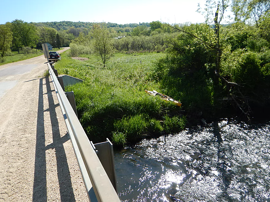
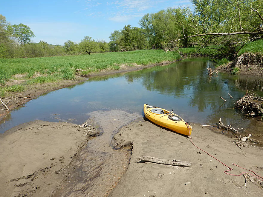
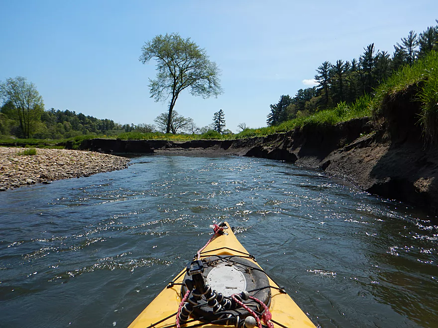
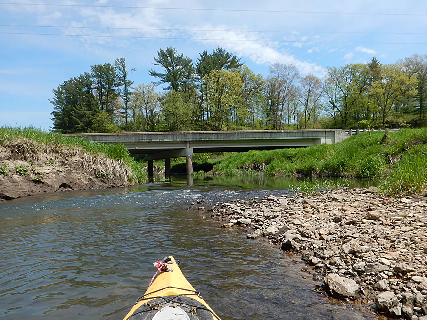
Launching by Quarry Road
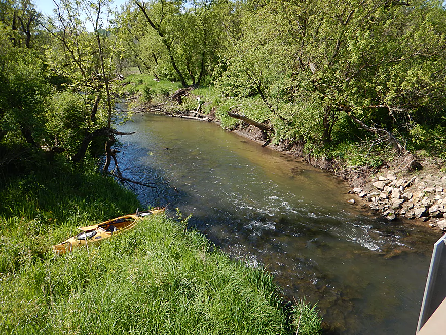
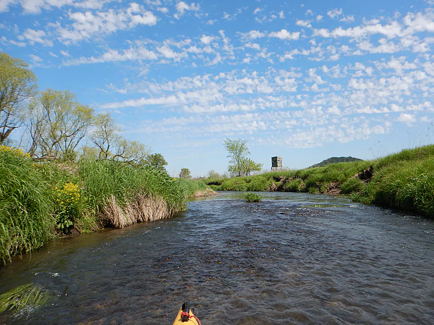
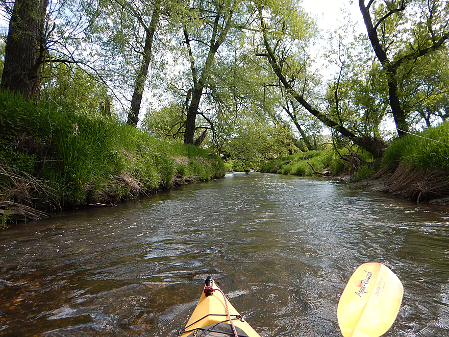
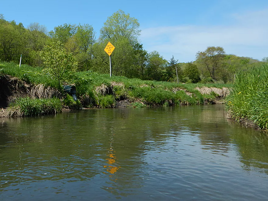
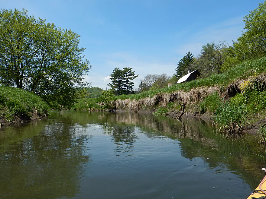
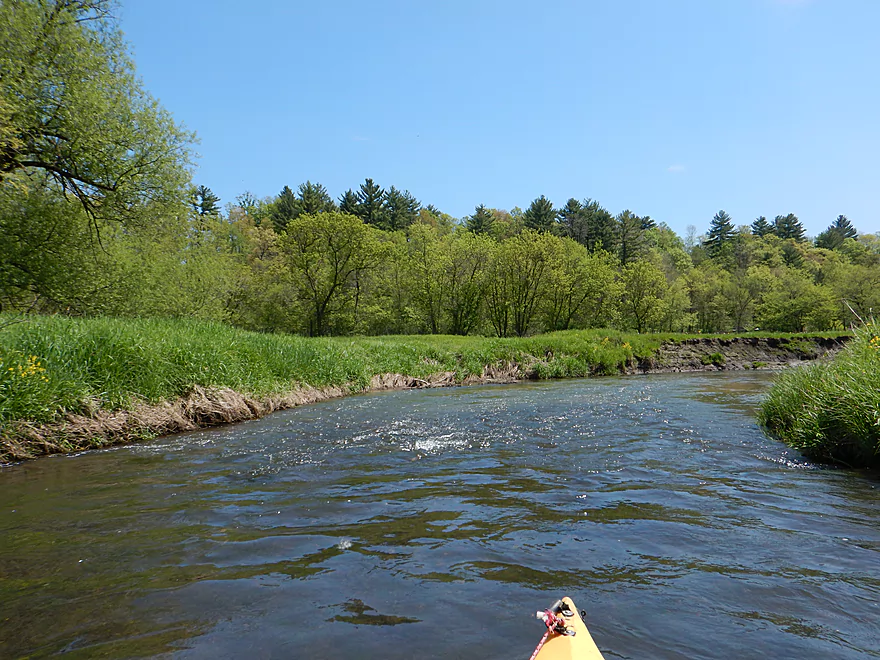
Scenic put-in
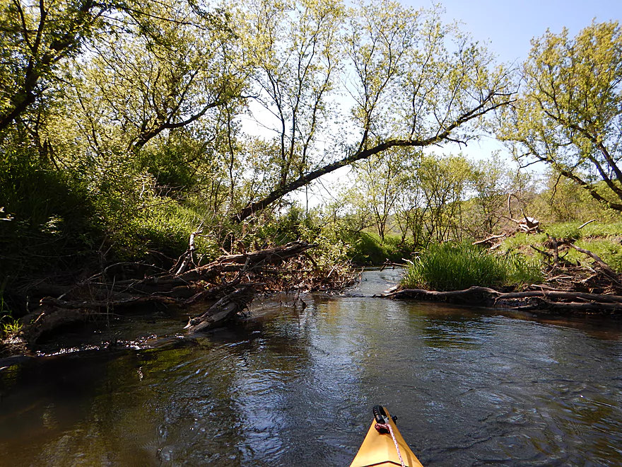
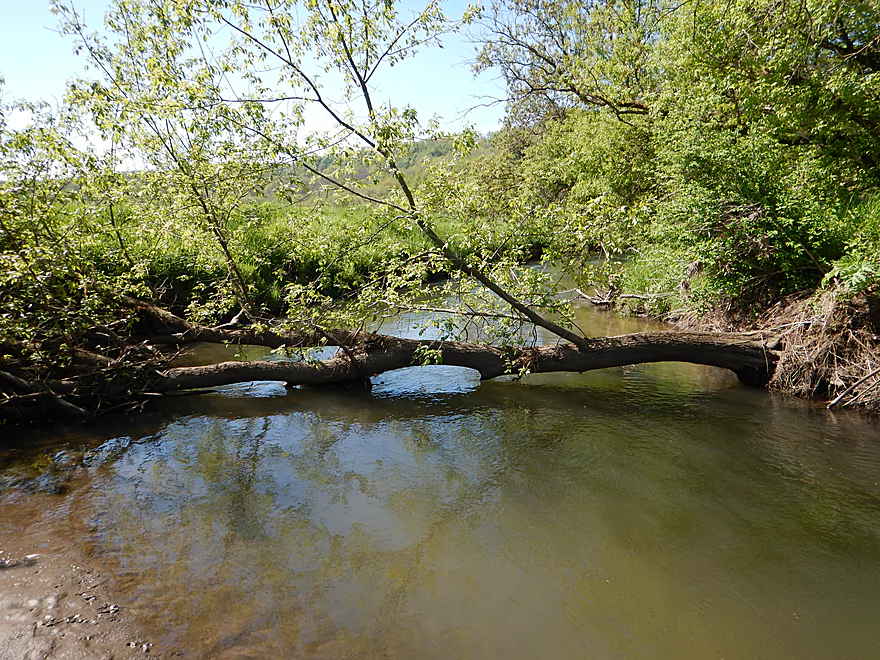
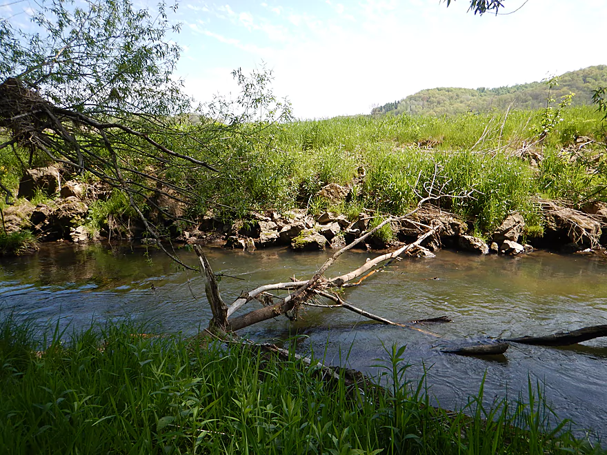
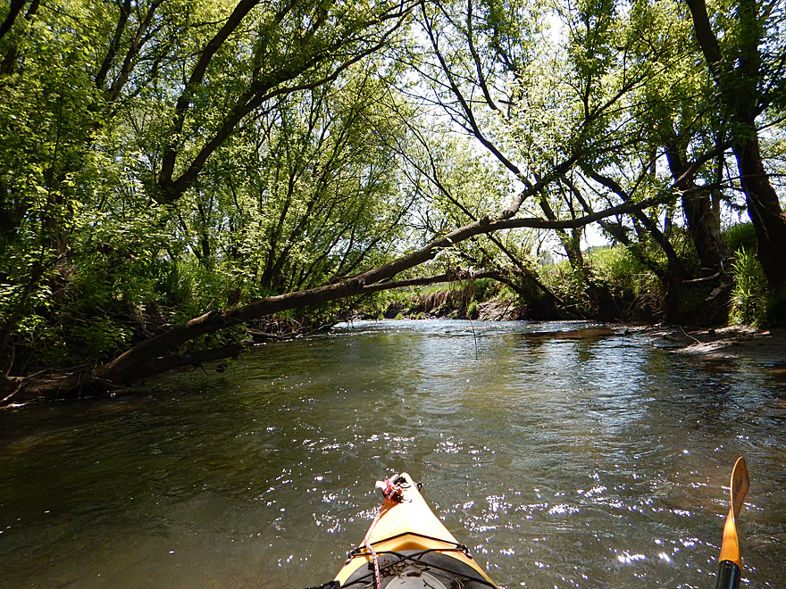
But then you encounter this
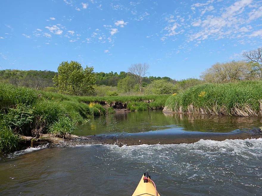
Lots of this
And then this…
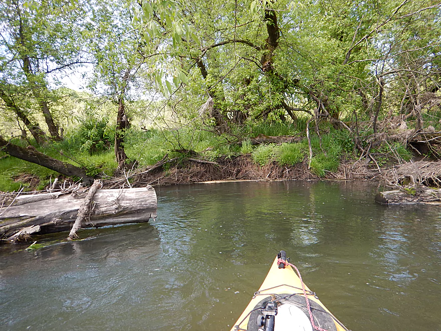
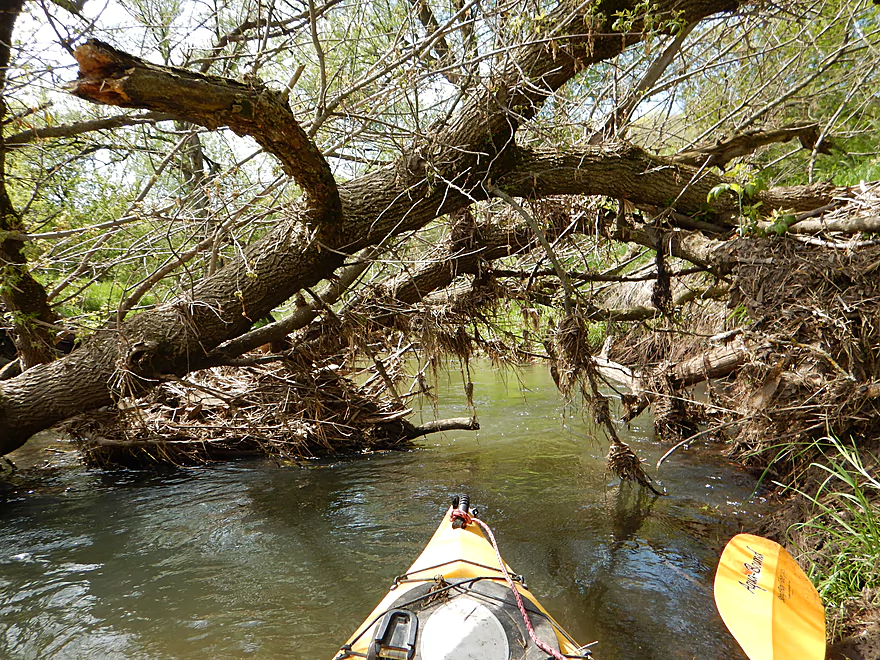
A manageable portage
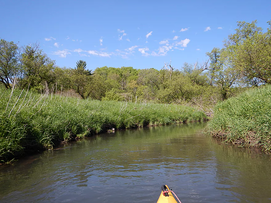
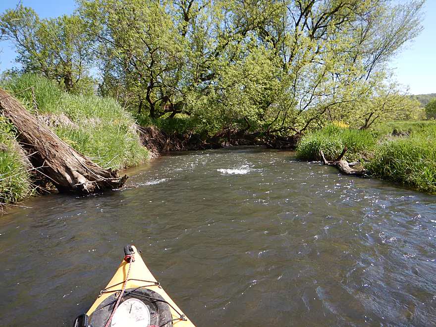
So much grass on this trip
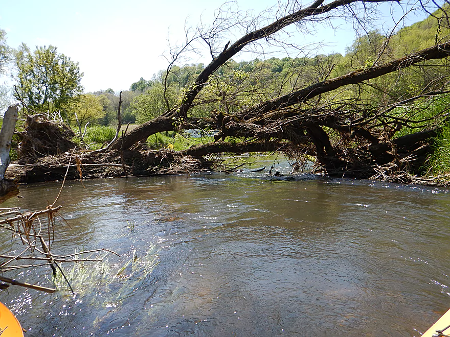
The second portage (more difficult)
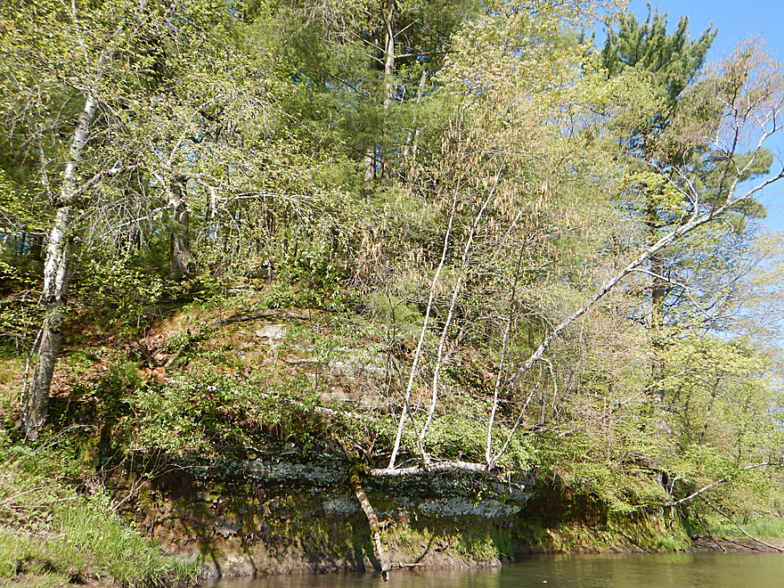
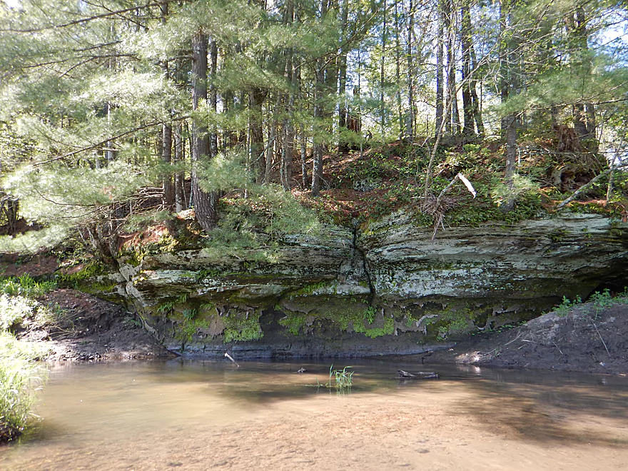
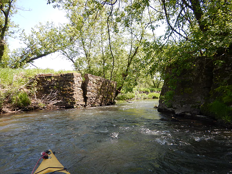
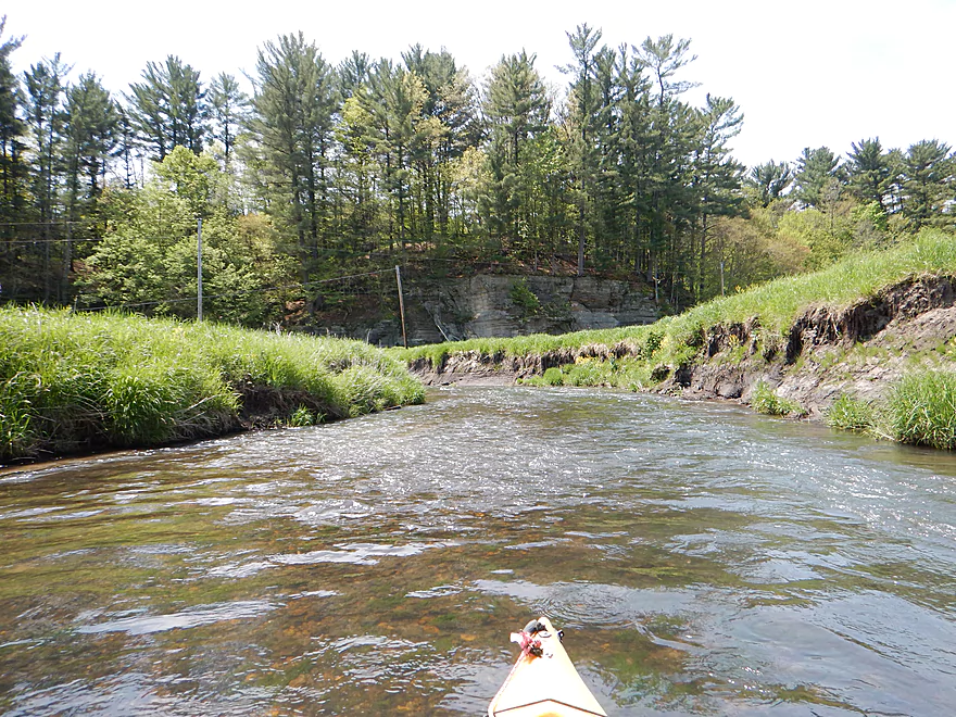
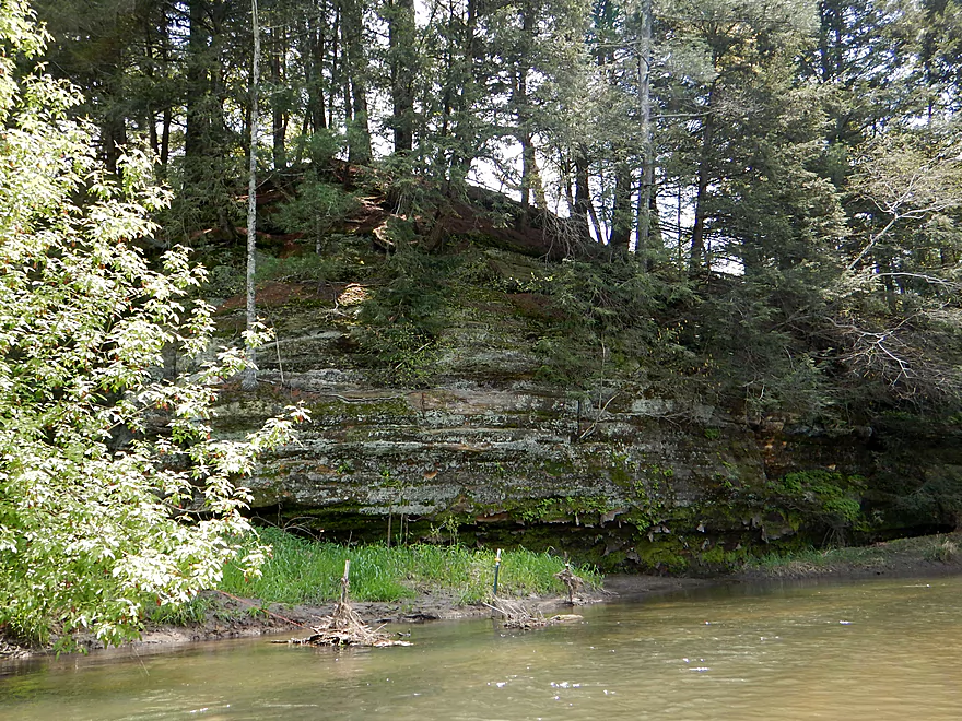
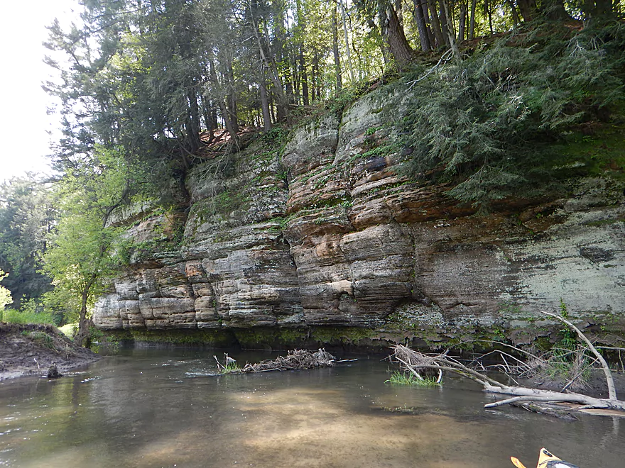
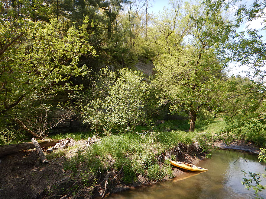
The first rock outcrop
Ok, but not large
Countless riffles on this segment
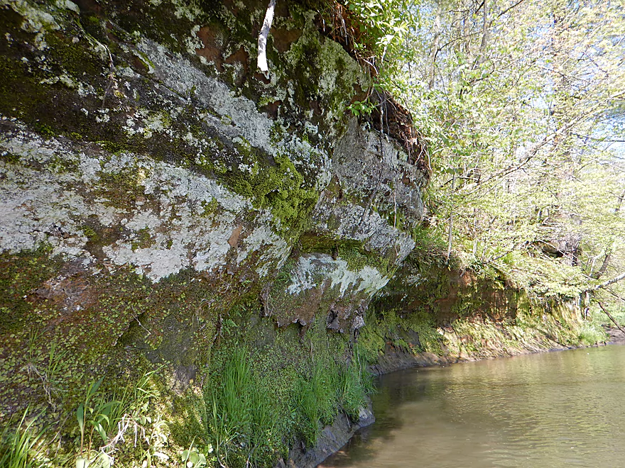
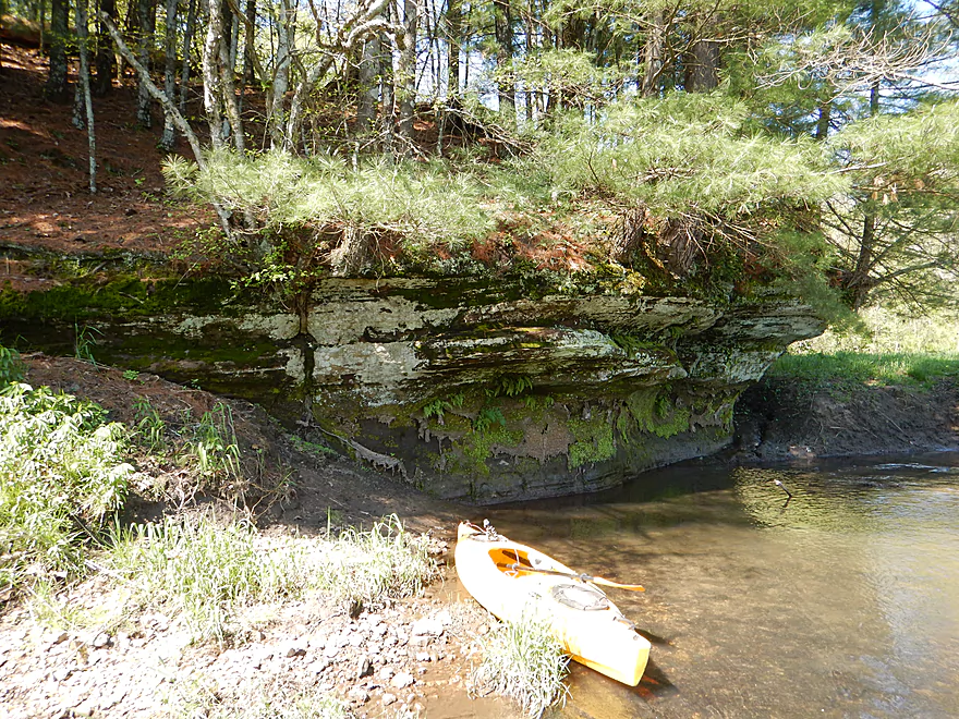
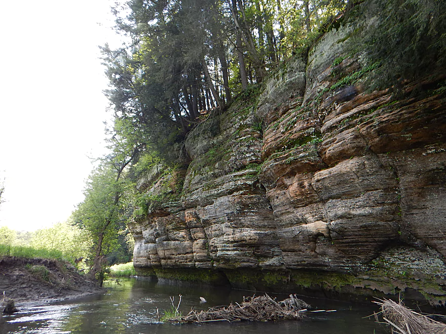
The second outcrop
Also not huge
But pleasant
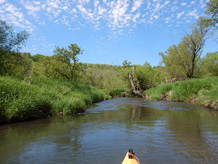
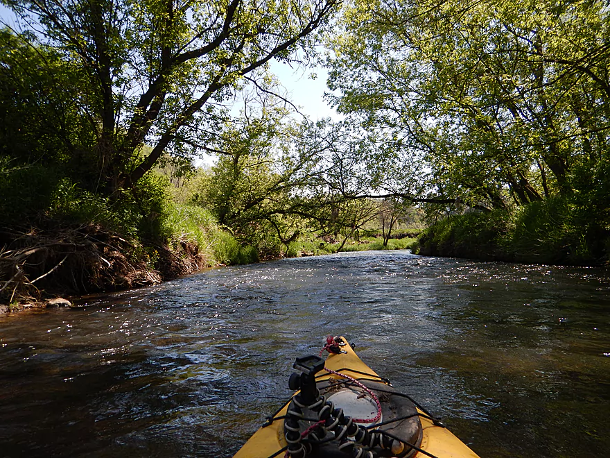
Creek starts to open up
A log dam (easy to get over)
Somebody has done some cleanup work on the river
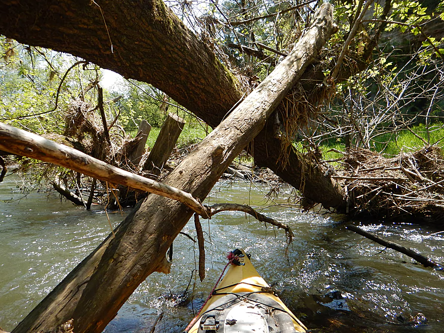
Lot of tight fits on this trip
Really nice red pebble substrate in some sections
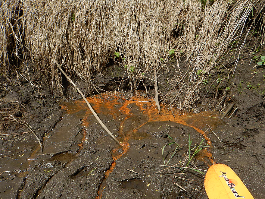
Something tells me the area is rich in iron
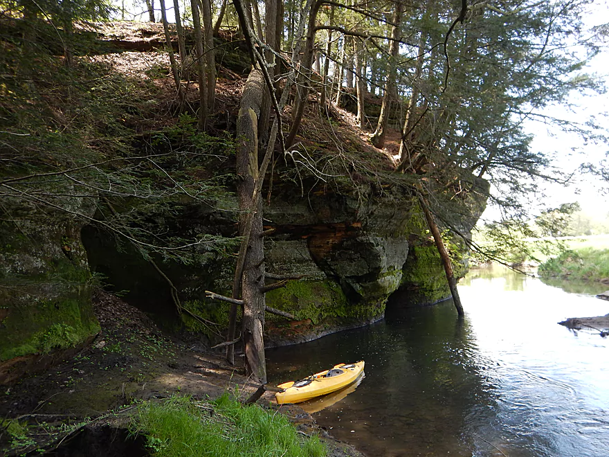
Time to get out…
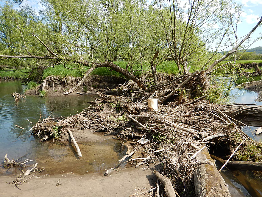
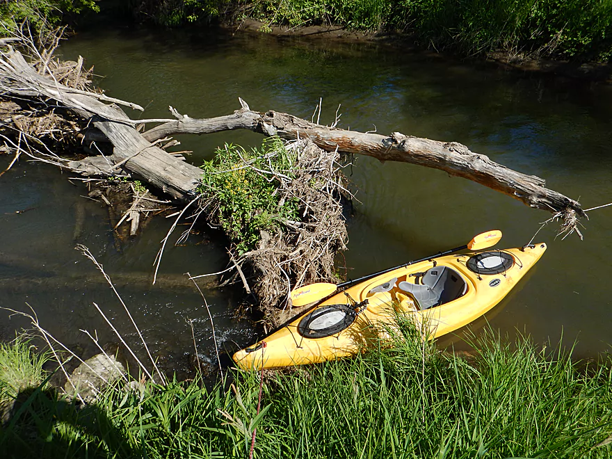
For portage #3
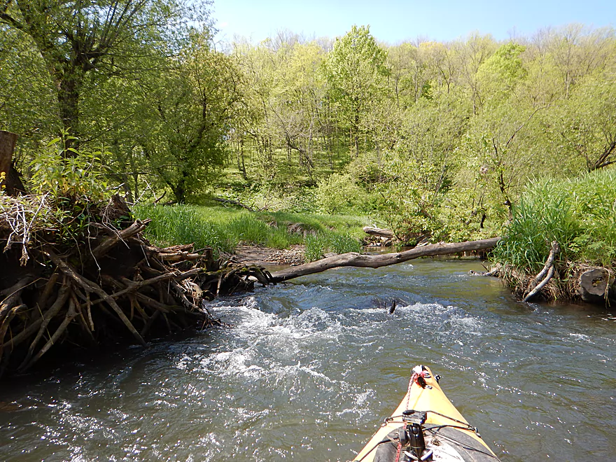
Right after is this tricky limbo stick
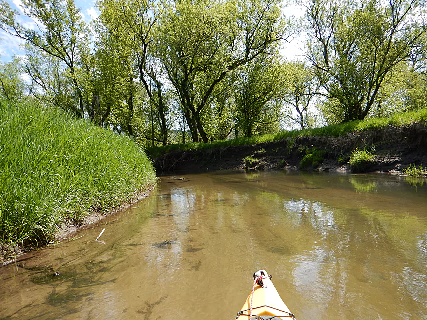
At times good clarity
Portage #4
By far, the easiest
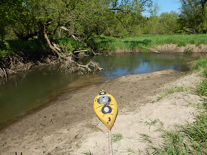
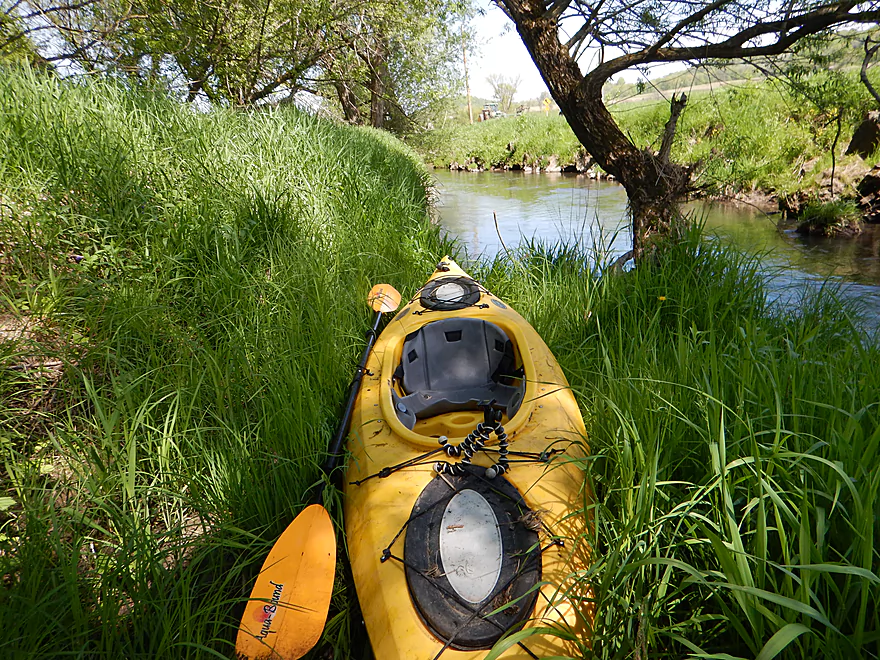
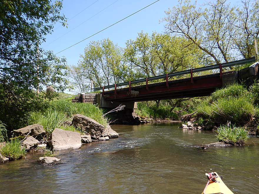
I suggest launching here at Hwy C (by the white fishing sign)
More limbo sticks in fast current
This creek can get very high
An old washed out bridge
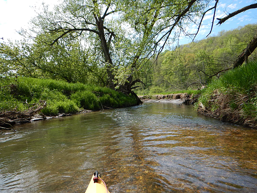
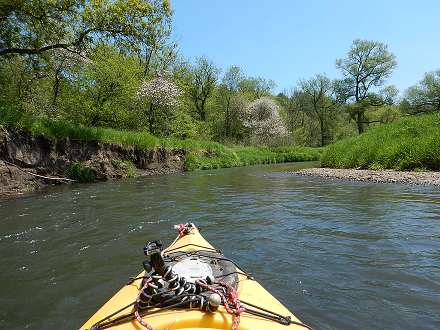
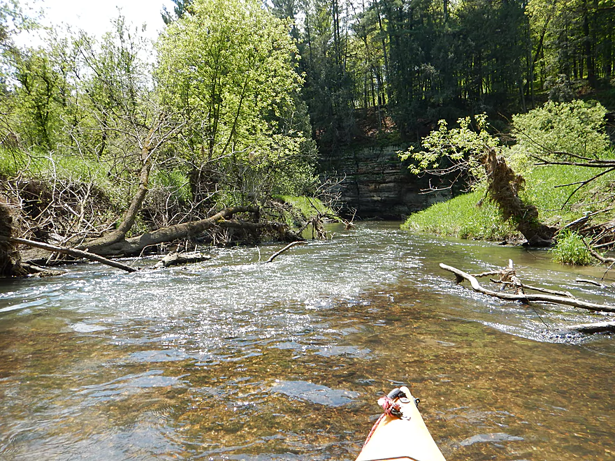
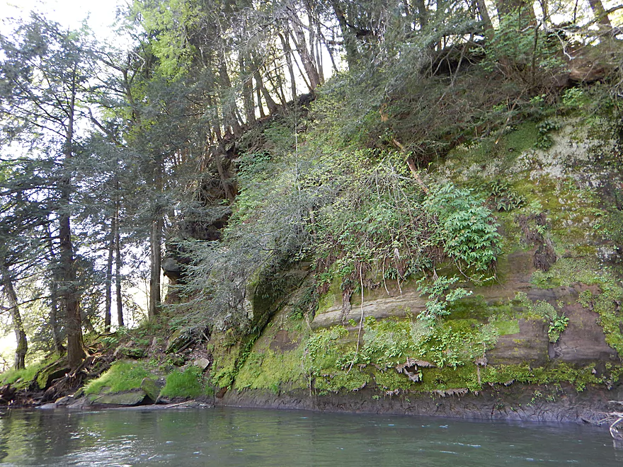
Entering a nice wooded section
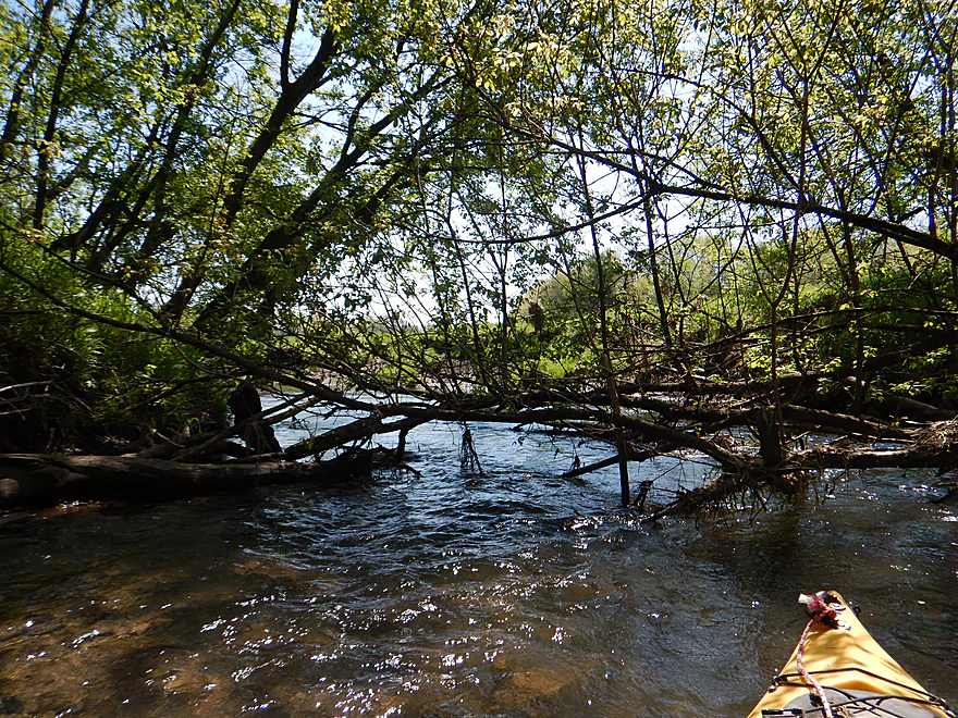
Getting under some of these branches is tough
Hatcher Lane
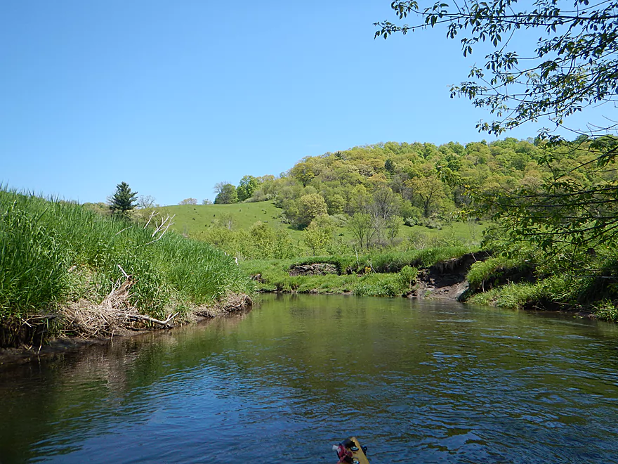
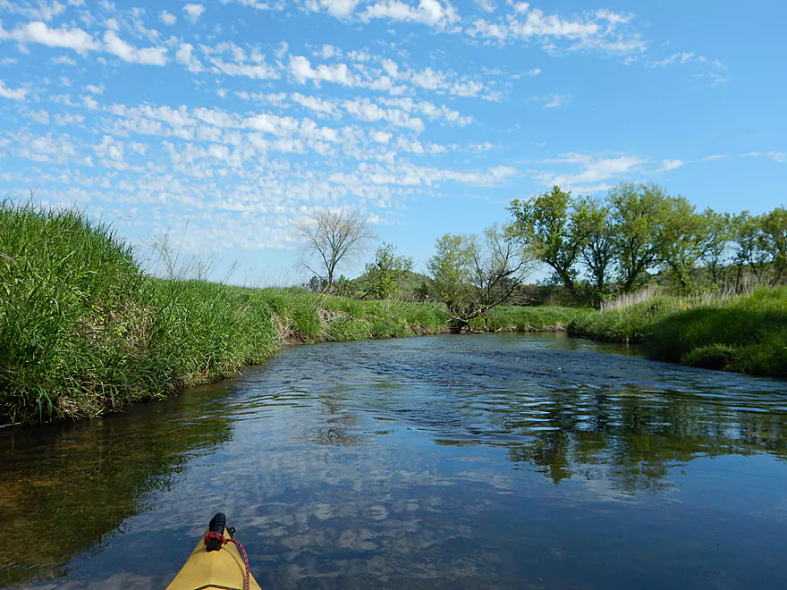
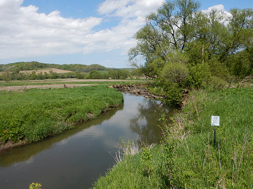
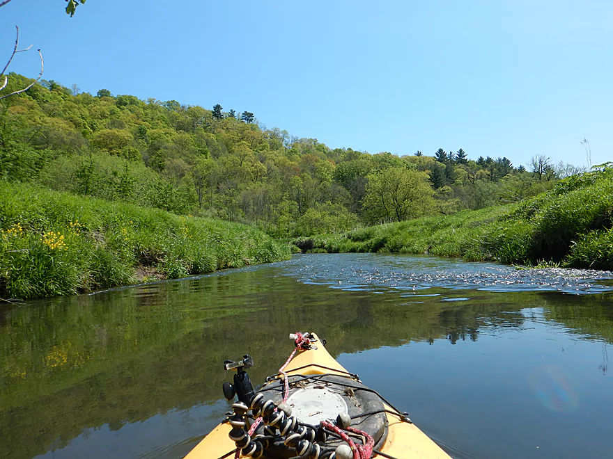
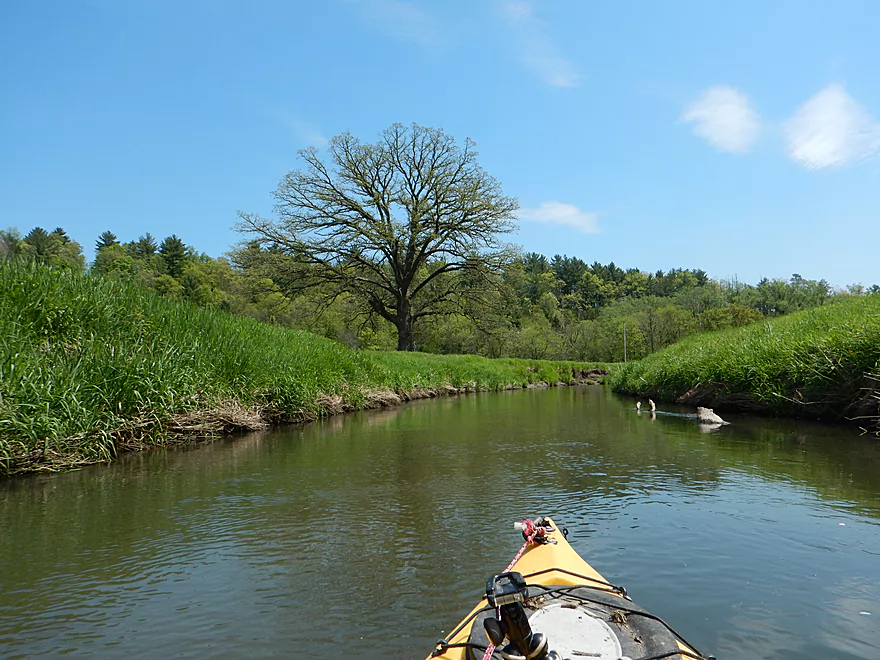
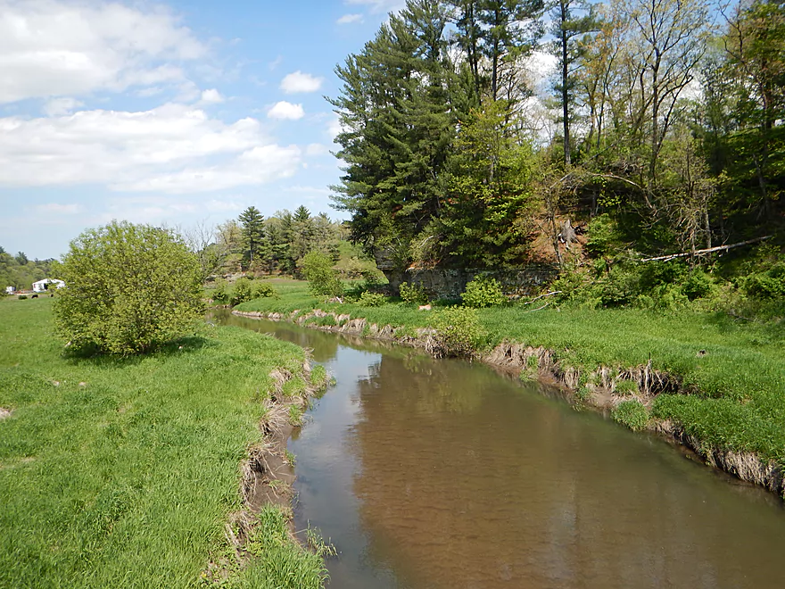
Finally, some driftless vistas
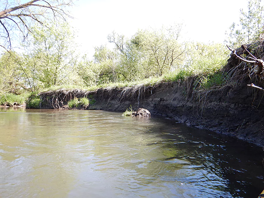
Still plenty of mud banks
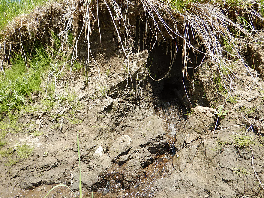
Like a blow torch, the seep has carved a hole in the mud
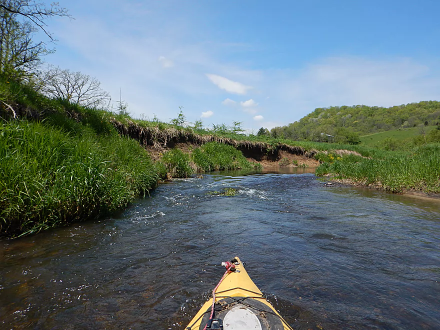
River stays fast
Entering a wide open section now
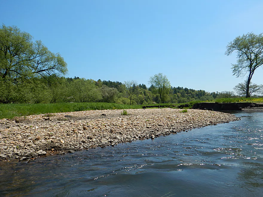
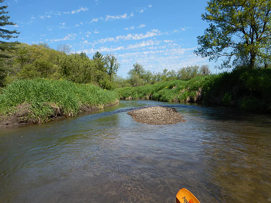
One of several gravel bars on the trip
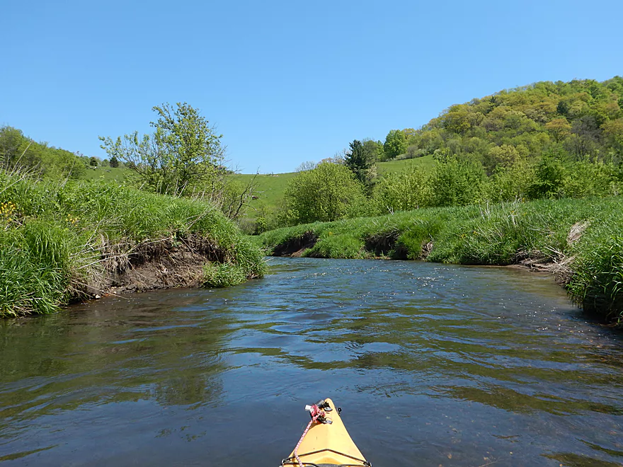
At times, this reminds you of a trout stream
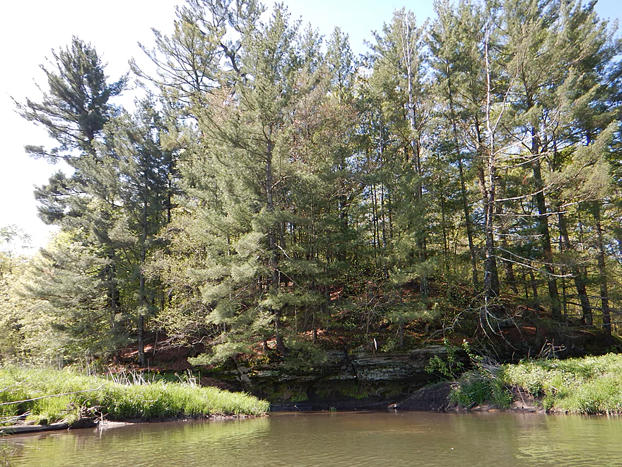
Finally seeing some geology again
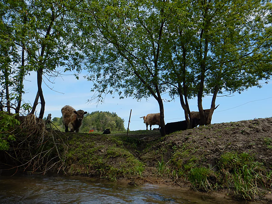
Some very furry cows
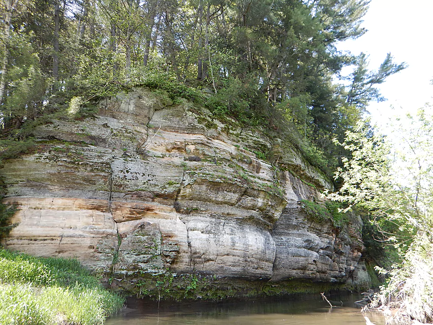
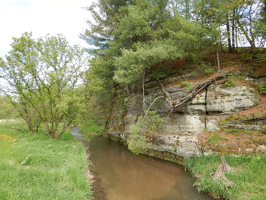
Finally a proper outcrop
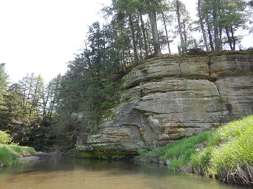
Reverse angle
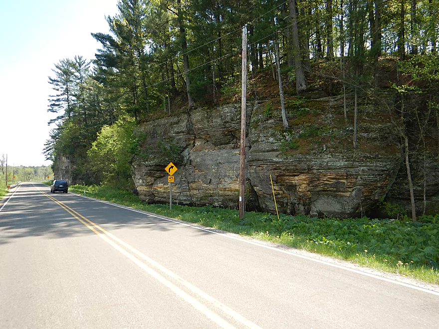
View from Hwy 80
Looking back
More nice pebble substrate
My favorite outcrop
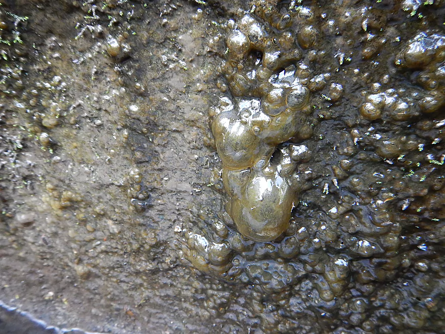
Odd slime bacteria growing on the face
Reverse angle
Another outcrop, this one heavily eroded
You always need to stay on your toes
Taking out at Shellington Drive
Steep, weedy and muddy take-out
Easy and scenic bike shuttle
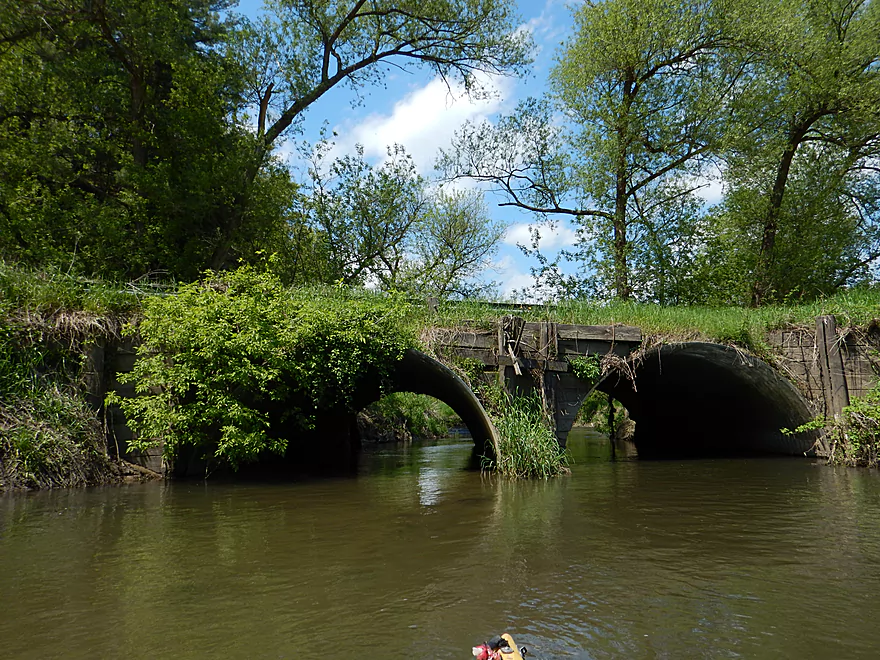
Melancthon Creek just next door is super cool
Pine River – Quarry Drive


While typically overshadowed by its neighbors (the Baraboo and Kickapoo Rivers), the Pine is a nice paddling prospect that has become relatively popular these past few years, thanks to a new livery. I’ve paddled this watershed multiple times including most recently Willow Creek (its far northeast branch). Willow being such a pleasant surprise had me curious to try the upper Pine (just 7 miles away) to see how it compared.
The problem is…it doesn’t. Much of the river is flanked by large, unsightly, tall mud banks and scraggly half-dead trees. Deadfall is an issue and I had to portage 4 times in the first 1.5 miles and deal with numerous strainers throughout the trip. Mud was everywhere, including on me. Despite this being in the heart of the Driftless Area, the scenery is simplistic and a little bland. Mostly weedy ditch paddling. The surrounding landscape was a mixture of pasture, woods with occasional white pines, and grassland. But really mostly grass, to the point of monotony.
But this is a Jekyll-and-Hyde segment. Just as I was about to write it off (as in 2 stars or even lower), I started to encounter some nicer sections. At times there were nice riffles, clear water, attractive pebble bottoms, natural springs, and scenic vistas of the river valley. Very much reminded me of some of the finer trout streams in Southwest Wisconsin.
My main reason for doing the Upper Pine though was for the sandstone outcrops such as those seen on the nearby Kickapoo River or Willow Creek…but alas there weren’t many. Two minor ones in the first half mile, but a bit runty. Having mentally given up on photographing any majestic outcrops, I was pleasantly surprised in the last half mile to encounter two really cool clusters of outcrops, some of which were over a 100′ high.
This is a difficult creek to judge in hindsight. The first 1.5 miles had the worst logjams and debris. But you can skip much of this by simply launching at Hwy C, and you’ll actually have a nice trip with the best scenery. If you are new to driftless paddling though, there are better prospects nearby (like the Kickapoo, Pine River below Rockbridge, and Willow Creek). But if you are looking for a new experience and are feeling adventurous this might be worth checking out.
I launched at Quarry Drive. Doable shoulder parking, but access is steep and weedy.
In hindsight, I do NOT suggest launching at Quarry Drive (too many logjams) and instead suggest Hwy C 1.5 miles downstream, which is a better option. Hwy C is not an easy launch either but better than Quarry Drive and is used by trout fishermen to access the river.
Shellington Drive is not a great access option. Very steep, weedy, and muddy. In hindsight I might have chosen the wrong corner of the bridge to disembark from and I do suggest scouting this in detail beforehand. There is a mowed trail to the river but it doesn’t lead to a good access option.
Pretty easy bike shuttle. Relatively flat, scenic and only 3.2 miles. Some gravel to peddle over, but only for a few hundred yards.
There is a local livery (Mark from Pine River Paddle and Tube – 608-475-2199), which services the Pine River from Rockbridge to the mouth. If you arrange an appointment in advance, Mark can likely help with shuttle services.
No fences to worry about. There are a number of riffles, but no noteworthy rapids. Logjams and strainers are a problem. I did end up portaging jams 4 times and ducked and hopped over numerous strainers. Some of the strainers are dangerous as the current is fast and the gap in between the branches is not large. Approach these with caution. You can avoid 80% of the strainers and all four of my logjams by simple launching from Hwy C instead of Quarry Drive.
List of portages (also marked on map):
- The first jam isn’t too bad. You can get out on a shallow sandbar. But then must pull your boat up a steep, weedy bank. Rope helps immensely. Re-entry is muddy but doable.
- Shortly after jam #1 is #2. This is also steep, muddy, and weedy. Be careful of poison ivy. Muddy re-entry.
- Maybe a half mile later is #3. Disembarkation is easy on a small sandbar. But then you must pull your boat up a steep, weedy bank. The trick here is there is a 2nd low hanging branch shortly after. You want to portage this too. I didn’t and only barely ducked under.
- Just prior to Hwy C is the 4th but easiest portage because of the shallow banks, but is a tad muddy.
From Hwy C to the take-out (3.25 miles), I did not have to portage. But…there were still some significant squeakers I had to get around though that might need to be portaged at different water depths.
This is not a creek to be messed with in high water, as it is prone to quick and extreme changes in flow rate. On my trip I saw flood debris in the branches 5-6′ overhead and the nearby roads had high water warning signs. High water combined with logjams is not only a nasty combination but dangerous. Simply put, I suggest doing this creek at low water levels. Despite being small, I actually think this segment is runnable most times of the year. Yes, some of the riffles were a bit shallow, but for the most part they weren’t too bad. You don’t have the big rocks on the Pine like other driftless streams, so it is easier to navigate even during low water.
Below is a rough guide based on the local gauge on the Kickapoo.
- 0-50 CFS: The riffles might be a bit shallow but the rest of the river should be fine.
- 51-100 CFS: A good target depth. Padding for the riffles, some clarity, and the river won’t be too pushy. My trip was done at 91 CFS, a good depth.
- 101-131 CFS: On the high side, but doable. Stay alert as dodging debris will be trickier.
- 132+ CFS: Probably too pushy to run given the debris.
Not much. Some fish and a crane. A redtail was getting beaked by a small bird and would let out loud squawking noises.
Detailed Overview
Map Overview:
- Click here to see a map of water trails and access options on the Pine (and its tributaries).
Quick Overview:
- Yuba to Pier County Park: Few paddle this stretch because of deadfall issues, but the river here is scenic and has some great outcrops.
- Pier County Park to Hwy D: The best and most popular part of the river.
- Hwy D to AA: An ok stretch with some outcrops, but not as many.
- Hwy AA to Hwy O: A nice stretch through the city of Richland Center. There are no outcrops here, but there are fun Class 2 rapids by Seminary Street.
- Hwy O to Mouth: This was cleaned up years ago, but likely has a few deadfall issues now. This is a mediocre paddle with no outcrops and isn't as interesting as upstream legs.
Detailed Overview:
- Yuba to Hwy C: 2.3 miles. Relatively open with some light rapids. Maybe one logjam.
- Hwy C to Beatty Dr: 0.4 miles. Mostly open with maybe some outcrops. Good prospect.
- Beatty Dr to Quarry Dr: 1.6 miles. Maybe 4-5 logjams.
- Quarry Road to Shellington Rd: 4.8 miles. Mediocre trip with some deadfall and mud, but some nice geology.
- Quarry Road to Hwy C: 1.5 miles. 4 major logjams make this not worth it IMO. There are two outcrops, but they aren't major.
- Hwy C to Shellington Road: 3.3 miles. Some snags, but no logjams. Bit of a trout stream feel to it. Two nice clusters of outcrops at the end. An underrated paddle.
- Shellington Rd to Hwy 80: 1.5 miles. Maybe 5 major logjams, but there should be some great outcrops on this stretch.
- Hwy 80 to Hwy I: 0.5 miles. Likely an uninteresting stretch with maybe 3 logjams.
- Hwy I to Hwy 80: 0.8 miles. Not a great stretch with maybe 2 serious logjams.
- Hwy 80 to Hwy D: 5.1 miles.
- Hwy 80 to Pier County Park: 1.4 miles. Two great outcrops, but also a number of snags on this stretch (none that I had to portage).
- Pier County Park to Hwy D: 3.7 miles. 11 outcrops on this stretch makes this the best leg on the Pine. The highlight is Pier County Park.
- Hwy D to Hwy AA: 6.9 miles.
- Hwy D to Hwy 80/SR: 2.3 miles. Roughly 3 outcrops on this leg.
- Hwy 80/SR to Hwy AA: 4.6 miles. Trying to remember…I believe there are 1-2 nice outcrops on this leg.
- Hwy AA to Hwy Q: 5.4 miles.
- Hwy AA to Industrial Dr: 2.7 miles. Nice open section with views of the hills.
- Industrial Dr to Krouskop Park: 1.7 miles. More tree cover. Some submerged logs to dodge.
- Krouskop Park to Hwy Q: 1.0 miles. Great section with cool bridges, class 2 rapids and hilly scenery.
- Hwy Q to Hwy O: 5.5 miles.
- Hwy Q to Bohman Dr: 2.3 miles. A nice section.
- Bohman Dr to Hwy O: 3.2 miles. Mostly open with some cornfields. Not as nice as the previous sections.
- Hwy O to Twin Bluffs: 4.8 miles. Mediocre prospect.
- Twin Bluffs to Gotham (mouth on Wisconsin River): 9.6 miles. Mostly floodplain paddling so not as interesting, but still ok.
Noteworthy Tributaries:
- Willow Creek: The best of the Pine River tributaries with fantastic "cake-shaped" outcrops.
- Melancthon Creek: An incredibly scenic creek that can only be done in high water. There are two tunnels that you can paddle through. Sadly there were a few annoying logjams on this stretch when I did it in 2017. Hopefully they've been cleared up by now or will be in the future.
- Hawkins Creek: This is a speculative prospect I will likely do in the future. It has many scenic outcrops, but also a fair degree of logjams, fences, and can only done in high water.
- Pine River - West Branch: This is one of the weaker tributaries. A lack of outcrops and likely fences/logjams make this somewhat unappetizing, but I might try to explore the more open sections in the future.
Trip Map
Overview Map
Video
Photos Size: