
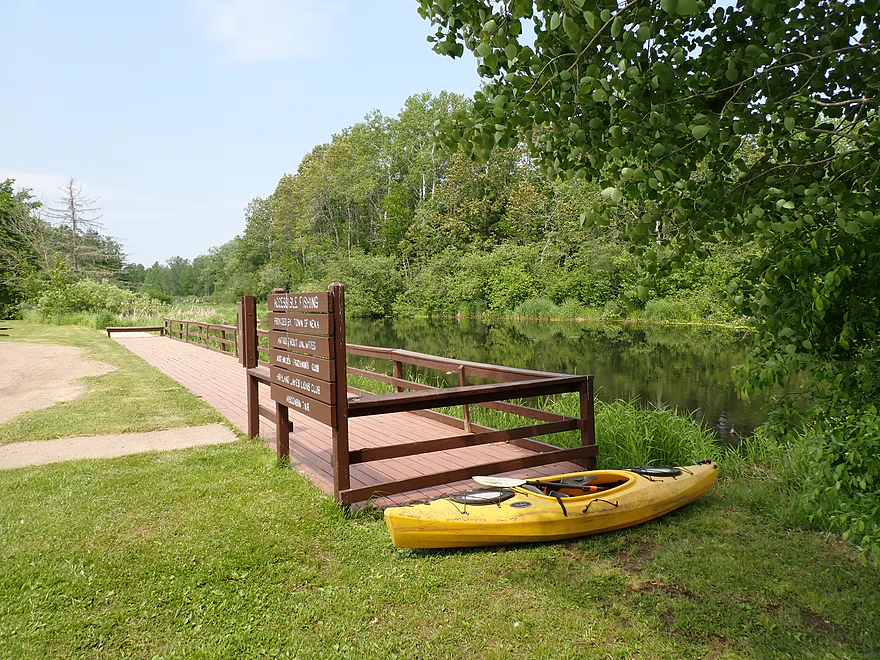
Starting the trip at Wayside Park
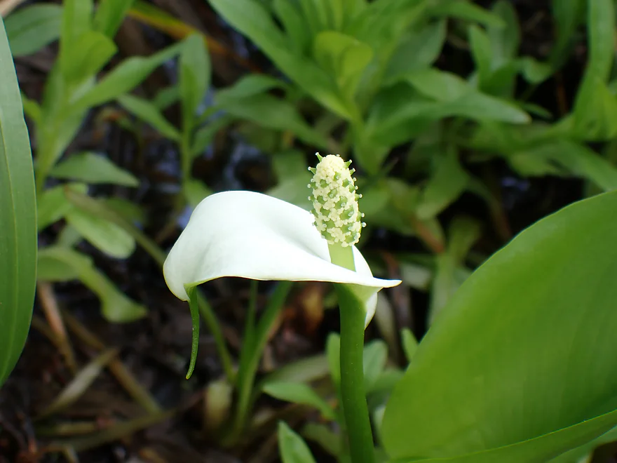
Wild calla lily
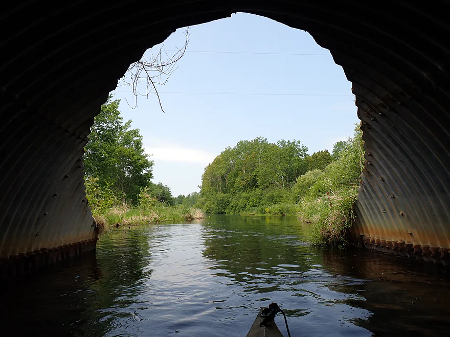
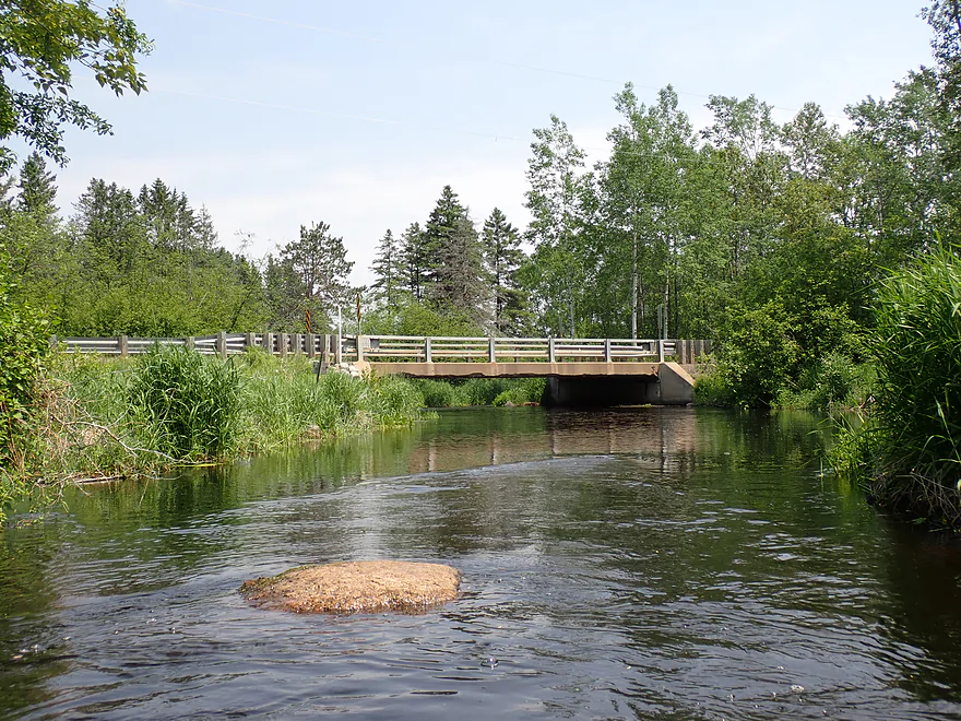
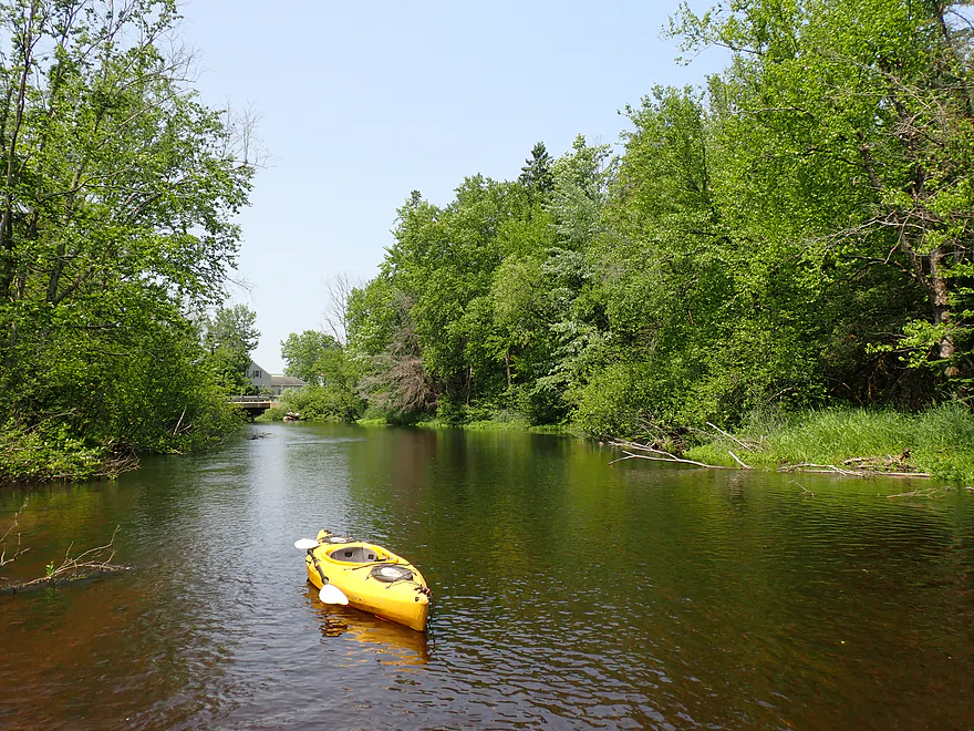
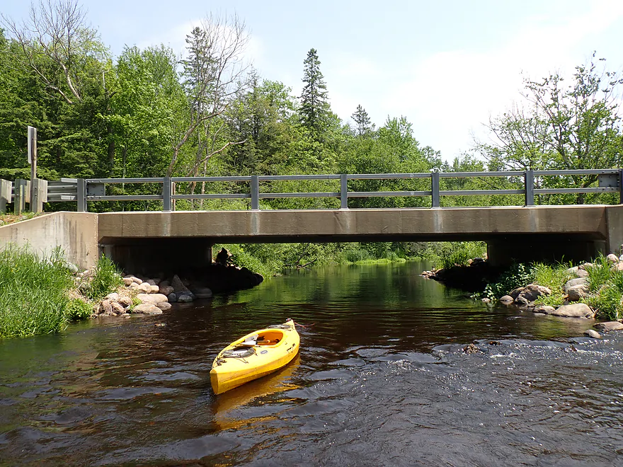
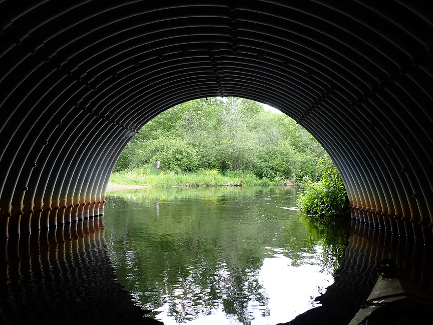
Paddling under Hwy 45
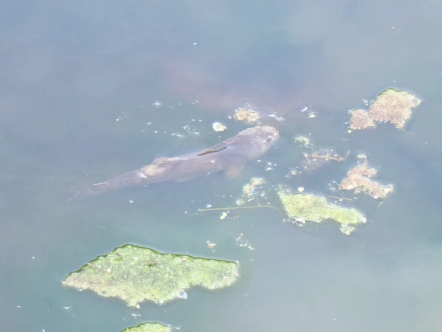
A friendly fish
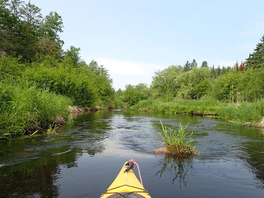
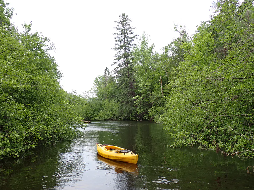
Scenic leg to start
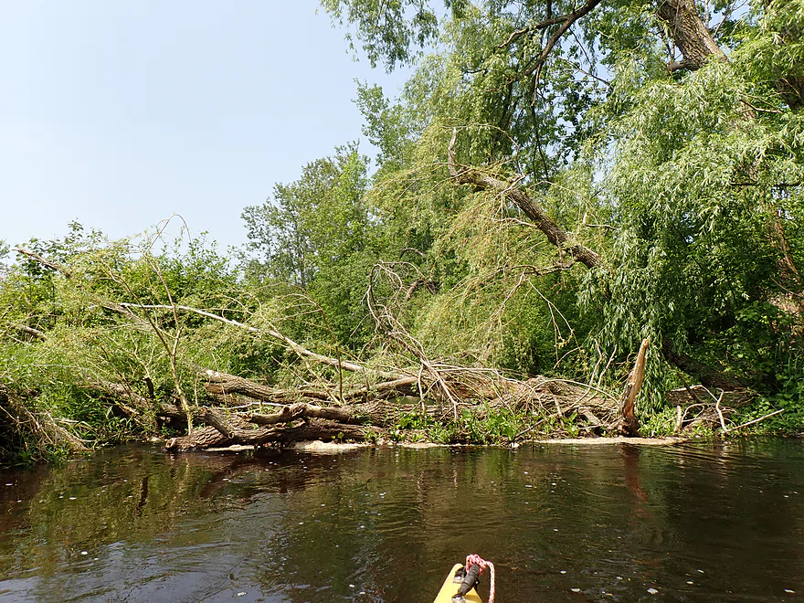
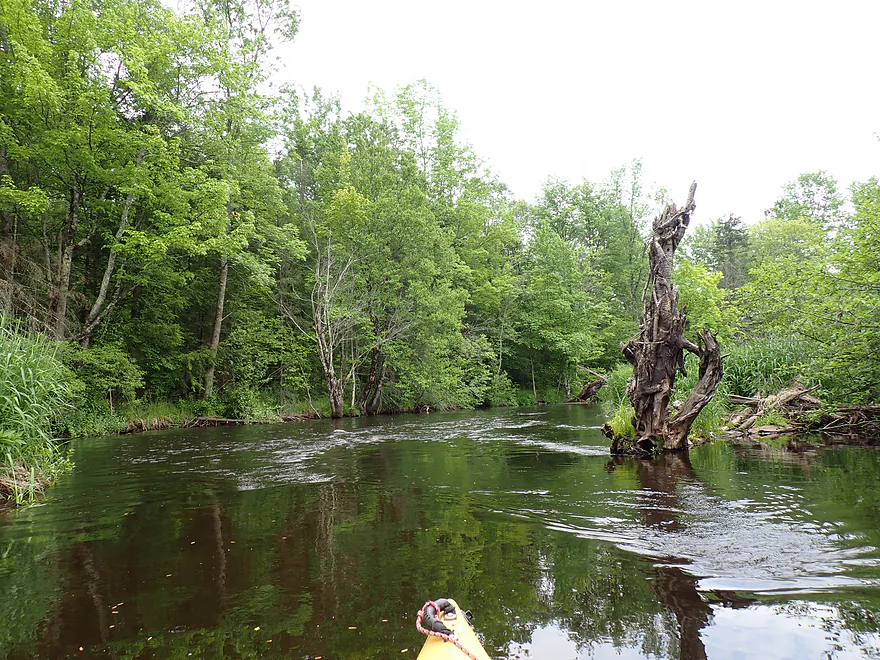
First logjam of the trip
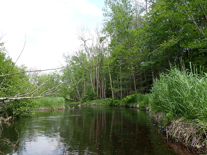
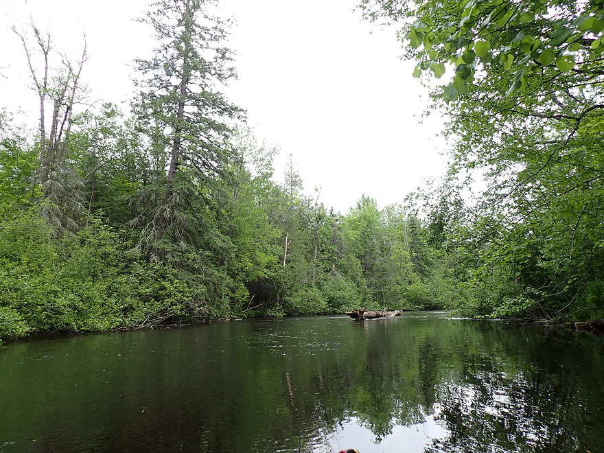
River starts to open up
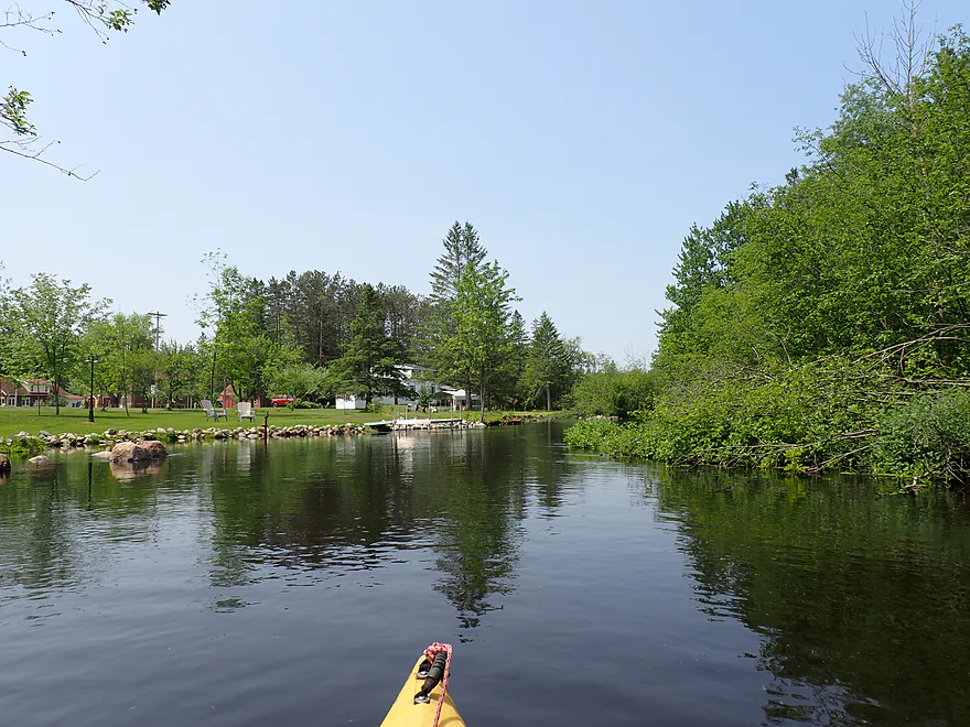
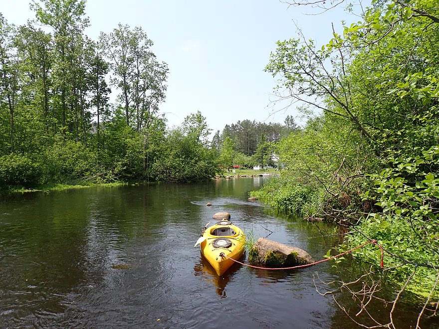
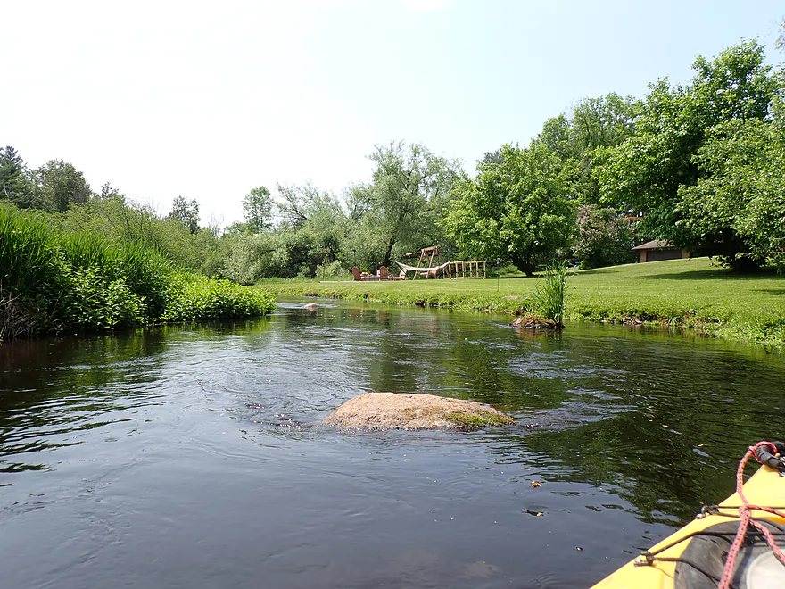
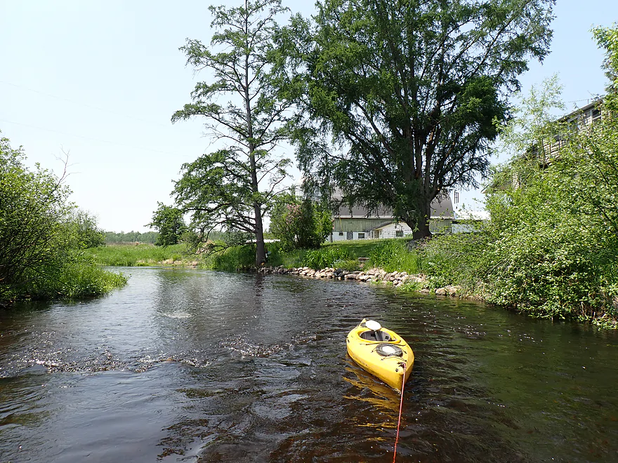
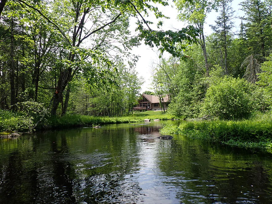
Coming up on a small collection of homes
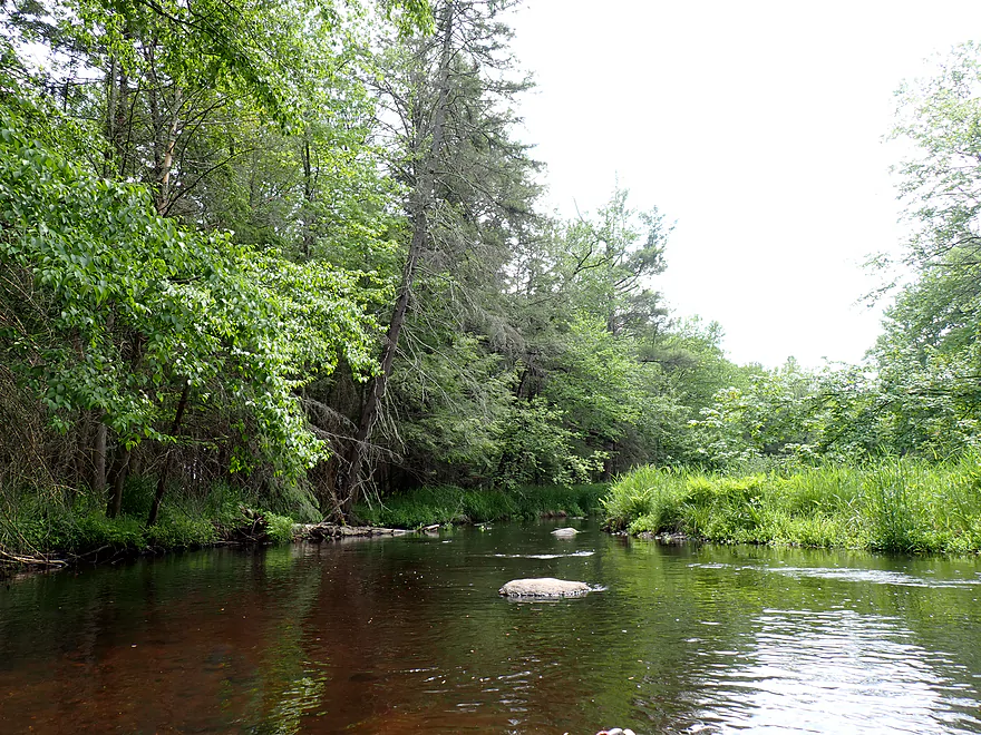
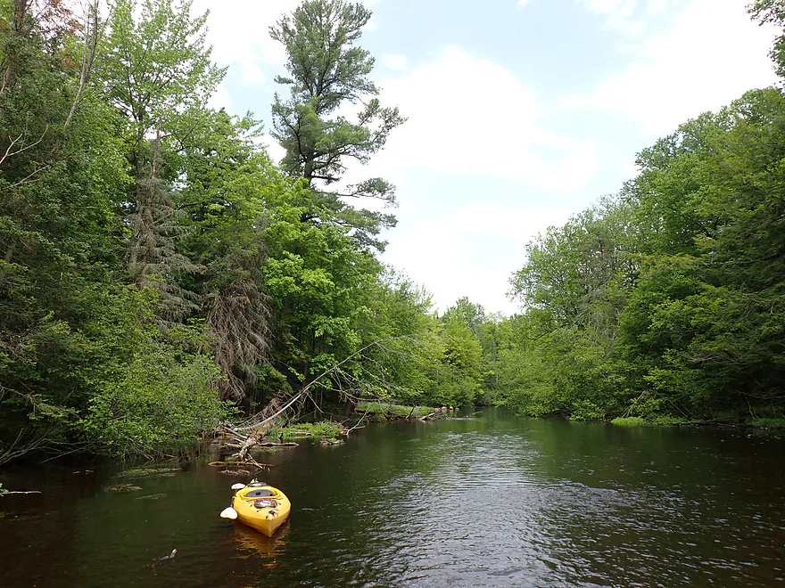
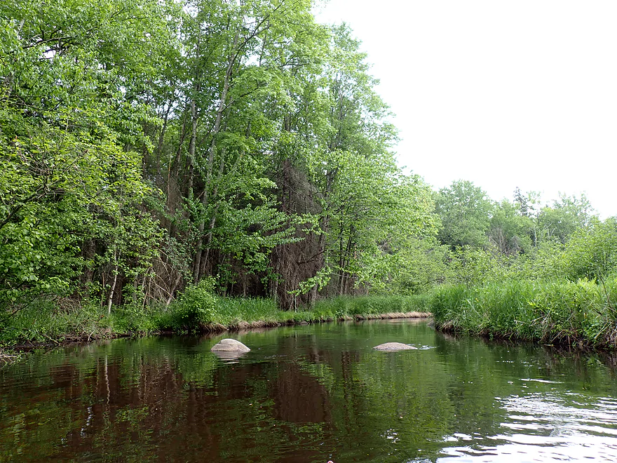
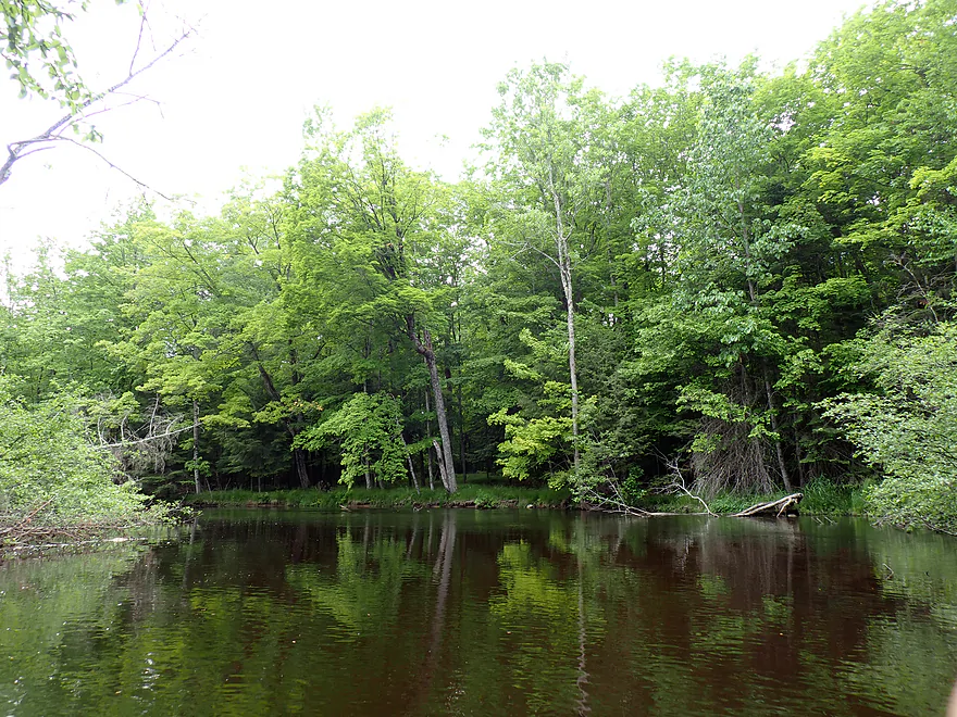
Very scenic
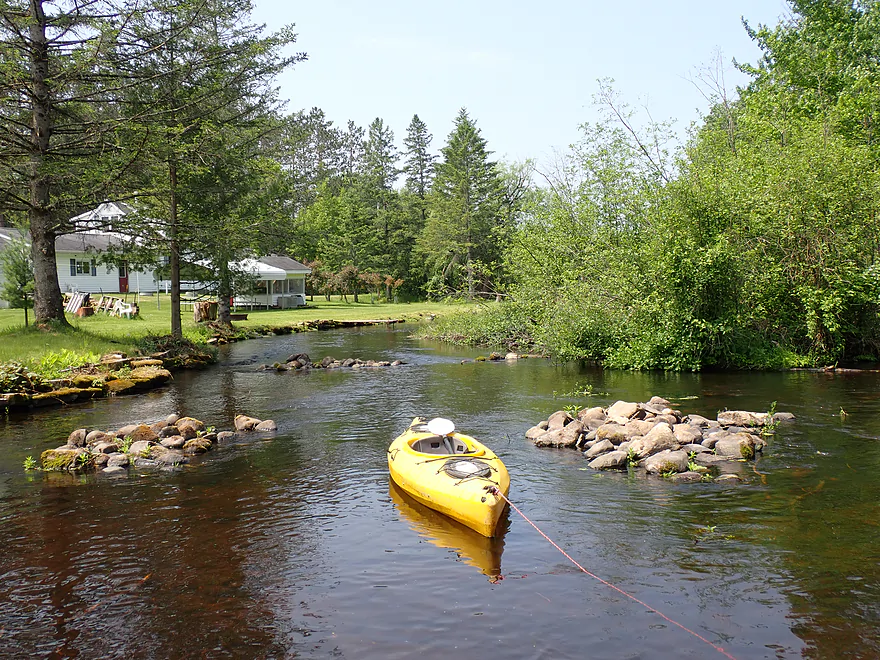
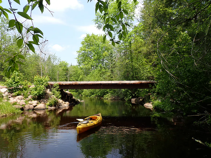
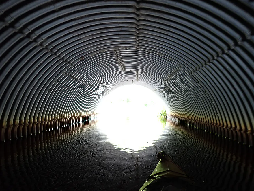
Low bridge and easy portage
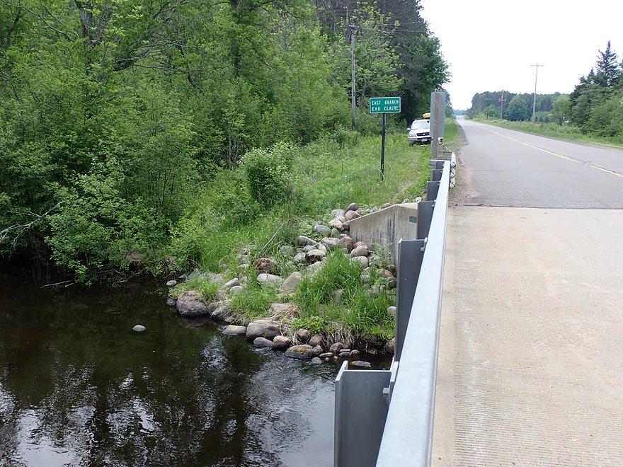
Cty C
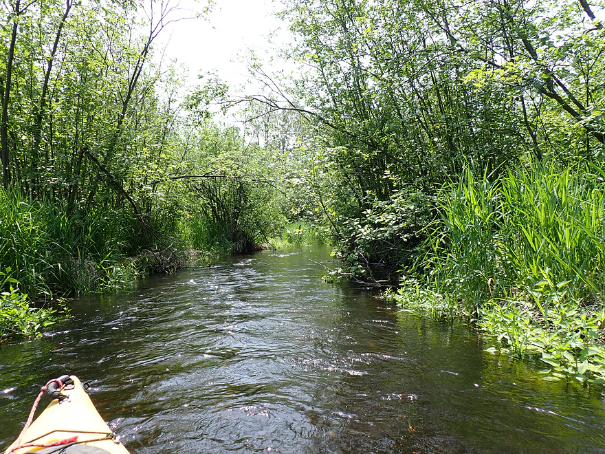
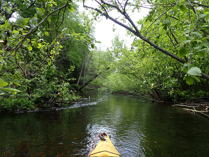
Section below Cty B is narrow and brushy
A reprieve from the alder gauntlets
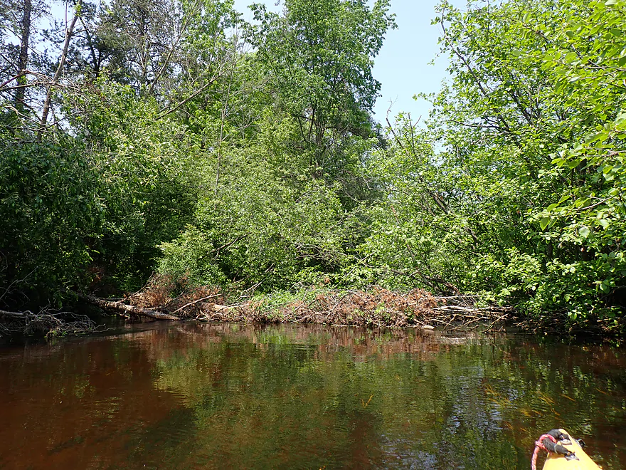
Logjam #2…easy portage
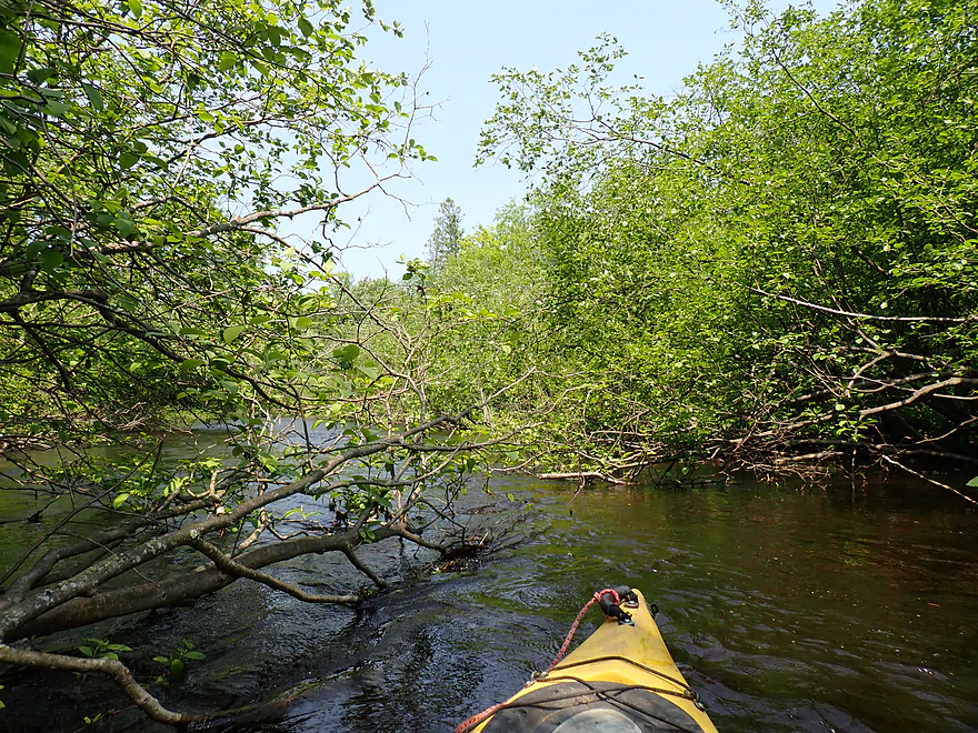
More branch dodging
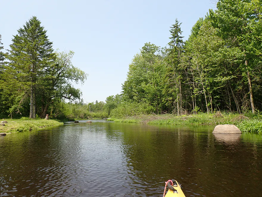
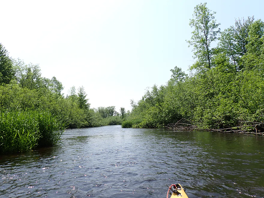
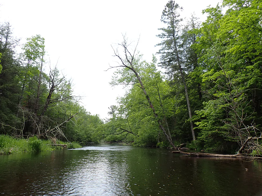
River finally opens up…from here on it was clear sailing
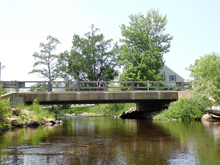
Cty B
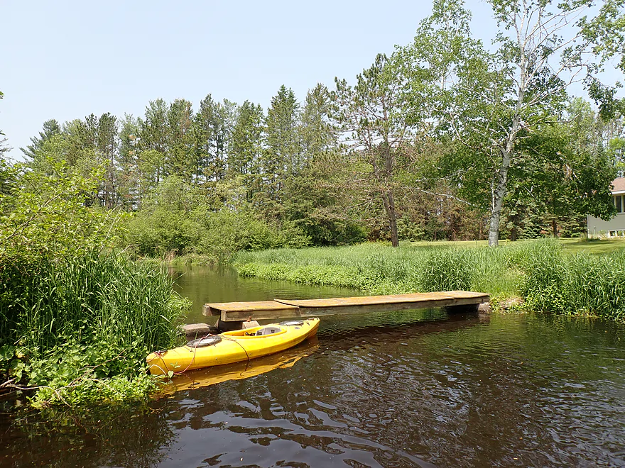
This is a good bridge access option
Reverse view
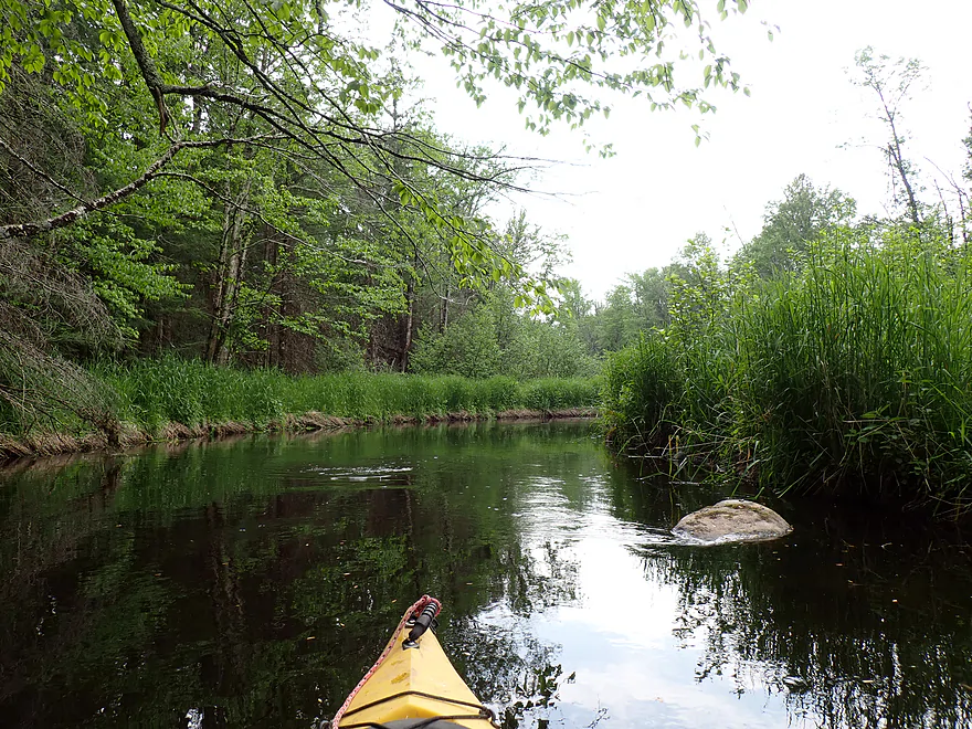
Some light riffles…no major rapids on this trip
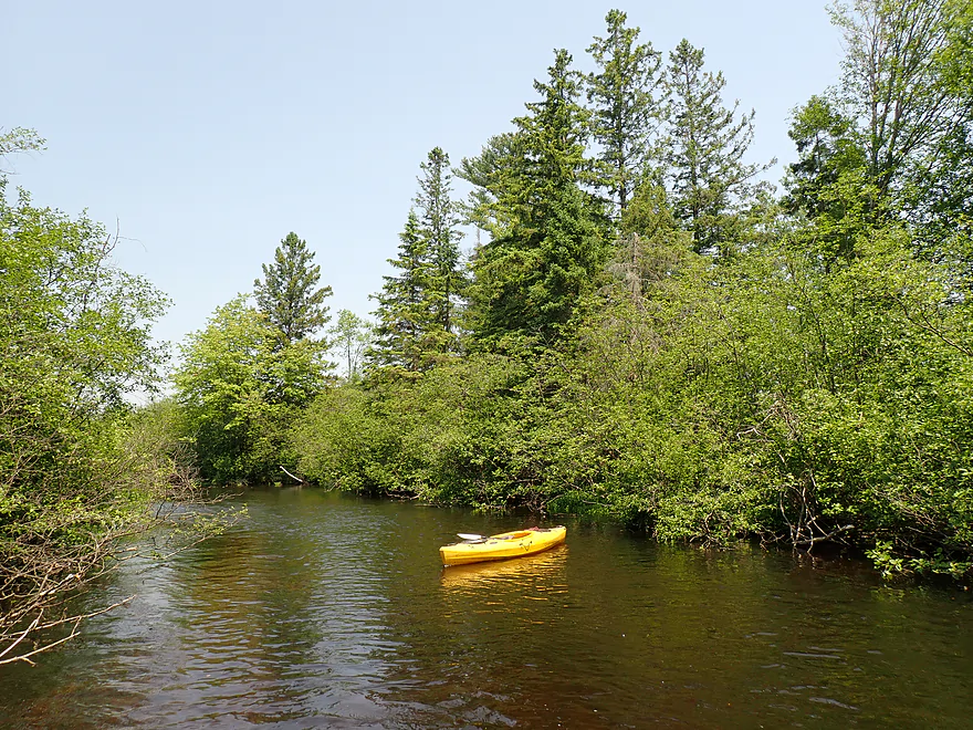
A few nice evergreen stands (and more alders)
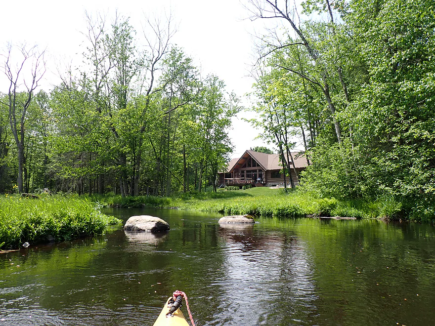
Scenic log cabin and boulders
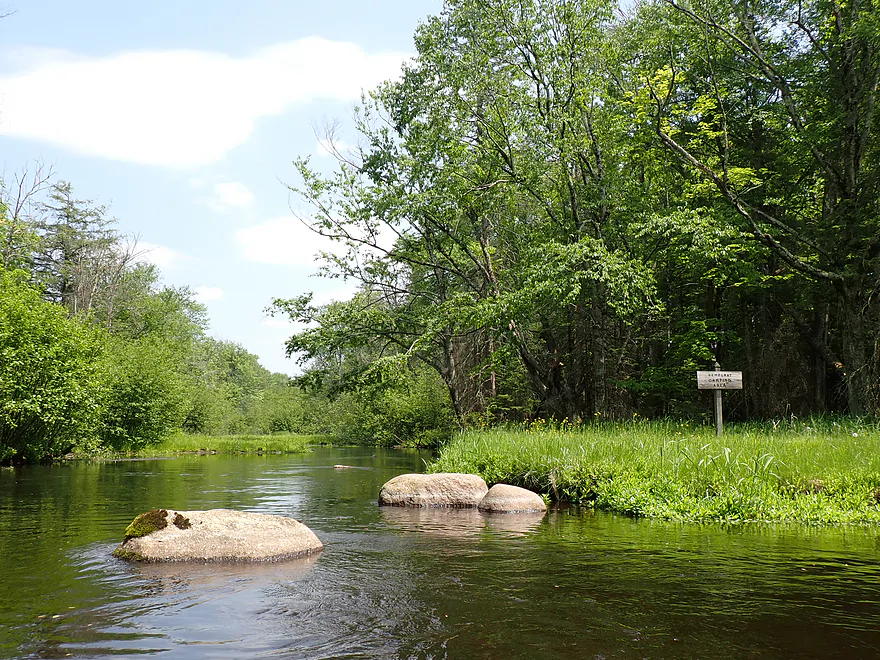
Sign says “Democrat Camping Area”
Private bridge
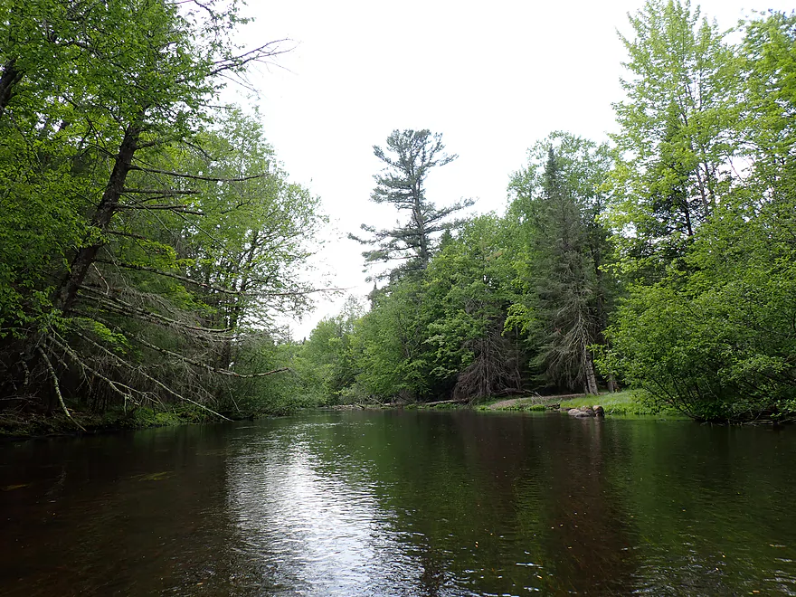
This stretch had more evergreens, which was nice
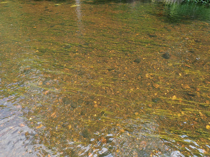
Water clarity was very good
Bluebell Road is an access option
Starting to see more ferns
Fun paddling around the boulders
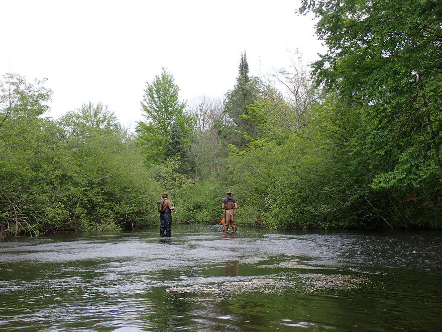
Surprised to see so many fishermen on the river
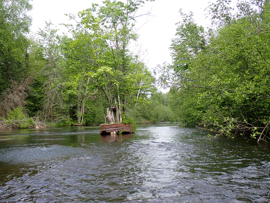
Interesting island
Getting out for a photo op
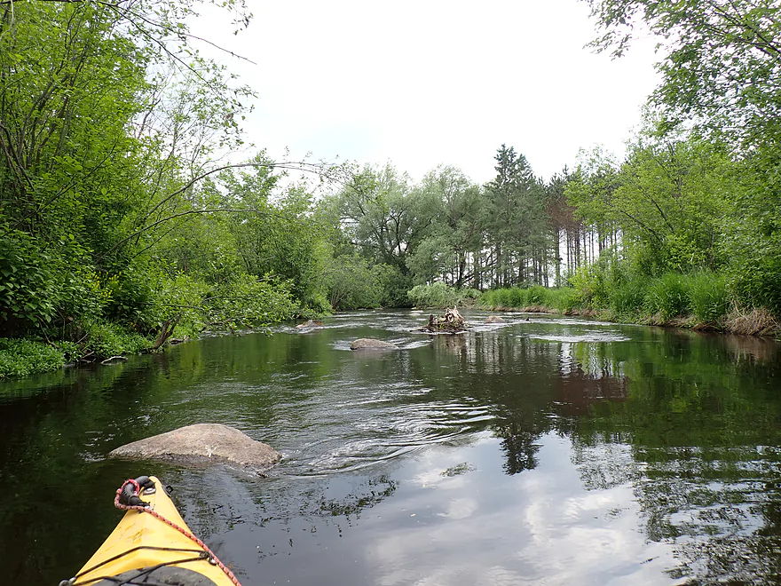
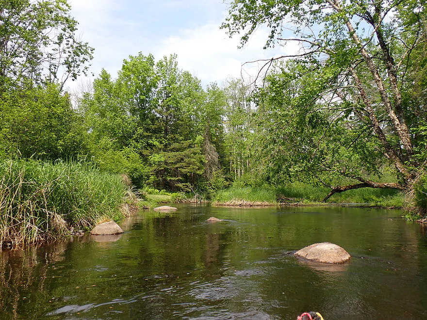
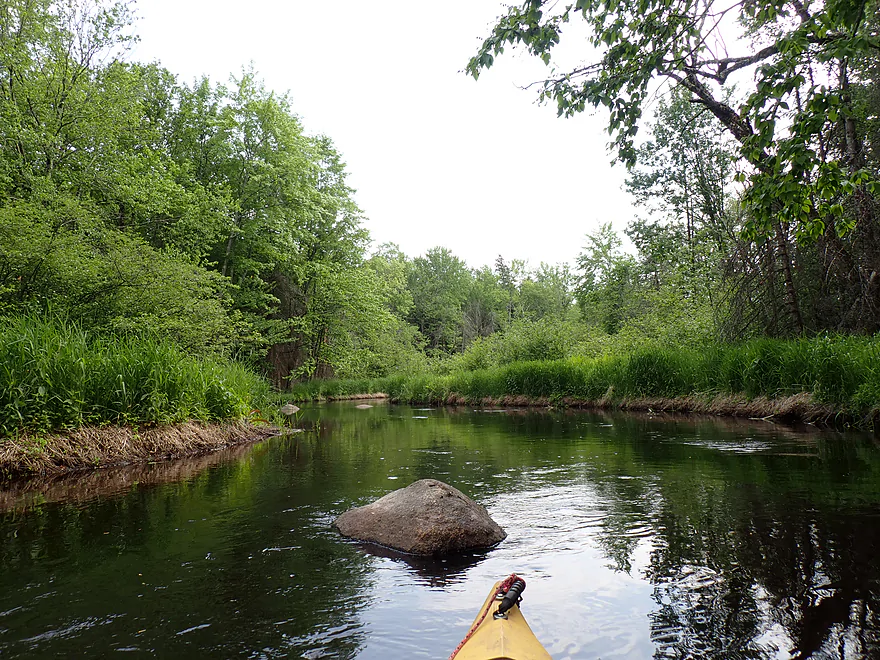
Last boulder field of the trip
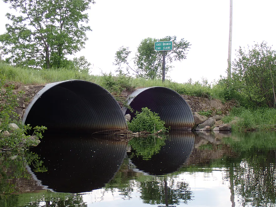
Cty I
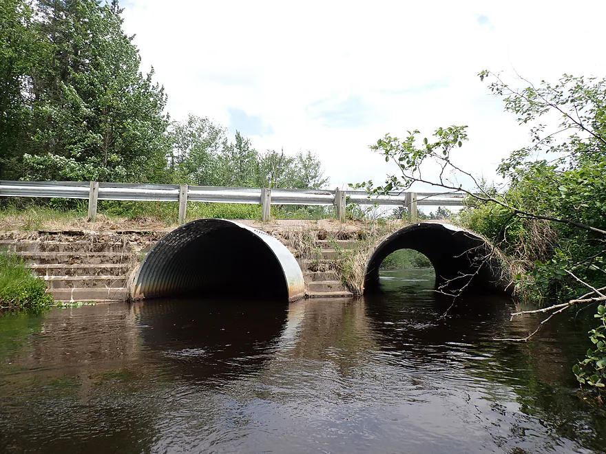
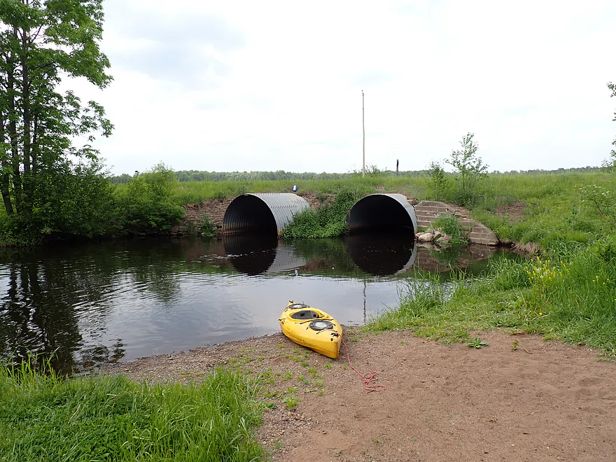
Culverts are always so photogenic
Great DNR access off Cty I
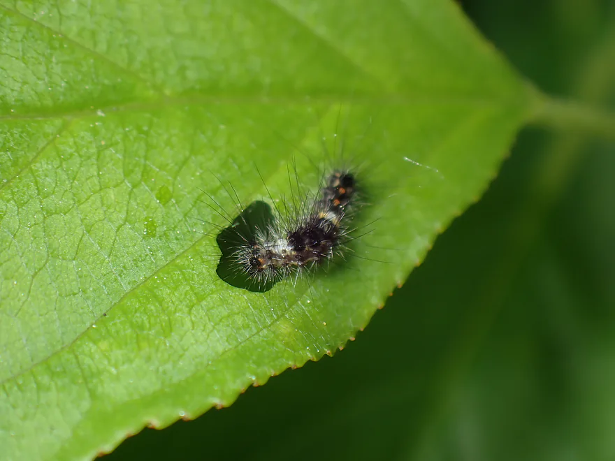
A caterpillar having lunch near the take-out
Eau Claire River – East Branch


Just northeast of Wausau is the Eau Claire River, which is noted for its clear water, rapids, exposed bedrock and large boulder gardens. The lower portions are popular with paddlers (especially whitewater kayakers). Less well known are its two upper tributaries, the East and West Branches. The West Branch seems “sus”, but the East Branch is very much viable for kayaking. After seeing some nice Google Street View images of the river and reading a favorable review from Rick Kark, I decided to give it a chance.
Just north of Antigo and off Hwy 45 is Wayside Park. It’s intended as a public fishing access, but it served well as a kayak launch point.
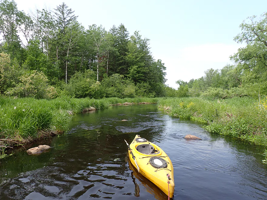
The first leg was from Wayside Park to Cty C (0.5 miles). The “river” here was no more than a small creek but remained plenty navigable. The channel weaved around large but mostly submerged boulders. Scenic woods backdropped the creek and the water was clear but with a slight dark stain. I passed a handful of bank-side homes, which featured attractive brick-lined shores and a small boulder garden. This was a great leg, but I did have to portage a downed tree (a bit tricky) and a low bridge (easy).
The worst leg was Cty C to Hwy 8 (0.8 miles). The creek really narrowed in spots here and I had to plow through a few alder gauntlets. The shoreline was mostly unattractive scrubland and alders (a gift from the previous logging operation). I did have to portage one logjam (not difficult). There were three large islands where I had to choose my route carefully, as the wrong choice typically had annoying obstructions. I don’t want to exaggerate this though and it wasn’t a horrible stretch. There were also a few nice stands of firs, spruce, and pines the loggers missed.
In contrast, the third leg from Cty B to Bluebell Road (1.7 miles) was much nicer, wider and more navigable. The woods were also larger and healthier. I never saw the epic northwoods pine walls that are common on other nearby water trails, but there were still some nice wooded stretches. I was surprised to see more than a few homes, many of which were positioned close to the river. Flooding on the East Branch must not be an issue.
The fourth and final leg was Bluebell Road to Cty I (2.1 miles). It started as a deep, but narrow, winding channel through attractive woods. Ferns dotted the banks, and large, mostly submerged boulders kept me on my toes. Eventually the river opened up, widened out and became shallower. Several spots had to be waded. I was surprised to see five fishermen on this stretch. It turns out the East Branch is a noted trout stream and this is one of the more popular legs with fishermen. The trip ended at Cty I where there was a terrific DNR access.
In summary, this was a nice trip, but I can’t give it an elite grade. The upper legs were a bit congested (not awful though) and it’s never ideal to have to portage logjams (although there weren’t many). The lower portions were nice and featured attractive woods, clear water, and gravel substrate, which I liked. But the woods were not consistent…there would be fantastic white pines, firs, and spruce…then a bunch of ugly hardwoods and scrub trees. Most kayakers will likely prefer the neighboring water trails (e.g., the Wolf is just to the northeast), but locals might enjoy this trip. If you do the East Branch, I suggest starting further downstream (say Cty B) and taking out at Cty H. This would avoid the weakest part of the river…plus the Google Street View of Cty H is ridiculously photogenic.
Sights included many deer, some dragonflies and a muskrat. I saw quite a few splashing fish as well as five trout fishermen. The East Branch is relatively famous as a trout stream.
Wayside Park: Located off Hwy 45, this is a nice public wayside and put-in option.
Alternate Put-ins:
- Cty B (1.3 miles downstream from Wayside Park): In hindsight I should have launched here to avoid the snags upstream from B.
Cty I: Southeast of the bridge there is a public DNR access and pull-off. This is a terrific access option.
Alternate Take-outs:
- River Road (1.1 miles downstream from I): There is a nice access northwest of River Road. This bonus leg should be decent, but likely isn’t special.
- Cty H (2.2 miles downstream from I): In hindsight I should have taken out here. The river by Cty H looks very scenic.
Bike Shuttle – Cty I to Wayside Park: 5.2 miles with 43′ of ascent. I thought this was an easy bike shuttle.
Current/Rapids: The current tends to be consistent and decent but never moves too fast. There are a few riffles, but no real noteworthy rapids. This stretch is plenty safe for beginners.
Logjams: Upstream from Cty B there are several logjams and one low bridge (marked on the trip map). The first logjam was a bit tricky to portage, but doable. The other logjam was easy to portage. There are also a few alder gauntlets upstream from Cty B. Downstream from Cty B the river is pretty open. I recommend launching from Cty B.
Closest Gauge: Eau Claire River @ Kelly
My Trip Depth: 165 cfs of 7.5′
Gauge Guide: Note, this gauge is way downstream so may not be accurate.
- < 100 CFS: A very shallow depth. You would likely have to wade a lot of spots, but clarity should be excellent.
- 101-200 CFS: An average depth. I had to wade a few shallow spots, but 99% of the river was plenty deep.
- 201-300 CFS: Above average depth that will be well padded. Clarity won’t be that good.
- 301-450 CFS: High depth, but should still be navigable. River likely won’t be as enjoyable.
- 451-900 CFS: Very high depth. Likely viable for paddling but not very attractive.
- 901+ CFS: This might be minor flood stage.
Detailed Overview
Click here to see an overview of the Eau Claire River.
East Branch:
- Upstream from Wayside Park: The river this far upstream might be small and brushy, but should be mostly navigable.
- Hwy 45/Wayside Park to Cty I: 5.1 miles.
- Wayside Park to Cty B: 1.3 miles. Upstream from Cty C the river flows through an attractive residential area with a few nice boulder gardens. There is one logjam to portage. Downstream from Cty C the river is more brushy and less attractive. This is the weakest part of the East Branch IMO.
- Cty B to Bluebell Road: 1.7 miles. This is a nice wooded stretch with some alders, but also some pines and spruce.
- Bluebell Road to Cty I: 2.1 miles. This leg starts narrow and deep, flowing past mostly submerged boulders, then widens out and becomes more shallow. This is a solid stretch that is popular with trout fishermen.
- Cty I to Hwy 64: 6.1 miles.
- Cty I to River Road: 1.1 miles. This is brushy and IMO not that interesting with one major logjam.
- River Road to Cty H: 1.1 miles. A bit more open than the preceding stretch, but still brushy and not super interesting.
- Cty H to Spring Road: 2.0 miles. The first half is a bit overgrown, but the second half is really nice with some boulder gardens, attractive woods, and fun rapids.
- Spring Road to Hwy 64: 1.5 miles. More open and not as rocky as the previous sections, but nice with attractive meadows.
Main Branch:
- Hwy 64 to Cty Y: 2.7 miles. West Branch joins up, significantly enlarging the river. Thick woods and canopies crowd the river. There might be some logjams on this stretch.
- Cty Y to Hanson Road: 1.7 miles. A very dense and wooded section. Maybe a few light rapids but nothing major.
- Hanson Road to Hwy G: 4.3 miles. More dense woods and some light rapids. Possibly a logjam....otherwise should be a nice stretch.
- Cty G to Bear Lake Road: 3.0 miles. A good prospect, but I don't believe there are rapids.
- Bear Lake Road to Hwy 52: 3.6 miles. A great five star section with many boulder gardens and rapids (a few Class 2s and one Class 3).
- Hwy 52 to Dells of the Eau Claire Park: 4.1 miles. Really neat section with rapids and fantastic rock walls. Rapids are less serious than the upstream leg, but do include a Class 2 I believe.
- Dells of the Eau Claire Park to Cty Y: 0.2 miles. This section is called "The Ledges" and is typically Class 2, but is Class 3 in higher water. The dam should be portaged river right (there are downed trees in the water to contend with below the dam).
- Cty Y to Cty N: 6.6 miles.
- Cty Y to Cty Z: 2.0 miles. This starts with the famous Dells that should be portaged. There is a portage path (right/north) but it is steep. I recommend instead launching from either the south or north trails. After the Dells is a great section which includes very scenic rock walls and Class 2 rapids.
- Cty Z to Cty N: 4.6 miles. More flatwater, but still many rapids, including a Class 3 by Lower Dells Island. Badger Road is a steep but alternate access point.
- Cty N to Clubhouse Road (aka Edwin's Park): 3.5 miles. Pleasant, but I suspect this lacks any serious rapids. Popular with locals and the liveries.
- Edwin's Park to Ross Ave: 7.8 miles.
- Edwin's Park to Cty J: 4.1 miles. A nice section with a few rapids and boulder gardens. The Mountain-Bay State Trail pull-off is an alternate access option.
- Hwy J to Ross Ave: 3.7 miles. A great section with more rapids and boulder gardens.
- Ross Ave to Yellowbanks Park: 2.7 miles. I don't know much about this section...there are some rapids.
- Yellowbanks Park to Eau Claire River Conservancy: 2.7 miles. A narrow wooded section. Not sure if the Conservancy is accessible during low water.
- Eau Claire River Conservancy to the Brooks & Ross Dam (aka Drott Street): 1.5 miles. Probably boring flowage paddling. After the dam you are on the Wisconsin River (and another flowage).
Trip Map
Overview Map
Video
Photos Size: