
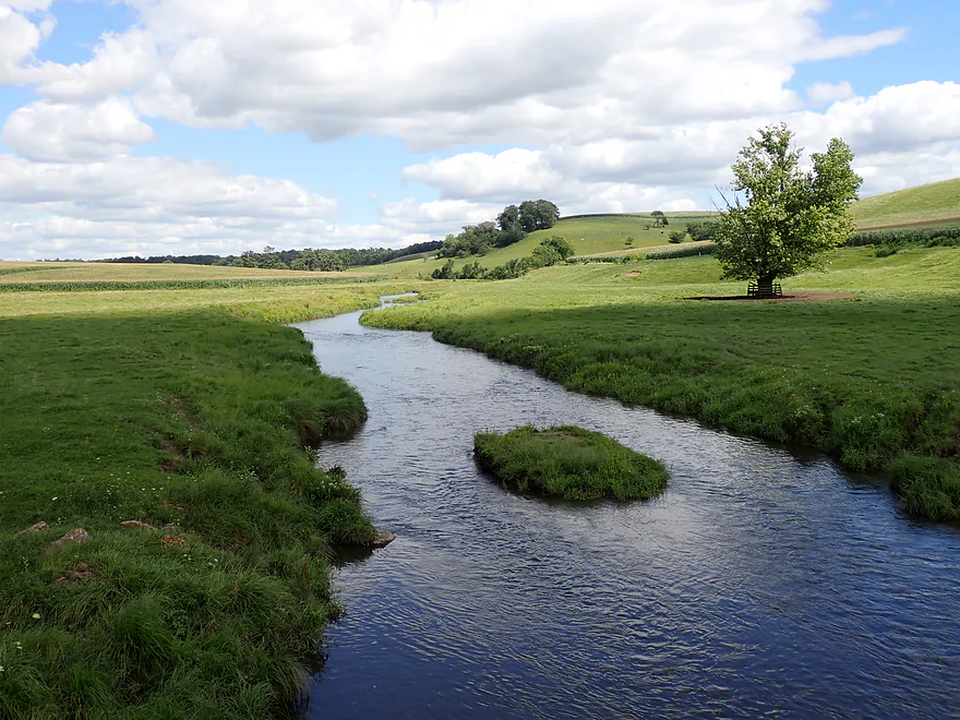
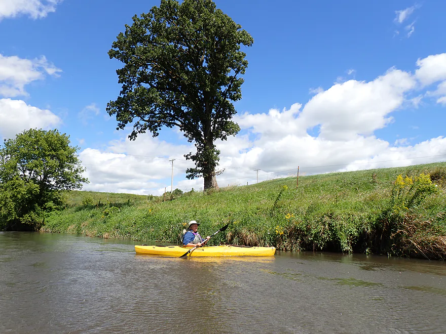
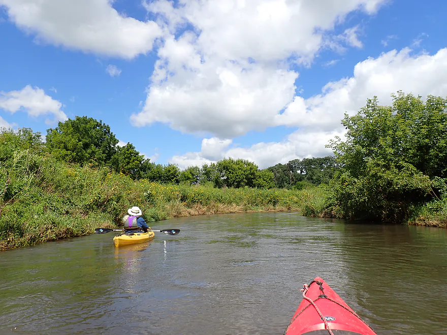
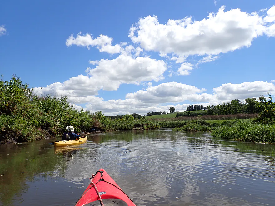
Scenic vista at our N. Oak Park Road put-in
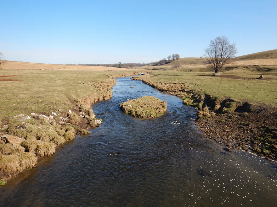
Same view, but 9 years ago in spring (200 CFS, which is shallow)
Same view 11,000 years ago
Upstream side of bridge is fenced off
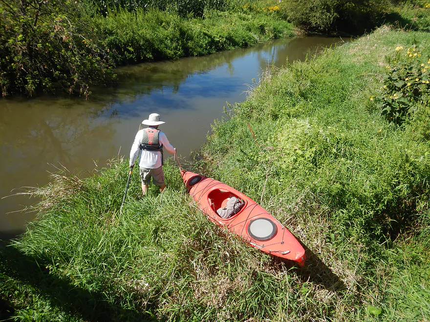
So we launched from the downstream side, which was very weedy
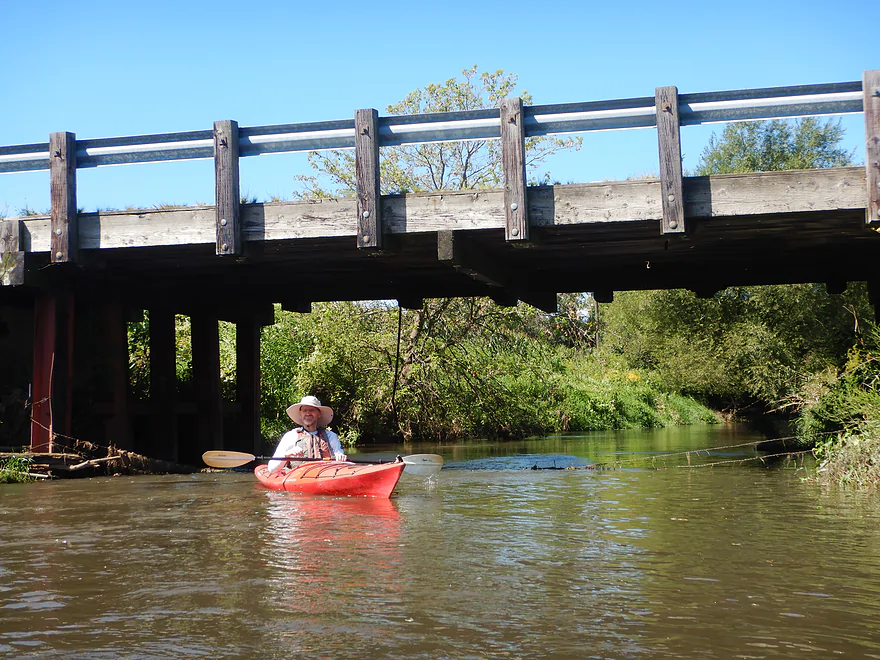
A rustic wooden bridge…they don’t build these any more
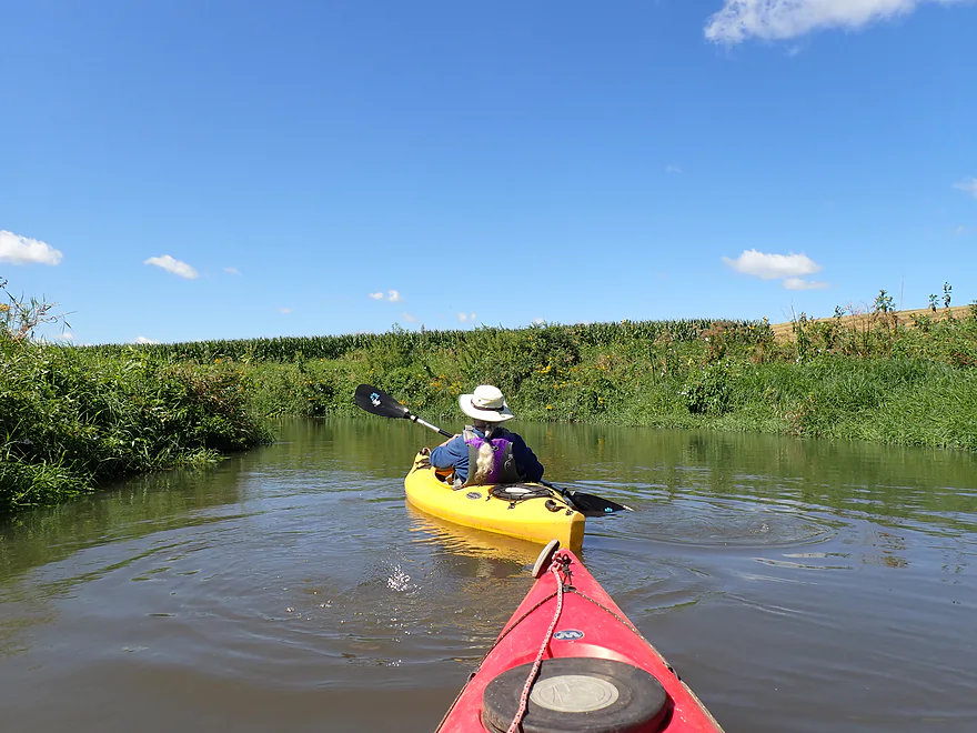
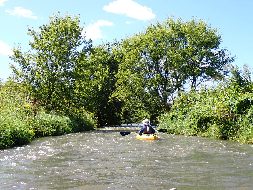
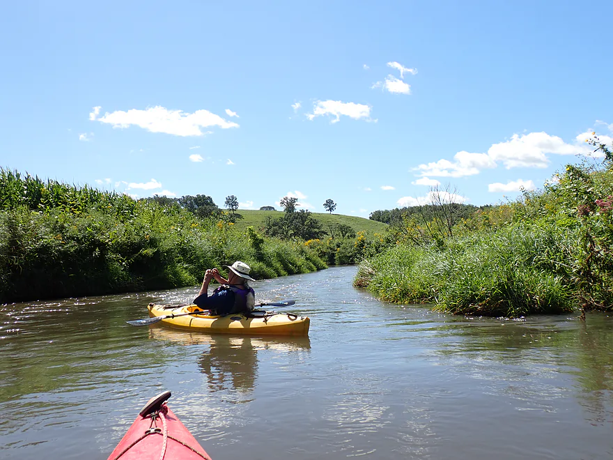
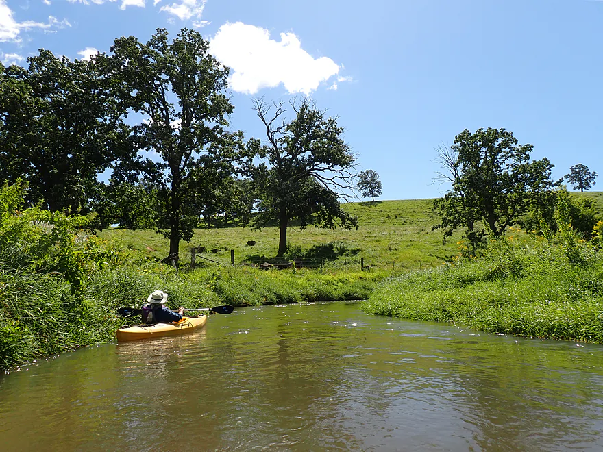
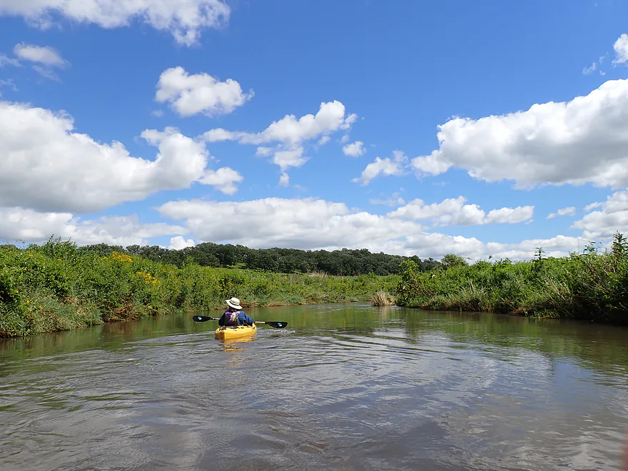
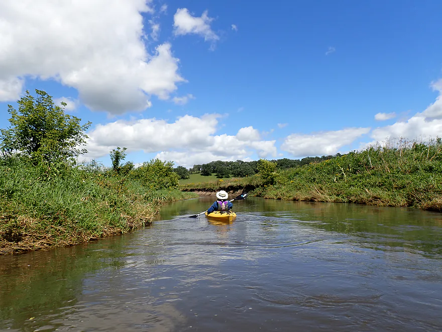
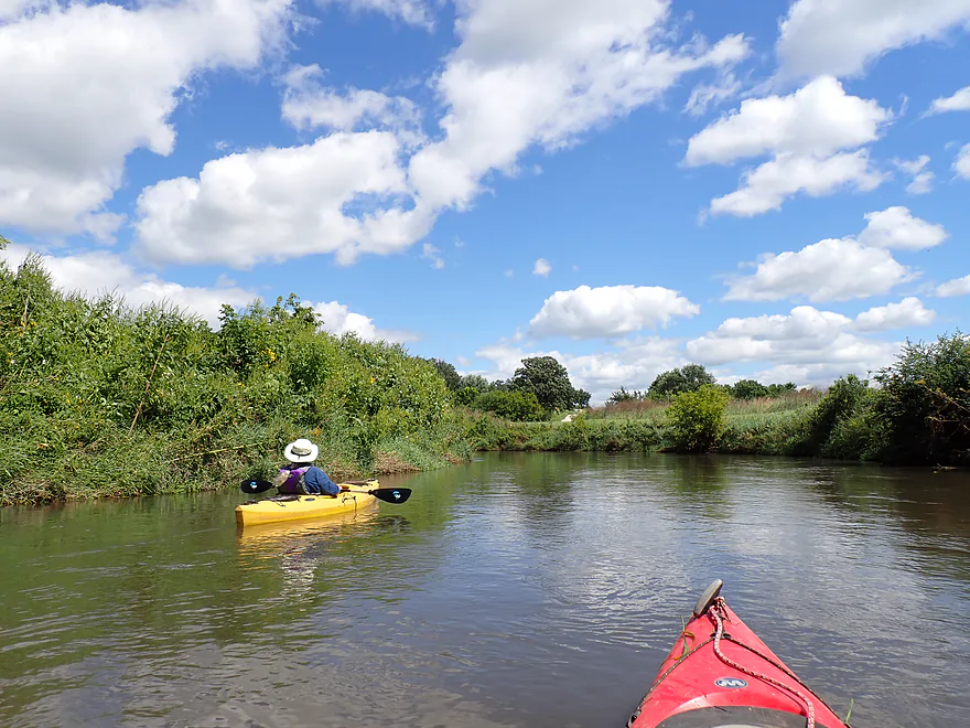
Paddling a bit upstream for the vista
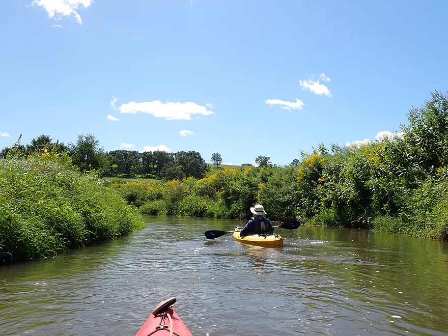
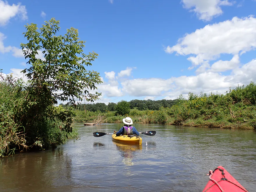
Heading back downstream and below the bridge–looks like a wheat field in the distance
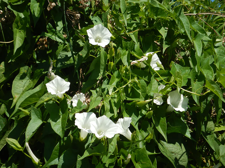
Bindweed (wild morning glory)
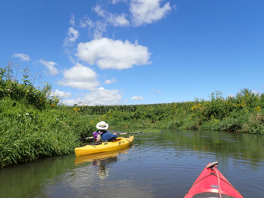
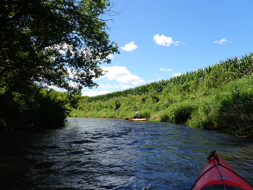
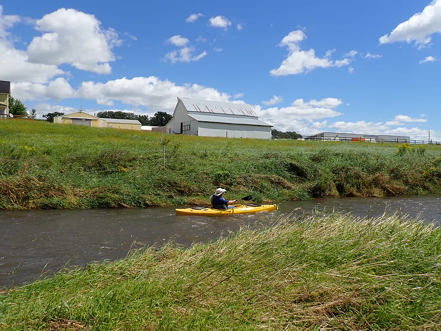
The start of many cornfields–which were likely pasture in the past
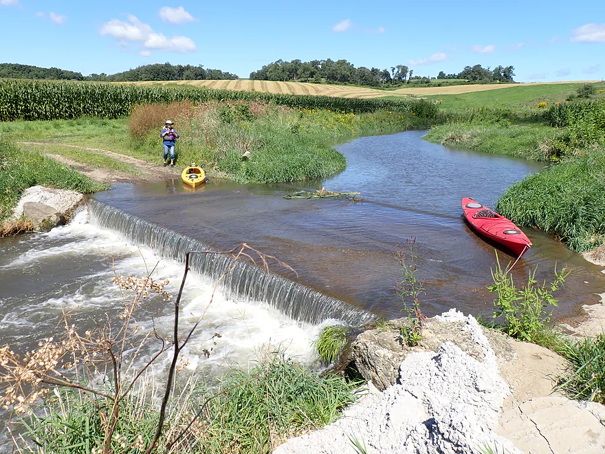
A farm ford acts as a mini-dam
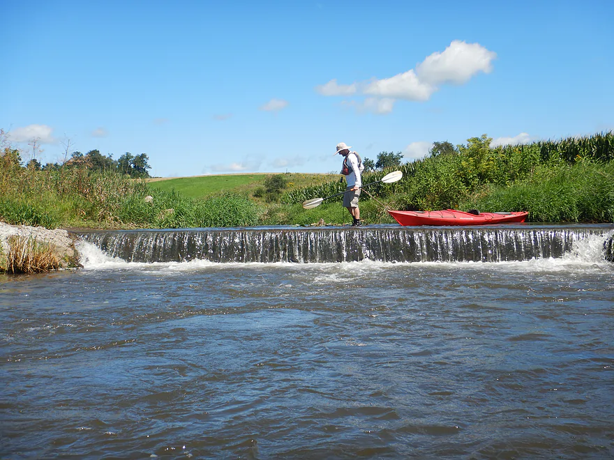
About 30″ tall, it is not a difficult portage
Fun rapids
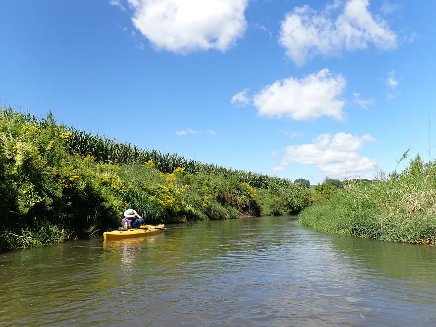
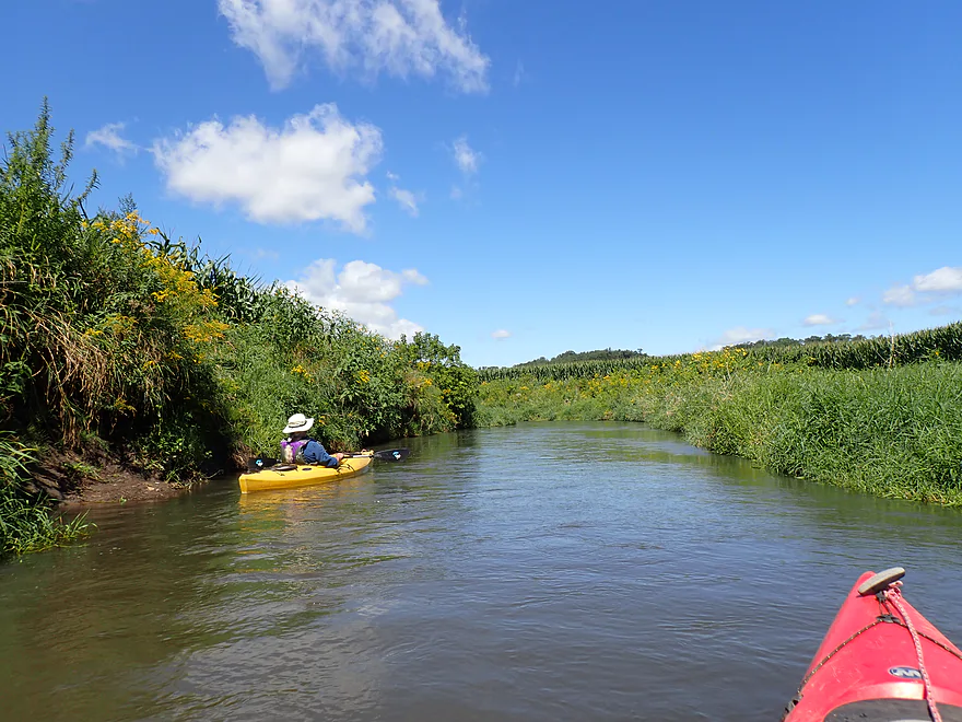
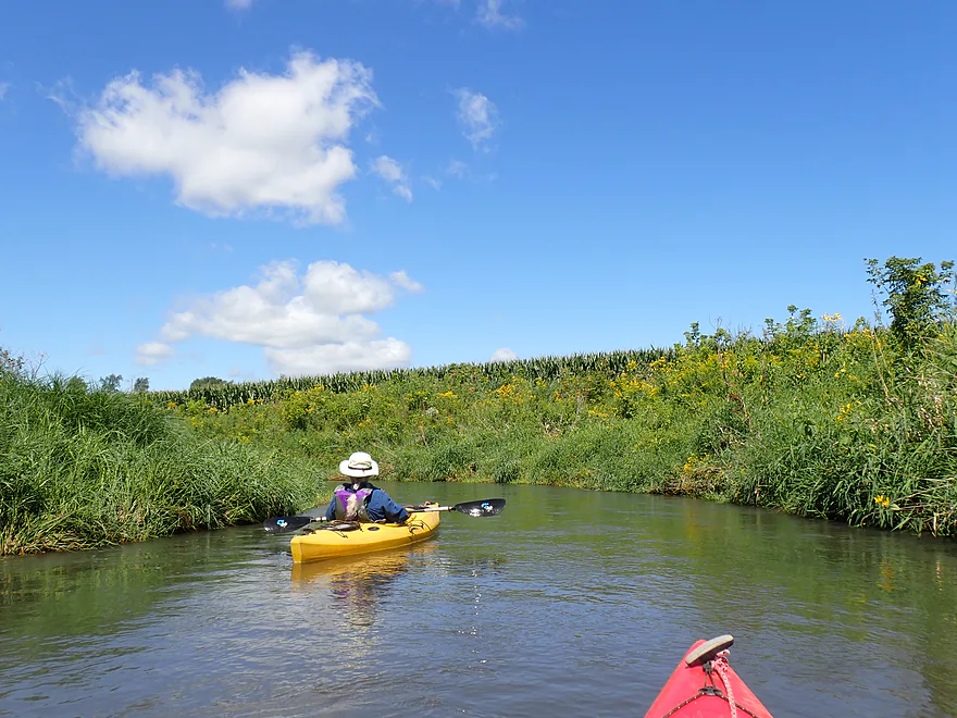
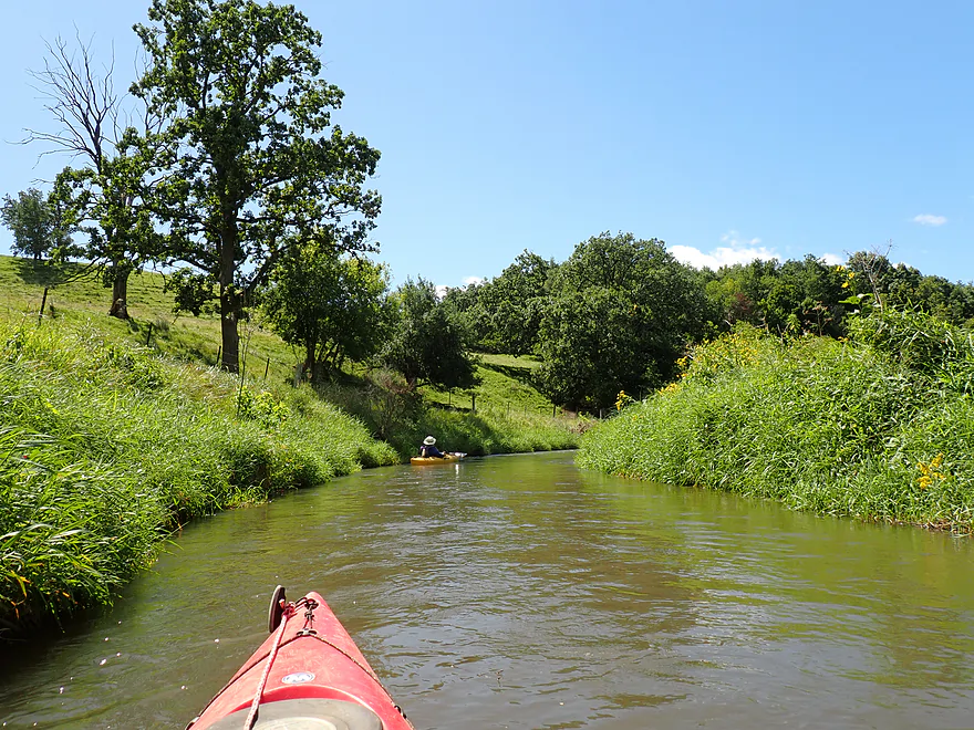
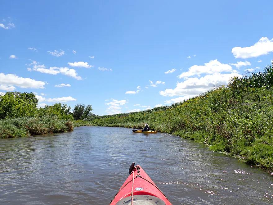
Walled corridors created by the banks, flowers and corn
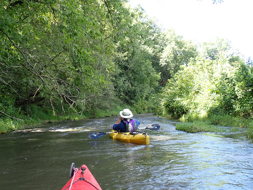
Brisk, fast current
Water levels were higher than normal from recent rains
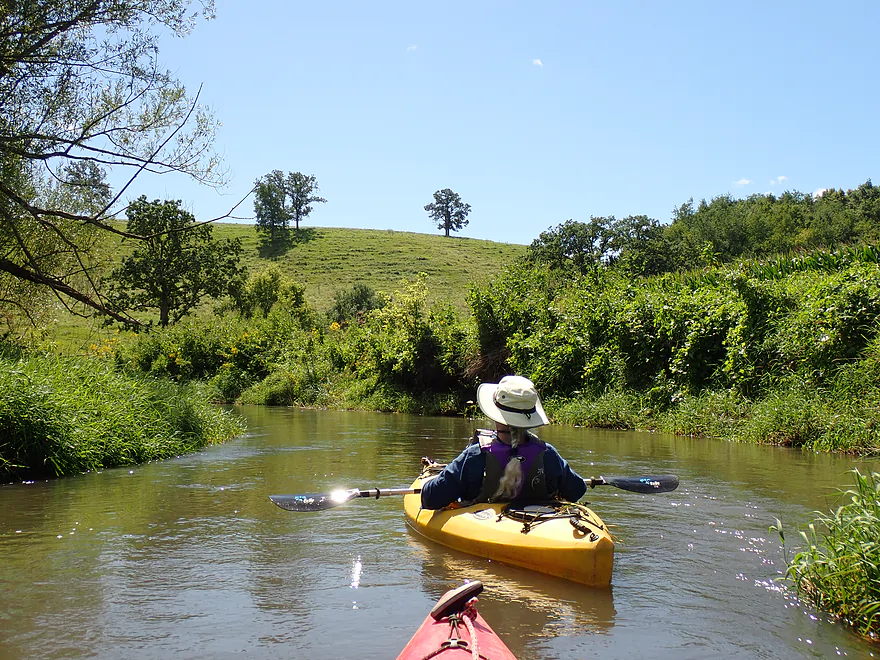
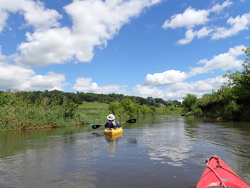
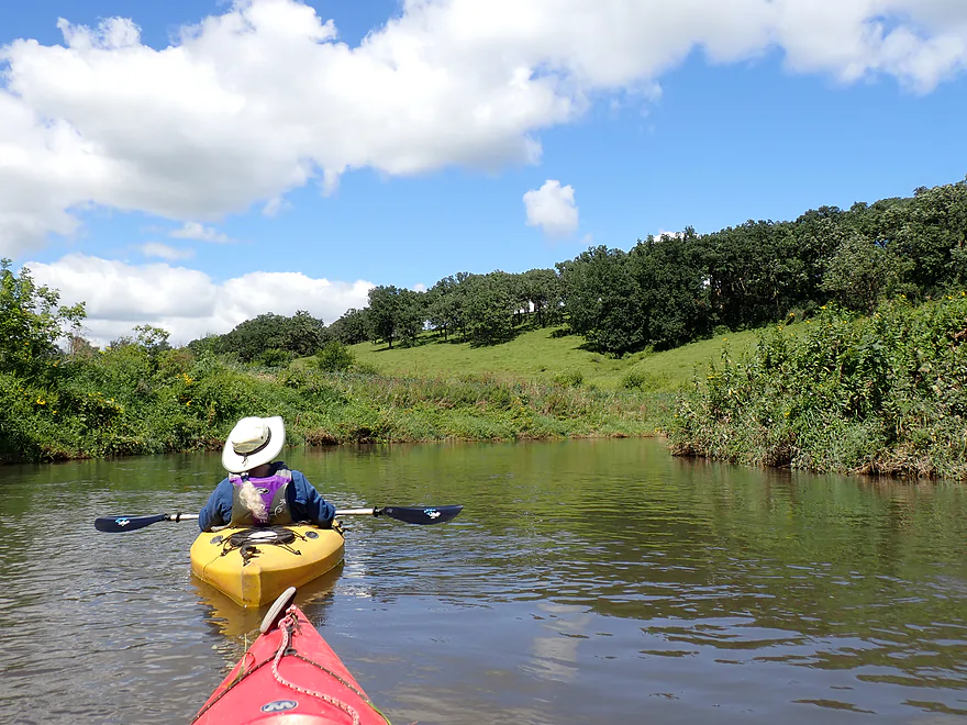
One of the nicer rolling hills of the trip
Most hills in Wisconsin are wooded so this is unique
Minor rapids
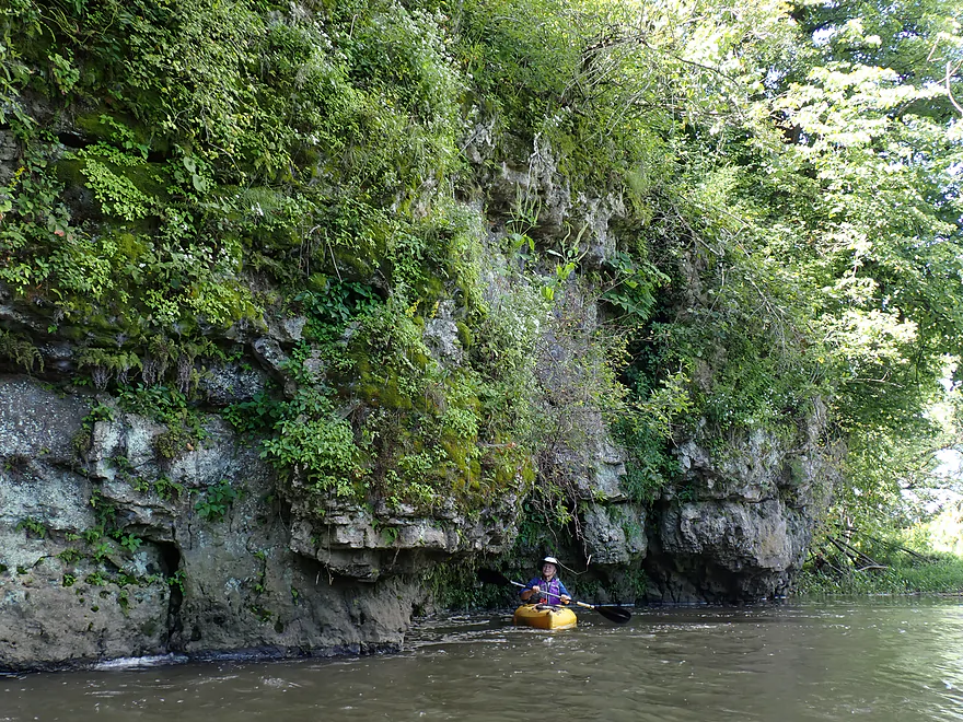
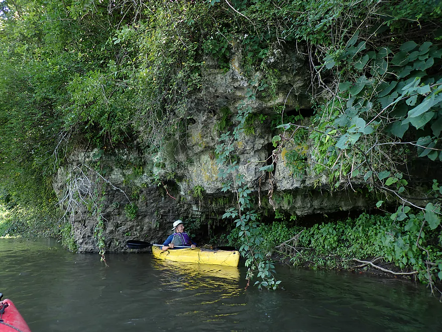
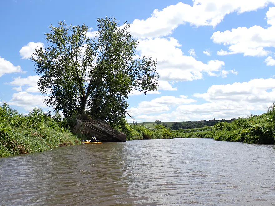
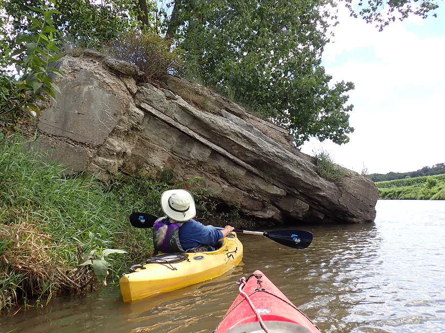
Best outcrop of the trip (these were all limestone)
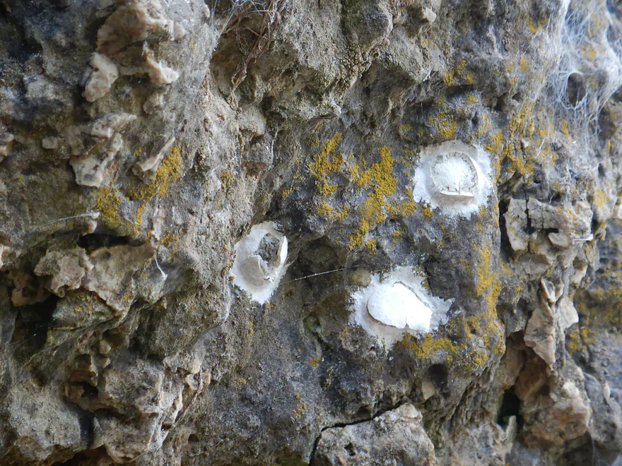
These are the remains of dobsonfly egg cases
Reverse view
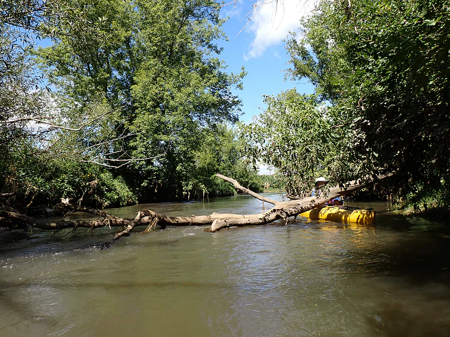
Never had to portage, but some snag dodging
More corn
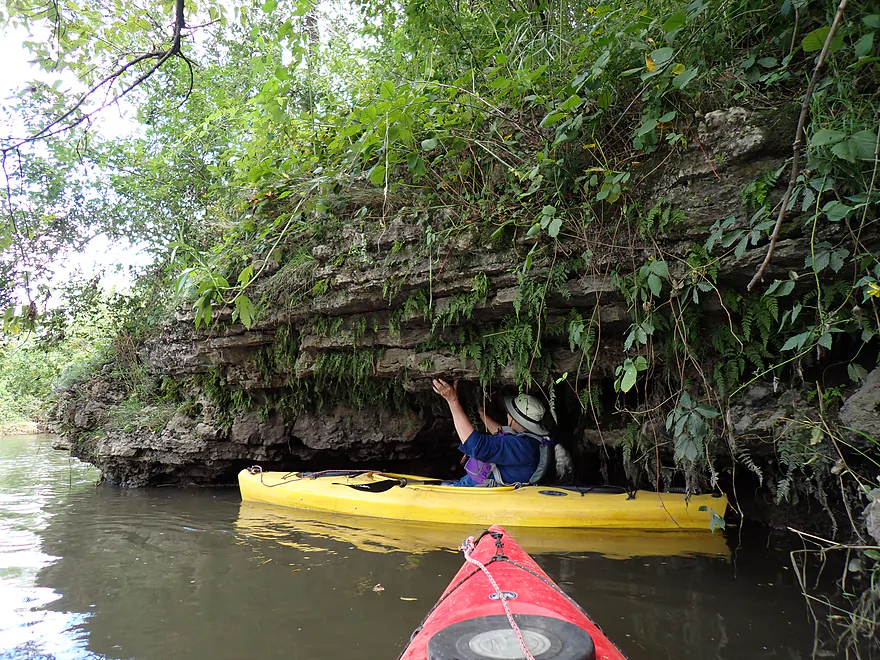
Second best outcrop of the trip

There is a way though, but it was tricky
The mouth of the Sudan Branch–it doubled the size of the river
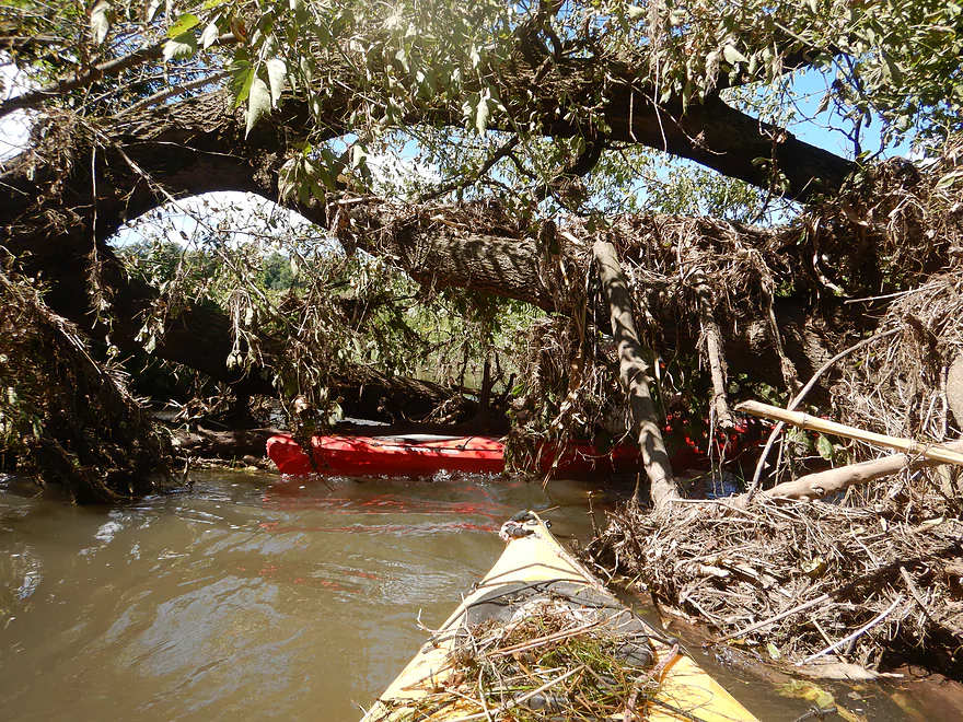
A tricky strainer in fast current
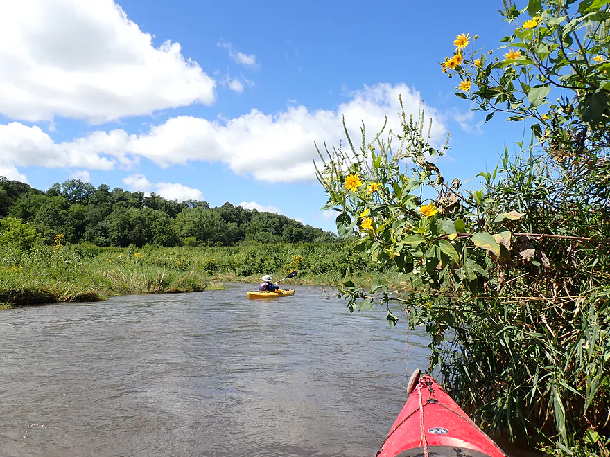
Woodland sunflowers watch us go by
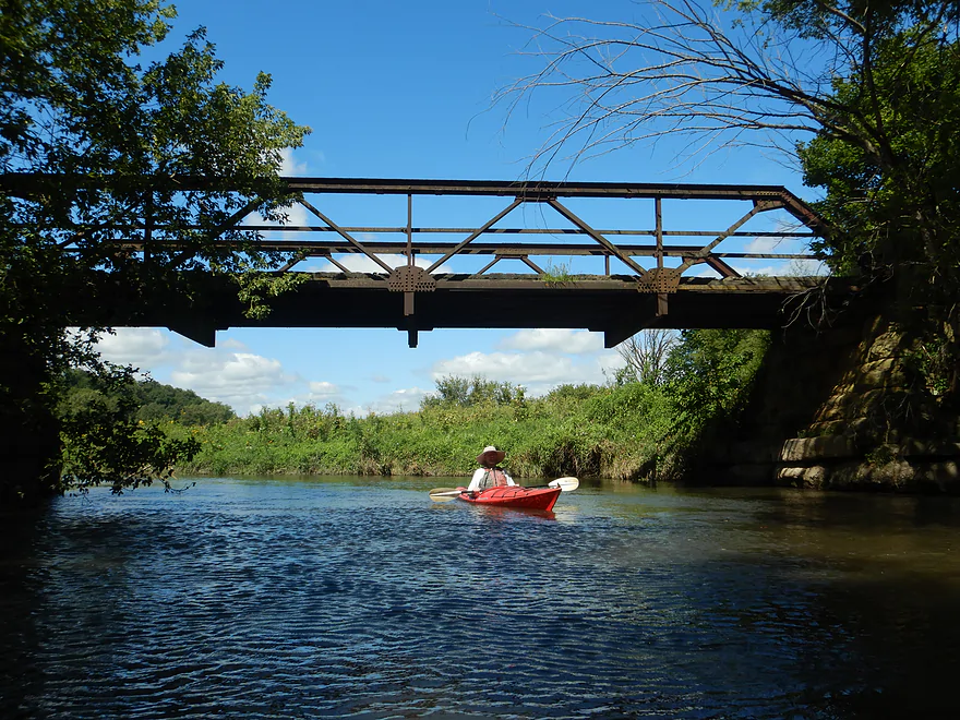
Rustic iron trestle farm bridge
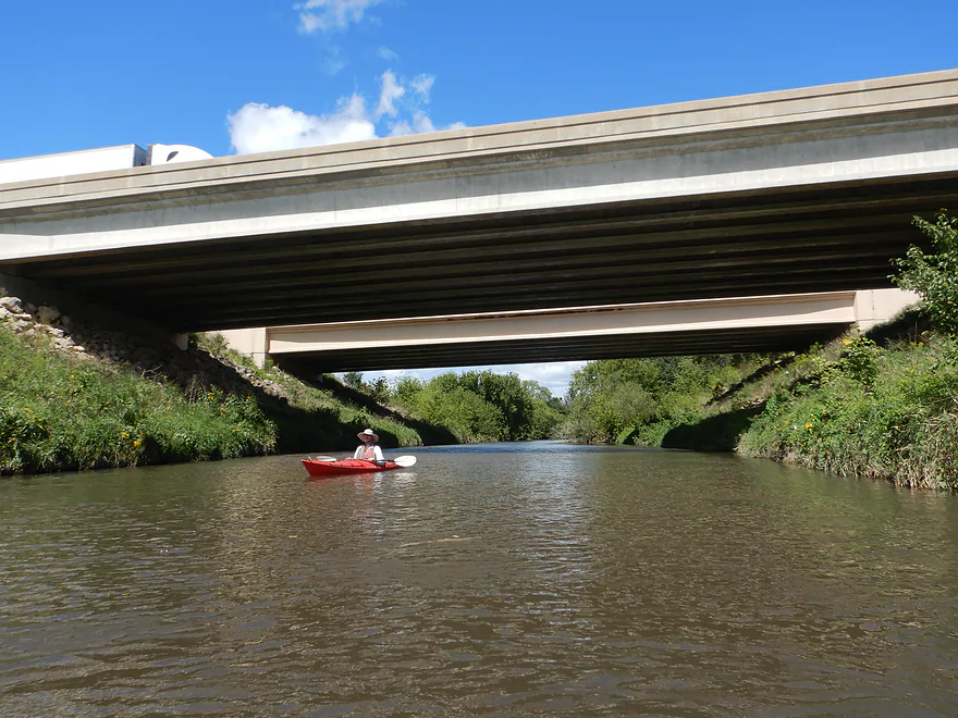
Busy Hwy 151
Some of the best rapids were located after Hwy 151
Not an outcrop, but an old bridge abutment
Second half of the trip was wider and less interesting…but still nice
Great texture (and ferns) on this limestone outcrop
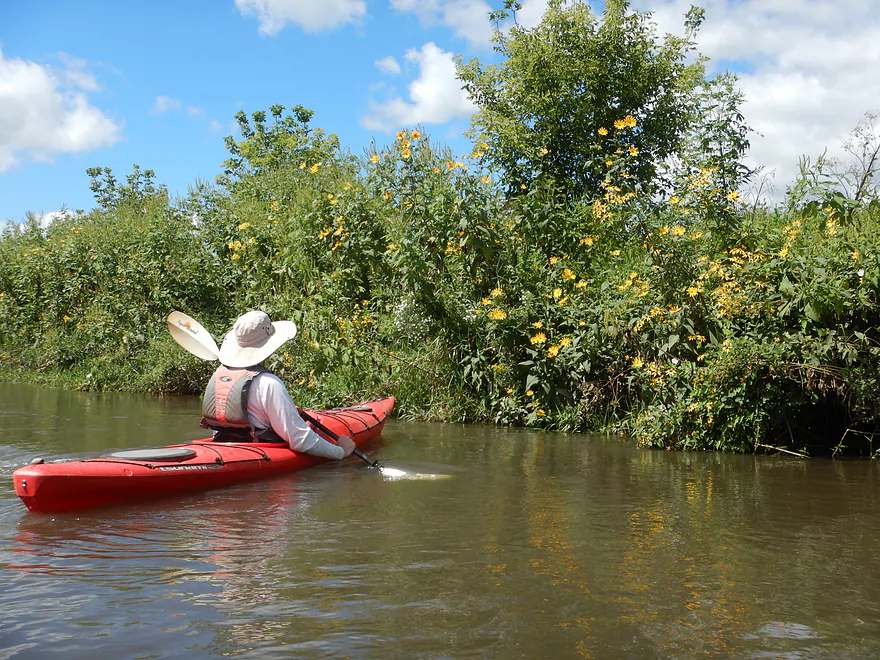
A terrific trip for wildflowers
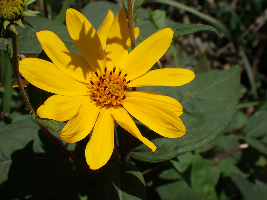
A closeup of a woodland sunflower
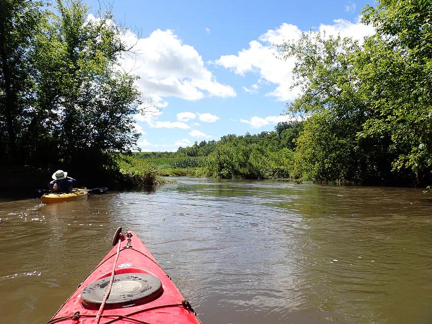
Great cloud day
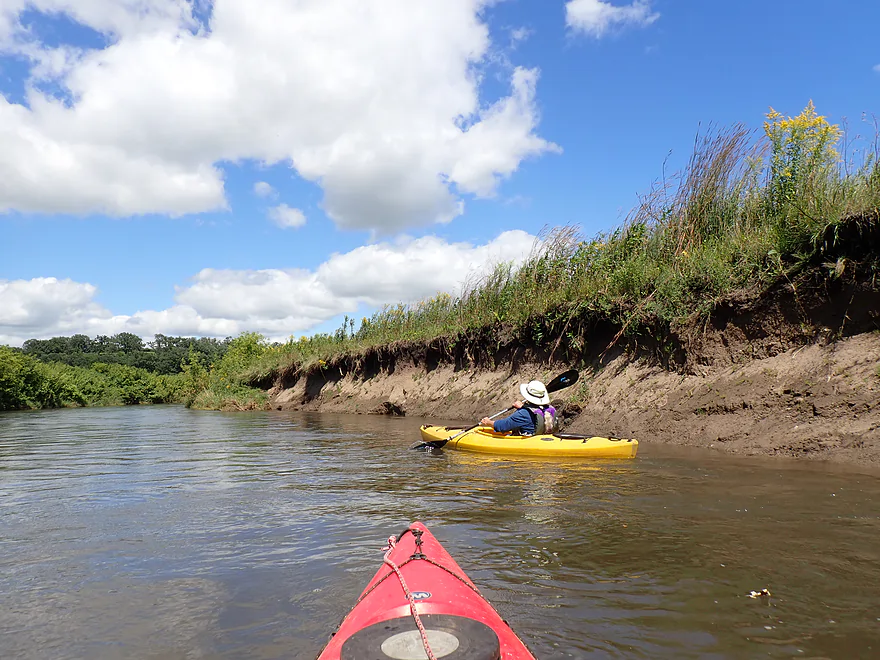
Not too many exposed mud banks, but some
A terrific hill and oak savannah
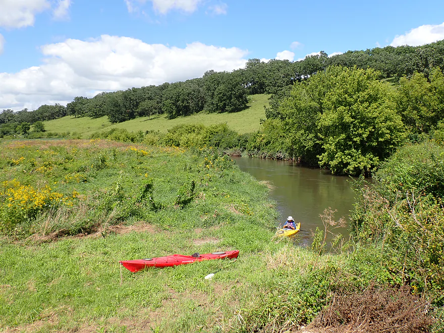
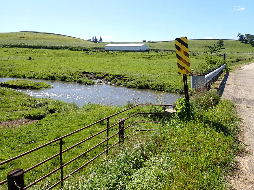
Taking out at S. Oak Park Road
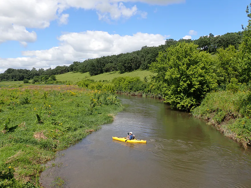
View from the bridge
Pecatonica River – Mineral Point Branch – N Oak Park Rd

After the Mississippi and Wisconsin River, the Pecatonica is Southwest Wisconsin’s largest watershed. The lower portions are ok paddles but a bit boring in spots. The secret to the Pecatonica is its many obscure and hidden branches tucked away hidden in Wisconsin’s Driftless Area. They are incredibly scenic, but deadfall and access can be problematic in spots. One of the more underrated Pecatonica tributaries is the Mineral Point Branch. I’ve done it twice before, but never the leg passing under Hwy 151, which would be this week’s trip.
The trip started at N. Oak Road which was, honestly, a somewhat difficult access. The upstream side has a pasture fence blocking access to the water, but it’s not difficult to scale and in 2018 a sign marked the area as a public access. Unfortunately, seven years later, the sign no longer remained. Not feeling excited about scaling a fence to launch (while being overlooked by a house on an adjacent hill), we decided to launch on the downstream side…which was steep and very weedy with some stinging nettles. It was a relief to finally be on the water. The landing area wasn’t all bad though…the upstream view of the river was gorgeous and very photogenic.
We continued downstream where things had really changed from my spring 2018 trip. Now thick weeds plastered what had been bare banks, and an early outcrop I recalled before was no longer visible. This is a great example of a trip that can change dramatically with the seasons.
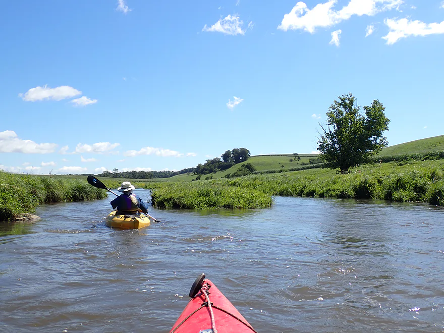
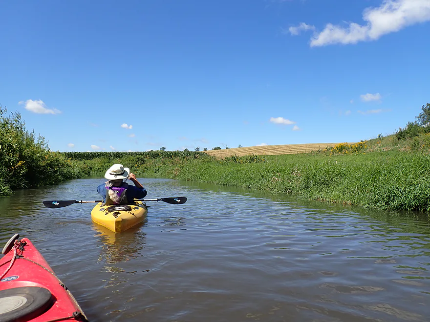
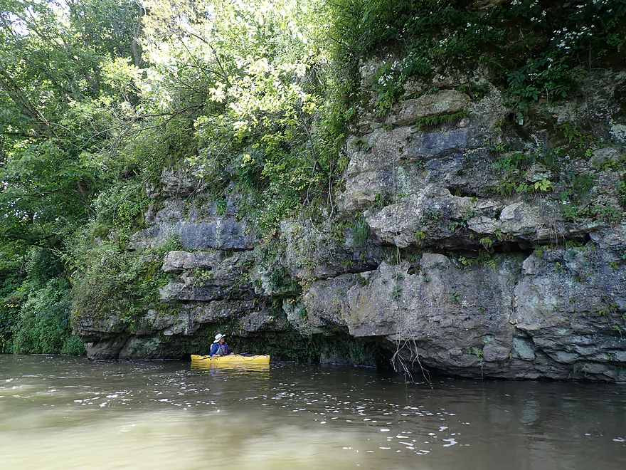
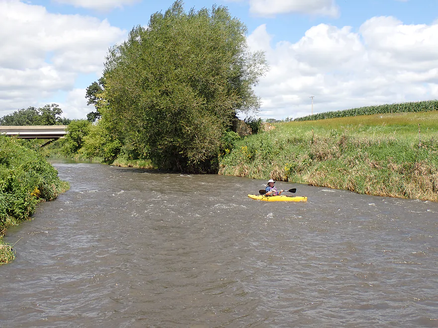
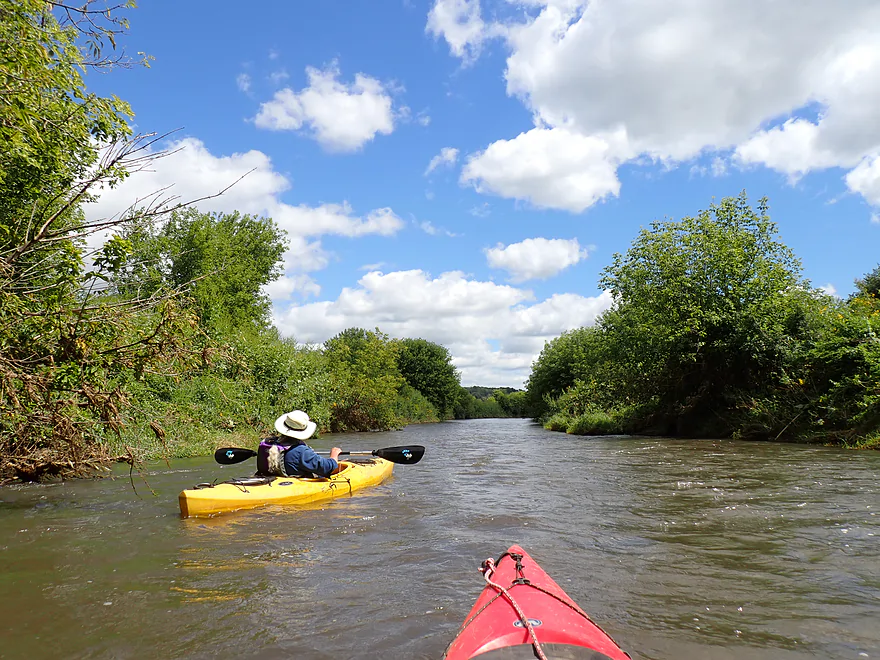
The first mile plus of the trip was really cool…five stars if it was to be ranked as a trip on its own. Here the narrow river briskly twisted between grassy banks topped with flowers and back-dropped by walls of corn. Every now and then rolling pastoral hills could be seen in the distance…very scenic. The river is normally fairly low, but higher than normal water levels made it a fast and bump-free float. Once we put in, it was pretty much “downhill” for most of the trip.
A low, cement ford used by the local farmer represented the first challenge of the trip. Because of the high water, it had turned into a “small” dam (~30 inches high). I don’t recommend going over this, and a portage wasn’t difficult. The “dam” was followed by more terrific scenery and a few light rapids. Soon we encountered a wooded bluff and a limestone outcrop. There were actually 4-5 of them on the trip…but this was the best.
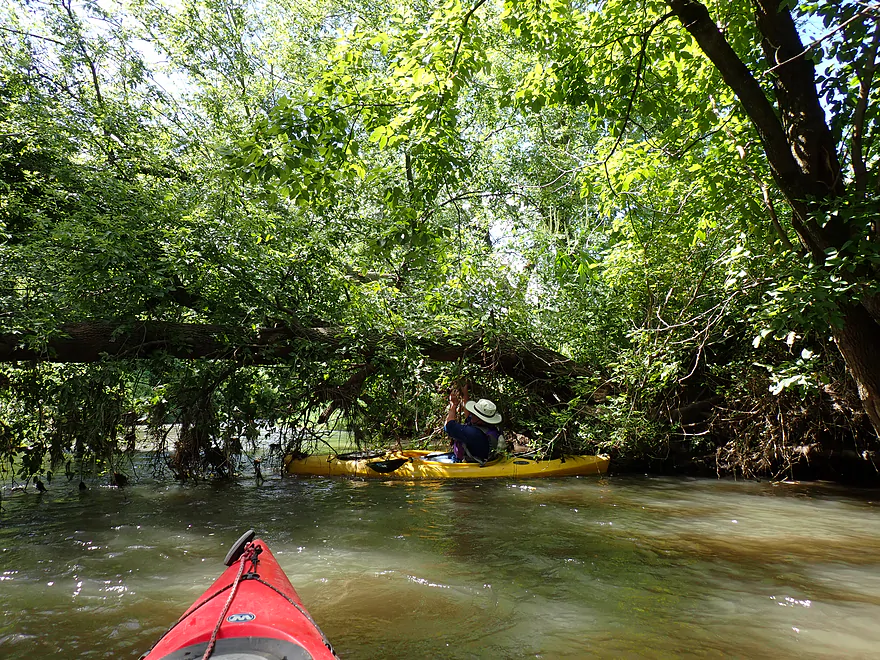
The river became a bit more wooded and ratty after that. There were a lot of boxelders, which I consider “weed trees”. While we never had to portage any logjams, there were a few downed trees that required very tight maneuvers to get through. One tree in particular created a wall of strainers hanging from the trunk, and we were able to scoot over and between the trunks of another tree, but the fast current made it difficult.
About two miles into the trip the Sudan Branch joined up with the river. It more than doubled the Mineral Point Branch and really did change the character of the river for the rest of the trip (it lost a bit of its magic).
The large Hwy 151 bridge marked the halfway point in the trip. It was novel paddling under a bridge I had passed over so many times while looking down on the river wondering how navigable it was. This was followed by a fun series of rapids and an old washed out bridge abutment (probably the original “151”).
The second half of the trip was not as interesting (straighter, more open, and the scenery was more repetitive). But it was still pleasant with enjoyable current (though not quite as fast as earlier). The highlights were the occasional driftless hills–some of which were “bald” (lacked trees). Without the trees, the hills showed off their unique rounded character. One of my favorite rolling hills was near the end of the trip and was topped with a fantastic oak savannah.
The trip ended at S. Oak Park Road which, while not an ideal landing, was infinitely better than N. Oak Park Road. A large area had been mowed by the bridge–perhaps by the local farmer, but there were no signs indicating public or private access. Other paddlers have used this access, so it appears to be okay.
In summary, this was a trip that turned out better than expected. The fast current, unique rolling hills, bankside flowers, occasional rapids, and scenic outcrops combined for a nice trip. The only downers were the one tricky strainer, followed by a downed tree (which could be portaged), and a put-in that made you choose between bushwhacking thick weeds or risking the ire of the local property owner. For those interested in longer trips, you can put in earlier or take out later. The upper leg is more scenic with better outcrops…but shallower and has some cattle and a few logjams to deal with. The subsequent leg (after where we took out) is very nice and IMO well worth doing.
Sights included a few clam shells, one or two muskrats, some beaver sign, several wooducks, one blue heron, and a few swallows gathering for migration. The blue heron kept flushing downstream for a total of about ten sightings, but he never stayed put long enough for a photo.
Mineral Point: One of the oldest towns in Wisconsin, the city was settled by Cornish miners. The quaint town is full of historic buildings, art galleries, and history.
Oak Park Road: This was a tricky put-in. The upstream river goes through a large grassy pasture and a fence separates the road from the river. The fence isn’t too much of a barrier and launching east of the bridge wouldn’t be a problem. But…the sign that used to mark this area as part of a public access has since been removed. Not wanting to get in conflict with the local farmer for scaling his fence, we decided to launch on the west/downstream side, which was much more challenging. Here a steep ditch and thick weeds made accessing the river difficult (doable, but not fun).
Alternate Put-ins:
- Ludden Lake Dam (4.3 miles upstream from N. Oak Park Road): The dam, while not officially marked as public, is often used by locals as a water slide and should be a viable access. You would have to drag your boat over a couple hundred feet of grass from the south parking area though. This bonus stretch is very scenic with impressive outcrops…but when I did it in 2018, there was a logjam and some cattle. This leg can also get very shallow, which can make navigation difficult.
- Ludden Lake Boat Ramp (4.8 miles upstream from N. Oak Park Road): This is a good put-in option. The lake is small but features a few nice outcrops. An easy portage of the dam will be required to continue downstream.
Alternate Take-outs:
- Hwy O – 1st Bridge (4.7 miles downstream from S. Oak Park Rd): This is a very tricky take-out because of the steep bank. But it might be worth it as the additional four miles are very nice and feature a few outcrops.
- Hwy O – 2nd Bridge (6.3 miles downstream from S. Oak Park Rd): The take-out is at the confluence of the Pecatonica River and, while not ideal, is better than the previous bridge landings. The additional 1.6 miles to reach this landing may feature a few logjams though, so paddlers should be wary.
Bike Shuttle – S. Oak Park Road to N. Oak Park Road: 2.6 miles with 213′ of ascent. This would be steep for a bike shuttle…but on the other hand it would be very short (and scenic).
Current/Rapids: The current was surprisingly brisk and there were a handful of Class 1 rapids (nothing too strong though).
Logjams/Strainers: Most of the trip was remarkably open. But…just above the Sudan Branch mouth were two downed trees that required careful threading to get through. Just below the Sudan Branch was a strainer in fast current…there is a path around but it does require careful circumnavigation.
Dams: While no official dams are on this leg, just downstream from the put-in a low concrete farm ford that acts like a make-shift dam. It’s about a 30″ drop and going over it is not recommended. A portage is not difficult.
Cattle: While cattle are a common sight on upstream legs of the Mineral Point Branch, we didn’t see any on this trip. I think in recent years local farmers have converted what used to be mostly pasture to now predominantly cornfields.
Closest Gauge: Pecatonica River @ Darlington
My Trip Depth: 500 CFS or 5.3′
Gauge Guide: Note, this gauge is located about 28 miles downstream so may not be very representative. In general the stretch above the Sudan Branch can be shallow, but not nearly as bad as the stretch below Ludden Lake.
- < 150 CFS: The river rarely gets this low. I think this stretch would still be navigable though. There would be bumpy spots upstream from the Sudan Branch. Once the Sudan Branch joins up, it would be clear sailing.
- 151-400 CFS: Average flow and a good target range.
- 401-600 CFS: High and turbid water. This should be mostly fine for paddling, although the current around a few strainers could get a bit pushy.
- 601-1000 CFS: River will be very high and dirty. Perhaps it would be navigable but not ideal. The open parts of the river will be fine, but the brief wooded stretches could have a few tough strainers.
- 1001+ CFS: This might be near flood conditions and would only be suitable for expert paddlers.
Detailed Overview
- Mill Creek Road to Ludden Lake Boat Ramp: 4.0 miles. Very small and will require high water. Fences might be an issue. Mostly open pasture with maybe 1-2 logjams. There are likely several scenic outcrops on this section.
- Ludden Lake Boat Ramp to N. Oak Park Road: 4.8 miles. A nice paddle through open pastures, rolling green hills, occasional outcrops and some light rapids.
- Ludden Lake Boat Ramp to Ludden Dam: 0.5 miles. Ludden Lake is a popular kayaking lake that consists of a scenic rocky shore with occasional outcrops.
- Ludden Dam to Hwy 39: 0.7 miles. A fun section with maybe three Class 1 rapids and several sandstone outcrops. I am not 100% sure the land below the dam is public access, but the locals and fishermen use it all the time.
- Hwy 39 to N. Oak Park Road: 3.6 miles. A great stretch through an open valley with fast current, several larger outcrops and only one logjam.
- N. Oak Park Road to S. Oak Park Road: 4.3 miles. Starts small, fast, narrow and scenic with gorgeous rolling hills and a few outcrops. The Sudan Branch doubles the river and afterwards it becomes less interesting, but remains pleasant with nice open vistas and brisk current.
- S. Oak Park Road to Hwy O 1st Bridge: 4.7 miles. A good leg with many outcrops and no logjams.
- Hwy O 1st Bridge to Hwy O 2nd Bridge: 1.6 miles. There could be a few logjams. Likely no outcrops, but maybe one. Hwy O (2nd Bridge) marks the confluence with the main branch of the Pecatonica.
- For more paddling options on the main branch, see my Pecatonica River Overview Map.
Trip Map
Overview Map
Video
Photos Size: