
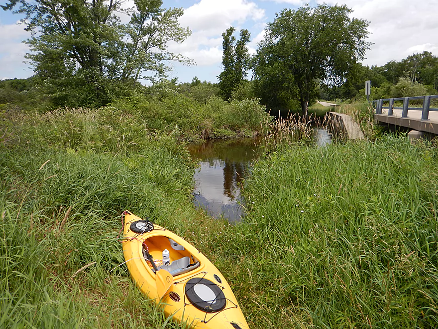
22nd Ave put-in
Little traffic and ok parking
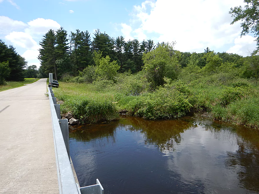
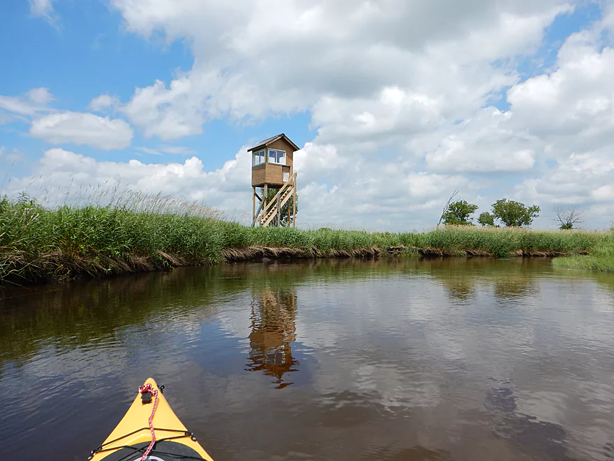
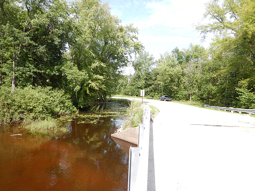
Superior launch area just downstream of bridge
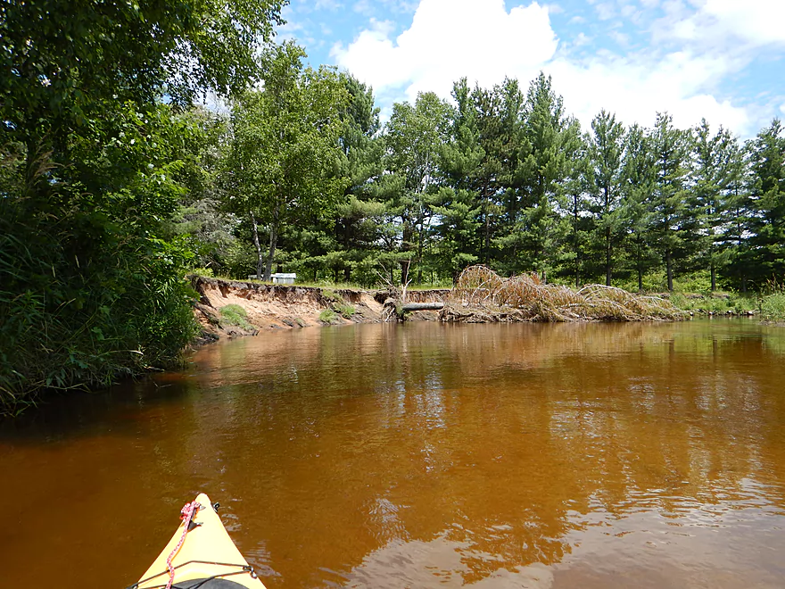
Nice clay banks
Old washed out bridge
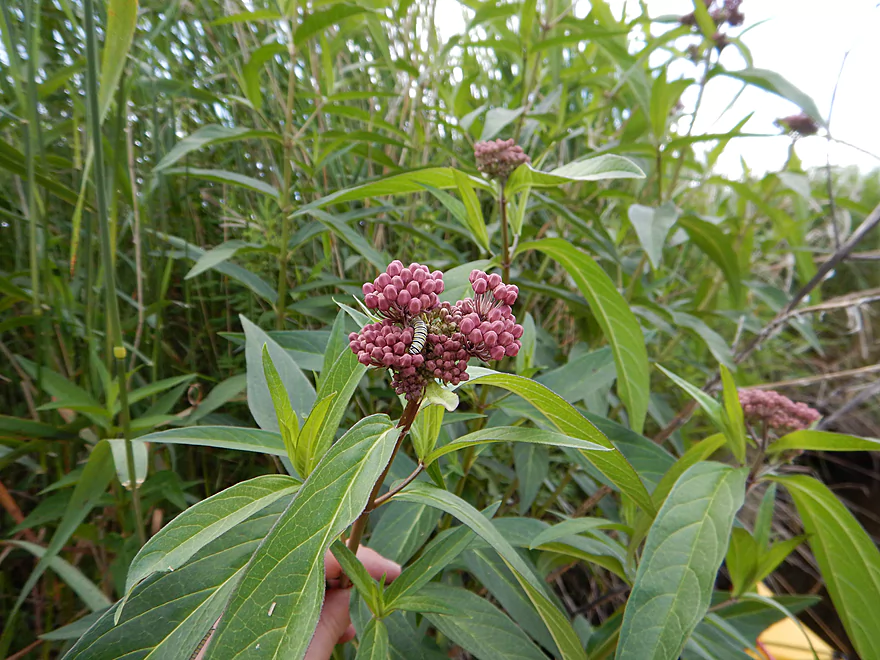
Swamp Milkweed has a parasite
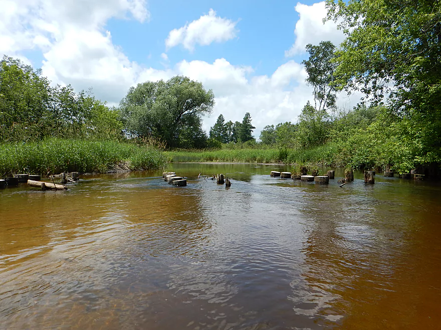
Lots of these on river (not sure they are legal)
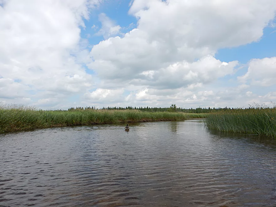
Wonderful blue sky (this would change)
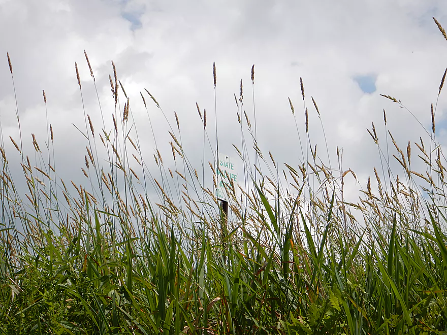
Lots of these signs on the river
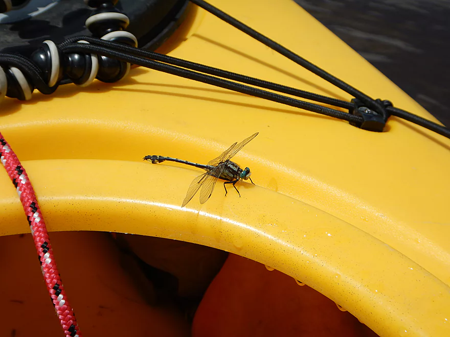
Midland clubtail
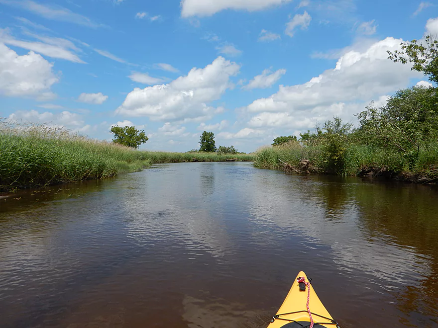
Tamarack line in the distance
Side channel around massive island
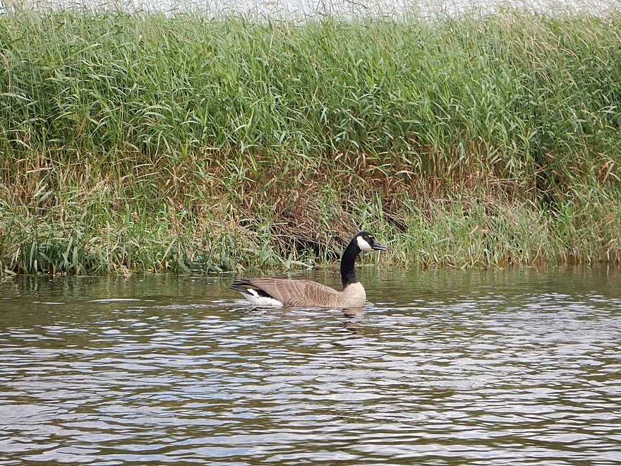
Angry goose
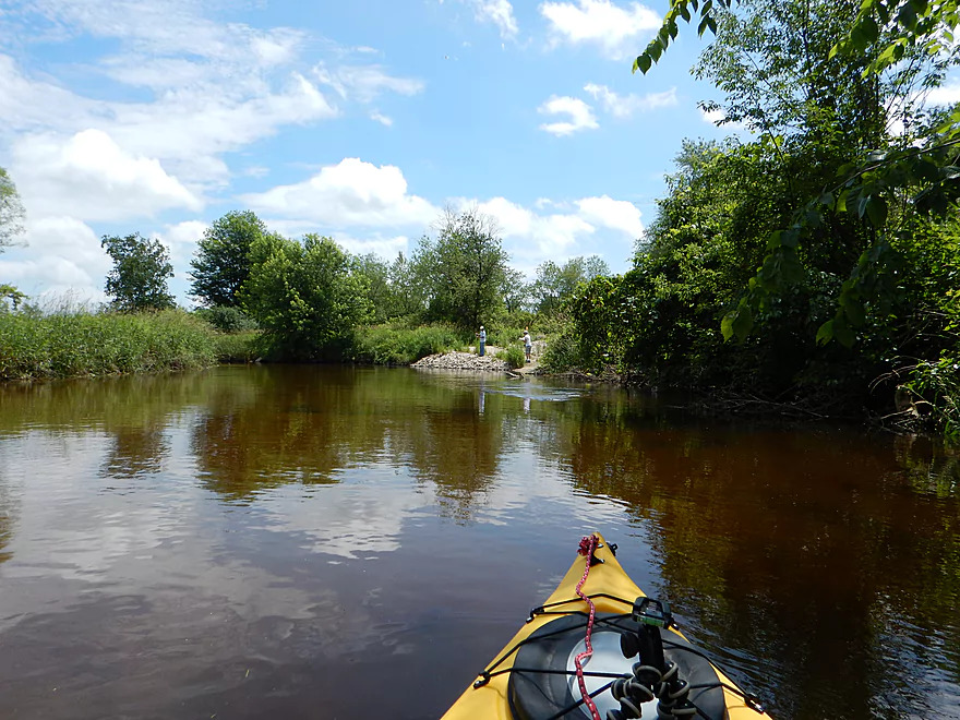
Being led on a goose chase away from the goslings
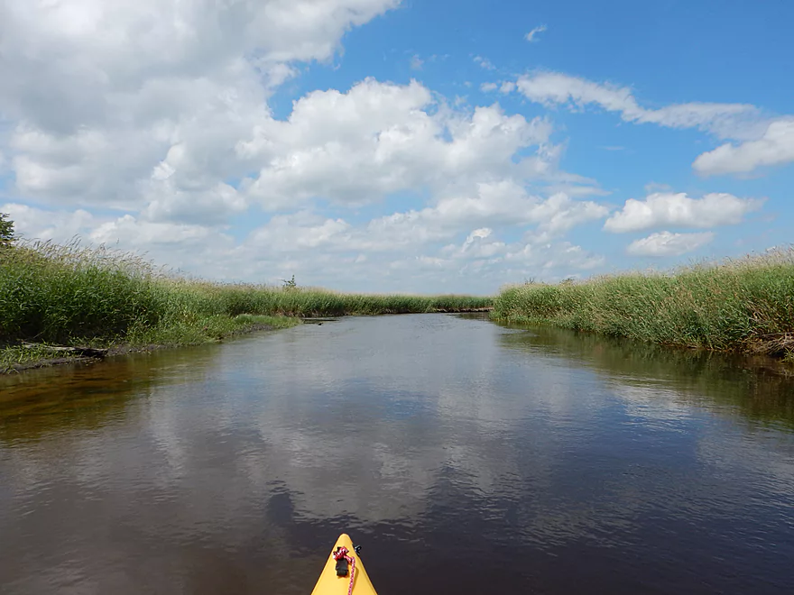
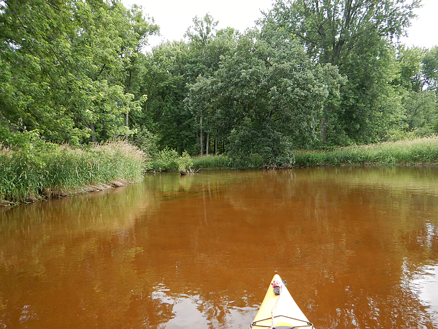
Again, terrific water
A tough ducker
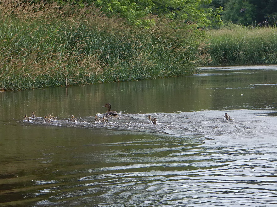
Some scampering goslings
This was really tough to duck under
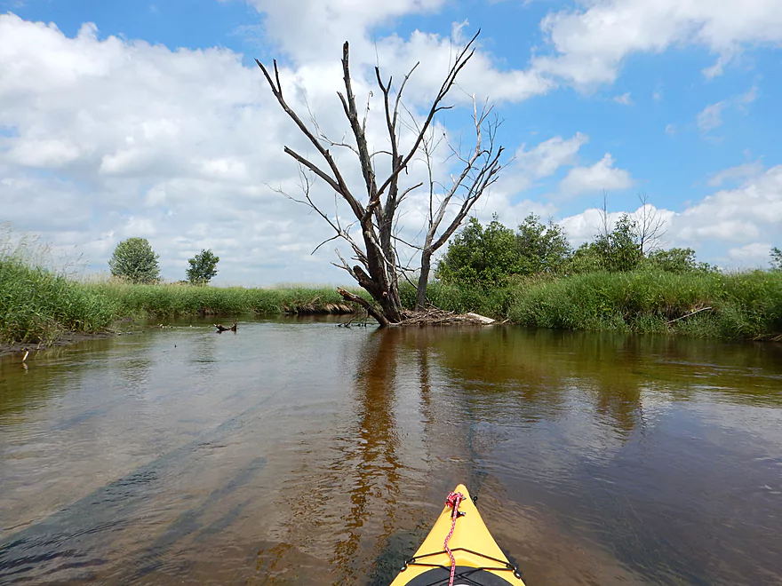
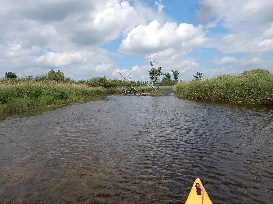
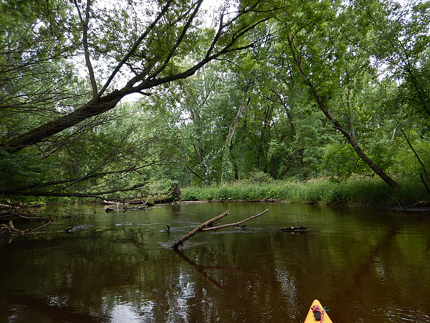
Snags get serious in last mile
Like a minefield
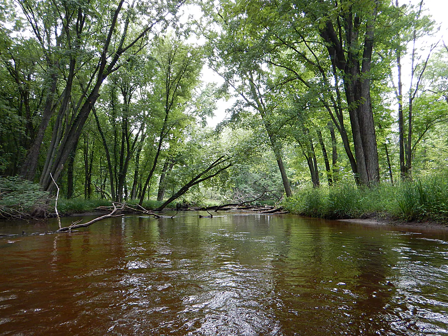
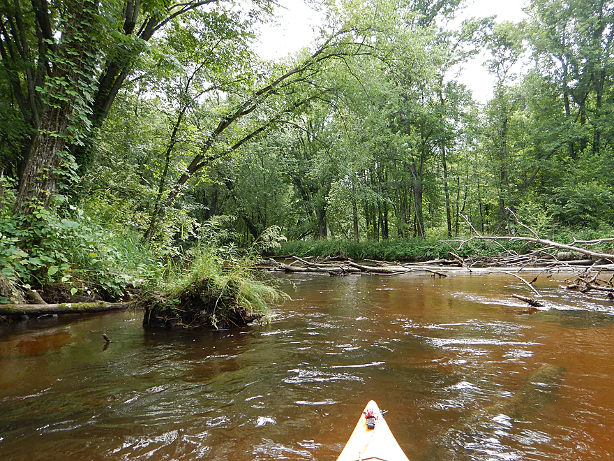
Nice tree canopies in this section
Still good water
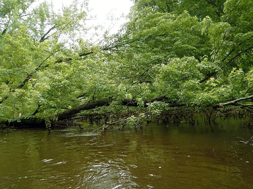
Not fun ducking under this one
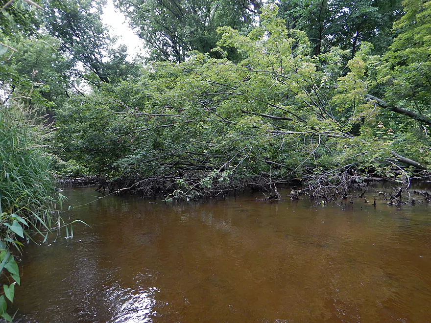
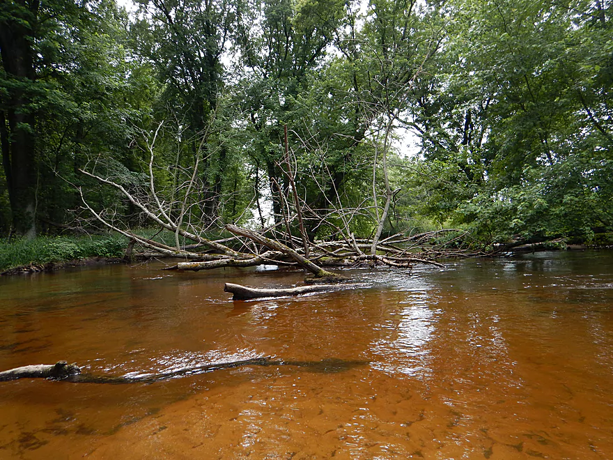
First real portage of the trip
And a bad one
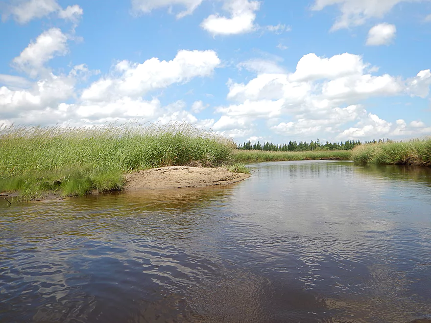
What happened to our nice sand?
Another fun ducker
Kind of cool looking though
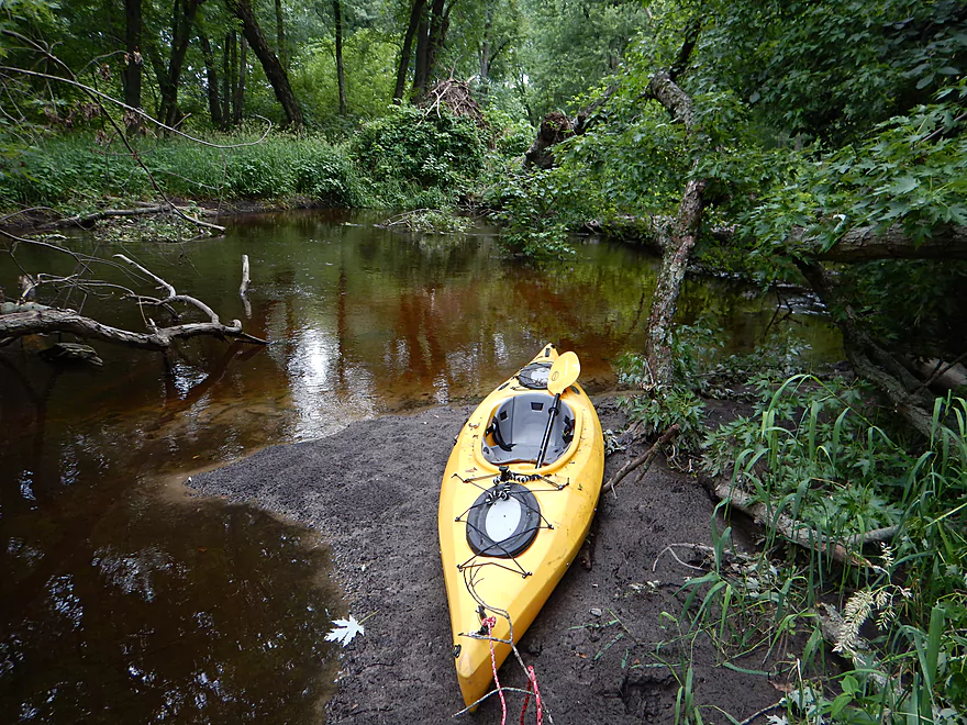
Poor take-out @ Hwy D
Only one parking spot available on right
White River

A river with two identities. The first 90%, you get clear water, sandy substrates and open, grassy vistas. The last 10% goes through woods and, unfortunately, has some deadfall to contend with. To clarify further, there are actually three White Rivers in Wisconsin. This is not the more famous one located by Lake Superior (a good paddling prospect in its own right). Nor is this the White River by Lake Geneva that is occasionally paddled. Rather this feeds into Fox River and is close to the city of Berlin. This (Green Lake County) White River watershed is most prominently known for its two state natural areas, Prairie/Tamaracks SNA and Sedge Meadow SNA. The DNR does refer to canoeing on this river and it does get some canoe traffic, but for the most part, it is a pretty obscure prospect and is rarely reviewed by other paddlers.
I first came across the idea for this trip from Frank F. Piraino who, in his guide book, called it an outstanding adventure with “no portages.” I would later find out out my dad had actually run the river twice. Once, all the way from the Neshkora dam to the mouth, but said it was a long trip and log jams were an issue. He did say that the worst deadfall was close to the mouth, so I gambled and planned a route (same as Frank’s) that would start 4 miles downstream of Neshkora, paddle for 8 miles, and then take out 8 miles before the mouth, which I hoped would eliminate any portages.
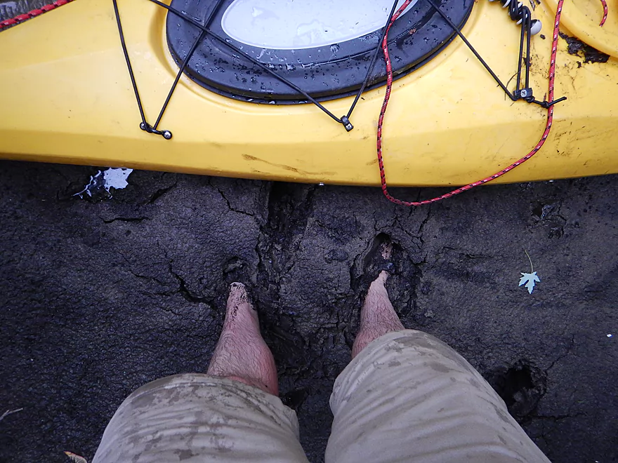
The put-in at 22nd Ave is just a bridge access, but is okay otherwise. I didn’t realize until after I put in that there was a more “proper” put-in just a couple hundred feet downstream. This was accessible by a gravel road and would have been far superior (especially for locking my bike and kayak, as the bridge didn’t have good locking trees or posts).
The water depth for this river was pretty good. Perhaps a tad on the high side, as the grass line was sometimes underwater, but the current was never pushy nor did it affect the water quality. This river could easily be run a lot lower IMO. The substrate is almost all sand, which is very nice and, because of the lack of rocks this should be runnable even in drought conditions. There isn’t a nearby gauge, so it is tough to predict how high the river will actually be. I’ve included the one at Waupaca (380 CFS), but that has a higher average flow rate. The gauge at the Fox River by Pardeeville might be helpful (7.5′), but the Fox is barely a creek at this point. Complicating any depth predictions will be the dam at Neshkora. Rumor has it that the dam operator illegally releases water on the weekend for tubers. If true, this would be unfortunate, as artificially excessive water fluctuations can hurt plant life (there are multiple rare plants in the state natural areas downstream of Neshkora) and sudden releases could contribute to erosion and even log jams. So you don’t know if you’ll be paddling during a release or not…I suspect I did.
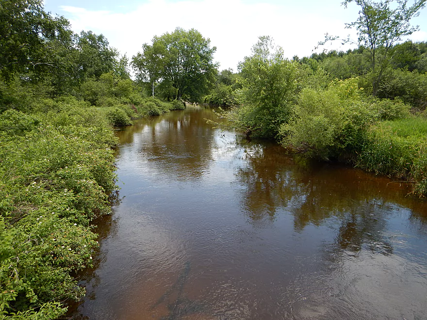
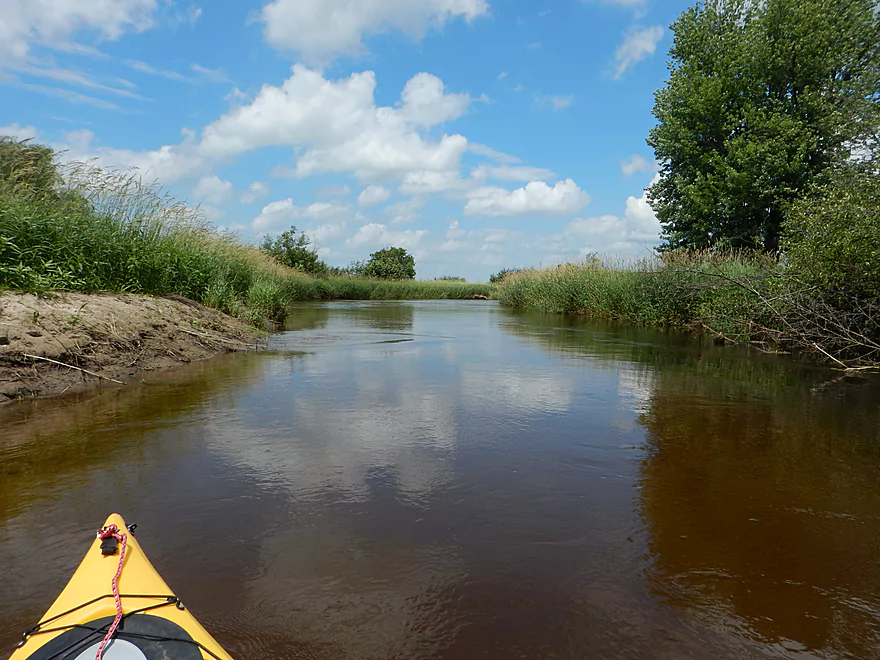
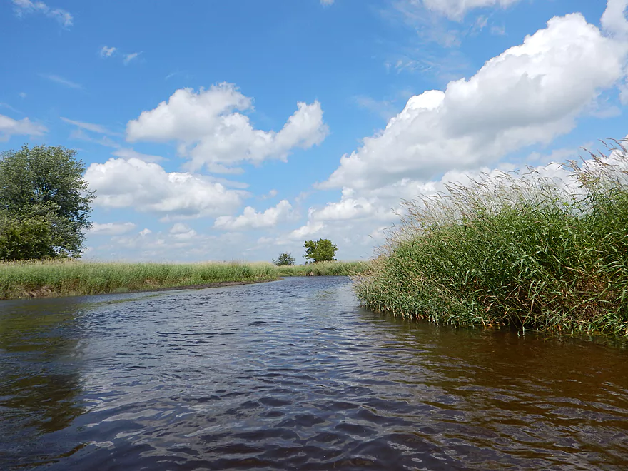
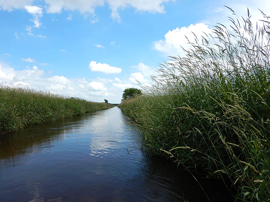
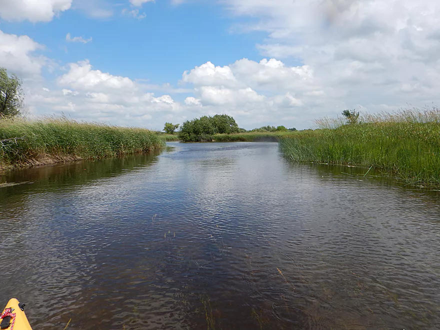
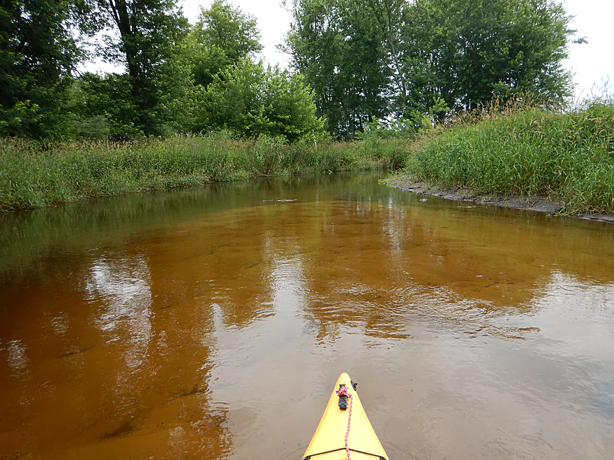
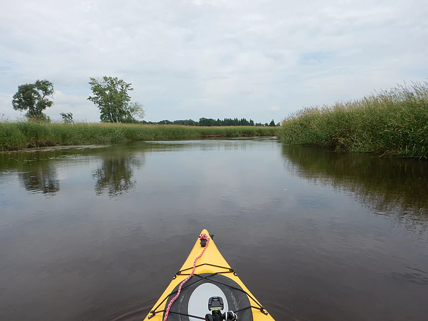
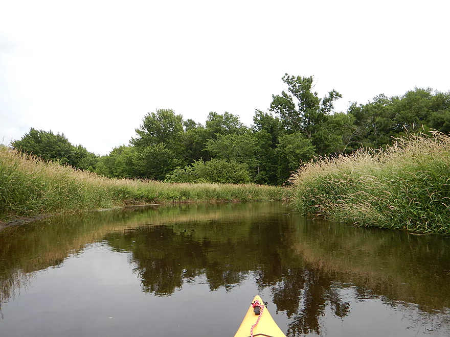
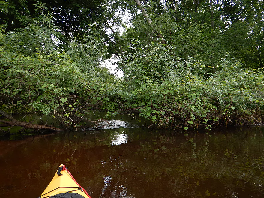
Back to the trip… Right off the bat, what struck me was how “grassy” the river was. Very few trees…some scrubby alders in the first mile and last mile, but not much in between. The water quality was superb, which afforded terrific views of the sandy bottom below. The other remarkable thing about this river is the lack of people. Some fishermen at the bridge and one house…but that was pretty much it. Plus, a whole bunch of permanent duck blinds (a curious contrast to the “no permanent blind” signs I saw in the area!). Generally speaking, a very peaceful paddle in mild current…a welcome change of pace from some rough current I’ve had to deal with in the past month of paddling. The river (well, for the first 90%) is extraordinarily free of deadfall, and, with the easy current and good depth, would actually be a good river for longer boats and canoes (don’t plan your trip though before reading the rest of the review!).
The wildlife on the White was mediocre. Saw a crayfish eating another crayfish (albeit upstream of the put-in). Lot of dragonflies, some clams, and unfortunately a lot of mosquitoes…but as long I stayed away from the banks and if there was a wind…I was fine. Also saw 3-4 deer, glimpses of a couple of muskrats or beaver, and a blue heron. Highlight was a goose family and duck family I came across. The goose parents weren’t happy to see me and led me on a “goose chase” away from the goslings. The duck parent pulled the old “wounded duck” routine, trying to lure me away from her ducklings. The plant life wasn’t as diverse as previous trips, but there were some nice wildflowers. For the most part, big grassy corridors were the name of the game, with occasional views of tamarack trees in the distance. To be honest…while the grassy banks were nice and peaceful…for ~7 miles worth, a little more diverse scenery would have been welcome. Despite the clear water, I didn’t see any fish.
Maybe halfway into the trip, you’ll encounter a side channel on your left that lets you access an old drainage ditch network. I explored this a bit, but fearing it was an old mill race, quickly backed out and got back into the main channel. Basically, a mill race is where (for the most part) a stream is diverted to provide water for a nearby waterwheel. The Fox River has several notable mill races (you’ll see them as straight lines leading into the Fox from satellite view) and most are no longer used. This one turned out to be a simple drainage ditch, long abandoned…but if it were a mill race, that could be problematic, to say the least. With some mill races you won’t be able to get back onto the main channel, as the current will prevent you from going back, and weeds/deadfall will prevent you from going to the mouth. Thankfully, this wasn’t a mill race to get lost on, but, interestingly enough, there is, I believe, a major mill race just 2.5 miles to the east of this spot, so the worry is legit. If you take this artificial channel, it will shave .5 miles off the trip and offer the swiftest current found on the river (which still isn’t too fast).
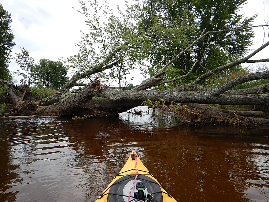
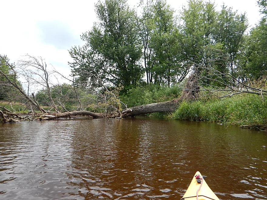
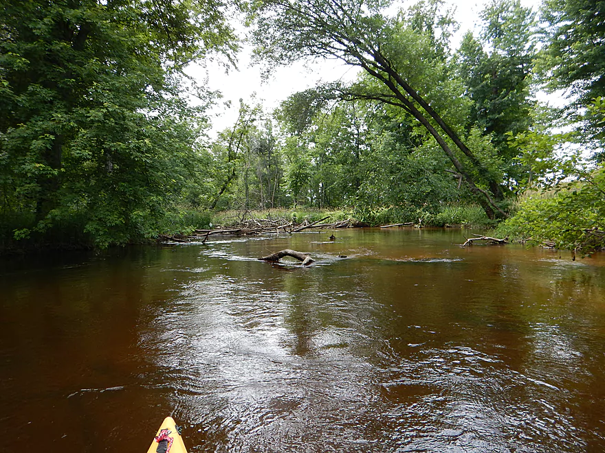
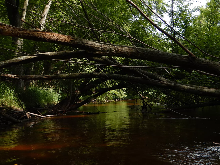
Now, as to why you may want to seriously question doing this trip… After a while the trees start to intrude on the water and deadfall becomes an issue. Still, in the open areas, there were two major jams that I was able to squeak through without portaging. Somebody had done MAJOR cleanup work on the log jams, which helped immensely…but it appears things have filled in somewhat since their last valiant effort. After a point (you can see this on the satellite maps), the trees really crowd the river and you’ll be paddling through a forest proper. This was actually quite nice to start with–wonderful tree canopies overhead, clear sandy water ahead, and entertaining debris fields to paddle through in mostly mild current. The debris kept getting more serious though and I had some serious squeaks to struggle under and hop over. When you slow down is when the mosquitoes come out of the weeds to attack, which really made things frustrating. The weather forecast had a chance of rain, so I was anxious not to be on the river too long, so this added up for a lot of stress.
I was still feeling pretty proud of myself for not having to portage and for being so close to the “finish line” (per the GPS on my camera). Then I came across a really nasty log jam that knocked a star out of this trip. No going under, I had to portage in an awful muddy area (the one spot that didn’t have nice sand) that smelled bad, had a steep incline for getting out and thick stinging nettles and poison ivy that did a number on my legs while the mosquitoes (and horseflies) drew their fare share of blood from my upper body. This is one of those log jams that extends over land a ways, so you have to pull your kayak over and through branches (fun!). Ultimately, when you get through, there is a poor re-entry area and the foreboding fear that you’ll just have to get out again. That was the worst experience… There was one more muddy portage, bringing the total portage count to two, but they were both bad. Even the squeakers were tough and left the kayak filthy.
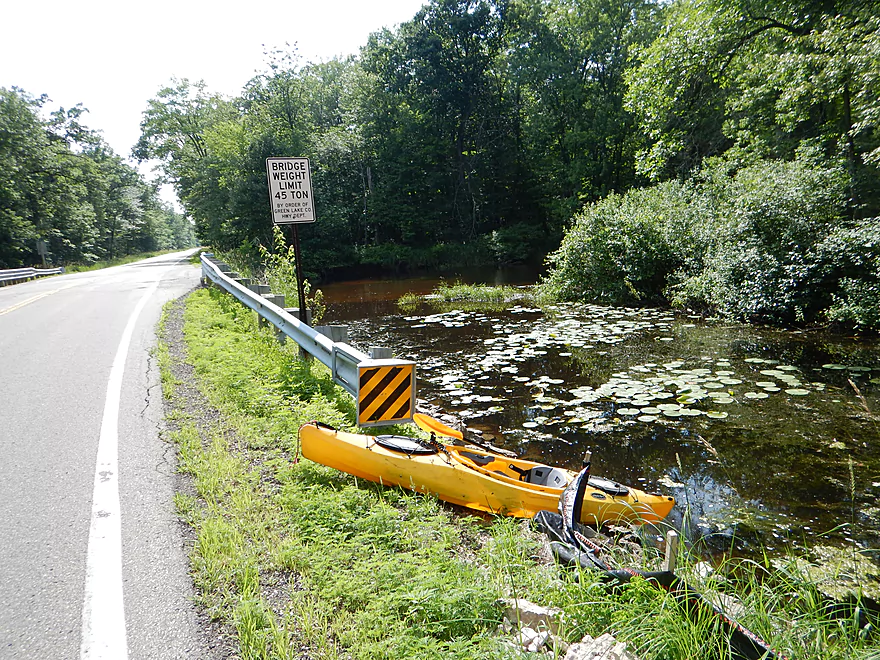
The take-out at Hwy D was not good. The banks are steep, so you have to paddle up a scummy backwater a bit and drag your kayak over rocks to reach the road. Parking is horrible, with steep small ditches and maybe one halfway acceptable spot on the southeast side of the road. To a certain degree the river looked inviting downstream of the bridge, but I was happy the trip was over. Based on what I’ve heard of the log jams going downstream, I can’t recommend that section at all. I believe there is a gravel road bridge on White River Road you could take out at if feeling adventurous (although, who knows…maybe there was a cleanup on this downstream section…but I doubt it). After that, your next option would have to be taking out on the Fox. You’ll have to paddle a mile upstream to the White River locks (a popular canoe launch) or paddle ~9 miles downstream to Berlin…not good options.
The bike shuttle is so-so. Low traffic and only 4.4 miles…but kind of hilly. One hill was steep enough I walked it, which I don’t usually do. Veteran (and more in shape) bike riders probably wouldn’t have an issue with this shuttle though.
After the trip was done and I was picking up my bike from the put-in, I came across some tubers who had just finished their trip. Asked them how the log jams were from Neshkora to 22nd Ave, and they said they had previously cleared them out with a cordless Sawzall. Curious, I decided to drive upstream to check things out. Just after the dam is a very nice park and launching area. The water quality here was five-star–terrific red hue, but completely transparent. The substrate also had nice pebbles and rocks…a far contrast to the section I ran. Here is where I found my cannibalistic crayfish. I guess if I could redo things, I would have done this upstream section instead–put in at the Neshkora Dam and paddled down to 22nd Ave. Yes, short at under 4 miles, but the tubers loved it and I think it has more potential than my route.
The section of the river I did I can’t recommend because of the log jams. Not all log jams are created equal…and these were tough. Plus, the scenery wasn’t as varied as I had hoped. This still might be worth doing, as it does have redeeming attributes…but perhaps during the spring and at low water . This way you will get more waterfowl, the banks without the grasses will be easier to portage, the mosquitoes will not have hatched yet, and it won’t matter that there aren’t leaves on the trees (as there aren’t that many anyways).
Ultimately…you should probably just paddle the Mecan River instead of the White River. Located just next door to the west, the Mecan is a very popular paddle river that is a much better prospect that I’ve reviewed previously.
—
Editor’s Updated…rumor has it that the White River actually might be clear from the dam to the mouth. If so somebody did some serious clean-up work which is very much appreciated.
Detailed Overview
Main Branch:
- Swamp Road to Wautoma Library: (1.94 miles) An interesting prospect with a few log jams. Unfortunately this is scheduled to be turned into a flowage in spring of 2017.
- Wautoma Wetlands Park to the Fire Department: (1.19 miles) A super scenic section but too clogged with jams. Reviewed here.
- Fire Department to Chicago Road: (0.8 miles) A good section with two down trees to circumnavigate. Reviewed here.
- Chicago Road to Cottonville Lane: (2.47 miles) A very nice section. Reviewed here.
- Cottonville Lane to Pine View Road Landing: (2.1 miles) Mostly open flowage paddling, which I assume is uninteresting.
- Pine View Landing to Czech Lane: (4.7 miles) A nice prospect on my to-do list, but will have some down trees and a dam to portage.
- Czech Lane to Neshokoro Dam: (2.64 miles) Probably uninteresting as this is mostly flowage paddling.
- Neshkoro Dam to 22nd Ave Canoe Launch: (3.43 miles) A very good prospect I review here.
- 22nd Ave Canoe Launch to Hwy D: (8.3 miles) A good section that I reviewed here. Liked the stretch, but found the log jams frustrating. Have been told that the main obstructions have been recently cleared out though.
- Hwy D to White River Road: (4.2 miles) A good prospect I had written off due to fear of log jams, but per Tim is mostly clear now.
- White River Road to Mouth on Fox River: (2.1 miles) Am unsure of this stretch and if log jams are an issue?
- Fox River Options After White River Mouth
- You can paddle 1.25 miles upstream to the White River Locks which is a great take-out option
- You can paddle 0.7 miles downstream to Huckleberry Lane where there is a small area for taking out (am not sure this is public or private though)
West Branch:
- Upstream of Hwy T: This leg may have too many logjams. A bigger concern is that the upstream bridge (13th Ave) has a very steep embankment so there really isn’t a good put-in option.
- Hwy T to Hwy 21: 2.2 miles. Very scenic leg with perfect clarity and a number of pine trees. On the downside it is a bit small and obstructed at times. Figure 7-8 logjams total, but it might be worth it.
- Hwy 21 to Cottonville Ave: 2.9 miles. Maybe 6 logjams, but a super scenic stretch with many pine trees. On my todo list.
- Cottonville Ave to Cottonville Lane: 5.0 miles.
- Cottonville Ave to Hwy 22: 2.2 miles. Great stretch with clear sandy water and nice pine trees. Two logjams and one log bridge, but manageable portages.
- Hwy 22 to Mouth on White River: 0.4 miles. Great stretch with more crystal clear water.
- Mouth to S. White River Rd: 1.4 miles. Very nice section with clear water. It’s much wider, deeper and more open that upstream legs. No logjams.
- Cottonville Lane to Pine View Rd: 2.1 miles. Mostly open flowage paddling, which I assume is uninteresting.
Trip Map
Overview Map
Video
Photos Size: