
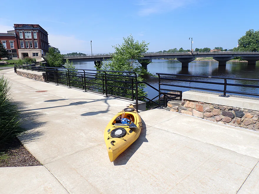
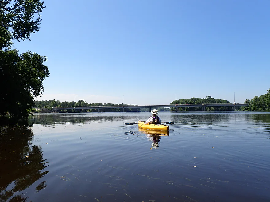
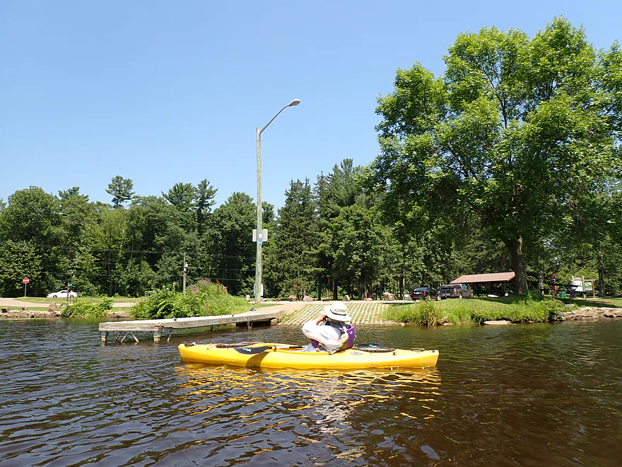
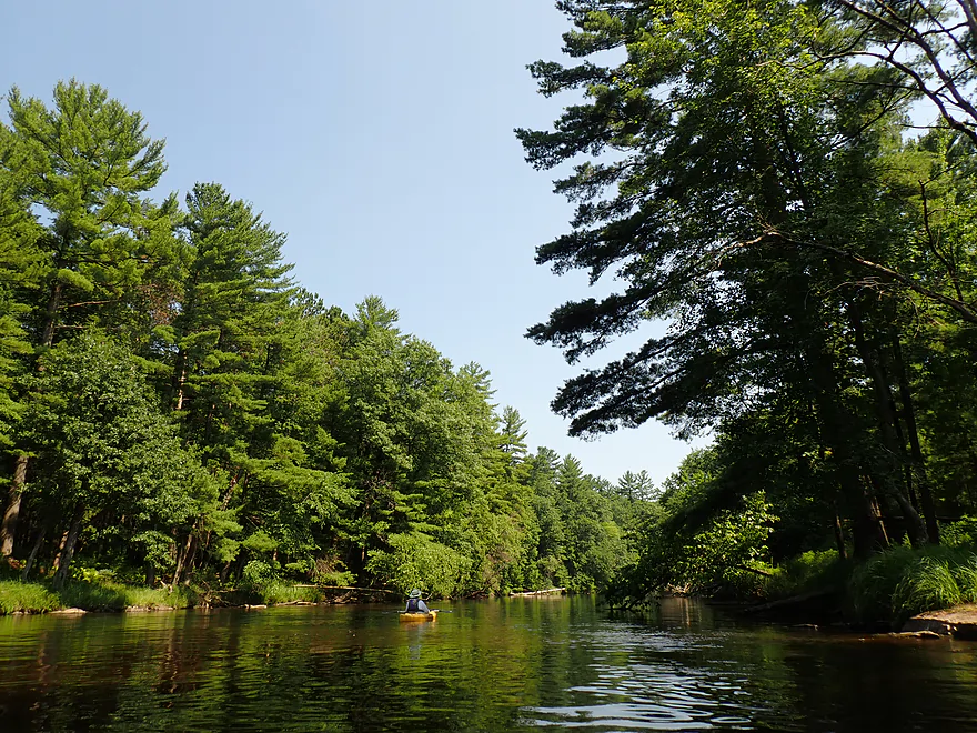
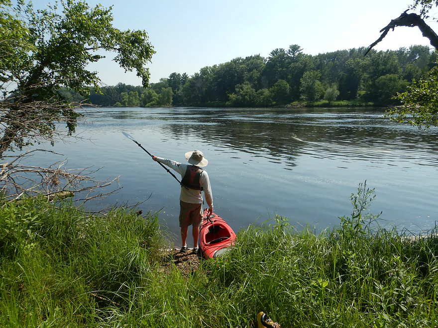
Starting at Veterans Memorial Park in Wisconsin Rapids
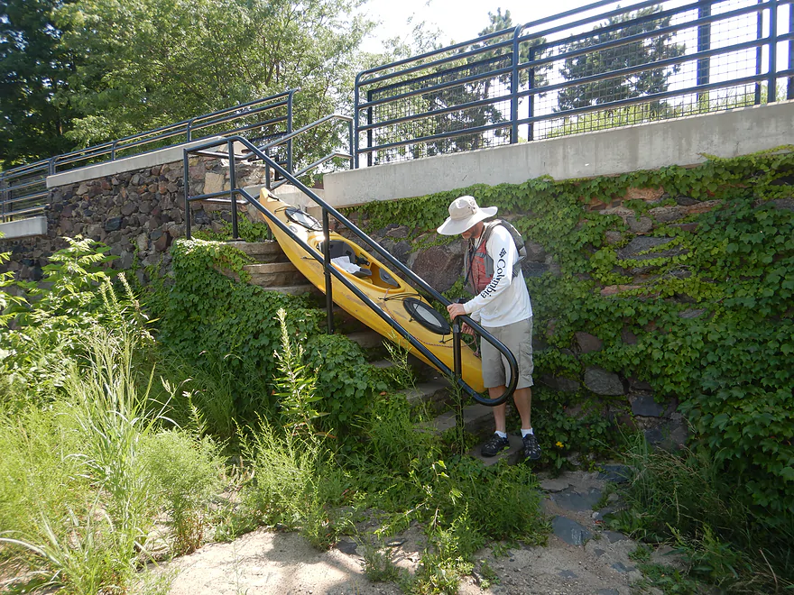
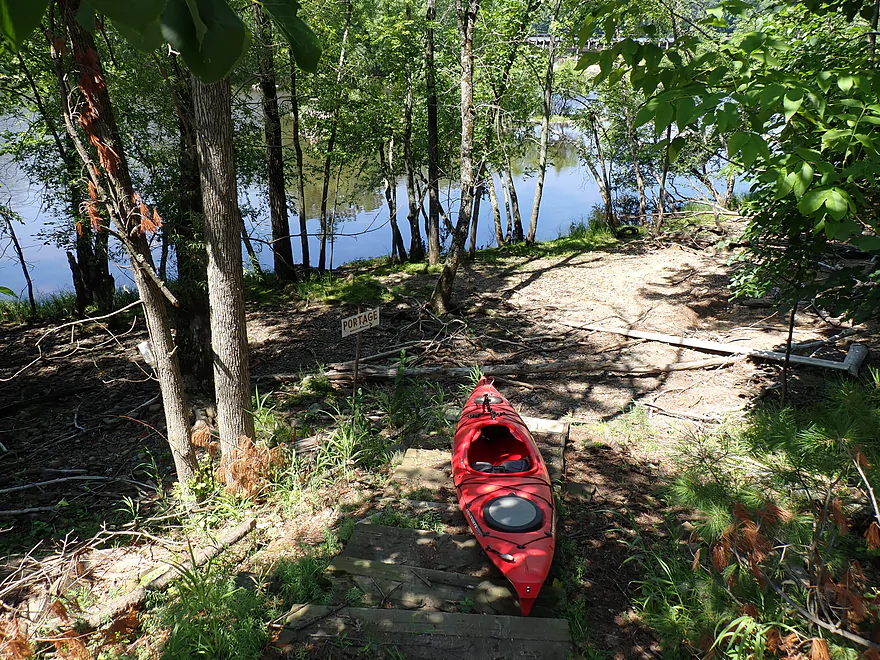
Tricky stairs for kayaks
Nice launch area though
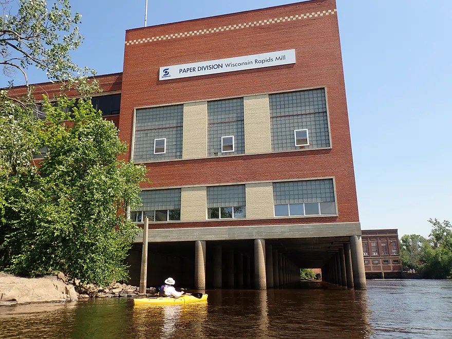
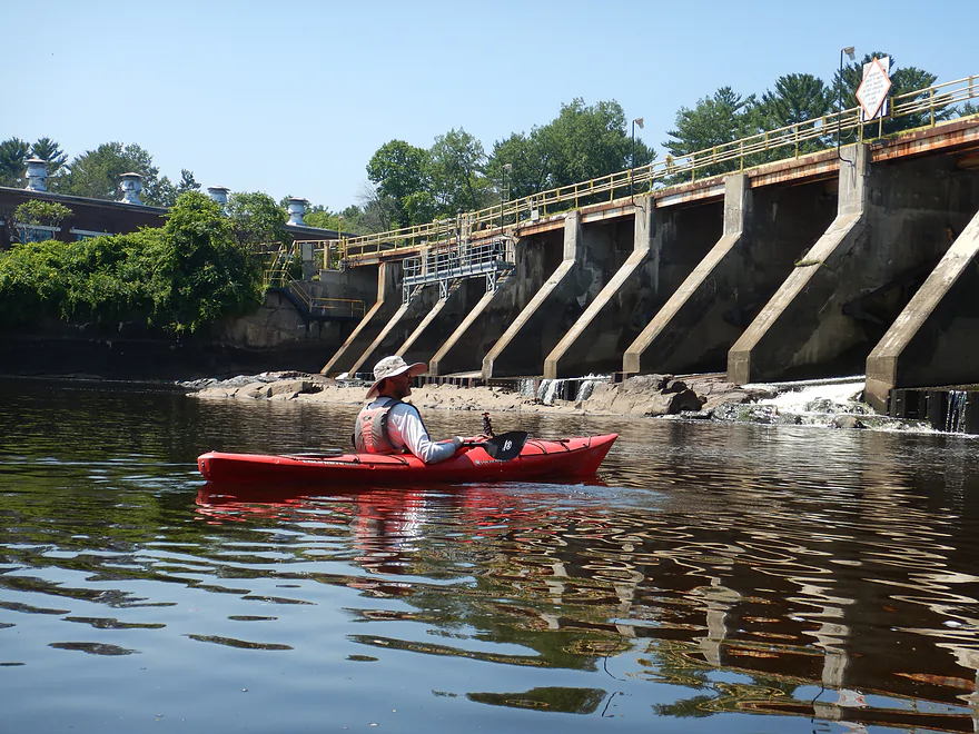
The old Verso powerhouse
A sign warns not to go under the building
The adjacent mill was recently shut down
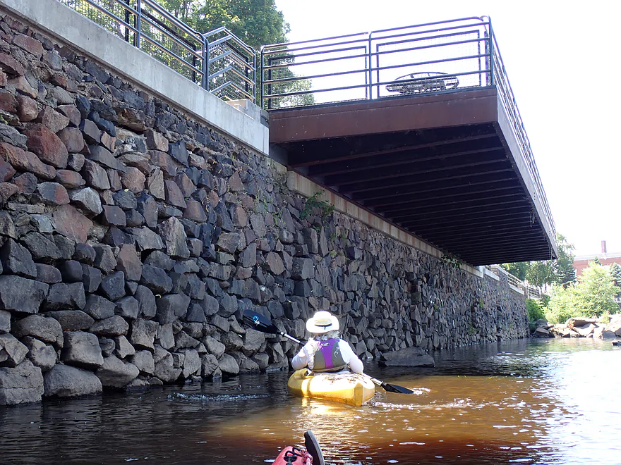
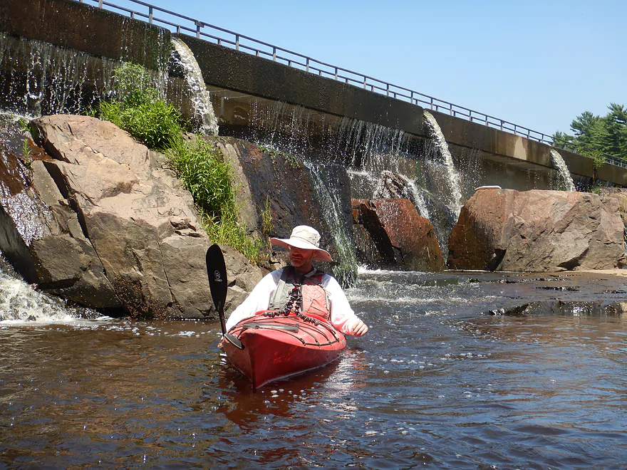
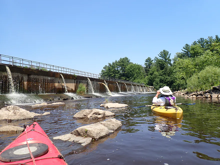
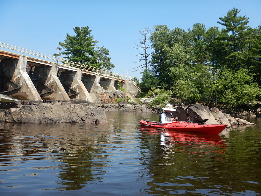
A very long stone retaining wall edges the entire park area
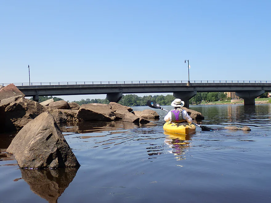
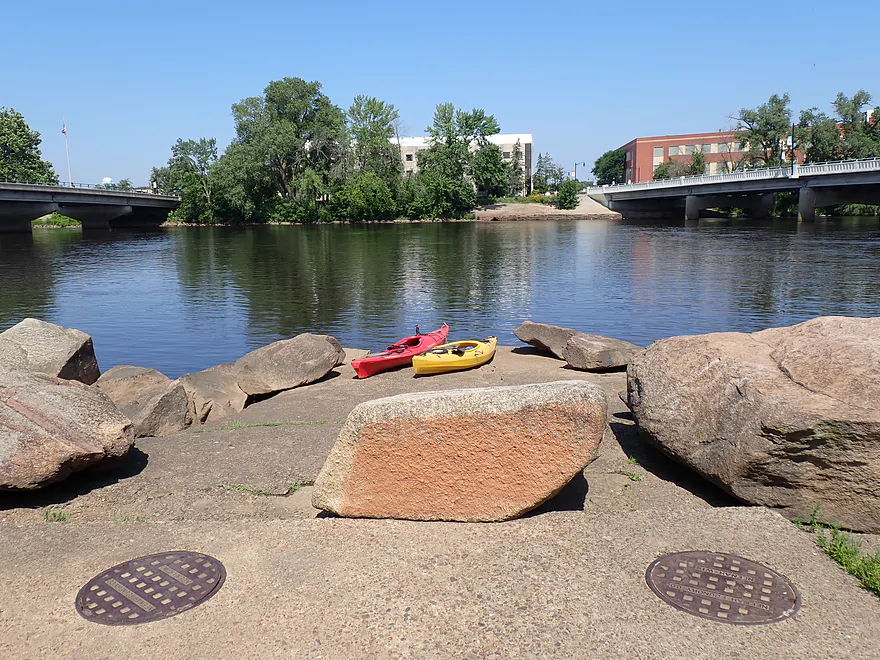
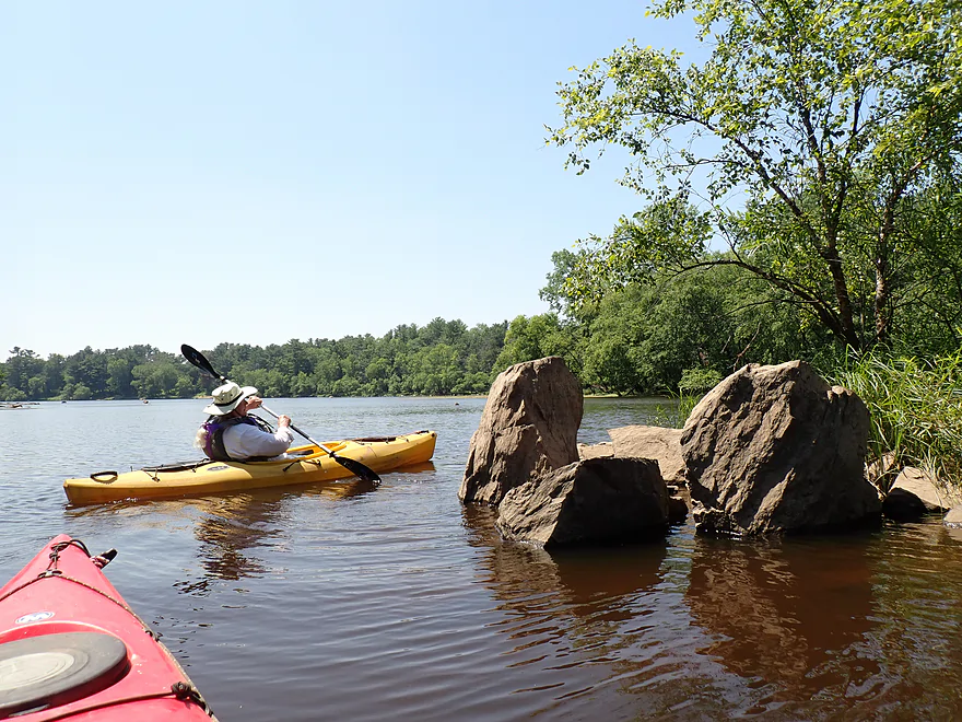
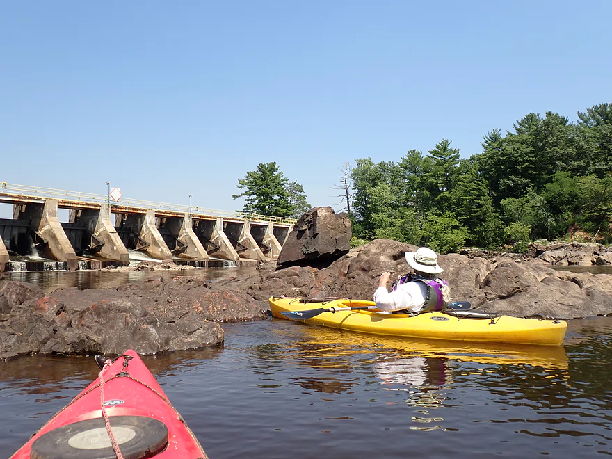
Cool boulders by Grand Ave bridge
East Riverbank Conservancy is an access option
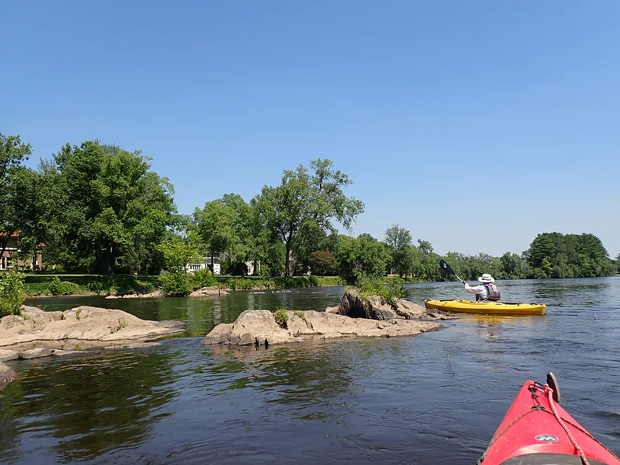
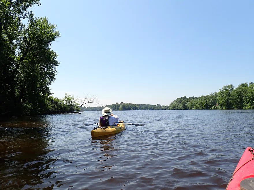
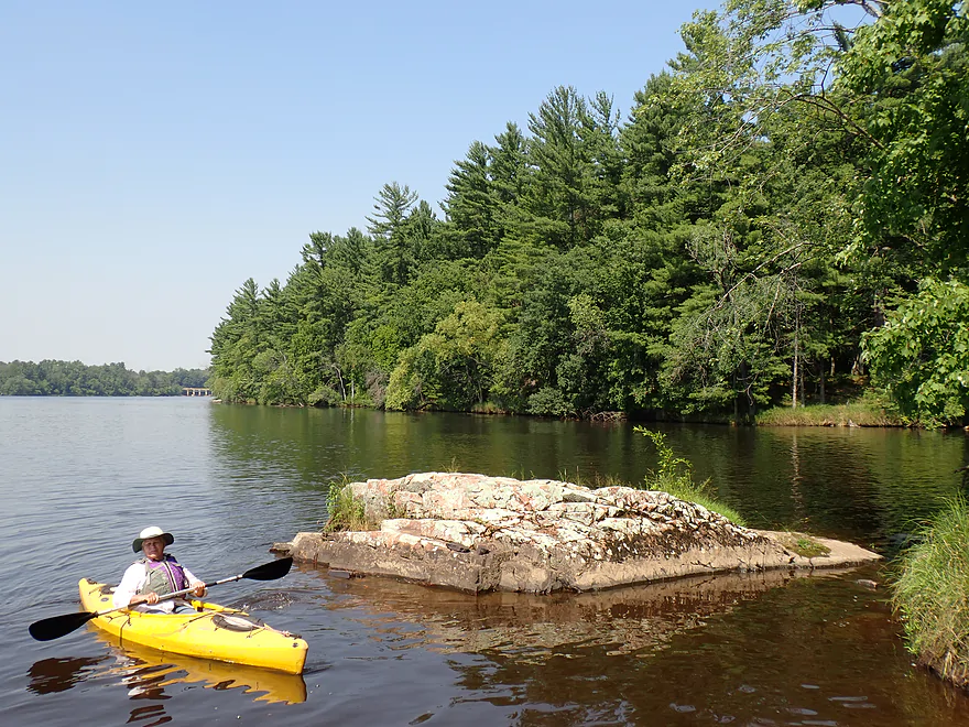
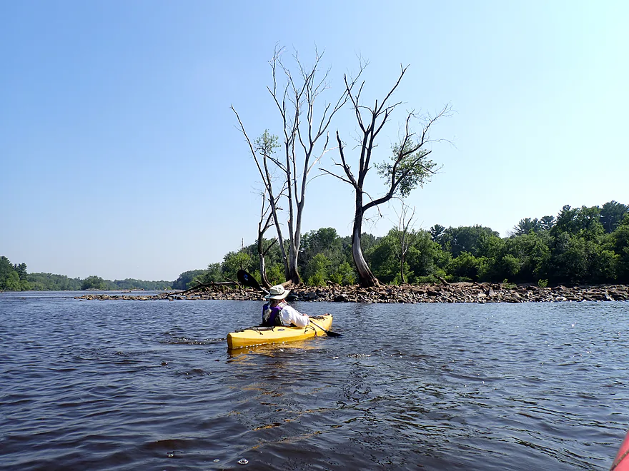
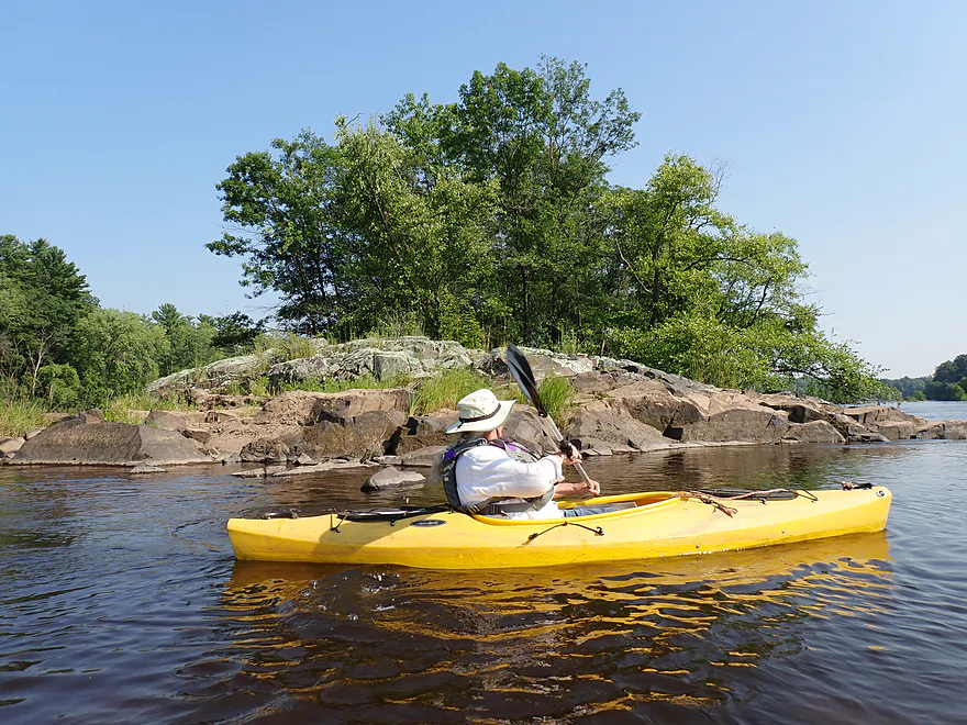
Approaching Belle Island
An old arched bridge leads to the island
Large mansions lined the main shore (perhaps built by paper barons)
River widens out by Hwy 13
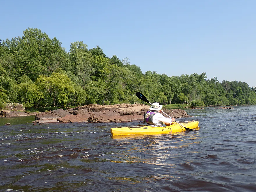
Checking out a side channel
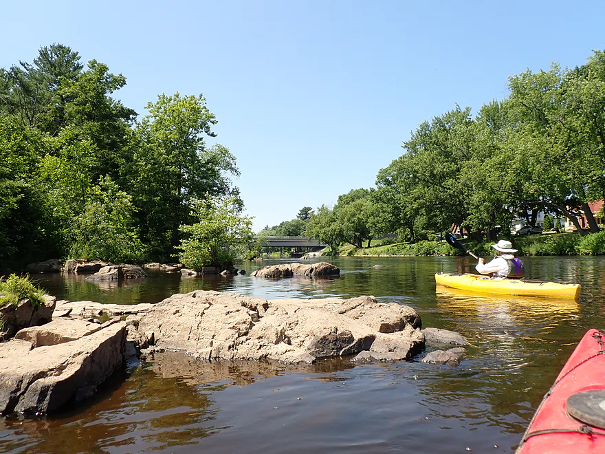
Exposed granite bedrock
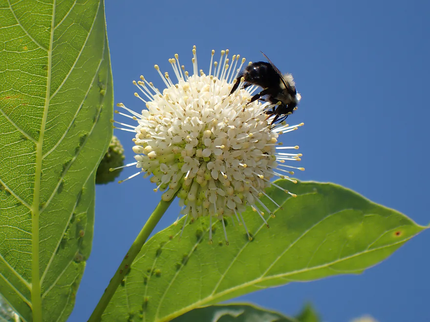
A buttonbush flower (with bumblebee)
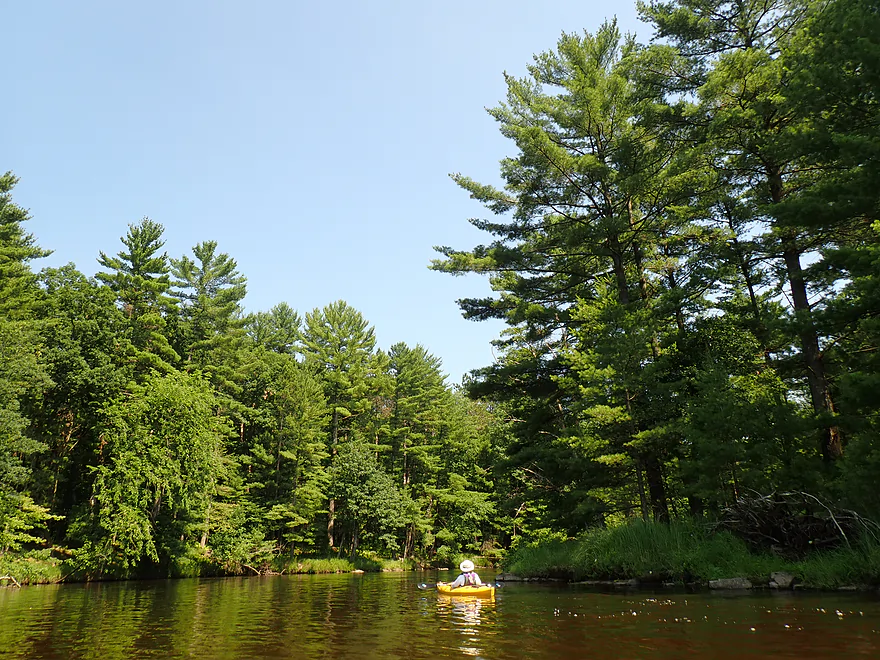
A less interesting stretch of lake paddling
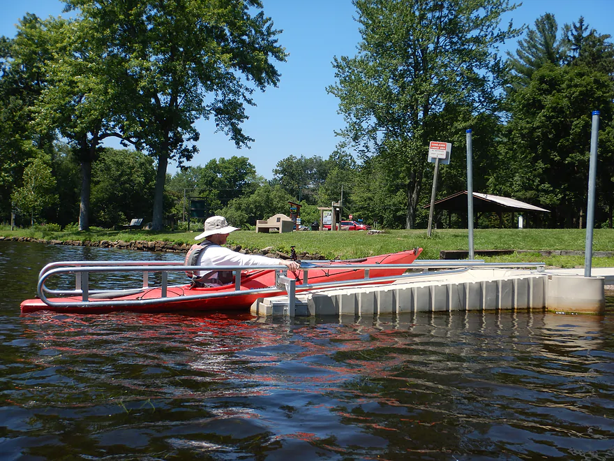
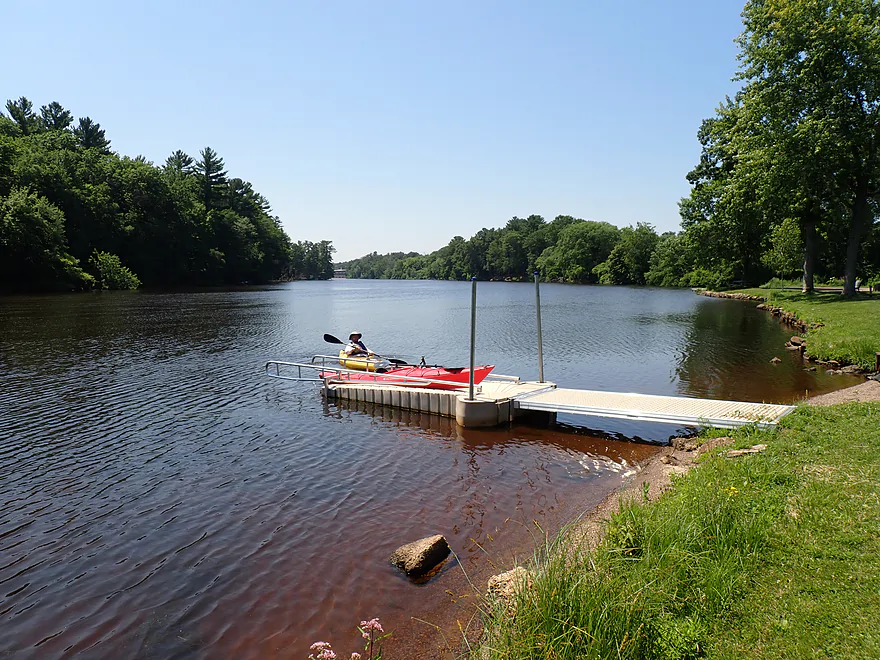
Checking out the kayak launcher at Ben Hanson Park
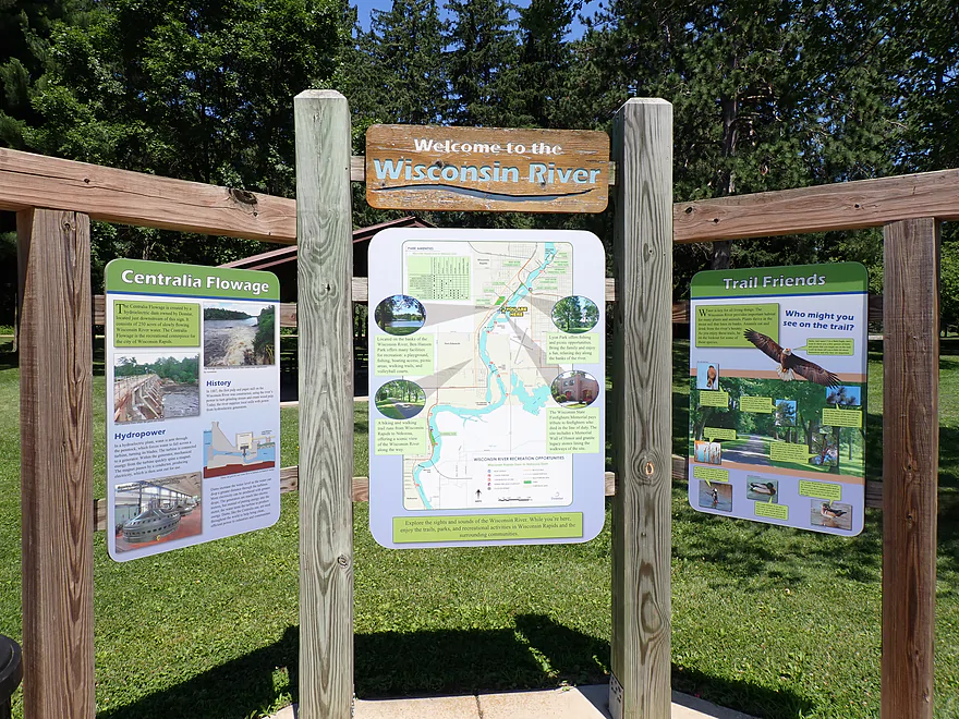
Nice info boards
Looking downstream at Edwards Island
The public boat ramp at Hanson Park
Edwards Island was really nice
Approaching some small islands
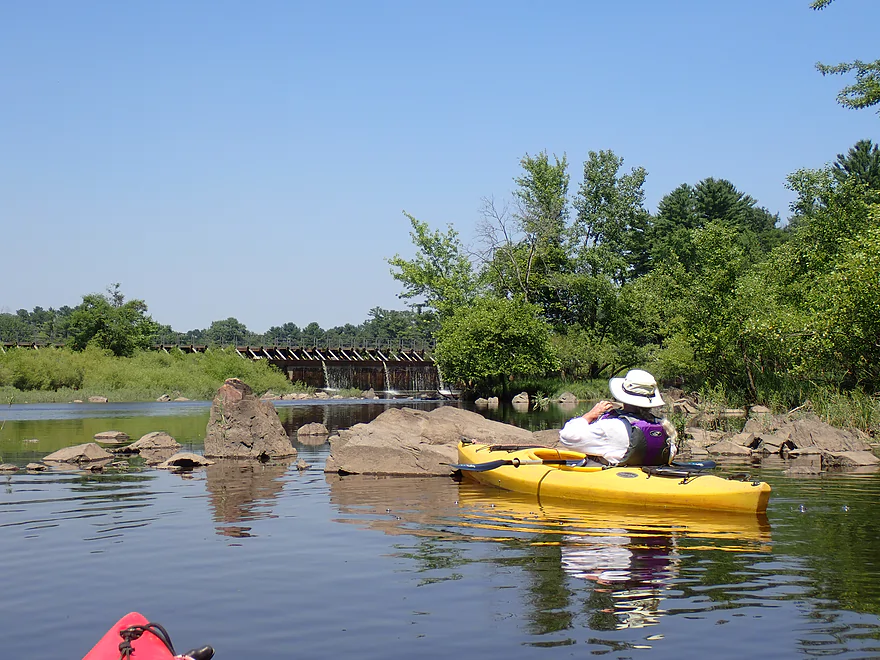
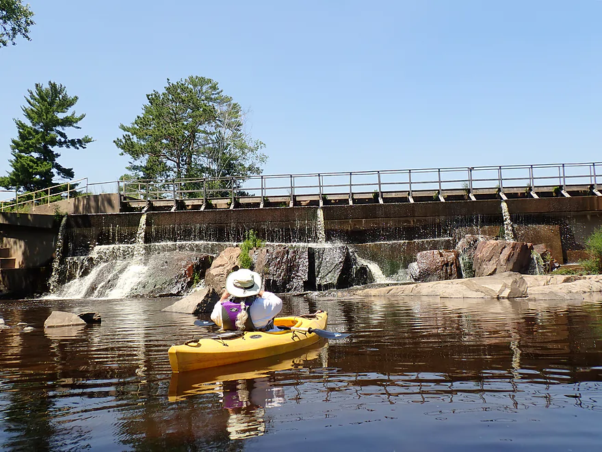
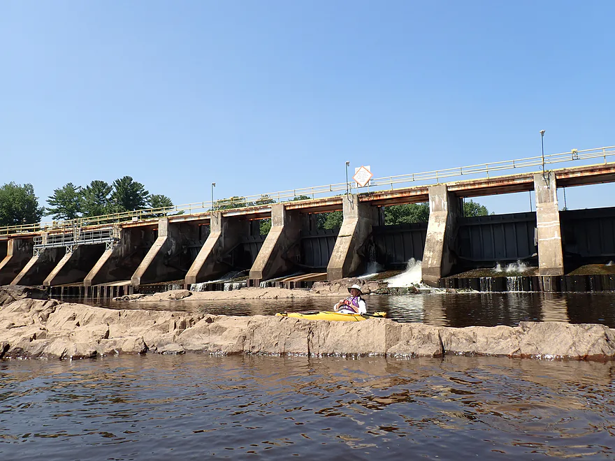
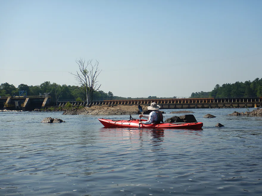
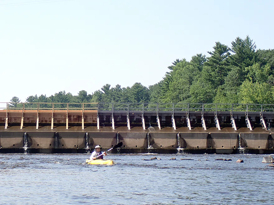
The Centralia dam is straight ahead
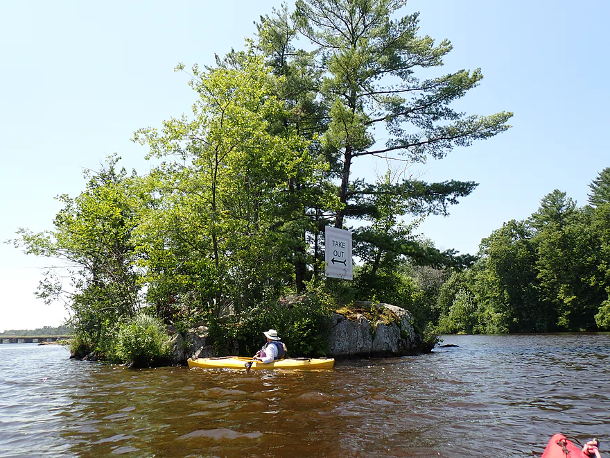
Signs point to the portage
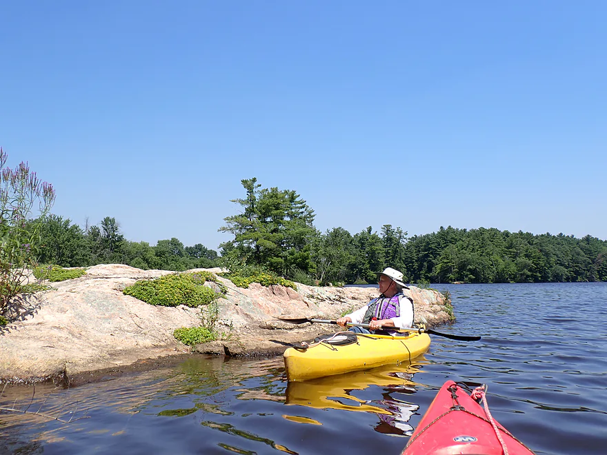
This granite has a nice pink color
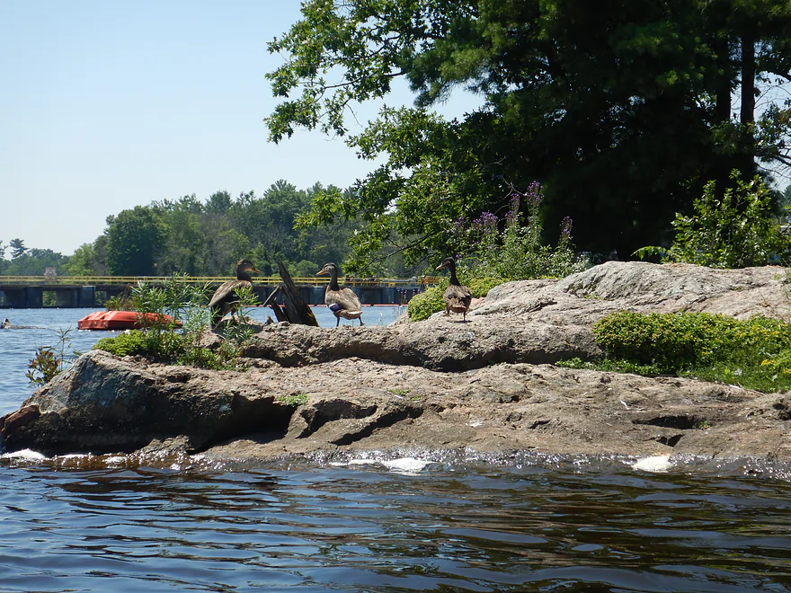
There were lots of mallards on this trip
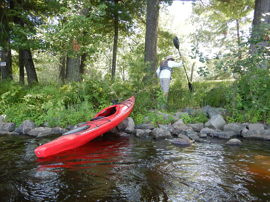
Getting out for the Centralia dam portage
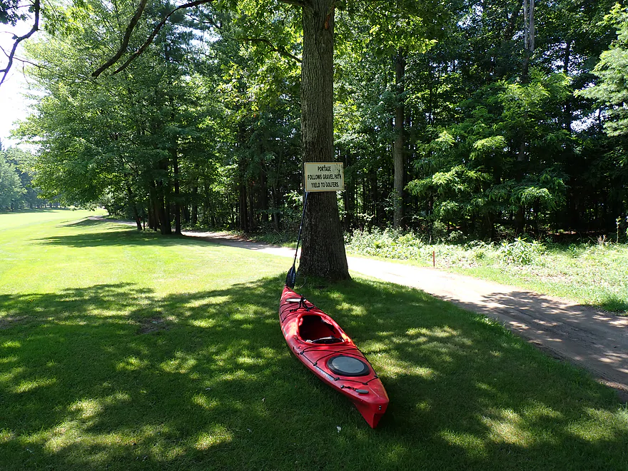
Signs tell you where to go
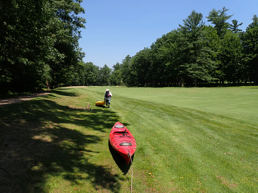
But it is a long hike along the edge of a golf course
Finally back to the river
Heading upstream to check out the east channel of the Centralia dam
The dam was built on granite outcrops
Hard to tell where the rocks end and the dam begins
Looking east
Perhaps at one point there was a natural waterfall here
Impressive bedrock
Looking at the far east end toward the golf course
Heading back downstream
Then upstream again to check out the middle channel and main dam
This section also had impressive geology

The dam is literally melded into the bedrock
These outcrops can only be seen at low water levels (note the closed gates)
The power house in the distance
This boulder doesn’t quite look natural
Lichens create neat patterns on this outcrop
Heading downstream from the dam
Now on the Port Edwards flowage
Port Edwards flowage has these cool granite peninsulas and micro-islands
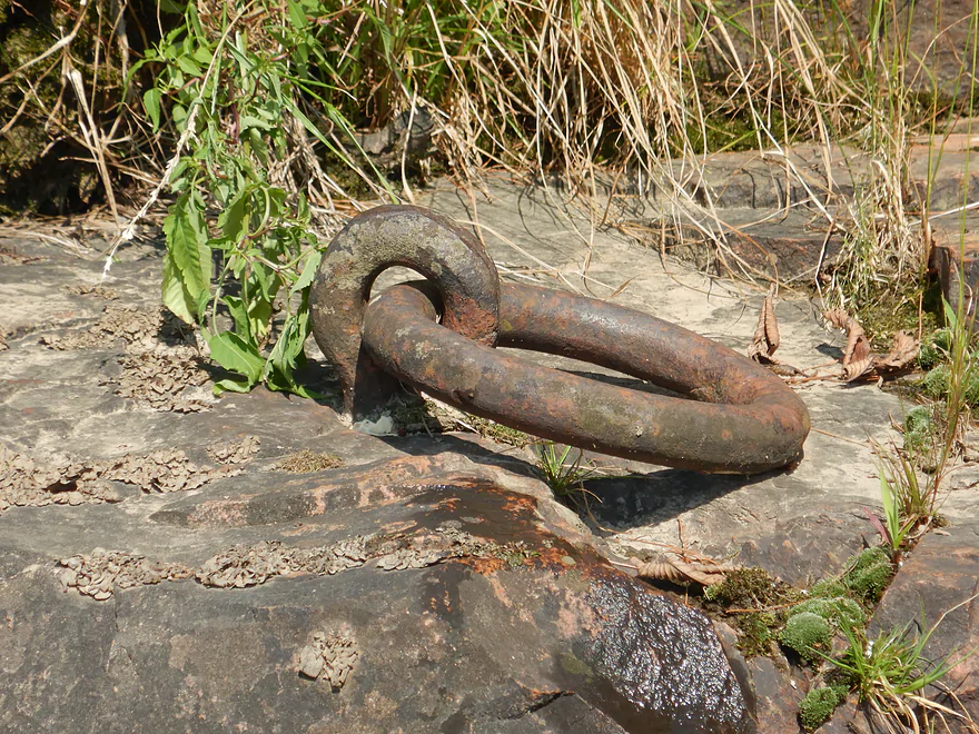
A random iron ring attached to the boulder
Exploring a side channel
Terrific pines
Just the tip of the mountain…most of the granite is buried under the flowage
The official Port Edwards portage take-out
The fence warns of the upcoming dam, but we sneaked under it to shorten our portage
Getting out above the dam to portage
There is a marked trail around the Port Edwards dam
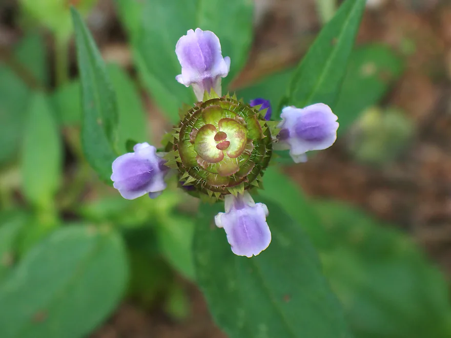
Looking down on a self-heal flower
Finally back on the water
Heading upstream to check out the dam
An island splits the channel in two
East channel had rapids…going upstream!
West channel was too rough and rowdy to explore
Continuing downstream
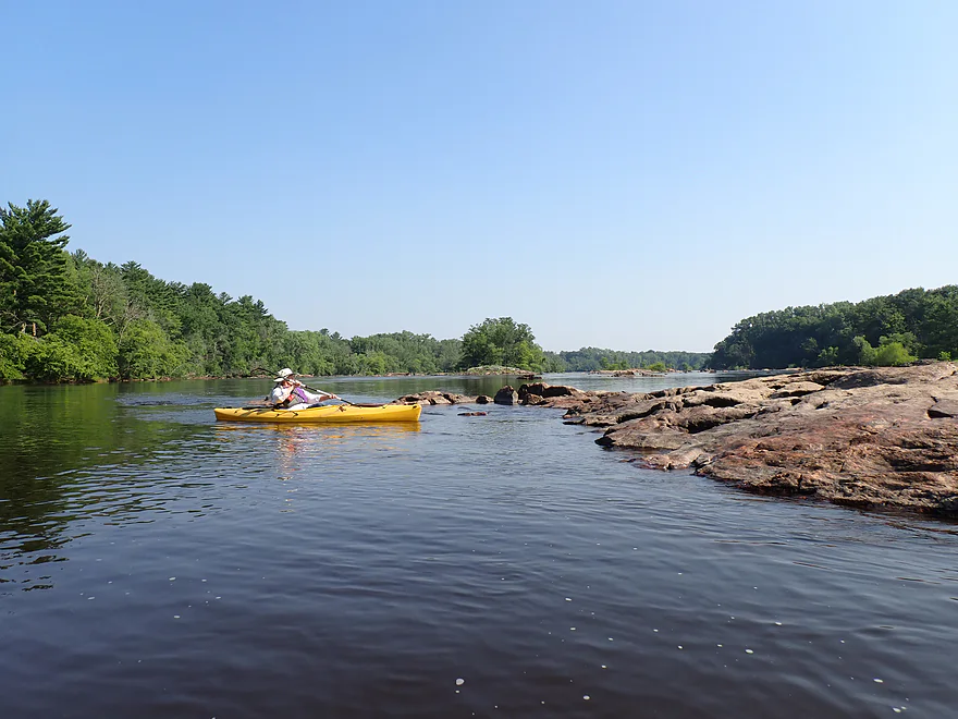
Cool granite island
And another
A fun chute
Reverse view
Reminded me of the Black River
These rapids can be rough in high water
More granite bedrock
This is known as Grignon’s Rapids
River slows now as it transitions into the Nekoosa flowage
Taking out at the Nepco Creek access (Nepco Creek is to the left)
In hindsight we could have paddled upstream on Nepco Creek to avoid a couple hundred foot portage
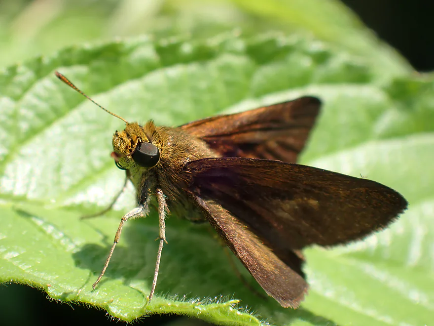
A furry-looking brown butterfly on the path
Wisconsin River – Wisconsin Rapids

Despite this being a scenic stretch, relatively few kayak the Wisconsin River between Biron and Nekoosa (the greater Wisconsin Rapids area). The main reason is the five dams and flowages that are packed together here (~3 miles apart on average). This means paddlers are restricted to a short flowage trip or having to do a dam portage(s). Paper mills were originally attracted to the area for the high river gradient (60′ drop in 10 miles). Sadly, many of the original rapids and rock formations were sacrificed to the paper gods, but there are still glimpses of Wisconsin’s scenic yesteryear if you know where to look.
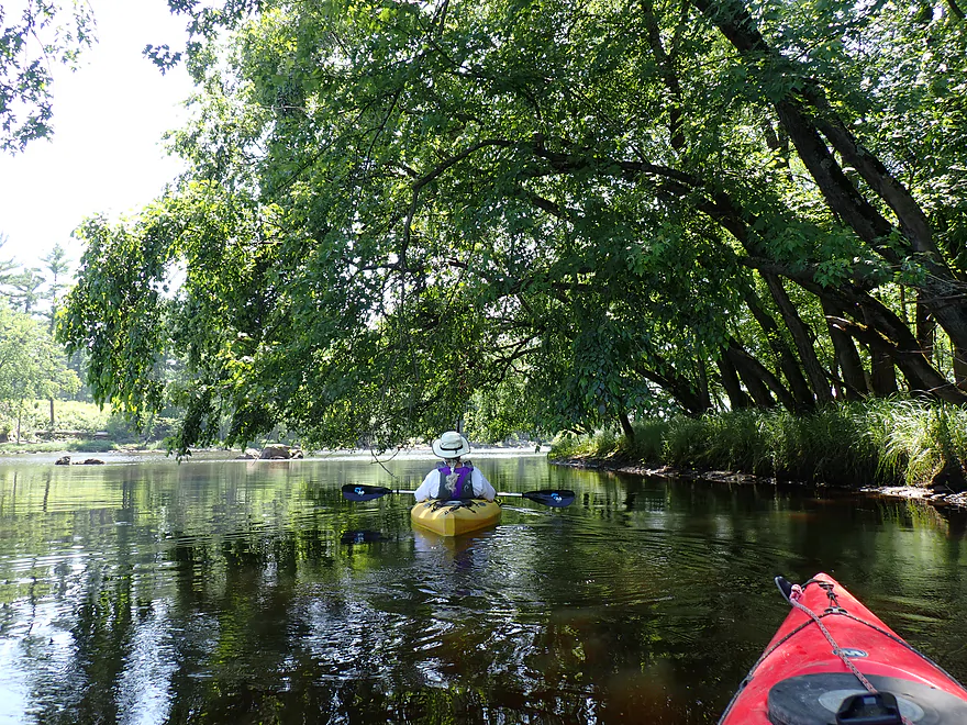
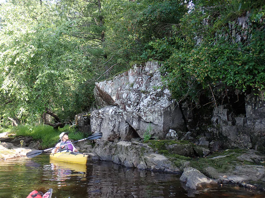
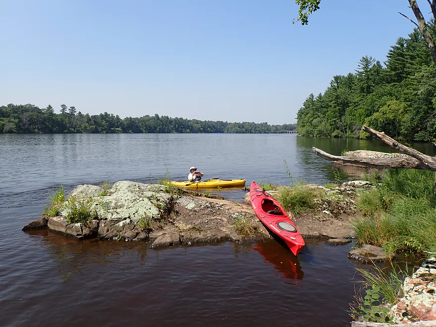
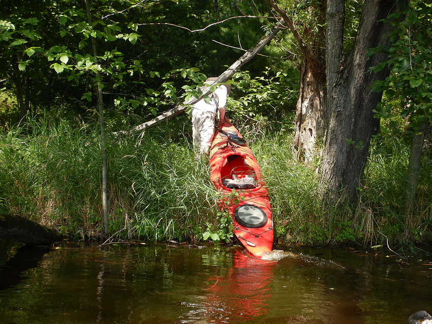
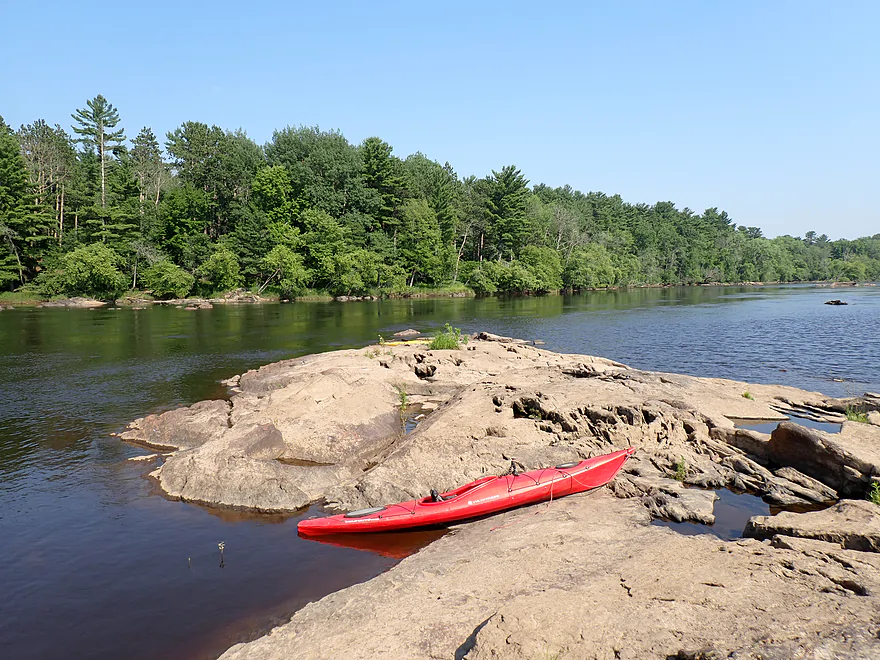
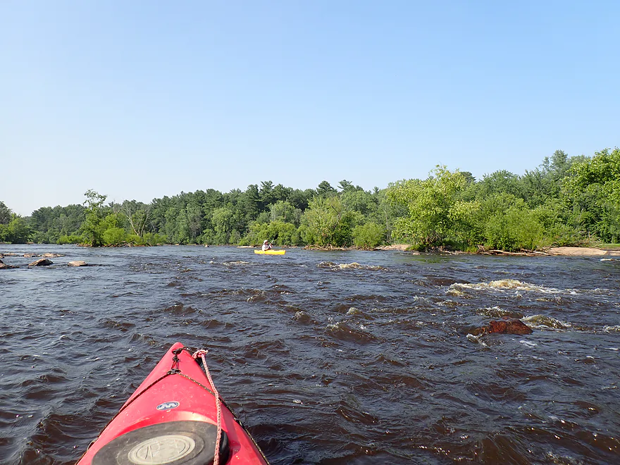
Previously I paddled the stretches above Wisconsin Rapids (Biron review) and below Port Edwards (Port Edwards review). This time I wanted to do the in-between leg in and below Wisconsin Rapids. We started at Veterans Memorial Park just downstream from the dam and paper mill. A high brick retaining wall limited access options, but there was a public staircase that led down to a nice cluster of granite boulders and it made for a scenic put-in. The only downside was the stair railing which required a bit of tricky kayak lifting (see photos).
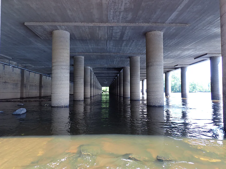
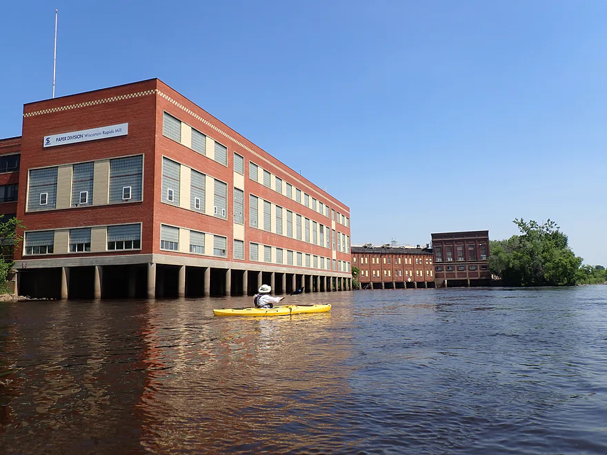
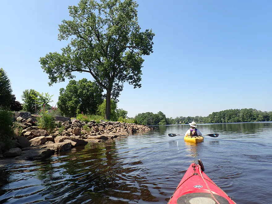
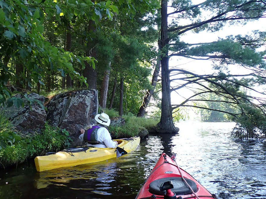
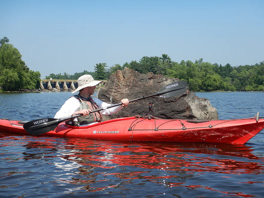
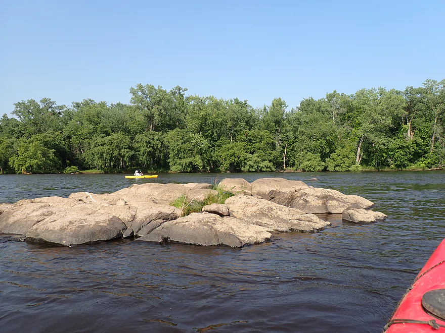
Before heading downstream, we first paddled upstream toward the Verso powerhouse . At one point it served the adjacent paper plant, once the largest in the country. But the paper industry has since fallen on hard times and this particular mill recently shut down. To the right of the powerhouse was a large boulder field with exposed granite bedrock. This was once the southern end of “Grand Rapids,” one of the most significant rapids on the river (hence the name “Wisconsin Rapids”). Sadly, this geologic wonder now lies submerged under a stagnate flowage created to serve a paper mill no longer in operation.
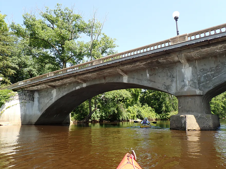
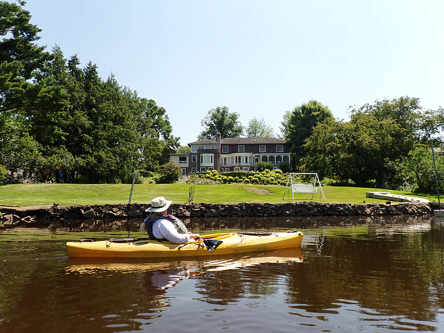
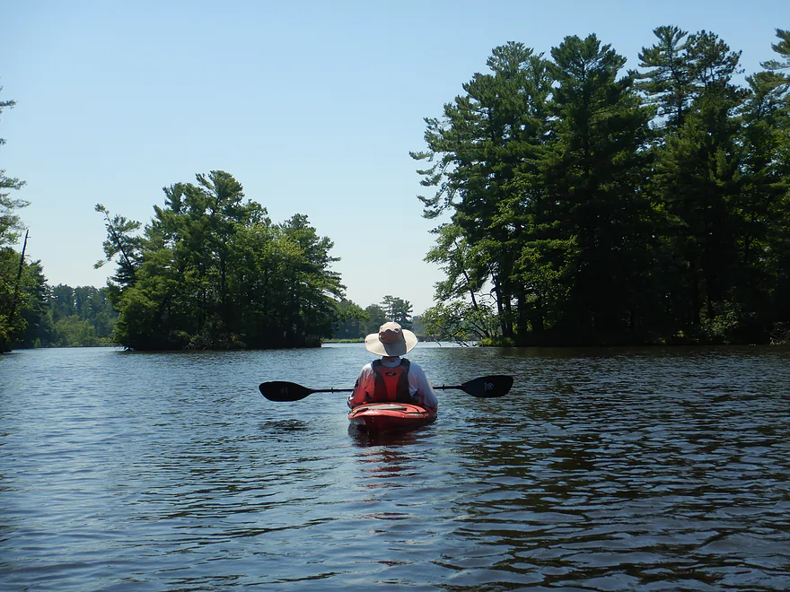
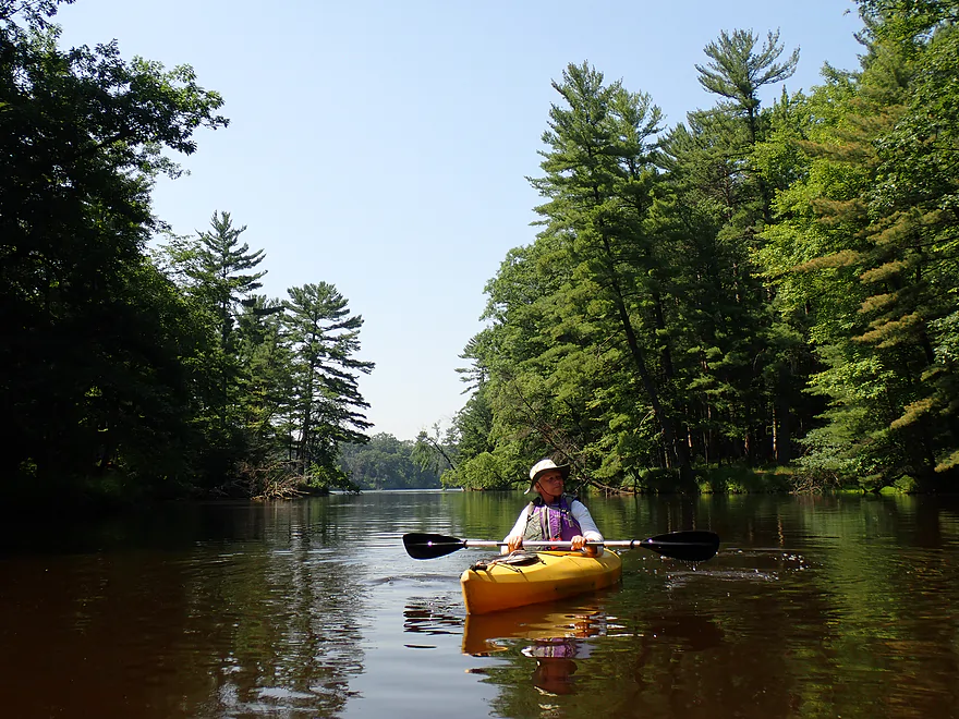
We headed back downstream (under two bridges) and explored the east channel off Belle Island. At one time this was a mini-hub for small mills, but all that remains today are some large homes and an attractive concrete arched bridge. Before the dams were built, Belle Island was part of a greater chain of islands surrounded by rapids.
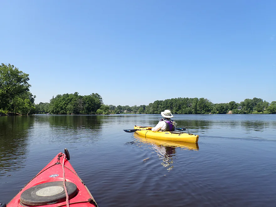
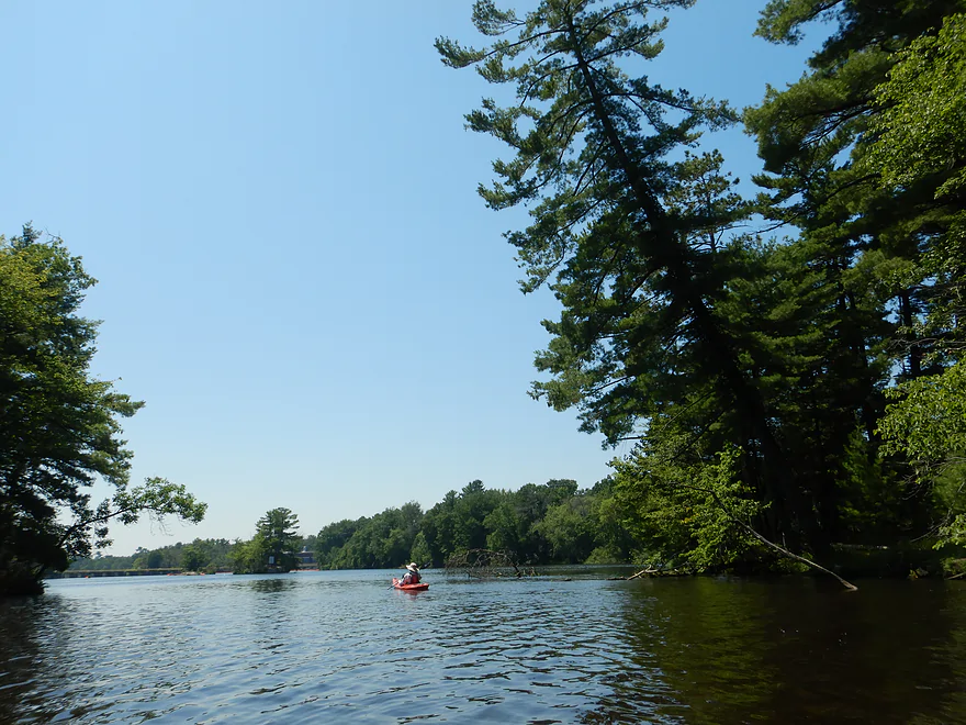
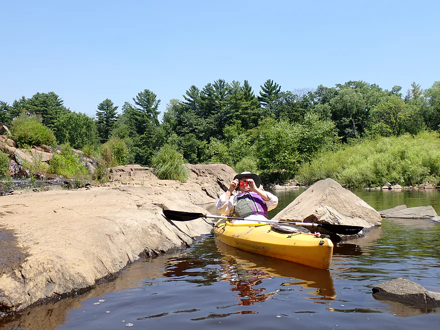
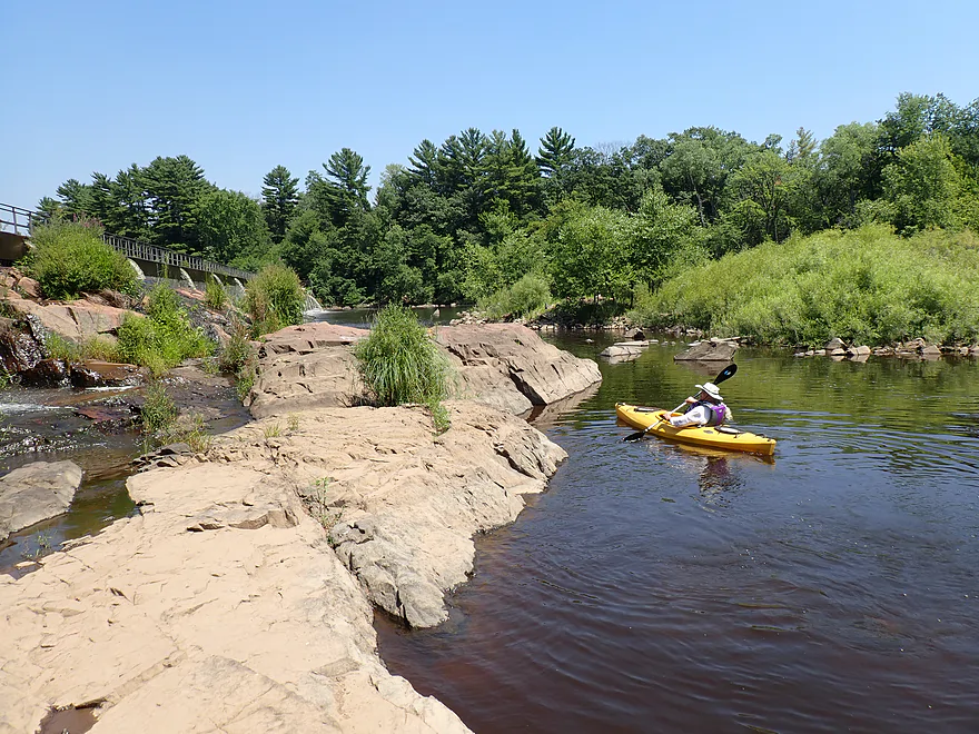
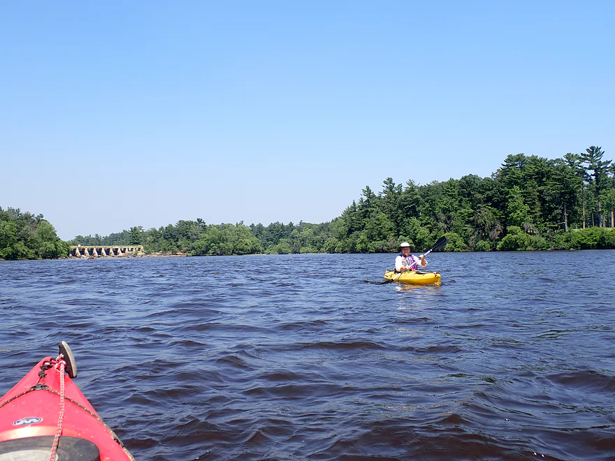
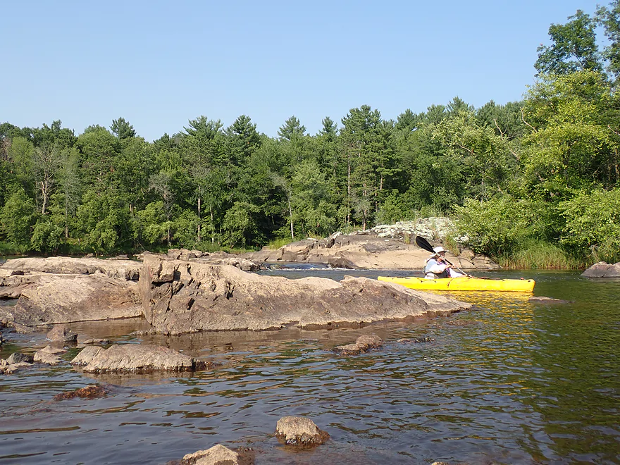
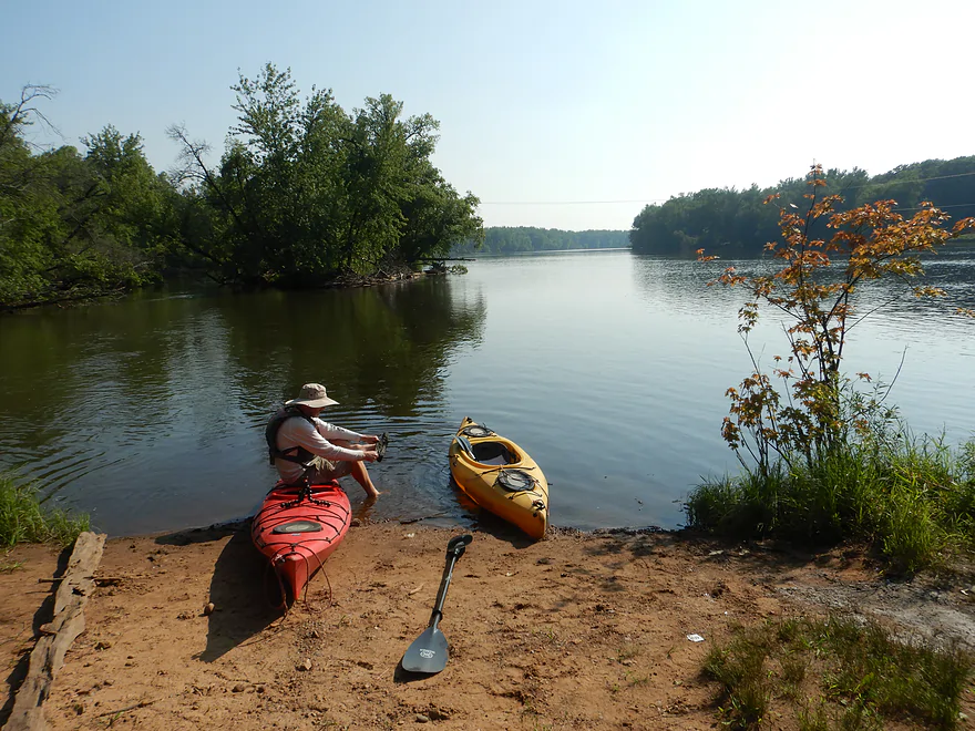
Past Hwy 13, the river widened out into a small lake as it approached two large islands (Garrison and Edwards). These present paddlers with a choice…typically you want to choose the smaller channel. Ben Hanson Park, on the right bank, has a nice public boat ramp, a paved bike/hike trail along the river, and a kayak launch, which I used to get out and take photos.
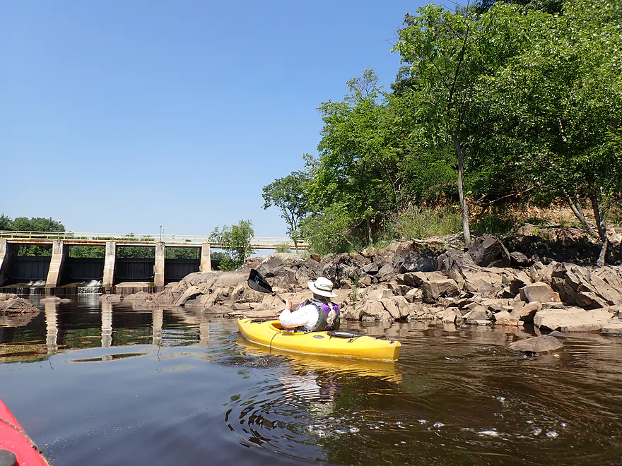
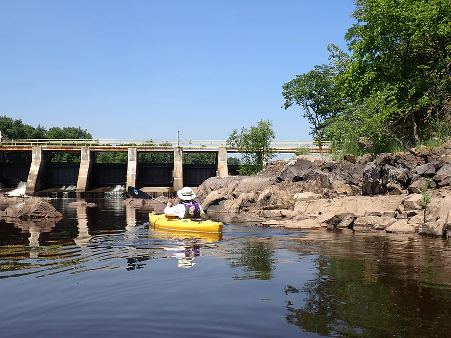
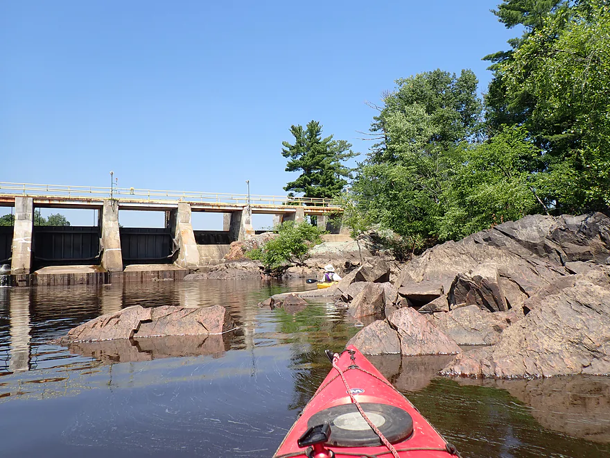
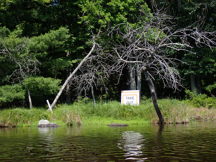
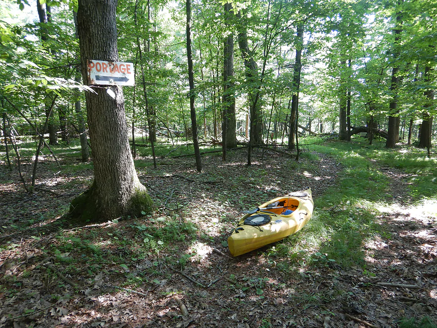
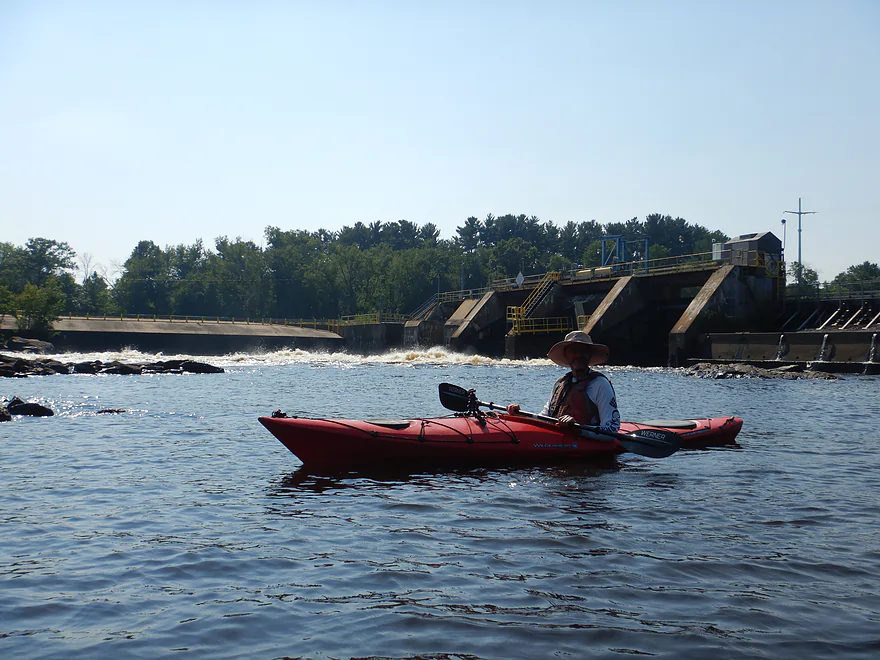
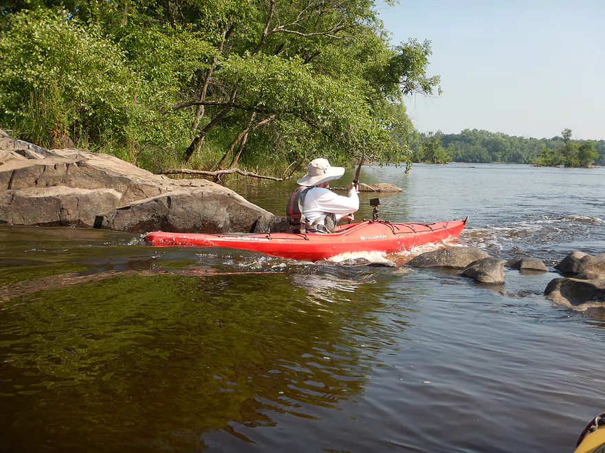
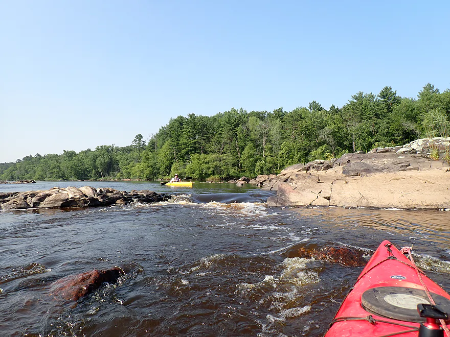
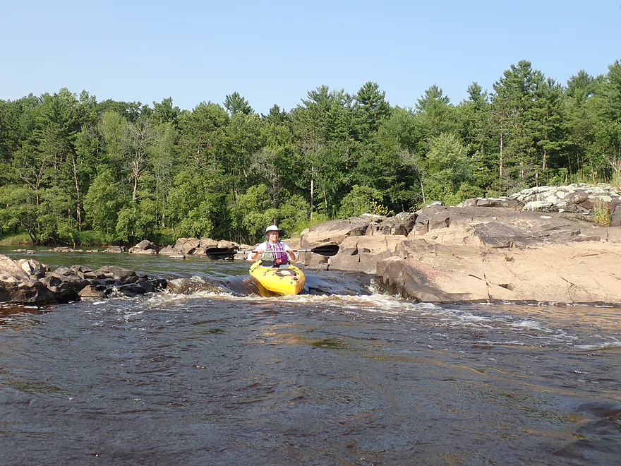
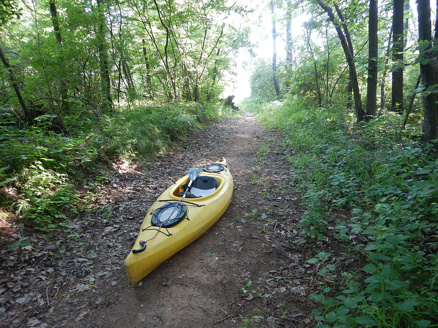
Following some nice pine stands and a few micro-granite islands (tips of underwater granite mountains), we came to the Centralia dam. It’s actually a bit confusing for paddlers as the dam is built across two islands, creating three channels. But we eventually found the official portage path on the east shore. We followed the portage signs for a surprisingly long portage (~1000′) which largely routed us along the edge of a local golf course. The golfers didn’t seem surprised to see us portaging, but we occasionally heard “fore” to warn us of flying balls.
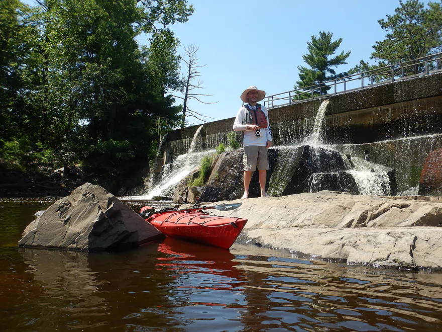
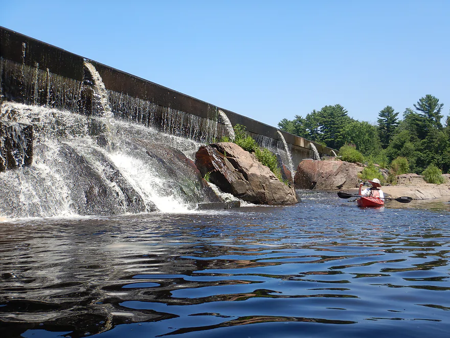
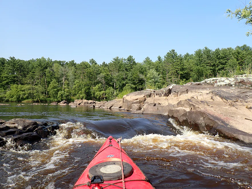
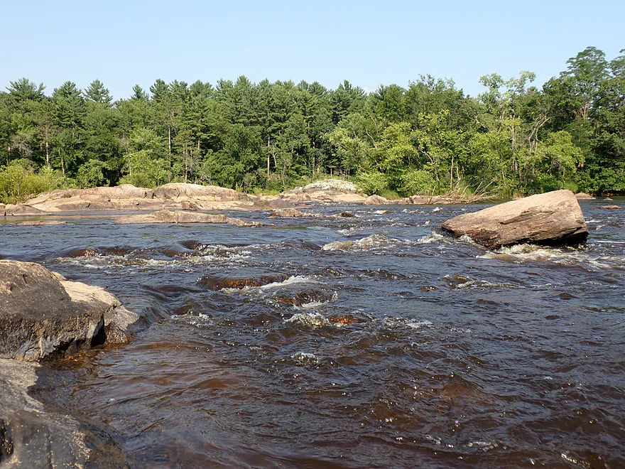
We finally reentered the river below the dam. Water levels were (thankfully) on the low side which allowed us to paddle upstream to the middle and right portions of the dam to check out the scenery. Here was a brief glimpse of what the Wisconsin River would have looked like before it was submerged under flowages. Terrific granite bedrock, boulders and fantastic white pines provided nice photo ops. The dam itself is built on the exposed granite, which IMO suggests there might have been small waterfalls here at one point. Much of this reminded me of the Upper Black River and it proved to be one of the trip highlights.
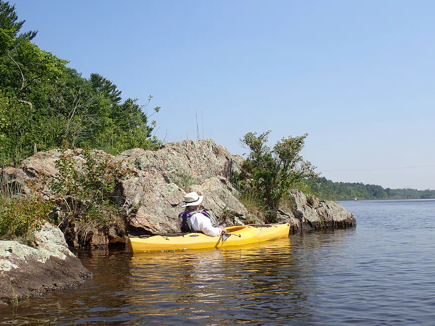
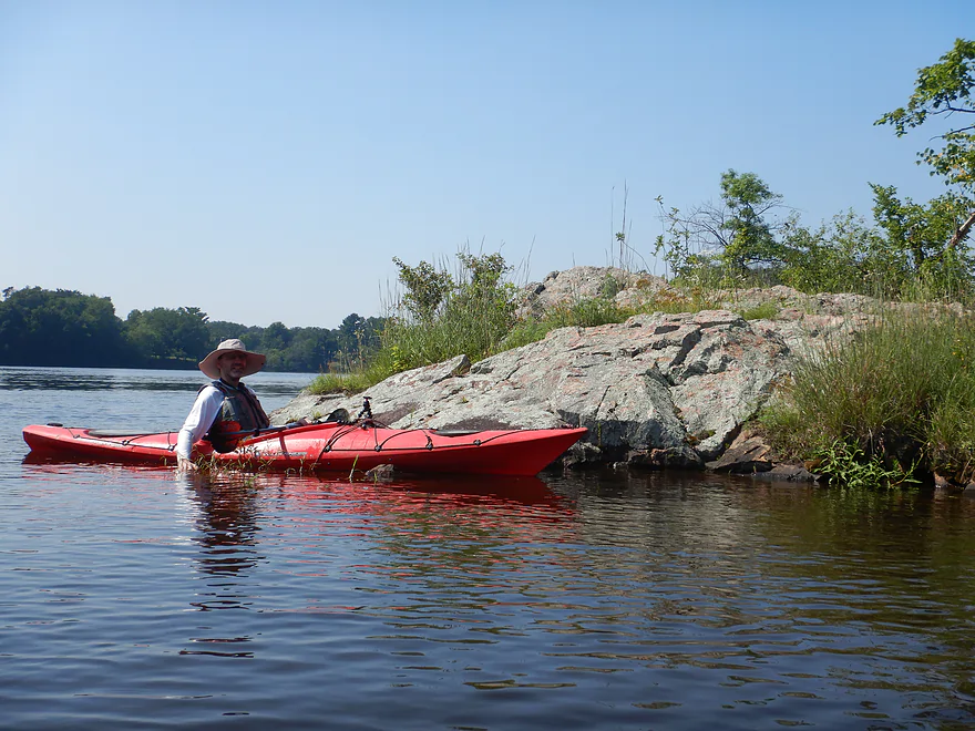
I had hoped to explore the third (and far west) channel below the Centralia dam, but the water coming out was way too fast (maybe 10 mph) and there was no way to paddle up it. We enjoyed a few trailing light riffles, but these were soon bottled up by the next flowage (Port Edwards). It’s remarkable that there is just a short window for the river to be a river again before being swallowed up by another flowage lake. The Port Edwards impoundment was still nice with some cool micro-granite islands and more terrific pine stands.
I suspect most paddlers will end their trip at the Port Edwards access (off Ver Bunker Drive on the west side of the river), but we had opted for a longer trip and to continue past the dam. The official portage path on the east side wasn’t the easiest or shortest (about 2500′ long). Because water levels were low, I knew we could get close to the overflow gates (which wouldn’t be overflowing) and this significantly shortened the portage, but it was still “a drag”. The trail itself seemed to be on an old logging road and has since become overgrown, but signs still (mostly) pointed the way.
Below the Port Edwards Dam was yet another impressive boulder field. This actually overlapped a bit with my 2021 trip, but that was done at 9100 CFS (high water). Because water levels were lower this time (4000 CFS), significant portions of the boulder field were now exposed that I didn’t see before. This is why you really want to save a trip like this for low levels.
An island below the Port Edwards dam splits the channel in two. The water from the west channel (where the powerhouse is located) was coming out so fast and strong it actually circulated around the island and back upstream, creating rapids on the east side pushing you TOWARD the dam. How often can you paddle down rapids while going upstream? The waves at the base of the west channel were churning pretty high so we decided not to get too close.
We continued downstream where we encountered a second impressive boulder field and a few large, solid granite islands. In one spot, a one-foot chute formed between the islands creating fun rapids (see 3:57 in the video). During my 2021 trip in high water, this “cute little chute” was a bit more rough and rowdy (see video at 1:41). The chute was followed by a series of light rapids and more boulders. Officially this is known as “Grignon’s Rapids” and is one of the few rapids on the Wisconsin River to have escaped the dams. But soon, the Nekoosa flowage kicked in and it was back to lake paddling. We didn’t stick around for that and decided to end our trip at the Nepco Creek public access.
In summary, this was an enjoyable and scenic trip. The dams were a downer…both for the uninteresting impoundments they created and the required portages (kayak wheels are recommended). But just downstream from each dam was a small oasis of terrific scenery (pines/boulders/bedrock/rapids) that made up for the long portages. The other highlight were the cool islands (there were a lot). Timing a trip like this is everything. It has to be done at low levels, otherwise you will miss most of the interesting geology. It’s also a great trip to do in the fall as, IMO, the area color is very underrated.
Sights included lots of mallards, some damselflies, dragonflies, four flopping fish, and several bald eagles (one immature). The highlight were the 2-4 ospreys we saw and heard (they squawked very loudly).
River History: This may shock paddlers but the Wisconsin River was once famous for its rapids. In its natural state the Upper Wisconsin consisted of terrific boulder fields, rapids, large exposed pre-cambrian bedrock, and an attractive pine-lined shore. Much of this has been destroyed, dynamited or buried by dams on behalf of the logging and paper industries. Before the dams were constructed, the Wisconsin River used to descend quite steeply through the “Wisconsin Rapids” area. For a 10-mile stretch (Biron to Nekoosa) the river dropped an impressive 60 feet. Here there were strong rapids, huge boulder gardens, and perhaps even small waterfalls. Sadly, five dams were built that submerged almost all of this. Here is an excerpt from the terrific book: “The Wisconsin River: An Odyssey Through Time and Space“.
Grand Rapids was at Wisconsin Rapids. Its Ojibwa name, Ah-dah-wa-gam, means “two-sided rapids.” It was the first in an almost unbroken, ten-mile-long series of rapids with a sixty-foot drop that extended to Pointe Basse. Grand Rapids itself, a mile long, ended above the Grand Ave. bridge; it had a twenty-seven-foot drop. A section by the old railroad bridge as sometimes called Lyon’s Rapids, in reference to Lyons’ sawmill situated nearby. Downstream by Witter’s Island was another set of bad rapids. There was a bad stretch at Hurleytown, too. Some sources speak of White Bull Falls and Barker Rapids, which were purported to be located by Port Edwards, but no details are known about them.
Today five densely packed flowages conceal these rapids (Biron, Wisconsin Rapids, Centralia, Port Edwards, Nekoosa) but there are still hints of what the Wisconsin used to be like. I’ll try to orient where the old rapids were relative to the landmarks on this trip:
- Grand Rapids – This was the most significant rapids and flowed through the upper parts of “Wisconsin Rapids”. It was about a mile long, dropped 27′ and extended from Biron to the Grand Ave bridge. Supposedly parts of these rapids “Sugar Loaf at Grand Rapids” were destroyed with dynamite (likely amazing rock formations lost forever). Of the five area dams, the Wisconsin Rapids one is the tallest at 30’…a testament to how impressive the rapids used to be. Pictures are rare of what the rapids used to look like, but I did find these two (just a small slice):
- Witter’s Island Rapids – This was considered another “bad” stretch of rapids (for rafters). Witter’s Island is no longer marked on maps but I believe this was located near the Hwy 13 bridge.
- Hurleytown Rapids – This was another name for south Centralia, so these were likely located just upstream from the now Centralia dam. These were considered dangerous…but I suspect it was one of the more scenic stretches of rapids.
- White Bull Falls and Barker Rapids – Likely located above the Port Edwards dam.
- Grignon’s Rapids – Located just below the Port Edwards dam, this is one of the few original rapids that remains mostly intact.
- Whitney’s Rapids – Aka Sill or Lower Rapids, these roughly started from the mouth of Moccasin Creek and continued 23′ down five pitches and ended where the present day Nekoosa dam is. These were considered very dangerous by early rafters. In 2021, there was a partial drawdown of the Nekoosa flowage that revealed maybe the first 20% of the original Whitney Rapids (the later parts remained submerged). I took photos and video in my Port Edwards review. After Whitney Rapids/Nekoosa, I don’t believe the Wisconsin River has any significant natural rapids.
Paper History: The Wisconsin Rapids area is famous for its paper mills. I thought it would be interesting to provide a quick overview:
- Biron Mill – This used to produce magazines/catalogs, but was sold to a Chinese company and now produces packaging materials.
- Verso – Wisconsin Rapids – At one point this was the largest paper mill in the world. They mostly produced magazines like Sports Illustrated and glossy catalogs, but they ran into financial issues and the mill closed in 2020. Its closure has actually significantly improved air/water quality and significantly reduced logging. There are plans to redevelop the plant area into an industrial park.
- Verso – Port Edwards – Verso produced glossy paper for advertising inserts and coated ground wood paper for magazines like Time and Newsweek. This plant was closed in 2008 and has since mostly been demolished.
- Domtar – Nekoosa – This is the one area mill that wasn’t repurposed or shut down. They still produce premium printing and book publishing paper.
Veteran’s Memorial Park: This is a scenic and inviting public park located just downstream of the Wisconsin Rapids dam. Note, you do need to descend down steep stairs with a tight 90 degree railing to reach the water. That can be a bit tricky while carrying a kayak. Below the stairs is a paved cluster of granite boulders where it is easy to launch.
Alternate Put-ins:
- East Riverbank Conservancy: (800′ downstream from Veteran’s Memorial Park) If you don’t want to mess with the stairs at Memorial Park this is an option located just a bit downstream (but not as scenic).
- Lyon Park/Demitz Park: (0.8 miles downstream from Veteran’s Memorial Park) Lyon Park is on the north side of the Hwy 13 bridge and Demitz is on the south side. Both would be suitable access options.
- Ben Hanson Park: (2.0 miles downstream from Veteran’s Memorial Park–west side of river) There is a public boat landing here. The park area is attractive and there is a nice kayak launch you can use.
Nepco Creek Access: This is located just downstream from the Port Edwards dam on the east bank. It’s a little hidden so keep an eye out for it. You have two take-out options. The first is to get out where there is a small sandy area at the creek junction and then hike/portage 400′ up a path to the Cty Z parking area. Or you can paddle upstream on Nepco Creek and take out right before the bridge, which would significantly shorten your take-out. I suggest the latter.
Alternate Take-outs:
- Port Edwards Landing: (0.9 miles upstream from Nepco Creek) This is a good public access located just upstream from the dam and on the west bank (opposite Ver Bunker Ave).
- Moccasin Creek Landing (2.0 miles downstream from Nepco Creek) This is a good public access, although the access road is a bit rough. This bonus stretch is a pleasant wooded stretch, but is mostly impounded waters and not anything special.
- Riverside Park (2.5 miles downstream) Located at the north end of Nekoosa, this is a terrific public access.
Yes…a trip like this actually justifies a dedicated section.
- Centralia Dam Portage: (~1000′) Portage on the east bank by the golf course. A small sign will mark where you can get out. You then follow a golf cart path south where a sign finally leads you down a series of steps where you can get in below the dam. Kayak wheels are highly recommended.
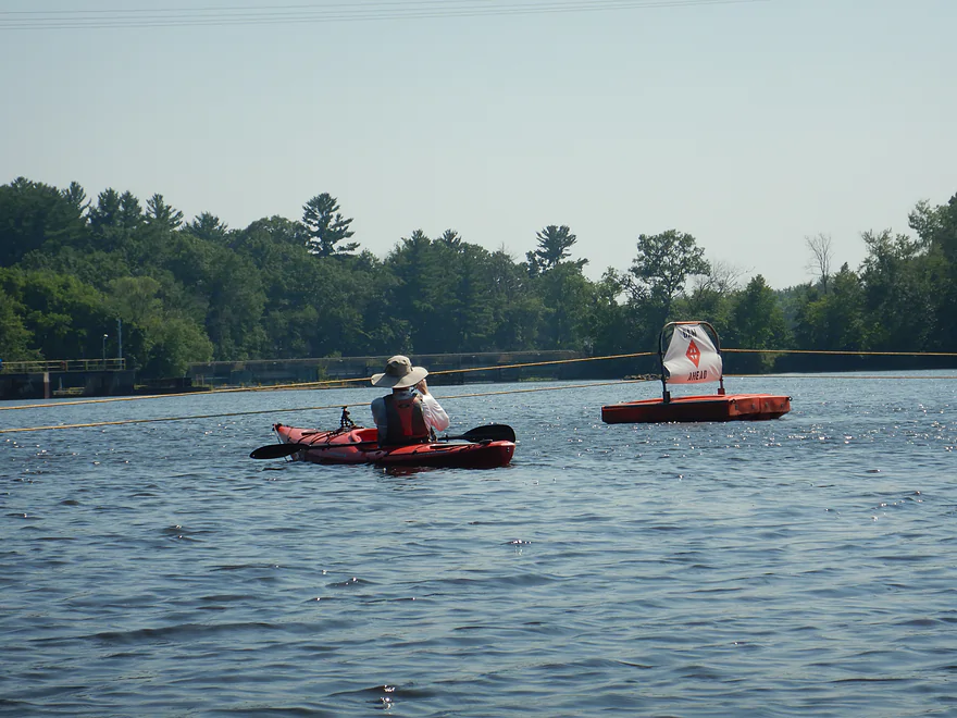
- Port Edwards Dam Portage: (~2500′) There is a well-marked portage trail on the east bank. This follows an old logging road with frequent arrow signs pointing the way. But…it is a long portage. If water levels are low (meaning the gates won’t be overtopped), I suggest paddling past the safety fence (floating buoys and cables) and getting out closer to the dam. This could reduce the portage to about 900′. Kayak wheels are recommended.
- Nepco Creek Take-out Portage (400′) If you take out on the Wisconsin River, you’ll have to follow the access trail to the Cty Z parking lot, which is about x’. I highly recommend paddling up Nepco Creek instead to shorten your take-out.
Bike Shuttle – Nepco Creek Landing to Veterans Memorial Park: 4.3 miles with 59′ of ascent. This would be a pleasant bike shuttle through the outskirts of Wisconsin Rapids.
Wind: There is some flowage paddling (it’s not too bad because of the islands). But because of this you should avoid the trip when it’s windy (10+ mph).
Dams: We saw three dams on this trip…these can be dangerous. During high water the overflow gates will be open and you don’t want to be close to the event horizon. Going during low water is highly recommended you’ll be able to paddle up to the base of the dam and see all the cool rock gardens and rock formations.
Portages: See above portage information.
Rapids:
- Centralia Flowage: None…unless you paddle really far upstream to the base of the Wisconsin Rapids dam.
- Port Edwards Flowage: Mostly none. There are a few faint riffles below the main two channels of the dam. Below the powerhouse there are strong rapids and very fast current, but you won’t be able to explore that anyway.
Nekoosa Flowage: Below the Port Edwards dam strong rapids can appear below the left channel during high water. The right channel should mostly have just class 1’s though. Further downstream is Grignon’s Rapids, which are Class 1-2 in low water and Class 2-3 in high water.
Wisconsin River @ Wisconsin Rapids: 4000 CFS or 3.2′
- 0-3000 CFS: A rare low depth but should still be navigable. Low depths will expose incredible boulder fields/granite bedrock below the Centralia and Port Edwards dams.
- 3001-4500 CFS: An average depth and a good target range. The boulder field below Port Edwards may be 70% exposed.
- 4501-6000 CFS: Grignon’s Rapids will awaken below the Port Edwards dam (Class 1-2) and much of the boulder field will be under water.
- 6001-9000 CFS: A high depth with multiple Class 2-3’s below the Port Edwards dam.
- 9001+ CFS: Perhaps too high for most rec paddlers. Grignon’s Rapids will have multiple Class 2’s and some Class 3’s. The current will be strong and unforgiving. Whitewater paddlers may enjoy these depths though.
Note, the Wisconsin River can rise or fall sharply. It often isn’t enough to know what the current depth is, but you should know what it will be when you do your trip. NOAA provides fantastic forecast graphs here. Just open up the Wisconsin Rapids graph and find the purple line…that will give you a good idea of what the depth will be.
Quick Overview
- Upstream of Stevens Point: I don't have information yet on these stretches.
- Stevens Point to Lake Petenwell: ~42 miles. This stretch in Central Wisconsin used to have many natural rapids, but most have been buried under 8 dams, some of which are now difficult portages. Despite this there is still some good paddling to be had in this region.
- Lake Petenwell: 14.9 miles. This is a large flowage lake that is challenging for paddlers because of frequent strong winds and big waves.
- Castle Rock Lake: 14.5 miles. Another large flowage lake that is likely too big for enjoyable paddling.
- Castle Rock Lake Dam to Lemonweir River: 9.4 miles. This pre-Dells leg isn't elite, but is a pleasant stretch.
- Lemonweir River to Indian Trails Landing: 21.7 miles. This includes the famous Upper Dells and Lower Dells which feature many scenic sandstone outcrops.
- Indian Trails Landing to Portage: 16 miles. This is an overlooked section sandwiched between the Dells and Portage. While the scenery isn't top-notch, it does have many sandbars and few people, which is a nice combination.
- Portage to Lake Wisconsin: 14.3 miles. This is a neat stretch of the river with many sandbars and cliffs, but the shoreline is very developed and motorboat traffic can be heavy on weekends.
- Lake Wisconsin: 14.5 miles. This is a challenging lake for paddling because of the huge and frequent waves created by motorboats.
- Prairie du Sac Dam to Port Andrews: 57 miles. This is the first half of the famous Lower Wisconsin Riverway. This is a super popular stretch for paddlers with the highlights being large sandbars, big bluffs, occasional cliffs, and fun side sloughs to explore.
- Port Andrews to Wyalusing: 40 miles. This is the second half of the Lower Wisconsin Riverway which has far fewer paddlers and sandbars. But the bluffs and sloughs are larger and more interesting.
Detailed Overview
- Upstream of Merrill: I don't have enough information yet on these legs to comment.
- Merrill Dam to Riverside Park: 0.5 miles. Might include some light rapids below the dam.
- Riverside Park in Merrill to Wisconsin River Forest Landing: 8.6 miles. A good prospect.
- Wisconsin River Forest Landing to Brokaw Boat Landing: 5.7 miles.
- Wisconsin River Forest Landing to Jesse Park: 1.4 miles. A terrific stretch with small boulder gardens, one set of Class 1-2 rapids, gravel bars and a nice sand bank.
- Jesse Park to Brokaw Boat Landing: 4.3 miles. A good stretch with scenic wooded banks and occasional gravel bars.
- Brokaw Boat Landing to Gilbert Park: 5.1 miles. River slows down and becomes hillier. This stretch is an ok prospect and goes past the old Brokaw paper plant that has been shut down. Paddlers must navigate Class 1 rapids and a 2' drop where the old Brokaw dam used to be.
- Gilbert Park to Wausau Boat Dock: 1.5 miles. An impounded stretch through Wausau. There are numerous alternate access options to choose from.
- Wausau Boat Dock to Oak Island Boat Ramp: 1.2 miles. A nice stretch that includes Barkers Island and Isle of Ferns Park. But the Wausau dam does require a portage. This stretch parallels the famous Wausau Whitewater Park.
- Oak Island Boat Ramp to Rothschild Dam Access: 5.8 miles. Likely mostly uninteresting flowage paddling. There are many alternate access options to choose from.
- Rothschild Dam Access to Zimpro Park: 1.0 miles. This might be a nice stretch.
- Zimpro Park to River Road Boat Landing: 7.6 miles. The first half of this leg is likely nice river paddling, but the second leg is probably just an uninteresting flowage.
- Chucks Landing/Mosinee Dam to Bean's Eddy Boat Landing: 2.8 miles. Likely a nice leg. You might be able to launch by the dam where there should be some nice rapids and boulders.
- Bean's Eddy Boat Landing to Seagull Boat Landing: 5.1 miles. Mostly uninteresting flowage paddling. Although there might be some nice sand banks on the eastern shore.
- Seagull Boat Landing to Dubay Dam Access: 5.3 miles. Mostly uninteresting flowage paddling.
- Dubay Dam Access to River Road Landing: 5.5 miles. This could be a nice stretch of river.
- River Road Landing to Old US 10 Landing: 2.3 miles. Likely an ok leg.
- Old US 10 Landing to Stevens Point Dam: 5.6 miles. Probably uninteresting flowage paddling. Many alternate access options closer to Stevens Point.
- Stevens Point Dam to Blue Heron Boat Landing: 4.2 miles.
- Steven Point Dam to Whiting Dam: 2.6 miles. Starts slow and uninteresting, but the river becomes very scenic after the Hwy HH bridge. The rock formations below both dams are very striking. Many alt access points.
- Whiting Dam to Kimberly Clark Dam/Al Tech Park: 0.6 miles. Incredible scenery with exposed bedrock and boulder gardens below the Whiting Dam. Some rapids, but nothing major. The Kimberly Clark Dam is a dangerous low-head dam and should be treated carefully.
- Kimberly Clark Dam to Blue Heron Landing: 1.0 miles. Class 2 rapids below the dam, but after that the river slows dramatically and splits into many sub-channels and islands. Round trips on this leg are possible. I chose the far western channel where there were some nice rocky stretches.
- Blue Heron Landing to Mill Creek Landing: 4.1 miles. Likely a mediocre paddle with nothing special. Galecke Park is an alternate access.
- Mill Creek Landing to Biron Dam North Gate: 7.6 miles. Mostly uninteresting flowage paddling. Several alternate access options on route.
- Biron Dam North Gate to Veteran's Memorial Park: 4.5 miles.
- Biron Dam North Gate to Biron Landing: 1.0 miles. Super scenic stretch by two islands with many granite boulders.
- Biron Landing to Legion Park: 3.0 miles. A nice stretch by Big Island. The west channel is more undeveloped...but the east channel has several scenic granite islands.
- Portage through Legion Park: 680'. A steep wall separates the park from the river but in two locations the wall is short enough to get over (see map). Paddlers may want to consider a longer portage to bypass some of the shallow rocky stretches by Legion Park.
- Legion Park to Veteran's Memorial Park: 0.4 miles. A scenic stretch that features a large boulder field and the powerhouse for a large paper mill.
- Veteran's Memorial Park to Port Edwards Landing: 3.8 miles
- Veteran's Memorial Park to Demitz Park: 0.8 miles. A pleasant stretch that includes Belle Island.
- Demitz Park to Ben Hansen Park: 1.2 miles. This leg goes by Garrison Island and Edwards Island. Lyon Park is located across the river from Demitz Park and is another access option.
- Ben Hansen Park to Port Edwards Landing: 1.8 miles. Above the Centralia dam there are several small but nice islands. Portage the dam on the left bank (follow the 1000' trail through the golf course). Below the dam there are scenic rock formations. Close to the Port Edwards dam are a few more scenic islands you can explore.
- Port Edwards Landing to Nekoosa/Riverside Park: 3.6 miles.
- Port Edwards Landing to Port Edwards Powerhouse: 1.3 miles. A half-mile portage is required (east bank). A very scenic boulder field is located below the dam. At high levels, the rocks are submerged and produce a half-mile stretch of rapids (some strong).
- Powerhouse to Moccasin Creek Landing: 1.8 miles. A generic wooded stretch that isn't super interesting.
- Moccasin Creek Landing to Riverside Park: 0.5 miles. During the Nekoosa dam drawdown, this stretch had nice boulder fields and rapids.
- Riverside Park to Hwy 73: 0.8 miles. An ok stretch of the river. There are scenic cliffs south of Hwy 73, but these are past the dam warning line. Hwy 73 is not a good access option.
- Hwy 73 to Point Basse Ave (Portage of the Nekoosa Dam): 1.5 miles. A difficult 1.5 mile portage through downtown Nekoosa. Don't try to portage the south bank. There is a steep hill, cliffs, and large Domtar paper mill fences to deal with.
- Point Basse Ave to Jim Freeman Memorial Boat Landing: 0.8 miles. A generic stretch going by historic Point Basse. If you're willing to backtrack to the dam, you can see scenic boulder fields (during low flows) and a few cliffs. Point Basse Ave is a somewhat speculative access, but it seems public and doable for launching.
- Jim Freeman Memorial Boat Landing to Plank Hill Small Boat Access: 2.0 miles. A generic stretch.
- Plank Hill Small Boat Access to 19th Drive Landing: 5.3 miles. Features two epic sand banks. The main channel has some minor sandbars. Several of the side sloughs can provide fun side adventures.
- 19th Drive to the Petenwell Dam: 14.9 miles. This is Lake Petenwell which is a large and challenging lake for paddling. Waves and strong winds are frequently an issue. But when calm there are nice sandbanks on the northwest shore, hidden sloughs, and large islands to explore. See the overview map for more info.
- Petenwell Dam to Ganter Lane Landing: 3.8 miles. This stretch isn't too impacted by dams and may have nice sandbars at low levels.
- Ganter Lane Landing to Castle Rock Lake Dam: 10.7 miles. Castle Rock Lake is likely too big (wind/waves) for enjoyable paddling. There are many alternate launch options along the shore.
- Castle Rock Lake to the Lemonweir River: 10 miles. An ok section.
- Lemonweir River Mouth to River Bay Landing: 7 miles. The first half of the classic Upper Dells.
- River Bay Landing to Blackhawk Island: 6.5 miles. Second half of the classic Upper Dells, known for its fantastic outcrops. Note, the Blackhawk Island landing is no longer accessible without special permission from the Upham Woods Outdoor Learning Center.
- Black Hawk Island to Wisconsin Dells Dam: 2.0 miles. More nice sandstone outcrops. You can take out at a public ramp off Indiana Ave or portage the dam and take out SW of the dam by a launch off Wisconsin Dells Pkwy/Hwy 12.
- Dells Dam to Indian Trails Landing: 6.2 miles.
- Dells Dam to Newport Park: 2.2 miles. This is the heart of the famous Lower Dells with many scenic outcrops. Unfortunately jet boats are a serious plague on this stretch.
- Newport Park to Indian Trails Landing: 4.0 miles. Features the famous "Sugar Bowl" formation and four super cool caves. The outcrops soon disappear and this stretch is mostly uneventful (but peaceful) big river paddling.
- Indian Trails Landing to Pine Island Boat Ramp: 9.8 miles. Few paddle this stretch as it isn't as interesting. But...it does have a good concentration of sandbars and few competing paddlers for them.
- Pine Island Boat Ramp to Portage/Hwy 33 Access: 6.0 miles. Not an elite section that is lacking in cliffs and bluffs. It does have good sandbars though.
- Portage to Dekorra Park: 7.7 miles
- Portage to Baraboo River/Thunderbird Road: 5.2 miles. A good section with great sandbars. Close to Portage there are few motorboats.
- Baraboo River to Dekorra Park: 2.5 miles. River splits around massive Lib Cross Island. West channel has nice sandbars. St Lawrence Bluff has scenic sandstone outcrops and includes a cave you can paddle into.
- Dekorra Park to James Whalen Memorial Park: 6.6 miles.
- Dekorra Park to Camp Rest Park: 5.1 miles. A terrific section with rock outcrops, large island deltas, hidden sloughs, and nice sandbars. Unfortunately this part of the river is popular with motorboats and jet skis which can be a plague. Multiple alternate access options.
- Camp Rest Park to James Whalen Memorial Park: 1.5 miles. Not a great section because of the open water paddling, powerboats and big waves. The west shore though does have nice outcrops.
- James Whalen Memorial Park to Merrimac Memorial Park: 4.4 miles. River turns into "Lake Wisconsin". Generally speaking this isn't ideal for kayaking as motorboat traffic can be heavy and waves can be surprisingly big. The most direct route is the north shore which has a few bluffs, but generally speaking isn't that interesting.
- Merrimac Memorial Park to Veterans Memorial Park/Prairie du Sac: 9.6 miles.
- Merrimac Memorial Park to Moon Valley Landing: 3.3 miles. Includes a lot of developed shoreline. The ferry, railroad bridge, and Moon Bay are highlights.
- Moon Valley Landing to Veterans Memorial Park/Prairie du Sac: 6.3 miles. Other than Moon Bay and the dam, this is a boring stretch. There are numerous alt access options on this route.
- Prairie du Sac to Mazomanie: 8 miles. An ok section of the Wisconsin but lacking in sandbars.
- Mazomanie to Arena: 9.7 miles. A great section with nice sandbars and scenic bluffs.
- Arena to Hwy 14: 8.0 miles. Good section with a high concentration of sandbars. One of the more popular legs on the Lower Wisconsin.
- Hwy 14 to Hwy 23/Spring Green: 2.2 miles. Neat mini-section with sandstone outcrops. Very popular in the summer.
- Spring Green to Lone Rock: 7.4 miles. Another fine sandbar/bluff section with some nice rock outcrops too.
- Lone Rock to Gotham: 8 miles. This stretch has super impressive rock outcrops and sand banks.
- Gotham to Muscoda: 7.6 miles. This leg includes more large sandbars and great outcrops. Bonus highlights include fast current and not seeing as many people.
- Muscoda to Port Andrew: 7 miles. A good stretch with many islands and sandbars.
- Port Andrew to Boscobel: 9 miles. Wooded islands start to get massive.
- Boscobel to Woodman/Big Green River: 9 miles and start of the less paddled stretch of the Lower Wisconsin. Far fewer sandbars from here to the mouth, but good bluffs and side sloughs to explore.
- Woodman to Millville: 7.7 miles. A good stretch with large bluffs and sandbars.
- Millville to Bridgeport: 5.3 miles. Huge islands, bluffs and sandbars are the highlight on this second-to-last leg on the Wisconsin River.
Bridgeport to Wyalusing (the mouth): 9 miles.
Trip Map
Overview Map
Video
Photos Size: