
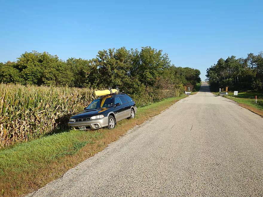
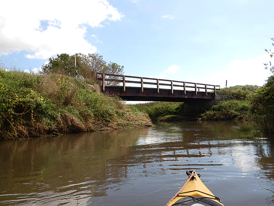
Putting in at Powell Road
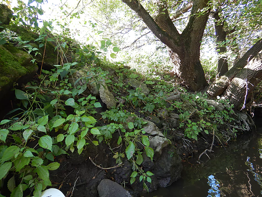
Tricky launch area southwest of the bridge
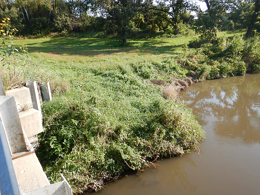
I should have launched from the northeast corner
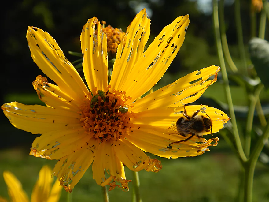
Poor flower being destroyed by insects
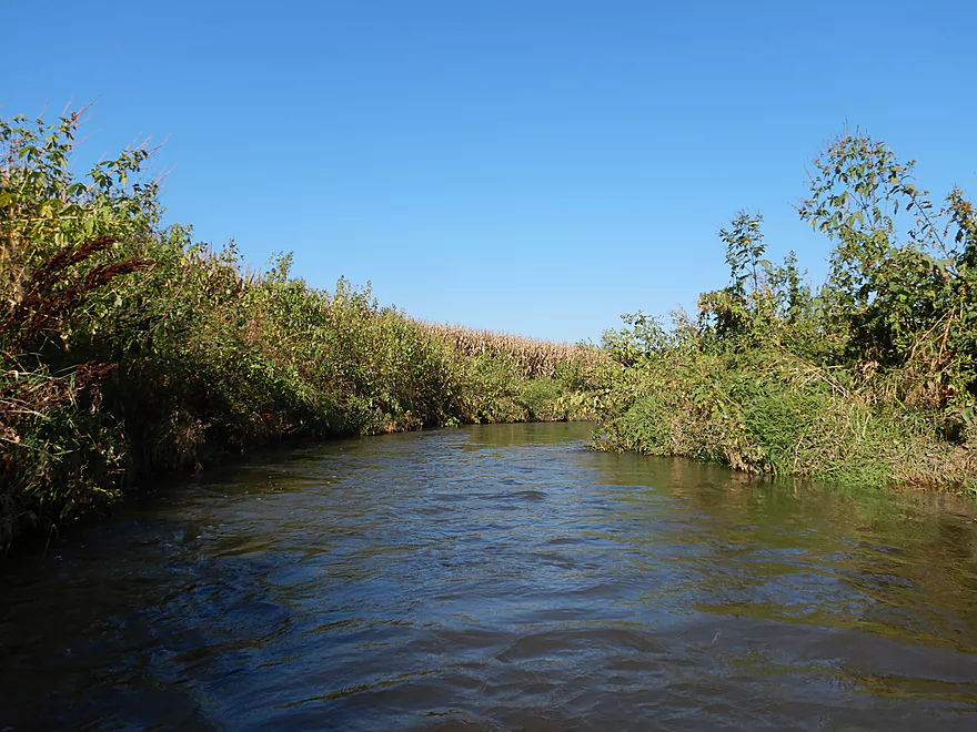
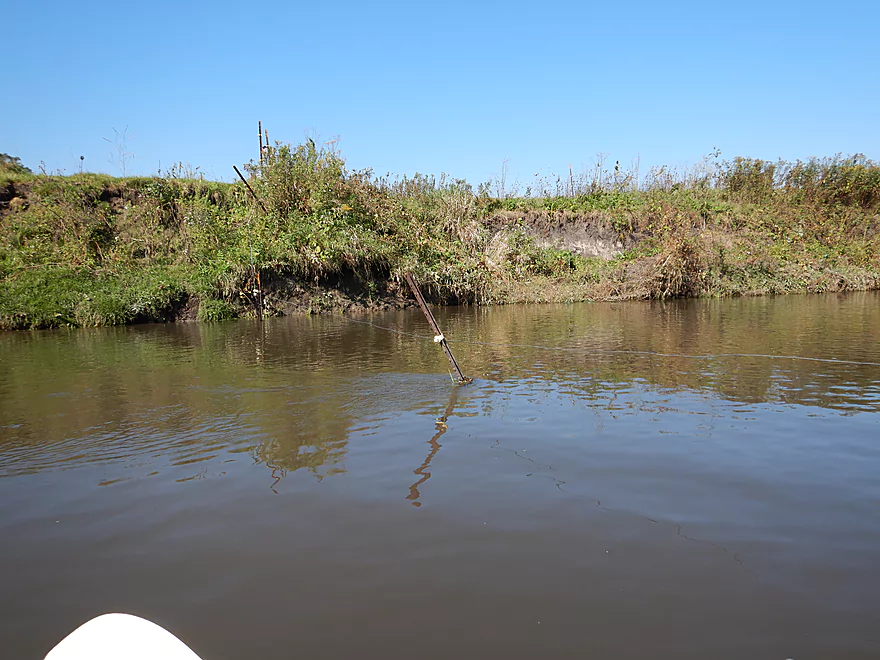
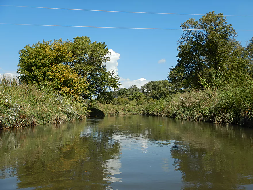
River starts small and narrow
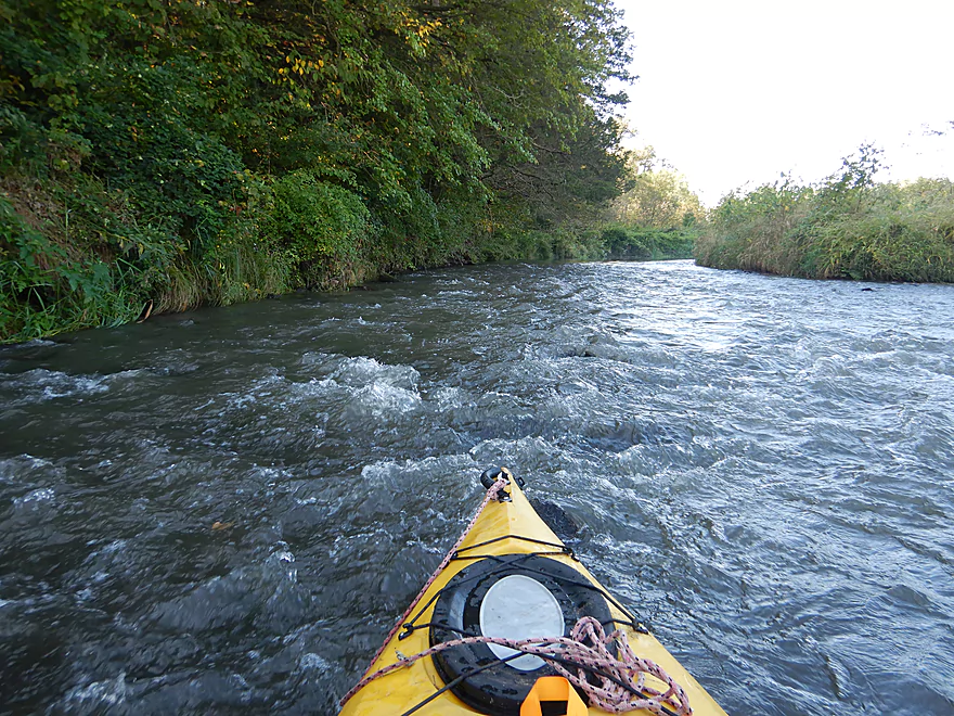
The first rapids
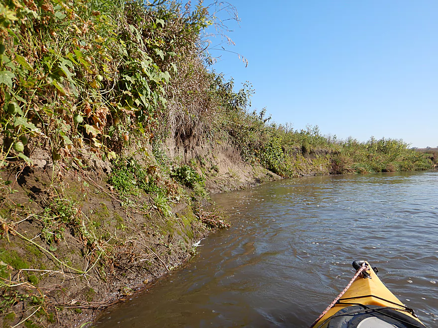
Mud banks were a common site
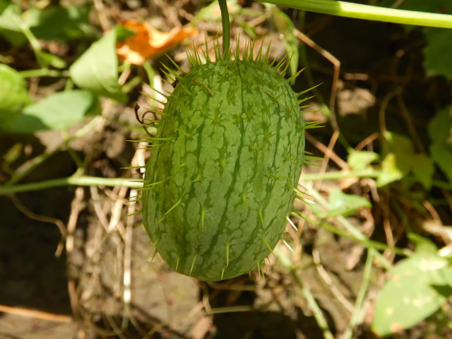
Spikey wild cucumber
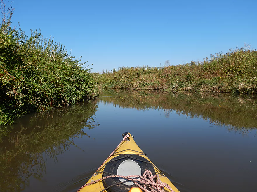
Very peaceful and pleasant section
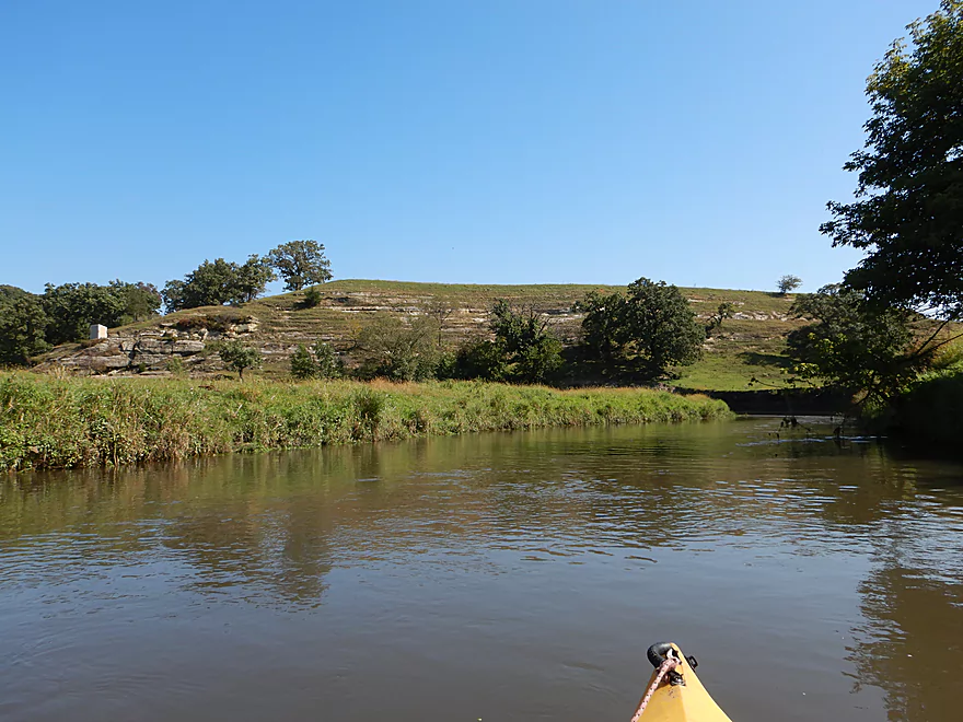
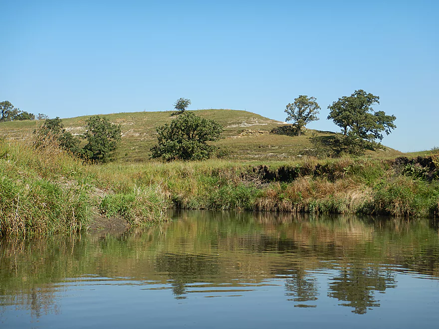
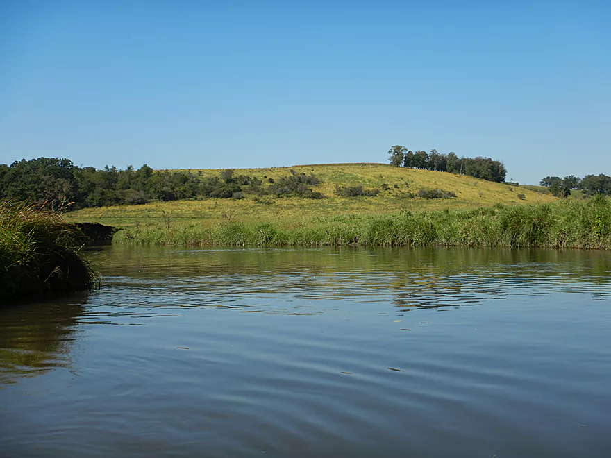
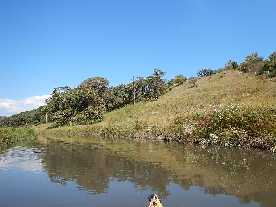
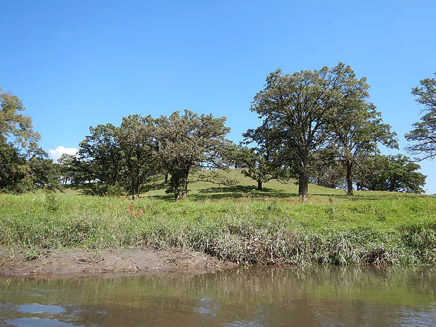
There were several oak savannas growing on hillsides
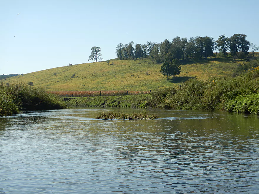
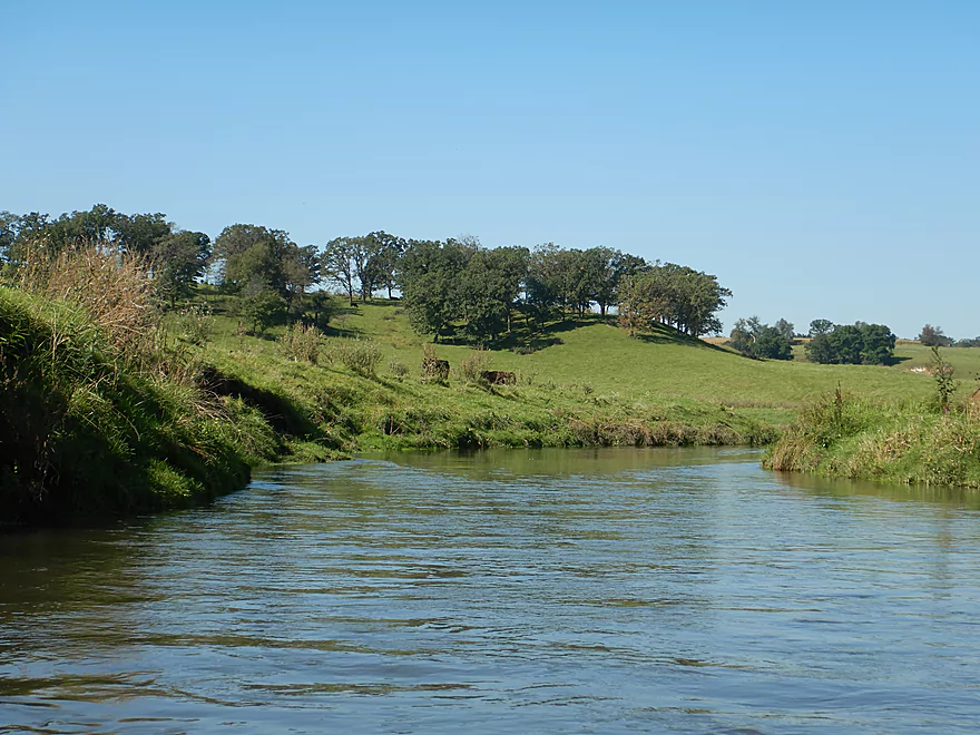
Attractive rolling green hills
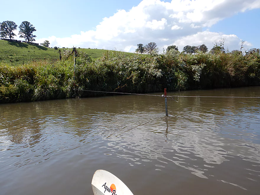
The first electric fence…tricky to get under
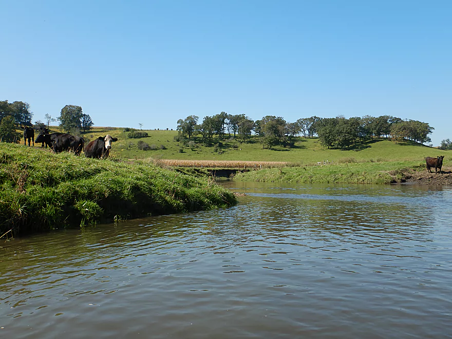
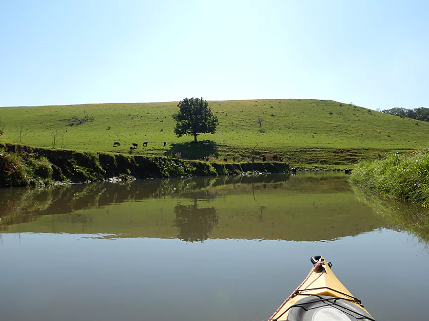
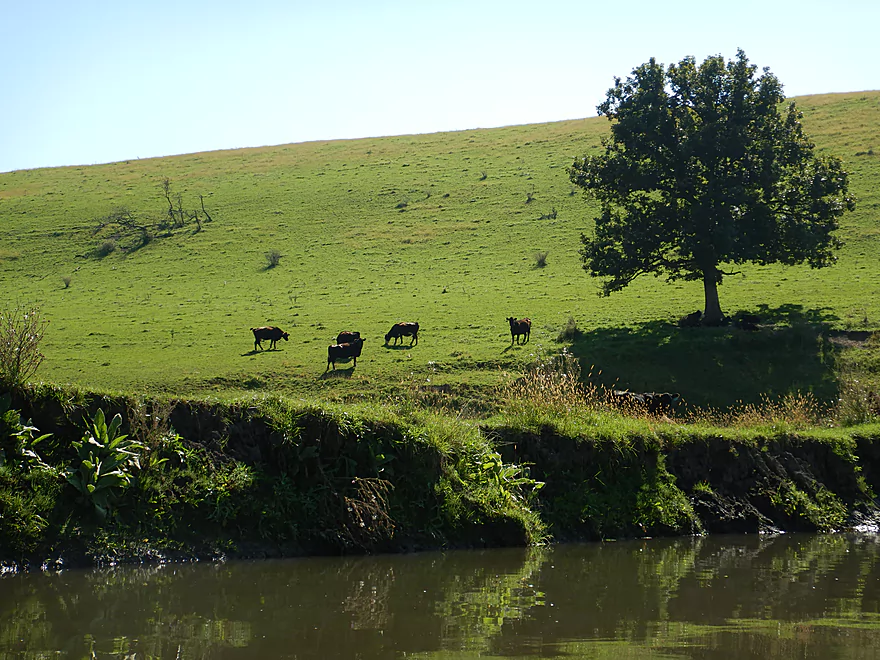
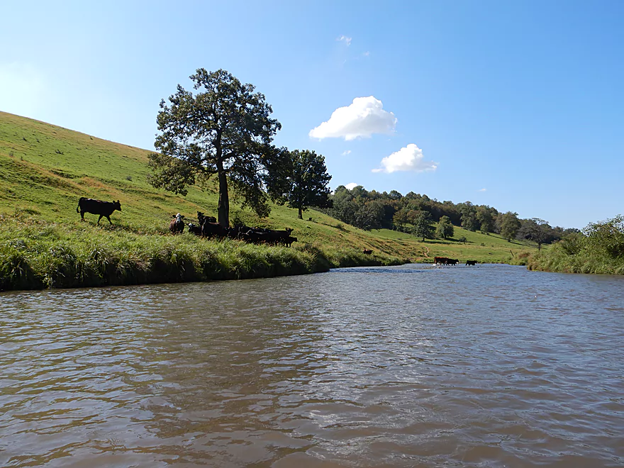
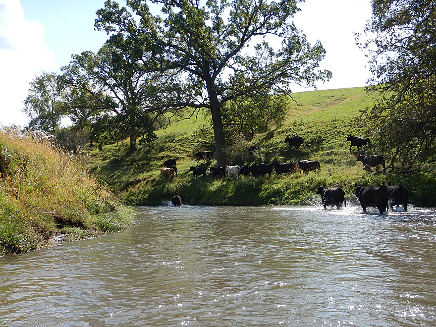
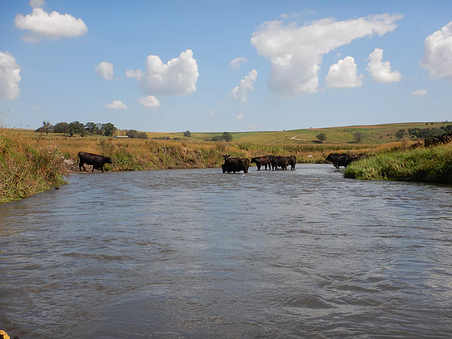
The first cows
Very pastoral river

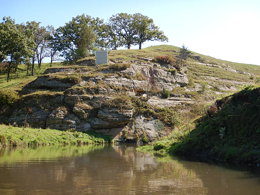
The only outcrop of the trip
But very nice
Part of a larger ridge
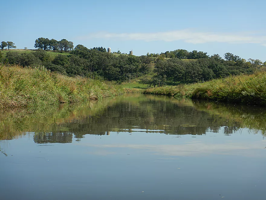
Scenic part of the river
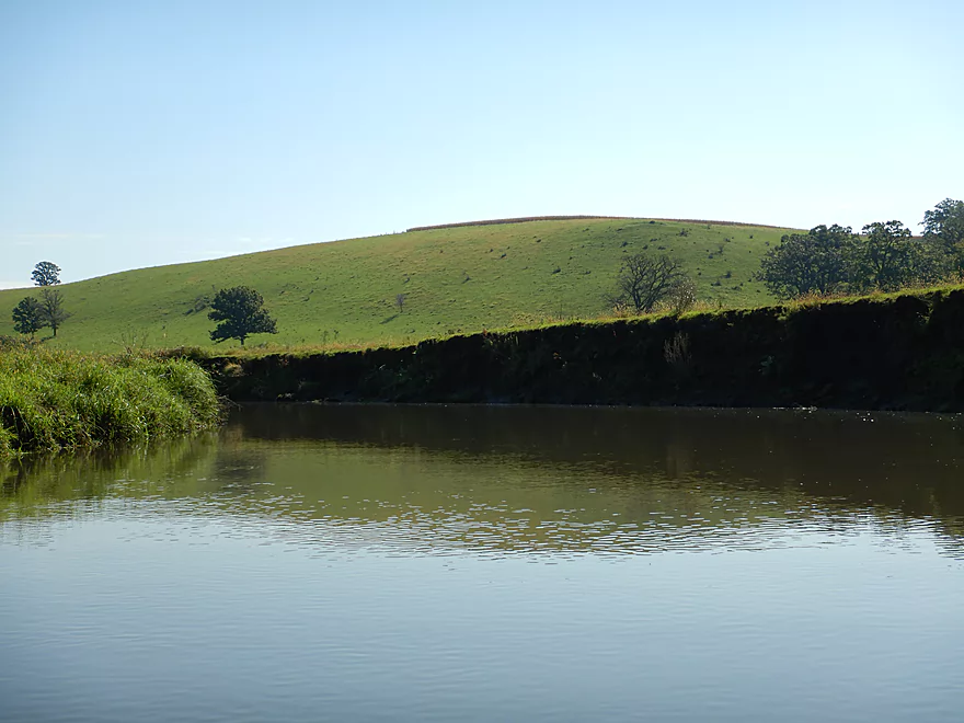
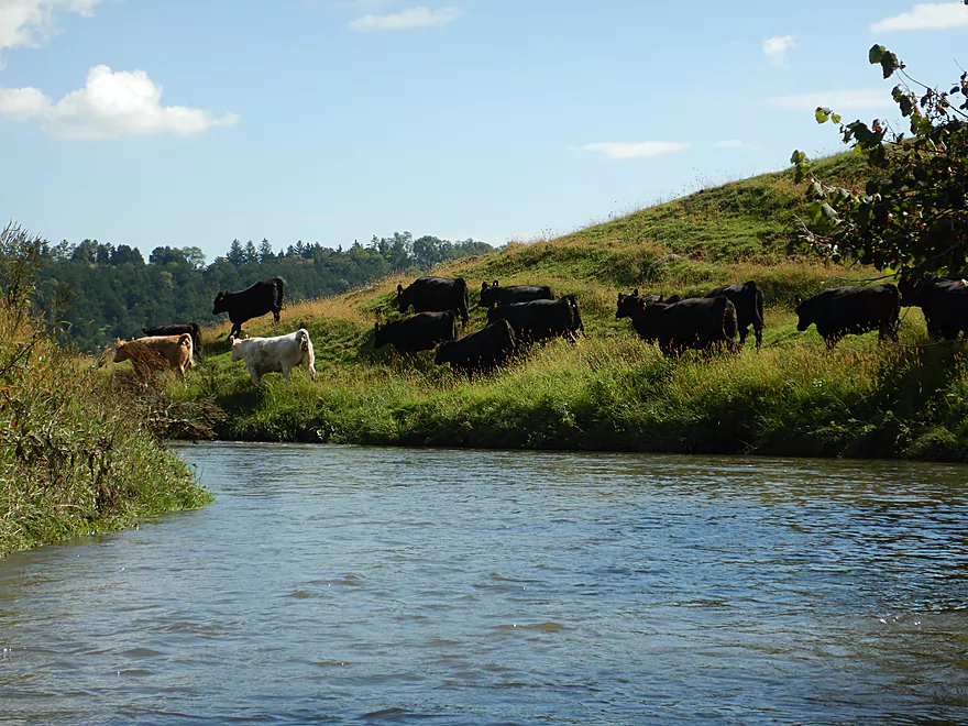
One of the larger hillsides
More teletubby hills
Large treeless hill
Cows and trees do not mix
One of the few shallow parts
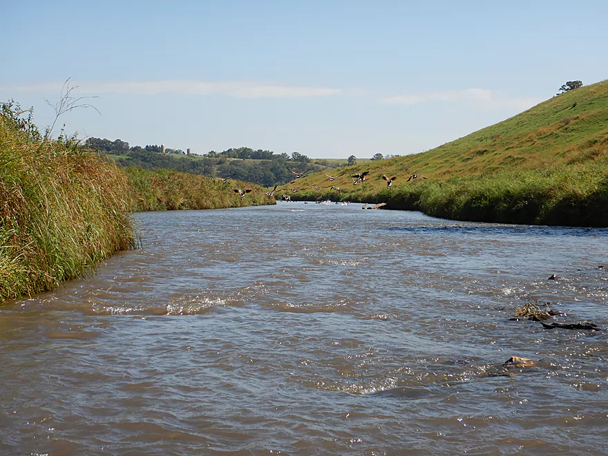
Geese taking off from the rapids
Looking back
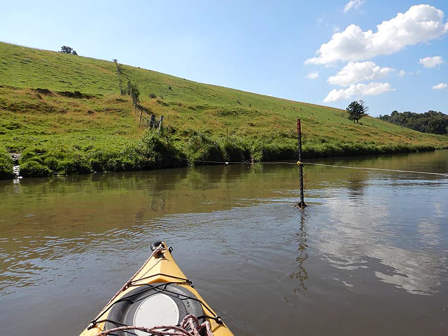
The second electric fence…also way too low
Paddling down what appears to be a straightened channel
A prairie topped hill
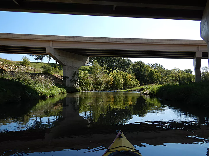
Hwy 151 marks the halfway point
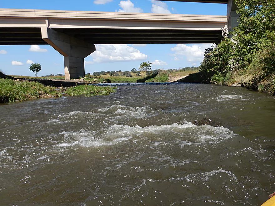
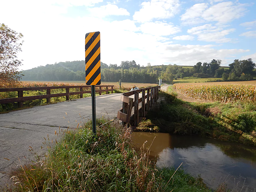
There are rapids hiding under the second bridge
Another oak savannah
The third and lowest electric fence
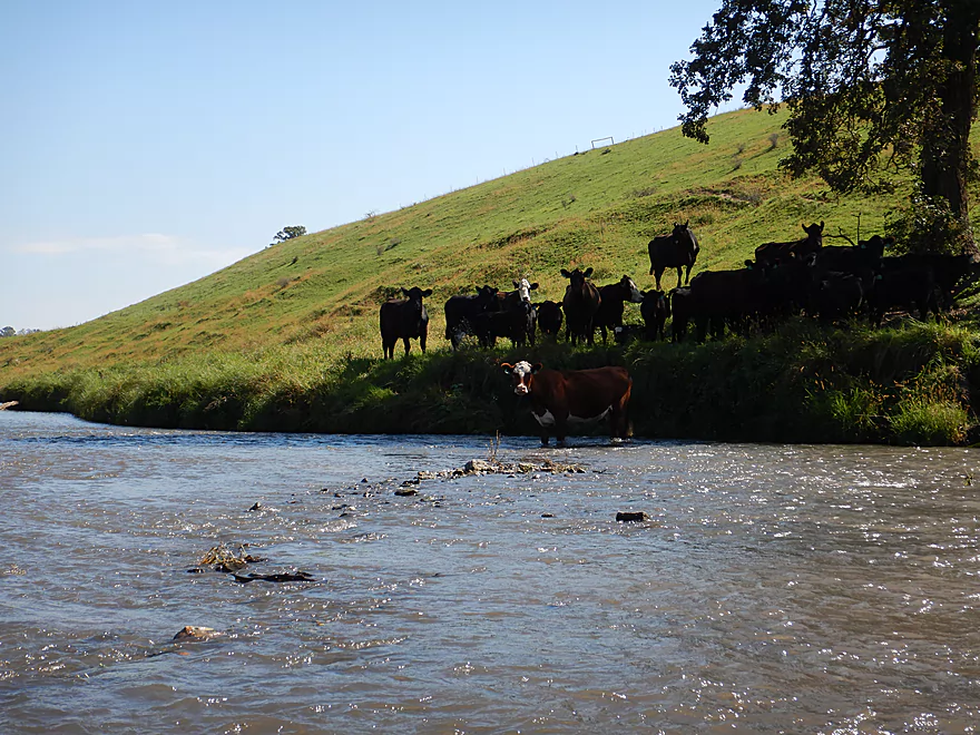
The steers were less likely to move
A galloping herd
Approaching a main cow crossing
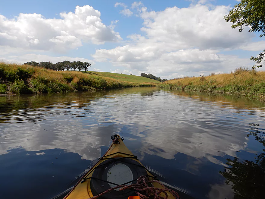
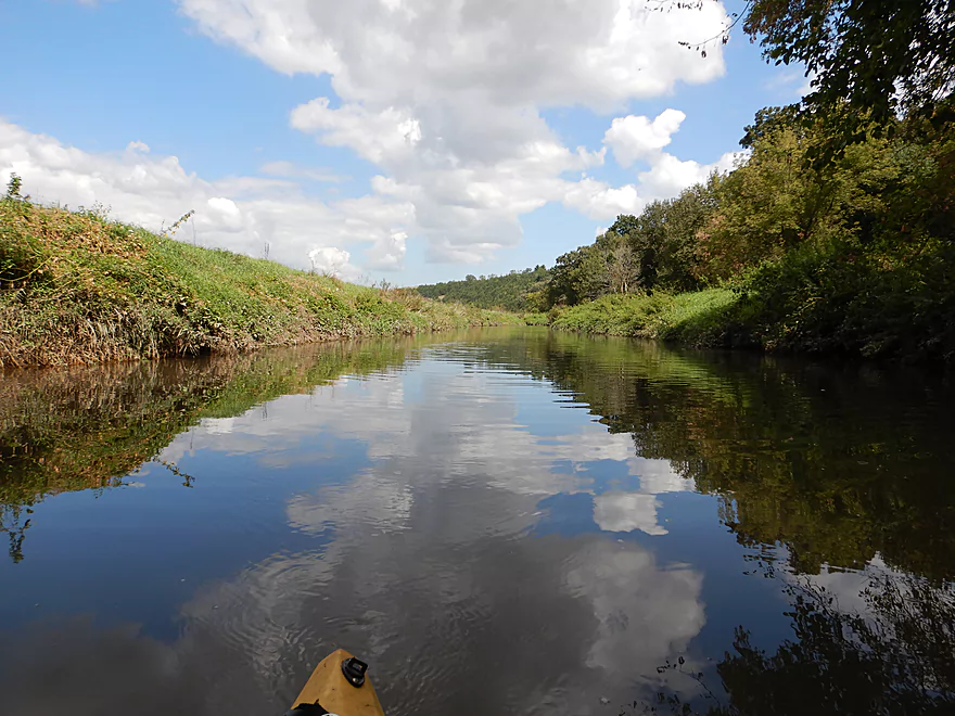
Great day for cloud reflections
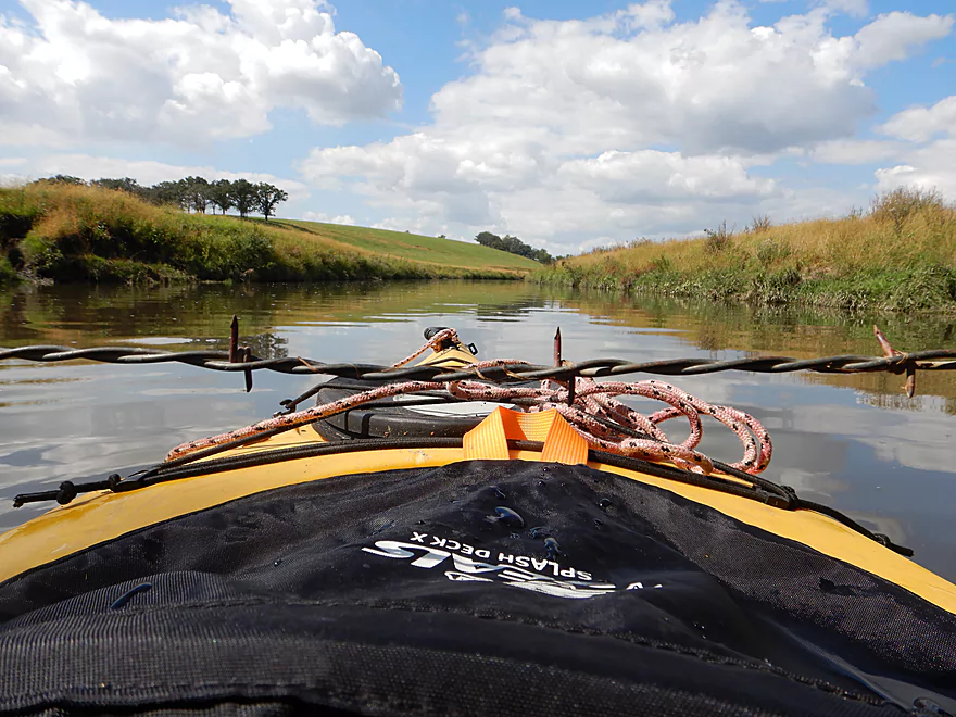
The fourth and lowest fence (but not electric)
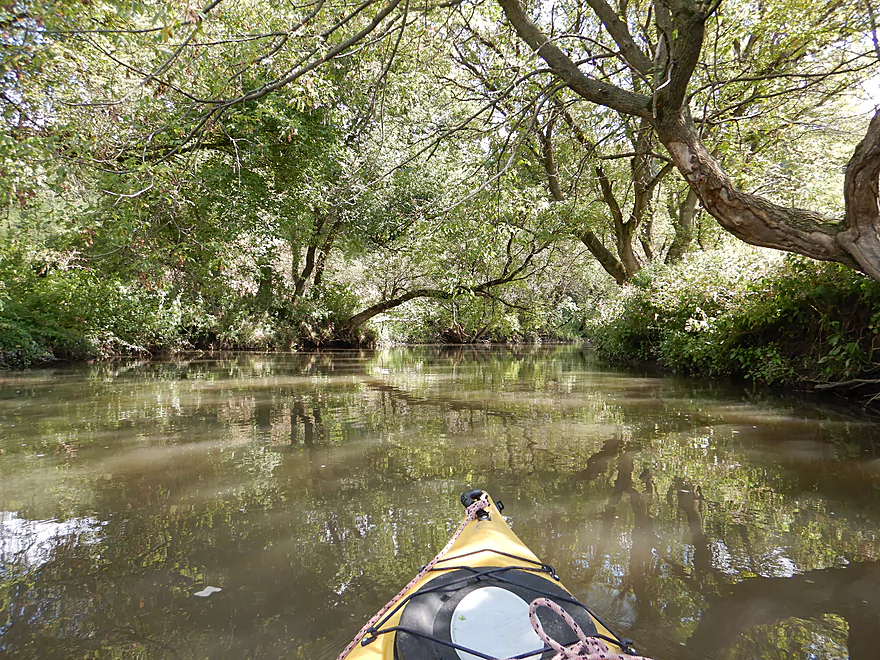
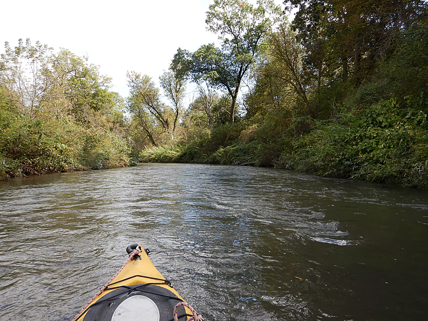
The second half of the trip was more wooded
But still was pretty open
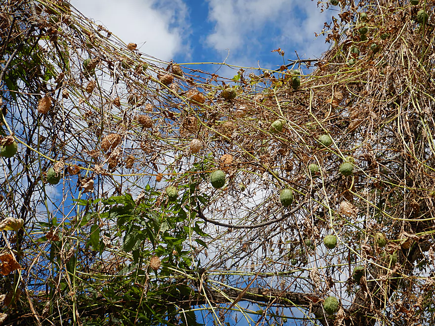
A tree trellis of cucumber vines
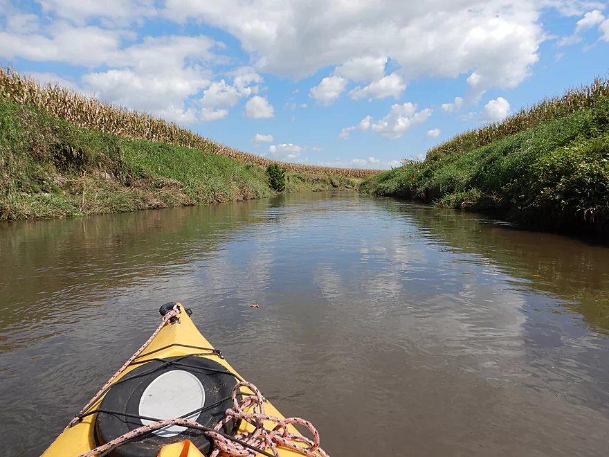
Paddling down corn corridors
Taking out at Oak Park Road
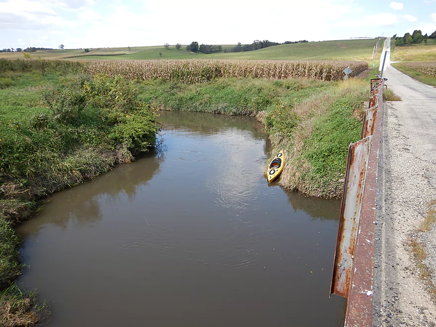
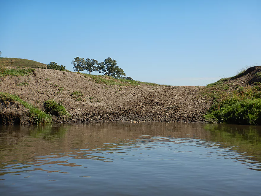
I disembarked along the northwest bank which was steep
The southwest bank would have been much better
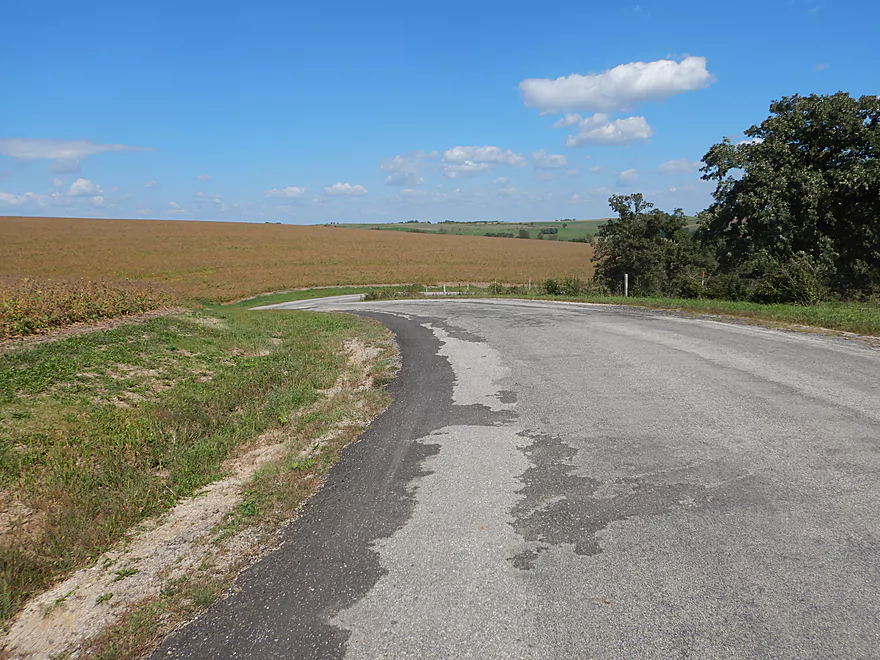
Hiking 6 miles over steep hills to get back to my car (not fun)
Pecatonica River – Powell Road to Oak Park Road

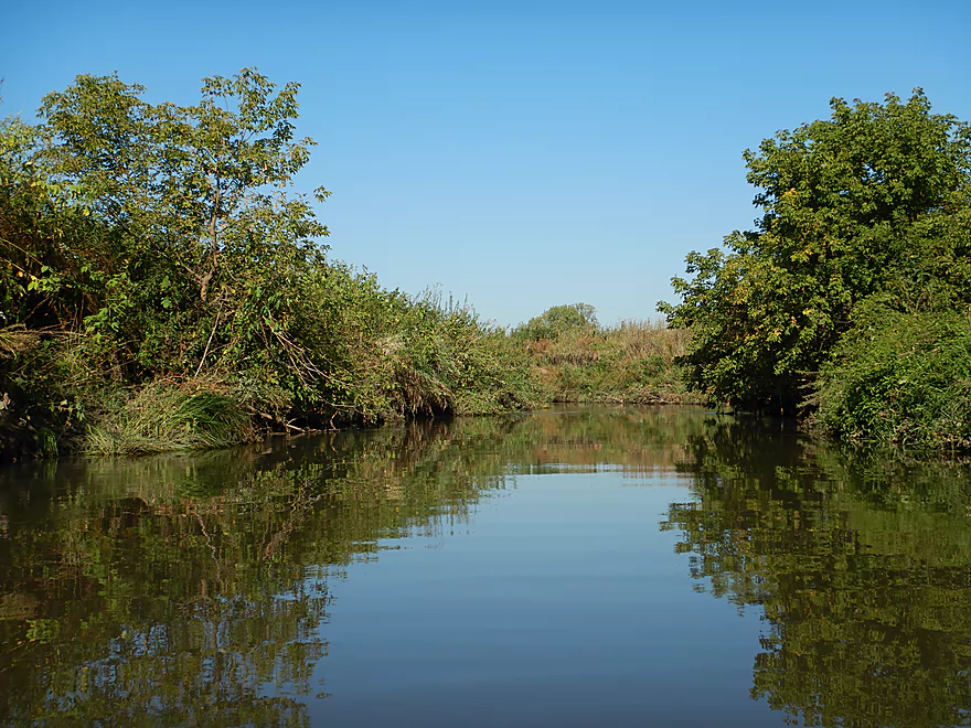
I started the trip at Powell Road, which while not a great bridge access was doable. The river to start was no more than a creek…narrow, muddy and with high weedy banks. Not the greatest first impression and it didn’t help that I was paddling directly into the sun (super challenging for photography). The river did get much better and the first sign of this was some surprise Class 1 rapids which were fun. Following the rapids, the river widened, slowed, opened up, and lost most of its trees.
Miles 2-4 were a peaceful part of the trip consisting of expansive open vistas of the surrounding countryside. Soon I came across my first fence though which was very low and electric. Because my kayak cockpit is so large, I have the unique ability to almost completely hide in it when paddling under fences (or logjams), so that didn’t phase me too much, but it would be a big deal for most other paddlers. Fences usually mark the start of cow territory and soon enough there was a herd blocking my passage. While initially reluctant to move, they ultimately did. While most of these cows are friendly, they were destructive and there was plenty of erosion and bank degradation.
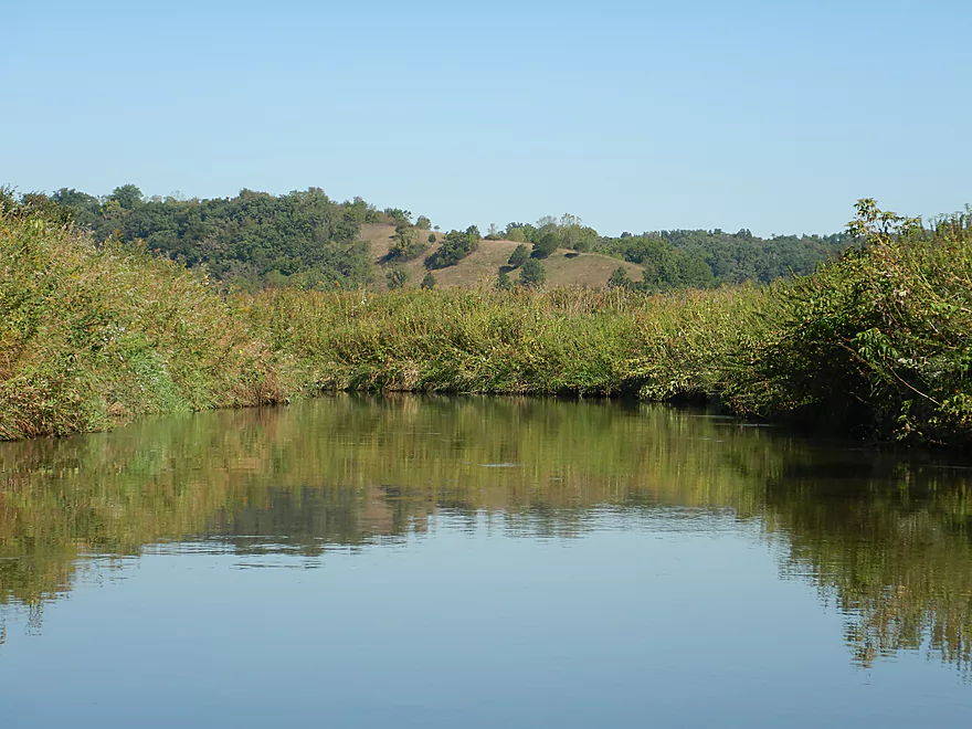
What was unique about miles 3-4 was that not only was there no corn or trees along the banks blocking my view, but there were none on the surrounding hillsides as well. They were mostly bald with the exception of several large oak savannas (likely a byproduct of the large pastures). From the boat, I was mostly flanked by large rolling green hills which were very scenic. To the east, the tops of semis whizzed by almost 200′ overhead along Hwy 151. While I suspected this trip would have a number of outcrops (based on relief maps), there only was one but it was very nice.
About halfway into the trip, the river turned sharply east at the base of one of the larger hills. It was here I came across another large herd of cows and another set of easy rapids. Despite the river being consistently pretty deep (say 2-3′), these rapids were on the shallow side. After the rapids I had to duck under yet another low electric fence. Not fun, but at least none of the fences were over rapids. The river continued in a suspiciously straight line for the next half mile (perhaps it was artificially straightened) before coming upon another large oak savannah and Hwy 151.
It was quite novel paddling under Hwy 151 being so familiar with the view from the top. Little do drivers overhead know but there are actually a set of rapids directly under the bridge which are pretty fun. I scouted this area as a launch…and it otherwise would be a terrific access….except the surrounding land is gated and private.
After Hwy 151, the river narrows somewhat and some woods return. I passed under the lowest electric fence of the trip and encountered a large group of steers. Unlike the cows, they weren’t as scared of me, but did finally relent when I got closer. I would continue paddling through mostly open pasture before encountering my fourth, final and lowest fence. But thankfully this was barbed and not electric, so I could lift it over my head (barely…this fence cleared my kayak by only inches).
The last fence marked a change in ownership and with it land management styles…which had a dramatic affect on the river. That was pretty much it for open pasture and what followed was a set of messy wooded banks more reminiscent of the lower Pecatonica. Following a surprise stand of firs, the rest of the trip was mostly corn country which together with the tall mud banks gave this a constricted and tunnel-like feel (in sharp contrast to the first half of the trip). I ended the trip at Oak Park Road which wasn’t the easiest take-out but could have been easier had I properly scouted this better before hand.
In conclusion this was a mixed bag trip. The rolling green hills, rapids, the sandstone outcrop, and zero logjams were great. But the four low fences were a downer, and the water and bank quality were never that great. Pecatonica newbies should start elsewhere (such as on the East Branch or downstream of Darlington), but locals or rugged paddlers looking for a new adventure and not minding low fences can have a good time.
My adventure didn’t end at the take-out though. My plan was do a bike shuttle back to the car over a long and hilly stretch of back county roads. But soon after biking up the first hill, my front tire sprang a leak (this has happened four times in the past two years). This forced me to hide my bike in the ditch and walk the rest of the way. Hiking shuttles are possible, but can be unpleasant. In this case I was hiking 6 miles over steep hills and in 90+ degree heat. On top of this, I did this in aquatic shoes not designed for long hikes and developed several huge blisters on my feet. Mercifully my shuttle came to an end two hours later when I finally reached my car.
Some dragonflies, a few spooked turtles, ducks, migrating geese and many, many cows. The highlight was an otter family I saw near the end of the trip.
Powell Road was a mediocre bridge access with good shoulder parking. I made this excessively difficult by launching southwest of the bridge where the bank was steep but close to parking. In hindsight, launching northeast of the bridge would have been significantly easier.
An alternate access 3.1 miles upstream would be at Jones Branch Road. It would not be difficult to launch here by the wheelchair fishing ramp. This bonus section is unexplored territory though and while it likely has a few fun rapids and several large outcrops, I estimate it could have 3-5 logjams.
I took out at Oak Park Road which again I made more difficult than need be as I climbed out along the northwest bank which was steep and overgrown. Much better in hindsight would have been the southwest corner which while still somewhat steep and weedy, would have been significantly easier.
An alternate take-out 3.6 miles upstream would be under the Hwy 151 bridge. While this would be an easy access, you would have to travel over a private drive owned by Blackstone Cattle to get to it. Get permission from this company before launching here (608-516-9697).
The bike shuttle while paved and with little traffic is very difficult because of the hills. This route would involve 6.0 miles, 384′ of ascent and 302′ of descent.
Current: Mostly slow, but a few minor rapids here and there.
Logjams: No logjams. There are a few strainers, but they should be easy to avoid.
Fences: This is an issue. There are two low electric fences upstream of Hwy 151. There is another low electric fence downstream of Hwy 151 which is followed by a very low barbed wire fence. I was able to get under the 3 electric fences and lifted the barbed one over my head. …but I’m very experienced at dealing with obstacles like this and these four fences are likely too low for most paddlers. If you do this section wait for lower water levels as portaging these fences would be very difficult.
Cattle: There are a decent number of cattle on this stretch. The cows upstream of Hwy 151 were pretty harmless and moved when I got close. The steers downstream of Hwy 151 were less inclined to budge but did move when I got close. No bulls were sighted. You should be ok…just give these animals a wide berth and make sure none step in your boat.
There is a gauge at Darlington, but that may not be entirely representative as it is 15-20 miles downstream and at that point the river is significantly larger.
- < 100 CFS: The river infrequently gets this low. Most of this stretch should be navigable, but you might have to walk 2-3 rapids.
- 101-210 CFS: An average fall depth. Mostly navigable but with very bumpy rapids.
- 211-250 CFS: An average summer depth. Likely a good target for paddling.
- 251-290 CFS: An above average depth that should be doable.
- 291-350 CFS: High water and good for the rapids. I did this at 310 CFS and getting under the four fences was difficult.
- 351-450 CFS: A very high depth. Definitely not recommended because of the low fences.
- 451+ CFS: A very full channel nearing flood stage. Absolutely not recommended.
Detailed Overview
- Upstream of Hwy X: I think the river up here is too shallow to run.
- Hwy X to Hwy G1st: 4.2 miles. This section is a small creek and may need high water. Some logjams and probably small outcrops. Hwy X is not a great access and lacks privacy.
- Hwy G1st to Hwy E: 3.4 miles.
- Hwy G1st to Hwy G2nd/Mifflin: 2.9 miles. Great section with many rock outcrops and light rapids. Shallow, but becomes much deeper after the Livingston Branch joins up. Two fences, but easy to get past.
- Hwy G2nd/Mifflin to Hwy E: 0.5 miles. Short, open section heavily grazed by nearby beef cattle. Some fun rapids and outcrops are on this segment. One fence to duck under (quite manageable).
- Hwy G2nd/Mifflin to Hwy A: 4.4 miles. An excellent prospect with good current, outcrops, a state natural area, and few logjams. Martin (reader comment) kayaked this section and wrote a nice summary here that you can read.
- Hwy A to Peniel Road/Hwy J: 1.7 miles. Maybe two outcrops and two major logjams.
- Peniel Road/Hwy J to Jones Branch Road: 2.5 miles. Some congested woods with maybe 3 logjams and 2-3 outcrops.
- Jones Branch Road to Powell Road: 3.1 miles. A nice peaceful stretch with a few outcrops, 2 sets of light rapids, and one serious logjam.
- Powell Road to Oak Park Road: 8.0 miles. A very open section with no logjams. Highlights include green rolling hills, oak savannas, a few rapids, and one outcrop. Lowlights include four low fences.
- Powell Road to Hwy 151/Blackstone Cattle: 4.4 miles. The more scenic of the two sections with scenic hills and one outcrop. There are two low electric fences to duck under.
- Hwy 151 to Oak Park Road: 3.6 miles. This section had more corn and trees and wasn’t as interesting, but still was decent. There is one low electric fence and one super low barbed wire fence.
- Oak Park Road to Hwy O: 3.7 miles. Likely some logjams but also some outcrops at the end. Oak Park Road is a muddy but doable put-in.
- Hwy O to Hwy G: 6.0 miles. Some scenic moments, but mud and logjams are detractions. Put-in and take-out are muddy.
- Hwy G to Darlington/Black Bridge Park: 8.5 miles. A decent prospect. As of 2020, there is a large logjam on this leg that requires a difficult portage up steep and muddy banks. This might be cleared out for the 2021 Darlington Canoe Festival.
- Darlington/Black Bridge Park to Roller Coaster Road: 4.9 miles.
- Black Bridge Park to Wells Street Access: 0.7 miles. A great stretch though the town of Darlington. The highlight is a section of Class 1 rapids where the old mill dam used to be.
- Wells Street Access to Roller Coast Road: 4.2 miles. A decent stretch, but no outcrops, the banks are steep/muddy and there are two partial logjams to circumnavigate around. Not bad...not great.
- Roller Coaster Road to Walnut Road: 7.3 miles. While one of the nicer legs on the lower Pecatonica, the river has been too badly damaged by erosion to be an elite paddle. The highlight is a sandstone outcrop.
- Walnut Road to Riverside Road: 5.5 miles. Mediocre prospect flanked by a lot of farmland. Excellent put-in and take-out.
- Riverside Road to Hwy 78 Canoe Landing: 3.2 miles. Likely an uninteresting leg with lots of farmland and large mud banks. I doubt there are many bluffs. There may be one major logjam.
- Hwy 78 Landing to Gratiot Conservation Club Landing: 5.8 miles. A mediocre stretch. Much of this is wide, slow, and straight...but there are a few nice wooded bluffs.
- Gratiot Conservation Club Landing to Sargent Road: 4.7 miles. Maybe a weaker section.
- Sargent Road to Hwy D/N: 4.6 miles. Flows partly through a SNA and by a valley ridge so might be interesting.
- Hwy D/N to Hwy 11 Boat Ramp/Browntown: 8.8 miles. The East Branch comes in and doubles the river (now pretty big).
- Browntown to Brewster's Landing: 12.2 miles.
- Hwy 11 Boat Ramp/Browntown to Hwy B: 4.8 miles. Generic stretch with farm fields and a thin layer of trees. Take-out might be tricky because of a guardrail but I think it’s doable.
- Hwy B to Hwy M: 4.6 miles. A good leg with scenic bluffs and outcrops. Put-in is meh…take-out might be bad.
- Hwy M to Brewster's Landing: 2.9 miles. Mediocre stretch that crosses into Illinois.
- Brewsters Landing to McConnell Bobtown Landing: 7.2 miles. Mostly straight and boring. But there is a wooded section with bluffs that might be nice. Could be an outcrop or two.
- McConnell Bobtown Landing to McNeil's Damascus Landing: 8.5 miles. River flows through a more rugged and varied part of Stephenson County. Still some boring parts, but also some nice bluffs and limestone outcrops.
- McNeil's Damascus Landing to Wes Block Trailhead: 8.3 miles. Mostly a straight and muddy paddle. But there should be a few nice bluffs on the west bank.
- Wes Block Trailhead to Tutty's Crossing: 6.4 miles. River enters Freeport (IL). This should be a pleasant stretch with fewer farm fields, nicer woods, and a few attractive trail bridges.
- Tutty's Crossing to Hancock Ave Boat Ramp: 0.7 miles. Wooded urban stretch.
- Hancock Ave Boat Ramp to Junior's Place/VFW: 2.3 miles. River leaves Freeport. This is likely a mediocre stretch.
- Junior's Place/VFW to Ridott Fishing Park: 14.8 miles. A very long stretch that I'm not sure would be that interesting. There are rapids by the Brown's Mill Dam that may have to be portaged.
- Ridott Fishing Park to Attens Landing: 6.7 miles. I don't know much about this stretch. It meanders more and has thicker woods so may be nicer.
- Attens Landing to Winnebago County Fairgrounds Ramp: 7.5 miles. Much of this flows through the Pecatonica Wetlands Forest Preserve.
- Winnebago County Fairgrounds Ramp to Sumner Park: 0.4 miles. There are tricky rapids where a dam was mostly removed. Depending on water levels, you may have to portage this.
- Sumner Park to Pecatonica River Forest Preserve Ramp: 6.0 miles. A north flowing leg of the river that is mostly undeveloped and contains some floodplain forests.
- Pecatonica River Forest Preserve Ramp to Trask Bridge Ramp: 7.0 miles. This is a relatively good prospect with large clay banks and a few nice woods.
- Trask Bridge Ramp to Two Rivers Ramp: 12.6 miles. Paddling author Mike Svob seemed to like this leg. Here the river meanders and twists more. The woods are also more impressive. Much of this is still likely wide, slow, and boring though. The take-out is close to the mouth of the Sugar River.
- Two Rivers Ramp to Boat Launch Mactown: 9.8 miles. The last leg of the Pecatonica before it empties into the Rock River. Significantly enlarged by the Sugar River, I suspect this is a big and boring leg.
Trip Map
Overview Map
Video
Photos Size: