
Putting in at Hwy 33
Just downstream from the golf course
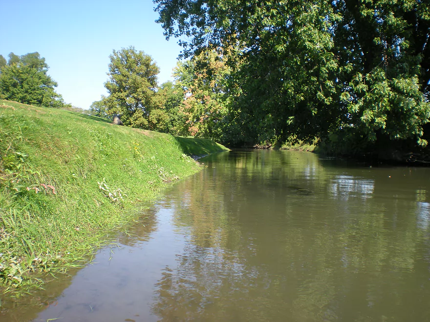
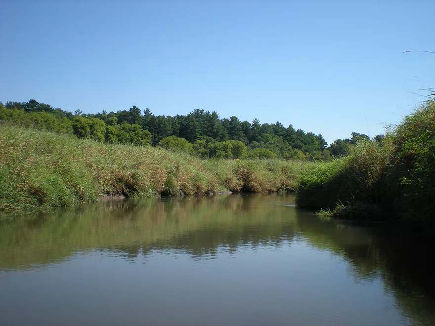
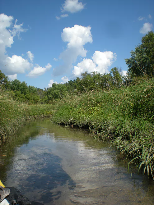
Very peaceful stretch
Hahn Street
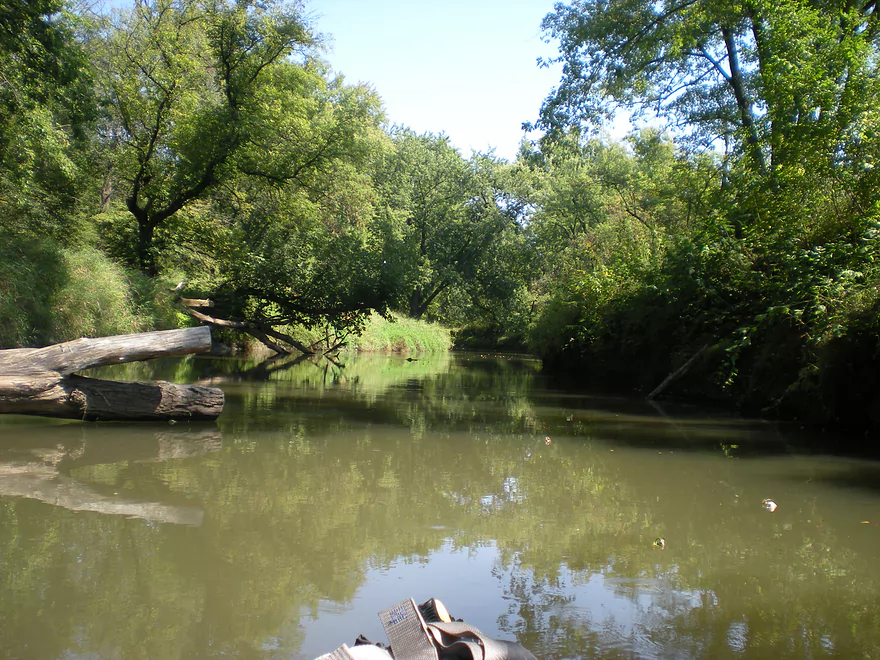
Lot of pines on this leg
The local livery clears up the jams
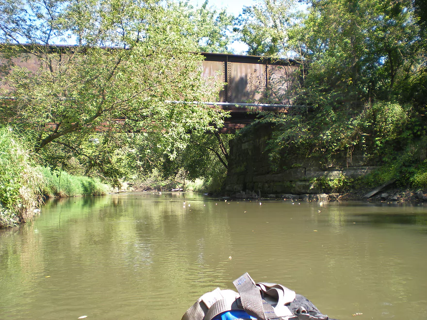
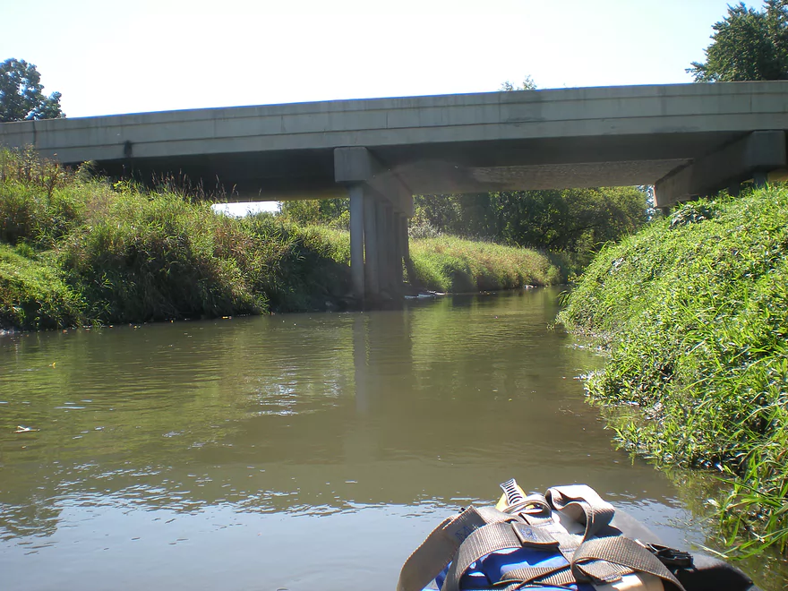
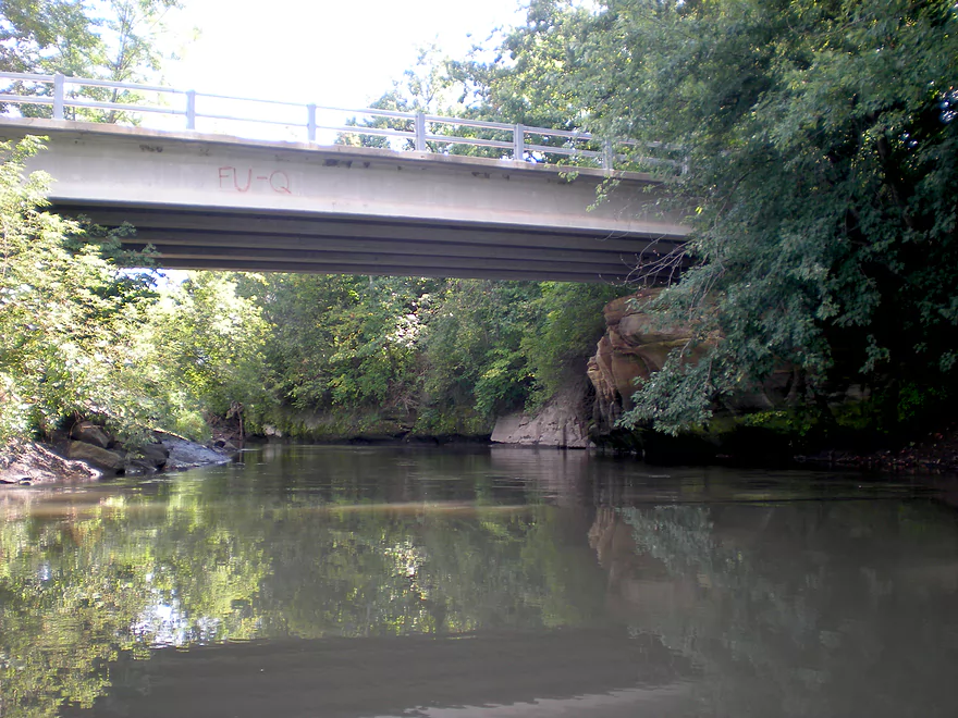
Paddling under the Hillsboro State Trail
Banks were tall and weedy
A clean little tribitary
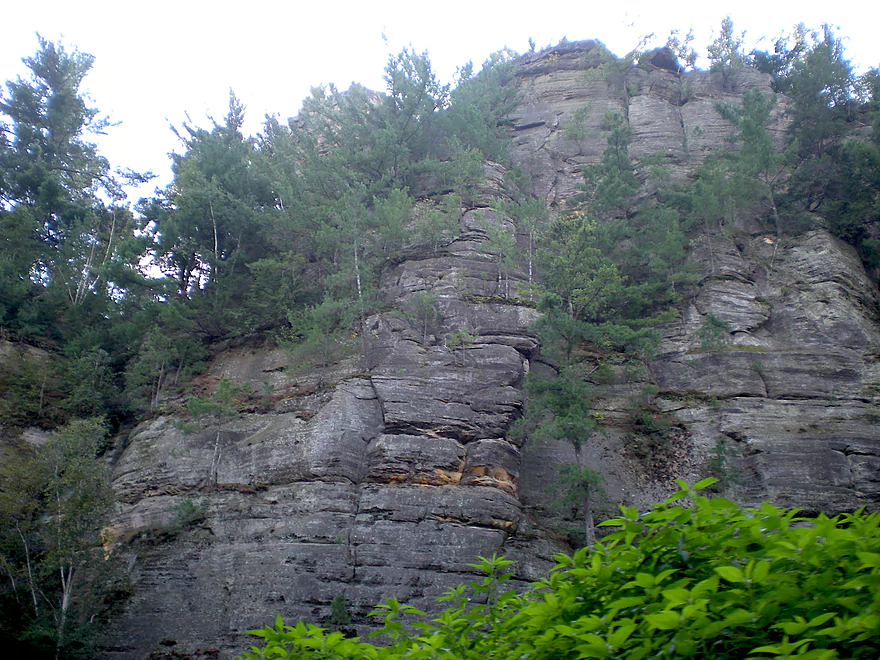
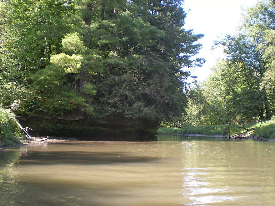
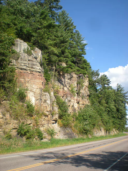
This is Third Castle
The highlight of the trip
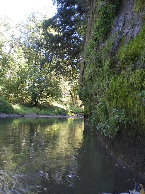
Some great mosses
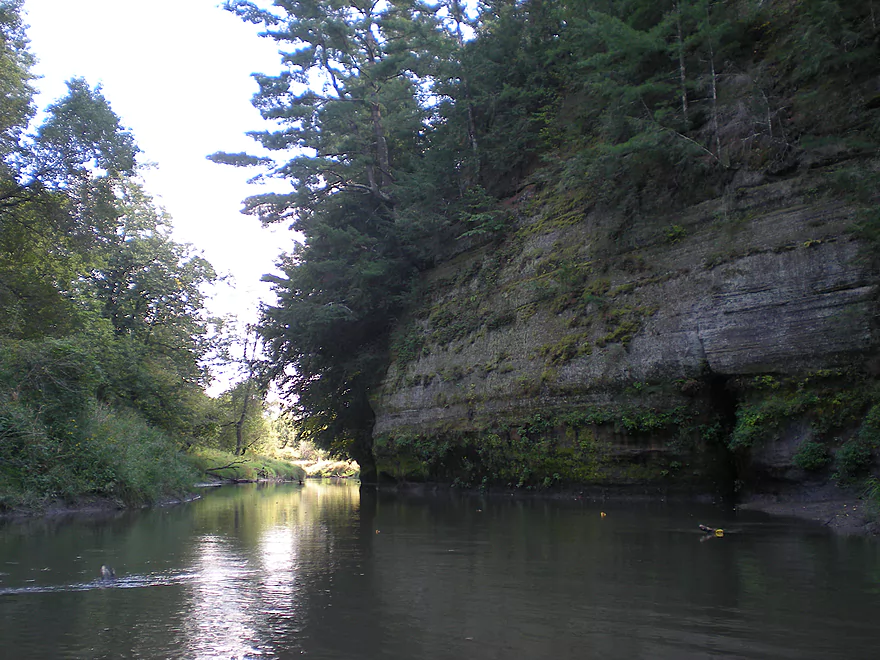
Looking back at the outcrops
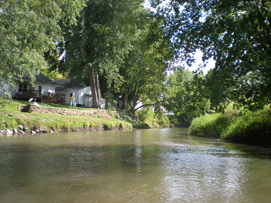
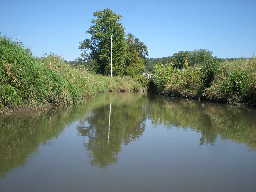
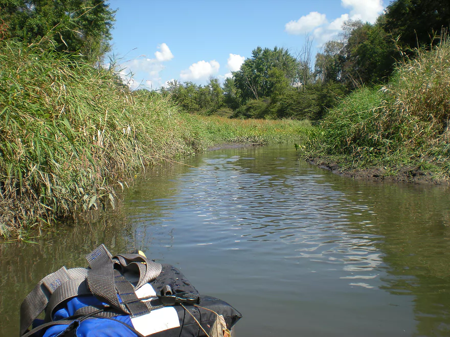
The outskirts of Wonewoc
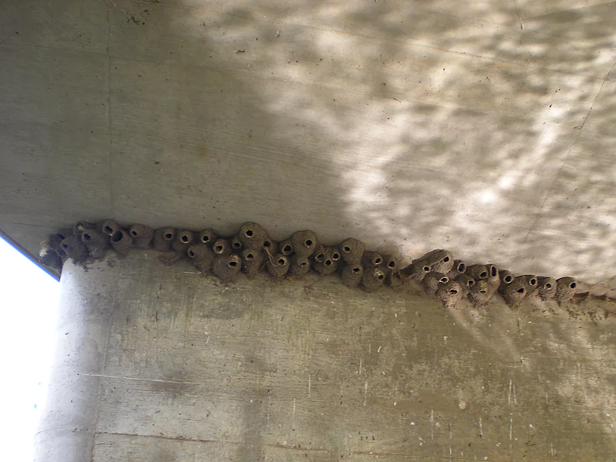
Cliff swallow nests
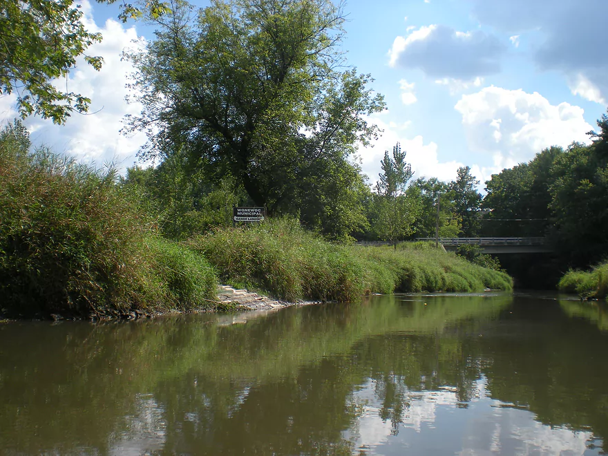
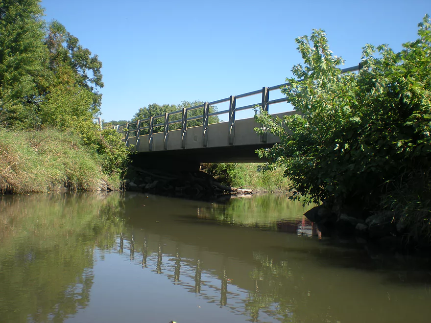
Taking out at a public canoe landing
Just upstream of Washington Street
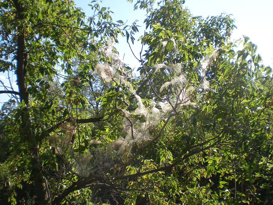
Some type of interesting webbing
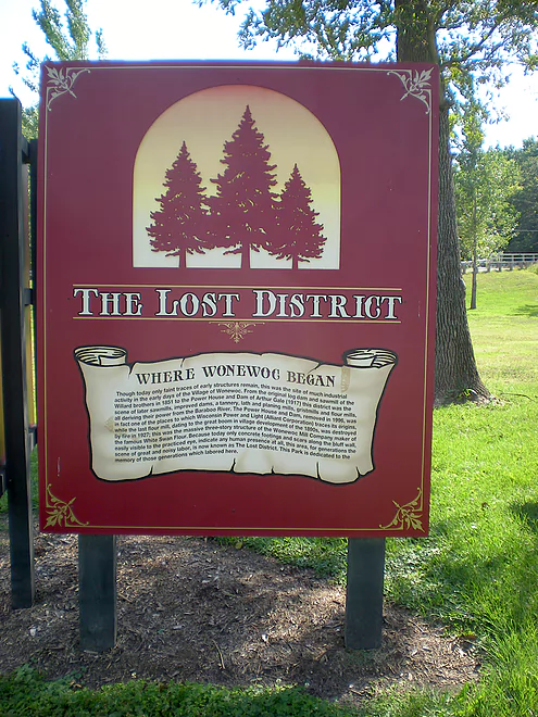
History of the Lost District
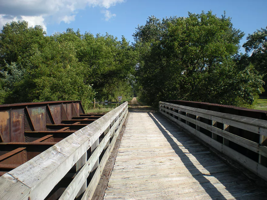
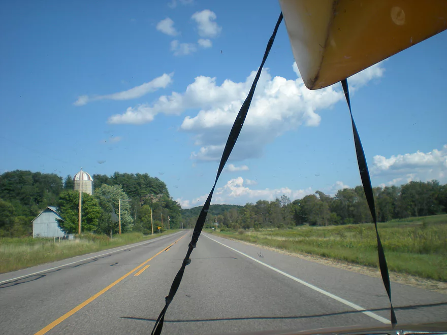
The 400 State Trail is a great way shuttle back after a trip
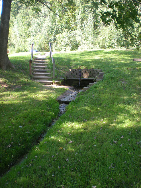
An artesian well with tasty water located at Wayside Park
There are more outcrops on downstream sections of the Boo…future trips
Heading home
Baraboo River – Wonewoc

This is as about upstream as you can get on the Baraboo. I believe you can put in further upstream (it seems deep enough…barely) but the main shuttle company in the area doesn’t like to because the river cuts through a golf course and their insurance company won’t cover this. This section is cleared out regularly so should be free of debris. It’s a little muddy, but MUCH better than the lower Baraboo. No rapids…and current is moderate (probably 3 ft. a mile). The West Baraboo branch joins the Baraboo shortly after Union Center, but looks too tight to navigate (could be wrong). The trip is about 6 miles and is easy to do. Navigating past Wonewoc isn’t recommended because of all the debris. The highlight of this trip is Third Castle, which is a massive rock formation hugging the Baraboo River about a mile upstream from Wonewoc. Very little traffic, so you’ll probably have the river to yourself. The other noteworthy element is the Old 400 bike trail, which follows this section. Some will bike upstream and kayak downstream.
2023 Update
Update for paddlers. Beyond Boundaries no longer clears out logjams on this stretch and it has gotten REALLY bad. At this point I advise avoiding this leg, until the logjams get cleaned out. When this is, I don’t know. Friends of the Baraboo River might do this in the future.
Detailed Overview
- Nutmeg Road to Hwy PP: 6.2 miles. Flows by the historic Elroy-Sparta Trail and is mostly open, but there are a few logjams. This is a narrow small stretch that will need very high water to be runnable. There are scenic outcrops on this stretch….maybe 3.
- Hwy PP to 2nd Main Street: 1.6 miles. Maybe 3 logjams.
- 2nd Main Street to Franklin Street: 0.9 miles. Maybe 1-2 logjams. Trip starts at a scenic covered bridge and on Class 1 rapids.
- Franklin Street to Hwy 82(South of Lincoln Street): 0.5 miles. A good stretch that is mostly open and has maybe one outcrop.
- Hwy 82(South of Lincoln Street) to Schultz Park: 0.6 miles. Maybe 2 logjams.
- Schultz Park to Hwy 82(South of Snyder Road): 4.0 miles.
- Schultz Park to Hwy 82(North of Lumsden Road): 0.6 miles. One outcrop, one logjam portage and a few tight fits.
- Hwy 82(North of Lumsden Road) to Hwy 82(South of Snyder Road): 3.4 miles. Three outcrops, three significant logjams and several tight fits. A section with good potential but needs cleanup work.
- Hwy 82(South of Snyder Road) to Hwy W: 1.9 miles. Maybe 2-3 jams…think this is doable though.
- Hwy W to Hwy 82/Union Center: 1.3 miles. Good prospect by the golf course with maybe 2 outcrops. Maybe 1-2 logjams.
- Hwy 82 to Hwy FF Landing/Wonewoc: 7.1 miles. A great section with one of the largest rock outcrops on the river.
- Hwy FF Landing to Wayside Park: 2.9 miles. There used to be a lot of logjams here. I think it might be doable…maybe 2-3 major portages.
- Wayside Park to Kalepp Road: 4.5 miles. An uninteresting part of the river with weedy, muddy banks. But…there are three fantastic sandstone outcrops.
- Kalepp Road to N. Dutch Hollow Road: 5.3 miles. One logjam portage with several “hoppers” and “duckers”. There are some outcrops but most are recessed and away from the river. Mud and downed trees are a bit unsightly, otherwise a pleasant paddle.
- N. Dutch Hollow Road to La Valle: 3.8 miles. Second best section on the entire river with great rock outcrops.
- From La Valle to Lake Redstone: 3.6 miles. One of the more underrated sections of the Boo, which I really liked.
- Lake Redstone to Monument Park/Reedsburg: 9.0 miles. Supposedly kind of boring, but the logjams should be cleared out.
- Monument Park to South Park: 1.4 miles. Spanning the length of Reedsburg, this should be a nice section mostly free of jams.
- South Park to Golf Course Road: 4.7 miles. Maybe 4-5 logjams. Probably one too many. Should be 1-2 small sandstone outcrops. Golf Course Road might not be a good access.
- Golf Course Road to Hwy 136(by Beth Road): 3.6 miles. Maybe a few jams. Likely mostly floodplain paddling and probably uninteresting.
- Hwy 136(by Beth Road) to Hwy 136(by Ableman’s Gorge): 6.0 miles. Maybe some outcrops at the end, but mostly uninteresting paddling I suspect. Likely several serious logjams with difficult portages because of the high muddy banks.
- Hwy 136(by Ableman’s Gorge) to North Freedom Boat Launch: 8.2 miles.
- Hwy 136(by Ableman’s Gorge) to Rock Springs Boat Launch/Firemen’s Park: 1.3 miles. One of the most scenic parts of the entire Baraboo River. Highlights include a steep gorge, riverside boulders and scenic outcrops.
- Rock Springs Boat Launch to North Freedom Boat Launch: 7.1 miles. This is a nice paddle, but with some downed trees to dodge and one to portage. Highlights include historic railroad bridges, scenic outcrops, and seeing the railroad museum from the river.
- North Freedom Boat Launch to Giese Park: 7.4 miles.
- North Freedom Boat Launch to Kohlmeyer Road: 4.3 miles. Stretch starts nice as the river naturally curves and has many shade trees. There is a scenic long outcrop after Seeley Creek. River becomes boring after that except for a scenic railroad bridge and a few rocky banks. Kohlmeyer Road isn't a great bridge access.
- Kohlmeyer Road to Giese Park: 3.1 miles. Some longer and less interesting stretches. There is however a unique large volume artesian well, and a historic railroad tunnel you can wade under.
- Giese Park to Gander Outdoors: 2.9 miles. A pleasant but simple farm country paddle. Highlights include the Skillet Creek bridge, the towering Hwy 12 bridge, and a rock outcrop upstream of Hwy 12.
- Gander Outdoors to Glenville Landing: 4.9 miles. A fantastic stretch through the heart of Baraboo with many light rapids.
- Gander Outdoors to Haskins Park: 0.6 miles. A good stretch with some fantastic rapids upstream of Hwy 136.
- Haskins Park to Maxwell-Potter Conservancy: 3.3 miles. The best section on the entire river with many rapids.
- Maxwell-Potter Conservancy to Glenville Landing/Hwy 113: 1.1 miles. A pleasant stretch, but lacking in rapids.
- Glenville Landing to Luebke Landing: 5.1 miles. A pleasant trip, but a little boring at times. I would rate this as one of the more uninteresting sections of the Baraboo. On the plus side it had no logjams (as of 2023) and remains plenty navigable even during big droughts.
- Luebke Landing to Hwy 33: 3.5 miles. This might be one of the better legs on the Lower Baraboo.
- Hwy 33 to Wayside Park: 8.0 miles. A stretch I’m curious about.
- Wayside Park to Hwy U: 3.9 miles. Simple but pleasant short section flanked by busy interstates.
- From Hwy U to the mouth: 5.3 miles. The final leg running through floodplain forest.
Notable Baraboo River Tributaries:
- West Branch of the Baraboo River: For the most part, too many logjams, but the flowage by Hillsboro is navigable with scenic outcrops by the dam.
- Dutch Hollow Lake: A heavily developed lake and popular with locals. Not as great as Lake Redstone but still nice. Dutch Hollow Creek is likely too shallow to run, but it (and the bike trail) goes past a fantastic and huge exposed rock face.
- Hemlock Slough: A nice little lake paddle with many rock outcrops and attractive hemlocks.
- Little Baraboo River: For the most part too many logjams. However the small flowage by Cazenovia Memorial Park is navigable and there are small outcrops both below the dam and on the northwest corner of Lee Lake.
- Lake Redstone: Definitely a fun paddle with fantastic red rock formations, a swimming beach, and a spillway waterfall.
- Big Creek: You can’t get too far upstream because of logjams, but there is a nice outcrop by Hwy F and this can be combined with a trip on the north side of Lake Redstone.
- Narrows Creek: There is a neat section by Weidman Memorial Park with boulders and light rapids with I believe nearby outcrops downstream. Unfortunately there are likely too many logjams. I did partly paddle a nice downstream portion from the mouth on the Baraboo before I hit a logjam and turned back.
- Seeley Creek:
- Hwy PF to Seeley Lane Boat Landing: 3.6 miles. A mix of creek and flowage paddling. Ok…maybe 2 logjams.
- Seeley Lane Boat Landing to Freedom Road: 1.7 miles. Probably too many logjams on this section.
- Freedom Road to Mouth: Neat stretch of the creek, but some logjams.
- Skillet Creek:
- From Gasser Road to Pewit’s Nest: Gorgeous, but filled with logjams.
- Pewit’s Nest: Stunning scenery, but the ledges are likely too steep and narrow for kayaking. Best experienced as a hike.
- Pewit’s Nest to Hatchery Road: A bit of nice geology, but likely small with several logjams. Neither endpoint is a great access.
- Rowley Creek: A scenic creek, but shallow and with hostile locals.
- Leech Creek: From Hwy U to Tritz Road would be 2.5 miles. Likely open and an easy paddle, but uninteresting because of the artificial channelization.
- Long Lake: A very slow creek that empties into the Boo close to the Wisconsin. There could be serious logjams by the mouth, but the upper sections are plenty navigable and are paddled by locals.
Trip Map
Overview Map
Video
Photos Size:
I just found this site and it seems like a fantastic resource. I look forward to exploring it more!
Now the river-
I initially read about this stretch in Mike Svob’s “Paddling Southern Wisconsin”.
Canoed this section two weeks ago on a very warm and sunny spring day. Discharge according to USGS at Hwy X bridge was about 490 cfs. Water level was very manageable on this stretch with no depth issues. Plenty of logs just below the water that could pose more issues with lower water. Banks were very steep and rather tall with the water level that day. Ran into a number of log jams, two of which required portaging. It must have been before anyone had been through to clear it out. Lots of navigating required.
We shuttled ourselves via bike on the state trail, super convenient. The access at highway 33 was less than ideal. We pulled into a clearing just west of the bridge on the south side of highway 33. It was very easy to miss and we only saw it after going past and turning around in the first business driveway then heading back east. Easy enough to pull in and unload the boat although had to drag it through some brush and the flood plain.
Very pleasant paddle. Current kept us moving along but plenty of time to relax. The paddle took just under 3 hours with plenty of time spent floating. Couldn’t believe how remote it felt considering Hwy 33 isn’t far away but the flood plain keeps the development away.
There is a small picnic site with a bench and fire ring directly across from Third Castle. I wish we’d had time to stop and relax. I will plan for a good 20-30 minute stop to enjoy the area next time around.
Access at takeout in Wonewoc was very good. Canoe landing well marked on Hwy 33 and FF.
Highly recommended!
I’m surprised at the logjams. I would assume the local livery will clear them out here pretty soon. I do like this section of the Baraboo and hope to explore downstream sections as well.
Update for paddlers. Beyond Boundaries no longer clears out logjams on this stretch and it has gotten REALLY bad. At this point I advise avoiding this leg, until the logjams get cleaned out. When this is, I don’t know. Friends of the Baraboo River might do this in the future.
I am happy to report that the logjams have been cleared (for the most part)! I saw a post from the Friends of the Baraboo River that the popular stretch from Union Center to Wonewoc had been cleared out in May of this year, and I finally got to see it for myself today. I actually ran this stretch with an add-on leg of 1.3 miles at the start by putting in at Cty W (goes through the golf course) and added about 2.75 at the end by taking out at the Hwy 33 wayside (10.4 total). There are definitely still logjams littered throughout, but there wasn’t one time that I had to get out of my kayak! I had to get pretty creative in a couple spots and strategically maneuver through others,, but this entire stretch is quite doable, especially for those who don’t mind a little bit of roughing it (a brand new / casual paddler may have a rough time in some areas). Check it out while you can, cause I can definitely see how this stretch gets clogged up quickly without routine maintenance. Thank you to those who cleared it out!
Great news! I definitely want to return this year to check it out again.