
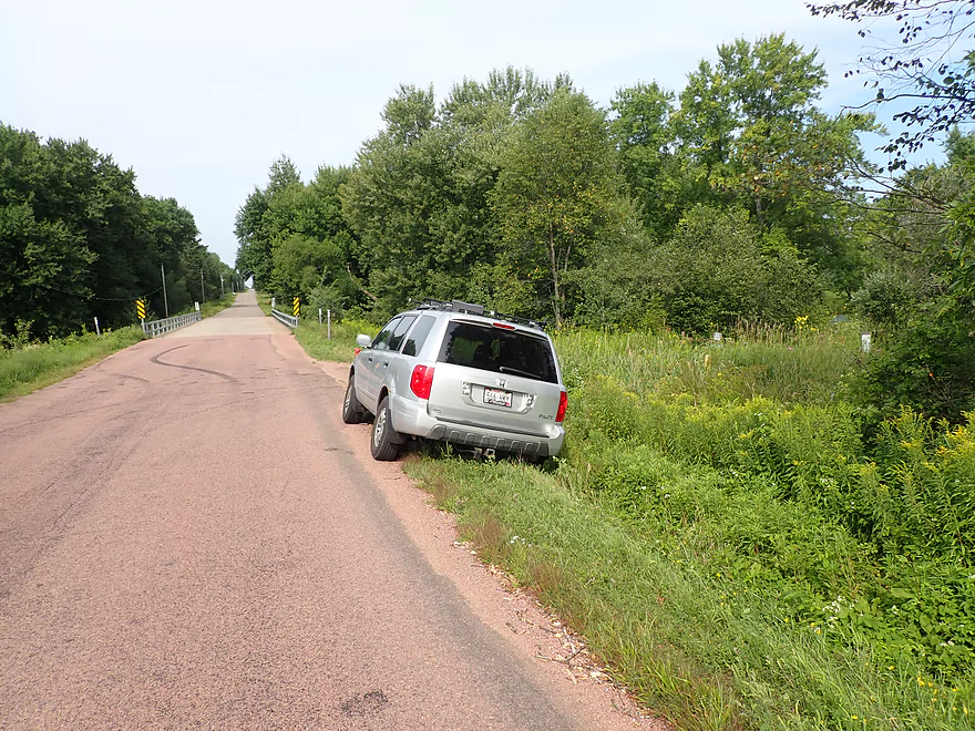
Putting in at Bear Lake Road…some tight parking
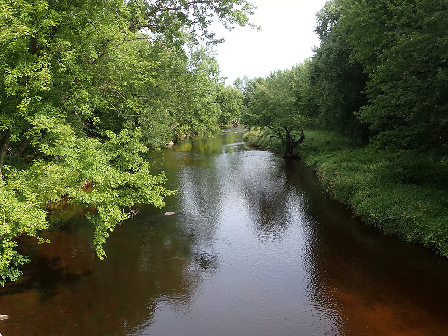
View from the bridge
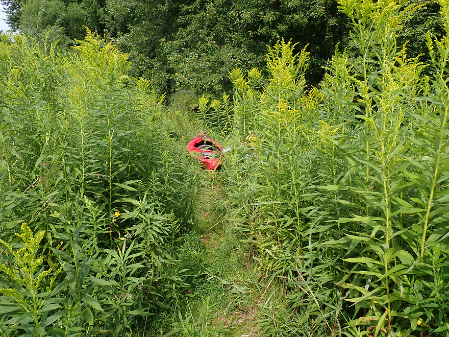
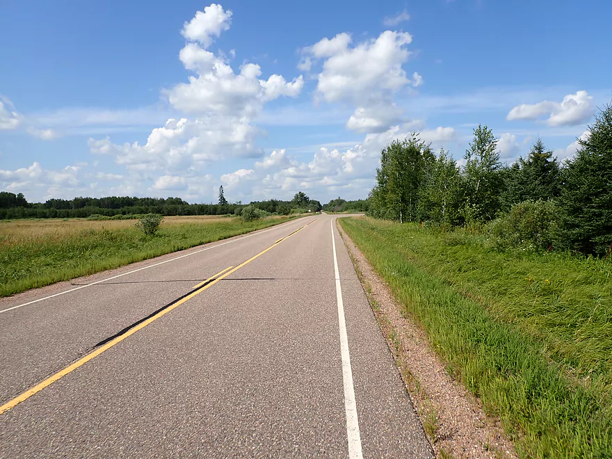
A path leads to the water
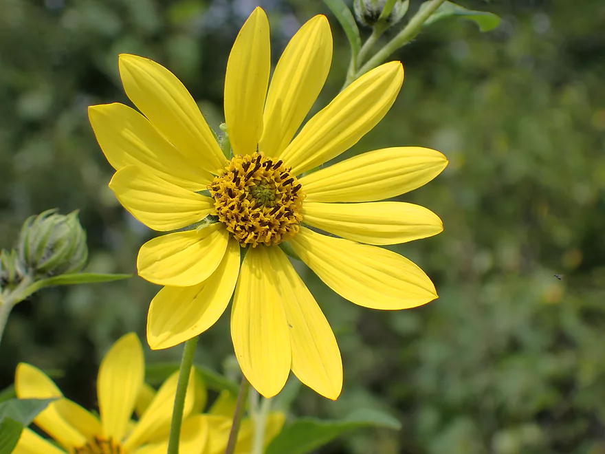
Woodland sunflower
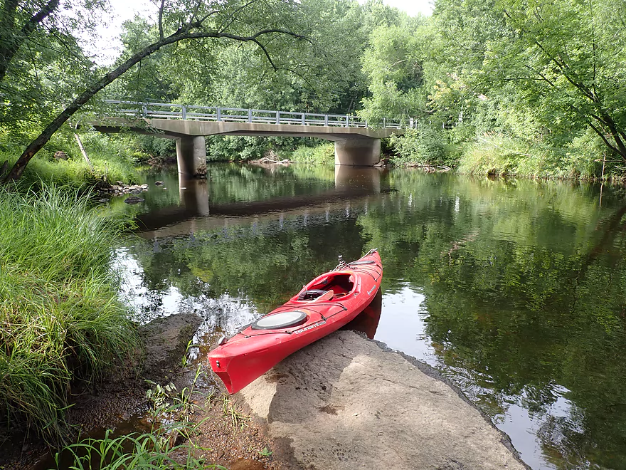
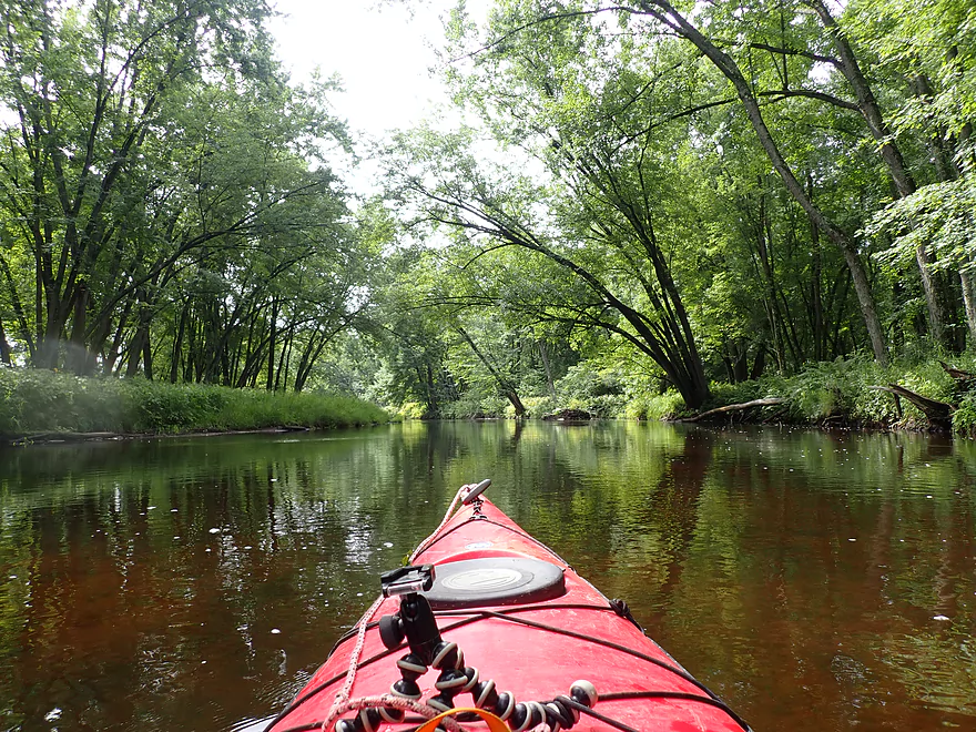
Nice launch area
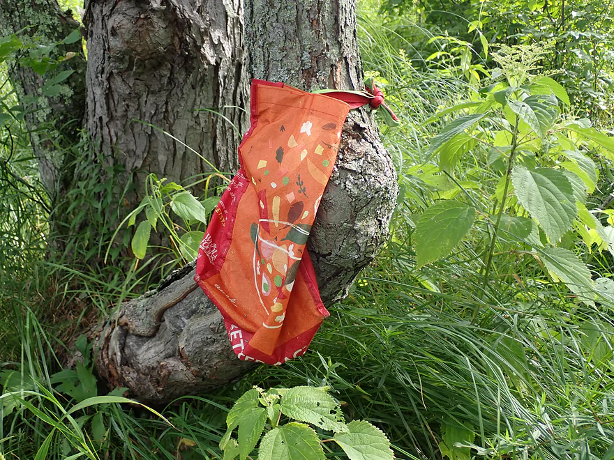
Marked by a Whole Foods bag
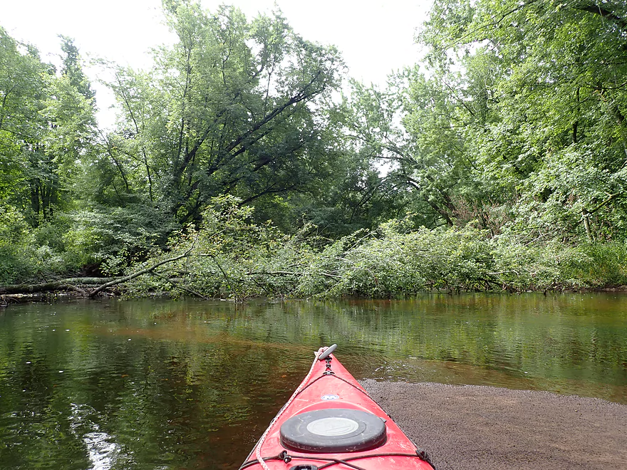
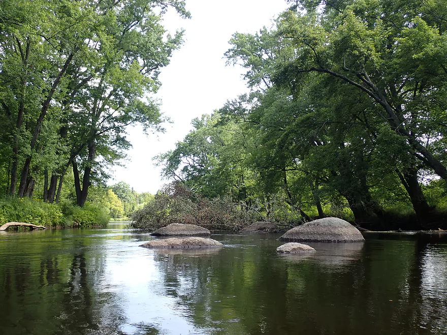
One of several derecho downed trees…always a way through though
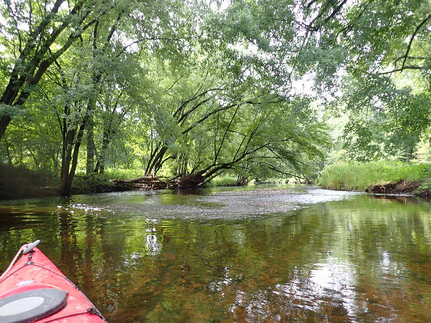
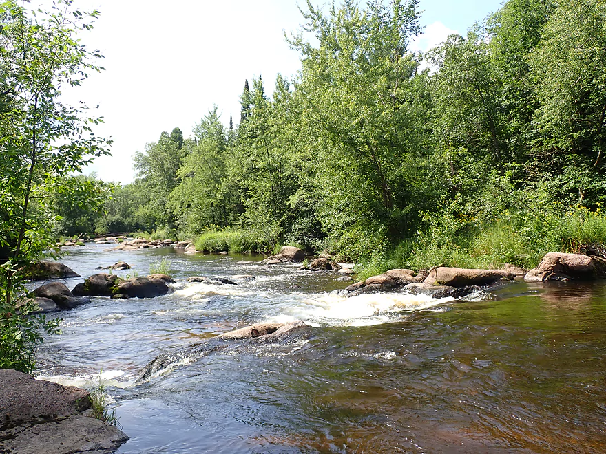
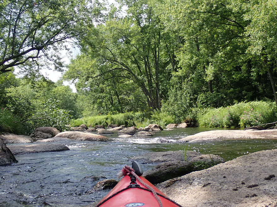
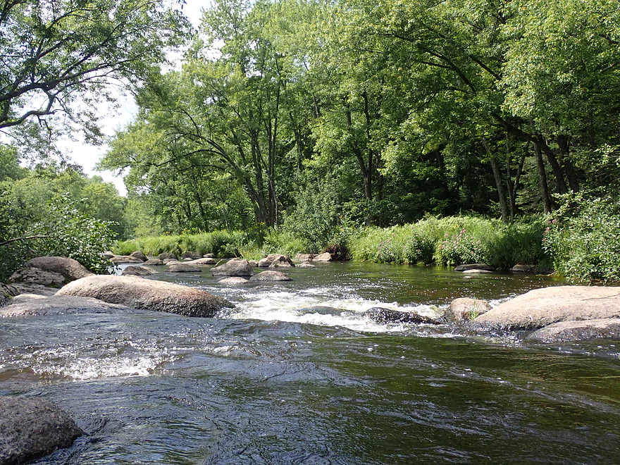
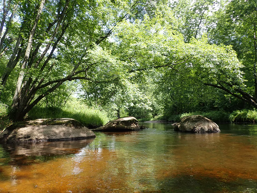
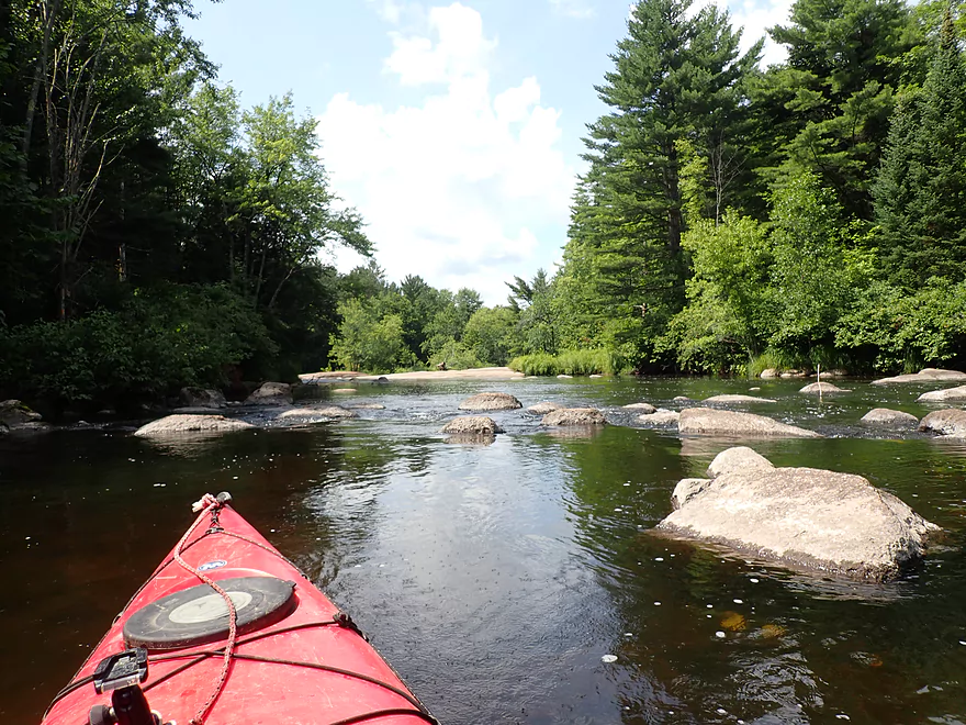
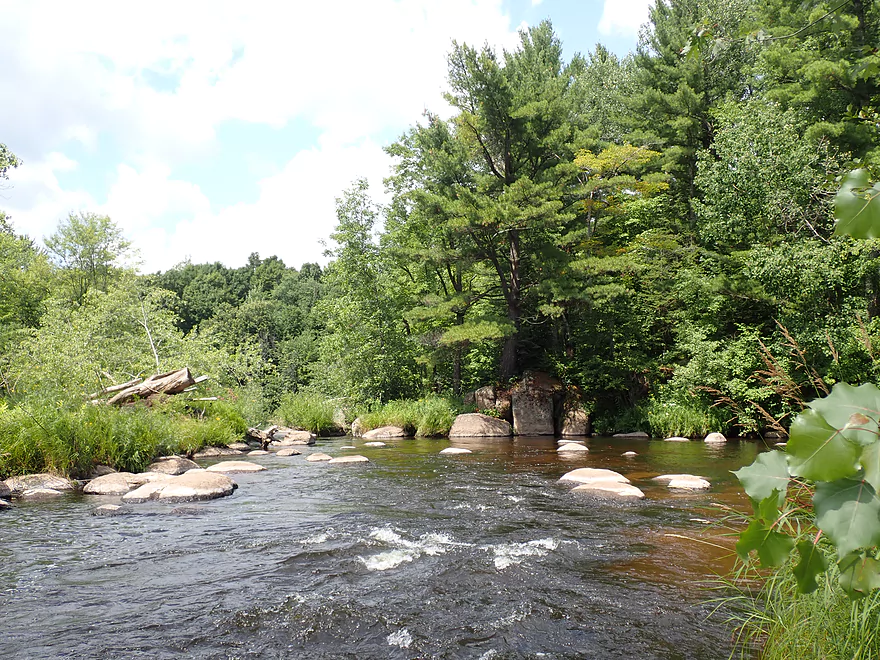
Some gravel bars
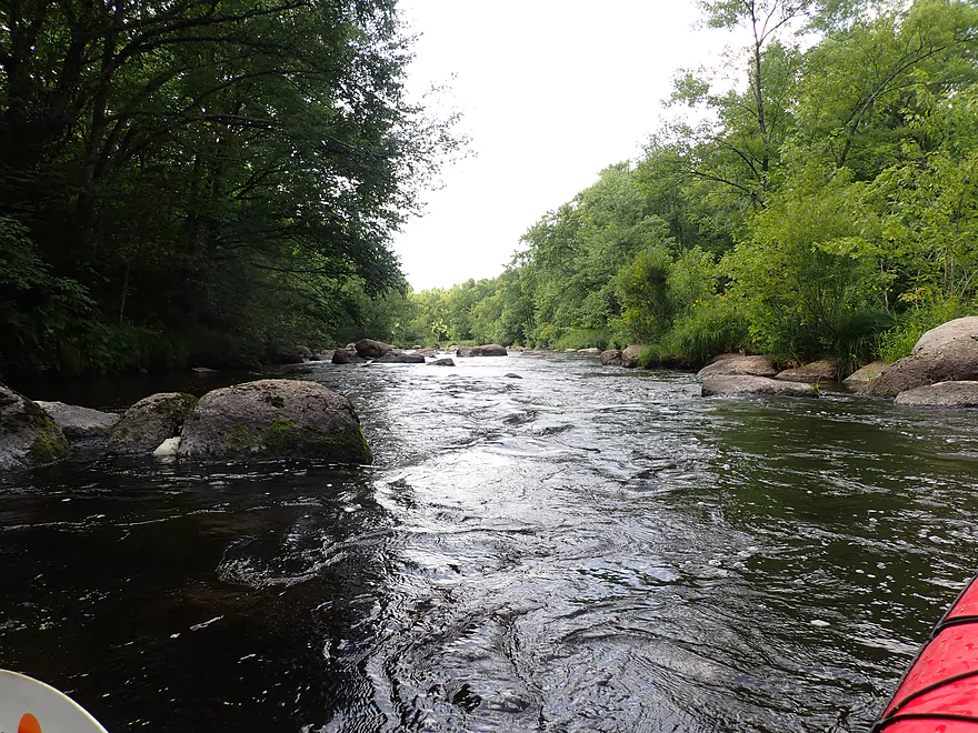
Wooded banks…not many pines
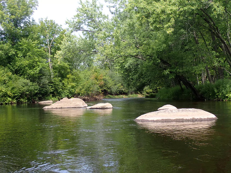
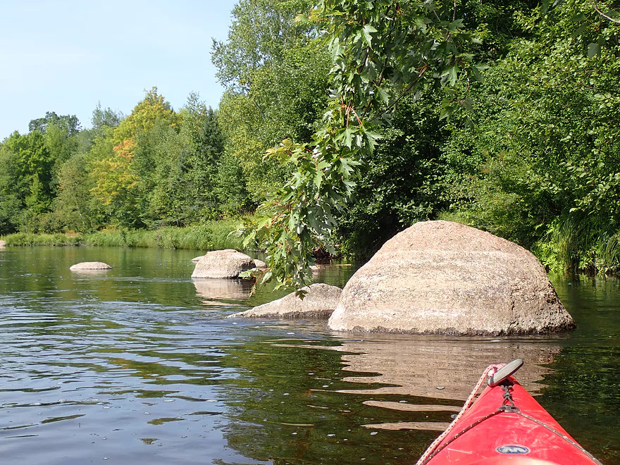
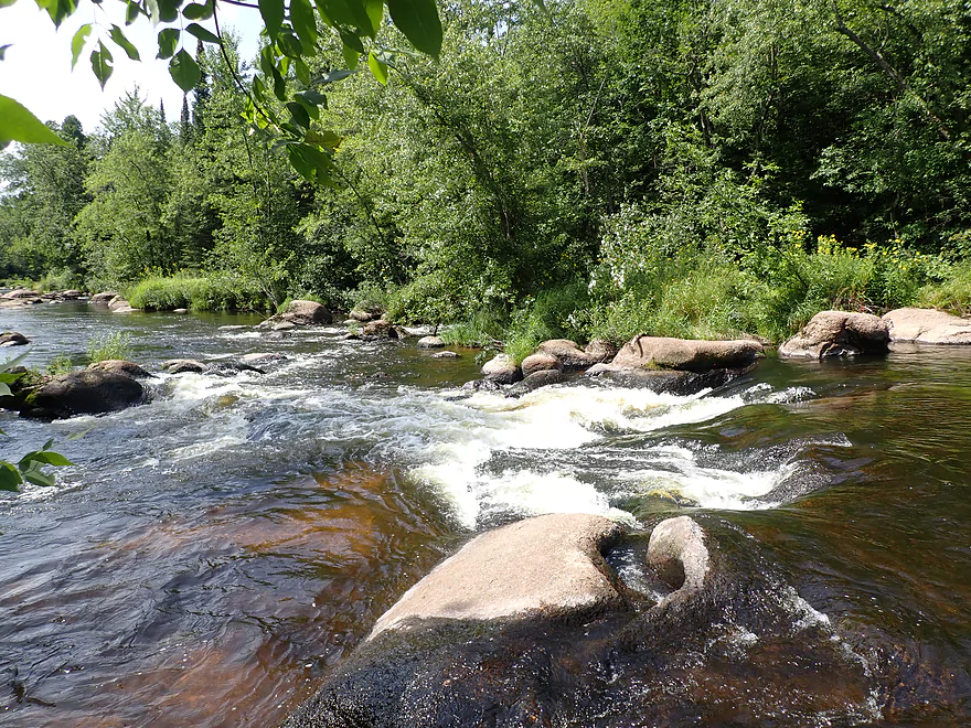
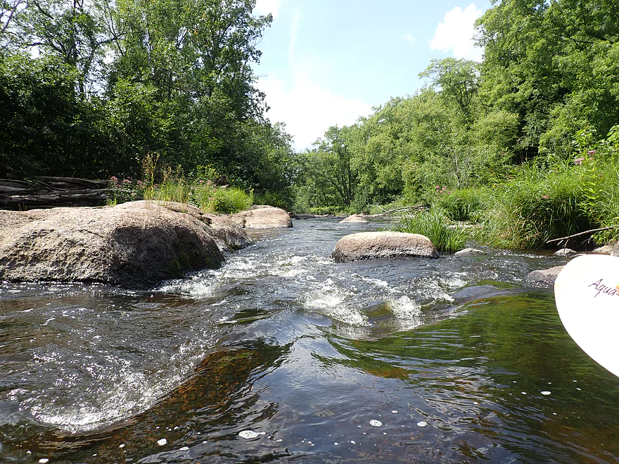
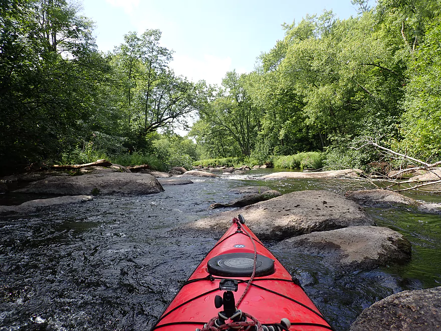
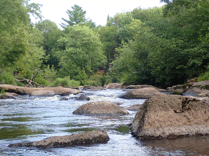
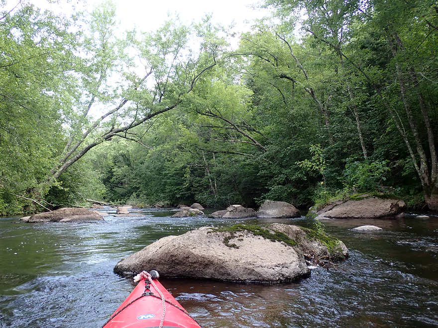
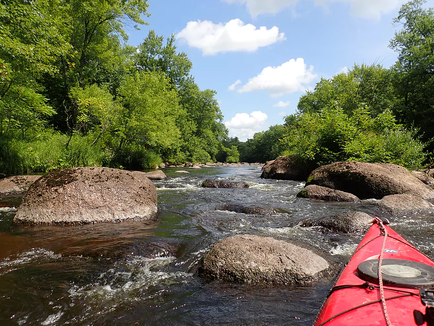
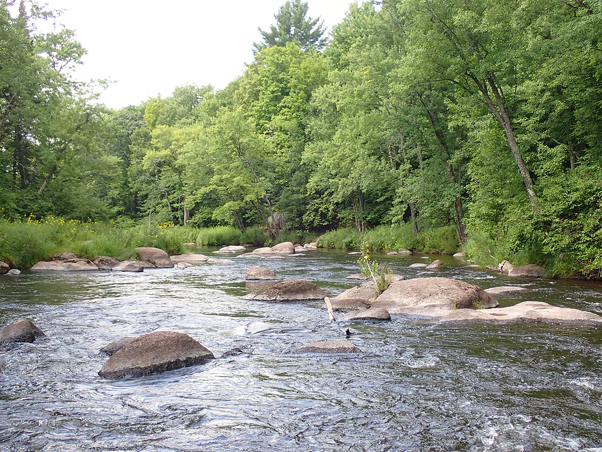
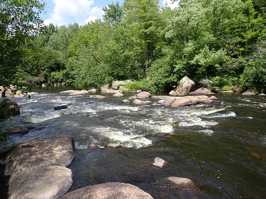
Small boulder gardens to start
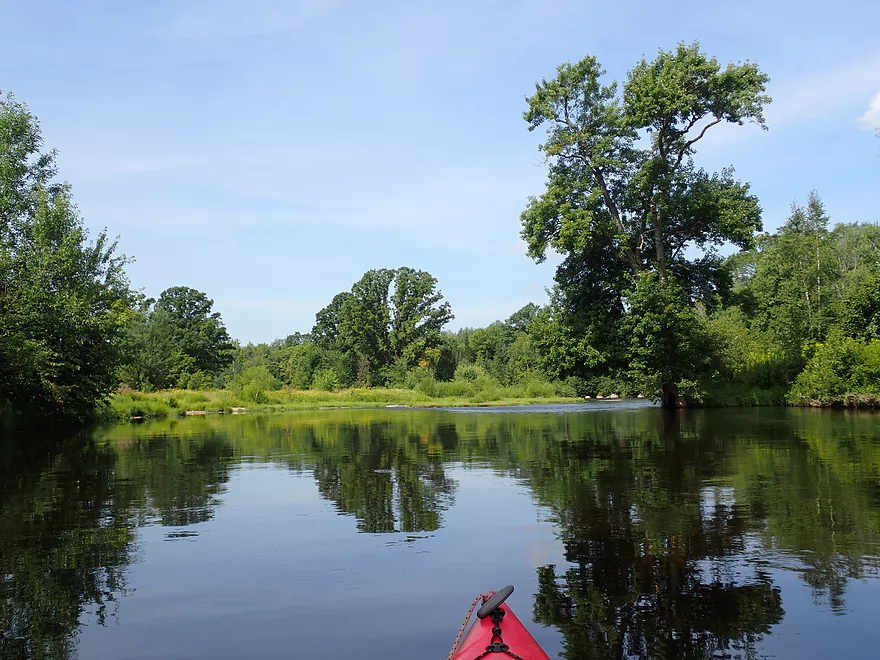
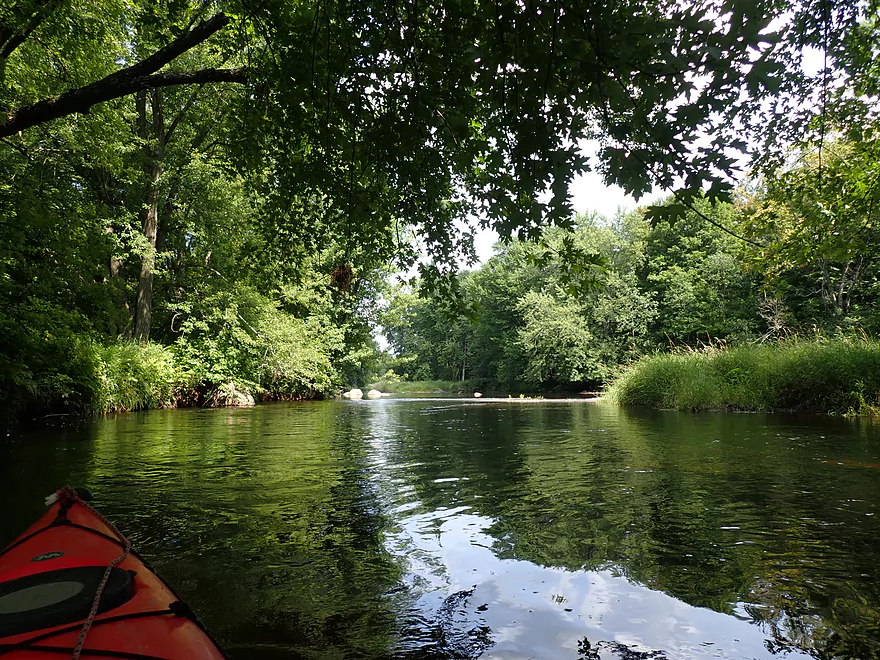
Nice reflections
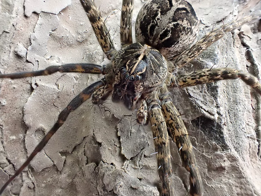
A huge and somewhat tame fishing spider
More boulder gardens and way too early fall color
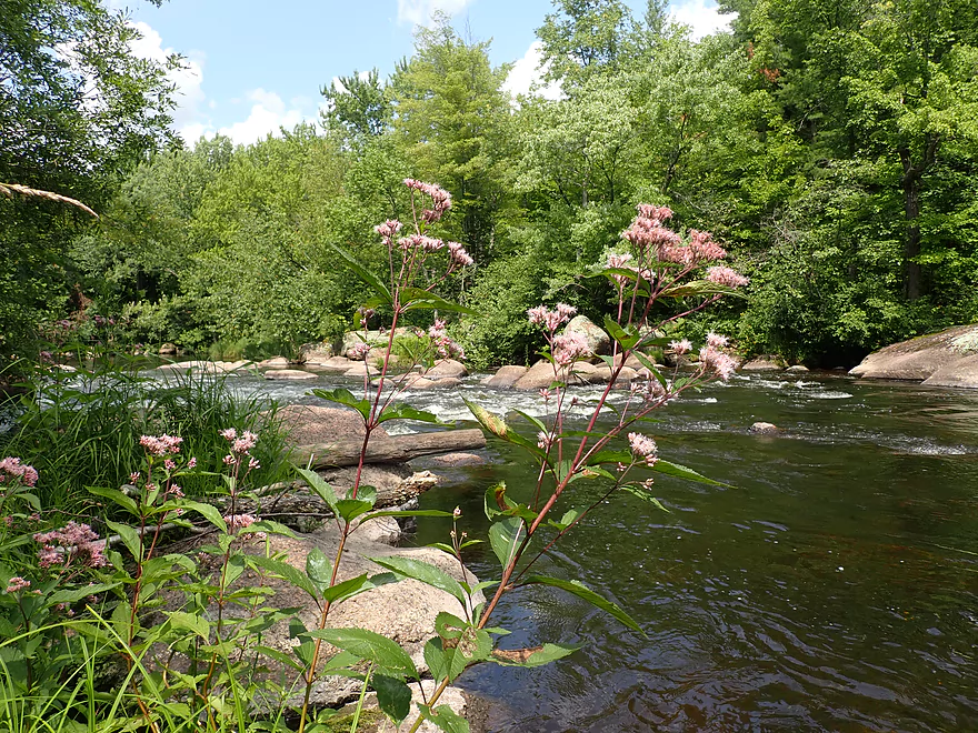
Very peaceful
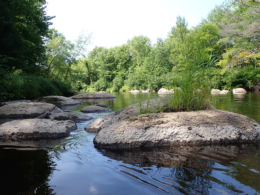
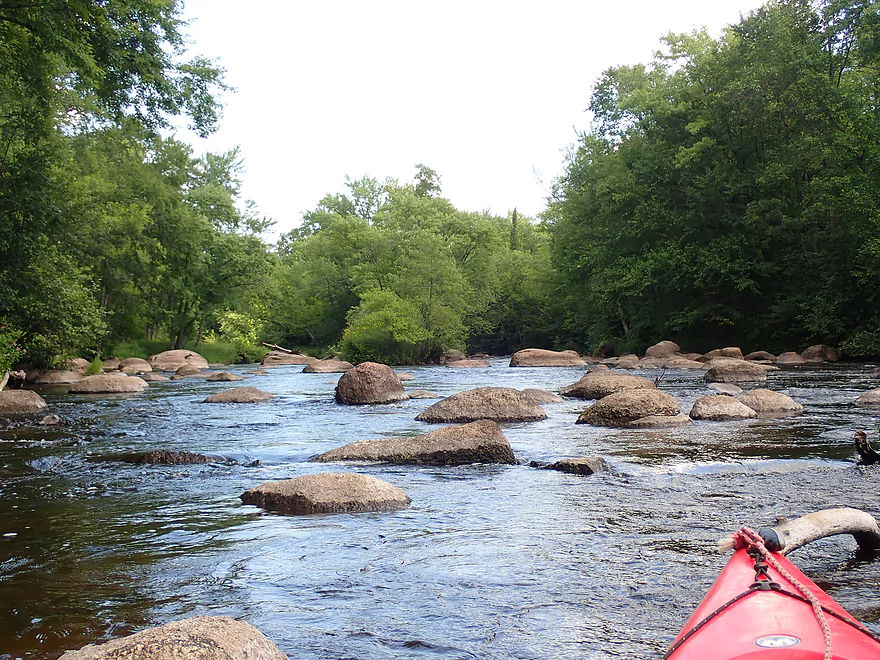
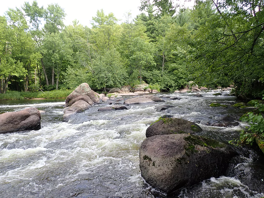
Boulder gardens starting to get bigger
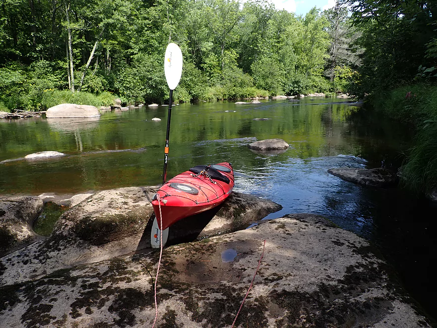
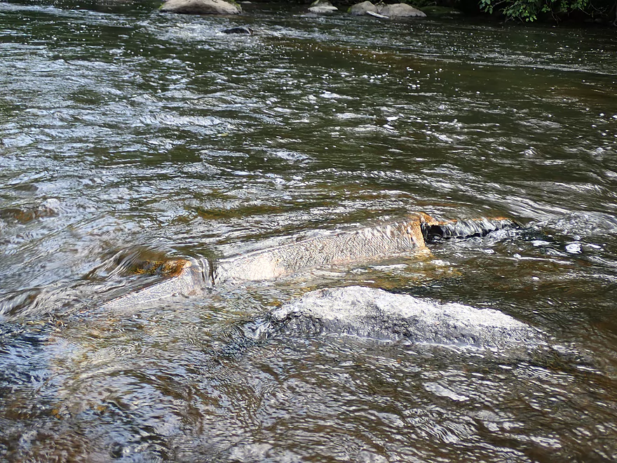
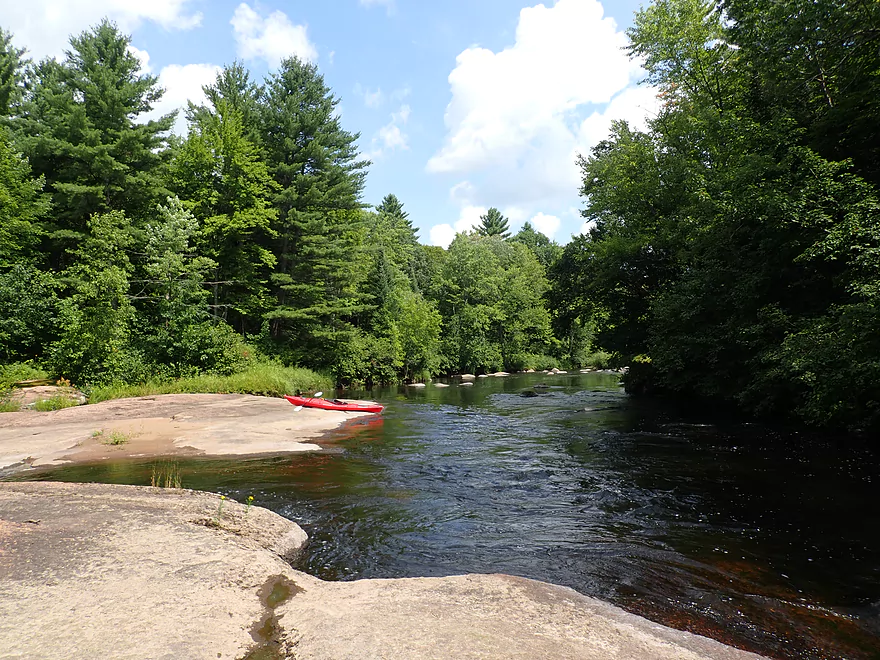
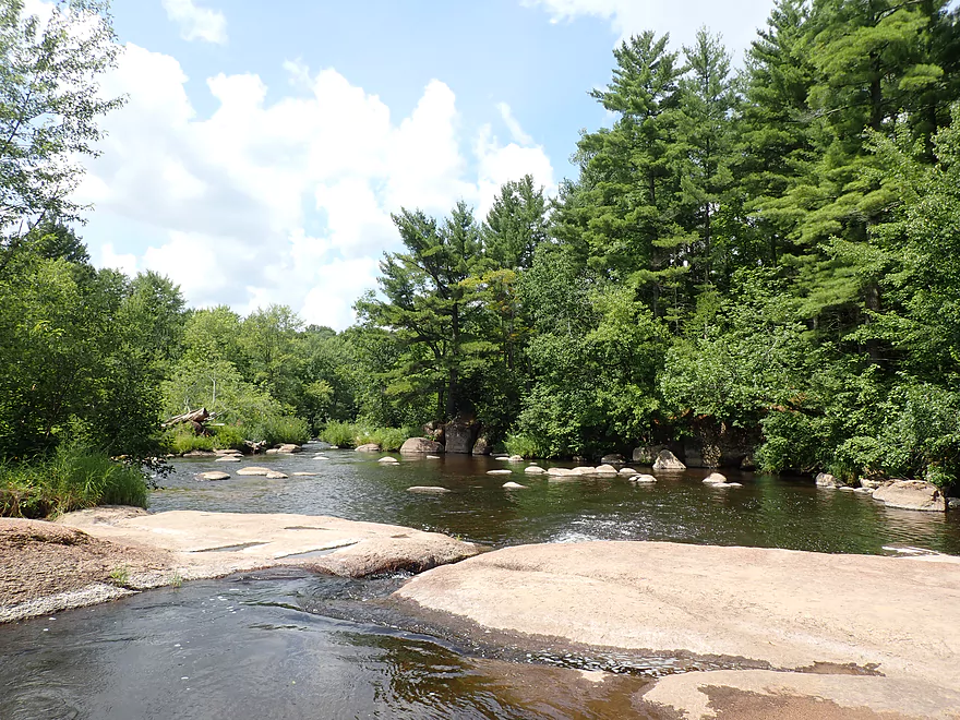
Getting out onto some granite…
To scout this ledge
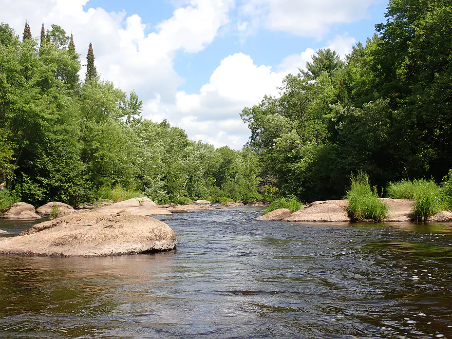
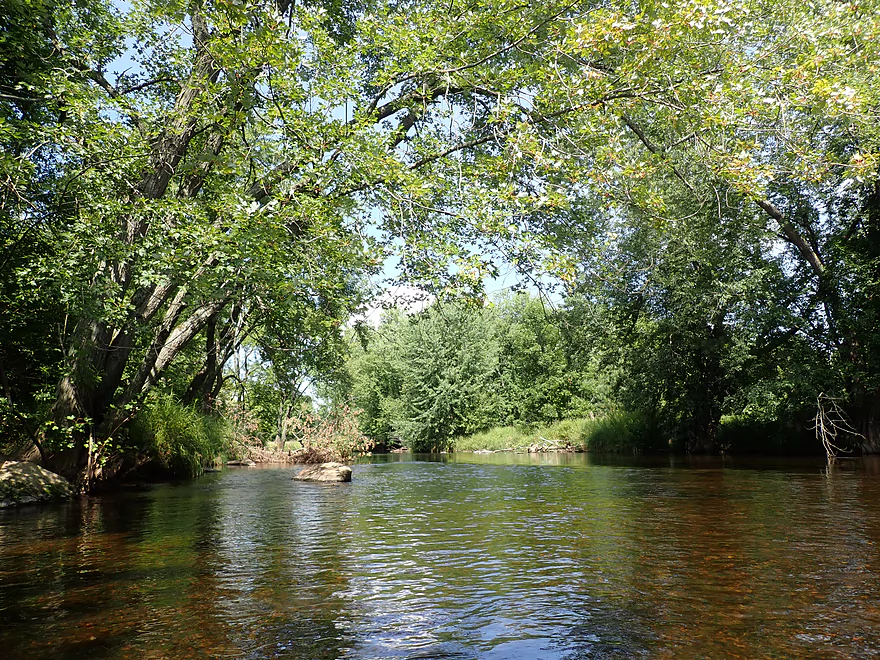
Scenic area
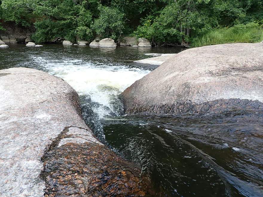
Reverse view of ledge
The next mile is a completely different river
Channel narrows at is goes around a large island
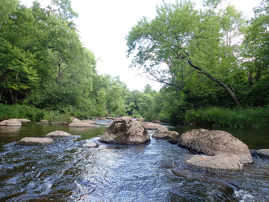
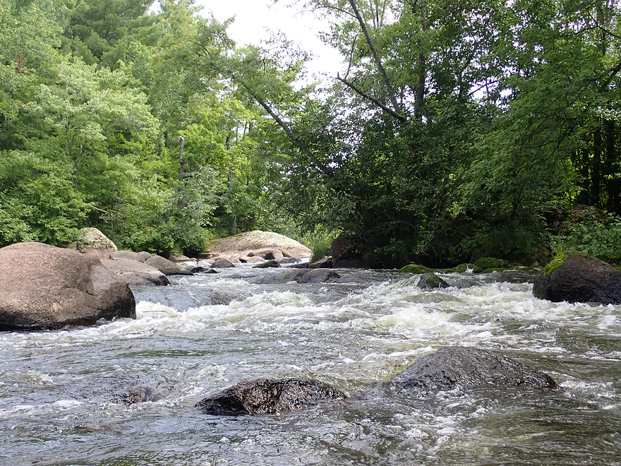
Dense boulders
Would be rough in high water
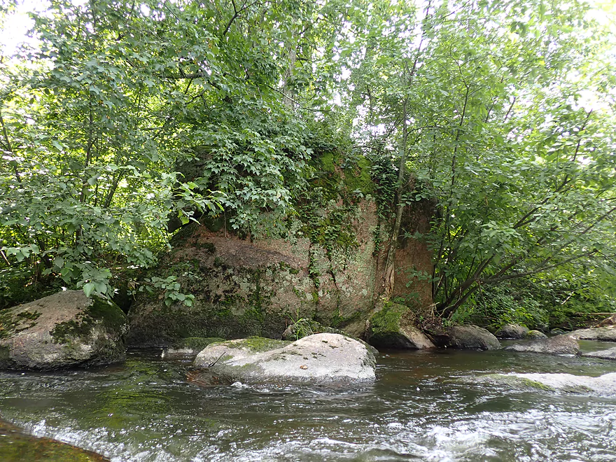
A giant erratic
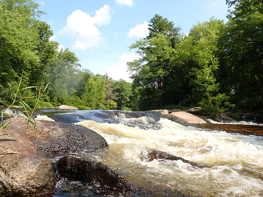
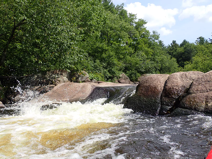
Nice ledge at the bottom
Reverse view…see that odd boulder in the middle?
It’s a blue kayak
Boulders getting bigger
Another submerged boat
Exploring the other island channel…looks nice minus that downed tree
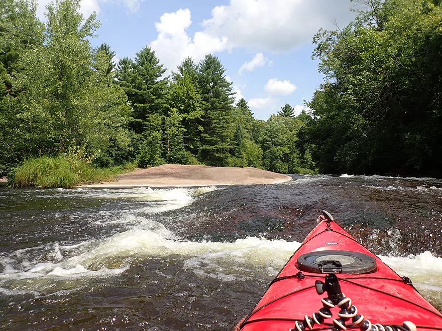
Zipping along at a good pace
Very scenic river
Some chutes are a little shallow
A reprieve from the rapids
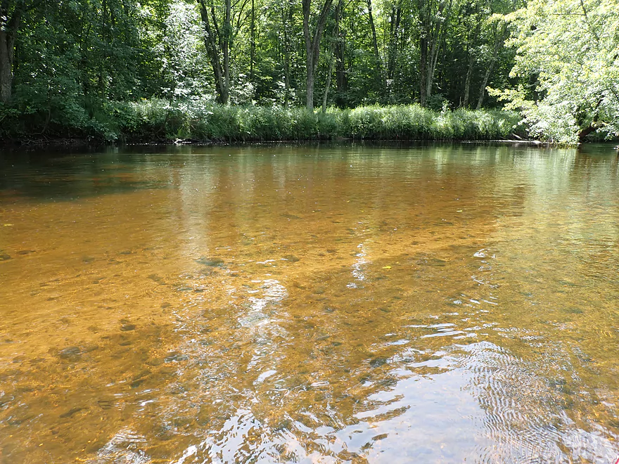
Fantastic clarity
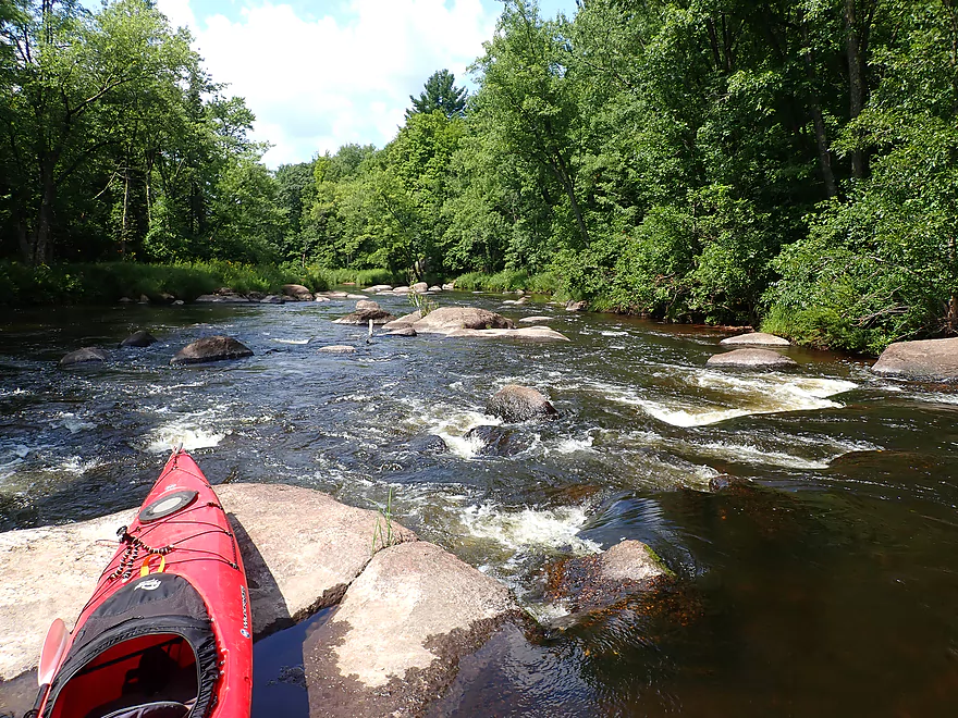
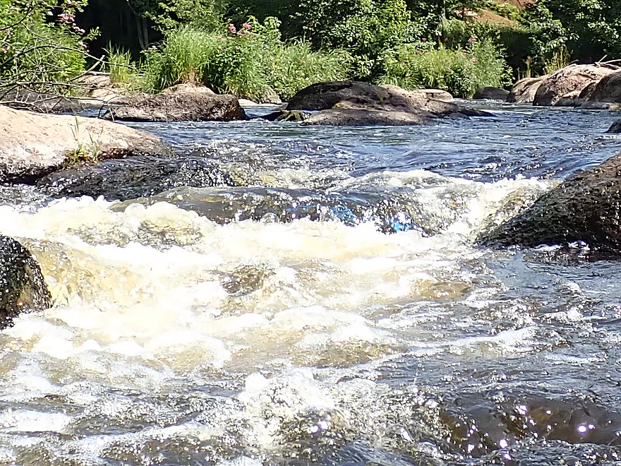
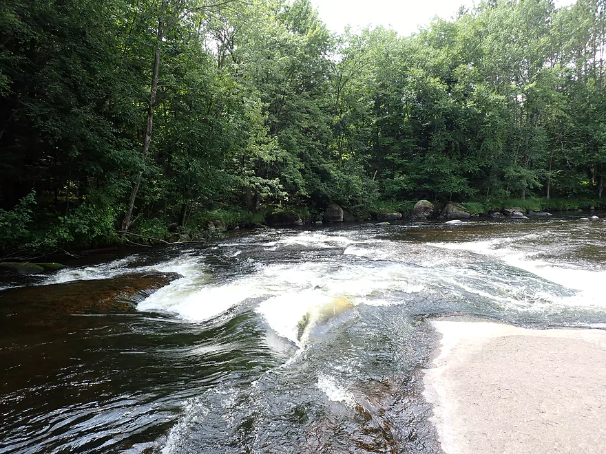
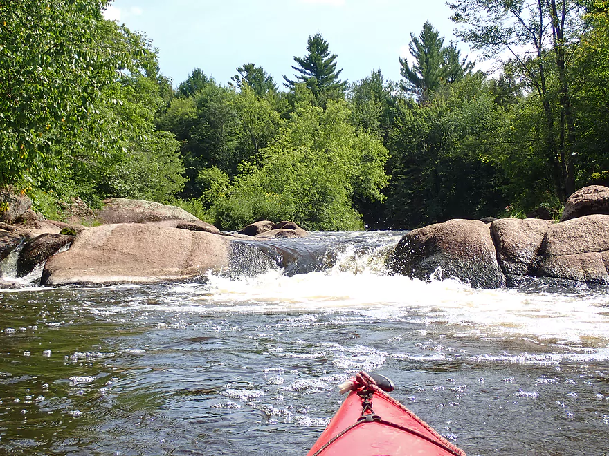
Class 1+ set of rapids
Could be trickier in high water
The pines mark the start of Three Rows Falls
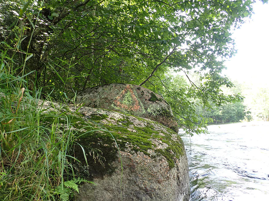
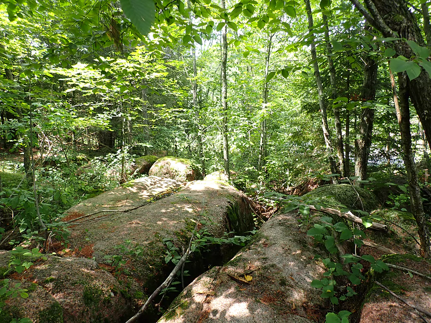
There is a portage path by this triangle
I’m getting out to scout on a granite island
There is a channel to the right
But it is a bit narrow to run
The left channel is navigable
Reverse view
Exploring a nice little side bay
Coming up on the second pitch
Some Class 3 rapids
Scouting was tricky but important
Reverse view of the left channel
I had to make some hard turns to run these rapids
Most paddlers will likely prefer to run the ledge
Straight forward…but it is steep
No more rapids after that
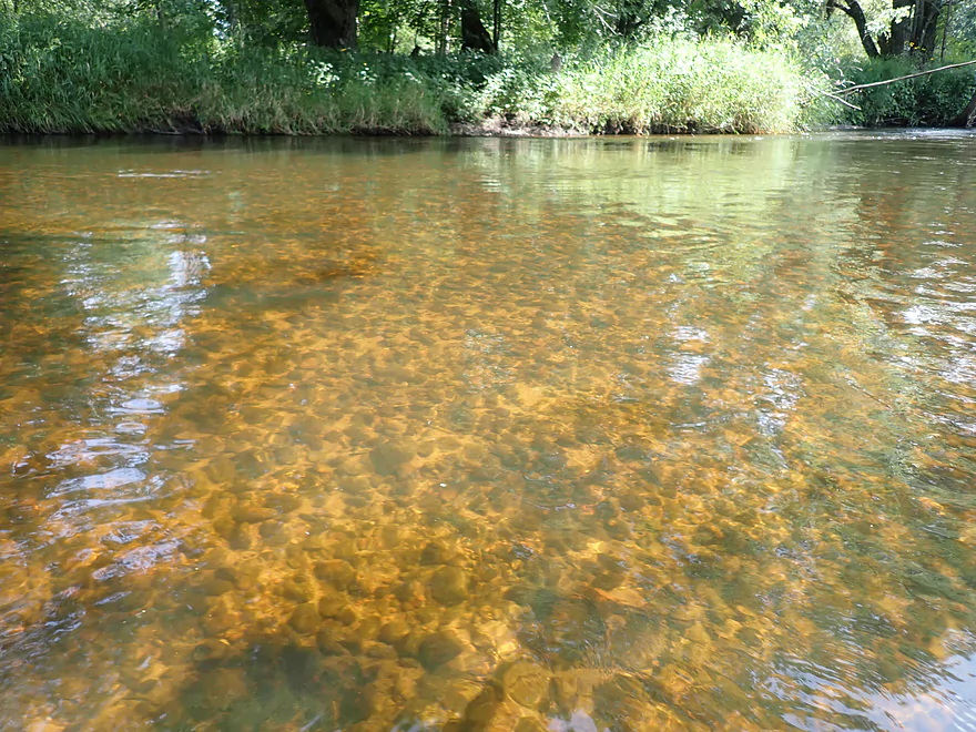
Still good clarity
Last mile was uneventful
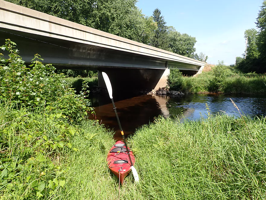
Good take-out at Hwy 52
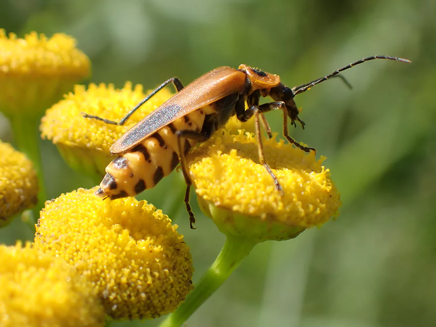
With a lot of interesting little critters…this is a soldier beetle
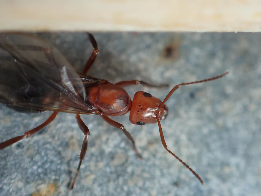
Cool looking ant
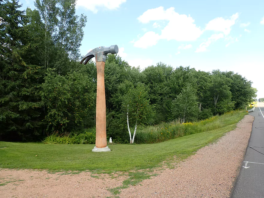
Next to the take-out is a sculpture garden
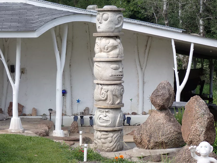
Kind of creative (do you see the monkey?)
Pleasant bike shuttle
Eau Claire River – Bear Lake Road to Hwy 52

Flowing just east of Wausau, the Eau Claire is one of the nicer water trails in central Wisconsin. I’ve paddled the Eau Claire before…three times in fact, but mostly just the middle and lower legs. For this time around, I wanted to explore the more rugged upper Eau Claire for its scenic boulder gardens and fun whitewater.
I started the trip at Bear Lake Road. The first mile reminded me of the Big Rib River…clear, lot of gravel, a bit of a red hue, occasional ferns along the shore, and hardwood trees topping the adjacent banks (not many pine). A few small boulder gardens dotted the channel, but the first mile wasn’t too exciting and honestly I was a bit disappointed (so far).
One of the things I was a bit nervous about was facing downed trees caused by July’s massive derecho. For those of you that don’t know, central Wisconsin (and especially the area between Wisconsin Rapids and Green Bay) was hit by incredible storms that resulted in a lot of tree damage. I fear some of the great water trails in central Wisconsin may now have some logjam issues. If you know for sure if a certain central Wisconsin water trail was or wasn’t affected, feel free to leave a comment on this website which will absolutely help others. It turned out that yes, this stretch of the Eau Claire did have three new logjams stemming from the derecho, but thankfully these were easy to get through.
This ~3 mile trip can be divided roughly into thirds. The first mile was ho-hum and not too exciting. But the second mile was a different story and was kicked off by a small ledge and a large slab of exposed granite bedrock. I was able to climb out onto the granite to scout the situation and to take pictures. Below the ledge were more rapids and boulder gardens that would continue for almost a mile. Water levels were a bit on the low side, so not all paths were navigable, but I was always able to get through and never had to walk my boat.
Following the post-ledge boulder garden, the river was split in two by a large island. I went right (west) onto the larger channel. Here the boulder gardens got even denser which I thought was really cool, but it could mean this would be a rough paddle in high water. As I approached one particular chute, I noticed it was partly blocked by a submerged “rock”. As I passed over…I realized it was actually a little blue whitewater kayak that had been wedged into the rocks. Somebody likely took a bad spill on the river and had to abandon ship. Just 20 yards downstream was another buried boat, this time a flatwater boat that had no business being on the Eau Claire.
It should go without saying, but be careful when running rapids. Scout them, wear a life jacket, and don’t paddle them when high. Websites like AmericanWhitewater.org often give horrible advice about flow rates that infer that higher is almost always better…kind of macho thing. This can be disastrously bad advice for non-hardcore whitewater paddlers though. In high water it is very difficult to maneuver, the current is pushier, getting pinned sideways can happen easily, eddies can be tough to catch, and the river is FAR less forgiving if you make a mistake. I know I’m a contrarian when I say this, but shallower is frequently better and safer when it comes to paddling rapids.
After the “island rapids”, the channel slowed a bit, but still featured several small ledges and dense boulder gardens. Then came Three Rows Falls which started as a huge island of exposed granite bedrock. I do recommend scouting these rapids…there is a great portage path on the left/south shore and it’s marked by an orange triangle. I actually scouted from the granite island itself which offered an impressive view of the scene. The rock mound is divided in two by a small chute of water that cuts through the granite like a knife. The chute almost looked navigable and a lot of fun…but was just a bit too narrow. The main channel roars south around the island and is mostly a straightforward run. However, there is a bulge of granite in the middle of these rapids that I got hung up on. It was actually kind of cool sitting still with rapids running 360 degrees around me…a great opportunity for video and photos!
This was followed by a nice eddy and boulder field. But then I heard a loud roar ahead which marked the second pitch of Three Rows Falls and the first Class 3 of the trip. Based on the noise level, I knew I had to scout this one, but getting out on the left/south bank was a bit tricky. The main channel was first broken up by a dense boulder field in fast current like a cheese grater…while rough, it seemed manageable. What concerned me was a split at the end formed by large granite boulders. The south channel had some tight and narrow turns in very fast current. The north channel I couldn’t see, but reasoned it had some sort of steep ledge based on its noise and occasional spray that jumped above the horizon line. This could all be reasonably portaged, but I decided to run the south channel. This proved tricky but it worked out (see 5:25 of the video). At the bottom and after the fact, I finally got a view of the mysterious north channel which turned out to have a 3′ drop. I would have gotten wet running it…but it would have been funner and easier.
After that…the third mile went back to being like the first mile. It wasn’t bad…but it was pretty ho-hum and uneventful. The trip ended at Hwy 52 which for a bridge access was a nice take-out.
In summary…this is one of the better legs on one of the better paddling rivers. The highlights were the rapids and boulder gardens. Also appreciated were the clear water and mostly wooded banks. I really liked my trip, but for most paddlers this will be too short and I recommend that they continue four more miles to the Dells of the Eau Claire Park. That fantastic stretch would include more rapids, boulder gardens and even some outcrops. I only kept this paddle short, because I had a long drive and wanted to give myself extra time for photos and video. One last tip…if you can time this for a fall color paddle…definitely do it. There are many maples along the banks and the color could be impressive.
Not too much…northern rivers tend not to have as much visible wildlife compared to southern rivers. There were some dragonflies, and a mouse that was struggling to climb up a steep river bank. The highlight was a huge fishing spider that let me get really close for pictures and video.
Ice Age Trail: A really scenic stretch that parallels parts of the river.
Dells of the Eau Claire River: A fantastic county park I highly recommend visiting. The highlight is a series of falls (Class 4) west of Hwy Y that are very photogenic. Locals like to climb out on the rocks here and even waterslide down some of the chutes…but that can be dangerous, especially in high water.
Hwy 52 Sculpture Garden: Just northwest of the Hwy 52 take-out is a unique sculpture garden you can see from the road. Some of the sculptures are a bit strange but they are creative.
The bridge access at Bear Lake Road was very good. A small trail leads to a hidden landing northeast of the bridge and was marked by a Whole Foods Bag. Shoulder parking is a bit tight, but is doable.
An alternate put-in would be 3 miles upstream at Hwy G. I’m not sure this is a great option though as this three mile stretch will lack rapids and have only small boulder gardens.
Hwy 52 was a very nice bridge access. A trampled-down trail leads to the water from the southwest corner. Parking is adequate although Hwy 52 is a busier road with less privacy.
Most paddlers will not take out at Hwy 52…but will continue 4 additional miles to the Dells of the Eau Claire Park. This additional leg has tamer rapids, but it does have fantastic boulder gardens and dells. The take-out above the dam is great with plentiful parking and nearby restrooms.
The bike shuttle was really nice…only 3.8 miles, all paved, little traffic and only one hill.
Again…most paddlers will actually take out at the Dells of the Eau Claire Park. That shuttle would be a reasonable 6.8 miles. But be warned if you try to take Eau Claire River Road as a shortcut, you will have to deal with 0.8 miles of gravel.
Logjams: None. There were a few new downed trees but it was easy to get past these and they weren’t in rapids.
Current: The river can be divided into thirds. The first and last thirds were pretty lazy with a few riffles. The middle third was very fast with rapids and pushy current.
Rapids: Again there were many rapids in the middle third of this leg. Many Class 1’s, a few Class 2’s, and one Class 3. The following is a detailed breakdown…the links correspond to the video times and the names correspond to markers on my map.
- Class 2 – Master Ledges (Part 1): The start of the serious rapids. Here the river is split by exposed bedrock and falls over two channels. The west channel is bigger and falls over a 1-2′ ledge, but it is bonier. The east channel has better padding (and was what I chose) but required some tight turns.
- Class 2 – Master Ledges (Part 2): A large island splits the river into two channels. I chose the west channel which had dense boulder gardens and some ledges. In high water these could be Class 2+ or even stronger. Two partly submerged boats here suggest this could be a hazardous stretch.
- Class 1 – Unnamed Rapids: Easy at low levels, but I suspect this could be a Class 2 at high levels.
- Class 2+ – Three Rows Falls (Part 1): The channel is split by a huge slab of exposed bedrock. The right channel is usually too narrow to run. The left channel is much wider but does have an irregular mound in the middle. I recommend scouting before running. There is a nice portage path to the south…marked by an orange triangle.
- Class 3 – Three Rows Falls (Part 2 – West Channel): Once again the river is split, but this time by a dense boulder field. I chose the west channel but this was very difficult because of the fast current and tight turns (as you’ll see in the video). Absolutely scout before running…I did so along the west bank. Doable portage if you wish it.
- Class 3 – Three Rows Falls (Part 2 – East Channel): In some ways this is an easy and straightforward run…but at the end is a narrow and steep chute…maybe 3′. You can’t scout this from the west shore (as I found out) and must scout it from the east shore. I assume most paddlers will prefer the easier east channel, but be prepared to get quite wet.
There is a gauge on the river but it is located ~15 miles downstream. I did the trip at 141 CFS, but the river soon surged to 180 CFS a few days later, so my ‘actual’ level likely was a bit on the higher side.
- 0-100 CFS: The rapids will be too shallow to run. River will be very scenic and have excellent clarity though.
- 101-120 CFS: A pretty bumpy depth. Some walking may be required.
- 121-160 CFS: A good depth for scenic boulder gardens and beginner paddlers. Current is much less pushy here and is more forgiving. Some turns might be tight at this level though.
- 161-220 CFS: A medium depth, but likely still good for beginners.
- 221-290 CFS: An above average depth. Rapids will be noticeably stronger. A few years ago, I did a trip below the Dells at 250 CFS.
- 291-350 CFS: Some of the more scenic boulder gardens may be buried at this depth.
- 351-500 CFS: Likely only suitable for experienced paddlers.
- 501-1000 CFS: A high depth only suitable for whitewater paddlers.
- 1001+ CFS: A very high depth only suitable for experienced whitewater paddlers.
Detailed Overview
Click here to see an overview of the Eau Claire River.
East Branch:
- Upstream from Wayside Park: The river this far upstream might be small and brushy, but should be mostly navigable.
- Hwy 45/Wayside Park to Cty I: 5.1 miles.
- Wayside Park to Cty B: 1.3 miles. Upstream from Cty C the river flows through an attractive residential area with a few nice boulder gardens. There is one logjam to portage. Downstream from Cty C the river is more brushy and less attractive. This is the weakest part of the East Branch IMO.
- Cty B to Bluebell Road: 1.7 miles. This is a nice wooded stretch with some alders, but also some pines and spruce.
- Bluebell Road to Cty I: 2.1 miles. This leg starts narrow and deep, flowing past mostly submerged boulders, then widens out and becomes more shallow. This is a solid stretch that is popular with trout fishermen.
- Cty I to Hwy 64: 6.1 miles.
- Cty I to River Road: 1.1 miles. This is brushy and IMO not that interesting with one major logjam.
- River Road to Cty H: 1.1 miles. A bit more open than the preceding stretch, but still brushy and not super interesting.
- Cty H to Spring Road: 2.0 miles. The first half is a bit overgrown, but the second half is really nice with some boulder gardens, attractive woods, and fun rapids.
- Spring Road to Hwy 64: 1.5 miles. More open and not as rocky as the previous sections, but nice with attractive meadows.
Main Branch:
- Hwy 64 to Cty Y: 2.7 miles. West Branch joins up, significantly enlarging the river. Thick woods and canopies crowd the river. There might be some logjams on this stretch.
- Cty Y to Hanson Road: 1.7 miles. A very dense and wooded section. Maybe a few light rapids but nothing major.
- Hanson Road to Hwy G: 4.3 miles. More dense woods and some light rapids. Possibly a logjam....otherwise should be a nice stretch.
- Cty G to Bear Lake Road: 3.0 miles. A good prospect, but I don't believe there are rapids.
- Bear Lake Road to Hwy 52: 3.6 miles. A great five star section with many boulder gardens and rapids (a few Class 2s and one Class 3).
- Hwy 52 to Dells of the Eau Claire Park: 4.1 miles. Really neat section with rapids and fantastic rock walls. Rapids are less serious than the upstream leg, but do include a Class 2 I believe.
- Dells of the Eau Claire Park to Cty Y: 0.2 miles. This section is called "The Ledges" and is typically Class 2, but is Class 3 in higher water. The dam should be portaged river right (there are downed trees in the water to contend with below the dam).
- Cty Y to Cty N: 6.6 miles.
- Cty Y to Cty Z: 2.0 miles. This starts with the famous Dells that should be portaged. There is a portage path (right/north) but it is steep. I recommend instead launching from either the south or north trails. After the Dells is a great section which includes very scenic rock walls and Class 2 rapids.
- Cty Z to Cty N: 4.6 miles. More flatwater, but still many rapids, including a Class 3 by Lower Dells Island. Badger Road is a steep but alternate access point.
- Cty N to Clubhouse Road (aka Edwin's Park): 3.5 miles. Pleasant, but I suspect this lacks any serious rapids. Popular with locals and the liveries.
- Edwin's Park to Ross Ave: 7.8 miles.
- Edwin's Park to Cty J: 4.1 miles. A nice section with a few rapids and boulder gardens. The Mountain-Bay State Trail pull-off is an alternate access option.
- Hwy J to Ross Ave: 3.7 miles. A great section with more rapids and boulder gardens.
- Ross Ave to Yellowbanks Park: 2.7 miles. I don't know much about this section...there are some rapids.
- Yellowbanks Park to Eau Claire River Conservancy: 2.7 miles. A narrow wooded section. Not sure if the Conservancy is accessible during low water.
- Eau Claire River Conservancy to the Brooks & Ross Dam (aka Drott Street): 1.5 miles. Probably boring flowage paddling. After the dam you are on the Wisconsin River (and another flowage).
Trip Map
Overview Map
Video
Photos Size:
A guest video of the Upper Eau Claire River has been posted. This contains valuable information concerning the stregth of the rapids between Bear Lake Rd and Hwy 52 at 460 CFS. https://www.youtube.com/watch?v=GeVzeTo0tsY&ab_channel=WisconsinRiverTrips