
Scouting the flowage by Hwy Y
Scouting the popular put-in by Bently Road
Looks nice
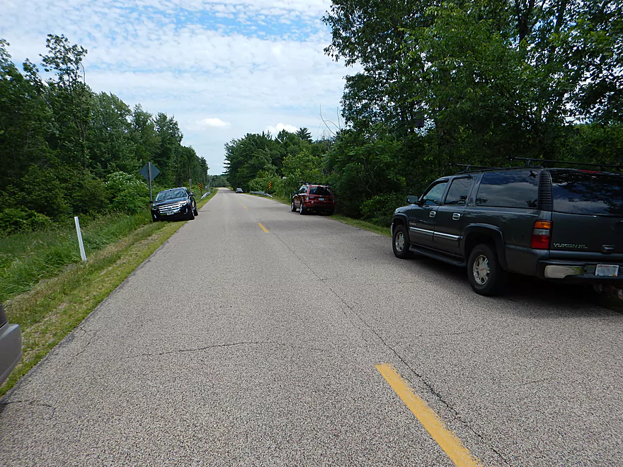
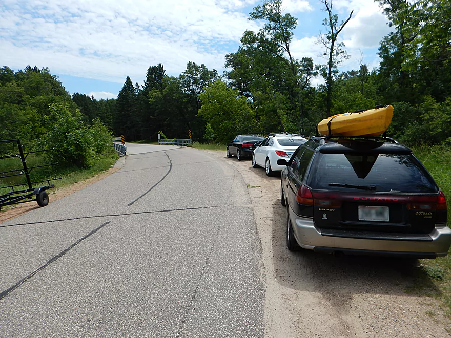
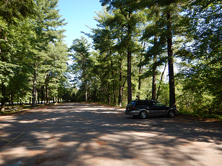
Launching at Hwy K instead (despite lack of parking)
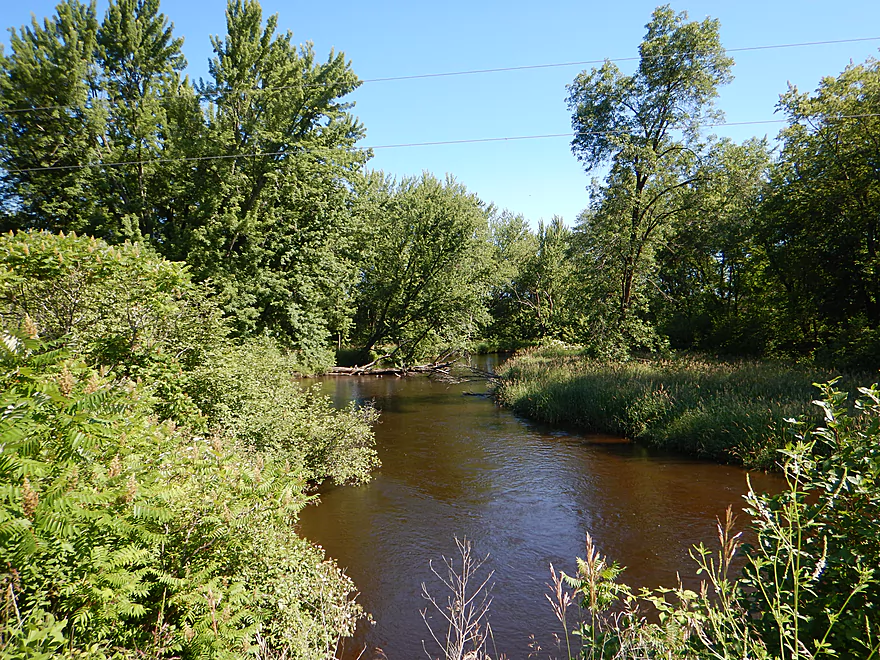
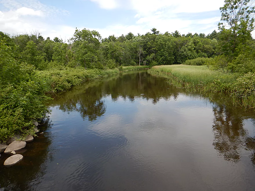
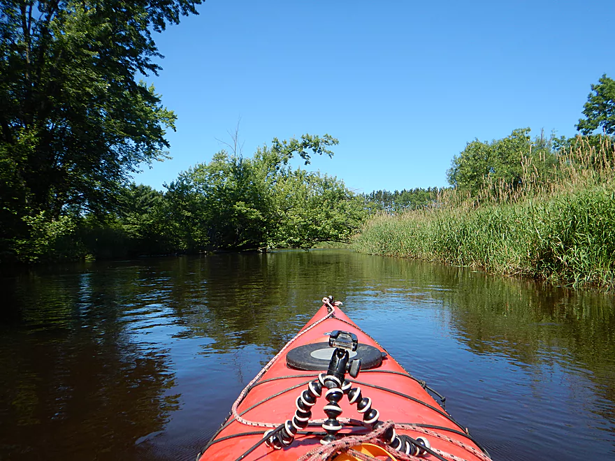
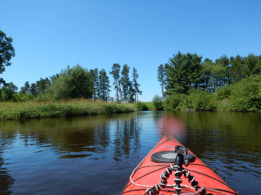
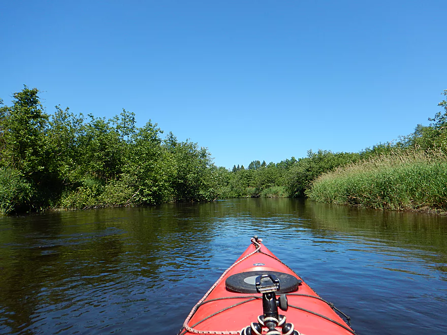
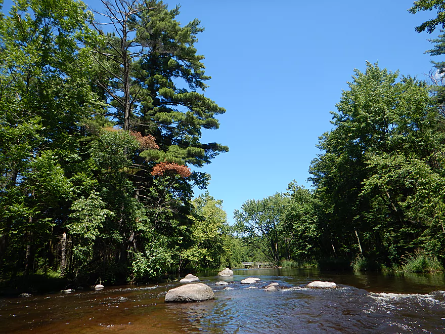
View upstream
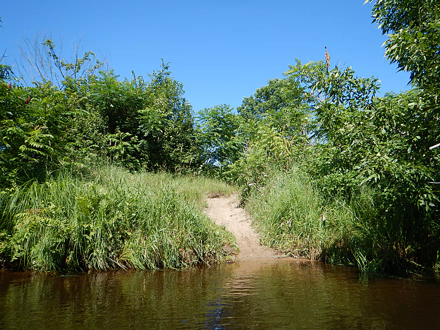
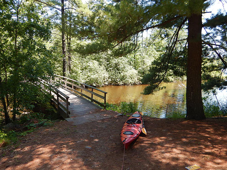
Nice launch area by Hwy K
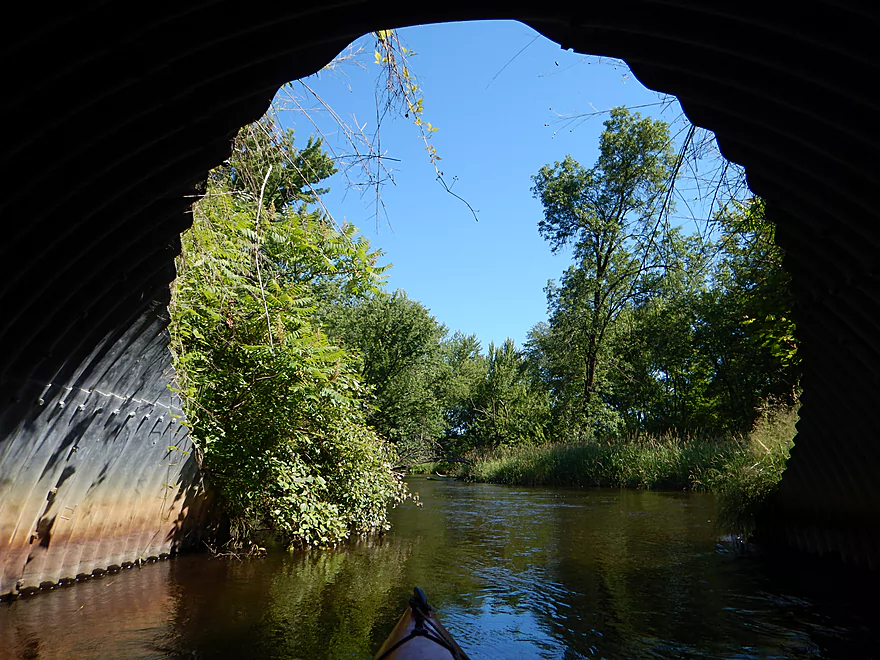
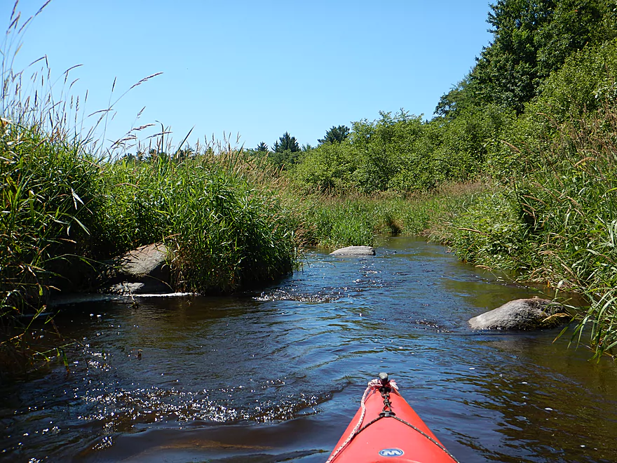
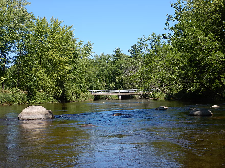
Starting the trip through the tunnel
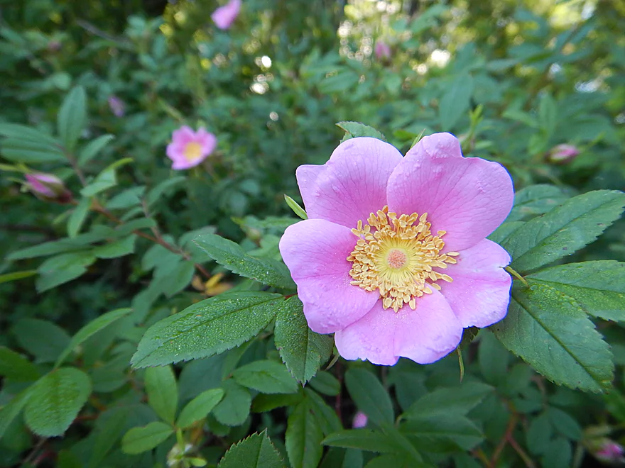
A wild rose
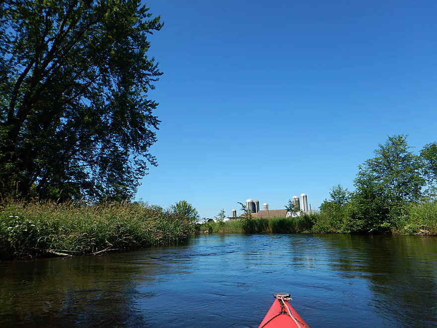
One of only two buildings I saw on the trip
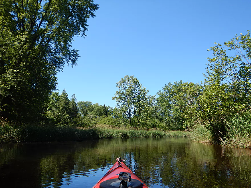
Simple and pleasant

Friendly hitchhiker
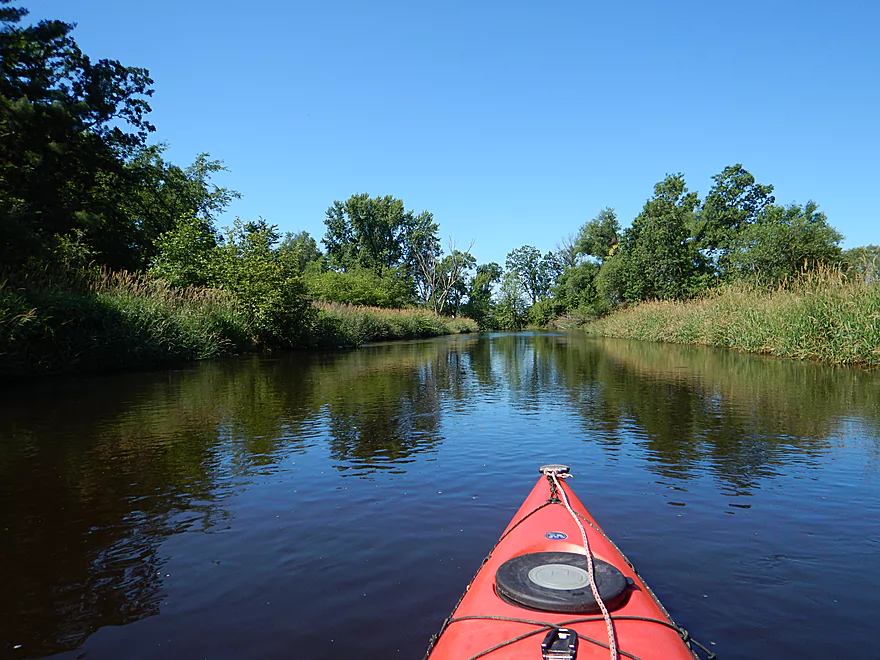
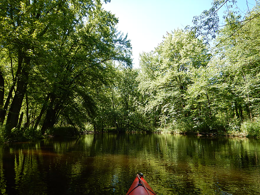
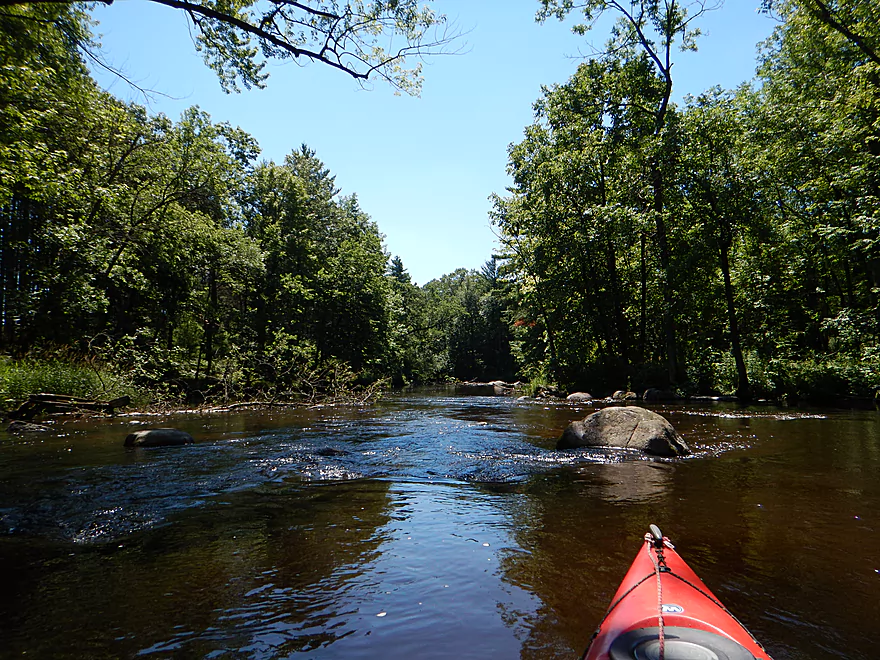
First few miles were heavily wooded
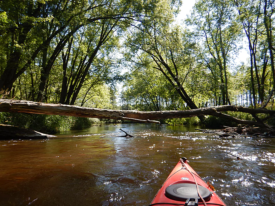
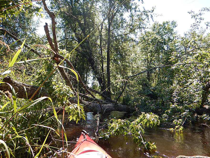
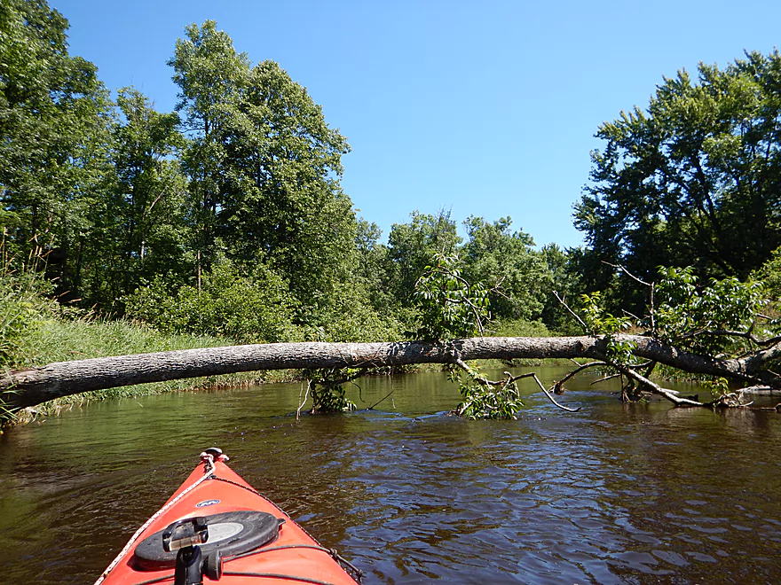
One of several logs I had to duck under
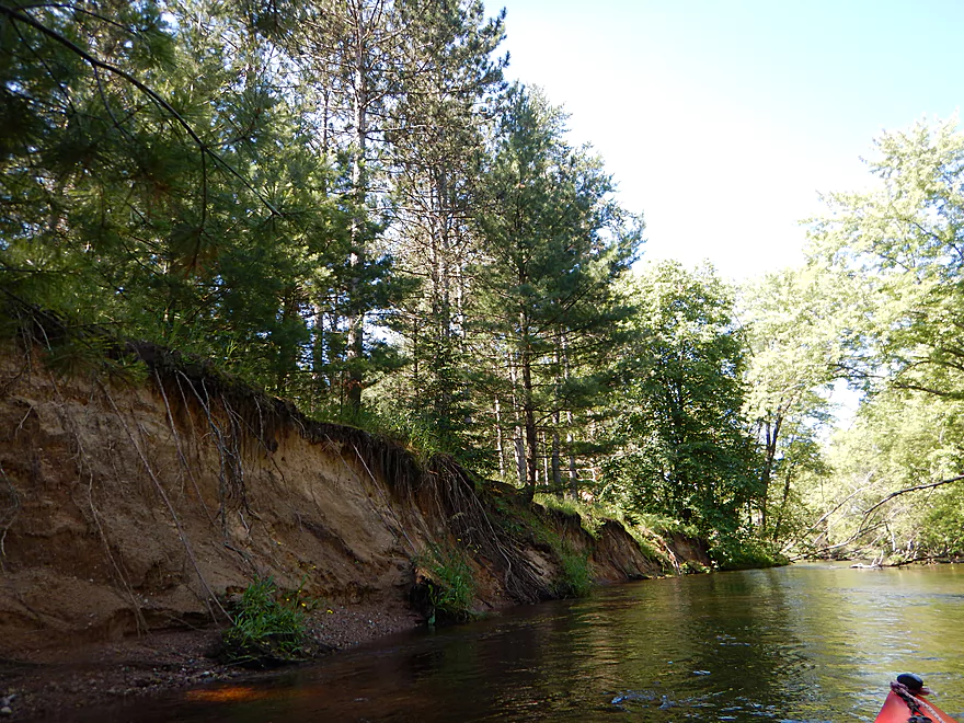
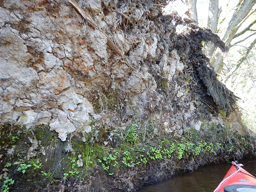
This is sand country
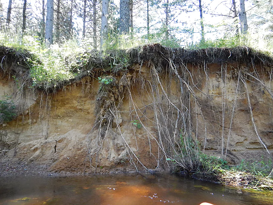
Which the trees do not appreciate
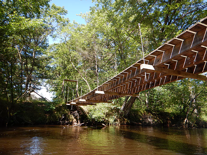
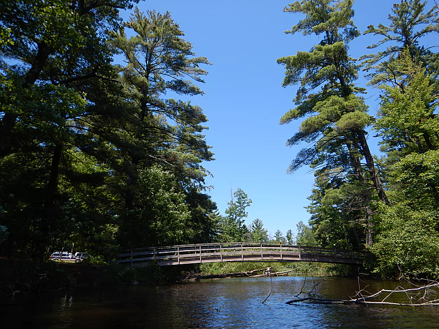
Cool suspension bridge
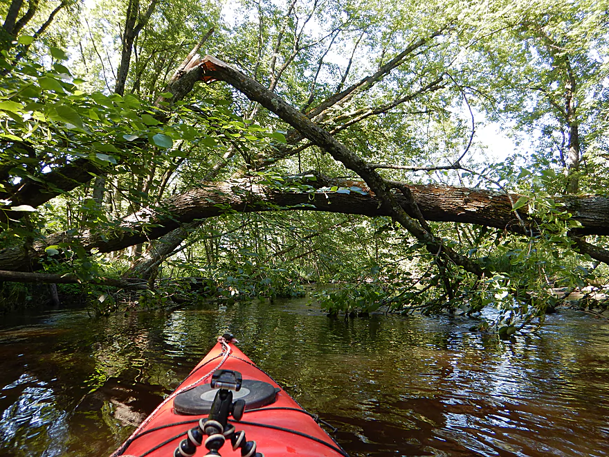
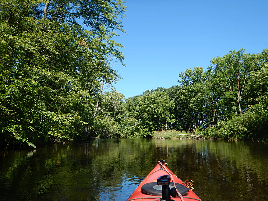
Lot of tree dodging
Little plants growing on a big dead plant
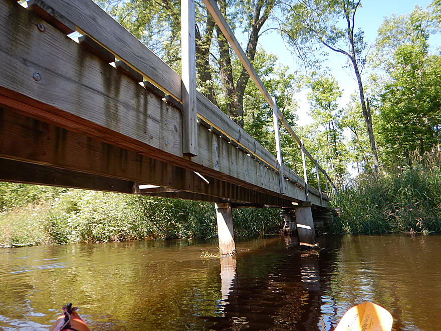
Another nicely built bridge
I was able to get through, but only barely
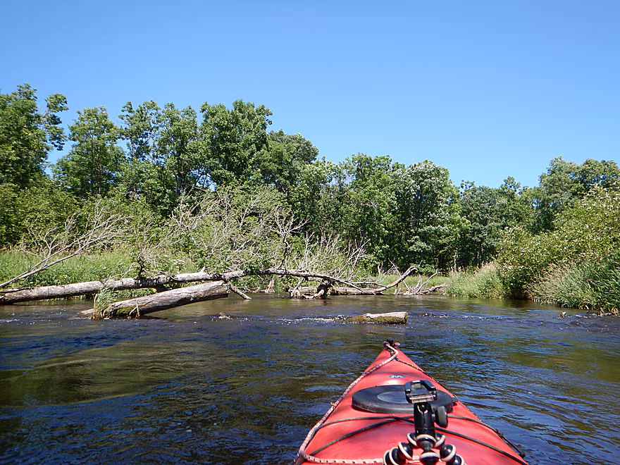
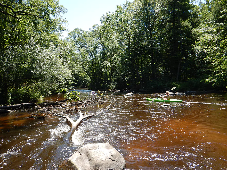
There are some strainers
Time to limbo
Some great cleanup work by locals
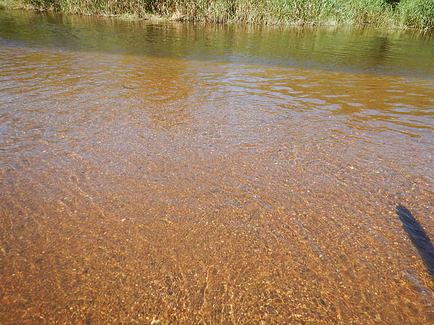
Normally much more of the river is this clear
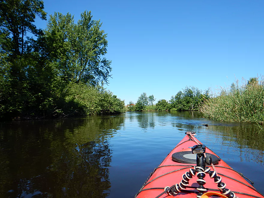
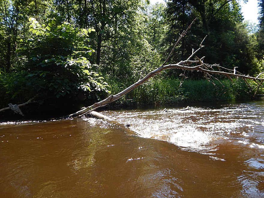
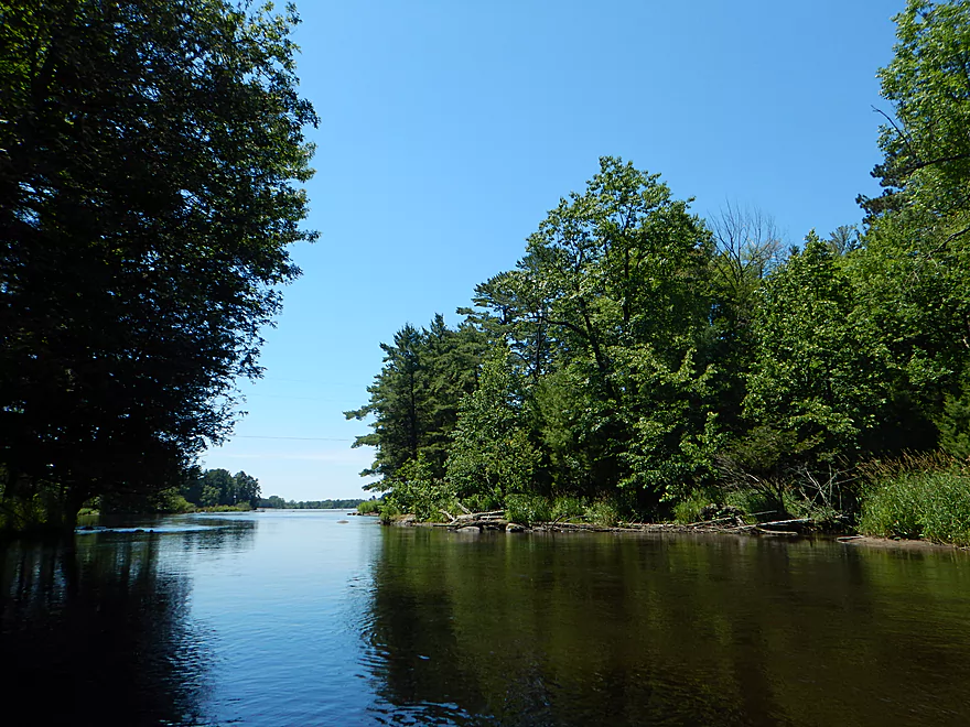
Entering the old flowage (notice the missing trees)
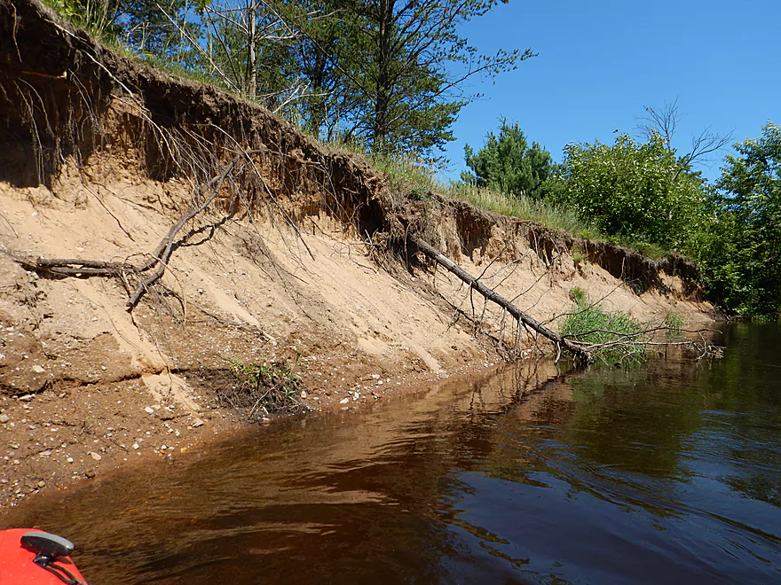
Exposed sand banks
Entering a wetgrass marsh area
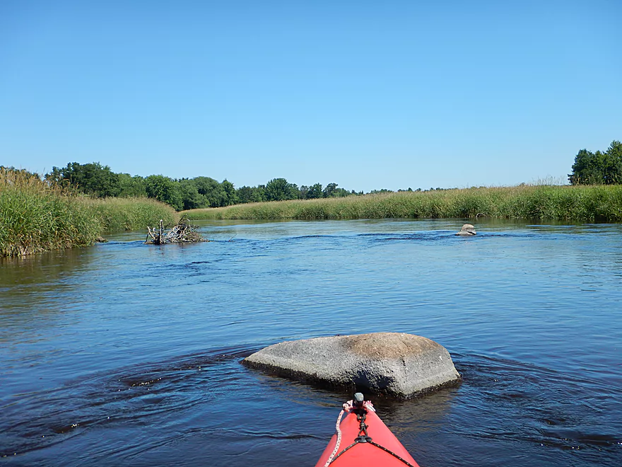
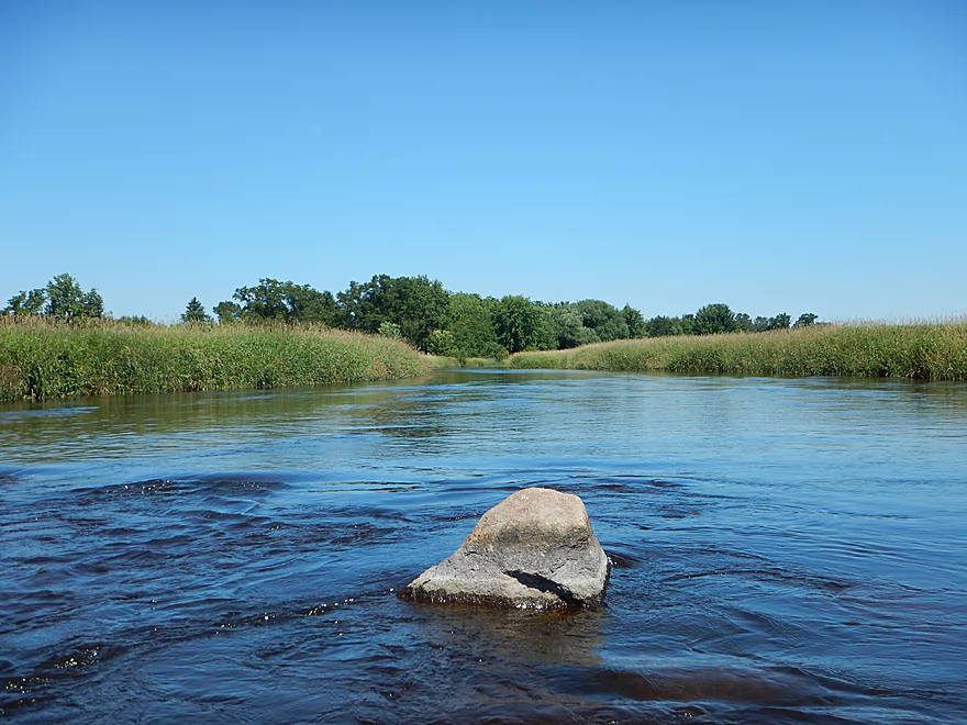
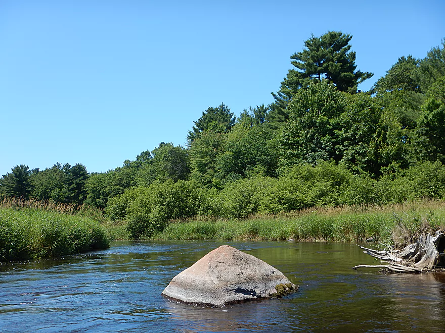
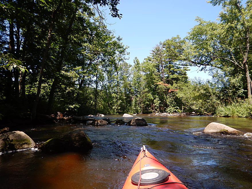
With occasional boulders
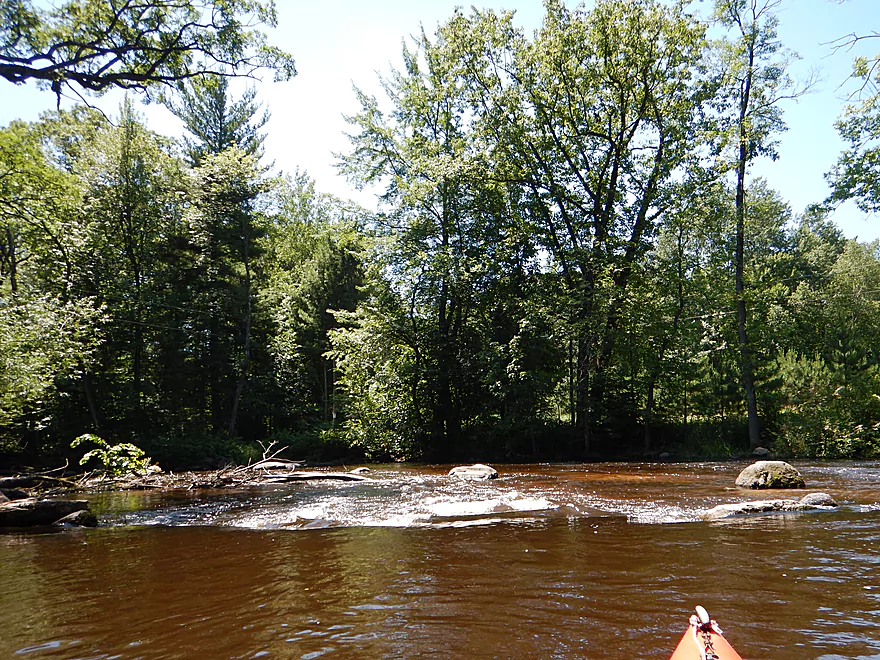
Fun little chute
In lower water, this would be twice as large
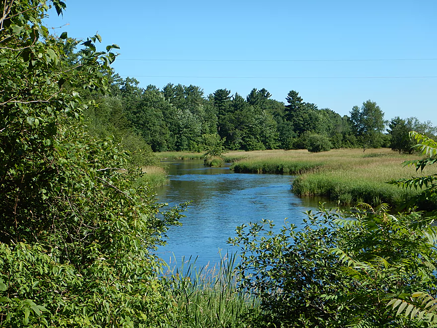
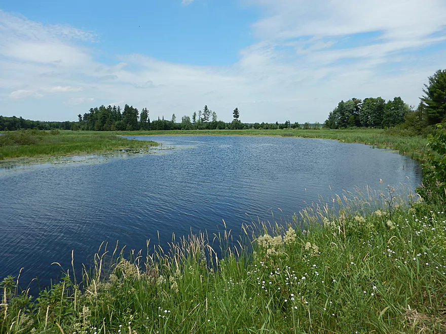
Scenic scene over the old flowage
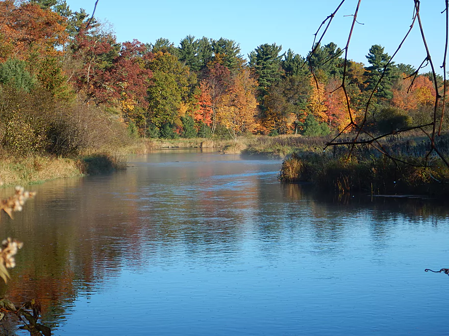
But even better in fall
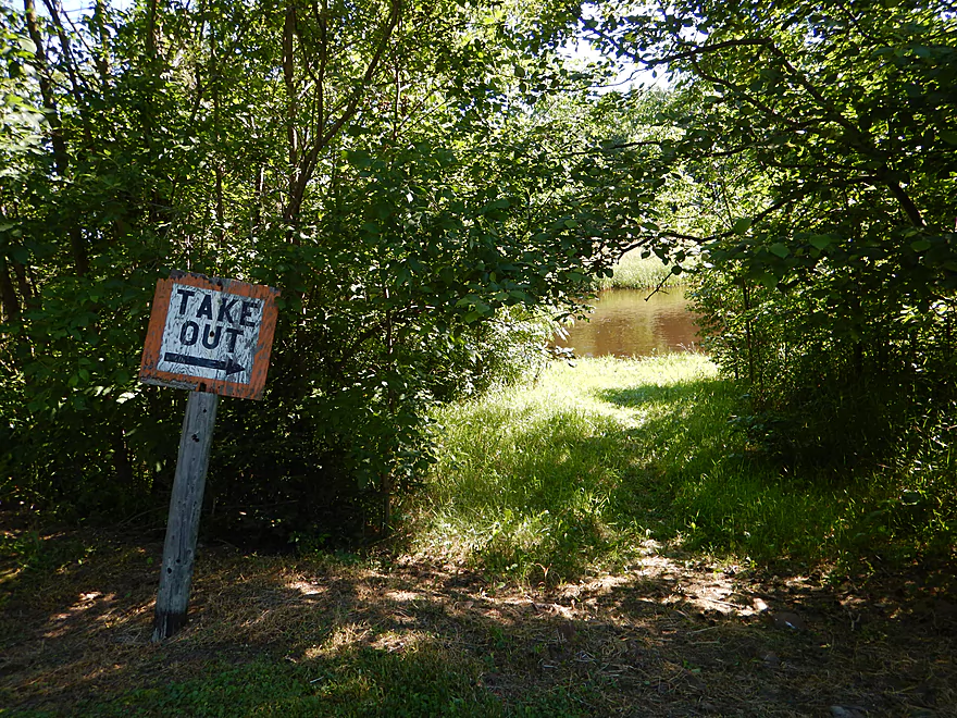
There is a take-out area on the west bank
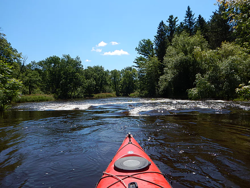
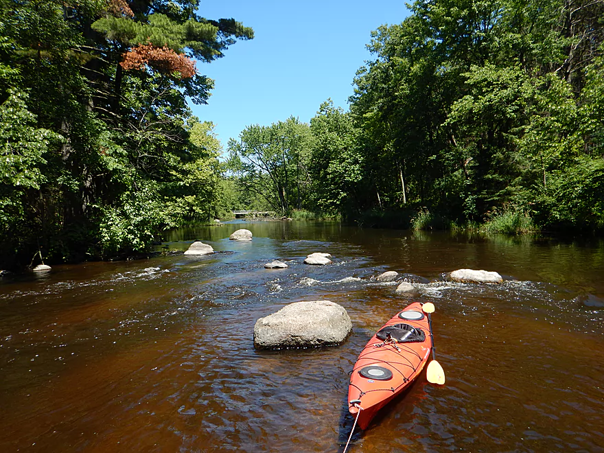
Coming up on the old dam
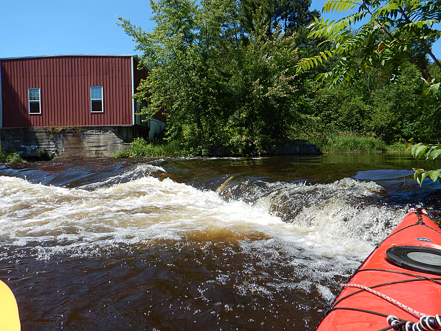
This is a decent-sized ledge
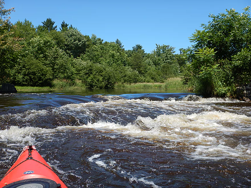
Class 2 rapids formed by the incomplete removal of the dam
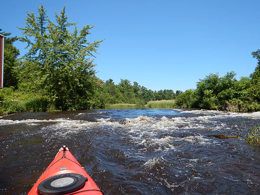
Safer/shallow area is on the right
Nice section after the rapids
Sharonwood Lane is an access option
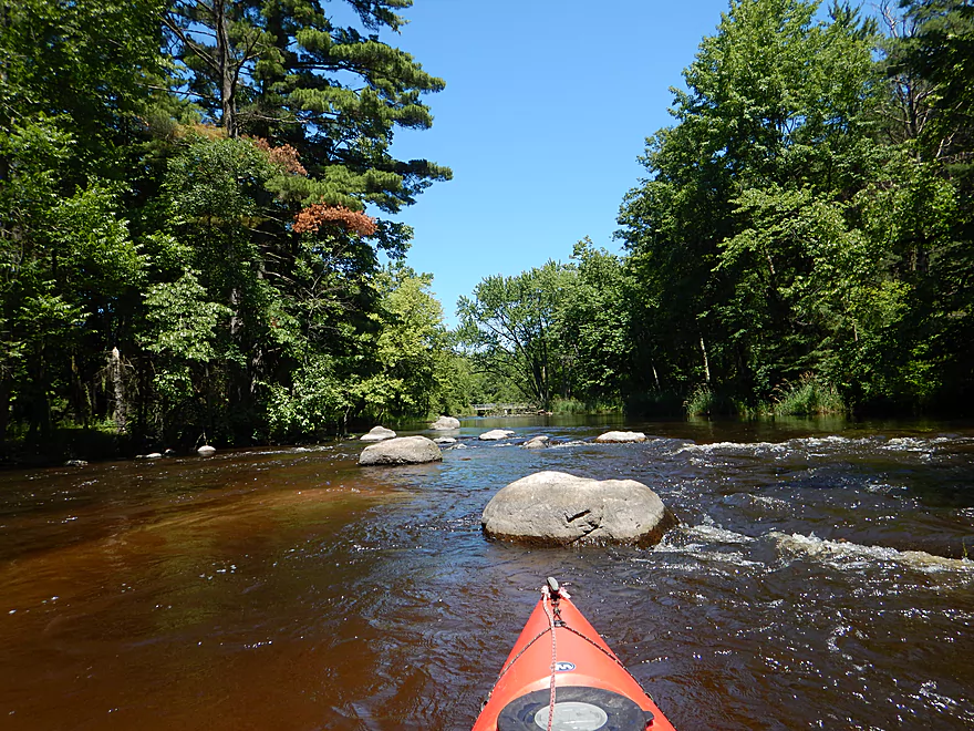
Coming up on another boulder garden
And more rapids
Scenic scene looking back
When you need scale for a picture, a boat can do
Reminded me of the far upper Plover
Surprised to see two other kayakers
End of the rapids…notice the whitewater course ropes at the top?
Entering Jordan Pond
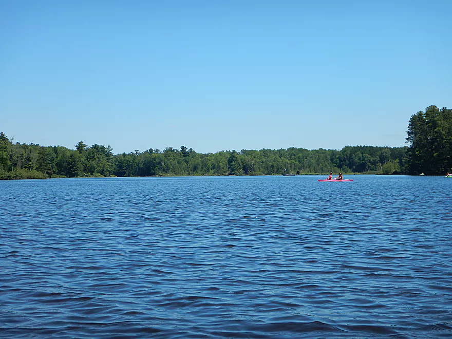
Very popular with paddlers
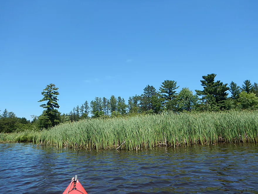
Some nice marshy banks
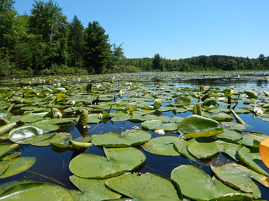
Huge lily field
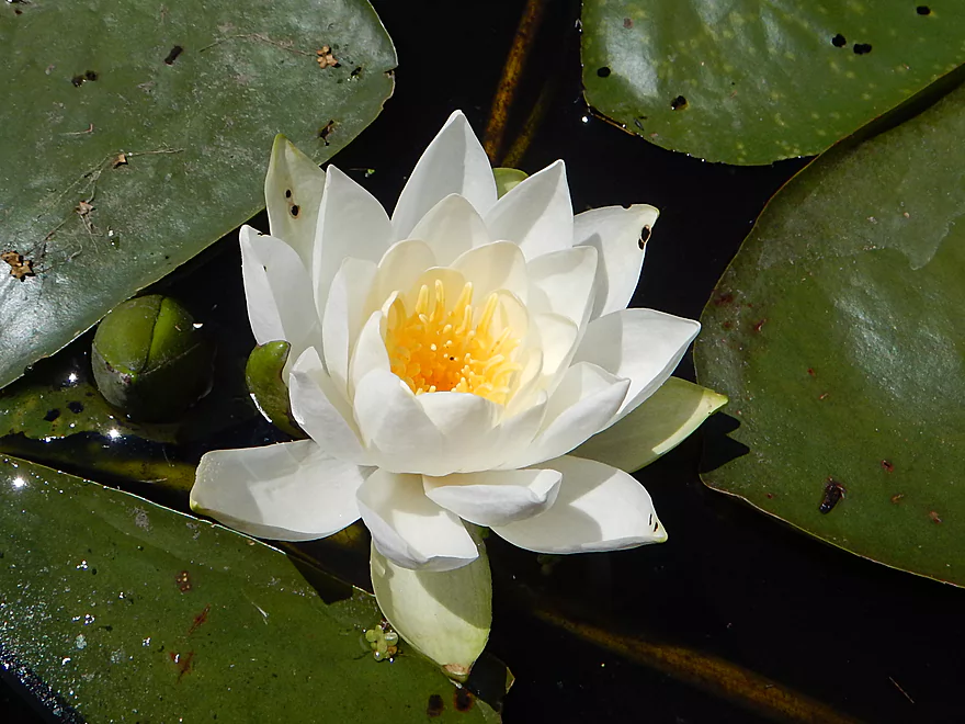
Flowers reflect a lot of light, so always under-expose
Taking out at Jordan Park
Great take-out
Huge canoe landing parking lot all to myself
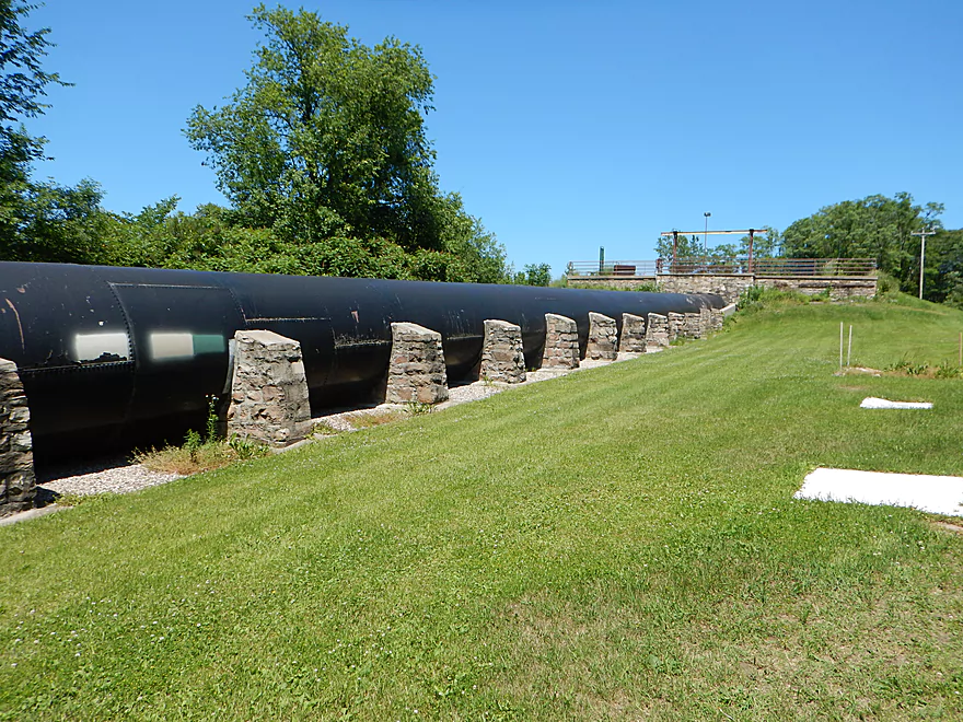
After Jordan Pond, the Plover gets packed into a tube!
Plover River – Hwy K


The Plover is a popular paddling river that empties into the Wisconsin River at Stevens Point. In some ways it is two rivers in one, as the upper portions of the river are rocky and coniferous while the lower portions are sandy and dominated by lowland hardwoods. For this latest installment, the plan was to check out a more obscure section on the Lower Plover above the Jordan Lake dam.
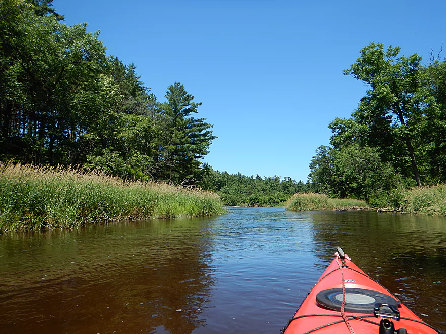
The trip starts at Hwy K where there is a nice launch area. Right off the bat, this reminded me of the Lower Mecan River with grassy banks, thinly spaced hardwoods, and an up-tempo current. An ok section (maybe 3 stars), but nothing special. Despite being near Stevens Point it is surprisingly isolated and I only saw two homes. This is sand country which gives the local trees a lot of grief and you’ll have to dodge many that end up in the water. Unfortunately water levels were a tad high for this trip which hurt clarity, but typically you can see the sand/gravel bottom through the water.
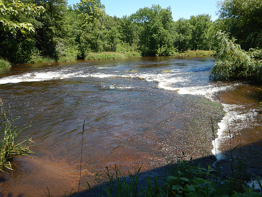
The next mile flows through the remnants of Van Order Pond. Basically there used to be a small flowage here, but the dam was removed and what remains now is an open grassland with few trees. I actually really liked this section, as it had a bright, open, clean feel to it in contrast to the murky, messy hardwoods of the previous two miles. You’ll see occasional boulders in the water and even a few boulder gardens. The website “Paddling The Plover” references boulders here larger than a kayak which I didn’t see but perhaps this was because of the higher water levels.
Soon you’ll come across the remnants of the old dam….and it hasn’t been completely removed! The result is a tricky Class 2 section with a 1-2′ ledge that I suspect most paddlers won’t run because of the irregular concrete below the surface. There is a take-out sign on the right/west bank but no clear portage path. You either have to portage through somebody’s lawn or through thick weeds. Definitely scout this prior to even starting the trip which is easy to do from the road by the take-out sign.
Shortly after Sharonwood Lane, you’ll come across the best boulder gardens of the trip and a mini-section of Class 1 rapids. According to “Paddling The Plover“, there once was an 18-gate slalom course here. I did see some wires but not much else. Honestly it really didn’t seem fast enough or long enough for a slalom course, but perhaps the former dam did special releases that made this viable.
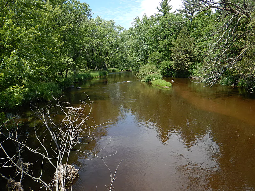
After the rapids, the river widens into a small flowage (Jordan Pond), which is a simple but pleasant lake paddle. Here there are really cool lily beds, but also some large shallow areas that you’ll want to carefully avoid. The pond today is popular with paddlers, but most are quite oblivious that really cool rapids and boulder gardens were buried to make this siltfest possible.
There a several options for taking out in Jordan County Park and I chose a canoe launch at the north end of the park. Following the flowage, the river is literally put into giant pipes and diverted to a dam. You could in theory walk under the Hwy 66 tunnel to portage past the tubes and launch below the dam by the rapids, but this might be a difficult trek. The next 8 miles through the outskirts of Stevens Point happen to be the most popular paddle of the river and one that I recommend as a separate trip. If you really want to do a longer paddle, I suggest putting in a bit earlier instead. Launch at at Bevent Drive which would add 3.4 miles to the trip. This upper stretch is quite popular with locals and one group I talked to really liked it (future trip!).
In summary this was an ok paddle that started mediocre but ended nice, hence the 3.5 star compromise. Honestly, my three other trips on the Plover were all better than this, but it wasn’t bad and if you’re a local I definitely recommend checking it out.
Hwy K is kind of a good put-in. There is a public launch area and nice trail south-west of the bridge which is popular with local paddlers. But…there is nowhere to park as the ditches are too steep. That doesn’t stop most paddlers though…and on a weekend, you’ll likely see 4-5 cars parked half in the ditch and half on the road (literally). As a bike shuttler I didn’t have to worry about this, but if you do park, maybe try parking by the intersection of K and Y and walking back to the launch.
Jordan Park is a great take-out option and there is a dedicated canoe launch on the north end of the park. Good parking, a nearby outhouse, no fees and a good launch area. Note for fall/spring paddlers, this is marked as walk-in access only from November to April. Still doable, but you’ll have to park your car outside of the gate and drag your boat a bit further.
I’m 99% sure that Nature Treks (715-254-0247) services this route with rentals and shuttles but call in advance to confirm availability.
Otherwise this is a really nice bike shuttle. Only 3.8 miles, no real hills, paved, little traffic and scenic.
Volunteers do clean this section up of logjams and their effort is really appreciated. But…there are a 2-3 downed trees that require serious limbo-ing and hopping to get through. I never had to portage, but this was a little annoying. Though if you did portage, it wouldn’t be too difficult. There are also numerous strainers, most of which are pretty easy to avoid, but you do want to stay on your toes.
The current is a bit above average and results in a few easy Class 1 rapids below Sharonwood Lane.
Above Sharonwood Lane is a Class 2 drop where the old Van Order dam used to be. Definitely scout this before running as there is irregular concrete below the surface. The left/west side is steeper, but rougher with bigger standing waves. The right/east side has a shallower slope, but there is a higher chance you’ll get hung up. I chose the latter and made it through ok. Portaging downstream right (west), is a bit awkward as somebody’s home is right there. While legally you can cross private property to portage, I advise portagers choose the east bank, which is weedy but doable for getting around the dam. For scouting, you actually want to do this before the trip. There is a “Take Out” sign right by the old mill which makes scouting the old dam much easier.
The river was a tad on the high side…very full, but not close to bursting its banks. This was somewhat unfortunate as some of the cooler boulder gardens were somewhat diminished in the high water and clarity wasn’t great (but can be in low water). The gauge I’m using for reference is the Eau Claire River gauge which roughly correlates with the Plover.
- 0-100 CFS: These would be low levels, but really I think this segment would always be navigable.
- 101-125 CFS: A good target depth for water clarity and for the scenic boulder gardens.
- 126-150 CFS: A bit above normal but still a decent depth.
- 151-175 CFS: Ok depth but not as scenic.
- 176-210 CFS: Getting on the high side but doable with more strainers in the water. Trip done at 200 CFS.
- 211-250 CFS: Pretty high and might be close to bursting the banks. Would not be as scenic and the strainers would likely be too annoying.
- 251+ CFS: Maybe flood conditions (don’t know for certain though).
Not much. Some turkeys, a deer and many mosquitoes.
Detailed Overview
- Legion Memory Park to Konkol Road: (1.8 miles) Scenic, narrow, shallow creek with perhaps a few logjams.
- Konkol Road to Townline Road: (1.3 miles) Probably a mediocre but doable prospect.
- Townline Road to Bridge Road: (1.4 miles) A creek prospect that should have scenic woods and a few boulder gardens. Townline Road should be ok for access.
- Bridge Road to Esker Road: (0.7 miles) Narrow, wooded and rocky, this is a good prospect. Probably some rapids and a few logjams. Should be ok put-in access.
- Esker Road to Hwy 153: (6.4 miles) A fantastic trip reviewed in Oct 2016.
- Esker Road to Plover Road: (1.5 miles) Pleasant section with a nice boulder garden.
- Plover River Road to Kristof Road: (2.7 miles) Best section on the entire river. Very scenic, with 3 Class 2s and many boulder gardens.
- Kristof Road to Hwy 153: (2.3 miles) Good section with no noteworthy rapids, but pleasant and scenic.
- Hwy 153 to Pinery Road: (5.0 miles) A great trip reviewed in June 2016.
- Hwy 153 to Bevent Drive: (2.7 miles) Five star segment and 2nd best leg on the entire river. Scenic with several small rapids.
- Bevent Drive to Pinery Road: (2.3 miles) Pleasant section but not as scenic as upstream parts.
- Pinery Road to Shantytown Drive: (4.9 miles) A medium trip reviewed May 2018.
- Pinery Road to Hwy J: (2.8 miles) Starts wide and uninteresting but gets better with narrow corridors of firs, white cedars and white pines. Section includes a small boulder garden and several low farm bridges.
- Hwy J to Shantytown Drive: (2.2 miles) A peaceful section with many conifers relatively undeveloped banks and good current.
- Shantytown Drive to Hwy Y: (5.2 miles) The river slows and widens here, with maybe a third of the trip being a flowage/marsh (looks pleasant). Shantytown Drive is a good launch option.
- Hwy Y to Bentley Road: (1.3 miles) A tweener section between the flowage and river that includes a dam portage. Hwy Y is a poor launch option with difficult parking.
- Bentley Road to Hwy K: (3.4 miles) The river narrows here and this is a popular section. Good shoulder parking at Bentley Road (lot of cars park here).
- Hwy K to Jordan County Park: (5.3 miles) Ok prospect reviewed Jul 2017.
- Hwy K to Sharonwood Lane: (4.7 miles) A less traveled, narrow, wooded section on the upper part and an open grassland paddle in the second part where the old flowage was. Be careful about running the old dam remnants. There are nice boulder gardens above and below Sharonwood Lane. Hwy K is an ok launch, but has very poor parking (most cars were literally parking more on the road than on the shoulder).
- Sharonwood Lane to Jordan County Park: (1.0 miles) Gorgeous boulder garden below Sharonwood and perhaps an abandoned whitewater slalom course. Most of this is lake paddling though Jordan Pond. Sharonwood Lane is small but ok for access.
- Jordan County Park to Jordan Dam/Jordan Park: (0.5 miles) Paddle west of the lake, then portage under the Hwy 66 tunnel. You then have to drag your boat 600+ feet to get past the pipeline and into the water. Not recommended.
- Jordan Park to Iverson Park: (8.0 miles) A good prospect previously reviewed July 2014.
- Iverson Park to Lower Whiting Park: (2.5 miles) Mostly open flowage paddling that is probably uninteresting.
- Lower Whiting Park to the Wisconsin River: (1.2 miles) Mostly big flowages. Probably not a good prospect.
Trip Map
Overview Map
Video
Photos Size: