
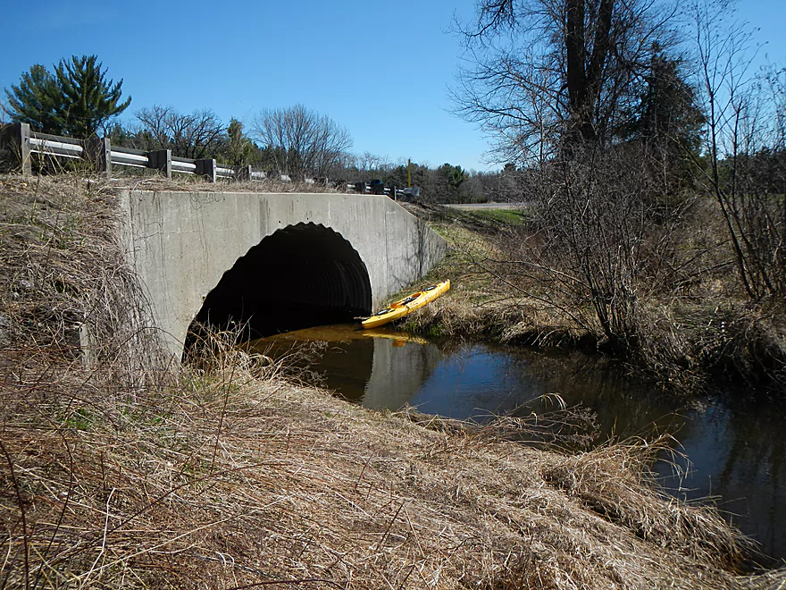
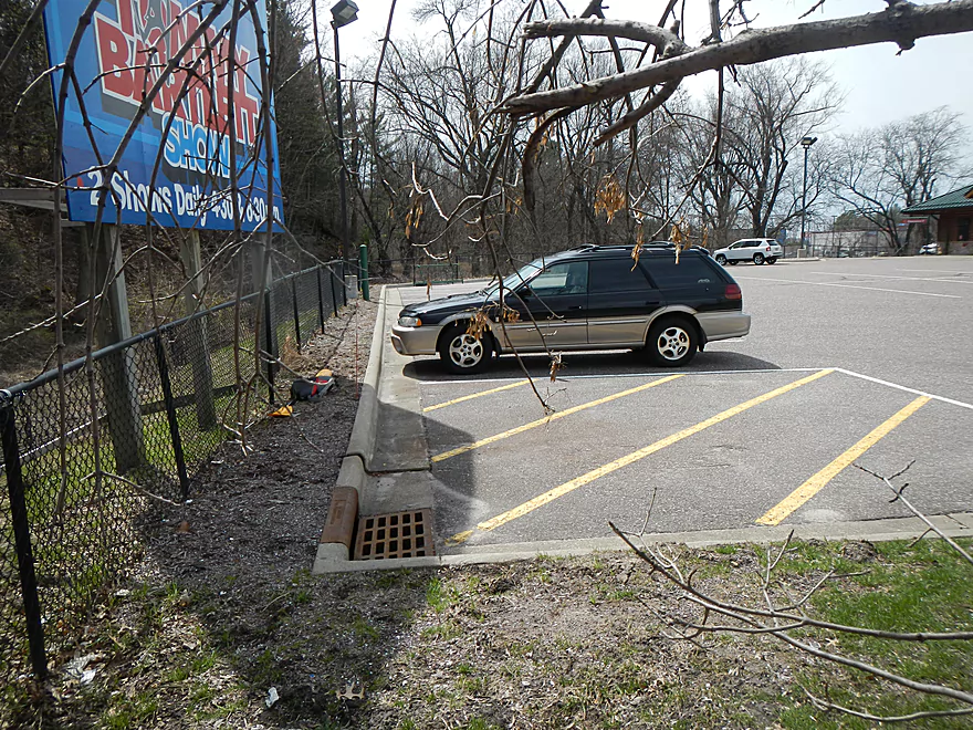
Okay parking on Hwy H
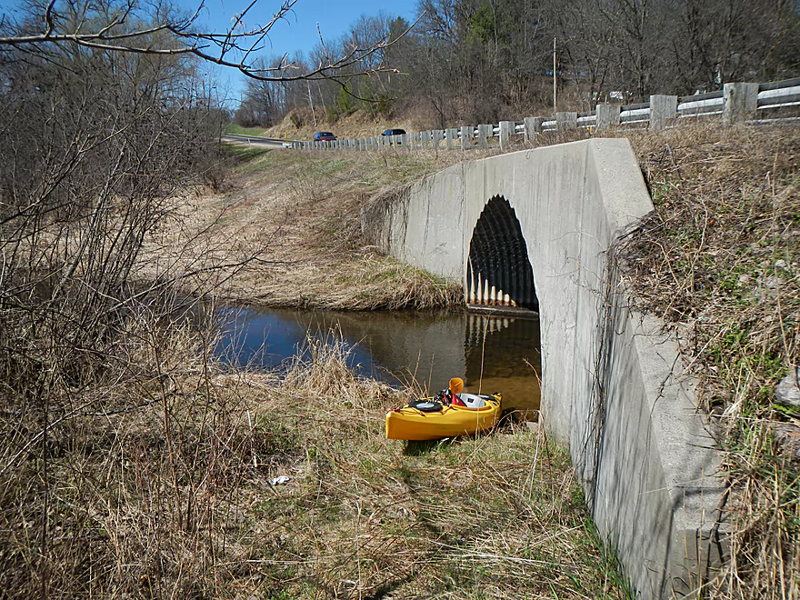
Acceptable put-in area
Can’t get too far upstream because of logjams
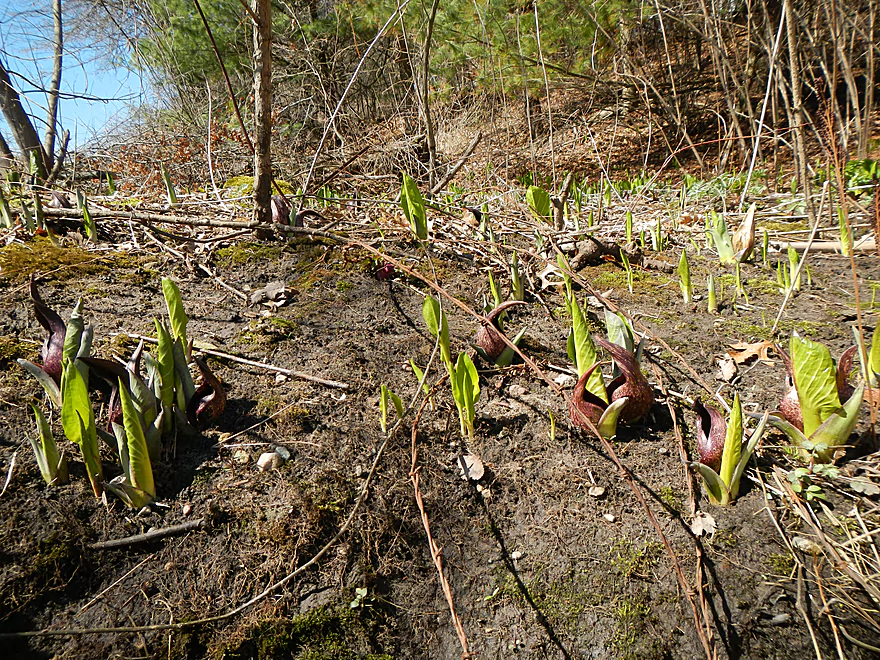
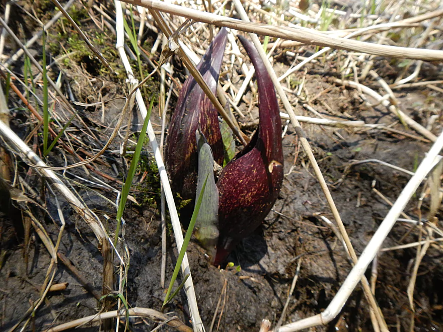
Skunk cabbage colony!
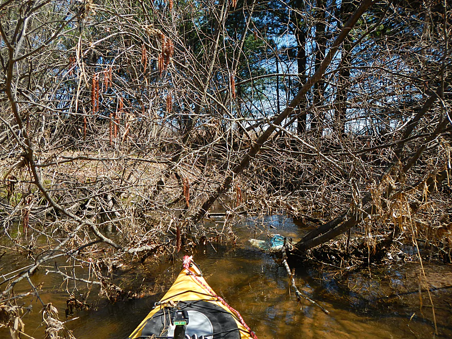
First of many obstacles
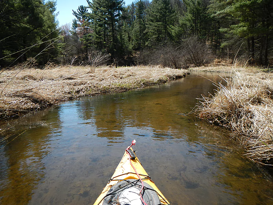
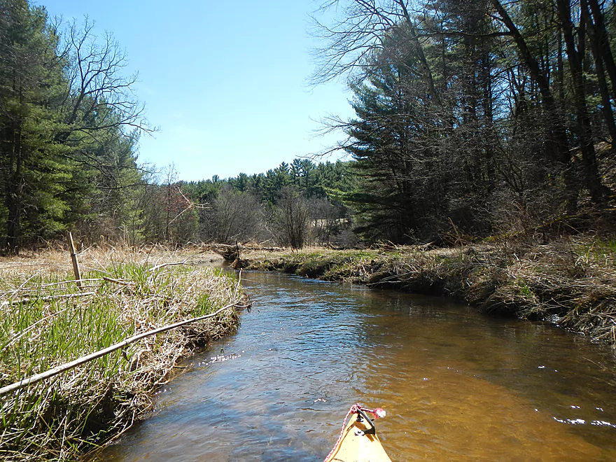
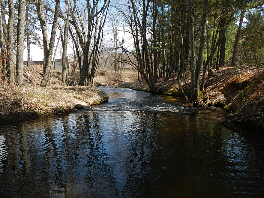
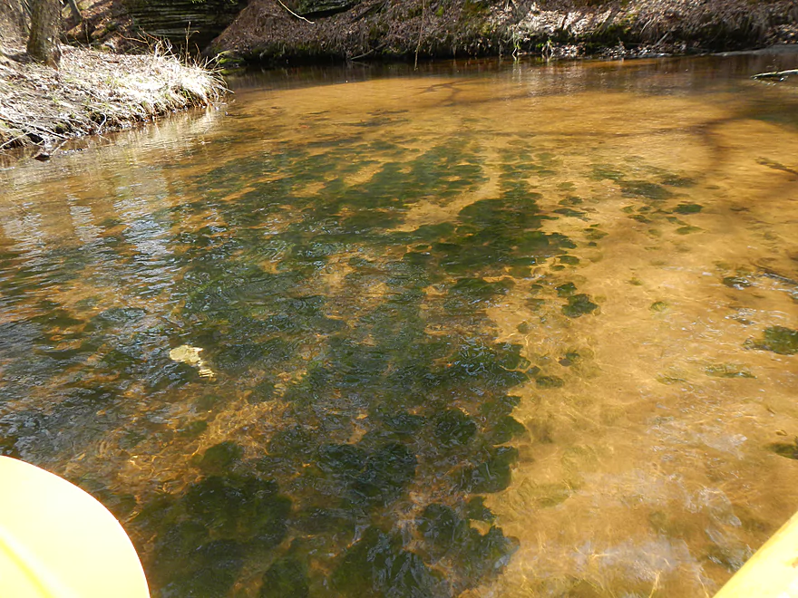
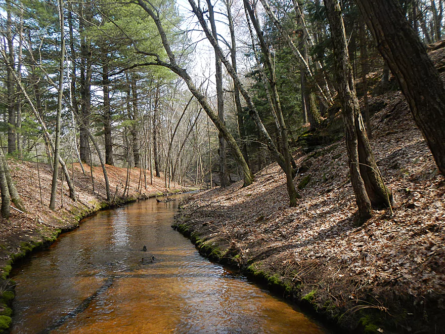
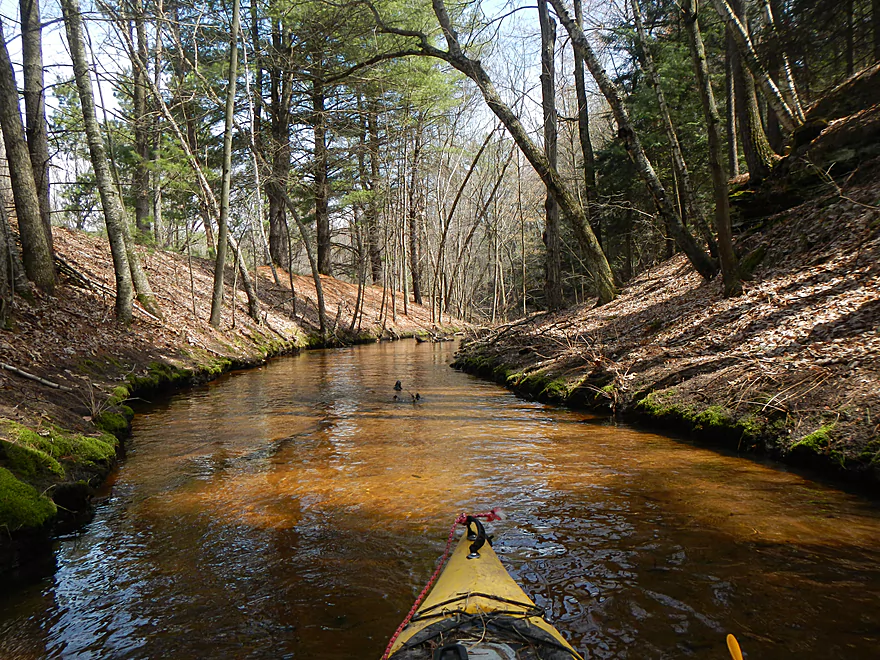
Great clear water
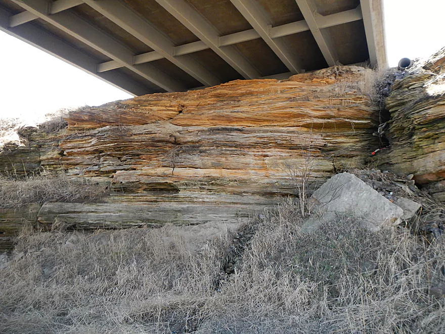
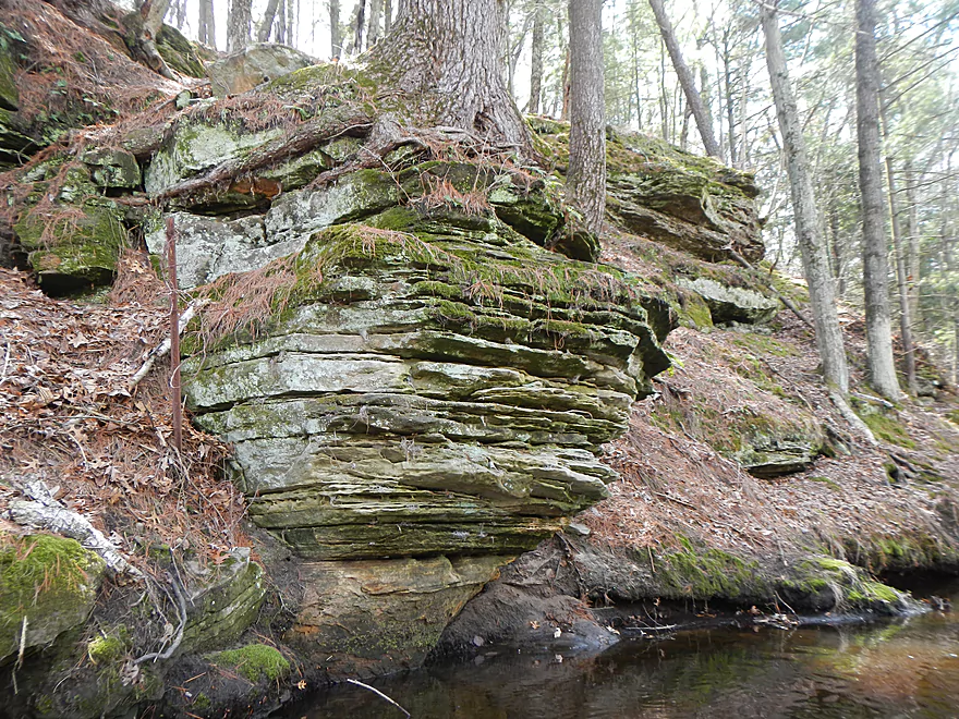
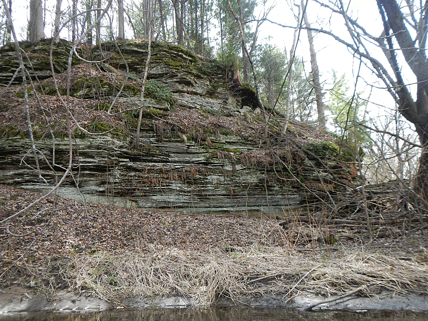
Several ok rock outcroppings right away
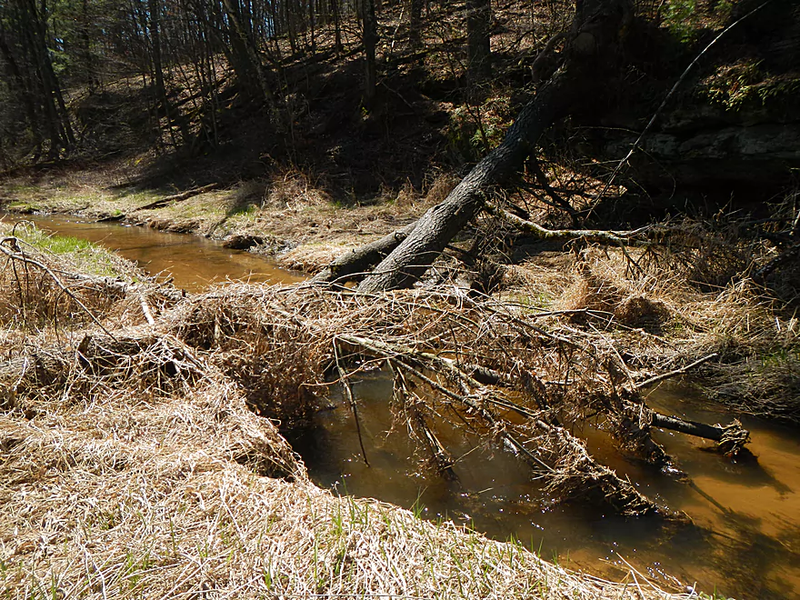
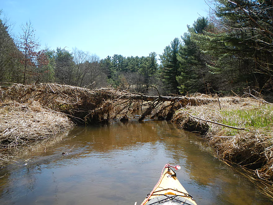
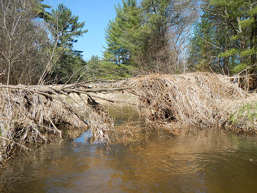
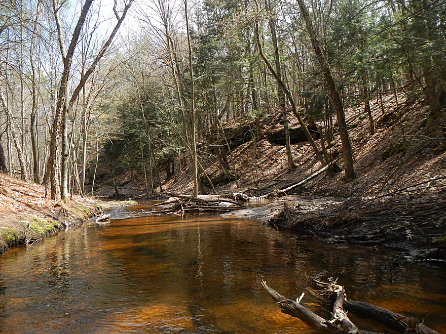
Another logjam
Yet another logjam
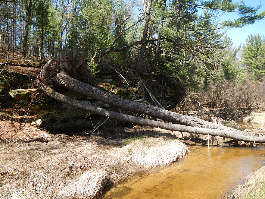
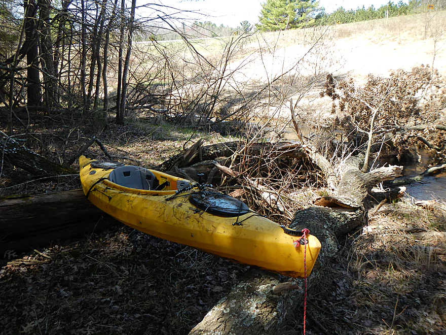
Before surgery
After surgery
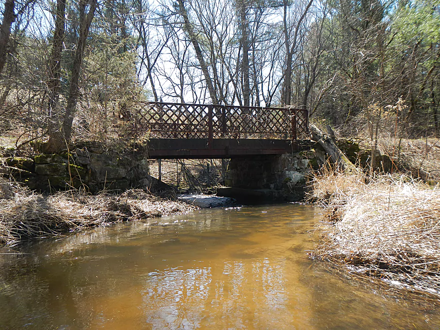
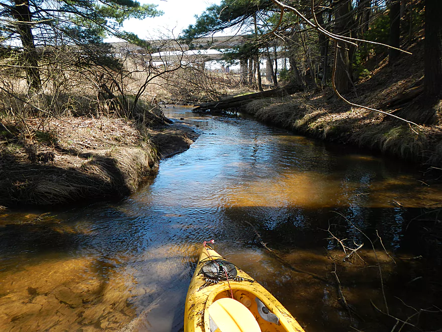
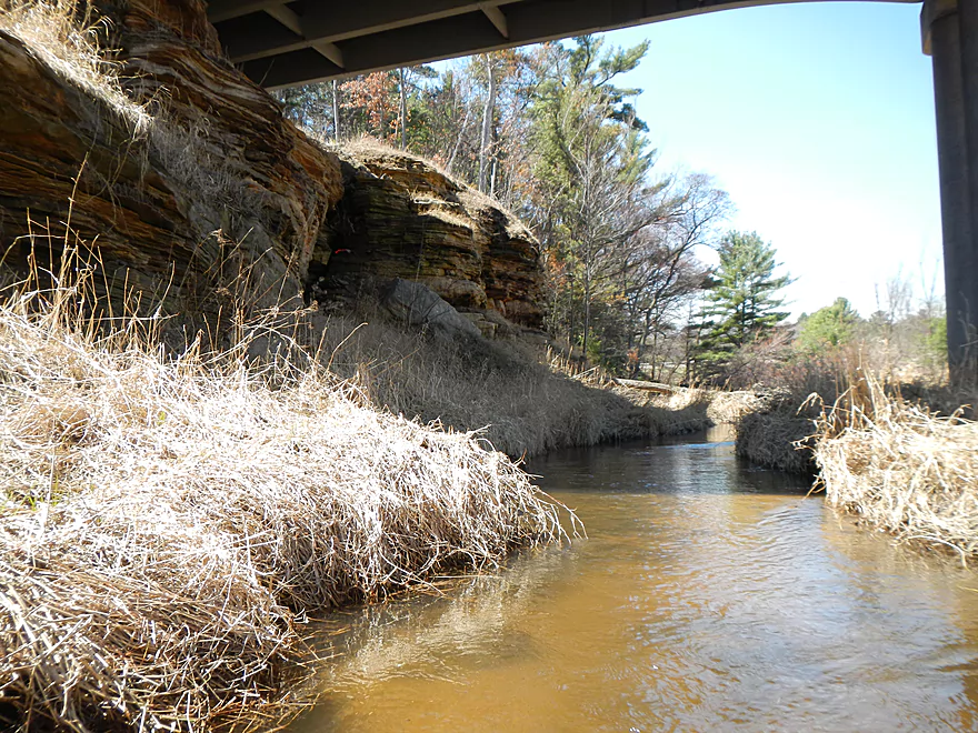
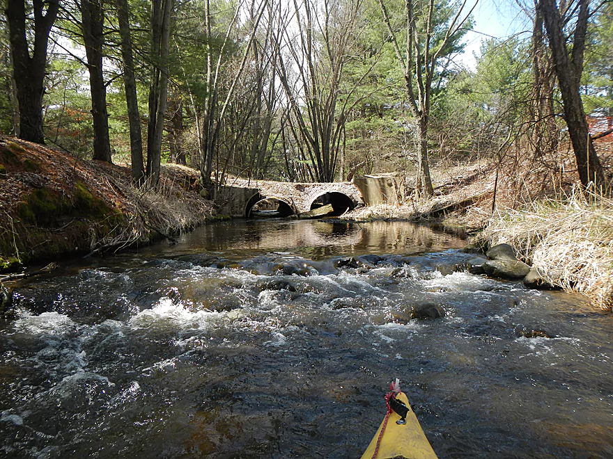
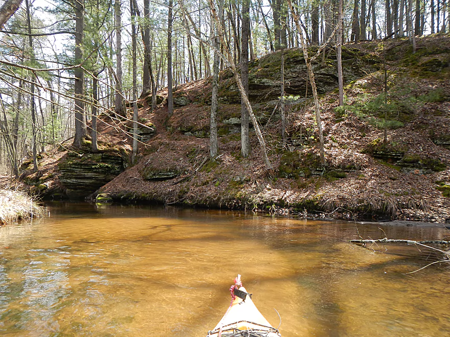
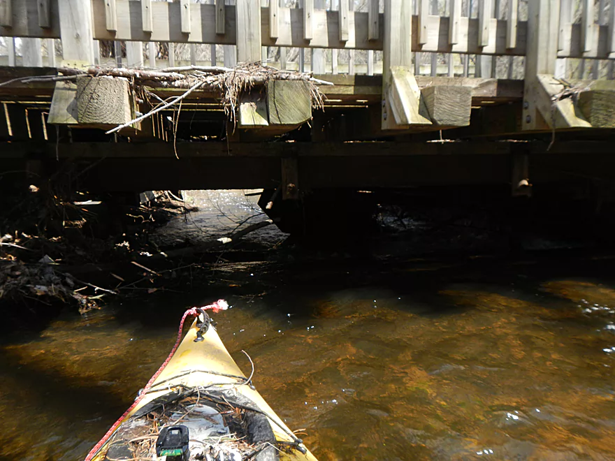
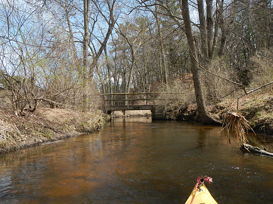
Public snowmobile bridge
Minor riffles
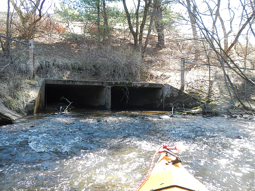
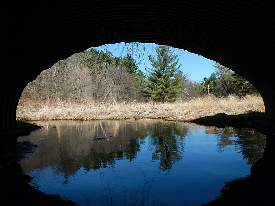
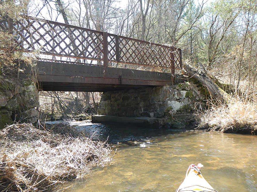
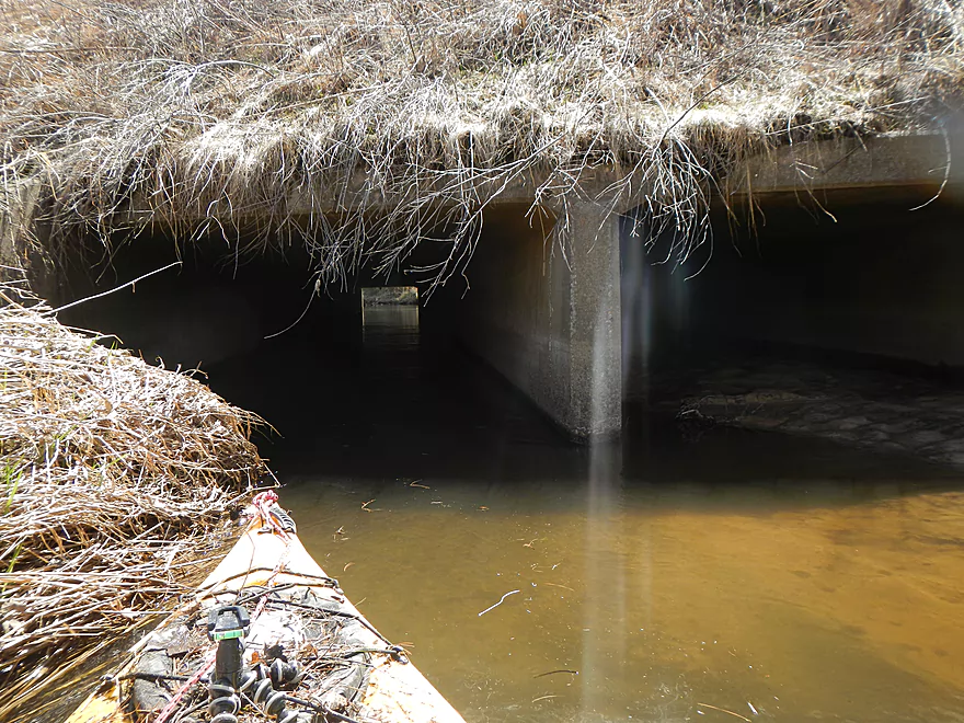
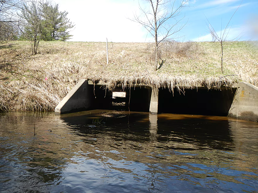
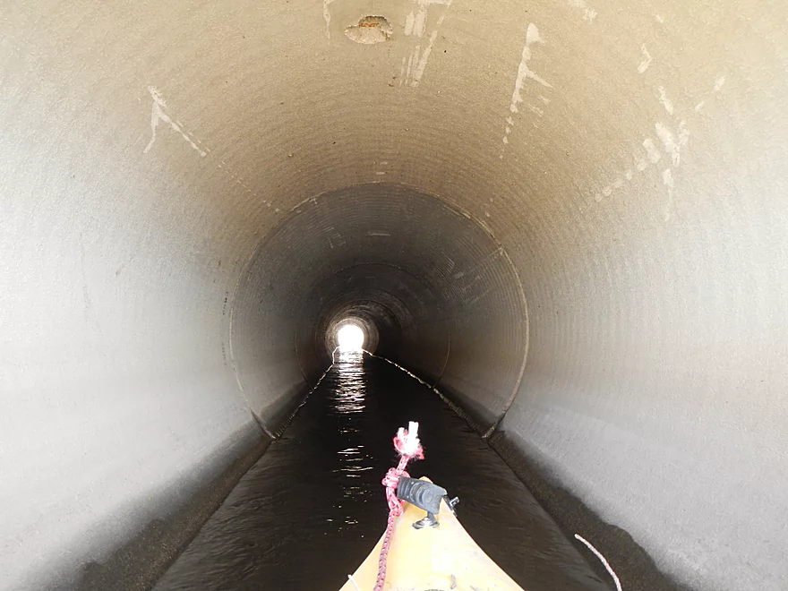
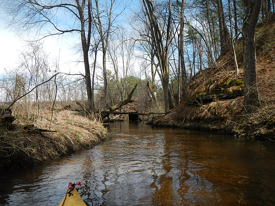
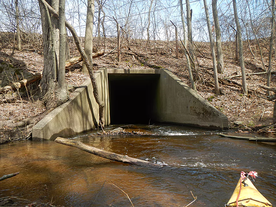
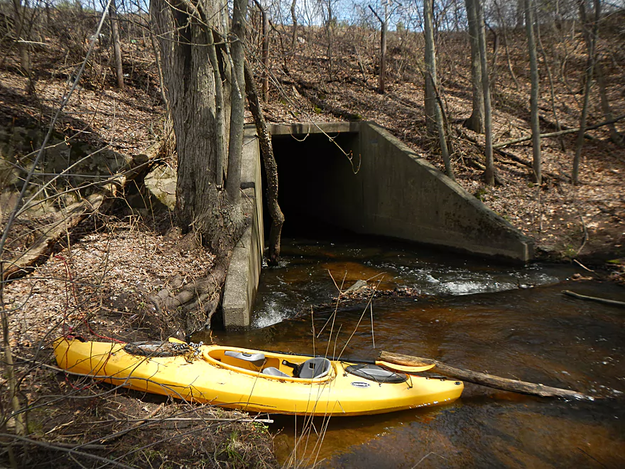
Head right (left tunnel is silted in)
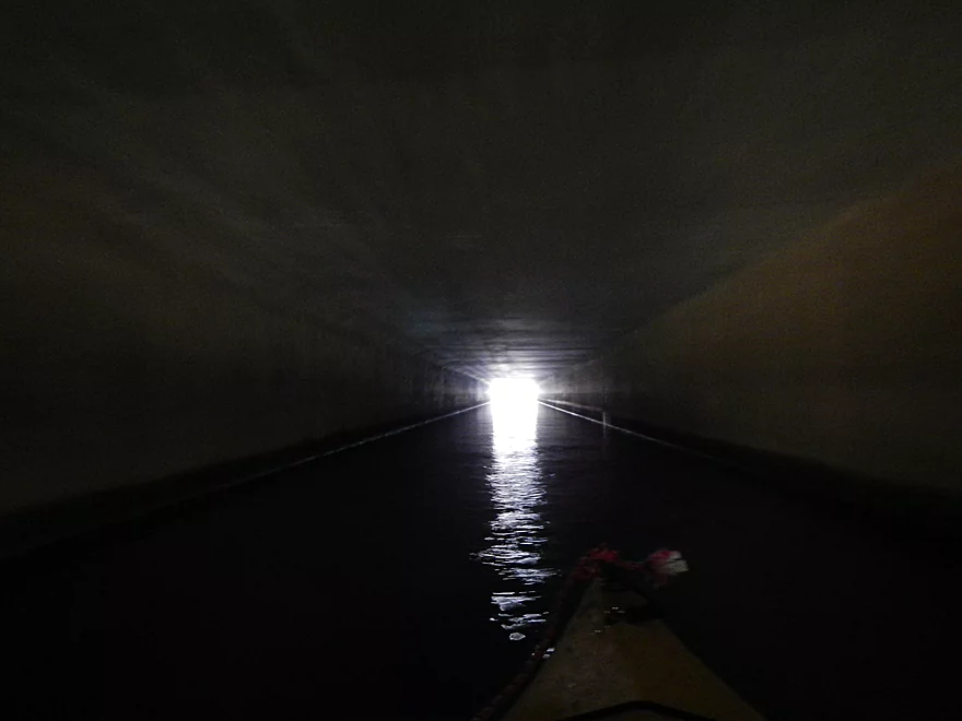
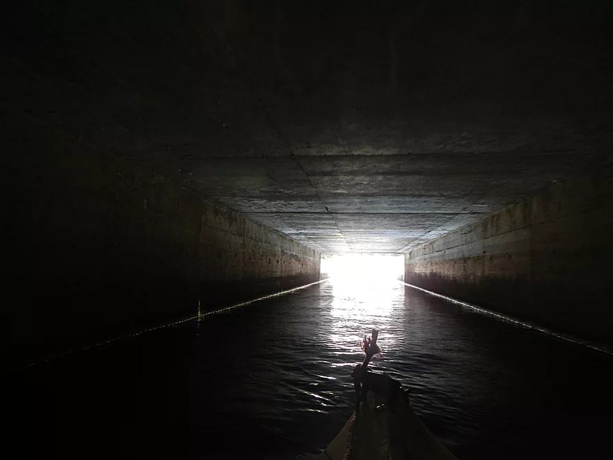
Reverse view
You’ll get very dirty on this creek
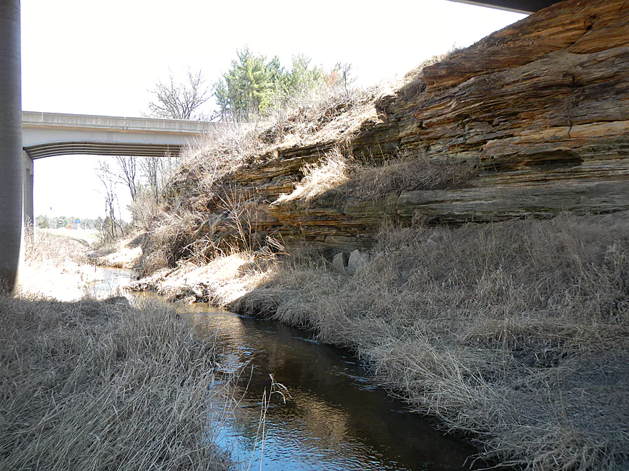
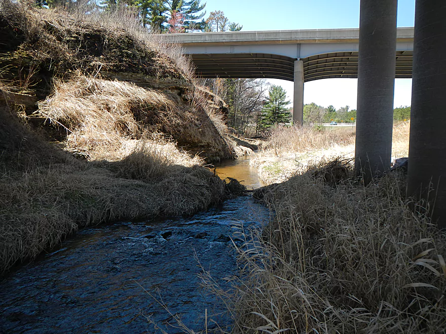
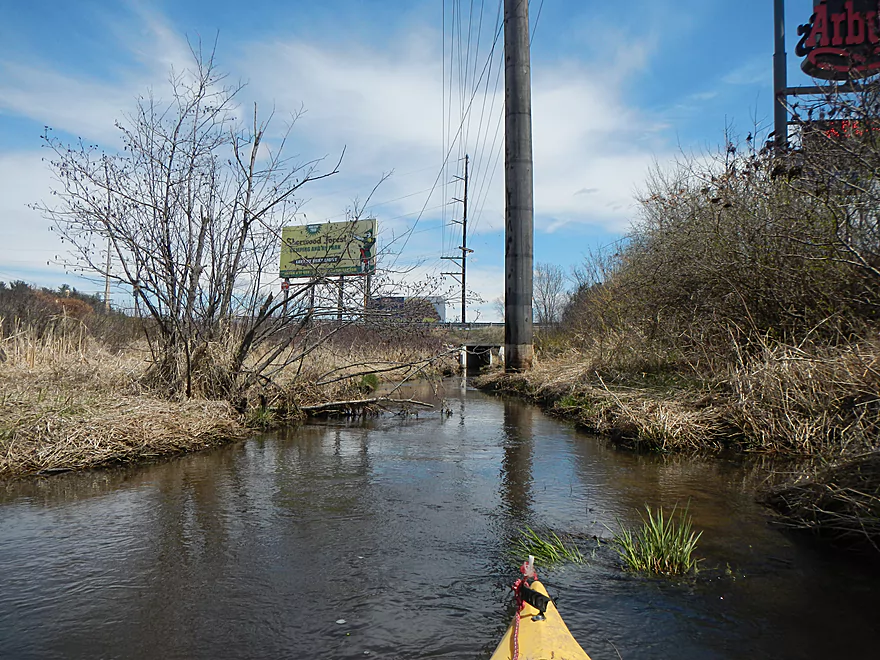
I-90 Ramp
Yet another “crab claw”
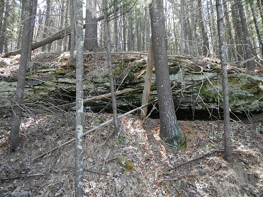
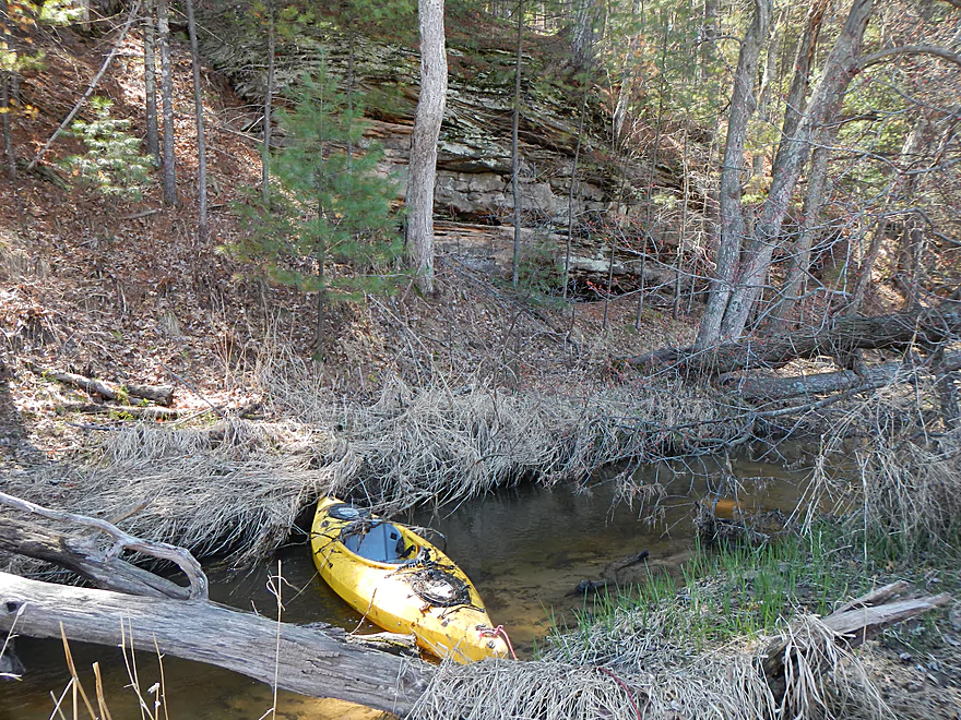
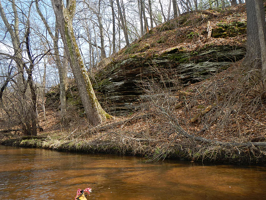
Lot of nice rock formations by the interstate
Logjams are the worst here…
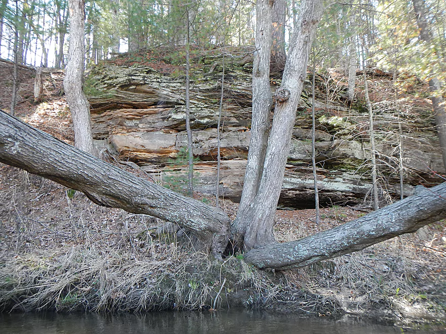
More great rock formations
I suggest portaging the entire 1200′ by the interstate
Reverse angle…cool area
Yet another logjam
Going under another I-90 ramp
Other side of ramp
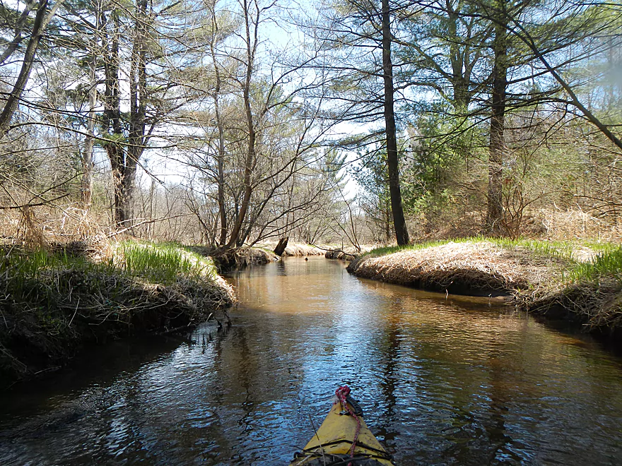
Nice wooded section
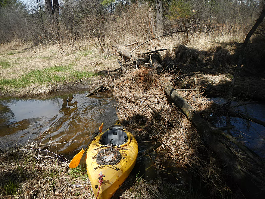
Only one jam here if I remember correctly
Welcome to the Dells
South Frontage Road tunnel
Advertising for kayakers…
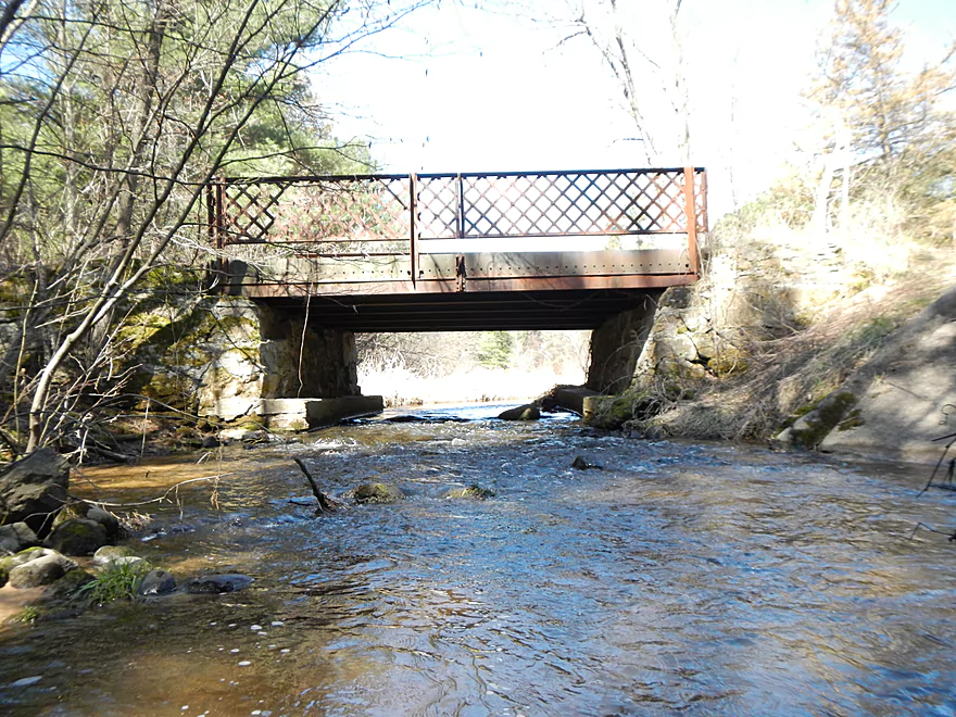
Trout Road bridge
Can’t fit here
Right tunnel has plenty of space
Power lines were making a lot of crackling noises
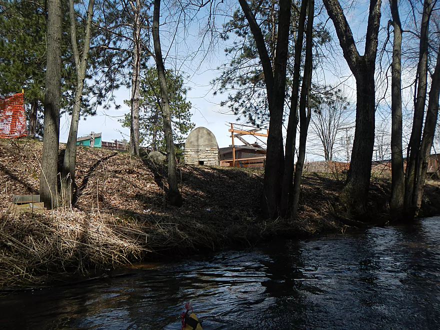
Access bridge to Arby’s
Creek changes character
Old Fort Dells bridge
Nice riffles
Looks artificial
Outdoor kiln
Smaller south branch joins here
Cool plants
Great rock formations in this area
Wading upstream on the South Branch
Very shallow
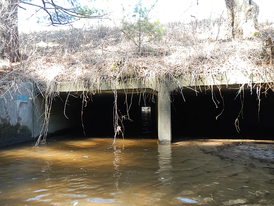
Hard to see, but there is a ledge/jogjam under the bridge (avoid!)
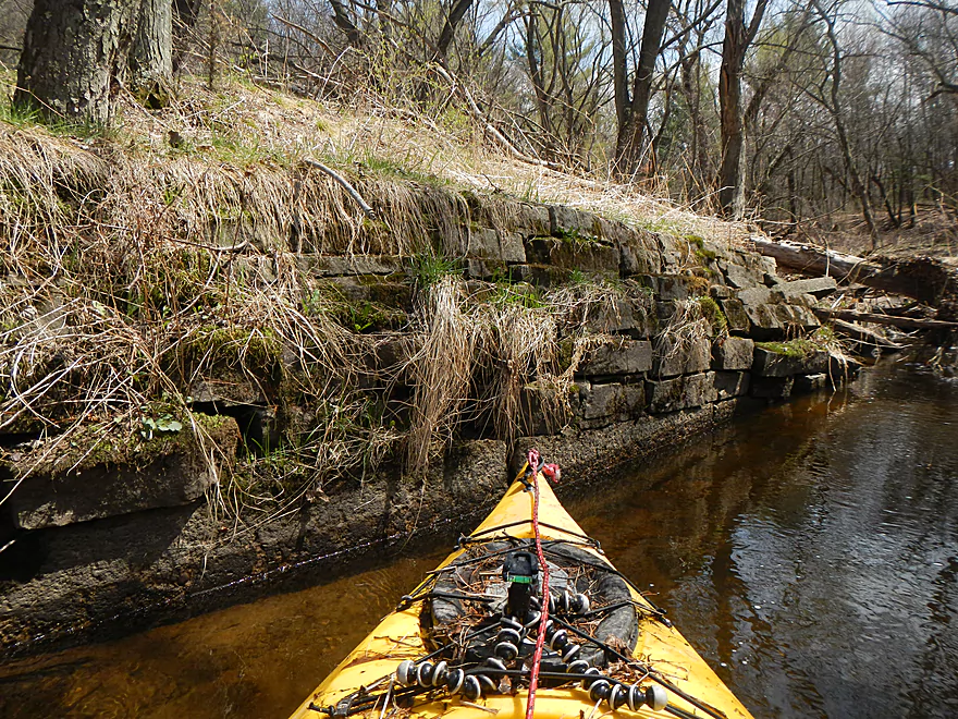
Old bank-work from Fort Dells era
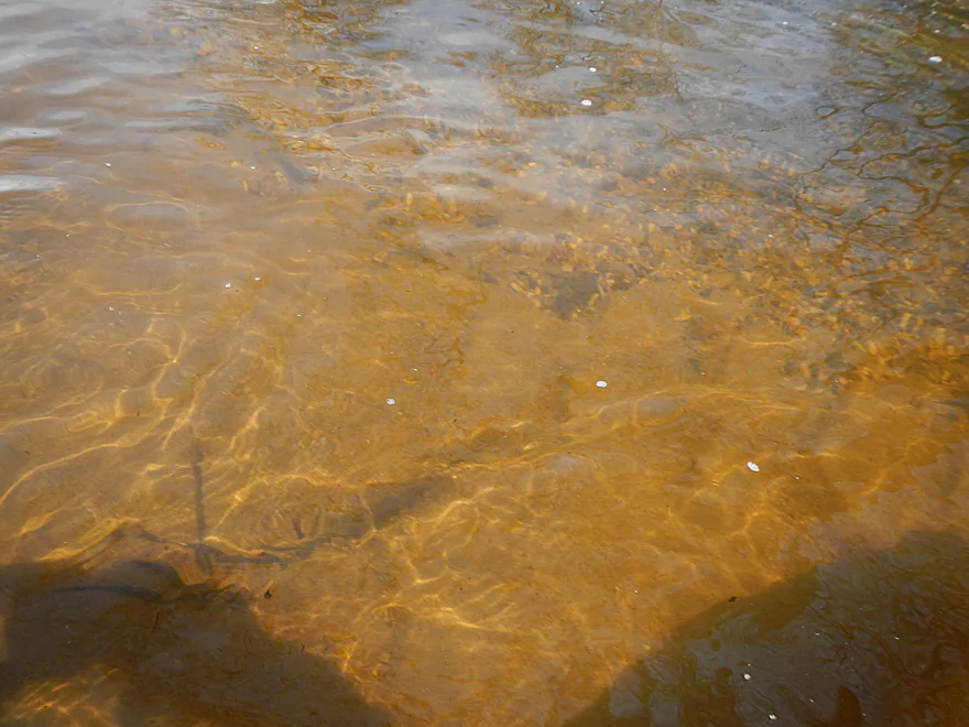
Terrific water quality
Another old Fort Dells bridge
Take-out area
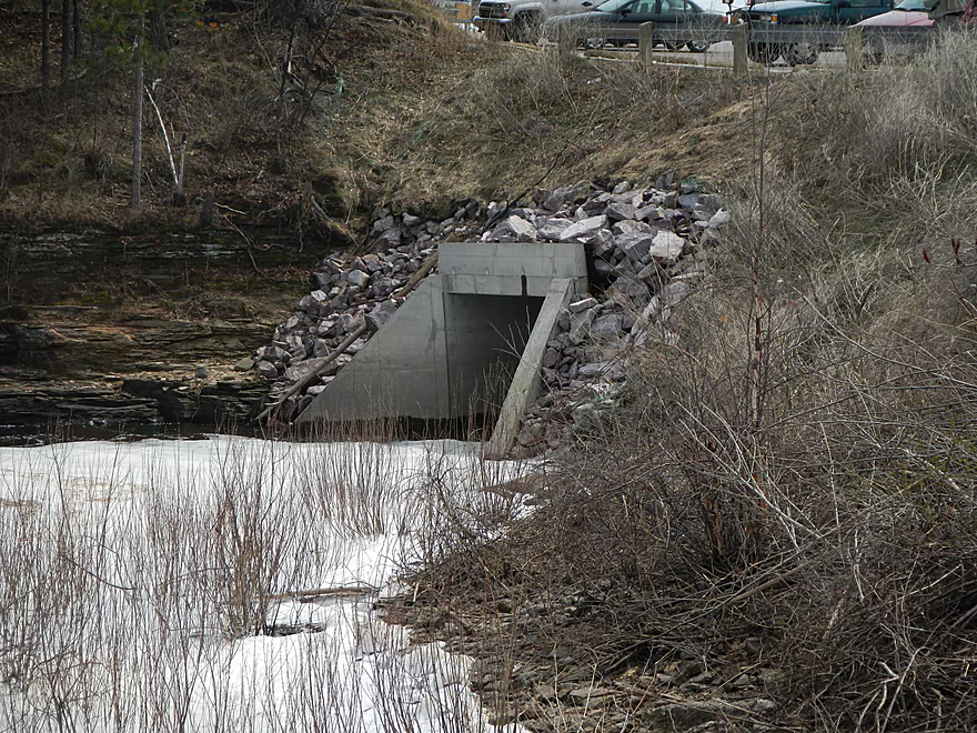
Do NOT go down this culvert!
Looking back
Ok take-out area
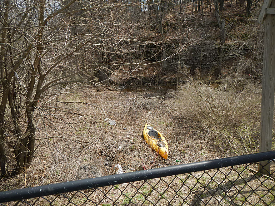
But a drag to the car
Ok parking and bike rack by McDonald’s
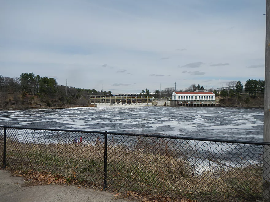
The mighty Wisconsin
Mouth of Hulburt Creek
Hulburt Creek

Hulburt Creek is an obscure little creek in the Wisconsin Dells area that few people paddle or even know about. Normally, it is just too shallow and filled with logs to paddle (more on that later). Thanks to our recent deluge of rain though, the creek levels really came up and I decided to give this a try, and I’m glad I did.
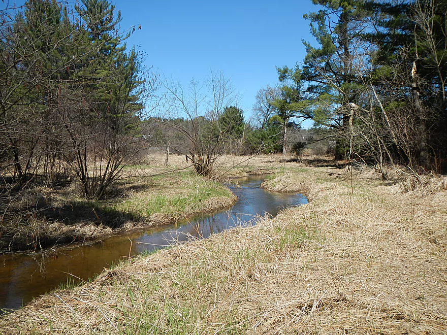
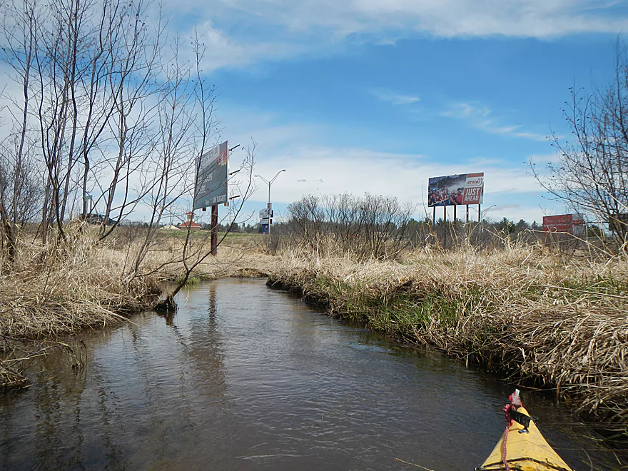
For putting in, you don’t have a lot of great options. You can put in perhaps at the Hulburt Creek State Natural Area (Birchwood Road) during flooding, but this was too shallow now even by my standards. I ultimately settled on the Hwy. H bridge, which creates a short 2-mile stretch. You almost could put in by the public snowmobile bridge, but the DNR gates off the access road in the summer. Further downstream, you could try parking by one of the local businesses and accessing the creek by Hwy. 13, but if you do so, you really shorten the trip and none of these access options are that great. Hwy. H is good for a “bridge landing,” with a pull-off area and shallow ledge to launch…but is busier then I prefer for kayak/bike shuttles and is very near a house.
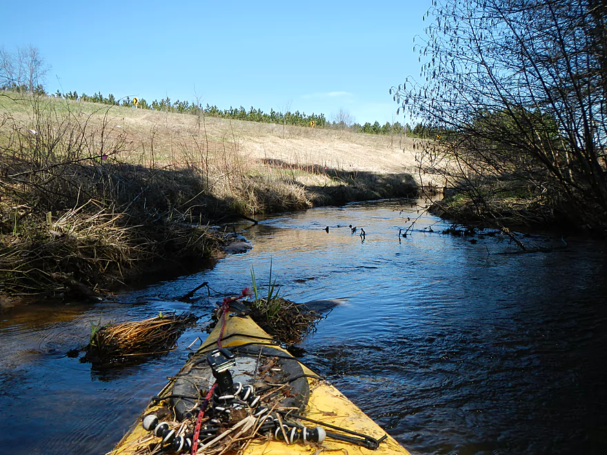
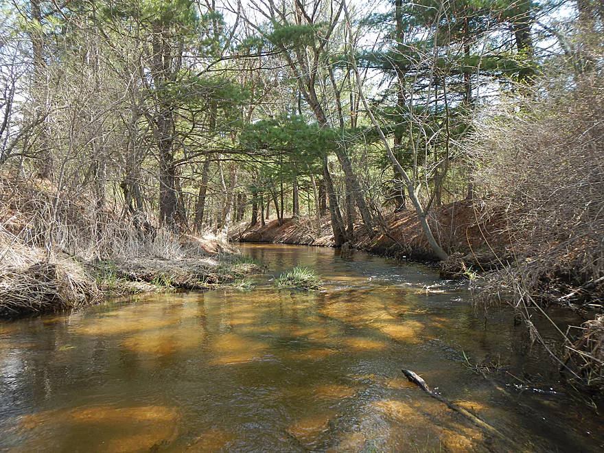
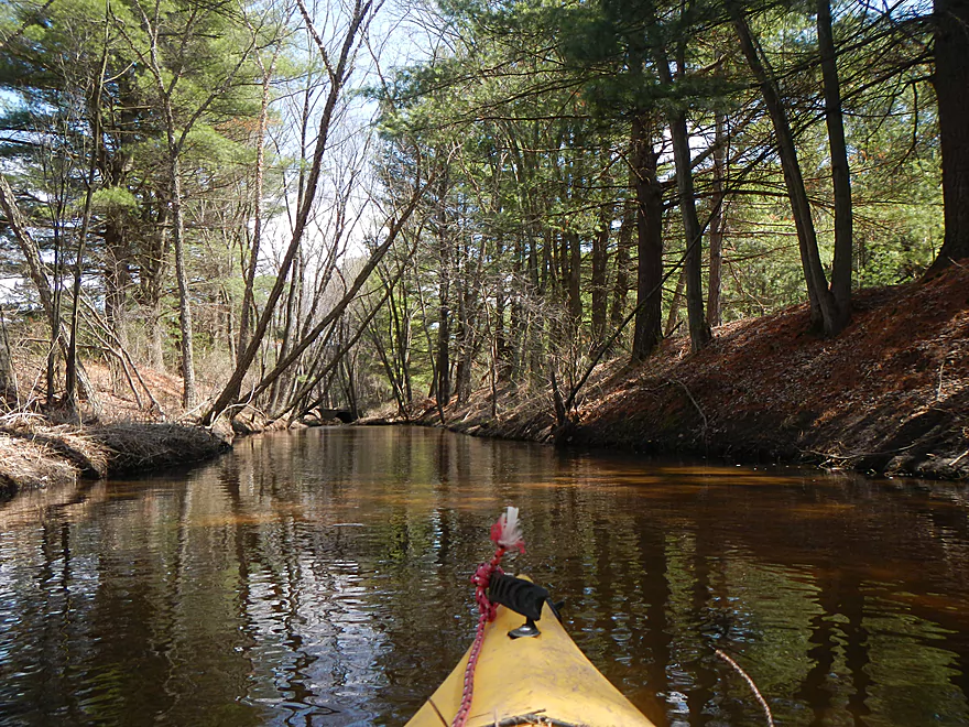
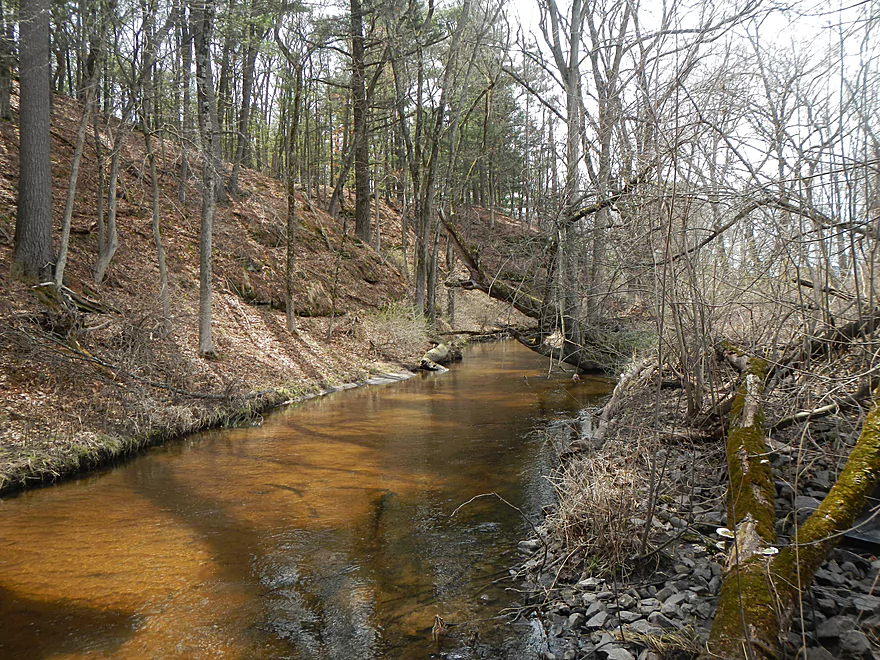
Putting in, you’ll start with a pleasant grassy area with plenty of clear water to paddle in. I was a tad worried about depth, but for the most part (minus a couple of tight areas) this wasn’t a huge deal. You definitely want to go during high water though. Right away, you’ll see nice rock outcroppings on the south bank. You’ll also encounter a number of logjams–maybe 3-4 in this stretch. They’re not too bad to portage because the trees don’t get too big in the sandy soil and the banks are pretty shallow. There are numerous “squeakers” which you can get through but require a little maneuvering and getting poked (ended up with lots of scrapes). I brought my handsaw and cut through a decent number of tangles, which should help future paddlers. Many of the smallish snags are filled with debris that rains down on you and your kayak when you go through. I don’t want to discourage paddlers too much, though, as this is a cool creek. But, you should come mentally prepared to deal with the jams, getting dirty, and using only a smallish kayak (my 10.5′ kayak was perfect).
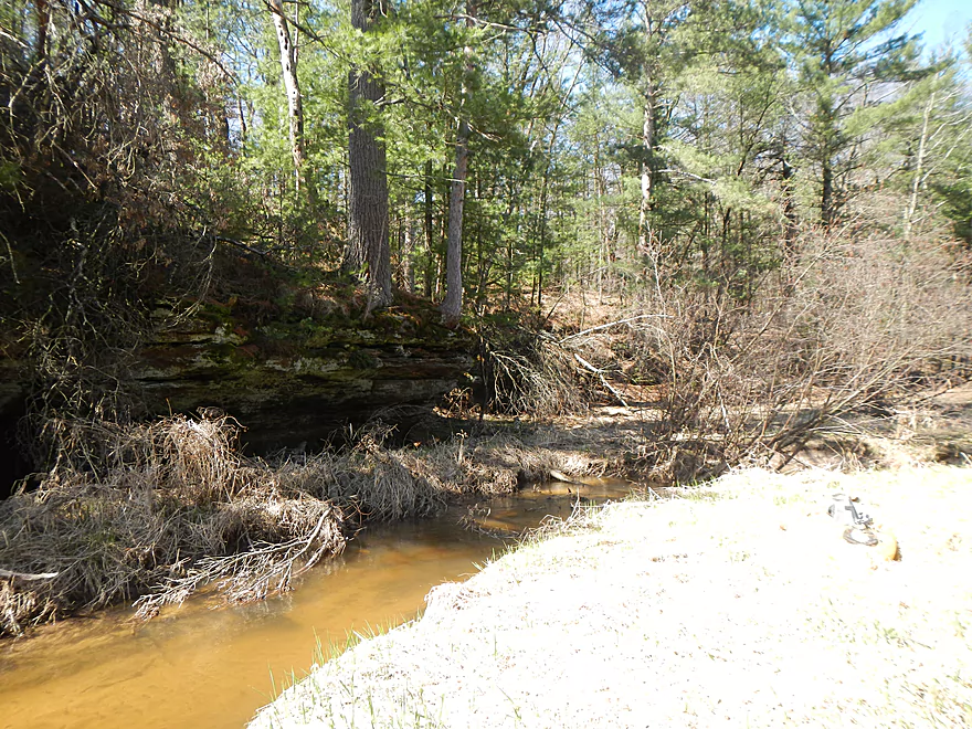
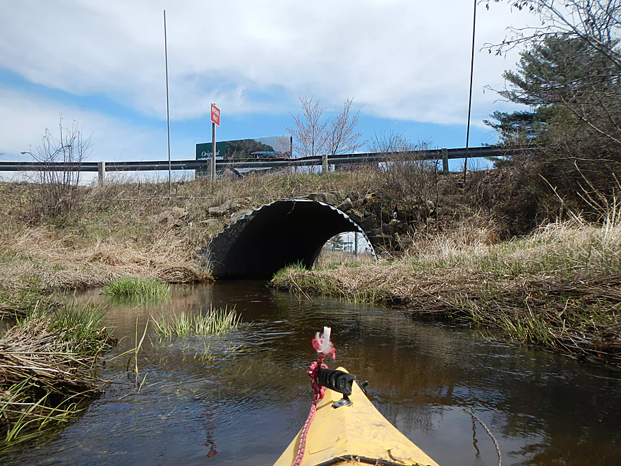
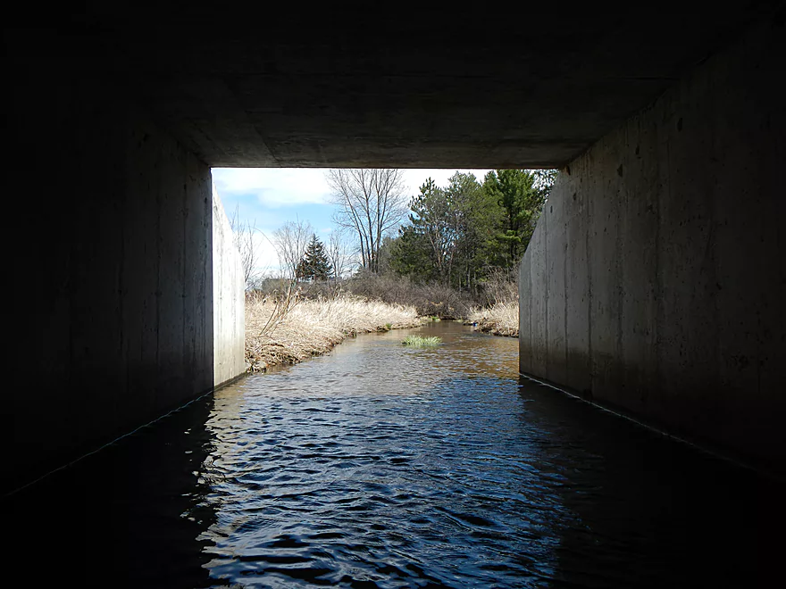
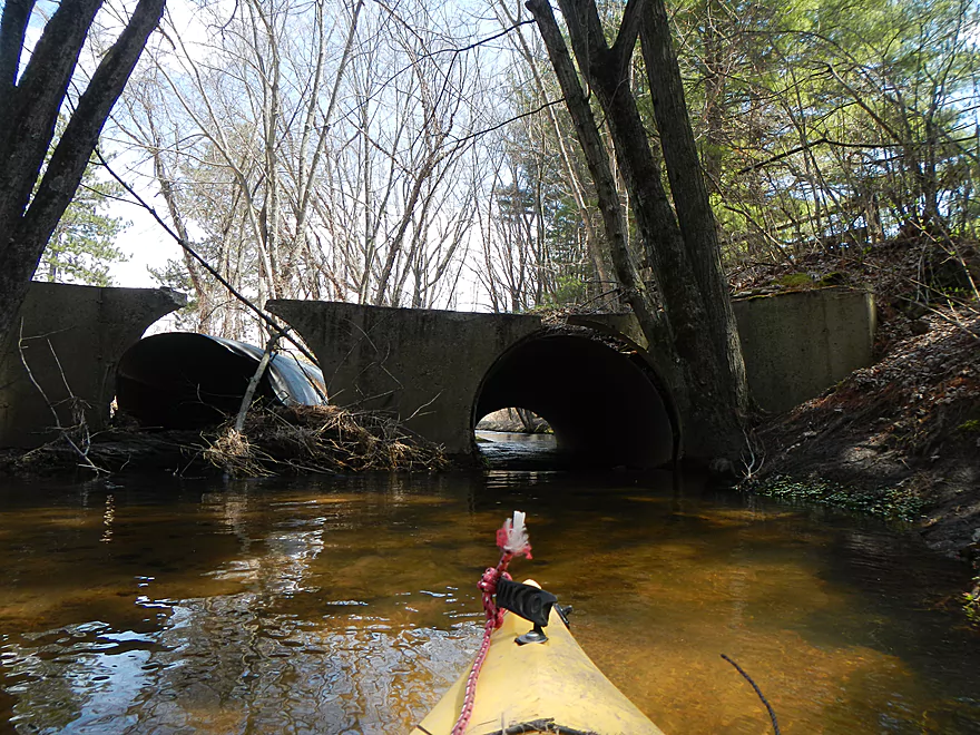
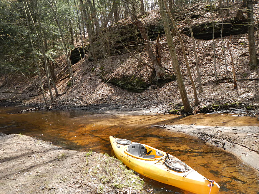
Maybe after about 4000′, you’ll encounter a nice snowmobile bridge, a riffly section, and an imposing hillside with twin tunnels leading underneath. The imposing hillside is actually one of the I-90 ramps. Don’t try the left tunnel, as that is silted in. Initially, from my scouting, I was worried that I would not fit under this and the other tunnels I knew I would encounter. Thankfully, I fit under all of these with ease and this was never an issue. The area by the interstate is actually quite nice (despite the constant noise and oblivious drivers whizzing by). On the south bank, you’ll witness more cool rock formations, but you’ll also get your fill of logjams. In fact, the logjams between the two I-90 ramp tunnels is so bad, I suggest portaging the entire 1200′ section on foot–which isn’t as bad as it sounds, as this is a flat grassy area (at least on the north bank). Just bring a towing rope and amphibious shoes and you’ll be fine.
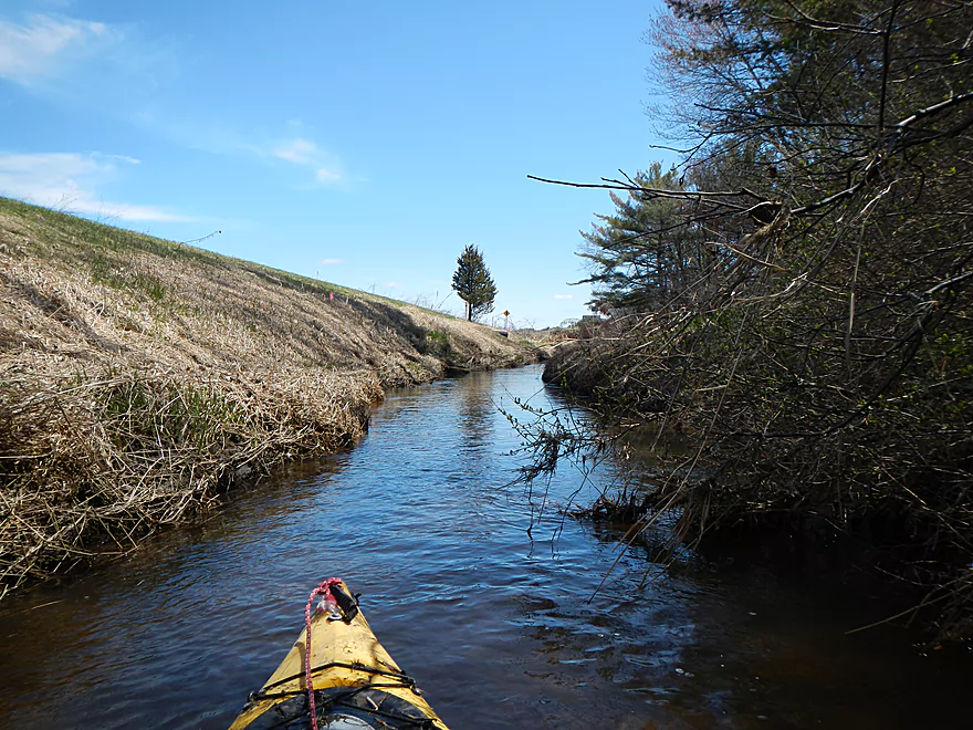
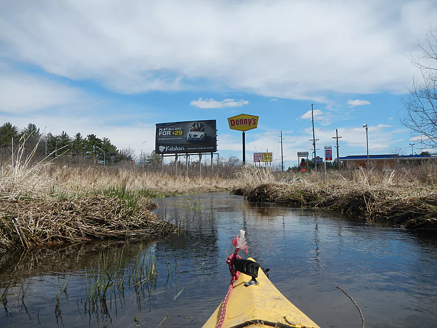
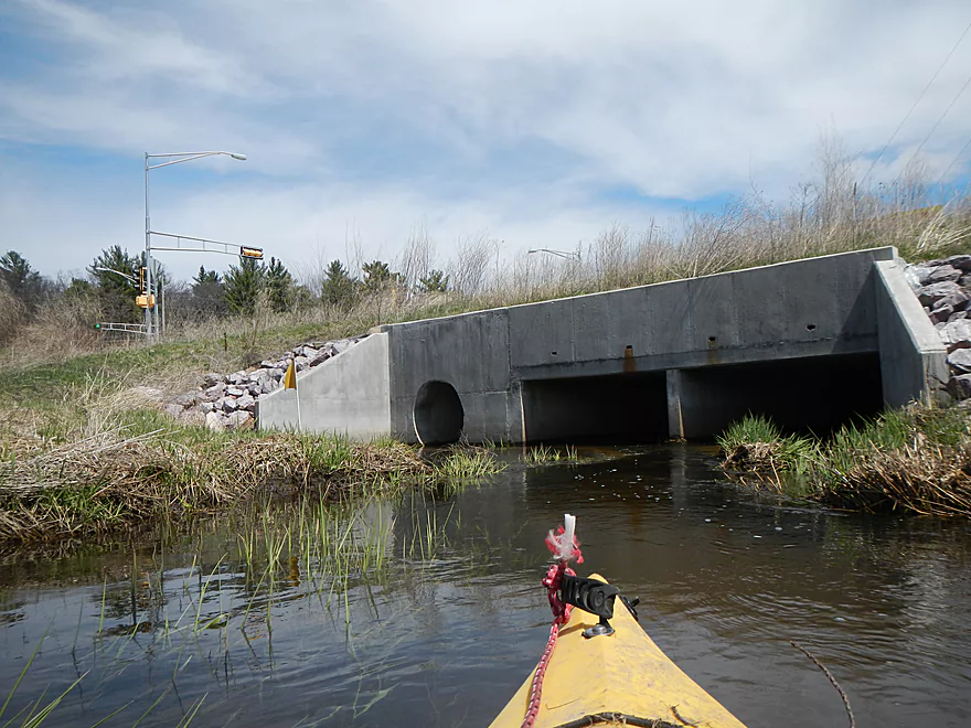
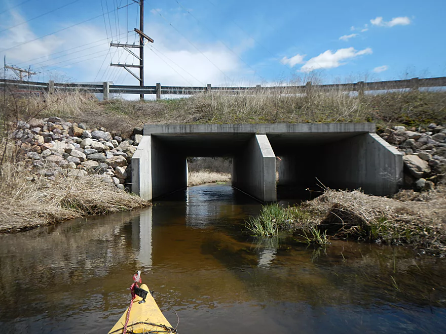
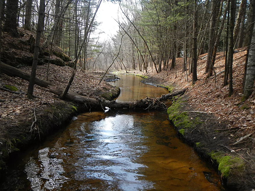
After the next I-90 tunnel you go through, you’ll enter a nice wooded section that I think had only one logjam necessitating portage. This will clear up into an open area and you’ll find yourself alongside busy Hwy. 13, funnelling people into the Dells from the interstate. This is a very developed section, with businesses on your right, power lines crackling above, and cars whizzing by to your left…but it is free of logjams and has some more cool bridge/tunnels to go under. I think I thoroughly confused some of the drivers who saw me paddling down the creek.
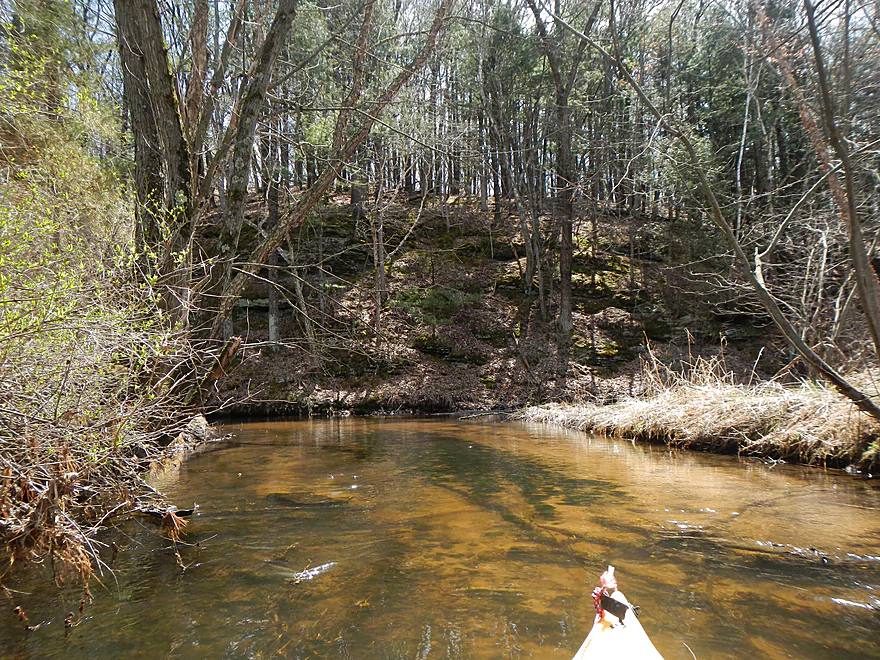
After the Trout Road bridge, Hulbert Creek takes on a very “up north” feel to it. The pines start to push out the hardwoods, the banks are filled with attractive needle carpets, civilization starts to fade away, and the water is very clear, running over the sandy substrate. You’ll also see evidence of the former “Fort Dells,” which was a mammoth enterprise…think Disney World’s Frontierland meets Old World Wisconsin. As you paddle through this area, you’ll see the decaying remnants of this former business: the old mini-railroad lines, a roundhouse, bridges, and an outdoor kiln. They used to do mock gunfights, “cowboy/Indian” stuff, train tours, and more. They also had a tower that supposedly would let you see all the way to Reedsburg (that’s impressive). They actually dammed Hulburt Creek and would run mini-steamboat rides over the resulting flowage. The dam is, of course, no more, but google still incorrectly shows the dammed canal and an island that is also gone. The local bluffs were part of the attraction and the outlaw “Black Bart” would hide his loot in one of the nearby sandstone caves. Eventually though, Fort Dells went belly up. A good portion of what was left was developed into a strip mall. They’ve tried re-developing the rest of the area, but nothing has really stuck so far. If you would like to see pictures of the old Fort Dells/Hulburt Creek, check out:
- http://www.vintagewisconsindells.com/attractions.htm
- https://www.facebook.com/FortDellsWisconsin
- https://www.facebook.com/media/set/?set=a.345258858830161.79464.192768004079248&type=1
- https://www.facebook.com/FortDellsWisconsin/
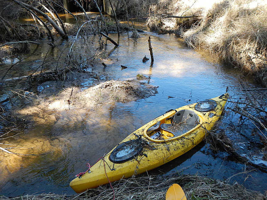
Getting back to the creek proper, this final half mile or so was my favorite section of the trip because of the bluffs, occasional riffles, and attractive pine banks. You’ll soon encounter a south branch of Hulburt Creek, which is much smaller than the main north branch. It is also much shallower, but is worth wading up just to check out the rock formations and terrain on this section. You can’t get too far upstream on the south branch, though, due to low water levels and logjams. If you go far enough upstream, you’ll encounter Beaver Springs Fishing Park where, I believe, the creek is partly dammed to create fishing ponds. Going upstream of that, the south branch has headwaters by the old “Family Land” attraction (now Mt. Olympus), but that, of course, is much too shallow to paddle.
Getting back to the main branch of Hulburt Creek, you’ll encounter many more nice rock formations, in addition to stonework done on the creek banks from the old Fort Dells days. The second of the three Fort Dells bridges is one to be mindful of. The bridge is extremely low (even by my standards), there is a logjam in the middle, and a decent ledge to complicate matters. A portage is in order and not a bad idea anyways, as there is a tough “ducker” after that. I think this was the only portage in the last mile of the creek.
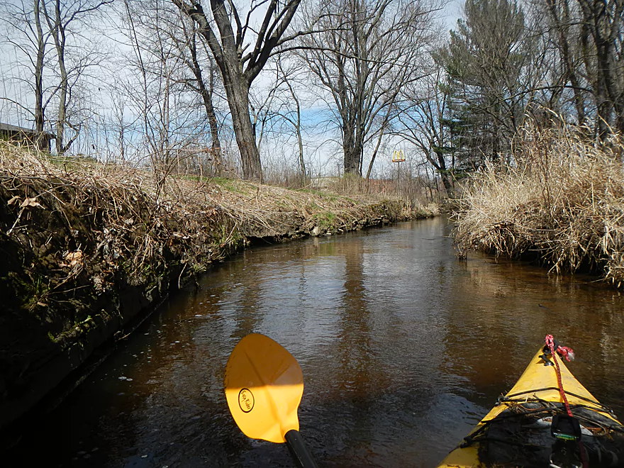
As you paddle near the end, you’ll see the Golden Arches…this will be your take-out, on the left bank (just before Hwy. 12). The take-out area is easy, but you have to drag your kayak a bit up a hill and around a fence to reach the McDonald’s parking lot. There is a nice bike rack here if you prefer to bike shuttle after the trip instead of before. Why take out here? There aren’t that many options… There is a culvert that runs under Hwy. 12 to the proper mouth at the Wisconsin (by the dam) and a nice launch area on the Wisconsin River (the main launch area for the lower Dells, really). But the culvert is not trustworthy. It’s pitch black (bad sign) and makes a lot of noise from the running water, so I suspect a significant drop at the end, which could be deadly. During lower water, the Wisconsin River doesn’t backfill Hulburt Creek, so the culvert actually comes out as a bit of a drop which would be another reason to avoid this last tunnel.
All in all, a very nice creek that reminds me of another obscure Dells prospect, Spring Brook. I can’t give it more than 3 stars. though. because it is so short, has so many logjams and requires high water to navigate.
If you are in the area, you might consider checking out Hulburt Creek State Natural Area. Basically, this is upstream of where I put in. Again, too shallow to paddle IMO, but supposedly there are nice valleys with rock outcroppings to hike in and interesting flora to check out. There are no trails though and access appears tricky (why I’ve never explored it). I suspect the Birchwood Road bridge might be your best bet to enter, but parking is tricky here. The Hulburt Creek State Natural Area is also home to 1000-year old Native American raised garden beds, making this a unique geological area and the oldest carbon dated ridge fields in the midwest.
Trip Map
Video
Photos Size: