
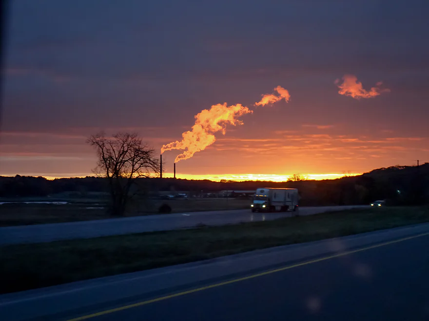
The drive south to Illinois
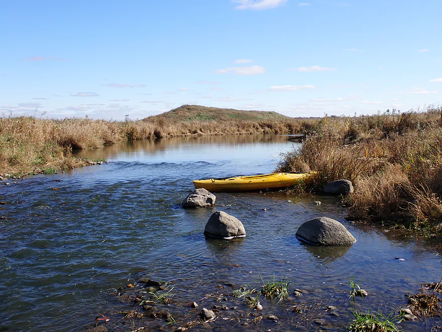
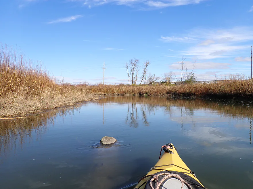
Keystone Landing
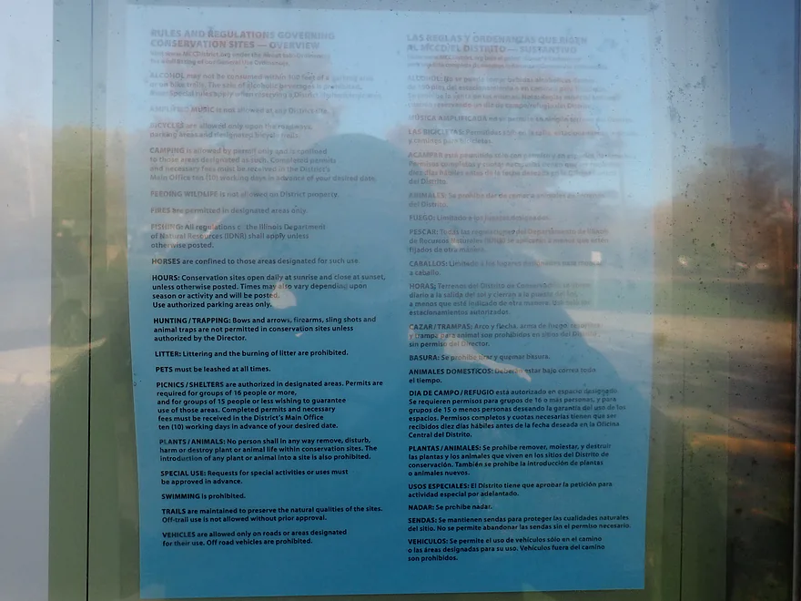
Glacial Park has a lot of rules (18!) to follow
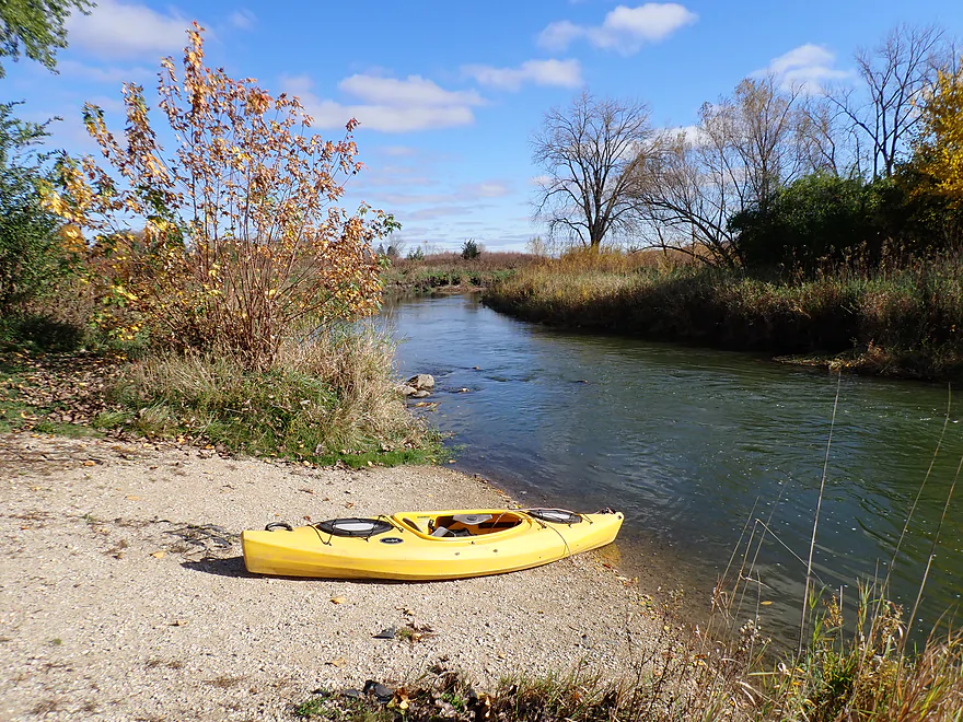
Otherwise a great put-in
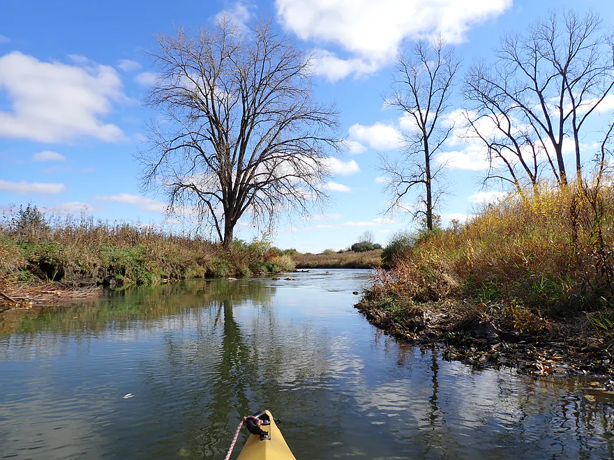
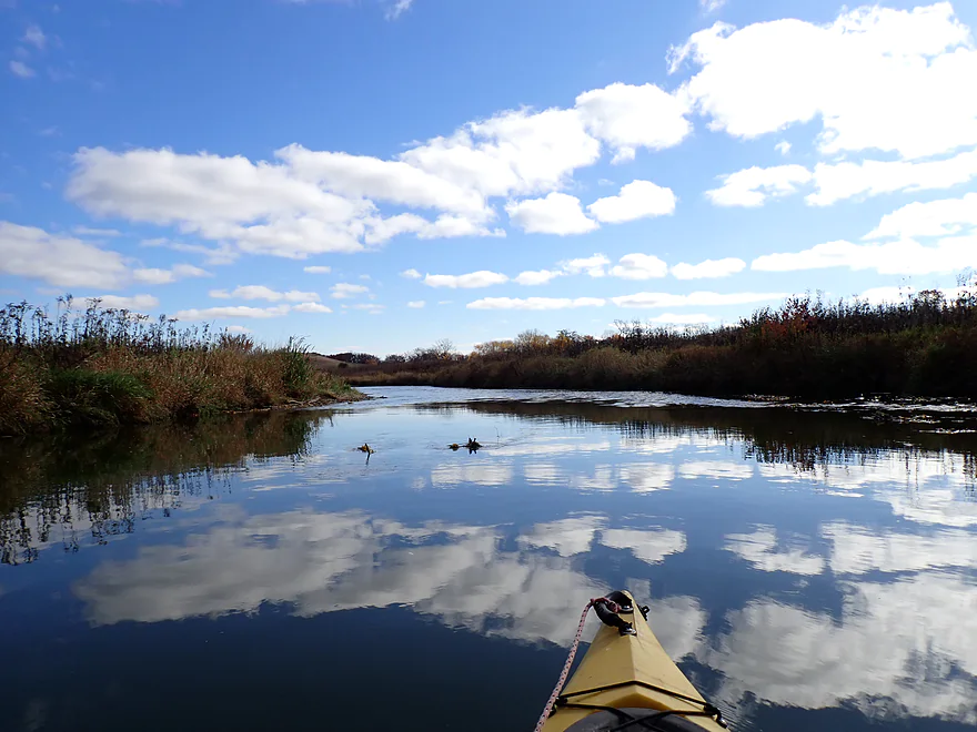
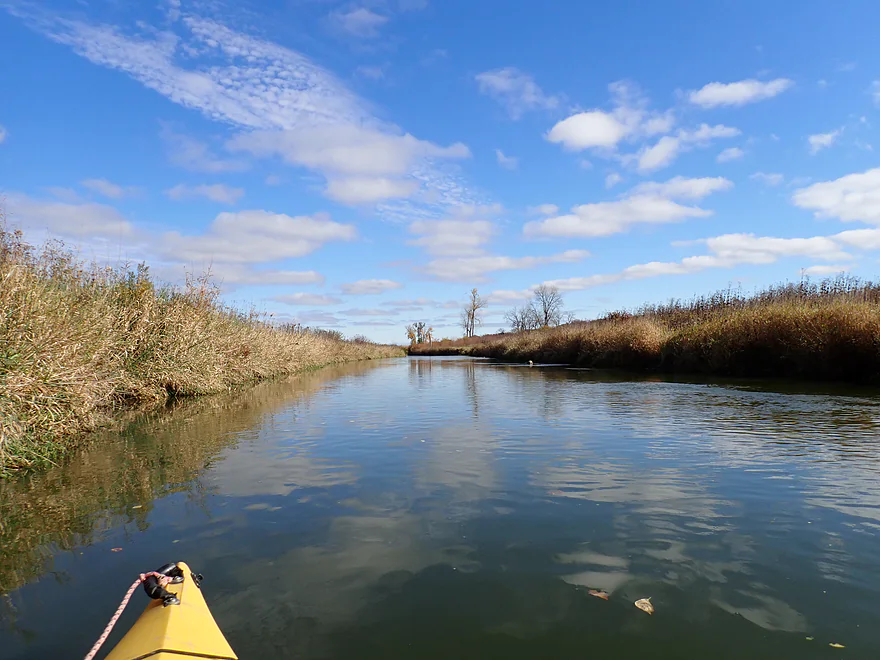
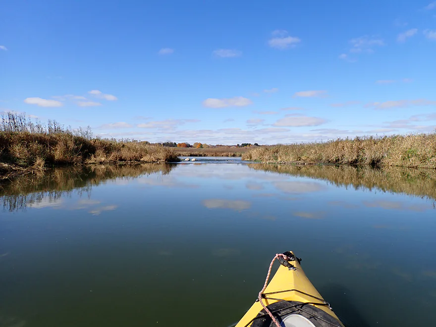
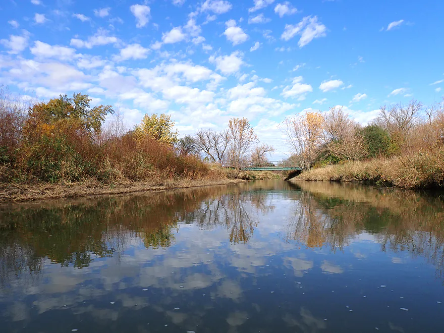
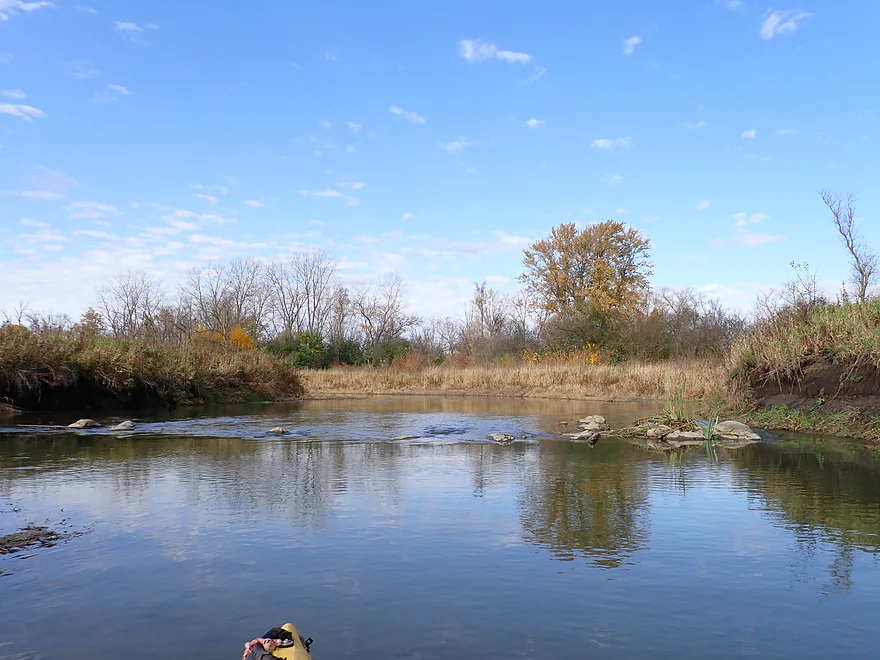
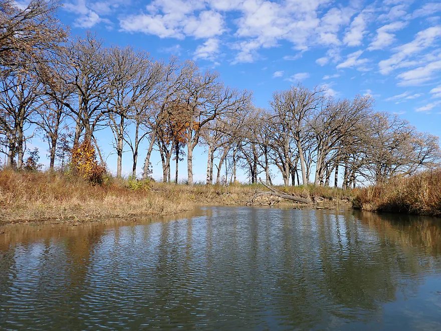
Water + no wind = great reflections
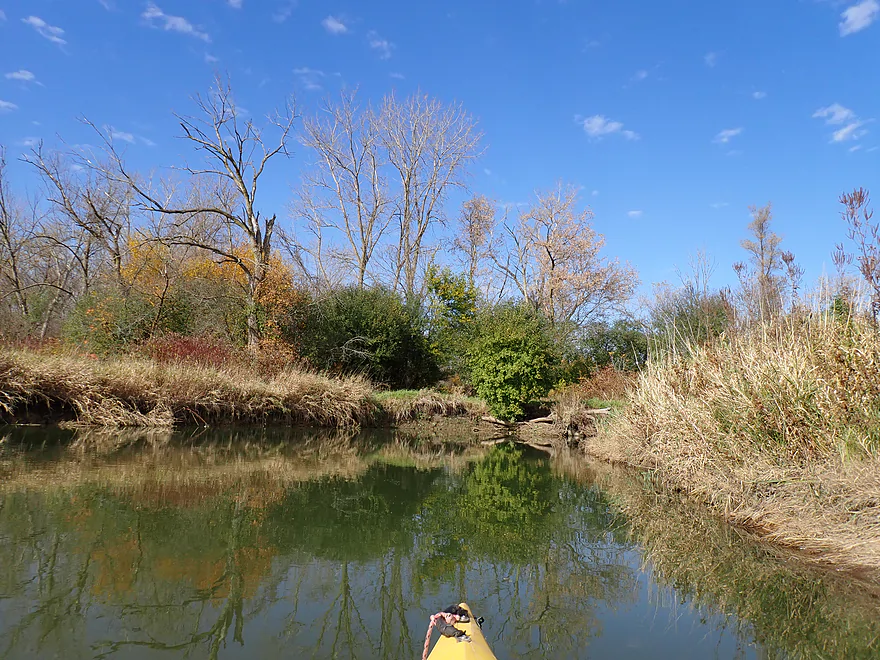
Parts of the creek were artificially straightened years ago
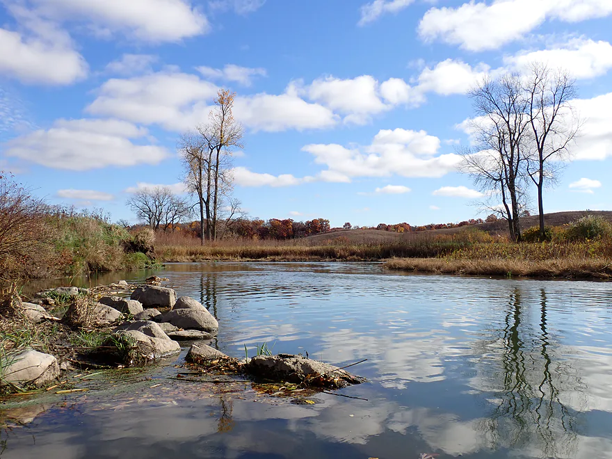
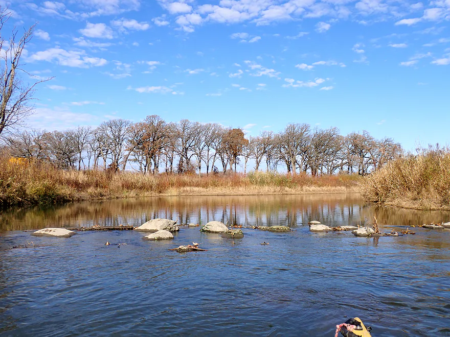
Glacially deposited rocks
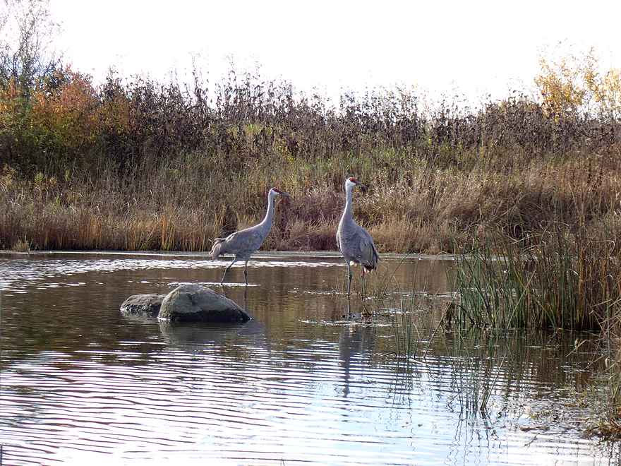
Very tame cranes…think farmers are less likely to shoot them in Illinois than Wisconsin
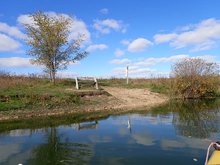
Nice bench…part of the local trail network
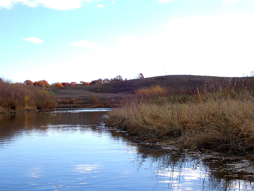
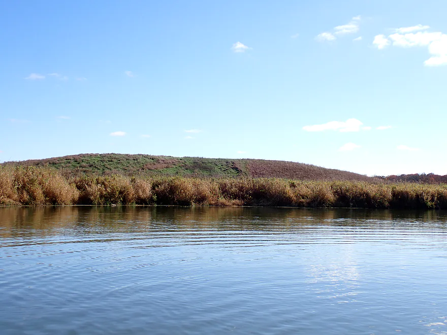
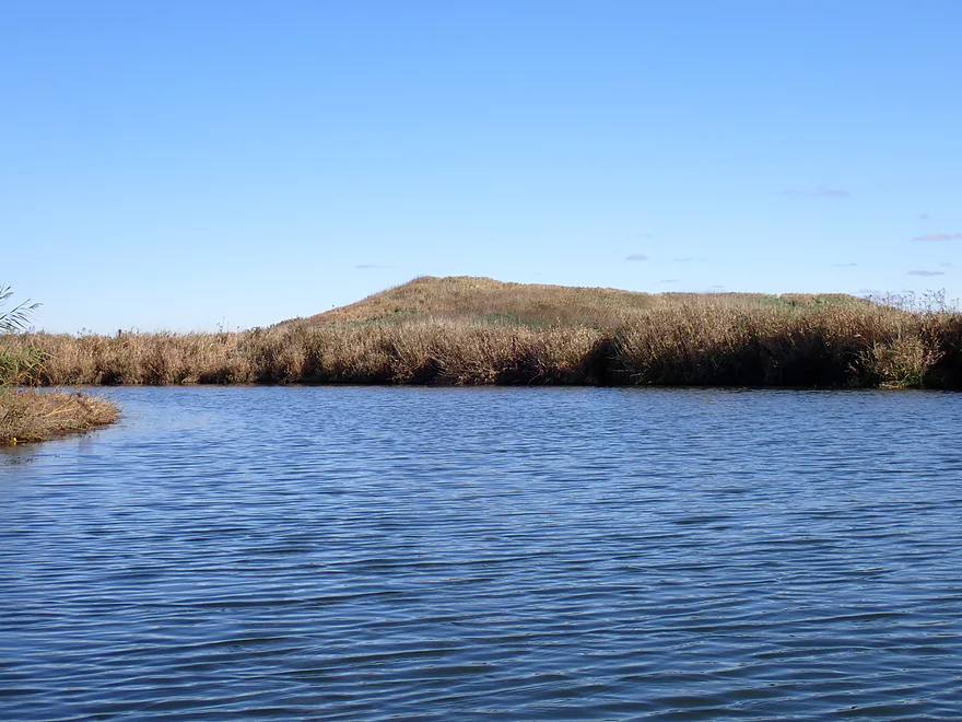
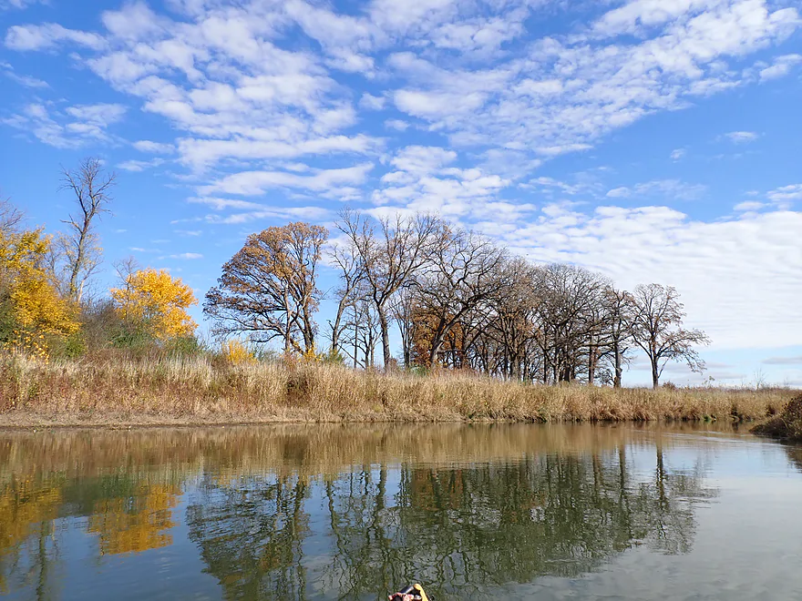
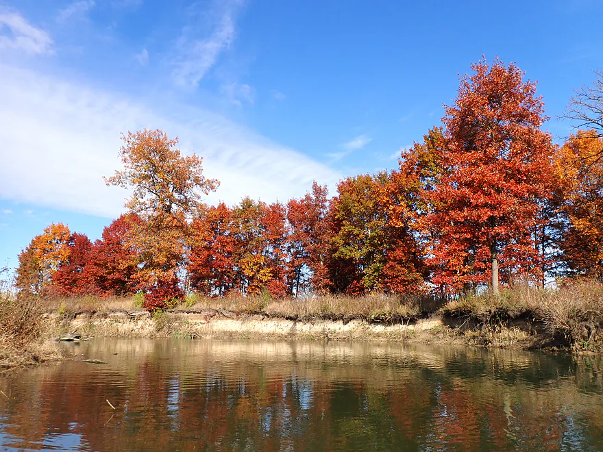
During the trip there were several great views of glacial kames
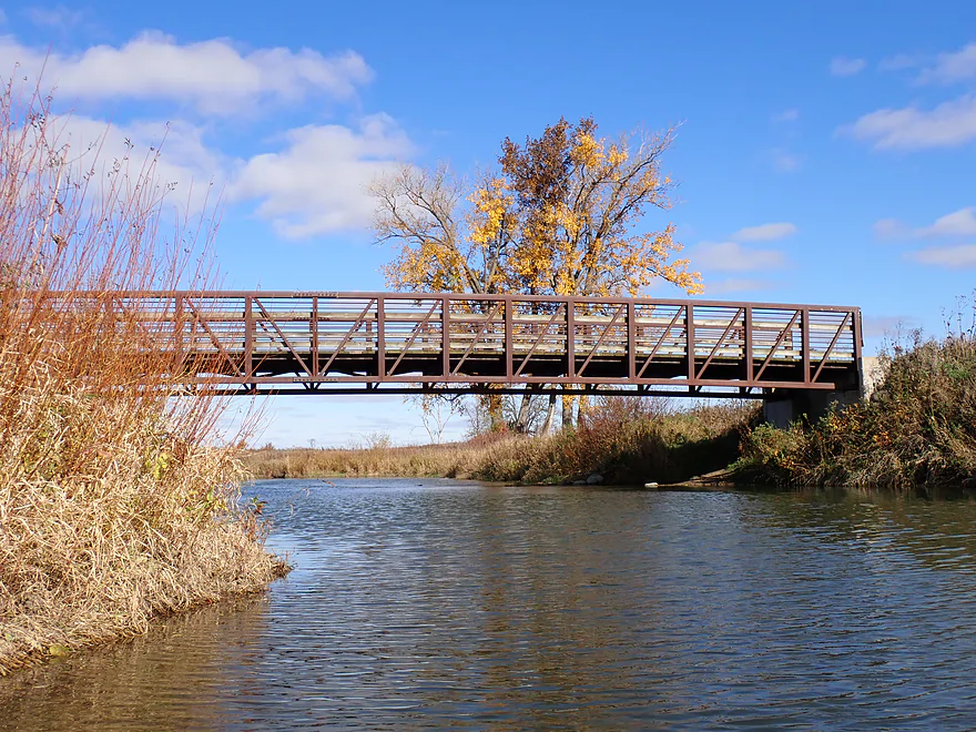
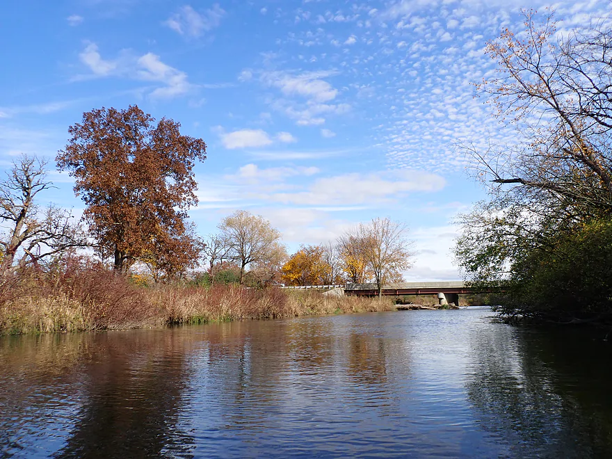
Scenic bridge from the “Deer Path” (part of Glacial Park)
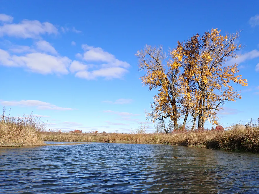
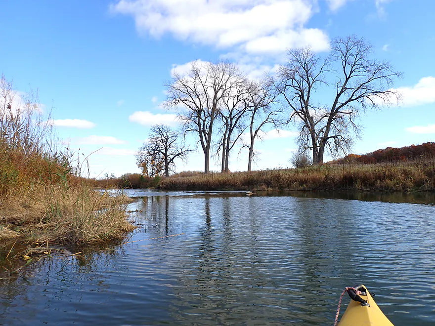
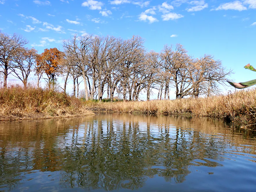
A group of cottonwood trees
Reverse view of bridge and Camelback Kame
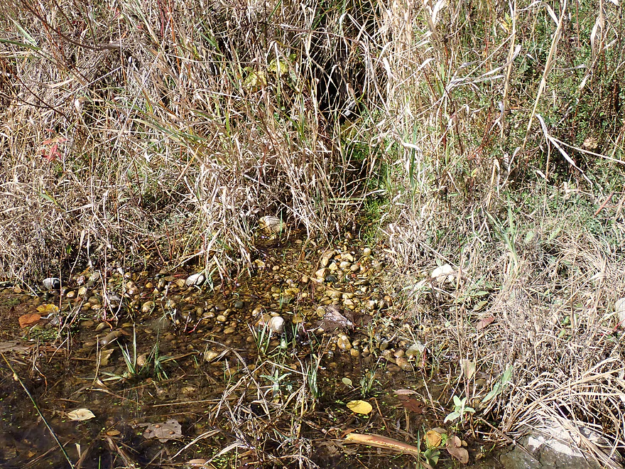
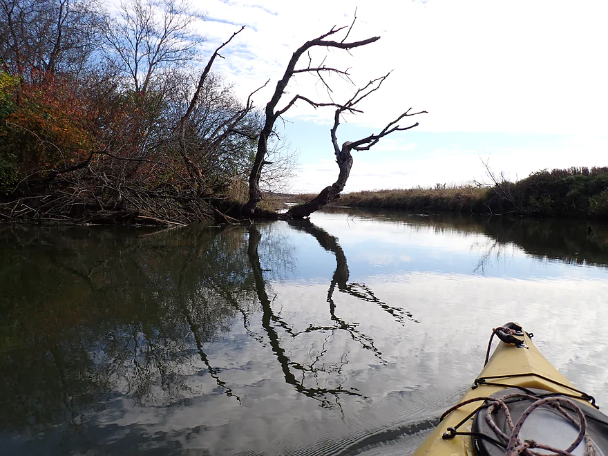
A small spring
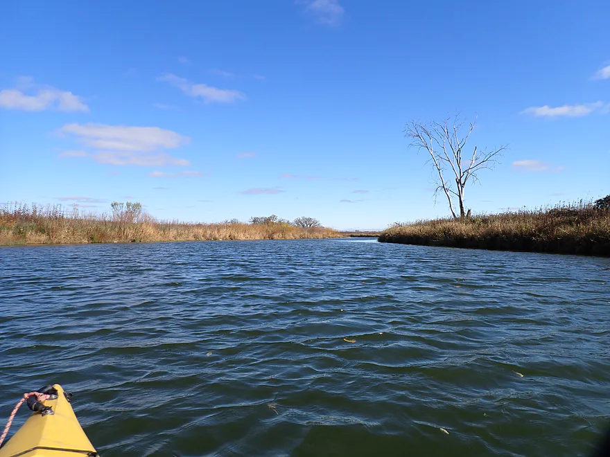
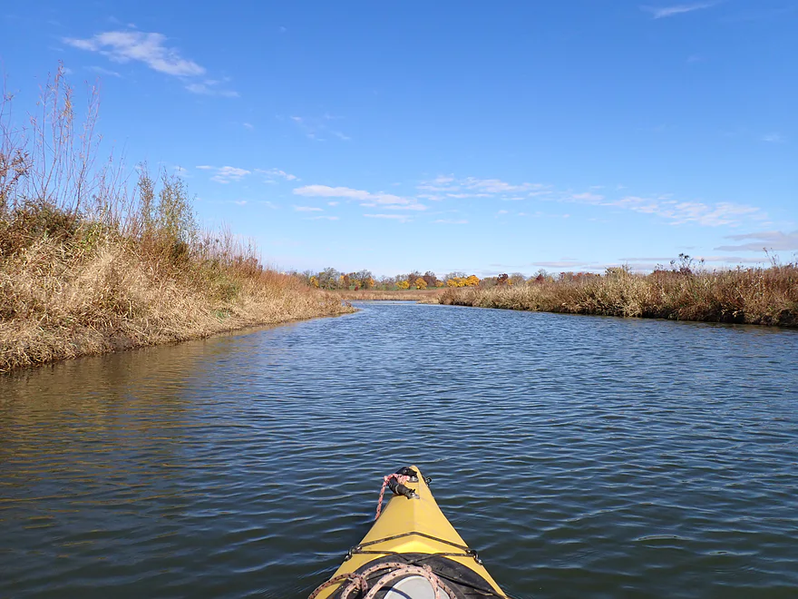
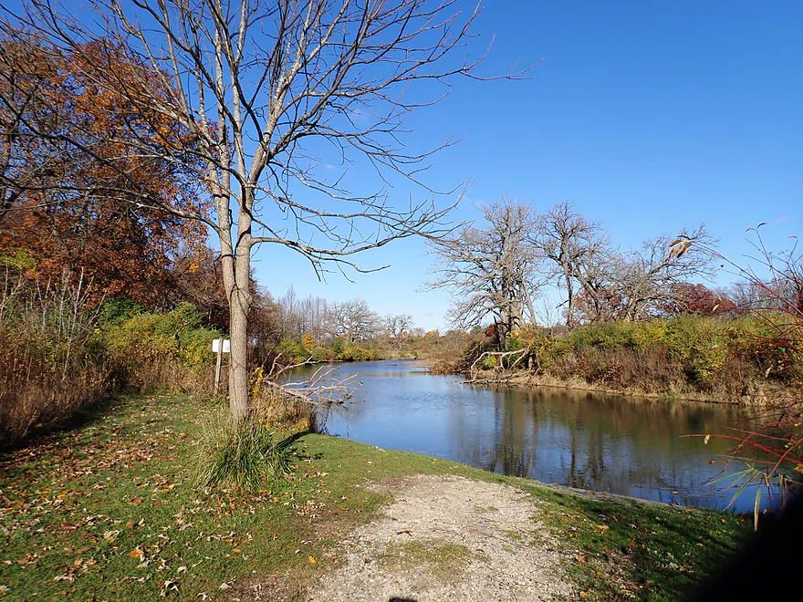
Widest and slowest part of the creek
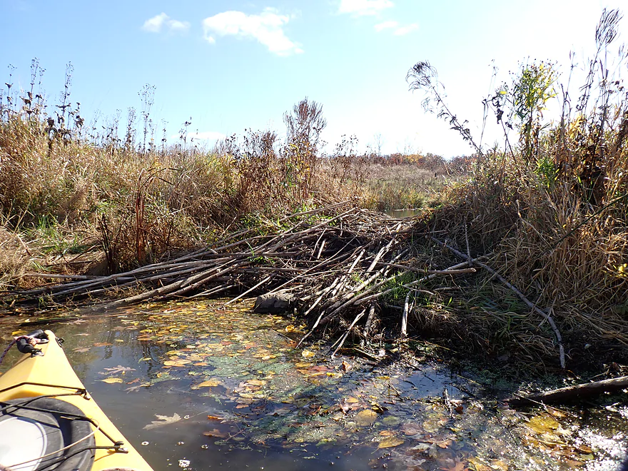
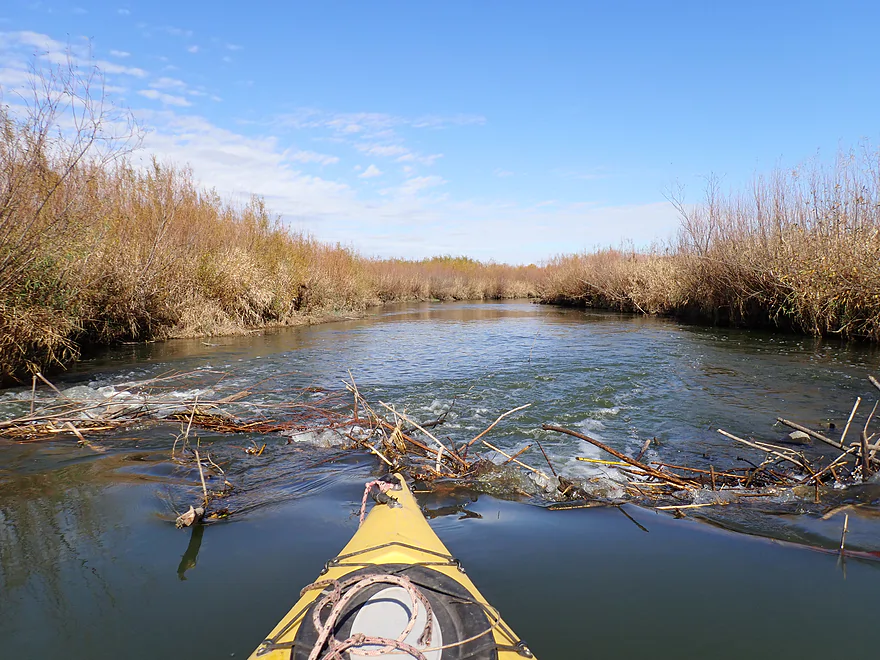
A beaver dam across the mouth of a small side creek
West end of Valley Road is closed to vehicle traffic (so not an access option)
Another great kame
Sometimes you could see hikers atop the hills
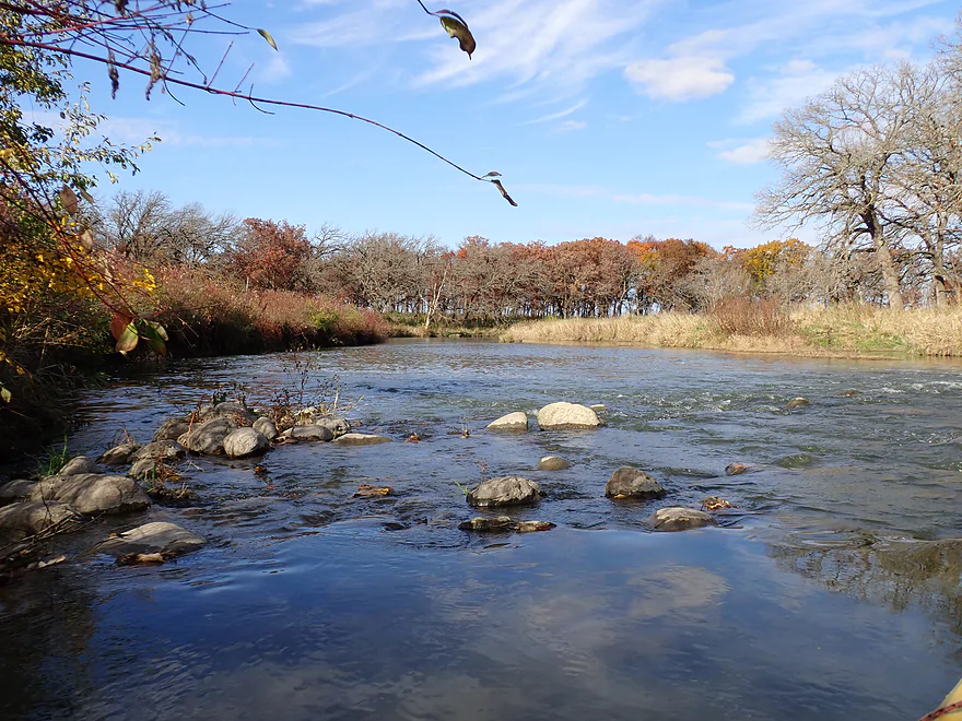
Nice rocky area
Reverse view
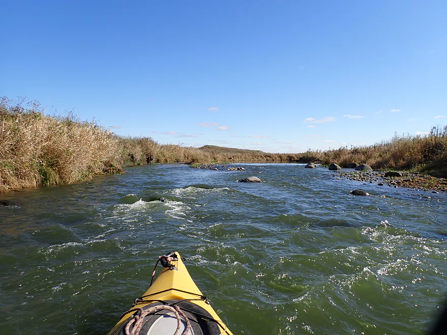
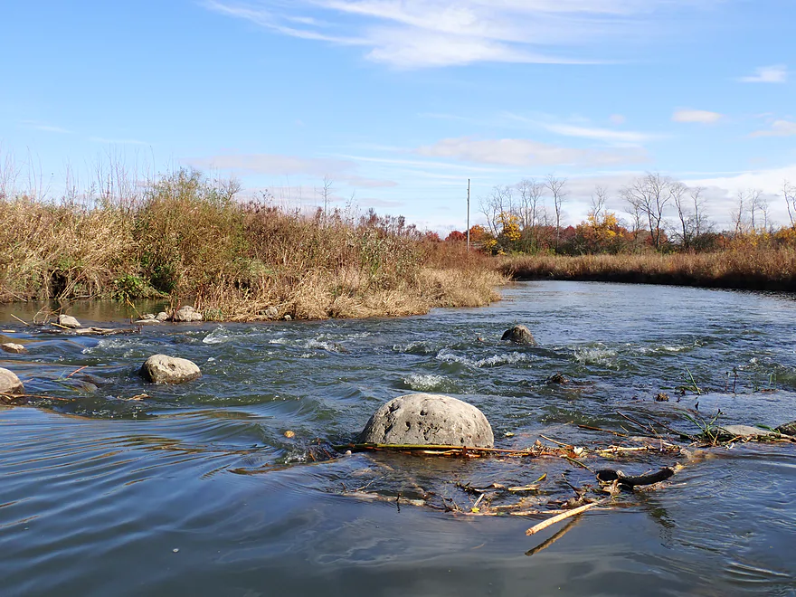
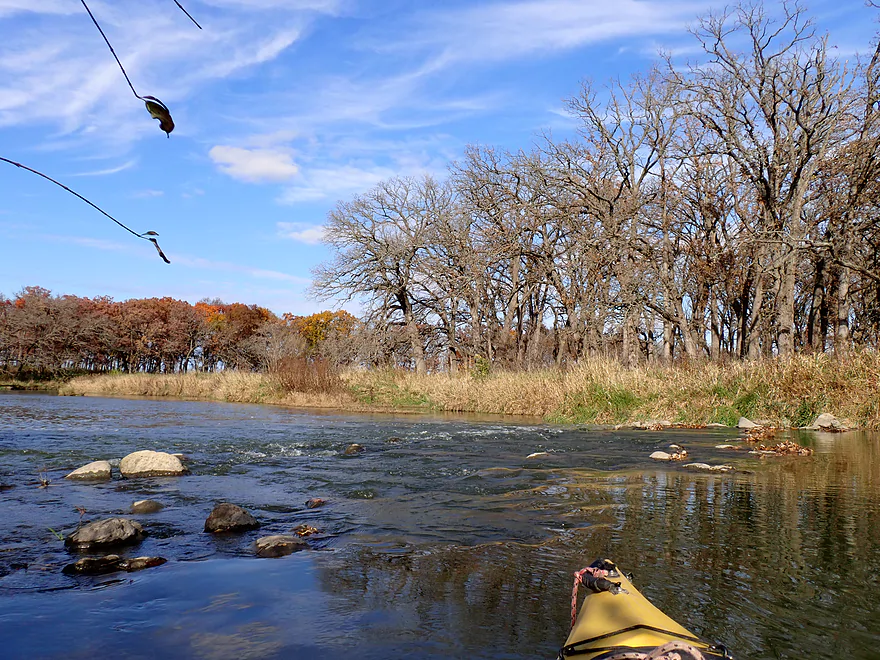
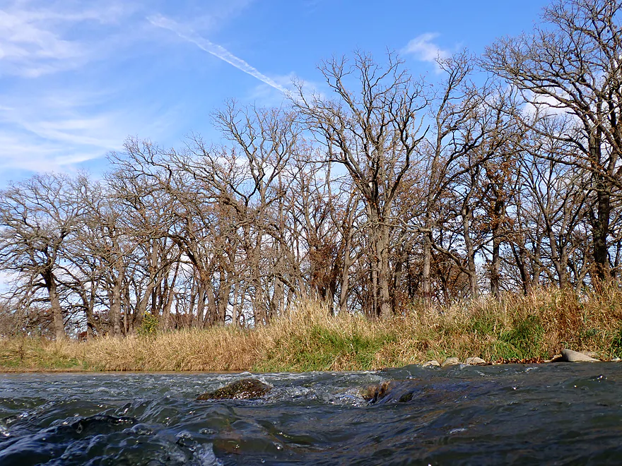
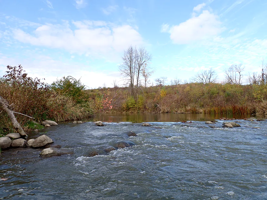
Fun rapids
Which are followed by another pitch
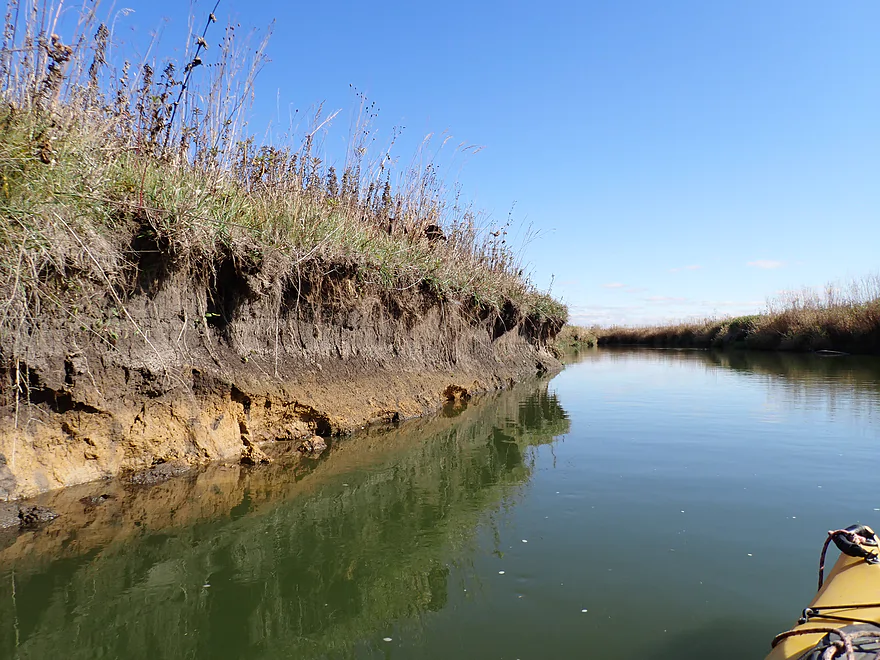
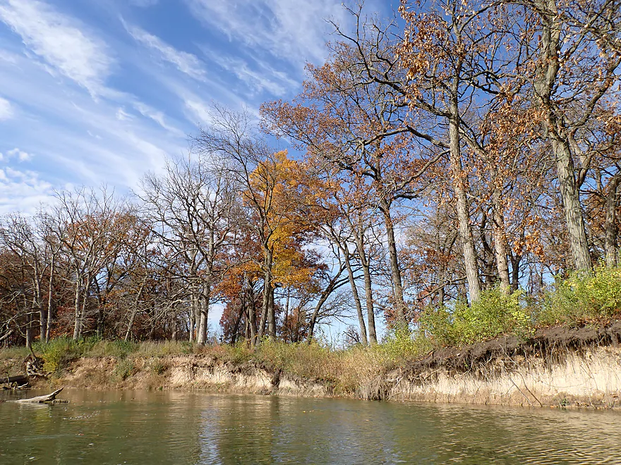
Some mud banks, but mostly fairly healthy shorelines
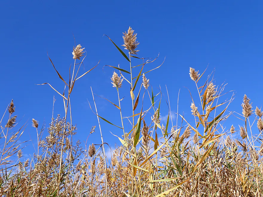
Phragmites (common reed)–an invasive wetland species
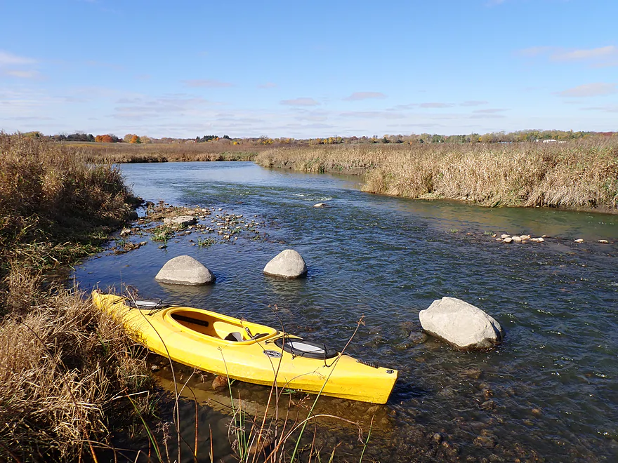
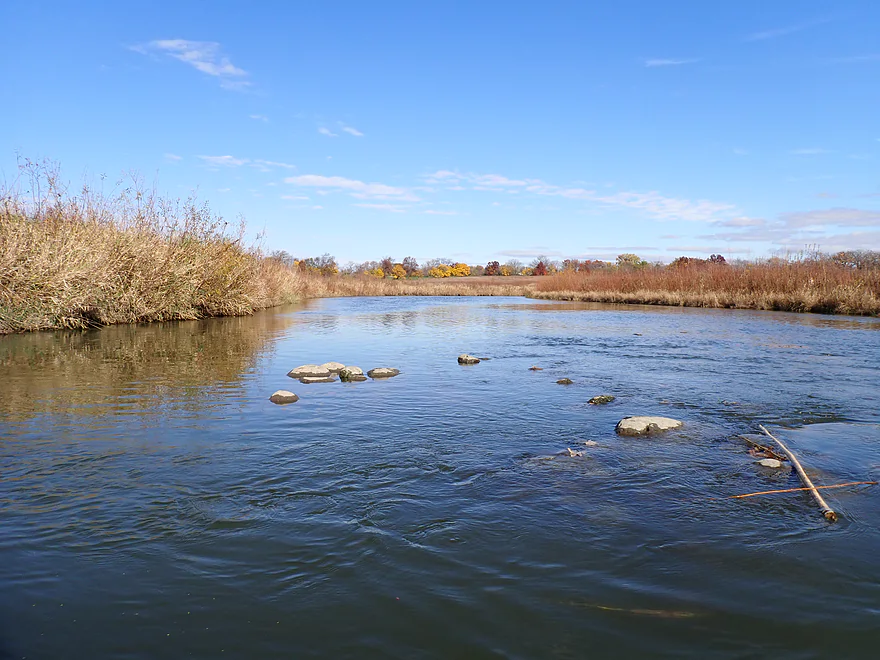
Surprisingly rocky creek
Hopping over a beaver dam
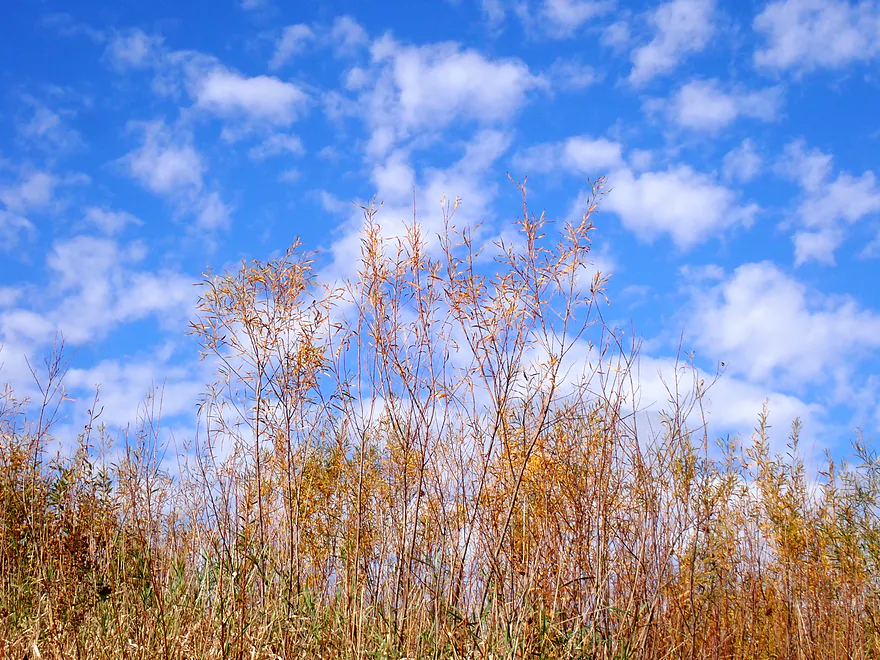
Sandbar willows against a cloud-dotted sky
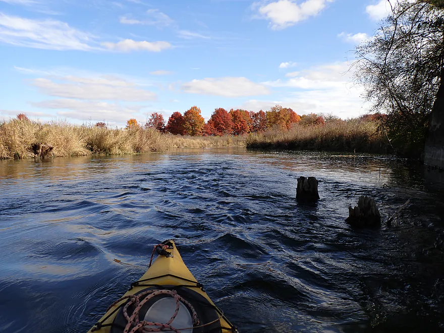
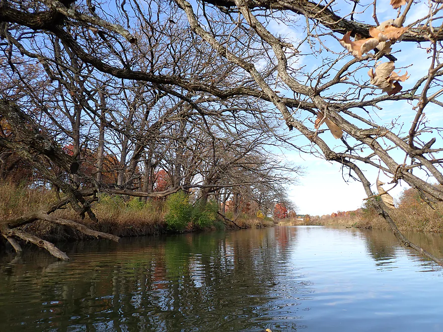
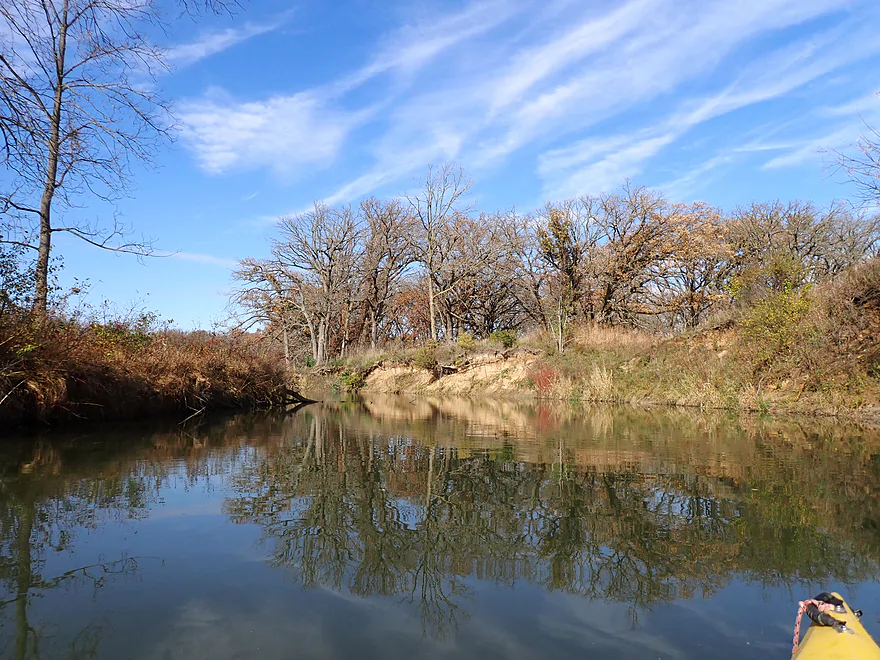
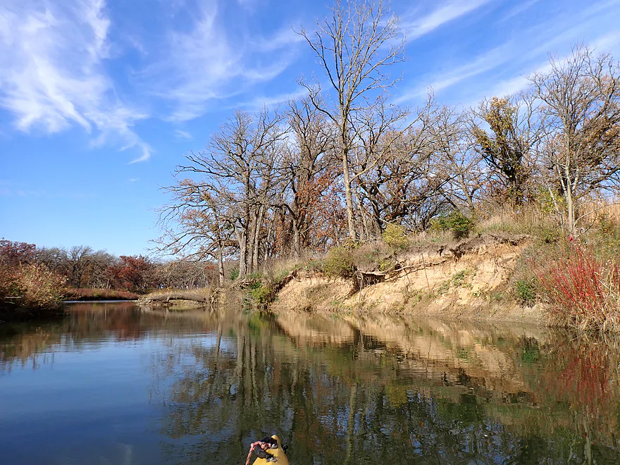
Entering a more wooded stretch of the creek
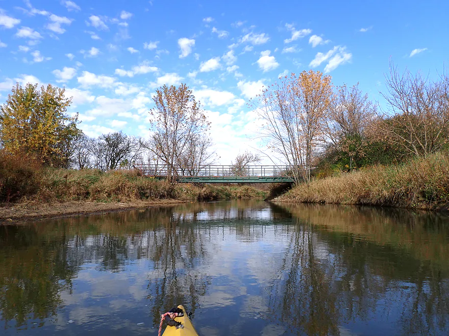
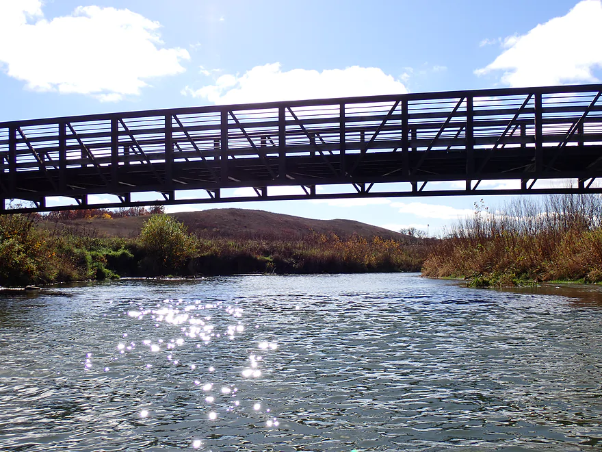
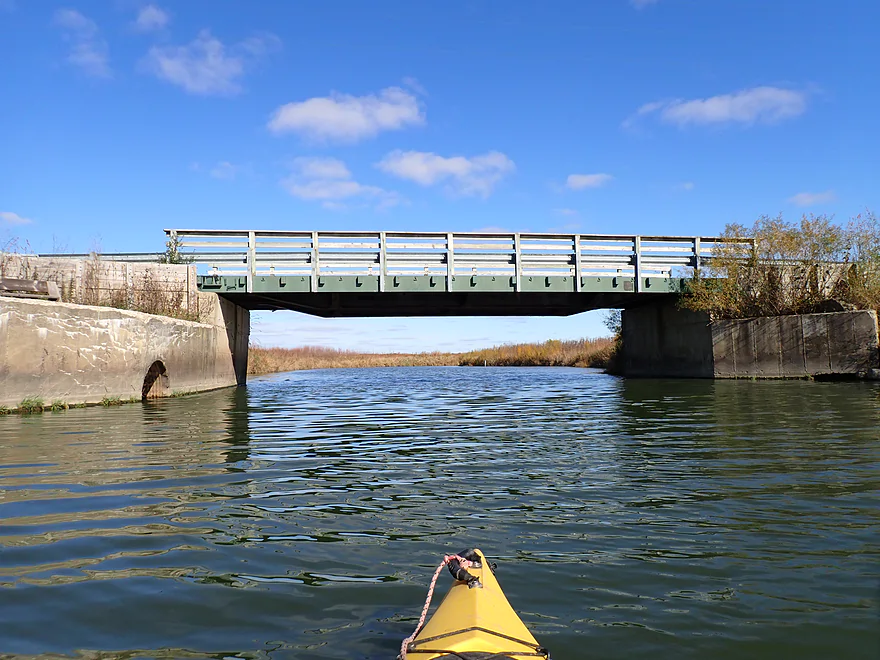
Local snowmobile bridge
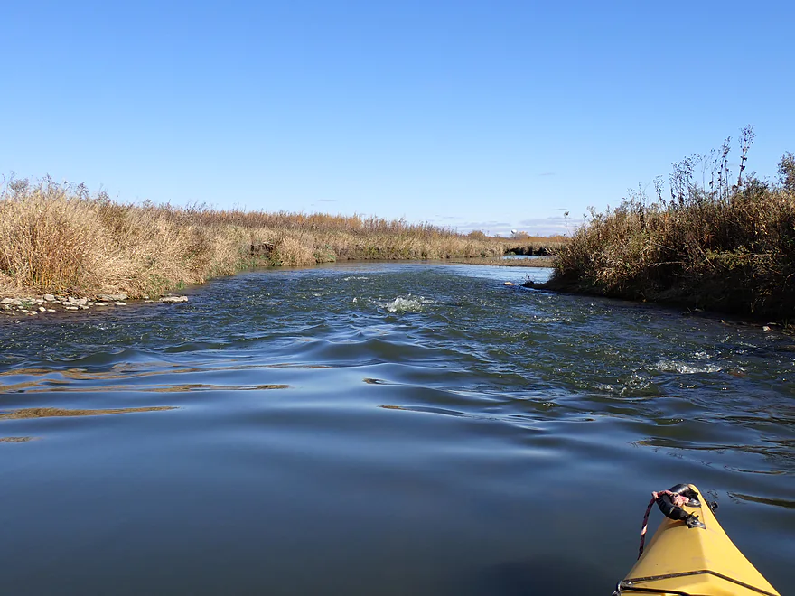
Creek starts to meander past the bridge
Some great cleanup work has been done on the creek
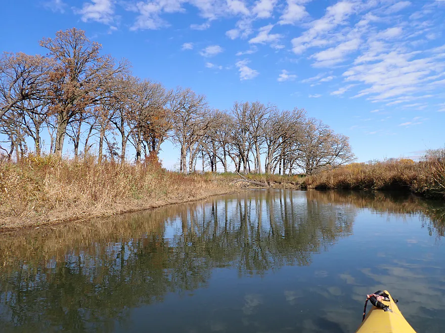
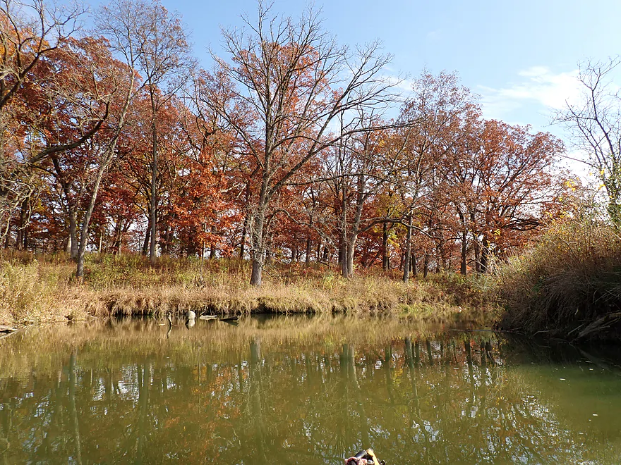
Second half of the trip had terrific oak groves
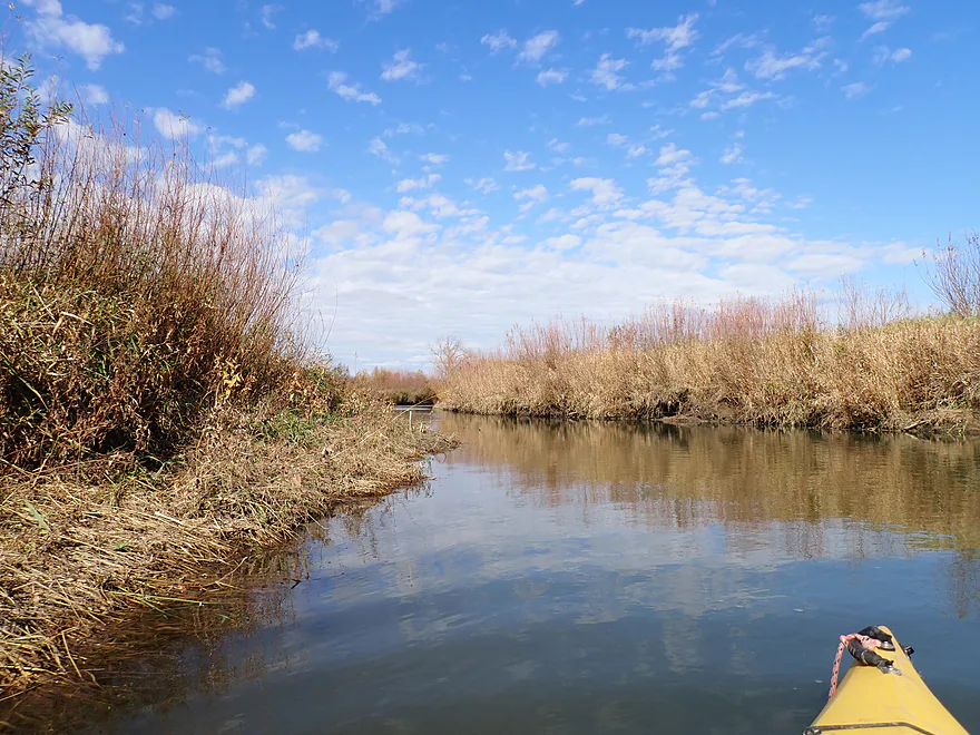
Clouds mark the edge of a cold front
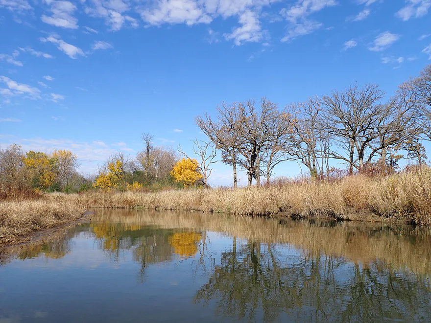
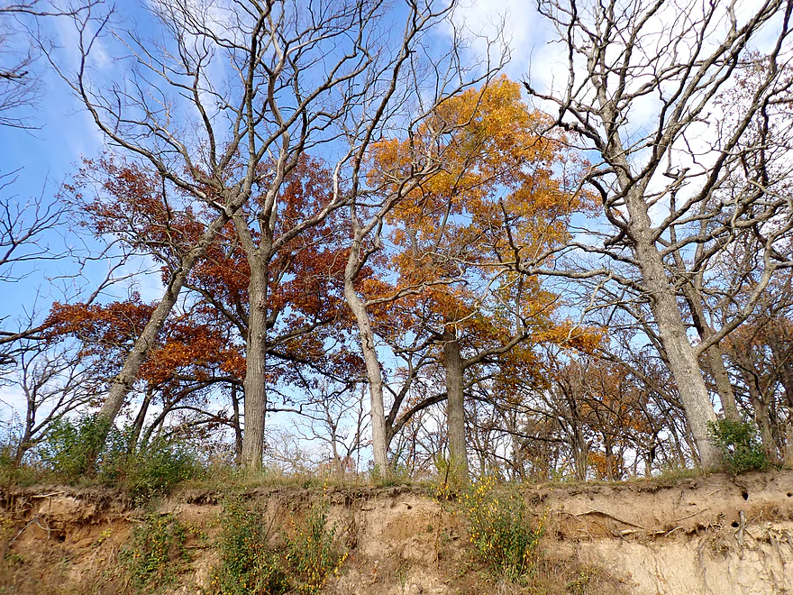
Oaks were the highlight of the trip
Another nice boulder garden
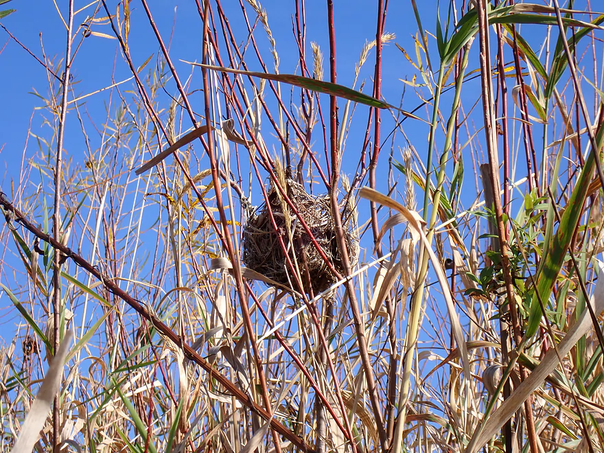
Bird nest situated in the grass
Some of the rapids were a bit shallow and bumpy
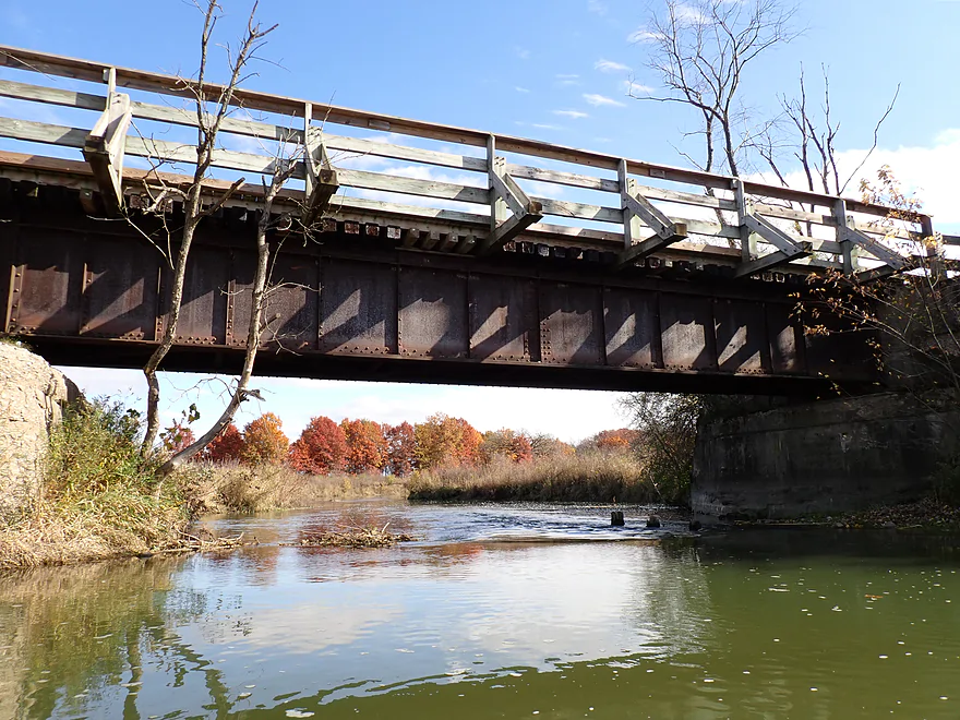
Old railroad bridge (now part of the Prairie Trail)
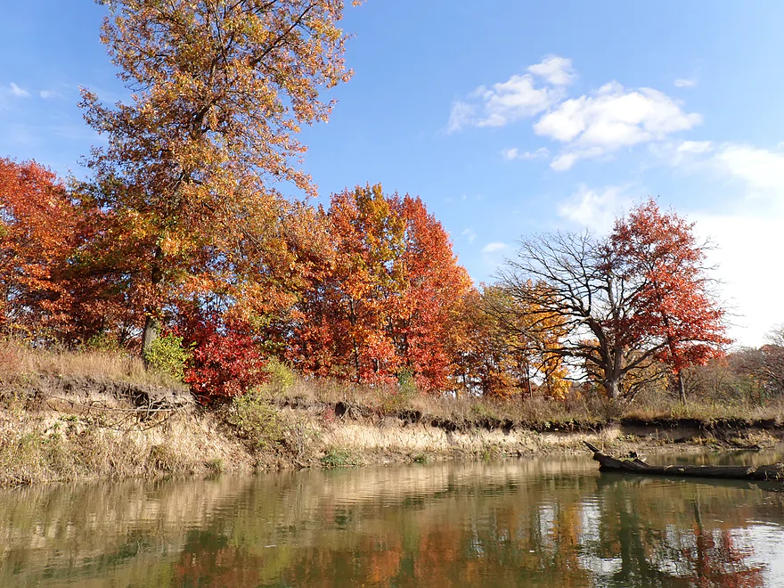
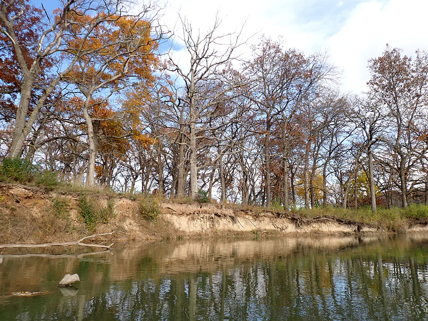
Sandy banks and bright red oaks
A line of oak trees that have already lost their leaves
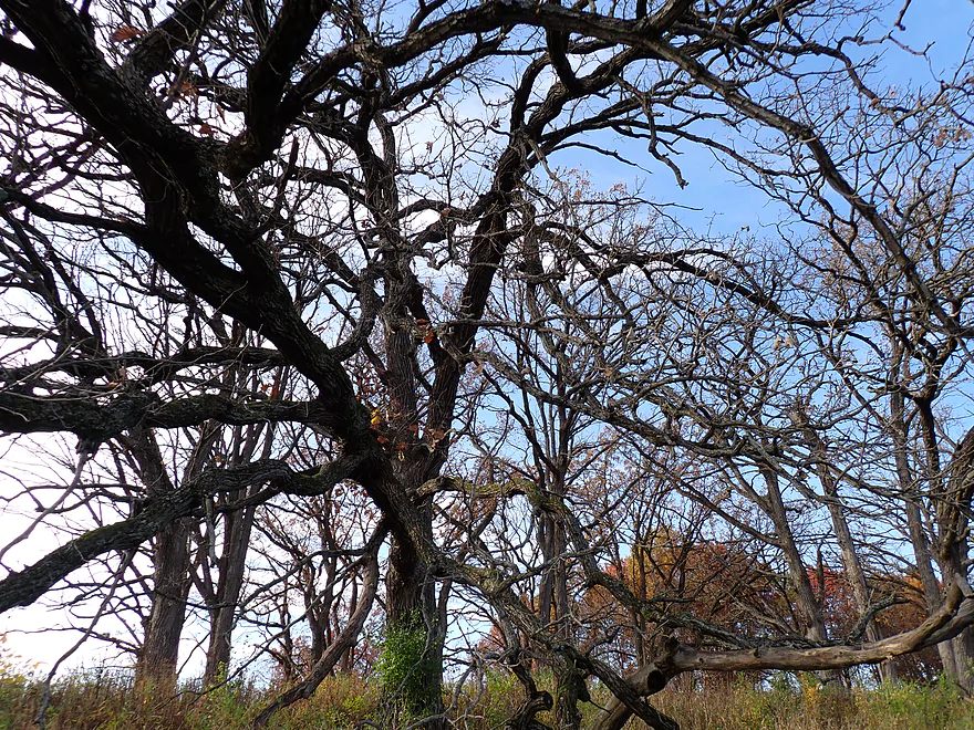
Oak branch maze
Hwy 31
More sandy banks
Another set of rocky riffles
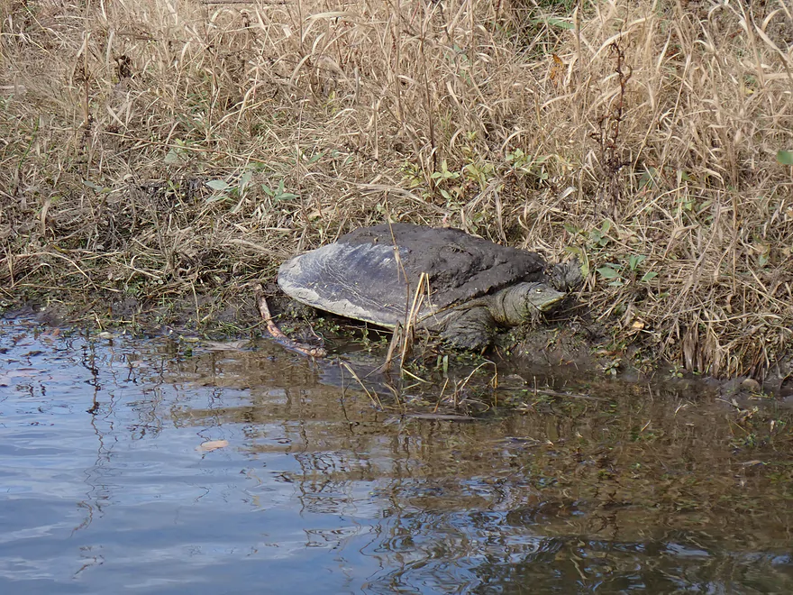
Tame softshell
Last riffles of the trip
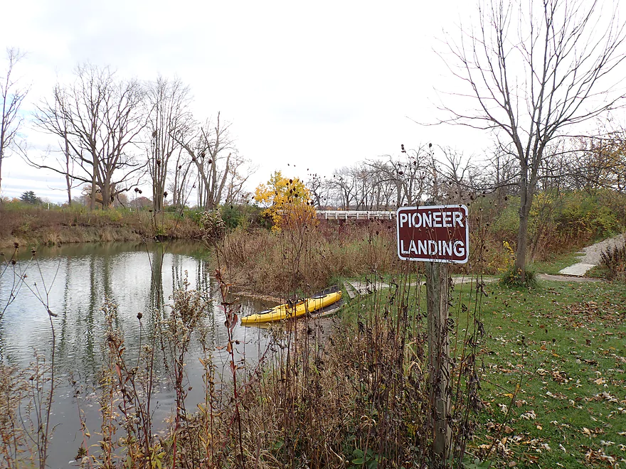
Taking out at Pioneer Landing
It’s a terrific access
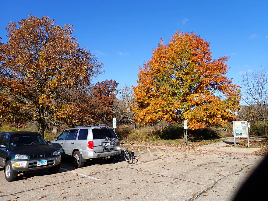
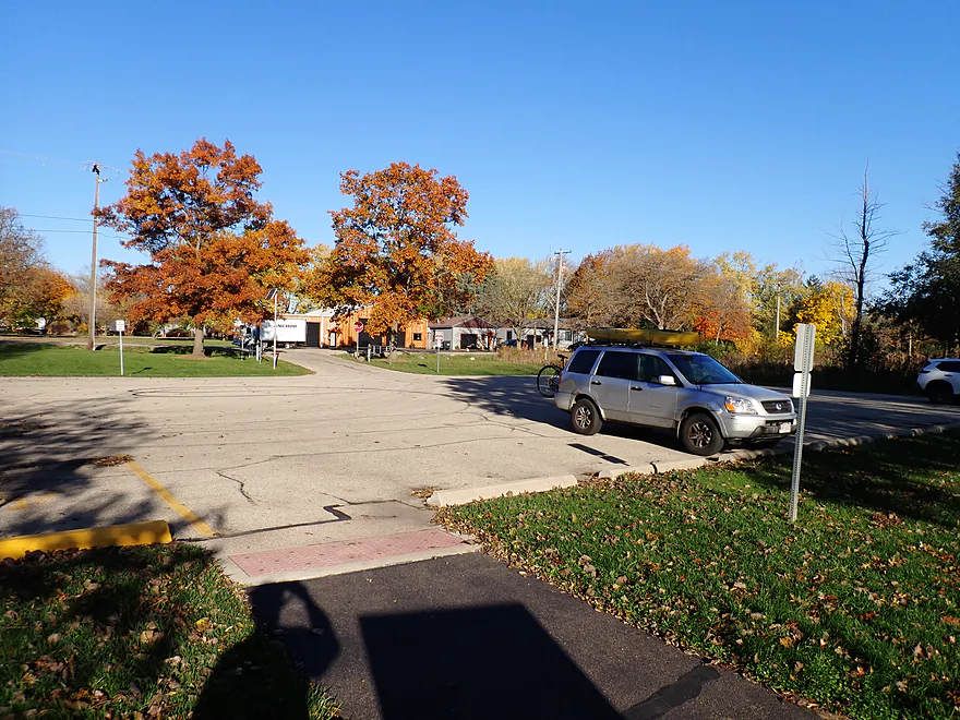
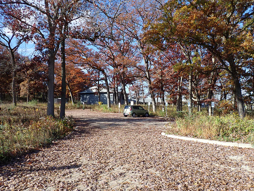
Great color in the parking lot
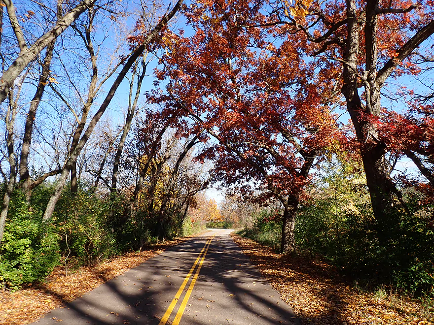
Very scenic bike shuttle to the put-in
Lost Valley Visitor Center (view from parking lot)
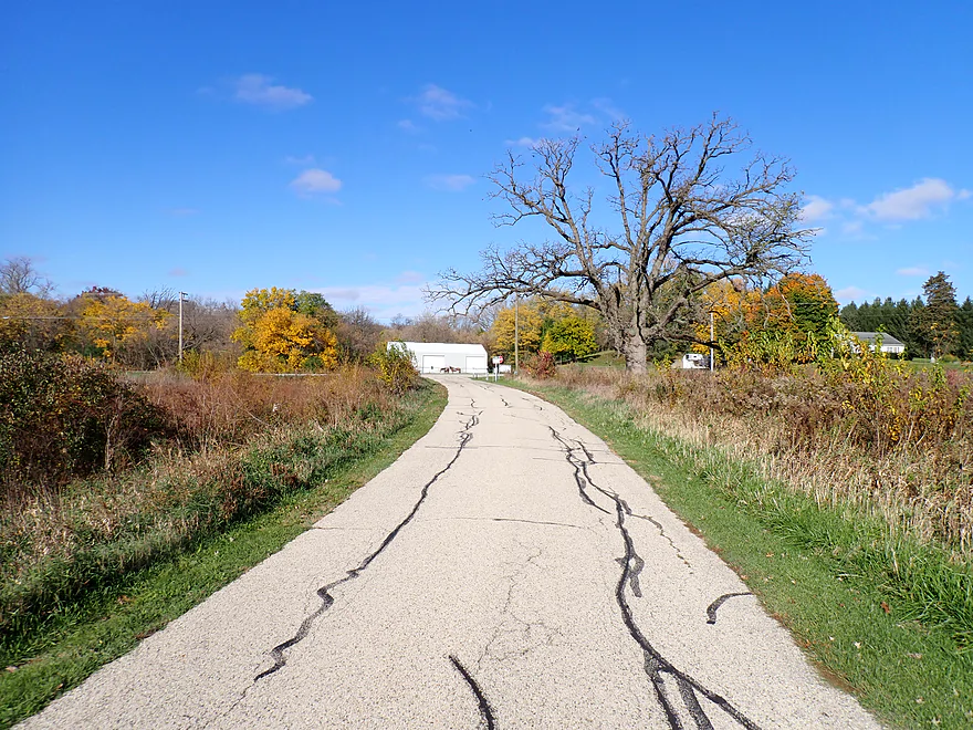
Lack of traffic on the west leg of Valley Road makes it a nice bike shuttle route
Nippersink Creek

Nippersink Creek is a popular water trail located in Illinois just southeast of Lake Geneva. Originally it was home to the Pottawatomi who got evicted by settlers in 1834. Much of the creek was then channelized for agriculture, which resulted in topsoil erosion, large mud banks, and poor streambank quality. In 1999 an effort was made by McHenry County to dechannelize a two-mile stretch between Keystone Landing and Pioneer Landing. This helped restore the creek to some of its original character. In the recent years since then the Nippersink has really taken off in popularity, thanks to positive word-of-mouth in the paddling community.
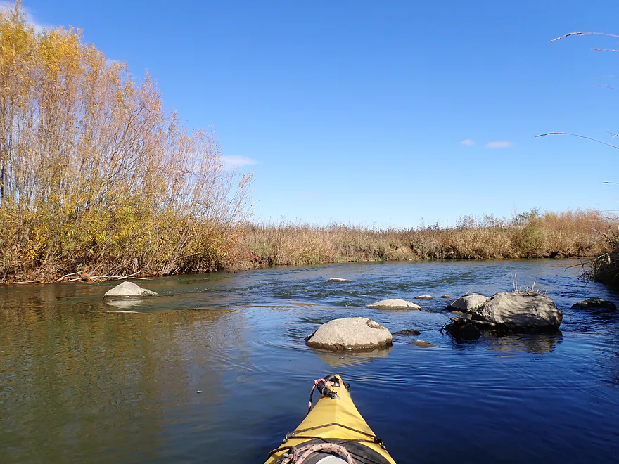
Keystone Landing was the chosen put-in for this trip and was a great access. The first third of the trip was terrific. The creek was relatively shallow and rocky, but fast and enjoyable. Aside from a few lonely trees, the creek flowed through rolling savannas with great open vistas. In the distance were large kames (gravel hills left by melting glaciers). These are part of Glacial Park which has a terrific trail system. In several spots I could see hiker silhouettes atop the kames/hills looking down toward the creek (and presumably at me as my yellow boat would have really stood out). Something else that impressed me was the quality of the banks (not too big nor muddy) and the combination of open grassy hills dotted with large oaks. All in all, very scenic.
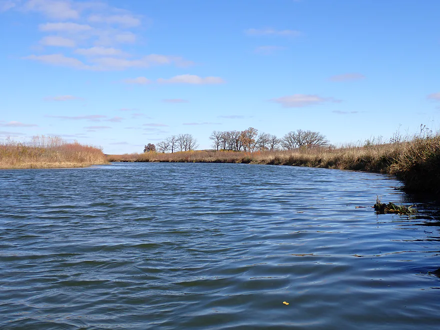
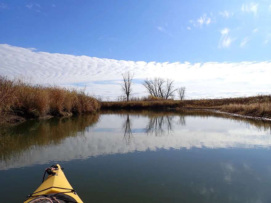
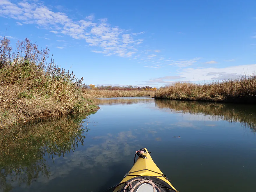
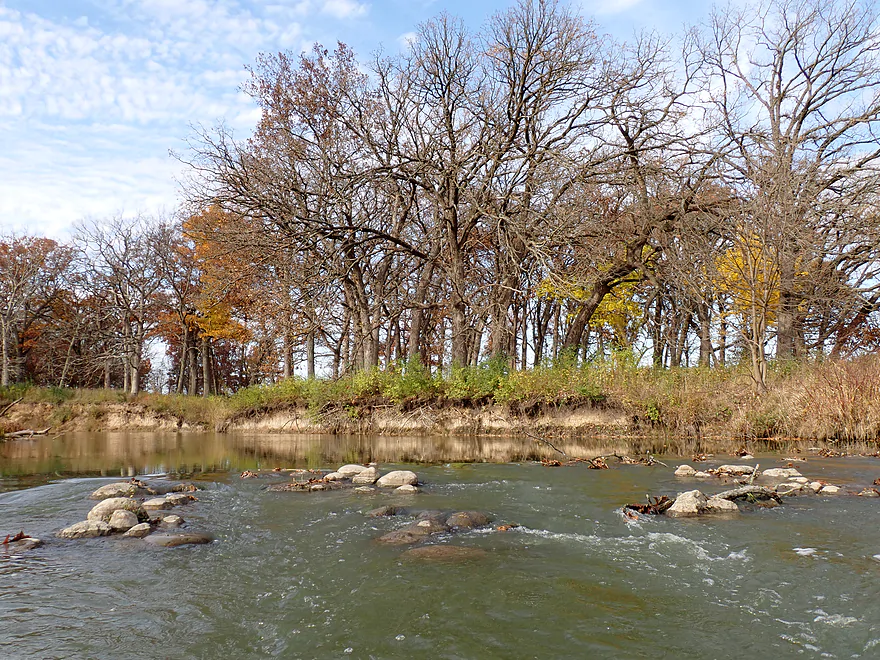
The Valley Road bridge (closed to cars) roughly marks the start of mile 3 or the middle third of the trip. This part of the trip wasn’t as interesting as the current slowed and the channel became wider and deeper. This section of the creek received most of the attention from the 1999 dechannelization efforts. The old ditch was filled in (still partially visible from satellite) and several artificial rock riffles were added to slow the water and prevent erosion. The riffles represented fun and easy rapids (although some were a bit bumpy). I had to wonder if engineers went a bit overboard with the meandering and “riffle dams” as sometimes the current was TOO slow. Good current is part of the reason creeks have the magic they do. It’s not only more enjoyable for paddling, but fast current improves stream ecohealth by reducing excess algae and bacteria. That being said the creek now is much better than it was in 1999 when it was just a ditch.
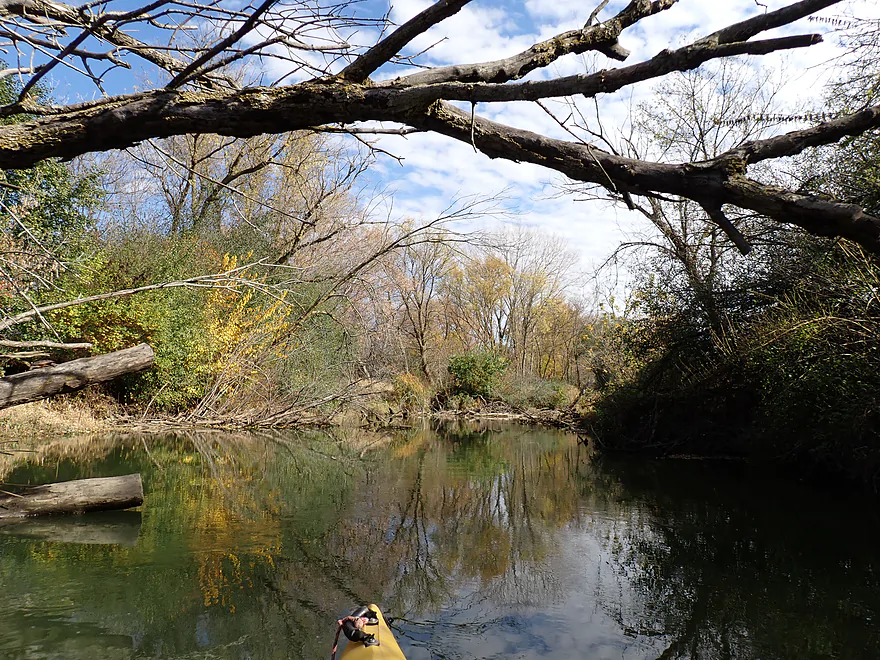
Following a snowmobile bridge at roughly the four mile mark, the creek became much more wooded. Scruffy woods clustered around the creek and there was evidence that locals had cleared out previous logjams. This wooded stretch wasn’t as scenic as the savannas and kames…and in fact I considered it the weakest part of the trip. Part of this stretch flowed through a second (2014) dechannelization project. The Army Corp of Engineers could only unstraighten the creek inside the park…private sections (mostly the far northern tips) are still still straight as an arrow.
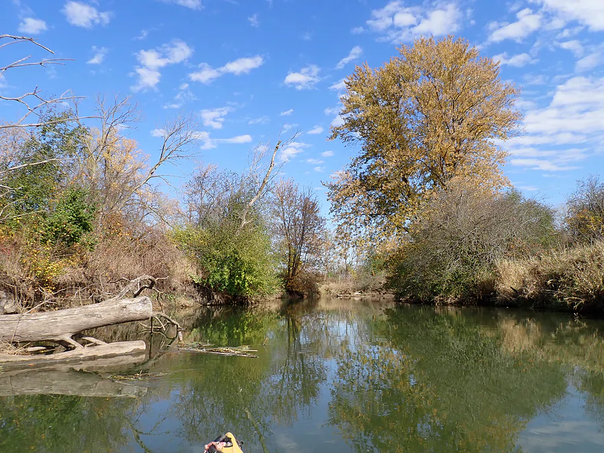
But for the last third of the trip, the scenery improved remarkably. There were fantastic oak groves along the creek…some of the best I’ve ever seen on a paddle. Many were past their fall color prime, but some still had their dark red leaves and looked great. Coupled with the sandy clay banks and boulders in the creek, it was the most photogenic part of the trip.
The trip ended at Pioneer Landing which was a terrific public access. I did see other cars in the parking lot, so despite this being a late time in the year for paddling, locals knew the Nippersink was still worth checking out.
In summary this was a trip that turned out much better than expected. The creek receives a lot of character from its riffles, boulders, oaks, bridges, kames, and prairies. The fall color was also surprisingly good, at least for the oaks which are known to turn late. I highly recommend this trip for those that live in the area.
Sights included two beaver dams, one fat, tame beaver, ducks, and a surprisingly docile softshell turtle. The highlight was two cranes I was able to paddle incredibly close to. The wildlife in general was very tame on this trip.
Keystone Landing: This is a great public landing with a gravel launch, outhouses, and parking area. Note this park has many rules such as alcohol not being allowed. It appears the park also has electronic gates which may shut automatically at night. Try to be out by then.
Alternate Put-ins: None really for this section. Just upstream from Keystone is Wonder Lake which is completely private and you could be arrested for kayaking on it. Downstream from Keystone Landing, some sources indicate you could launch from Valley Road. However, I believe this road is now permanently gated shut and closed to vehicle traffic, so it wouldn’t be a viable kayak access.
Pioneer Landing: This is another great landing and is quite similar to Keystone Landing. Great parking, outhouses, launch area, lots of petty rules, etc… The big thing to note is this too has an electronic gate. I believe it shuts automatically at night. There appears to be a phone number you can call if you get trapped in the park, but I’m not sure I would trust this…try to be off the water before dark!
Alternate Take-outs:
- Lyle C. Thomas Memorial Park (4.7 miles downstream from Pioneer Landing): Memorial Park is a good access and take-out for those wanting a very long trip. This additional leg would be nice, but would lack the oak savannas of the previous section and be less interesting (more woods and more development).
-
Nippersink Canoe Base Conservation Area (9.1 miles downstream from Pioneer Landing): This is an ok access. This bonus leg would be mediocre and likely wouldn’t be as interesting as previous legs.
Glacial Park: Much of upper Nippersink Creek wraps around Glacial Park. This is a terrific public park known for its glacial kames, oaks, and rolling prairie. At its center is the “Lost Valley Visitor Center” which features some exhibits and emphasizes environmental education. The highlight of the park is its terrific trail system which goes through the oak savannas and atop some of the larger kames. Note, the western access to the park and “Lost Valley Visitor Center” (Valley Road) is now gated shut and I’m not sure if it will ever reopen. You’ll have to enter in from the east.
Most of my readers are from Wisconsin and should be warned that Illinois has very restrictive rules and attitudes toward public access. The main issue is that many lakes/streams/rivers are COMPLETELY private. This is in stark contrast to Wisconsin where all waterways are public, thanks to the “common highways and forever free” provision of its state constitution.
For Illinois, you can only paddle in waterways that are deemed “commercially navigable”. Knowing which waterways fit this definition is both easy and not so easy. Illinois has a map and list of public waterways here…which is jaw droppingly limited with many counties not having ANY “commercially navigable” waterways. The definition of what is navigable seems to be outdated and based on whether the waterway was big enough for steamboat traffic or would connect to a commerce center for steamboats.
However, there is a bit of a gray area in that some water trails seem to be ok to navigate in Illinois despite not getting the “commercially navigable” designation, with Nippersink Creek being just such a notable exception. These exceptions seem to be formed by arbitrary norms and traditions, and aren’t predictable. In general, if you hear that other paddlers are using a creek or river section without conflict, or there is an official kayak/canoe launch, it’s likely ok.
However even with exceptions like Nippersink Creek, paddlers should be warned this is still tricky. Just upstream from Keystone Landing, Nippersink Creek is impounded as Wonder Lake which is completely private despite its decent size, and paddlers could be arrested for kayaking on it. There was a bill in the Illinois General Assembly to provide better water trail access rights for kayakers, but I believe it died in committee. Illinois kayakers are encouraged to pressure their representatives to reform its backwards and feudalistic rules restricting water trail access for kayakers and canoers.
Even if a waterway is deemed public in Illinois, the other issue is shoreline access. In Wisconsin you’re generally ok to launch from the DOT right-of-way/easement adjacent to a road or bridge unless restricted explicitly by a township sign. In Illinois more power is given to local landowners to restrict access by bridges. There are gray areas of course which paddlers can and do use…but in general, you should be wary of using bridge accesses in Illinois, especially if close to private homes.
The third issue is water usage stamps which is also confusing. Various websites and the signs at the Nippersink landings indicate all boats including kayaks are required to have water usage stamps. However the Illinois DNR website indicates the rule for usage stamps was repealed for non-powered watercraft in 2018. So I don’t think you need them anymore.
Lastly, it should be pointed out that besides legal differences, Illinois has culturally a very different attitude toward public lands and access. This was readily apparent when Illinois resort investors dammed the Scuppernong River in Wisconsin, declared it a private lake, and harassed boaters who were on that portion of the Scuppernong River. When the Wisconsin DNR told the resort owners they couldn’t do this, they threw a tantrum and complained to the Milwaukee Journal Sentinel that they were being bullied by the DNR.
I was shocked at how common security cameras, electronic gates, No Trespassing signs, parks that are gated shut at night, and various posted petty rules there were when I was in the Nippersink area. I’m not sure if crime is really that common or if locals are just being overly paranoid.
Bike Shuttle – Pioneer Landing to Keystone Landing: 5.0 miles with 89′ of ascent. Note the western end of Valley Road is gated shut and blocks car traffic, but can be used as a bike shuttle shortcut. I really liked this bike shuttle…much of it cuts through Glacial Park and is very scenic with the oaks/savannas/kames. If possible, try to bike past the Lost Valley Visitor Center which is a very striking area of the park.
Commercial Rentals/Shuttles: Note I don’t know much about the following…only that they were recommended rentals in the area by a local Nippersink group. Call in advance to ensure service.
- Tip-A-Canoe, Burlington WI (262) 342-1012 (canoes & kayaks) These guys do both the Nippersink in Illinois and the Illinois Fox in Wisconsin.
- Scull and Oars, Wonder Lake, (815) 814-5155 (canoes and kayaks) They appear to service both the Nippersink and Wonder Lake.
- Rip the Nip, Richmond, IL, (847) 861-0515 (canoes, kayaks, and tubes) They service the stretch I did.
Current: In the first mile the current moves pretty quickly, but seemed to slow down significantly in the second half of the trip.
Rapids: There are a number of minor riffles/ledges…figure say ~13 short Class 1 rapids. These are pretty easy, but when water levels are low some can be bumpy and require careful navigation to avoid rocks. As always, portage anything you’re not comfortable running. But in general I consider this a beginner friendly kayak stream.
Logjams: None…locals keep the creek open.
Beaver Dams: There are two. One is on a side creek and isn’t an issue. There is a second beaver dam that blocks the creek roughly halfway into the trip, but it is easy to hop over.
Fences/Dams: None.
Closest Gauge: Nippersink Creek @ Spring Grove
My Trip Depth: 66 CFS or 4.12′
Gauge Guide: Note the following are only rough estimates. Always use your own judgement.
- 0-20 CFS: This might be too shallow.
- 21-40 CFS: Most of the creek will be navigable, but some of the rapids may have to be waded. The shallowest area will the first mile by Keystone landing.
- 41-70 CFS: This should be a fine depth for kayaking, but some of the rapids will be bumpy.
- 71-90 CFS: Most rapids should be adequately padded at this depth.
- 91-120 CFS: A high depth. The creek is likely navigable, but may be dirty. The high water may steal some of the character from the creek.
- 121-150 CFS: A very high depth…creek may burst its banks in some spots. You should know what you’re doing before attempting a high water paddle like this.
- 151+ CFS: I presume most of the creek will be flooded at this point. Only suitable for expert paddlers. The local district “closes” the creek at 750 CFS because of the lack of bridge clearance.
Main Branch: Click here for a Nippersink Creek Overview Map. Special thanks to “Openlands” for much of the below information about the creek.
- Far Upstream Legs: Upstream from Wonder Lake, Nippersink is a creek again and while shallow it seems somewhat navigable. I’m not sure it has public access though.
- Wonder Lake: I believe not only are all landings on Wonder Lake private, but the lake itself is private (something common in Illinois which has feudalistic anti-public access laws).
- Wonder Lake Dam to Keystone Landing: 0.8 miles. A nice rocky stretch that looks attractive. Unfortunately I’m not sure if public access is an option.
- Keystone Landing to Pioneer Landing: 6.2 miles. The best and most popular segment on the creek. A great trip with glacial hills, open prairie, fun riffles, and terrific oaks.
- Pioneer Landing to Lyle C. Thomas Memorial Park: 4.7 miles. This stretch is more wooded and bankside homes are more common. Creek grows significantly with the addition of the North Branch. This might be the second best leg on the creek.
- Lyle C. Thomas Memorial Park to Nippersink Canoe Base Conservation Area: 4.4 miles. Perhaps a slower and less interesting leg. A mix of thick woods and development.
- Nippersink Canoe Base to McHenry Township Park: 1.0 miles. Creek passes under Hwy 12 and past more shoreside homes.
- McHenry Township Park to Mouth on Chain o’ Lakes/Illinois Fox River: 1.2 miles. Stretch includes countless piers and homes. Looks very overdeveloped.
- Illinois Fox River: There are certainly multiple legs on the Fox River you can paddle, but covering this would go beyond the purview of this review.
North Branch: Note the North Branch is scenic and may be partly navigable. Much of it appears to have logjams though.
- Upstream from Veterans Park: The North Branch looks too congested to run.
- Veterans Park to Hwy 12/Main Street: 3.6 miles. Creek leaves Wisconsin and enters Illinois. Lot of logjams though…maybe 10-11.
- Hwy 12/Main Street to McConnell Park Canoe & Kayak Launch: 1.1 miles. Scenic and fast stretch through the outskirts of Richmond. But there are likely logjams (maybe 4-5).
- McConnell Park Canoe & Kayak Launch to W. Solon Road: 5.0 miles. Very wooded leg with many riffles and some boulders. Good scenic potential but there are logjams. Maybe ~5-8. Hopefully these get cleared out in the future which would create a great water trail.
- W. Solon Road to Mouth on Main Branch: 1.1 miles. Open wetgrass section.
Trip Map
Overview Map
Video
Photos Size: