
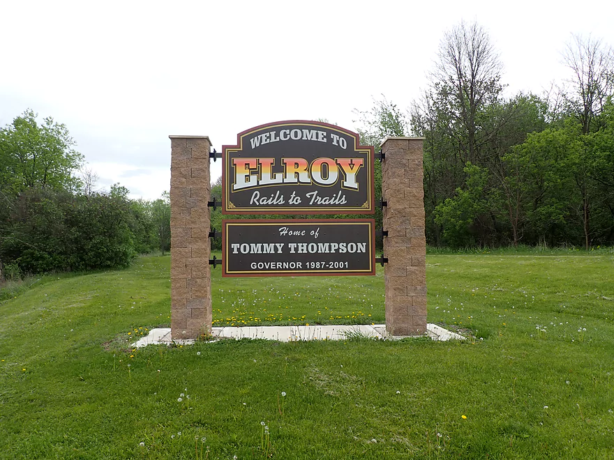
Welcome to Elroy
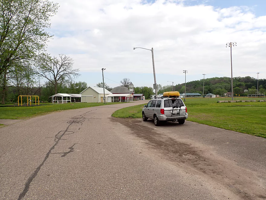
Starting the trip at the Elroy Fairgrounds
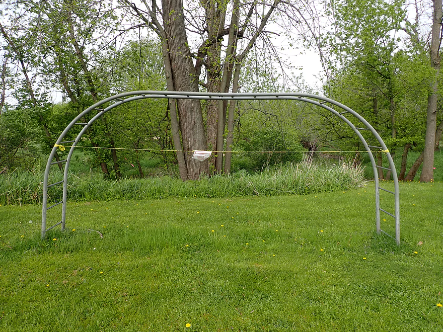
Where all the playground equipment is wrapped in police tape…

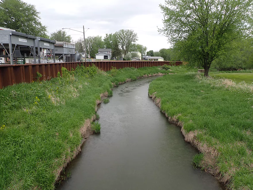
Nice path leads to the water
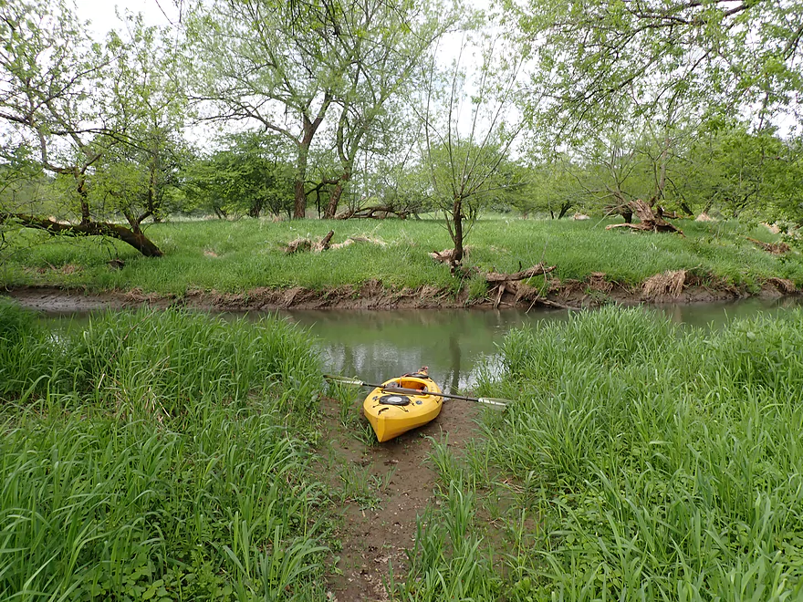
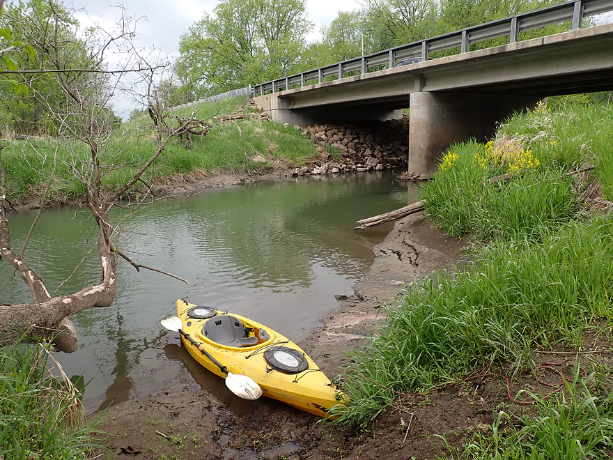
A muddy but good access
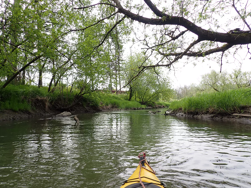
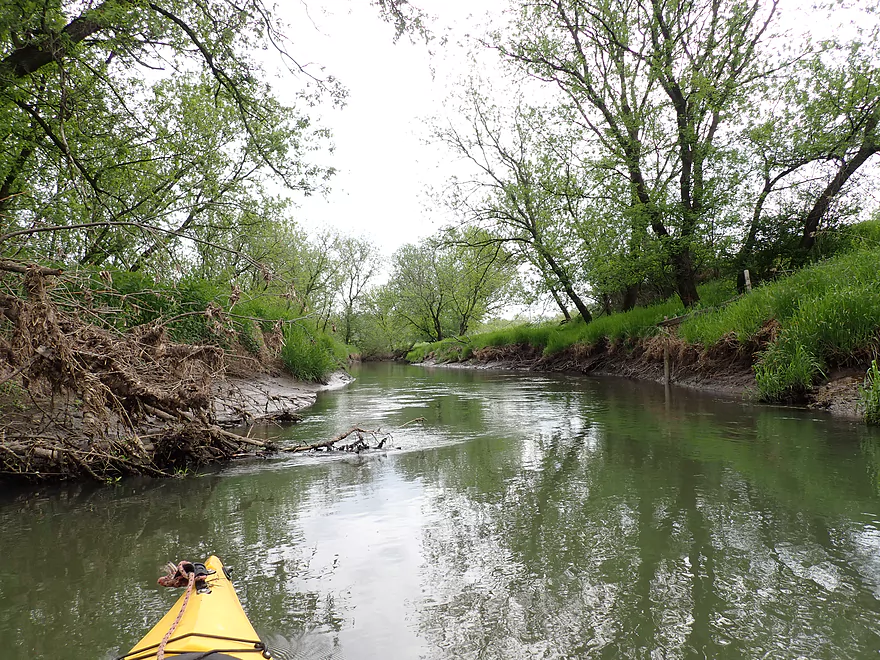
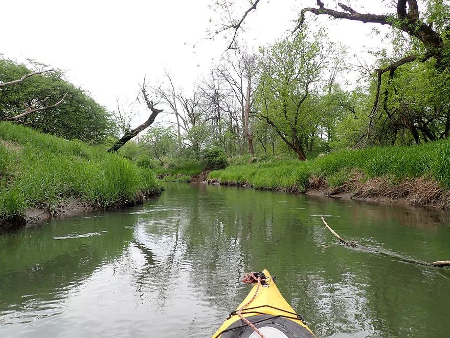
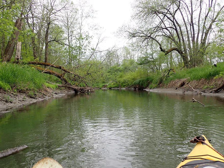
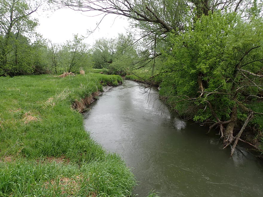
The Baraboo River is no more than a creek at this point
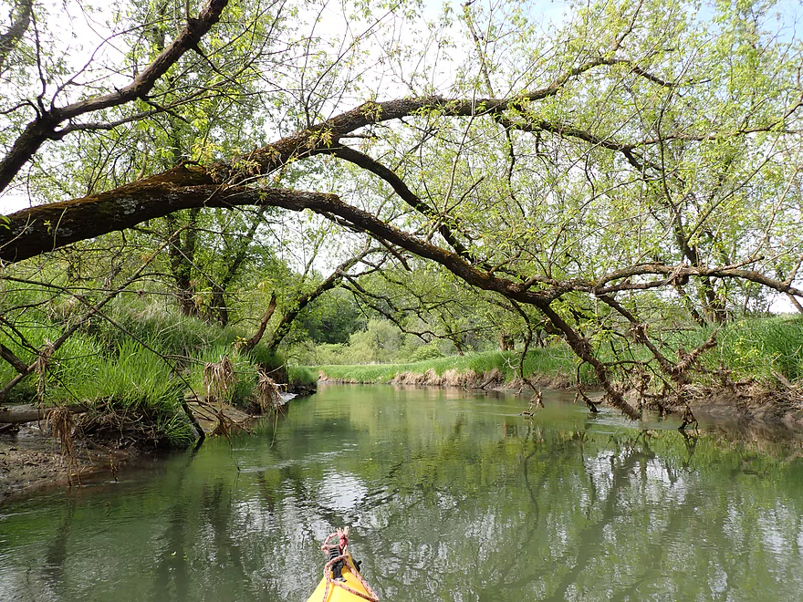
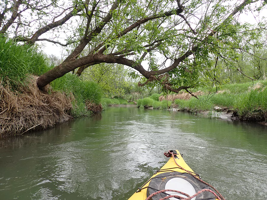
Dodging some downed trees
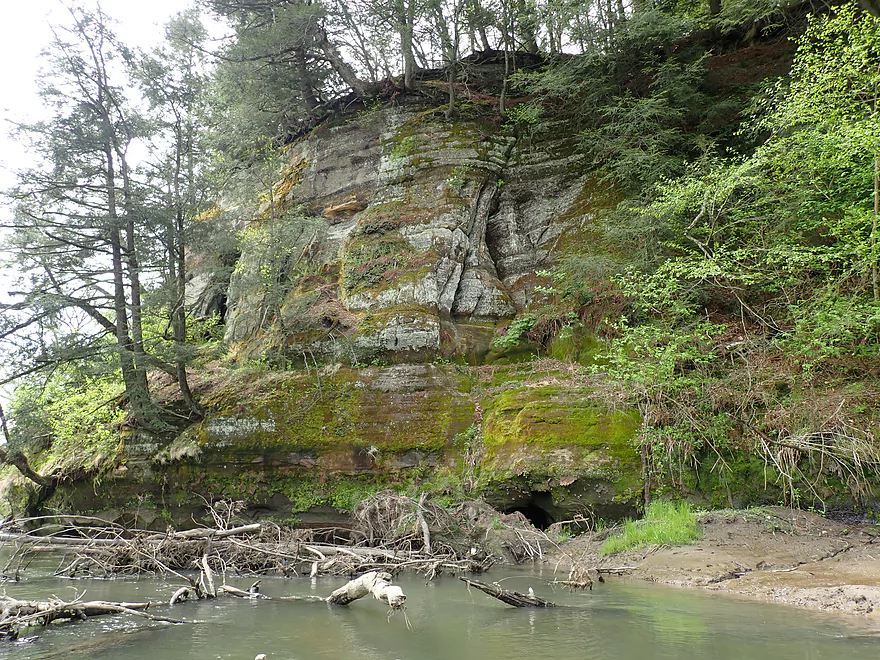
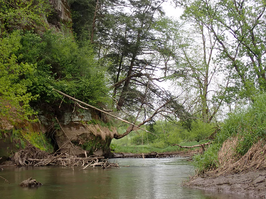
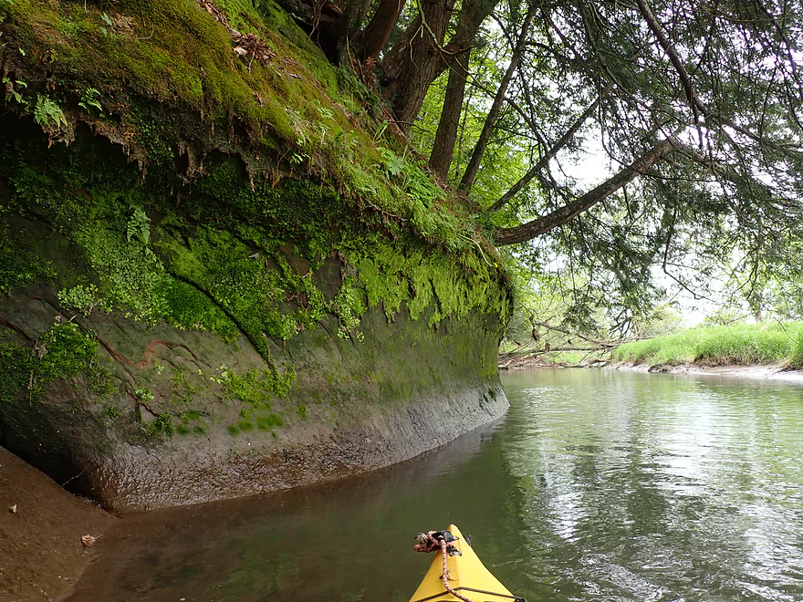
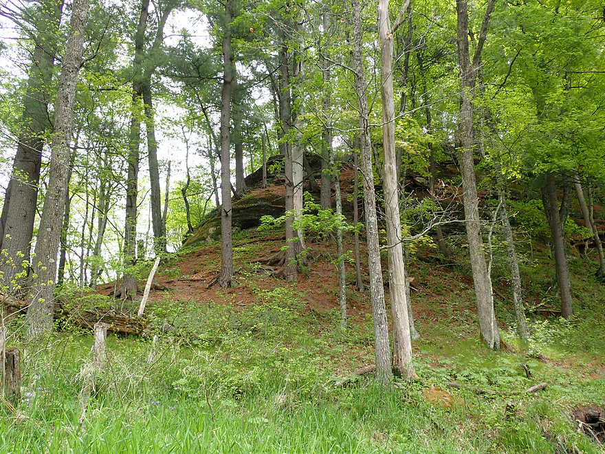
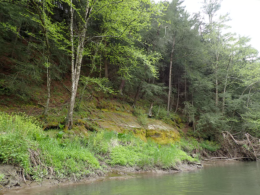
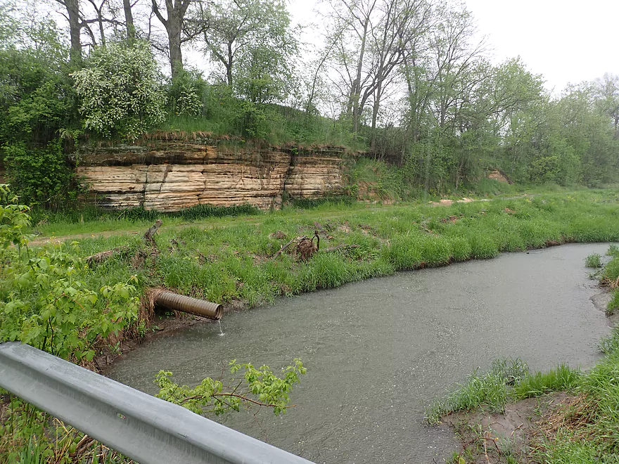
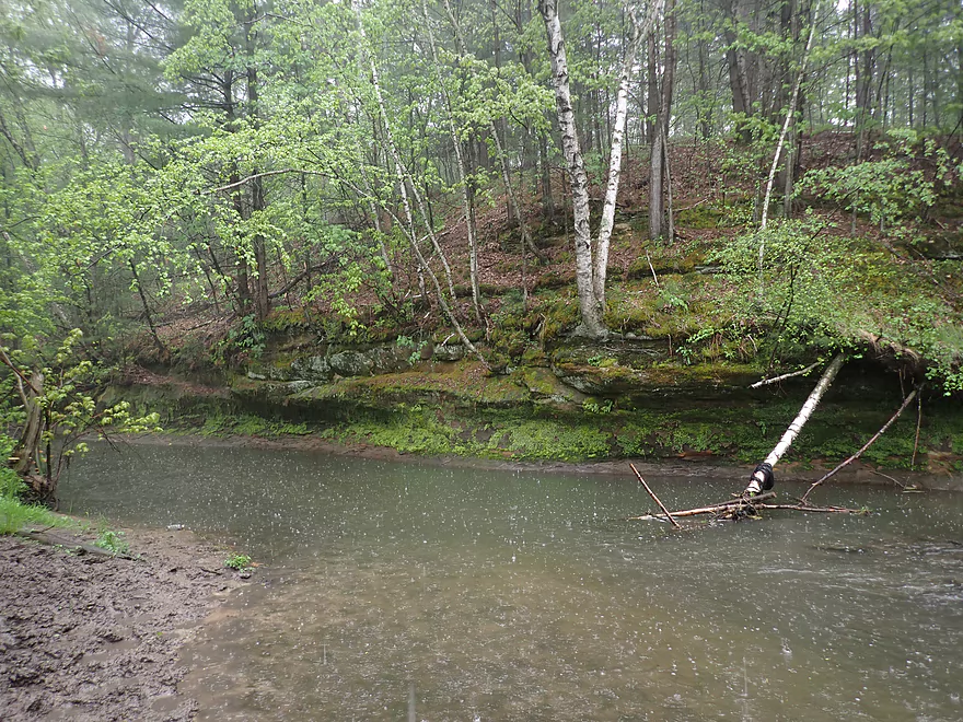
The first outcrop
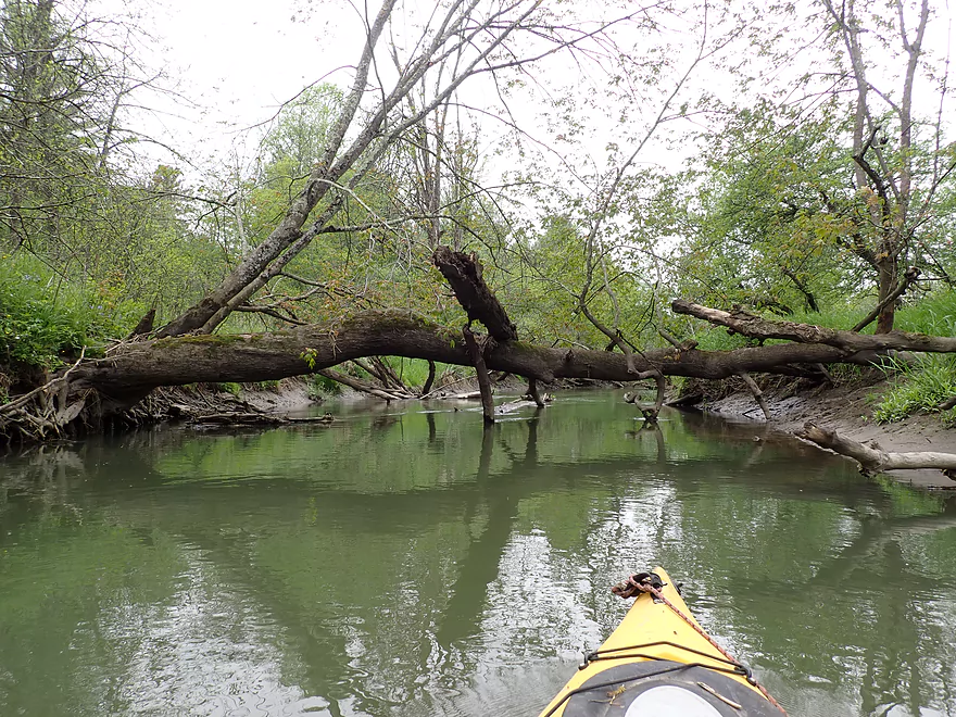
Some more deadfall to dodge
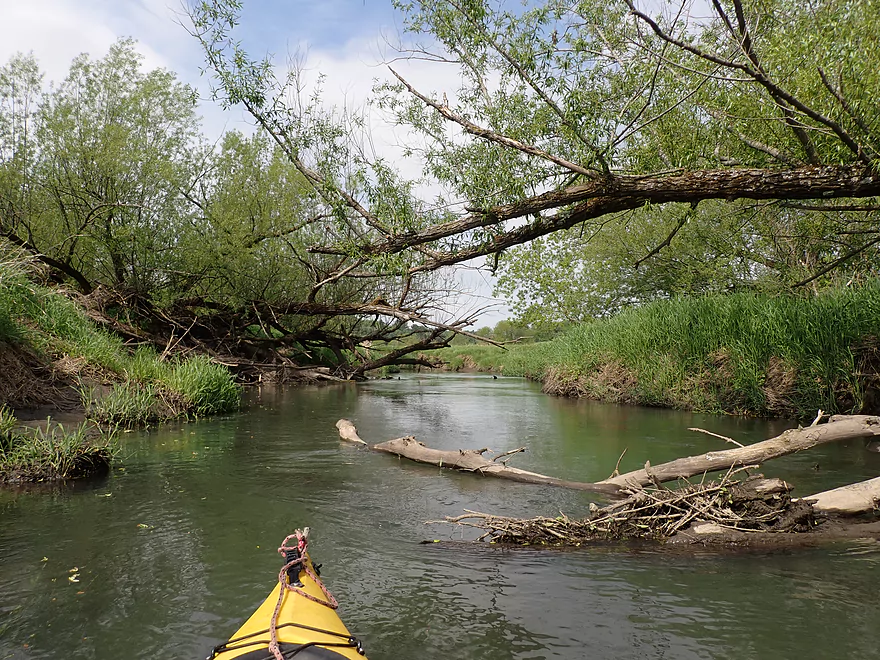
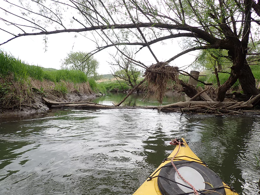
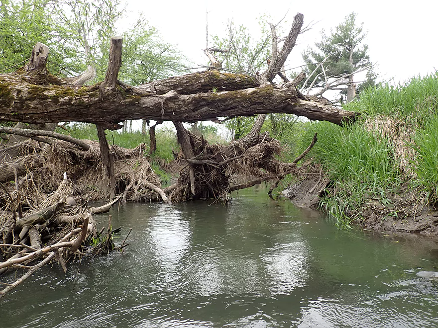
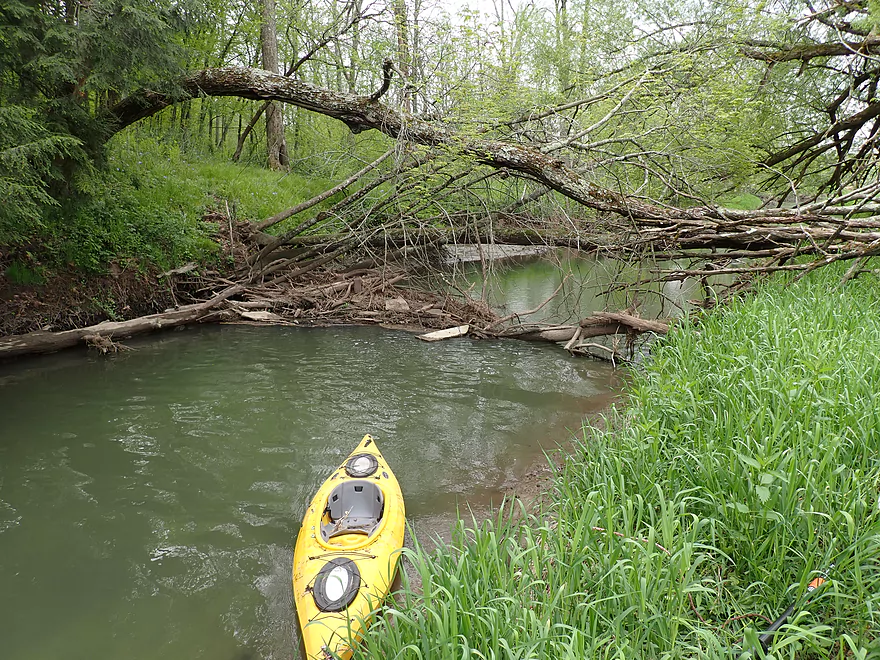
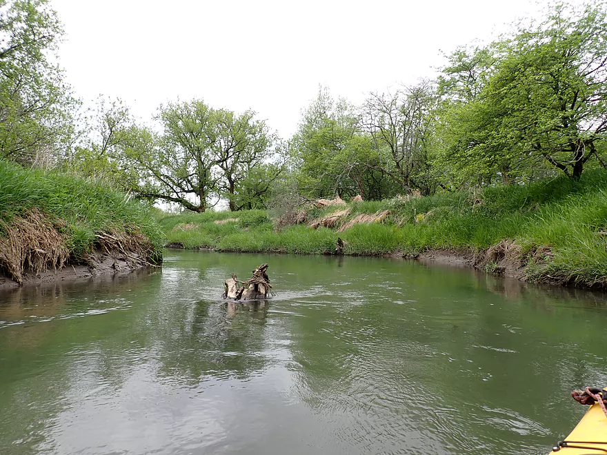
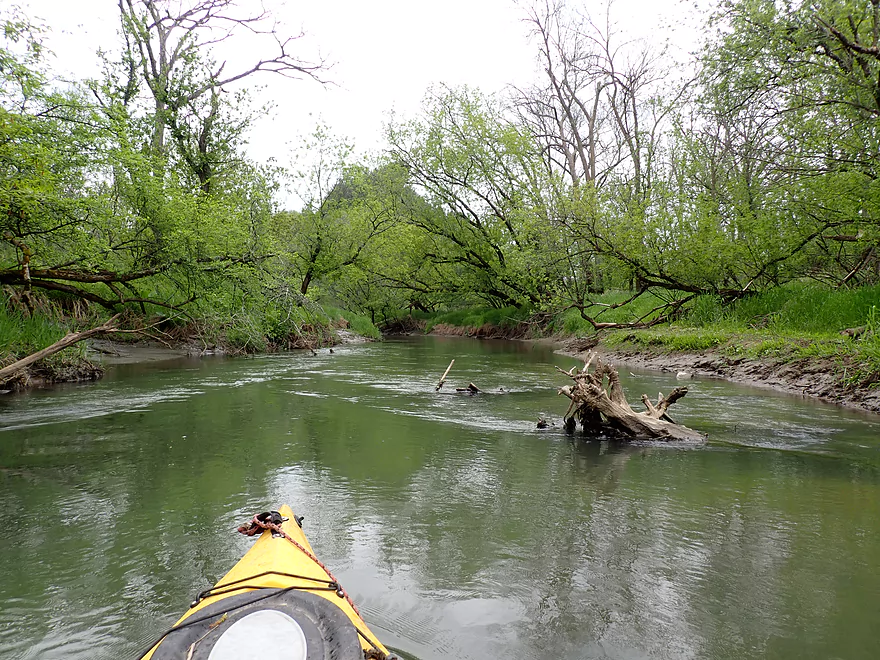
Logjam #1
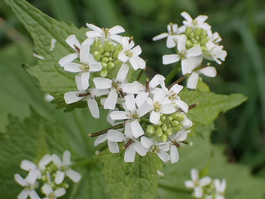
Attractive but invasive garlic mustard
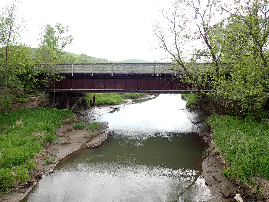
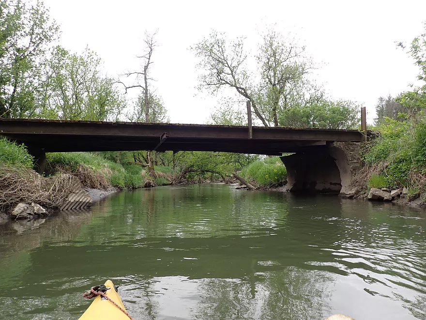
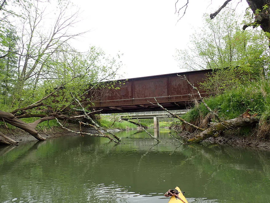
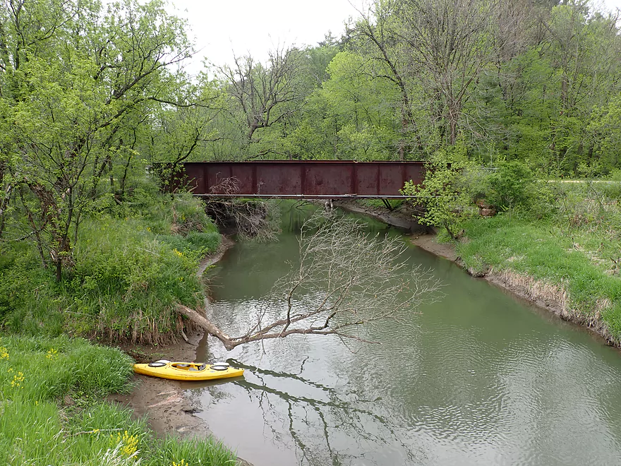
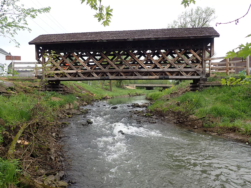
Old 400 bridge (a popular bike trail)
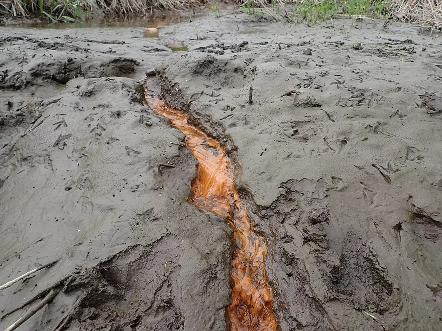
Lot of iron rich seeps
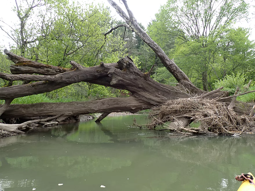
Significant logjam #2
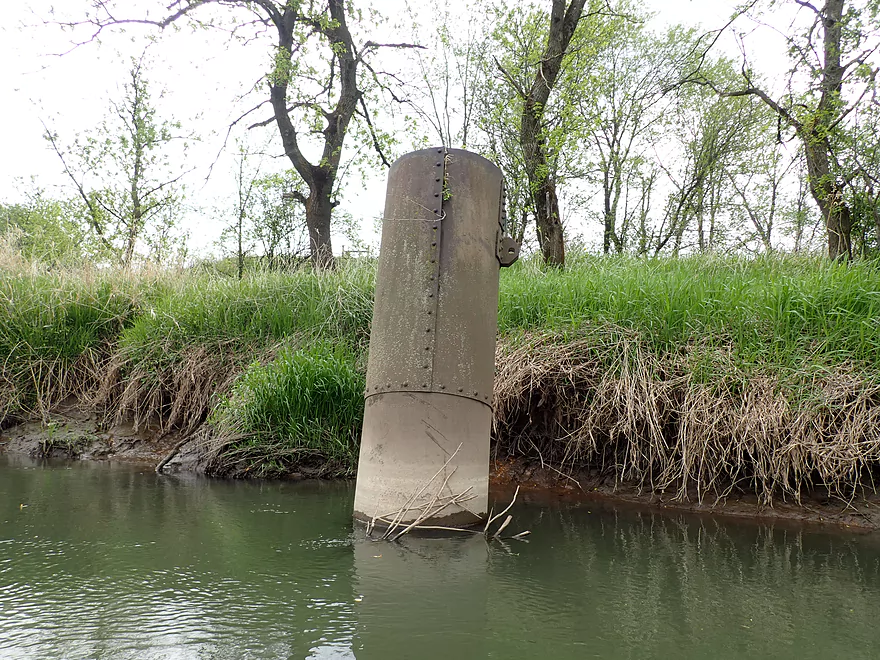
Some Baraboo River steampunk (likely a concrete bridge cast)
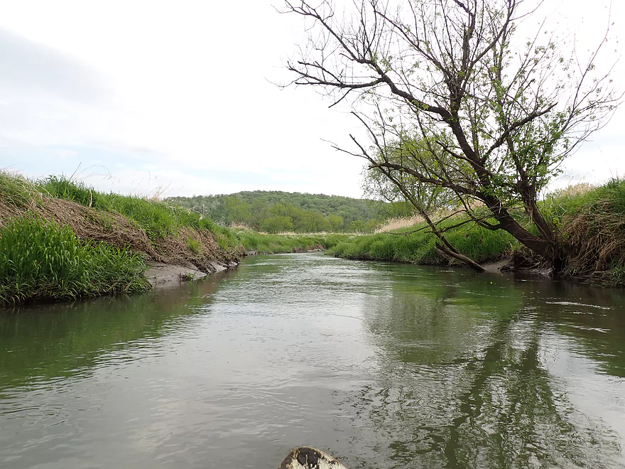
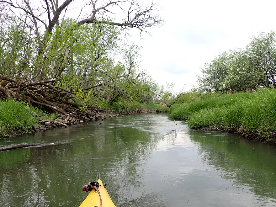
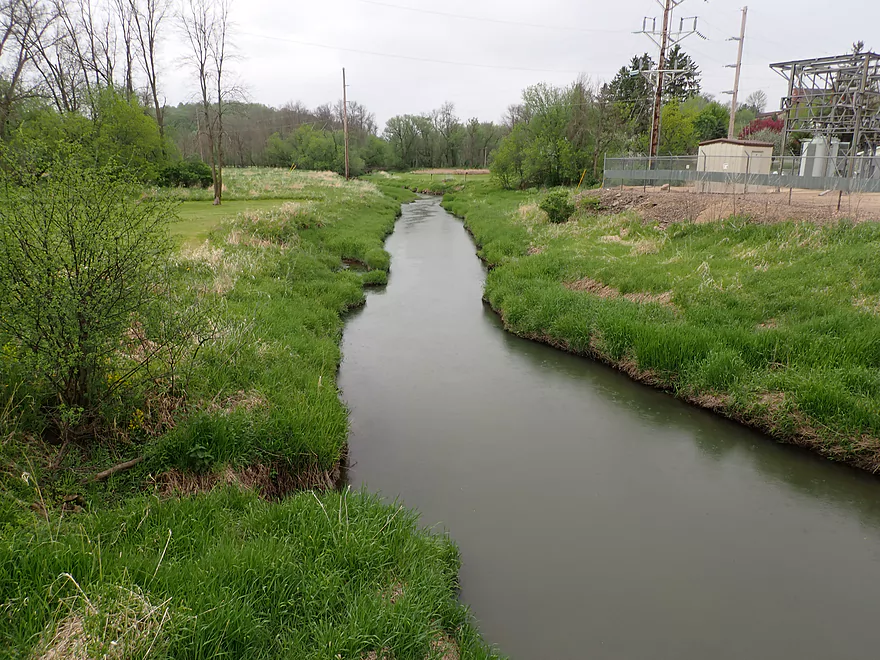
Creek starts to open up…hills in the distance
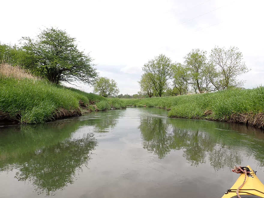
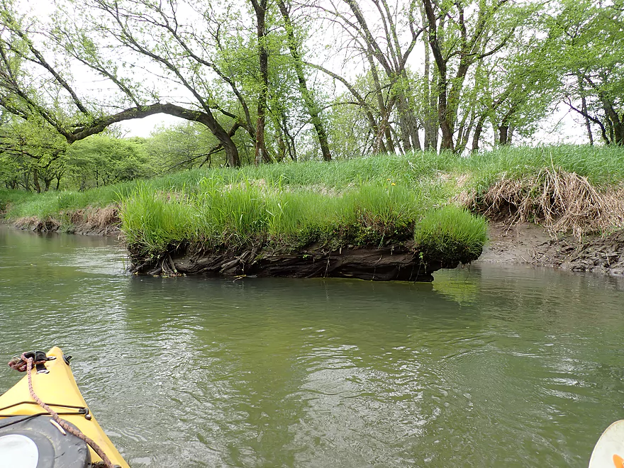
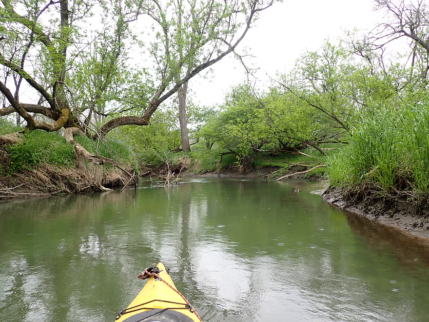
So much grass on this trip
Logjam #3…I got filthy fitting under that small gap
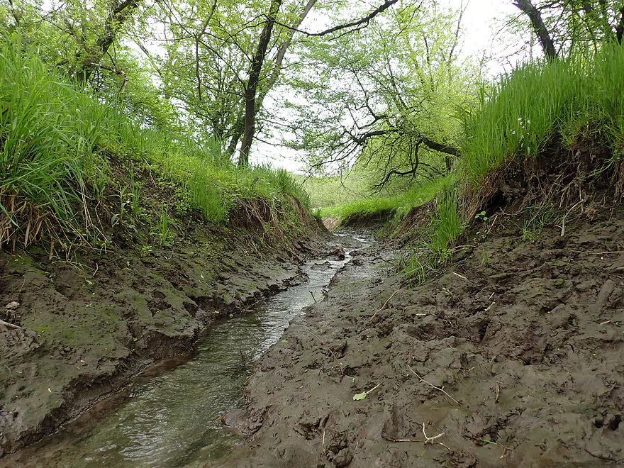
Cool how this tiny creek eroded such a big ditch
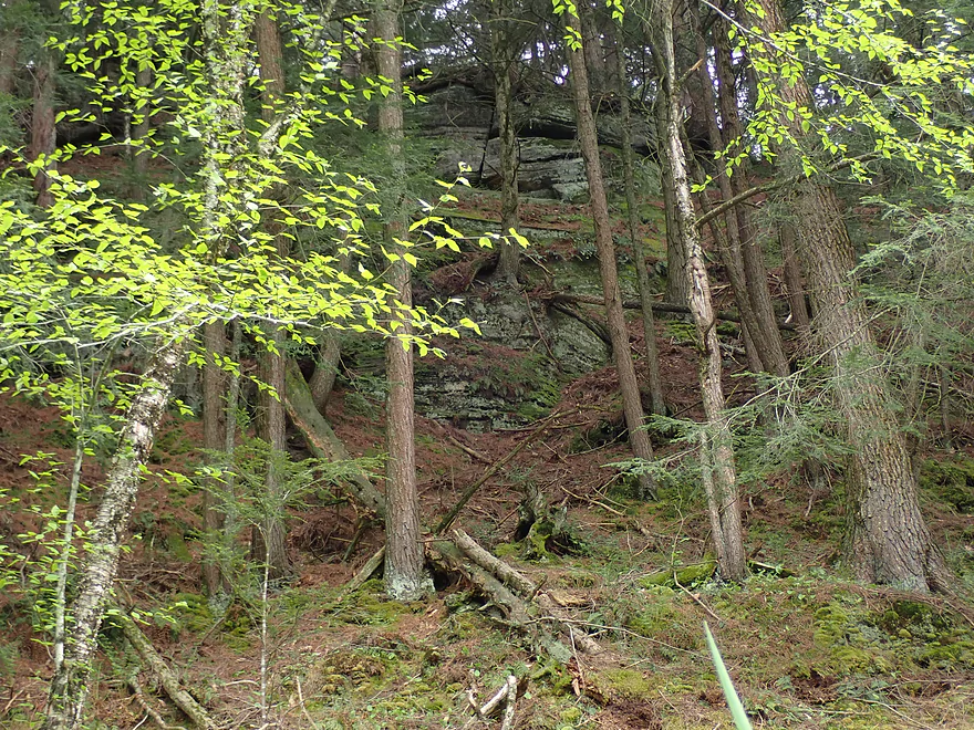
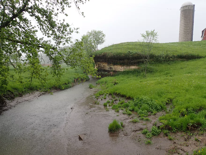
Outcrop #2 (mostly hidden by vegetation)

Nice mosses
Reminiscent of the Kickapooo
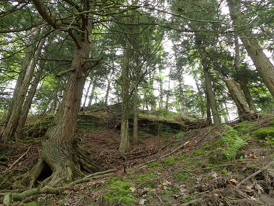
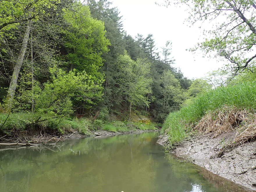
Part of a much larger bluff filled with hemlocks
Major logjam #4
No more portages after that
Although there were still some tight fits
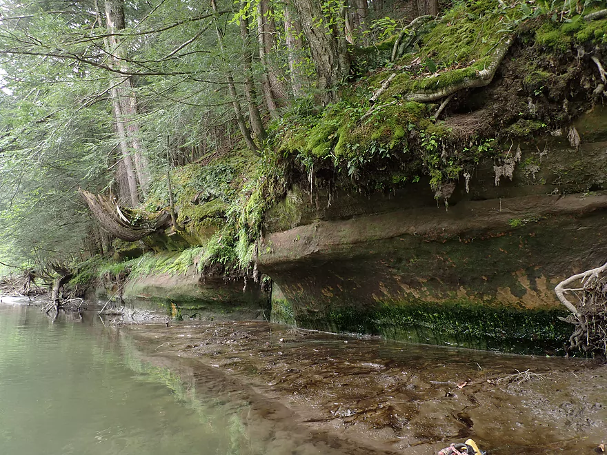
Outcrop #3 (my favorite)
The pines were actually more scenic than the rock face
More typical scenery from the trip
Grass growing on a log…
A few more tight fits
Wagner Road
Starting to rain
Coming up on a large bluff
Outcrop #4
The best features are hidden behind the trees
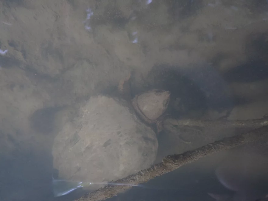
A teenage snapping turtle
Reverse view
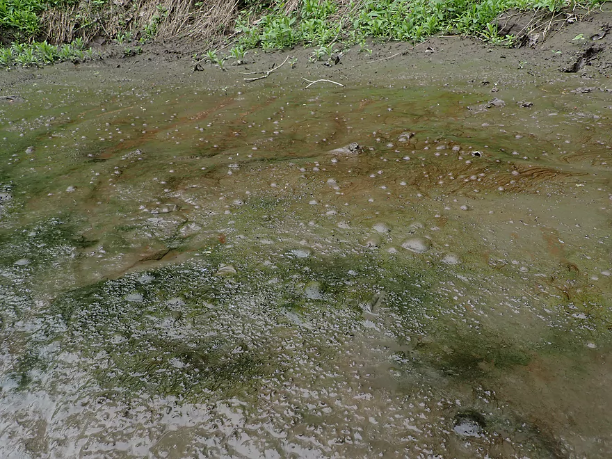
Interesting bubbles coming up through the mud
More paddling in the rain
The Old 400 bike trail again
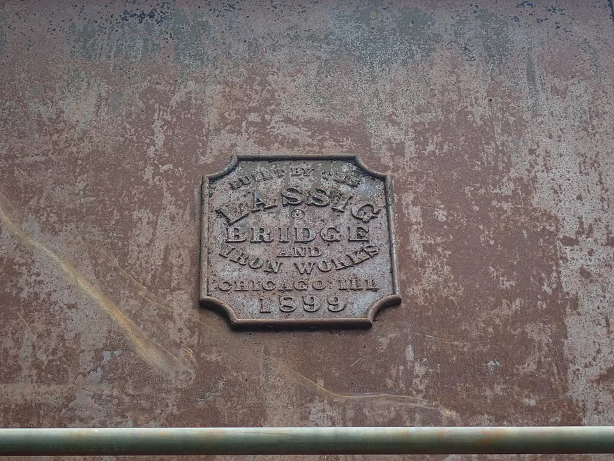
Built in 1899
Taking out at Hwy 82
View upstream…a bit muddy
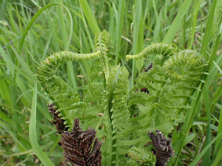
Ferns that look like gossiping seahorses
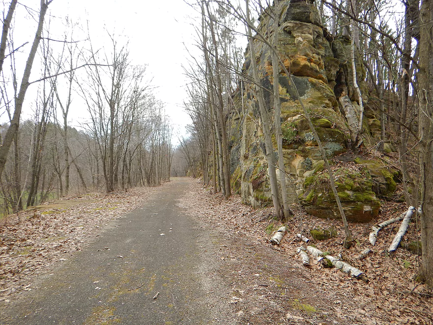
Great bike shuttle back to the car
Scouting the river at Franklin Street
Looks nice
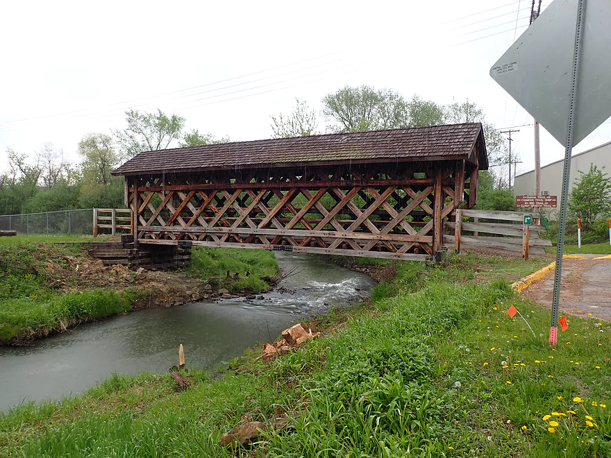
Scouting the river at 2nd Main Street
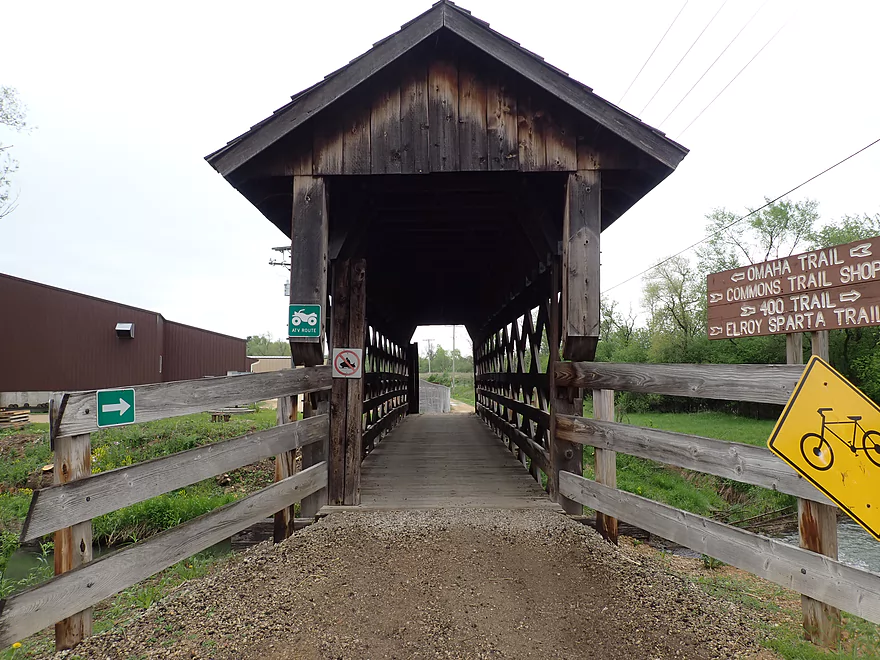
This covered bridge connects the Omaha Trail with the 400 and Elroy-Sparta trails
Inviting rapids under the bridge
Scouting the river at Hwy PP
Scouting the river at Nutmeg Road
Which has some nice “Hobbit” outcrops
Gorgeous outcrops by Kendall…but this stretch isn’t practical for kayaking
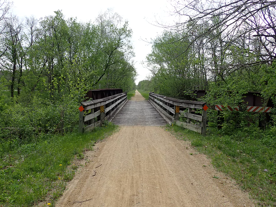
This is a picture of the nearby Omaha Trail
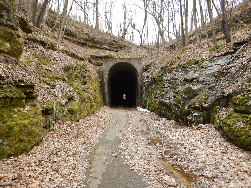
While not as famous as Elroy-Sparta, it does have a nice tunnel
Baraboo River – Schultz Park


Another week and another trip on the Boo. Normally I don’t like to do the same river two weeks in a row, but I was intrigued by a map of the upper Baraboo I found in the Baraboo River Corridor Plan: Phase II document. The map detailed an obscure stretch below Elroy with four marked outcrops in just four miles. Despite the warning of eight logjams, I decided to roll the dice and check it out.
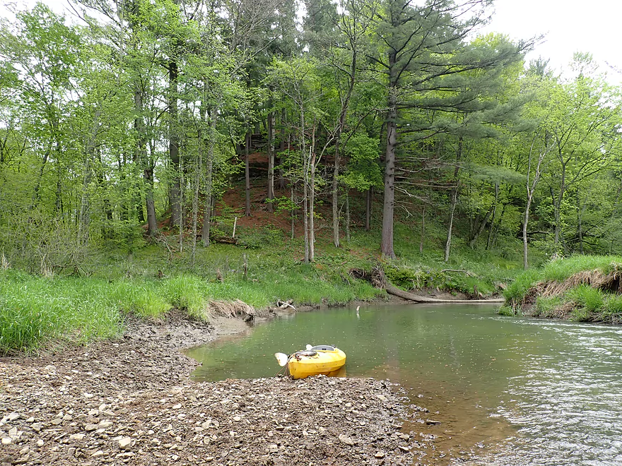
This trip started at the Elroy fairgrounds (aka Schultz Park) where there is an obscure but really nice canoe/kayak launch. I’m sure this park is typically quite busy in the summer, but on this Memorial Day weekend it was a ghost town. Police tape was wrapped around all the playground equipment warning the children not to play on it (Covid-19). It was a morbid scene and something you imagine seeing in say Chernobyl…not in Wisconsin. Despite all this, the launch area was still open and worked well.
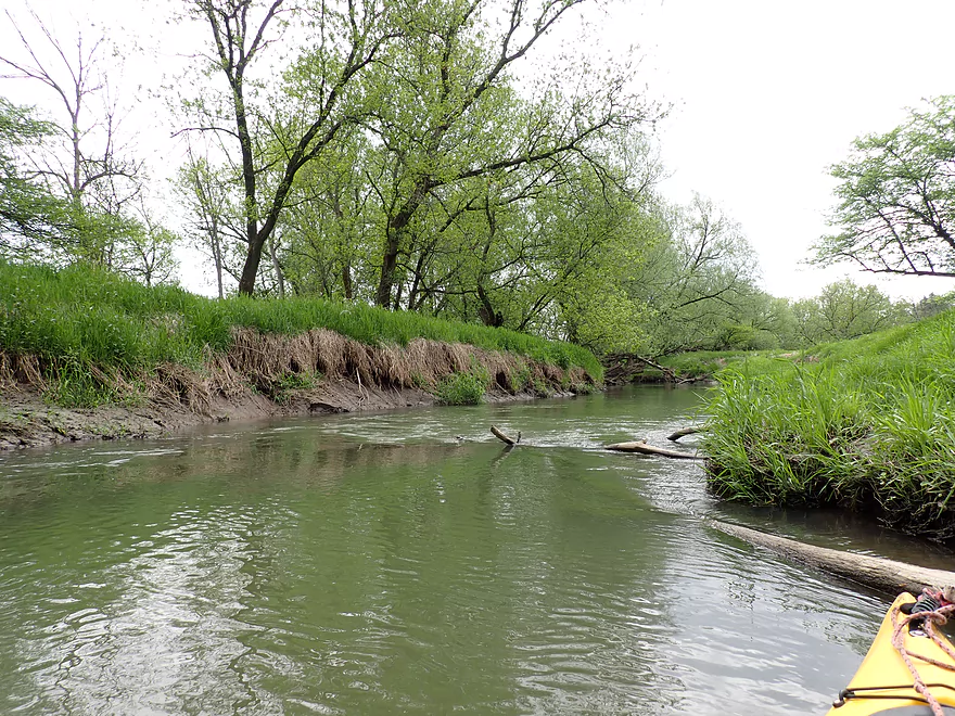
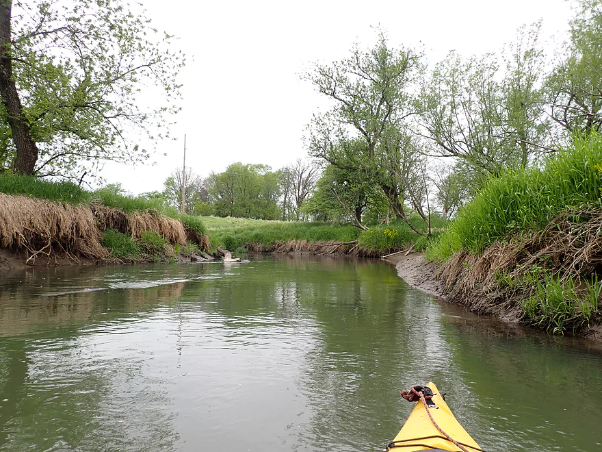
The Baraboo River below Elroy is not very big and really is just a creek…not too dissimilar from other creeks in southern Wisconsin. The banks were muddy and topped with thick grass while the shoreline consisted of a smattering of hardwoods. As a creek paddle it was ok…but it wasn’t the reason I did the trip. Shortly after the Elroy fairgrounds though I came across the first of the four outcrops described in the Corridor Plan. It was quite nice, but some deadfall at the base did distract from the experience.
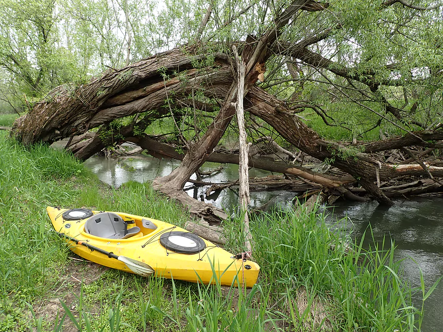
Soon I encountered my first major logjam, which necessitated a short but muddy portage. This was followed by Hwy 80 and the Old 400 Bike Trail bridges which in theory could be an access option. Below the bridges iron rich seeps trickled into the Baraboo River like blood.
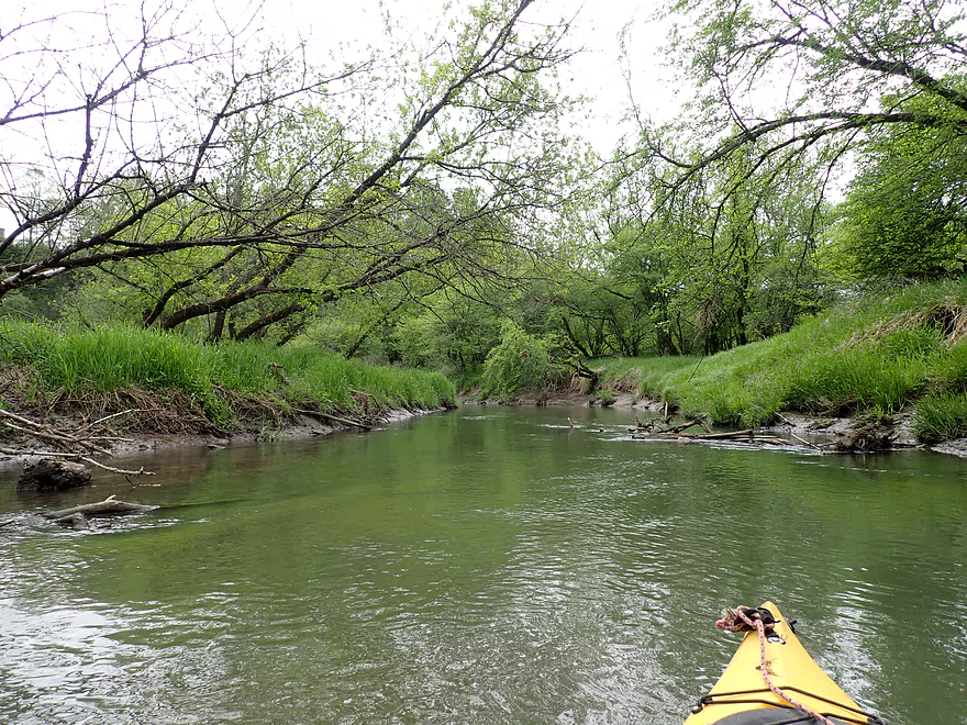
The river then opened up somewhat and started to meander. But the deadfall after the bridge was tricky and I had to deal with two challenging logjams. One I barely squeaked under, but got absolutely filthy doing so and regretted simply not portaging it.
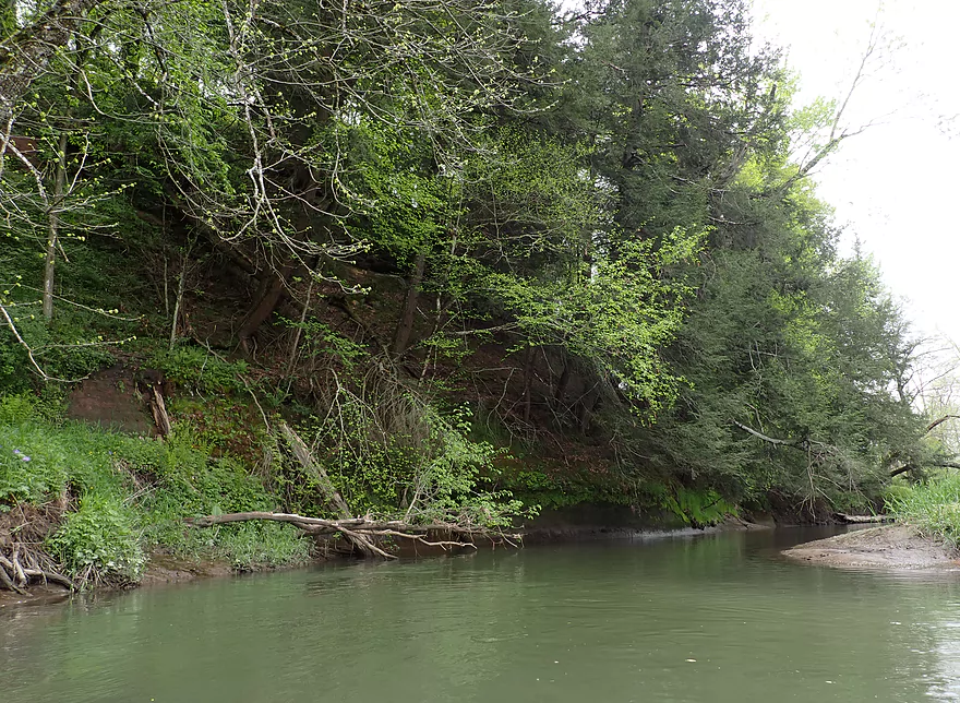
The river was then forced south by a long series of bluffs. It was here I encountered my second outcrop. It was a small but nice sandstone wall reminiscent of the Kickapoo but topped with attractive hemlocks. Unfortunately it was fairly obscured by vegetation so it was difficult to see (and photograph) many of the hidden rock formations.
Following another muddy logjam portage, I came upon outcrop #3. This too was somewhat obscured by trees…but was IMO the most scenic and my favorite. The scene was preceded by a nice gravel bar, while the outcrop had an attractive pine needle carpet with white pines towering overhead.
At this point I was a bit disappointed with the trip because while the outcrops were nice, I had dealt with four major logjams not to mention several tight fits…and the trip wasn’t even half over. I dreaded what was to come, but little did I realize that was it for major logjams and I wouldn’t have to get out of my boat for the rest of the entire trip. Much of the second half of the trip was a fairly generic creek paddle with more mud, grass and haphazard hardwoods. I came upon Wagner Road which the River Corridor Plan described as a possible future launch access…but it was completely private and gated.
On both Google Maps and the River Corridor Plan there was a reference to “Kimballs Bluff” by the river which seemed noteworthy and a potential highlight. But unfortunately it was just too far from the river to see. Kimballs Bluff was followed by an unnamed bluff which was nice though. This was an almost vertical hillside topped with attractive hemlocks and with a small sandstone wall at the base. The best outcrops were at the top of the bluff, but like the others it was too obscured by vegetation to properly photograph.
Following a historic 1899 railroad bridge, I took out at Hwy 82. This wasn’t the easiest of bridge access points because of a steep embankment and mud, but was doable. I could have bike shuttled back to my car on the highway itself, but opted to do a slightly longer but significantly more scenic shuttle on the Old 400 Trail.
In summary this was a slightly disappointing trip because of the deadfall, most of which was located in the first half of the trip. Hopefully locals will work to clean this up (I did report each of the logjams)…at that point it could be a nice paddle. Until then I would recommend that Upper Boo paddlers choose another stretch…say Union Center to Wonewoc which was recently cleaned up by Beyond Boundaries.
- Old 400 Bike Trail: This trail runs from Reedsburg to Elroy and closely parallels the Baraboo River.
- Elroy-Sparta Trail: This is considered the very first and one of the most popular rail-to-trail projects in the United States. Its highlight are three fantastic tunnels.
- Omaha Trail: This is a relatively short trail that connects Camp Douglas to Elroy. It’s quite scenic though with several outcrops and does feature a nice tunnel 7 miles north of Elroy.
Schultz Park: This is a public park and the public fairgrounds for Elroy. Just north of the swimming pool, a path leads to the water where there is a muddy but nice launch. All in all a great access.
Alternate Put-ins:
- Upstream of Schultz Park is the city of Elroy where there are numerous access options (see overview map). One fun idea might be to launch at 2nd Main Street by the scenic covered bridge. This would add 2 miles to the trip and flows through the outskirts of Elroy. It’s a nice stretch and likely includes one outcrop…but also 3-4 possible logjams.
Hwy 82: This wasn’t an ideal take-out. The banks were muddy, the embankment was steep, and Hwy 82 was noisy and fast. It’s all doable though. Note, the Baraboo River crosses Hwy 82 multiple times. The bridge I’m referring to is the one south of Wagner Road and north of the Elroy airport.
Alternate Take-outs:
- Hwy W (1.9 miles downstream from my take-out): A lightly wooded section with 2-3 logjams and no outcrops.
- Union Center/Hwy 80 (3.2 miles downstream from my take-out): The above, plus a mile stretch through the golf course with 1-2 additional logjams. But there could be 2 nice outcrops.
Hwy 82 to Schultz Park (2.0 miles). This was a great shuttle on the “400 State Trail”. The surface wasn’t paved, but there were worn groves in the gravel so I was able to maintain good speed. Trees line both sides of the trail which were scenic and act to protect bikers from the wind.
Note, Beyond Boundaries does shuttle paddlers between Union Center and Wonewoc. They may be convinced to service this stretch but you should call to verify.
- Logjams: There were four significant logjam portages all of which are marked on the trip map. One is located upstream of Hwy 80, while three are located after this bridge. Several of the portage banks are muddy.
- Tight Fits: There were multiple “hoppers” and “duckers” on this trip. At different water levels these may require portages.
Gauge: Baraboo @ Baraboo – Trip done at 589 CFS
- 0-200 CFS: A low depth but likely navigable. Some of the “hoppers” may require portaging at this depth.
- 201-350 CFS: An average depth.
- 351-500 CFS: Above normal depth.
- 501-700 CFS: A high depth. River moves at a good clip but isn’t too pushy.
- 701-1000 CFS: A very high depth. River should still be navigable, but some of the “duckers” may require portaging.
- 1000+ CFS: This might approach flood stage.
Detailed Overview
- Nutmeg Road to Hwy PP: 6.2 miles. Flows by the historic Elroy-Sparta Trail and is mostly open, but there are a few logjams. This is a narrow small stretch that will need very high water to be runnable. There are scenic outcrops on this stretch….maybe 3.
- Hwy PP to 2nd Main Street: 1.6 miles. Maybe 3 logjams.
- 2nd Main Street to Franklin Street: 0.9 miles. Maybe 1-2 logjams. Trip starts at a scenic covered bridge and on Class 1 rapids.
- Franklin Street to Hwy 82(South of Lincoln Street): 0.5 miles. A good stretch that is mostly open and has maybe one outcrop.
- Hwy 82(South of Lincoln Street) to Schultz Park: 0.6 miles. Maybe 2 logjams.
- Schultz Park to Hwy 82(South of Snyder Road): 4.0 miles.
- Schultz Park to Hwy 82(North of Lumsden Road): 0.6 miles. One outcrop, one logjam portage and a few tight fits.
- Hwy 82(North of Lumsden Road) to Hwy 82(South of Snyder Road): 3.4 miles. Three outcrops, three significant logjams and several tight fits. A section with good potential but needs cleanup work.
- Hwy 82(South of Snyder Road) to Hwy W: 1.9 miles. Maybe 2-3 jams…think this is doable though.
- Hwy W to Hwy 82/Union Center: 1.3 miles. Good prospect by the golf course with maybe 2 outcrops. Maybe 1-2 logjams.
- Hwy 82 to Hwy FF Landing/Wonewoc: 7.1 miles. A great section with one of the largest rock outcrops on the river.
- Hwy FF Landing to Wayside Park: 2.9 miles. There used to be a lot of logjams here. I think it might be doable…maybe 2-3 major portages.
- Wayside Park to Kalepp Road: 4.5 miles. An uninteresting part of the river with weedy, muddy banks. But…there are three fantastic sandstone outcrops.
- Kalepp Road to N. Dutch Hollow Road: 5.3 miles. One logjam portage with several “hoppers” and “duckers”. There are some outcrops but most are recessed and away from the river. Mud and downed trees are a bit unsightly, otherwise a pleasant paddle.
- N. Dutch Hollow Road to La Valle: 3.8 miles. Second best section on the entire river with great rock outcrops.
- From La Valle to Lake Redstone: 3.6 miles. One of the more underrated sections of the Boo, which I really liked.
- Lake Redstone to Monument Park/Reedsburg: 9.0 miles. Supposedly kind of boring, but the logjams should be cleared out.
- Monument Park to South Park: 1.4 miles. Spanning the length of Reedsburg, this should be a nice section mostly free of jams.
- South Park to Golf Course Road: 4.7 miles. Maybe 4-5 logjams. Probably one too many. Should be 1-2 small sandstone outcrops. Golf Course Road might not be a good access.
- Golf Course Road to Hwy 136(by Beth Road): 3.6 miles. Maybe a few jams. Likely mostly floodplain paddling and probably uninteresting.
- Hwy 136(by Beth Road) to Hwy 136(by Ableman’s Gorge): 6.0 miles. Maybe some outcrops at the end, but mostly uninteresting paddling I suspect. Likely several serious logjams with difficult portages because of the high muddy banks.
- Hwy 136(by Ableman’s Gorge) to North Freedom Boat Launch: 8.2 miles.
- Hwy 136(by Ableman’s Gorge) to Rock Springs Boat Launch/Firemen’s Park: 1.3 miles. One of the most scenic parts of the entire Baraboo River. Highlights include a steep gorge, riverside boulders and scenic outcrops.
- Rock Springs Boat Launch to North Freedom Boat Launch: 7.1 miles. This is a nice paddle, but with some downed trees to dodge and one to portage. Highlights include historic railroad bridges, scenic outcrops, and seeing the railroad museum from the river.
- North Freedom Boat Launch to Giese Park: 7.4 miles.
- North Freedom Boat Launch to Kohlmeyer Road: 4.3 miles. Stretch starts nice as the river naturally curves and has many shade trees. There is a scenic long outcrop after Seeley Creek. River becomes boring after that except for a scenic railroad bridge and a few rocky banks. Kohlmeyer Road isn't a great bridge access.
- Kohlmeyer Road to Giese Park: 3.1 miles. Some longer and less interesting stretches. There is however a unique large volume artesian well, and a historic railroad tunnel you can wade under.
- Giese Park to Gander Outdoors: 2.9 miles. A pleasant but simple farm country paddle. Highlights include the Skillet Creek bridge, the towering Hwy 12 bridge, and a rock outcrop upstream of Hwy 12.
- Gander Outdoors to Glenville Landing: 4.9 miles. A fantastic stretch through the heart of Baraboo with many light rapids.
- Gander Outdoors to Haskins Park: 0.6 miles. A good stretch with some fantastic rapids upstream of Hwy 136.
- Haskins Park to Maxwell-Potter Conservancy: 3.3 miles. The best section on the entire river with many rapids.
- Maxwell-Potter Conservancy to Glenville Landing/Hwy 113: 1.1 miles. A pleasant stretch, but lacking in rapids.
- Glenville Landing to Luebke Landing: 5.1 miles. A pleasant trip, but a little boring at times. I would rate this as one of the more uninteresting sections of the Baraboo. On the plus side it had no logjams (as of 2023) and remains plenty navigable even during big droughts.
- Luebke Landing to Hwy 33: 3.5 miles. This might be one of the better legs on the Lower Baraboo.
- Hwy 33 to Wayside Park: 8.0 miles. A stretch I’m curious about.
- Wayside Park to Hwy U: 3.9 miles. Simple but pleasant short section flanked by busy interstates.
- From Hwy U to the mouth: 5.3 miles. The final leg running through floodplain forest.
Notable Baraboo River Tributaries:
- West Branch of the Baraboo River: For the most part, too many logjams, but the flowage by Hillsboro is navigable with scenic outcrops by the dam.
- Dutch Hollow Lake: A heavily developed lake and popular with locals. Not as great as Lake Redstone but still nice. Dutch Hollow Creek is likely too shallow to run, but it (and the bike trail) goes past a fantastic and huge exposed rock face.
- Hemlock Slough: A nice little lake paddle with many rock outcrops and attractive hemlocks.
- Little Baraboo River: For the most part too many logjams. However the small flowage by Cazenovia Memorial Park is navigable and there are small outcrops both below the dam and on the northwest corner of Lee Lake.
- Lake Redstone: Definitely a fun paddle with fantastic red rock formations, a swimming beach, and a spillway waterfall.
- Big Creek: You can’t get too far upstream because of logjams, but there is a nice outcrop by Hwy F and this can be combined with a trip on the north side of Lake Redstone.
- Narrows Creek: There is a neat section by Weidman Memorial Park with boulders and light rapids with I believe nearby outcrops downstream. Unfortunately there are likely too many logjams. I did partly paddle a nice downstream portion from the mouth on the Baraboo before I hit a logjam and turned back.
- Seeley Creek:
- Hwy PF to Seeley Lane Boat Landing: 3.6 miles. A mix of creek and flowage paddling. Ok…maybe 2 logjams.
- Seeley Lane Boat Landing to Freedom Road: 1.7 miles. Probably too many logjams on this section.
- Freedom Road to Mouth: Neat stretch of the creek, but some logjams.
- Skillet Creek:
- From Gasser Road to Pewit’s Nest: Gorgeous, but filled with logjams.
- Pewit’s Nest: Stunning scenery, but the ledges are likely too steep and narrow for kayaking. Best experienced as a hike.
- Pewit’s Nest to Hatchery Road: A bit of nice geology, but likely small with several logjams. Neither endpoint is a great access.
- Rowley Creek: A scenic creek, but shallow and with hostile locals.
- Leech Creek: From Hwy U to Tritz Road would be 2.5 miles. Likely open and an easy paddle, but uninteresting because of the artificial channelization.
- Long Lake: A very slow creek that empties into the Boo close to the Wisconsin. There could be serious logjams by the mouth, but the upper sections are plenty navigable and are paddled by locals.
Trip Map
Overview Map
Video
Photos Size: