
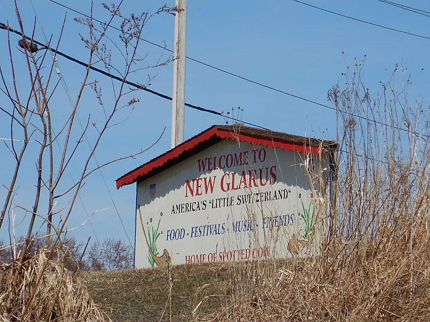
Welcome to New Glarus
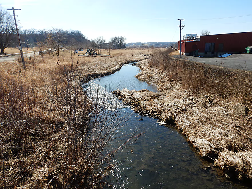
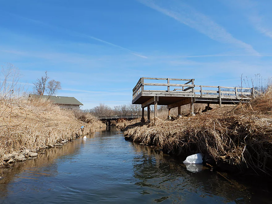
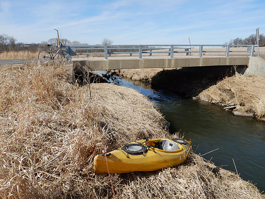
Launching at Valle Tell Soccer Park
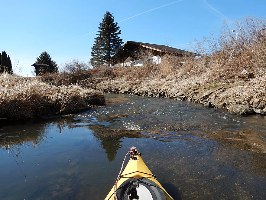
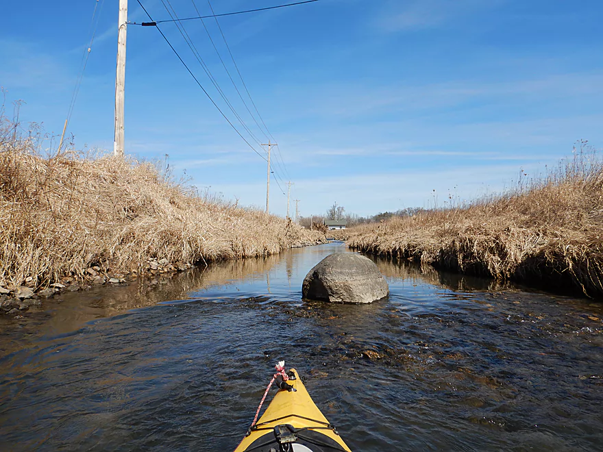
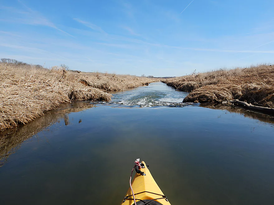
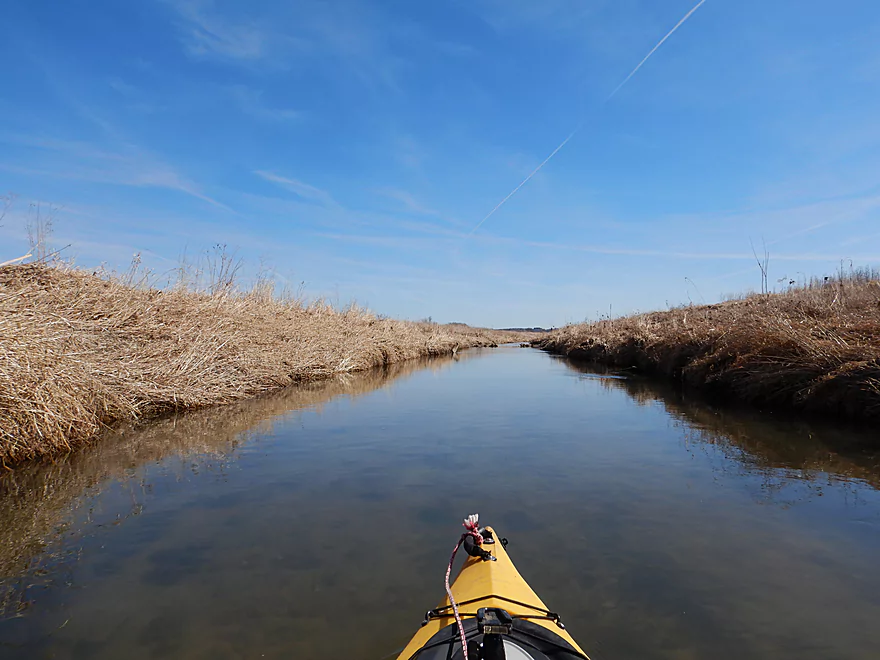
Just upstream of the playground
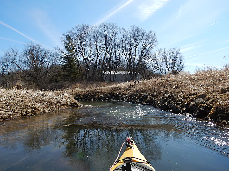
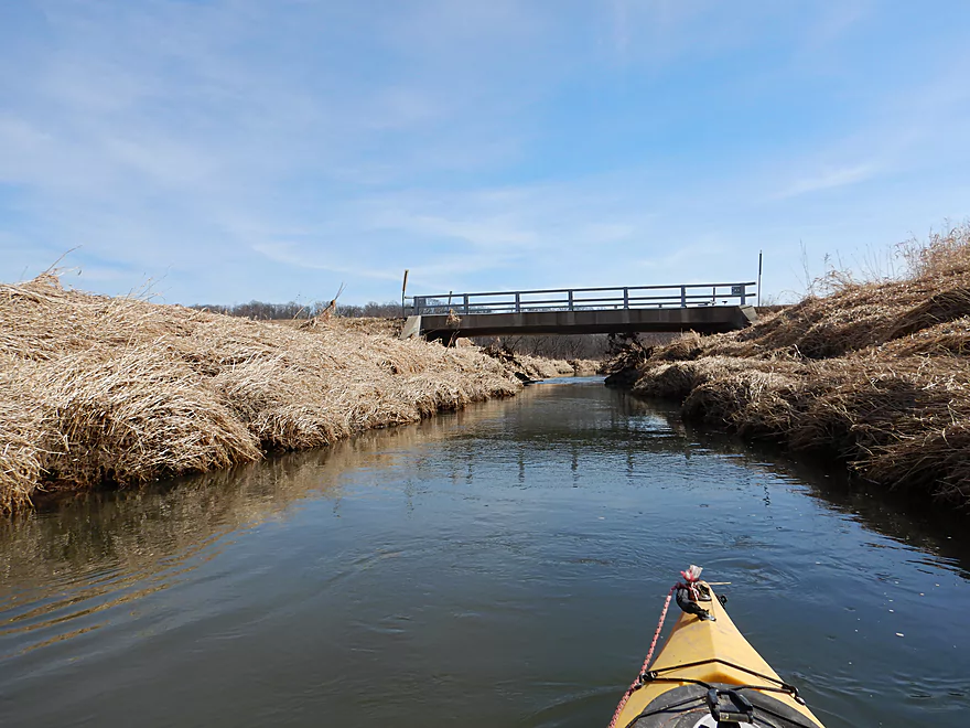
Very narrow channel to start
Many of the buildings have Swiss architecture…including this bank
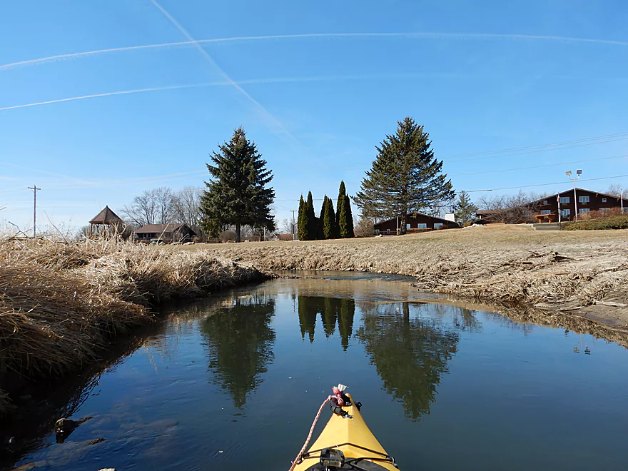
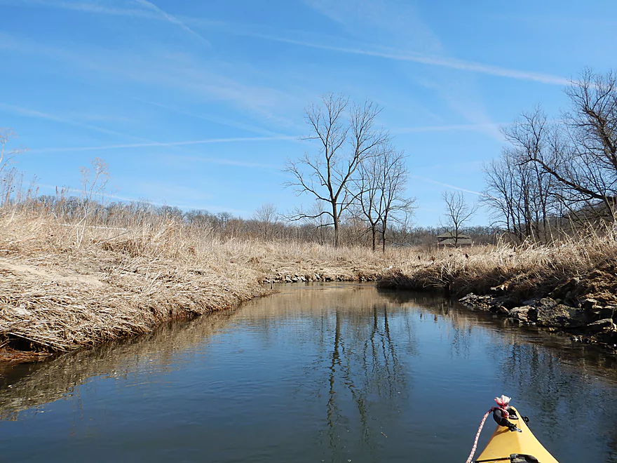
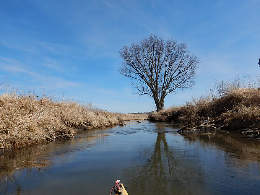
Cool reflections
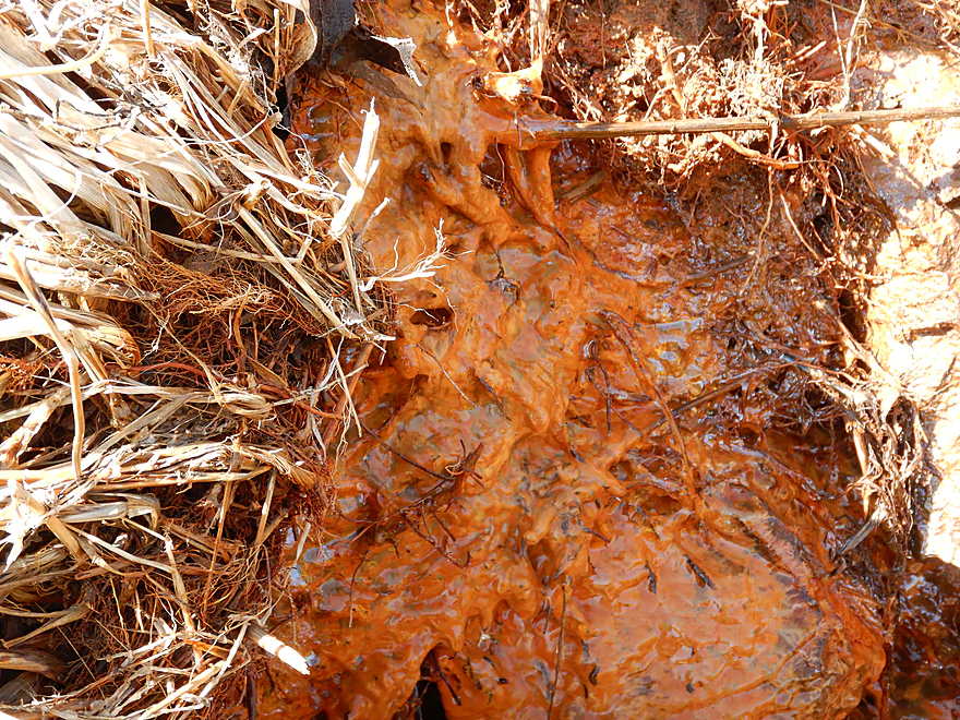
An interesting iron seep with some strange slime
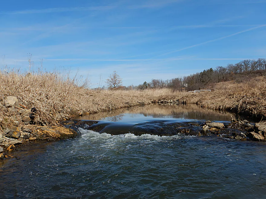
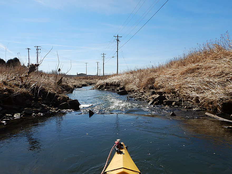
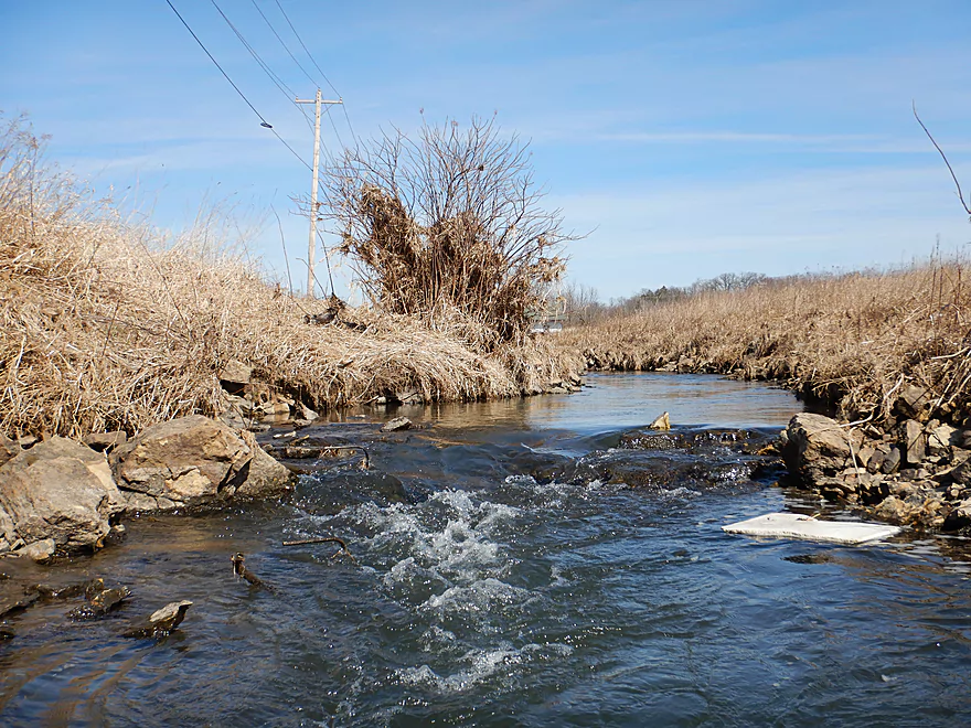
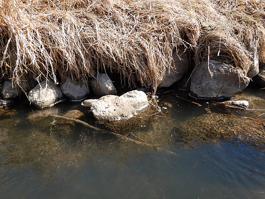
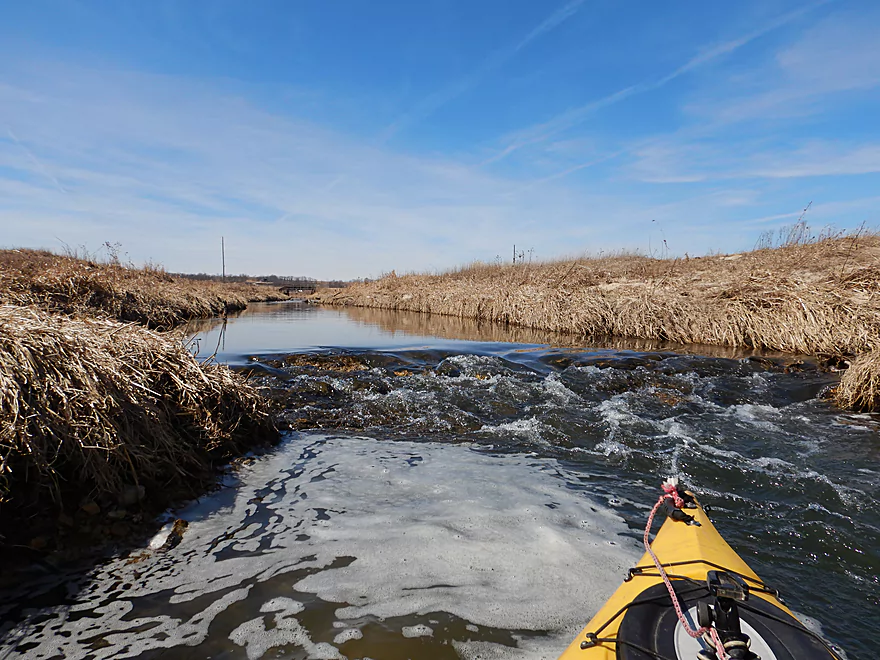
One of many small ledges
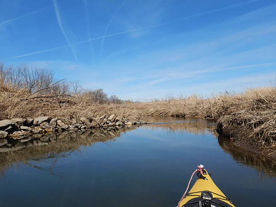
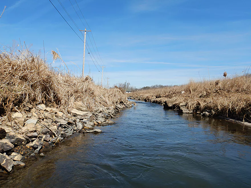
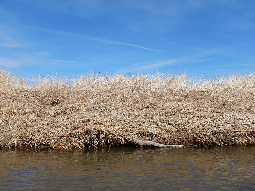
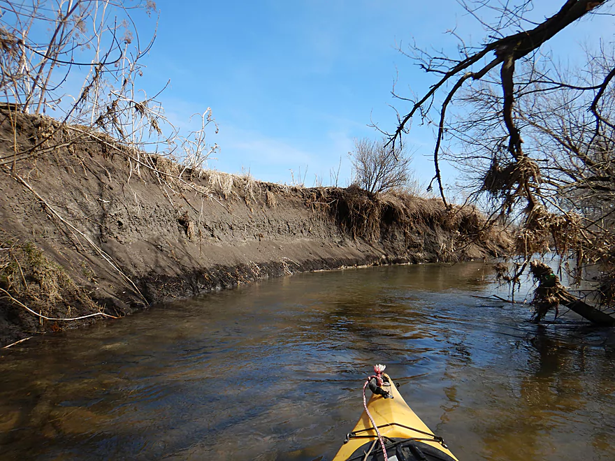
Artificial banks created with fill

Garbage is an issue
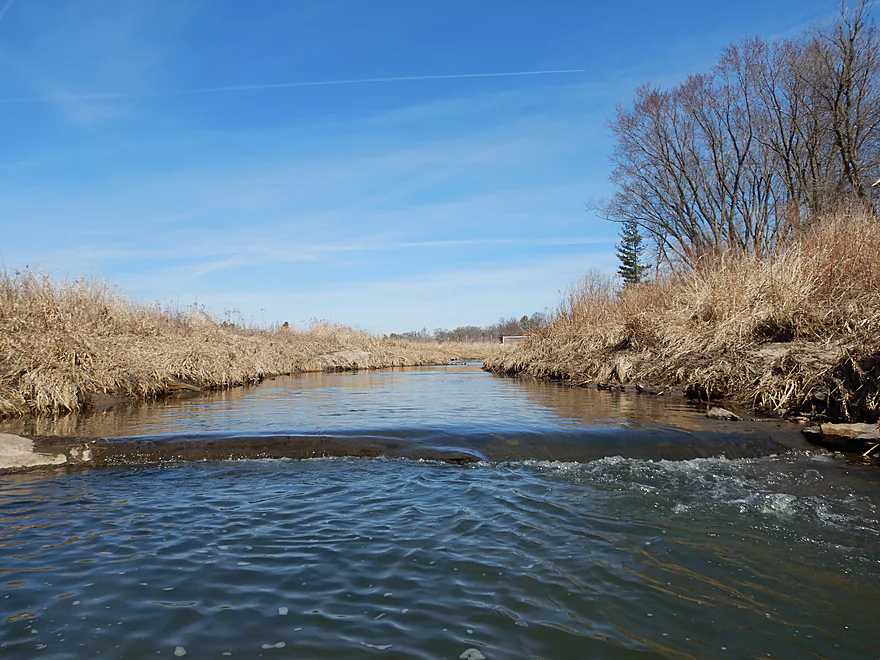
I suspect many of these ledges were created for trout
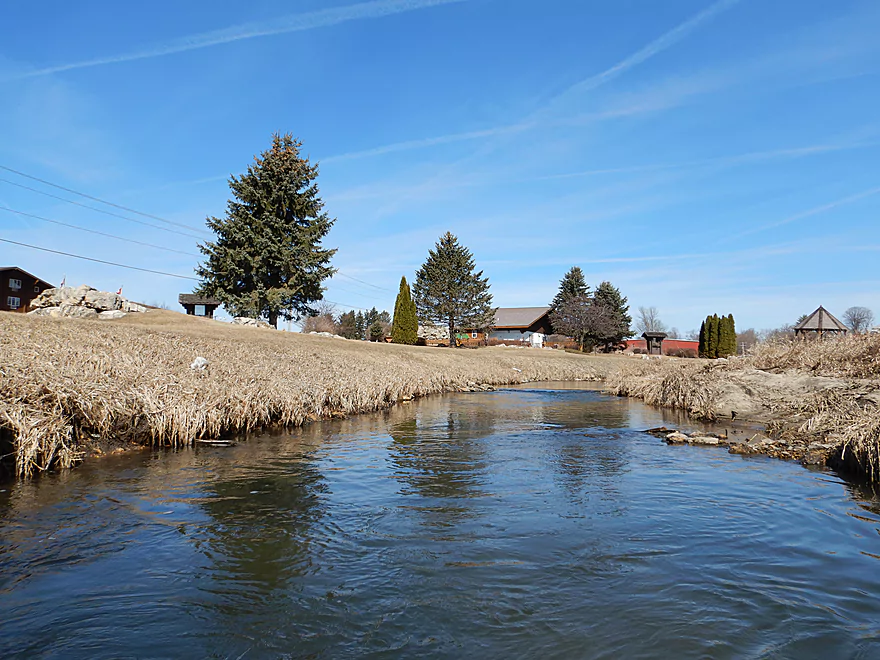
Some were scenic
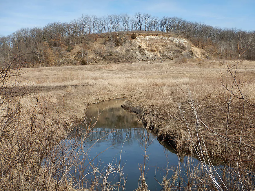
Only hill on the trip
Sugar River State Trail
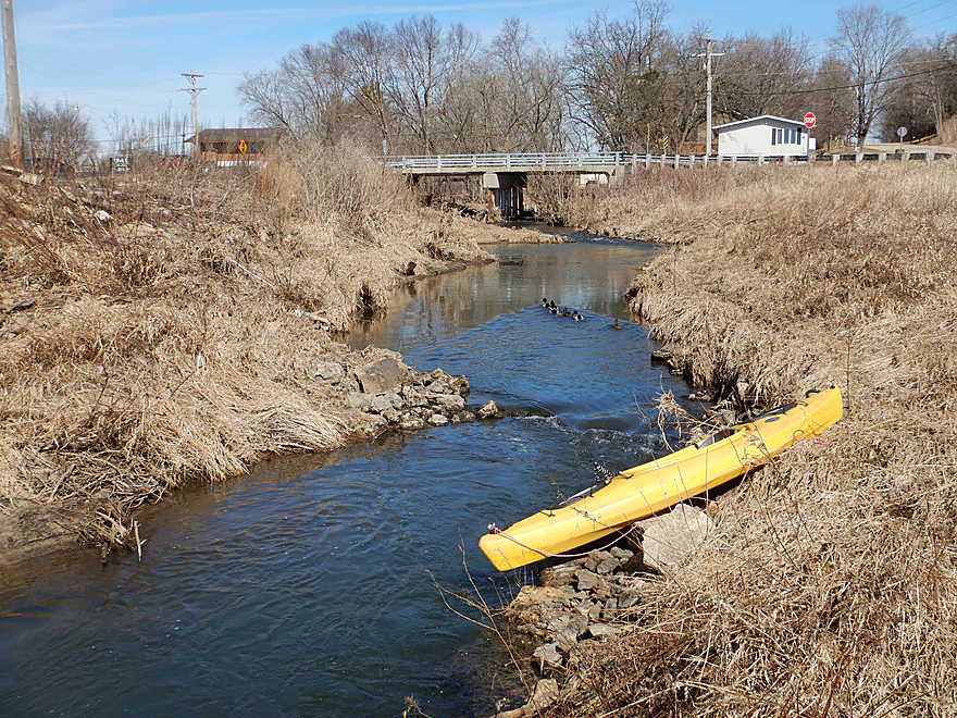
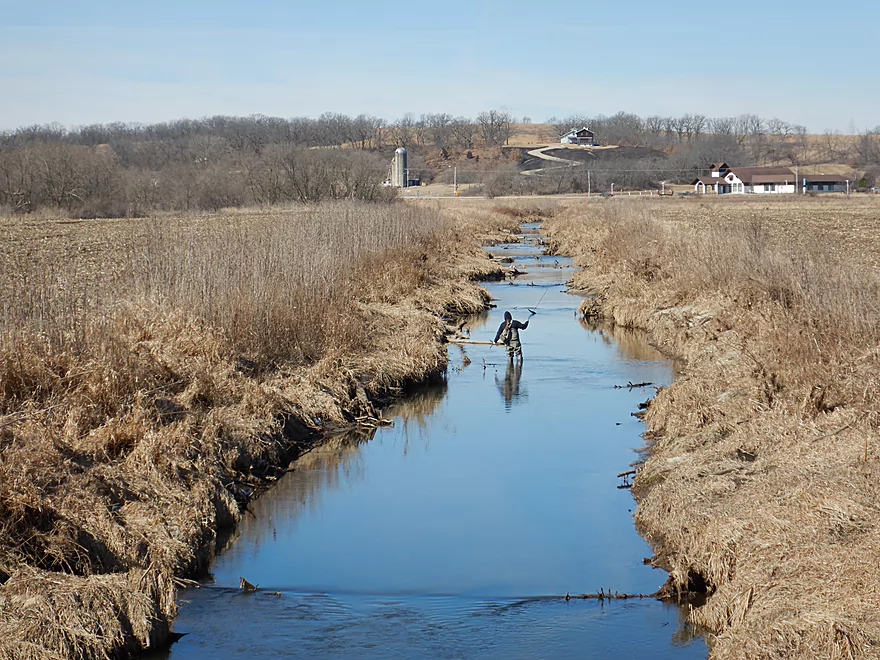
This is a popular section with fishermen
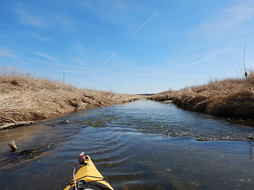
Channel getting very narrow
But I always fit
Scenic…but not sure if artificial debris or a native boulder
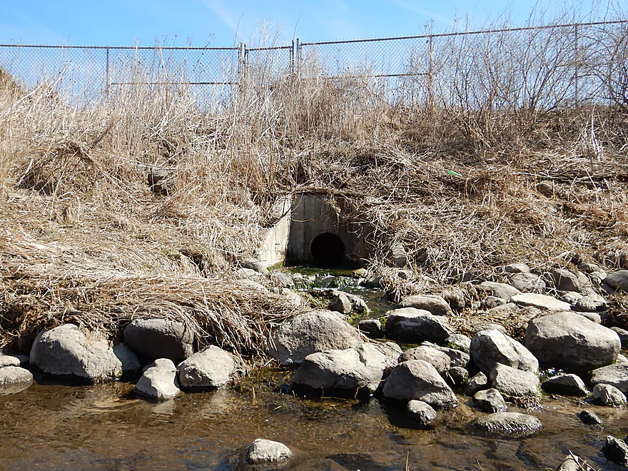
A strong odor came from this direction
The culprit
After the septic plant, algae growth/slime started appearing

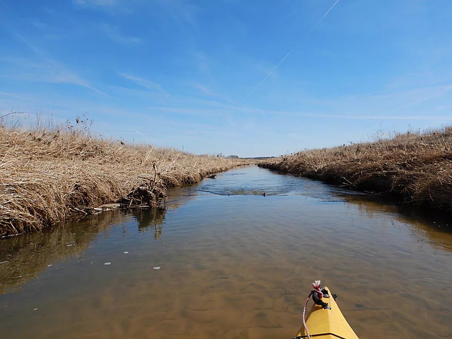
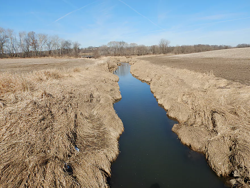
Start of a long straight leg
Substrate became quite sandy
Valley View Road is an access option
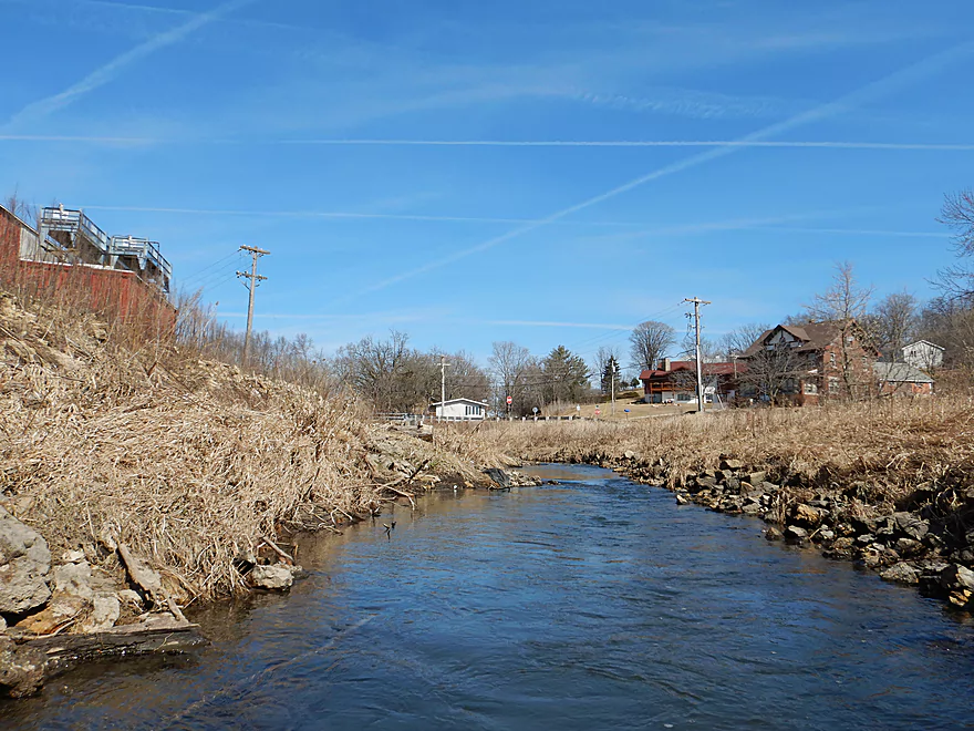
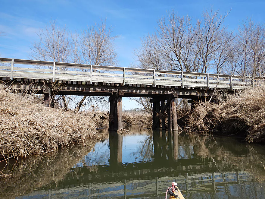
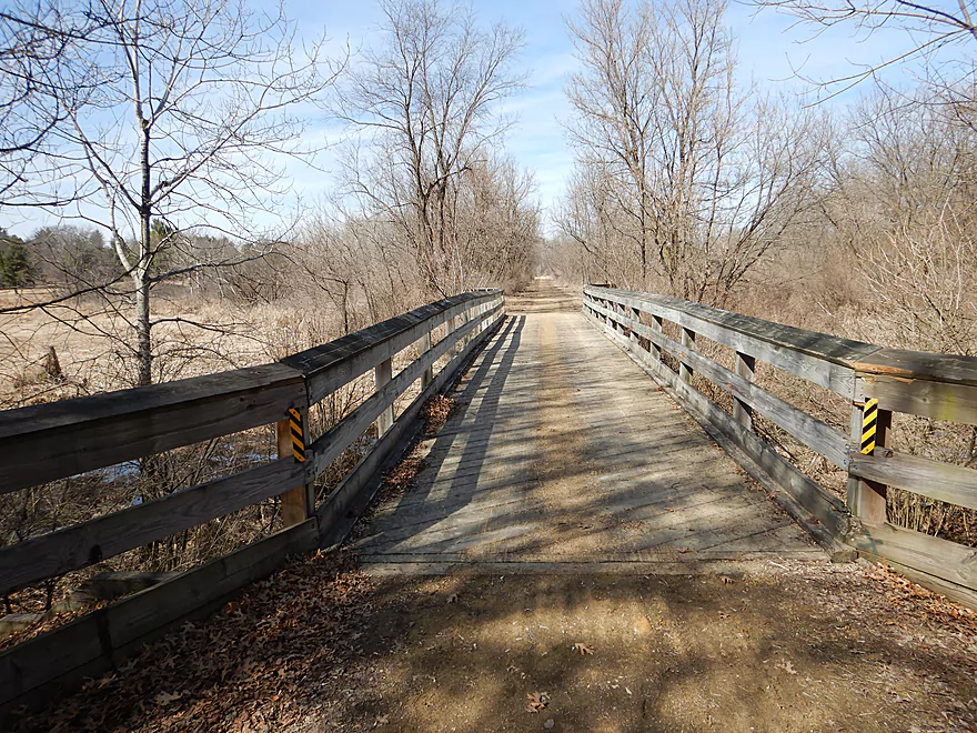
View from the bridge
Cool reflection gradient
Still somewhat zippy
The last of the ledges
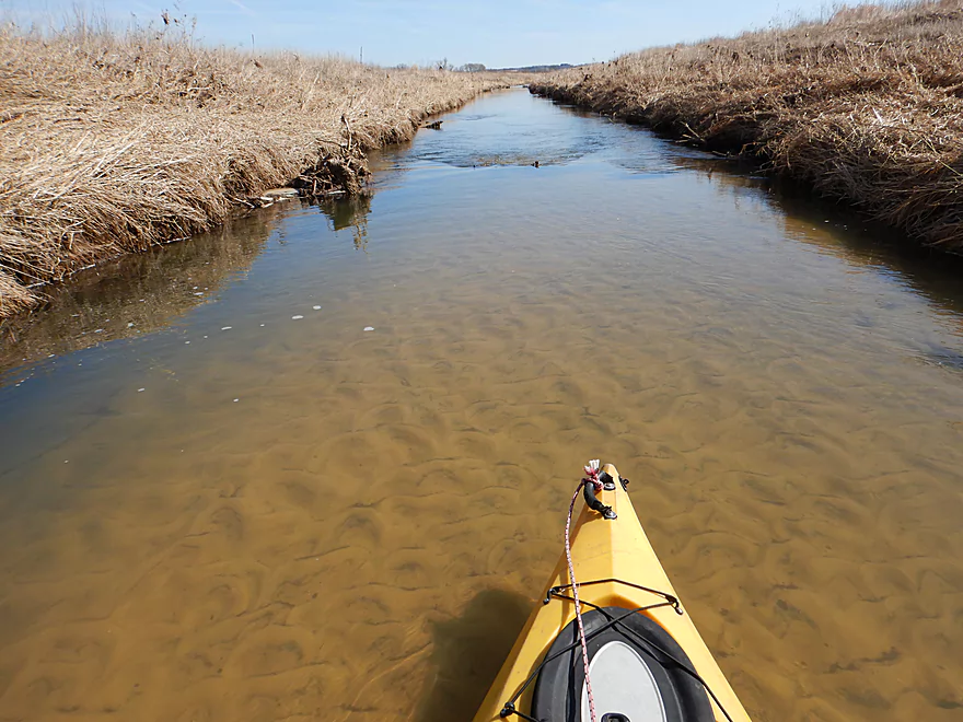
Surprisingly good clarity
Very serene section
Zen-like simplicity and beauty
No trees so far…just grass
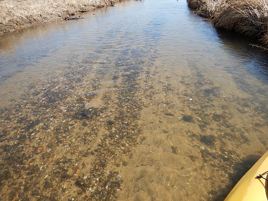
Surprised to see gravel in a river like this
Also surprised to see a sandbar
The first curves after a mile-long straightaway
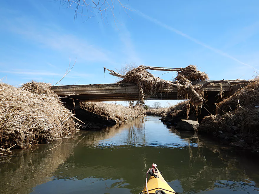
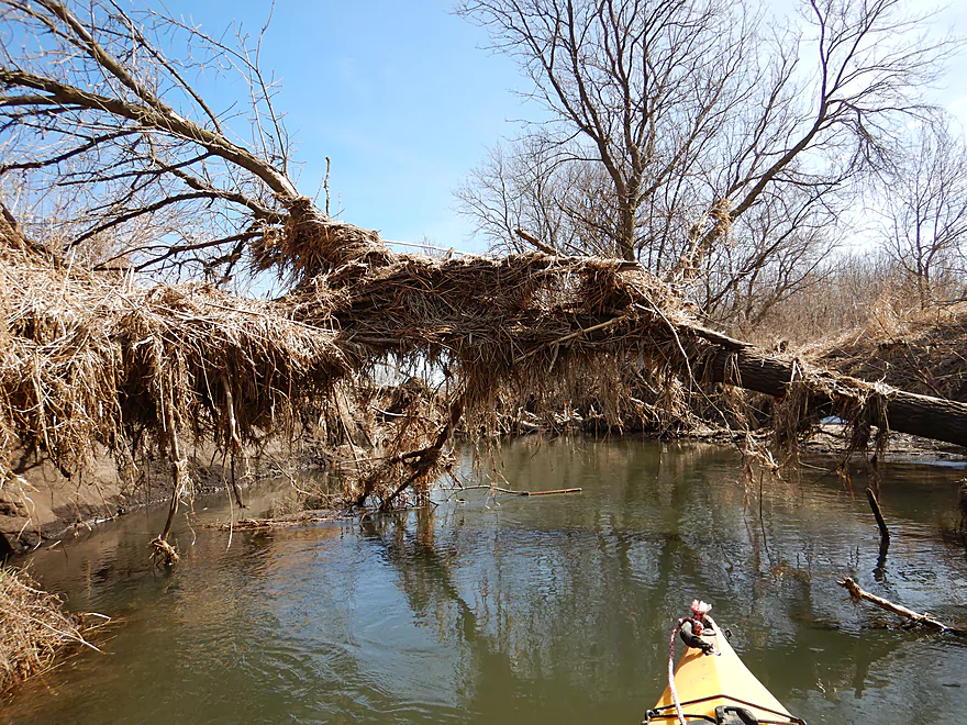
A golf course bridge with serious debris
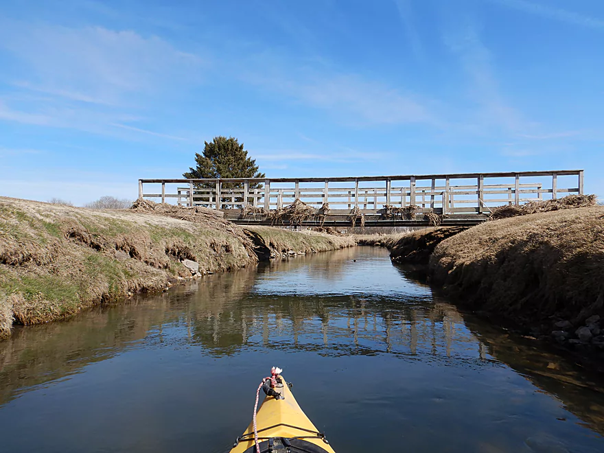
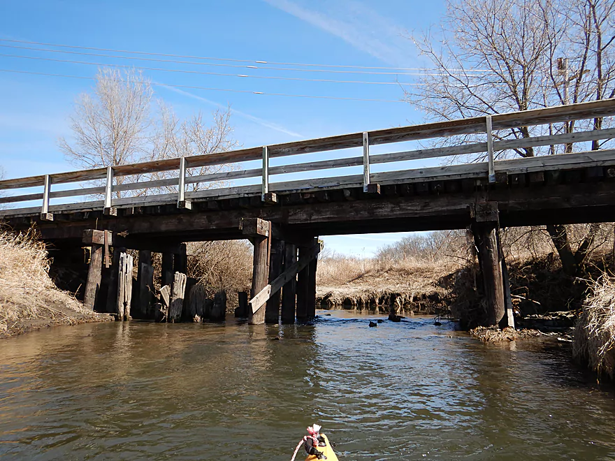
The second of four bridges in a row
The Sugar River State Trail again
After that bridge, things got a bit hairy
A low limb that required serious ducking
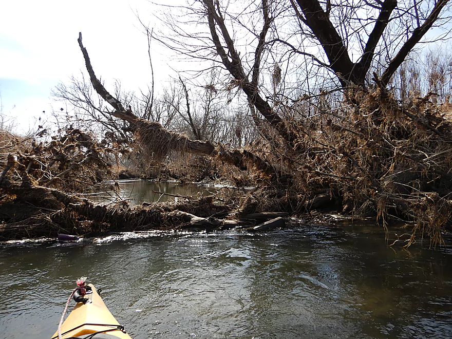
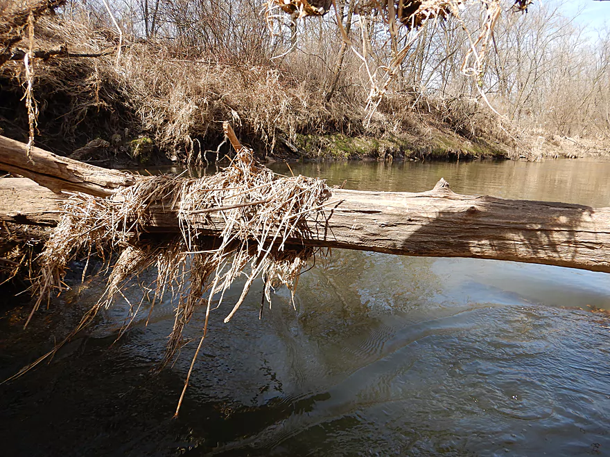
Most of the deadfall you could paddle around
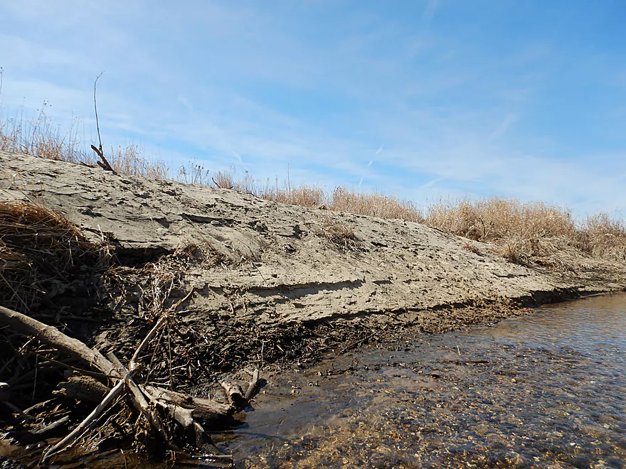
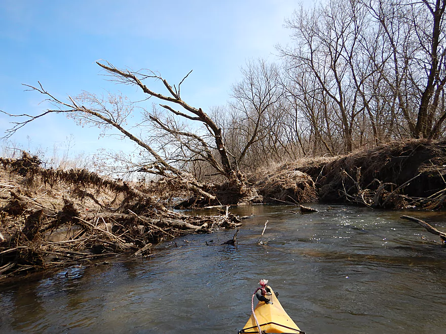
The banks became very steep and muddy
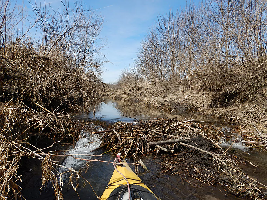
A beaver dam on Ward Creek
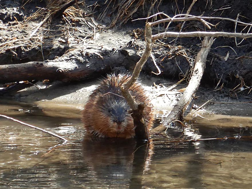
And its friendly owner
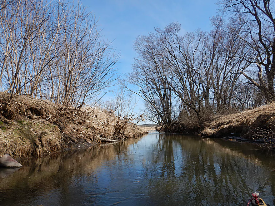
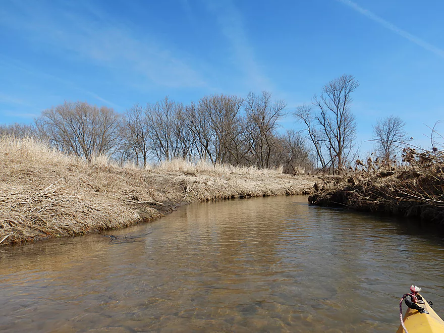
River starts to open up again
I saw a lot of these in the water
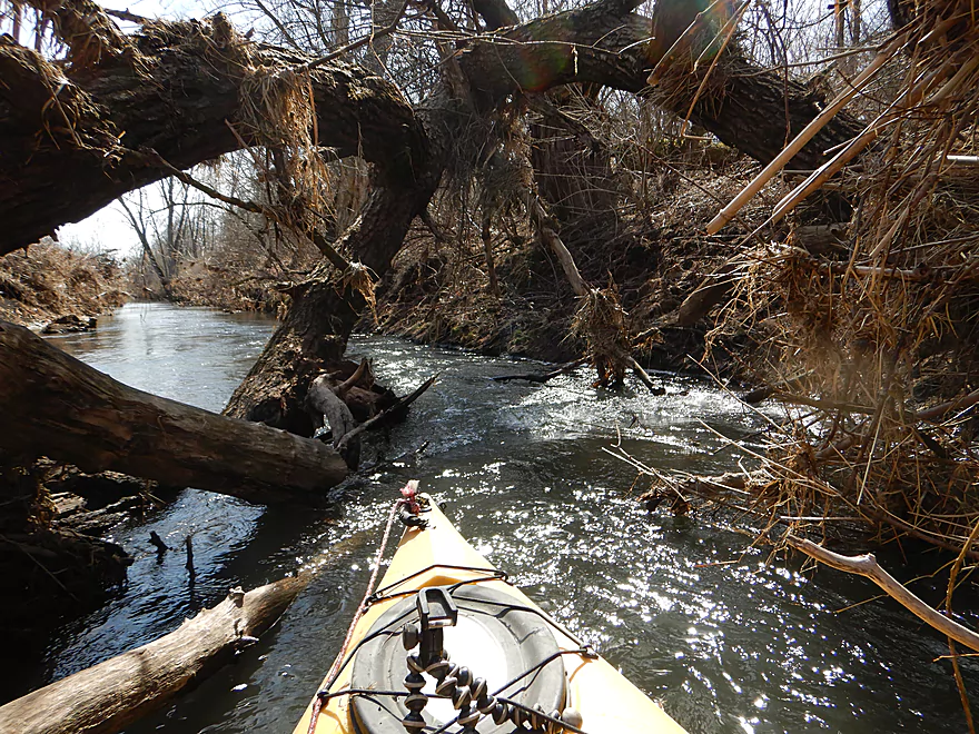
A tricky logjam
The only portage of the trip
Then another low branch to duck under
Followed by a strainer in fast current
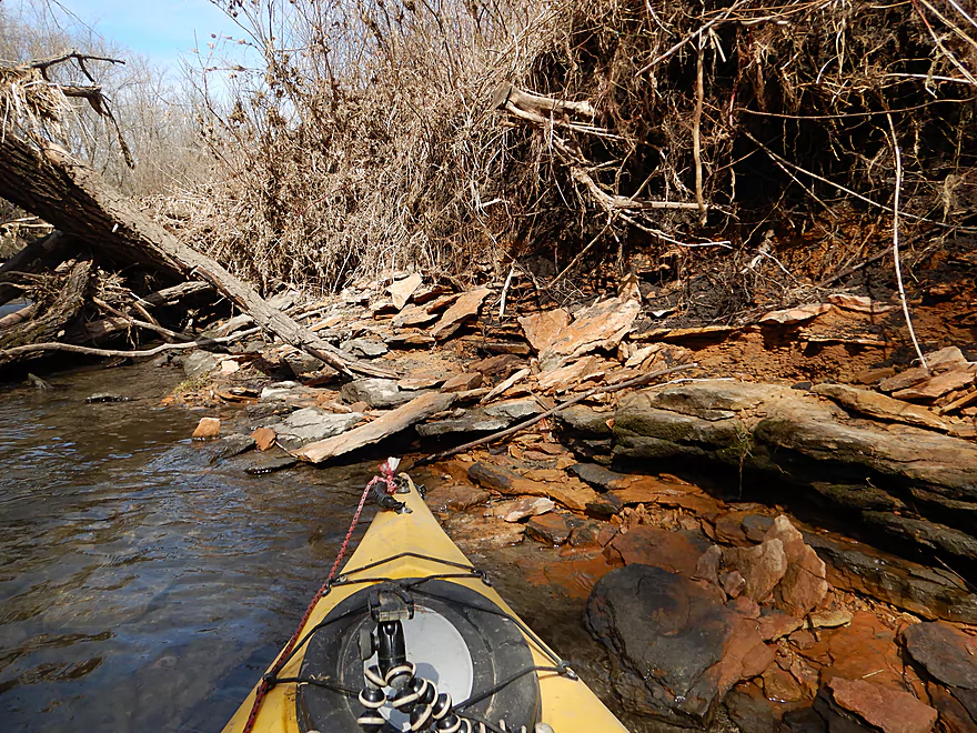
Interesting rock strata
Coming up on Exeter Crossing Road
Which was a doable take-out option
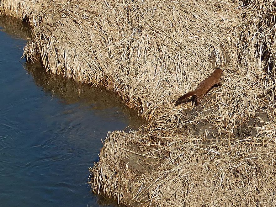
A surprise mink at the take-out
View upstream
Biking (well walking) back to the put-in on the Sugar River State Trail
Little Sugar River – New Glarus

The Little Sugar is a small tributary to the Sugar River, located about a half hour south of Madison. Few paddlers venture onto this small “river” as much of it is clogged with deadfall, but there are open sections worth exploring. In reviewing satellite maps around New Glarus, I was impressed by a remarkable lack of logjams, and after a favorable impression car scouting it, I decided to roll the dice and try it out.
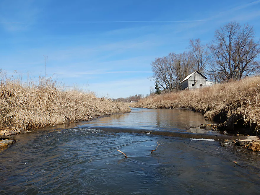
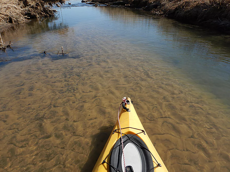
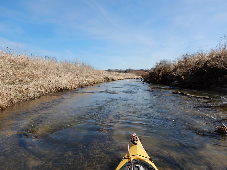
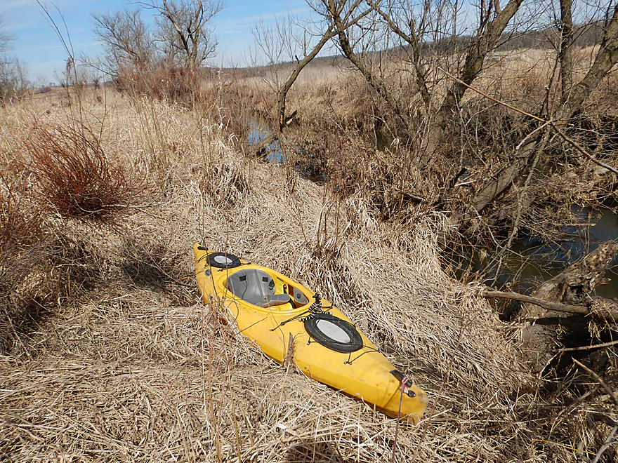
The trip started in the city of New Glarus at the Valle Tell Soccer Park. This was my favorite part of the trip because of the fast riffly current and small ledges. Quite narrow (at times under 8′), this would not be suitable for big boats…but worked great for my 10.5′ kayak.
Chances are if you do this trip on a weekend, you’ll see trout fishermen and I saw four. Much of the upper Little Sugar is designated as a Class 2 trout stream and has endured dramatic trout restoration work to improve habitat. This included rechannelization, channel straightening, and the adding of artificial ledges. I’m not 100% sure I agree with how these restoration projects are always done. In this case, the banks were clear-cut of all trees, erosion has become an issue, and the artificial fill they used for the banks had a lot of garbage on it. …but by removing the logjams and speeding up the river, it sure does make it a more fun paddling experience.
I soon paddled past the New Glarus sanitation plant (unfortunately quite pungent). After this, the river does change significantly. While it stays fast, you lose most of the ledges and the channel widens to about 20′. The plant introduces a lot of nutrients into the water, which is evident by the slimy algae that uncoincidentally starts appearing after this point. Garbage is also a serious problem on this river and it is in serious need of a cleanup.
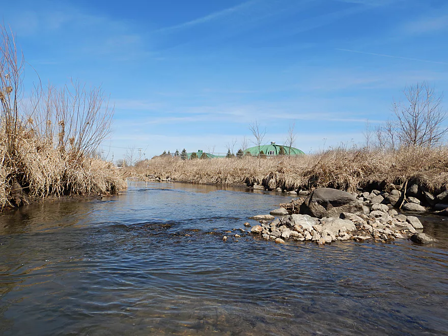
Past the plant the channel straightens dramatically and I experienced no significant curves for the next mile as farm fields replaced the outskirts of New Glarus. Small rocks dot the channel, but I was never really sure which were natural and which were parts of artificial fill. On the face of it, this wouldn’t seem like a nice section because of the beat-up banks, construction fill, and dead limbs littering the shoreline…but it actually was. With no logjams to worry about, good clear water, and no development…this second mile was very enjoyable and peaceful.
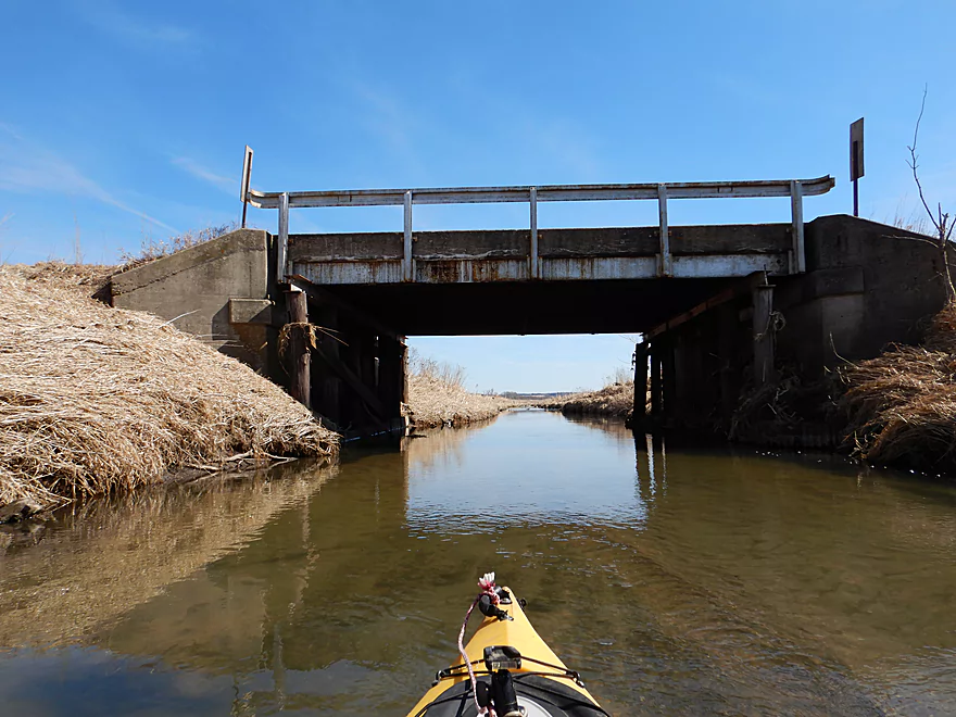
The next noteworthy landmark was the Valley View Road bridge, which you could use as an access if you wished. This roughly marks the end of the Class 2 trout zone, but the creek stayed nice. The substrate becomes sandier with occasional patches of gravel which were easy to see in the clear water, while the channel stayed open and straight.
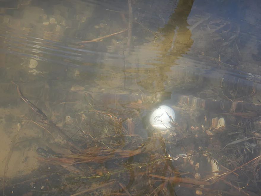
Maybe a mile downstream is a golf course and I started seeing golf balls in the water. The pedestrian bridges used by golf carts are clogged with debris and I had to wonder how often the entire golf course gets submerged by periodic floods.
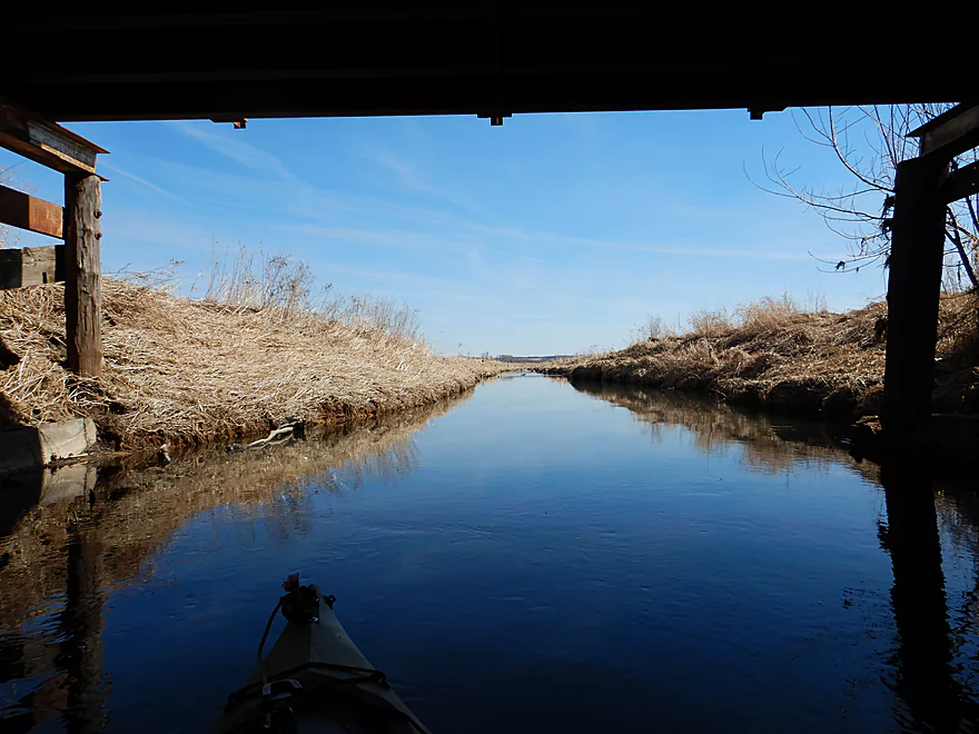
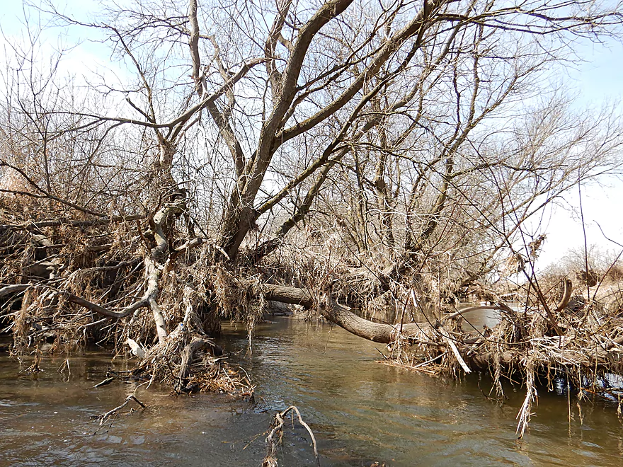
Once I paddled under the second Sugar River State Trail bridge…the river changed dramatically. It finally starts to twist and curve naturally (like rivers are supposed to) and for the first time I saw trees line the banks. Unfortunately the banks here are tall and muddy, and there is deadfall to duck and paddle around. All things considered though…I only had to portage once the entire trip. But it was a muddy and unfun portage that cost the trip a half star. If you do this section, bring grubby clothes and attach a rope to your boat to make doing any portages easier.
After the golf course, the river starts to open back up again with much less deadfall and there was even a surprise section of small rapids. By the time I reached my take-out at Exeter Crossing, the river resembled an oversized ditch, which wasn’t as bad as it sounds. The bridge access here wasn’t an issue, but in hindsight I wish I had paddled the additional 2.6 miles to Hwy C, which looks like a good section with few if any logjams.
Valle Tell Soccer Park in New Glarus is a popular access option for trout fishermen but works equally well for kayakers. Street parking is available on Elmer Road and it is easy to launch west of the playgrounds near one of the ledges.
In hindsight I wish I had launched about a half mile upstream, where I believe there is a public fishing location just northwest of the Hwy 69 bridge (see map).
Exeter Crossing is a simple bridge access option. Banks are a bit steep here, but it is isn’t difficult to take out if you disembark directly under the bridge by the rocks. Parking is available on the shoulder. Many paddlers may want to extend the trip 2.6 miles and take out at Hwy C instead.
Google maps will tell bikers to take the Sugar River State Recreational Trail. This is flat and only 3.5 miles, which typically would be a very good option…but the trail was in very poor condition and really it was too soft for biking. I walked most of the three miles :(
I learned after-the-fact that there was another state trail just to the west of Hwy 69 that is far superior, paved, goes through New Glarus Woods State Park, and would have only been 4.3 miles. Take that trail instead.
If you use either trail, make sure you purchase a state trail pass so you don’t get ticketed by a warden.
There are a number of light rapids and ledges on the trip (mostly near New Glarus), but all are safe and none greater than Class 1. Roughly speaking the river starts fast and slows the further downstream you go.
Prior to the golf course there are no logjams (not even squeakers). But after the golf course, there is a congested stretch that has some downed trees. Most are easy to duck under. There were two instances though in which I had to duck extremely low (as in my back was touching my kayak floor) and less determined paddlers would portage. Portaging is doable but not easy as the banks are muddy and somewhat high at this point in the river.
I only had to portage once (marked on the map). Honestly, it wasn’t fun climbing up a steep 4′ mud bank and hauling my boat up after me with rope…but I’ve faced worse.
The most approximate gauge is likely the Sugar River one which read 59 CFS. This might be a smidgen above average. The following is a rough depth guide for the river.
- 0-40 CFS: The stretch above Valley View Road would likely be too shallow to run.
- 41-70 CFS: A good average depth and a good target range for paddling. I did the trip at 59 CFS, which had good clarity and I only was grounded twice.
- 71-95 CFS: A high depth, but likely doable. This will allow you to go over some downed trees but will force you to portage others.
- 96+ CFS: Maybe too high…it is tough to know.
Some ducks, a few clams, what looked like a trout, and a mink at the take-out. The highlight was a beaver dam at the mouth of Ward Creek and getting really close to the owner…who wasn’t afraid of me. The DNR has a nasty habit of killing beavers and I hope they leave this guy alone. Honestly some of the artificial trout ledges were bigger than his dam.
New Glarus is a quaint little immigrant town that is proud of its Swiss Heritage. You’ll see many Swiss-style buildings and life-size decorated plastic cows around town.
Just to the south and atop a hill resides the New Glarus Brewing Company. It’s quite the operation and looks like a medieval Swiss village. Roughly 150,000 people a year visit the facility making it quite the tourist attraction.
New Glarus Woods State Park is just southwest of town which I don’t know much about, but it does offer camping and an extensive hiking trail network.
The famous Stewart Tunnel is just a few miles northeast of town. Your best access option is likely off Tunnel Road (the south crossing). You can then peddle a half mile north on the Badger Trail to reach the tunnel.
Click here to see an overview map of the Little Sugar River.
- Old Madison Road to Hwy 69/W Intersection: (1.3 miles) River is very narrow here and likely requires high water to run. Very good water clarity. Maybe 4-6 logjams.
- Hwy 69/W Intersection to Valle Tell Soccer Park: (0.4 miles) Just northwest of the 69/W intersection there appears to be a public pull-off and a nice pedestrian bridge that might be a good launch spot. This little section looks nice and I wish I had done it. Maybe 1 logjam.
- Valle Tell Soccer Park to Exeter Crossing: (4.1 miles) A nice trip that has seen trout restoration work and channelization. Good current and water clarity.
- Valle Tell Soccer Park to Valley View Road: (1.5 miles) Great section with fast current, small ledges and no logjams. Very narrow, this segment is only suitable for small boats.
- Valley View Road to Exeter Crossing Road: (2.6 miles) A pleasant section that starts open, then flows by a golf course and finally through a more congested bit of woods. There are two serious “duckers” and one low tree I had to portage around.
- Exeter Crossing Road to E. Coates Ave: (2.8 miles) Maybe 0-2 logjams. Looks to be sandy, open and somewhat channelized. A good prospect with clear water.
- E. Coates Ave to Hwy EE: (1.5 miles) Maybe 3-6 logjams. This is a very open and grassy section. Portaging should be much easier because the banks are relatively low.
- Hwy EE to River Road: (2.0 miles) Deadfall is likely an issue. Maybe 8-12 logjams.
- River Road to Silver Road: (4.1 miles) Deadfall is likely an issue. Maybe 12-16 logjams.
- Silver Road to Schneeberger Road: (2.0 miles) Deadfall is likely an issue. Maybe 6-10 logjams.
- Schneeberger Road to Tin Can Road: (4.4 miles) A very wooded section that is attractive and a scenic paddle. However, logjams are a serious issue and several require difficult portages. Not recommended.
- Tin Can Road to American Legion Park: (3.2 miles)
- Tin Can Road to Mouth on Sugar River: (1.9 miles) A simple but pleasant stretch with ok scenery. Most of this flows through the Albany Wildlife Area. The highlight is “Reuben’s Cave” which you can explore.
- Mouth to American Legion Park: (1.0 miles) The Albany Dam creates a shallow impounded lake on the Sugar River. It’s not super interesting and has some shoreside development, but it does feature some attractive wooded hills.
Trip Map
Overview Map
Video
Photos Size:
I ran this section and went beyond where the reviewing paddler stopped — to Green County Hwy. C, and it is totally navigable. 50 cfs was the level the day I did it and that was adequate.
You have to like paddling in a ditch, as the Little Sugar was straightened by and channelized by the railroads to minimize stream crossings. It makes this stream less interesting than most.
Thanks for the update…I do want to do that bonus stretch you did.
On 8/4/22 I paddled from Schneeberger Road to Albany Lake. The section from Schneeberger Rd to Tin Can Road had many, many deadfalls and logs across and was frankly a miserable trip. I had to get out numerous times to portage around or pull over trees, and the banks were steep and muddy and overgrown, and I was often sinking nearly to my knees in mud. After Tin Can Road it was fine – no more portages. I would not do the section above Tin Can Road again; below Tin Can it is really nice. On previous trips I have simply paddled upstream from Albany Lake, and that is quite easy and saves a shuttle.
Thanks for the information, which is very helpful for other paddlers.