
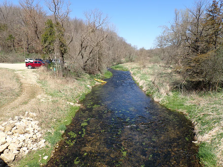
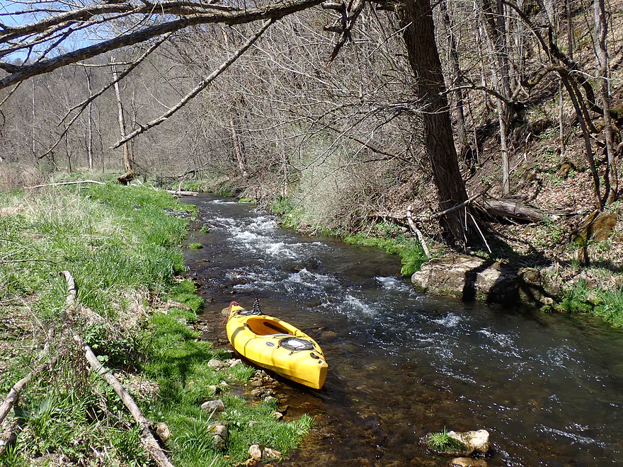
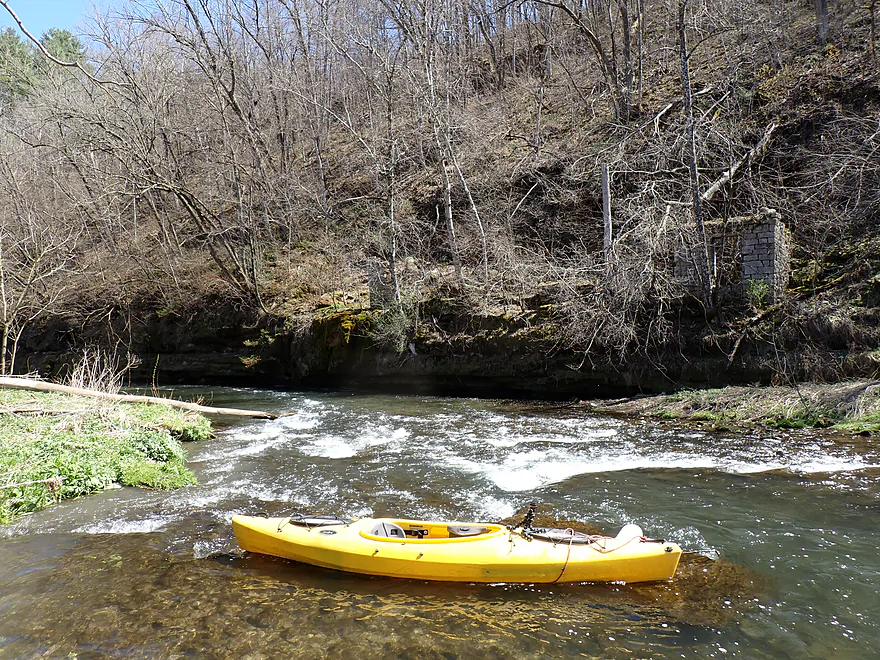
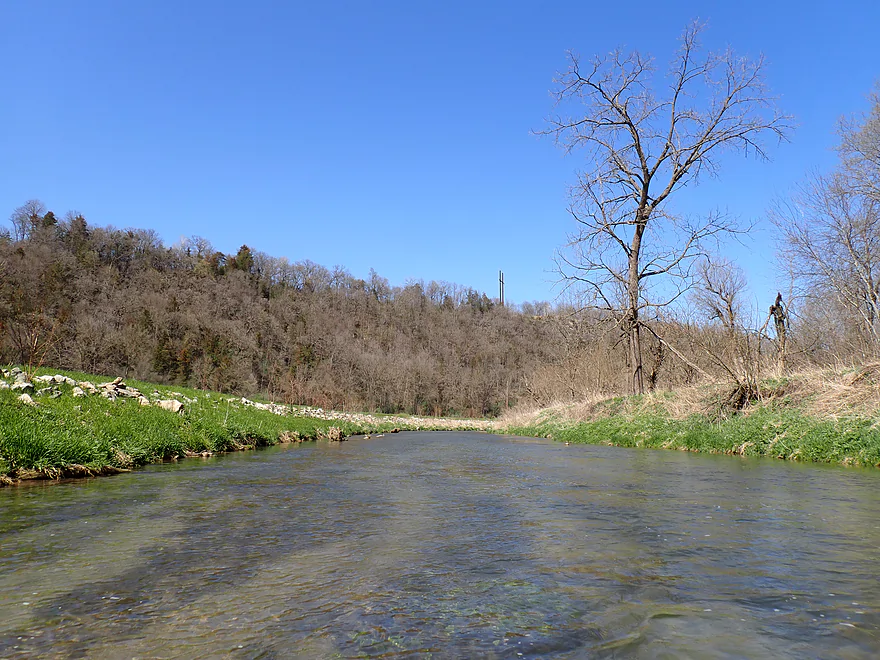
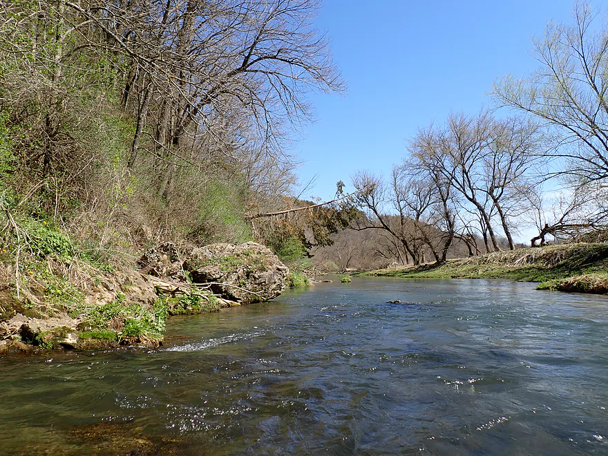
Starting at 360th Street which is popular with fishermen
Great access
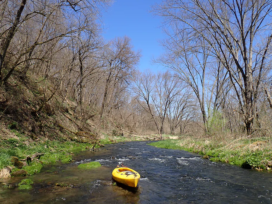
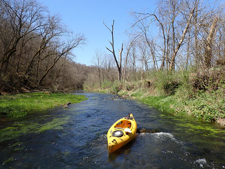
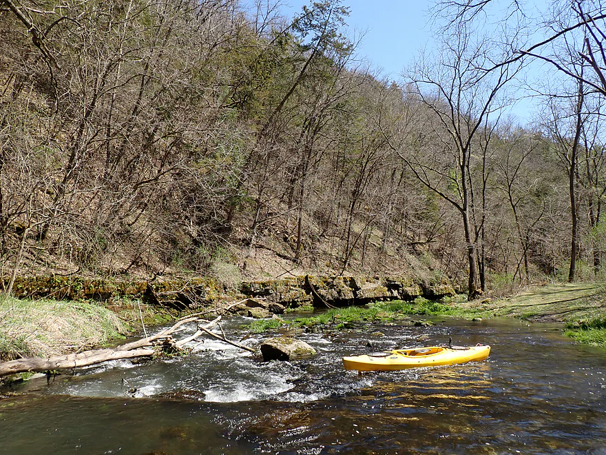
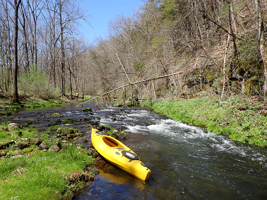
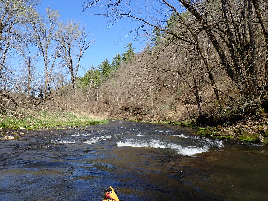
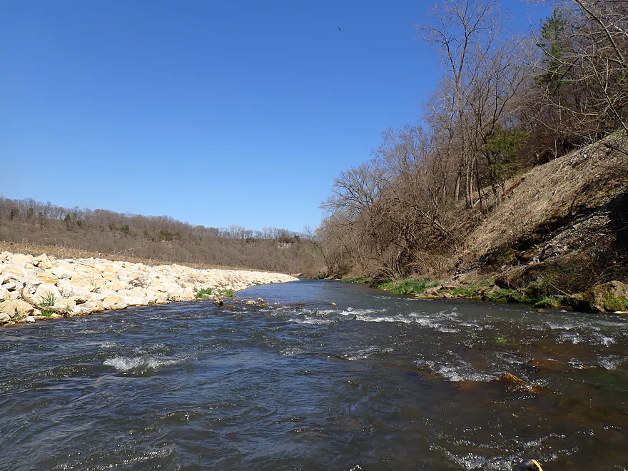
Rapids right off the bat
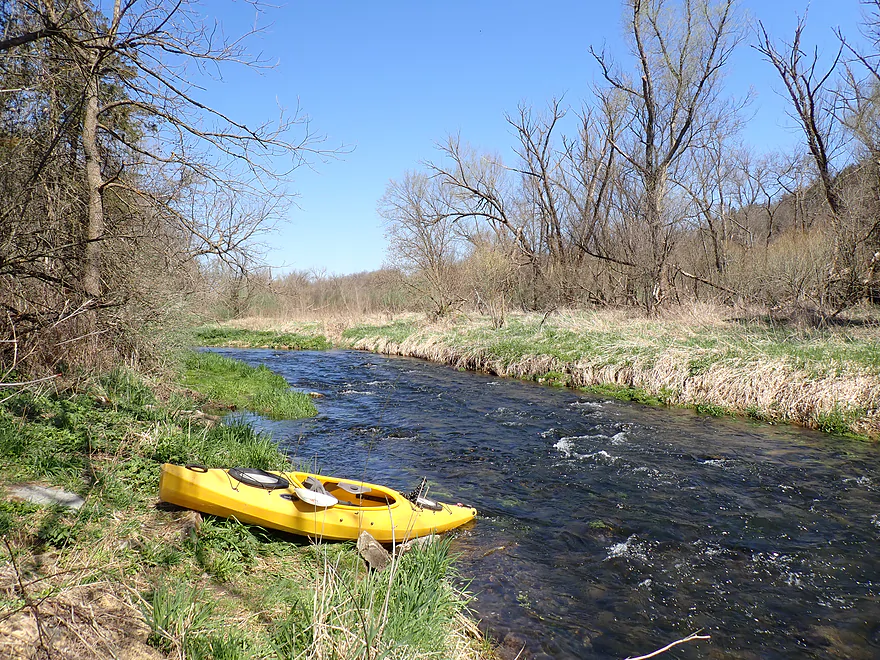
Incredible clarity (creek is mostly spring-fed)
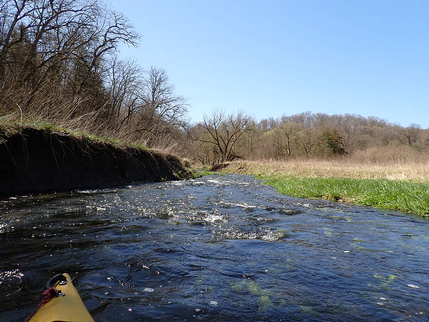
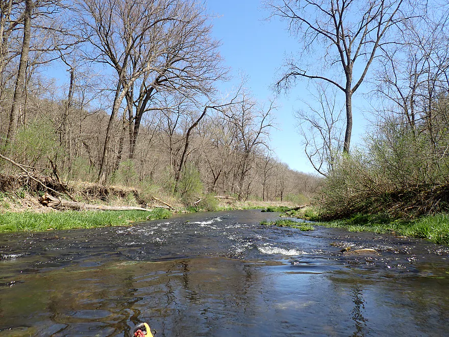
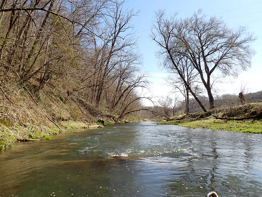
North Bear Creek is really fast
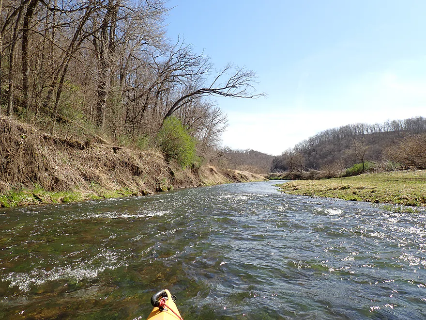
Some shallow spots
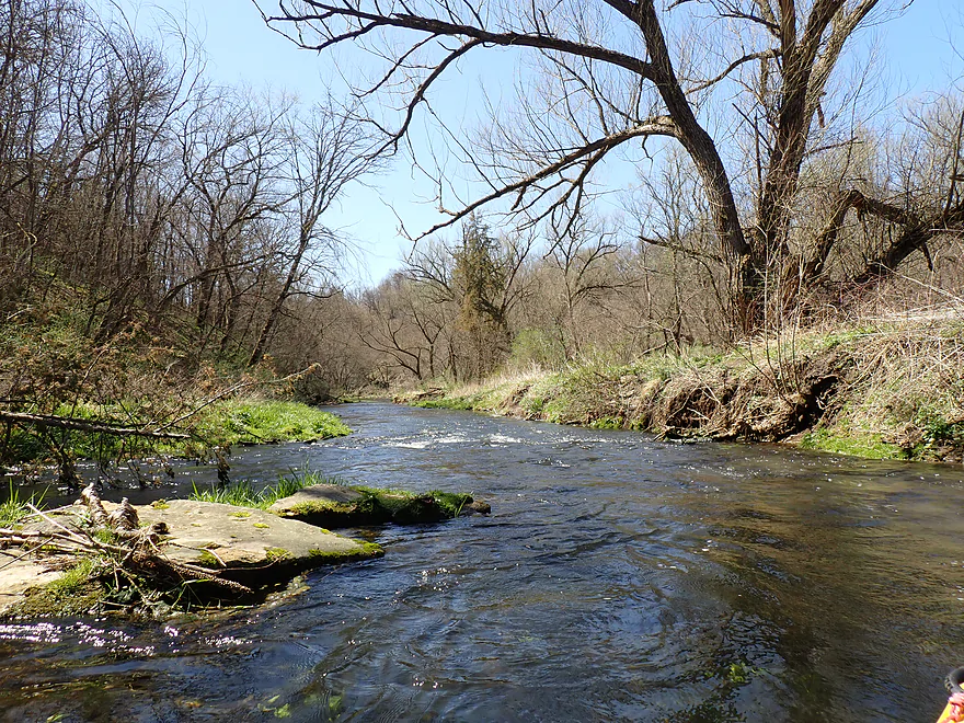
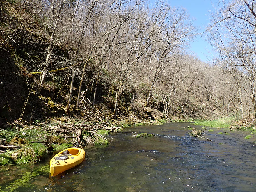
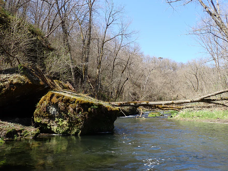
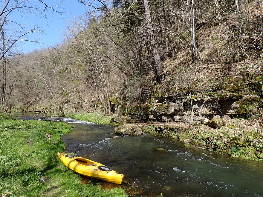
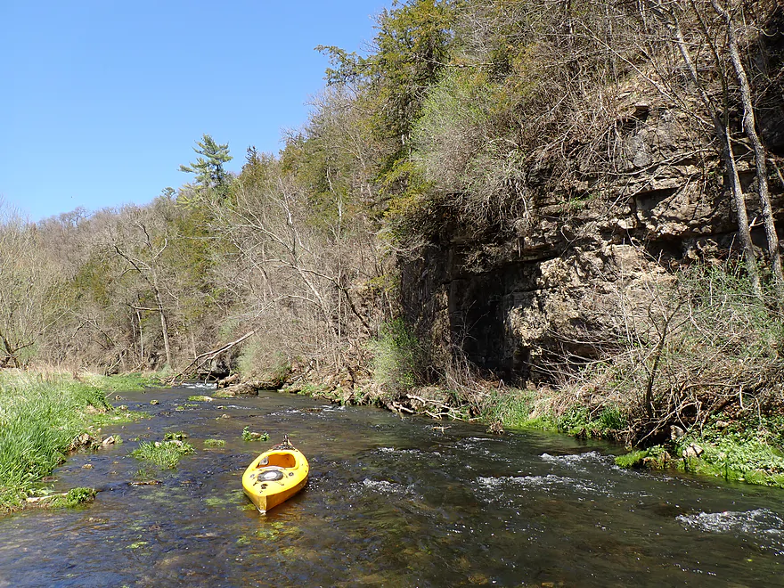
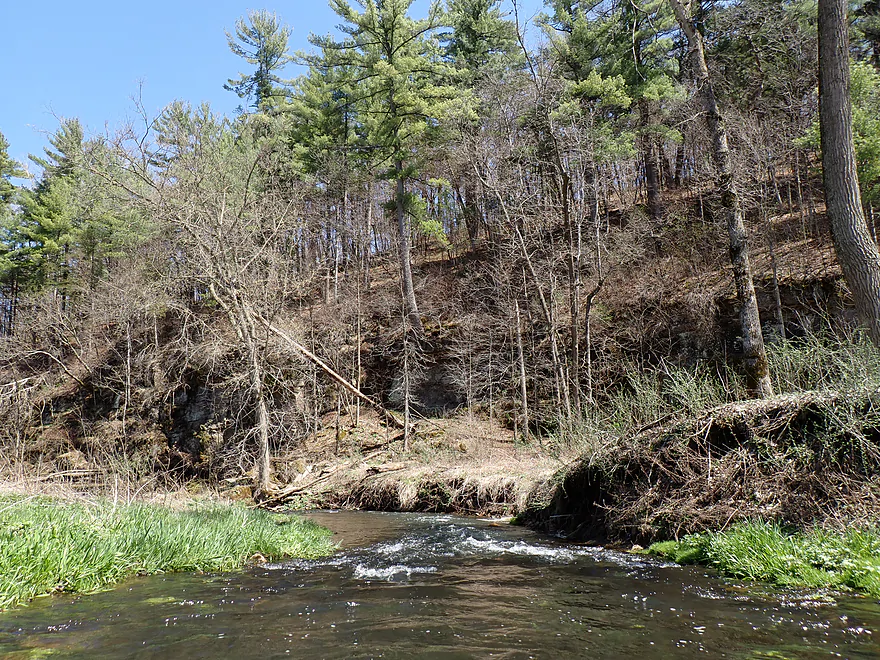
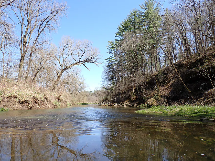
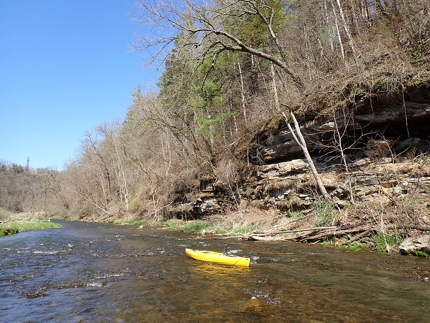
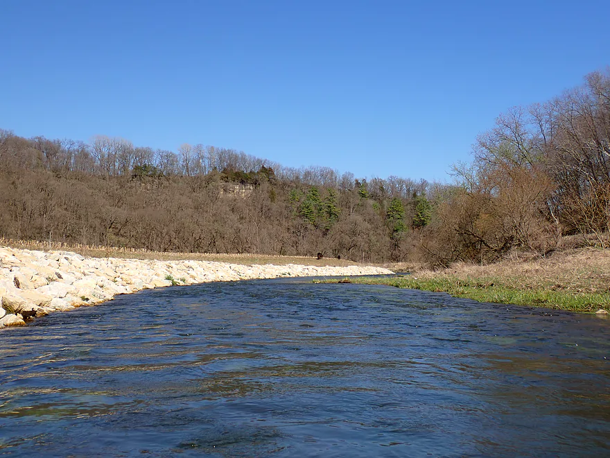
A scenic bluff
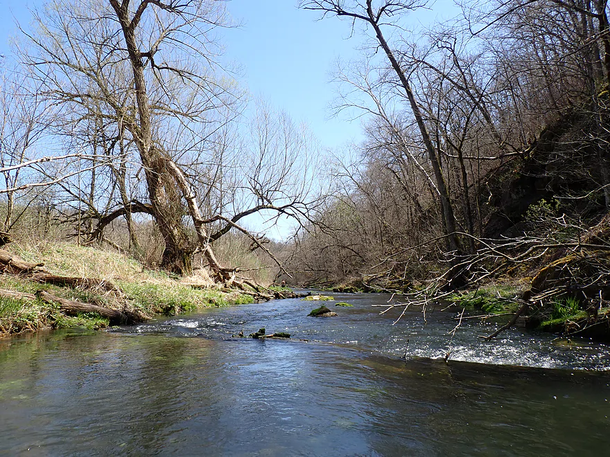
Reverse view
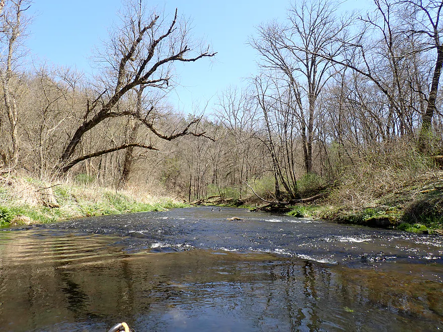
Looking forward…some tricky rapids
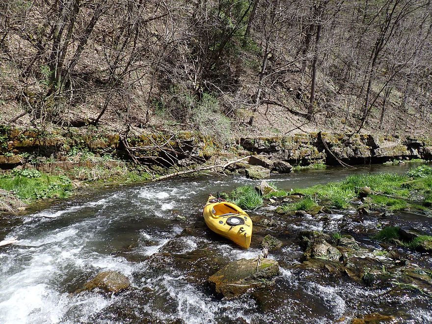
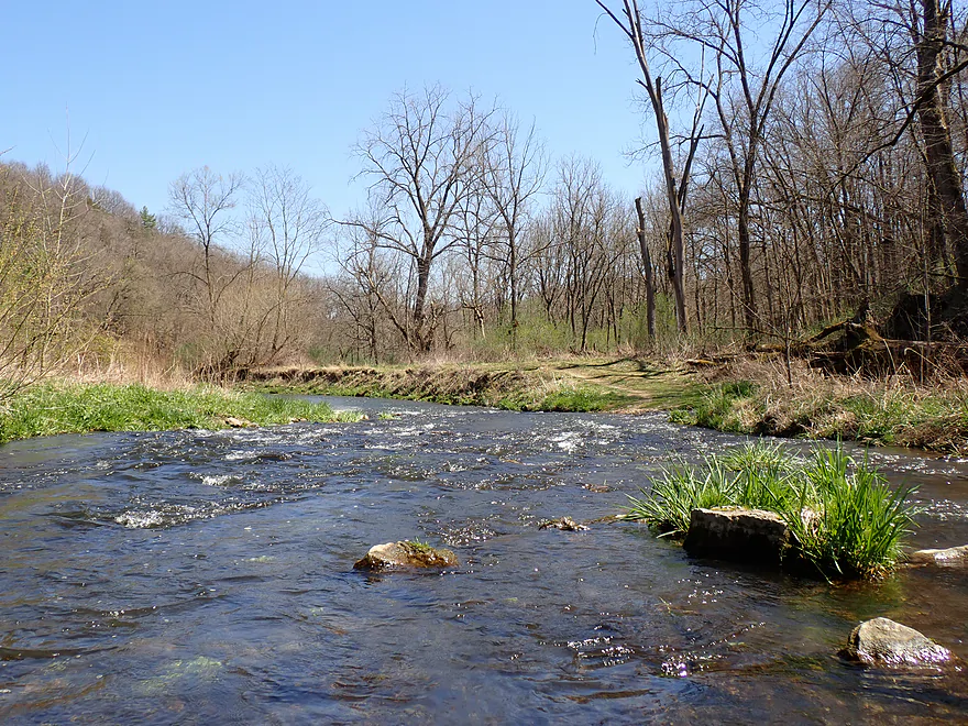
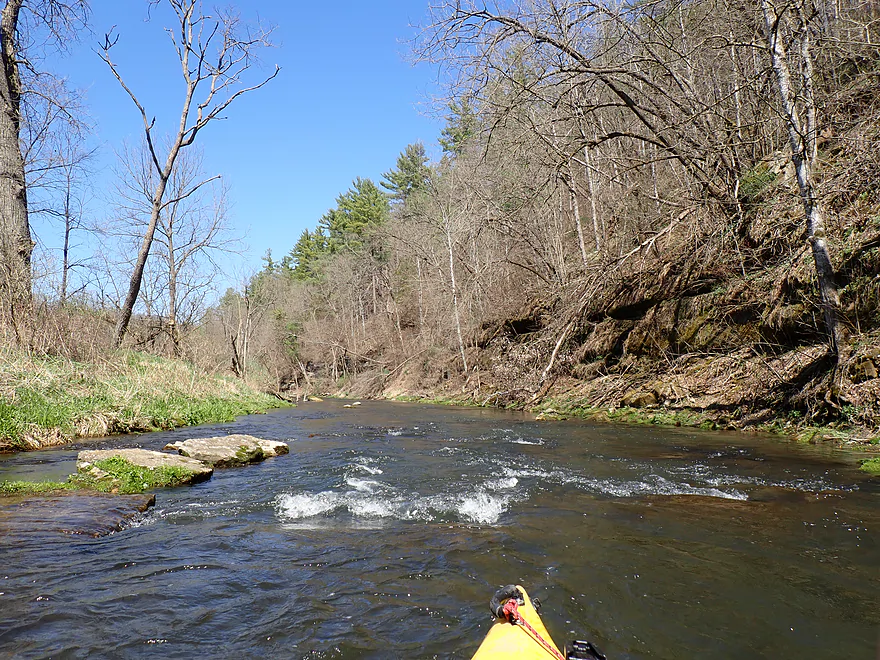
Nice boulders
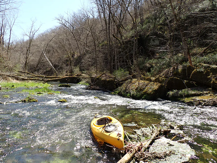
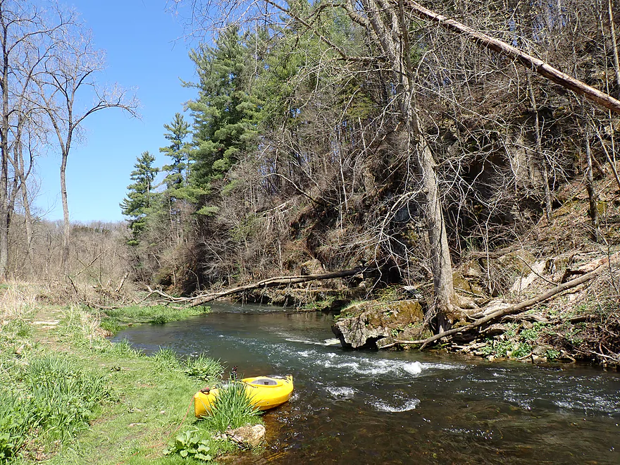
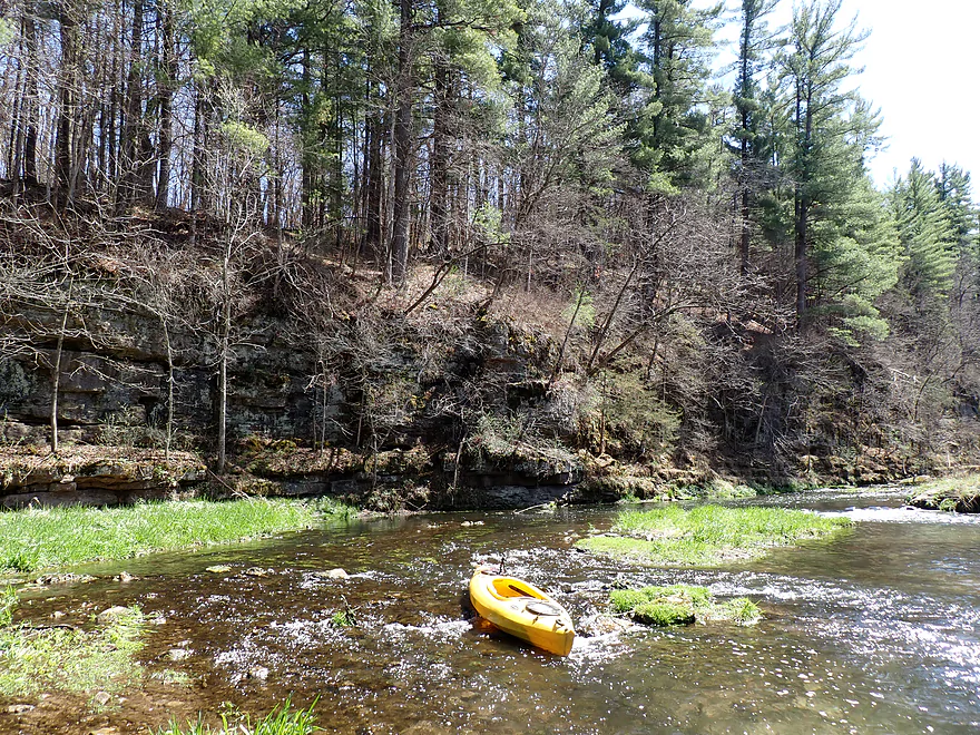
Most pictures of North Bear Creek are of this stretch
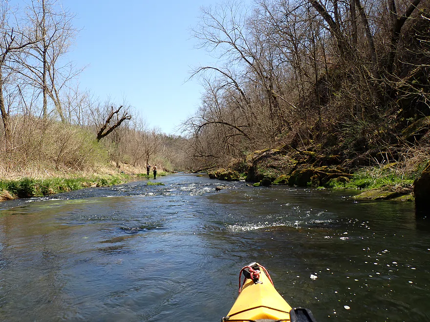
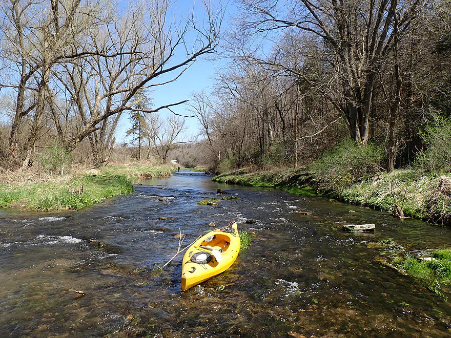
About to pass some fishermen
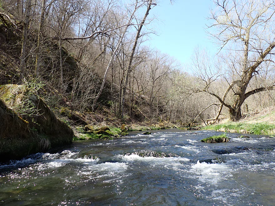
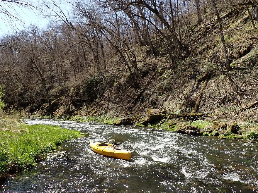
More rapids
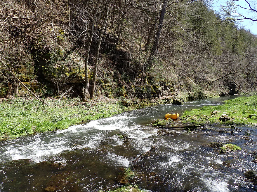
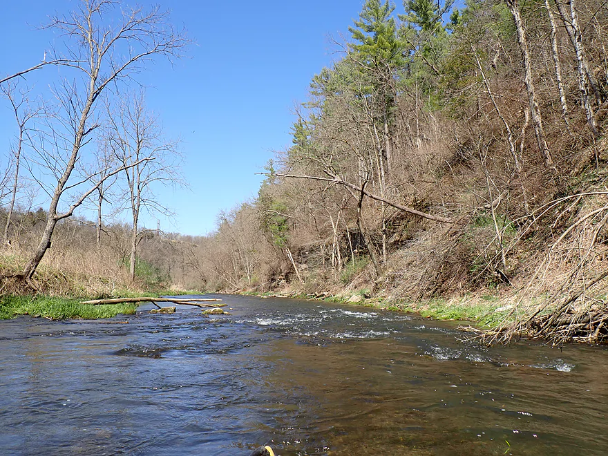
Leaving the bluff behind
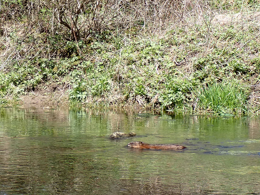
Muskrat passing my boat
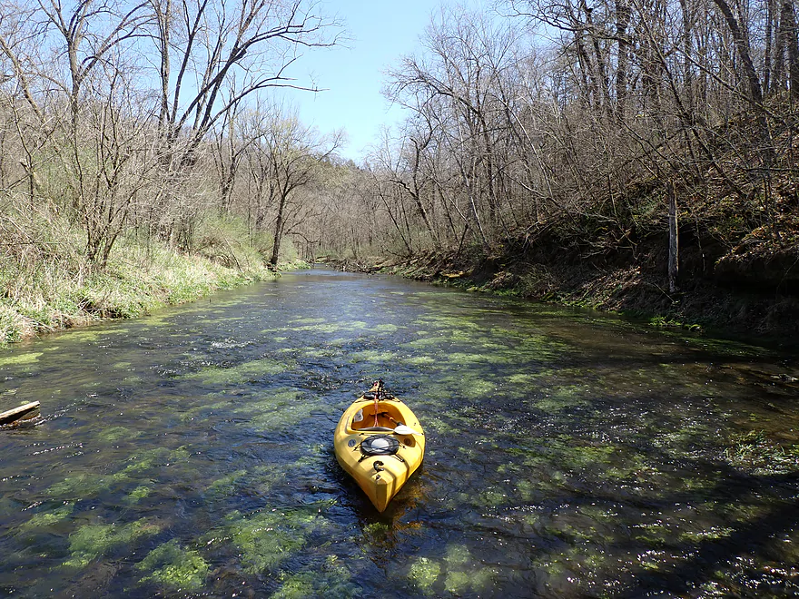
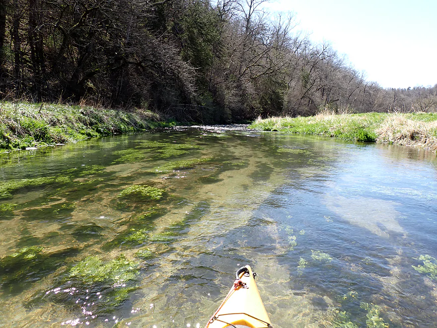
Clarity was so nice
Few more shallow parts
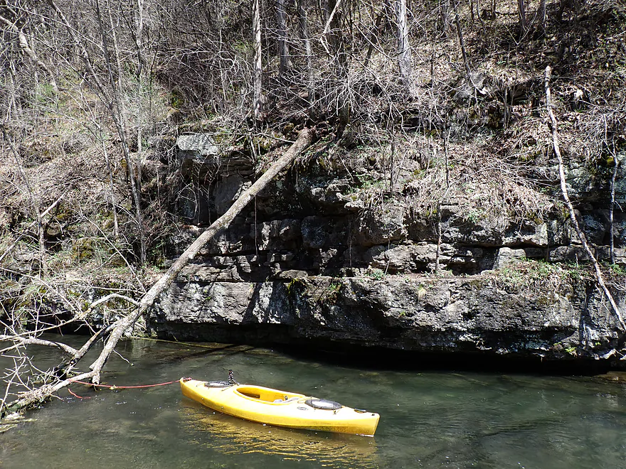
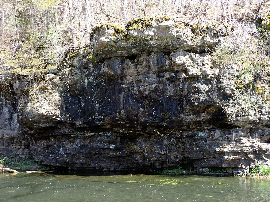
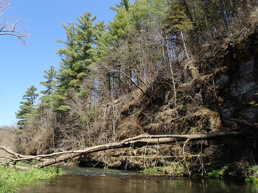
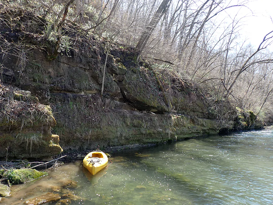
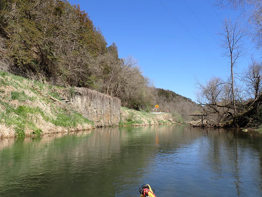
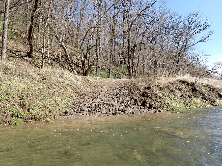
That long wall is actually a layer of erosion-resistant limestone
This chute wasn’t runnable and had to be portaged
A second pitch of rapids below the first
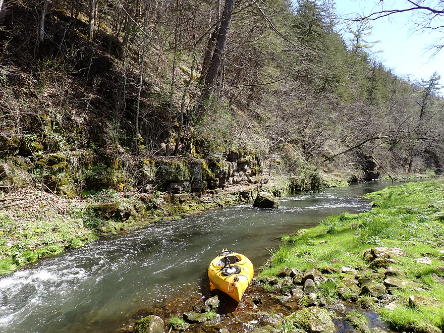
Scenery stays good
More cliffs
Reminded me of the Rush River
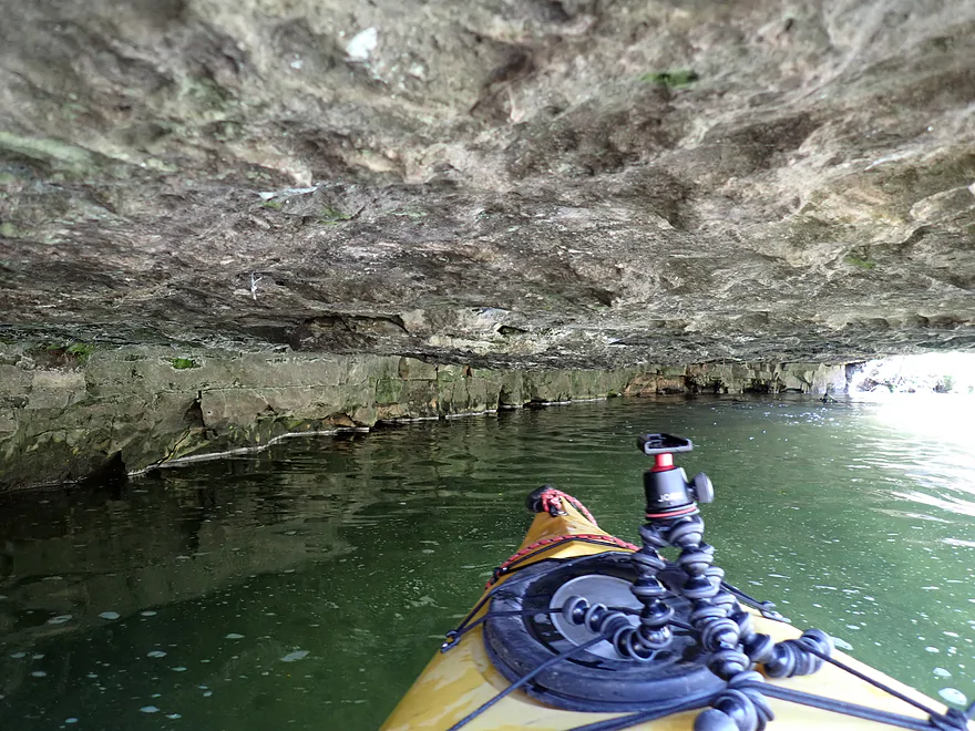
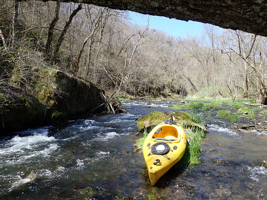
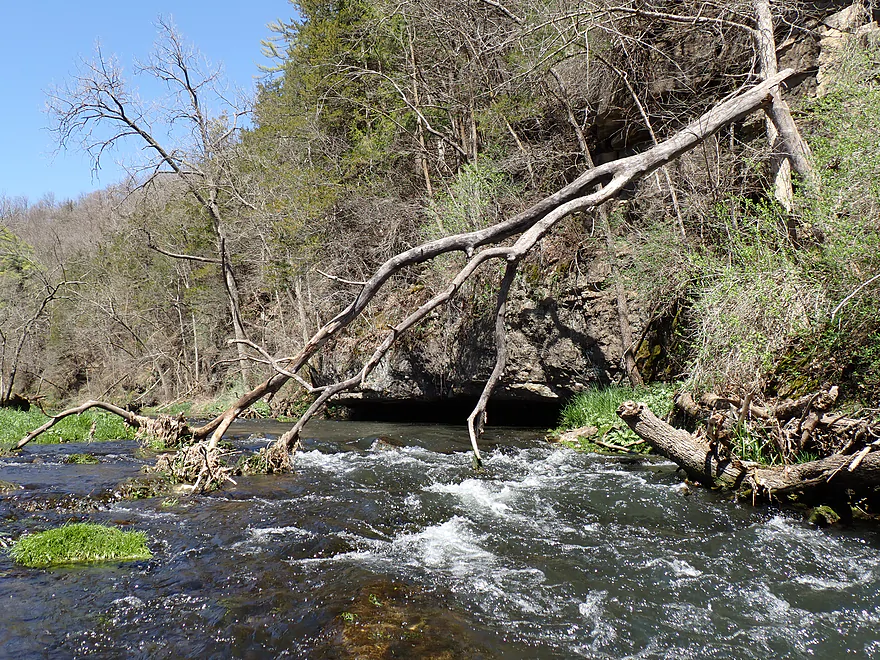
Paddling under a huge overhang
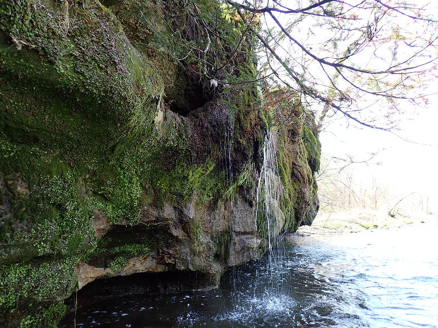
Stained cliff with spring boils at the base
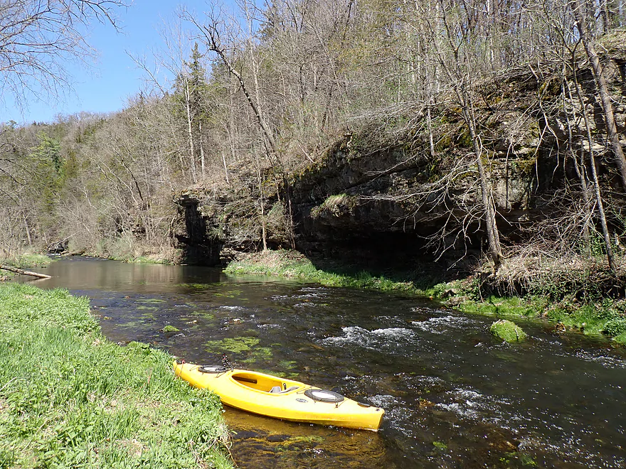
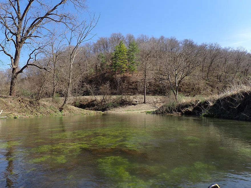
Approaching another large bluff
Terrific pines
Reverse view
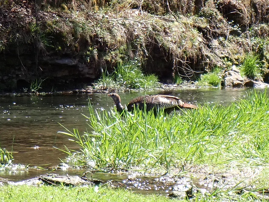
Friendly turkey
Creek opens up a bit
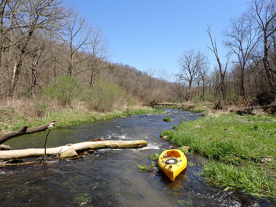
Another minor portage
Another shallow spot
A very fast chute
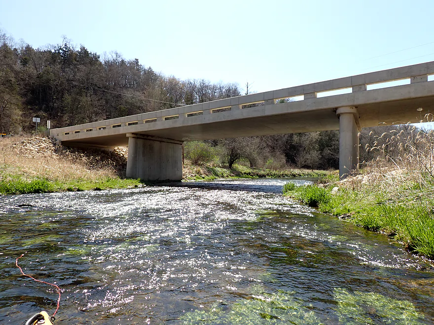
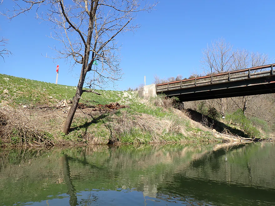
Approaching Quandahl Road
One of the steeper pitches on the creek
Last fishermen I would see
Now on Bear Creek proper (South Bear Creek just joined up after the bridge)
Creek now about double in width
Banks start to get a bit taller
Rapids flowing towards a great bluff
High volume artesian well spilling into the river
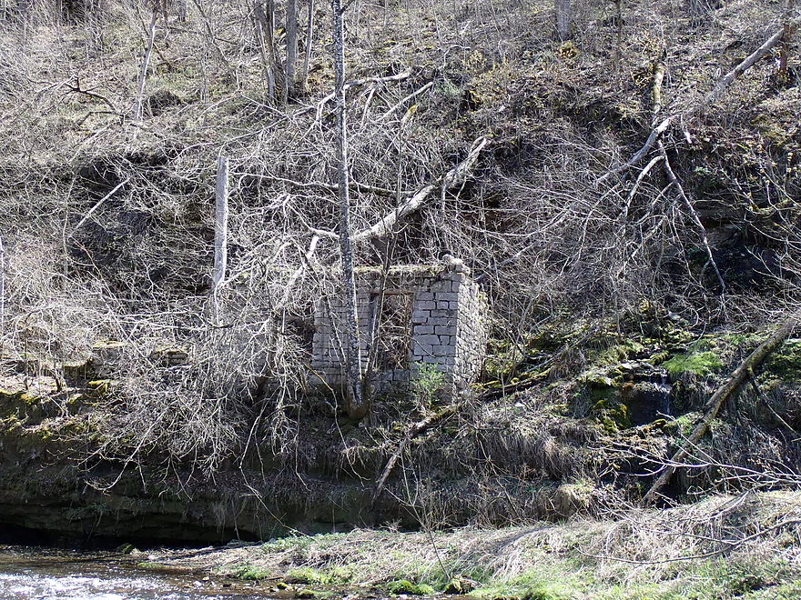
An old spring house
Reverse view of cliffs
Rapids leading towards the last great bluff of the trip
Super scenic
Getting out for pictures
River really opens up after that
An old bridge abutment
Balsam Road is a bridge access option…but not a good one
Few cliffs after the bridge…but still some ok geology
Very clear water
Natural framing
Entering pasture country
Cow path into the river
This section has had riprap work done to protect the banks
Nice stretch with good current
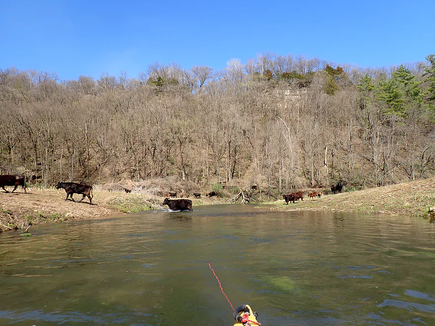
Waiting for the cows to cross…can you spot the bull?
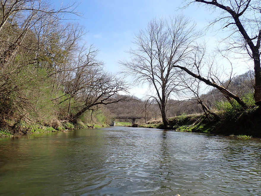
Home stretch
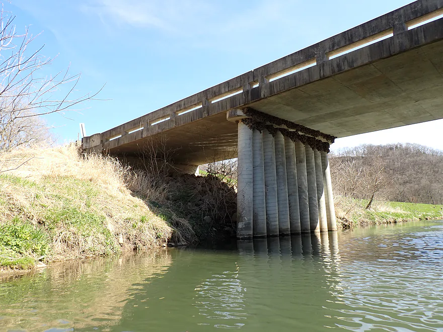
Ending the day at Willow Drive (a poor access)
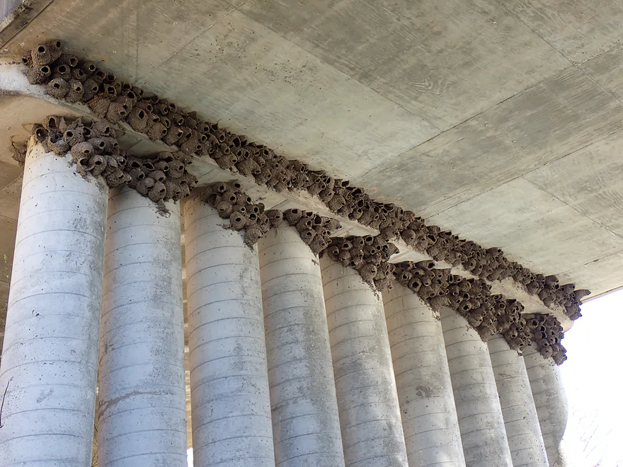
Cool how the swallows used the pillars for their nests
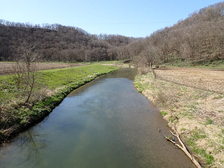
Downstream view from Willow Drive bridge
North Bear Creek Iowa

Nestled in the scenic landscape of Northeast Iowa, Bear Creek flows as a beautiful tributary to the Upper Iowa River. The creek splinters into multiple sub-branches…but the most scenic and famous is North Bear Creek. I was impressed by its online photos, so decided to drive two hours and gamble on a creek that (to the best of my knowledge) had never been paddled before.
For those who read last week’s blog post, you might have noticed a certain repeating theme…another Bear Creek! I thought it would be funny to review two Bear Creeks in a row. Despite being very different creeks in separate states, they share rugged geographical similarities and both are part of the greater Driftless Area. Given their shared moniker and relative proximity (just an hour drive apart) you have to wonder if black bears used to be common near the Minnesota-Iowa state line? Today black bears have been mostly extirpated from Iowa, but on occasion some will wander into northeast Iowa from Minnesota.
My trip began at 360th Street, which is a popular fishing access. There were already five cars in the parking lot, which shouldn’t have been too surprising. North Bear Creek is widely considered to be one of, if not THE most popular, trout streams in the entire state of Iowa. The Iowa DNR has done a good job of providing public access points along the creek and conserving the shoreline with public easements.
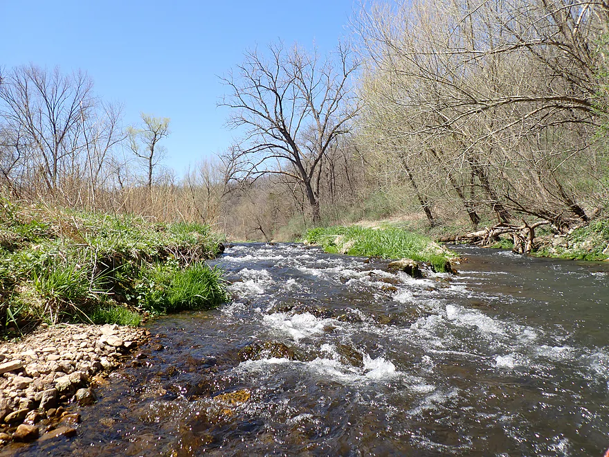
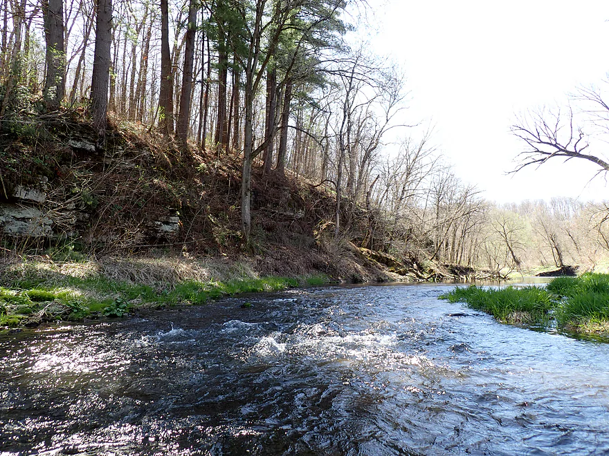
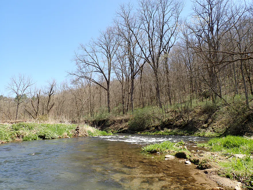
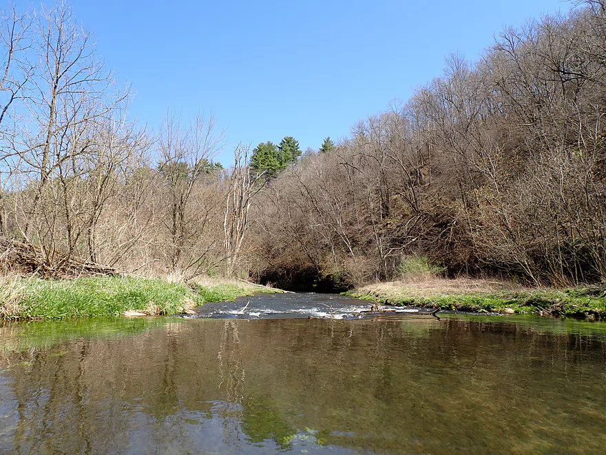
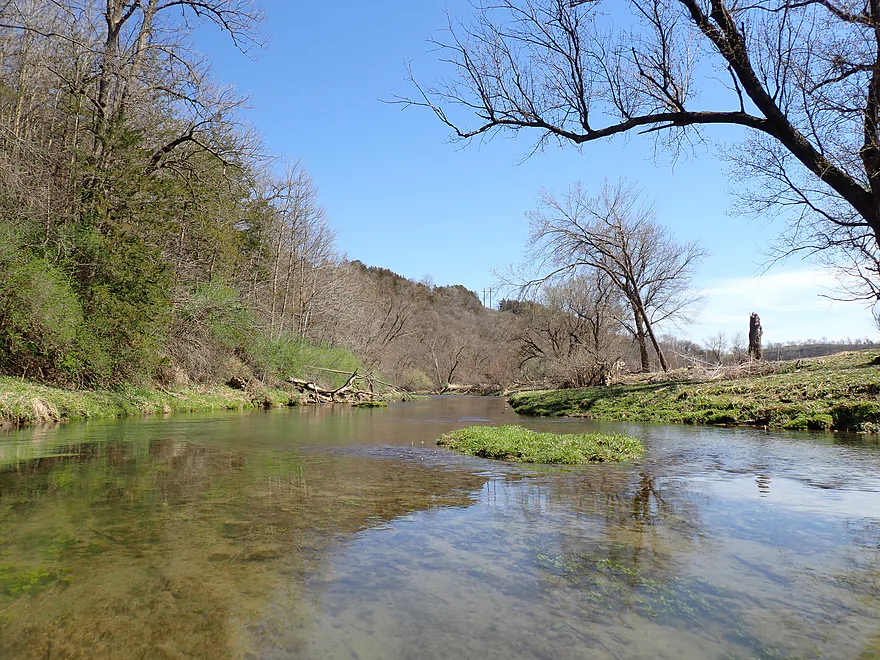
From the outset, North Bear Creek offered peppy current and incredible water clarity. The shallow channel required careful navigation and was mostly manageable, but I did “ground out” on some of the rapids. As I navigated downstream, I passed several trout fishermen–among the ten+ I would see on North Bear Creek.
The creek was soon redirected sharply east by a large L-shaped bluff. At the base was a gorgeous gorge with outcrops, large boulders, and fun rapids. This is a famous spot on the creek…if you Google “North Bear Creek”, chances are good the images that come up will be of this very spot. Some of the rapids were a bit tricky to squeak past, but most were fun and all were scenic (see video for context). Portaging/scouting was always an easy option as a public fishing trail paralleled the creek to the north.
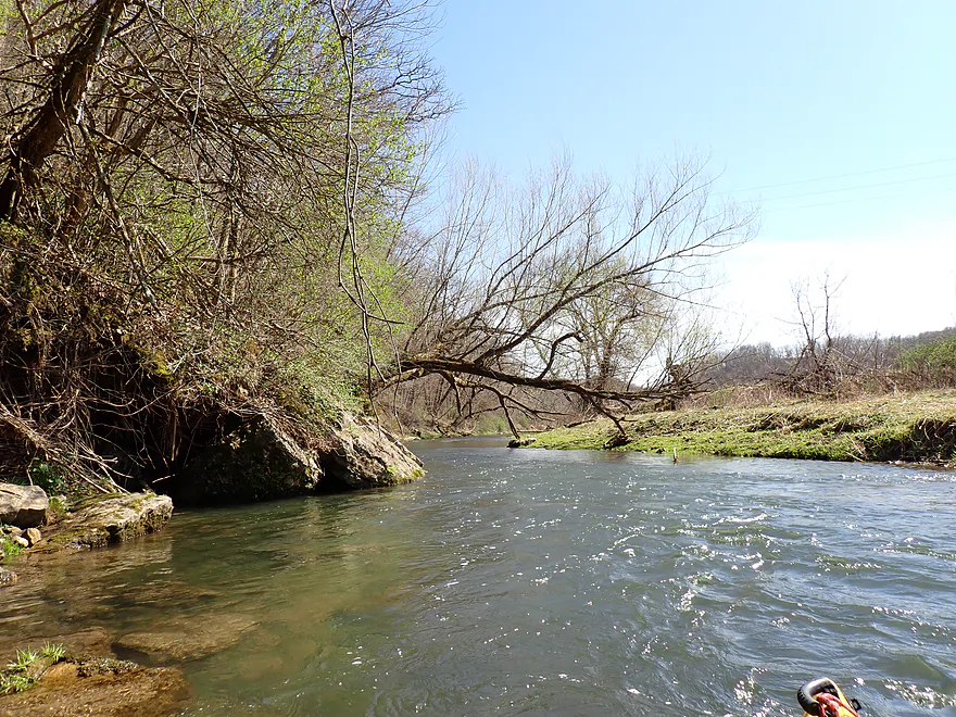
After navigating the gorge I expected the best scenery to be behind me, but North Bear Creek had more surprises in store. I would encounter several more incredibly scenic bluffs and cliffs. It’s hard to overstate how good the scenery was…I would consider it among the top five most scenic waterways I’ve ever kayaked (and I’ve done a lot of trips). Unfortunately the best cliffs usually had a fisherman camped out nearby. I didn’t want to loiter and disturb their peace, but I did need to take my pictures and video. Hopefully I didn’t annoy too many people.
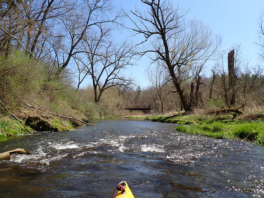
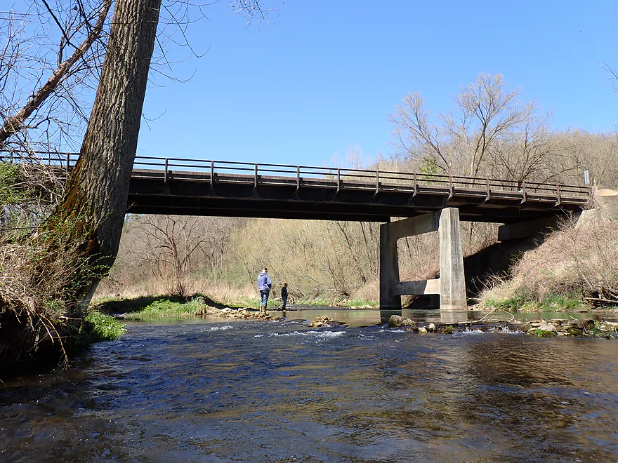
Following a fast chute of rapids, I arrived at the Quandahl Road bridge and the adjacent North Bear Campground. A lot of fishermen access the creek by the bridge here…there must have been ~8 cars in the parking lot. While taking out here was an option, it would have limited my paddle to a brief 2-mile trip.
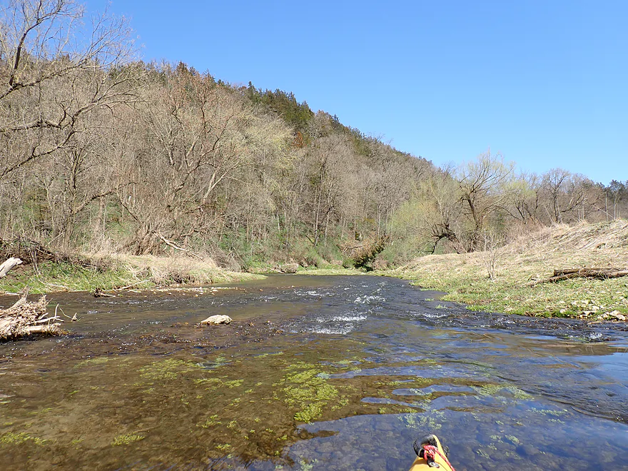
After the Quandahl bridge, North Bear branch was joined by the South Bear branch, which nearly doubled the volume and really changed the character of the creek. From this point on the river was easier to paddle, although some rapids were still boney.
The first half mile after the bridge was particularly fantastic as Bear Creek (proper) paralleled an impressive bluff topped with occasional pines with rock outcrops at its base. Several seeps fed the creek and I spotted what appeared to be an old spring house built over a gushing artesian well. It has since deteriorated, leaving the spring water to trickle over the cliffs and into the river. Despite the increased volume, rapids remained common (this is a fast creek!).
Eventually, the creek turned away from the bluff and the landscape opened up into farm country. I no longer saw fishermen and suspect the DNR had not been able to secure shoreline easements here. I passed Balsam Road, a bridge I previously considered taking out at. However, the bank was steep and one side of the bride had “No Tresspassing” signs. Despite these obstacles, I suspect determined paddlers could still manage to get out here.
After Balsam Road, most of the prominent cliffs petered out, and the next mile and a half flowed through more open country. Still, the numerous rapids and distant Driftless Area bluffs remained impressive. Near Willow Drive, a long line (~2000′) of riprap had been added to the shoreline to prevent streambank erosion. This massive line of rock fill created almost continuous rapids that were super fun.
Not so fun were the cattle along the north bank. They didn’t dare step on the riprap, so paralleled the creek with the intention to cross where the riprap ended. At that point I came face to face with a large herd…on the left bank, right bank…and in the creek itself. I’ve dealt with cattle on paddles before, and they’re often not a problem (except for the bank erosion they create), but you absolutely need to be vigilant for bulls. And, yikes, I spotted three. Bulls are very dangerous and I considered doubling back and getting out by Willow Drive (which paralleled the creek). Fortunately though, a gap appeared between crossing cattle and I was able to shoot through and into the protection of deeper water and steeper banks before they realized what had occurred.
The final quarter mile was pleasant but nothing special. I was just relieved to get past the bulls without incident. I ended the trip at Willow Drive, which wasn’t a great bridge access (see below).
To sum up, I loved this trip and it ranks as one of the most scenic paddles I’ve ever done. But…it won’t be for most. The combination of Class 2 rapids, shallow stretches, and bulls will deter many kayakers (somewhere a trout fisherman is breathing a sigh of relief). That said, you might be able to work around most of these issues. For water levels, wait until they are high. For the rapids, just portage what you’re not comfortable running. And for the bulls, maybe get out at an earlier bridge before the pasture (you could put in at North Bear Road to compensate for a shorter trip). You could also check to see if the cattle were out to pasture. It should be noted that the final legs of Bear Creek (by the mouth) should be much easier in comparison (deeper, tamer, and likely with fewer cattle).
Sights included one muskrat, many geese, one eagle, and a pheasant. North Bear Creek is famous as a trout stream and I did see some..but not a lot. Fishing pressure on the creek is heavy…one guy I saw had nine dead trout on a string. I suspect Iowa has more lax trout harvesting regulations than Wisconsin… The highlight of the trip were the turkeys. One turkey seemed relatively friendly and hopped out to an island near me.
360th Street: There is a public parking lot and access west of the bridge. This is a great access (and scenic).
Alternate Put-ins:
- North Bear Creek Road (1.4 miles upstream from 360th St): There is a DNR access east of the bridge. This bonus leg is small/shallow…but scenic and mostly protected by the Iowa DNR. This is popular with fishermen and I suspect would be a great add-on leg (if it has enough water).
Willow Drive: This was not a great bridge access. Only the northeast corner didn’t have either a fence or No Trespassing sign..and that bank was pretty steep. It was doable and I’ve faced far worse…but most paddlers would really dislike this as an access.
Alternate Take-out:
- Quandahl Road (3.0 miles upstream from Willow Drive): There is a public fishing access by the campground and bridge, so this would be a good take-out…but it would cut a trip pretty short.
- Balsam Road (1.7 miles upstream from Willow Drive): Not an ideal access because of nearby No Trespassing signs and a steep bank. I think this would be doable though, but hug the bridge to stay within the DOT right-of-way. In some ways this is a good spot to end the trip…the best outcrops are upstream from here, and the following leg is more pasture and has some cattle (including bulls) to deal with.
- Big Joe’s Little Campground (2.6 miles downstream from Willow Drive). There is an excellent access/ramp next to the campground, but this is private. Contact the campground (563-497-3500) to get their permission to use the ramp.
Bike Shuttle – Willow Drive to 360th Street: 3.8 miles with 292′ of ascent. This was, unfortunately, all gravel. The first half of the shuttle, which parallels the creek, wasn’t bad…it’s flat, there were (usually) gaps in the gravel to bike on and the scenery was great with good views of the creek and valley. But the second half of the shuttle had a brutal hill to climb up. All in all though, I can’t complain too much as any bike shuttle under 4 miles is a win in my book.
Fences: None.
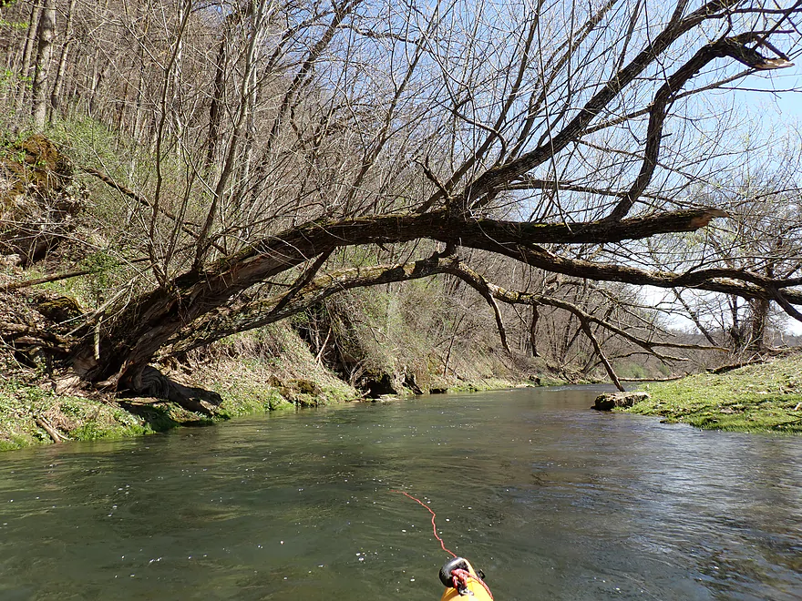
Strainers: There are a number of strainers. Most are actually kind of fun to paddle past or under. But a few can be tricky. All are easy portages if need be.
Logjams: There are a few cases of downed trees and fast current that will require a portage. This wasn’t a huge deal because of how easy portaging is.
Current/Rapids: This was an extremely fast creek with many riffles and rapids. There are some Class 2s that can be tricky because of nearby limbs or inconveniently located rocks. That being said, these mostly aren’t show stoppers because portaging/scouting is super easy. The banks are mostly flat and much of North Bear Creek has a trout trail nearby you can use. Watch the video to get a better feel for the rapids.
Cattle: There is a large pasture after the intersection of Balsam Road and Willow Drive. The riprap mostly keeps them out of the creek, but they can and do cross in spots. Because there are bulls in this herd, they have to be considered a significant hazard. Maybe you could scout this before the trip to see if the herd is out to pasture? I don’t know…but this isn’t a small problem for those wanting to paddle to Willow Drive.
Closest Gauge: Waterloo Creek @ Dorchester
My Trip Depth: 7.03′
Gauge Guide: This gauge, while being nearby and on a similar-sized creek, lacks historical data so it is difficult to make accurate estimates. After the South Bear Creek joins up, the creek gets much bigger and deeper…North Bear Creek by itself will need more water to be floated.
- < 7.02′: North Bear Creek will be too shallow. But I think lower Bear Creek by the Upper Iowa (which, at that point, is a small river) could be run at low depths.
- 7.02-7.04′: Shallow depth…figure 50% of the rapids will be too boney on North Bear Creek. And maybe 20% of the rapids on Bear Creek (proper) will be too boney.
- 7.05-7.12′: Probably a good depth…creek could get pushy in spots and clarity won’t be as good.
- 7.13-7.25′: High depth. Likely poor quality, but rapids should be padded. Could be some very tricky spots…portage what you’re not comfortable running.
- 7.26-7.4′: Very high depth. Maybe only suitable for expert paddlers.
- 7.5’+: Maybe major flood stage.
Click here to see an overview map of Bear Creek Iowa.
North Bear Creek:
- Upstream from 380th Street: The creek splits in two as it nears and crosses the state border between Iowa and Minnesota. I don’t know much about this section…but suspect it’s just too small to float.
- 380th Street Fishing Access to North Bear Road: 1.7 miles. Not sure how viable this is…it’s likely very small. Fishermen access the creek here, so hopefully that means cattle aren’t a problem. Likely some nice bluffs and cliffs, but more open than the next leg.
- North Bear Road to 360th Street: 1.4 miles. This could be a good prospect with a number of bluffs and cliffs. Popular leg with fishermen, but is on the small side for paddling.
- 360th Street to Quandahl Road: 2.0 miles. Stunning scenery with incredible bluffs, boulders, outcrops and rapids. Only downside is many of the rapids are shallow, and some will have to be portaged. South Bear Creek joins up at the Quandahl Road bridge and doubles the size of the creek.
Bear Creek (after South/North Bear Creek Confluence):
- Quandahl Road to Balsam Road: 1.3 miles. Creek becomes bigger and more open. There are still some incredible bluffs and cliffs…including an impressive artesian well. Balsam Road is a poor bridge access.
- Balsam Road to Willow Drive: 1.7 miles. Creek opens up even more and there are far fewer cliffs. Scenery with the hills in the distance is nice and still plenty of rapids. By the rip-rapped stretch, I encountered a large herd of cattle, which included three bulls. Be mindful of bulls as they can be dangerous. Maybe the local farmer will convert the pasture to cornfields in the summer, and they won’t be a problem then? I don’t know…bulls are not a small problem though. Both Balsam Road and Willow Drive are poor bridge access points.
- Willow Drive to Big Joe’s Little Campground: 2.6 miles. Likely a nice leg. River parallels a huge bluff so cattle crossing shouldn’t be an issue and I bet there are multiple outcrops at the base. Big Joe’s Little Campground has an excellent river access ramp, but it is private. Call (563-497-3500) for permission.
- Big Joe’s Little Campground to Bear Creek Drive/A26: 2.9 miles. At this point the creek is now a small river. I believe this is a nice leg with good pastoral scenery and great rolling hills. Perhaps a few more cliffs as well.
- Bear Creek Drive/A26 to Hwy 76: 4.1 miles. Nice prospect with more scenic hills and is on my todo list. Streetview panorama at Hwy 76 looks inviting.
- Hwy 76 to Mouth on Upper Iowa River: 0.5 miles. A short, simple stretch before the confluence.
- Take-out Options on the Upper Iowa River:
- Hwy 76: 0.5 miles upstream from confluence. Short leg, but does require upstream paddling. Not sure if it’s worth it.
- Kumpf River Access: 3.5 miles downstream from confluence. Good access. This leg of the Upper Iowa is likely mediocre and nothing special.
Not included are the tributaries South Bear Creek and Waterloo Creek. South Bear is really small and likely has serious congestion issues. Waterloo Creek, though, seems viable and is on my todo list.
Trip Map
Overview Map
Video
Photos Size: