
Little Wolf River
This is one of the great paddling rivers of central Wisconsin. Highlights include multiple Class 2 rapids that are a lot of fun.
Trip Reports
Ness Road to Wolf River Road
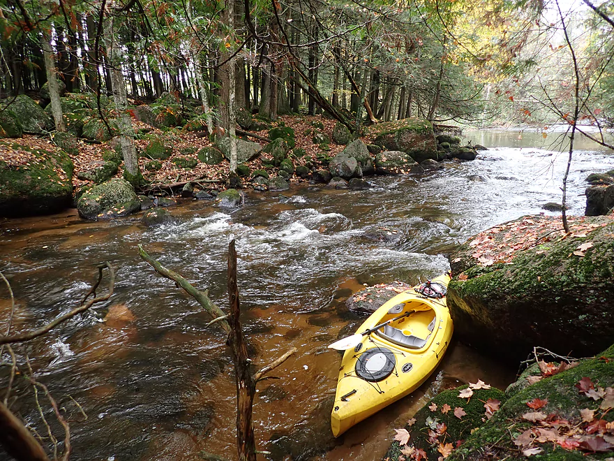
Date Paddled: October 2nd, 2021
Distance: 2.5 miles
Time: Expect ~90 minutes
This is an obscure stretch of the far upper Little Wolf. While it doesn't have as many boulders and rapids as its more famous downstream neighbors, it's still a nice paddle.
Read More...DNR Parking Area to Big Falls Boat Landing
Date Paddled: May 15th, 2013
Distance: 7.5 Miles
Time:
The Little Wolf is one of the nicer rivers I have kayaked. It has very nice scenery. The forest is healthy and filled with ferns, hemlocks, and wildflowers. Bird life is abundant. There are several boulder gardens with some very large boulders. Throughout the stretch, there were numerous riffles and a couple of rapids to […]
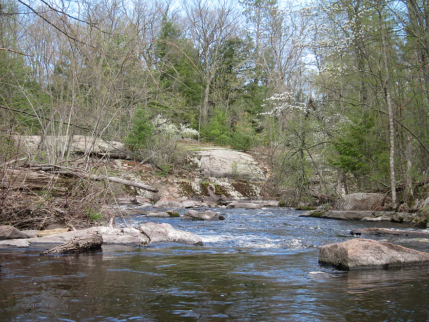
Read More...Wolf River Road to Big Falls Public Access
Date Paddled: June 22nd, 2014
Distance: 7.8 Miles
Time: 7 hours
This is a nice scenic river in which the whitewater is the highlight (or low-light). During the weekend of this trip, most rivers in south and central Wisconsin were flooded or too high to paddle (ironically, the Fever River was one of the exceptions). One water trail on my prospect list that caught my eye […]
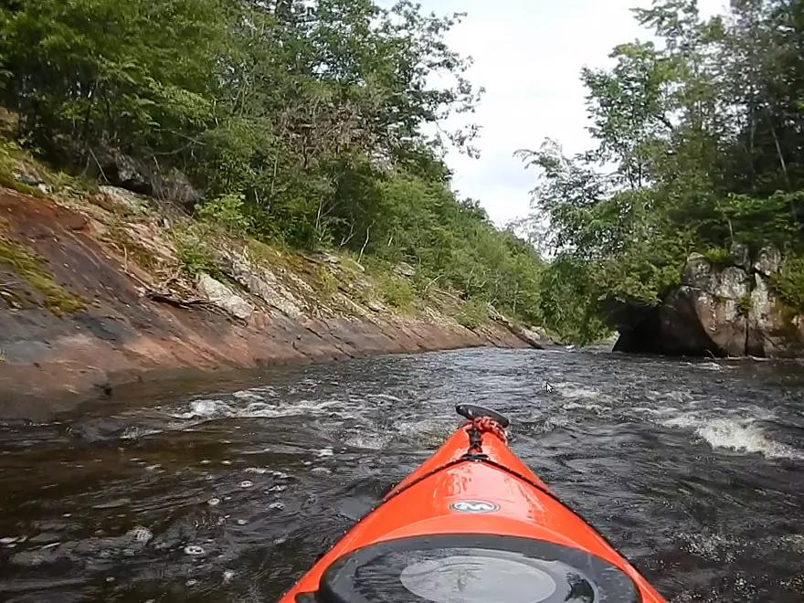
Read More...Wall Street to Kretchner Rd
Date Paddled: October 9th, 2021
Distance: 4.4 miles
Time: Expect 2 hours
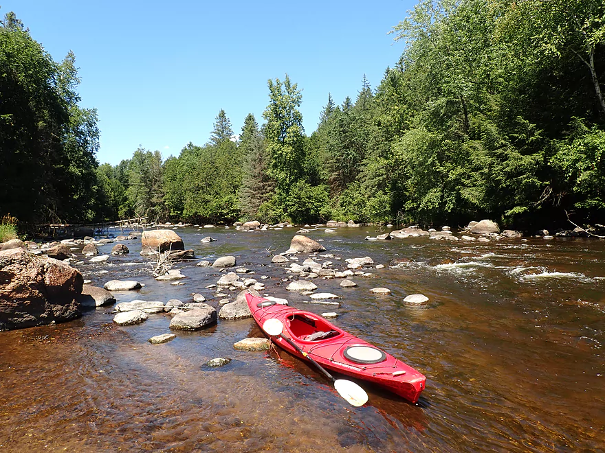
This was the best 2021 paddle to date and is one of the premier paddles in central Wisconsin. Highlights on this obscure stretch of the Little Wolf include fun rapids, incredible scenery, and huge granite boulders that dwarf a kayak.
Read More...Kretchner Road to Hwy 110
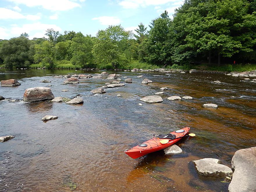
Date Paddled: July 22nd, 2022
Distance: 4.5 miles
Time: Expect 2-3 hours
This was a great trip with many scenic boulder gardens. Rapids on this stretch are mild and suitable for beginners. While nice, this leg isn't as top-notch as the Little Falls or Big Falls legs located upstream.
Read More...Sturm Memorial Library to Cty Road Bb
Date Paddled: August 29th, 2020
Distance: 3.9 miles
Time: Expect 2 hours
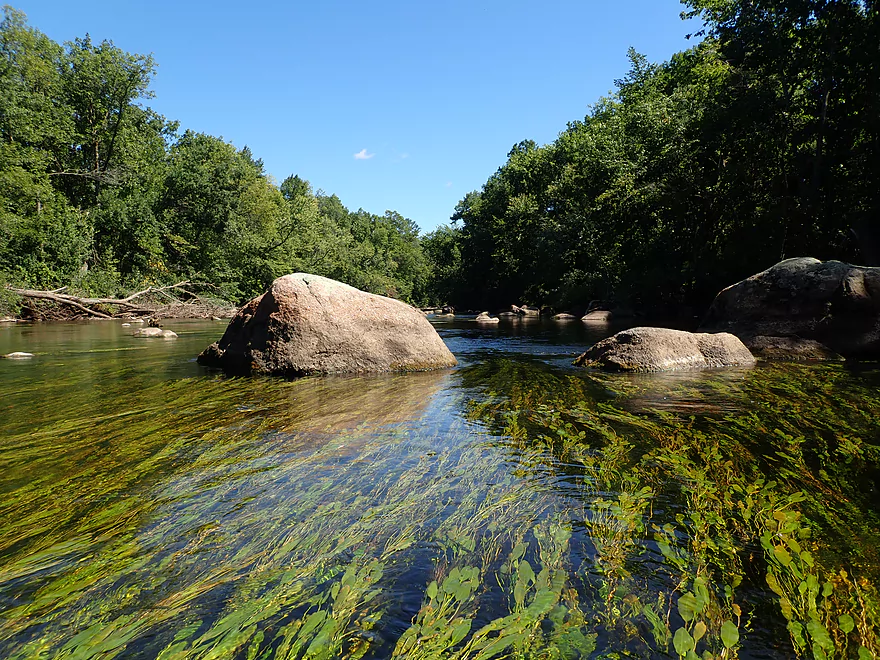
While not the best stretch on the Little Wolf, it was a pleasant paddle. Highlights included large boulder gardens and long flowing strands of potamogeton.
Read More...County Road BB Launch to Hwy X
Date Paddled: July 4th, 2016
Distance: 7.7 Miles
Time: 3 hours 26 minutes
An ok stretch but not in the same class as neighboring water trails. Some fun rapids and boulder gardens, but the sheer number of tubers was an annoying distraction.
Read More...Overview Map
Detailed Overview
- Wolf River Road to Ness Road: (3.0 miles) Very narrow, heavily wooded, shallow in spots, and very rocky. Maybe 2 logjams. This is an intriguing prospect on my todo list.
- Ness Road to Wolf River Road: (2.5 miles) A good trip with clear water, boulders, and a few easy rapids.
- Wolf River Road to Big Falls Dam: (7.7 miles)
- Wolf River Road to Hwy J: (3.6 miles) Scenic section with some strong Class 2 whitewater. Good put-in.
- Hwy J to Big Falls: (4.1 miles) Also scenic and with whitewater, with perhaps a Class 3 by the Dells. Good launch by Hwy J.
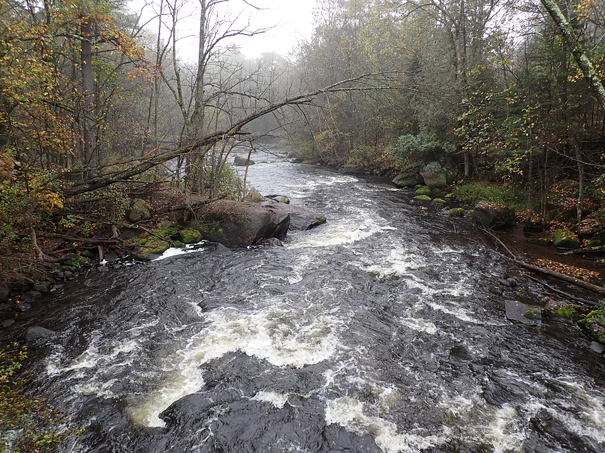
- Big Falls Dam to Big Falls Powerhouse: (700') This is a steep chute of exposed granite that can create Class 4 rapids when it has sufficient water. But typically the dam penstock robs Big Falls of 99% of its flow. Access to the top of the falls is available from either the east or west shore.
- Big Falls Powerhouse to Kretchner Road: (4.4 miles)
- Big Falls Powerhouse to Little Falls Park: (1.7 miles) This is a good stretch with the highlight being a 2000' stretch of rapids.
- Little Falls Park to Hwy C: (0.3 miles) Features a Class 2 under a bridge, and then a 1500' stretch of boulders and Class 1 rapids. Hwy C isn't a great bridge access.
- Hwy C to Kretchner Road: (2.7 miles) Just below Hwy C is a series of rapids including a Class 3 that runs through a scenic gorge. After that the river slows down and becomes less interesting
- Kretchner Road to Hwy 110: (4.3 miles) A great leg with many scenic boulder gardens. Rapids on this stretch are mild and suitable for beginners. While nice, this leg isn't as terrific as Little Falls or Big Falls legs located upstream.
- Hwy 110 to Hwy 22/Symco: (8.0 miles) Unimproved bridge put-in but should be ok. This section likely has some deadfall issues (not sure how much though).
- Hwy 22/Symco to Manawa Dam: (5.9 miles)
- Hwy 22/Symco to Bridge Road: (2.0 miles) Looks like a nice section with some rapids and boulder gardens near Symco. Good put-in at Symco.
- Bridge Road to Manawa Dam: (3.9 miles) Likely a mediocre section with some flowage paddling at the end. Some of the flowage paddling can be avoided by taking out at Waupaca Park. Bridge Road is a good put-in.
- Manawa Dam to Road Bb: (3.9 miles)
- Manawa Dam to Hwy B: (1.9 miles) Honestly an uninteresting section with slow current and bland flood-bottom woods. Aquatic weeds are an issue (thanks to the Manawa Septic plant). River does get a bit more interesting after the railroad tracks and features a small boulder garden.
- Hwy B to Hwy 110/B: (0.9 miles) A good stretch with some boulder gardens and good clarity. There are Class 2 rapids by the "Rapid View" island.
- Hwy 110/B to Road Bb: (2.1 miles). A great stretch with several impressive boulder gardens and a few minor rapids.
- Road Bb to Hwy X: (7.6 miles)
- Road Bb to Royalton: (3.5 miles) Very good put-in. Nice clarity and boulders until the South Branch joins (almost doubling the river). Very nice boulder garden and rapids 2/3rds in.
- Royalton to Ostrander: (2.7 miles) After the brief rapids under Hwy 54/O, the Little Wolf goes back to sleep, with pleasant but monotonous scenery (the highlight being sporadic boulders). Finally, maybe a half mile prior to Ostrander Road, there is another set of rapids (Class 1) and an attractive boulder garden. Paddlers will have to deal with many tubers.
- Ostrander Road to Hwy X: (1.4 miles) Busiest tubing section probably in the state. Very nice boulder gardens and rapids at end. Public landing NE of Ostrander Road.
- Hwy X to the Mouth (Junction at Wolf River): (2.0 miles) Part of the Mukwa Bottomland Forest SNA
- Mouth to Dey Road/Shaw Road Boat Ramp: (0.8 miles) A short stretch on a now large Wolf River.
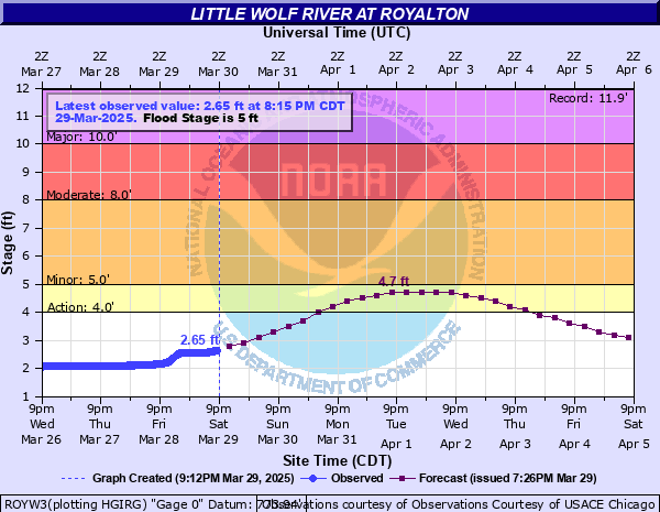
Nearby Guages
Videos
0:02 - Log jam at launch
0:55 - Start of mile long rapids run
6:57 - Low hanging limbs in rapids
13:15 - Another low hanging limb over rapids
13:41 - Down tree over class 2 rapids
15:10 - Picnic Ledge
16:15 - Final Section of mile long rapids/Hwy J
17:50 - McNinch Road Rapids
18:44 - Toughest rapids with strainer
19:42 - Little Wolf Dells
22:14 - Big Falls Pond flowage & attractive granite
23:27 - Big Falls Dam